off interstate 10 — in sulphur...
TRANSCRIPT
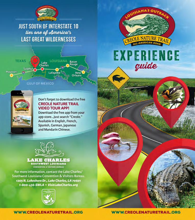

The most popular entrances to the Creole Nature Trail All-American Road are off Interstate 10 — in Sulphur (Exit 20) and just east of Lake Charles at La 397 (Exit 36). Whichever entrance you choose, be sure to download the free “creole” personal tour app in advance to get the full Louisiana’s Outback experience! Available in six languages, once downloaded, the app uses your device’s GPS to indicate when you should push “play” to view audio/video content as you travel the trail.
The app will also point out some locations of public restrooms along the way, but they are limited. Most importantly, assign each person in the vehicle to a window. On the Creole Nature Trail, everyone is a lookout!
Timing: The most frequently travelled portion of the trail is the main loop from Sulphur to the Gulf of Mexico and back up to Lake Charles which takes about four to six hours, depending on stops and taking in the sights. Three spurs off the main trail (see page 9) offer additional exploration if time allows.
CREOLENATURE TRAIL
ADVENTURE POINT
NEOTROPICCORMORANT
IDENTIFY INTERESTS ALONG THE WAY WITH THESE SYMBOLS.
Buy or Catch
Shrimp
Fishing or
Charter Fishing
Gas Food/Drink
Beach/Shelling
Crabbing Restrooms RouteChoice
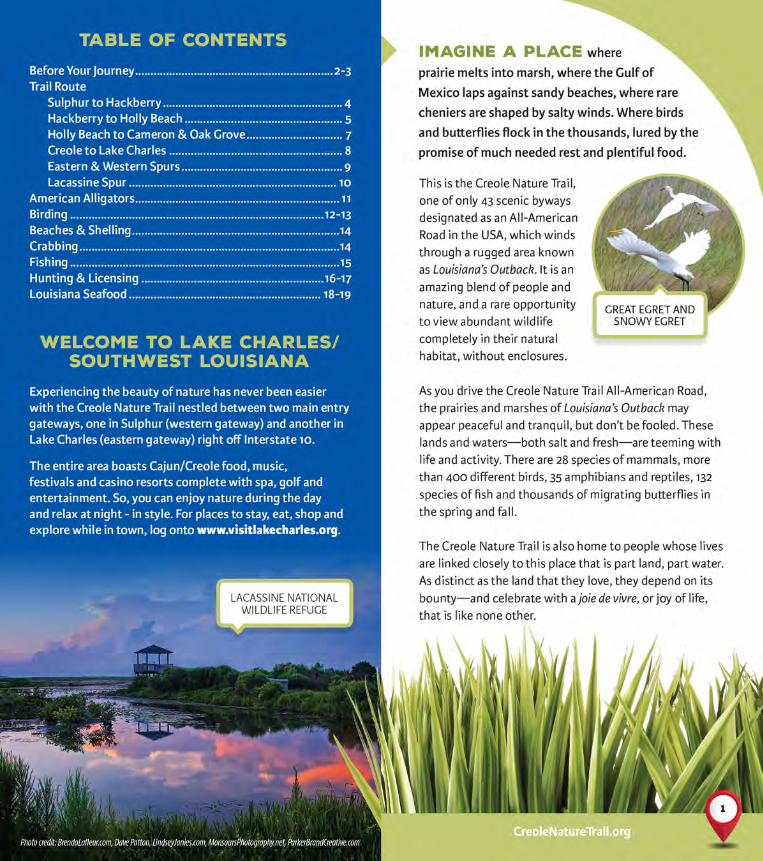
BEFORE YOUR JOURNEY In advance of traveling the Creole Nature Trail All-American Road, it’s best to fill up on gas and grab some beverages or even a picnic lunch for the road. Also, remember phone chargers, camera batteries, sunscreen and insect repellent.
Kick off your outdoor excursion at Creole Nature Trail Adventure Point, 2740 Ruth St., just south of Exit 20 in Sulphur (at the western gateway to the trail) to familiarize yourself with the trail and Southwest Louisiana. At Adventure Point, imaginative hands-on displays invite you to take a peek at wildlife found in bayous and marshes, smell the mouthwatering aromas of Cajun/Creole cooking and “play along” with a Cajun and Zydeco band. Knowledgeable adventure guides are also on hand at this free attraction to assist with any questions you may have.
32
CreoleNatureTrail.org
Traveling south, you’ll come to the Sabine National Wildlife Refuge (NWR). As you drive through Sabine NWR, you’ll see signage for several recreational areas where you can stop to fish or crab, visit with the locals and perhaps catch sight of alligators. At the Blue Goose Trail, the scenic overlook enables you
to look out over the marshland and see wintering snow geese and many other seasonal migratory birds. There is also a one-mile paved walkway leading you to the edge of Calcasieu Lake.
Continuing south, you’ll reach Wetland Walkway, a 1.5 mile handicap-accessible walking path right into the heart of the marsh, complete with a two-story observation tower for panoramic views!
Heading south again, you’ll discover Holly Beach—part of 26 miles of accessible Gulf beaches – great for shelling, surf fishing or a blanket picnic.
LA 82
LA 27
West CoveWetland
Walkway
Blue GooseWalking Trail
HogIsland Gully
Blue Crab
Northline
Hackberry
LA 27
Exit 20Sulphur
Holly Beach
Lake Charles10
10
210
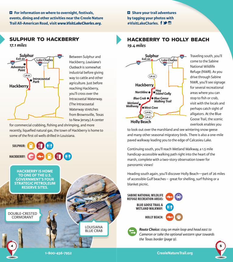
Between Sulphur and Hackberry, Louisiana’s Outback is somewhat industrial before giving way to cattle and other agriculture. Just before reaching Hackberry, you’ll cross over the Intracoastal Waterway. (The Intracoastal Waterway stretches from Brownsville, Texas to New Jersey.) A center
for commercial crabbing, fishing and shrimping, and more recently, liquefied natural gas, the town of Hackberry is home to some of the first oil wells drilled in Louisiana.
HACKBERRY:
SULPHUR:
Exit 20Sulphur
LA 27
Hackberry
Lake Charles10
10
210
Sulphur to Hackberry17.1 miles
Hackberry to Holly Beach19.4 miles
Route Choice: stay on main loop and head east to Cameron or take the optional western spur towards the Texas border (page 9).
SABINE NATIONAL WILDLIFE REFUGE RECREATION AREAS:
HOLLY BEACH:
BLUE GOOSE TRAIL &WETLAND WALKWAY:
HACKBERRY IS HOME TO ONE OF THE U.S.
GOVERNMENT’S FOUR STRATEGIC PETROLEUM
RESERVE SITES.
For information on where to overnight, festivals, events, dining and other activities near the Creole Nature Trail All-American Road, visit www.VisitLakeCharles.org.
LOUISIANABLUE CRAB
DOUBLE-CRESTEDCORMORANT
Share your trail adventures by tagging your photos with #VisitLakeCharles.
54
CreoleNatureTrail.org1-800-456-7952

Continuing east from Holly Beach, you will begin to sense the magnitude of Louisiana’s oil deposits. The vehicle ferry to Cameron crosses the Calcasieu Ship Channel, which connects the Intracoastal Waterway to the Gulf. Massive freighters, oil tankers, and jack-up rigs seem to dwarf the shrimp boats and recreational vessels as they glide side-by-side along the waterway. Be on the lookout for porpoises and pelicans while on the ferry.
Back on land in the community of Cameron, there are a few walk-up restaurants and convenience stores available. Take Davis Road to the Cameron Jetty Pier where you can see the huge boulders along the ship channel that keep the silt from building up, and where outdoor enthusiasts can enjoy a pavilion, playground and RV hook-ups or do some saltwater fishing from the pier.
The next stop heading east is Rutherford Beach where you can enjoy sand, surf fishing, shelling or a soothing, lazy day in the sun. Just east of Rutherford Beach, you’ll come to Oak Grove, a small area named for its magnificent live oak trees.
Oak GroveLA 82
Cameron
Cameron Je�ies Fishing Pier & RV Park
Rutherford BeachHolly Beach
LA 82
LA 27
Exit 20Sulphur
Lake CharlesSabine IslandWildlifeManagementArea
Niblett’s BluffRecreation Area
ROCKEFELLER REFUGE
10
10
210
Holly Beach (east) to Cameron (10.6 miles) and Oak Grove (14 miles from Cameron)
Route Choice: stay on main loop and head north to Creole or take the optional eastern spur to Rockefeller Refuge (page 9).
CreoleNatureTrail.org
RUTHERFORD BEACH:
CAMERON JETTY PIER:
CAMERON:
GULF COAST SUNSET
SUMMERTANAGER
GULF BEACHES
FRESHWATERFISHING
7
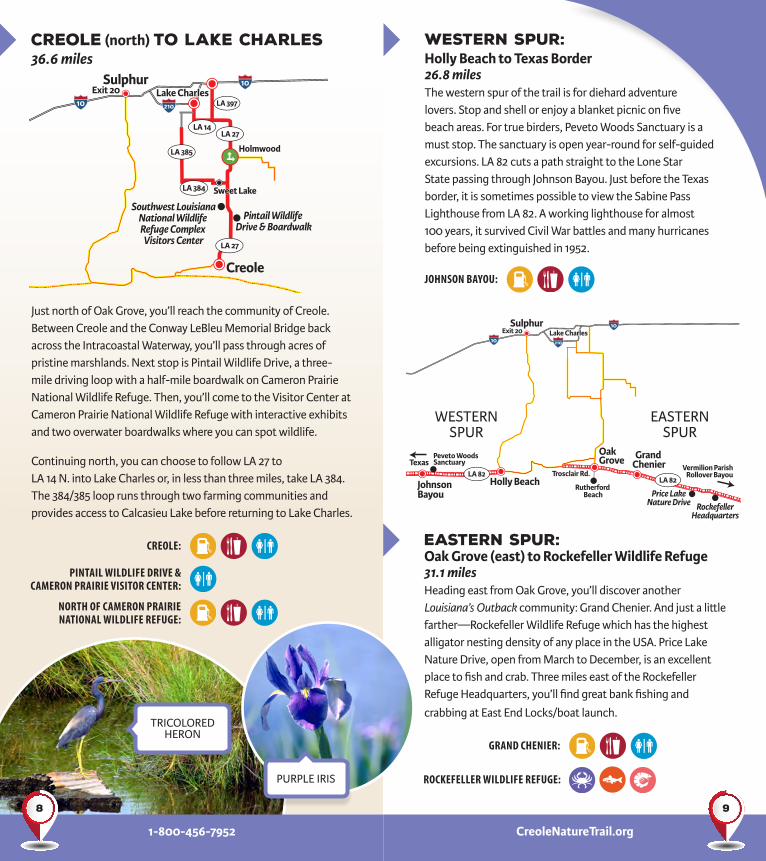
Just north of Oak Grove, you’ll reach the community of Creole. Between Creole and the Conway LeBleu Memorial Bridge back across the Intracoastal Waterway, you’ll pass through acres of pristine marshlands. Next stop is Pintail Wildlife Drive, a three-mile driving loop with a half-mile boardwalk on Cameron Prairie National Wildlife Refuge. Then, you’ll come to the Visitor Center at Cameron Prairie National Wildlife Refuge with interactive exhibits and two overwater boardwalks where you can spot wildlife.
Continuing north, you can choose to follow LA 27 to LA 14 N. into Lake Charles or, in less than three miles, take LA 384. The 384/385 loop runs through two farming communities and provides access to Calcasieu Lake before returning to Lake Charles.
Creole (north) to Lake Charles36.6 miles
Southwest LouisianaNational Wildlife Refuge Complex Visitors Center
Creole
LA 385
LA 384
LA 14LA 27
LA 27
LA 397Lake Charles
Pintail Wildlife Drive & Boardwalk
Holmwood
Exit 20Sulphur
10
10
210
1-800-456-7952
JOHNSON BAYOU:
GRAND CHENIER:
ROCKEFELLER WILDLIFE REFUGE:
PINTAIL WILDLIFE DRIVE & CAMERON PRAIRIE VISITOR CENTER:
CREOLE:
NORTH OF CAMERON PRAIRIE NATIONAL WILDLIFE REFUGE:
CreoleNatureTrail.org
Western Spur: Holly Beach to Texas Border26.8 miles The western spur of the trail is for diehard adventure lovers. Stop and shell or enjoy a blanket picnic on five beach areas. For true birders, Peveto Woods Sanctuary is a must stop. The sanctuary is open year-round for self-guided excursions. LA 82 cuts a path straight to the Lone Star State passing through Johnson Bayou. Just before the Texas border, it is sometimes possible to view the Sabine Pass Lighthouse from LA 82. A working lighthouse for almost 100 years, it survived Civil War battles and many hurricanes before being extinguished in 1952.
Eastern Spur: Oak Grove (east) to Rockefeller Wildlife Refuge31.1 milesHeading east from Oak Grove, you’ll discover another Louisiana’s Outback community: Grand Chenier. And just a little farther—Rockefeller Wildlife Refuge which has the highest alligator nesting density of any place in the USA. Price Lake Nature Drive, open from March to December, is an excellent place to fish and crab. Three miles east of the Rockefeller Refuge Headquarters, you’ll find great bank fishing and
crabbing at East End Locks/boat launch.
Vermilion ParishRollover Bayou
Price LakeNature Drive Rockefeller
Headquarters
Grand Chenier
Oak Grove
Trosclair Rd.
Rutherford Beach
Holly BeachJohnson Bayou
Peveto Woods Sanctuary
Exit 20Sulphur
TexasLA 82
LA 82
Lake Charles10
10
210
WESTERNSPUR
EASTERNSPUR
PURPLE IRIS
TRICOLOREDHERON
98

American Alligators
Along the marshland roads of the Creole Nature Trail, you may well see American alligators, especially on warm, sunny days. Ranging up to 14 feet long, alligators can often be seen lounging on land or drifting along in a canal.
Alligators may seem slow and ungainly, but they can actually run upwards of 10 mph for short periods. For your own safety, always keep your
distance and never feed, tease, prod, or otherwise provoke an alligator! These are wild animals with crushing jaws and powerful tails that can be extremely dangerous. They should always be treated with caution.
Ever wondered how big an alligator is? Estimate the distance from the tip of his snout to between his eyes – now change that number from inches to feet. So, if you see about 6 inches of gator from snout to eyes, chances are you’re looking at a 6 foot gator!
Another optional jaunt is the Lacassine National Wildlife Refuge. This freshwater marsh refuge is best known for the 16,000 acre Lacassine Impoundment referred to as “The Pool.” One of the few roseate spoonbill nesting rookeries in Louisiana is found here, and there are excellent bank and boat fishing opportunities (boat motors are restricted to 40 horsepower or less) as well as great wildlife viewing and birding spots along the 3-mile wildlife drive around the pool. The Pool is open annually March 15 - October 15.
LacassineHeadquarters
Lacassine Pool
LA 3056
Lake Arthur
Lake Charles
Holmwood
LA 14
Sabine IslandWildlifeManagementArea
Niblett’s BluffRecreation Area
Exit 20Sulphur
10
10
210
Lacassine Spur: Holmwood (east) to the Lacassine “Pool,” 18.2 miles
LACASSINE POOL:
1-800-456-7952 CreoleNatureTrail.org
MORE THAN 15,000 ALLIGATORS LIVE IN THE WETLANDS ALONG THE CREOLE NATURE TRAIL.
PLEASE NEVER FEED
WILDLIFE!
GREAT EGRET
LACASSINE POOL
Route Choice: stay on main loop and head north to Lake Charles or take the optional eastern spur to the Lacassine National Wildlife Refuge.
1110

Birding
It is estimated that as many as half of all land birds that breed in eastern North America pass through Louisiana twice each year. In a typical year, more than 400 different species can be spotted in Southwest Louisiana!
Whether you wish to see neotropical songbirds fluttering in the trees during the spring and fall, shorebirds refueling in the tidal flats and salt marshes, fields made white by massive flocks of wintering snow geese or butterflies in the late fall to early summer, the Creole Nature Trail is a perfect destination for nature lovers. Birds can be seen year round; however, fall, winter and spring are the best seasons for birding in this area.
CreoleNatureTrail.org1-800-456-7952
AMERICANBITTERN
BLACK-NECKEDSTILT
RUBY-THROATEDHUMMINGBIRD
(FEMALE)
PURPLEGALLINULE
HOODEDWARBLER
AMERICAN WHITE PELICANS AND AMERICAN AVOCETS
DICKCISSEL
GREAT BLUEHERON
1312

SEASHELLS
FishingThe fishing opportunities in Louisiana’s Outback are almost too numerous to list. It is the activity that is the most accessible to most people. Your choice is between freshwater fishing or saltwater fishing. Then you must decide if you want to fish from a boat or the shore. Surf fishing is excellent along the beaches and there are plenty of waterways along the Creole Nature Trail perfect for wetting a line. Professional charter guides are also available. Popular catches are speckled trout, redfish, red snapper, black drum and king mackerel.
Beaches & ShellingThe 26 miles of natural beaches along the Creole Nature Trail All-American Road are undeveloped and easily accessible providing a wide variety of activities including shelling. Deposits from the Mississippi River’s southeast tidal flows most often include a variety of shells such as whelks, cockles, angelwings, olives, wentletraps, coquinas, lettered olive and more. The best opportunities for shelling are at low tide. Check out our Shelling Guide at www.VisitLakeCharles.org/Shells.
1-800-456-7952 CreoleNatureTrail.org
CrabbingFrom May through September, catching Louisiana blue crabs is great fun along the Creole Nature Trail. All that’s needed to crab is some thick cotton string; turkey or chicken necks, cut fish or chunks of meat; a dip net for scooping; and a pail to hold the crabs. Drop your string into the water tied to a piece of meat. Have a dip net handy to scoop once the crab has attached to the meat, and then, slowly pull it up. Throw the crab into a bucket, and you are well on your way to a delicious meal. Stay alert because alligators also like bait.
CRABBING
CASTNETTING FOR SHRIMP
SURF FISHING
RED DRUM(REDFISH)
SPECKLEDTROUT
1514


