offshore oil exploration: probabilistic simulations …...offshore oil exploration: probabilistic...
TRANSCRIPT
Offshore Oil Exploration: Probabilistic Simulations of Plume
Dispersion and Potential Impacts on Beaches
Lindino Benedet, Msc, Ph. Oc. Rafael Bonanata, Msc, Ph. Oc.
Thomas P. Pierro, Msc, P.E.Thomas Campbell, Msc., PE
Coastal Planning & Engineering
Boca Raton, FL, USA
Florianopolis, SC, Brazil

Main Topics• Approaches for simulating the transport and fate of oil spills
• Differences and applications of Trajectory (deterministic ), Stochastic (Probabilistic), and hindcast (backtrack) modeling approaches, with examples of two recent CPE studies in South America
• Importance of simulation studies in potential impact evaluation and decision making
• Real-time (operational) monitoring and modeling for contingency planning and risk-mitigation
• Implications /Recommendations to the Florida Coast
Physical Properties of Oil • The term OIL describes a broad range of hydrocarbon-based substances.
• Each type of oil has distinct physical and chemical properties. These properties affect the way oil will spread and break down and the hazard it may pose to aquatic life, human life, as well as to natural and man-made resources.
• The rate at which an oil spill spreads will determine its effect on the environment. Most oils tend to spread horizontally into a smooth and slippery surface, a slick, on top of the water. Factors which affect the ability of an oil spill to spread include surface tension, specific gravity, and viscosity.

Weathering Processes and Time ScalesThe physical and chemical characteristics of petroleum change almostimmediately when spilled in the marine environment due toevaporation, dispersion, emulsification, dissolution, oxidation,sedimentation, and biodegradation. All of these processes interact witheach other and are collectively referred to as oil weathering.

WEATHERING PROCESSES AND TIME SCALES
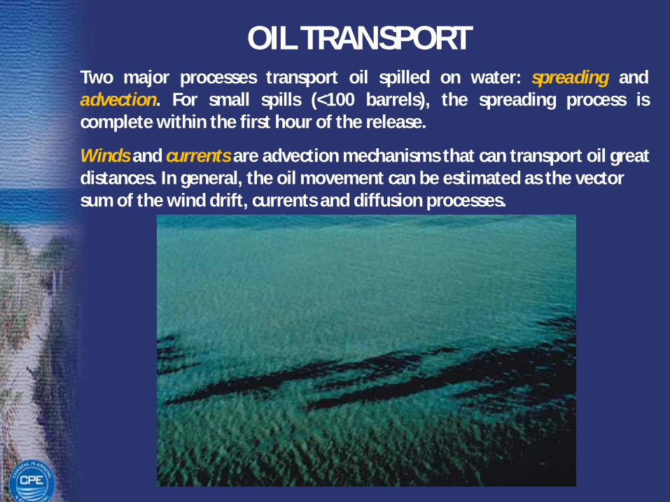
OIL TRANSPORTTwo major processes transport oil spilled on water: spreading andadvection. For small spills (<100 barrels), the spreading process iscomplete within the first hour of the release.
Winds and currents are advection mechanisms that can transport oil great distances. In general, the oil movement can be estimated as the vector sum of the wind drift, currents and diffusion processes.
OIL TRANSPORT
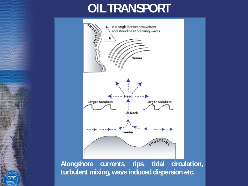
Alongshore currents, rips, tidal circulation,turbulent mixing, wave induced dispersion etc.
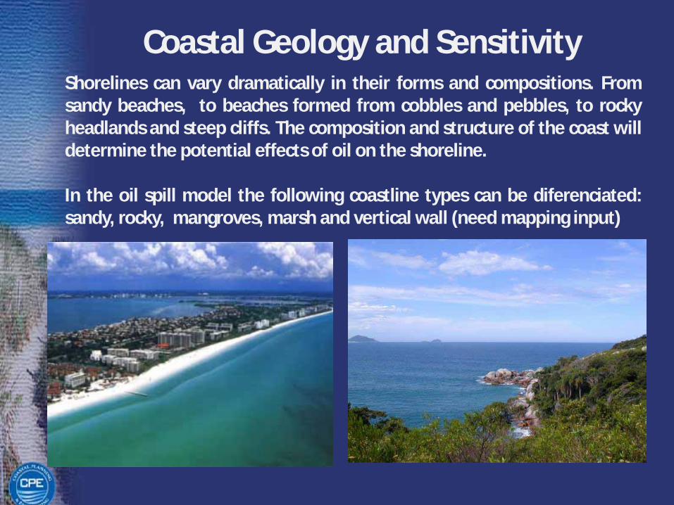
Coastal Geology and SensitivityShorelines can vary dramatically in their forms and compositions. Fromsandy beaches, to beaches formed from cobbles and pebbles, to rockyheadlands and steep cliffs. The composition and structure of the coast willdetermine the potential effects of oil on the shoreline.
In the oil spill model the following coastline types can be diferenciated:sandy, rocky, mangroves, marsh and vertical wall (need mapping input)

OIL SPILL MODELINGOil spill model systems are used routinely by industry andgovernment to assist in planning and emergency decisionmaking.
“Where will the oil go?”
This is a critical question asked by the emergency responder during an oil spill. Knowing the trajectory of the spill gives decision-makers critical guidance in deciding how best to protect resources and direct cleanup.
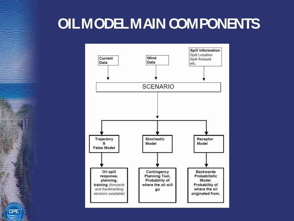
OIL MODEL MAIN COMPONENTS
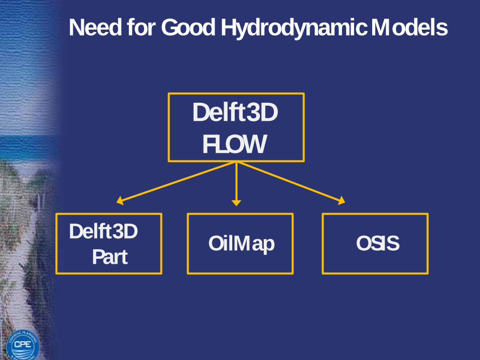
Need for Good Hydrodynamic Models
Delft3D FLOW
Delft3DPart
OilMap OSIS
Need for Good Hydrodynamic Models

SPILL INFORMATION
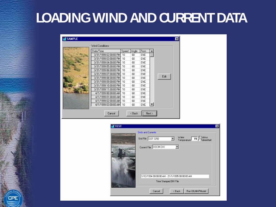
LOADING WIND AND CURRENT DATA
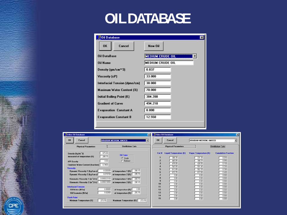
OIL DATABASE
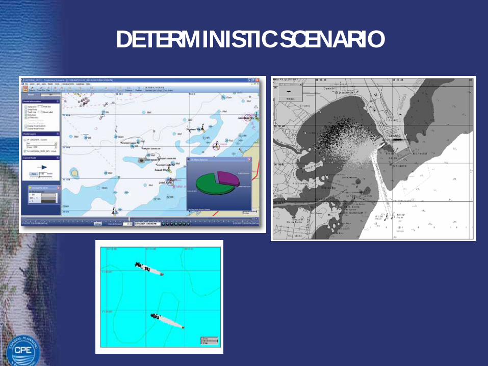
DETERMINISTIC SCENARIO

STOCHASTIC SCENARIO500 SIMULATIONS STARTING RANDOMLY ALONG
THE WIND RECORD
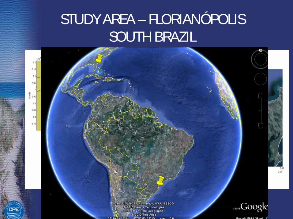
STUDY AREA – FLORIANÓPOLISSOUTH BRAZIL
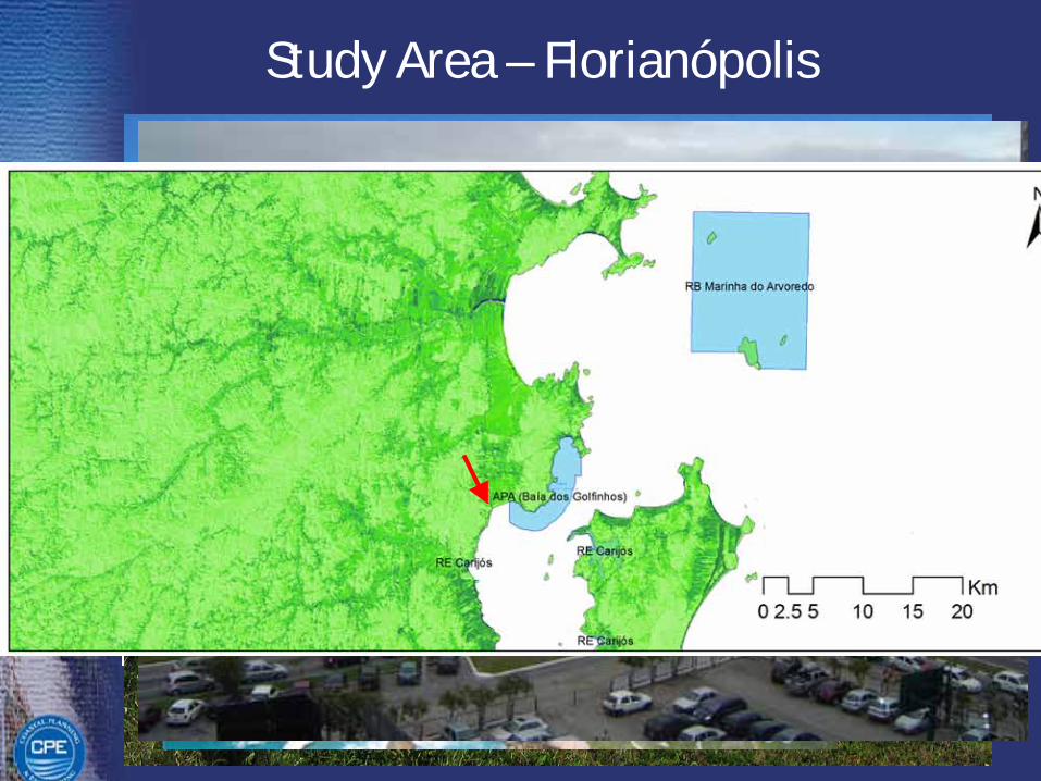
Study Area – Florianópolis
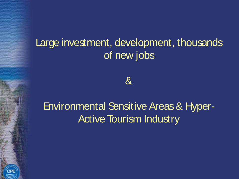
Large investment, development, thousands of new jobs
&
Environmental Sensitive Areas & Hyper-Active Tourism Industry
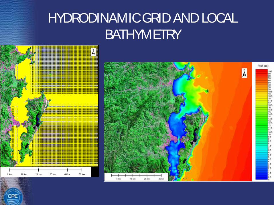
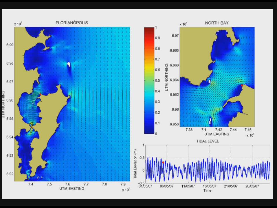
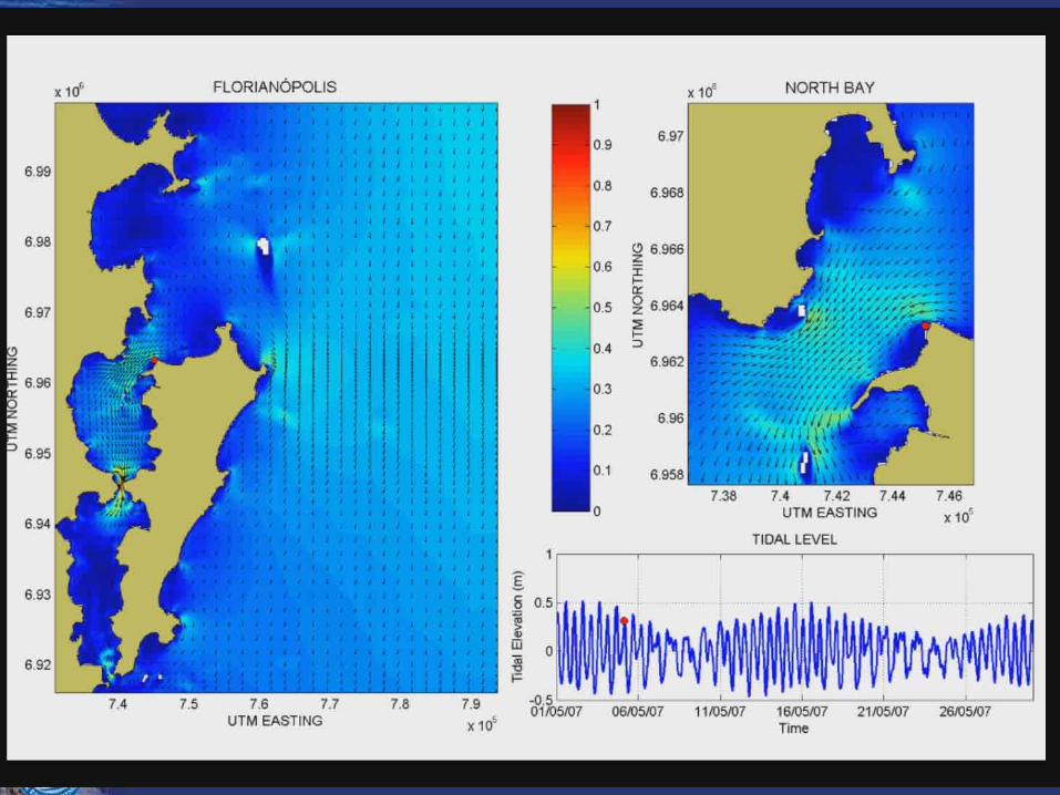
HYDRODINAMIC GRID AND LOCAL BATHYMETRY
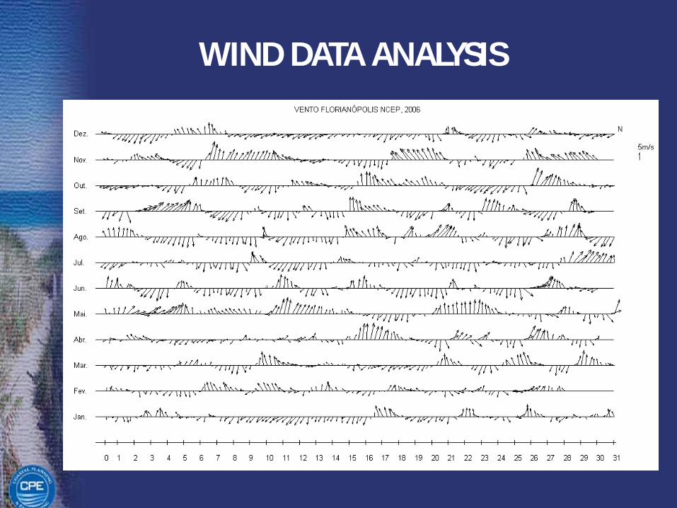
WIND DATA ANALYSIS
Need for Good Hydrodynamic Models
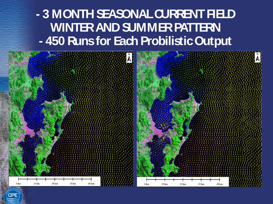
- 3 MONTH SEASONAL CURRENT FIELDWINTER AND SUMMER PATTERN
- 450 Runs for Each Probilistic Output
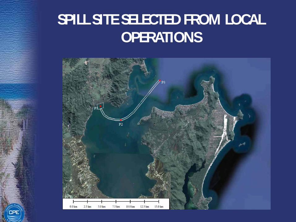
SPILL SITE SELECTED FROM LOCAL OPERATIONS
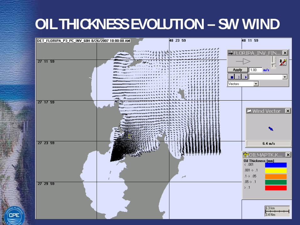
OIL THICKNESS EVOLUTION – SW WIND
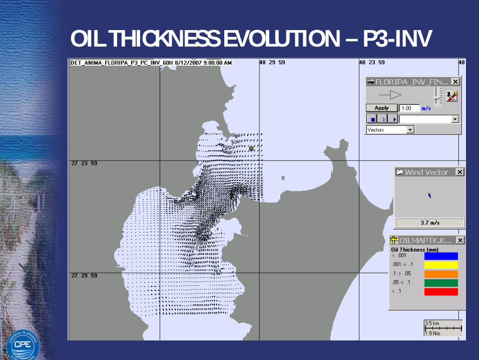
OIL THICKNESS EVOLUTION – P3-INV
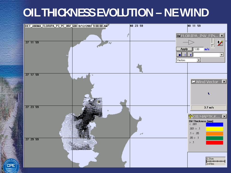
OIL THICKNESS EVOLUTION – NE WIND
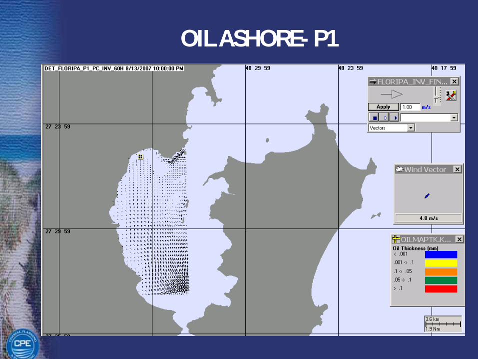
OIL ASHORE- P1

Stochastic Model Outputs
Water Probability Shore Probability
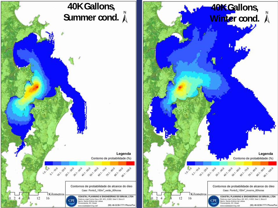
40K Gallons, Summer cond.
40K Gallons, Winter cond.

40K Gallons, Summer cond.
40K Gallons, Winter cond.
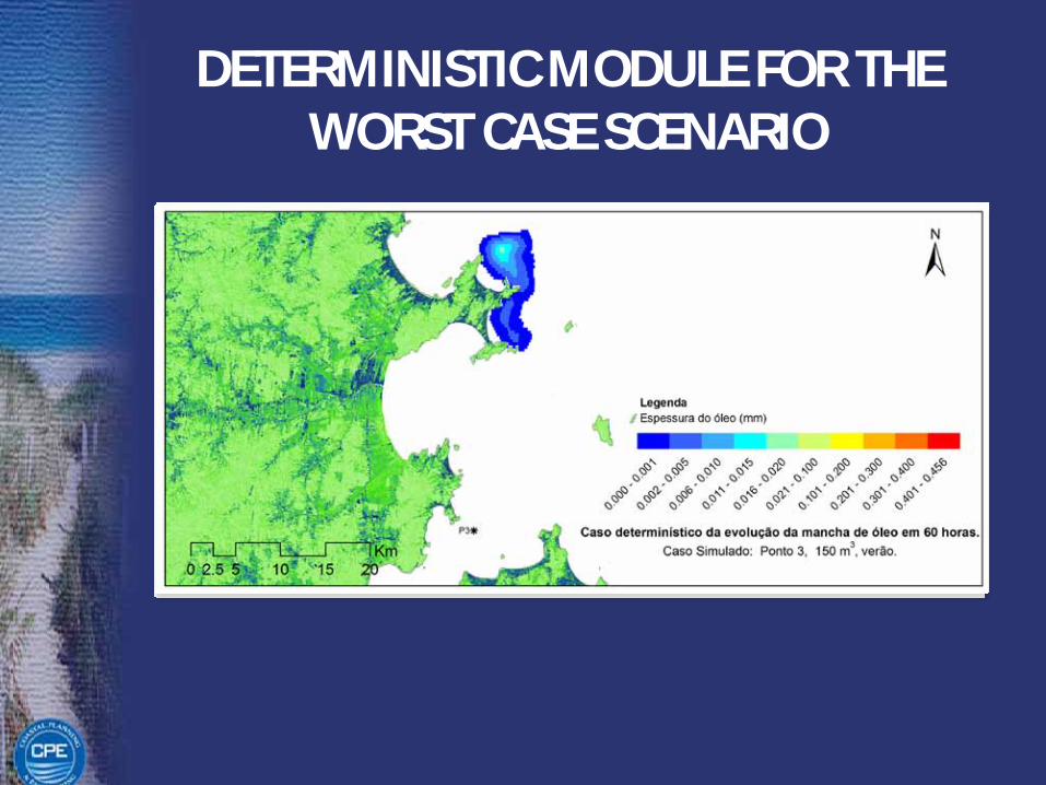
DETERMINISTIC MODULE FOR THE WORST CASE SCENARIO

STUDY AREA – PORT OF IMBITUBASOUTH BRAZIL

STUDY AREA – PORT OF IMBITUBASOUTH BRAZIL
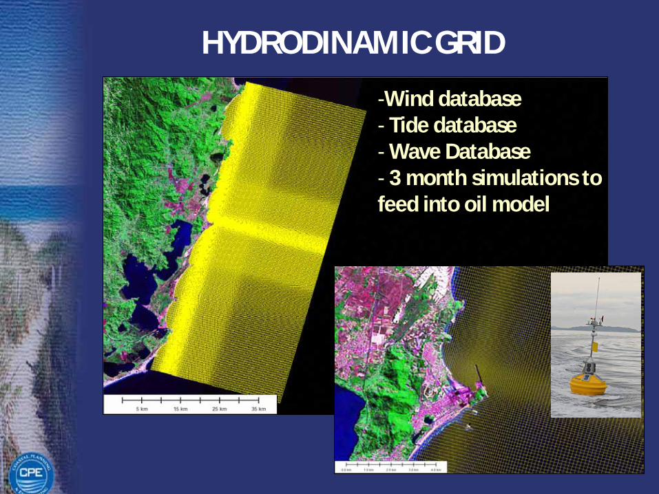
HYDRODINAMIC GRID
-Wind database- Tide database- Wave Database- 3 month simulations tofeed into oil model
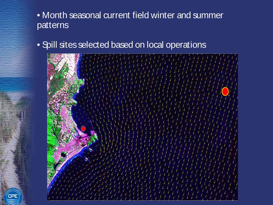
• Month seasonal current field winter and summer patterns
• Spill sites selected based on local operations

PROBABILISTIC SCENARIO
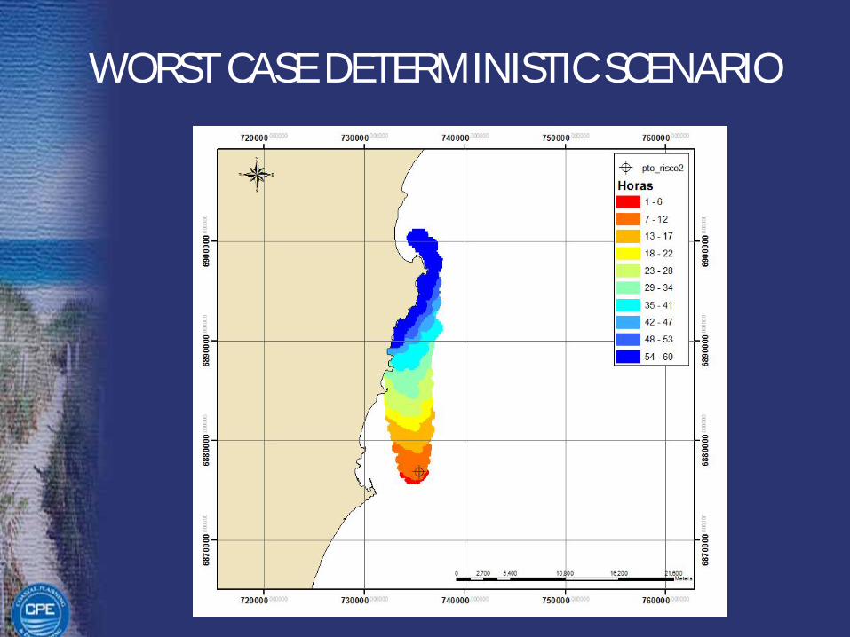
WORST CASE DETERMINISTIC SCENARIO

Final Considerations
• Once the probable locations of impact are definedagencies can make informed decision about permitingand stakeholders can enforce their rights
• Oil spill model results are exported as shapefiles andincorporated into desktop or web-base GIS in minutes.In teh GIS environment the model outputs can becorrelated with environmental sensitivty maps for impactquatification
• Oil companies can use the same information to draft upcontingency plans and risk-reduction strategies
• Real-time monitoring and deterministic modeling (3-dayforecasts issued daily) are of most importance for properoil spill response
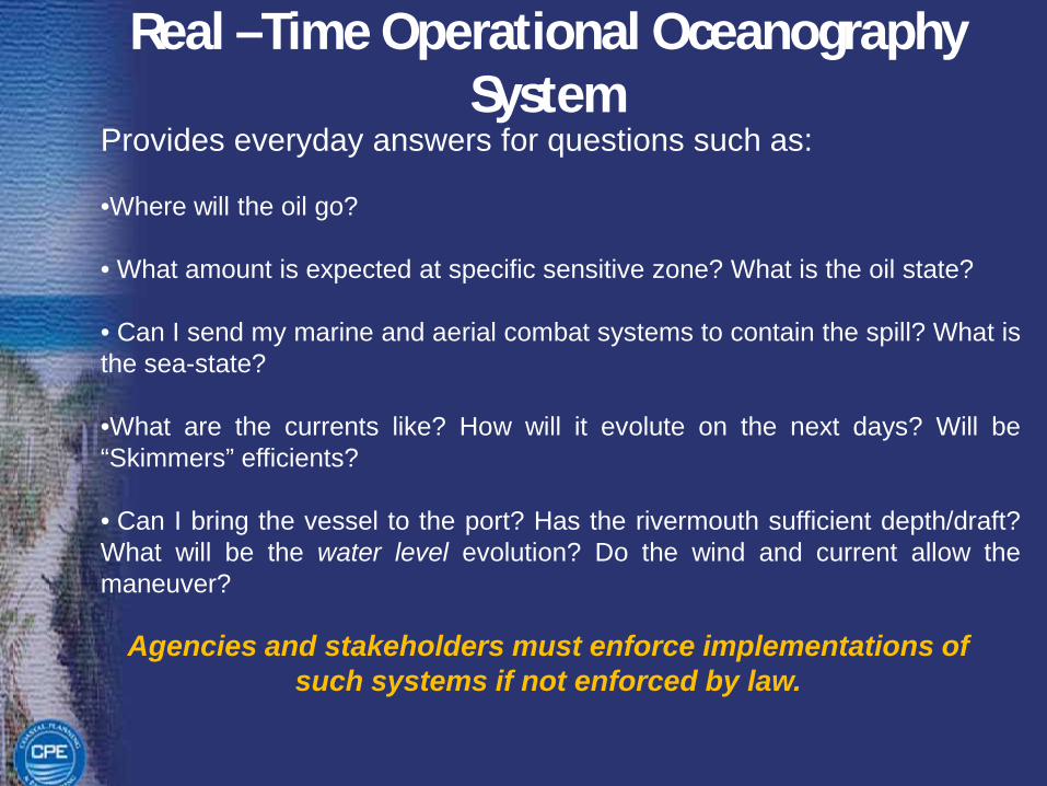
Real –Time Operational Oceanography System
Agencies and stakeholders must enforce implementations of such systems if not enforced by law.
Provides everyday answers for questions such as:
•Where will the oil go?
• What amount is expected at specific sensitive zone? What is the oil state?
• Can I send my marine and aerial combat systems to contain the spill? What isthe sea-state?
•What are the currents like? How will it evolute on the next days? Will be“Skimmers” efficients?
• Can I bring the vessel to the port? Has the rivermouth sufficient depth/draft?What will be the water level evolution? Do the wind and current allow themaneuver?
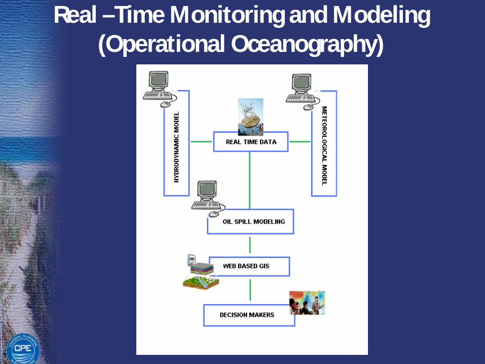
Real –Time Monitoring and Modeling (Operational Oceanography)
Recommendations for the Florida Coast
• Probabilistic simulations are reccomended to answerquestions in the air, that is to evaluate the trajectoryand fate of spills from possible exploration areas andtransport routes to identify which specific areas can beimpacted the most
• Decisions should be based on such studies togetherwith other environmental and infraestructureconsiderations
• Real-time monitoring and modeling at regional andlocal scales, can provide crucial information for risk-mitigation and effective accident response


THANK YOU