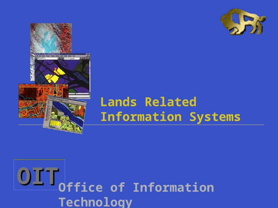
oit office of information technology lands related information systems
Post on 19-Dec-2015
215 views
TRANSCRIPT
OITOITOffice of Information Technology
Lands Related Information Systems

OITOITOffice of Information Technology
Intro Facts ...The Government of Manitoba:
has been involved in lands related computing initiatives for decades (bringing technological advances in GIS, Distributed Databases and Internet)
has a responsibility to meet the public's increasing demand for information
has a responsibility to continuously review our progress and direction in this area
is a center of provincial lands related Information

OITOITOffice of Information Technology
GIS - an area with great potential for service improvement
OIT has undertaken a preliminary review of our current situation
Departments have provided information on existing or planned land management computing systems
This review will be a base for setting future strategic directions of lands related systems

OITOITOffice of Information Technology
Little interdepartmental consultation and co-ordination
Most systems have been developed in isolation of other departments needs
Multiple systems within individual departments
extremely diverse GIS environment
Findings….

OITOITOffice of Information Technology
Numbers ... 30 land related systems Departments:
Agriculture (including MB Crop Insurance Corporation) Consumer and Corporate Affairs (Land Titles Office) Energy and Mines Environment Highways and Transportation Government Services (Land Management Services) Natural Resources Northern Affairs Rural Development

OITOITOffice of Information Technology
Findings…
Diversity of how land info is used and interpreted throughout the government
Similarity in many of the systems - some could accommodate several other outdated systems
Standards: not established, but: 80% - the same tools (ESRI, Oracle, NT)
20% - miscellaneous tools, databases, and hardware
20 FTEs (excluding LMS and LTO) working on land management applications

OITOITOffice of Information Technology
Findings ... Duplication of collected, stored and managed land
related data: Basic components for integrated land repository of data are
non-existent (Metadata definition, Land Information Data Dictionary, Base Mapping Standards, Information Access Guidelines and Policies)
Many systems process similar data sets
There is no unique standard base map various “base maps” with different scales and contents, but: all departments are interested in having a unique corporate
base map

OITOITOffice of Information Technology
Need to ... Provide direction and co-ordination to departments
to ensure they are partnering on similar projects
Recognize departments’ unique needs
Ensure sharing ideas with other jurisdictions and agencies (municipal, federal, Crown corporations, and SOAs)
Establish a relationship between the business owners (clients) and the facilitators (IT)

OITOITOffice of Information Technology
Other experiences Government of British Columbia has developed a government
wide framework for the management of land information
In Ontario, departments formed the Land Cluster to share common standards, systems and data. Their "Land Information Ontario” - integrated GIS system allows users to search for and access a broad range of data about land and property in the province
In Nunavut, there is an "one-window" project registration system - NPC Planner. It links project proponents, government agencies, landowners, non-governmental organizations and the general public. It handles land use related applications and provides information about the land use planning process

OITOITOffice of Information Technology
Benefits of integrated approach...
Raising the profile of land systems in government Timely and accurate decision making Access to land data from all government departments, agencies, by the general
public All new land data becomes a part of database as it is entered Electronic transactions Service delivery is onsite / remote The benefits for smaller departments Greater career opportunities for IT professionals Better possibility for back-up of peers

OITOITOffice of Information Technology
Savings ...
Greater utilization of hardware Elimination of duplicate software licenses Greater price/performance ratios on larger machines Better utilization of personnel
Public money spent more wisely (more value for it)
Better use of our economic resources A competitive advantage to industry
an ultimate result
OITOITOffice of Information Technology
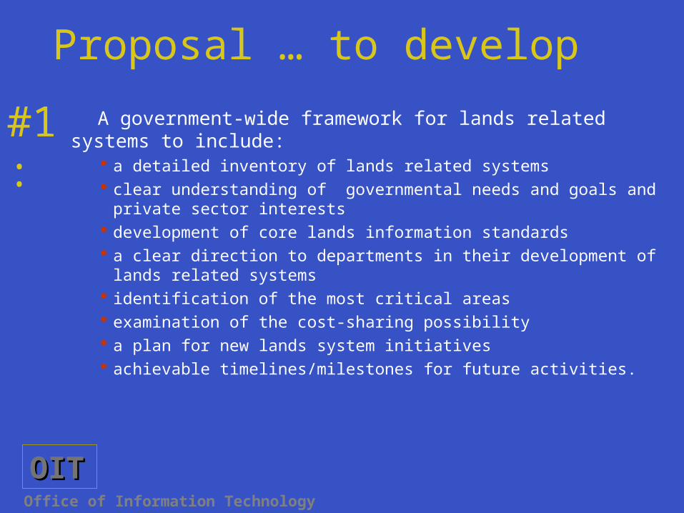
Proposal … to develop
A government-wide framework for lands related systems to include: a detailed inventory of lands related systems clear understanding of governmental needs and goals and private sector
interests development of core lands information standards a clear direction to departments in their development of lands related
systems identification of the most critical areas examination of the cost-sharing possibility a plan for new lands system initiatives achievable timelines/milestones for future activities.
#1:

OITOITOffice of Information Technology
Proposal … to develop
A method to achieve the co-ordination between affected departments
It must be detailed and enabled so all departments are willing to accept it and abide by it
There must be a firm directive for provision of initial data and ongoing updates
Control of transactions after implementation would require firm and fixed guidelines from or enforced by a central authority
#2:

OITOITOffice of Information Technology
The next step ... Decide who should be the lead department, to
co-ordinate the development of a government-wide lands management framework
Explore possibilities for creating sub-groups with similar business requirements
Set preliminary milestones for this development

OITOITOffice of Information Technology
Finally...
It is necessary to recognize, properly address and eliminate existing barriers to allow for true collaboration
The framework must be developed in co-ordination with all concerned departments
The time is right to create a corporate, lands related information environment