ok a 0 m a - colorado geological...
TRANSCRIPT
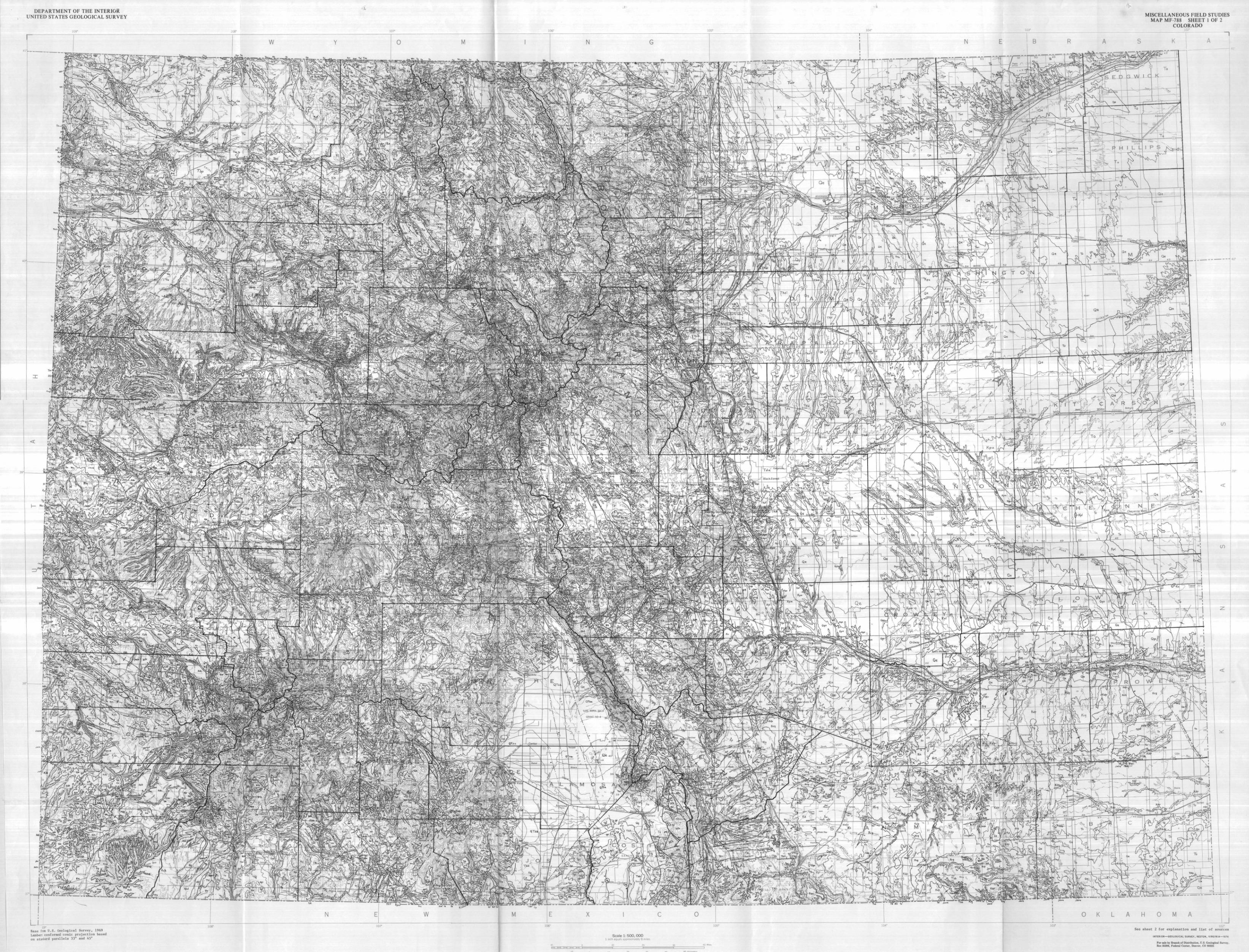
DEPARTMENT OF THE INTERIORUNITED STATES GEOLOGICAL SURVEY MISCELLANEOUS FIELD STUDIES
MAP MF-788 SHEET 1 OF 2COLORADO
"1
O K A 0 M A
Scale 1:500,0001 inch equals approximately 8 miles
109°Base from U . S . Geological Survey, 1969Lambert conformed conic projection basedon standard parallels 33° and 45°
See sheet 2 for explanation and list of sources
INTERIOR—GEOLOGICAL SURVEY. RESTON. V IRGIN l»—1976
For sale by Branch of Distribution. U.S. Geological Survey,Box 25286, Federal Center, Denver, CO 80225

DEPARTMENT OF THE INTERIORUNITED STATES GEOLOGICAL SURVEY
E X P L A N A T I O N
MISCELLANEOUS FIELD STUDIESMAP MF-788 SHEET 2 OF 2
COLORADO
Qa
Qg
Qgo
Qe
Qeo
Qd
Qdo
Ql Qb
Holoc.ene
Pleistocene
PlioceneUNCONSOLIDATED SURFICIAL DEPOSITS
AND ROCKS OF QUATERNARY AGE
Qa Modern alluvium—Includes Piney Creek Allu-vium and younger deposits
Qg Gravels and alluviums (Pinedale and Bull Lakeage)—Includes Broadway and LouviersAlluviums
Qgo Older gravels and alluviums (pre-Bull Lake age)—Includes Slocum, Verdos, Rocky Flats, andNussbaum Alluviums in east, and Florida,Bridgetimber, and Bayfield Gravels in south-west
Qe Eolian deposits—Includes dune sand and silt andPeorian Loess
Qeo Older eolian deposits—Includes Love land LoessQd Glacial drift of Pinedale and Bull Lake Glacia-
t ions—includes some unclassified glacialdeposits
Qdo Older glacial drift (pre-Bull Lake age)Ql Landslide deposits—Locally includes talus,
rock-glacier, and thick colluvial depositsQb Basalt flows (age <1.8 m.y.1)
QTsa
EAST NORTHWEST AND WEST-CENTRAL SOUTHWEST
QTa
QUATERNARY
^TERTIARY
UNCONSOLIDATED DEPOSITS OFQUATERNARY AND LATE TERTIARY AGE
QTsa Unclassified surficial deposits and underlyingAlamosa Formation (gravel, sand, and silt)in San Luis Valley
QTa Ancient alluvium—In isolated patches that maynot all be of the same age
Upper
Cretaceous
EAST NORTHWEST SOUTH-CENTRAL SOUTHWEST
Pliocenef?^)
Miocene
Oligocene
To
Ta
Twr
Tgv
Eocene
Paleocene
Th
Tcu
Tpc Tdu
Td Ts
Tos
Te
Tsp
Tip
Tos
Te
Tn
TERTIARY
SEDIMENTARY ROCKS OF TERTIARY AGE
EastTo
Tgv
Ta
Twr
Th
TcuTpc
Tdu
Tbp
Tt
Tnp
Tos
Twr
Tb
Tu
Tg
Tgp
Tgl
Tglm
Tgt
Tglu
Tglw
Tw
Tbb
Tbbi
Tbr
Tbrt
Taf
Ogallala Formation—Loose to well-cemented sandand gravel
Bouldery gravel on old erosion surfaces inFront Range and Never Summer Mountains
Arikaree Formation—Sandstone; contains abun-dant volcanically derived material
White River Formation or Group—Ashy claystoneand sandstone. Includes Castle Rock Con-glomerate in region southeast of Denver
Huerfano Formation—Shale and sandstone. In-cludes Farisita Conglomerate in northwest-ern Huerfano County
Cuchara Format ion—Sandstone and shalePoison Canyon Formation—Arkosic conglomerate,
sandstone, and shaleUpper part of Dawson Arkose—Arkosic sandstone,
conglomerate, and shale. Includes GreenMountain Conglomerate
NorthwestBrowns Park Formation—Sandstone and siltstone;
west of Park RangeTroublesome Formation—Sandstone and siltstone;
in Middle ParkNorth Park Formation—Sandstone, siltstone, and
conglomerate; in North Park and Laramiebasin
Oligocene sedimentary rocks—Includes DuchesneRiver Formation (sandstone and shale) andBishop Conglomerate near Utah border
White River Formation—Ashy claystone and sand-stone; in North Park
Bridger Formation—Claystone and raudstone; inSand Wash basin
Uinta Formation—Sandstone and siltstone; inPiceance basin. Formerly Evacuation CreekMember of Green River Formation
Green River Formation—MarIstone, sandstone,and oil shale
Parachute Creek Member—Oil shale, marl-stone, and siltstone; in Piceance basin
Lower part—Shale, sandstone, marlstone,and limestone in Anvil Points, GardenGulch, and Douglas Creek Members; inPiceance basin
Laney Member—Claystone, oil shale, andsandstone; in Sand Wash basin
Tipton Tongue—Claystone and oil shale; inSand Wash basin. In extreme northwestincludes rocks of Wilkins Peak Member
Luman Tongue—Carbonaceous shale and marl-stone; in Sand Wash basin
Lower part of Green River Formation and Wa-satch Formation—Shale and sandstone
Wasatch Formation—Claystone, shale, andsandstone
Pliocene
Miocene
Oligocene
Eocene
IGNEOUS ROCKS
Basalt flows and associated tuff, breccia, andconglomerate of late-volcanic bimodalsuite (age 3.5-26 m.y.)—Includes basaltsof Hinsdale Formation in San Juan Mountains,Servilleta Formation in San Luis Valley,and many other occurrences
Basaltic intrusive rocks related to basalt flows(Tbb)—In dikes and plugs
Rhyoli tic intrusive rocks and flows of late-volcanic bimodal suite
Ash-flow tuff of late-volcanic bimodal suite(age 22-23 m.y.)
Ash-flow tuff of main volcanic sequence (agein San Juan Mountains 26-30 m.y.; in SouthPark 29-32 m.y.)—Includes many named units
Northwest (Cont inued)Twc Cathedral Bluffs Tongue—Claystone, mud-
stone, and sandstone; in Sand Wash basinTwn Niland Tongue—Mudstone, sandstone, and
carbonaceous shale; in Sand Wash basinTwo Wasatch Formation (including Fort Union equiv-
alent at base) and Ohio Creek Formation—Claystone, mudstone, sandstone, and con-glomerate
Tf Fort Union Formation—Shale, sandstone, andlocal coal beds
Tc Coalmont Formation—Arkosic sandstone, con-glomerate, and shale; coal in lower part;in North Park
Tm Middle Park Formation exclusive of Windy GapMember—Arkosic sandstone and conglomeratecontaining abundant volcanic materials.Arbitrary line between Middle Park andCoalmont Formations is at ContinentalDivide
South-centralTd Dry Union Formation—Siltstone, sandstone, and
conglomerate. Includes Wagontongue Forma-tion (Miocene) in South Park
Ts Santa Fe Formation—Siltstone, sandstone, andconglomerate
Tos Oligocene sedimentary rocks—Includes Floris-sant Lake Beds (tuffaceous shale and tuff)and Antero Formation (limestone, tuff,tuffaceous sandstone, and conglomerate)
Te Eocene prevolcanic sedimentary rocks—Arkosicsand and bouldery gravel of Echo ParkAlluvium
Tsp South Park Formation—Arkosic sandstone andshale, volcaniclastic conglomerate, andandesite flows and breccia
SouthwestTip Los Pinos Formation—Volcaniclastic conglom-
erate interbedded with basalt flows ofHinsdale Formation (Tbb) on east flankof San Juan Mountains. Grades laterallyinto Santa Fe Formation of San Luis Valley
Tos Oligocene sedimentary rocks—Includes CreedeFormation (tuffaceous siltstone, sandstone,and conglomerate) and gravels interbeddedwith volcanic rocks northeast and south-east of Gunnison
Tsj San Jose Formation--Siltstone, shale, andsandstone
Te Eocene prevolcanic sedimentary rocks—IncludesTelluride Conglomerate and Blanco BasinFormation (arkosic mudstone, sandstone,and conglomerate)
Tn Nacimiento Formation—Shale and sandstone
' TbbL
Taf
Tpl
Twm
*****Tbbi
Tial
H *
Tbr
Tiql
TbrtTV
^**Tui
*****Tmi
TERTIARY
Eocene -I
Paleocene J
Upper /Cretaceous L
TKda CZldv TKdl TKr TKaTKec TKi
OF TERTIARY AGE
Tial Intra-ash-flow andesitic lavasTiql Intra-ash-flow quartz latitic lavasTpl Pre-ash-flow andesitic lavas, breccias, tuffs,
and conglomerates (general age 30-35 m.y.)—Includes several named units
Twm Wall Mountain Tuff (older than tuffs of SanJuan provenance; age 35-36 m.y.)—Earlyash-flow tuff of Sawatch Range provenance
TV Volcanic rocks In northwestern Colorado (age<-'7-33 m.y.)—Mainly of intermediate compo-sitions
Tui Upper Tertiary intrusive rocks (age <20 m.y.)Intermediate to felsic compositions
Tmi Middle Tertiary intrusive rocks (age 20-40m.y.)—Intermediate to felsic compositions
>TERTIARY
| CRETACEOUS
SEDIMENTARY AND IGNEOUS ROCKS OF EARLY TERTIARYAND LATE CRETACEOUS AGE
TKda
Tdv
TKdl
TKr
Denver and Arapahoe Formations--Sandstone,mudstone, claystone, and conglomerate;Denver is characterized by andesiticmaterials
Basaltic flows in Denver Formation nearGolden (age 62-64 m.y.)
Denver Formation or lower part of DawsonArkose—Arkosic sandstone, shale, mud-stone, conglomerate, and local coal beds
Raton Formation—Arkosic sandstone, siltstone,and shale; contains major coal depositsin Raton Basin
TKa Animas Formation—Arkosic sandstone, shale,and conglomerate; contains abundant vol-canic materials; Upper Cretaceous volcan-iclastic McDermott Member at base
TKec Telluride Conglomerate of Eocene prevolcanicsedimentary rocks (Te) and Cimarron RidgeFormation (Upper Cretaceous, volcanicbreccia and conglomerate, age about 66m.y.)—In northwestern San Juan Mountains
TKi Laramide intrusive rocks (age 40-72? m.y.)—Mainly intermediate to felsic compositions;some mafic
Million years.oAge of upper parts of uppermost Tertiary
units is problematic. These parts have his-torically been assigned to the Pliocene.Successive reductions in radiometric age ofthe base of the Pliocene in Europe to 7 m.y.(Lambert, 1971) or 5 m.y. (Berggren, 1972)places a Pliocene age in question, though topbeds of the formations have not been dated.
LowerCretaceous
Kl
Kf
Kp
Kn
Keg
Kdp
Kpu
Kpm
Kpl
Kc
Kd
Kvt
Kpg
Kl
Kl*
Kmw
Km
Kmfm
KdKfd
Kdb
Kkf
Kpcl
KchKmp
Km
Kdb
Kmv
Kmj
BP1 ^Pc U P I L 'SPjs liPcs TJFcp IPrIPdc
TiPmcRPlf
CRETACEOUS
SEDIMENTARY ROCKS OF CRETACEOUS AGE
EastKl Laramie Formation—Shale, claystone, sandstone,
and major coal bedsKf Fox Hills SandstoneK I f Laramie Formation and Fox Hills SandstoneKvt Vermej o Formation (shale, sandstone, and
major coal beds) and Trinidad SandstoneKp Pierre Shale, undividedKpu Upper unitKpm Middle unit—In Boulder-Fort Collins area,
contains Richard, Larimer, Rocky Ridge,Terry, and Hygiene Sandstone Members;elsewhere, shale between zones of B_aculi_t_esreesidei and 13. s co 11 i
Kpl Lower unit—Sharon Springs Member (organic-rich shale and numerous bentonite beds) inlower part
Kn Niobrara Formation—Calcareous shale andlimestone
Keg Carlile Shale, Greenhorn Limestone, andGraneros Shale
Kc Colorado Group—Consists of Niobrara Formation(Kn) and either Benton Shale or Carlile,Greenhorn and Graneros Formations (Keg)
Kpg Pierre Shale (Kp), Niobrara (Kn), and Carlile,
Greenhorn, and Graneros (Keg) Formations,undivided
Kdp Dakota Sandstone and Purgatoire Formation—Sandstone and shale
Kd Dakota Sandstone or Group
Northwest and west-centralKl Lance Formation—Shale, sandstone, and minor
coal beds; Fox Hills equivalent at baseKmw Windy Gap Member (Upper Cretaceous?) of Middle
Park Format ion—Andesitic breccia and con-glomerate
Kls Lewis ShaleKmv Mesaverde Formation, undivided—Maj or coal beds
in lower part; Rollins Sandstone Member atbase in Delta, Gunnison, and Pitkin Counties
Mesaverde Group or FormationKmvu Upper part—In Moffat and Rio Blanco Counties,
sandstone, shale, and coal beds above SegoSandstone. Along Grand Hogback south ofColorado River, sandstone and shale abovecoal-bearing sequence
Kmvl Lower part — Sandstone, shale, and maj or coalbeds
Northwest and west-central (continued)Kw Williams Fork Format ion—Sandstone, shale, and
maj or coal bedsKi lies Formation—Sandstone and shale. Trout
Creek Sandstone Member at top; coal bedsin upper half
Ksc Sego Sandstone, Buck Tongue of Mancos Shale,and Castlegate Sandstone
Kh Hunter Canyon Formation—Sandstone and shaleKmgs Mount Garfield Formation and Sego Sandstone—
Sandstone and shale; major coal beds inlower part of Mount Garfield
Km Mancos Shale—Intertongues complexly with units
of overlying Mesaverde Group or Formation;.1 ower part consists of a calcareous Niobraraequivalent and Frontier Sandstone and MowryShale Members; in areas where the Frontierand Mowry Members (Kmfm), or these and theDakota Sandstone (Kfd) are distinguished,map unit (Km) consists of shale above Fron-tier Member
Kmfm Frontier Sandstone and Mowry Shale Members andintervening shale zone
Kd Dakota SandstoneKfd Frontier Sandstone and Mowry Shale Members of
Mancos Shale and Dakota Sandstone—Locallyincludes, at base, Burro Canyon Format ion(shale and sandstone) or, in western MoffatCounty, Cedar Mountain Formation (conglom-erate and shale)
Kdb Dakota Sandstone and Burro Canyon Formation—Sandstone, shale, and conglomerate
SouthwestKkf Kirtland Shale and Fruitland Formation—Shale,
sandstone, and major coal bedsKpcl Pictured Cliffs Sandstone and Lewis ShaleKch Cliff House SandstoneKmp Menefee Formation (sandstone, shale, and coal)
and Point Lookout SandstoneKrnv Mesaverde Group, undivided—Sandstone and shaleKm Mancos Shale—Lower part contains Juana Lopez
Member (Kmj)Kmj Juana Lopez Member—Calcareous sandstone; a
thin but persistent unit distinguishedonly locally
Kdb Dakota Sandstone and Burro Canyon Format ion--Sandstone, shale, and conglomerate
UpperTriassic
LowerTriassicUpperPermianLower
PermianUpper andMiddle
Pennsylvanian
SEDIMENTARY ROCKS OF TRIASSTC,
1 PI Lykins Formation—Red silts tone, shale, andlimestone
IPs State Bridge Formation—Red and orange silt-stone and sandstone
'SP11 Lykins Format ion and Lyons Sandstone'EPj s Jelm, Lykins, Lyons, and Satanka Formations
—Red si Itstone, shale and sandstone'SPcs Chinle and State Bridge Formations—Red
siltstonc and sandstoner£Pop Chinl e, Mocnkopi, and Park City Formations
—Red and gray siltstone, shale andsandstone
TRIASSIC
PERMIAN
PENNSYLVANIAN
PERMIAN, AND PENNSYLVANIAN AGESrfiPr Triassic and Permian rocks—Red siltstone,
shale, and sandstone. Includes variouscombinations of Nugget, Jelm, Popo Agie,Chugwater, Red Peak, Forelle, Satanka,and Goose Egg Formations near Wyomingborder
"KPdc Dolores Formation (Upper Triassic) and CutlerFormation (Lower Permian)—Red siltstone,sandstone, and conglomerate
"PPmc Moenkopi Formation (Lower Triassic} and Cutler
Formation (Lower Permian)—Red siltstoneand sandstone
"S IPlf Lykins, Lyons, and Fountain Formations—Redsiltstone, sandstone, and conglomerate
Upper rPermian )Lower JPermian L
PP Pu
PC
Pp
Pu
PC
^PERMIAN
SEDIMENTARY ROCKS OF PERMIAN AGE
Park City Formation—Calcareous siltstoneand sandstone
Upper Permian rocks, undivided—Siltstone,dolomite, and sandstone; in southeast
Cutler Formation—Arkosic sandstone, silt-stone, and conglomerate
LowerPermian
Upper andM i d d l e
Pennsylvanian
MzMzPz
i MESOZOIC
> PALEOZOIC
Plf P£cf PPif Pis PPm\PPw
PPwm\
SEDIMENTARY ROCKS BROADLY CLASSIFIEDShown in small areas of complex structure
Mz Mesozoic rocks—Mainly Lower Cretaceous,Jurassic, and Triassic formations
MzPz Mesozoic and Paleozoic rocks—Mainly asin Mesozoic unit (Mz) plus Permianand Pennsylvanian formations
PERMIAN
PENNSYLVANIAN
SEDIMENTARY ROCKS OF PERMIAN AND PENNSYLVANIAN AGE
P2f Fountain Formation—Arkosic sandstone andconglomerate
PPcf Casper Formation (sandstone) and lower partof Fountain Formation
PPif Ingleside Formation (limestone and calcareoussandstone) and Fountain Formation
UpperPennsylvanian
MiddlePennsylvanian
LowerPennsylvanian
Pm
Pb
^-\ Smbe Ph
Frh
Pmr
PPs Sangre de Cristo Formation—Arkosic conglom-erate, sandstone, and siltstone
PPm Maroon Forma tion—Arkosic sandstone, silt-stone, conglomerate, and local limestone
PPw Weber SandstonePPwm Weber Sandstone and Maroon Formation
PENNSYLVANIAN
SEDIMENTARY ROCKS OF PENNSYLVANIAN AGE
KJdm- KJdj KJdw KJdr KJde KJds
> CRETACEOUS
I JURASSIC
Eb
PmbPe
SeeSEDIMENTARY ROCKS OF CRETACEOUS AND JURASSIC AGESSee under headings immediately above and below forcompositions and age designations of formations
KJdmKJdj
KJdw
KJdr
Dakota and Morrison Formations KJdeDakota, Burro Canyon, Morrison, and Junction
Creek Formations—Burro Canyon is locallyabsent
Dakota, Burro Canyon, Morrison, and WanakahFormations
Dakota Group and Morrison and Ralston CreekFormations at mountain front betweenBoulder and Colorado Springs KJds
Dakota, Purgatoire, Morrison, and Ralston CreekFormations in Canon City area
Dakota, Purgatoire, Morrison, Ralston Creek,and Entrada Formations in southeast
Dakota, Morrison, and Entrada Formationsin central mountains
Dakota, Burro Canyon, Morrison, Wanakah, andEntrada Formations in Gunnison River area
Dakota, Morrison, Curtis, and Entrada Formationsin northwest
Dakota, Morrison, and Sundance Formations
Minturn Formation in west-central and south- Smbecentral and other units of Middle Penn-sylvanian age—Arkosic sandstone, con-glomerate, shale, and limestone. Includes ffhMadera Formation and Sharpsdale Formationof Chronic (1958) in Sangre de CristoRange and Gothic Formation of Langenheim(1952) in Elk Mountains TPrh
BeIden Formation—Shale, limestone, and sand-stone. Includes Kerber Formation insouth-central
Minturn and Belden FormationsEagle Valley Formation—Siltstone, shale, and Pmr
local, gypsumEvaporitic fades—Gypsum, siltstone, and
shale; salt present in deep borings.Intertongues with Minturn and lower MaroonFormations. Diapiric structure in manyplaces
Evaporitic facies of Minturn and Belden For-mations in South Park and southward—Gypsum, siltstone, and shale
Hcrmosa Formation—Arkosi c sandstone, conglom-erate, shale, and limestone; gypsum andsalt in Paradox Member present in saltanticlines near Utah border
Rico and Hermosa Formations—Arkosic sand-stone, conglomerate, shale, and limestone.Includes at base in some areas siltstoneand shale of Molas Formation, or LarsenQuartzite
Morgan Formation (limestone, sandstone, andshale.) and Round Valley Limestone—Infar northwest
SOUTHERN FRONT RANGEAND WET MOUNTAINS
WEST-CENTRAL ANDSOUTH-CENTRAL
UINTAMOUNTAINS
Upper fDevonian \.
Upper fCambrian \
MCMDO
DOC0€
Or
MD
OC
MC MDCMDO
-Cs
DO
Mm
-Cl
M€ml
FARSOUTHWEST
MBC
MDMISSISSIPPIAN
DEVONIAN
ORDOVICIAN
CAMBRIAN
SEDIMENTARY ROCKS OF PRE-PENNSYLVANIAN PALEOZOIC AGE
UpperJurassic
Jm Jmj Jmc Jmw Jmr Jme Jms Jmse Jmce Jmre Jmwe JURASSIC
SEDIMENTARY ROCKS OF JURASSIC AGE
Jm
Jmj
Jmc
Jmw
Jmr
Morrison Formation—Variegated claystone, mud-stone, sandstone, and local beds of lime-stone
Morrison Formation and Junction Creek Sandstone—In Gunnison River area east of wedgeoutof all units of Wanakah Formation (Jmw)except the Junction Creek Member
Morrison Formation and Curtis Formation(glauconitic sands tone and limestone)
Morrison Formation and Wanakah Formation(sandstone, shale, limestone, and localgypsum; Junction Creek Sandstone Memberat or near top; Pony Express LimestoneMember at base)
Morrison Formation and Ralston Creek Formation(claystone, sandstone, limestone, andgypsum)
Jme Morrison Formation and Entrada SandstoneJms Morrison Formation and Sundance Formation
(sandstone, shale, claystone, and limestone)Jmse Morrison Format ion, Summerville Formation
(shale and siltstone), and Entrada SandstoneJmce Morrison, Curtis, and Entrada Formations—In
extreme southwestern Moffat County, includesthin wedge of Carmel Formation (red silt-stone and sandstone) beneath Entrada
Jmre Morrison, Ralston Creek, and Entrada (or Exeter)Formations
Jmwe Morrison, Wanakah, and Entrada Formations
MDO
DOC
O€Or
MD
0€
Upper JJurassic 1Lower f
Jurassic 1
Upper JTriassic |
J3gJ'Sgc
JlmgJBmc
JURASSIC
TRIASSIC
SEDIMENTARY ROCKS OF JURASSIC AND TRIASSIC AGE
Southern Front Range and Wet Mountains
Leadville Limestone (Mississippiau), WilliamsCanyon Limestone (Devonian), ManitouLimestone (Ordovician), and SawatchQuartzite (Cambrian)
Leadville Limestone, Williams Canyon Limestone,and one. or more Ordovic ian formations:Fremont Limestone, Harding Sandstone, andManitou Limestone
Wi Lliams Canyon Limestone, Manitou Limestone,and Sawatch Quartzite
Manitou Limestone and Sawatch QuartziteOne or more Ordovician formations—Fremont
Limestone, Harding Sandstone, and ManitouLimestone
West-central and south-central
Leadville Limestone (Mississippian), GilmanSandstone (Mississippian or Devonian),Dyer Dolomite (MississippianV and Devonian),and Parting Formation (Devonian, quartziteand shale)
One or more Ordovician formations (FremontLimestone, Harding Sandstone, and ManitouDolomite), Dotsero Formation (Cambrian,dolomite; in White River Plateau only),Peerless Formation (Cambrian, sandstoneand dolomite), and Sawatch Quartzite(Cambrian)
West-central and south-central (continued)
M€ Leadville, Gilman, Dyer, Parting, Fremont,Harding, Manitou, Dotsero, Peerless, andSawatch Formations
MDC Leadville, Gilman, Dyer, Parting, and SawatchFormations
MDO Leadville, Gilman, Dyer, Parting, Fremont,Harding, and Manitou Formations
DO Parting, Fremont, and Harding Formations-Cs Sawatch Quartzite—Locally includes Peerless
Formation
Uinta Mountains
Mm Madison Limestone (Mississippian)—Upper partincludes equivalents of Upper Mississip-pian Doughnut and Humbug Formations(shal e., limestone , and sandstone)
-Cl Lodore Formation (Cambrian)—Sandstone, shale,and conglomerate
MCml Madison Limestone and Lodore Formation
Far southwest
MDC Leadville Limestone (Mississippian), OurayLimestone (Devonian), Elbert Formation(Devonian, shale and sandstone), andIgnacio Quartzite (Cambrian)
MD Leadville, Ouray, and Elbert Formations
JT?gcGlen Canyon Sandstone — In northwestGlen Canyon Group and Chinle Formation — In
southwest. Glen Canyon Group consistsof Navajo Sandstone, Kayenta Formation(red siltstone, shale, and sandstone) ,and Wingate Sandstone; Chinle is redsiltstone
Upper JTriassic |
Lower JTriassic L
"Skc
Em
"Ewe
"fich"B cc
f t c Jtd *dg
Iwc
Hch
SEDIMENTARY ROCKS
Kayenta Formation (red siltstone, shale, andsandstone), Winga te Sandstone, and ChinleFormation (red siltstone and sandstone)
Wingate Sandstone and Chinle FormationMoenkopi Formation—Red siltstone, mudstone,
sandstone, and local gypsumChugwater Formation—Red sandstone, siltstone,
shale, and local limestone and gypsum
SYMBOLS
- ContactFault—Dotted where concealed. Bar and ball
on downthrown sideLow-angle thrust fault—Dotted where concealed.
Sawteeth on upper plateInferred fault in and beneath valley-fill
deposits—Bar and ball on downthrown sidePrecambrian shear zoneFold lines—General locations of major folds
shown where space allows. Dotted whereconcealed
AnticlineSynclineOverturned synclineMonocline
Volcanic cinder cone or crater (age <"!. 8 m.y.)—In Costilla and Eagle Counties
Volcanic neck (age 7-10 m.y.)—In southernRoutt County
Diatreme (pre-Upper Devonian, post-MiddleSilurian)—In northern Larimer County
Water body—Lake or reservoir
'Edg
JTJmg Morrison, Curtis, Entrada, and Glen CanyonFormations—Curtis is absent along GrandHogback
J"Smc Morrison, Entrada, and Chinle Formations—Along southern Grand Hogback, Chinle isrepresented only by basal Gartra Sand-stone Member
TRIASSIC
OF TRIASSIC AGE
Chinle and Chugwater FormationsChinle Formation — Red siltstone, sandstone,
and limestone-pellet conglomerateDolores Formation — Red siltstone , shale ,
sandstone , and 1 imestone-pellet conglom-erate
Dockum Group — Red sandstone, siltstone, andlocal 1 imestone
REFERENCES
Berggren, W. A. , 1972, A Cenozoic time-scale — someimpl ications for regional geology and paleo-biogeography: Lethia, v. 5, no. 2, p. 195-215
Boyer , R. E. , 1962 , Petrology and structure of thesouthern Wet Mountains, Colorado: Geol. Soc.America Bull., v. 73, no. 9, p. 1047-1070.
Chronic, B. J., Jr., 1958, Pennsylvanian rocks incentral Colorado, in Rocky Mtn. Assoc. Geolo-gists, Symposium on Pennsylvanian rocks ofColorado and adjacent areas, p. 59-63.
Lambert, R. S. J., 1971, The pre-Pleistocene Phan-erozoic time-scale — A review, in Part I ofthe Phanerozoic time-scale — A supplement :Geol . Soc . London Spec. Pub. no. 5, p. 9-34.
Langenheim, R. L., Jr., 1952, Pennsylvanian andPermian stratigraphy in Crested Butte quad-rangle, Gunnison County , Colorado: Am. Assoc.Petroleum Geologists Bull., v. 36, no. 4,p. 543-574.
-Cam
^CAMBRIAN
IGNEOUS ROCKS OF CAMBRIAN AGE
Alkalic and mafic intrusive rocks in smallplutons, and diabase dikes (age 510-570 m.y.)
SEDIMENTARY ROCKS IGNEOUS ROCKS
Yp
Yg
Yam
Xm
YXg
METAMORPHIC ROCKS
Xb X f h Xq
Wr
PRECAMBRIAN Y
PRECAMBRIAN X
PRECAMBRIAN W
SEDIMENTARY, METAMORPHIC, AND IGNEOUS ROCKS OF PRECAMBRIAN AGE
Yu
YXu
Xb
Xfh
Xq
Wr
Sedimentary rocks
Uinta Mountain Group (age 950-1,400 m.y.)--Quartzite, conglomerate, and shale
Uncompahgre Formation (older than granitesof 1,400-m.y. age group and younger thangranites of 1,700-m.y. age group)—Quartzite, slate, and phyllite
Metamorphic rocksAge 1,700-1,800 m.y.
Biotitic gneiss, schist, and migmatite—Locally contains minor hornblende gneiss,calc-silicate rock, quartzite, and marble.Derived principally from sedimentary rocks
Felsic and hornblendic. gneisses, either sepa-rate or Inter layered—Includes metabasalt,metatuff, and interbedded metagraywacke;locally contains interlayered biotitegneiss. Derived principally from volcanicrocks
Quartzite, conglomerate, and interlayered micaschist
Age probably >2,500 m.y.
Red Creek Quartzite—Metaquartzite, amphibo-lite, and mica schist. Present only insmall area at Utah border in UintaMountains
Igneous rocks
Yp Rocks of Pikes Peak batholith (1,000-m.y. agegroup)—Includes Pikes Peak, Mount Rosa,Windy Point, and Redskin Granites andunnamed rocks
Yg Granitic rocks of 1,400-m.y. age group (age1,350-1,480 m.y.)—Includes Silver Plume,Sherman, Cripple Creek, St. Kevin, VernalMesa, Curecanti, Eolus, and Trimble Granitesor Quartz Monzonites; also, San IsabelGranite of Boyer (1962) and unnamed graniticrocks
Yam Alkalic and mafic rocks in small plutons,and diabase and gabbro dikes
Xg Granitic rocks of 1,700-m.y. age group (age1,650-1,730 m.y.)—Includes Boulder Creek,Cross Creek, Denny Creek, Kroenke, BrownsPass, Powderhorn, Pitts Meadow, BakersBridge, and Tenmile Granites, QuartzMonzonites, or Granodiorites; also, unnamedgranitic rocks
Xm Mafic rocks of 1,700-m.y. age group—Gabbro andmafic diorite and monzonite
YXg Granitic rocks of 1,400- and 1,700-m.y. agegroups, undivided
P R E L I M I N A R Y G E O L O G I C M A P O F C O L O R A D OCompiled by Ogden Tweto
1976
0 50 100 150 KILOMETERS
INDEX MAP OF COLORADO SHOWING PRINCIPAL SOURCESOF GEOLOGIC DATA
PRINCIPAL SOURCES OF GEOLOGIC DATA
Geologic data for the Colorado map were de-rived principally from compilations of I°x2°quadrangles, references to which are given below.The individual I°x2° quadrangle maps in turnincorporate many other maps, references to whichmay be found on the I°x2° quadrangle maps. Allquadrangle maps have been generalized as necessaryto fit requirements of scale, and some have beenmodified or amplified from sources indicated underthe quadrangle headings.
1. Vernal quadrangleTweto, Ogden, 1975, Preliminary geologic map
of east half of Vernal I°x2° quadrangle,Colorado: U.S. Geol. Survey Open-fileRept. 75-588.
Supplementary data from:Rowley, P. D., and Hansen, W. R., U.S. Geo-
logical Survey unpub. maps of parts ofquadrangle.
2. Craig quadrangleTweto, Ogden, 1976, Geologic map of the CraigI°x2° quadrangle, northwestern Colorado:U.S. Geol. Survey Misc. Inv. Series Map I-972.
Supplementary data from:Snyder, G. L., U.S. Geol. Survey unpub. map
of Steamboat Springs-Oak Creek-Rabbit EarsPeak area.
3. Greeley quadrangleInterim compilation by Ogden Tweto from:Beckwith, R. H., 1942, Structure of the upperLaramie River valley, Colorado-Wyoming:Geol. Soc. America Bull., v. 53, no. 10,p. 1491-1532.
Bjorklund, L. J., and Brown, R. F., 1957,Geology and ground-water resources of thelower South Platte River Valley betweenHardin, Colorado, and Paxton, Nebraska,with^ a section on Chemical quality of theground water, by H. A. Swenson: U.S. Geol.Survey Water-Supply Paper 1378, 431 p.
Braddock, W. A., Calvert, R. H., Gawarecki,
S. J., and Nuta.laya, Prinya, 1970, Geologicmap of the Masonvilie quadrangle, LarimerCounty, Colorado: U.S. Geol. Survey Geol.Quad. Map GQ-832.
Braddock, W. A., Calvert, R. H., O'Conner,J. T., and Swann, G. A., 1973, Geologic mapand sections of the Horsetooth Reservoirquadrangle, Larimer County, Colorado: U.S.Geol. Survey open-file map.
Braddock, W. A., Conner, J. J., Swann, G. A. ,and Wohlford, D. D., 1973, Geologic map andsections of the Laporte quadrangle, LarimerCounty, Colorado: U.S. Geol. Survey open-file map.
Braddock, W. A., Nutalaya, Prinya, Gawarecki,S. J., and Curtin, G. C., 1970, Geologicmap of the Drake quadrangle, Larimer County,Colorado: U.S. Geol. Survey Geol. Quad. MapGQ-829.
Colton, R. B., and Lowrie, R. L., 1973, Mapshowing mined areas of the Boulder-Weld coalfield, Colorado: U.S. Geol. Survey Misc.Field Studies Map MF-513.
EggLer, D. H. , 1968, Virginia Dale ring-dikecomplex , Colorado-Wyoming : Geol, Soc..America Bull., v. 79, no. 11, p. 1545-1564.
Gable, D. J., and Madole, R. F., 1976, Geologicmap of the Ward quadrangle, Boulder County,Colorado: U.S. Geol. Survey Geol. Quad. MapGQ-1277.
Hershey, L. A., and Schneider, P. A., Jr., 1972,Geologic map of the lower Cache la PoudreRiver basin, north-central Colorado: U.S.Geol. Survey Misc. Ceol. Tnv. Map 1-687.
Hunter, Z. M., 1955, Geology of the foothillsof the Front Range in northern Colorado:Rocky Mtn. Assoc. Geologists, Denver, Colo-rado, 2 map sheets.
Izett, G. A., 1974, Geologic map of the TrailMountain quadrangle, Grand County, Colorado:U.S. Geol. Survey Geol. Quad. Map GQ-1156.
Lovering, T. S., and Goddard, E. N., 1950,Geology and ore deposits of the Front Range,Colorado: U.S. Geol. Survey Prof. Paper 223,319 p. [1951].
O'Neil, J. M., Colorado Univ., unpublished mapof Mount Richthofen quadrangle, Grand andJackson Counties, Colorado.
Pearson, R. C., and Speltz, C. N., 1975, Min-eral resources of the Indian Peaks studyarea, Boulder and Grand Counties, Colorado,w i t h a s e c t i o n o n Interpretation of aeromag-netic data, by Gordon Johnson: U.S. Geol.Survey Open-file Rept. 75-500.
Scott, G. R., and Cobban, W. A., 1965, Geologicand biostratigraphic map of the Pierre Shalebetween Jarre Creek and Loveland, Colorado:U.S. Geol. Survey Misc. Geol. Inv. Map 1-439.
Smith, R. 0., Schneider, P. A., Jr., and Petrie,L. R., 1964, Ground-water resources of theSouth Platte River basin in western Adams andsouthwestern Weld Counties, Colorado: U.S.Geol. Survey Water-Supply Paper 1658, 132 p.
Soister, P. E., 1965, Geologic map of the FortLupton quadrangle, Weld and Adams Counties,Colorado: U.S. Geol. Survey Geol. Quad. MapGQ-397.
1965, Geologic map of the Hudson quadran-gle, Weld and Adams Counties, Colorado:U.S. Geol. Survey Geol. Quad. Map GQ-398.
1965, Geologic map of the Platteville quad-rangle, Weld County, Colorado: U.S. Geol.Survey Geol. Quad. Map GQ-399.
Trimble, D. E., 1975, Geologic map of the Niwotquadrangle, Boulder County, Colorado: U.S.Geol. Survey Geol. Quad. Map GQ-1229.
Weist, W. G., Jr., 1965, Reconnaissance of theground-water resources in parts of Larimer,Logan, Morgan, Sedgwick, and Weld Counties,Colorado, with a sectlor^ ori The chemicalquality of the water, by Robert Brennan:U.S. Geol. Survey Water Supply Paper 1809-L,24 p.
Wrucke, C. T., and Wilson, R. F., 1964, Geo-logic map of the Boulder quadrangle, Boulder,County, Colorado: U.S. Geol. Survey open-file map.
U.S. Geol. Survey unpub, maps by W. A. Braddock,R. B. Colton, D. J. Gable, N. M. Denson,D. M. Kinney, M. E. McCallum, R. C. Pearson,G. R. Scott, and Ogden Tweto.
4. Sterling quadrangleScott, G. R., U.S. Geol, Survey unpub. map of
quadrangle.5. Grand Junction quadrangle
Cashion, W. B., 1973, Geologic and structuremap of the Grand Junction quadrangle, Colo-rado and Utah: U.S. Geol. Survey Misc.Geol. Inv. Map 1-736.
10,
11
12
13
14,
15,
16,
I50KILOMETERS
LOCATION MAP OF MAJOR TECTONICAND GEOGRAPHIC FEATURES
Leadville quadrangleTweto, Ogden, Moench, R. H., and Reed, J. C.,
Jr., 1976, Preliminary geologic map of theLeadville I°x2° quadrangle, northwesternColorado: U.S. Geol. Survey Misc. FieldStudies Map MF-760.
Denver quadrangleBryant, Bruce, U.S. Geol, Survey unpub. compi-
lation of northwest part of quadrangle.Bryant, Bruce, and Wobus, R. A., 1975, Prelimi-nary geologic map of the southwestern quarterof the Denver I°x2° quadrangle, Colorado: U.S.Geol. Survey Open-file Rept. 75-340.
McGrew, L. W., U.S. Geol. Survey unpub. map ofeastern part of quadrangle.
Soister, P. E., U.S. Geol. Survey unpub. map ofDenver and Dawson Formations.
Trimble, D. E., U.S. Geol. Survey unpub. maps of
Front Range Urban Corridor, Greater Denver andColorado Springs-Castle Rock areas.
Limon quadrangleSharps, J. A., U.S. Geol. Survey unpub. map of
quadrangle.Moab quadrangleWilliams, P. L., 1964, Geology, structure, and
uranium deposits of the Moab quadrangle, Colo-rado and Utah: U.S. Geol. Survey Misc. Geol.Tnv. Map 1-360.
Supplementary data on Precambrian rocks from:Case, J. E., 1966, Geophysical anomalies overPrecambrian rocks, northwestern UncompahgrePlateau, Utah and Colorado: Am. Assoc. Pe-troleum Geologists Bull., v. 50, no. 7, p.1423-1443.
Hedge, C. E., Peterman, Z. E., Case, J. E., andObradovich, J. D., 1968, Precambrian geochron-ology of the northwestern Uncompahgre Plateau,Utah and Colorado, in Geological Survey Re-search 1968: U.S. Geol. Survey Prof. Paper600-C, p. C91-C96.
Mose, D. G., and Bickford, M. E., 1969, Precam-brian geochronology in the Unaweep Canyon,west-central Colorado: Jour. Geophysical Re-search, v. 74, no. 6, p. 1677-1687,
Montrose quadrangleTweto, Ogden, Steven, T. A., Hail, W. J., Jr.,
and Moench, R. H., 1976, Preliminary geologicmap of the Montrose I°x2° quadrangle, south-western Colorado : U.S. Geol. Survey Misc.Field Studies Map MF-761.
Pueblo quadrangleScott, G. R., Taylor, R. B., Epis, R. C., andWobus, R. A., 1976, Geologic map of the Pueb-lo I°x2° quadrangle, south-central Colorado:U.S. Geol. Survey Misc. Field Studies Map MF-775.
Lamar quadrangleSharps, J. A., 1976, Geologic map of the Lamar
quadrangle, Colorado and Kansas: U.S. Geol.Survey Misc. Inv. Series Map 1-944.
Supplementary data on bedrock from:
Boettcher, A. J. 1964, Geology and ground-waterresources in eastern Cheyenne and Kiowa Coun-ties, Colorado, with a section on Chemicalquality of
and Wyant, D. G.,
he ground water, by C. A. Horr:U.S. Geol. Survey Watrer-Supply Paper 1779-N,32 p.
Coffin, D. L., 1967, Geology and ground-waterresources of the Big Sandy Creek valley,Lincoln, Cheyenne, and Kiowa Counties, Colo-rado, with a section on Chemical quality ofground water, by C. A. Horr: U.S. Geol. Sur-vey Water Supply Paper 1843, 49 p.
Voegeli, P. T., Sr., and Hershey, L. A., 1965,Geology and ground-water resources of ProwersCounty, Colorado: U.S. Geol. Survey Water-Supply Paper 1772, 101 p.
Weist, W. G., Jr., 1965, Geology and occurrenceof ground water in Otero County and thesouthern part of Crowley County, Colorado,with_sections on Hydrology of the ArkansasRiver valley in the project area, by W. G.Weist, Jr., and E. D. Jenkins; Hydraulicproperties of the water-bearing materials,by E. D. Jenkins; and Quality of the groundwater, by C. A. Horr: U.S. Geol. SurveyWater-Supply Paper 1799, 90 p.
Cortez quadrangleHaynes, D. D., Vogel, J. D
1972, Geology, structure, and uranium depo-si ts of the Cortez quadrangle, Colorado andUtah: U.S. Geol. Survey Misc. Geol, Inv. Map1-629.
Durango quadrangleSteven, T. A., Lipman, P. W., Hail, W. J., Jr.,
Barker, Fred, and Luedke, R. G., 1974, Geolo-gic map of the Durango quadrangle, southwest-ern Colorado: U.S. Geol. Survey Misc. Inv.Series Map 1-764.
Supplementary data on surficial deposits from:Atwood, W. W., and Mather, K. F., 1932, Physi-
ography and Quaternary geology of the SanJuan Mountains, Colorado: U.S. Geol. SurveyProf. Paper 166, 176 p.
Richmond, G. M., 1965, Quaternary stratigraphyof the Durango area, San Juan Mountains, Colo-rado, JLTI Geological Survey Research 1965:U.S. Geol. Survey Prof. Paper 525-C, p. C137-C143.
Trinidad quadrangleJohnson, R. B., 1969, Geologic map of the Trin-
idad quadrangle, south-central Colorado: U.S.Geol. Survey Misc. Geol. Inv. Map 1-558.
Supplementary data from:Boyer, R. E., 1962, Petrology and structure of
the southern Wet Mountains, Colorado: Geol.Soc. America Bull., v. 73, no. 9, p. 1047-1070.
Burroughs, R. L., 1971, Geology of the San LuisHills, south-central Colorado, _in New MexicoGeol. Soc. Guidebook 22d Field Conf., SanLuis Basin, Colorado, 1971: p. 277-287. Also,unpub. geologic map of San Luis Hills area.
Cochran, D. M., 1974, Charles S. Robinson andAssociates, Inc., unpub. geologic map ofForbes Trinchera Ranch.
Gaca, J. R., and Karig, D. E., 1966, Gravitysurvey in the San Luis Valley area, Colorado:U.S. Geol. Survey open-file report, 22 p.
Kleinkopf, M. D., Peterson, D. L., and Johnson,R. B., 1970, Reconnaissance geophysical stud-ies of the Trinidad quadrangle, south-centralColorado, in. Geological Survey Research, 1970:U.S. Geol. Survey Prof. Paper 700-B, p. B78-B85.
McCulloch, D. S., 1963, Late Cenozoic historyof Huerfano Park, Colorado: Michigan Univ.Ph. D. thesis, 158 p.
Scott, G. R., and Taylor, R. B., 1975, Post-Paleocene Tertiary rocks and Quaternary vol-canic ash of the Wet Mountain Valley, Colo-rado: U.S. Geol. Survey Prof. Paper 868,15 P.
Tweto, Ogden, U.S. Geol. Survey reconnaissancemapping.
Vine, J. D., 1974, Geologic map and cross sec-tions of the LaVeta Pass, LaVeta, and RitterArroyo quadrangles, Huerfano and CostillaCounties, Colorado: U.S. Geol. Survey Misc.Inv. Series Map 1-833.
LaJunta quadrangleScott, G. R., 1968, Geologic and structure con-
tour map of the LaJunta quadrangle, Coloradoand Kansas: U.S. Geol. Survey Misc. Geol.Inv. Map 1-560.
INTERIOR —GEOLOGICAL SURVEY, RESTON. VI RG IN [A—1976
For sale by Branch of Distribution, U.S. Geological Survey,Box 25286, Federal Center, Denver, CO 80225