old arctic red site - gwich'in
TRANSCRIPT
1
Gwich'in Social & Cultural Institute Fort McPherson, NWT
Nomination Form for Territorial Historic Sites
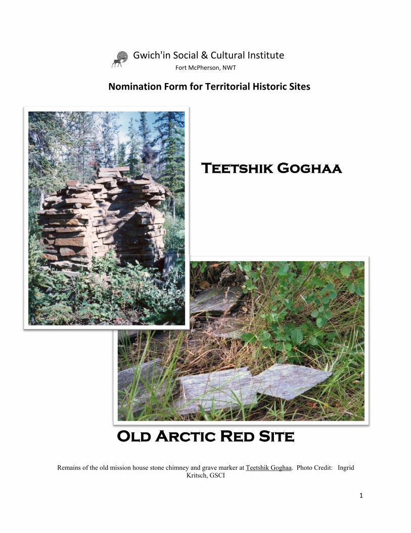
Teetshik Goghaa
Old Arctic Red Site
Remains of the old mission house stone chimney and grave marker at Teetshik Goghaa. Photo Credit: Ingrid Kritsch, GSCI
G

2
MANDATORY INFORMATION What is the name of the site you are nominating? Teetshik Goghaa is the traditional Gwich’in name for an old town site that is located seven miles below Tsiigehtchic on the Mackenzie River. For a time, the community that is now Tsiigehtchic was located there. The Gwich’in name refers to the creeks that flow into the Mackenzie River at this site and translates as ‘a bundle of creeks’. It is also known in the Gwich’in language as Zheh Gwishik, which means ‘old town,’ and locally it is often now called Old Arctic Red. Early missionaries also recorded the name, spelling it as Trétchigwarat (Father Séguin in Heine et al 2007) and T’etchi-Konra (Petitot in Savoie 2001).
Teetshik Goghaa, that’s just a bunch of creeks piled up in one place like.
That’s what it means. 1
1 Noel Andre, Tape 25, July 28, 1992 ‐ Gwichya Gwich'in Place Names Project 1992
3
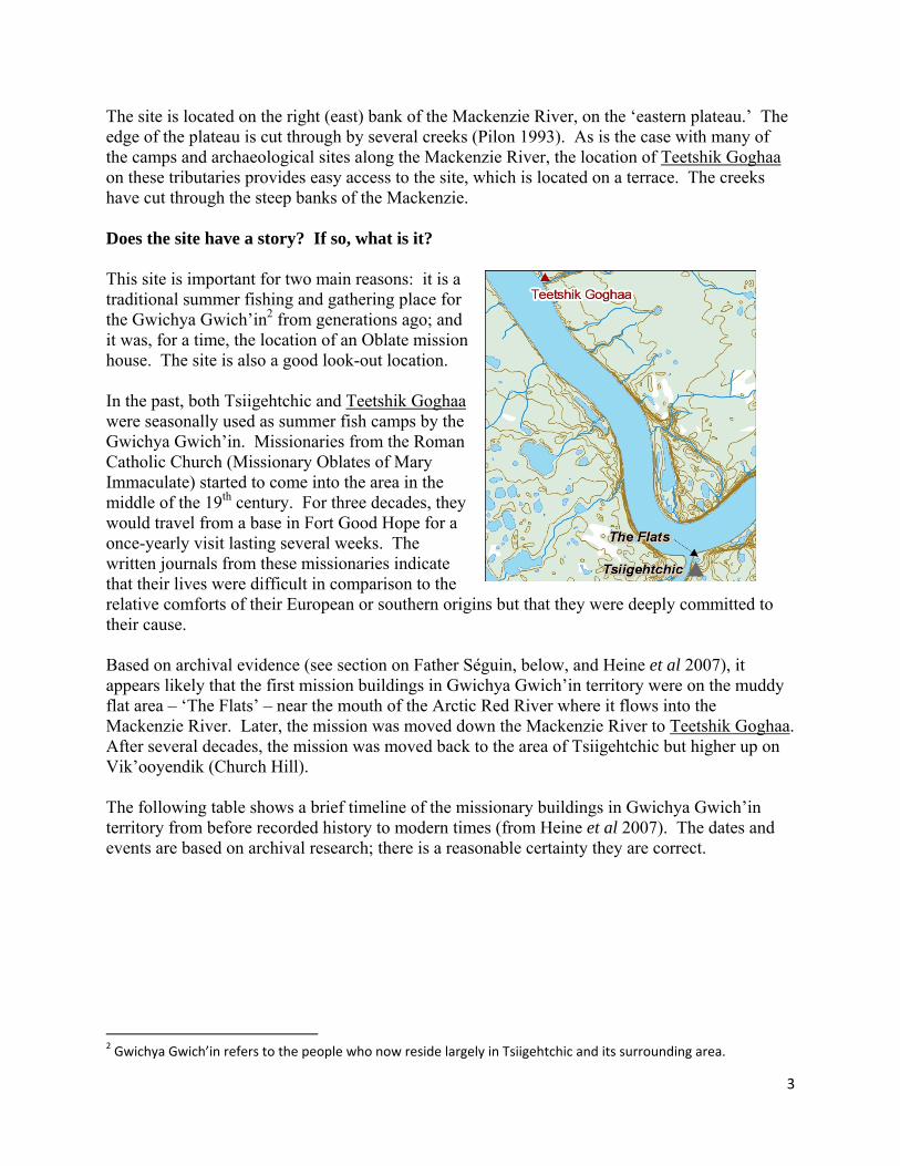
The site is located on the right (east) bank of the Mackenzie River, on the ‘eastern plateau.’ The edge of the plateau is cut through by several creeks (Pilon 1993). As is the case with many of the camps and archaeological sites along the Mackenzie River, the location of Teetshik Goghaa on these tributaries provides easy access to the site, which is located on a terrace. The creeks have cut through the steep banks of the Mackenzie. Does the site have a story? If so, what is it? This site is important for two main reasons: it is a traditional summer fishing and gathering place for the Gwichya Gwich’in2 from generations ago; and it was, for a time, the location of an Oblate mission house. The site is also a good look-out location. In the past, both Tsiigehtchic and Teetshik Goghaa were seasonally used as summer fish camps by the Gwichya Gwich’in. Missionaries from the Roman Catholic Church (Missionary Oblates of Mary Immaculate) started to come into the area in the middle of the 19th century. For three decades, they would travel from a base in Fort Good Hope for a once-yearly visit lasting several weeks. The written journals from these missionaries indicate that their lives were difficult in comparison to the relative comforts of their European or southern origins but that they were deeply committed to their cause. Based on archival evidence (see section on Father Séguin, below, and Heine et al 2007), it appears likely that the first mission buildings in Gwichya Gwich’in territory were on the muddy flat area – ‘The Flats’ – near the mouth of the Arctic Red River where it flows into the Mackenzie River. Later, the mission was moved down the Mackenzie River to Teetshik Goghaa. After several decades, the mission was moved back to the area of Tsiigehtchic but higher up on Vik’ooyendik (Church Hill). The following table shows a brief timeline of the missionary buildings in Gwichya Gwich’in territory from before recorded history to modern times (from Heine et al 2007). The dates and events are based on archival research; there is a reasonable certainty they are correct.
2 Gwichya Gwich’in refers to the people who now reside largely in Tsiigehtchic and its surrounding area.
4
Teetshik Goghaa
Tsiigehtchic
Before recorded history
Summer gathering spot for fishing. Gathering spot for fishing, trail head.
1862-1867 Oblate Father Jean Séguin starts once-a-year visits to Gwichya Gwich’in territory. He visits both sites but no permanent structures are built.
1867-1883 Catholic mission site built, probably on The Flats near modern-day Tsiigehtchic. Storms and flooding damaged the structures and prompted a move to a different location.
1883 to c1890 Mission site moved from the Flats to Teetshik Goghaa. Windy conditions and/or a lack of good landing for boats made the site unsuitable. After this time, a mission was established in Fort McPherson to serve the area.
c1890-1900 (Mission in Fort McPherson serving this population) c1901 to today Catholic mission established again
in the area of modern-day Tsiigehtchic at the mouth of the Arctic Red River. Built higher up on a large hill (Vik’ooyendik) overlooking the Mackenzie and Arctic Red Rivers.
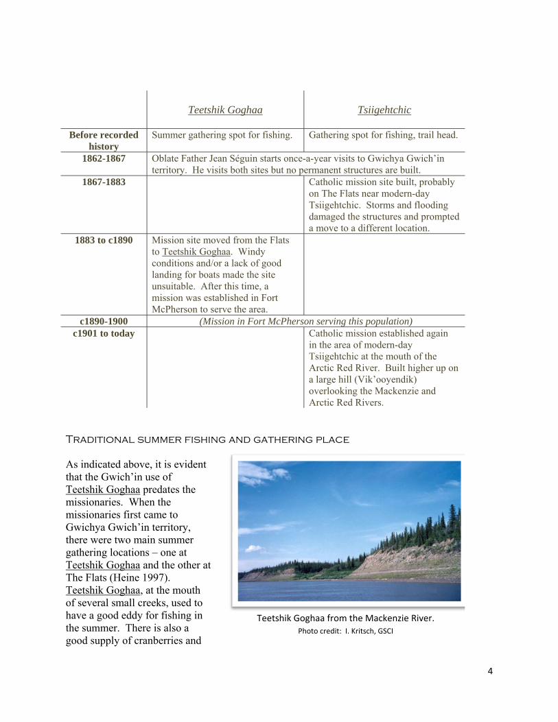
Traditional summer fishing and gathering place As indicated above, it is evident that the Gwich’in use of Teetshik Goghaa predates the missionaries. When the missionaries first came to Gwichya Gwich’in territory, there were two main summer gathering locations – one at Teetshik Goghaa and the other at The Flats (Heine 1997). Teetshik Goghaa, at the mouth of several small creeks, used to have a good eddy for fishing in the summer. There is also a good supply of cranberries and
Teetshik Goghaa from the Mackenzie River. Photo credit: I. Kritsch, GSCI
5
blueberries. “That’s where the old peoples were staying, hundred years ago... just live there and fish. ...Winter they go back in the lakes.”3 As a summer gathering place, Teetshik Goghaa would have been occupied briefly by many friends and families that had not seen each other for the long winter. They would gather and celebrate with tea dances, games, and other festivities. The dancing would last for days. Town and Mission site The Roman Catholic missions established at Tsiigehtchic and Teetshik Goghaa were built to serve the Gwich’in, and in response to the Protestant mission that was built at Fort McPherson. Teetshik Goghaa was constructed at the mouth of several creeks and the Gwich’in stayed in tents on the hills flanking the mission buildings during the summer months. Although it has been 150 years since the missionaries travelled down the Mackenzie to the Gwichya Gwich’in, their patterns are remembered through oral history, “Father ... came down there, with canoe, paddle and stayed there for awhile and [then] they went back up where they come from.” 4 Gabe Andre remembers hearing from his mother that people stayed at Teetshik Goghaa in moss houses, which pre-date the introduction of canvas tents. He was also told that they used spruce bark to build smoke houses for fish; and to live in as well during the summer months. Several families could stay in one moss house together as they were quite large – Gabe thought maybe 16 by 16 feet. One or two fires could be lit inside these structures.5 When Annie Norbert’s mother was young and through Annie’s childhood, people stayed out ‘in the bush’ all the time and only visited towns for certain occasions or to resupply – “sometimes they come for Christmas and Easter.” Some people stayed at Teetshik Goghaa for the month of July before heading back out to other resource harvesting areas such as fish lakes or the mountains as part of their seasonal travels. Annie thought that maybe older people who weren’t as capable of moving around may have lived at Teetshik Goghaa as well. Besides fishing, “I guess they enjoy one another, ’cause they don’t see one another all winter and maybe they enjoy one another and make feast and put up there.” After being away from friends and family for many months, this was a time for celebration, “tea dance and hand gambling… mom told me when they dance like that they dance for days and days. Nights and nights.” Her husband Nap added that hand gambling could go on for several days and nights!6 Annie Norbert also remembers her mother saying that Inuvialuit boats could be seen at Teetshik Goghaa. They would arrive from further down the Mackenzie River in the Delta or from along the Arctic coast, just to visit. “Them too, they show their dance, yeah. They show their dance.” This was after the time when the Gwich’in and the Siglit Inuit fought wars with each other, and peaceful relations were instead the norm.7
3 Edward Coyen, Tape 29, July 8, 1992, Gwichya Gwich'in Place Names Project 1992. 4 Edward Coyen, Tape 29, July 8, 1992, Gwichya Gwich'in Place Names Project 1992. 5 Gabe Andre, Tape 12, July 15, 1992, Gwichya Gwich’in Place Names Project 1992. 6 Annie and Nap Norbert, Tape 40, July 1992, Gwichya Gwich’in Place Names 1992 7 Annie and Nap Norbert, Tape 40, July 1992, Gwichya Gwich’in Place Names 1992
6
Reasons for leaving Teetshik Goghaa According to Gwichya Gwich’in Elder Annie Norbert, the move out of Teetshik Goghaa to Tsiigehtchic happened when her mother was only eight or nine years old. She remembered; Mom says there’s ‘Lots of people, lots of people! Eskimo and people from around here. Lots, lots of people. And people used to have good time. But it’s bad for windy so the priest right there moved the Arctic Red River up here’…8
Another contributing factor to the decision to move the town was the lack of a good boat landing spot, according to Elder Caroline Andre; Oh yeah, my mom was saying that they were going to build a town there. That's where it was going to be Arctic Red River town like, but then it's no good for boat landing so they moved it over to this place
here, they call Arctic Red River now.9
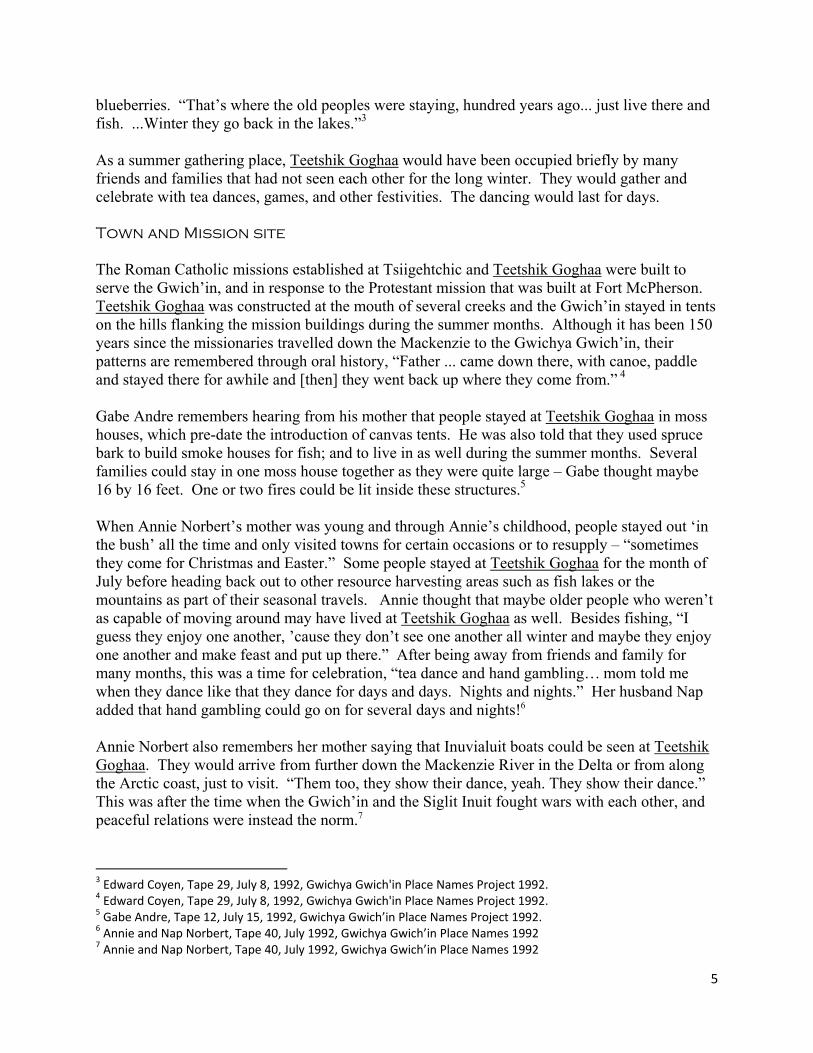
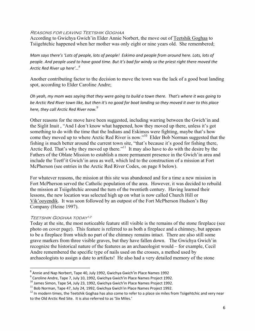
Other reasons for the move have been suggested, including warring between the Gwich’in and the Siglit Inuit , “And I don’t know what happened, how they moved up there, unless it’s got something to do with the time that the Indians and Eskimos were fighting, maybe that’s how come they moved up to where Arctic Red River is now.”10 Elder Bob Norman suggested that the fishing is much better around the current town site, “that’s because it’s good for fishing there, Arctic Red. That’s why they moved up there.”11 It may also have to do with the desire by the Fathers of the Oblate Mission to establish a more permanent presence in the Gwich’in area and include the Teetł’it Gwich’in area as well, which led to the construction of a mission at Fort McPherson (see entries in the Arctic Red River Codex, on page 8 below). For whatever reasons, the mission at this site was abandoned and for a time a new mission in Fort McPherson served the Catholic population of the area. However, it was decided to rebuild the mission at Tsiigehtchic around the turn of the twentieth century. Having learned their lessons, the new location was selected high up on what is now called Church Hill or Vik’ooyendik. It was soon followed by an outpost of the Fort McPherson Hudson’s Bay Company (Heine 1997). Teetshik Goghaa today12 Today at the site, the most noticeable feature still visible is the remains of the stone fireplace (see photo on cover page). This feature is referred to as both a fireplace and a chimney, but appears to be a fireplace from which no part of the chimney remains intact. There are also still some grave markers from three visible graves, but they have fallen down. The Gwichya Gwich’in recognize the historical nature of the features as an archaeologist would – for example, Cecil Andre remembered the specific type of nails used on the crosses, a method used by archaeologists to assign a date to artifacts! He also had a very detailed memory of the stone
8 Annie and Nap Norbert, Tape 40, July 1992, Gwichya Gwich’in Place Names 1992 9 Caroline Andre, Tape 7, July 10, 1992, Gwichya Gwich'in Place Names Project 1992. 10 James Simon, Tape 54, July 23, 1992, Gwichya Gwich'in Place Names Project 1992. 11 Bob Norman, Tape 47, July 24, 1992, Gwichya Gwich'in Place Names Project 1992. 12 In modern times, the Teetshik Goghaa has also come to refer to a place six miles from Tsiigehtchic and very near to the Old Arctic Red Site. It is also referred to as ‘Six Miles.’
7
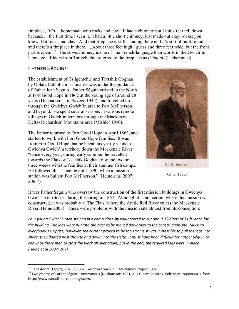
fireplace, “it’s ... homemade with rocks and clay. It had a chimney but I think that fell down because ... the first time I seen it, it had a little short chimney, just made out clay, rocks; you know, flat rocks and clay. And that fireplace is still standing there and it’s sort of built round, and there’s a fireplace in there. ...About three feet high I guess and three feet wide, but the front part is open.”13 The stove/chimney is one of the French-language loan words in the Gwich’in language – Elders from Tsiigehtchic referred to the fireplace as lishuunii (la cheminée). Father Séguin14 The establishment of Tsiigehtchic and Teetshik Goghaa by Oblate Catholic missionaries was under the guidance of Father Jean Séguin. Father Séguin arrived in the North at Fort Good Hope in 1862 at the young age of around 28 years (Duchaussois, in Savege 1942), and travelled on through the Gwichya Gwich’in area to Fort McPherson and beyond. He spent several seasons in various remote villages in Gwich’in territory through the Mackenzie Delta- Richardson Mountains area (Mishler 1990). The Father returned to Fort Good Hope in April 1863, and started to work with Fort Good Hope families. It was from Fort Good Hope that he began his yearly visits to Gwichya Gwich’in territory down the Mackenzie River. “Once every year, during early summer, he travelled towards the Flats or Teetshik Goghaa to spend two or three weeks with the families at their summer fish camps. He followed this schedule until 1890, when a mission station was built at Fort McPherson.” (Heine et al 2007: 206-7). It was Father Séguin who oversaw the construction of the first mission buildings in Gwichya Gwich’in territories during the spring of 1867. Although it is not certain where this mission was constructed, it was probably at The Flats (where the Arctic Red River enters the Mackenzie River, Heine 2007). There were problems with the mission site almost from its conception: Four young Gwich'in men staying in a camp close‐by volunteered to cut about 120 logs of 11 ft. each for the building. The logs were put into the river to be moved downriver to the construction site. Much to everybody’s surprise, however, the current proved to be too strong. It was impossible to pull the logs into shore; they floated past the site and down into the Delta. It must have been difficult for Father Séguin to convince those men to start the work all over again, but in the end, the required logs were in place (Heine et al 2007: 207).
13 Cecil Andre, Tape 9, July 17, 1992, Gwichya Gwich'in Place Names Project 1992. 14 Two photos of Father Séguin: Anonymous (Duchaussois 1921, Aux Glaces Polaires, Indiens et Esquimaux.), from http://www.canadianarchaeology.com.
Father Séguin.
8
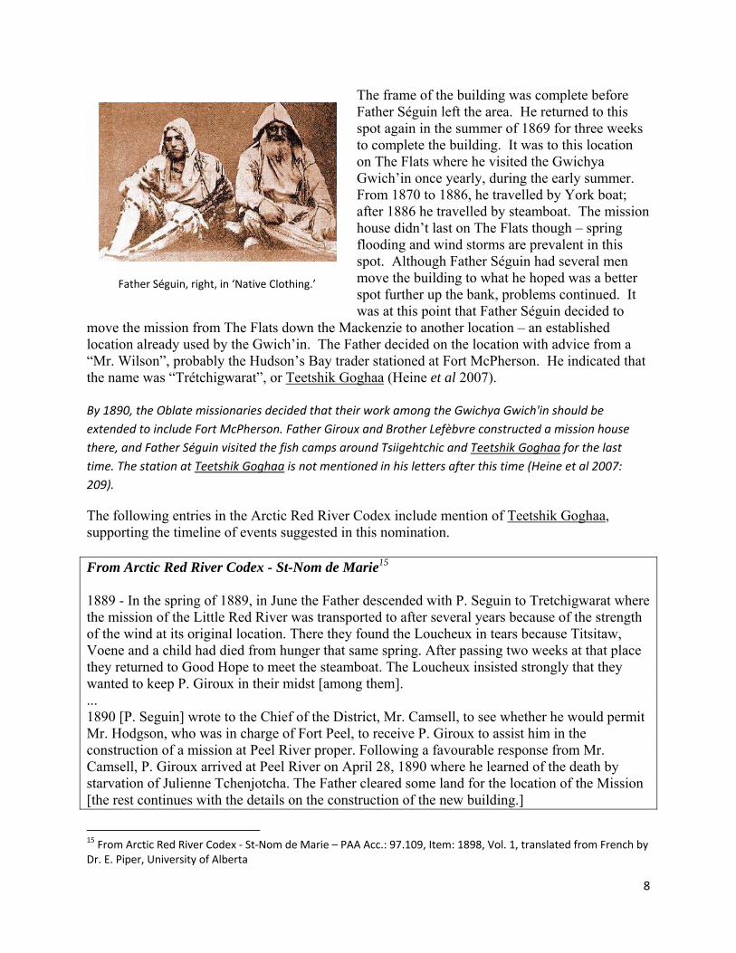
The frame of the building was complete before Father Séguin left the area. He returned to this spot again in the summer of 1869 for three weeks to complete the building. It was to this location on The Flats where he visited the Gwichya Gwich’in once yearly, during the early summer. From 1870 to 1886, he travelled by York boat; after 1886 he travelled by steamboat. The mission house didn’t last on The Flats though – spring flooding and wind storms are prevalent in this spot. Although Father Séguin had several men move the building to what he hoped was a better spot further up the bank, problems continued. It was at this point that Father Séguin decided to
move the mission from The Flats down the Mackenzie to another location – an established location already used by the Gwich’in. The Father decided on the location with advice from a “Mr. Wilson”, probably the Hudson’s Bay trader stationed at Fort McPherson. He indicated that the name was “Trétchigwarat”, or Teetshik Goghaa (Heine et al 2007). By 1890, the Oblate missionaries decided that their work among the Gwichya Gwich'in should be extended to include Fort McPherson. Father Giroux and Brother Lefèbvre constructed a mission house there, and Father Séguin visited the fish camps around Tsiigehtchic and Teetshik Goghaa for the last time. The station at Teetshik Goghaa is not mentioned in his letters after this time (Heine et al 2007: 209).
The following entries in the Arctic Red River Codex include mention of Teetshik Goghaa, supporting the timeline of events suggested in this nomination. From Arctic Red River Codex - St-Nom de Marie15 1889 - In the spring of 1889, in June the Father descended with P. Seguin to Tretchigwarat where the mission of the Little Red River was transported to after several years because of the strength of the wind at its original location. There they found the Loucheux in tears because Titsitaw, Voene and a child had died from hunger that same spring. After passing two weeks at that place they returned to Good Hope to meet the steamboat. The Loucheux insisted strongly that they wanted to keep P. Giroux in their midst [among them]. ... 1890 [P. Seguin] wrote to the Chief of the District, Mr. Camsell, to see whether he would permit Mr. Hodgson, who was in charge of Fort Peel, to receive P. Giroux to assist him in the construction of a mission at Peel River proper. Following a favourable response from Mr. Camsell, P. Giroux arrived at Peel River on April 28, 1890 where he learned of the death by starvation of Julienne Tchenjotcha. The Father cleared some land for the location of the Mission [the rest continues with the details on the construction of the new building.]
15 From Arctic Red River Codex ‐ St‐Nom de Marie – PAA Acc.: 97.109, Item: 1898, Vol. 1, translated from French by Dr. E. Piper, University of Alberta
Father Séguin, right, in ‘Native Clothing.’
9
The name “Tretchigwarat” was also noted in a 1982 Arctic Red River Roman Catholic Church Report as the place where the original mission was constructed, “at about six miles down the Mackenzie River from the modern from the present site of Arctic Red River.”16 Father Séguin continued his work at Fort Good Hope until near his death in 1904. Shortly before he died, and in failing health, he returned to his native France (Pilon 1993). Archaeology Teetshik Goghaa is a recorded archaeological site, MjTr-1. Although the site was always known to Tsiigehtchic residents it was not officially recorded until 1983 (Morrison 1983) – even though Tsiigehtchic Elder Gabe Andre showed the spot to larger-than-life archaeologist Richard “Scotty” MacNeish in 1949, the site did not show up in MacNeish’s field notes. The original recording of the site was very brief – no sub-surface testing was carried out, and only a brief sketch of the chimney and graves provided due to the overview nature of the project (Morrison 1983). Years later, archaeologist Jean-Luc Pilon of the NOGAP project recorded the site in greater detail even though it was outside the scope of his project. Jean-Luc noted, “...we had the opportunity of visiting and documenting this locally very important site. Heritage is, after all, the affair of a community, and quite obviously this site is of great significance to the people of Tsiigehtchic” (Pilon 1993). Pilon describes the site in his field notes; Although the most obvious feature is a partially‐standing stone and mud fireplace … with its associated building foundation, there were also at least two separate building foundations and a large, now‐collapsed cross … The chimney is made of limestone slabs mortared together with what appears to be local mud. The wide opening faces the river and consists of a wide rather than a deep hearth. A paving of limestone slabs seems to lie in front of the fireplace. A low, slightly‐raised square appears to define the base of the building which must have once included this chimney. … many of the stones lying in front of the fireplace may simply have fallen from the top of the chimney. On the other hand, some of these may have been part of some sort of paving in front of and possibly throughout the building (Pilon 1993). Pilon also describes two other earthen features – pits or the remains of foundations – that were probably related to historic buildings. Archaeological tests confirmed that they were related to the human occupation of the site and indicated that at least one of the buildings were ultimately destroyed by fire. Historic period graves were located along the top edge of the steep rise from the creek to the south of the plateau. … All three consisted of small, now collapsed picket fence enclosures. The tips of the individual pickets had usually been cut into diamond‐shapes; nails were both square machine‐cut varieties and round wire‐cut. Other evidence of occupation could be noted in the vicinity of this site and included axe‐cut tree stumps and birch trees from which large rectangular sections of bark had been
16 Hand written note attributed to “GM omi” (Oblates Mary Immaculate, possibly Father Gilles Mousseau, omi who was the Archivist at the RC Diocese in Yellowknife) at the bottom of a page of Sister Matte’s Roman Catholic Church Report, 1982.
10
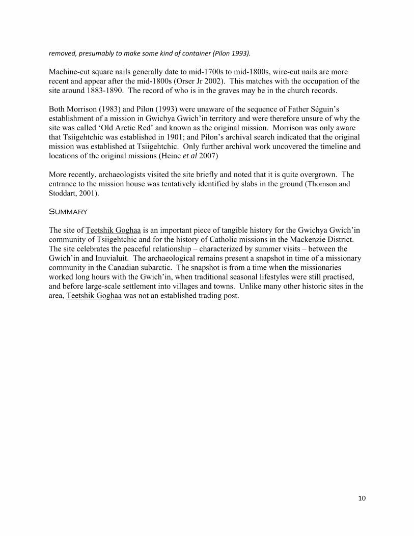
removed, presumably to make some kind of container (Pilon 1993). Machine-cut square nails generally date to mid-1700s to mid-1800s, wire-cut nails are more recent and appear after the mid-1800s (Orser Jr 2002). This matches with the occupation of the site around 1883-1890. The record of who is in the graves may be in the church records. Both Morrison (1983) and Pilon (1993) were unaware of the sequence of Father Séguin’s establishment of a mission in Gwichya Gwich’in territory and were therefore unsure of why the site was called ‘Old Arctic Red’ and known as the original mission. Morrison was only aware that Tsiigehtchic was established in 1901; and Pilon’s archival search indicated that the original mission was established at Tsiigehtchic. Only further archival work uncovered the timeline and locations of the original missions (Heine et al 2007) More recently, archaeologists visited the site briefly and noted that it is quite overgrown. The entrance to the mission house was tentatively identified by slabs in the ground (Thomson and Stoddart, 2001). Summary The site of Teetshik Goghaa is an important piece of tangible history for the Gwichya Gwich’in community of Tsiigehtchic and for the history of Catholic missions in the Mackenzie District. The site celebrates the peaceful relationship – characterized by summer visits – between the Gwich’in and Inuvialuit. The archaeological remains present a snapshot in time of a missionary community in the Canadian subarctic. The snapshot is from a time when the missionaries worked long hours with the Gwich’in, when traditional seasonal lifestyles were still practised, and before large-scale settlement into villages and towns. Unlike many other historic sites in the area, Teetshik Goghaa was not an established trading post.
11
Bibliography Andre, Alestine and Ingrid Kritsch 1992 Traditional Use of the Travaillant Lake Area Using Trails and Place Names of the Gwichya
Gwich’in from Arctic Red River, N.W.T. Report prepared under contract to NOGAP on file with GSCI. Gwich’in Social and Cultural Institute, Tsiigehtchic, N.W.T.
Gwich'in Land Use Planning Board 2003 Nanh' Geenjit Gwit'rit Tigwaa'in / Working For The Land. Gwich'in Land Use Plan. Gwich'in Land
Use Planning Board, Inuvik, NWT. Gwich’in Renewable Resource Board and Gwich’in Elders 1997 Nành’ Kak Geenjit Gwich’in Ginjik (Gwich’in words about the land). Gwich’in Renewable
Resource Board, Inuvik, NWT. GSCI and Parks Canada 2004 Nagwichoonjik National Historic Site of Canada Commemorative Integrity Statement. GSCI
Review Draft. April 2004. Heine, Michael 1997 "That river, it's like a highway for us. " The Mackenzie River through Gwichya Gwich' in history
and culture. Historic Sites and Monuments Board of Canada Agenda Paper. GSCI. Heine, Michael, Alestine Andre, Ingrid Kritsch, Alma Cardinal and the Elders of Tsiigehtshik 2007 Gwichya Gwich'in Googwandak: The History and Stories of the Gwichya Gwich'in. Gwich'in
Social and Cultural Institute, Tsiigehtchic, NT. Revised. Originally published 2001. Kritsch, Ingrid and Alestine Andre 1994 Gwichya Gwich'in Place Names in the Mackenzie Delta, Gwich'in Settlement Area, N.W.T.
Gwich'in Social and Cultural Institute, Tsiigehtchic, N.W.T. Millar, J. F. V., G. C. Short, and L. Konotopetz 1973 Report of Investigations 1973 Program – Mackenzie River Archaeological Project. Report
produced for the Historic Advisory Board, Government of the Northwest Territories. Archaeological permit 1973‐334. Manuscript on file at Prince of Wales Northern Heritage Centre.
Mishler, Craig 1990 “Missionairies [sic] in Collision: Anglicans and Oblates among the Gwich‘in, 1861‐65.” Arctic,
Volume 43, No. 2, pp. 121‐126. Morrison, David 1983 An Archaeological Survey in the Lower Mackenzie Drainage, NWT. Archaeological permit 1983‐
532. Manuscript on file at Prince of Wales Northern Heritage Centre. Orser, Charles Jr 2002 “Nails” Encyclopedia of Historical Archaeology. Charles E Orser Jr, Ed, pp 376‐377. Routledge:
New York. Pilon, Jean‐Luc 1993 1993 Field Report, Part 2. NOGAP Archaeological Project, CMC. Accessed March 3, 2009
www.canadianarchaeology.com/cmcc/f93rep2.htm Savege, A.H.
12
1942 Dogsled Apostles. Sheed and Ward (original publishers), Universal Digital Library http://www.archive.org/details/dogsledapostles013387mbp accessed March 3, 2009.
Savoie, Donat (editor) 2001 Land Occupancy by the Amerindians of the Canadian Northwest in the 19th Century as reported
by Émile Petitot. Occasional Publication no. 49, Canadian Circumpolar Institute, University of Alberta, reissued 2005.
Thomson, Callum and Eleason Stoddart 2001 Preliminary Historical Resources Inventory and Assessment of the Proposed Mackenzie Valley
Pipeline Route Northwest Territories. Jacques Whitford Environment Limited. Report produced for Alaska Gas Producers Pipeline Team Northwest Territories Permit 2001‐914. Manuscript on file at Prince of Wales Northern Heritage Centre.
Primary sources from the following project
Gwichya Gwich’in Place Names Project 1992 Alestine Andre and Ingrid Kritsch, on file with Gwich’in Social and Cultural Institute
Sister Matte’s Roman Catholic Church Report 1982 April‐May. Hand‐typed manuscript describing the mission at Arctic Red River. On file at GSCI.
Arctic Red River Codex ‐ St‐Nom de Marie. Provincial Archives of Alberta (PAA), Fonds Oblats de Marie‐Immaculée (OMI), Acc.: 97.109.
A Name of the Site Type of Name Name Information on use of name
Present name(s) Old Arctic Red Traditional name(s) Teetshik Goghaa, Zheh GwishikOriginal name Teetshik GoghaaOther historic names(s) Alternate spellings include Trétchigwarat (In Father Séguin’s notes), T’etchi‐Konra (In Petitot’s notes) Official name N/A Other names N/A Please include any information about the name i.e. what language it is in, the period when it was used… Teetshik Goghaa is a traditional Gwich’in place name, in the Gwichya Gwich’in dialect. The name refers to a number of creeks that flows out at this location.
B Geographical Location of the Site. Street address n/a Legal address n/a Latitude / Longitude 67.528512 N 133.853808 W NAD83Other method: About 7 miles (11 km) down the Mackenzie River from Tsiigehtchic on the right (east) bank of the Mackenzie.
13
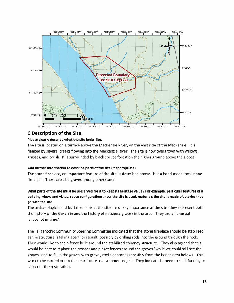
C Description of the Site Please clearly describe what the site looks like.
The site is located on a terrace above the Mackenzie River, on the east side of the Mackenzie. It is flanked by several creeks flowing into the Mackenzie River. The site is now overgrown with willows, grasses, and brush. It is surrounded by black spruce forest on the higher ground above the slopes. Add further information to describe parts of the site (if appropriate).
The stone fireplace, an important feature of the site, is described above. It is a hand‐made local stone fireplace. There are also graves among birch stand. What parts of the site must be preserved for it to keep its heritage value? For example, particular features of a building, views and vistas, space configurations, how the site is used, materials the site is made of, stories that go with the site…
The archaeological and burial remains at the site are of key importance at the site; they represent both the history of the Gwich’in and the history of missionary work in the area. They are an unusual ‘snapshot in time.’ The Tsiigehtchic Community Steering Committee indicated that the stone fireplace should be stabilized as the structure is falling apart, or rebuilt, possibly by drilling rods into the ground through the rock. They would like to see a fence built around the stabilized chimney structure. They also agreed that it would be best to replace the crosses and picket fences around the graves “while we could still see the graves” and to fill in the graves with gravel, rocks or stones (possibly from the beach area below). This work to be carried out in the near future as a summer project. They indicated a need to seek funding to carry out the restoration.
14
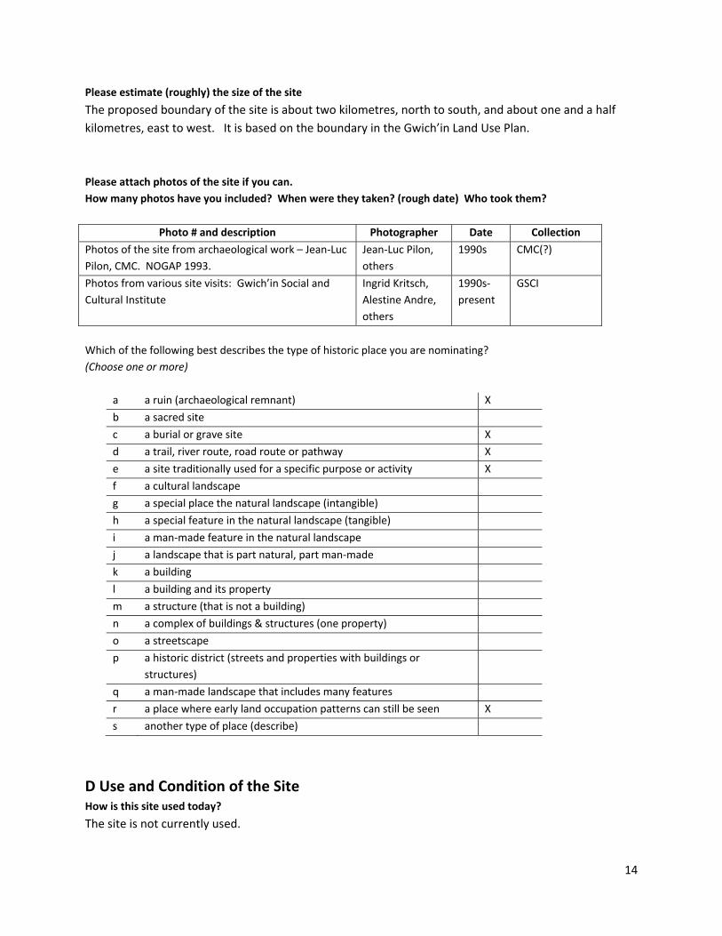
Please estimate (roughly) the size of the site
The proposed boundary of the site is about two kilometres, north to south, and about one and a half kilometres, east to west. It is based on the boundary in the Gwich’in Land Use Plan. Please attach photos of the site if you can. How many photos have you included? When were they taken? (rough date) Who took them?
Photo # and description Photographer Date Collection
Photos of the site from archaeological work – Jean‐Luc Pilon, CMC. NOGAP 1993.
Jean‐Luc Pilon, others
1990s CMC(?)
Photos from various site visits: Gwich’in Social and Cultural Institute
Ingrid Kritsch, Alestine Andre, others
1990s‐present
GSCI
Which of the following best describes the type of historic place you are nominating? (Choose one or more)
a a ruin (archaeological remnant) X
b a sacred site
c a burial or grave site X
d a trail, river route, road route or pathway X
e a site traditionally used for a specific purpose or activity X
f a cultural landscape
g a special place the natural landscape (intangible)
h a special feature in the natural landscape (tangible)
i a man‐made feature in the natural landscape
j a landscape that is part natural, part man‐made
k a building
l a building and its property
m a structure (that is not a building)
n a complex of buildings & structures (one property)
o a streetscape
p a historic district (streets and properties with buildings or structures)
q a man‐made landscape that includes many features
r a place where early land occupation patterns can still be seen X
s another type of place (describe)
D Use and Condition of the Site How is this site used today?
The site is not currently used.

15
Is this site currently under threat? If so, please describe the threat.
Inadvertent threat may have come from maintenance/clearing activities in the early‐1990s. Archaeologist Pilon noted, During the summer of 1993, workers from Tsiigehtchic had been busy cutting brush which had grown‐up on the site over the years. In doing so, they had inadvertently exposed some of the more fragile remains to the worst kind of destructive agents; humans. In fact, one of the areas where this brush was burned, in order to dispose of it, was very close to ... historic burials (Pilon 1993). Currently, no threats are identified. How would you describe the present condition of this place?
Condition Yes/No Comments healthy YESwhole YESgood YESokay YESpoor NOOvergrown YESfalling apart YESbeing destroyed NO
The condition of the site needs further assessment. Who currently owns the site?
The site is located within Gwich’in –owned Parcel 15 Schedule I, Gwich'in Lands, Excluding Minerals. Are they aware and supportive of this nomination? Letter of support from Gwich’in Tribal Council and Gwichya Gwich’in Council to come.
Thank you for completing this nomination form. Please tell us who you are, and where we can reach you .
name Executive Director organization (if any) Gwich’in Social & Cultural Institute
mailing address Box 30, Fort McPherson, NT X0E 0J0 telephone 867‐952‐2524
fax 867‐952‐2238 e‐mail [email protected] other
16
This nomination form can be submitted by mail Cultural Places Officer
Prince of Wales Northern Heritage Centre Box 1320 Yellowknife, NT XIA 2L9
by fax Cultural Places Officer Prince of Wales Northern Heritage Centre 867‐873‐0205
by e‐mail [email protected]
on‐line It is also available to be downloaded on‐line at www.pwnhc.ca/programs/nwthpp.html Prince of Wales Northern Heritage Centre staff will be in touch with you to confirm they have received it. A file number for further correspondence about the historic place will be attached to the reply.
17
ADDITIONAL INFORMATION Answers to the following questions are not required to nominate a Territorial historic site. However, it will help us to process your nomination more quickly if you can provide any of the following information. 1) Do you have a personal attachment to this site? If so, please tell us about it. The Gwichya Gwich’in residents of Tsiigehtchic have a strong attachment to this site through a connection to their history. The site has been a summer gathering and fishing location for generations and is remembered as a place where dancing and feasts were held to express the joy of seeing friends and family after a long winter dispersed away from each other. More recently, this site was the location of an Oblate Catholic mission, the story of which is intertwined with the lives of the Gwichya Gwich’in in a complex manner. 2) Can you provide information to precisely identify the boundaries of the site?
See maps in this document and a GIS Shapefile (digital mapping file) is attached to this application. This boundary is based on the boundary in the Gwich’in Land Use Plan. 3) Has this site already been recognized as a historic place by another government or agency? If so, by whom and as what type of site?
Teetshik Goghaa is a Gwich’in Heritage Conservation Zone in the Nanh' Geenjit Gwit'rit Tigwaa'in / Working For The Land. Gwich'in Land Use Plan. Land use and development is restricted within this zone. The site is within the boundary of Nagwichoonjik – Mackenzie River National Historic Site. This site follows the Mackenzie River from where it enters the Gwich’in Settlement Area to Point Separation. It was commemorated for the following reasons (GSCI and Parks Canada 2004: 11): • it is prominent as a cultural landscape within the Gwichya Gwich’in traditional territory; • it is culturally, socially and spiritually significant to the people; and, the history of life on the land and along the river is remembered through names that are given to a great number of places on the land and along the river. Additionally, the archaeological remains “includ[ing] the surface and buried resources related to... the remains of the Oblate Mission at Teetshik goghaa (Old Arctic Red River)” are considered important heritage features in the Nagwichoonjik National Historic Site (GSCI and Parks Canada 2004: 20). 4) Is this site presently occupied by someone who is not the owner? Please name (if known).
Unoccupied. Does the present occupant know the site has been nominated as a Territorial historic site? N/A 5) Has this site been maintained over the years by someone (who is not the owner or occupant)? Please name person and contact information (if known). The residents of Tsiigehtchic cleared the area and did maintenance during the early 1990s, and perhaps afterwards as well. They are represented by the Tsiigehtchic Territorial Historic Sites Steering Committee, who has reviewed and approved this nomination. Does this caretaker know the site has been nominated as a Territorial historic site? See above. 6) Do you know of a person, group or organization that has stories, papers or historic photographs of the site? If so, please tell us who they are, and how we can contact them.
18
The Archives Dechatelets in Ottawa, Ontario, the Provincial Archives of Alberta, and the NWT RC Diocesan Centre Archives in Yellowknife. 7) Do you know where we can obtain additional information about the site? (Please list the names of any books, articles, tapes, videos, or similar materials.)
See bibliography for known sources. 8) Have parts of this historic place been removed and relocated elsewhere. If so, what parts are they and how can we find them? Not to the knowledge of the GSCI or members of the Tsiigehtchic HPI Nomination Community Steering Committee. 9) Is this historic place a building or structure that has been moved to its present location from an earlier site? If so, please tell us what you know about when it was moved and where it came from. Not to the knowledge of the GSCI. 10) Does your community support designation of this site?
Yes. Letters of support to come. If available, please attach letters of community support to this nomination. If such letters are not currently available, please submit them separately, using the file number Prince of Wales Northern Heritage Centre provides when it responds to the nomination.