operations in the arctic areas? - sots...
TRANSCRIPT

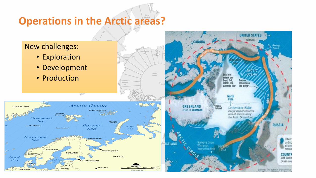
Operations in the Arctic areas?
New challenges:
• Exploration
• Development
• Production
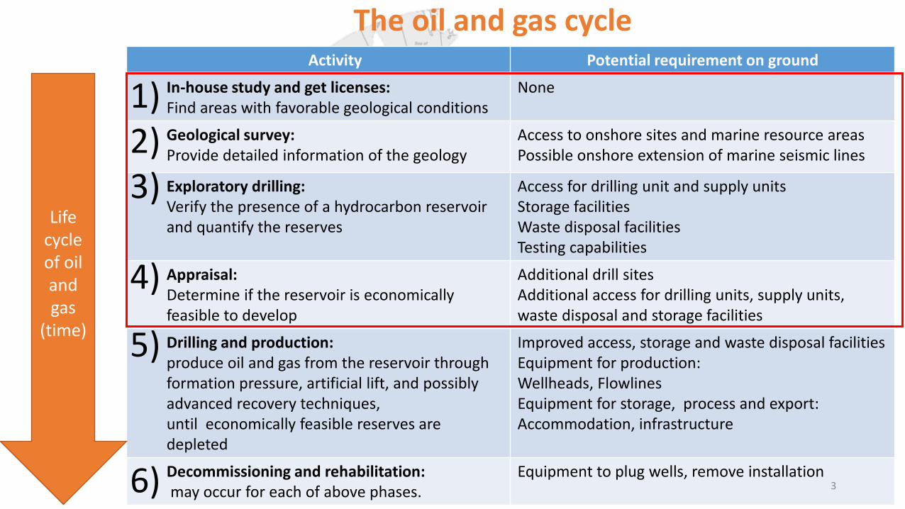
Activity Potential requirement on ground
In-house study and get licenses: Find areas with favorable geological conditions
None
Geological survey: Provide detailed information of the geology
Access to onshore sites and marine resource areas Possible onshore extension of marine seismic lines
Exploratory drilling: Verify the presence of a hydrocarbon reservoir and quantify the reserves
Access for drilling unit and supply units Storage facilities Waste disposal facilities Testing capabilities
Appraisal: Determine if the reservoir is economically feasible to develop
Additional drill sites Additional access for drilling units, supply units, waste disposal and storage facilities
Drilling and production: produce oil and gas from the reservoir through formation pressure, artificial lift, and possibly advanced recovery techniques, until economically feasible reserves are depleted
Improved access, storage and waste disposal facilities Equipment for production: Wellheads, Flowlines Equipment for storage, process and export: Accommodation, infrastructure
Decommissioning and rehabilitation: may occur for each of above phases.
Equipment to plug wells, remove installation 3
The oil and gas cycle
Life cycle of oil and gas
(time)
1) 2) 3) 4)
5) 6)
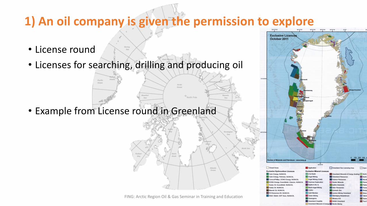
1) An oil company is given the permission to explore
• License round
• Licenses for searching, drilling and producing oil
• Example from License round in Greenland
FING: Arctic Region Oil & Gas Seminar in Training and Education 6

Licensing system
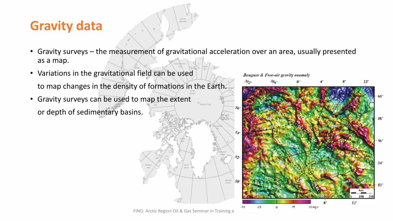
Gravity data
• Gravity surveys – the measurement of gravitational acceleration over an area, usually presented as a map.
• Variations in the gravitational field can be used
to map changes in the density of formations in the Earth.
• Gravity surveys can be used to map the extent
or depth of sedimentary basins.
FING: Arctic Region Oil & Gas Seminar in Training and Education 8

Magnetic data
• Variations in the magnetic field can be used to determine the extent of sedimentary basins an the depth to basement rocks, as well as differentiate between igneous rocks and certain sedimentary rocks such as salt.
FING: Arctic Region Oil & Gas Seminar in Training and Education 9
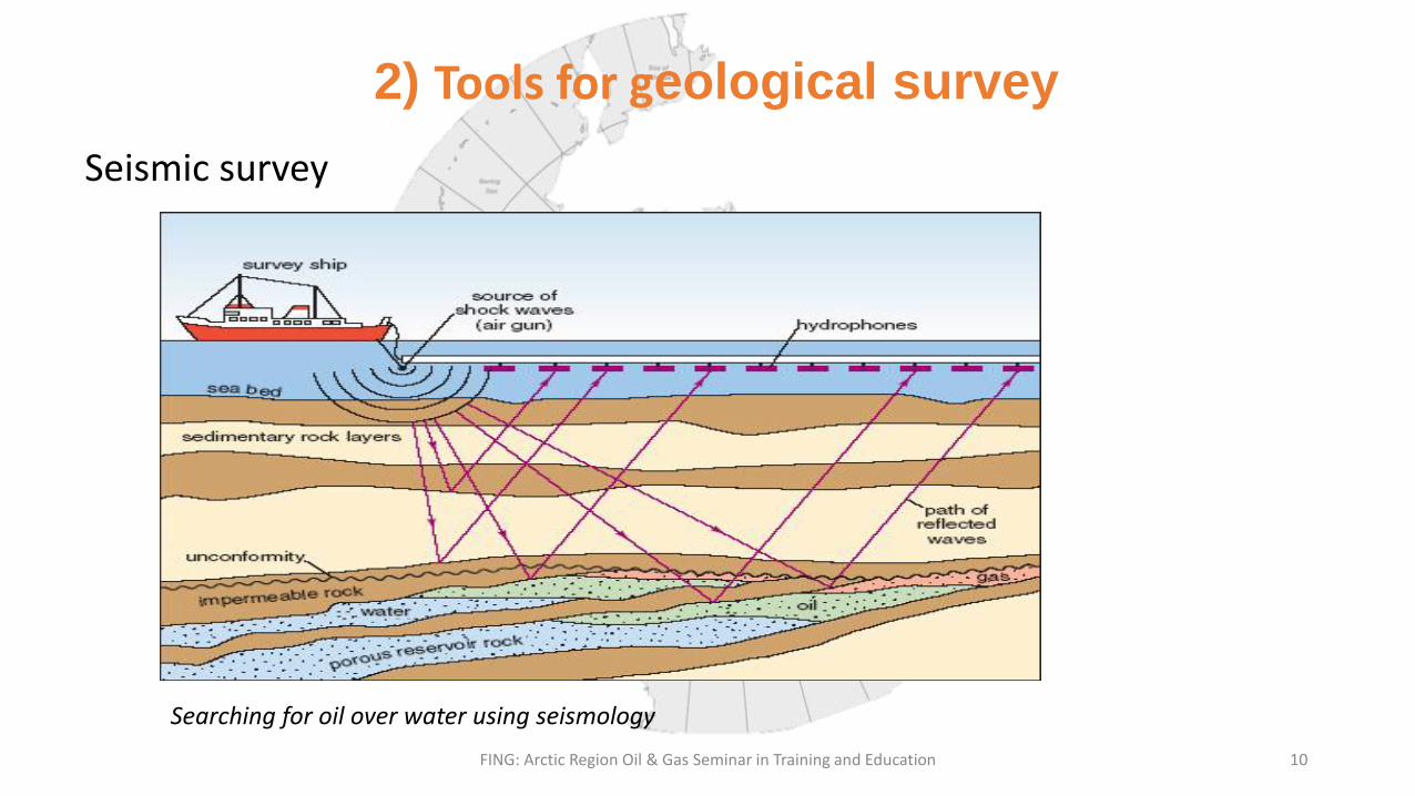
2) Tools for geological survey
Seismic survey
FING: Arctic Region Oil & Gas Seminar in Training and Education 10
Searching for oil over water using seismology

2. Detection of shallow gas
FING: Arctic Region Oil & Gas Seminar in Training and Education 11

Seabed disturbance by iceberg scours offshore Labrador in water depth of more than 100 metres.

3) Exploration drilling
Background:
• Based on desk study:
• a map of the rocks where they think oil and gas might be found
Purpose:
• One or more exploration wells are drilled to determine possibly of hydrocarbons
• If hydrocarbon reservoir is detected the well will be surveyed with logging tools both from the MWD/LWD and wireline logging.
The well will be well tested
• Hydrocarbon samples
• Temperature and pressure measurements
• Flow rates
After the well test, plug and abandon.
A treasure hunt to find oil and gas
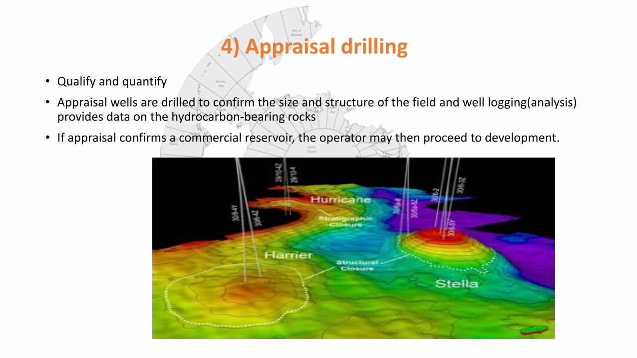
4) Appraisal drilling
• Qualify and quantify
• Appraisal wells are drilled to confirm the size and structure of the field and well logging(analysis) provides data on the hydrocarbon-bearing rocks
• If appraisal confirms a commercial reservoir, the operator may then proceed to development.

Field development plan (FDP)
• Give the best technical solutions for field optimization.
• Based on Geophysics, geology, reservoir information from exploration and appraisal drilling
• Comprise activities and processes required to develop a field, including:
A. Logistics, due to • Transport the personnel and equipment to the rig
• Location of onshore base
• Minimize cost while maximizing safety and efficiency
B. Drilling system & Production system
C. Processing & surface facilities
D. Economics and risk assessment
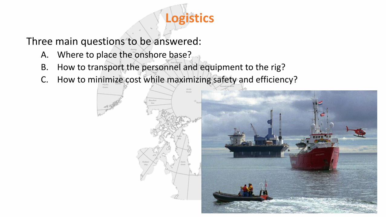
Logistics
Three main questions to be answered: A. Where to place the onshore base?
B. How to transport the personnel and equipment to the rig?
C. How to minimize cost while maximizing safety and efficiency?
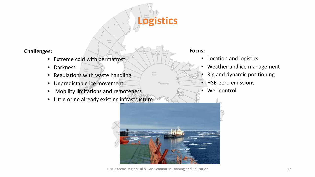
Logistics
Challenges:
• Extreme cold with permafrost
• Darkness
• Regulations with waste handling
• Unpredictable ice movement
• Mobility limitations and remoteness
• Little or no already existing infrastructure
FING: Arctic Region Oil & Gas Seminar in Training and Education 17
Focus:
• Location and logistics
• Weather and ice management
• Rig and dynamic positioning
• HSE, zero emissions
• Well control
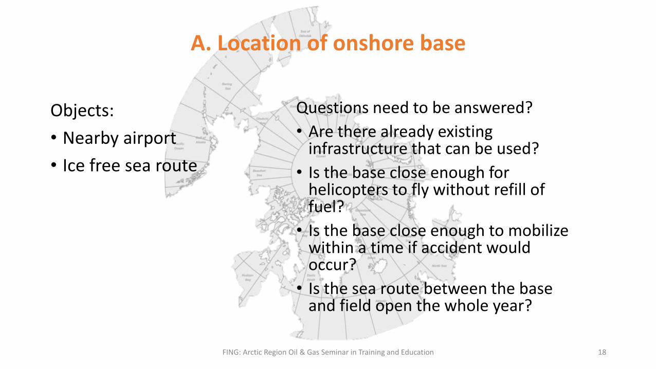
A. Location of onshore base
Objects:
• Nearby airport
• Ice free sea route
FING: Arctic Region Oil & Gas Seminar in Training and Education 18
Questions need to be answered?
• Are there already existing infrastructure that can be used?
• Is the base close enough for helicopters to fly without refill of fuel?
• Is the base close enough to mobilize within a time if accident would occur?
• Is the sea route between the base and field open the whole year?
FING: Arctic Region Oil & Gas Seminar in Training and Education 19
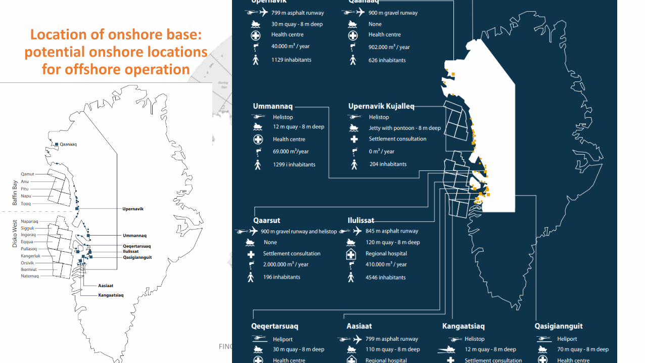
Location of onshore base: potential onshore locations
for offshore operation

HSE: Safety Ice challenges:
• High speed
• Ice mass (thickness)
• Unpredictable movements/Changing direction in ice
• Large ice loads on rig
Ice Movement (Keinonen et al 2000)
Animation; Ice movement in the artic

Edit the text with your own short phrases.
The animation is already done for you; just copy and paste the slide into your existing presentation.
21
Challenges
Low pressure, Changing weather
Waves and wind
Fog Ice berg