outdoor economy growth engine for the big bear valley summit for... · california trails and...
TRANSCRIPT
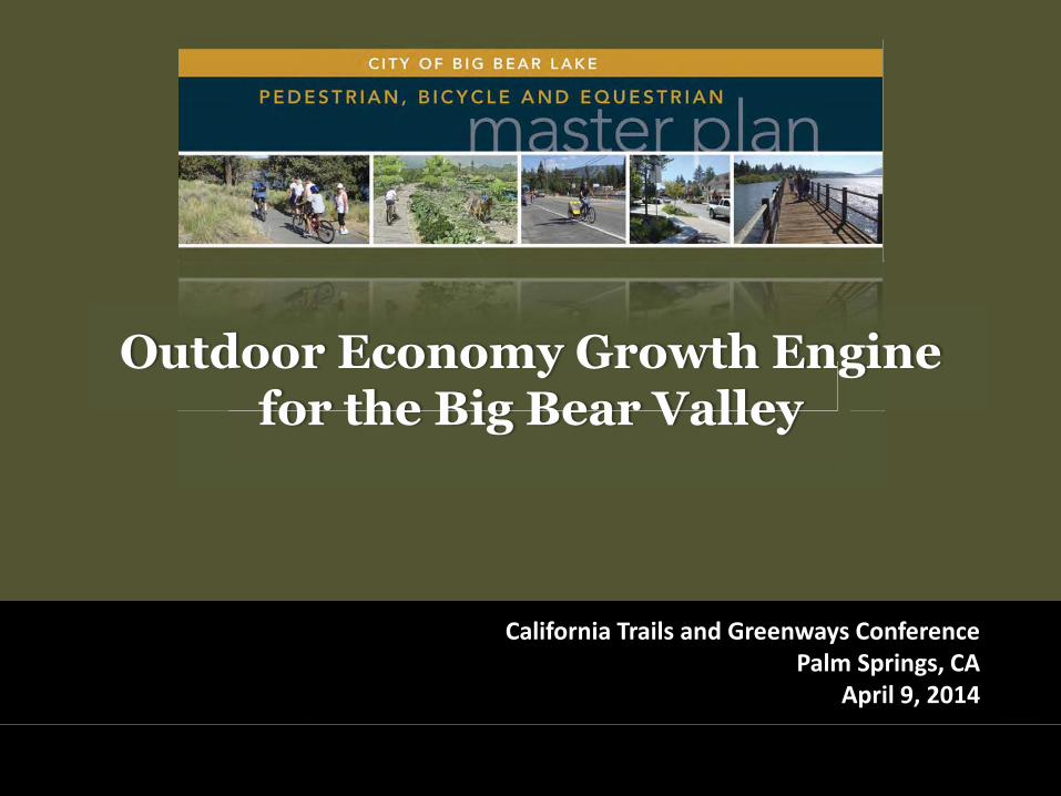
California Trails and Greenways Conference Palm Springs, CA
April 9, 2014
Outdoor Economy Growth Engine for the Big Bear Valley

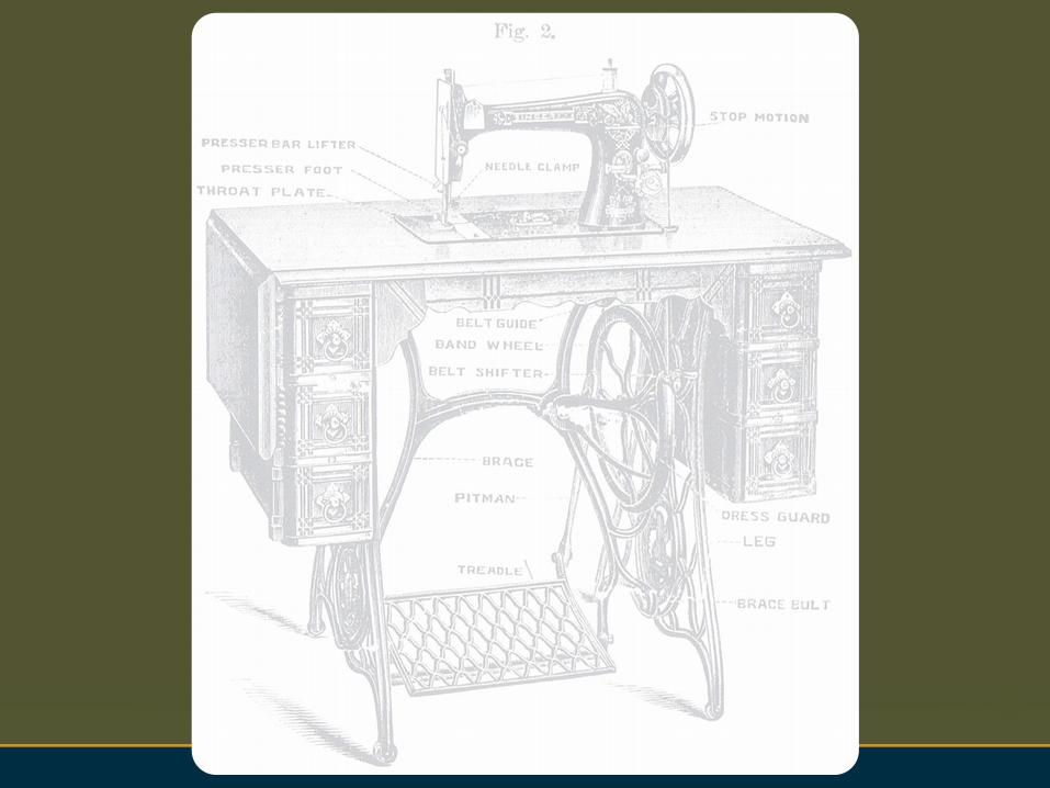
: a machine that changes energy into motion
\ˈen-jən\
: something that produces a particular and usually desirable result


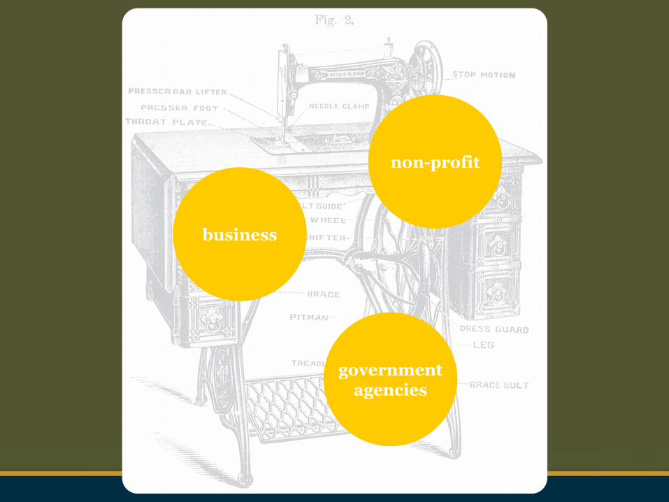
business
non-profit
government agencies

Welcome
Siri Eggebraten City of Big Bear Lake
Jay Renkens MIG
Jan Hancock Hancock Resources LLC

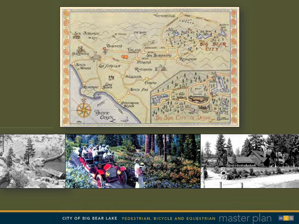

BIG BEAR VALLEY Central Los Angeles
About 100 Miles

BIG BEAR VALLEY Central Los Angeles
About 100 Miles


: generate and focus energy to set about the motion of change
what do we do to fix these problems?
: create a document that meets legal mandates and can be used to by a variety of actors to produce pedestrian pathways, bicycle routes, equestrian trails, related amenities, and economic stimulus for our an outdated economy


Crafting the Team
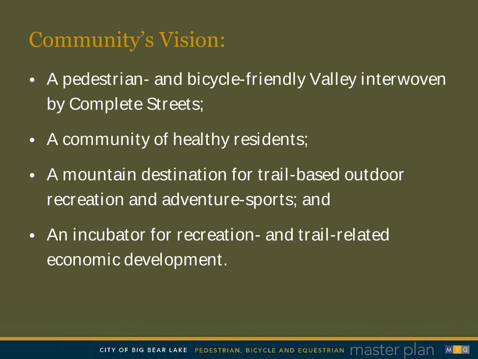
• A pedestrian- and bicycle-friendly Valley interwoven
by Complete Streets;
• A community of healthy residents;
• A mountain destination for trail-based outdoor
recreation and adventure-sports; and
• An incubator for recreation- and trail-related
economic development.
Community’s Vision:

Pedestrian, Bicycle &
Equestrian Systems Planning
An Integrated Approach . . .
Complete Streets Design
Market Analysis & Economic Strategy
Natural, Cultural &
Recreational Resources
Land Use Support &
Placemaking
Meaningful Community & Stakeholder Engagement
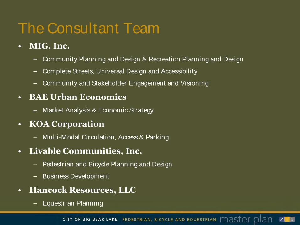
The Consultant Team • MIG, Inc.
– Community Planning and Design & Recreation Planning and Design
– Complete Streets, Universal Design and Accessibility
– Community and Stakeholder Engagement and Visioning
• BAE Urban Economics – Market Analysis & Economic Strategy
• KOA Corporation – Multi-Modal Circulation, Access & Parking
• Livable Communities, Inc. – Pedestrian and Bicycle Planning and Design
– Business Development
• Hancock Resources, LLC – Equestrian Planning

Engaging Stakeholders Process

Plan Process
Phase 1: Existing
Conditions and
Community Visioning
September – December 2012
Phase 2: Analysis
and Concept
Refinement
December 2012 – January 2013
Phase 3: Plan
Development, Documentation
and Acceptance
February – April 2013

Committee Direction and Review
• Technical Advisory Committee • Recreational Industry Advisory Committee • Stakeholder Advisory Committee

Community Involvement Activities
• Community Field Activities • Focus Groups and Stakeholder
Interviews • Complete Streets/Smart Mobility
Workshop • Community Workshops and Open
House • Community Questionnaire • Project Website • Joint City Council/Planning
Commission Meetings

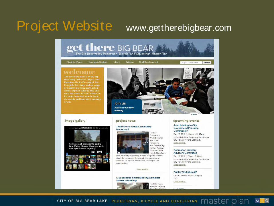
Project Website www.gettherebigbear.com

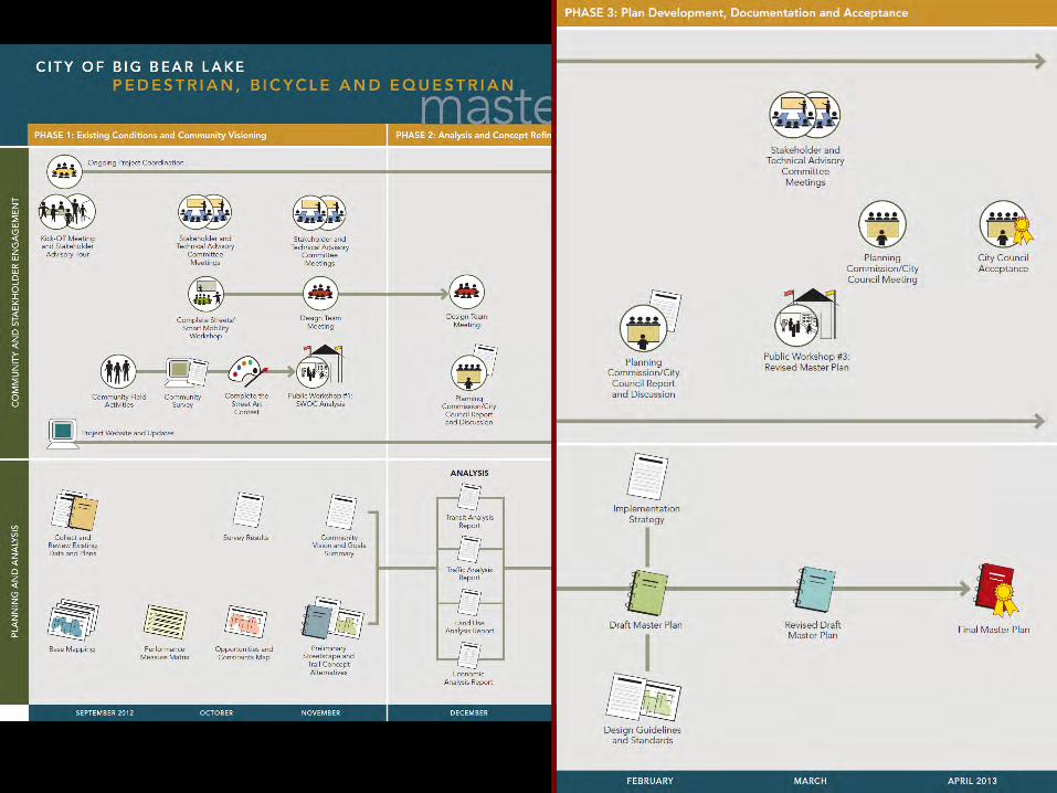

Key Plan Elements
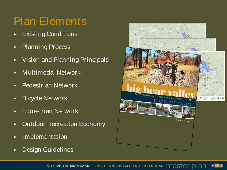
Plan Elements • Existing Conditions
• Planning Process
• Vision and Planning Principals
• Multimodal Network
• Pedestrian Network
• Bicycle Network
• Equestrian Network
• Outdoor Recreation Economy
• Implementation
• Design Guidelines


Design Guidelines Overview

Regulatory and Design Framework
• California Manual on Uniform Traffic Control Devises (MUTCD)
• NACTO Urban Bikeway Design Guide
• AASHTO Green Book
• California Vehicle Code
• Caltrans Highway Design Manual
• LA County Living Streets Design Manual
• San Bernardino County Non-Motorized Transportation Plan

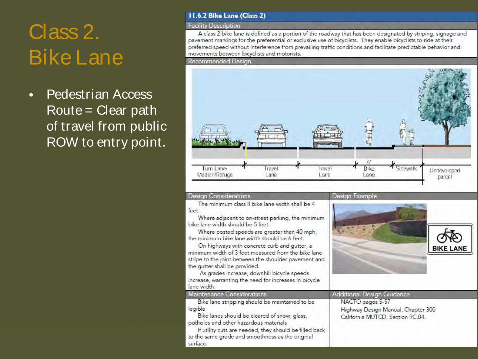
Facility Description
Recommended Design
Design Considerations
Maintenance Considerations
Design Example
Additional Design Guidance

Class 1. Multi-Use Path
• Allows for two-way traffic
• 8-12 foot width
• 2-foot shoulder
• 5-foot separation from street
• Pedestrian Access Route = Clear path of travel from public ROW to entry point.
Class 2. Bike Lane
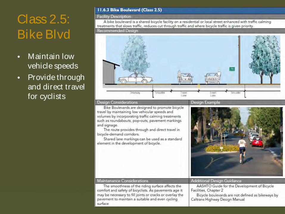
Class 2.5: Bike Blvd
• Maintain low vehicle speeds
• Provide through and direct travel for cyclists

Below-Grade Trail Crossings
• 8-foot clear width tunnel
• Use of natural soils or textured concrete
• Mounting blocks at tunnel entrance/exit

Equestrian Campground/ Recreation Site • Perimeter fencing
• Provide a range of camping sites in different configurations
• Perimeter restrooms/showers

Outdoor Recreation Economy

Big Bear Outdoor Recreation
Economy
Trail–Based Businesses
Outdoor Recreation
Support Businesses
Lodging, Dining, &
Entertainment

What might be The Ahwahnee Hotel of Big Bear Valley?


Planning for Trails-Based Economic Development
• Understand community capacity
• Understand community desire
• Target markets are based on trail characteristics
• Community’s relationship to the trail system is important – i.e., Big Bear is at the hub of a system
Guiding principles for trail-based economic development, from “Implementing Trail-Based Economic Development Programs” Iowa Department of Transportation

Planning for Trails-Based Economic Development, continued
• Choose trailhead sites based on desired user markets and impacts
• Locate trailheads in town boundaries to maximize economic impacts
• Build off existing markets
• Cultivate partnerships

Examples of Strategies & Leads
Clearly define markets Non-profits
Broaden marketing materials & redefine image Non- profits
Establish a common design aesthetic across Valley Government
Expand tourist offerings (such as guided activities, classes, beginner lessons)
Businesses
Develop Moonridge/Rathbun Corridor as “recreation row” Government
Establish new permit types to encourage new enterprise Government

B I G B E A R V A L L E Y
Equestrian Economic Development Opportunities
Equestrian Economic Development Opportunities


Equestrian Economics by the Numbers
“A Ghost Industry”
• 9.2 million horses in the U.S. (Where are they?)
• What states have the largest numbers of horses?
• How big is the horse industry? $_____billion
• The horse industry pays $____billion in taxes
• One out of every _____Americans are involved
with the horse industry.

Equestrian Key Elements
1. Preserve existing trail access locations
2. Retain the unique character of Big Bear
3. Increase equestrian opportunities
4. Provide improved wayfinding, maps, and trail
descriptions for equestrians
5. Encourage trail etiquette with all users
6. Plan with equestrian safety as a priority

Equestrian Policies & Programs • Develop Increased Equestrian
Tourism
• Expand Equestrian Network Regionally
• Attract New Equestrian-Oriented Businesses, Events, Services and Sustainable Activities
Equestrian Policies & Programs •
•
•

Equestrian Policies & Programs
• Create Horse Programs for Youth, Underprivileged, Therapy and Paralympics
• Increase Equestrian Safety, Public Education and Users Policy Enforcement
• Establish Valley-wide Equestrian Right-of-Way Guidelines for All Trail Users
•
•
•

Equestrian Socioeconomic Needs
•
Equestrian Socioeconomic Needs
• • Trailhead access and horse trailer parking
• Horse stabling, corrals, and RV parking
• Campground facilities for extended stays
• Developed trail systems for riders, concessionaires and competitive events
•
•

Equestrian Socioeconomic Needs
• Highway, roadway, and trail wayfinding system
• Trail features and water locations for horses
• Trail maps with details, mileages & elevations
• Equestrian services and industry infrastructure
• Safe trails & roads system
•
•
•
•
•

Typical Equestrian Supplies & Services Typical Equestrian Supplies & Services • Feed Stores
• Tack Stores
• Farriers
• Veterinarians
• Apparel Stores
• Service Stations
• Grocery Stores
• Boarding Stables
• RV Campgrounds
• Equestrian B&B’s

Related Equestrian Economic Drivers • Horseshows
• Rodeos & Ropings
• Endurance Rides
• Riding Lessons
• Horse Training
• Wounded Warriors
• Therapeutic Riding
• Horse Expos
• Olympics Training

Increasing Equestrian Opportunities • Expand parking at existing
trailheads • Create new trailheads at
strategic locations • Develop loop trails to the
Pacific Crest Trail • Provide increased
equestrian amenities • Link the Valley’s trails
•
•
•
•
• Link the Valley’s trails

Existing Equestrian Opportunities
1 - Little Bear Springs Trail Camp
2 - Harold F. Whittle Camp
3 - Grays Peak Trailhead
4 - Old Baldy Scout Camp
5 - Cougar Crest Trailhead
6 - Green Spot Equestrian Group Camp
7 - Los Vaquero’s Rodeo Arena

Map Identifying Existing Facilities

Proposed Equestrian Opportunities
1 - Tanglewood Group Camp
2 - Baldwin Lake Road/FR 2N02 Trailhead
3 - City of Big Bear Lake Equestrian Center
4 - Rathbone Creek Trail Corridor
5 - Doble Trail Trailhead and Campground
6 - Cushenberry Summit Trailhead
7 - Van Dusen Canyon Trailhead and Trails
8 - Trailhead Hub on State Highway 38
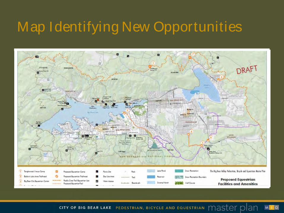
Map Identifying New Opportunities

11.7 EQUESTRIAN-SPECIFIC FACILITIES
11.7.1 Equestrian Parking and Staging
Facility Description Trailheads and other parking and staging areas designated for equestrian use Recommended Design
Design Considerations Design Example Suitability of Trailhead Location:
A. Publicly managed access location B. Adequate acreage C. Generally Flat Topography D. Ease of Roadway Access E. Appropriate sightlines for safe
access/egress F. Adequate roadway and trailhead signage G. Appropriate parking area surface treatment
Access to water source with drain features Perimeter fencing and equestrian gate design Conflicting user groups near trailhead (target
shooting, model airplanes, hot air balloons, etc.) Dark skies compliant lighting fixtures Mounting blocks and/or mounting ramps
Maintenance Considerations Additional Design Guidance Establish land manager agreements regarding the
removal of manure, trailhead surface maintenance, seasons of use, and appropriate closures to use.
Possible closure due to snow, ice and snow removal to provide a safer recreational experience
Equestrian Design Guidebook for Trails, Trailheads and Campgrounds, Federal Highway Administration, U.S. Department of Transportation; 2009
Safe Fencing for Horses, Kevin Kline, Ph.D. University of Illinois; 2005
A 19-foot (5.8-meter) pickup truck towing a bumper pull, two-horse trailer would require a total length of 55 feet (16.8 meters) to park and unload safely. This includes a 15-foot (4.6-meter) unloading area plus walking space at both ends of the vehicle.
A four-horse gooseneck trailer drawn by a 19-foot pickup truck would need 78 feet (23.8 meters) for parking and loading. A 78-foot-long parking space covers most parking and loading needs. Forty-two-foot (12.8-meter) motorhomes pulling six-horse trailers with interior living quarters may need a space 110 feet (33.5 meters). If these long trailers are common or expected in the facility, provide several longer spaces for them. If local riders commonly use two-horse trailers, provide some 55-foot- (16.8-meter-) long spaces for them.
Minimum outside turning radius required into and within trailhead parking area is 25 feet, with designated turning lanes for safer entry/exit both into/out of trailhead from paved highway due to slower speeds of vehicles turning with horse trailers. Ideal parking space width is 28 feet.
Design Guidelines
• Linked Loop Trails
• Trailhead Parking
• Campgrounds
• Water Amenities
• Roadway Crossings
• Signs & Sharrows
• Gates & Fencing
Equestrian Specific Facilities
Implementation & Lessons Learned
business
non-profit
government agencies

business non-profit
government agencies

Who makes the pattern?
design standards
Who supplies the raw material?
land, lumber, dirt, trees, etc.
Who pushes the treadle?
community will
Who guides the fabric? ensures the energy is
collective
Who sells the product? business groups,
social media
Who channels the return on
investment? taxes, memberships
business non-profit
government agencies

Who makes the pattern?
design standards
Who supplies the raw material?
land, lumber, dirt, trees, etc.
Who pushes the treadle?
community will
Who guides the fabric? ensures the energy is
collective
Who sells the product? business groups,
social media
Who channels the return on
investment? taxes, memberships, etc.
business non-profit
government agencies

Siri Eggebraten City of Big Bear Lake
Jay Renkens MIG
805.796.8613 [email protected]
503.297.1005 [email protected] www.migcom.com
Jan Hancock Hancock Resources LLC
805 N. 4th Avenue, Suite 703 Phoenix, AZ 85003-1306
877-727-7117 [email protected]
www.linkedin.com/in/janhancock/ Facebook-Twitter-YouTube-Blog
Thank you