pak: patrind hydropower project - adb.org
TRANSCRIPT
Environmental Impact Assessment: Part 5 Project Number: 44914 April 2011
PAK: Patrind Hydropower Project Prepared by Star Hydropower Limited for the Asian Development Bank. This environmental impact assessment is a document of the borrower. The views expressed herein do not necessarily represent those of ADB's Board of Directors, Management, or staff. In preparing any country program or strategy, financing any project, or by making any designation of or reference to a particular territory or geographic area in this document, the Asian Development Bank does not intend to make any judgments as to the legal or other status of any territory or area.
STAR HYDROPOWER LIMITED HEAD OFFICE: House No. 534, Margalla road, Sector F10/2, Islamabad - Pakistan
Tel: +92 51 2212610-1 Fax: +92 51 2212616 E-mail: [email protected]
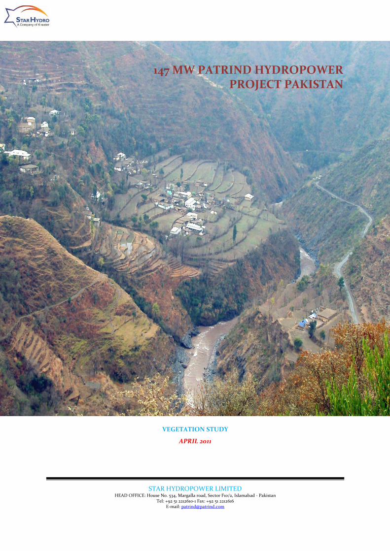
147 MW PATRIND HYDROPOWER PROJECT PAKISTAN
VEGETATION STUDY
APRIL 2011

Patrind Hydropower Project Vegetation Study
TOC-1
TABLE OF CONTENTS
EXECUTIVE SUMMARY .......................................................................................................................................... 1
1. KUNHAR RIVER WATERSHED................................................................................................................ 1
2. FOREST TYPES (ECOLOGICAL CLASSIFICATION) ................................................................................ 1
3. LEGAL CLASSIFICATION OF FORESTS ................................................................................................... 1
4. RANGELANDS .......................................................................................................................................... 1
5. PATRIND HYDROPOWER PROJECT AREA ........................................................................................... 2
6. OUTCOME OF THE STUDY .................................................................................................................... 3
VEGETATION STUDY ............................................................................................................................................. 1
1. INTRODUCTION ...................................................................................................................................... 1
1.1 KUNHAR RIVER WATERSHED................................................................................................................ 1
2. FOREST TYPES (ECOLOGICAL CLASSIFICATION) ................................................................................ 1
2.1 LEGAL CLASSIFICATION OF FORESTS .................................................................................................. 4
2.2 RESERVED / PROTECTED FORESTS ...................................................................................................... 4
2.3 GUZARA/PRIVATE/COMMUNITY FORESTS ......................................................................................... 4
3. RANGELANDS ......................................................................................................................................... 5
3.1 Temperate Humid Zone ......................................................................................................................... 5
3.2 Sub-Alpine Zone ...................................................................................................................................... 6
3.3 Alpine Zone ............................................................................................................................................. 6
3.4 Trans-Himalayan Sub humid Zone ........................................................................................................ 6
3.5 Glacier and Snow fields .......................................................................................................................... 6
4. MEDICINAL PLANTS ............................................................................................................................... 6
5. PATRIND HYDROPOWER PROJECT AREA ........................................................................................... 7
5.1 Methodology ........................................................................................................................................... 7
5.2 Results ..................................................................................................................................................... 8
6. OUTCOME OF THE STUDY ................................................................................................................... 14
REFERENCES: ....................................................................................................................................................... 16

Patrind Hydropower Project Vegetation Study
ES-1
EXECUTIVE SUMMARY
1. KUNHAR RIVER WATERSHED
The Kunhar river catchment is commonly known as Kaghan Valley, situated
between 34°-17´ & 35°-10´ N latitudes and 73°-28´ & 74°-7´ E longitudes.
2. FOREST TYPES (ECOLOGICAL CLASSIFICATION)
Ecological distribution of different types of forest is described in the following
paragraphs to give an overall picture of the vegetative worth of the project area.
It is also needed because it affects the life of reservoir through sedimentation.
The principal plant communities of Kunhar catchments are related to the
altitudinal zonation.
A. Sub-tropical pine forests
i) Himalayan sub-tropical scrub forests
ii) Himalayan chir pine (Pinus roxburghii) forests
B. Himalayan moist temperate forests
i) Low level blue pine (Pinus wallichiana) forests
ii) Moist deodar (Cedrus deodara) forests
iii) Western mixed coniferous forests
iv) Upper west Himalayan fir and broad-leave forests
C. Dry temperate forests
D. Sub Alpine Scrub and Alpine Pastures
3. LEGAL CLASSIFICATION OF FORESTS
Legally the productive forests of the Kunhar catchments are of two types the
reserved or the Government owned forests, and the guzaras or the private or
community owned forests.
4. RANGELANDS
Rangelands occupy about 50 % of the entire land area of the valley; therefore
the production of grass is a major land use of Kunhar river watershed. The
rangelands were classified as under:
i) Sub-mountain rangeland: below 4000 elevation sub-divided into two slope
classes i.e. less than 50% slope and more than 50% slope.
ii) Mountain rangelands: between 1,200 m and 3,050 m elevation subdivided
into two slope classes i.e. less then 50% slope and more the than 50%
slope.
iii) Alpine pastures: between 3,050 m elevation and the permanent snow line.

Patrind Hydropower Project Vegetation Study
ES-2
5. PATRIND HYDROPOWER PROJECT AREA
A detailed study of the Project site was conducted. The area behind the weir site
is up to almost 7 Km backward. Three representative sites were selected for
vegetation survey. At each site two transect lines of 500 meter each were laid
across one another. On each transect line 1m X 1m Quadrat for grasses/herbs,
4m X 4m Quadrat for shrubs/trees were laid on an interval of 50 meter. The data
was collected and compiled for identification, calculation of cover percentage,
species composition and forage production. For forage production the species
were clipped and air dried at 2 cm from the ground level. The study yielded
following results.
5.1 Vegetation Species
The Vegetation Species comprising of grasses, herbs, shrubs and trees
collected and identified in the Project site are listed below;
Trees
Pinus roxburghii (Chir Pine), Ailanthus altissima (Tree of Heaven), Salix
spp (Willow), Pyrus pashia (Pear), Picca smythianaPi (Spruce), Prunus
padus (Birds cherry), Ascer spp (Maple),
Cornus macrophilla (Kandar), Acacia modesta (Kiker), Robinia pseudocacia
(Phulai), Olea cuspidata (Kau), Bauhinia variagata (Kahnar), Azadarachta
indica (Bakain), Zizyphus jujuba (Ber), Cedrela serrata (Drawa), Salmalia
malabericum (Simal), Acacia arabica (Punjabi Kiker), Cassia fistula
(Amaltas), Aesculus indica (Bankhour), Juglans regia (Wallnut), Grevia
opposittifolia (Tamman), Celtis australis (Batkarar), and Populus spp.
(Sufaida).
Shrubs
Dodonaea viscosa (Hopseed bush), Berberis lyceum (Barberry), Rosa
moschata (Wild Rose), Vitex negundo (Five leave Chaste tree), Buxus
wallichiana (The Boxwood tree) and Clematis gouriana (Oldmans Breed).
Herbs
Tribulus terrestris (Calthrop), Oxalis repens (Wood Sorrel), Mentha
sylvestris (Pepermint), Chenopodium album (Whitegoosefoot),
Amaranthus viridis (Amaranthus),
Grasses
Themeda anathera (Red Oat Grass), Pennisetum typhoide (Pearl, Millet),
Aristida cyanatha (Wildgrass), Apluda mutica (Apluda), Heteropogon
contortus (Speargrass), Bothriochloa pertusa (Palwan), Cynodon dactylon
(Lawngrass) and Cymbopogon jawarancusa (Common Scented Grass).
5.1.1 Biomass estimates (Tons/ha)
Biomass data was calculated in the project site supposed to be submerged.
It was estimated that on the average about 3.5 tons per hectare of
biomass would be submerged.
Patrind Hydropower Project Vegetation Study
ES-3
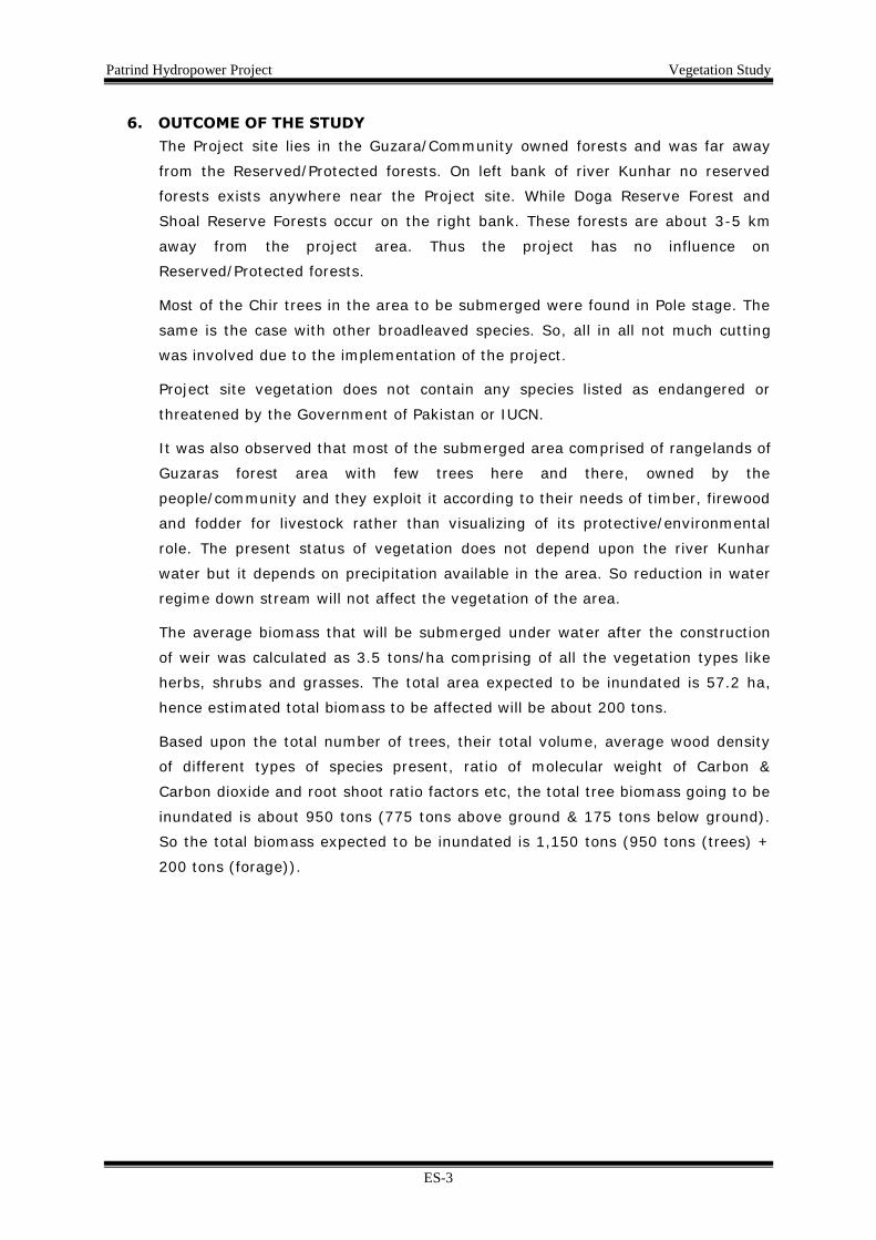
6. OUTCOME OF THE STUDY
The Project site lies in the Guzara/Community owned forests and was far away
from the Reserved/Protected forests. On left bank of river Kunhar no reserved
forests exists anywhere near the Project site. While Doga Reserve Forest and
Shoal Reserve Forests occur on the right bank. These forests are about 3-5 km
away from the project area. Thus the project has no influence on
Reserved/Protected forests.
Most of the Chir trees in the area to be submerged were found in Pole stage. The
same is the case with other broadleaved species. So, all in all not much cutting
was involved due to the implementation of the project.
Project site vegetation does not contain any species listed as endangered or
threatened by the Government of Pakistan or IUCN.
It was also observed that most of the submerged area comprised of rangelands of
Guzaras forest area with few trees here and there, owned by the
people/community and they exploit it according to their needs of timber, firewood
and fodder for livestock rather than visualizing of its protective/environmental
role. The present status of vegetation does not depend upon the river Kunhar
water but it depends on precipitation available in the area. So reduction in water
regime down stream will not affect the vegetation of the area.
The average biomass that will be submerged under water after the construction
of weir was calculated as 3.5 tons/ha comprising of all the vegetation types like
herbs, shrubs and grasses. The total area expected to be inundated is 57.2 ha,
hence estimated total biomass to be affected will be about 200 tons.
Based upon the total number of trees, their total volume, average wood density
of different types of species present, ratio of molecular weight of Carbon &
Carbon dioxide and root shoot ratio factors etc, the total tree biomass going to be
inundated is about 950 tons (775 tons above ground & 175 tons below ground).
So the total biomass expected to be inundated is 1,150 tons (950 tons (trees) +
200 tons (forage)).
Patrind Hydropower Project Vegetation Study
1
VEGETATION STUDY
1. INTRODUCTION
Patrind Hydropower Project is located near Village Patrind in Muzaffarabad
District of AJ&K. It spreads over two sides of Lohar Gali ridge. The water will be
diverted from Kunhar river through a conveyance system and discharged into
Jhelum river after power generation. A weir will be constructed on Kunhar river
to divert the flow. The head pond will be created due to the weir at an elevation
of 765 masl with a length of about 7 Km upstream of the project site.
1.1 KUNHAR RIVER WATERSHED
The Kunhar river catchment is commonly known as Kaghan Valley, situated
between 34°-17´ & 35°-10´ N latitudes and 73°-28´ & 74°-7´ E longitudes.
Out of the total catchment area about 1000 sq. miles lie in Mansehra and
Abbottabad Districts of Hazara Division and about 25sq.miles are situated in the
territory of Azad Kashmir.
The catchment area of the Kunhar river is subdivided into upper and lower sub-
basins.
The catchment area up to Naran is 1,036 sq. km (400 sq. miles). Mean elevation
in the area is 2,500 m amsl. Upper basin consists of steep mountains covered
with snow. The slope of river in upper basin is very steep i.e. 20 m/km. In this
basin most of river flow is due to snow melt in summer season.
The lower basin extends from Naran to its confluence with Jhelum River. The
catchment area of the lower basin is 1,453 sq. km (561 sq. miles) confluence
with Jhelum River. Mean elevation in area is 800 m. The lower basin consists of
steep mountains covered with vegetation / forestry. Most of river flows are due
to rainfall in the catchment area. In lower reach the river has relatively flatter
slope of 11 m/km.
2. FOREST TYPES (ECOLOGICAL CLASSIFICATION)
The principal plant communities of Kunhar catchments are related to the
altitudinal zonation. There is sharp altitudinal variation in the valley resulting in
the development of prominent vegetation types which according to the standard
classification of forest types of Pakistan (Champion, Seith and Khattak, 1987 &
M.I. Sheikh, 1997) are given as follows:
Sub-tropical Pine Forests
i) Himalayan sub-tropical scrub forests
ii) Himalayan chir pine (Pinus roxburghii) forests

Patrind Hydropower Project Vegetation Study
2
Himalayan Moist Temperate Forests
i) Low level blue pine (Pinus wallichiana) forests
ii) Moist deodar (Cedrus deodara) forests
iii) Western mixed coniferous forests
iv) Upper west Himalayan fir and broad-leave forests
Dry Temperate Forests
i. Himalayan Sub-tropical Scrub Forests
This type of poor scrub growth mainly consisting of Sanatha (Dodonaea
viscosa) and Olive Palm (ole cuspidata) is found in the lower reaches of the
valley up to 750-900 m elevation merging in the chir pine zone.
ii. Himalayan Chir Pine Forest
This type comprises bulk of the managed chir forests generally starting
from 750-900 m elevation. The chir pine forms full cover with no under
storey except along the moist depressions where a few Oak (Quercus
incana) and other broad-leaved species are seen if still saved from fire.
However shrubs like Myrsine Africana and Berberis spp are found on cool
aspects.
iii. Low-level Blue Pine Forests
This type is generally met within the altitudinal range of 1,500 m to 2,100
m with marked variations depending on aspect. The forests consist of blue
pine with a small admixture of chir pine, deodar and occasionally spruce
depending of the locality, aspect and elevation. Broad leaved species are
restricted to moist depressions and there is very little undergrowth found
in these forests.
iv. Moist Deodar Forests
These forests occupy the altitudinal range of about 1,500 m to 2,450 m
extending to the lower and higher elevations by about 300 m on suitable
sites. These forest in pure form, are found in a very small extent close to
the settlements where these form a scattered open canopy. Some blue
pine and spruce trees are commonly present with oaks and rhododenron
arboretum trees scattered as the under storey. Pohu shrub (Parrotia
jaquemontiana) form dense underwood at places. The ground flora is rich
between the shrubs consisting of a variety of species. Deodar is one of the
most valuable timbers. Deodar trees growing in Kaghan valley have been
declared as state trees and are forbidden for felling save with the prior

Patrind Hydropower Project Vegetation Study
3
permission of the Government.
v. Western mixed Coniferous Forests
This is one of the most important and most commonly met forest types of
the Kunhar catchment and constitutes bulk of the forests of moist
temperate region in the valley a variety of combination of both coniferous
and broad-leaved species. The altitudinal range of this type is between
2,300 m and 2,900 m on the warmer aspects with variation of 150 m to
300 m on the cool northern slopes.
Some of the valuable broad leaved trees are found in this zone. These are
walnut (Juglans regia) and ash (Fraxinus spp). The other broad leaved
species are oak (Quercus dilatria) horse chestnut (Aescullus inica) poplar
(Populus cliaa) bird cherry (Prunus padus) maples (Acer spp) and batangi
(Pyrus pashia).
The density of the undergrowth depends on that of the overwood and the
extent of grazing. Pohu shrub forms thickets where the canopy has been
broken. A rich herbaceous growth is developed on the ground during the
monsoons.
vi. Upper West Himalaya Fir and Broad – Leaved Forests
All the silver fir forests, growing between 2,750 m and 3,200 m elevation
with usual variations according to aspect are grouped in this type. Kaghan
fir is generally restricted towards ridges with blanks along the depressions
where the snow slides are common during the winter. Spruce (Picea
smithania) is scarce while blue pine is found at places.
vii. Dry Temperate Forests
North of Mahandri the valley is not in the reach of south west monsoons
and receives most of the precipitation in the form of winter snow. Here, in
addition to the dry temperate coniferous forests which are similar to their
counter part in the moist zone except for their growth, degraded
temperate scrubs are found which are represented by birch (Betula utilis)
on rocky spurs. In the interior of the valley, some juniper (Juniperus
macropoda) is found on eastern and south eastern aspects with
Plectranthus rugosus and Artimisia spp. The latter type is very limited and
has no economic value other than its utility as open rangeland.
viii. Sub Alpine Scrubs and Alpine Pastures
Large areas above the tree limit are covered by pastures which have long
been used as summer ranges. Due to extensive use, the rangelands have
been deteriorated and especially the eastern slopes are invaded by the

Patrind Hydropower Project Vegetation Study
4
shrub growth of Artmisia spp. and in moist situation Simbucus spp. has
spread considerably.
2.1 LEGAL CLASSIFICATION OF FORESTS
Legally the productive forests of the Kunhar catchments are of two types the
reserved or the Government owned forests, and the guzaras or the private or
community owned forests. The latter are managed by the Forests Department of
KP Province since their transfer from the Revenue Departments in 1950.
2.2 RESERVED / PROTECTED FORESTS
The reserved forests in Kunhar watershed were declared Resrved after the first
regular settlement in 1873. The reserved forests of Kunhar catchment lie in the
three territorial forest divisions and are managed through regular working plans.
2.3 GUZARA/PRIVATE/COMMUNITY FORESTS
These forests, which were left out as village forests at the time of first
settlement, are privately or severally owned and are termed as guzaras as
these are primarily set out to meet the bonafide needs of local population. The
forests remained under the control of Revenue Department till 1950, when
these were transferred to forest department for rational and scientific
management. Although efforts to prepare working plans for these valuable
forests started in the early 1960s yet these remained without proper scientific
management till recently. The Guzara Demarcation sub-division was created in
1961 to demarcate the guzara forest and thus the permanent demarcation is
yet to be completed and it will only be after the completion of demarcation work
that the exact boundaries of these forests will be known and permanently
marked on the maps. So at this point of time it is not possible to to give the
details pertaining to the total area etc.
In addition to the above guzara forests, some degraded areas outside the
reserve forests were taken up by the Forest Department for anti-erosion works
in consultation with the local owners under the Forest Act. These areas now
constitute the scrub forest and except for watershed protection and provision of
rough firewood, their economic importance remains to be as potential
rangelands. These are located in Garhi Habibullah forest range of Mansehra
Forest Division. These areas were taken for periods ranging from 5 to 15 years
and have now been mostly returned to the owners on expiry of the period.
These protections along with the closures against the grazing have decidedly
helped in improving the watershed properties and rehabilitation of the badly
eroded sites. In many cases, however the vegetation cover has been destroyed

Patrind Hydropower Project Vegetation Study
5
after the return of areas to the owners and the areas have again been subjected
to active erosion. Similarly the guzara forests/community forests located in
Muzaffarabad Forest Division falling in the Patrind Hydropower Project area were
also not demarcated properly. The areas outside the reserved forests, exploited
by the local people for timber, firewood, grazing of livestock and cultivation
purposes were termed as Guzaras /community forests.
3. RANGELANDS
Rangelands occupy about 50 % of the entire land area of the valley; therefore
the production of grass is a major land use of Kunhar river watershed. In the
beginning, trees were removed for cultivating the land but later it deteriorated
due to ruthless cutting and mal-treatment thud the was considered suitable only
for grazing. The rangelands were classified (M.A.A. Qureshi, 1996, M.A. Khan,
1995) as under:
i) Sub-mountain rangeland: below 1,200 m elevation sub-divided into two
slope classes i.e. less than 50% slope and more than 50% slope.
ii) Mountain rangelands: between 1,200 m and 3,050 m elevation subdivided
into two slope classes i.e. less then 50% slope and more the than 50%
slope.
iii) Alpine pastures: between 3,050 m elevation and the permanent snow line.
3.1 Temperate Humid Zone
The important shrubs found in this zone are: vibernum nrevosum idigofera spp
Rosa webbiana; Cotoneaster spp Pistacia spp Berberis lyceum; Prunus cornata
Rhodedendron arboretum; Lonicera quinquelocularis; Rubus spp Myrsine
Africana; and Parrotia spp’
The grasses found in the zone are: Dactylis glomerata; Agropyron dentatum;
Phacelurus flaccidum Oryzopis spp Poa spp Stipa Bromus inermis Bothiochlos
pseudoischemum; chrysopogon achinueltus and themeda anathera.
The forbs are: Plantago spp Senecio Spp: Rumex neplensis; Astragalus spp;
Trifoium spp lotus cuvrniculauts; Fragaria vaxa; Medicaga spp; Geranuium spp;
Thymus serphyllum; Polygonum spp Tarzium sp; Tarazium officinalis; and
sambucus ebulus.
There are five forest range and three range types in this zone. The range types
are shrub grasslands shrub savans, and grasslands.

Patrind Hydropower Project Vegetation Study
6
3.2 Sub-Alpine Zone
Some of the grass species found in the zone are Phleum alpinum: Agrostis
gigiantea; tristum spp., clamagrosits spp orgapisi spp and carex spp.
3.3 Alpine Zone
The grasses found in this zone are phleum alpinum, agrosits spp; Pestuca ovina;
trisetum specatum poa spp. Carex spp and agropyron spp.
The forbs found in the zone are polygonum spp., ptentilla spp Taraxicum
officinslias astragalus spp; Thymus serphyllus; Geranium nepalenis; Plantago
spp; Galeum spp Trifolium repens and vicia cornifoium.
3.4 Trans-Himalayan Sub humid Zone
The important species of the zone among the trees are Juniperus macropoda
(Chalia) Quercus ilex (Rhin) pinus gerardian Chilghoza and Faxiunus xanthohloies
(Hanzu)
The shrubs are (Artemisa spp indigofera spp: Rosa spp and Ephedura sppo: the
important grasses are Chryspogon spp: chmbogon sppp. Dicanthium annulatum:
Pennisetum orientale: Aristida spp; Oryzopisis spp; Poa spp; Bromus inermis;
Agropyron spp. Agrostis spp: and dactylic spp.
3.5 Glacier and Snow fields
This zone is permanently covered with now and is characterized by almost
absence of flowering plants. Thus the zone is non productive or barren from the
view point of range management.
4. MEDICINAL PLANTS
The Kunhar valley is rich in medicinal plants, some of which are of pharmaceutical
importance, while many others are utilized for local medicines. These plants are
generally found on slopes, away from habitation and grazing pressure, therefore
the project footprint is unlikely to contain such plants.
On account of lack of knowledge and facilities, this resource has remained partly
untapped in the past, although it can play a vital role in the economy of the
valley. Following is the list of major medicinal plants identified (Tariq Mahmood,
2007 & Shabbir Mughal, 2009) in the Kaghan valley.
1. Achillea millefolium (Blood Wort)
2. Adhatoda vasica (Malabar Nut tree)
3. Asparagus adscendens (Asparagus)
4. Berberis lyceum (Berberry)
5. Cannabus sativa (Pakistani hemp)
6. Chenopodium ambrosioides (Mexican tea)
7. Colchicum luteum (Golden Collyrium)
8. Dioscorea deltoids (Yam)

Patrind Hydropower Project Vegetation Study
7
9. Malva sylvestris (Common Mallow)
10. Moringa oleifera (Drumstick Tree)
11. Plantago ciliate (Ispaghul)
12. Rosa moschata (Wild Rose)
13. Valeriana wallichii (Pakistani Valeriae)
14. Viola odorata (Sweet Violet)
15. Withania somnifera (Winter Cherry)
16. Podophylum emodii (Baukhakri)
17. Atropa belladonna (Namaku Sag)
5. PATRIND HYDROPOWER PROJECT AREA
Following is the discussion on the vegetation types (both forests and range) in
the Kunhar river watershed falling in the Patrind Hydropower Project area.
5.1 Methodology
Based on the climate, topography and vegetation density of the area behind the
weir site up to almost 7 Km backwards, three representative sites each on both
sides (covering the eastern and western aspects) of the river were selected for
vegetation survey. At each site two transect lines of 500 meter each were laid
across one another. The transects running upslope commenced at river level. On
each transect line 1m X 1m Quadrat for grasses/herbs, 4m X 4m Quadrat for
shrubs/trees were laid on an interval of 50 meter as shown in the sketch below.
The data was collected on standard data collection forms and compiled for
identification, calculation of cover percentage, species composition and forage
production. For forage production the species were clipped and air dried at 2 cm
from the ground level. This air dried mass was then computed on Hectare basis
for calculating the forage production in Kg/tones per hectare.
7km

Patrind Hydropower Project Vegetation Study
8
5.2 Results
Two forest types and two range types occur in the surveyed areas.
5.2.1 Forest Types
5.2.1.1 Himalayan Sub-tropical Scrub Forests This is a poor type of scrub growth, mainly consisting of Sanatha
(Dodonaea viscosa), found in lower reaches of valley merging in Chir Pine
forests comprising of gentle to medium sloping rocks.The type has been
degraded by excessive cutting and grazing, thus classified as rangelands.
In this zone grasses occupied the maximum area (65%), followed by
shrubs (15%) and forbs (10%).The remaining 10% area was either bare
or consists of rocks. On the basis of density these forests are categorized
as sparse with <25 percent density.
Major grasses found in the zone were Aristida cyanatha (32%), followed by
Themeda anathera (23%), Cynodon dactylon (22%) and Cymbopogon
jawarancusa (21%). The same trend was observed in frequency of the
grass species.
5.2.1.2 Himalayan Chir Pine Forests This type comprises bulk of the managed Chir pine forests generally
starting from 750 m elevation and merging with the Blue Pine forests at an
elevation of 1,700-1,800 m mostly comprising of steep slopes. These
forests forms full cover with no under storey except along the moist
depressions where a few Oaks (Quercus incana) and broad-leaved species
are seen, if saved from the frequent fire hazards prevailed in Chir Pine
Forests. However, shrubs like Myrsine Africana and Berberis lyceum are
found on cooler aspects.Due to frequent fire incidences, the ground cover
is scant and a few grasses likes Heteropogon and Aristida still survive
locally. The forests were exploited commercially unless a ban on green
felling was imposed in 1992.On the basis of density these forests were
classified as open to medium dense 25-50%.Major tree species was
Chirpine with some brobleaved trees.
In this zone grasses occupied the maximum area (55%), followed by
shrubs (20%) and forbs (15%) and trees (10%).The remaining 5% area
was either bare or consists of rocks.
Major shrubs found were Rosa webbiana (24%), Cannabus sativa (18%),
Buxus papillus (25%) and Astragalis candolensis (10%).
Major forbs found in the zone were Cunoglossum lanceolatum (29%),
Echinops corinigrus (17%) and Ajuga bracteosa (15%).
Major grasses found in the zone were Aristida cyanatha (23%) followed by

Patrind Hydropower Project Vegetation Study
9
Themeda anathera (18%), Cynodon dactylon (17%), Heteropogon
contortus (17%) and Cymbopogon jawarancusa (16%). Same trend was
observed in frequency of the grass species.
5.2.2 Range Types
5.2.2.1 Sub-Tropical Sub Humid Zone It is potentially a zone of good rangelands in which three range types are
recognizable these are acacia, olea type, Dodonaea type and Imperata
type.
In acacia olea type acacia modesta develops almost pure on southern
aspects and low altitudes while Olea cuspidata appear on cooler and higher
altitudes along gently sloping river banks and adjoining areas. The
productivity is mainly dependent upon soil cover and soil depth and
several subtypes or forms of rangelands are recognizable. Dodonaea type
has a very low forage potential and develops on warmer aspects to almost
exclusion of its tree associates. Imperata type occurs on gently sloping
river flood plains and has a high potential of forage production.
5.2.2.2 Sub-Tropical Humid Zone This zone consists of several types of ranges which are often highly
productive comprising of steep rocky slopes with little soil traces in
depressions. Climax species is chir pine and the zone is situated above
Acacia, olea zone and below kail zone. On account of the human
interference large tracts have been converted for cultivation purposes or
for grazing in this zone. With the removal of chir needles and or trees
there develop good and productive grass lands. But still there are vast
areas covered by chir pine with limited shrub and herbaceous under
growth.
The grasses found in this zone are: Themeda anathera; Heteropogon
contorutus; Chrysopogon aucheri; bothriocloa spp; cymbopogon martini;
apluda aristata; aristda cyanantha; digitaria spp; branciaria spp; imperata
cylinderica; sotari spp; rottbolia exaltata; and pennisetum orientale.
The chir zone is occupied by chir forest type. The range utility of this forest
type depends on the openness of the crop. Herbaceous forage is available
wherever there is enough light and open canopies. Within the chir forest
type two forest range types are recognizable one having more than 50%
canopy cover and the other 50% there are three range types found in the
zone. There are chir tree savanna, shrub savanna, and grasslands.

Patrind Hydropower Project Vegetation Study
10
5.2.3 Vegetation Species
The Vegetation Species comprising of grasses, herbs, shrubs and trees collected
and identified in the project area are listed below;
Trees
1. Pinus roxburghii (Chir Pine)
2. Ailanthus altissima (Tree of Heaven)
3. Salix spp (Willow)
4. Pyrus pashia (Pear)
5. Picca smythianaPi (Spruce)
6. Prunus padus (Birds cherry)
7. Ascer spp. (Maple)
8. Cornus macrophilla (Kandar)
9. Acacia modesta (Kiker)
10. Robinia pseudocacia (Phulai)
11. Olea cuspidata (Kau)
12. Bauhinia variagata (Kahnar)
13. Azadarachta indica (Bakain)
14. Zizyphus jujuba (Ber)
15. Cedrela serrata (Drawa)
16. Salmalia malabericum (Simal)
17. Acacia arabica (Punjabi Kike)
18. Cassia fistula (Amaltas)
19. Aesculus indica (Bankhour)
20. Juglans regia (Wallnut)
21. Grevia opposittifolia (Tamman)
22. Celtis australis (Batkarar)
23. Populus spp. (Sufaida)
Shrubs
1. Dodonaea viscosa (Hopseed bush)
2. Berberis lyceum (Barberry)
3. Rosa moschata (Wild Rose)
4. Vitex negundo (Five leave Chaste tree)
5. Buxus wallichiana (The Boxwood tree)
6. Clematis gouriana (Oldmans Breed)

Patrind Hydropower Project Vegetation Study
11
Herbs
1. Tribulus terrestris (Calthrop)
2. Oxalis repens (Wood Sorrel)
3. Mentha sylvestris (Pepermint)
4. Chenopodium album (Whitegoosefoot)
5. Amaranthus viridis (Amaranthus)
6. Etchinops corrinigrus
7. Ajuga bracteosa
8. Lespedezzia spp
Grasses
1. Themeda anathera (Red Oat Grass)
2. Pennisetum typhoide (Pearl,Millet)
3. Aristida cyanatha (Wildgrass)
4. Apluda mutica (Apluda)
5. Heteropogon contortus (Speargrass)
6. Bothriochloa pertusa (Palwan)
7. Cynodon dactylon (Lawngrass)
8. Cymbopogon jawarancusa (Common Scented Grass)
9. Hyperhennia spp
10. Agrostis spp
11. Digitaria spp
5.2.4 Biomass Estimate (Kg/ha)
A biomass estimate was calculated for the weir inundation area to indicate the net
biomass loss from this area. The data for forage was computed per hectare for
ease of calculation. The average biomass that will be submerged under water
after the construction of weir comprises of all the vegetation types like herbs,
shrubs and grasses.
Eastern Aspect Serial # Vegetation Type Production
(kg/ha) 1 Grasses 3,530 2 Forbs 600 3 Shrubs 490 Total 4,620
Western Aspect 1 Grasses 1,630 2 Forbs 450 3 Shrubs 230 Total 2,310
Average 1 Grasses 2,580 2 Forbs 525 3 Shrubs 363 Total 3,468

Patrind Hydropower Project Vegetation Study
12
The total area expected to be inundated is 57.2 ha, hence estimated total
biomass to be affected will be about 200 tons.
Based upon the total number of trees, their total volume, average wood density
of different types of species present, ratio of molecular weight of Carbon &
Carbon dioxide and root shoot ratio factors etc, the total tree biomass going to be
inundated is about 950 tons (775 tons above ground & 175 tons below ground).
So the total biomass expected to be inundated is 1,150 tons (950 tons (trees) +
200 tons (forage)).
5.2.5 Species Conservation Status
Species Forest Type Distribution
Conservation Significance
IUCN GoP
Pinus roxburghii Himalayan
Chirpine Common Protected/Common
Protected/Common
Ailanthus altissima Himalayan
Chirpine Common Protected/Common
Protected/Common
Salix spp Himalayan
Chirpine Scattered Common
Common
Celtis australis Himalayan
Chirpine Scattered Common
Rare
Pyrus pashia Himalayan
Chirpine Common Protected/Common
Protected/Common
Ficus carica Himalayan
Chirpine Scattered Common
Rare
Dodonaea viscosa
Himalayan
sub-tropical
scrub
Common Protected/Common
Protected/Common
Berberis lyceum Himalayan
Chirpine Common Protected/Common
Protected/Common
Rosa webbiana Himalayan
Chirpine Common Protected/Common
Protected/Common
Vitex negundo Himalayan
Chirpine Common Protected/Common
Protected/Common
Buxus wallichiana Himalayan
Chirpine Common Protected/Common
Protected/Common
Clematis gouriana Himalayan
Chirpine Common Protected/Common
Protected/Common
Tribulus terrestris Himalayan
Chirpine Common Protected/Common
Protected/Common
Oxalis repens Himalayan
Chirpine Common Protected/Common
Protected/Common
Mentha sylvestris Himalayan
Chirpine Common Protected/Common
Protected/Common
Chenopodium
album
Himalayan
Chirpine Common Protected/Common
Protected/Common

Patrind Hydropower Project Vegetation Study
13
Amaranthus viridis Himalayan
Chirpine Common Protected/Common
Protected/Common
Etchinops
corrinigrus
Himalayan
Chirpine Common Protected/Common
Protected/Common
Ajuga bracteosa Himalayan
Chirpine Common Protected/Common
Protected/Common
Lespedezzia spp Himalayan
Chirpine Common Protected/Common
Protected/Common
Themeda anathera
Himalayan
sub-tropical
scrub
Himalayan
Chirpine
Common Protected/Common
Protected/Common
Pennisetum
typhoide
Himalayan
Chirpine Common Protected/Common
Protected/Common
Aristida cyanatha Himalayan
Chirpine Common Protected/Common
Protected/Common
Apluda mutica Himalayan
Chirpine Common Protected/Common
Protected/Common
Heteropogon
contortus
Himalayan
sub-tropical
scrub
Himalayan
Chirpine
Common Protected/Common
Protected/Common
Bothriochloa
pertusa
Himalayan
Chirpine Common Protected/Common
Protected/Common
Cynodon dactylon
Himalayan
sub-tropical
scrub
Himalayan
Chirpine
Common Protected/Common
Protected/Common
Cymbopogon
jawarancusa
Himalayan
sub-tropical
scrub
Himalayan
Chirpine
Common Protected/Common
Protected/Common
Hyperhennia spp Himalayan
Chirpine Common Protected/Common
Protected/Common
Digitaria spp Himalayan
Chirpine Common Protected/Common
Protected/Common
Agrostis spp Himalayan
Chirpine Common Protected/Common
Protected/Common
References:
1. IUCN criteria, 2006, 2008 & 2009.
2. Revised Flora of Pakistan by Ali & Qaisar (Series 2000-2010).
3. Catalogue of vascular Plants of Western Pakistan by S. Stewart (1972).

Patrind Hydropower Project Vegetation Study
14
6. OUTCOME OF THE STUDY
The Project site was lies in the Guzara/Community owned forests and was far
away from the Reserved/Protected forests. On left bank of river Kunhar in
Muzaffarabad District no reserved forest exists anywhere near the Project site.
While the Reserved forests on the right bank of river Kunhar in Abbotabad
District, Doga Reserve Forest and Shoal Reserve Forests are at least about 3-5
km away from the Project site. Thus the project has no influence on
Reserved/Protected forests.
Most of the Chir trees in the area to be submerged were found in Pole stage (age
20-30 years) with few at tree stage. The same is the case with other broadleaved
species. So all in all not much cutting was found involved due to the
implementation of the project.
Project site vegetation does not contain any species listed as endangered or
threatened by the Government of Pakistan or IUCN. Only two species Celtis
austarlus (Tree of Heaven) and Ficus carica (Fig) were found rare in Pakistan but
they are listed as common for the rest of the world. The presence of these two
species will not be disturbed as they were found above the submerged area and
away from the area where trees needed to be felled down. The rest of the
vegetation species were found protected and common in Pakistan and for the rest
of the world. So it is concluded that there will be no negative impacts of Patrind
Hydropower Project on conservation status of the vegetation of the area.
It was also observed that most of the submerged area comprised of rangelands of
Guzaras forest area with few trees here and there. The Project site consisted of
Guzara forests owned by the people/community and they exploit it according to
their needs of timber, firewood and fodder for livestock rather than visualizing its
protective/environmental role. Due to this the area was in degraded form. Heavy
uncontrolled grazing and clearance of area for cultivation also affected the area
badly.
The present status of vegetation does not depend upon the river Kunhar water
but it depends on precipitation available in the area. So reduction in water regime
down stream will not affect the vegetation of the area.
The average biomass for forage that will be submerged under water after the
construction of weir was calculated as 3,468 Kg/ha. The total biomass to be
inundated is estimated to about 200 tons.
The area affected on the weir site due to inundation is 57.2 ha and on the
powerhouse site is 5.5 ha which will come under construction. In the headpond
area, 222 numbers of trees and on powerhouse site 263 numbers of trees are
visualized to be affected. The tree biomass going to be inundated is about 950

Patrind Hydropower Project Vegetation Study
15
tons (775 tons above ground & 175 tons below ground).The name, number and
type of affected trees are given below in tabular form.
Sr. No.
Name of Trees Type of Trees Numbers
Common Name Botanical Name
Reservoir Impounding
1. Sherol Alnus nitida Firewood 30
2. Shahtoot Morus alba Fruit 22
3. Dhraik Melia Azadrach Firewood 16
4. Wallnut Juglans regia Fruit 4
5. Daraba Cedrela serrata Firewood 14
6. Angeer Ficus carica Fruit Tree 16
7. Nim Azadirachata indica Firewood 6
8. Balkald - Firewood 25
9. Kau Olea cuspidate Firewood 23
10. Chir Pinus roxburglii Timber 14
11. Shesham Dilbergia sisso Timber 6
12. Pipal Ficus religiosa Firewood 8
13. Kiker Acacia nilotica Firewood 6
14. Phulai Acacia modesta Firewood 7
15. Beence - Firewood 6
16. Deodar Cedrus deodara Timber 11
17. Phagwar Ficus palmate Firewood 8
Sub Total 222
Powerhouse Site
1. Sherol Alnus nitida Firewood 200
2. Phagwar Ficus palmate Firewood 19
3. Wallnut Juglans regia Fruit Tree 9
4. Mixed Fruit Trees - Mixed Fruit Trees
35
Sub Total 263
There are 31 timber wood trees, 76 mixed fruit trees and the remaining 378 trees
are used as fire wood. Cost of each tree has been estimated after consulting the
local market and forest department and is given in EIA report. The grasses are
used for grazing. Shrubs sometimes are collected to be used as firewood. As
already mentioned the Guzara/Community forest is under degraded condition. No
endangered species exist in the Project site.
Patrind Hydropower Project Vegetation Study
16
REFERENCES:
1. Forest Types of Pakistan by Champion, Seith and Khattak (1987), Pakistan
Forest Institute, Peshawar; Pakistan.
2. Forest and Forestry in Pakistan by M.I. Sheikh (1997), Pakistan Forest
Institute, Peshawar; Pakistan.
3. Range Management in Pakistan by Masood A.A. Qureshi (1996), University
of Agriculture, Faisalabad; Pakistan.
4. Range Management in Hazara District of NWFP by M. Anwar Khan (1995),
Pakistan forest Institute, Peshawar; Pakistan.
5. Resource Management Plan for Upper Kaghan Guzara Forest 2005 to 2015
by Ali Gauhar Khan, Forest Management Circle, KPK Forest Department ;
Pakistan.
6. Resource Management Plan for Lower Kaghan Guzara Forest 2005 to 2015
by Ali Gauhar Khan, Forest Management Circle, KPK Forest Department ;
Pakistan.
7. Revised Working Plan for Chir Reserved Forests of the Lower Siran and
Agror valley 1992-2002 by Ali Gauhar Khan, Forest Management Circle,
KPK Forest Department ; Pakistan.
8. Resource Management Plan for Kaghan Reserved Forest 1985 to 2005 by
Mohammad Iqbal Swati, Forest Management Circle, KPK Forest
Department.
9. Revised Working Plans for Kaghan, Lower Siran and Galis Reserved Forests
1992-2002 by Mohammad Iqbal Swati, Forest Management Circle, KPK
Forest Department; Pakistan.
10. Landslide Mapping of Muzaffarabad city through GIS and Remote Sensing
by Waqas Ali (2007).An unpublished M.Sc thesis at Pakistan Forest
Institute, Peshawar; Pakistan.
11. Ethnobotany and Medicinal plants of Rahimkot and surrounding areas in
Muzaffarabad District by Tariq Mahmood (2007).An unpublished M.Sc
thesis at Pakistan Forest Institute, Peshawar; Pakistan.