pams: leveraging a gis-based pavement assessment and ... · pams: leveraging a gis-based pavement...
TRANSCRIPT

PAMS: Leveraging a GIS-Based Pavement Assessment and Management System to Validate and Justify Roadway Project
Formulation
AASHTO GIS for Transportation Symposium May 7, 2014
Candice Ottley-Francois, PMP, GISP

2
Project Overview Project Background Pavement Assessment and Management System
(PAMS) Program Capabilities Brief Demo Wrap-Up Challenges & Successes Next Steps Questions
Agenda

3
Prince George’s County Government, MD Multi-agency Effort
DPIE Utility and Technical Support
DPW&T Highway Maintenance Engineering/Project Management
Office of Information Technology GIS Section
Project Overview

4
OBJECTIVE: Establish a decision support system for pavement management Understand current condition of network Countywide Develop justifiable projects given limited funding
Pavement Assessment and Management System (PAMS)
Project Overview
ArcGIS Online Project
Coordination Map
Custom ArcGIS 10.x
Desktop AddIn
Oracle ArcSDE 10.x
Relational Database
ArcGIS Server/
Silverlight Web Viewer
MicroPAVER Pavement
Management Software

5
Interdisciplinary Consultant Team JMT, Dynatest, Shahin & Assoc.
Project Overview
Pavement Layer Creation
1st Condition Survey
Data Analysis & Reporting
Custom Web Viewer
Data Management Tools
2nd Condition Survey & Project Formulation Tools
ArcGIS Online Project Coordination Map
2007 2008
2009 2010
2011 + 2013
Present
Data Conflation
Pavement Sectioning
County-maintained roads
Semi-automated
Pavement & Right-of-way images
Distress Type and Severity
MicroPAVER Pavement
Condition Index (PCI) Score
State of Streets Report
ArcGIS Server & Silverlight
View images and PCI data
Internal access only
ArcSDE Relational Database
ArcGIS Desktop AddIn
Manage inventory
Track work history
Estimate condition
Updated condition data & algorithms
Recommend
project candidates
Formulate projects
Estimate project costs
ArcGIS Online web map
Project Coordination with other agencies

6
Versioned ArcSDE Oracle database PAMS feature dataset Pavements FC Projects FC Deleted pavements FC
Related Tables Many-to-Many Work History Complaints Project Groups
One-to-Many Distresses Condition (PCI) Edit log
Look up Tables
PAMS Database Design

7
Pavement Program Capabilities
Data Management - Data Creation - Data Editing - ID Management
Data Collection - Pavement Condition Survey - Work History Tracking - Needs List Tracking
Data Analysis - PCI Determination - Projected PCI Deterioration - Project Formulation
Data Dissemination - Ad-hoc Reporting - PAMS Internal Application - PAMS Web Coordination Map

8
Data Conflation Requirements driven by MicroPAVER & inspection software ArcGIS Server editing application for attribute conflation 9 datasets in various formats
County Edge of Pavement Pre-sectioned Area readily available
Pavement Sectioning Unique Pavement ID Automated section ID assignment
PAMS Pavement Layer Development
9
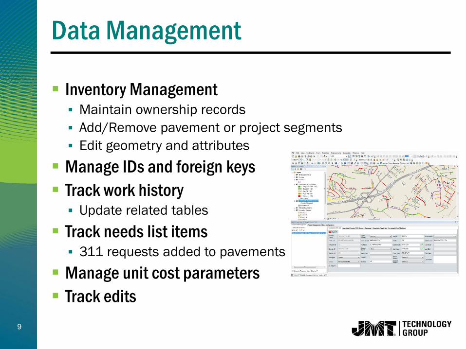
Inventory Management Maintain ownership records Add/Remove pavement or project segments Edit geometry and attributes
Manage IDs and foreign keys Track work history Update related tables
Track needs list items 311 requests added to pavements
Manage unit cost parameters Track edits
Data Management

10
New or proposed construction Work History Data Needs List Data Data from Pavement Condition Survey Distress Data Distress Types with Severity
Updated PCI Scores Open/Closed Status Full Curb, Partial Curb, Full Open
Longitudinal & Cross Slope Data
Data Collection

11
Pavement Inspection in Spring 2008 & Spring 2013 Almost 2,000 miles of County Maintained Roadways Dynatest Multi-Function Vehicle Pavement Roughness Photos – Pavement & Right of Way
Post Processing Extract distress data from photos Import to MicroPAVER for assessment Generate new PCI scores
Pavement Condition Survey
12
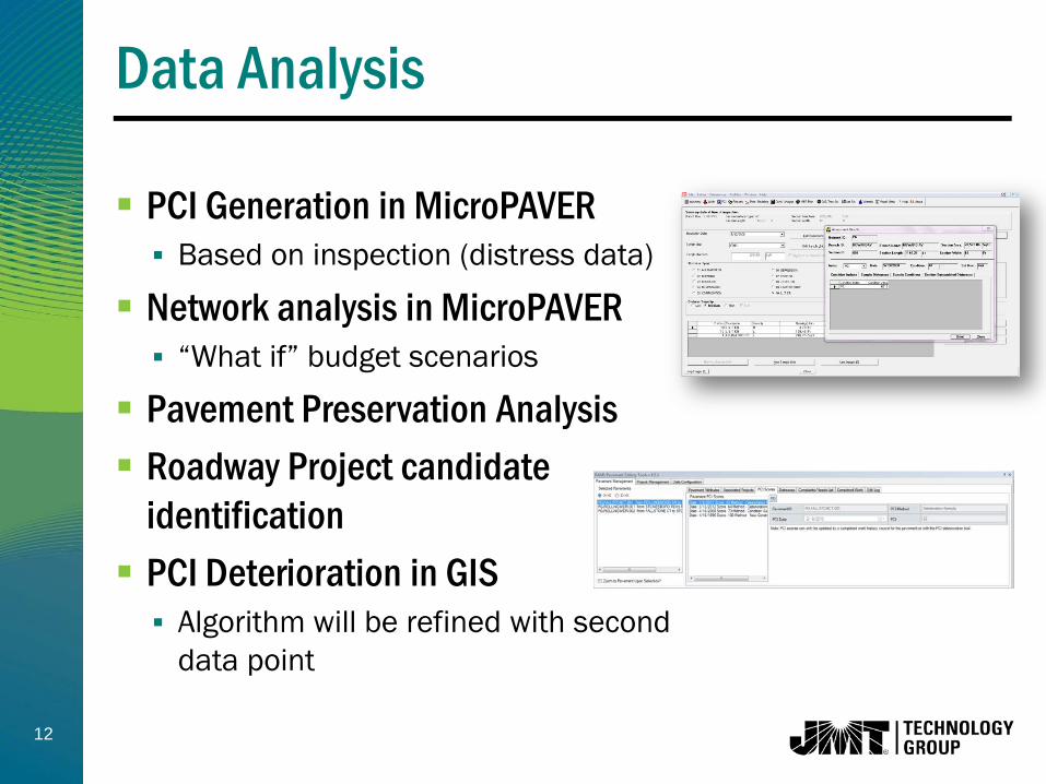
PCI Generation in MicroPAVER Based on inspection (distress data)
Network analysis in MicroPAVER “What if” budget scenarios
Pavement Preservation Analysis Roadway Project candidate
identification PCI Deterioration in GIS Algorithm will be refined with second
data point
Data Analysis

13
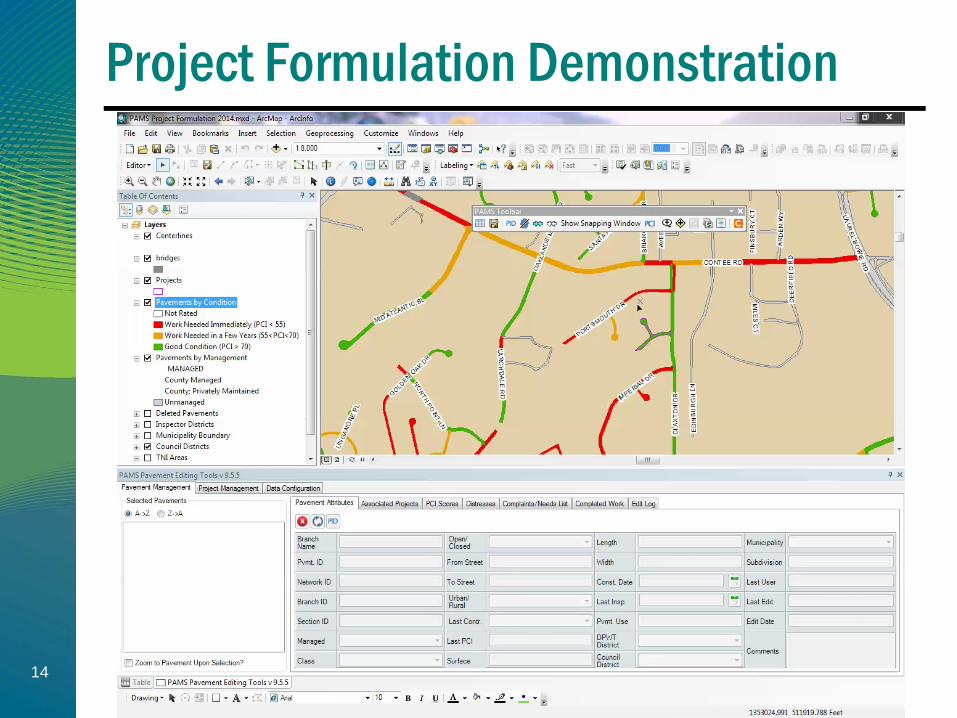
GIS-Based Project Formulation Generate Recommendations for Project Treatment type – major M&R or pavement preservation Budget Condition (PCI Score, %Load, %Climate) Geographic Constraints – Districts, TNI Areas Functional Class Needs List
Refine Project Recommendation Limits Create project with known limits & estimate costs Organize projects into groups Estimate costs for project group
Data Analysis
14
Project Formulation Demonstration

15
State of the Streets report Pavement Preservation report Generate ad-hoc reports Internal PAMS Silverlight Viewer ArcGIS Online Project
Coordination Map Coordinate roadwork efforts with
utility companies and other stakeholders
Data Dissemination

16
Initial end-user buy-in Resolved with training, daily usage and expansion of
PAMS GIS functionality
One-to-many and many-to-many relationships make ad-hoc reports more challenging to generate Plan to add some reporting capabilities into PAMS
Desktop tools
Maintaining two systems – MicroPAVER and GIS Still a challenge. GIS is definitive data source.
Challenges

17
Data driven decision making Use of condition data and GIS to formulate projects
and estimate costs
Incorporation into daily business processes Schedule A creation; Work tracking
Data used for purposes other than pavement maintenance Utility coordination, Snow operations, NPDES
Successes

18
Updates to database Add street segment ID to pavement polygons Update needs list data Update Managed = “Other” to more specific entity
(state, municipality etc) Update PCI scores for pavement preservation
treatments Add reporting capabilities to PAMS tools Explore additional uses of ArcGIS Online to support
PAMS
Next Steps

19
Questions?
Candice Ottley-Francois, PMP, GISP JMT Technology Group
[email protected] 410-316-2381
Erv Beckert, P.E. Prince George’s County Government
[email protected] 301-883-5714

20
Connect with us…
Web | www.jmttg.com Twitter | @JMTTG LinkedIn | JMT Technology Group Phone | (410) 316-2280 Email | [email protected]