pandowae 1 highlights of studies at dlr and lmu based on aircraft observations during t ‑ parc...
TRANSCRIPT

PANDOWAE
1
Highlights of studies at DLR and LMU based on aircraft observations during T‑PARC
Picture taken by Yomiuri Shimbun on 11 Sept. 2008
Martin Weissmann1,2, Florian Harnisch1,2 and Kathrin Folger1
Hans-Ertel-Centre for Weather Research, DA Branch, LMU München, Germany
Formerly: DLR Oberpfaffenhofen
Falcon fundingCollaborators:C. Cardinali, ECMWF, Reading, United KingdomR. Langland and P. Pauley, NRL, Monterey, USAT. Nakazawa, WMO, Geneva, SwitzerlandM. Wirth, S. Rahm, DLR Oberpfaffenhofen, GermanyY. Ohta and K. Yamashita, JMA, JapanC.-C. Wu, K.-H. Chou and P.-H. Lin, NTU, TaiwanY. Kim and E.-H. Yeon, NIMR, KoreaS. Aberson, NOAA/AOML/HRD, USA

PANDOWAE
2
Taiwan:DOTSTARAstra Jet
Atsugi:DLR Falcon
Guam:US AirForce WC-130NRL P-3
THORPEX Pacific Asian Regional Campaign (T-PARC, Aug – Oct 2008)
DLR Falcon:•25 flights•Dropsondes•Wind lidar•Water vapour lidar

PANDOWAE
3
Dropsonde observations
Campaign objectives:•TC genesis and structure•Targeted observations for NWP•ET transition
Evaluation of dropsonde impact
Period: Three weeks in September 2008
Typhoons: Sinlaku and Jangmi
Models:•ECMWF (global)•JMA GSM (global)•NCEP GFS (global)•WRF-ARW (regional)

PANDOWAE
4
ECMWF IFS JMA GSM
JapanKMA WRF NIMR KOREA
NCEP GFS
Resolution TL799L91 (~25 km)
TL959L60(~20 km) 30 km
T382L64(~38 km)
DA-method 12h 4D-VAR 6h 4D-VAR 6h 3D-Var 6h 3D-Var
Domain Globe Globe 190*190 grid points
Globe
Bogus NO NO (YES in oper. version)
NO vortex relocation, bogus if no vortex in first guess (rare)
Use of TCcore and eyewall observations
YES YES YES NO
Denied observations
Pacific dropsondesdriftsondesJMA ship SYNOPJMA ship TEMP
Pacific dropsondesJMA ship TEMPJMA special TEMP
Atlantic dropsondes
Atlantic and Pacific dropsondesdriftsondes
Model set-up used for the evaluation of dropsonde impact
(Weissmann, Harnisch, Wu, Lin, Ohta, Yamashita, Kim, Jeon, Nakazawa and Aberson, 2011, MWR)
ECMWF, JMA and NCEP systems from 2008/2009/2010 (no hybrid DA)

PANDOWAE
55
Influence of T-PARC dropsondes on typhoon track forecasts
24 36 48 60 72 84 96 108 1200
5
10
15
20
25
30
forecast lead time (h)24 36 48 60 72 84 96 108 120
0
100
200
300
400
500
600
700
800
mea
n tr
ack
fore
cast
err
or (
km)
GFS typhoon forecasts, lead time: 24-120 h
GFS NoDrop
GFS Drop
NCEP GFS3D-Var
0 12 24 36 48 60 720
50
100
150
200
250
300
350
400
450
mea
n tr
ack
fore
cast
err
or (
km)
forecast lead time (h)
WRF, lead time: 0-72 h
WRF NoDrop
WRF Drop
KMA WRF3D-VAR
0 12 24 36 48 60 72 840
5
10
15
20
25
30
forecast lead time (h)0 12 24 36 48 60 72 84
0
50
100
150
200
250
300
mea
n tr
ack
fore
cast
err
or (
km)
JMA, lead time: 0-84 h
JMA NoDrop
JMA Drop
JMA GSM4D-Var
24 36 48 60 72 84 96 108 1200
5
10
15
20
25
30
forecast lead time (h)24 36 48 60 72 84 96 108 120
0
100
200
300
400
500
600
700m
ean
trac
k fo
reca
st e
rror
(km
)
ECMWF and GFS typhoon forecasts, lead time: 24-120 h
EC NoDrop
EC Drop
ECMWF4D-VAR
All models show some reduction of typhoon track forecast errors with dropsondes, but impact strongly depends on DA system
Different scales!
(Weissmann, Harnisch, Wu, Lin, Ohta, Yamashita, Kim, Jeon, Nakazawa and Aberson, 2011, MWR)

PANDOWAE
6
• Large improvement in NCEP-GFS and WRF (models with 3D-Var, less other obs., larger errors)
• Lower impact in JMA and ECMWF (4D-Var, more satellite observations, lower errors)
• Best forecast both with and without dropsondes by ECMWF
• GFS with dropsondes comparable to ECMWF despite 3D-Var and less satellite observations
Influence of T-PARC dropsondes on typhoon track forecasts
(Weissmann, Harnisch, Wu, Lin, Ohta, Yamashita, Kim, Jeon, Nakazawa and Aberson, 2011, MWR)

PANDOWAE
7
909 910 911 912 913 914 915 916 917 918-500
-400
-300
-200
-100
0
100
200
300
400
500Difference track error Exp-Control; fctime: 72h
diff
eren
ce (
km)
date
ECMWF
JMA
GFS
925 926 927 928date
Low mean impact of JMA due to two deteriorating forecasts, whereas majority of forecasts improves(both deteriorating forecasts contain observations in typhoon core and eyewall region)
SINLAKU JANGMI
deterioration
improvem
ent
Dropsonde impact for individual forecasts
All models show more improving than deteriorating forecasts
(Weissmann, Harnisch, Wu, Lin, Ohta, Yamashita, Kim, Jeon, Nakazawa and Aberson, 2011, MWR)

PANDOWAE
8
Comparison of dropsonde targeting strategies
Concept for ideal mission and sensitivity experiments: Joint mission on 11 September •Falcon obs. in sensitive area highlighted by e.g. SV, ETKF (red)•DOTSTAR observations in typhoon surrounding (blue)•WC-130 observations in typhoon center (green)
Evaluation of targeting strategies in ECMWF system
Japan
China
ETKF
SV
(Harnisch and Weissmann, 2010, MWR)

PANDOWAE
9
Typhoon center and core:overall neutral impact
Typhoon vicinity:improvement of the track
forecast
Remote sensitive regions:small positive to neutral
impact
Which dropsonde observations are most beneficial?
ECMWF Integrated Forecast System (Harnisch and Weissmann, 2010, MWR)
Possible reasons:•SV resolution•Insufficient sampling of region•Low analysis error
Possible reasons:•Model resolution•Static B-matrix•Observation error, QC

PANDOWAE
10
Doppler wind lidar (DWL) assimilation in ECMWF and NOGAPS
Airborne scanning DWL:• Coherent 2 µm Doppler lidar• Profiles of horizontal wind • Horiz. resolution ~5 km• Vert. resolution 100 m• Accuracy: 0.5 - 1 m/s• Representative observations
0 12 24 36 48 60 72 84 96 108 1200
5
10
15
20
25
30
forecast lead time (h)
num
ber
of c
ases
0 12 24 36 48 60 72 84 96 108 1200
100
200
300
400
500
600
700
mea
n tr
ack
fore
cast
err
or (
km)
Mean ECMWF track forecast error
ECMWF
EC CONTROL
EC DWL
EC DROP
912 913 914 915 916 917 918930
940
950
960
970
980
990
1000
1010ECMWF Sinlaku pressure minimum
pres
sure
(hP
a)
date (ddhh)
(c)
best track
ECCTR AN
ECDWL ANECCTR FC48
ECDWL FC48
0 12 24 36 48 60 72 84 96 108 1200
5
10
15
20
25
30
forecast lead time (h)
num
ber
of c
ases
0 12 24 36 48 60 72 84 96 108 1200
100
200
300
400
500
600
700
forecast lead time (h)
mea
n tr
ack
fore
cast
err
or (
km)
Mean NRL NOGAPS track forecast error
NOGAPS
NRL CONTROL
NRL DWL
912 913 914 915 916 917 918930
940
950
960
970
980
990
1000
1010NRL NOGAPS Sinlaku pressure minimum
pres
sure
(hP
a)
date (ddhh)
(d)
best track
NRLCTR AN
NRLDWL ANNRLCTR FC48
NRLDWL FC480 12 24 36 48 60 72 84 96 108 120
0
5
10
15
20
25
30
forecast lead time (h)
num
ber
of c
ases
0 12 24 36 48 60 72 84 96 108 1200
100
200
300
400
500
600
700
mea
n tr
ack
fore
cast
err
or (
km)
Mean ECMWF track forecast error
ECMWF
EC CONTROL
EC DWL
EC DROP
912 913 914 915 916 917 918930
940
950
960
970
980
990
1000
1010ECMWF Sinlaku pressure minimum
pres
sure
(hP
a)
date (ddhh)
(c)
best track
ECCTR AN
ECDWL ANECCTR FC48
ECDWL FC48
0 12 24 36 48 60 72 84 96 108 1200
5
10
15
20
25
30
forecast lead time (h)
num
ber
of c
ases
0 12 24 36 48 60 72 84 96 108 1200
100
200
300
400
500
600
700
forecast lead time (h)
mea
n tr
ack
fore
cast
err
or (
km)
Mean NRL NOGAPS track forecast error
NOGAPS
NRL CONTROL
NRL DWL
912 913 914 915 916 917 918930
940
950
960
970
980
990
1000
1010NRL NOGAPS Sinlaku pressure minimum
pres
sure
(hP
a)
date (ddhh)
(d)
best track
NRLCTR AN
NRLDWL ANNRLCTR FC48
NRLDWL FC48
Impact of 1 DWL similar to dropsondes from 4 aircraft
Low impact on TC forecasts, likely due to bogus that “competes“ with other observations near TC(Weissmann, Langland, Pauley, Rahm and Cardinali,
2012, QJRMS)

PANDOWAE
11
Relative reduction of global 24-h forecast error by different observations:•Overall, significant impact of DWL in both systems•NOGAPS: DWL impact largest after TPW, bogus and scatterometer•ECMWF: DWL impact similar to aircraft observations•Larger total (accumulated) impact of DWL in NOGAPS although small impact on TC tracks (likely due to bogus near TC, but less other satellite observations elsewhere)
d) Rel. contr. per obs., area 20-50 N, 120-160 W
-0.0010 0.0000 0.0010 0.0020 0.0030
TEMPAMV GEO
AircraftDWL
Land SYNOPShip SYNOP
SSMI SFC WINDSSMI-TPW
SCAT SFC WINDASCAT SFC WIND
WINDSAT SFC WINDWINDSAT-TPW
TC SynthAMSU-A
IASISSMISAQUA
NOGAPS FEC per obs. (%) in area 20-50 N, 120-160 W
DWL
TPW
TPW
SCAT
bogus
b) Mean relative contribution per observation
-0.00005 0.00000 0.00005 0.00010 0.00015 0.00020
SYNOPAIRCRAFT
DWLDRIBU
TEMP/PILOTAMV GEO
SCATHIRS
AMSU-AAIRSIASI
GPS-ROSSM/I
AMSR-EMHS
AMSU-BMTSAT-Rad
O3
ECMWF FEC per observation (%) in area 20-50 N, 120-160 W
DWLaircraft buoys
AMVs
SYNOP
radiosonde
SCAT
ECMWFNOGAPS
FSO impact per observation (area 20-50N, 120-160W)
(Weissmann, Langland, Pauley, Rahm and Cardinali, 2012, QJRMS)

PANDOWAE
12
Water vapour lidar (DIAL) assimilation at ECMWF
• Observations from 8 flights assimilated in ECMWF system• Verification with independent dropsondes shows analysis improvement• Weak forecast impact in most cases, but improvement in two events with modified downstream development
S-Korea Japan
Okinawa
(Harnisch, Weissmann, Cardinali and Wirth, 2011, QJRMS)
Forecast impact
Improvement

PANDOWAE
13
Height correction of AMVs with lidar cloud top observations
Atmospheric motion vectors (AMVs) are the only available wind information in many regions of the globe, but:•Height assignment errors lead to significant wind errors•These errors are correlated over several hundred km only a small fraction of AMVs is used for NWP
T-PARC offered a unique data set to test the potential of correcting AMVs with lidar information•Availablility of collocated lidar observations and independent dropsonde winds for verification
Best results were achieved for assigning AMVs to a 100 hPa layer beneath lidar cloud tops
On average, AMV wind errors were reduced by 14% with lidar correction
(Weissmann, Folger and Lange, 2013, JAMC)
Layer beneath lidar cloud top

PANDOWAE
14
Application of the correction with CALIPSO lidar observations
~1200 collocated MSG-AMVs/CALIPSO observations per day
error for AMV level
error for layer 25% above, 75% beneatherror for lidar layers
Results:•12-17% lower AMV wind error•Lower bias•Lower error correlation
(further details on poster)
(Folger and Weissmann , 2014, JAMC)

PANDOWAE
15
Dropsonde impact in different models:•Some benefit of dropsonde observations in all systems •Large impact in NCEP GFS and KMA WRF (models with 3D-Var, less satellite observations and larger errors)
Overall, targeted dropsondes are beneficial for TC forecasts, whereas results for mid-latitude targeting are neutral or small (latter not shown)
Specific ECMWF results:•Largest impact from dropsondes in typhoon vicinity•Low impact from dropsondes in remote “sensitive areas” indicated by singular vectors or ETKF•Neutral impact from core/eyewall dropsondes
Doppler wind lidar (DWL)•Overall significant and comparably large impact•Emphasizes high expectations for ADM-Aeolus satellite (despite some differences of the systems)
DIAL assimilation:•Improved humidity analysis, but weak forecast impact in most cases•Forecast impact when humidity is transported in mid-latitudes and downstream development is modified
AMV height correction with lidar cloud top observations:•Significant reduction of AMV wind errors (12-17%)•Lower bias and lower error correlation
Conclusions
PANDOWAE
16
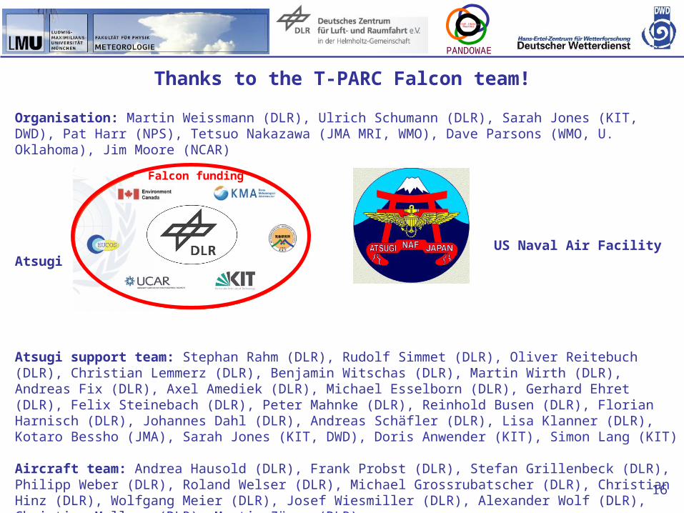
Thanks to the T-PARC Falcon team!
Organisation: Martin Weissmann (DLR), Ulrich Schumann (DLR), Sarah Jones (KIT, DWD), Pat Harr (NPS), Tetsuo Nakazawa (JMA MRI, WMO), Dave Parsons (WMO, U. Oklahoma), Jim Moore (NCAR)
US Naval Air Facility Atsugi
Atsugi support team: Stephan Rahm (DLR), Rudolf Simmet (DLR), Oliver Reitebuch (DLR), Christian Lemmerz (DLR), Benjamin Witschas (DLR), Martin Wirth (DLR), Andreas Fix (DLR), Axel Amediek (DLR), Michael Esselborn (DLR), Gerhard Ehret (DLR), Felix Steinebach (DLR), Peter Mahnke (DLR), Reinhold Busen (DLR), Florian Harnisch (DLR), Johannes Dahl (DLR), Andreas Schäfler (DLR), Lisa Klanner (DLR), Kotaro Bessho (JMA), Sarah Jones (KIT, DWD), Doris Anwender (KIT), Simon Lang (KIT)
Aircraft team: Andrea Hausold (DLR), Frank Probst (DLR), Stefan Grillenbeck (DLR), Philipp Weber (DLR), Roland Welser (DLR), Michael Grossrubatscher (DLR), Christian Hinz (DLR), Wolfgang Meier (DLR), Josef Wiesmiller (DLR), Alexander Wolf (DLR), Christian Mallaun (DLR), Martin Zöger (DLR)
Falcon funding