pegasus - international civil aviation organization · 2013-03-18 · eurocontrol doc. no.:...
TRANSCRIPT
EUROCONTROL Doc. No.: PEG-TN-SBAS
Issue: I Date: 17/06/2003
Project:PEGASUS
Technical Notes on SBAS Sheet 1 of 96
Title: PEGASUS
Technical Notes on SBAS
Prepared by: GNSS Tools Team Date: 17/06/2003
Checked by: GNSS Tools Review Team
Distribution: PEGASUS development team, EEC/GNSSPEGASUS development team, TU BS/IFFSoftware Engineering Unit EEC/SEUSBAS Team EEC/GNSSGBAS Team EEC/GNSS
This document and the information therein is the property of Eurocontrol. It must not be reproduced in whole or in part or otherwise disclosed without prior written consent of the Director Eurocontrol Experimental Centre.
The contents of this document only expresses the opinions of the author anddoes not necessarily reflect the official views or policy of the Agency.

EUROCONTROL Doc. No.: PEG-TN-SBAS
Issue: I Date: 17/06/2003
Project:PEGASUS
Technical Notes on SBAS Sheet 2 of 96
DOCUMENT IDENTIFICATION SHEET
DOCUMENT DESCRIPTION
Document Title
PEGASUS Technical Notes on SBAS
EDITION : I EDITION DATE : 17/06/2003Abstract
Description of the algorithms for the WinGPSAll module of the PEGASUS data processing and analysissystem using the EGNOS System Test Bed ESTB, a prototype version of the European implementationof a Satellite Based Augmentation System SBAS.
Keywords
GNSS algorithms SBAS GBASsatellite navigation Ephemeris GPS GLONASSEGNOS ESTB PEGASUS Technical notecorrection computation Message types
CONTACT: EATMP GNSS Programme TEL: +33-1-6988-7571 UNIT: GNSS Tools
DOCUMENT STATUS
STATUS CATEGORY CLASSIFICATIONWorking Draft Executive Task General PublicDraft Specialist Task ü EATMP üProposed Issue Lower Layer Task RestrictedReleased Issue ü
ELECTRONIC BACKUP
INTERNAL REFERENCE NAME : TN.DOC

EUROCONTROL Doc. No.: PEG-TN-SBAS
Issue: I Date: 17/06/2003
Project:PEGASUS
Technical Notes on SBAS Sheet 3 of 96
CHANGE RECORD
Issue Date Chapter Description of Changes
0-F All Previous Issues for ESTB SIS versions V1.0 (RTCADO 229 Change 1) and V1.1 (RTCA DO 229A)
“PEGASUS Technical Notes, PEG-TN-01, Issue F”
G 17/01/2003 All Issue associated with ESTB SIS version 1.2 (RTCADO 229 A/B)
Harmonisation of documentation associated in thePEGAS*Plus Project
H 09/04/2003 7, 10 minor correction of documentation
I 17/06/2003 All minor editorial changes

EUROCONTROL Doc. No.: PEG-TN-SBAS
Issue: I Date: 17/06/2003
Project:PEGASUS
Technical Notes on SBAS Sheet 4 of 96
TABLE OF CONTENTS
1 INTRODUCTION................................................................................................................................71.1 Purpose of this document.........................................................................................................71.2 Overview......................................................................................................................................71.3 Acronyms and Abbreviations....................................................................................................71.4 Definitions....................................................................................................................................91.5 References ............................................................................................................................... 101.6 Constraints ............................................................................................................................... 11
2 THE EGNOS SATELLITE TEST BED........................................................................................ 122.1 Description of the ESTB General Functions ....................................................................... 122.2 Description of the ESTB Implementation............................................................................ 122.3 User equipment requirements............................................................................................... 132.4 Modes and Provided Services .............................................................................................. 14
3 PRELIMINARY................................................................................................................................ 15
SBAS DIFFERENTIAL CORRECTION AND INTEGRITY
4 GENERAL........................................................................................................................................ 174.1 Message Types and Format.................................................................................................. 174.2 Message Timeouts and Update Intervals ............................................................................ 204.3 Satellite Mask and Organisation of Correction Information.............................................. 214.4 Degradation of Correction Information................................................................................. 234.5 Application of Message Types .............................................................................................. 25
5 FAST CORRECTIONS.................................................................................................................. 265.1 Message Types and Format.................................................................................................. 265.2 Pseudorange Corrections ...................................................................................................... 285.3 Correction Error Estimation ................................................................................................... 315.4 Application of Corrections ...................................................................................................... 36
6 SLOW CORRECTIONS ................................................................................................................ 376.1 Message Types and Format.................................................................................................. 376.2 Satellite Position and Clock Corrections.............................................................................. 396.3 Correction Error Estimation ................................................................................................... 416.4 Application of Correction........................................................................................................ 41
7 IONOSPHERIC CORRECTIONS ................................................................................................ 437.1 General Approach to the Ionospheric Corrections............................................................. 437.2 The Ionospheric Grid .............................................................................................................. 437.3 Message Types and Format.................................................................................................. 447.4 The Pierce Point Computation.............................................................................................. 487.5 The Selection of Interpolation Grid Points........................................................................... 497.6 The Interpolation Scheme...................................................................................................... 517.7 The Ionospheric Delay............................................................................................................ 557.8 Degradation of Correction Information................................................................................. 55

EUROCONTROL Doc. No.: PEG-TN-SBAS
Issue: I Date: 17/06/2003
Project:PEGASUS
Technical Notes on SBAS Sheet 5 of 96
7.9 Application of Corrections ...................................................................................................... 57
8 TROPOSPHERIC CORRECTIONS ............................................................................................ 588.1 General Approach to the Tropospheric Corrections .......................................................... 588.2 The Linear Interpolation Scheme.......................................................................................... 588.3 The Meteorological Parameters............................................................................................ 598.4 The Slant Tropospheric Delay............................................................................................... 60
9 DETERMINATION OF THE CORRECTED PSEUDORANGE ............................................... 629.1 Satellite Designations ............................................................................................................. 62
9.1.1 Designation SBAS Unhealthy .................................................................................................... 629.1.2 Designation SBAS Unmonitored................................................................................................ 629.1.3 Designation SBAS Healthy........................................................................................................ 63
9.2 Selection of Satellites ............................................................................................................. 639.3 Consistency Check of Range Measurements .................................................................... 65
9.3.1 Quality Control for Range Measurements................................................................................... 659.3.2 Test for Exclusion..................................................................................................................... 659.3.3 Test for Re-Inclusion................................................................................................................. 669.3.4 Surviving Data Gaps................................................................................................................. 67
9.4 Range Smoothing.................................................................................................................... 679.5 SBAS Non-Precision Approach Mode ................................................................................. 699.6 SBAS Precision Approach Mode.......................................................................................... 70
10 NAVIGATION SOLUTION AND PROTECTION LEVELS................................................... 7210.1 General Approach to Protection Levels ............................................................................... 7210.2 Navigation Equation................................................................................................................ 7410.3 Unweighted Least Squares Algorithms................................................................................ 7510.4 Weighted Least Squares Algorithms.................................................................................... 7610.5 Weights using SBAS Corrections ......................................................................................... 76
10.5.1 Total Modelled Variance ........................................................................................................... 7610.5.2 Bound on Fast and Slow Residual Errors ................................................................................... 7710.5.3 Bound on Ionospheric Residual Errors ....................................................................................... 7810.5.4 Bound on Receiver Noise and Multipath Residual Errors............................................................. 7810.5.5 Bound on Tropospheric Residual Errors..................................................................................... 80
10.6 Protection Levels using SBAS Corrections ......................................................................... 80
11 THE SERVICE REGION INDICATION .................................................................................... 8311.1 General Approach to the Service Region Indication.......................................................... 8311.2 Message Types and Format.................................................................................................. 8311.3 Service Region Processing.................................................................................................... 8511.4 Indirect Geodetic Problem ..................................................................................................... 85
SBAS RANGING
12 THE SBAS RAW DATA............................................................................................................. 89
13 THE SBAS EPHEMERIS........................................................................................................... 9113.1 Message Type and Formats.................................................................................................. 9113.2 Satellite Position Calculation................................................................................................. 9213.3 Satellite Clock Error Calculations ......................................................................................... 92
14 THE SBAS ALMANAC............................................................................................................... 94

EUROCONTROL Doc. No.: PEG-TN-SBAS
Issue: I Date: 17/06/2003
Project:PEGASUS
Technical Notes on SBAS Sheet 6 of 96
14.1 Message Type and Formats.................................................................................................. 9414.2 Satellite Position Calculation................................................................................................. 95

EUROCONTROL Doc. No.: PEG-TN-SBAS
Issue: I Date: 17/06/2003
Project:PEGASUS
Technical Notes on SBAS Sheet 7 of 96
1 Introduction
1.1 Purpose of this document
The purpose of this document is to describe the messages broadcast by the ESTB and how the data areapplied in the PEGASUS algorithms.
The ESTB is a test bed for the European Geostationary Navigation Overlay Service (EGNOS), the Europeancomponent of a world-wide Satellite Based Augmentation System (SBAS) for the current generation of satellitenavigation systems. The purpose of the SBAS is to enhance the available accuracy and integrity of the coreGNSS-1 elements GPS and GLONASS.
The PEGASUS development is based on the prototypes of the SAPPHIRE phases I and II. The SAPPHIREdatabase collects GNSS raw measurements and computed data and implements algorithms for processingthe data stored in the database. So far, SAPPHIRE has implemented a GPS position solution algorithm,several integrity algorithms and a constellation analysis tool. With PEGASUS, these algorithms are extendedto process not only GPS, but also ESTB data.
1.2 OverviewThis document is divided into several parts. The first part, chapter 2, describes the architecture of the ESTBand its implementation, although it should be noted that the description contained in this chapter is mainlybased on the implementation of the ESTB during the phase between February 2000 and June 2001. In themeantime, the ESTB changed its signal format twice
Ø at the end of June 2001 to the standard “RTCA Do 229A Minimal Operational Performance Standards forGPS/WAAS Airborne Equipment, June 1998” [3]
Ø at the end of August 2002 to a mix between the above mentioned standard “RTCA Do 229A MinimalOperational Performance Standards for GPS/WAAS Airborne Equipment, June 1998” [3] and itssucceeding issue “RTCA Do 229B Minimal Operational Performance Standards for GPS/WAAS AirborneEquipment, October 1999” [4]
and therefore the main parts of the signal generation and signal implementation. If current information on thesignal content and the broadcast schedule is needed, the interested reader is referred to the appropriate webpages [16].
The second part is dedicated to the processing of the SBAS correction and integrity data (chapters 3 through10). The third part is dedicated to the processing of the SBAS ranging data (chapters 11 through 13). Thedocument will be extended and modified along with the evolution of the ESTB.
It is important to acknowledge that the currently transmitted ESTB “Signal In Space” version 1.2(although labelled RTCA DO 229B) is specified mainly by the RTCA DO 229B [4] standard – but certain
individual parts still conform to the RTCA DO 229A [3] standard.
It has been decided that the PEGASUS Project should be able to process the ESTB SIS according to itscurrent specifications. This document is intended to describe the algorithmic implementation that is necessaryto process the transmitted ESTB SIS in order to obtain a position solution and integrity information. Thus, inthe individual chapters it has been decided to adhere to the RTCA DO 229B [4] standard and to identify theparts which still conform to the RTCA DO 229A [3] standard. The interested reader is additionally referred tothe document [5], where the relevant changes for the ESTB CPF are identified. ü
1.3 Acronyms and AbbreviationsAI Degradation FactorAL Alert LimitAORE INMARSAT satellite Atlantic Ocean Region East
´

EUROCONTROL Doc. No.: PEG-TN-SBAS
Issue: I Date: 17/06/2003
Project:PEGASUS
Technical Notes on SBAS Sheet 8 of 96
CAT-I Precision Approach Flight Phase Category ICPF Central Processing Facility
DOP Dilution Of Precision
E Eastern LongitudeECAC European Civil Aviation ConferenceEGNOS European Geostationary Navigation Overlay ServiceENR Flight Phase En-RouteESTB EGNOS System Test Bed
FC Fast CorrectionsFEC Forward Error CheckingFTE Flight Technical Error
GBAS Ground Based Augmentation SystemGEO Geostationary SatelliteGIC Ground Integrity ChannelGIVE Grid Ionospheric Vertical ErrorGIVEI GIVE IndicatorGLONASS Global Navigation Satellite SystemGNSS Global Navigation System SystemsGPS Global Positioning SystemGRS Geostationary Ranging Station
HAL Horizontal Alert LimitHPL Horizontal Protection Level
ID IdentifierIGP Ionospheric Grid PointIOD Issue Of DataIODC Issue Of Data Clock (GPS)IODE Issue Of Data Ephemeris (GPS)IODF Issue Of Data Fast CorrectionsIODI Issue Of Data IonosphereIODP Issue Of Data PRN MaskIODS Issue Of Data ServiceIOD Issue Of DataIOR INMARSAT satellite Indian Ocean RegionIPP Ionospheric Pierce Point
MCC Mission Control CentreMOPS Minimum Operational Performance StandardsMT Message Type
N Northern LatitudeN/A Not ApplicableNLES Navigation Land Earth StationNMA Norwegian Mapping AgencyNPA Flight Phase Non-Precision ApproachNPV-I Flight Phase Non-Precision Approach with Vertical Guidance INPV-II Flight Phase Non-Precision Approach with Vertical Guidance IINSE Navigation System Error
PEGASUS Prototype EGNOS GBAS Analysis System Using SAPPHIREPRN Pseudo Random Noise (satellite identifier)PRC Pseudo Range Correction

EUROCONTROL Doc. No.: PEG-TN-SBAS
Issue: I Date: 17/06/2003
Project:PEGASUS
Technical Notes on SBAS Sheet 9 of 96
RAIM Receiver Autonomous Integrity MonitoringRC Range CorrectionsROC Rate of ChangeRRC Range Rate CorrectionsRS Reference StationsRSS Root Sum SquareRTCA Radio Technical Committee on Aeronautics
S Southern LatitudeSA Selective AvailabilitySAPPHIRE Satellite and Aircraft Database for System Integrity ResearchSARPs Standards and Recommended PracticesSC Slow CorrectionsSBAS Satellite Based Augmentation SystemsSDM Service Definition ManualSPS Standard Positioning Service
TBC to be confirmedTBD to be done/determinedTMS Test Master StationTL System Latency TimeTRM Flight Phase TerminalTSE Total System Error
UDRE User Differential Range EstimateUDREI UDRE IndicatorUIRE User Ionospheric Range ErrorUIVE User Ionospheric Vertical ErrorUIVEI UIVE IndicatorURD User Requirement DocumentUTC Universal Time Co-ordinated
VAL Vertical Alert LimitVPL Vertical Protection Level
W Western LongitudeWAAS Wide Area Augmentation SystemWAD Wide Area Differential
1.4 DefinitionsFlight Technical Error : The Flight Technical Error is defined to be the difference between the required flightpath and the displayed position of the aircraft.
Horizontal Protection Level : The Horizontal Protection Level HPL is the radius of a circle in the horizontalplane (the plane tangent to the WGS84 ellipsoid), with the centre being at the true aircraft position, whichdescribes the region which is assured to contain the indicated horizontal position with a specified probability. Itis the horizontal region for which the missed alert requirements can be met.
Vertical Protection Level : The Vertical Protection Level VPL is half of the length of a segment on the verticalaxis (perpendicular to the horizontal plane of WGS84 ellipsoid), with its centre being at the true position, whichdescribes the region which is assured to contain the indicated vertical position specified probability. It definesthe vertical region for which the missed alert requirements can be met.
Navigation System Error : The Navigation System Error is defined to be the difference between the aircraft’strue position and its computed and displayed position.

EUROCONTROL Doc. No.: PEG-TN-SBAS
Issue: I Date: 17/06/2003
Project:PEGASUS
Technical Notes on SBAS Sheet 10 of 96
Misleading Information: Misleading Information is defined to be any data which is output that has an errorlarger than the alert limit without any indication of the error within the Time-To-Alert for the applicable phase offlight.
Verification: Verification is a confirmation by examination and provision of objective evidence that the specifiedrequirements have been fulfilled. A verification process is performed to show the system is built right (see[19]).
Validation: Validation is a confirmation by examination and provision of objective evidence that the particularrequirements for a specific intended use are fulfilled. A validation process is performed to show the rightsystem is built (see [19]).
Certification: Certification is a procedure by which a third party gives written assurance that a product, processor service conforms to specific requirements (see [19]).
1.5 References
[1] -: RTCA Minimal Operational Performance Standards for GPS/WAAS Airborne Equipment.Doc. No. Do 229, June 1996, including Change 1, dated July 1997
[2] -: Minimum Operational Performance Standards for Airborne Supplemental NavigationEquipment Using GPS, RTCA Document 208, July 1991
[3] -: RTCA: Minimal Operational Performance Standards for GPS/WAAS Airborne Equipment.Doc. No. Do 229 A, June 1998
[4] -: RTCA: Minimal Operational Performance Standards for GPS/WAAS Airborne Equipment.Doc. No. Do 229 B, October 1999
[5] - : ESTB-CPF Improvements and Corrective Maintenance ESTB-UPG, Analysis of compliancewith MOPS DO-229B, Doc. No. GMV-ESTB_UPG-TN-001/01
[6] -: PEGASUS*PLUS User Requirement Document (1), Doc. No. PEG+-URD-01
[7] -: PEGASUS User Requirement Document, Doc. No. PEG-URD-01
[8] -: PEGASUS Interface Control Document, Doc. No. PEG-ICD-01
[9] Mueller, K. Tysen; Dr. Loomis, Peter V. W.; Biester, Mike : Performance Comparison ofCandidate U.S. Coast Guard WADGPS Network Architectures, ION National Technical Meeting1994
[10] Pullen, Sam; Dr. Enge, Per; Dr. Parkinson, Bradford: Simulation-Based Evaluation of WAASPerformance: Risk and Integrity Factors, ION GPS Satellite Division 1994
[11] Dr. El-Arini, M. Bakry; Hegarty, Christopher J.; Fernow, James P.; Klobuchar, John A.:Development of an Error Budget for a GPS Wide-Area Augmentation System (WAAS), IONNational Technical Meeting 1994
[12] -: International Standards and Recommended Practises, Aeronautical Telecommunications, Annex10 to the Convention on International Civil Aviation, Volume 1, November 2001
[13] -: ESTB SIS User Interface Description, ESA, Doc.-No. : E-TN-ITF-E31-0008-ESA, issue 0revision 1, 20-06-00
[14] - GPS Standard Positioning Service Performance Standard, June 1995
[15] - GPS Standard Positioning Service Performance Standard, October 2001
[16] -: ESA EGNOS web pages http://www.esa.int/export/esaEG/estb.html

EUROCONTROL Doc. No.: PEG-TN-SBAS
Issue: I Date: 17/06/2003
Project:PEGASUS
Technical Notes on SBAS Sheet 11 of 96
[17] -: Euridis System Test Measurement Station, Michel Brunet, Alain Lamy, N. Suard - CNES,ION GPS, September 1999
[18] -: Service Definition Manual SDM for INMARSAT Geostationary Navigation Overlay Service
[19] Giovanni Naddeo, Klaus Strodl, Michel Tossaint: Verification & Validation of Galileo Systemand Services, GNSS 2001, Sevilla, May 2001
[20] Christian Altmayer: Real-Time Kinematic and High Accuracy Navigation with Low Cost GPSReceivers, ION National Technical Meeting, Long Beach, January 2001
[21] Pieter Bastiaan Ober: SBAS Integrity Concept, Issue 1.0, Reelektronika b.v., June 2001
[22] Vicenty, T. : Direct and inverse solution of geodesics on the ellipsoid with application of nestedequations, Survey Review, No 176 (1975), pp. 88-93
(1) The PEGASUS*Plus project established an extension to the original PEGASUS project that decode, process and evaluate the GNSS /SBAS data. Recent developments have integrated all these modules into a PEGASUS frame and the necessary documentation has beenmodified accordingly – except for the URD where it has been decided not to generate a new issue.
1.6 ConstraintsAlthough the implementation of the SBAS correction and ranging information is based on documents whichdescribe the intent quite clearly, several points in these documents are open to interpretation and application.These open questions have been marked inside this document with the following convention.
The problem is identified by the text following this question mark. This problem is discussed and asolution to the problem is suggested, which has then been implemented inside PEGASUS. Still, the
interested reader is invited to provide feedback in order to clarify the points subject to discussion and toimprove the processing of the data inside PEGASUS. The following check mark closes the discussion on thisparticular problem. ü
´
EUROCONTROL Doc. No.: PEG-TN-SBAS
Issue: I Date: 17/06/2003
Project:PEGASUS
Technical Notes on SBAS Sheet 12 of 96
2 The EGNOS Satellite Test BedThe description of the EGNOS Satellite Test Bed is taken from the ESTB User Interface Document [13].Further information can also be found on the ESTB web page [16].
It should be noted that the description contained in this chapter summarises the implementation of theESTB during the phase between February 2000 and June 2001. In the meantime, the ESTB changedits signal format twice
Ø at the end of June 2001 to the standard “RTCA Do 229A Minimal Operational Performance Standards forGPS/WAAS Airborne Equipment, June 1998” [3]
Ø at the end of August 2002 to a mix between the above mentioned standard “RTCA Do 229A MinimalOperational Performance Standards for GPS/WAAS Airborne Equipment, June 1998” [3] and itssucceeding issue “RTCA Do 229B Minimal Operational Performance Standards for GPS/WAAS AirborneEquipment, October 1999” [4]
and therefore the main parts of the signal generation and signal implementation. If current information on thesignal content and the broadcast schedule is needed, the interested reader is referred to the appropriate webpages [16]. No updated description could be obtained at the current moment of updating this document. ü
2.1 Description of the ESTB General FunctionsThe ESTB is a complete prototype of the EGNOS system. It implements the main functions (ranging, GPSdifferential corrections and integrity) with real time elements enabling different user experiments or tests. Ofcourse, the ESTB functions, complexity and performance are reduced by an order of magnitude with respectto the EGNOS system, principally concerning the availability, the robustness and redundancy of facilities.
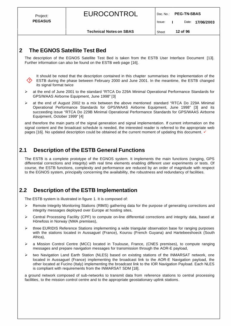
2.2 Description of the ESTB ImplementationThe ESTB system is illustrated in figure 1. It is composed of:
Ø Remote Integrity Monitoring Stations (RIMS) gathering data for the purpose of generating corrections andintegrity messages deployed over Europe at hosting sites,
Ø Central Processing Facility (CPF) to compute on-line differential corrections and integrity data, based atHönefoss in Norway (NMA premises),
Ø three EURIDIS Reference Stations implementing a wide triangular observation base for ranging purposeswith the stations located in Aussaguel (France), Kourou (French Guyana) and Hartebeeshoeck (SouthAfrica),
Ø a Mission Control Centre (MCC) located in Toulouse, France, (CNES premises), to compute rangingmessages and prepare navigation messages for transmission through the AOR-E payload,
Ø two Navigation Land Earth Station (NLES) based on existing stations of the INMARSAT network, onelocated in Aussaguel (France) implementing the broadcast link to the AOR-E Navigation payload, theother located at Fucino (Italy) implementing the broadcast link to the IOR Navigation Payload. Each NLESis compliant with requirements from the INMARSAT SDM [18].
a ground network composed of sub-networks to transmit data from reference stations to central processingfacilities, to the mission control centre and to the appropriate geostationary uplink stations.
´

EUROCONTROL Doc. No.: PEG-TN-SBAS
Issue: I Date: 17/06/2003
Project:PEGASUS
Technical Notes on SBAS Sheet 13 of 96
Kourou
Hartebeesthoek
AOR-E IOR
Höfn
Tromsö
Hönefoss
Rotterdam
Scilly
Toulouse
MalagaPalma
Canaries
Fucino
Matera
Ankara
Figure 1: ESTB System Architecture
2.3 User equipment requirementsTo be able to receive the ESTB signal and process ESTB messages, the user has to acquire a GNSS receiverable to process a Signal-in-Space as defined in
Ø the ICAO SARPS [12]
Ø the MOPS [4], with the exception of the message type 0 (see warning hereafter)
Ø and the GPS SPS [14].
The receiver has to track the geostationary satellite with the Pseudo Range Number (PRN) set to ESTBsignals :
Ø PRN 120 for AOR-E navigation payload
Ø PRN 131 for IOR navigation payload
in order to obtain lock on the ESTB satellites L1 signal, to measure pseudoranges, to acquire the ESTBbroadcast messages and to compute user positions including GPS/SPS and ESTB services.
Warning about message type 0 : In case of reception of this type of message, the MOPS receiver is supposedto discard all the data messages from the geostationary satellite. If positions are delivered by the receiver, it isonly for test purposes and using these positions for another matter is at the user’s own risk without any claimagainst the ESTB signal provider. The ESTB always broadcasts message type zero, so the use of the signalwould not be possible if the receiver followed the requirement in the MOPS [4].

EUROCONTROL Doc. No.: PEG-TN-SBAS
Issue: I Date: 17/06/2003
Project:PEGASUS
Technical Notes on SBAS Sheet 14 of 96
2.4 Modes and Provided ServicesThe ESTB Signal in Space is broadcast by the AOR-E and the IOR geostationary satellites. The ESTB hasbegun its broadcast via the AOR-E in February 2000. Current and updated information can be obtained bycontacting the appropriate personnel through the ESA web pages [16].
A set of modes has been defined for the ESTB according to the status of some ESTB components. In eachmode, some information about test receiver deliveries are given regarding the augmentation service relative tothe basic GPS SPS. The list of possible ESTB modes is:
Ø ESTB mode 0 (all corrections broadcast)
Ø ESTB mode 2 (fast corrections and ionospheric corrections broadcast)
Ø ESTB mode 3 (fast corrections broadcast)
Ø ESTB mode ranging only (no corrections broadcast)
The broadcast by the geostationary satellite AOR-E (i.e. the PRN 120) in all modes can include the rangingfunctionality for this satellites. At the time being, the geostationary satellite IOR (i.e. the PRN 131) does notinclude the ranging functionality and thus transmits only in modes 0, 2 and 3.
The different types of messages broadcast by the ESTB are summarised in the following table. The contentand use of each type of message is described in the relevant MOPS [4].
Availability throughESTB mode Types of broadcast messages
AORE (PRN 120) IOR (PRN 131)
Mode 0 0, 1, 2-5(1), 7(2), 9, 10(2), 12, 18, 25, 26, 27(3) Yes Yes
Mode 2 0, 1, 2-5(1), 7(2), 9, 10(2), 12, 18, 25(4), 26, 27(3) Yes Yes
Mode 3 0, 1, 2-5(1), 7(2), 9, 10(2), 12, 25(4), 27(3) Yes Yes
Ranging Only 0, 1, 9, 12, 17, 24, 63(5) yes No
(1) The PRN 120 is set to “unmonitored” in the fast correction message type broadcast (message types 2-5)(2) The values contained in the broadcast are fixed to a certain configuration of the ESTB service management approach.(3) Message type MT 27 is broadcast only when testing the ESTB outside the nominal area(4) In modes 2 and 3, message type MT 25 (slow corrections) do contain only the time information(5) The definition of MT 24 in the ranging only mode is not quite clear
Table 1: ESTB modes and message types
Warning : There is no standard ESTB sequence(s) of messages except in “only ranging” mode. The ESTBmessages are only constrained to the maximum update interval defined for each type of message in theMOPS [4].
Note : The IOR transmits no message type MT 10 and the transmissions for message types MT 9 and MT 12are filled with zeros. Further information can also be found on the ESTB web page [16].

EUROCONTROL Doc. No.: PEG-TN-SBAS
Issue: I Date: 17/06/2003
Project:PEGASUS
Technical Notes on SBAS Sheet 15 of 96
3 PreliminaryThe next two sections of this document describe the processing of the SBAS correction and ranginginformation.
This first section covers the processing of the SBAS differential correction and integrity data. Chapter 4describes the general layout and approach to the organisation and processing of the differential corrections. Inchapter 5, the fast correction data is introduced, while in chapter 6 the long-term (or slow) correction data isdescribed. In chapter 7, the ionospheric correction model is explained and in chapter 8 the tropospheric errorcorrection model is described.
In chapter 9, the application of the differential corrections is shown and the logic behind the satellite selectionfor the positioning solution is described. In chapter 10, a brief description of the navigation solution algorithmand the protection level calculation is provided. The application of the message type MT 27 (service regionindication) is described in chapter 11. However, the ESTB implements the message type MT 27 broadcastonly in an “expansion mode” approach. Further information on the “expansion mode” could not be obtained atthe moment of updating this document, but it is expected that this information will be available in the future.
The second section covers the processing of the SBAS ranging data. In chapter 12, a brief description of theSBAS ranging data and its processing is provided. Chapter 13 explains the processing of the SBAS ephemerisdata, after which the chapter 14 describes the processing of the SBAS almanac data.

EUROCONTROL Doc. No.: PEG-TN-SBAS
Issue: I Date: 17/06/2003
Project:PEGASUS
Technical Notes on SBAS Sheet 16 of 96
SBAS Differential Correction and Integrity

EUROCONTROL Doc. No.: PEG-TN-SBAS
Issue: I Date: 17/06/2003
Project:PEGASUS
Technical Notes on SBAS Sheet 17 of 96
4 General
4.1 Message Types and Format
The raw navigation message of the SBAS SIS contains 500 bits, transmitted in each second. This rawnavigation message is ½ convolutional encoded with a Forward Error Correcting (FEC) Code. Thus, thebaseline data rate of the SBAS SIS will be 250 bits per second.
The block format for the 250 bits per second data rate is shown in table 2 and figure 2. The 8-bit preamblestarts at bit 0 of the 250-bit message, followed by the 6-bit message type identifier at bit 8. The data field thenstarts at bit 14, followed by parity field that starts at bit 226.
Bit Position Number of Bits Purpose
0 8 preamble
8 6 message type identifier
14 212 binary message
226 24 parity
Table 2: SBAS SIS Message Format
8-Bit Message Preamble6-Bit Message Type Identifier
212-Bit Message Data
24-Bit Message Parity
250-Bit Message
Figure 2: SBAS SIS Message Format
The preamble is a 24-bit unique word, distributed over three successive blocks. These three 8-bit words aremade up of the sequence of bits (01010011, 10011010 or 11000110). The receiver must successively lock ondifferent preambles in order to avoid decoding the same preamble and message twice, but not necessarily insuccessive blocks. This assures frame synchronisation while allowing for occasional block errors withoutrepeating a complete synchronisation.
The message type identifier is a binary coded integer value (range 0-63), thus resulting in 64 different possiblemessage types for the SBAS SIS. The following table 3 contains a summary of the message types that arecontained in the current ESTB SIS version 1.2. This version is transmitted starting from end of August 2002.
It is important to acknowledge that the currently transmitted ESTB SIS V1.2 (although labelled RTCADO 229B) is specified mainly by the RTCA DO 229B [4] standard – but certain individual parts still
conform to the RTCA DO 229A [3] standard. The table includes as well information on which of the standardsis used in the current ESTB SIS V1.2 .ü
´

EUROCONTROL Doc. No.: PEG-TN-SBAS
Issue: I Date: 17/06/2003
Project:PEGASUS
Technical Notes on SBAS Sheet 18 of 96
The transmitted message types can be grouped into several applications. The message type MT 0 broadcastsa “do not use this satellite” message, whereas the message type MT 1 is used for the organisation of the fastand slow corrections and is discussed in this chapter. The message types MT 2 – MT 5, MT 6 and MT 7 areused for the fast corrections. They are discussed in chapter 5. Message type 25 contains the slow correctionsand is described in chapter 6. The ionospheric correction parameters are contained in the message types MT18 and MT 26. A description of these parameters can be found in chapter 7. The message type MT 10describes the degradation of the upper bounds on the residual errors of the fast corrections, slow correctionsand ionospheric corrections over time. A description of the content of the message type MT 10 can be foundinside this chapter, whereas the application of the information contained in the MT 10 will be found with therelevant chapters on fast corrections (chapter 5), slow corrections (chapter 6) and ionospheric corrections(chapter 7). Message types MT 9 and MT 17 contain the ephemeris or the almanac data for the SBASsatellites. These messages are detailed in the chapters 13 and 14.The application of message type MT 27 isdiscussed in chapter 11.
Message Type Purpose Remark
0 Do Not Use The GEO For Anything This message type is transmitted by thecurrent ESTB version 1.2 .
Signal Standard is 229B [4]
1 PRN Mask Assignments This message type is transmitted by thecurrent ESTB version 1.2 .
Signal Standard is 229B [4]
2-5 Fast Corrections This message type is transmitted by thecurrent ESTB version 1.2 .
Signal Standard is 229B [4]
6 Integrity Information This message type is transmitted by thecurrent ESTB version 1.2 .
Signal Standard is 229B [4]
7 Integrity Degradation Information This message type is transmitted by thecurrent ESTB version 1.2 .
Signal Standard is 229B [4]
9 SBAS Ephemeris This message type is transmitted by thecurrent ESTB version 1.2 .
Signal Standard is 229B [4]
10 Degradation of Fast, Slow andIonospheric Corrections
This message type is transmitted by thecurrent ESTB version 1.2 .
Signal Standard is 229B [4]
12 SBAS Network Time/UTC Offset This message type is transmitted by thecurrent ESTB version 1.2 .
17 SBAS Almanac This message type is transmitted by thecurrent ESTB version 1.2.
Signal Standard is 229B [4]
18 Ionospheric Grid Point Mask This message type is transmitted by thecurrent ESTB version 1.2 .
Signal Standard is 229A [3]

EUROCONTROL Doc. No.: PEG-TN-SBAS
Issue: I Date: 17/06/2003
Project:PEGASUS
Technical Notes on SBAS Sheet 19 of 96
Message Type Purpose Remark
24 Mixed Fast Correction/SlowCorrections
Although specified in the MOPS [4], thecurrent ESTB version 1.2 SIS does notcontain this message type 24.
Further details on the implementationcould not be obtained at the moment ofupdating this document.
25 Slow Corrections This message type is transmitted by thecurrent ESTB version 1.2 .
Signal Standard is 229B [4]
26 Ionospheric Delay Corrections This message type is transmitted by thecurrent ESTB version 1.2 .
Signal Standard is 229A [3]
27 SBAS Service Region This message type is transmitted by thecurrent ESTB version 1.2, althoughimplemented with a different intention (1)
Signal Standard is 229A [3]
62 Internal Test Message Although this message has beenintended to be used for internal testprocedures, it is not known at themoment whether the current ESTBversion 1.2 uses this message type. It isnot specified in the broadcast schedule.
63 Null Message This message type is transmitted bycurrent ESTB version 1.2 .
Signal Standard is 229B [4]
In contrast to the original intent of the MOPS [4], the ESTB version 1.2 uses this message type only when it is in an “expansionmode”, i.e. supports in addition to the required service region another area with ESTB applications. Further information on the“expansion mode” could not be obtained at the moment of updating this document, but it is expected that this information will beavailable in the future.
Table 3: ESTB SIS Message Types
A description of the message types MT 24 is not given in this document, since in the ESTB version 1.2 nobroadcast of these message types has been planned. Furthermore, the chapter on the content and applicationof the message type MT 27 is still evolving and not considered to be mature. No current information on thissubject could be obtained.
Although the MOPS [4] require that, at least for some flight phases, the data from two different SBASsatellites must be processed, the currently available versions of the PEGASUS tools do not support this
functionality. Only the data from one SBAS satellite can be processed.
This is primarily due to the fact that the current ESTB architecture supports only the AOR-E satellite (PRN120) in the day-to-day transmissions. Nevertheless, ESA started transmissions the broadcast of the ESTBsignal as well on the IOR satellite (PRN 131) on a regular basis starting from October 2002. However, the SIStransmitted by the IOR satellite contains currently no message type MT 10 (i.e. general degradationparameters) and an empty message content for the message types MT 9 (SBAS ephemeris) and MT 12 (timetransformation). Updated information on this issue might be found at the ESA web pages [16].
´

EUROCONTROL Doc. No.: PEG-TN-SBAS
Issue: I Date: 17/06/2003
Project:PEGASUS
Technical Notes on SBAS Sheet 20 of 96
Additionally, the majority of receivers incorporated in the PEGASUS tools so far support only the reception ofone SBAS satellite. ü
During normal service operations, the sequence of transmissions of the several message types is in theresponsibility of the service provider, who is responsible that the provisioned operational service can beperformed within the specific requirements. However, a requirement is included in the MOPS [4] about thetiming of the transmissions of the SBAS broadcast with particular attention to alarm conditions. Each messagetype that will result in an alarm condition (broadcast in a Type 2-5, Type 24, Type 6 ,Type 26 or Type 27) mustbe repeated three times after the initial notification of the alarm condition (for a total of four times in fourseconds). Subsequent messages can be broadcast at the normal update rate.
4.2 Message Timeouts and Update IntervalsThe SBAS equipment should only use data if it is current, i.e. before it has timed out. The time-out intervalsare defined from the end of the reception of a message until the end of the reception of a new message whichcontains replacement information. The time-out intervals are different for each message type and, for the fastcorrections, are a function of the flight phase (i.e. type of operation selected). The time-out intervals are givenin the following table 4.
MessageTypes
MaximumUpdate Interval
Time-Out Interval for En-Route,through Non-Precision Approach
Time-Out Interval for PrecisionApproach
0 6 seconds reception of MT 0 results in de-selection of the SBAS satellite for 60seconds (1)
reception of MT 0 results in de-selection of the SBAS satellitefor 60 seconds (1)
1 120 seconds (2) 600 seconds 600 seconds
2-5 60 seconds Variable variable
6 6 seconds 18 seconds 12 seconds
25 120 seconds 360 seconds 240 seconds
10 120 seconds 360 seconds 240 seconds
9 120 seconds 360 seconds 240 seconds
7 120 seconds 360 seconds 240 seconds
18 300 seconds (2) 1200 seconds 1200 seconds
26 300 seconds 600 seconds 600 seconds
27 300 seconds (3) none none
12 300 seconds 86400 86400
17 300 seconds none none(1)
Strictly speaking, the time specified for the time-out interval of message type MT 0 should not be interpreted as a time-outinterval. It is a waiting time until the user is allowed to re-use the transmissions of the geostationary satellite which transmits thatmessage type MT 0(2) When the PRN mask or the ionospheric mask is changed, it should be repeated several times before the new masks are used.This will ensure that all users receive the new mask before it is applied, maintaining high continuity.
(3) The onset of a reduced service level is an alarm condition. Therefore a MT 27 which reduces the level of service in a regionshould be repeated 3 times (for a total of four times in four seconds).
Table 4: Time-Out Intervals and Update Intervals

EUROCONTROL Doc. No.: PEG-TN-SBAS
Issue: I Date: 17/06/2003
Project:PEGASUS
Technical Notes on SBAS Sheet 21 of 96
The time-out interval of the fast corrections PRC provided in the message types MT 2-5 is variable anddepends on the values of the degradation factors transmitted in the message type MT 7. The correspondingtime-out intervals are also given in table 11.
Those data items that are not timed out shall be used until they are replaced. In the case of the PRN maskand the ionospheric masks, the equipment must retain the old and the new version of the mask to accomplisha smooth mask transition.
The currently transmitted ESTB SIS V1.2 adheres to the standard DO 229B [4] except for somedeviations, in particular the application of the service region indication using the message type MT 27.
The implementation these corrections still follows the standard DO 229A [3]. It has been decided that thePEGASUS Project should be able to process the ESTB SIS according to its current specifications, in particularin the implementation of the service region determination scheme. The interested reader is additionallyreferred to the document [5], where the relevant changes for the ESTB CPF are identified. ü
The message type MT 0 is used in the MOPS [3] for transmitting alarm conditions and for testing a new SBASsatellite. If the user receives the message type MT 0 from one SBAS satellite, the data transmitted from thatsatellite must be disregarded for 60 seconds. Thus, no correction information and no ranging information thatis transmitted by that satellite can be used.
The SIS of the ESTB version 1.2 transmits the message type MT 0 on a regular basis, due to the factthat the SIS can not and shall not be used for any official positioning service. Receiver software which
is designed to the MOPS [4] thus will not be able to evaluate the actual and current performance of the ESTB.
In order to use the ESTB SIS for the PEGASUS development, the result of the message type MT 0 isdisregarded (in a mode called EGNOSTESTMODE). Nevertheless, the message type MT 0 will be read in andprocessed. Once the EGNOS transmits the message type MT 0 for its original purpose, the message type MT0 can be easily re-activated in the PEGASUS development. ü
The US american version of a Satellite Based Augmentation System SBAS, the Wide AreaAugmentation System WAAS, uses a slightly different scheme to broadcast the message type 0. In
order to save bandwidth for other transmissions, the WAAS broadcasts the contents of a message type 2 (i.e.fast corrections) in each message type 0. This is called by ESA the “SBAS mode 0/2”.
The message type MT 0 that is not empty may be used for ranging and correction purposes. In order to usethe PEGASUS prototypes in such a mode, the prototypes will decode a non-empty message type 0 andinterprete the data as message type MT 2 data (in a mode called WAASTESTMODE). Nevertheless, themessage type MT 0 will be read in and processed. Once the EGNOS transmits the message type MT 0 for itsoriginal purpose, the message type MT 0 can be easily re-activated in the PEGASUS development. ü
4.3 Satellite Mask and Organisation of Correction Information
The fast and slow correction data are not provided with a PRN number attached to every item of correctioninformation. For the organisation of the fast and slow correction data, the PRN mask will be used to designatewhich PRN belongs to which correction slot. The use of this mask instead of labelling fast corrections andintegrity information continually with PRN numbers improves the efficiency of the broadcast.
The PRN mask is given in message type MT 1. It consists of 210 ordered slots, each of which indicates if datais provided for the corresponding satellite as defined in table 5. The mask can have up to 51 bits set to “1” inthe 210 corrections slots.
´
´
´

EUROCONTROL Doc. No.: PEG-TN-SBAS
Issue: I Date: 17/06/2003
Project:PEGASUS
Technical Notes on SBAS Sheet 22 of 96
PRN Slotin Mask
PRN Assignment
1-37 GPS and GPS Reserved PRN
38-61 GLONASS
120-138 SBAS
Table 5: PRN Mask Assignment according to MT 1
The PRN mask is followed by a 2-bit issue of data PRN (IODP) to indicate the mask’s applicability to thecorrections and integrity data contained in the following messages. The data content of MT 1 is shown in thefollowing table 6.
Bit Position Number of Bits Purpose
0 210 PRN mask
210 2 IODP PRN
Table 6: Message Type 1
Each correction set in the MT 2-5, 6, 7, 25, 24 is characterised by its PRN Mask Number which can have themaximum value of 51 slots set to “1”. The assignment from the PRN Mask Number to the real PRN with theuse of the mask in message type MT 1 is shown in the following table 7.
Bit No. 1 2 3 4 5 6 7 … 38 …. 120 …. 210
PRNMask
0 0 1 0 1 0 1 1 1 0
PRNCode No
GPSPRN 3
GPSPRN 5
GPSPRN 7
GLONASSSlot 1
ESTBAOR-E
Table 7: PRN Mask Assignments
The time-out interval of message type MT 1 does not depend on the flight phase and given in the followingtable 8.
message type time-out
MT 1 600 seconds
Table 8: Time-Out Intervals for MT 1
A transition of the PRN mask would – according to the MOPS [4] - probably only occur when a new satellite islaunched or when a satellite fails and is permanently taken out of service. The transition of the PRN mask to anew PRN mask will be controlled with the 2-bit IODP, which will sequence to a number between 0 and 3. Thesame IODP will appear in the applicable message types 2-5, 7, 24 and 25.
If the IODP of the mask does not agree with the IODP in the applicable message types 2-5, 7, 24 and 25, theuser will not use the applicable message until the IODPs agree. However, if the user can resolve the satellitePRN numbers during a change-over of the IODP in the PRN mask, the appropriate message types can be

EUROCONTROL Doc. No.: PEG-TN-SBAS
Issue: I Date: 17/06/2003
Project:PEGASUS
Technical Notes on SBAS Sheet 23 of 96
applied by making the appropriate mapping of the PRN numbers across the change-over. Thus, the user mustbe able to store and use two PRN masks. The appropriate mask matching the IODP in the message types 2-5,7 and 25 can be used during a mask-transition. In order to avoid interruptions during the PRN mask transition,the user must be able to use portions of both stored masks simultaneously.
However, if the IODP changes in those message types before a reception of the new PRN mask in MT 1,these message types must not be used until the receipt of the new mask. The change of IODP in the PRNmask message should always occur before the IODP changes in all other messages.
4.4 Degradation of Correction InformationThe fast, slow and ionospheric correction data are provided only at certain instances of time (due thebandwidth of the transmission of the information) and are valid throughout an interval until they experience atime-out. In order to be able to use the corrections and upper bounds on the residual errors in the wholeinterval in which these corrections are valid, a degradation of the correction information is assumed. Themodels for the degradation of the correction and the upper bounds of the residual errors are provided in theMOPS [4] and are updated through the transmission of parameters that are applicable for these models. Thedata of these parameters are transmitted in the message types MT 7 and MT 10.
There is a time gap of several seconds between the update of pseudorange corrections and upper bounds onthe residual error for each satellite. To take the degradation of the correction values and error bound due tothe presence of the Selective Availability of the GPS over time into account, the message type MT 7 transmitsdegradation factors for the User Differential Range Error UDRE. The content of the message type MT 7 islisted in the table 9. The application of the transmitted information on the degradation of the fast corrections isprovided in the relevant chapter 5.
Parameter Bit Position No. of Bits Scale Factor Range Units
System Latency TL 0 4 1 0...15 s
IODP 4 2 1 0...3 1
spare 6 2 - - -
AI (51 x) 8 4 1 0...15 1
Table 9: Degradation Message Type MT 7
The time-out interval of the degradation parameters transmitted in MT 7 are only dependent on the flightphase and are given in the following table 10.
Message Type time-out interval (Non-Precision Approach) time-out interval (Precision Approach)
MT 7 360 seconds 240 seconds
Table 10: Time-Out Intervals for MT 7
The time-out interval of the fast corrections provided in the message types MT 2-5 is variable and depends onthe values of the degradation factors transmitted in the message type MT 7. The corresponding time-outintervals are also given in table 11.

EUROCONTROL Doc. No.: PEG-TN-SBAS
Issue: I Date: 17/06/2003
Project:PEGASUS
Technical Notes on SBAS Sheet 24 of 96
degradation factor indicatorAI
time-out interval (Non-PrecisionApproach) for Fast Corrections
time-out interval (Precision Approach) forFast Corrections
0 180 seconds 120 seconds
1 180 seconds 120 seconds
2 153 seconds 102 seconds
3 135 seconds 90 seconds
4 135 seconds 90 seconds
5 117 seconds 78 seconds
6 99 seconds 66 seconds
7 81 seconds 54 seconds
8 63 seconds 42 seconds
9 45 seconds 30 seconds
10 45 seconds 30 seconds
11 27 seconds 18 seconds
12 27 seconds 18 seconds
13 27 seconds 18 seconds
14 18 seconds 12 seconds
15 18 seconds 12 seconds
Table 11: Degradation Message Type MT 7
In addition to the degradation of the fast corrections and error bounds due to the existence of SelectiveAvailability, the obvious degradation of all transmitted corrections (fast, slow and ionospheric corrections) overtime due to the limited bandwidth of the transmission must be taken into account. A parametric model isprovided for all error bounds in the MOPS and the parameters for these models are updated through thetransmission of the message type MT 10. The content of the message type MT 10 is listed in the table 12. Theapplication of the transmitted information on the degradation of the fast corrections is provided in the relevantchapters (chapter 5 and chapter 7).
Parameter Bit Position No. of Bits Scale Factor Range Units
BRRC 0 10 0.002 0…2.046 m
CLTC LSB 10 10 0.002 0…2.046 m
CLTC V1 20 10 0.00005 0…0.05115 ms-1
ILTC V1 29 9 1 0…511 s
CLTC V0 39 10 0.002 0…2.046 m
ILTC V0 48 9 1 0…511 s
CGEO LSV 58 10 0.0005 0…0.5115 m
CGEO V 68 10 0.00005 0…0.05115 ms-1
IGEO 77 9 1 0…511 s
CER 83 6 0.5 0…3.15 m

EUROCONTROL Doc. No.: PEG-TN-SBAS
Issue: I Date: 17/06/2003
Project:PEGASUS
Technical Notes on SBAS Sheet 25 of 96
Parameter Bit Position No. of Bits Scale Factor Range Units
CIONO STEP 93 10 0.001 0…1023 m
IIONO 102 9 1 0…511 s
CIONO RAMP 112 10 0.000005 0…0.005115 ms-1
RSSUDRE 113 1 1 0…1 N/A
RSSIONO 114 1 1 0…1 N/A
spare 115 88 N/A N/A N/A
Table 12: Degradation Message Type MT 10
The spare bits in the message type MT 10 may be used in an update of the MOPS [4] to define degradationparameters applicable to the GLONASS satellites. The time-out interval of the degradation parameterstransmitted in MT 10 are only dependent on the flight phase and are given in the following table 13.
Message type time-out interval (Non-Precision Approach) time-out interval (Precision Approach)
MT 10 360 seconds 240 seconds
Table 13: Time-Out Intervals for MT 10
4.5 Application of Message TypesIf possible, the MOPS [4] recommends that the equipment apply differential corrections whenever available.Any message may be optionally used in flight phases for which they are not specifically required, but mustthen conform to the relevant requirements. If an optional message is used, the loss of those messages mustnot cause the loss of the navigation functionality.
The message types MT 0 (Don’t Use), MT 1 (PRN Mask), MT 2-5 (Fast Corrections), MT 6 (Integrity), MT 7(UDRE Degradation), MT 9 (SBAS Ephemeris), MT 17 (SBAS Almanac), MT 24 (Mixed Corrections), MT 25(Slow Corrections) and MT 27 (service region) must be used for all navigation modes. Additionally, for thePrecision Approach flight phase, the message type MT 10 (Correction Degradation), MT 18 (Ionospheric Grid)and MT 26 (Ionospheric Corrections) must be applied.
In the current implementation of the ESTB version 1.2, there is a deviations from the requirements ofthe MOPS [4]. Thus, in order to be able to use the PEGASUS developments for the implemented
version of the ESTB, the following specifications are established.
The current ESTB version 1.2 does transmit message type MT 27 data (service region) as it is defined in theMOPS [3] or [4]. However, the intended application of the message information differs from the requirementsof the specification: it is used to define regions outside the applicable service region where a certain type ofoperation might be supported. No further information was available at the time of the updating of thisdocument. Thus, the presence of this message type will be treated as optional (i.e. read in and processed, ifthere), but will not be required for any flight phase. ü
´

EUROCONTROL Doc. No.: PEG-TN-SBAS
Issue: I Date: 17/06/2003
Project:PEGASUS
Technical Notes on SBAS Sheet 26 of 96
5 Fast Corrections
5.1 Message Types and Format
The fast corrections must be utilised in all navigation modes from En Route to Precision Approach. They arenecessary to correct the fast changing errors – usually the satellite clock error due to the (now no longerexisting) degradation through selective availability SA. The fast corrections, provided as range correctionvalues, are applied directly to the range measurements.
Together with the fast corrections, the FC message types contain integrity indicators in the form of UserDifferential Range Error UDRE estimates. These UDRE are an upper bound – in form of a standard deviation -on the residual error of the pseudorange after the application of fast corrections, including the possibility thatany messages are missed by the user. The UDRE are used to compute protection levels and warning flagsindicating that an individual PRN should not be used in the position solution.
The message types which contain the information for the fast corrections and UDRE are MT 2-5, MT 6 and MT7. The message types MT 2, MT 3, MT 4 and MT 5 have the same format. Each message contains rangecorrection values and the associated UDRE values for 13 out of a total of 51 GNSS satellites. The fastcorrection message format is shown in the following table 14. A fast correction message type will only be sentif the number of satellites designated in the PRN mask (message type MT 1) requires it, i.e. message type MT5 will only be broadcast, if 40 or more satellites are designated. In any case, the last block of message typeMT 5 will be empty, since only a total of 51 satellites are supported by the SBAS.
Parameter Bit Position No. of Bits Scale Factor Range Units
IODF 0 2 1 0...3 1
IODP 2 2 1 0...3 1
PRC (13 x) 4 12 0.125 -256.000......+255.875 metres
UDREI (13 x) 160 4 1 0...15 1
Table 14: Fast Correction Message Types MT 2-5
The IODP is used to associate the pseudorange corrections and UDRE which are designated by the PRNMask Numbers with the real PRN number as shown in chapter 4 and table 7. The Issue of Data FastCorrections IODF will change with each new set of the Message and is used for synchronising the UDRE fromthat Message with the ones from a succeeding message type MT 6.
UDREI σ2i,UDRE UDREI σ2
i,UDRE
0 0.0520 m2 8 2.5465 m2
1 0.0924 m2 9 3.3260 m2
2 0.1444 m2 10 5.1968 m2
3 0.2830 m2 11 20.7870 m2
4 0.4678 m2 12 230.9661 m2
5 0.8315 m2 13 2078.695 m2
6 1.2992 m2 14 satellite not monitored !
7 1.8709 m2 15 do not use satellite !
Table 15: Conversion from UDREI to σ2i,UDRE

EUROCONTROL Doc. No.: PEG-TN-SBAS
Issue: I Date: 17/06/2003
Project:PEGASUS
Technical Notes on SBAS Sheet 27 of 96
As can be seen in the table 14, it is not the UDRE itself that is transmitted, but the User Differential RangeError Indicator UDREI value. The conversion from the indicators UDREI to the actual σ2
i,UDRE can be derivedfrom table 15.
In addition, a satellite shall not be used for the precision approach flight phase, if the UDREI associated withthat satellite is 12 or greater. The exclusion of a satellite using such an approach allows the service provider todesignate satellites not to be used for precision approach flight phases under certain failure conditions.
If there are 6 or less pseudorange corrections to be transmitted, these values are placed according tothe MOPS [4] in the first half of the message type 24 (Mixed Corrections). The format of that message
type is similar to that shown in table 14, but contains only 6 pseudorange corrections and UDREI values andadditionally one 2-bit Block ID. This Block ID is used to associate the transmitted correction values with thecorresponding message type 2,3,4 or 5 (and thus, with a corresponding PRN number !).
Although the ESTB SIS V1.2 does not transmit the message type MT 24 information, the option ofincorporating the message type MT 24 into the fast correction calculation is implemented the PEGASUSdevelopment in order to accommodate future versions and configurations of the ESTB Signal-In-Space.ü
The UDREI values can also be transmitted via the message type MT 6. The message type MT 6 contains anupdate of the error bound values for all possible 51 satellites at once. According to the MOPS [4], it istransmitted to provide integrity information in the case where the message types MT 2-5 need not betransmitted at an frequent interval (due to absence of S/A, etc.). The format of the message type MT 6 isshown in table 16.
Parameter Bit Position No. of Bits Scale Factor Range Units
IODF_1 0 2 1 0...3 1
IODF_2 2 2 1 0...3 1
IODF_3 4 2 1 0...3 1
IODF_4 6 2 1 0...3 1
51 x UDREI 8 4 1 0...15 1
Table 16: Integrity Message Type MT 6
This message contains UDREI values for each PRN Mask Number. Thus, the integrity values and alarms formultiple satellites can be transmitted at once if necessary. To guarantee the correct assignments with thepreceding MT 2-5, there are 4 IODF parameters included in the message. These Issue of Data FastCorrections IODF are used to associate the UDREI values with the corresponding pseudorange correctionvalues in the message types MT 2-5.
An Issue of Data PRN IODP is missing in the message type MT 6. When interpreting a message type MT 6,the user equipment shall use the most recently received PRN mask for which corrections have been received.
There is a time gap of several seconds between the update of pseudorange corrections PRC and UDRE foreach satellite. To take the degradation of the correction values over time into account, the message type MT 7transmits degradation factors for the User Differential Range Error UDRE. Apart from the degradation ofUDRE with time, the message type MT 7 is used to determine the time-out intervals of the fast correctioninformation in the message types MT 2-5. The format of the message type MT 7 data is given in table 9 in thechapter 4.
Again an IODP is included in the message type MT 7 to assign the degradation factor indicators AI to thecorrect PRN satellite numbers. The system latency time TL is included for the correct calculation of the
´

EUROCONTROL Doc. No.: PEG-TN-SBAS
Issue: I Date: 17/06/2003
Project:PEGASUS
Technical Notes on SBAS Sheet 28 of 96
degradation of the UDRE with time, since the time of application of the UDRE is not identical with the time ofapplication of the degradation factors AI. As can be seen from the table 9, it is not the degradation of theUDRE that is transmitted, only indicator values are provided. The actual degradation can be found using thefollowing table 17.
degradation factorindicator aii
UDRE degradation factor ai degradation factorindicator aii
UDRE degradation factor ai
0 0.00000 m/s2 8 0.00060 m/s2
1 0.00005 m/s2 9 0.00090 m/s2
2 0.00009 m/s2 10 0.00150 m/s2
3 0.00012 m/s2 11 0.00210 m/s2
4 0.00015 m/s2 12 0.00270 m/s2
5 0.00020 m/s2 13 0.00330 m/s2
6 0.00030 m/s2 14 0.00460 m/s2
7 0.00045 m/s2 15 0.00580 m/s2
Table 17: Degradation Message Type MT 7
The time-out intervals of the indicator values UDREI (message types MT 2-5, MT 6) and AI parameter(message type MT 7) themselves are only dependent on the flight phase and are given in the following table18.
Indicator time-out interval (Non-Precision Approach) time-out interval (Precision Approach)
UDREI 18 seconds 12 seconds
AI 360 seconds 240 seconds
Table 18: Time-Out Intervals for UDREI and AI
The calculation of the fast corrections PRC to the pseudorange measurements is explained in the chapter 5.2,whereas the application of the UDRE and AI degradation factors and the degradation due to message type MT10 information are described in chapter 5.3.
5.2 Pseudorange CorrectionsThe pseudorange corrections PRC and UDRE are sorted by PRN mask numbers. In the message type MT 2the values transmitted correspond to the first 13 satellites supported as indicated by the PRN mask (i.e. thefirst 13 slots in the PRN mask set to “1”). In the message type MT 3, the values transmitted are correspondingto the second set of 13 satellites supported (i.e. the second 13 slots in the PRN mask set to “1”). The samereasoning applies to the values transmitted in the message types MT 4 and MT 5. If the message type MT 24is used, then this message will contain some indication for what PRN slots the corrections are intended. Theassignment from the PRN mask number to the real PRN number via the PRN Mask message MT 1 is alreadydescribed in the chapter 4.2.
The fast corrections are updated using a certain interval which is in the provision of the service provider. Themaximum update interval is given in the MOPS [4] as 60 seconds. However, range-rate corrections are nottransmitted by the SBAS satellite. The equipment must compute these rates-of-change by differencingsuccessively received fast correction PRC – regardless of the Issue of Data Fast Correction IODF. Thisprocedure is shown in the following figure 3.

EUROCONTROL Doc. No.: PEG-TN-SBAS
Issue: I Date: 17/06/2003
Project:PEGASUS
Technical Notes on SBAS Sheet 29 of 96
Fas
t Pse
udor
ange
Cor
rect
ions
Time
PRC
calculatedRRC
appliedRRC
Figure 3: Pseudorange Corrections and Pseudorange-Rate Corrections
previousofcurrentof
previouscurrentof tt
PRCPRCtRRC
,,
)(−
−= (1)
with RRC Range-Rate Corrections
PRC Pseudorange Corrections
currentoft ,. time of applicability of the most recent received pseudorange correction
previousoft , time of applicability of the previously received pseudorange correction
The time of applicability of the pseudorange corrections is the start of the epoch of the SBAS Networktime second that is coincident with the transmission at the SBAS satellite of the first bit of the message
block. Most of the current GNSS receivers are receive-time receivers. Thus, the instance of time in which thesignal is transmitted by the satellite is not known exactly and can only be estimated using the measuredpseudorange. Since the signal transition time is (even for SBAS satellites) very small, the time of applicabilityof the pseudorange-rate corrections are taken as the start of the epoch of the time of reception of the signal atthe receiver for the PEGASUS tools. ü
However, if the fast correction degradation parameter AI for a particular satellite is set to zero, then thepseudorange rate correction RRC shall be equal to zero as well:
00 =⇒= RRCAI (2)
The most recent received fast correction PRCcurrent must be used when computing the range rate corrections.In selecting the previously received fast correction PRCprevious to be used in determining the range ratecorrections, the user should select the fast correction which minimizes the degradation due to fast correctionsand range rate corrections according to chapter 5.3
(a) If the current IODF of the fast corrections is equal to 3 (which signals an “alarm condition” for the fastcorrections), it is likely that several corrections (i.e. transmissions of a fast correction message type) willbe set over a short period of time. In this case, in order to minimizes the noise effect on the range-ratecorrections, the previous fast correction closest to Ifc / 2 seconds prior to the current fast correction shall
´

EUROCONTROL Doc. No.: PEG-TN-SBAS
Issue: I Date: 17/06/2003
Project:PEGASUS
Technical Notes on SBAS Sheet 30 of 96
be selected, where If c is the time-out interval for the fast corrections determined through the fast correctiondegradation factors AI in message type MT 7 and table 11.
Thus, a buffer for at least Ifc / 2 seconds must be available in order to store the received fast corrections.Using the nominal update rates of the transmissions for message types MT 2-5 and the maximum time-out intervals for the fast corrections according to table, a buffer of maximum 20 fast corrections data setsmust be stored. This buffer will be searched for the transmitted fast correction which is closest to Ifc / 2seconds previous to the most recently received fast corrections.
(b) If the current IODF of the fast corrections is not equal to 3, the user should select the most recentlyprevious transmitted fast correction to determine the range rate corrections according to equation (1).
Time
12
3
currenttime
1 current PRC2 most recent previous PRC
3 optimal PRC for alarm conditions
I / 2fc
Ifc
Pse
udo
ran
ge F
ast
Co
rrec
tion
s
valid PRCnot yet received PRCtimed-out PRC
Figure 4: Time History of Pseudorange Corrections
The figure 4 summarises the approach to selecting the previous pseudorange correction in order to computethe range rate correction in equation (1).
At the beginning of data collection or after the reception of a “not monitored” or “do not use” message (seetable 15), the calculation of the range-rate correction RRC must be initialised. During re-initialisation, the RRCshall not be used and the variance of the associated satellite σ2
i,flt is set to 602 m2 (the variance is used tocalculate the protection levels).
Particular attention is drawn to situations where a satellite previously is considered either “notmonitored” or “unsuitable” and then its status is changed and a UDREI below 12 is transmitted for that
satellite. The above mentioned approach requires that the variance of such a satellite is set to a very highvalue. This will have an impact on the calculated protection levels, which will experience a significant increase.
It is proposed to not to use a satellite where the range-rate corrections must be initialised for precisionapproach flight phases. This can be accomplished by setting the UDREI in the first transmission after a “notmonitored” or after a “do not use” to a value of either 12 or 13. This will allow the re-initialisation of the rangerate corrections, but will prevent the use of the satellite for precision approach flight phases. ü
´

EUROCONTROL Doc. No.: PEG-TN-SBAS
Issue: I Date: 17/06/2003
Project:PEGASUS
Technical Notes on SBAS Sheet 31 of 96
In the MOPS [4] there is no guidance on the re-initialisation of the range rate corrections in the situationafter a timeout of a pseudorange correction PRC (i.e. in situations, where the most recently receivedPRC is valid, but the previously received PRC has timed out. It is assumed that the range rate
corrections must be re-initialised in these situations. ü
In addition to the time-out interval for the fast corrections determined by table 11, there are three time-outconditions applicable to the range rate corrections:
outtimeRRC1 −⇒>−− fcof Itt (3)
outtimeRRC81 −⇒∆>−− ttt of (4)
outtimeRRC −⇒>∆ fcIt (5)
previousofof ttt ,−=∆ (6)
with: t current user epoch
oft time of applicability of current fast corrections
previousoft , time of applicability of previous fast corrections
fcI time-out interface as determined by the fast correction degradation parameter AI
In the MOPS [4] there is no guidance on the re-initialisation of the range rate corrections in situationsdescribed in the last paragraph above, i.e. in situations where the range rate corrections have timed
out. Furthermore, it is not clear from the MOPS [4] whether the satellite should be used for positioning or not.
It is assumed that the range rate corrections must be re-initialised after a time-out of the range-ratecorrections. The satellite shall not be used in these circumstances. ü
At a specified user time t, which is usually greater than the time of applicability tof , the total range correctionsare calculated using a linear interpolation scheme (see as well figure 3).
)()()()( ofofof tttRRCtPRCtRC −+= (7)
with RC total range correction
t user time
oft time of applicability of the most recent fast corrections
The total range correction according to the equation (7) is then used in the correction scheme for measuredpseudorange as shown in chapter 9.
5.3 Correction Error EstimationThe fast corrections and the slow corrections are designed to provide the most recent information to the user.However, the limited bandwidth used for the transmission of the information provides for situations where theuser does not have the data for the current epoch available. In addition, there is always the possibility that theuser will fail to receive one of these messages, either due to momentary shadowing or a random bit error.
´
´

EUROCONTROL Doc. No.: PEG-TN-SBAS
Issue: I Date: 17/06/2003
Project:PEGASUS
Technical Notes on SBAS Sheet 32 of 96
In order to guarantee integrity even when some messages are not received, the user must apply models ofdegradation to the correction information transmitted. The system provider, in turn, will monitor the old data toensure that is remains valid until it times out. For the fast corrections and the slow corrections, the model ofdegradation computes an upper bound on the residual error (after application of fast and slow corrections) inthe form of a standard deviation.
The fast correction message types (MT 2-5, MT 6 and MT 7) not only provide the correction values that mustbe applied to the measured pseudorange but – in combination with the message type MT 10 – also provide ameans to calculate this upper bound on the pseudorange error after the fast and slow corrections have beenapplied.
The contribution of the fast corrections and slow corrections to variance of range measurements is determinedmainly by the actual residual variance of each range correction and by taking the degradation of the variancewith respect to time into account.
=+++++
=+++++=
1,)(
0,)(
22222
2
2,
UDREerltcrrcfcUDREUDRE
UDREerltcrrcfcUDREUDRE
fltiRSS
RSS
εεεεδσσ
εεεεδσσσ (8)
with 2fltσ variance of residual error model for fast and slow corrections
2UDREσ variance of User Differential Range Error UDRE (message types MT 2-5, MT 6)
2UDREδσ increment for the variance of the UDRE (message types MT 27)
fcε degradation parameter for fast correction data (message type MT 7)
rrcε degradation parameter for range rate correction data (message type MT 10)
ltcε degradation paramet er for long term correction data (message type MT 10)
erε degradation parameter for flight phases en-route through non-precision approach
(message type MT 10)
UDRERSS root-sum-square flag for User Differential Range Errors (message type MT 10)
It should be noted that airborne equipment which does not miss any messages will have zero values inequation (8) for all terms except the standard variation of the residual error σUDRE and the degradation of thefast corrections εf c, which typically will be less than 0.35 meters.
The currently transmitted ESTB SIS V1.2 adheres to the standard DO 229B [4] except for somedeviations, in particular the application of the message type MT 27. The implementation this message
type still follows the standard DO 229A [3]. It has been decided that the PEGASUS Project should be able toprocess the ESTB SIS according to its current specifications, in particular in the implementation of thecurrently supported message type MT 27. The interested reader is additionally referred to the document [5],where the relevant changes for the ESTB CPF are identified. ü
The standard deviation of the residual error σUDRE is derived using table 15 and the User Differential RangeError Indicator values that are contained in the message types MT 2-5, MT 6 and MT 24. If no message typeMT 6 is received (as is the case for the ESTB SIS), then the UDREI values will be taken from thecorresponding message types MT 2-5 and MT 24 (for each satellite). If, however, the message type MT 6 istransmitted the MOPS [4] specifies the following approach to the selection of the UDREI values. In themessage type MT 6, the Issue Of Data Fast Corrections IODFj is provided for each block of 13 UDREI.
´

EUROCONTROL Doc. No.: PEG-TN-SBAS
Issue: I Date: 17/06/2003
Project:PEGASUS
Technical Notes on SBAS Sheet 33 of 96
Ø If the IODFj for one block of 13 provided UDREI values is set to 3, then the UDREI values must be takenfrom this message type MT 6 block. The time of applicability for the degradation of the UDRE is taken asthat from the MT 2-5 and MT 24.
Ø If the IODFj for one block of 13 provided UDREI values is set to a value less than 3:
Ø if the IODFj for the block of UDREI values in message type MT 6 is equal to the IODF of thecorresponding message type MT 2-5 of MT 24, then UDREI values from the message type MT 6should be selected. The time of applicability for the degradation of the UDRE is taken as that fromMT 6.
Ø if the IODFj for the block of UDREI values in message type MT 6 is not equal to the IODF of thecorresponding message type MT 2-5 or MT 24, then none of the transmitted data (MT 2-5, MT 24and MT 6) should be applied to the corresponding satellite.
The degradation parameter for the fast correction data can be determined using the parameters transmitted inthe message type MT 7 (see chapters 4.4 and 5.1, table 17). They are defined as:
2)( 2
latuifc
ttta
+−=ε (9)
with ia fast correction degradation parameter (from MT 7)
t current time
ut time of reception of the last UDRE data (MT 2-5, 6 or 24)
Lt system latency time (from MT 7)
The time of reception of the last UDRE data in equation (9) must be the time the last UDRE data was receivedwith an IODF that matches the one associated with the fast correction being used. For UDRE broadcast in MT2-5 or MT 24, this time equals the time of applicability of the fast corrections, since they are in the samemessage. For UDRE broadcast in MT 6 when the IODF equals 3, this time equals as well the time ofapplicability of the fast corrections. For UDRE broadcast in MT 6 when the IODF is not equal to 3, this time isdefined to be the time of transmission of the first bit of the MT 6 at the SBAS satellite.
If the fast correction degradation parameter AI is equal to zero, then the range rate correction degradationparameter εrrc is as well equal to zero.
00 =⇒= rrcia ε (10)
Otherwise, the range rate degradation is divided into two situations. The first case covers the situation wherethe IODF of both the current and the previous fast corrections are not equal to 3. This situation is again dividedinto two subcategories: in one category where the user does not miss consecutive transmissions of theappropriate fast correction message types MT 2-5 or MT 24 and in the other category where the user missesone or several consecutive transmissions.
≠−−
∆
+
=−
=
13)(,)(4
13)(,0
MODIODFIODFttt
BIa
MODIODFIODF
lastcurrentofrrcfci
lastcurrent
rrcε (11)

EUROCONTROL Doc. No.: PEG-TN-SBAS
Issue: I Date: 17/06/2003
Project:PEGASUS
Technical Notes on SBAS Sheet 34 of 96
The second case covers the situation where at least one of the IODF is equal to 3. This situation is as welldivided into two subcategories: in one category where the appropriate fast corrections for the determination ofthe range rate corrections are chosen optimally (see chapter 5.2) and in the other category where non-optimalfast corrections are selected to determine the range rate corrections. In the latter case, there are manypossible results for the degradation parameter εrrc, since there are many possible choices of fast corrections asalarm conditions do not necessarily occur at regular spaced intervals.
≠
−∆−
∆
+−∆
=
−∆
=
02
,)(2
|2|
02
,0
fcof
rrcfci
fc
rrc
Ittt
tBIta
It
ε (12)
with ia fast correction degradation parameter (from MT 7)
t current time
oft time of applicability of range rate corrections
t∆ time interval between current time and time of applicability of RRC
fcI time-out interval of fast corrections (from MT 7)
rrcB relative estimation noise and round-off error parameter (from MT 10)
currentIODF IODF associated with most recent fast corrections
previousIODF IODF associated with previous fast corrections
In the MOPS [4], an ambiguity can be found with regard to range rate correction degradationparameter. In the first line of section A.4.5.1.2 of the MOPS [4], the following requirement is found: “If
the RRC = 0, then the range rate correction degradation is also equal to zero”. However, in the second line ofthe same paragraph, the following comment can be found: “(i.e. εRRC = 0, if ai = 0, see section A.4.4.5)”.
There can be situations where the equation (1) is applied (i.e. the condition in equation (2) is not met), and thecomputed range rate is still equal to zero (i.e. if the pseudorange fast corrections used to compute the rangerate corrections are of equal value). Following the first line of the section A.4.5.1.2, the range rate correctiondegradation parameter must be set to zero. Following the second line of the same section, the range ratecorrection degradation parameter must be computed according to the equations provided above.
Checking other sources of information (e.g. [12]) provided no further information. Without the availability offurther guidance on the solution of this problem, the range rate correction degradations are set in thePEGASUS tools only to zero, if the fast correction degradation parameter ai is set to zero. ü
The degradation associated with slow corrections is covered for GNSS satellites by two cases depending onwhether both offset and velocity information (MT 24 or MT 25 velocity code 1) or only offset information (MT24 or MT 25 velocity code 0) is included in the message.
−=
0__0,
vltc
ltclsbltcVCltc I
ttCε (13)
( )1_001__1, ,,0max vltcvltclsbltcVCltc IttttCC −−−+=ε (14)
´

EUROCONTROL Doc. No.: PEG-TN-SBAS
Issue: I Date: 17/06/2003
Project:PEGASUS
Technical Notes on SBAS Sheet 35 of 96
with lsbltcC _ maximum round-off error due to resolution of slow corrections (from MT 10)
0_ vltcC bound on position error between two successive transmissions (from MT 10)
1_ vltcC bound on velocity error between two successive transmissions (from MT 10)
t current time
oft time of applicability of slow corrections
ltct time of transmission of slow corrections
0_ vltcI update interval for velocity code 0 information (from MT 10)
1_ vltcI update interval for velocity code 1 information (from MT 10)
L function to obtain the floor or greatest integer less than input argument
)max(L function to obtain the maximum value of input arguments
Typically, a slow correction message will be broadcast once before t0 and two more times in the intervalstarting at t0 and ending at (to+ILTC). If no slow corrections are missed, it is always possible to have the currenttime in between the interval starting at t0 and ending at (t0+ILTC). In this case, a zero degradation value isdetermined. If the airborne equipment misses slow correction messages, the equipment may be forced toeither use a slow correction transmitted before t0 or use the slow corrections transmitted after (t0+ILTC).
The degradation associated with the slow corrections for the SBAS satellites is provided only using theapproach for long term corrections with velocity code 1 information and the same principles apply as to theperiods of applicability.
( )
−−−+
+<<=
otherwise,,0max
0
00__
00
,
geovgeolsbgeo
geo
SBASltc
IttttCC
Itttε (15)
with lsbgeoC _ maximum round-off error due to resolution of slow corrections (from MT 10)
1_ vgeoC bound on velocity error between two successive transmissions (from MT 10)
geoI update interval for velocity code 1 information (from MT 10)
t current time
0t time of applicability of SBAS ephemeris navigation message
This degradation function is similar to that of the slow correction degradation for GNSS satellites in equation(14) and the same principles apply as to the periods of applicability.
When using fast or slow corrections which have timed out for precision approach modes, but have not timedout for other navigation modes, an extra “catch all” degradation factor is applied. This degradation is:
=)(,)(,0
bconditionCacondition
ererε (16)

EUROCONTROL Doc. No.: PEG-TN-SBAS
Issue: I Date: 17/06/2003
Project:PEGASUS
Technical Notes on SBAS Sheet 36 of 96
The condition (a) describes a situation where neither fast corrections nor slow corrections have timed out forprecision approach, whereas the condition (b) describe the situation where at least either the fast correctionsor the slow corrections have timed out for the precision approach modes.
Using this degraded estimation of the variance on the residual pseudorange error after the application of thefast and slow corrections, the protection levels can be calculated. This is shown in chapter 10.
5.4 Application of Corrections
In order to apply the pseudorange corrections according to equation (7) and the variance on the residualpseudorange error after the application of the fast and slow corrections according to equation (8), the followingconditions must be met:
Ø the time-out periods for the fast corrections must be determinable, i.e. a message type MT 7 must havebeen received and must be valid (determined through their corresponding time-out interval).
Ø the corresponding UDREI indicator values must have been received and must be valid (determinedthrough their corresponding time-out interval )
Ø the corresponding UDREI indicator values are not set to 14 (“not monitored !”) or 15 (“do not use !”).
Ø for precision approach modes, the UDREI indicator value must be smaller than 12 for a particular satelliteto be used in the position solution.
Ø for precision approach modes, the message type MT 10 must be received and valid (determined throughtheir corresponding time-out interval).
Ø the pseudorange correction values must be valid (determined through their corresponding time-outinterval)
Ø the pseudorange rate correction values must be valid as determined through their corresponding time-outintervals. If there are initialisation periods, the satellite can be used for positioning (although with a veryhigh variance σ2
i,flt).
As a reminder, the time-out interval of the fast corrections PRC provided in the message types MT 2-5 or MT24 is variable and depends on the values of the degradation factors transmitted in the message type MT 7.The time-out intervals are given in table 11. The time-out interval of the indicator values UDREI (messagetypes MT 2-5, MT 6) and AI (message type MT 7) are only dependent on the flight phase and are given in thetable 18. The time-out interval of the general degradation parameters MT 10 are only dependent on the flightphase and are given in table 13.

EUROCONTROL Doc. No.: PEG-TN-SBAS
Issue: I Date: 17/06/2003
Project:PEGASUS
Technical Notes on SBAS Sheet 37 of 96
6 Slow Corrections
6.1 Message Types and Format
The purpose of the slow or long term corrections is to correct for the slowly varying errors such as the satelliteposition errors caused by errors in the ephemeris transmissions and the degradation of satellite positioncalculations with the time. Another error source which is corrected by the slow corrections is the update of thesatellite clock error, although there is already a correction of the satellite clock error contained in the GPSnavigation message.
The slow corrections are provided in the message type MT 25 and in the second half of the mixedcorrection message type MT 24. In the current ESTB SIS version 1.2, there is no message type MT 24
broadcast, only the message type 25 is discussed. However, the application of the slow corrections inmessage type MT 24 is identical. ü
The correction information for one satellite in the message type MT 25 can consist of only position correctionand satellite clock bias correction, which is indicated by the velocity code 0. If the velocity code is set to 0, thencorrection data for two satellites can be transmitted using 106 bits. The format of the message type MT 25 isshown in table 19 for velocity code 0 for these 106 bits (i.e. one half of the total message type MT 25)
Parameter Bit Position No. of Bits Scale Factor Range Units
Velocity Code = 0 0 1 1 0..1 1
PRN Mask No 1 6 1 0..51 1
issue of data (IOD) 7 8 1 0..255 1
DX (ECEF) 15 9 0.125 ±32 metres
DY (ECEF) 24 9 0.125 ±32 metres
DZ (ECEF) 33 9 0.125 ±32 metres
clock bias DAF0 42 10 2-32 (≈ 2.33 10-10) ±2-22 seconds
PRN Mask No 52 6 1 0..51 1
issue of data (IOD) 58 8 1 0..255 1
… … … … … …
IODP 104 2 1 0..3 1
spare 106 1 - - -
Table 19: Message Type MT 25 Velocity Code 0
If the message type includes the corresponding drifts (i.e. satellite velocity corrections and satellite clock driftcorrections), this will be indicated by the velocity code 1. Then only correction data for one satellite can betransmitted using 106 bits. The format of the message type MT 25 is shown in table 20 for velocity code 1 forthese 106 bits (i.e. one half of the total message type MT 25)
´

EUROCONTROL Doc. No.: PEG-TN-SBAS
Issue: I Date: 17/06/2003
Project:PEGASUS
Technical Notes on SBAS Sheet 38 of 96
Parameter Bit Position No. of Bits Scale Factor Range Units
Velocity Code = 1 0 1 1 0..1 1
PRN Mask No 1 6 1 0..51 1
issue of data (IOD) 7 8 1 0..255 1
DX (ECEF) 15 11 0.125 ±128 metres
DY (ECEF) 26 11 0.125 ±128 metres
DZ (ECEF) 37 11 0.125 ±128 metres
clock bias DAF0 48 11 2-32 (≈ 2.33 10-10) ±2-21 seconds
DX Rate of Change 59 8 2-11 (≈ 4.88 10-4) ±0.0625 metres/second
DY Rate of Change 67 8 2-11 (≈ 4.88 10-4) ±0.0625 metres/second
DZ Rate of Change 75 8 2-11 (≈ 4.88 10-4) ±0.0625 metres/second
clock drift DAF1 83 8 2-39 (≈ 1.82 10-12) ±2-32 second/second
time of applicability 91 13 16 0 ... 86384 seconds
IODP 104 2 1 0..3 1
Table 20: Message Type MT 25 Velocity Code 1
Thus, one message type MT 25 can contain correction data for a minimum of 1 and a maximum of 4 satellites,depending on the velocity codes in both halves of the message and how many satellites are being corrected.The error estimates are accompanied by the IODP associated with the PRN mask in message type MT 1. Theparticular satellites are identified using the PRN mask number – i.e. a value between 1 … 51 (see chapter 4for more information on the application of the PRN mask). As opposed to the data in message types MT 2-5and MT 24, the data in the message type MT 25 does not have to appear in sequence. Error corrections forsatellites with faster changing long term errors can be repeated at a higher rate than one with slower changinglong term errors. Nevertheless, the IODP of the message type MT 25 must agree with the IODP associatedwith the message type MT 1.
It should be noted that the ranges of the clock offset and position component error estimates when the velocitycode is equal to 0 (see table 19) are less than the ones if the velocity code is equal to 1 (see table 20). Thereason for this is data rate efficiency. Usually, the necessity for clock drift and velocity component errorestimates is small. Only the clock offset and position component error estimates will be broadcast, unless anyof the errors (i.e. position, velocity, clock offset or clock drift) will be large enough to warrant their use on asatellite-by-satellite basis.
For synchronisation purposes with the GPS ephemeris, the message type MT 25 also provides the Issue OfData IOD. This IOD has to correspond with the IODE of the current GPS ephemeris for that satellite and withthe (least 8 significant bits of) the IODC of the GPS ephemeris. If the IODE and IODC of the GPS broadcastephemeris data do not match the IOD of the SBAS transmission, it is an indication that the GPS ephemerisdata sets have changed. The equipment must continue to use the old matched data from the previousbroadcasts (i.e. the old GPS ephemeris data sets as well !), until a new message type MT 25 with matchingIOD is broadcast for the new GPS ephemeris data set.
Upon the transmission of new clock and ephemeris data from GPS satellites, the SBAS will continue tobroadcast corrections to the old long term clock and ephemeris data for a period of 2 minutes. This delay willenable the user equipment to acquire the new GPS ephemeris data. The new matching messages will bebroadcast by the service provider within the time constraints for user initialisation.

EUROCONTROL Doc. No.: PEG-TN-SBAS
Issue: I Date: 17/06/2003
Project:PEGASUS
Technical Notes on SBAS Sheet 39 of 96
In contrast to the fast corrections (see chapter 5), where the time of applicability for the corrections istaken to be the reception time of the signal at the receiver, the time of applicability for the slow
corrections is –at least for the velocity code 1 transmissions - contained in the message type itself (see table20). For transmissions with the velocity code 0, however, the time of applicability can not be found in thecontent of the transmission (see table 19).
The choice of the time of applicability for the message type MT 25 velocity code 0 data is therefore notobvious. In the PEGASUS implementation, the reception time of the MT 25 velocity code 0 transmission istaken as the time of applicability. ü
Using the actual user time and the time of applicability for the slow correction, the validity of the slowcorrections can be determined. The time-out interval for the slow corrections is shown in the following table 21.
MT time-out interval (Non-Precision Approach) time-out interval (Precision Approach)
25 360 seconds 240 seconds
Table 21: Message Type MT 25 Time-Out Interval
There are no such corrections transmitted by an SBAS service provider for SBAS satellites operated by thatservice provider itself. Instead, the message type 9 will be updated as required to prevent slow varyingsatellite errors. However, for SBAS satellites not operated by a particular service provider, there are slowcorrections transmitted (if the satellite is supported).
In situations where slow corrections are transmitted by a SBAS service provider for geostationarysatellites not operated by the service provider itself, there must be mechanism to link the transmitted
slow corrections to a particular set of ephemeris for that satellite. At the current moment it is unclear how theuser receiver should be prevented from applying ephemeris and slow correction data which are not matching.
A possible solution would be either to use the parameter IODN (contained in the message type 9). This ishowever not foreseen, since the parameter IODN is not contained in further evolutions of the SBAS SISrequirements (e.g. [12]).
For the current implementation of the PEGASUS tools, this problem is not applicable, since data from only oneSBAS satellite can be processed. However, further evolutions of the PEGASUS tools will certainly have towork with data of more than one SBAS satellite.ü
According to the MOPS [4], the slow corrections have to be applied for position calculations. They are applied(a) to the calculated satellite position and velocity in WGS84 co-ordinates and (b) to the pseudorangemeasurements (the additional clock error estimate). The uncertainty of the slow corrections is represented inthe UDRE included in the message types MT 2-5 and MT 6.
6.2 Satellite Position and Clock Corrections
The equipment must compare the Issue Of Data IOD in the message type 25 for each GPS satellite with theIODE of that GPS satellite being utilised by the equipment. There are three possible outcomes:
Ø The SBAS IOD and the GPS IODE match (i.e. the usual condition)., in which case the SBAS correctionsmust be applied using the current GPS IODE to compute the satellite position.
Ø The SBAS IOD and the GPS IODE do not match, but the SBAS IOD matches the previous GPS IODE (acondition which might happen for a few minutes each hour), in which case the SBAS corrections shall beapplied using the previous GPS IODE to compute the satellite position.
´
´

EUROCONTROL Doc. No.: PEG-TN-SBAS
Issue: I Date: 17/06/2003
Project:PEGASUS
Technical Notes on SBAS Sheet 40 of 96
Ø The SBAS IOD and the GPS IODE do not match, nor does the SBAS IOD match the previous GPS IODE(a rare condition). Then the equipment must not apply the fast or slow corrections.
The SBAS will generate each satellite correction based on the old ephemeris for approximately two minutesafter the GPS broadcast ephemeris has changed in order to ensure that the user equipment has decoded thenew ephemeris. During this period, the equipment needs to retain the old ephemeris for at least 5 minutes oruntil a match between the SBAS IOD and the GPS IODE is obtained in order to ensure that the pseudorangemeasurements and the slow corrections for that satellite are based on the same ephemeris data set.
The requirement to retain old ephemeris information for at least 5 minutes requires that at least 3 data sets ofbroadcast ephemeris may be stored, as GPS satellite data can be updated twice within a 5 minute period. Inthe PEGASUS implementation, all GPS ephemeris data sets are stored internally until they are timed-outbased on their appropriate application interval (4 hours or 6 hours).
The equipment must use the active slow correction with the latest time of applicability which is less (i.e. earlier)than the current time whenever possible. If slow corrections are received with a time of applicability in thefuture, those corrections should not be used until (1) the current time equals the time of applicability or (2) theprevious slow corrections time out.
The application of the corrections is straight forward, once the synchronisation is ensured. At one point of theuser position calculation, the satellite positions for a user time t have been calculated. They will be available inthe ECEF co-ordinate system as X,Y and Z as a function of time.
To compensate for some of the inherent errors, the satellite position corrections are calculated using a linearinterpolation scheme and added to the satellite positions.
)()( 0ttDXDXtDX ROC −+= (17)
)()( 0ttDYDYtDY ROC −+= (18)
)()( 0ttDZDZtDZ ROC −+= (19)
with )(),(),( tDZtDYtDX actual corrections for satellite position
DZDYDX ,, transmitted position corrections
ROCROCROC DZDYDX ,, transmitted velocity corrections
t user time
0t time of applicability for velocity corrections
If the message type MT 25 does not contain velocity corrections (i.e. a transmission with velocity code 0), thenthe velocity corrections are zeroed and the correction scheme shown above can still be applied.
It should be noted that the time of applicability t0 in the message type MT 25 will be typically approximately 2minutes in the future of the transmission time of the message, minimizing resolution errors for at least 4minutes. Additionally, the time of applicability in the message type MT 25 represents “seconds into the day”,whereas the user time is – in most cases – provided as “seconds into the week”. Hence, one of them has to becorrected before the application of the corrections. Additionally, it should be noted that, since the time ofapplicability of the slow corrections might be in the future with respect to the current user time, the time intervalfor the linear interpolation scheme might be negative.

EUROCONTROL Doc. No.: PEG-TN-SBAS
Issue: I Date: 17/06/2003
Project:PEGASUS
Technical Notes on SBAS Sheet 41 of 96
In a similar and straight forward way, the satellite clock corrections have to be applied. According to the MOPS[4], the user equipment will compute the clock time error estimate as:
)()( 010 ttaatt ffSV −+=∆ δδδ (20)
with 10 , ff aa δδ clock correction parameters supplied by message type MT 25
svt∆δ resulting clock correction
0t time of applicability of clock correction parameters (corrected for clock rollovers)
t user time
If the message type MT 25 does not contain velocity corrections (i.e. a transmission with velocity code 0), thenthe clock drift correction is zeroed and the correction scheme shown above can still be applied.
This calculated clock correction term is then, according to the MOPS [4], added to the satellite clock correctioncalculated previously using the standard GPS ephemeris data (see section 2.5.5.2 of [14]). The followingscheme is used to correct the measurements for the effects of satellite clock errors.
The standard satellite clock error model for the GPS satellite (which is contained in the GPS ephemeris data)and the additional SBAS clock error model for the GPS satellite are computed separately. Thus, the resultingtwo range corrections are added separately as the final pseudorange correction.
cttRC SVclock )(∆= δ (21)
with clockRC pseudorange correction resulting from SBAS clock correction
c speed of light
6.3 Correction Error EstimationAs stated already in chapter 5 (application of the fast corrections), the fast corrections and the slow correctionsare designed to provide the most recent information to the user. Due to the limitation of the bandwidth and thepossibility of missing some transmissions of the SBAS SIS (bit errors, masking, etc.), the user must applymodels of degradation to the correction information transmitted. The appropriate algorithms are provided in thechapter 5.3, where the effects of the application of the fast corrections and slow corrections are combined toprovide an upper bound on the residual error in the form of a standard deviation.
6.4 Application of Correction
The slow corrections are tightly coupled with the fast corrections discussed in chapter 5. For all flight phases,the slow corrections must be applied. If they can not be used for any reason (see below), no fast correctionand slow correction can be applied to the satellite and this particular satellite must be de-selected for theposition computation. Upon the reception of the slow correction, the following general checks must be madebefore these slow corrections can be used in the correction scheme.
Ø The time-out interval for the slow correction is dependent on the flight phase and is provided in table 21.
Ø The IODP transmitted in the message type MT 25 must match with the IODP transmitted in the messagetype MT 1.

EUROCONTROL Doc. No.: PEG-TN-SBAS
Issue: I Date: 17/06/2003
Project:PEGASUS
Technical Notes on SBAS Sheet 42 of 96
The equipment must compare the Issue Of Data IOD in the message type 25 for each GPS satellite with theIODE of that GPS satellite being utilised by the equipment. There are three possible outcomes:
Ø The SBAS IOD and the GPS IODE match (i.e. the usual condition)., in which case the SBAS correctionsmust be applied using the current GPS IODE to compute the satellite position.
Ø The SBAS IOD and the GPS IODE do not match, but the SBAS IOD matches the previous GPS IODE (acondition which might happen for a few minutes each hour), in which case the SBAS corrections shall beapplied using the previous GPS IODE to compute the satellite position.
Ø The SBAS IOD and the GPS IODE do not match, nor does the SBAS IOD match the previous GPS IODE(a rare condition). Then the equipment must not apply the fast or slow corrections and the satellite cannot be used for positioning.

EUROCONTROL Doc. No.: PEG-TN-SBAS
Issue: I Date: 17/06/2003
Project:PEGASUS
Technical Notes on SBAS Sheet 43 of 96
7 Ionospheric Corrections
7.1 General Approach to the Ionospheric Corrections
In contrast to the calculation of the fast and slow corrections (which are very straight forward), thedetermination of the ionospheric error corrections is more complex. The slant delay and the slant residualionospheric error caused by the ionosphere are calculated using several steps.
The SBAS ionospheric correction messages are related to an interpolation grid above the earth’s surface at analtitude of the ionosphere. The grid points for the interpolation are defined through the use of the messagetype MT 18 and the interpolation values at each grid point are provided through the message type MT 26.
For each satellite, the pierce point of the direct line-of-sight from the satellite to the user’s position through theionosphere is determined. This pierce point is then used to determine the appropriate grid points for theinterpolation.
The interpolation uses a weighting scheme for all four neighbouring grid points to determine an estimation ofthe vertical delay of the pseudorange at the ionospheric pierce point. This vertical delay is finally modified totake the elevation of a particular satellite into account. Thus, a slant delay for the ionospheric error model andan estimation about its residual error are calculated.
The currently transmitted ESTB SIS V1.2 adheres to the standard DO 229B [4] except for somedeviations, in particular the application of the ionospheric corrections using the message types MT 18
and MT 26. The implementation these corrections still follows the standard DO 229A [3]. It has been decidedthat the PEGASUS Project should be able to process the ESTB SIS according to its current specifications, inparticular in the implementation of the currently supported ionospheric correction scheme. The interestedreader is additionally referred to the document [5], where the relevant changes for the ESTB CPF areidentified. ü
7.2 The Ionospheric GridThe SBAS ionospheric correction messages utilise an interpolation grid above the earth’s surface at analtitude of 350 km in the ionosphere. The ionospheric delay corrections are broadcast as vertical delayestimates at specified Ionospheric Grid Points IGP. In order to facilitate flexibility in the location of these IGP, afixed definition of densely spaced IGP locations is used, resulting in a large number of possible IGP.
The density of these predefined IGP is dictated by the possible large variation in the ionospheric vertical delayduring periods of high solar activity, especially at lower latitudes. The IGP used at any time are based uponthe current variations of the ionosphere between IGP locations. Since it would be impossible to broadcast IGPdelays for all possible locations, a mask is broadcast to define the IGP locations providing the most efficientmodel of the ionosphere at the time.
There are 1808 predefined possible IGP locations, given in latitude and longitude co-ordinates, as shown infigure 5. These IGP locations must be stored permanently by the user. The IGP locations are denser at lowerlatitudes due to the fact that the distance represented by a degree of longitude becomes smaller at higherlatitudes. The IGP grid at the equator has a spacing of 5° x 5°, increasing to a spacing of 10° x 10° north oflatitude N55° and south of latitude S55°. Finally, the IGP are spaced by 90 degrees at N85° and S85°, with theIGP at southern latitudes offset by 40 degrees longitude to accommodate an even distribution of bands asdescribed below.
The grid points for the interpolation are defined through the use of message type MT 18. However, the totalIGP grid represents too many IGP for broadcasting in a single message. Thus, the grid is divided into ninebands (band 0 to band 8) – in each band there are 201 possible IGP locations contained. Each band covers40 degrees of longitude (see figure 5).
´

EUROCONTROL Doc. No.: PEG-TN-SBAS
Issue: I Date: 17/06/2003
Project:PEGASUS
Technical Notes on SBAS Sheet 44 of 96
W140 W100 W60 W20 E20 E60 E140E100S85S75S65S55
N55N65N75N85
Band 0 Band 2 Band 4 Band 6 Band 8
Figure 5: Predefined Global IGP Grid
A given SBAS satellite will only support IGP in bands that cover the observable IGP visible from theintersection of its footprint and the controlling system’s service volume. At the edge of the SBAS satellitefootprint, the ionospheric pierce points IPP could be located beyond IGPs of the band being broadcast.However, because of the overlap of SBAS footprints, those IPPs would be covered by an adjacent SBASsatellite broadcasting an adjacent band. The adjacent SBAS satellite itself would be at a higher elevationangle. It should be noted that the user only has to collect and save the vertical delays for IGPs located withinabout ± 20 degrees of his location, which would all be located in one or two bands.
7.3 Message Types and Format
Message type MT 18 provides a mask for any of these nine bands, while message type MT 26 provides theinterpolation values for the supported grid points. The following table 22 contains the format for message typeMT 18.
Parameter Bit Position No. of Bits Scale Factor Range Units
Number of Bands 0 4 1 0 .. 9 -
Band Number 4 4 1 0 .. 8 -
IODI 8 2 1 0 .. 3 -
IGP Mask 10 201 - - -
Spare 211 1 - - -
Table 22: Message Type MT 18

EUROCONTROL Doc. No.: PEG-TN-SBAS
Issue: I Date: 17/06/2003
Project:PEGASUS
Technical Notes on SBAS Sheet 45 of 96
The first parameter of message type 18, the 4-bit Number-Of-Bands, indicates how many band masks will bebroadcast by the particular SBAS satellite, so that a user knows whether all available data has been receivedor whether to wait for another band mask. Additionally, the actual band number of the broadcast is provided. Ifthe number of bands is 0, then the message is used to indicate that no ionospheric delay corrections are beingprovided – thus indicating, as well, that the precision approach service is not being provided by thebroadcasting SBAS satellite.
Within each band, the IGP are numbered from 1 to 201, counting from the southwest corner up each longitudecolumn of the band from south to north and continuing for each column from west to east. The application ofthe IGP mask is identical to the decoding of the PRN mask (see chapter 4). Thus, if the bit position X in thetransmitted IGP mask is set, then the corresponding IGP number X is supported using the current SBAS SIS.Table 23 contains the IGP numbers for the band number 3, 4 and 5 (i.e. the bands covering the ECAC area).
Longitude Latitude IGP Number
Band 3
60 W 75S, 65S, 55S, …, 55N, 65N, 75N 1-27
55 W 55S, …, 55N 28-50
50 W 75S, 65S, 55S, …, 55N, 65N, 75N 51-78
45 W 55S, …, 55N 79-101
40 W 75S, 65S, 55S, …, 55N, 65N, 75N, 85N 102-128
35 W 55S, …, 55N 129-151
30 W 75S, 65S, 55S, …, 55N, 65N, 75N 152-178
25 W 55S, …, 55N 179-201
Band 4
20 W 75S, 65S, 55S, …, 55N, 65N, 75N 1-27
15 W 55S, …, 55N 28-50
10 W 75S, 65S, 55S, …, 55N, 65N, 75N 51-77
5 W 55S, …, 55N 78-100
0 75S, 65S, 55S, …, 55N, 65N, 75N, 85N 101-128
5 E 55S, …, 55N 129-151
10 E 75S, 65S, 55S, …, 55N, 65N, 75N 152-178
15 E 55S, …, 55N 179-201
Band 5
20 E 75S, 65S, 55S, …, 55N, 65N, 75N 1-27
25 E 55S, …, 55N 28-50
30 E 75S, 65S, 55S, …, 55N, 65N, 75N 51-77
35 E 55S, …, 55N 78-100
40 E 85S, 75S, 65S, 55S, …, 55N, 65N, 75N 101-128
45 E 55S, …, 55N 129-151
50 E 75S, 65S, 55S, …, 55N, 65N, 75N 152-178
55 E 55S, …, 55N 179-201
Table 23: IGP numbering for Band 4 and Band 5
Each message also contains an Ionospheric mask Issue Of Data IODI to ensure that the ionosphericcorrections are properly decoded. The IODI will sequence through the range from 0 to 3, changing each time

EUROCONTROL Doc. No.: PEG-TN-SBAS
Issue: I Date: 17/06/2003
Project:PEGASUS
Technical Notes on SBAS Sheet 46 of 96
the IGP mask changes (which is expected to happen very rarely). The user must assure that the IODI of allreceived bands agree and that they agree with the IODI in the message type MT 26 before applying thevertical delays to the model.
Message type 26 provides the user with vertical delays and an upper bound on the residual error afterapplication of the corrections (in the form of a standard deviation) at the geographically defined IGP identifiedby the band number and IGP number. The format of message type MT 26 is shown in the following table 24.
Parameter Bit Position No. of Bits Scale Factor Range Units
Band Number 0 4 1 0 .. 9 -
Block ID 4 4 1 0 .. 13 -
Vertical Delay (15 x) 8 … 9 0.125 0 .. 63.875 metres
GIVEI (15 x) 17 … 4 1 0 .. 15 -
IODI 203 2 1 0 .. 3 -
Spare 205 7
Table 24: Message Type MT 26
Each message contains a band number and a 4-bit block ID, which cycles through the range of 0 to 13. Usingone message type MT 26, only 15 vertical delays and error bounds can be transmitted (i.e. not the whole bandof 201 values). Each band is therefore divided into a maximum of 14 blocks. Thus, the block with the ID 0contains the IGP corrections for the first 15 IGP locations in the band mask, the block with the ID 1 containsthe IGP corrections for the second 15 IGP locations (i.e. IGP 16-30) designated in the band mask, etc.Corrections associated with slot numbers that exceed the number of IGPs indicated in the IGP band maskshould be ignored.
It should be noted that the block with the ID 0 denotes the first 15 IGP vertical delays that are actuallysupported by the corresponding IGP mask in MT 18, and so on. Thus, not the IGP numbering, but thesequence of supported IGP is indicated by that Block ID. The assignment of the IGP location from the IGPMask Number in combination with the MT 26 Block ID and the corresponding vertical delay is shown in thefollowing table 25.
IGP in Mask 1 … 18 19 20 … 49 50 …
Mask itself 0 0 0 1 1 … 1 1 …
MT 26 Block ID - - - 0 0 … 0 1 …
Place in Block - - - 1 2 … 15 1 …
Table 25: IGP Locations and MT 26 Block ID
The Issue of Data Ionosphere IODI is used for synchronisation purposes with message type MT 18. The usermust assure that the IODI of all received bands of MT 18 agree and that they agree with the IODI in themessage type MT 26 before applying the vertical delays to the model.
Not the complete resolution of the vertical delay can be used for the determination of the error corrections. Avertical delay of 63.750 meters is used to indicate an IGP not monitored event, whereas a vertical delay of63.875 meters will indicate an do not use IGP event.

EUROCONTROL Doc. No.: PEG-TN-SBAS
Issue: I Date: 17/06/2003
Project:PEGASUS
Technical Notes on SBAS Sheet 47 of 96
GIVEI σ2i,GIVE GIVEI σ2
i,GIVE
0 0.0084 m2 8 0.6735 m2
1 0.0333 m2 9 0.8315 m2
2 0.0749 m2 10 1.1974 m2
3 0.1331 m2 11 1.8709 m2
4 0.2079 m2 12 3.3260 m2
5 0.2994 m2 13 20.7870 m2
6 0.4075 m2 14 187.0826 m2
7 0.5322 m2 15 Not monitored
Table 26: Conversion from GIVEI to σ2i,GIVE
The Grid Ionospheric Vertical Error Indicator GIVEI is used to transmit an upper bound on the residual errorafter the application of the ionospheric corrections in the form of a standard deviation. Identical to theprocedure with the fast corrections, not the actual error bound is broadcast, but an indicator value for this errorbound. The table 26 contains the relationship between the Grid Ionospheric Vertical Error Indicator GIVEI andthe actual Grid Ionospheric Vertical Error σ2
i,GIVE.
W40 W20 0 E20 E40
N80N80
N60
N40
N20
Band 3 Band 4 Band 5
128 178 27 77 27178
151 201 50 100 151 201
127 77 128
149
10050
119 145 170 195 19 44 69 94 119 145 170
193 17 42 67 92 118 143 168
0-01 0-10 1-02 1-11 0-01 0-10 1-02 1-11 2-03 2-12 3-04
3-13 0-01 0-12 1-06 2-02 2-11 3-07 3-14
3-13
2-101-054-063-032-021-012-021-01
0-09 1-10 0-09 1-10 3-12 0-11 2-01 3-06
1744-05
2-11
IGP
suppo
rted by E
STB
together w
ith IGP
grid num
ber,
MT
26 block id and
delay num
ber
IGP no
t suppor-
ted ted by E
STB
Figure 6: IGP Grid over ECAC Area (actual supported grid may differ)
The ESTB SIS version 1.2 supports only IGP locations of the ECAC area. The figure 6 illustrates the locationof the appropriate IGP and their corresponding numbering in each band and block at the time of thegeneration of this image. It should be mentioned that the form of the supported IGP grid and the numbering ofthe message type MT 26 Block ID and delay number inside that block is depending on the actual supported

EUROCONTROL Doc. No.: PEG-TN-SBAS
Issue: I Date: 17/06/2003
Project:PEGASUS
Technical Notes on SBAS Sheet 48 of 96
IGP grid, whereas the IGP numbering is fixed (see table 23). At the time of the generation of this image,extended trials in the Mediterranean Area had been scheduled. Thus, the ionospheric grid was extended forthat area.
The time-out interval of message type MT 18 and message type MT 26 are not depending on the flight phaseand given in the following table 27.
message type time-out message type time-out
MT 18 1200 MT 26 600
Table 27: Time-Out Intervals for MT 18 and MT 26
7.4 The Pierce Point ComputationConsidering the satellite and user locations, the user must first determine the location of the ionospheric piercepoint of the signal path from the satellite. First, the latitude of the pierce point is determined to be:
( ))cos()sin()cos()cos()sin(sin 1ippuppupp AΨΦ+ΨΦ=Φ −
(22)
with ppΦ pierce point latitude (in radian)
uΦ user latitude
iA azimuth of satellite
ppΨ central earth angle (in radian)
where, as shown as well in figure 7, the angle Ψpp is the earth’s central angle between the user position andthe earth projection of the pierce point computed as:
+
−−=Ψ − )cos(sin2
1i
Ie
eipp E
hRR
Eπ
(23)
with iE elevation of satellite
eR earth radius ( assumed to be 6378 km)
Ih height of maximum electron density (assumed to be 350 km)
The longitude of the pierce point is then:
Φ
Ψ+= −
)cos(
)sin()sin(sin 1
pp
ippupp
Aλλ (24)
with ppλ pierce point longitude (in radian)
uλ user longitude

EUROCONTROL Doc. No.: PEG-TN-SBAS
Issue: I Date: 17/06/2003
Project:PEGASUS
Technical Notes on SBAS Sheet 49 of 96
not moni-tored IGP
IGP
IPPnot used
IGP
Figure 8: 10° x 10° rectangularand triangular cell
User, Φ λu u
EarthCentre
EarthEllipsoid
PiercePoint
Φ λpp pp,
DirectionTo SV
local tangentplane
E
Re
hI
Ψpp
Ionosphere
Figure 7: Central Earth Angle for Pierce Point Computations
7.5 The Selection of Interpolation Grid PointsAlthough the data base broadcast to the user is in the form of vertical IGP delays, these points do notgenerally correspond to the computed IPP location (see section before). Thus, it is necessary for theequipment to interpolate from the broadcast IGP delays to that at the computed IPP location. It should benoted that the user only has to collect and save the vertical delays for IGPs located within about ±20° of hislocation, which would all be located in one or two bands.
After determining the location of the user ionospheric pierce point, the user must select the IGP to be used tointerpolate the ionospheric correction value and its corresponding error bound. This selection is done basedonly on the information provided in the mask, and must be done without regard to whether or not the selectedIGP are monitored, not monitored or a “do not use” event is issued.
Ø if the latitude of an ionospheric pierce point is between N55° andS55°:
Ø if four IGP that define a 5° x 5° rectangular cell around the IPPare set in the IGP mask, they are selected, else
Ø if three IGP that define a 5° x 5° triangular cell around the IPPare set in the IGP mask, they are selected, else
Ø if four IGP that define a 10° x 10° rectangular cell around theIPP are set in the IGP mask, they are selected. There are fourpotential 10° x 10° cells that must be checked, any one ofwhich may be used. There is no hierarchy fpr selecting amongmultiple cells if they are defined. Else
Ø if three IGP that define a 10° x 10° triangular cell around theIPP are set in the IGP mask, they are selected, else
Ø an ionospheric correction is not available

EUROCONTROL Doc. No.: PEG-TN-SBAS
Issue: I Date: 17/06/2003
Project:PEGASUS
Technical Notes on SBAS Sheet 50 of 96
IGPIPP
not moni-tored IGP
Figure 9: 5° x 5° rectangular andtriangular cell
IPPIGP
interpolated IGP
IPPIGP
Figure 10: 10° x 10° rectangular cellby interpolation
IGP
Figure 11: circle cell at poles
IPP
IGP
not moni-tored IGP
Figure 12: semi-circle cell at poles
Ø if the latitude of an ionospheric pierce point is between N55°and N75° or between S55° and S75°
Ø if four IGP that define a 10° x 10° rectangular cell aroundthe IPP are set in the IGP mask, they are selected, else
Ø if three IGP that define a 10° x 10° triangular cell aroundthe IPP are set in the IGP mask, they are selected, else
Ø an ionospheric correction is not available
Ø if the latitude of an ionospheric pierce point is between N75°and N85° or between S75° and S85°
Ø if the two nearest IGP at 75° and the two nearest IGP at85° are set in the IGP mask, a 10° x 10° rectangular cellis created by linearly interpolating between the IGP at 85°to obtain virtual IGP at longitudes equal to the longitudesof the IGP at 75°, else
Ø an ionospheric correction is not available
Ø if the latitude of an ionospheric pierce point is greater thanN85°
Ø if the four IGP at N85° and longitudes of W180°, W90°,0° and E90° are set in the IGP mask, they are selected,else
Ø if any three of the four points at N85° that describe asemicircle that circumscribes the IPP are set in the IGPmask, they are selected, else
Ø an ionospheric correction is not available
Ø if the latitude of an ionospheric pierce point is greater thanS85°
Ø if the four IGP at S85° and longitudes of W140°, W50°,E40° and E130° are set in the IGP mask, they areselected, else
Ø if any three of the four points at S85° that describe asemicircle that circumscribes the IPP are set in the IGPmask, they are selected, else
Ø an ionospheric correction is not available
It should be noted that if four IGPs were selected and one of the four is identified as “not monitored”, then thetriangular interpolation should be used if the user’s pierce points is within the triangular region covered by thethree corrections that are provided. If one of the four selected IGPs is identified as “don’t use”, the entiresquare must not be used.

EUROCONTROL Doc. No.: PEG-TN-SBAS
Issue: I Date: 17/06/2003
Project:PEGASUS
Technical Notes on SBAS Sheet 51 of 96
7.6 The Interpolation SchemeOnce the nodes of an interpolation cell of the IGP grid that surround the IPP to a satellite have beendetermined (see chapter before), the equipment must interpolate from those nodes to the pierce point usingthe following algorithm. This situation is illustrated in figures 13 for the square cell and figure 15 for thetriangular cell.
For the four-point interpolation, the mathematical formulation for the interpolated vertical IPP delay as afunction of the IPP latitude and longitude is given by:
∑=
=Φ4
1
),(),(i
vippppippppvpp yxW τλτ (25)
with vppτ vertical ionospheric delay at pierce point
viτ vertical ionospheric delay at grid points
iW weighting function
grid point 2 grid point 3
grid point 4grid point 1
yΦ
x
λ
1
10
ypp
xpp
Φ2
Φpp
Φ1
λ1 λpp λ2
user’s IPP
Figure 13: IGP interpolation cell and IPP
A weighting function approach for the modelling of irregular surfaces provides a simple procedure forapproximating an irregular surface from regularly spaced data. The general equation for the weighting functionis given by:
yxyxW ⋅=),(1 (26)
yxyxW ⋅−= )1(),(2 (27)
)1()1(),(3 yxyxW −⋅−= (28)
)1(),(4 yxyxW −⋅= (29)

EUROCONTROL Doc. No.: PEG-TN-SBAS
Issue: I Date: 17/06/2003
Project:PEGASUS
Technical Notes on SBAS Sheet 52 of 96
with ppx relative longitude in the interpolation grid
ppy relative latitude in the interpolation grid
),( yxWi weighting function
and displayed in figure 14. The relative longitude xpp and relative latitude ypp in the interpolation grid can bedetermined as follows. For IPP’s between N85° and S85°, the relative longitude and latitude in theinterpolation grid are computed as:
12
1
λλ
λλ
−
−= ppx (30)
12
1
Φ−Φ
Φ−Φ= ppy (31)
For IPP’s north of N85° or south of S85°, these values are computed as:
pppp
ppyyx +−⋅
°
−= )21(
903λλ
(32)
°
°−Φ=
10
85ppy (33)
with 21 ,, λλλ pp longitude of pierce point and grid points (see figure 13)
21 ,, ΦΦΦ pp latitude of pierce point and grid points (see figure 13)

EUROCONTROL Doc. No.: PEG-TN-SBAS
Issue: I Date: 17/06/2003
Project:PEGASUS
Technical Notes on SBAS Sheet 53 of 96
Figure 14: Weighting Functions W1 – W4 for four-point interpolation
The MOPS [3] provides guidance on the calculation of the relative longitude and relative latitude for tworegions: (a) between N75 and S75 – see equations (30) and (31) – and (b) north of N85 and south of
S85. There is no guidance on how to compute the relative latitude and longitude in the region between N75and N85 or in the region between S75 and S85.
In order to implement the required algorithms, the MOPS [4] were used as a guideline to compute the relativelongitude and latitude for these regions according to equations (30) and (31) as well. ü
For the triangular interpolation, the pierce points are numbered as shown in figure 15 so that grid point #2 isalways the vertex opposite the hypotenuse and the relative longitude and relative latitude are alwaysdetermined relative to the distance to grid point #2. It should be noted that there are an additional threeorientations of the triangle that are not shown in figure 15.
For the three-point interpolation, the mathematical formulation for the interpolated vertical IPP delay as afunction of the IPP latitude and longitude is given by:
∑=
=Φ3
1
),(),(i
vippppippppvpp yxW τλτ (34)
The general equation for the weighting function is given by :
yyxW ⋅= 1),(1 (35)
)1(1),(2 yxyxW −−⋅= (36)
1),(3 ⋅= xyxW (37)
with the relative longitude xpp and relative latitude ypp as defined with the four-point interpolation. The resultingweights using this set of functions are displayed in figure 16.
´

EUROCONTROL Doc. No.: PEG-TN-SBAS
Issue: I Date: 17/06/2003
Project:PEGASUS
Technical Notes on SBAS Sheet 54 of 96
grid point 1
grid point 3grid point 2
yΦ
x
λ
ypp
xpp
Φ2
Φpp
Φ1
λ1 λpp λ2
user’s IPP
Figure 15: IGP interpolation cell and IPP
Figure 16: Weighting Functions W1 – W3 for three-point interpolation

EUROCONTROL Doc. No.: PEG-TN-SBAS
Issue: I Date: 17/06/2003
Project:PEGASUS
Technical Notes on SBAS Sheet 55 of 96
7.7 The Ionospheric DelayOnce the equipment establishes the vertical delay at the pierce point, the user must multiply this vertical delayby the obliquity factor (displayed in figure 17) to obtain the slant delay, which then can be subtracted from thepseudorange measurement:
vppIe
ieiono hR
ERRC τ•
+
−=
−21
2)cos(
1 (38)
with ionoRC slant ionospheric delay at pierce point
1
3
0 20 40 60 80
Obl
iqui
ty F
acto
r Io
nos
pher
e [-
]
Elevation [deg]Figure 17: Obliquity Factor for Ionospheric Corrections
7.8 Degradation of Correction InformationAs stated already in chapter 5 (application of the fast corrections), the ionospheric corrections are designed toprovide the most recent information to the user. Due to the limitation of the bandwidth and the possibility ofmissing some transmissions of the SBAS SIS (bit errors, masking, etc.), the user must apply models ofdegradation to the correction information transmitted.
The message type 26 provides the user – in addition to the vertical delays – with an upper bound on theresidual error after application of the corrections (in the form of a standard deviation) at the geographicallydefined IGP. In a first step, the degradation over time of this transmitted information is calculated using datafrom the message type MT 10:

EUROCONTROL Doc. No.: PEG-TN-SBAS
Issue: I Date: 17/06/2003
Project:PEGASUS
Technical Notes on SBAS Sheet 56 of 96
=+=+
=1,0,)(
22
22
,ionoionoGIVE
ionoionoGIVEgridiono RSS
RSSεσεσ
σ (39)
with 2GIVEσ grid ionospheric vertical error bound2ionogridσ grid ionospheric vertical error bound with degradation over time
ionoε degradation of ionospheric correction information
ionoRSS root-sum-square flag for ionospheric information (from MT 10)
The degradation of the ionospheric correction information is determined by:
)(__ ionorampionoiono
ionostepionoiono ttC
Itt
C −+
−=ε (40)
with stepionoC − bound on the update error for ionospheric grid delay values (from MT 10)
rampionoC − rate of change for the ionospheric grid delay values (from MT 10)
t current time
ionot time of transmission of the first bit of the MT 26
ionoI update interval for ionospheric corrections MT 26 (from MT 10)
L function to obtain the floor or greatest integer less than input argument
Furthermore, the user must use the interpolation scheme described in chapter 7.6 to determine an upperbound on the vertical error for the location of the ionospheric pierce point IPP:
∑=
=Φ4
1
22 ),(),(i
ionogridippppUIVE yxW σλσ (41)
∑=
=Φ3
1
22 ),(),(i
ionogridippppUIVE yxW σλσ (42)
Finally, the user must take the slant direction of the signal into account. The User Ionospheric Range Errorestimate is calculated by:
2
2
2 )cos(1 UIVE
Ie
ieUIRE hR
ERσσ •
+
−= (43)
with 2UIVEσ interpolated user ionospheric vertical error bound2UIREσ interpolated user ionospheric range error bound

EUROCONTROL Doc. No.: PEG-TN-SBAS
Issue: I Date: 17/06/2003
Project:PEGASUS
Technical Notes on SBAS Sheet 57 of 96
7.9 Application of CorrectionsIn order to apply the ionospheric corrections according to equation (38) and the User Ionospheric Range ErrorUIRE estimate according to equation (43), the following conditions must be met:
Ø Message type MT 26 must not be timed-out. The time-out interval for MT 26 is given in table 27. Thesame condition must be met for MT 18.
Ø The equipment must be able to find an interpolation cell with four or at least three supported grid pointsfollowing the logic described in chapter 7.5.
Ø None of the four grid points surrounding the pierce point may have a “do not use” flag in MT 26: If one ormore selected IGPs do have a “do not use” flag, no ionospheric corrections can be computed.
Ø If a square interpolation mode is selected and if only one of the selected IGPs is flagged as “notmonitored” in MT 26, then the interpolation mode can revert to a triangular interpolation, provided that theIPP can be found to be inside the resulting triangle. If the IPP is outside the resulting triangle or if morethan one IGP is flagged as “not monitored” in MT 26, then no ionospheric corrections can be computed.
Only if the these conditions are met, the ionospheric corrections can be applied. They are applied by addingthem to the pseudoranges instead of applying the KLOBUCHAR model. The estimation on the upper errorbound (in combination with the degradation over time) is used to in the computation of the protection levels.

EUROCONTROL Doc. No.: PEG-TN-SBAS
Issue: I Date: 17/06/2003
Project:PEGASUS
Technical Notes on SBAS Sheet 58 of 96
8 Tropospheric Corrections
8.1 General Approach to the Tropospheric Corrections
Because tropospheric refraction is a local phenomenon, all users will compute their own tropospheric delaycorrection which is depending only on their current position. The meteorological parameters used in thetropospheric correction model are interpolated using tabulated values.
The slant delay and the slant residual tropospheric error caused by the refraction is calculated using severalsteps. The meteorological parameters are interpolated using the latitude of the current user position and theday-of-year of the user. Then, the zero-altitude zenith delay terms for the wet and the dry part of the errorcompensations are calculated. These computed delays are then modified to account for the user’s altitude.Finally, the elevation of the particular satellite is considered, transforming the estimation of the vertical delayinto an estimation of the slant delay.
8.2 The Linear Interpolation SchemeThe starting point of the determination of the tropospheric corrections is the linear interpolation of five differentmeteorological parameters from tabulated values.
Ø the meteorological pressure P
Ø the temperature T
Ø the water vapour pressure e
Ø the temperature lapse rate β
Ø the water vapour lapse rate λ
Each of these five parameters are given in the MOPS [4] through a tabulated mean value and a tabulatedseasonal variation. The independent parameter for the tabulated values is the user latitude. The table 28contains the tabulated mean meteorological values and the table 29 contains the tabulated seasonal variationfor each meteorological parameter:
Latitude Pressure[mbar]
Temperature [K]
Water VapourPressure [mbar]
TemperatureLapse Rate [K/m]
Water VapourLapse Rate [-]
15 ° or less 1013.25 299.65 26.31 6.30 10-3 2.77
30 ° 1017.25 294.15 21.79 6.05 10-3 3.15
45 ° 1015.75 283.15 11.66 5.58 10-3 2.57
60 ° 1011.75 272.15 6.78 5.39 10-3 1.81
75 ° or more 1013.00 263.65 4.11 4.53 10-3 1.55
Table 28: Meteorological Mean Parameters
Latitude Pressure[mbar]
Temperature [K]
Water VapourPressure [mbar]
TemperatureLapse Rate [K/m]
Water VapourLapse Rate [-]
15 ° or less 0.00 0.00 0.00 0.00 10-3 0.00
30 ° -3.75 7.00 8.85 0.25 10-3 0.33

EUROCONTROL Doc. No.: PEG-TN-SBAS
Issue: I Date: 17/06/2003
Project:PEGASUS
Technical Notes on SBAS Sheet 59 of 96
Latitude Pressure[mbar]
Temperature [K]
Water VapourPressure [mbar]
TemperatureLapse Rate [K/m]
Water VapourLapse Rate [-]
45 ° -2.25 11.00 7.24 0.32 10-3 0.46
60 ° -1.75 15.00 5.36 0.81 10-3 0.74
75 ° or more -0.50 14.50 3.39 0.62 10-3 0.30
Table 29: Meteorological Seasonal Variation Parameters
In order to interpolate the meteorological parameters, the user latitude is used. For latitude less than 15 ° ormore than 75 °, the values for the mean and seasonal variation are taken directly from the tables 28 and 29.For latitudes in the range between 15 ° and 75 °, the values for the mean and seasonal variation arecalculated by linear interpolation between the values for the two closest latitudes.
( )ii
iiioi Φ−Φ
Φ−ΦΦ−Φ+Φ=Φ
++
10100 )()()()( ξξξξ (44)
( )ii
iiii Φ−Φ
Φ−ΦΦ∆−Φ∆+Φ∆=Φ∆
++
11 )()()()( ξξξξ (45)
with oξ mean meteorological parameter
ξ∆ seasonal variation meteorological parameter
Φ user latitude
iΦ latitude of first interpolation point
1+Φ i latitude of second interpolation point
8.3 The Meteorological ParametersHaving established a scheme for the linear interpolation, the five current meteorological parameters thatinfluence the tropospheric correction model are calculated using the contribution of the interpolated meanvalue and the contribution of the interpolated seasonal variation.
−Φ∆−Φ=Φ
25.365)(2
cos)()(),( min0
DDD
πξξξ (46)
with ),( DΦξ actual meteorological parameter
)(0 Φξ mean meteorological parameter from equation (44)
)(Φ∆ξ seasonal variation of the meteorological parameter from equation (45)
D day-of-year
minD constant offset
=latitudessouthernforlatitudesnorthernfor
D21128
min (47)

EUROCONTROL Doc. No.: PEG-TN-SBAS
Issue: I Date: 17/06/2003
Project:PEGASUS
Technical Notes on SBAS Sheet 60 of 96
Using this scheme for the determination of the five meteorological parameters, the vertical zero-altitude zenithdelay due to the tropospheric refraction can be calculated.
8.4 The Slant Tropospheric DelayThe zero-altitude zenith delay contribution for the wet and dry delays are calculated as follows:
m
dhyd g
PRkz 1
610−
= (48)
Te
RgRk
zdm
dwet βλ −+
=−
)1(10 2
6
(49)
with hydz dry contribution to zero-altitude zenith delay
wetz wet contribution to zero-altitude zenith delay
P meteorological pressure using equation (46)
e water vapour pressure using equation (46)
T temperature using equation (46)
β temperature lapse rate using equation (46)
λ water vapour lapse rate using equation (46)
The following table 30 contains the physical and meteorological constants that have been used in equation(48) and (49) :
Parameter Value Parameter Value
k1 77.604 k/mbar gm 9.784 m/s2
k2 38200 k2/mbar g 9.80665 m/s2
Rd 287.054 J/kg/K
Table 30: Meteorological Constants Used by the Tropospheric Model
The zero-altitude zenith delay must then be modified to take the user’s altitude into account. This is done bythe following equations.
hyd
R
g
hyd zTH
dd ββ
−= 1 (50)
wet
Rg
wet zT
Hd
d1
)1(
1−
+
−=
βλ
β(51)
with hydd dry contribution to zenith delay
wetd wet contribution to zenith delay
H user altitude expressed in meters above mean sea level

EUROCONTROL Doc. No.: PEG-TN-SBAS
Issue: I Date: 17/06/2003
Project:PEGASUS
Technical Notes on SBAS Sheet 61 of 96
The tropospheric delay estimate takes then the following form:
)(sin002001.0
001.1)(
2i
wethydtropoE
ddRC+
+−= (52)
with tropoRC tropospheric delay estimate
iE elevation angle of a particular satellite
0 20 40 60 80
10
20
0
Elevation [deg]
Ob
litq
uit
y F
acto
r T
rop
osp
he
re [
-]
Figure 18: Mapping Function for Slant Tropospheric Delays
This mapping function for the tropospheric delay estimate is valid for satellite elevation angles of not less than5 degrees. The model for the residual error for the tropospheric delay estimate for a particular satellite is givenas:
2
2
2
22,
)(sin002001.0
001.112.0 m
Ei
tropoi
+=σ (53)
This function need not take account a degradation over time, since the calculation of the troposphericcorrections does not depend on the reception of any correction information through the transmission of theSBAS Signal-In-Space.

EUROCONTROL Doc. No.: PEG-TN-SBAS
Issue: I Date: 17/06/2003
Project:PEGASUS
Technical Notes on SBAS Sheet 62 of 96
9 Determination of the Corrected Pseudorange
9.1 Satellite Designations
The selection of individual satellites for the position solution algorithm is performed using a complex logic. TheMOPS [3] requires that the equipment must designate each GPS and SBAS satellite as either “SBASunhealthy”, “SBAS unmonitored” or “SBAS healthy”. These three definitions are listed below:
9.1.1 Designation SBAS Unhealthy
The equipment must designate any GPS or SBAS satellite as “SBAS unhealthy” for a particular navigationmode upon the occurrence of any of the following conditions:
Ø the equipment has successfully decoded a UDREI of 15, indicating that the SBAS has assessed thesatellite’s signals as unusable
Ø the step detector function has declared a step error
Ø for SBAS satellites, the failure of parity on four successive messages
The current implementation of PEGASUS contains no possibility to perform a parity check on the ESTBmessages, since the receiver native output of the ESTB data does not contain a ESTB parity
information. A parity check is performed on the receiver native output message. It is assumed that erroneousESTB messages can be detected by that mechanism. ü
The “SBAS unhealthy” status for that satellite shall be changed only after the condition has cleared and noneof the above condition exists. When an SBAS satellite is designated as “SBAS unhealthy” due to any of theabove conditions, the integrity and correction data can continue to be applied until the normal time-out intervalexpires.
Although not considered “SBAS unhealthy”, a satellite must not be used for the precision approach mode, ifthe UDREI associated with that satellite (transmitted in the message types 2-5 and 24) is equal to 12 or evenlarger. The exclusion of satellites for precision approach under these conditions allows the service provider todesignate satellites not to be used for these operations under certain failure conditions.
Due to the formulation of the MOPS [4], it is unclear whether the message types that are transmitted bythe ESTB satellite can still be decoded when a UDREI of 15 is transmitted for that particular satellite.
The MOPS [4] only states that the integrity and correction data still can be used until the normal time-outperiods expires. For the PEGASUS implementation, it is assumed that in such a case the SBAS messagetypes can still be decoded and applied. ü
9.1.2 Designation SBAS Unmonitored
If not designated already as “SBAS unhealthy”, the equipment must designate any GPS or SBAS satellite as“SBAS unmonitored” for a particular navigation mode upon the occurrence of any of the following conditions:
Ø the equipment has successfully decoded a UDREI of 14 (i.e. not “not monitored”),
Ø SBAS data is not provided (i.e. not supported by the current PRN mask in message type MT 1),
Ø SBAS signals are not received (i.e. a reception loss due to line-of-sight problems, etc.)
Ø SBAS data has timed out
´
´

EUROCONTROL Doc. No.: PEG-TN-SBAS
Issue: I Date: 17/06/2003
Project:PEGASUS
Technical Notes on SBAS Sheet 63 of 96
Ø SBAS IOD and SBAS IODE can not be reconciled
The “SBAS unmonitored” status for that satellite shall be changed only after the condition has cleared andnone of the above conditions exists.
9.1.3 Designation SBAS Healthy
If not designated already as “SBAS unmonitored”, the equipment must designate any GPS or SBAS satelliteas “SBAS healthy” for a particular navigation mode upon the occurrence of any of the following conditions:
Ø the step detection function has not declared a step error
Ø the equipment has not received a UDREI of 14 or 15.
The SBAS may declare a satellite as usable under some conditions even when the GPS navigation messageindicates that the satellite is unhealthy. In such a case, the user can utilise the satellite in any mode ofnavigation.
The current implementation of PEGASUS assumes that once the parity check of the receiver nativeoutput message has been passed and the range measurements are output, the GPS measurements
can be identified as “GPS healthy” – unless it is explicitly designated as “GPS unhealthy” in the appropriateephemeris data set. ü
9.2 Selection of SatellitesThe equipment shall automatically select the satellites for use in the navigational computation. It must select atleast one ESTB satellite (if received), which is providing valid integrity information. Remaining satellites shallbe selected to ensure continued integrity in the event of the loss of the SBAS satellite. The SBAS satellite isnecessary in order to obtain the integrity information. However, it is not required that the SBAS satellite beused in the position determination.
The current implementation of PEGASUS provides two pre-set navigation modes while using the SBASfunctionality: the ”Non-Precision Approach mode” and the ”Precision Approach mode”. The selection of
these modes pre-selects as well the corrections to be applied (see chapter 9.6 and 9.7).ü
The equipment shall not utilise any satellite designated as “SBAS unhealthy”. Otherwise, the selection of thesatellites shall be accomplished in the following way:
Ø If there are enough “SBAS healthy” satellites available to compute a position solution and to provide anprotection level below the alarm limit, then use those satellites. Integrity is provided by the SBAS.
If there are not enough “SBAS healthy” satellites available to meet the requirements stated above, then theprecision approach mode is not possible in the current situation. The user is notified and the following schemeis applied to obtain a position solution:
Ø Are there enough “SBAS healthy” and “SBAS unmonitored” satellites available to compute a positionsolution and to provide integrity by the FDE functionality, then those satellites are used (however, withoutapplying the SBAS corrections and thus reverting to a GPS standalone positioning mode). Integrity isprovided by the FDE functionality. Else,
Ø Are there enough “SBAS healthy” and “SBAS unmonitored” satellites available to compute a positionsolution and to provide integrity by the FD functionality, then use those satellites (however, without
´
´

EUROCONTROL Doc. No.: PEG-TN-SBAS
Issue: I Date: 17/06/2003
Project:PEGASUS
Technical Notes on SBAS Sheet 64 of 96
applying the SBAS corrections and thus reverting to a GPS standalone positioning mode). Integrity isprovided by the FD functionality. Else,
Ø Are there enough “SBAS healthy” and “SBAS unmonitored” satellites available to compute a positionsolution, then use those satellites (however, without applying the SBAS corrections and thus reverting toa GPS standalone positioning mode). Integrity is not provided. Else,
Ø no position solution can be computed.
The equipment must always operate in the highest available mode that can satisfy the performancerequirements of the particular navigation mode.
In contrast to the method specified above, the current implementation of PEGASUS implements adifferent kind of selection strategy. The deviation from the selection strategy required in the MOPS [4]
can be explained by the use of the PEGASUS tools: They are used more in an investigative approach than inan operative way.
Ø In the Precision Approach mode, if there are enough “SBAS healthy” satellites available to compute aposition solution, then those satellites are used. The protection levels are computed at all epochs a validposition solution can be generated. Integrity is provided by the SBAS, if the protection levels are belowthe alarm limit (if not, then integrity is not provided and the particular flight phase is designated as “notavailable”).
Ø In the Non-Precision Approach modes, if there are enough “SBAS healthy” satellites available to computea position solution, then those satellites are used. The protection levels are computed at all epochs avalid position solution can be generated. Integrity is provided by the SBAS, if the protection levels arebelow the alarm limit (if not, then integrity is not provided and the particular flight phase is designated as“not available”).
For both modes, if there are not enough “SBAS healthy” satellites available to compute a position solution,then a navigation solution for that epoch is not available. ü
If possible, the MOPS [4] recommends that the equipment apply differential corrections whenever available.Any message may be optionally used in flight phases for which they are not specifically required, but mustthen conform to the relevant requirements. If an optional message is used, the loss of those messages mustnot cause the loss of the navigation functionality.
The message types MT 0 (Don’t Use), MT 1 (PRN Mask), MT 2-5 (Fast Corrections), MT 6 (Integrity), MT 7(UDRE Degradation), MT 9 (SBAS Ephemeris), MT 17 (SBAS Almanac) and MT 24 (Mixed Corrections), MT25 (Slow Corrections) and MT 27 (Service Region) must be used for all navigation modes. Additionally, for thePrecision Approach flight phase, the message type MT 10 (Degradation), MT 18 (Ionospheric Grid) and MT 26(Ionospheric Corrections) must be applied.
In the current implementation of the ESTB version 1.2, there is a deviations from the requirements ofthe MOPS [4]. Thus, in order to be able to use the PEGASUS developments for the implemented
version of the ESTB, the following specifications are established.
The current ESTB version 1.2 does transmit message type MT 27 data (service region) as it is defined in theMOPS [3] or [4]. However, the intended application of the message information differs from the requirementsof the specification: it is used to define regions outside the applicable service region where a certain type ofoperation might be supported. No further information was available at the time of the updating of thisdocument. Thus, the presence of this message type will be treated as optional (i.e. read in and processed, ifthere), but will not be required for any flight phase. ü
´
´

EUROCONTROL Doc. No.: PEG-TN-SBAS
Issue: I Date: 17/06/2003
Project:PEGASUS
Technical Notes on SBAS Sheet 65 of 96
9.3 Consistency Check of Range Measurements
9.3.1 Quality Control for Range Measurements
In order to use the measured pseudoranges, the measurement values have to pass a consistency checkbefore any other evaluation and calculation process is done. This consistency check is concerned mainlyabout the behaviour of the measured code pseudorange and the measured carrier phase pseudorange.
Based on the difference in transit times, an estimation on the range rate of the measured code pseudorange iscalculated. Additionally, based on the increments in carrier phase measurements (i.e. the integrated doppler ordelta range measurements), an estimation on the range rate of the carrier phase pseudorange is determined.It is important to notice that – due to the format description of the measurement data (which can be found inthe ICD [8]) – the carrier phase measurements are provided as increments or “delta ranges”. The total valuefor the carrier phase measurements must be reconstructed by adding consecutive “delta ranges”.
PRcode
PRphase
Time
Pseudorange RRcode
RRphase
checks fails: reconstructedrange rate phase is not inthe same order than range
rate code
Figure 19: Approach to Consistency Checks
If the difference between those two estimation of the range rate exceeds a certain threshold, themeasurements of that particular satellite are considered not to be applicable to the positioning in that epoch. Ifa carrier-phase smoothing filter is used, then additionally the ranging filter is re-set. The approach to theconsistency check implemented is shown as well in figure 19.
Thus, the implemented consistency check is realised as a step detector as required in the MOPS [4]. It will bedescribed in detail in the next section.
9.3.2 Test for Exclusion
The step detector implemented in PEGASUS is the algorithm proposed by the MOPS [4] It should be able todetect and exclude a range measurement that has a pseudorange step error of 700 meters or more from onemeasurement to the next. It should be noted that the equipment should not act on smaller step errors to avoidinterference with the Fault Detection and Exclusion FDE algorithms.

EUROCONTROL Doc. No.: PEG-TN-SBAS
Issue: I Date: 17/06/2003
Project:PEGASUS
Technical Notes on SBAS Sheet 66 of 96
The pseudorange step detector implemented calculates the pseudorange measurement innovation of anindividual satellite by subtracting the predicted pseudorange from the measured pseudorange. The predictedpseudorange is based on the last pseudorange measurement and the last increment of the pseudorangemeasurement.
)( 12 RRRR δ+−=∆ (54)
with R∆ difference between the measured and predicted pseudorange
2R measured pseudorange at epoch “2”
1R measured pseudorange at epoch “1”
Rδ predicted change in the pseudorange
and the predicted change in the pseudorange measurement from epoch 1 to the epoch 2 is based on theextrapolated change in the pseudorange measurement using the previous epoch. Following the proposedimplementation of the MOPS [4], the following test is performed:
thresRR ∆≤∆ test is passed (55)
thresRR ∆>∆ test is failed (56)
with thresR∆ pseudorange step detector threshold
The setting for the pseudorange step detector is set to the specified value of 73.8 meters in order to obtain aprobability of less than 0.001 of accepting a satellite with a pseudorange bias of greater than 700 metres, asrequired by the MOPS [4].
9.3.3 Test for Re-Inclusion
Once a satellite has been excluded from the position solution due to a failed “step detector” test, it must bemonitored for possible future inclusion into the position solution. The MOPS [4] differentiates between thefollowing three situations:
Ø exclusion with no loss-of-lock
Ø exclusion with loss-of-lock but re-acquisition within a short period of time
Ø exclusion with loss-of-lock and re-acquisition after a longer period of time
After a satellite has been excluded without loss-of-lock, it remains excluded until positive integrity is availablethrough autonomous fault detection. Thus, if a valid position solution has been calculated (without using theexcluded satellite), the difference between the measured pseudorange and the “predicted” pseudorange forthat satellite is computed. The “predicted” pseudorange is determined through the calculated position solution(i.e. based on the satellites which are already in the position solution. The same test threshold settings as inthe step detector test is used, i.e. the test threshold is set to 73.8 meters.
The above mentioned approach of a test requires that a valid position solution must be calculated usingthe other valid (i.e. not excluded) satellites. In the case where a satellite has been excluded due to a
failed step detector test and no valid position solution can be calculated, the satellite is “blocked” for a 10seconds and no measurement data is accepted from that satellite. ü
´

EUROCONTROL Doc. No.: PEG-TN-SBAS
Issue: I Date: 17/06/2003
Project:PEGASUS
Technical Notes on SBAS Sheet 67 of 96
After a satellite has been excluded with loss-of-lock and is re-acquired within a short period of time (the MOPS[4] speficies 10 seconds), the above mentioned test for positive re-inclusion into the position solution isperformed, but with an augmented test threshold which accounts for a possible dynamic user profile of aconstant altitude assumption allowing up to 2 g of acceleration in the horziontal plane. The final test thresholdis then set to 433.8 meters.
A discrepancy can be found in the MOPS [4] for the magnitude of the augmented test threshold. Anadditional value of 360 meters is provided. The maximum allowable time period for re-acquisition was
specified to 10 seconds, but the explanation for the derivation of these 360 meters uses a time period of 6seconds. The interested reader is referred to the Apendix I of the MOPS [4] page I-3 and is invited to providefeedback and any comments. ü
After a satellite has been excluded with loss-of-lock and is re-acquired only after a longer period of time (theMOPS [4] specifies 10 seconds), the satellite is considered as “newly acquired” and no special test for positivere-inclusion into the position solution is performed. It is assumed that the SBAS is transmitting the necessaryintegrity information with regard to that satellite within the specified time period.
9.3.4 Surviving Data Gaps
However, every instance the ranging filter had to be restarted, the filtered pseudorange measurement couldnot be used for a certain amount of time (the time the filter uses for the convergence process of the rangingfilter) – this amount of time is directly proportional to the time constant used for the smoothing filter (seechapter 9.4). However, a considerable time constant causes a long transition time in the filter in order to reachthe steady state of the smoothed pseudorange, which is, of course, disadvantageous especially for highdynamic applications with frequent loss-of-lock and re-acquiring of GPS signals.
In the current version of the PEGASUS prototypes, the user can specify a maximum allowable time gap,during which the carrier phase range smoothing filter will not be restarted, if there are interruptions in the datastream for one satellite. It is important to notice that
Ø There will be no interpolations and extrapolations for missing data sets (i.e. missing input data epochs willresult in missing output data epochs)
Ø After the data interruption, the carrier phase measurements of that satellite will have to pass the abovedescribed consistency check (as it is always the case). Only if this consistency check is passed using thecurrent and last (i.e. previously) received phase measurements, then the carrier smoothing filter for thatsatellite will not be reset. In all other cases, the filter will be reset and thus the range measurements forthat satellite will not be available for positioning.
Ø If the specified period in has been exceeded, the carrier phase smoothing filter for the satellite in questionwill be reset regardless of the quality of the (then to be) received carrier phase measurements.
9.4 Range SmoothingThe noise of the pseudorange code signal is limited to approximately 50 cm one standard deviation for currentreceivers (for more information, please refer to [20]). In order to reduce the noise level of the codepseudorange measurements, a smoothing scheme is employed in which the carrier phase measurement areused. The noise level of the carrier phase measurements is limited to approximately 2 mm. In order to thecompliant to the SARPS [12], this carrier phase smoothing is applied before the standard and SBASpseudorange corrections are added on to the pseudorange measurements.
The implemented carrier-smoothing filter follows the specification of the SARPS [12]. It is implemented usingthe following equation:
´

EUROCONTROL Doc. No.: PEG-TN-SBAS
Issue: I Date: 17/06/2003
Project:PEGASUS
Technical Notes on SBAS Sheet 68 of 96
( )
−+−+= −−−
Pk
Pk
Sk
Ck
Sk PRPRPPRPR 111 2
)1(πλ
αα (57)
Tdt
=α (58)
with SkPR smoothed pseudorange at epoch kCkPR code pseudorange at epoch kPkPR phase seudorange at epoch k
λ wavelength of the GPS carrier frequency at L1T smoothing constantdt sampling interval
It can be shown through a re-organisation of the terms in equation (57) that the implemented smoothing filtercan be illustrated as well using the figure 20.
∆phasecode
-
+
low-pass filter
T
-PRk
code
PRkphase
PR0code
∆PR0kcode
-
PR0phase
∆PR0kcode
PRksmooth
+
Figure 20: Carrier Smoothing Filter Scheme
The quality of the noise reduction is strongly dependent on the time constant T. However, a considerable timeconstant causes a long transition time in the filter in order to reach the steady state of the smoothedpseudorange, which is, of course, disadvantageous especially for high dynamic applications with frequentloss-of-lock and re-acquiring of GPS signals.
Therefore, a compromise has to be found on the quantity of the filter time constant according to the type ofapplication and on the decision on when to use a “steady-state” smoothed pseudorange. In the PEGASUSimplementation, the following scheme is proposed:

EUROCONTROL Doc. No.: PEG-TN-SBAS
Issue: I Date: 17/06/2003
Project:PEGASUS
Technical Notes on SBAS Sheet 69 of 96
( )alignTTt ,max<∆ smoothed pseudorange is not used for positioning (59)
( )alignTTt ,max≥∆ smoothed pseudorange is used for positioning (60)
with t∆ time since initialisation of the filter for a particular pseudorange
alignT filter align time, pre-set to 60 seconds
It should be noted that the specifications MOPS [3] and MOPS [4] do not require a range smoothing.However, in the current SARPs [12] a range smoothing filter with a certain performance is required.
Thus, the need for a range smoothing has been recognised and a range smoothing filter has beenimplemented. ü
9.5 SBAS Non-Precision Approach ModeIn the Non-Precision Approach mode, only the SBAS fast and slow corrections are applied. If no fast and slowcorrections are available (see chapter 5.4 and 6.4), then the particular satellite will not be used in the positionsolution. The message type MT 10 information will not be used in order to calculate the degradation of thecorrection information (see chapters 5.3 and 7.8).
With regard to ionospheric corrections models, the user can choose between “no ionospheric correction”, the“standard ionospheric correction” or the “SBAS ionospheric correction”. If SBAS ionospheric corrections areselected and available, then those corrections will be applied. If they are not available for a particular satellite,then the standard GPS ionospheric correction model will be used.
With regard to tropospheric corrections models, the user can choose between “no tropospheric correction”, the“standard tropospheric correction” and the “SBAS tropospheric corrections”. Tropospheric corrections will beused according to the selected model.
The MOPS [4] requires that if the equipment smoothes code or Doppler measurements in developing apseudorange measurement, the differential corrections must be applied after the filtering and immediatelybefore the determination of the user position. The corrected pseudorange will then be:
clocktropoionofastmeas RCRCRCRC ++−+= ρρ (61)
with ρ pseudorange for position determination application (see chapter 10)
measρ measured pseudorange
fastRC fast corrections (see chapter 5)
ionoRC ionospheric corrections for selected model
tropoRC tropospheric corrections for selected model
clockRC clock corrections for the particular satellite (either GPS or SBAS)
The currently transmitted ESTB SIS V1.2 adheres to the standard DO 229B [4] except for somedeviations, in particular the application of the ionospheric corrections using the message types MT 18
and MT 26. The implementation these corrections still follows the standard DO 229A [3]. It has been decidedthat the PEGASUS Project should be able to process the ESTB SIS according to its current specifications, inparticular in the implementation of the currently supported ionospheric correction scheme. The interestedreader is additionally referred to the document [5], where the relevant changes for the ESTB CPF areidentified. ü
´
´

EUROCONTROL Doc. No.: PEG-TN-SBAS
Issue: I Date: 17/06/2003
Project:PEGASUS
Technical Notes on SBAS Sheet 70 of 96
In contrast to the MOPS [4], the ionospheric corrections are subtracted from the measuredpseudoranges. This is due to the fact that the ionospheric corrections itself do not possess a negative
sign.ü
The satellite position will be corrected using the slow corrections (see chapter 6.4) and equation:
∆∆∆
+
=
sv
sv
sv
sv
sv
sv
svc
svc
svc
ZYX
zyx
zyx
,
,
,
(62)
with svcsvcsvc zyx ,,, ,, corrected satellite position
svsvsv zyx ,, satellite position using GPS ephemeris
svsvsv ZYX ∆∆∆ ,, slow corrections (see chapter 6)
Furthermore, the satellite clock error must as well be corrected for. For a GPS satellite, this can be done byadding the additional SBAS clock correction (from message type MT 25) to the already computed GPS clockcorrection (see chapter 6.3). It should be noted that the clock error model for the SBAS satellite uses a slightlydifferent error model than for the GPS satellite (see chapter 13).
9.6 SBAS Precision Approach ModeIn the Precision Approach mode, the SBAS fast, slow, ionospheric and tropospheric corrections are applied. Ifno fast and slow corrections are available (see chapter 5.4 and 6.4), then the particular satellite will not beused in the position solution. Additionally, if the SBAS ionospheric corrections are not available for a particularsatellite, this satellite will be excluded from the position solution. The message type MT 10 information will beused in order to calculate the degradation of the correction information (see chapters 5.3 and 7.8).
With regard to ionospheric corrections models, the user can choose between “no ionospheric correction”, the“standard ionospheric correction” or the “SBAS ionospheric correction”. If a non-default ionospheric correctionis selected, the PEGASUS tools will issue a warning. If SBAS ionospheric corrections are selected andunavailable, then the particular satellite will not be used for the position computation.
With regard to tropospheric corrections models, the user can choose between “no tropospheric correction”, the“standard tropospheric correction” and the “SBAS tropospheric corrections”. Tropospheric corrections will beused according to the selected model. If a non-default tropospheric correction is selected, the PEGASUS toolswill issue a warning.
The MOPS [4] requires that if the equipment filters code or Doppler measurements in developing apseudorange measurement, the differential corrections must be applied after the filtering and immediatelybefore the determination of the user position. The corrected pseudorange will then be:
clocktropoionofastmeas RCRCRCRC ++−+= ρρ (63)
with ρ pseudorange for position determination application (see chapter 10)
measρ measured pseudorange
fastRC fast corrections (see chapter 5)
´

EUROCONTROL Doc. No.: PEG-TN-SBAS
Issue: I Date: 17/06/2003
Project:PEGASUS
Technical Notes on SBAS Sheet 71 of 96
ionoRC ESTB ionospheric corrections (see chapter 7)
tropoRC ESTB tropospheric corrections (see chapter 8)
clockRC clock corrections for the particular satellite (either GPS or SBAS)
The currently transmitted ESTB SIS V1.2 adheres to the standard DO 229B [4] except for somedeviations, in particular the application of the ionospheric corrections using the message types MT 18
and MT 26. The implementation these corrections still follows the standard DO 229A [3]. It has been decidedthat the PEGASUS Project should be able to process the ESTB SIS according to its current specifications, inparticular in the implementation of the currently supported ionospheric correction scheme. The interestedreader is additionally referred to the document [5], where the relevant changes for the ESTB CPF areidentified. ü
In contrast to the MOPS [4], the ionospheric corrections are subtracted from the measuredpseudoranges. This is due to the fact that the ionospheric corrections itself do not possess a negative
sign.ü
The satellite position will be corrected using the slow corrections (see chapter 6.4) and equation:
∆∆∆
+
=
sv
sv
sv
sv
sv
sv
svc
svc
svc
ZYX
zyx
zyx
,
,
,
(64)
with svcsvcsvc zyx ,,, ,, corrected satellite position
svsvsv zyx ,, satellite position using GPS ephemeris
svsvsv ZYX ∆∆∆ ,, slow corrections (see chapter 6)
The satellite clock error must as well be corrected for. For a GPS satellite, this can be done by adding theadditional SBAS clock correction (from message type MT 25) to the already computed GPS clock correction(see chapter 6.3). It should be noted that the clock error model for the SBAS satellite uses a slightly differenterror model than for the GPS satellite (see chapter 13).
´
´

EUROCONTROL Doc. No.: PEG-TN-SBAS
Issue: I Date: 17/06/2003
Project:PEGASUS
Technical Notes on SBAS Sheet 72 of 96
10 Navigation Solution and Protection Levels
10.1 General Approach to Protection Levels
The accuracy of a navigation system is defined in term of Total System Error TSE which is referenced to arequired flight path defined for each phase of flight. To follow the required path, the aircraft navigation systemestimates the aircraft’s position and generates commands (either to a cockpit display or to the autopilot).Errors in the estimation of the aircraft’s position is referred to as Navigation System Error NSE which is thedifference between the aircraft’s true position and its displayed position (see figure 21).
The difference between the required flight path and the displayed position of the aircraft is called FlightTechnical Error FTE and contains aircraft dynamics, turbulence effects, man-machine-interface problems, etc.The vector sum of the NSE and the FTE is the Total System Error. Since the actual Navigation System Errorcan not be observed without a high-precision reference system (the NSE is the difference between the actualposition of an aircraft and its computed position !), an approach has to be found with which an upper boundcan be found for this error.
Ø The Horizontal Protection Level HPL is the radius of a circle in the horizontal plane (the plane tangent tothe WGS84 ellipsoid), with the centre being at the true aircraft position, which describes the region whichis assured to contain the indicated horizontal position. It is the horizontal region for which the missed alertrequirements can be met.
Ø The Vertical Protection Level VPL is the half length of a segment on the vertical axis (perpendicular to thehorizontal plane of the WGS84 ellipsoid), with the centre being at the true aircraft position, whichdescribes the region which is assured to contain the indicated vertical position. It is the vertical region forwhich the missed alert requirements can be met.
TSE
Bou
ndar
y
Desired
Flight Path indicated
Actual
TSENSE
FTE
Flight Path
Flight Path
by Navigation System
Figure 21: Navigation System Error, Flight Technical Error and Total System Error
The SBAS protection levels are a function of the satellite constellation and the estimated SBAS performance.Thus, using the SBAS correction data, the protection levels can be determined without using actualpseudorange measurements.
The computed protection levels must be compared to the required Alert Limits AL for the particular phase offlight. If the protection level is smaller than the required alert limit, then the phase of flight can be performed.However, if the protection level is greater than or equal to the required alert limit, then the integrity of theposition solution can not be guaranteed in the context of the requirements for that particular flight phase.

EUROCONTROL Doc. No.: PEG-TN-SBAS
Issue: I Date: 17/06/2003
Project:PEGASUS
Technical Notes on SBAS Sheet 73 of 96
XALXPL < integrity can be assured (65)
XALXPL ≥ integrity can not be assured (66)
with XPL (horizontal or vertical) protection level
XAL (horizontal or vertical) alert limit
The relevant alert limits, in combination with the required alert limit requirement, are listed in table 31. Inparticular, the Integrity Requirements will be used later to derive the protection levels. The correspondingsituation in the horizontal plane is depicted in the figure 22.
FlightPhase
Integrity Re-quirements ([12])
Horizontal AlertLimit ([12])
Vertical AlertLimit ([12])
Note
ENR 1-10-7 per hour 7400 m3700 m1850 m
N/A different alert limits fordomestic and oceanic flightphases
TMA 1-10-7 per hour 1850 m N/A
NPA 1-10-7 per hour 600 m N/A
APV-I 1 - 2 x 10⁻⁷ perapproach
600 m 50 m new flight phase defined inthe current SARPs [12]
APV-II 1 - 2 x 10⁻⁷ perapproach
40 m 20 m new flight phase defined inthe current SARPs [12]
CAT-I 1 - 2 x 10⁻⁷ perapproach
40 m 10 m – 15 m
Table 31: Protection Levels for Flight Phases ([4] and [12])
Figure 22: Horizontal Protection Levels and Horizontal Alert Limit

EUROCONTROL Doc. No.: PEG-TN-SBAS
Issue: I Date: 17/06/2003
Project:PEGASUS
Technical Notes on SBAS Sheet 74 of 96
It should be noted that the main significance using this approach is not the computation of the protection levelsand their comparison with the corresponding alert limit. The major interest should be considered to be on theassurance that the computed protection levels represent an upper bound on the NSE with a certainconfidence. “Misleading Information” results only, if the NSE is greater than the alert limit and the protectionlevel does not indicate this fact (for a more complete and detailed description of the “overbounding concept”and problems resulting of it, refer to [21]).
10.2 Navigation Equation
The navigation equation of the satellite navigation systems can be found by analysing the geometric distancebetween a satellite and the (unknown) user position and by taking into account of the additional (unknown)user clock offset:
TcZZYYXX svsvsv ∆+−+−+−= 222 )()()(ρ (67)
with ρ measured and corrected pseudorange for one satellite
ZYX ,, unknown user position
svsvsv ZYX ,, satellite positionc velocity of light
T∆ unknown receiver clock error
The navigation equation can be solved by linearising around a known starting point, preferably the positionsolution of the last epoch. Thus:
εδδ += xHR (68)
with Rδ linearised pseudorange using a starting pointH observation matrixxδ unknown innovations for the user position and receiver clock offset using a starting point
ε error in the linearised pseudoranges
The linearised pseudorange is established as the difference between the pseudorange measurements(including carrier smoothing effects and all necessary corrections) and the expected ranging values based onthe location of the satellites and the location of the user. A column of the design matrix for a particular satelliteconstellation is determined to:
[ ]1)sin()sin()cos()cos()cos( EAEAEH i −−−= (69)
with iH a column of the design matrix for a particular satellite
E elevation of the satelliteA azimuth of the satellite
when positive azimuth is defined clockwise from North. Thus, the co-ordinate system used is a local tangentone, the x-axis pointing to the east, the y-axis pointing to the north and the vertical axis complementing theother to in the local vertical (i.e. pointing upwards).

EUROCONTROL Doc. No.: PEG-TN-SBAS
Issue: I Date: 17/06/2003
Project:PEGASUS
Technical Notes on SBAS Sheet 75 of 96
10.3 Unweighted Least Squares AlgorithmsThe Unweighted Least Squares algorithm is one possible approach to determine the navigation solution (i.e.the user position and the receiver clock offset) from the GNSS pseudorange measurements. The navigationsolution using the standard Least Squares can be found to:
RHHHx TT δδ 1)( −= (70)
The innovations to the unknown user position and receiver clock offset, computed by this equation, are addedto the starting point of the linearisation. The process of linearising and solving the linearised equation isperformed iteratively until the innovations to the user position can be neglected.
Having achieved a new position solution, the characteristics of the linearised pseudoranges can be assumedto have the following characteristics:
0][ =RE δ (71)
=
1
11
][ 2
OσδRD (72)
with []E expectation operator
[]D covariance operatorσ assumed standard deviation of the pseudoranges
Thus, the linearised pseudoranges are assumed to have a zero mean. Additionally, they are supposed to beuncorrelated and have the same standard deviation. The value of the standard deviation for the SPS of GPShad been assumed by [2] to be 33.3 m, but after the removal of S/A this value obviously has be reviewed.Thus, the covariance of the position solution can be determined to be:
0][ =xE δ (73)
]])[(])[([][ TxExxExExD δδδδδ −−=
12 )(][ −= HHxD Tσδ (74)
Thus, the standard deviation of the horizontal and vertical position solution can be determined to the followingwell-known result:
σσ HDOPhor = (75)
σσ VDOPver = (76)
with HDOP horizontal dilution of precisionVDOP vertical dilution of precision
horσ standard deviation of horizontal position
verσ standard deviation of vertical position

EUROCONTROL Doc. No.: PEG-TN-SBAS
Issue: I Date: 17/06/2003
Project:PEGASUS
Technical Notes on SBAS Sheet 76 of 96
10.4 Weighted Least Squares AlgorithmsIn contrast to the standard Least Squares approach to the position solution of satellite navigation systems, theweighted Least Squares does not assume that all pseudorange measurements will have the same standarddeviation. The general idea of the weighted Least Squares is that a measurement with a high level of certaintyshould be weighted higher in a position solution than a measurement with a low level of uncertainty. Thus, aweighting matrix is introduced.
=−
2
22
21
1
n
W
σ
σσ
O(77)
with W weighting matrix2iσ weighting factor of an individual satellite (i.e. uncertainty of the pseudorange)
The navigation solution using the weighted Least Squares approach can be found to:
RWHHWHx TT δδ 1)( −= (78)
The innovations to the unknown user position and receiver clock offset, computed by this equation, are addedto the starting point of the linearisation. The process of linearising and solving the linearised equation isperformed iteratively until the innovations to the user position can be neglected.
If the weighting factors in the weighting matrix of equation (77) represent the actual variance of pseudorangemeasurements, then the achieved position solution is also a minimum variance position solution. Thisalgorithm assumes that the error sources for each satellite are uncorrelated with the error sources for anyother satellite. While this assumption may not be strictly true, it should be a reasonably good approximation.
Because the satellites are weighted unequally, it is no longer possible to separate the expected positioningerrors into a geometrical factor (the DOP values) and a user ranging accuracy. The covariance of the positionsolution can be determined to be:
0][ =xE (79)
]])[(])[([][ TxExxExExD −−=
1)(][ −= WHHxD T (80)
Using that result, the standard deviation of the position solution in the horizontal and the vertical direction canbe computed.
10.5 Weights using SBAS Corrections
10.5.1 Total Modelled Variance
Since the actual variance of the pseudorange measurement can not be observed in real-time, the variance foran individual satellite is modelled based on the correction information supplied by the SBAS. The weightingfactors are:

EUROCONTROL Doc. No.: PEG-TN-SBAS
Issue: I Date: 17/06/2003
Project:PEGASUS
Technical Notes on SBAS Sheet 77 of 96
2,
2,
2,
2,
2troiairiUIREifltii σσσσσ +++=
(81)
with 2iσ total modelled variance of the pseudorange measurement2
,ifltσ variance of the residual error after applications of fast and slow corrections2
,iUIREσ variance of the residual error after applications of ionospheric corrections2
, iairσ variance of the contributions of the receiver to the residual error2
, itroσ variance of the residual error after applications of tropospheric corrections
The remaining residual error after the application of fast and slow corrections, ionospheric corrections andtropospheric corrections and the contribution of the receiver noise and multipath effects are discussed in thefollowing sections.
10.5.2 Bound on Fast and Slow Residual Errors
When applying fast and slow corrections and the contents of message type MT 10 are processed, theparameters to be used are determined from the broadcaset information. The variance of the residualpseudorange error can be found by equation (8).
For airborne equipment which does not process the message type MT 10 information (and is thus not capableof precision approach flight phases), a conservative bound is used and the following simplified version for thevariance of the residual pseudorange error after application of fast and slow corrections can be made:
22 )8( mUDREUDREi ++= δσσσ (82)
The currently transmitted ESTB SIS V1.2 adheres to the standard DO 229B [4] except for somedeviations, in particular the application of the service region indication using the message type MT 27.
The implementation these corrections still follows the standard DO 229A [3]. It has been decided that thePEGASUS Project should be able to process the ESTB SIS according to its current specifications, in particularin the implementation of the service region determination scheme. The interested reader is additionallyreferred to the document [5], where the relevant changes for the ESTB CPF are identified. ü
At the current time, all equipment is required to apply slow and fast corrections when they are available.However, future systems may support an integrity-only mode, where message type MT 6 information isbroadcast to provide integrity monitoring without corrections. If no corrections are applied, a conservativeestimate of the value of the corrections has been chosen based upon the maximum correction values. Themaximum magnitude of the fast corrections is 255 m, clock correction is at maximum 25 m (calculated overthe time-out period of 360 seconds), root-sum-square long-term ephemeris corrections are 222 m (rotated toline-of-sight) and the maximum slow correction is 143 m (for velocity code 1).
Since these quantities are independent, a reasonable maximum can be calculated by the root-sum-square ofthese terms, which is 368 m. Dividing this total budget by the typical K values for the flight phases en-routethough non-precision approach yields the following upper bound of approximately 60 m. Thus, the variance ofthe residual pseudorange error after application of fast and slow corrections shall be:
22 3600 mi =σ (83)
´

EUROCONTROL Doc. No.: PEG-TN-SBAS
Issue: I Date: 17/06/2003
Project:PEGASUS
Technical Notes on SBAS Sheet 78 of 96
In the current PEGASUS development, when selecting the precision approach modes, the variance ofthe residual error after the application of slow and fast corrections is computed according to equation
(8). If message type MT 10 information need not be applied, i.e. in all other flight phases except precisionapproach, the variance of the residual error after the application of slow and fast corrections is computedaccording to equation (82). ü
10.5.3 Bound on Ionospheric Residual Errors
When using the SBAS ionospheric corrections, the residual pseudorange error after application of thecorrections can be found to follow equation (43).
If flight phases other than precision approach are selected by the user, the standard GPS ionospheric errormodel might be applied. A conservative bound for the vertical delay is used depending on the pierce pointlatitude. To account for the possibility that erroneous values are broadcast by the GPS in the navigationmessage, a scaled version of the GPS based ionospheric correction is also used. The residual pseudorangeerror after application of the standard GPS ionospheric error model is specified to be:
( )
= 2
22 ,
5max vertpp
ionoUIRE F
Tτσ (84)
with
Φ<≤Φ<
≤Φ≤
=||55,655||20,5.4
20||0,9
m
m
m
vert
mm
m
τ (85)
and with ionoT ionospheric corrections of standard error model (see [14] )
ppF obliquity factor (see chapter 7.7 and equation (38))
vertτ conservative bound on the vertical delay (see [14])
mΦ geomagnetic latitude of ionospheric pierce point (see [14] )
In the current PEGASUS development, the operator has the option to select the standard GPSionospheric model or no ionospheric correction model at all when using the Non-Precision Approach
mode or Precision Approach mode (obviously, the operator is notified about these atypical parametersettings). Using those parameter settings, the error bound given in equation (84) is applied in order to be ableto compute protection levels.ü
10.5.4 Bound on Receiver Noise and Multipath Residual Errors
The contribution of the receiver noise to the residual range error shall represent the accuracy performance ofthe airborne receiver, including receiver noise and multipath. For airborne equipment which meets theaccuracy requirements of the MOPS [4] section 2.1.4.1 for precision approach flight phases, the followingvalues shall be used:
´
´

EUROCONTROL Doc. No.: PEG-TN-SBAS
Issue: I Date: 17/06/2003
Project:PEGASUS
Technical Notes on SBAS Sheet 79 of 96
2,
22,, GPSnoisempGPSairi σσσ += (86)
2,
22,, SBASnoisempSBASairi σσσ += (87)
with GPSairi ,,σ standard deviations receiver noise for a GNSS satellite
GEOairi ,,σ standard deviation receiver noise for a SBAS satellite
mpσ standard deviation modelling the residual multipath error
GPSnoise,σ standard deviation modelling the tracking accuracy for GPS satellites
SBASnoise,σ standard deviation modelling the tracking accuracy for SBAS satellites
For equipment that uses the carrier-smoothing filter specified in the GNSS SARPs [12], the variance of anormal distribution that models the residual multipath error of an airborne subsystem can be obtained to:
22
0.75exp2.0 m
Emp
−=σ (88)
with E elevation angle of the satellite (in degrees)
The tracking accuracy of the receiver is evaluated as part of the accuracy requirements in the MOPS [4]section 2.1.4.1. The standard deviation modellung the tracking accuracy for either a GPS or a SBAS satelliteis depending, among other parameters, on the current signal-to-noise ratio and the time since initialisation ofthe smoothing. It includes any error induced by filtering and code-carrier divergence. This parameter must bevariable to reflect the current signal reception conditions. Any degradation of the system accuracy due toabnormal aircraft dynamics must be accounted for within the time to alert. This value should also be inflatedfor satellites which are incorporated prior to convergence of any smoothing filter.
In order to achieve a predictable and reproducable parameter that reflects the tracking accuracy of a receiverwhich meets the accuracy requirements of the MOPS [4] section 2.1.4.1, the minimum requirementsrepresenting the worst case signal reception conditions are used:
mGPSnoisei 4.0,, =σ (89)
mSBASnoisei 8.1,, =σ (90)
For airborne equipment which does not meet the accuracy requirements of the MOPS [4] section 2.1.4.1 forprecision approach flight phases, the following value shall be used:
22, 25 miair =σ (91)
The current implementation of PEGASUS assumes a receiver which meets the accuracy requirementsof the MOPS [4] section 2.1.4.1 for the precision approach flight phases and thus a receiver where the
contribution of the receiver noise and multipath effects to the residual pseudorange error can be representedby equations (88), (89) and (90). Furthermore, a steady-state navigation and normal aircraft dynamics areassumed. No satellite will be included in the position solution process until the range smoothing filter for thatsatellite has converged (and thus, no provision for additional contributions for that effect have beenconsidered). ü
´

EUROCONTROL Doc. No.: PEG-TN-SBAS
Issue: I Date: 17/06/2003
Project:PEGASUS
Technical Notes on SBAS Sheet 80 of 96
10.5.5 Bound on Tropospheric Residual Errors
For equipment which applies the SBAS tropospheric model as described in section 8, the bound on theremaining tropospheric error can be found using equation (53). For equipment which does not apply the SBAStropospheric model, the equipment shall include a model of the residual error that overbound the raretropospheric delay.
In the current PEGASUS development, the operator has the option to select the standard GPStropospheric model or no tropospheric correction model at all when using the Non-Precision Approach
mode or Precision Approach mode (obviously, the operator is notified about these atypical parametersettings).
In order to be able to compute protection levels using these parameter selections, the SBAS tropospheric errormodel in equation (53) is applied to compute σ2
i,tropo even when (a) applying the standard GPS troposphericerror model or when (b) applying no tropospheric error model at all.ü
10.6 Protection Levels using SBAS CorrectionsSince the SBAS correction information is applied to each individual pseudorange in different ways (accordingto the criteria shown in the chapters before), the assumption on one single value for the standard deviation forall pseudoranges can not be applied. For the calculation of the protection levels using SBAS corrections, thegeneral approach of the weighted least squares is used (see chapter 10.3).
The design matrix is determined using equation (69). The co-ordinate system used is a local tangent one, thex-axis pointing to the east, the y-axis pointing to the north and the vertical axis complementing the other to inthe local vertical.
The weighting matrix is given by equation (77). For modes other then precision approach, the weights areundefined. For an unweighted least squares solution, the weighting matrix is a unity diagonal matrix (i.e. theelements on the main diagonal are set to 1). Using a weighted least squares solution, the weights can bedetermined by the equation (81).
The projection matrix of the position solution is then calculated as:
( )
==−
tntt
znzz
ynyy
xnxx
TT
ssssssssssss
WHHWHS
LLLL
21
21
21
21
1(92)
The variances of the model distribution that overbounds the true error distribution in each direction of the localtangent co-ordinate system are calculated as:
∑=
=N
iiixx sd
1
22,
2 σ (93)
∑=
=N
iiiyy sd
1
22,
2 σ (94)
∑=
=N
iiiyixxy ssd
1
2,, σ (95)
∑=
=N
iiizv sd
1
22,
2 σ (96)
´

EUROCONTROL Doc. No.: PEG-TN-SBAS
Issue: I Date: 17/06/2003
Project:PEGASUS
Technical Notes on SBAS Sheet 81 of 96
In the horizontal plane, the error distribution will result in an error ellipse. The principal axes of this error ellipsemight not be coincident with the north- and east-directions (due to the covariance in north-east direction, seefigure 23).
East
North
semi-majoraxis
semi-minoraxis
horizontalposition error
Figure 23: Horizontal Position Error Ellipse
The intent is to determine the semi-major axis of that error ellipse and use that error variance in order todetermine a protection level. The error covariance in the horizontal plane is:
= 2
2
yxy
xyx
dddd
P
Mathematically, an eigenvalue problem of that two-dimensional matrix must be solved. A necessary conditionto determine the eigenvalues is:
0)det( =− IP λ
or:
0det 2
2
=
−−
λλ
yxy
xyx
dddd
Thus:
0)()( 222 =−−− xyyx ddd λλ
If this equation is solved for the eigenvalues λ1,2, they are obtained to:
222222
2,1 4)(2 xyyx
yx ddddd
+−±+
=λ
Taking the root of the larger eigenvalue, the standard deviation of the of the horizontal position solution in thesemi-major axis of the error ellipse is determined.

EUROCONTROL Doc. No.: PEG-TN-SBAS
Issue: I Date: 17/06/2003
Project:PEGASUS
Technical Notes on SBAS Sheet 82 of 96
2
22222
1 22 xyyxyx
major ddddd
+
−+
+== λσ (97)
The horizontal and the vertical protection level are calculated as:
vv dKVPL = (98)
majhKHPL σ= (99)
with Kv = 5.33 multiplication factorKh = 6.18 multiplication factor (en-route through non-precision approachKh = 6.0 multiplication factor (precision approach)
σ
K σ
Figure 24: Gaussian Distribution
For the precision approach mode, the values of Kh and Kv were selected to bound the user’s position in onedimension with a probability of 2 x 10⁻⁹ and 10-7, respectively, assuming that the error is characterised by aGaussian distribution (see figure 24). A Gaussian distribution is used because the aircraft needs to beprotected in the vertical and the lateral axes. Only one dimension is used for the HPL, since the along-tracktolerance is so much larger than the cross-track tolerance. The worst-case dimension is used. It has beenassumed that there is only one independent sample per approach, that half of the total integrity requirement(i.e. 2 x 10⁻⁷ per approach) has been allocated to the VPL bounding probability and that the HPL boundingprobability has been made negligible.
For en-route through non-precision approach modes, the value of Kh was chosen to bound the user’s positionin two dimensions with a probability of 5 x 10⁻⁹ per independent sample, assuming that the error ischaracterised by a Rayleigh distribution. A Rayleigh distribution is used because the radial error needs to bebounded (both cross-track and along-track errors), using the worst case assumption that the semi-major andsemi-minor axes are equal. It has been assumed that there are 10 independent samples per hour, and thathalf of the total integrity requirement (i.e. 10-7 per hour) has been allocated to the HPL bounding probability.

EUROCONTROL Doc. No.: PEG-TN-SBAS
Issue: I Date: 17/06/2003
Project:PEGASUS
Technical Notes on SBAS Sheet 83 of 96
11 The Service Region Indication
11.1 General Approach to the Service Region Indication
The currently transmitted ESTB SIS V1.2 adheres to the standard DO 229B [4] except for somedeviations, in particular the application of the service region indication using the message type MT 27.
The implementation these corrections still follows the standard DO 229A [3]. It has been decided that thePEGASUS Project should be able to process the ESTB SIS according to its current specifications, in particularin the implementation of the service region determination scheme. The interested reader is additionallyreferred to the document [5], where the relevant changes for the ESTB CPF are identified. ü
In contrast to the original intent of the MOPS [3], the ESTB version 1.1 uses this message type only when it isin an “expansion mode”, i.e. supports in addition to the required service region another area with ESTBapplications. Further information on the “expansion mode” could not be obtained at the moment of updatingthis document, but it is expected that this information will be available in the future. The message type MT 27contains SBAS service indications and UDRE increments for a specified region. There are two applications forthese parameters:Ø The SBAS service indications shall specify the class of service (i.e. en-route, terminal area, non-precision
approach or precision approach) provided in designated regions where the full SBAS service (i.e. theprecision approach capability) is not provided.
Ø Increments for the UDRE will be used to increase the model variance defined by the UDREI parameters(see chapter 5) provided in the message types MT 2-5, MT 6 and MT 24 for designated regions where thefull SBAS service is provided. These increments will account for local phenomena, such as anomalousionospheric or tropospheric conditions or interference, that can not be modelled in the correctionsmessages.
11.2 Message Types and Format
The service region indication and UDRE increments transmitted by the message type MT 27 contains 21-bitregion indications (11 bits for longitude and 10 bits for latitude with a resolution of ¼° degree), SBAS serviceindications and / or UDRE increment indicators and region radius indicators. The format of the message typeMT 27 is provided in the table 32.
Parameter Bit Position No. of Bits Scale Factor Range Units
for each of 7 regions
region latitude 0 10 0.25 ± 90 degrees
region longitude 10 11 0.25 ±180 degrees
region radius indicator 21 3 1 0 .. 7 N/A
SBAS service indication
UDRE increment indication
24 4 1 0 .. 15
number of service messages 196 4 1 1 .. 15 N/A
Issue of Data IODS 200 3 1 0 .. 7 N/A
spare 203 9 N/A N/A N/A
Table 32: Fast Correction Message Types MT 2-5
´

EUROCONTROL Doc. No.: PEG-TN-SBAS
Issue: I Date: 17/06/2003
Project:PEGASUS
Technical Notes on SBAS Sheet 84 of 96
The four bit SBAS service indication / UDRE increment indication will be used by the user to either determinethe service provided or to increase the σ2
UDRE for that region. The Service Issue Of Data IODS and the numberof service messages for that IODS is provided in each message to aid the user in defining his data base.
The SBAS service indication and the UDRE increment indication can be translated to the SBAS service andthe UDRE increments with the use of table 33.
SBAS Service Indication
UDRE Increments Indication
SBAS Service
UDRE Increments
0 0.0 m (clears any previously provided indicator)
1 0.1 m
2 0.2 m
3 0.3 m
4 0.4 m
5 0.5 m
6 0.6 m
7 0.8 m
8 1.0 m
9 1.5 m
10 2.5 m
11 5.0 m
12 10.0 m
13 SBAS supports en-route, terminal area and non-precision approachonly
14 SBAS supports en-route, terminal area only
15 SBAS performance not guaranteed for any class of services
Table 33: SBAS Service Indication and UDRE Increments
The region radius indicator will be translated to the region radius in nautical miles with the use of table 34,which defines the boundary about the region centre in which the SBAS service or the UDRE increments areapplicable.
Region Radius Indicator Region Radius Region Radius Indicator Region Radius
0 50 nm 4 400 nm
1 100 nm 5 800 nm
2 200 nm 6 1600 nm
3 300 nm 7 5400 nm
Table 34: Region Radius Indicator

EUROCONTROL Doc. No.: PEG-TN-SBAS
Issue: I Date: 17/06/2003
Project:PEGASUS
Technical Notes on SBAS Sheet 85 of 96
There is no time-out interval for the message type MT 27, as is shown in table. Thus, a message type MT 27shall apply until a subsequent message type MT 27 is received or until broadcast data from the associatedservice provider is not used.
message type all flight phases
MT 27 N/A
Table 35: Time-Out Intervals for MT 27
11.3 Service Region Processing
The user must examine the information contained in message type MT 27 to determine whether he is withinthe region of applicability. The equipment shall not use the SBAS corrections and integrity information in aparticular mode, if a message type MT 27 indicates that the navigation mode is not supported by the SBASservice. This does not preclude the use of this data in other modes.
The region designation will indicate the centre of the region. The region radius is the length of an arc on agreat circle passing thought the centre of the region. The region is that which is enclosed by the union of thatcircle and the 5° mask footprint of the broadcasting SBAS satellite, which has a radius of 8497 nm. Multiplecircles may be required to make up an overall region. Since regions could overlap, the user will use the bestservice indicated or the smallest UDRE increment of overlapping regions. Thus, the indirect geodetic problemhas to be solved for the user location. The solution to that problem formulation is specified in the MOPS [3]and given in the following section.
In areas where no region is defined, the full SBAS service is provided. If the user is not in a region identified bya message type MT 27 (including if not message type MT 27 has been received), the full SBAS service isprovided.
11.4 Indirect Geodetic ProblemThis section provides an example algorithm for solving the inverse problem of geodesy or the indirect geodeticproblem.
“Given the geodetic latitude and longitude of two points on the WGS84 ellipsoid, find therange (i.e. the distance) and the bearing of the shortest path between them. This path iscalled a geodesic.“
The corresponding problem on the surface of a sphere has a well-known and elementary solution. On a non-spherical ellipsoid, the problem is considerably different. It is therefore as well inappropriate to refer togeodesics on a non-spherical ellipsoid as “great circles”. The geodesic can, in general, be computed to anarbitrary level of accuracy only iteratively. The algorithm presented here (see [22] for more information) willprovide an accuracy within fractions of a millimetre, if the termination criterion is selected appropriately.
The inputs to the solution of the indirect geodetic problem are:
1Φ departure geodetic latitude (in radians)
1L departure geodetic longitude (in radians)
2Φ arrival geodetic latitude (in radians)
2L arrival geodetic longitude (in radians)

EUROCONTROL Doc. No.: PEG-TN-SBAS
Issue: I Date: 17/06/2003
Project:PEGASUS
Technical Notes on SBAS Sheet 86 of 96
The latitude and longitude values for these two points have to be used in radians. Thus, if not already in thecorrect dimension, these will have to be converted. Next, the difference in longitude and the reduced latitudesare calculated:
( ))12 LLL −=∆ (100)
[ ])tan()1(tan 11
1 Θ−= − fβ (101)
[ ])tan()1(tan 21
2 Θ−= − fβ (102)
with: L∆ difference in longitude
1β reduced departure latitude
2β reduced arrival latitude
f WGS84 flattening (= 3.35281066474 10-3)
The iteration is initialised with the following value:
L∆=0λ (103)
The next couple of equations form the iterative procedure of this algorithm.
( ) ( )22121
22 coscossinsincossincossin kk λββββλβσ −+= (104)
kλββββσ coscoscossinsincos 2121 += (105)
)cos,sin(atan2 σσσ = (106)
σ
λββα
sin
sincoscossin 21 k
e = (107)
ee αα 22 sin1cos −= (108)
=
≠−=
0cos0
0coscos
sinsin2cos
)2cos(2
22
21
e
eem
α
αα
ββσ
σ (109)
( )[ ]ee ff
C αα 22 cos344cos16
−+= (110)
( )
+−++−+∆=+ )2(cos21cos
)2cos(sinsin)1(
21m
mek C
CfCLσσ
σσσαλ
L
L(111)
where the function “atan2” has the following properties:

EUROCONTROL Doc. No.: PEG-TN-SBAS
Issue: I Date: 17/06/2003
Project:PEGASUS
Technical Notes on SBAS Sheet 87 of 96
<=−>=
<+>
=−
−
002/002/
0)/(tan0)/(tan
),(atan21
1
YandXYandX
XXYXXY
XY
ππ
π
The iteration is terminated, if the following criterion is met:
121 10|| −
+ =<− ελλ kk (112)
After the iterative part of the algorithm is terminated, the following values have to be determined:
)(cos)( 222 αeu ′= (113)
( )[ ]{ }2222
175320768409616384
1 uuuu
A −+−++= (114)
( )[ ]{ }2222
47741282561024
uuuu
B −+−+= (115)
( )( )( )
+−+−−
+−+=∆
)2cos()2(cos43sin4361
cos)2(cos21
41
)2cos(sin22
2
mm
m
mB
BBσσσ
σσσσσ
L
K(116)
with: 2)(e′ square ofWGS84 second eccentricity ( = 6.73949674227 10-3)
The range s and the bearings 1α and 2α at the departure point and arrival point, respectively, may now be
computed as follows:
( )σσ ∆−= Abs (117)
)coscossinsincos,sincos(atan2 12121121 ++ −= kk λββββλβα (118)
)cossincoscossin,sincos(atan2 12121112 ++ +−= kk λββββλβα (119)
with b WGS84 semi-minor axis ( = 6356752.3142 m)
s distance between two locations on WGS84 (in meter)
1α bearing between departure point and arrival point at the departure point (in radians)
2α bearing between departure point and arrival point at the arrival point (in radians)
It should be noted that the above proposed algorithm enters in an endless loop if the start point and theend point are exactly identical. This special case should be considered before the iteration loop above
is entered.ü´

EUROCONTROL Doc. No.: PEG-TN-SBAS
Issue: I Date: 17/06/2003
Project:PEGASUS
Technical Notes on SBAS Sheet 88 of 96
SBAS Ranging

EUROCONTROL Doc. No.: PEG-TN-SBAS
Issue: I Date: 17/06/2003
Project:PEGASUS
Technical Notes on SBAS Sheet 89 of 96
12 The SBAS Raw DataThe use of the SBAS ranging data in the position calculation process described in chapter 10 requires thatrange measurements from the SBAS satellite are available and that the SBAS satellite position can becalculated. The range measurements of the SBAS is described in this chapter, while the calculation of theSBAS satellite position is provided in the next chapter 13 using the ephemeris and in chapter 14 using thealmanac.
The user equipment must determine the pseudorange to each SBAS satellite that is currently being used inthe position computation. These pseudoranges must be referenced (by the receiver) to the same time base asthat of the GPS satellites. The GNSS receiver with pseudorange measurement output provides the rawranging data of the SBAS satellites in the same way as the GPS satellites. The raw ranging data contains themeasured code pseudorange, the accumulated carrier phase cycles and the Doppler frequency, which can behandled just like the GPS measurements.
The SBAS satellite uses an own time scale, the SBAS Network Time SNT. Thus, the SBAS pseudorange istransmitted by the satellite which uses the SNT time scale and received by a GNSS receiver which mustreference the pseudoranges to the GPS time scale. The system provider must assure that the SBAS NetworkTime scale will be maintained within 50 nanoseconds of the GPS system time. Estimates of the time differencebetween the SNT and the UTC will be provided in an appropriate message type (message type 12), the formatof which is shown in the following table 36.
Parameter Bit Position No. of Bits Scale Factor Range Units
A1 WNT 0 24 2-50±7.45 10-9 s/s-
A0 WNT 24 32 2-30± 1 s
T0t 56 8 212 602112 s
WNt 64 8 1 256 N/A
∆tLS 72 8 1 ± 127 s
WNLSF 80 8 1 256 N/A
DN 88 8 1 7 N/A
∆TLSF 96 8 1 ± 127 s
UTC ID 134 3 1 7 N/A
GPS TOW 104 20 1 86399 s
GPS WN 124 10 1 1024 N/A
GLONASS indicator 134 1 1 0 .. 1 N/A
GLONASS timeoffset (reserved)
135 74 tbd. tbd. tbd.
Table 36: Message Type MT 12 (SBAS time transformation)
The definition of these parameters and the applicable algorithms are in section 2.4.5.5 and 2.5.6 of [14], withthe exception that the UTC parameters will correlate the UTC time with the SBAS Network Time SNT. TheUTC standard used is indicated by the UTC ID and is given in table 37. Therefore, it must be noted that, if thecorrections transmitted by the SBAS satellite are not used, the position solution will be with respect to acomposite GPS/SNT time, and the resulting accuracy will be affected by the difference between those twotime scales. Only if the corrections transmitted by the SBAS satellite are used, the user’s solution for time willbe with respect for the SNT time scale.

EUROCONTROL Doc. No.: PEG-TN-SBAS
Issue: I Date: 17/06/2003
Project:PEGASUS
Technical Notes on SBAS Sheet 90 of 96
According to [14], the raw pseudorange measurements have to be corrected before they can be used in theposition calculation algorithms. There are several corrections (see chapter 9) - among others there is thecorrection for satellite clock errors. The correction for this satellite clock error for the SBAS rangemeasurements is slightly different (as compared with the GPS range measurements). The SBAS correctioncan be found in chapter 12.
UTC ID UTC standard
0 UTC as operated by the Communications Research Laboratory, Tokyo, Japan
1 UTC as operated by the National Institute of Standards and Technology
2 UTC as operated by the US Naval Observatory
3 UTC as operated by the International Bureau of Weights and Measures
4-6 reserved for future uses
7 UTC not provided
Table 37: UTC Standard for MT 12
The relevant time-out intervals for the MT 12 data is given in the table 38.
message type Flight Phases En-Route, Terminaland Non-Precision Approach
Flight Phase Precision Approach
MT 12 86400 86400
Table 38: Time-Out Intervals for MT 12
The current SIS V1.2 of the ESTB transmits the message type MT 0 on a regular basis, due to the factthat the SIS can not and shall not be used for any official positioning service. Receiver software which
is designed to the MOPS [4] thus shall not be able to use the ESTB pseudorange measurement for rangingpurposes. In order to use the ESTB SIS for the PEGASUS development, the result of the message type MT 0is disregarded. Nevertheless, the message type MT 0 will be read in and processed. Once the EGNOStransmits the message type MT 0 for its original purpose, the message type MT 0 can be easily re-activated inthe PEGASUS development. ü
´

EUROCONTROL Doc. No.: PEG-TN-SBAS
Issue: I Date: 17/06/2003
Project:PEGASUS
Technical Notes on SBAS Sheet 91 of 96
13 The SBAS Ephemeris
13.1 Message Type and Formats
The ephemeris of the SBAS satellites are – compared to the ephemeris data set of the GPS satellites - quitedifferent in content. Instead of KEPLER elements, the ephemeris data of the SBAS satellites consist of theECEF position co-ordinates and their derivatives up to the second order (i.e. satellite velocity and satelliteacceleration). The change of position in time is calculated with the use of an second-order polynomial. Thisrelatively simple model of the SBAS satellite’s position is due to the fact that the SBAS satellites aregeostationary satellites, i.e. the change in position with respect to their nominal position should be very small.
The content of the Navigation Message MT 9 (i.e. the SBAS ephemeris) is shown in the table 39. It consists ofthe position, velocity and acceleration of the geostationary satellite and its apparent clock offset and drift withrespect to the SBAS network time. Also included is the time of applicability, an Issue Of Data IOD and anaccuracy exponent URA representing the estimated accuracy of the message.
Parameter Bit Position No. of Bits Scale Factor Range Units
Issue of Data 0 8 1 0...250 -
time of applicabilityt0
8 13 16 0...86384 s
accuracy URA 21 4 1 0...15 -
XG (ECEF) 25 30 0.08 42949673 m
YG 55 30 0.08 42949673 m
ZG 85 25 0.4 6710886.4 m
XG velocity 110 17 0.000625 40.96 m/s
YG velocity 127 17 0.000625 40.96 m/s
ZG velocity 144 18 0.004 524.288 m/s
XG acceleration 162 10 0.0000125 0.0064 m/s²
YG acceleration 172 10 0.0000125 0.0064 m/s²
ZG acceleration 182 10 0.0000625 0.032 m/s²
clock bias aGf0 192 12 2-32 (≈2.3x10⁻¹⁰) 0.9537x10⁻⁶ s
clock bias drift aGf1 204 8 2-40 (≈9.1x10⁻¹³) 1.1642x10⁻¹⁰ s/s
Table 39: Message Type MT 9 (SBAS ephemeris)
The User Range Accuracy URA parameter can also be found in the GPS ephemeris data. For theinterpretation of that parameter, see section 2.5.3 of [14].
The SBAS ephemeris data also contain the time of applicability (i.e. the starting point for the polynomialinterpolation) and an issue of data IOD. For the purpose of timeout calculation, the data set that
contains the SBAS ephemeris must include, as well, the time of reception of the message type MT 9. For thePEGASUS implementation, a new equivalent RINEX ephemeris format for the SBAS ephemeris data - notunlike the GLONASS RINEX2 ephemeris – has been proposed (for more information, please refer to [8]).ü
´

EUROCONTROL Doc. No.: PEG-TN-SBAS
Issue: I Date: 17/06/2003
Project:PEGASUS
Technical Notes on SBAS Sheet 92 of 96
The time-out interval for the message type MT 9 is depending on the flight phase and is shown in table 40. Itshould be noted that the time-out interval starts from the time of message reception, and not, as it might beassumed, from the time of applicability.
messagetype
Flight Phases En-Route, Terminaland Non-Precision Approach
Flight Phase Precision Approach
MT 9 360 seconds 240 seconds
Table 40: Time-Out Intervals for MT 9
13.2 Satellite Position CalculationDue to the geostationary orbit, the SBAS satellites move much slower than the GPS satellites. Furthermore,the update rate of the SBAS ephemeris data is set to 2 minutes. Thus, a very simple and straight forwardapproach to the calculation of the satellite position in ECEF co-ordinates can be used:
( ) ( )200 2
1tt
Z
Y
X
tt
Z
Y
X
ZY
X
ZY
X
k
G
G
G
k
G
G
G
G
G
G
Gk
Gk
Gk
−
+−
+
=
&&
&&
&&
&
&
&
(120)
with GkGkGk ZYX ,, satellite position at time tk
GGG ZYX ,, satellite position at time t0
GGG ZYX &&& ,, satellite velocity at time t0
GGG ZYX &&&&&& ,, satellite acceleration at time t0
kt time of day, corrected for day cross-over
0t time of applicability
It should be noted that the time scale for the calculation of the satellite position is based on the “time of theday” scale – and not on the “time of the week” scale of the GNSS satellites. Thus, an appropriate correctionterm must be added or subtracted.
The position co-ordinates can then be used in the design matrix calculations in the same way as the GPSsatellite co-ordinates, as is shown in chapter 10. Since the message type MT 9 will be updated very frequently(each 2 minutes), there are no slow corrections transmitted for them, as already mentioned in chapter 6.
13.3 Satellite Clock Error CalculationsAs with the GPS satellites, the clock running in an SBAS satellite is affected by several clock errors. Incombination with the SBAS satellite position data, the message type MT 9 contains two parameters, whichallow the modelling of the clock error. A relatively simple and straight forward approach of a first-orderpolynomial is used.
( ) ( )010 ttaatt kGfGfkG −+=∆ (121)

EUROCONTROL Doc. No.: PEG-TN-SBAS
Issue: I Date: 17/06/2003
Project:PEGASUS
Technical Notes on SBAS Sheet 93 of 96
with )( kG tt∆ correction term to satellite clock
10 , GfGf aa clock correction parameters
kt time of day, corrected for day cross-over
0t time of applicability
In contrast to the correction approach of the GPS satellite clock error, there are no relativistic effect and nocorrection for the group delay for the SBAS satellite. Any relativistic effects will be removed by the systemprovider.
The corrected satellite time tG is the time associated with the reception time of the raw range measurements.Practical use can be found for the correction term ∆tG. While the GPS ranges are corrected for the satelliteclock error ∆tSV, (see the relevant chapter in [14]) the SBAS pseudoranges are corrected for the ∆tG accordingto:
)(, kGSBASsvSBAS ttcPRPR ∆+= (122)
with svSBASPR , SBAS pseudorange corrected for satellite clock error
SBASPR SBAS measured pseudorange
c speed of light
This modified pseudorange can then be used in the position calculation process just as any other GPS rangingmeasurement (see chapter 9 and 10).

EUROCONTROL Doc. No.: PEG-TN-SBAS
Issue: I Date: 17/06/2003
Project:PEGASUS
Technical Notes on SBAS Sheet 94 of 96
14 The SBAS Almanac
14.1 Message Type and Formats
Almanacs for all geostationary satellites will be broadcast periodically to alert the user of their existence,location, the general service provided and their health status. The almanacs will be broadcast in the messagetype MT 17. These messages will be repeated to include all geostationary satellites. Unused almanacs willhave a PRN of zero and should be ignored.
The almanac of the SBAS satellites are – compared to the almanac data set of the GPS satellites - quitedifferent in content. Instead of KEPLER elements, the almanac data of the SBAS satellites consist of theECEF position co-ordinates and their derivatives up to the first order (i.e. satellite velocity). The change ofposition in time is calculated with the use of an first-order polynomial. This relatively simple model of the SBASsatellite’s position is due to the fact that the SBAS satellites are geostationary satellites, i.e. the change inposition with respect to their nominal position should be very small.
The content of the Navigation Message MT 17 (i.e. the SBAS almanac) is shown in the table 41. It consists ofthe position and the velocity of up to three geostationary satellite. The relevant time-out intervals for the MT 17data is given in the table 42.
Parameter Bit Position No. of Bits Scale Factor Range Units
for 3 satellites
Data ID 0 2 N/A
PRN number 2 8 1 210 N/A
Health and Status 10 8 m
XG 18 15 2600 ± 42595800 m
YG 33 15 2600 ± 42595800 m
ZG 48 9 26000 ± 6630000 m
XG velocity 57 3 10 ± 40 m/s
YG velocity 60 3 10 ± 40 m/s
ZG velocity 63 4 60 ± 480 m/s
T0 201 11 64 86336 s
Table 41: Message Type MT 17 (SBAS almanac)
messagetype
Flight Phases En-Route, Terminaland Non-Precision Approach
Flight Phase Precision Approach
MT 17 N/A N/A
Table 42: Time-Out Intervals for MT 17
The Data ID for the current Signal Specification format is ‘00’. Other states of the Data ID are reserved for thepossibility of future Signal Specification formats. The Health and Status parameter are defined as follows(table 43):

EUROCONTROL Doc. No.: PEG-TN-SBAS
Issue: I Date: 17/06/2003
Project:PEGASUS
Technical Notes on SBAS Sheet 95 of 96
Bit Purpose
0 not set : ranging on, set: ranging off
1 not set: correction on, set: corrections off
2 not set: broadcast integrity on, set: broadcast integrity off
3 reserved
4-7 Service Provider ID0:WAAS1: EGNOS2: MSAS3-15: reserved
Table 43: Health and Status of SBAS Almanac
14.2 Satellite Position CalculationDue to the geostationary orbit, the SBAS satellites move much slower than the GPS satellites. Thus, a verysimple and straight forward approach to the calculation of the satellite position in ECEF co-ordinates can beused:
( )0tt
Z
Y
X
ZY
X
ZY
X
k
G
G
G
G
G
G
Gk
Gk
Gk
−
+
=
&
&
&
(123)
with GkGkGk ZYX ,, satellite position at time tk
GGG ZYX ,, satellite position at time t0
GGG ZYX &&& ,, satellite velocity at time t0
kt time of day, corrected for day cross-over
0t time of applicability
It should be noted that the time scale for the calculation of the satellite position is based on the “time of theday” scale – and not on the “time of the week” scale of the GNSS satellites. Thus, an appropriate correctionterm must be added or subtracted.

EUROCONTROL Doc. No.: PEG-TN-SBAS
Issue: I Date: 17/06/2003
Project:PEGASUS
Technical Notes on SBAS Sheet 96 of 96
END OF DOCUMENT