phase i launch workshop report in south ... - euredd.efi.int
TRANSCRIPT

Support to the development of a
Common Mapping Platform in Cameroon
A pilot project undertaken with the assistance of the European Union and the Governments of
France, Germany, Ireland, Spain and the United Kingdom, commissioned by the European
Forest Institute (EU REDD Facility) to LTS International Ltd, in collaboration with Rainbow
Consult, Ecometrica and Proforest. The contents of this report are the sole responsibility of the
European Forest Institute's EU REDD Facility and LTS International and can under no
circumstances be regarded as reflecting the position of funding organisations.
Report of Project Launch Meetings in South West Region
Submitted to the European Forest Institute by LTS International Ltd in collaboration with
Rainbow Environment Consult, Proforest and Ecometrica 21 May 2015

LTS International Ltd
Pentlands Science Park, Bush Loan
Penicuik, EH26 0PL
United Kingdom
Tel. +44 (0)131 440 5500 Fax. +44 (0)131 440 5501 Email. [email protected]
Web. www.ltsi.co.uk Twitter. @LTS_Int
Registered in Scotland Number 100833

Acknowledgment This report covers the Launch meetings conducted by LTS and Rainbow Consult in
the South West Region of Cameroon between 20th and 24th April 2015.
Minutes of the meetings that constitute the bulk of this report were prepared by
Teclaire Same with contributions from the team.
The LTS consortium members would like to express their sincere gratitude to all the
representatives of the Ministries, local, national and international NGOs, and local community
representative in Nguti Municipality who gave their time, ideas and enthusiasm during the
launch meetings.
In particular, the LTS team appreciates the leadership provided for the mission by the Ministry
of Economy, Planning and Regional Development, through the Minister’s representative who
provided valuable insight into the national framework for land use planning, and the staff of
the Regional Delegation, who very ably organised a successful meeting in Buea.
In addition, LTS wishes to express its appreciation to all partners to the “Mapping for Forest
Governance” Project, who participated in and contributed strongly to the mission with their
own funds. Partners of the “Mapping for Forest Governance” project include Rainforest
Foundation UK, FODER (Forêts et Développement Rural) a national NGO, and AJESH (a local
NGO operating in the South West Region). AJESH not only contributed with presentations to
both meetings but took full responsibility for organising the highly successful and much
appreciated meeting in Nguti with the support of the local administration and Nature
Cameroon.
The Mapping for Forest Governance Project is implemented with funding from the Forests,
Governance, Markets and Climate (FGMC) Programme, which is funded by the UK Department
for International Development (DFID). The FGMC programme also co-funds the European
Forestry Institute (EFI), along with the European Union and other donors.
The Centre for Environment and Development (CED) and Greenpeace also sent a team to the
meeting at their own expense, and presented the participatory maps they had prepared for
seven villages.
Lastly, but most importantly, the LTS team would like to thank the Mayor of Nguti for hosting
the meeting in the Council Chambers free of charge, the Member of Parliament for Nguti who
travelled from Yaoundé to Buea for the launch meeting, and the Chiefs and members of the
Communities of Nguti Municipality who walked and travelled for many hours through Nguti’s
notoriously difficult roads to attend the meeting. We very much hope their efforts will finally
be rewarded.

Acronyms
AFD Agence Française de Développement
AMO Appui à la Maitrise d’Oeuvre – A MINADER / MINEPIA project funded by AFD
BMWS Banyang Mbo Wildlife Sanctuary
CBD Convention on Biological Diversity
CDC Cameroon Development Corporation
CED Centre for Environment and Development
CLIP Consentement Libre, Informé et Préalable (Free Prior Informed Consent)
COMIFAC Commission des Forêts d’Afrique Centrale
CSO Civil Society Organisation
DFID Department for International Development (UK Government)
DO Divisional Officer
EFI European Forest Institute
ESIA Environmental & Social Impact Assessment
EU European Union
FGMC Forest Governance Markets & Climate
FLEGT Forest Law Enforcement Governance and Trade
FODER Forêts et Développement Rurale (a National NGO)
FPIC Free Prior Informed Consent
GDP Gross Domestic Product
GoC Government of Cameroon
HCS High Carbon Stock
HCV High Conservation Value
INC Institut National de Cartographie
IRAD Institute for Agronomic Research and Development
IRGM Institut De Recherches Géologiques Et Minières
IUCN International Union for Conservation of Nature
KfW German Development Bank
LLMSDP Local Land Management and Sustainable Development Plan
LTS LTS International Ltd (Consulting Firm)
MINADER Ministry of Agriculture and Rural Development
MINAS Ministry of Social Affairs
MINDCAF Ministry of State Property, Surveys and Land Affairs
MINEE Ministry of Energy and Water
MINEPAT Ministry of Economy, Planning and Regional Development.
MINEPDED Ministry of Environment, Protection of Nature and Sustainable Development.

MINEPIA Ministry of Livestock and Animal Industries
MINFOF Ministry of Forestry & Wildlife
MINIMIDT Ministry of Industry Mines and Technological Development
MINPROFF Ministry of Women’s Empowerment and the Family
MINRESI Ministry of Scientific Research and Innovation
MINTP Ministry of Public Works
NGO Non Governmental Organisation
NP National Park
NTFP Non-Timber Forest Product
OE Our Ecosystem
OPM Office of the Prime Minister
PA Protected Area
PLADDT Plan Local d’Aménagement et de Développement Durable du Territoire
PNDP National Community Driven Development Programme
PSMNR Programme for the Sustainable Management of Natural Resources.
REDD+ Reducing Emissions from Deforestation and Degradation
RFA Redevance Forestier Annuel (Annual Area Fee paid by Forest Concession)
RPP Readiness Preparation Proposal
RRI Rights & Resources Initiative
RSPO Roundtable on sustainable palm oil
SRADDT Schéma Régional d’Aménagement et de Développement Durable du
Territoire
VFMC Village Forest Management Committees
WWF World Wide Fund for Nature

Contents
1. EXECUTIVE SUMMARY ...................................................................................................... 1
2. INTRODUCTION AND CONTEXT OF THE PROJECT ........................................................ 3
2.1 CONTEXT FOR THE PROJECT ............................................................................................................................. 3
2.1.1 On-going planning processes ........................................................................................................ 4
2.1.2 Scope of the Common Mapping Platform ................................................................................. 5
2.1.3 Rationale for selection of South West Region and Nguti Municipality to pilot the
project ............................................................................................................................................................... 5
2.1.4 The Launch Mission ........................................................................................................................... 6
3. MINUTES OF THE MEETING IN BUEA - HEADQUARTERS OF SOUTH WEST REGION . 7
3.1 INTRODUCTION, AND OBJECTIVES ................................................................................................................... 7
3.2 PRESENTATIONS ................................................................................................................................................ 8
3.3 PLENARY DISCUSSION SESSION ...................................................................................................................... 9
3.4 EXPECTATIONS OF LOCAL STAKEHOLDERS .................................................................................................. 14
3.5 CONCLUSIONS ................................................................................................................................................ 15
3.6 CLOSING REMARKS ......................................................................................................................................... 15
4. MINUTES OF THE LAUNCH MEETING IN NGUTI – 23 APRIL 2015 ............................. 17
4.1 INTRODUCTION............................................................................................................................................... 17
4.2 PRESENTATIONS (PART 1) ............................................................................................................................. 17
4.3 FIRST PLENARY DISCUSSION SESSION ......................................................................................................... 18
4.4 PRESENTATIONS (PART 2) ............................................................................................................................. 20
4.5 SECOND PLENARY DISCUSSIONS ................................................................................................................. 22
4.6 IDENTIFICATION OF ISSUES TO ADDRESS DURING LOCAL LAND USE PLANNING AND INFORMATION
NEEDS............................................................................................................................................................... 23
4.7 CLOSING REMARKS AND VOTE OF SUPPORT FOR THE PROJECT ................................................................ 30
5. ANNEXES .......................................................................................................................... 32
ANNEX 1. IMPORTANT BACKGROUND INFORMATION ABOUT THE PROJECT
ANNEX 2. LETTER OF MINISTER MINEPAT TO EU AMBASSADOR APPROVING THE PROJECT
ANNEX 3. MISSION SCHEDULE - 20–24 APRIL 2015
ANNEX 4. ATTENDANCE LIST: REGIONAL PROJECT LAUNCH MEETING, CONFERENCE HALL OF THE
REGIONAL DELEGATION OF MINEPAT, 21ST APRIL 2015
ANNEX 5. AGENDA FOR THE BUEA MEETING – 21ST APRIL 2015
ANNEX 6. PRESENTATION BY PROFESSOR SOH FOTSING, MINEPAT MINISTER’S REPRESENTATIVE, IN
BUEA
ANNEX 7. PRESENTATION BY THE LTS TEAM LEADER, IN BUEA

ANNEX 8. PRESENTATION BY THE RFUK PROJECT PARTNERS, IN BUEA
ANNEX 9. EXPECTATIONS FOR LOCAL LAND USE PLANNING FROM THE PERSPECTIVE OF STAKEHOLDERS IN
NGUTI MUNICIPALITY – PRESENTATION AT BUEA MEETING
ANNEX 10. AGENDA FOR THE NGUTI MEETING – 23RD APRIL 2015
ANNEX 11. ATTENDANCE LIST: PROJECT LAUNCH MEETING, COUNCIL HALL NGUTI, 23RD APRIL 2015
ANNEX 12. PRESENTATION BY PROF SOH FOTSING, MINISTER’S REPRESENTATIVE, IN NGUTI
ANNEX 13. PRESENTATION BY THE LTS PROJECT TEAM LEADER, IN NGUTI
ANNEX 14. PRESENTATION OF BOA PLAIN COMMUNITY MAPPING EXPERIENCE
ANNEX 15. PRESENTATION BY CED / GREENPEACE PROJECT PARTNERS, IN NGUTI
ANNEX 16. PRESENTATION BY THE “MAPPING AND GOVERNANCE IN THE CONGO BASIN” PROJECT
PARTNERS (RFUK, FODER AND AJESH), IN NGUTI

Support to the development of a common mapping platform in Cameroon –
Deliverable 3: Launch Workshop Report Page 1
1. Executive Summary
This report is the output of two project launch meetings conducted by LTS International Ltd
and Rainbow Consult in the South West Region of Cameroon between 20 and 24 April 2015
for the project “Support to the development of a Common Mapping Platform in Cameroon”.
This project is implemented in the context of the 2011 Orientation Law on the Management
and Sustainable Development of Land in Cameroon, and has the full support of the
Cameroon Ministry of Economy, Planning and Regional Development (MINEPAT).
The project aims to develop a “common mapping platform” to share relevant information for
local land use planning with all stakeholders with an interest in land. Relevant information
includes:
• the location and population of towns, villages and hamlets;
• transport infrastructure (roads, tracks, paths), and accessibility of markets;
• how communities use land and understand their own customary tenure;
• the legal status of land that has already been designated to one or another use;
• the suitability of land for different crops such as food crops, cocoa, oil palm and rubber;
• land cover, including urban areas, cropland, forests and fallow;
• the quality of forests, including the carbon stocks and biodiversity.
This data comes from many sources and is managed by different agencies. As a result, it is
not available all in one place. What is available is often incomplete and/or out of date. This
makes it difficult to ensure that stakeholder interests are fairly represented, and to balance
interests during local land use planning. The purpose of the common mapping platform is
therefore to enable the different actors to update relevant information and share it with all
other stakeholders.
The South West Region and Nguti Municipality were selected as the pilot region and
municipality to demonstrate the value of the mapping platform being developed by the
project. The purpose of the launch meetings was, therefore, to present the objectives and
program for implementation of the project at the regional and municipal level, and to gain
the support of the regional government services, the local authorities in the Nguti Municipal
Council area, and the traditional chiefs and people from the rural communities in Nguti. The
launch meetings also brought together the many different initiatives that are working in the
area to see how they can better coordinate their activities. These include national and local
organisations and programmes supporting forest conservation (PSMNR, MINFOF, WWF);
private sector actors developing commercial agricultural plantations (Herakles Farms); and

Support to the development of a common mapping platform in Cameroon –
Deliverable 3: Launch Workshop Report Page 2
civil society organisations (Rainforest Foundation UK, FODER, AJESH and CED) supporting
communities to map their lands to help them better defend their interests in any future
discussion about land use.
The interest of EFI’s REDD Facility to support such work is that more informed and
transparent spatial planning, better addressing both social and environmental concerns, is a
pre-requisite for the responsible implementation of REDD+ (Reduced Emissions from
Deforestation and Forest Degradation), as recognized in the REDD+ preparation roadmap of
Cameroon. The goal of improving land use planning evidently goes much beyond REDD+
circles and touches upon a fundamental pillar of Cameroon’s development: the sustainable
management and development of the country’s rich natural resources, which is central to the
achievement of the Vision 2035. At the local level, land use planning can determine the
future development of a council’s land for the council area’s inhabitants’ best interest.
The launch meetings were very well attended, and all stakeholders strongly welcomed the
initiative to prepare a common mapping tool and expressed their willingness to collaborate.

Support to the development of a common mapping platform in Cameroon –
Deliverable 3: Launch Workshop Report Page 3
2. Introduction and context of
the project
In April 2014, EFI contracted LTS International, working locally with Rainbow Environment
Consult to implement the project, with the objective of developing an interactive mapping
tool to support the sharing of multi-sectorial information during land use planning. More
details about EFI, LTS and the project are presented in Annex 1.
The mapping platform will provide access to all stakeholders interested in land use in
Cameroon – to local councils and communities, local NGOs, and the local, regional and
national administrative departments. Each of these stakeholders has information that they
have compiled and would like to share to inform those preparing a land use plan.
The project also seeks to guide land management within the context of the implementation
of the Rural Sector Development Strategy and the formulation of national REDD+ strategy.
The Minister of Economy, Planning, and Regional Development (MINEPAT) has given his
blessing for this project and the proposal to test it in Nguti through Letter No.
00527/L/MINEPAT/SG/DGPAT/DATZF of 3 February 2015 (see Annex 2).
2.1 Context for the project
The guiding text for Land Use Planning in Cameroon is the Law No. 2011/008 of 6 May 2011,
providing orientation for the management and sustainable development of land. A copy of
this law can be downloaded from the MINEPAT website by clicking on the link here. The
Ministry has not yet adopted implementing regulations for the law, or a national land use
planning strategy that guides interpretation of this law. However, MINEPAT has launched a
series of tenders recently, which give an indication of how it intends to implement this law.
The following provisional list of known initiatives gives an indication of the context, and
current ‘strategy’ to implement land use planning.

Support to the development of a common mapping platform in Cameroon –
Deliverable 3: Launch Workshop Report Page 4
2.1.1 On-going planning processes
1. Preparation of various Land Use Planning documents by MINEPAT:
a) A National Schema for the management and sustainable development of land (as
envisaged by Land Management Law - Call for Expression of Interest, which has been
issued by MINEPAT1);
b) A National Zoning Plan (note that such a plan was not envisaged in the Law No.
2011/008 on Land management, but a Call for Expression of Interest to prepare a
“National Zoning Plan”)has been issued by MINEPAT2
c) A set of Regional land use and sustainable development schemas (RLUSDS) or
Schéma Régional d’Aménagement et de Développement Durable du Territoire
(SRADDT) in French. The preparation of SRADDTs in the South-West Region will be
supported by KfW;
d) Local Land Use and Sustainable Development Plans (LLUSDPs) or Plan Local
d’Aménagement et de Développement Durable du Territoire (PLADDT) in French
(PLADDT) that further define the Regional Schemas for one or more Council areas.
2. MINEPAT has recently drafted a revised National Rural Development Strategy that,
subject to final adoption, guides reconciliation of multi-sectoral interests, with inputs
from all sub-sectoral ministries: agriculture, livestock, forestry and environment. The
strategy aims to guide the reconciliation of multi-sectoral interests. Investment in the
implementation of the plan will be through the Plan National d’Investissement Agricole,
but should also be supported by REDD+.
3. MINEPAT has indicated that it will prepare a National Land Use Planning Strategy with
GIZ support. However, this proposal has been stalled for some time. The intention is that
the strategy would clarify the land use planning processes, steps, responsibilities,
partnerships, tools, etc.
4. A National REDD+ Strategy by the Ministry of Environment, Nature Protection and
Sustainable Development (MINEPDED, REDD+ Coordination Unit) is being prepared with
support from the World Bank’s Forest Carbon Partnership Facility. A study on drivers of
deforestation in the South West region has been conducted (funded by GIZ).
1 Avis d’Appel à Manifestation d’intérêt No. 02/2014/AAMI/MINEPAT du 22 Avril 2014 pour la présélection des
cabinets d’études, entreprises ou groupements en vue de l’élaboration du Schéma National d’Aménagement et
de Développement du Territoire du Cameroun.
2 Avis d’Appel à Manifestation d’intérêt No. 01/2014/AAMI/MINEPAT du 22 Avril 2014 pour la présélection des
cabinets d’études, entreprises ou groupements en vue de l’élaboration du Plan de Zonage du Territoire National
du Cameroun.

Support to the development of a common mapping platform in Cameroon –
Deliverable 3: Launch Workshop Report Page 5
2.1.2 Scope of the Common Mapping Platform
Initially, the platform will be developed to support the participatory preparation of PLADDTs
as envisaged in the 2011 Law on Land Management. These PLADDTs are prepared and
adopted by the respective councils and should be completed prior to the designation of land
for any particular use. The platform is being designed to help stakeholders explore how
REDD+ might influence decisions about land use during local land use planning.
Once the tool has been tested and proven useful at the local council level, it will be further
developed to support the preparation of a Regional Schema for Land Management and
Sustainable Development (SRADDT). However, it will only be able to support regional
planning when sufficient up-to-date data has been compiled to support its use at this scale.
In the longer term, LTS expects that such a tool would have applications for more detailed
Environmental and Social Impact Assessments of specific projects.
In particular, the consortium envisaged that the tool must be developed in such a way that
ensures that environmental and social safeguards are implemented - a pre-requisite for
REDD+ and many other projects – and are adequately addressed to the satisfaction of all
stakeholders.
If the pilot project proves successful, the common mapping platform will be fully developed
and transferred to a Cameroonian government institution, each administration keeping
control of official data within the scope of its mandate. In this light, MINEPAT would take the
lead to ensure good institutional coordination for the success of this project.
2.1.3 Rationale for selection of South West Region and Nguti
Municipality to pilot the project
After consultations with Stakeholders during the inception mission, LTS International and
Rainbow Consult proposed the South-West Region, and specifically Nguti Municipality, as a
good place to test the mapping tool. It was chosen because of the high conservation values
and existing network of Protected Areas, the opportunities, and also the potential conflicts,
surrounding proposed new agro-industrial plantations and new road infrastructure, as well
as the dynamic smallholder farming sector. Specifically:
• There are high conservation values in the area
– High biodiversity and many Protected Areas;
– Proposals to create new corridors between Protected Areas (PSMNR).
• There are new opportunities for development
– New Kumba-Mamfe road (AfDB);
– A rapid increase in smallholder farming;
– New agro-industrial plantations (Herakles / SGSoc).

Support to the development of a common mapping platform in Cameroon –
Deliverable 3: Launch Workshop Report Page 6
• There is a high risk of conflicts
– Potential conflicts between all of the above;
– Need to find ways to minimise conflicts through better land use planning.
• There is an accelerating rate of deforestation in SW Region.
– Interest to develop REDD+ projects to address this;
– Interest in implementing REDD+ projects (WWF, KfW).
• Other organisations are already mapping in the area and there is a lot of data
available
– CED with Greenpeace;
– FODER / AJESH with Rainforest Foundation UK;
– Herakles.
• The people of Nguti have a long experience of negotiating land use. They have:
– Created the Nguti Council Forest and three Community Forests;
– Negotiated with private sector (Herakles);
– Negotiated with MINFOF, WCS and WWF about boundaries of Protected
Areas.
The experiences gained by the people of Nguti during all the above processes will allow the
project to learn from the people of Nguti and apply the lessons learned to the land use
planning process, and the development of the tool.
2.1.4 The Launch Mission
LTS International and Rainbow Consult conducted a launch mission to South West Region
from 20 to 24 June 2015 to present the project to representatives of relevant Regional
Delegations Programs, and Nguti Municipal leaders, Nguti Municipal Council, the Divisional
Administration and the communities of Nguti Sub-Division (the Mission Schedule is attached
in Annex 3). The main objectives of the mission was to launch the project and gain support
from regional and local stakeholders. The mission resulted in a widespread expression of
support for the project concept.
This report is the summary of the preparation for and the findings of this 5-day mission to
Nguti. During the mission, a Launch Meeting was held in Buea on 21 April and one in Nguti
on 23 April.

Support to the development of a common mapping platform in Cameroon –
Deliverable 3: Launch Workshop Report Page 7
3. Minutes of the meeting in Buea -
Headquarters of South West Region
3.1 Introduction, and objectives
A first meeting was held on 21 April in Buea with government agencies, civil society
organisations (CSOs), private sector representatives and development partners:
• Representative of MINEPAT;
• Representatives of the Regional Delegations central to land management,
including MINEPAT, MINFOF, MINADER, MINEPDED and MINTP. (MINDCAF was
invited but did not attend);
• The Mayor of Nguti;
• The Member of Parliament for Nguti;
• International NGOs: including Rainforest Foundation UK, and Rights and
Resources Initiative;
• Civil Society: including national NGOs (FODER), local NGO People Earthwise
(which currently holds the Presidency of the Regional REDD+ Platform), and local
NGOs (AJESH and Nature Cameroon); and
• Development Programmes: PNDP, PSMNR.
The full list of meeting participants is attached (Annex 4). Subsequent follow up meetings
and exchanges were conducted with PNDP and PSMNR to explore scope for further
synergies and data exchange.
The objectives of the launch meeting were to:
• Raise awareness on the objectives for developing an interactive mapping tool to
improve transparency in land use planning;
• Understand all stakeholder interests;
• Share ideas about what type of decisions a mapping tool should be able to support;
• Agree what spatial information (thematic maps) are needed to make these
decisions;
• Gain the support of regional and local stakeholders for the project;
• Build synergies with other initiatives and actors; and
• To plan for field data collection and get support for field work.
The meeting agenda is attached in Annex 5.

Support to the development of a common mapping platform in Cameroon –
Deliverable 3: Launch Workshop Report Page 8
3.2 Presentations
The opening and welcome remarks were given by the representative of the regional delegate
MINEPAT, Mme Stephanie Tchouateu, Regional Chief of Service of Economic Affairs and
Programming.
The first presentation was an overview of the national land use planning and sustainable
development framework made by the MINEPAT focal point, Prof Bertin Soh Fotsing, Head of
the Cartography Unit at MINEPAT. The presentation was divided into four main parts:
• A general introduction highlighting the key definitions of land use planning, as well
as the motivations and main issues highlighted in the law no. 2011/008 of 06 May
2011 to lay down conditions for national land use planning and sustainable
development.
• Secondly, the presentation explained some of the existing land use challenges and
problems: the lack of coherence and coordination in the actions and development
strategies of different ministerial departments and other stakeholders; the need for
effective border planning and sustainable development; etc.
• The third aspect of this presentation outlined the previous experiences and efforts of
MINEPAT and other ministries and actors in terms of land use planning.
• Fourthly, geographical information systems (GIS) was presented as the main tool to
aid the land use planning process with explanation on how this information will be
integrated in a generic land use map accessible online.
The full text of the presentation is available in Annex 6. This presentation was immediately
followed by a brief discussion during which questions were asked and contributions made by
different participants.
The presentation by MINEPAT was followed by a presentation from James Acworth, project
Team Leader from LTS International. He introduced the general project donors,
implementing partners, objectives and the future uses Annex 7.
The presentation also situated this mapping tool project within the on-going national land
use planning process and other initiatives such as decentralisation and REDD+ readiness. The
creation of a spatial mapping tool is important to bring together all existing information,
which is currently dispersed amongst different ministries and organisations. This tool will
equally help update existing information and create a publicly available system accessible to
all. It will represent diverse interests, land uses and environmental and social impacts.
The third presentation was a combined presentation by RFUK, FODER and AJESH, and was
delivered by Nora Serrat of Rainforest Foundation UK (RFUK). It focused on the objectives
and activities of the “mapping and forest governance programme” and its contribution to the

Support to the development of a common mapping platform in Cameroon –
Deliverable 3: Launch Workshop Report Page 9
common mapping platform. The DFID Forest Governance Markets and Climate (FGMC)
funded programme is aimed at mapping customary tenure. Regarding the degree of
community participation in the customary land uses, FODER noted that not all communities
were actively involved and there is still need to identify mapping skills in different
communities. FODER also highlighted the importance of using a local facilitator, who
understands the project and activities to introduce the project in the local communities. The
presentation is available at Annex 8.
AJESH also gave a brief overview of the steps and stages before and during the community
mapping. The first step is information and prospection, which includes the identification of
local resource persons to act as an entry point to the community. There are currently some
villages opposing the data collection activities due to the challenges and suspicion created
by Herakles Farms. Some villages are insisting on having a letter of approval from the
Divisional Officer (DO).
3.3 Plenary Discussion Session
Regional REDD Platform representative (Benjamin Serkfem): How does the Ministry
(MINEPAT) plan to respond to the existing land use challenges created by the multiple land
uses and plans by different stakeholder groups? How can civil society organisations
participate in enhancing this plan?
• The Minister’s representative responded that MINEPAT is currently trying to
consolidate the multiple isolated actions that other departments have already put
in place in the past, through a common tool beginning with the creation of PNDP.
Because of the overlap between different land uses, it is advisable to plan at the
national level and move progressively to the regional and local levels through the
creation of the local development plans.
• Pertaining to the responsibility of CSO’s in land use planning, they are to act as the
watchdog of local interest, bringing to the attention of the administration what has
been done and ensuring effective checks and balances between different groups.
MINFOF/PSMNR-SWR: Mr Bakia pointed out that prior to privatisation of Cameroon
Development Corporation (CDC), MINFOF initiated the creation of Technical Operational
Units (TOUs) as a forum for inter-ministerial participation on local land use planning. The
TOUs were created by a Decision (Arrêté) of the Prime Minister. The new 2011 land use
planning law has introduced new actors – what are the responsibilities of the different sub
groups, what are the areas of overlap and how can such conflicts of interest be resolved?

Support to the development of a common mapping platform in Cameroon –
Deliverable 3: Launch Workshop Report Page 10
• The problem of inefficiency and conflicts in authority is due to governance
weaknesses because the laws in force have clearly defined roles and responsibilities
of different actors.
MINADER Representative: What mechanism has MINEPAT put in place to resolve the
current problem of wrong, or out of date, data currently used in development planning?
• Tools and methods used for data collection are currently not harmonised or are
inadequate, thereby failing to be fit for purpose. In addition, the topographic maps,
which date back to the 1920s, are a weak basis on which to make reliable planning.
This land use planning process will help update and harmonise information created
through a uniform tool.
In relation to the system of data collection the representative of PNDP highlighted that they
have made some progress in standardising data collection methods, but some local NGOS
do not respect the procedure which creates problems in harmonizing the data during the
creation of the council development plans.
MINFOF/PSMNR-SWR Representative: Mr Bakia expressed his worry about the
ever-growing number of projects and consultancies all doing the same thing under different
names. He recommended there should be a meeting to bring together national experts to
collaborate to ensure continuity. It is also advisable to have one regional coordination unit
for land use planning efforts in the region to ensure coordination and effective local
development.
• How then do we get a clear-cut and central point of decision-making? How do these
actors and ministries collaborate to harmonize the different data already collected?
• What is the link between the REDD land use planning and this project?
• Will the project also take into account demographic data and projections in the map?
• How will this project fit into the broader programme given the multiple ongoing
projects?
MINEPDED Regional Delegate: What regulations exist to implement law on land use
planning? The Team Leader agreed that guidelines and a clear decision defining how land
use plans are prepared should come from MINEPAT. There is a need for a regulation to
define the content of land use plans.
MINFOF/PSMNR-SWR Representative: There have also been issues with land use planning
in Korup, including challenges with defining Permanent Use Zones (PUZ). This meant that
PUZs and their allocation and uses were defined at a local level by local communities
following guidelines and bylaws for land use that were developed by MINFOF. The Chief,
Community Representatives and the Divisional Officer then signed an agreement for
management and use of the PUZ, which included guidelines for land allocation.

Support to the development of a common mapping platform in Cameroon –
Deliverable 3: Launch Workshop Report Page 11
PNDP Representative: PNDP has already developed some community maps under PNDP –
e.g. for Manyemen. But AJESH noted that there are presently many versions of maps in
Manyemen by PNDP, Herakles, etc. each prepared with their own objective and often
different information. There is a need for a comprehensive compilation of all data to
understand the situation.
Mayor of Nguti: Regarding the local suspicion of NGOs and projects, the mayor has had
meetings with communities to help change the suspicious mind-set of local communities
and improve collaboration but they are yet to be convinced.
MINFOF/PSMNR-SWR Representative: noted that communities also need to be made
aware of their rights and limitations to enable them to understand the importance of the
mapping process and how they can improve their tenure security. This can also prevent a
situation where one individual sells out a huge area of land for smallholders at the expense
of other local community members.
Regional REDD Platform representative (Benjamin Serkfem): If mapping is perceived
wrongly by local communities, CSOs should effectively play their independent role in
protecting local interests and rights, rather than giving the impression that they are working
for different ministries, CSOs should be watchdogs to protect the voiceless. During the
Yaoundé conference organized by the NGO Centre for Environment and Development (CED)
on Governance in Natural Resource Management, it was revealed that land management still
follows a colonial model, giving out land to investors. However, in practise, producers do not
need the land, they need the yield from the land.
There was discussion and feedback from different ministries regarding availability of data
and on-going or planned data collection and mapping activities.
The facilitator requested each ministry to provide a brief overview of data that they hold or
are currently collecting:
MINADER: The Regional Consultative Forum for Rural Development coordinated by
MINADER / MINEPIA is a multi-stakeholder forum where different ministries, CSOs, farmers
etc. are represented. Can this forum not become a central unit for collaboration? Why is
MINEPAT not assuming its responsibility by coordinating existing efforts?
According to James Ojong a representative from MINADER, a soil suitability map for rubber
was developed in 1990, but it is difficult to get socio-economic data on agriculture because
of lack of a specific standard for data collection and measurement. There is currently no plan
by MINADER to update the soil map at the regional level, but there is a plan to update this
data at national level.

Support to the development of a common mapping platform in Cameroon –
Deliverable 3: Launch Workshop Report Page 12
MINTP: Why cannot MINEPAT take responsibility to coordinate territorial administration
given that it is a cross-sectoral transversal ministry to which all issues are addressed:
Planning, Economy, land use planning etc.?
MINEPAT: MINEPAT has launched the Terms of Reference (TOR) for the National Zoning
Plan, the National Schema (land use planning “scheme”), and four Regional Schemas (land
use planning schemes). In May 2014, MINEPAT consulted with all Ministries / administrations
at the regional level to approve the methodology. Regional Schemas should be updated
every three years so that they can integrate new information and proposals periodically. KfW
is supporting the preparation of the Regional Schemas in the North and South-West Regions
– because there are a number of interesting issues in South-West (REDD+, etc.). This was one
of the reasons for selecting SW Region. MINEPAT has opted to fund the preparation of
Regional Schemas (SRADDTs) in the South and East Regions – because of a major
programme for mining projects, including the mines in Congo – to manage the Mbalam /
Kribi area (a huge area across two Regions). If Cameroon does not clarify its intention to
develop railway infrastructure to extract iron ore through Cameroon, then Congo will send its
ore out by other routes. Due to the complexities of the sectors, the Prime Minister is
sometimes called upon to arbitrate between ministries.
MINEPDED: MINEPDED does not have a sector, but is involved in the activities of all other
sectors that impact on the environment. The main activity of the ministry is to remind the
other sectors to assess the environmental impact of their projects. Mapping and land use
planning is important because it is currently challenging for MINEPDED to put in place and
follow-up development plans until the different land use options are clearly identified. In the
context of the REDD+ process, MINEPDED is also putting in place a strategy and national
Monitoring, Reporting and Verification (MRV).
MINEPAT Minister’s Representative: Professor Soh pointed out that like MINEPAT,
MINEPDED is a transversal Ministry that takes into account all sectors and should identify the
risks. The workshop held in Douala last week by the Centre d’Information et de
Documentation Environnementale (CIDE), a division of MINEPDED, was to put in place a data
management system to take into account all the natural and environmental risks in one
system. This initiative is led by M. Ondoua and M. Ntep.
MINEPIA: Has data on livestock etc. (e.g. on cattle at Twin Lakes, Muanengouba) but it has
difficulty collecting data and GIS points on existing animal and fishing resources due to lack
of adequate tools and no suitable methodology. There is also lack of coherence between the
data of different ministries. The challenge is how to ensure that the methodology and data
are the same in all ministries. There is a need to involve all the sectorial ministers for this.
MINEPIA hosts a platform to share data, but how can data about marine fisheries be
collected and integrated on such a platform? A statistics unit has been created at MINEPIA

Support to the development of a common mapping platform in Cameroon –
Deliverable 3: Launch Workshop Report Page 13
and personnel have been trained on how to collect data and integrate land use maps.
However the training provided by the AFD funded AMO programme is not very helpful for
land use planning. If EFI can provide more training to the head of services in the statistics
units of each ministry, it will be an asset for data collection and land use planning.
• Audience members asked: How will the Port at Limbe be integrated? What will
MINEPIA’s role be regarding fisheries? What approach will be used to make different
investments coherent?
MINTP: The Ministry of Public Works mainly focuses on development and maintenance of
roads and is not directly involved in land issues. It has a road network map of the region
although this information is not up-to-date. The data collection on roads is done centrally
and the information is available on the ministry’s website.
• MINEPAT – Prof Soh commented to MINTP that they need to think about how roads
impact on other land uses and work in synergy with others to update the road
network map.
• MINADER – Is there possibility to update the land suitability map?
• PSMNR – Has data on the different types of roads within the TOUs. This information
is collected with GPS every time a PSMNR team goes to the field. Thus the data for
SW Region is updated. PSMNR also have standard data attributes and a system of
classifying the roads which might be different from the road classification criteria of
MINTP standard for road data. But will it be kept up-to-date?
• There is need to coordinate and standardise data compilation on roads.
MINFOF: MINFOF / PSMNR has a well-structured database for South West with a variety of
data on biodiversity and Conservation Areas, Production Forest Reserves, FMUs managed by
forest industries, Community Forests, Council Forest Areas, base layers on rivers, etc. MINFOF
has also collected data on road networks and other land uses such as agriculture and mining.
They follow-up projects that encroach into permanent forest estates. PSMNR has equally
done rigorous land use planning for two villages in Korup Park. But communities have
problems finding the funds to manage them, although there are strategies to protect forests
from outsiders.
There is a constant reconstruction of administrative boundaries – every 5-10 years, Divisions/
Sub-Divisions are changing – which creates a challenge in long term planning. For example
some communities in one council area are found in other regions e.g. in Nguti, there is a
community in Littoral that is seen to be within Nguti Sub-Division.

Support to the development of a common mapping platform in Cameroon –
Deliverable 3: Launch Workshop Report Page 14
Forestry entities can be managed through one or more councils. It is also possible to manage
corridors by generating benefits for communities from REDD+. MINFOF is trying to do all of
the above in the context of the National Forest Policy to maintain 30% of land under
conservation.
• REDD+ Platform representative: We must recognise that there is a major problem
with data sharing, or to have statistics on the number of children in schools. There is
need for a change of culture to facilitate more data exchange.
Regarding the problem of coordination and information sharing, the MINFOF/PSMNR
representative noted that the Regional Consultative Platform has requested all data to be
made available for others to use. All ministries are competing for land, often in the same
area. The Technical Operations Units (TOUs) created by Prime Ministerial Decree seeks to
facilitate the coordination of inter-ministerial collaboration. Though MINFOF is the technical
lead of TOUs, MINEPAT and DO chair the meetings.
There are inconsistencies in the allocation of agricultural concessions. For example, CDC and
Herakles have leaseholds, whereas PAMOL has a nucleus and cluster structure. This means
that PAMOL does not have a leasehold of its own but negotiates access to land with local
chiefs and outgrowers (mainly thousands of community members), who plant on their own
land.
3.4 Expectations of local Stakeholders
The facilitator then invited the mayor to express the expectations of local stakeholders of a
land use planning process. In summary, the mayor noted the need for the following:
• Urban planning to avoid haphazard development;
• Sustainability of forest resources which are illegally exploited / inefficiently managed;
• Reduced poaching in Protected Areas;
• Improved sanitation / reduction of water diseases by protection of water sources;
• Improved standard of living of population – map agricultural land and move to
‘second generation’ methods of agriculture;
• Contribute to the creation of an enabling environment, to enrich development.
• Enable Nguti Council as facilitator to engage all citizens in implementation,
monitoring, and efficient utilisation of resources.
• Through micro-projects, productive sectors such as agriculture, forestry and tourism
could increase the wealth of the population;
• Allow Nguti Council to improve road access to ease marketing of produce, and
access to services.
A full copy of the Mayor’s presentation can be found in Annex 9.

Support to the development of a common mapping platform in Cameroon –
Deliverable 3: Launch Workshop Report Page 15
3.5 Conclusions
Everybody appreciated EFI’s approach. Before adopting the common mapping platform, it
was recommended that:
1. All stakeholders are made aware of the difficulties on the ground.
2. Ensure communities are engaged with the exercise and aware of its objectives.
3. All administrations should be involved in providing and sharing geo-referenced data
in a standard format. Mapping is a strategic investment of any country. For example
Obama insisted that every state has its own cartographic unit. Since the Cameroon
Government is in the process of preparing a new base map (1:25,000) it is a key time
to ensure that all ministries adopt a common tool to share data.
With these recommendations, all participants unanimously adopted the laudable project for
its contribution in the development of the country.
3.6 Closing remarks
The Member of Parliament for Nguti Sub-Division - Honourable Clarah EYABI
concluded that the meeting had been very instructive. She requested that MINEPAT organise
a working session at the national assembly to inform parliamentarians about all the
difficulties in the field, noting that MPs are unaware of such challenges, because most MPs
are not technicians in this field. This will enable MPs to make informed decisions and come
up with solutions to meet the 2035 development vision. With regard to the Nguti Council,
the MP noted that she always works in synergy with the mayor who already made an
excellent presentation giving details on the council area. Notwithstanding this, she made a
general request for a report of the day’s activities to be distributed to participants after the
workshop for future reference.
The Representative of the Minister MINEPAT Yaoundé – Prof Soh Fotsing expressed his
satisfaction with the presentations and was happy that other actors such as RFUK are
heading in the same direction. This project creates opportunities to guarantee a more
efficient data collection strategy and avoid replication. He equally advised the different
sectors to update their information to facilitate the creation of a common mapping tool.
The Representative of the Regional Delegate MINEPAT concluded the meeting by stating
that all participants have had the opportunity to discuss the subject in detail. She
appreciated the patience of all participants which contributed in the fruitful discussions and
outcome of the meeting.
The meeting closed at around 3 pm with a group photograph (Figure 1).

Support to the development of a common mapping platform in Cameroon –
Deliverable 3: Launch Workshop Report Page 16
Figure 1. Group photo from the meeting in Buea - Headquarters of South West Region

Support to the development of a common mapping platform in Cameroon –
Deliverable 3: Launch Workshop Report Page 17
4. Minutes of the Launch Meeting in
Nguti – 23 April 2015
A second meeting was held on 23 April in the Nguti Council Hall. The launch meeting was
attended by:
• The Representative of the Minister of MINEPAT;
• Representatives of the Divisional Delegations of MINEPAT, MINFOF, MINADER,
MINEFOP (Ministry of Women’s Empowerment and the Family). Conservators of
Korup National Park, Bakossi National Park and Banyang Mbo Wildlife Sanctuary. The
Regional Coordinator of Technical Operational Units representing the Regional
Delegate of MINFOF. MINDCAF and MINEPDED were invited but did not attend;
• The representative of the Mayor of Nguti;
• The Alternate for the Member of Parliament for Nguti;
• The Chief, and a youth and women’s representative from each of the nine Clans of
Nguti Council Area.
• International NGOs: Rainforest Foundation UK, Rights and Resources Initiative and
WWF;
• Civil Society: National NGOs including CED and FODER; local NGOs including AJESH
and Nature Cameroon;
• The Private Sector: A representative of Herakles Farms (an agro-industrial palm
plantation company); and
• Development partners (PSMNR, WWF).
The full list of meeting participants is attached (Annex 10). The meeting agenda is attached
in Annex 11.
4.1 Introduction
The meeting was opened by the Assistant DO who appreciated the initiative and called on
participants to actively participate in the discussions during the meeting. The second deputy
mayor then welcomed all participants to the meeting on behalf of the council. There was also
a self-introduction of participants before the presentations.
4.2 Presentations (Part 1)
The first presentation was given by Prof Soh, representative of the Minister, MINEPAT. This
presentation gave a brief overview of the 2011 law and highlighted the challenges of the
absence of a harmonised land use plan for all sectors. He also highlighted the lack of
coordination, conflicting land uses and duplication of efforts. He then narrowed down to the

Support to the development of a common mapping platform in Cameroon –
Deliverable 3: Launch Workshop Report Page 18
links between national and local land use plans focusing on the relevance of the council
development plan which highlights the needs and interests of the council and local groups.
The presentation also explained that the 2011 Law on Land Use Planning provides for the
negotiation of a “Contract Plan” between the government and the council after its council
development plan has been made. The phases, mode of application, duration and financial
requirements for the establishment and implementation of the contract plan were equally
elaborated upon. The full presentation is available at Error! Reference source not found..
The presentation by MINEPAT was followed by a presentation from James Acworth, project
Team Leader from LTS International. He introduced the general project donors,
implementing partners, objectives and the future uses Annex 13.
4.3 First Plenary Discussion Session
The facilitator opened the floor and took a series of questions:
• Eyeni Eyeni – Representative Nguti youths: Given the current conflicts between
different activities, will this mapping tool help to bring order?
• How was Herakles Farms allocated the 4% of land in the Nguti Council Area without
community consent? Is an investor supposed to just implement its project without
consultation? Who should be consulted and how should the process be carried out?
• Fredy – CED: At what stage will communities be involved in this project? When will
consultations be made to integrate the opinions and concerns of local communities?
• Abie Nelson: How did Herakles Farms come into communities without the
knowledge of the communities? How do the communities benefit from setting aside
huge portions of their land for conservation?
• Ekane Eric (Babubock village) – Aboh Ngoe youths’ representative: Will the data
collected also include information about minerals underground?
• Monge Julius: Should communities remain enclaved because of conservation? What
measures can be put in place to alleviate the suffering and dis-enclave local
communities?
• What will happen if the data collected and mapping discover that current farmland is
unsuitable for agriculture, will communities be evicted from such areas?
• Macnight – CED: How will the project guarantee effective community participation
by all stakeholders and avoid elite capture of the process?
• Ngwese Dominic – Nature Cameroon: Given that most communities were not
adequately consulted during the creation of national parks, has MINFOF put in place
a communication strategy to communicate the effects of the 2015 finance laws, which
seems to reduce the share of revenues that goes to local communities?
• Is it possible to redistribute to local communities some of the land from other land
uses such as conservation and FMUs because the 40% currently available for
community use cannot adequately meet community needs?

Support to the development of a common mapping platform in Cameroon –
Deliverable 3: Launch Workshop Report Page 19
Contributions and response to questions
• Prof Soh noted that national land use planning is aimed at solving some of the
existing land use conflicts mentioned by the participants. However, the law is still to
be implemented because land use planning is still to be realised. Future land use
plans will consider the needs of communities after careful analysis of the situation by
the government to avoid the current land use conflicts. This decision will also be
based on the relative importance and economic value of the different land uses and
resources of the different sectors.
• The representative of the Divisional Delegate of MINEPAT equally highlighted that
the current bottom–up development approach requires that government integrates
community concerns prior to any development planning. Regarding the finance law,
he argued that communities should hold their representatives in Parliament
responsible if the laws do not protect their interests.
• According to the MINFOF representative, there are several channels through which
communities can benefit from conservation and protected areas. Forest royalties are
paid to local communities from forest revenues. The Programme for Sustainable
Management of Natural Resources (PSMNR) has also introduced the idea of
“Conservation Development Agreements” that are negotiated between MINFOF and
the communities with engagements on the responsibilities of respective parties.
There are equally community hunting zones created within national parks to enable
communities to benefit from the parks. Income generated from tourism will also be
redistributed for development of the affected communities.
• According to the conservator of Banyang-Mbo Wildlife Sanctuary, 29 village forest
management committees, which serve as a social platform at the local level, have
been created for information-sharing, to gather information on community needs
and to see how conservation can contribute to these needs. Based on the outcome of
meetings and the needs of the communities, the PSMNR has agreed to build a bridge
in the area. The park also brings direct benefits in terms of employment and revenue
generation. Every month workers are selected from different villages for joint patrol
with MINFOF. This ensures that every community benefits from these wages. There
has also been the creation of Common Initiative Groups (CIGs) and collection points
for non-timber forest products (NTFPs).
• The Conservator of the Korup National Park equally mentioned that development
activities are implemented by the projects based on the issues in the management
plan.
The LTS team leader, James Acworth, equally mentioned REDD+ as one way that
communities may be able to benefit from conservation in the future, through the money
paid in by REDD+ projects. Regarding gaining of prior consent, he added local land use
plans are prepared by, and adopted by, the Local Council. As a result, the Local Council will

Support to the development of a common mapping platform in Cameroon –
Deliverable 3: Launch Workshop Report Page 20
not adopt the plan if it is not in agreement with the proposals. The Local Council needs to
consult the local communities during this local land use planning process. The obligation to
obtain Free Prior Informed Consent (FPIC - or CLIP in French) imposes the need for all
projects and investors to have community consent prior to any project implementation. The
purpose of this meeting is also to inform the communities at the very beginning of the
mapping project and obtain consent to proceed. Regarding minerals, there may not be any
information available for Nguti, but whatever is available from MINIMIDT (Ministry of
Industry Mines and Technological Development) will be made available on the mapping
platform.
4.4 Presentations (Part 2)
After the coffee break there were some presentations of practical examples of previous,
ongoing and planned mapping exercises carried out in the Nguti Council Area and other
areas in Ndian.
The first of these presentations was made by Mr Molua Micheal of Mbongo Village, Ndian
Division who described the process of preparing the Boa Plain Community Land Use Map in
1998-99. He explained the importance of this map in helping to inform community land use
decisions and also in lobbying for the redistribution of part of the CDC leasehold to release
more land for community use. This case clearly demonstrated the need for communities to
map their land uses so as to understand the availability of land and make informed decisions
for future use. Mr Molua’s presentation is available at Error! Reference source not found.
and the Boa Plain Community Land Use Map is presented in Figure .

Support to the development of a common mapping platform in Cameroon –
Deliverable 3: Launch Workshop Report Page 21
Figure 2. The Boa Plain Community Land Use Map (prepared in 1998)

Support to the development of a common mapping platform in Cameroon –
Deliverable 3: Launch Workshop Report Page 22
The second presentation was made by Macnight Ngwese of CED, who made a review of the
participatory mapping process in some communities around the Herakles Farms project
areas. These maps were made upon the request of the communities. The case of two
communities in Ndian, where land has been allocated to Herakles Farms, was an eye opener
to communities and raised awareness of the need for communities to carry out land use
mapping before deciding to allocate land to investors. It also demonstrated the
co-management and use of the same forest area by two or more communities and
concluded that the land use decisions of one community could affect other neighbouring
communities which are using the same resources. His presentation is available in Error!
Reference source not found..
The third presentation was made by Harrison Nnoko of AJESH, who presented the mapping
and forest governance programme currently implemented in the South and South West
Regions funded by Rainforest Foundation UK (RFUK) and implemented by FODER and AJESH.
The project, which is aimed at helping communities’ document customary land tenure
through participatory mapping, will support communities in producing community land use
maps and train them on how to use these maps for future land use planning and to protect
their customary land rights. Some examples of communities where this exercise has been
completed was also presented and a representative of one of these communities, Mr Ekenge,
gave a brief overview of the entire process including the training, data collection and the use
of this map for community decision-making. The presentation is provided in Error!
Reference source not found..
4.5 Second Plenary Discussions
Questions
• Why has the problem of Boa community still not been resolved since 1998 when the
mapping exercise was done and the request for land distribution made?
• Who will compensate CDC for the surrender of this land given that they have been
paying taxes to government?
• What is done with the maps after the mapping exercise, are copies given to the
government to inform them of the existing conflicts? How will these maps be used by
the government?
• Can the project executants developing these maps inform communities of any future
projects that plan to invest in their area? This will enable communities to better
prepare and increase their bargaining power before the arrival of the investor.
Responses and contributions

Support to the development of a common mapping platform in Cameroon –
Deliverable 3: Launch Workshop Report Page 23
Molua Michael explained that the Boa Plain community has not yet received land because
their map was developed after land was already allocated to CDC and the process of
redistribution is complex. However, the negotiations are ongoing. CDC is presently
demarcating all its land in preparation for ceding some of it back to the local community. He
emphasised that the Nguti Council has the advantage of creating their maps before any long
term land use decisions are made. This way their needs will be integrated in development
planning.
With regards to the mapping process, community heads and opinion leaders were advised
on the need to be honest during the mapping process so as to ensure that data collected is
reliable and reflects the reality on the ground. The CED Representative, Macnight Ngwese
equally mentioned some of the benefits that the map has already had for communities such
as a common management agreement between MINFOF and communities made possible by
the participatory mapping. He also mentioned that CED has an ongoing process to hand
over maps to government and local administration.
4.6 Identification of issues to address during local land use
planning and information needs
In the final session, James Acworth asked a series of questions to the floor, relating to the
key issues that need to be addressed in a land use plan. First, he laid out the type of issues
that might be addressed in a local land use plan, and then asked the plenary a series of
questions about how they see that such issues might be addressed during a land use
planning process, and what information would be needed to support decision making.
First, he reminded participants of the type of issues that need to be addressed in a local land
use plan:
• Local Land Use Plans can balance interests in land:
o Meeting local food security needs;
o Managing forests for community use;
o Producing commodities for the nation and export markets;
o Protecting biodiversity, carbon stocks and the environment.
• Local Land Use Plans can be used to prioritise investments in infrastructure:
o Roads;
o Markets;
o Other infrastructure.
• Local Land Use Plans can also guide private investments:
o Where to invest and in what?
o Who should be given access to land?
He then led the participants through a series of questions:

Support to the development of a common mapping platform in Cameroon –
Deliverable 3: Launch Workshop Report Page 24

Support to the development of a common mapping platform in Cameroon –
Deliverable 3: Launch Workshop Report Page 25
Question 1. How to identify and secure farmland for the future needs of the
community?
• Where is your farmland today?
• Where will you need land to farm in the future?
• How will you identify areas that are best for farming?
• How will you identify areas that cannot be farmed (hilly or swampy areas)?
• How will you map these areas?
• What information do you need to help you map farmland?
• How can you secure your own farmland in the future?
Answers:
• Chiefs: If we reserve land as “village land for future use”, individuals sell it. Instead he
recommended allocating land to families - they will not sell it.
• Youths: There are no boundaries between communities. Communities have already
sold all the land, leaving none for the youth. The Youths proposed solution was to go
back to MINFOF and renegotiate boundaries of the Protected Areas to make room
for future farming needs.
• Women: Support family agriculture. Many Common Initiative Groups (CIGs) are only
on paper. The Government should give help to families with priority to CIGs.
• Government: On the issue of farmland, MINADER stated that they are supporting
farming cooperatives. They are identifying considerable areas for farmland. The
Ministry of Agriculture will be distributing tractors to farmers, and they therefore
expect them to have access to land. Farmers are being encouraged to move to
second generation agriculture. They can only do this if they can locate areas of land
for that purpose. According to the OHADA “Uniform Act relating to Cooperative
Companies Law” (adopted on 15 December 2010) all CIGs are supposed to be
transformed into cooperatives. These cooperatives should be business inclined and
profit-making. Areas should be identified for maize cultivation, cassava production.
He said it was important to organise farming so that it is possible for the Ministry to
inspect, etc.
• MINEPIA: Recommended intensifying livestock production on smaller areas of land.
On the question of how to secure community farmland:
• MP: If you break land down to the individual level, one can then give title to
individual land owners. One can use the community maps to secure title for
communities / individuals.

Support to the development of a common mapping platform in Cameroon –
Deliverable 3: Launch Workshop Report Page 26
• Chief: The chief with money can clear more land than poor people, which is unfair.
We need to think how to address this.
Question 2. How to secure forests for future needs of Community?
Nguti has experience with creating Community forests:
• How did you choose the areas for your community forests?
• What have you learned from the experience?
• How would you do it better in future?
• Do any other communities in Nguti Municipality want to create their own Community
Forest?
Answers:
• Chiefs: Some traditional areas were put aside by our forefathers as community
forests. But the youth now want to clear it for farming. The forest has a boundary with
the neighbouring village. There are conflicts over this land. For now, people are
hunting there. They need to clarify the use of these areas for the future. This raises
many challenges. He concluded that the village needs help to develop a community
forest.
• Youths: In the case of Manyemen Community Forest, some people fear that
individuals will benefit, but not the overall community. Some farms were already
inside the community forest before it was created. The question is now whether these
farmers should be forced to quit or not. They want to demarcate the farms within the
community forest. In future, they need to give enough buffer zones around
community forests to allow space for future activities.
• Women: There is a need to identify the benefits of the forest to the community and
to allow space for development. Some former villages, that have been abandoned by
people who have moved to other areas, should be reallocated to be used for other
things.
• Government: Management of a community forest is an agreement between
government and the community. The community create a Village Forest Management
Committees (VFMC). If VFMC brings up an issue to DO or Chief of Post, it is assumed
to be a valid concern. In order to secure farmland within permanent forests or
community forests, people need to bring the issue up through the VFMC.
• Private sector: Alfred Akumsi (Herakles Farms) expressed that he is very happy with
this exercise and the proposal to prepare a local land use plan. But he stressed that

Support to the development of a common mapping platform in Cameroon –
Deliverable 3: Launch Workshop Report Page 27
this should have been done six years ago. If all the community interests were on a
common map, it would have been much easier to identify where investors can and
cannot go. That is why Herakles boundary lines pass through farms and not through
Forest Reserves.
• CED: The procedures to get Community Forests are too complicated and expensive
for communities. Herakles did prepare maps of community farmland, but they had
their own interests. During the field surveys, when the survey team got to the end of
big farms they said they were tired and stopped – so the smaller farms further into
the forest were included in Herakles leasehold.
Question 3. How to negotiate with Government / Conservation Organisations for
Protected Areas?
Nguti has experience with negotiating with Government over the creation of Protected Areas
and boundaries.
• How did you negotiate with Government?
• What have you learned from the experience?
• How do you think it could be done better in future?
Answers:
• There was no time to discuss this topic during the plenary, but various comments
during the workshop suggested that some communities had not been adequately
consulted during the establishment of new Protected Area boundaries and that there
was need to revisit some of them in light of current pressures on land.
• This question will need to be addressed during any local land use planning process in
future.
Question 4. How to identify areas for ‘development’ that are available to outsiders?
Many people are looking for land: locals, nationals, and foreigners. Nguti therefore has
experience of negotiating with outsiders.
• What have you learned?
• If you had to identify land for investors (or smallholders), how would you do it this
time?
• What type of investor do you want in Nguti?

Support to the development of a common mapping platform in Cameroon –
Deliverable 3: Launch Workshop Report Page 28
Answers:
• There was no time to discuss this topic during the plenary, but various comments
during the workshop suggested that some communities did not feel that the
government had consulted with them adequately during the allocation of land to
outside investors. Herakles expressed that they intend to set aside about 30% of the
forested land within their concession for conservation and community use. This
suggests there is still an opportunity for communities to negotiate which areas within
the Herakles lease should be retained as forests.
• This question will need to be addressed during any local land use planning process in
future.
Question 5. How to identify priorities for government investment in road
infrastructure?
Nguti has prepared its Community Development Plan:
• How do you map the roads and paths you use and the state that they are in?
• How do you prioritise the areas that need to be dis-enclaved with better roads?
• How can you do this better?
Answers:
• Chiefs: have written several letters to DO. Finally had a visit from DO and the MP and
hope that they will get a better response. But not yet solved. Some communities are
only 25 minutes from the road, but across the Moungo River. There is need for a
bridge. About 10-15 villages could benefit from that road so it is a top priority. Put it
in their Council Development Plan. If maps can give an opening that show there is a
problem with transport, it might help. It is dangerous for communities without a
bridge. Nguti Sub-Division is one of the most enclaved. If there is a way to strengthen
the argument with maps, it would be good. People still use headload for many
kilometres. The issue of roads should be highlighted. Especially those on the other
side of the Banyang Mbo Wildlife Sanctuary (BMWS).
• The Chief of one Lower Nkongo Mbo village trekked 17 hours to get to where there
is a bike. He then had to pass through three regions to get back to the Nguti
Municipal Headquarters in the South West. Government should degazette part of the
Banyang Mbo Wildlife Sanctuary (BMWS) so that a road can leave Nguti to the
hinterland. Conservation should not be “killing people” through refusing the
construction of roads, which makes the hinterlands accessible.

Support to the development of a common mapping platform in Cameroon –
Deliverable 3: Launch Workshop Report Page 29
• He suggested that they need to create a new administrative unit for the enclaved
areas to the East of BMWS.
• The Nguti Sub-Division has been hijacked by a few individuals who were fortunate
enough to be blessed by education from their ancestors. Today we are crying about
the Mbo Hinterland but this is not a new cry. It has been an issue for generations.
Sincerely speaking a PNDP diagnostic study and preparation of the Council
Development Plan was prepared by one of the Chief’s colleagues but it was poorly
done. Need to act now to balance development in the Municipality.
• Chief of Lekwe: Very happy about this workshop. Mbo hinterland – Only three
priorities: 1. Road, 2. Road, 3. Road!!! There is too much suffering in that area.
• Youths: Nature Cameroon advised that government should not degazette any part of
the Protected Areas. He said they were gazetted with the support of the Chiefs. But
he agreed that we need to find a balance between conservation and livelihoods.
• It was also stressed that better data can support better lobbying for development: the
villages of Nguti produce a lot of cocoa and coffee. But there is no data on how much
is produced or where. If the Chiefs, or Council, had good data they would be able to
argue better for roads to facilitate the extraction of produce.
• Women: Need to take into account the activities of people within the villages. For
example, women grow crops that they cannot sell, even though they could help the
economy of the country. Rural women are neglected. Activities need to be taken into
consideration. Much of the cassava they convert to fufu and gari but it is very difficult
to process and sell.
• Government: The Assistant Divisional Officer expressed that he is a witness to the
difficult access in Nguti. He added that development follows administration, and the
creation of administrative posts in the hinterland might trigger more development.
• MINEPAT: This year, MINEPAT started the development of a strategic plan of
infrastructure. The database of infrastructure is based on local plans for development
– what they have done with PNDP. If roads that are needed were not included in the
PNDPs, the plan is unlikely to include them. It is not too late to negotiate a contract
plan with MINEPAT. MINEPAT Divisional Delegate: Council Development Plan – It is
true that it has been completed, but it can be updated with PNDP. When they carried
out the exercise, some people thought it would not materialise but MINEPAT is trying
to follow up with implementation.

Support to the development of a common mapping platform in Cameroon –
Deliverable 3: Launch Workshop Report Page 30
• EFI Project: we will create a new map layer showing all settlements and all routes out
of villages to support arguments for better infrastructure.
4.7 Closing remarks and vote of support for the project
On behalf of the traditional rulers of the different clans represented, the Chief of Baro
expressed their gratitude to the organisers of the meeting and the other NGOs and
participants especially the Boa Plain community representative who shared their experience
on community land use mapping with them. He thanked the team for bringing this project to
their communities and all the chiefs unanimously approved the next steps of the project and
pledged their support to the project team, who will be sent to the field for data collection.
The chiefs equally nominated Nature Cameroon as the main entry point and link between
communities and the project.
The representatives from MINEPAT expressed their satisfaction with the attendance and
active participation of the participants and reiterated the government’s commitment and
support for the project and requested that the communities become actively involved in the
process, which will contribute to their development.
The second deputy mayor equally thanked the organisers of the launch meeting for the very
informative session and expressed the gratitude of the council to the project for choosing
Nguti Council as the pilot project, and pledged the support of the council in the process.
The Assistant Divisional Officer was equally impressed by the meeting and the positive
attitude of the organisers, especially the Team Leader whose efforts to express himself in the
local language was proof of his commitment and the project to get closer to the
communities. He pledged the support of the local administration to support the project and
continue to push for the disenclavement of the hinterlands and the development of the
council area.
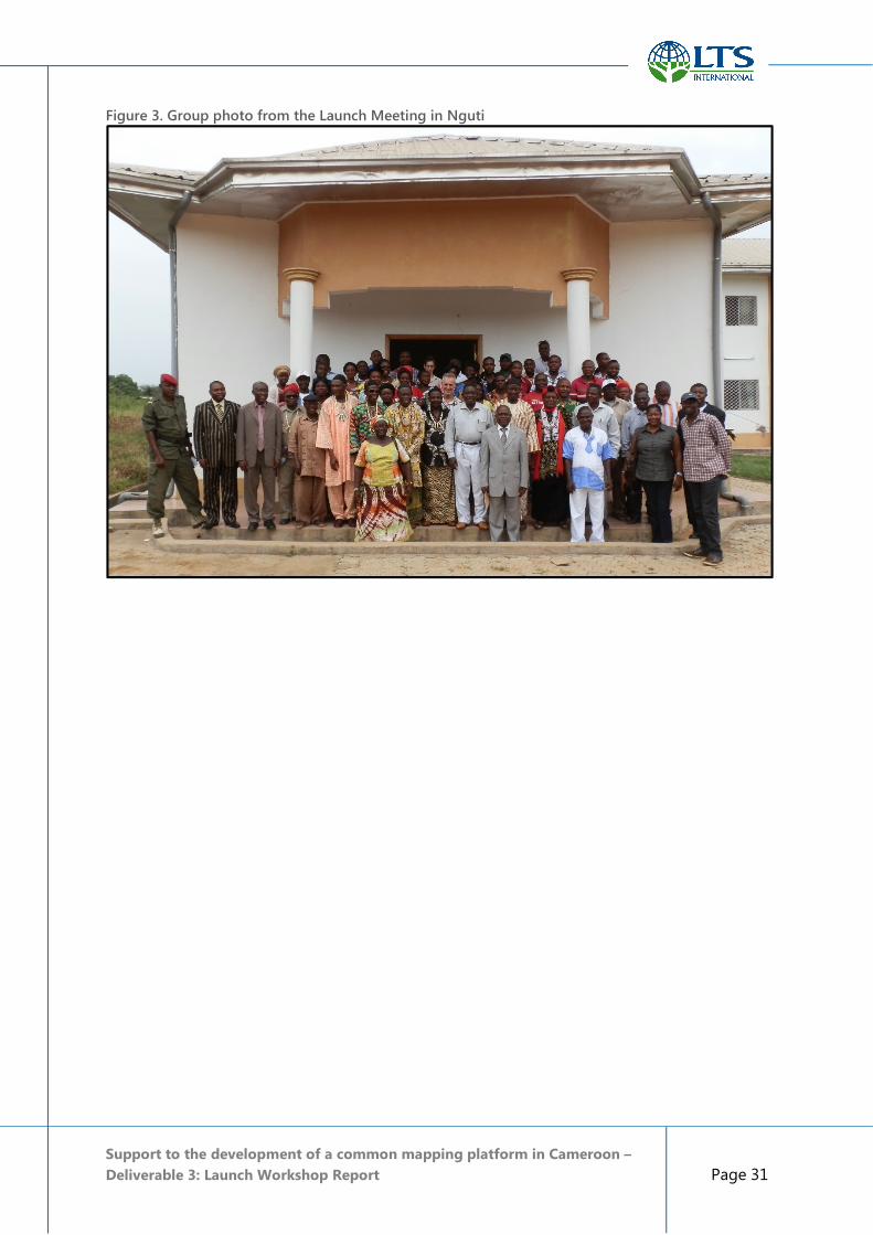
Support to the development of a common mapping platform in Cameroon –
Deliverable 3: Launch Workshop Report Page 31
Figure 3. Group photo from the Launch Meeting in Nguti

Support to the development of a common mapping platform in Cameroon –
Deliverable 3: Launch Workshop Report Page 32
5. Annexes
Annex 1. Important background information about the project
Annex 2. Letter of Minister MINEPAT to EU Ambassador approving the Project
Annex 3. Mission Schedule - 20–24 April 2015
Annex 4. Attendance list: Regional Project Launch Meeting, Conference Hall of the Regional
Delegation of MINEPAT, 21st April 2015
Annex 5. Agenda for the Buea Meeting – 21st April 2015
Annex 6. Presentation by Professor Soh Fotsing, MINEPAT Minister’s Representative, in Buea
Annex 7. Presentation by the LTS team leader, in Buea
Annex 8. Presentation by the RFUK Project Partners, in Buea
Annex 9. Expectations for local land use planning from the perspective of Stakeholders in Nguti
Municipality – Presentation at Buea meeting
Annex 10. Agenda for the Nguti Meeting – 23rd April 2015
Annex 11. Attendance list: Project Launch Meeting, Council Hall Nguti, 23rd April 2015
Annex 12. Presentation by Prof Soh Fotsing, Minister’s Representative, in Nguti
Annex 13. Presentation by the LTS Project team leader, in Nguti
Annex 14. Presentation of Boa Plain Community mapping Experience
Annex 15. Presentation by CED / Greenpeace Project Partners, in Nguti
Annex 16. Presentation by the “Mapping and Governance in the Congo Basin” Project Partners (RFUK,
FODER and AJESH), in Nguti
Full text of the annexes is in a separate document.