photoscan - topptopo a/s · 2016-10-25 · agisoft photoscan is a stand-alone photo- ... photoscan...
TRANSCRIPT

PhotoScanFully automated professional photogrammetric kit
Agisoft PhotoScan is a stand-alone photo-grammetric software solution for automatic generation of dense point clouds, textured polygonal models, georeferenced true orthomosaics and DSMs / DTMs from still images.
Based on the state-of-the-art technology developed by Agisoft, it allows for very fast processing (typically within a couple of hours), providing at the same time highly accurate results (up to 3cm for aerial, andup to 1mm for close-range photography).
Agisoft PhotoScan is capable of processing of thousands of photos, yet all the opera-tions are performed locally, without the need to transmit the data outside the com-pany, making it ideal solution for process-ing of sensitive data.
The software package has a linear project-based workflow that is intuitive and can be easily mastered even by a non-specialist, while professional photogrammetrists have complete control over the results accuracy, with detailed report being generated at the end of processing.
CGPress Editor’s Choice Award
3D World Highly commended
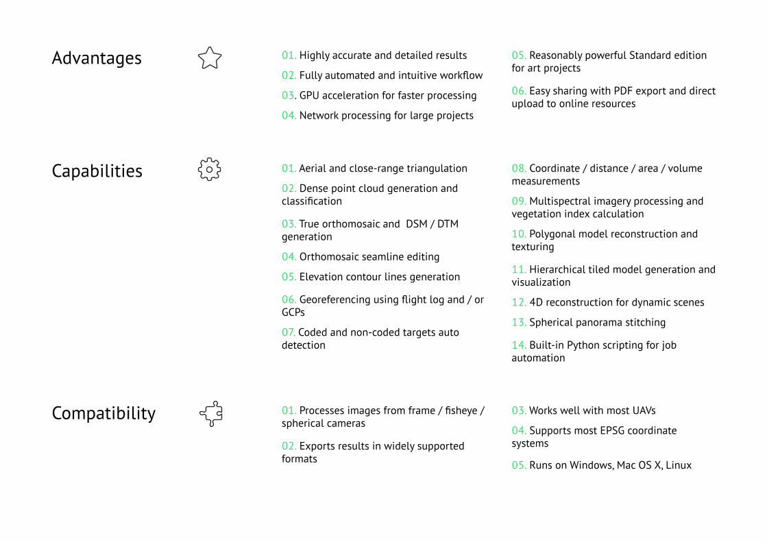
01. Highly accurate and detailed results
02. Fully automated and intuitive workflow
03. GPU acceleration for faster processing
04. Network processing for large projects
Advantages
01. Aerial and close-range triangulation
02. Dense point cloud generation and classification
03. True orthomosaic and DSM / DTM generation
04. Orthomosaic seamline editing
05. Elevation contour lines generation
06. Georeferencing using flight log and / or GCPs
07. Coded and non-coded targets auto detection
Capabilities
01. Processes images from frame / fisheye / spherical cameras
02. Exports results in widely supported formats
Compatibility
05. Reasonably powerful Standard edition for art projects
06. Easy sharing with PDF export and direct upload to online resources
08. Coordinate / distance / area / volume measurements
09. Multispectral imagery processing and vegetation index calculation
10. Polygonal model reconstruction and texturing
11. Hierarchical tiled model generation and visualization
12. 4D reconstruction for dynamic scenes
13. Spherical panorama stitching
14. Built-in Python scripting for job automation
03. Works well with most UAVs
04. Supports most EPSG coordinate systems
05. Runs on Windows, Mac OS X, Linux
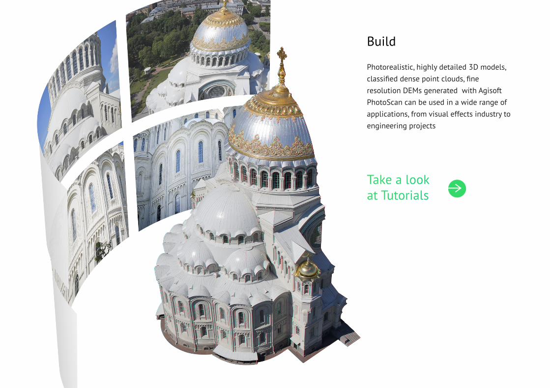
Photorealistic, highly detailed 3D models, classified dense point clouds, fine resolution DEMs generated with Agisoft PhotoScan can be used in a wide range of applications, from visual effects industry to engineering projects
Build
Take a lookat Tutorials

High accuracy of polygonal models and DSMs reconstructed with Agisoft PhotoScan guarantees precise area and volume mea-surements. Multispectral imagery process-ing and NDVI index calculation supportmake it a valuable tool for precision agri-culture projects
Measure
Take a lookat Articles

Network processing capability of Agisoft PhotoScan allows to efficiently reduce com-putation time while working with massive data. Optimized hierarchical tiled model format provides for city-scale modeling and visualization on a medium range lap-top using Agisoft Viewer included in the photogrammetric kit.
Visualize
Take a lookat Showcase
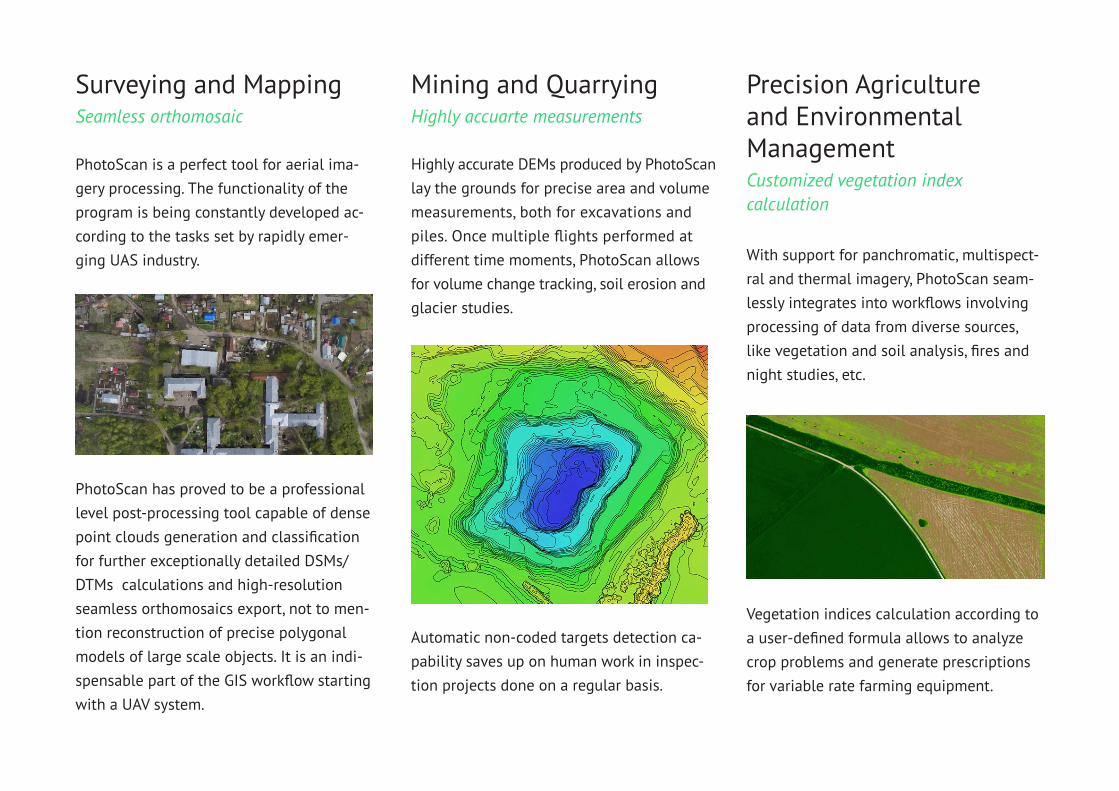
PhotoScan is a perfect tool for aerial ima-gery processing. The functionality of the program is being constantly developed ac-cording to the tasks set by rapidly emer-ging UAS industry.
Highly accurate DEMs produced by PhotoScan lay the grounds for precise area and volume measurements, both for excavations andpiles. Once multiple flights performed at different time moments, PhotoScan allows for volume change tracking, soil erosion and glacier studies.
Surveying and MappingSeamless orthomosaic
Mining and QuarryingHighly accuarte measurements
With support for panchromatic, multispect-ral and thermal imagery, PhotoScan seam-lessly integrates into workflows involving processing of data from diverse sources, like vegetation and soil analysis, fires and night studies, etc.
Precision Agricultureand EnvironmentalManagementCustomized vegetation index calculation
PhotoScan has proved to be a professional level post-processing tool capable of dense point clouds generation and classification for further exceptionally detailed DSMs/DTMs calculations and high-resolution seamless orthomosaics export, not to men-tion reconstruction of precise polygonal models of large scale objects. It is an indi-spensable part of the GIS workflow starting with a UAV system.
Automatic non-coded targets detection ca-pability saves up on human work in inspec-tion projects done on a regular basis.
Vegetation indices calculation according to a user-defined formula allows to analyze crop problems and generate prescriptions for variable rate farming equipment.
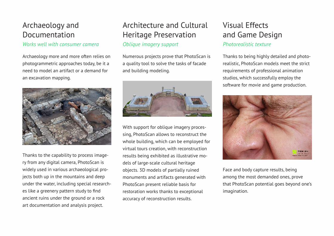
Archaeology more and more often relies on photogrammetric approaches today, be it a need to model an artifact or a demand for an excavation mapping.
Archaeology and DocumentationWorks well with consumer camera
Architecture and Cultural Heritage PreservationOblique imagery support
Thanks to being highly detailed and photo-realistic, PhotoScan models meet the strict requirements of professional animation studios, which successfully employ the software for movie and game production.
Visual Effectsand Game DesignPhotorealistic texture
Thanks to the capability to process image-ry from any digital camera, PhotoScan is widely used in various archaeological pro-jects both up in the mountains and deep under the water, including special research-es like a greenery pattern study to find ancient ruins under the ground or a rockart documentation and analysis project.
With support for oblique imagery proces-sing, PhotoScan allows to reconstruct the whole building, which can be employed for virtual tours creation, with reconstruction results being exhibited as illustrative mo-dels of large-scale cultural heritage objects. 3D models of partially ruined monuments and artifacts generated with PhotoScan present reliable basis for restoration works thanks to exceptional accuracy of reconstruction results.
Face and body capture results, being among the most demanded ones, prove that PhotoScan potential goes beyond one’s imagination.
Numerous projects prove that PhotoScan is a quality tool to solve the tasks of facade and building modeling.
Agisoft PhotoScan 1.2
More powerfuland more flexibleAgisoft PhotoScan version 1.2 presents orthomosaic editor window with support for orthomosaic/DEM preview, seamline editing, NDVI calculation and DEM-based measurement tools. New orthomosaic export formats and direct web publishing facilitate software inte-gration in a wide variety of workflows. Improved tie point locali-zation and seamline selection strategy guarantee more accurateand clean results.
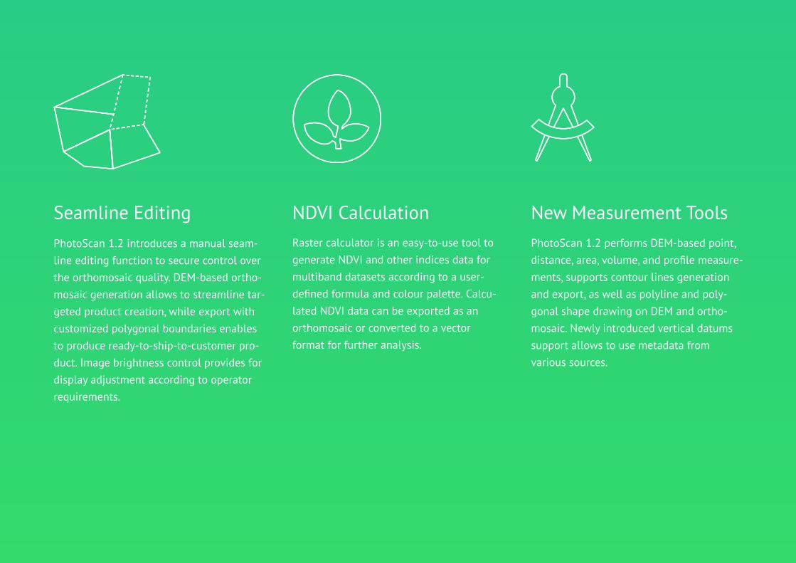
PhotoScan 1.2 performs DEM-based point, distance, area, volume, and profile measure-ments, supports contour lines generation and export, as well as polyline and poly-gonal shape drawing on DEM and ortho-mosaic. Newly introduced vertical datums support allows to use metadata from various sources.
Raster calculator is an easy-to-use tool to generate NDVI and other indices data for multiband datasets according to a user-defined formula and colour palette. Calcu-lated NDVI data can be exported as an orthomosaic or converted to a vector format for further analysis.
PhotoScan 1.2 introduces a manual seam-line editing function to secure control over the orthomosaic quality. DEM-based ortho-mosaic generation allows to streamline tar-geted product creation, while export with customized polygonal boundaries enables to produce ready-to-ship-to-customer pro-duct. Image brightness control provides for display adjustment according to operator requirements.
Seamline Editing New Measurement ToolsNDVI Calculation
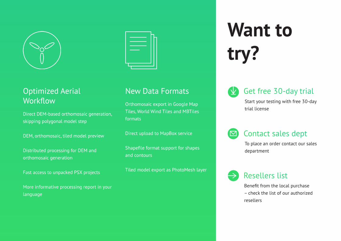
Direct DEM-based orthomosaic generation, skipping polygonal model step
DEM, orthomosaic, tiled model preview
Distributed processing for DEM and orthomosaic generation
Fast access to unpacked PSX projects
More informative processing report in your language
Orthomosaic export in Google Map Tiles, World Wind Tiles and MBTiles formats
Direct upload to MapBox service
Shapefile format support for shapes and contours
Tiled model export as PhotoMesh layer
Optimized Aerial Workflow
New Data FormatsStart your testing with free 30-day trial license
Want to try?
To place an order contact our sales department
Benefit from the local purchase – check the list of our authorized resellers
Get free 30-day trial
Contact sales dept
Resellers list

© 2015 Agisoft LLC
11B Degtyarniy per., St. Petersburg, Russia, 191144
www.agisoft.com