pioneers and problems of early american...
TRANSCRIPT

STEVEN L. RICHARDSON Magna, UT 84044
Pioneers and Problems of Early American Photogrammetry
Early efforts to introduce photographic surveying in the United States were met with resistance.
INTRODUCTION
I N THE FIRST MONTHS of 1892 a Topographical Conference was organized at the office of the U.S .
Coast and Geodetic Survey in Washington, D.C. (Figure 1) "in order to promote a better understanding among topographers of the Survey with regard to methods of executing field and office work; to formulate rules for governing topographic work on specified scales for typical regions; to consider the question of improvements in the plane-table; what other instruments might be valuable as
was concerned with all phases of map production. Photogrammetry was not a major subject of discussion at the meetings, but this was the first serious attempt by an agency of the United States Government to consider incorporating it as a part of its mapping program. From our perspective today we may view this as inevitable, but it was not so clear to the topographers gathered at the offices of the U.S . Coast and Geodetic Survey in 1892.
It should be noted that during this period the plane table (Figure 2) was undergoing a rapid evolution in design, and the topographers who were
AasTRACT: A book published in the United States in 1906 gives the following chronology: "Photography has been extensively applied to surveys of rugged mountain regions in Italy, Austria, Russia, Canada, and Alaska with great success. The phototopographic method, originally devised by Colonel Laussedat, found its first application in France and in Germany . ... More recently photographic surveys have been executed in Greece, Spain, Portugal, Norway, Belgium, Mexico, Chile, Peru, Brazil, Argentine Republic, Switzerland, Australia, England, Africa, and more recently still in the United States . ... "(Flemer, 1906, p. 4)
This paper concerns itself with how the United States happened to find itself at the bottom of the list, a process too complex to be covered in an abstract, except perhaps to point out that ( a) the plane table had proven itself to be so versatile an instrument that no other methods seemed to be necessary, and (b) most of the U.S. Government mapping agencies were convinced that the above statement was true.
auxiliaries, and how far photogrammetry would be a useful auxiliary .... " (Mendenhall, 1892, Part I, p . 9)
The Conference continued daily from 18 January until 7 March. There were eleven participants at the Conference, and, in addition, nine others responded to a circular letter inviting them to express their views on topography. It is doubtful that any of the Coast Survey topographers who participated in the Conference are still living, but fortunately for us the proceedings were published in the Report of the Superintendent of the U.S. Coast and Geodetic Survey for 1891, Part II, as Appendix No. 16. Examination of this report reveals that the conference
PHOTOG RAMMETRIC ENGINEERING AND REMOTE SENSING ,
Vol. 50, No. 4, April 1984, pp. 433-450.
using it were gaining a high degree of competency and confidence in its use (Rabbitt, 1980, pp. 134, 137). In this regard, it should not be surprising to find the camera frequently unfavorably compared to the plane table . For example, Assistant John W. Donn made the following remarks at the Conference:
"The camera, in connection with the plane table, may be occasionally usefully employed in the representation of the profiles of mountains and hills in bold relief. It can not be said that its sphere of usefulness is in any case so great as to make it a formidable rival to the plane table .... "
"We may rest satisfied that in the plane table we
0099-l l 12/84/5004-0433$02. 25/0 © 1984 American Society of Photogrammetry
434 PHOTOGRAMMETRIC ENGINEERING & REMOTE SENSING, 1984
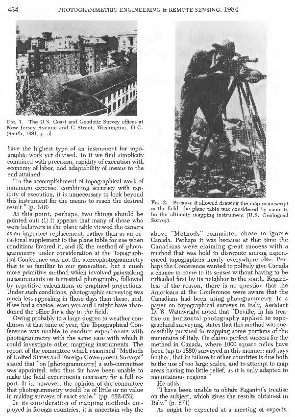
Frc . 1. The U.S. Coast and Geodetic Survey offices at New Jersey Avenue and C Street, Washington, D.C. (Smith, 1981, p. 5).
have the highest type of an instrument for topographic work yet devised. In it we find simplicity combined with precision, rapidity of execution with economy of labor, and adaptability of means to the end attained.
"In the accomplishment of topographical work of minimum expense, combining accuracy with rapidity of execution, it is unnecessary to look beyond this instrument for the means to reach the desired result." (p. 646)
At this point, perhaps, two things should be pointed out: (1) it appears that many of those who were believers in the plane table viewed the camera as an imperfect replacement, rather than as an occasional supplement to the plane table for use when conditions favored it; and (2) the method of photogrammetry under consideration at the Topographical Conference was not the stereophotogrammetry that is so familiar to our generation, but a much more primitive method which involved painstaking measurements on terrestrial photographs, followed by repetitive calculations or graphical projections. Under such conditions, photographic surveying was much less appealing in those days than these, and, if we had a choice, even you and I might have abandoned the office for a day in the field.
Owing probably to a large degree to weather conditions at that time of year, the Topographical Conference was unable to conduct experiments with photogrammetry with the same ease with which it could investigate other mapping instruments. The report of the committee which examined "Methods of United States and Foreign Government Surveys" stated that "on [photogrammetry J a sub-committee was appointed, who thus far have been unable to make the field experiments necessary for a full report. It is, however, the opinion of the committee that photogrammetry would be of little or no value in making surveys of exact scale." (pp. 652-653)
In its consideration of mapping methods employed in foreign countries, it is uncertain why the
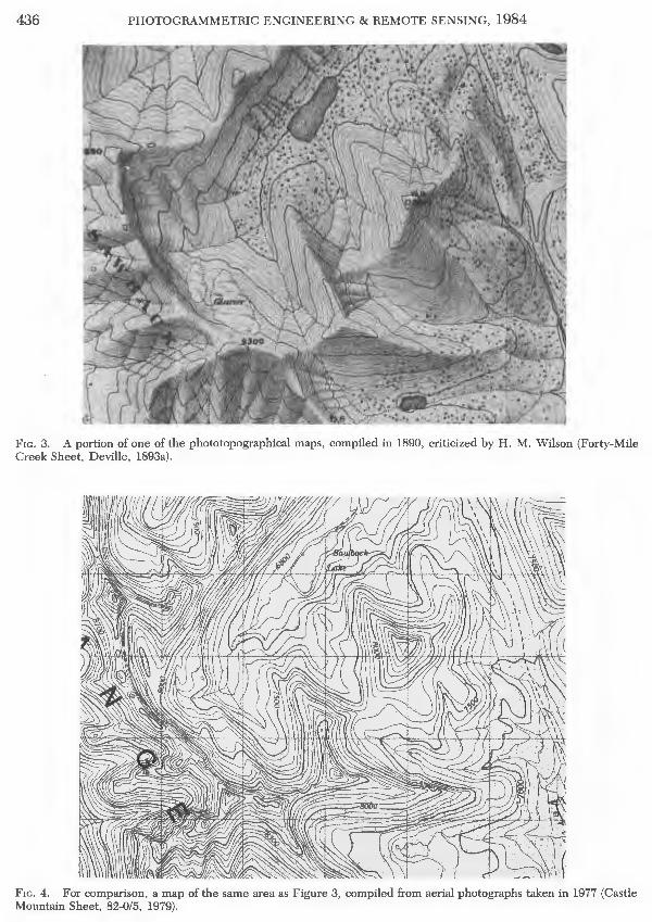
Frc. 2. Because it allowed drawing the map manuscript in the field, the plane table was considered by many to be the ultimate mapping instrument (U.S. Geological Survey).
above "Methods" committee chose to ignore Canada. Perhaps it was because at that time the Canadians were claiming great success with a method that was held in disrepute among experienced topographers nearly everywhere else. Perhaps the Conference wanted to politely give Canada a chance to come to its senses without having to be ridiculed first by its neighbor to the south. Regardless of the reason, there is no question that the Americans at the Conference were aware that the Canadians had been using photogrammetry. In a paper on topographical surveys in Italy, Assistant D. B. Wainwright noted that "Deville, in his treatise on horizontal photography applied to topographical surveying, states that this method was successfully pursued in mapping some portions of the mountains of Italy. He claims perfect success for the method in Canada, where 1000 square miles have been (up to 1889) surveyed in this manner; and says further, that its failure in other countries is due both to the use of too large scales, and to attempt to map areas having too little relief, as it is only adapted to mountainous regions."
He adds: "I have been unable to obtain Paganini's .treatise
on the subject, which gives the results obtained in Italy." (p. 671)
As might be expected at a meeting of experts,

PROBLEMS OF EARLY AMERICAN PHOTOGRAMMETRY 435
there was some diversity of opinion. Assistant J. A. Flemer submitted a paper on photogrammetry (Flemer, 1892) in which he expressed some views not in conformity with those above:
"By mastering photography and combining it with geodetical instruments, the idea of photographical surveying has become a reality, and at this date must be regarded as a subservient factor in modern engineering no longer to be overlooked. . . . (p. 693)
"The photogrammetric plotting is altogether very much like the plotting on the plane table, and, generally speaking, photogrammetry has the same advantages and disadvantages adherent to the plane table, except that the duration of the field work is reduced to a minimum." (p. 702)
John A. Flemer did not express his conflicting viewpoint out of ignorance. Though he was born in 1859 in New York City, at the age of eleven his parents sent him to Germany to receive his education. He was given a degree in civil engineering from the Royal Technical High School, a university, at Charlottenburg, near Berlin in 1881 (Flemer, 1981). Because Germany was at that time leading the world in photogrammetric research, especially on an academic level, Flem er' s education almost certainly included training in photogrammetry.
It is likely that Flem er' s presence at the Conference tempered what could possibly have been a judgement against even investigating photogrammetry. Assistant D. B. Wainwright, in reporting the findings of the committee on photographic surveying from balloons, added:
"It is not to be inferred from the criticism of the present plan that your committee holds an unfavorable opinion of all photography as applied to surveying. It believes a reasonably accurate map, of small scale could be made of a flat or gently rolling country from a balloon at the height of several thousand feet, if only a balloon were susceptible of management at that height. It also believes that the question of mapping mountainous regions by means of cameras directed horizontally is worthy of discussion and investigation." (p. 706)
Among the list of conclusions reached by the Topographical Conference at its close was a decision "that photography may be found at times a useful auxiliary, but under ordinary circumstances can not compete with the plane-table in rapidity, economy, or accuracy." (p. 580) During the Conference a subcommittee had been formed to investigate photogrammetry (John A. Flemer was not a member), and the Conference also recommended "the continuance of the committee on photographic surveying, that it may conclude its investigations." (p. 580)
When the Topographical Conference ended, it had investigated, as much as it could, every aspect of topographical mapping, and the findings that were made then had a very real effect on the appearance and style of the maps we use today. If the
Conference deliberately chose to ignore Canada and what seemed to be its unreasonable commitment to phototopography, it did so to avoid passing judgement on a subject it knew little about.
"A VERY INDIRECT WAY OF MAKING A MAP"
Although Canadian phototopography seems to have been a forbidden subject at the Topographical Conference, American topographers were by no means unaware of what was going on up in Canada. An article appeared in the 8 February 1893 issue of the National Geographic Magazine which gives us a very good idea of what was going through at least some of their minds. It was written by the Geographer and Chief Engineer of the U.S. Geological Survey, Herbert Michael Wilson (1860-1920):
"Some two years ago a book on the subject of photographic surveying by Mr. E. Deville, surveyor general of Canada, was issued by the Oominion land office. Apparently this is a book of instructions, and treats exhaustively of the methods of photographing and of using photographs for constructing maps therefrom.
"Since few are acquainted with this subject, it may be well to characterize briefly the method of surveying by photography. A few points, including all occupied stations, are located by angular measurements. From the occupied points, photographs of the surrounding topography are taken, a complete round of the horizon usually being made from each station. Devices are employed for facilitating the measurement of horizontal and vertical angles from the photographs, and the photographs are sent to the central office at Ottawa, where maps are constructed from them. Angles are measured from the photographs, and thus all points for location are fixed, their heights determined and contour lines located.
"To topographers on the southern side of the boundary this appears to be a very indirect way of making a map. Most of those who have studied the subject are aware that this method has been experimented with by several countries and discarded by all except Italy and Canada. The topographers of all other countries are accustomed to making maps directly in the field, using the country itself as copy, and not passing it through the medium of a photograph. By this simple and direct method it is believed that a more lifelike transcript of the original can be obtained, and, moreover, that the work can thus be done more rapidly and at less expense.
"A few sheets recently issued by the Dominion land office appear to sustain this position. They are lithographed on a scale of 1:40,000, relief being expressed by contours at intervals of 100 feet and by shading. They represent a portion of the Rocky mountain region on the line of the Canadian Pacific railway. In many respects these maps are very creditable productions. A commendable attempt has been made to map a wild and unknown region, and
436 PHOTOGRAMMETRIC ENGINEERING & REMOTE SENSING, 1984
F,c. 3. A portion of one of the phototopographical maps, compiled in 1890, criticized by H . M. Wilson (Forty-Mile Creek Sheet, Deville, 1893a).
Fie. 4. For comparison, a map of the same area as Figure 3, compiled from aerial photographs taken in 1977 (Castle Mountain Sheet, 82-0/5, 1979).

PROBLEMS OF EARLY AMERICAN PHOTOGRAMMETRY 437
the use of hill shading, combined with contours, is a move toward giving a graphic presentation of the appearance of the country ....
"There are, however, some serious defects in these maps. The representation of the topographic features is hardly natural (Figures 3 and 4). There is a want of detail and little suggestion of the ruggedness of the country ....
"Apparently but a small number of stations were occupied in mapping the country. On one of these sheets in particular, the Anthracite sheet, but one station appears to have been occupied in a total area of 65 square miles. The expense of this work, eight dollars per square mile, is double that of work on a scale of 2 miles to the inch on this side of the boundary, with which it may be compared." (Wilson, 1893)
"FoR Tms THE METHOD Is NoT TO BLAME"
The World's Columbian Exposition began in Chicago in October, 1892 to celebrate the 400th anniversary of Columbus' discovery of America, and an invitation was given to all nations on Earth to participate. As might be expected, Americans made up the majority of the visitors to the fair, which included numerous buildings exhibiting the pride of every state and territory of the Union, and of every country in the world.
Of special interest to us, of course, is how photogrammetry enters into this . As might be expected, France and Germany proudly displayed the cameras and equipment manufactured in their own countries (Flemer, 1895, pp. 41, 115), but of even more interest to the average American was the Canadian building (Figure 5), where" ... a phototopographic map of a part of the Rocky Mountain Park, comprising a dozen sheets of about sixty square miles each, published on a 1:40000 scale, formed one of the most interesting exhibits of the government of the Dominion of Canada. The topography on each sheet was obtained, on an average, from sixteen stations , giving from seventy to one hundred and twenty panorama views. Six complete panoramas were taken, on an average, from stations situated within the limits of the topography mapped on each sheet and the development of the terrene was controlled by about ten additional camera stations falling outside of the actual sheet margin and furnishing ten additional panoramas. " (Flemer, 1906, pp. 29-30)
The maps were accompanied by a leaflet describing in general terms how they were made, and noting that the mapping progress by the end of 1892 had covered over 2000 square miles, increasing by about 500 square miles each year. The leaflet also responded to Mr. Wilson's criticism: "Some remarks in an American publication about one of the published sheets (Anthracite) led to a special examination of that sheet which may be given by way of illustration. The area is 63 square miles . The plot
was made from six stations inside and eleven stations outside of the sheet. One thousand and seventy-five points were fixed by intersection or by constructions equivalent in accuracy; they were taken from thirty-five photographic views. This corresponds to seventeen points per square mile; there would be no difficulty in fixing more points and obtaining greater accuracy; the only limit is the time which can be devoted to the plotting. The rule adopted here is that the topographer and his assistant must plot the surveys of the preceding season before they start again for the field. If at any time, a more detailed plan of a particular locality were required, it could be prepared from the same views without going back on the ground." (Deville, 1893b, pp. 5-6)
Deville concluded his pamphlet with the following caution:
"But it must not be understood that every photographic survey must prove a success or that a failure after a first trial indicates that the method is defective. The fact is that it requires not only experience, but also a combination of those faculties which make an accomplished topographer. Unlike other methods , he has nothing before his eyes to show the progress of the work or the gaps that may exist in it. His undeveloped plates are his only records; so every time he exposes one, he must have present in his mind what it will give, what amount of information he will extract from it, what constructions he will apply, what further views are necessary and how they will combine together. These acquirements are not the lot of every surveyor and unless the man is well qualified, his attempts at photographic surveying will not be successful. For this the method is not to blame; if properly used, it will give results far beyond what could be accomplished by any other process. " (Deville, 1893b, p. 7)
Fie. 5. Canadian Building at the World's Columbian Exposition (Truman, 1893, p. 530).

438 PHOTOGRAMMETRIC ENGINEERING & REMOTE SENSING, 1984
Fie. 6. William Frederick King (1854-1916) (Public Archives Canada PA 12444).
" ON A S CALE TO APPAL Wntt hs MAGNITUDE"
An international controversy very quickly turned the philosophical argument over the relative merits of photographic surveying into an actual experiment where American plane tables and Canadian cameras were at the same time applied to a very difficult mapping problem, the International Boundary Survey. The controversy concerned the exact location of the boundary separating Alaska from British Columbia. It seems that in 1825, when a treaty was signed by Russia and Great Britain, neither country knew very much about the unexplored territory that they were passing a boundary line through, and so neither country was concerned that the wording in the treaty was vague. Toward the latter part of the 19th Century, however, the United States had bought up Russia's interest in Alaska, and both the United States and Canada were becoming increasingly aware of Alaska's abundant natural resources, so the exact location of a boundary line became more urgent.
The problem was a difficult one. According to Deville:
"All that was known of the country in the eighteenth century was that it was a mountainous district, and in order to indicate that, the cartographers of that time represented a chain of mountains following the curve of the coast. Guided by these maps, the governments concerned had adopted a frontier following the crests of mountains along a line parallel to the coast, but wherever the line was more than ten nautical miles [actually ten marine
Fie . 7. Edouard Gaston Daniel Deville (1849-1924) (Pubhc Archives Canada C 9231).
leagues, or thirty nautical miles] from the ocean the frontier was taken parallel to the curved line of the coast, being never more distant from it than ten nautical miles [sic]. The United States maintained that the mountain range did not exist, and, therefore, claimed a belt of ten nautical miles [sic] in width along the coast. In 1892 a Commission was appointed to study the territory in dispute, and was given three years to make its report. As the United States had denied the existence of mountains parallel to the coast, it was necessary for Canada not only to affirm their existence, but to indicate the situation of these mountains. A fairly exact map of the country was therefore required. The length of the frontier being about 1,000 kilometres, a topographical survey of this district of mountains and glaciers was a formidable task, seeing that it had to be completed in three short summer seasons; also owing to the climatic conditions in these latitudes there is almost continuous rain, and the mountains are most frequently enveloped in clouds." (Deville, 1910)
When the Canadian Boundary Commissioner, William F. King (Figure 6) , decided to apply phototopography under these difficult conditions, even Deville (Figure 7) could scarcely endorse his choice. In a letter to A. M. Burgess, Deputy Minister of the Interior, dated 10 October 1894, Deville recalled that " ... when Mr. King told me that he intended to use photography for the Alaska surveys, I expressed some doubt on the success of the experiment on account of the prevalence of rain on the coast. I did not consider that it would be wise

PROBLEMS OF EARLY AMERICAN PHOTOGRAMMETRY 439
Fie. 8. James Joseph McArthur (1856-1925) (Public Archives Canada PA 12444).
to depend exclusively upon photography and I thought that the equipment of the parties should be such as to permit resorting to other methods, should photography fail." (Public Archives Canada, Record Group 88, Volume 93, file 1375; hereafter cited as PAC RG88 V93 fl.375)
A lively account of the first year of the Boundary Survey was written by James J. McArthur (Figure 8), one of the earliest Canadian phototopographers. He wrote that
"When in 1892, the question of establishing the boundary between the United States, territory of Alaska, and the Canadian North west came to be discussed, very little was known of the country beyond what could be seen from the deck of a coasting vessel. A few rivers had been explored, but the topographical information gained was very limited.
"As a preliminary to the laying down of the boundary, it was decided by the two governments to make a joint survey of the country within ten marine leagues of the coast, which was the limit within which the boundary might be interpreted to lie. The commissioners were allowed two years in which to perform this gigantic task, for it was known to be a region of glaciers and snowfields of avalanches and precipices on a scale to appal with its magnitude.
"To the Canadian commission was allotted the topographical exploration of the mountainous portion, while the Americans, made the survey of the shore line.
"Her Majesty's Commissioner decided to adopt the system of Photo-topography which had been so
successfully introduced by Capt. E. Deville Surveyor General of Canada, for the Survey of the Rocky Mountains, and by which a large area of that rugged country had already been accurately mapped. The writer who had been carrying on the Photo-topographical survey under the instructions of Captain Deville was detailed to accompany the Commissioner. Six other surveyors were engaged and before starting a month was spent instructing them in the methods of survey, manipulation of instruments, science of photography &c. We were divided into seven parties, each to consist of the Surveyor in charge and five assistants to be joined on the ground by one American officer and an assistant. We reached our field of operations on May 12th 1893. The parties were distributed along the coast and to each was allotted a portion of the work. During the summer months the rainfall in Alaska is very heavy, and it was thought by many that we would not succeed with photography, but our experience has proved that in a mountainous country when the conditions are unfavorable for the taking of views they are also unfavorable for any other method of survey. The coast line of Alaska is much broken by deep fiords and the mountains rise abruptly from the waters edge.
"At the time of our arrival the country still bore a wintry aspect, the mountains being completely covered with snow. To penetrate to the ten league limit, after hauling our canoes as far as practicable up the streams which empty into the deep inlets, we were obliged to carry our instruments provisions &c. for long distances across glaciers and snowfields. We had a very wet season, it rained sometimes for ten days at a time, and we had to make the most of the short spells of fine weather. We usually made a camp at the foot of the mountain which we had to ascend, and as soon as the rain ceased and it showed signs of clearing, we started for the summit, sometimes as early as 2 A. M. We often reached the top about 9 O'clock and remained in mist all day hoping that it might clear; only to be obliged to descend without having accomplished anything. It sometimes happened that the clouds would lift like magic, and the landscape be revealed for a short time, during which we would hasten to take the views and make our observations; we would have, perhaps, but a small part of our work accomplished, when the fog would as suddenly envelope us, and we would have to await the next lift to continue. It often took us from three to eight hours to complete our observations, on many occasions, after shivering with cold all day on the summits, we had to return to camp and there await another opportunity.
"On this expedition, the superiority of the camera over any other instrument for mountain work was strikingly demonstrated. Our American colleagues were equipped with the plane table, and except on very find days were unable to accomplish any-

440 PHOTOGRAMMETRIC ENGINEERING & REMOTE SENSING, 1984
thing. We could secure, in a few minutes with our cameras, more topographical data, than could be accomplished in this rough country by any other method in as many weeks." (PAC RG88 V91 fl261)
Under these conditions, photographic surveying was proved to have an additional advantage over the plane table, because, according to Deville, "the surveyors of the Canadian commission were able to obtain 3,000 photographs from which the map was made. On the question being submitted to arbitration, they were able not only to present a map showing the mountains parallel to the coast, but, in addition, photographs of these mountains taken in all directions, thus supplying a direct answer to the objections raised by the United States. Although the decision of the arbitrators was favourable to the United States in certain respects, Canada succeeded in reducing considerably the depth of the belt granted to the States. In the absence of the photographs, undoubtedly the full ten nautical miles [sic] of country claimed would have been granted." (Deville, 1910)
"THE WoRK OF PLoTIING HAD JusT GorrEN WELL UNDER WAY"
This impressive show by the Canadians prompted the American Boundary Commissioner, usc&GS Superintendent Thomas C. Mendenhall, to take increased interest in the possibilities of photographic surveying. The first book in English on photogrammetry had been published in 1888 by an American, Lt. Henry Albert Reed (1844-1930) of the U.S. Military Academy at West Point. This book included a demonstration map representing what is probably the first photographic survey in the Wes tern Hemisphere. Unfortunately, Reed was removed from the scene in 1888 by an assignment to Europe (Reed, 1931, p. 106), and there is no record of any further involvement by him in photogrammetry. This fact, and a friendly informal invitation by the Canadians, led to an assignment for Assistant John A. Flemer (Figure 9) to travel to Canada. In a memo to Dr. Mendenhall dated 9 December 1893, Flemer gave an account of his visit:
"Sir: In obedience to your instructions of the 13th ult. to proceed to Ottawa, Canada, to investigate and study the Canadian methods of phototopographic plotting, I left Washington Nov. 14th and arrived in Ottawa, Nov. 16th meeting Dr. W. F. King, Alaskan Boundary Commissioner to H.M. the same day.
"The plotting from photographs taken in S. E . Alaska had just been commenced by Dr. King's Assistants, under charge of Mr. J. J. McArthur, whose past experience in phototopography, gained in the topographical survey of the Rocky Mountains under Capt. E. Deville, Surveyor General of the Dominion of Canada, is of great value in this Alaskan work.
Frc. Y. John Adolph Flemer (1859-1957) (Carl F. Flemer, Jr.) .
"The enlarged prints from the negatives had been but partially completed and the work of plotting had just gotten well under way when I left Ottawa for Washington. During my week's stay at Ottawa I visited Capt. E. Deville, Surveyor General and chief promoter of the photographic method of surveying in Canada, who gave me much valuable information and showed me many attentions facilitating my duties greatly.
"The Canadian cameras, made by J. H . Dallmeyer (No. 25 Newman Str., London W.) were supposed to be all alike in every particular. Practically, however, it seemed impossible to reach such uniformity in their mechanical manufacture, each lens differing a little from the others and it became necessary to determine the constants for each camera separately." (U.S. National Archives, Record Group 23, Entry 22, Letters Received from Assistants 1893 E-L)
He then described the method the Canadians used to calibrate the cameras, which involved photographing the Parliament Building "from a window sill in the upper story of the Langevin Building," and projecting rays graphically from an enlarged print to various features of the building on an enlarged plan to determine the focal length of each camera. Mr. Flem er' s memo was accompanied by a lengthy manuscript detailing the Italian and Canadian methods, and referring to the French, German, and Austrian phototopographical equipment (Flemer, 1895).
Experimenting with photography had been Edouard Deville' s hobby for about a year before his

PROBLEMS OF EARLY AMERICAN PHOTOGRAMMETRY 441
survey crews moved westward from the prairies into the Canadian Rockies in 1886. At first, Deville directed his attention toward using photography to illustrate the surveyor's reports (Thomson, 1967, p. 137), but the difficulties they faced in their mapping activities led him the following year to consider a more daring application for photography. Photographic surveying had fallen into disfavor by the time Deville began to study it (Deville, 1889, p. 7). He was able to succeed where others had failed by remembering that, in theory, the laws of perspective geometry work; any failure to make them work in practice must be blamed on the equipment or the methods, not the theory. Using this approach, Deville had by the start of the field season, 1888, developed a practical technology, and additional improvements to speed or improve the process were constantly being tested during the years that followed. What resulted was a species of photogrammetry that was radically different from anything practiced in Europe. There can be little doubt that at that time Canada led the world in photogrammetric research. There can also be little doubt that, with only a few exceptions, European photogrammetrists were largely unaware of what was going on in Canada, partly because of language barriers, and partly because they were widely separated from each other, both geographically and philosophically.
As he had demonstrated at the Topographical Conference, J. A. Flemer was well acquainted with the complex methods of German photogrammetry, but he quickly saw the advantages of the simple Canadian techniques, and he made them his own.
Because the photogrammetric methods of those days were greatly different from today's procedures, a brief description of the Canadian methods may prove useful. The earliest cameras, such as those used on the International Boundary Survey, were adapted from commercial instruments, not originally intended for surveying (Figure 10), which Deville described as being " . . . merely a rectangular box of mahogany firmly bound in brass, one face having a hole for the lens and the opposite one being left open to receive the plate holder. The size is the English half plate, 43/4 x 61/2 inches. The box is constructed with great care, the faces being perfectly plane and as nearly parallel and perpendicular to each other as they can be made ... .
"The lens is a Dallmeyer wide angle, No. LA., of 55/s inch focus : with the half plate employed, it gives an angle of 45° in one direction and 60° in the other (Figure 11).
"Three levelling screws, forming part of the head of the tripod, serve to level the camera. Once levelled, it may be turned around, the screw fixing it to the tripod acting as an axis; it remains tolerably level during the revolution." (Deville, 1889, p . 224)
About 1895 Deville designed and had constructed a more specialized instrument, which was to become the workhorse of Canadian surveys until the
F,c. 10. Early Canadian survey camera (Public Archives Canada C 5182).
1930's (Figure 12), and which compares favorably to modern terrestrial survey cameras. This camera had a wide angle Zeiss anastigmatic lens of 141 mm focal length, which projected the image onto photographic glass plates of the same dimensions as above (Figure 13). The new camera was composed of two boxes, one nesting inside the other. The inner box was of aluminum with the lens attached to the front and open at the back, with four small notches acting as the fiducial marks and eight more measuring out the focal length of the camera horizontally, and half the focal length vertically (Figure 14). Cross levels were permanently affixed to the aluminum box. The outer box was of well seasoned mahogany and served the function of protecting the inner box from damage while allowing access to its various features. As with the earlier camera, the angle of view was marked on the outside of the outer box to aid in aiming the camera. Just prior to exposure, the surface of the photographic plate was placed in contact with the rim of the aluminum box by means of a screw, which allowed the images of the twelve marks to become a part of the image during exposure (Deville, 1895, pp. 139-141).
The most important factor which made the Canadian procedure a success was the fact that Deville had developed some foolproof methods by which the camera's calibration could be checked in the field. It is especially because of this that the surveyors who used it developed a liking for phototopography; they had confidence that what they were doing would likely not have to be repeated.

442 PHOTOGRAMMETRIC ENGINEERING & REMOTE SENSING, 1984
F,c. 11. Photograph taken with camera similar to Figure 10 by J. J. McArthur (Public Archives Canada PA 37710).
All the surveyor had to do when he arrived at the summit of a particular mountain peak was to unpack and assemble his survey equipment, sketch and make theodolite readings of various peaks and features, then carefully replace the theodolite with the
Fie. 12. Deville's later survey camera, developed in 1895 (Public Archives Canada C 11611).
camera, expose a complete or partial panorama of six or less views, repack his equipment, and descend.
The bulk of the work took place in the office at Ottawa during the winter months. First, the negatives were developed and enlarged 2.1 times to fill 91/2 by 13 inch bromide paper, the largest sheets available commercially at that time. Either by coincidence or design, when the enlarged print was held at the usual viewing distance of about ten inches, the view represented itself to the surveyor very much as it had in the field, which was certainly an aid in helping him to select the best views of the area to be mapped. The prints were first carefully checked for distortion by comparing the focal length marks along the edge of the print. If they indicated little distortion as a result of the enlargement process, a pair of prints was selected covering the same area from different camera stations, and a number of points common to each was located, pricked with a needle, and identified with a number or letter in red ink. The points were next transferred to strips of paper, which were to represent the film plane, and the strips of paper were placed in correct orientation upon the map manuscript, which had been prepared from the survey data. After the strips were in place the horizontal angles were projected from a pin, located at the camera station on the manuscript, along a thread, to the mark on the strip of paper. The intersection of two threads from two camera stations located the point on the manuscript. Once the distance from the point to the camera station was measured, the elevation of that point above
PROBLEMS OF EARLY AMERICAN PHOTOGRAMMETRY 443
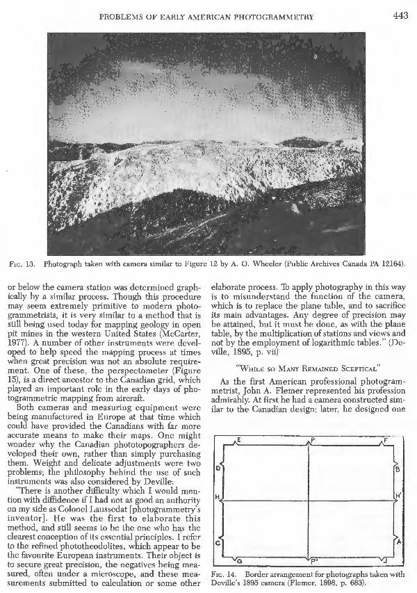
Fie. 13. Photograph taken with camera similar to Figure 12 by A. 0. Wheeler (Public Archives Canada PA 12164).
or below the camera station was determined graphically by a similar process. Though this procedure may seem extremely primitive to modern photogrammetrists, it is very similar to a method that is still being used today for mapping geology in open pit mines in the western United States (McCarter, 1977). A number of other instruments were developed to help speed the mapping process at times when great precision was not an absolute requirement. One of these, the perspectometer (Figure 15), is a direct ancestor to the Canadian grid, which played an important role in the early days of photogrammetric mapping from aircraft.
Both cameras and measuring equipment were being manufactured in Europe at that time which could have provided the Canadians with far more accurate means to make their maps. One might wonder why the Canadian phototopographers developed their own, rather than simply purchasing them. Weight and delicate adjustments were two problems; the philosophy behind the use of such instruments was also considered by Deville:
"There is another difficulty which I would mention with diffidence if I had not as good an authority on my side as Colonel Laussedat [photogrammetry' s inventor] . He was the first to elaborate this method, and still seems to be the one who has the clearest conception of its essential principles. (refer to the refined phototheodolites, which appear to be the favourite European instruments. Their object is to secure great precision, the negatives being measured, often under a microscope, and these measurements submitted to calculation or some other
elaborate process. To apply photography in this way is to misunderstand the function of the camera, which is to replace the plane table, and to sacrifice its main advantages. Any degree of precision may be attained, but it must be done, as with the plane table, by the multiplication of stations and views and not by the employment of logarithmic tables." (Deville, 1895, p. vii)
"WHILE so MANY REMAINED SCEPTICAL"
As the first American professional photogrammetrist, John A. Flemer represented his profession admirably. At first he had a came.ra constructed similar to the Canadian design; later, he designed one
E p
D B
A
G p• J
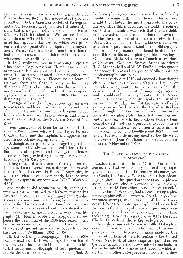
Fie. 14. Border arrangement for photographs taken with Deville's 1895 camera (Flemer, 1898, p. 683).

444 PHOTOGRAMMETRIC ENGINEERING & REMOTE SENSING, 1984
F,c. 15. Perspectometer, a perspective grid used as a guide in sketching horizontal features on the map (Bridgland, 1924, p. 44).
himself which included several improvements (Flemer, 1911). When the manuscript that he submitted following his visit to Canada had been published as a booklet, Deville wrote him:
"I have received your pamphlet on 'Phototopography as practiced in Italy and in the Dominion of Canada' and was very much interested in reading it. It will be a great convenience to English speaking people to have the Italian methods explained in their own language and the information which you give about our surveys ought to prove valuable. Very few persons realize what has been accomplished in phototopographical work: generally there is a feeling that this method, although very nice in theory, is not practical. Your paper will go a long way to dispel that impression.
"It is only during the last few years that it has come into actual practice: it cannot be reasonably expected that in such a short space of time, it will have been brought to perfection. It presents many difficulties: little by little they are being overcome and I feel satisfied that, for certain classes of work, it is the method of the future. By and by, you will receive full credit for having perceived that while so many remained sceptical." (PAC RG88 V93 fl501 19 July 1895)
Flemer went on to write an extremely detailed treatise covering all aspects of photographic surveying, which was published as an appendix to the Report of the Superintendent of the U.S. Coast and Geodetic Survey for 1897 (Flemer, 1898). Aside from his writing assignments, Flemer' s only actual
involvement in photogrammetry while with . the Coast and Geodetic Survey was a reconnaissance at the Head of Lynn Canal in 1894, the Portland Canal in 1895 (both are actually fiords along the coast of Alaska), and a survey of the Pribilof Islands in the Bering Sea in 1897 (Flemer, 1906, p. 32). Although the workmanship he demonstrated on these mapping projects was greatly admired (Sommer, 1906), there came a time when his services as phototopographer were no longer required and he was assigned to the less interesting triangulation projects and plane table surveys that formed the bulk of the Coast Survey' s work. Throughout this period he continued to collect and read the photogrammetric literature from Europe, and continued to correspond with those whom we now consider pioneers. Flemer may have felt that, as the U.S. mapping program moved into the rugged mountains of the West, the adoption of terrestrial photogrammetry was inevitable, and so kept himself current on the technology, anticipating the time when his services would be needed. If this was his hope, it never materialized. It seems that the American topographers were so stubborn that they forced the plane table to do jobs that should rightfully have been given to the camera. During this period, Flemer published many papers in scientific journals optimistically describing the progress of phototopography, apparently hoping to increase interest in it in his own country. One of these, by the way, published in 1899, was discovered many years later by Marshall S. Wright, who was so impressed by the
PROBLEMS OF EARLY AMERICAN PHOTOGRAMMETRY 445
fact that photogrammetry was being practiced in those early days that he had a copy of it typed and submitted it to the American Society of Photogrammetry "for two reasons: (1) its historical value; (2) to show that photogrammetry is not a new science" (Flemer, 1944, introduction). We can imagine the astonishment with which the members of the ASP
must have greeted that article, which was previously-unknown proof of the antiquity of photogrammetry. We can also imagine additional astonishment had the members also been informed that the man who wrote it was still living.
In 1899, while involved in a mapping project at Chesapeake Bay, Assistant Flemer and several members of his party came down with malarial fever. The sickness continued to have its effect, and in March, 1900, John A. Flemer took a leave of absence from the Coast Survey without pay (Flemer, 1900). His last letter to Deville was written many months after Deville had sent him a copy of a paper he had written (Deville, 1902). The letter, dated 20 June 1903, said:
"I resigned from the Coast Survey Service over two years ago and have tried to live in different parts of our country with a view toward regaining my health which was badly broken down, and I have now finally settled on the Northern Neck of Virginia.
"Your pamphlet had been forwarded me to the various Post Offices where I had stayed for any length of time, and this explains the apparent neglect in not acknowledging its receipt sooner.
"Although no longer actively engaged in geodetic operations, I shall always take great interest in all that may tend to perfect and develop the sciences of mensuration, particularly in every advance made in Photographic Surveying.
"I beg to take this occasion to thank you for the kind consideration shown me in the past and to wish you continued success in Photo-Topography, in which art-science you so eminently have become the leading spirit in our continent." (PAC RG88 V93 fl.501)
Apparently he did regain his health, and beginning in 1904 he returned to Alaska to resume his favorite interest, this time performing photographic surveys in connection with placing boundary monuments for the International Boundary Commission. After a few years of adventure combined with hard work, having spent too long away from his family, Mr. Flemer wrote and informed his crew before the beginning of the 1906 field season "that he was not coming north again .... He was about fifty years of age and the work had begun to be too hard for him. " (Williams, 1952, p. 35)
His last book on phototopography (Flemer, 1906) was his masterwork. It was an updated version of his 1897 work, but included the most complete historical survey and bibliography of early photogrammetric literature that had yet been compiled. A
book on photogrammetry to equal it technically would not come forth for nearly a quarter century. I said it included the most complete historical survey; while this is accurate, it should be pointed out that his humility was such that Flemer deliberately avoided making any mention of his own role in the development of photogrammetry in the United States-even to leaving his own name out as author of publications listed in the bibliography. In fact, the only names mentioned in the section describing the history of photographic surveying in Canada and Alaska who are not Canadians are those of Coast and Geodetic Survey Superintendents T. C. Mendenhall and W. W. Duffield, who guided the agency during its brief period of official interest in photographic surveying.
Flemer retired in 1910 and enjoyed a long though obscure retirement of nearly 50 years. Deville, on the other hand, went on to play a major role in the development of his country's mapping programs, and so could not be so easily forgotten. F. H. Peters, Deville's successor, recently spoke to Canadian writer Don W. Thomson "of the results of early camera survey field work in the Canadian Rockies being brought to Ottawa survey headquarters in the form of heavy glass plates (imported from England) and of plotting work in those offices being a long, complicated, tedious operation during winter months. International recognition of sorts (in Europe) began to come to Deville about 1922, ... but 'rather too late to do me any good' so Deville wryly told Peters. " (Don W. Thomson, personal communication, 9 November 1978)
"THIS OFFICE DoEs NOT UsE THE CAMERA IN SURVEYING"
Inside the conterminous United States, the agency that had responsibility for producing topographic maps of most of the country, of course, was the Geological Survey. Why didn't it adopt phototopography? To this question there is no simple answer, but a vital clue is provided by the following letter, dated 13 December 1898. One of Deville's men, Arthur 0. Wheeler, had recently set up a phototopographic office in western Canada to perform irrigation surveys, which was one of the most successful forms of phototopography. Wheeler had written to the Geological Survey requesting examples of maps and probably also offering to share technology. Over the signature of uses Director Charles D . Walcott, this is the reply he got:
"In reply to yours of November 29th, I take pleasure in forwarding you under separate cover a package of sample topographic maps made by this survey of portions of the arid regions of the United States. Nearly all of these maps are published on the uniform scale of about two miles to one inch. In the better inhabited regions and those in which irrigation and other enterprises are most active, they

446 PHOTOGRAMMETRIC ENGINEERING & REMOTE SENSING, 1984
are published on the larger scale of one mile to the inch.
"These surveys are made entirely by the planetable methods controlled by triangulation with theodolite or by primary traverse. This office does not use the camera in surveying. Our investigations and belief leads us to the conclusion that a draftsman constructing a topographic map from photographs of the terrene cannot depict its details with the same accuracy and truthfulness to nature as can the topographer who sketches the same on the planetable board with the original in view.
"Moreover, under ordinary circumstances it appears to us that little greater speed can be made in the field with the camera than with the planetable because the photographer can only occupy one or at most two stations in rough country in a day, often less on account of the difficulties of travel, and the matter of a half hour or an hour saved on the summit of the station is not sufficient to enable him to get in an additional station in a day. The output per day is, therefore, the same with the planetable, as with camera, whereas there are many days when the planetable can be worked when the camera cannot.
"Finally, the expense of reproducing photographs in office both for time and money, far exceeds that required for inking in and lettering a completed planetable map.
"A careful study of the maps published by the Interior Department of Canada as produced from photographic surveys, conveys an impression of a lack of detail in the region mapped. The reproduction has what we call a "wooden appearance" as though the contour of the surface were carved from wood rather than eroded from the soil. A map made on a planetable in the presence of the object surveyed possesses a vim and life in its expression that is not reproduced in any map made from sketches or photographs."
From the reference to a "wooden appearance" we may assume that the writer of the above letter was probably not aware that, to a large extent, the mountains of Canada were carved by glaciers, which results in a very different type of landforms than is found in most of the United States. This difference would have been obvious to Walcott, a competent geologist, and the fact that this argument was brought up at all is evidence that the letter, though signed by Walcott, was written by someone else. On 19 December 1898 Wheeler sent Deville a typed copy of the above letter together with the following comments:
"The enclosed is a copy of a letter received from the Director of the United States Geological Survey, in response to mine asking for copies of their topographical maps as samples.
"You will observe that the Director makes a somewhat candid criticism of our methods and map results.
"As I have had no experience with the planetable
I should be much obliged for an expression of your opinion upon his remarks.
"It appears to me, that the planetable and camera surveys are in the main dependent upon the same principal, viz: a location of points by intersection. In this respect, the camera should be more superior, for, once the station is left, no more points can be fixed upon the planetable sketches, while upon the photographs, visible points can be fixed at any time afterwards.
"The establishment of differences of elevation with the planetable means actual work in the field, with the camera means office work.
"As regards the number of stations that can be occupied with the camera, the Director is rightno more than two can be occupied in a day owing to difficulties in travel; but does this apply to the planetable? I question much if they can occupy two stations in one day. With his remark, that there are many days when the planetable can be worked that the camera cannot, I do not corcur. In our section of the country, where high wiµds prevail during a large portion of the year, there are many days I have worked a camera, when it would have been quite impossible to work any instrument such as a planetable."
In his reply to Wheeler, dated 30 December 1898, Deville saw the letter as yet another encounter with an old adversary:
"The letter was apparently drafted by Mr. H. M. Wilson whose views are well known to me, having been published in the National Geographic Magazine some ten years ago. According to Mr. Wilson, not only the method of survey, but the drafting and printing of the maps, the scale, the number of colours, etc. are wrong and the cost much higher than the work of the Geological Survey. There is only one perfect system which is the one adopted by the Geological Survey ....
"I have had experience with the plane table and know well what can be done with it. When the character of the country is such that only two photographic stations can be occupied in a day, the time required for plane table work at one station will take up the best part of the day and prevent occupying another station, unless the survey is of a very flimsy kind or mere sketching. As to the number of days upon which the plane table can be used while the camera cannot, the statement of Mr. Wilson is not borne out by your experience nor by the experience of the surveyors in the Rocky Mountains and in Alaska.
"The charge that our topographical maps have a wooden appearance is quite correct, but they would have had the same appearance and perhaps to a greater extent if made by the same surveyors with the plane table. In order to convey a correct impression of the surface of the ground by sketching contours, it is necessary to have been trained to the work and to thoroughly understand the mode of for-

PROBLEMS OF EARLY AMERICAN PHOTOGRAMMETRY 447
mation of the surface. When these two conditions are fulfilled, better work should be done from photographs than with the plane table because you have before you at the same time views of the ground from different points and you realize better its real shape.
"In addition to your remarks on the subject which are quite correct, I may say that with the plane table, I lost a considerable number of points which after being observed at one station, could not be recognized from the next.
"The camera, just like the plane table, has to be used with discretion and judgement: even with the camera it is necessary to be a topographer in order to produce a topographical map." (PAC RG88 Vl85 £5429)
If we study the above controversy looking for heroes and villians, upon reflection we are likely to discover that the line is not really so sharply drawn, with sincere and well meaning human beings finding themselves attracted to both sides of not only this issue, but modern ones as well. But the eventual effect of this episode on the Geological Survey was, as we might expect, strained relations between topographers of the uses and the Canadian Surveys Branch, a situation that should have been regretted.
Herbert M. Wilson went on to write a popular and comprehensive textbook on surveying that was first published in 1900 (Wilson, 1912). Though he included a chapter on phototopography, in it he continued his argument that the plane table produces a livelier map, not significantly different from his remarks recorded earlier in this paper. It becomes obvious that Wilson failed to recognize that there were two schools of thought on how photographic surveys ought to be done, because he ignored the simple graphical methods and furnished his readers instead with the computational process. He concluded his chapter with the warning that "the computations and office platting connected with phototopographic surveying are long and tedious operations, one day's work in the field frequently requiring from four to eight days' office work for the accomplishment of the platting of the map." (Wilson, 1912, p. 304)
THE OTHER WRIGHT BROTHERS
Of course, photogrammetry eventually did find a home in the United States Geological Survey, and in fact, that agency has since taken a position of world leadership in photogrammetric research (Landen, 1952). But it first became involved in an unusual manner. Although Walcott's (Wilson's) letter mentioned early "investigations" of phototopography, nothing else seems to have been done with the method in the uses until (according to Bagley, 1917) two brothers, both geologists, Charles W. and Fred E. Wright (Figures 16 and 17), began to experiment. As Charles Wright later described it:
Fie. 16. Charles Will Wright(l879-1968) (National Cyclopaedia of American Biography).
"In 1904 I employed the plate-camera for this purpose in Alaska, but found that the labor necessary to plot the maps, even in a general way, was long and tedious. In 1905 a small Eastman pan-
Fic.17. Fred Eugene Wright(l877-1953)(National Cyclopaedia of American Biography).

448 PHOTOGRAMMETRIC ENGINEERING & REMOTE SENSING, 1984
oramic camera was fitted with spirit-levels, a sightalidade and a transparent scale, introduced inside the camera to register the degree-points in the skyline of the film-negative; also arrows to indicate the horizon-line. This was , on the whole, successful; but the details in the topography were not brought out in the views with sufficient clearness, and the photographs were too small. These difficulties were overcome by obtaining a larger and more carefully constructed instrument, which was satisfactorily employed in the field during the year 1906." (Wright, 1908, p. 101)
It should be noted that he used exactly the same words, "long and tedious" that Wilson used at the close of the chapter on phototopography in his textbook, and it is likely that Wright researched no other sources on phototopography than this, because his description of a typical survey camera includes non-typical features that Wilson described, such as a built-in compass. Though he may not have known it, Wright's camera itself (Figure 18) was a revival of an early European phototopographical instrument (Reed, 1906, p. 36; Flemer, 1898, p. 722). By means of a clockwork mechanism, the lens was rotated from side to side around an axis, projecting the image onto a strip of film that was curved in an arc around that axis at the focal distance of the lens. The resulting photograph (Figure 19), covering a horizontal angle of about 140°, could not be measured in the usual manner, and so Wright developed a plotting apparatus (Figure 20). The Geological Survey was in those days establishing high standards in technical illustration for its publications, and it was probably more the awesome beauty of these panoramas than their mapping potential that gave phototopography at last a foothold in the Geological Survey. To Wright's credit, he did make some important improvements to the panoramic camera and was able to produce maps from it (Figure 21), but compared to the streamlined methods developed by the Canadians many years earlier, it is difficult to
Fie. 18. Panoramic camera (Wright, 1908, p. 103).
come up with words that better describe Wright's plotting process than "long and tedious."
Wright designed a new panoramic camera in 1907, but he was assigned to other projects before he was able to use it. James W. Bagley (Figure 22), started to use this camera in 1910, and to Bagley was left the job of discovering where this variant of phototopography belonged. He wrote:
"Available records concerning the panoramic camera fail to indicate that the earlier patterns were actually employed in topographic surveying, although it is probable that the "cylindrographe" de-
Fie. 19. Photograph taken with camera shown in Figure 18 (Wright, 1908, p. 104).

PROBLEMS OF EARLY AMERICAN PHOTOGRAMMETRY 449
Fie. 20. Method for plotting from panoramic photographs (Wright, 1908, p. 112).
signed by Moessard was used to a small extent, for it was constructed for that purpose. This instrument, to judge from drawings of it, seems to have been well conceived and constructed, so that it is difficult to understand why it did not find more favor among topographic engineers in France. The only explanation that occurs to the writer for this failure to attract the attention of those interested in phototopographic methods is that probably when the camera was brought out the films available were much inferior to those available at the present time." (Bagley, 1917, p 15)
Bagley also studied the question of why phototopography had not been used earlier by the uses and concluded (not incorrectly): "The slight use of the camera in topographic surveying in the United States is due largely to the character and size of our part of the North American Continent. 'J:he progress of settlement in extending we~tward over enormous areas of timbered and · prairie lands of relatively small relief called for a development in surveying methods which .brought out the plane table as the most serviceable instrument for the work. As no better means were available, thought and energy were concentrated upon adding to and improving the plane table. The consequence was that a relatively large body of topographers became highly trained in this method of surveying, so that when, in more recent years, surveys were extended farther into the mountainous regions of the West not only was little thought given to taking up other m~thods, but there was, in fact, little need for other devices, because of the skill and rapidity with which the sur-
FIG . 21. Map plotte d from panoramic photographs (Wright, 1908, p . 106).
Frc. 22. James Warren Bagley (1881-1950) (National Cyclopaedia of American Biography).
veys could be executed by use of the plane table . This was true of a very large part of the West that has been mapped. There were exceptions, however, which must have inspired the topographers with thoughts of improved methods of work, for in the desert mountains of the Southwest and in the northern Rockies there are large areas of rugged and bare ranges which consist of an almost bewildering number of peaks, spurs , pinnacles , saddles, and slopes-details which must be located on the map in order that the; topogr~phy may be properly represented. The Grand Canyon of the Colorado is a field so tedious to survey with the plane table, so extensive in length, in relief, and in wealth of features, that it alone, in the writer's opinion would justify the employment of the camera in its topographic survey." (Bagley, 1917, p. 9-10)
Today photogrammetry holds a respected position among the engineering sciences. But in the early days as phototopographers were trying so hard to establish a place for themselves, even the most optimistic among them could scarcely have dreamed that the photogrammetrist' s camera would one day occupy a station on the surface of Mars. Or wander among the stars.
ACKNOWLEDGMENTS
The writer is grateful to Don W. Thomson, T. J. Blachut, Muriel Ryan, R. H. Field, G. S. Andrews, Alex McEwen, and Robert J. Hayward of Canada, and to Sharon Gibbs Thibodeau, Ruth Freitag, Suzanne H. Semsch, Carl F. Flemer, Jr., Gertrude M.

450 PHOTOGRAMMETRIC ENGINEERING & REMOTE SENSING, 1984
Sinnott, Cynthia H . Peters, the Salt Lake County Library System, and Cathy M. Richardson of the United States.
REFERENCES
Bagley, James W., 1917. The Use of the Panoramic Camera in Topographic Surveying With Notes on the Application of Photogrammetry to Aerial Surveys, USGS Bulletin 657: Washington , Government Printing Office, 88 p.
Bridgland, M. P. , 1924. Photographic Surveying, Topographical Survey of Canada Bulletin No. 56, Ottawa, F. A. Acland, 48 p .
Deville, E., 1889. Photographic Surveying: Ottawa, the Survey Office, 324 p.
---, 1893a. Lever topographique des Montagnes Rocheuses execute par la photographie, Transactions of the Royal Society of Canada, Tome XI, Section III, pp. 13-15.
---,1893b. The Map of the Rocky Mountains Park of Canada and Surrounding Country and the Canadian Topographical Surveys Executed by Means of Photography: Ottawa, S. E. Dawson, 7 p.
---, 1895. Photographic Surveying: Ottawa, Government Printing Bureau , 232 p.
---,1902. On the use of Wheatstone stereoscope in photographic surveying, Transactions of the Royal Society of Canada, Second Series, 1902-03, Vol. VIII, Section III, pp. 63-69.
---,1910. Photo-surveying in Canada, The British Journal of Photography, Vol. 57, No. 2623, pp. 611-612.
Flemer, Carl F., Jr. , 1981. Capt. John Adolph Flemer, 1859-1957, biographical information, e lectrostatic copy, 3 p.
Flemer, J. A., 1892. Photogrammetry-short historical review of French and German surveys, Report of the Superintendent of the U.S. Coast and Geodetic Survey for 1891, Part II, Appendix 16, Washington, Government Printing Office, pp. 690-705.
---,1895. Phototopography as practiced in Italy under the auspices of the Royal Military Geographical Institute, and as practiced in the Dominion of Canada under the auspices of the Department of the Interior. Also a short historical review of other photographic surveys and publications on the subject, Report of the Superintendent of the U.S. Coast and Geodetic Survey for 1892, Part II, Appendix No. 3: Washington, Government Printing Office, pp. 37-116.
---, 1898. Phototopographic methods and instruments, Report of the Superintendent of the U.S. Coast and Geodetic Survey for 1897, Appendix No. 10: Washington, Government Printing Office, pp . 619-735.
---, 1900. Maryland, Chesapeake Bay. Triangulation. Topographic., Report of the Superintendent of the U.S. Coast and Geodetic Survey for 1900: Washington, Government Printing Office, pp. 134-135.
---, 1906. An Elementary Treatise on Phototopographic Methods and Instruments, Including a Concise Review of Executed Phototopographic Surveys and of Publications On This Subject: New York, John Wiley & Sons, 438 p .
---, 1911. Photographic surveying in the United States Coast and Geodetic Survey, lnten1ationales Archiv fur Photogrammetrie, II Band, 1909-11: Wien und Leipzig, Carl Fromme, pp. 124-128.
---, 1944. The progress of the photographic surveying method, Photogrammetric Engineering, Vol. 10, Apr/ June, pp. 66-67, reprinted from The International Annual of Anthony's Photographic Bulletin for 1900, issued in November, 1899.
Landen, David, 1952. History of photograrnmetry in the United States, Photogrammetric Engineering, Vol. 18, No. 5, pp. 854-898.
McCarter, M. K., 1977. Application of plane table photogrammetry to open pit mapping, in Wayn e S. Brown, Sydney Green, and William Hustrulid (Eels.) Monograph on Rock Mechanics Applications in Mining: New York, Society of Mining Engineers of A.l.M.E ., pp. 93-98.
Mendenhall, T. C ., 1892. Topographical Conference, Report of the Superintendent of the U.S. Coast and Geodetic Survey for 1891, Part I : Washington, Government Printing Office, pp. 9-10.
The National Cyclopaedia of American Biography, Being the History of the United States, As Illustrated in the Lives of the Founders, Builders, and Defenders of the Republic, and of the Men and Women Who Are Doing the Work and Moulding the Thought of the Present Time , J. W. Bagley, Vol. 37, 1951, p. 214: J. A. Flemer, Vol. A, 1930, p. 480; C. W. Wright, Vol. J, 1964, p. 413; F. E. Wright, Vol. 41, 1956, p. 574. New York, James T. White & Co.
Rabbitt, Mary C., 1980. Min erals, Lands, and Geology for the Common Defence and General Welfare , Vol. 2, 1879-1904 (a history of the U.S. Geological Survey): Washington, Government Printing Office, 407 p.
Reed, Henry A., 1906 (first edition was 1888). Photography Applied to Surveying: New York, John Wiley & Sons, 68 p.
Reed, Henry Frederick, 1931. Henry Albert Reed , No. 2321, Class of 1870, Annual Report, June IO, 1931 : West Point, U.S. Military Academy, pp. 104-109.
Smith, John T., Jr., 1981. A History of Flying and Photography in the Photogrammetry Division of the National Ocean Survey, 1919-79: Washington , U.S. Department of Commerce, 486 p.
Sommer, Ernest J., 1906. Photographic surveying (book review), Engineering News, July 12, 1906, p. 50.
Thompson, Morris M., 1952. Development of Photogrammetry in the U.S. Geological Survey , USGS Circular 218: Washington, Geological Survey, 28 p.
Thomson , Don W., 1967. Men and Meridians, Vol. 2: Ottawa, Information Canada, 342 p.
Truman, Ben C., 1893. History of the World's Fair, Being a Complete Description of the World's Columbian Exposition From Its Inception: Chicago, Mammoth Publishing Co., 594 p.
Williams, Jay P., 1952. Alaskan Adventure: Harrisburg, PA, The Stackpole Company.
Wilson, Herbert M ., 1893. Topographic survey of Canada, The National Geographic Magazine, Vol. 4, February 8, 1893, pp. 201-202.
---, 1912 (first edition was 1900). Topographic, Trigonometric and Geodetic Surveying, Including Geographic, Exploratory, and Militan; Mapping With Hints on Camping , Emergency Surgen;, and Photography: New York, John Wiley & Sons.
Wright, C. W , 1908. The panoramic camera applied to phototopographic work, Bi-Monthly Bulletin of the American InstitLtte of Mining Engineer·s, Vol. 19, PP· 101-116.
(Received 18 February 1983; revised and accepted 25 November 1983)