plan of action and strategy forum on the future of surveying · plan of action and strategy for the...
TRANSCRIPT

1
Draft Appendix
to the
Plan of Action and Strategy
For the
Forum on the Future of Surveying
Addressing Highest Priorities:
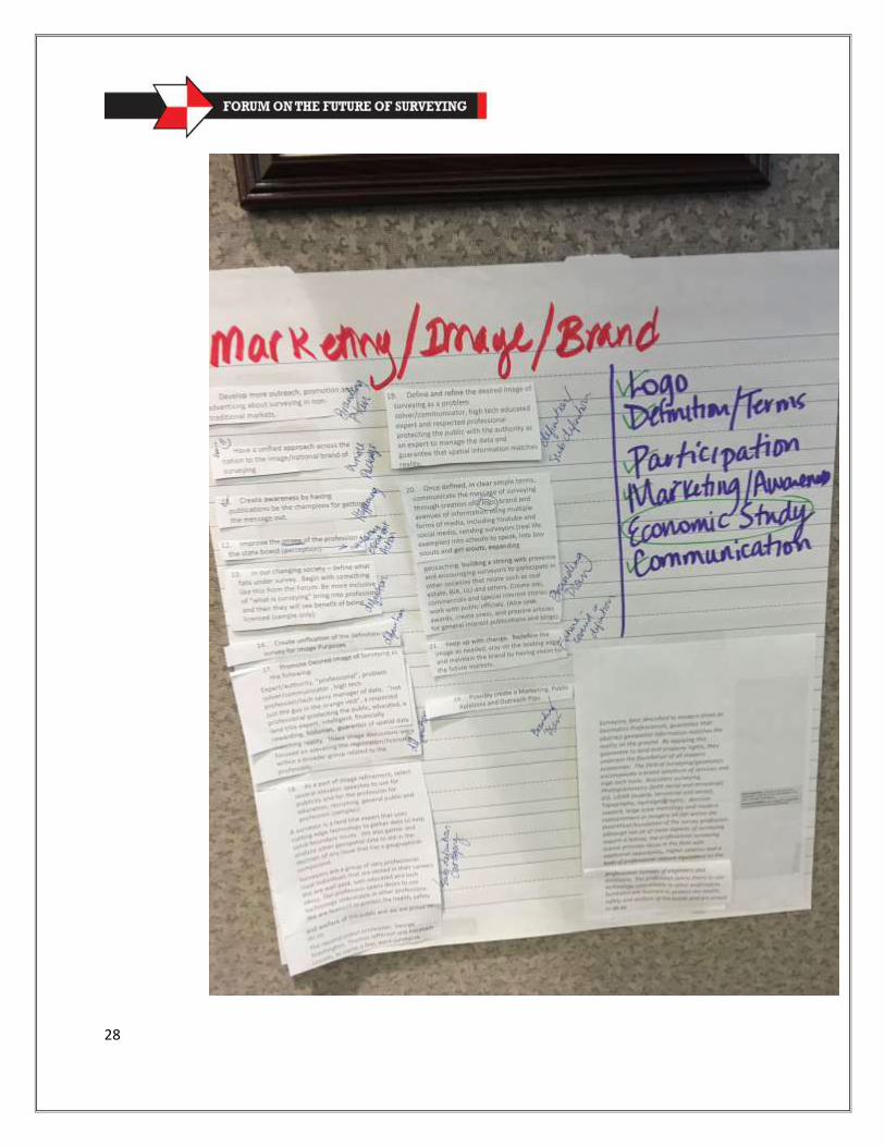
National Brand/Image
Education
Recruiting/Mentoring
Based on Facilitated Forum: Friday, June 10 and Saturday, June 11, 2016
LAPELS Offices, Baton Rouge, LA
1
Table of Contents
XVI. Appendix
Appendix 1. Forum Agenda, June 10 and 11, 2016
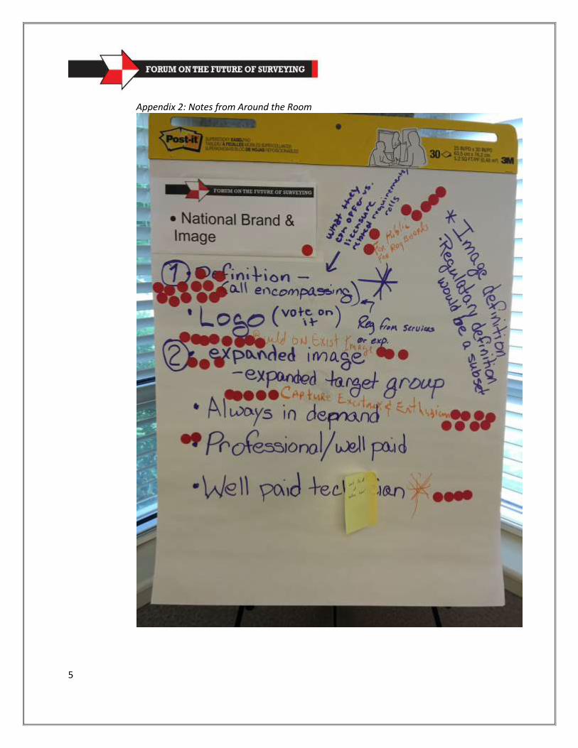
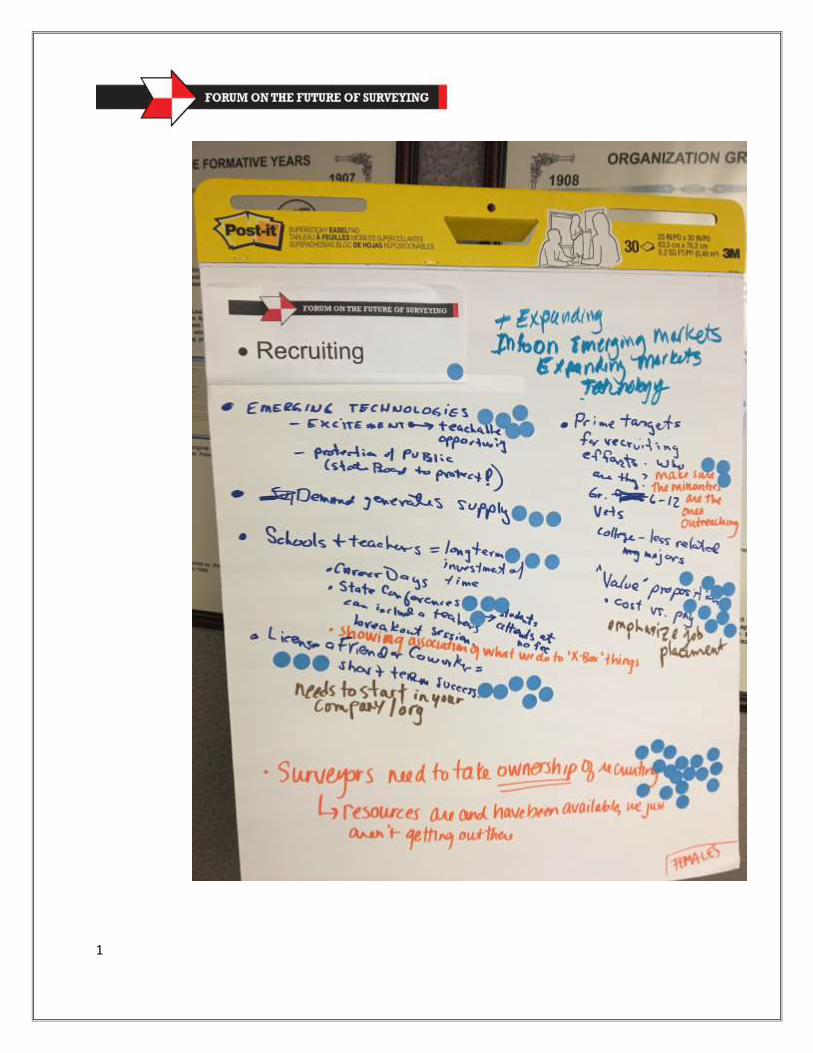
Appendix 2. Notes from Activities Around the Room (For documentation purposes only. Votes using
colored dots were for priority, stars represent high priority and moustache represents something that will distinguish the profession.)
Appendix 3. Notes from the National Brand and Image Subcommittee illustrating the beginnings of a definition and some initial logo samples to be further developed
2
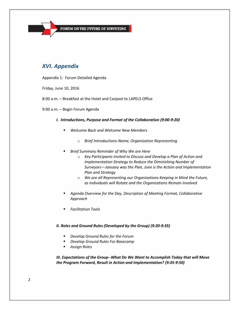
XVI. Appendix Appendix 1: Forum Detailed Agenda Friday, June 10, 2016 8:00 a.m. – Breakfast at the Hotel and Carpool to LAPELS Office 9:00 a.m. – Begin Forum Agenda
I. Introductions, Purpose and Format of the Collaboration (9:00-9:20)
Welcome Back and Welcome New Members
o Brief Introductions-Name, Organization Representing
Brief Summary Reminder of Why We are Here o Key Participants Invited to Discuss and Develop a Plan of Action and
Implementation Strategy to Reduce the Diminishing Number of Surveyors—January was the Plan, June is the Action and Implementation Plan and Strategy
o We are all Representing our Organizations-Keeping in Mind the Future, as Individuals will Rotate and the Organizations Remain Involved
Agenda Overview for the Day, Description of Meeting Format, Collaborative Approach
Facilitation Tools
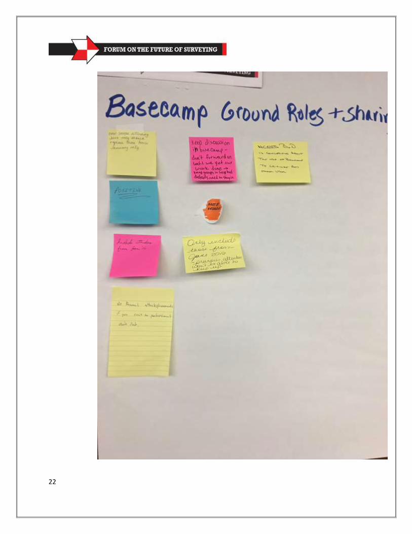
II. Roles and Ground Rules (Developed by the Group) (9:20-9:35)
Develop Ground Rules for the Forum Develop Ground Rules For Basecamp Assign Roles
III. Expectations of the Group--What Do We Want to Accomplish Today that will Move the Program Forward, Result in Action and Implementation? (9:35-9:50)
3
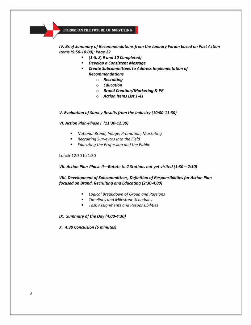
IV. Brief Summary of Recommendations from the January Forum based on Past Action Items (9:50-10:00): Page 22
(1-5, 8, 9 and 10 Completed) Develop a Consistent Message Create Subcommittees to Address Implementation of
Recommendations o Recruiting o Education o Brand Creation/Marketing & PR o Action Items List 1-41
V. Evaluation of Survey Results from the Industry (10:00-11:30)
VI. Action Plan-Phase I (11:30-12:30)
National Brand, Image, Promotion, Marketing Recruiting Surveyors Into the Field Educating the Profession and the Public
Lunch-12:30 to 1:30 VII. Action Plan-Phase II—Rotate to 2 Stations not yet visited (1:30 – 2:30) VIII. Development of Subcommittees, Definition of Responsibilities for Action Plan focused on Brand, Recruiting and Educating (2:30-4:00)
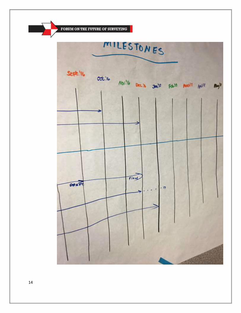
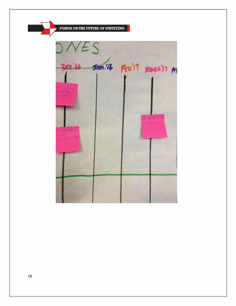
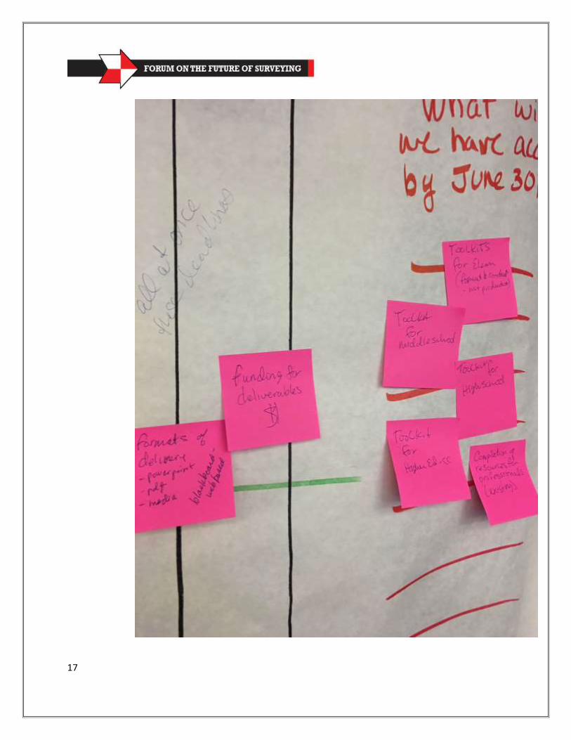
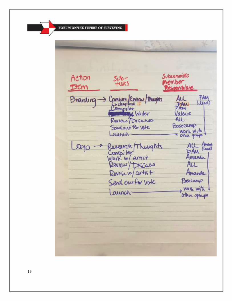
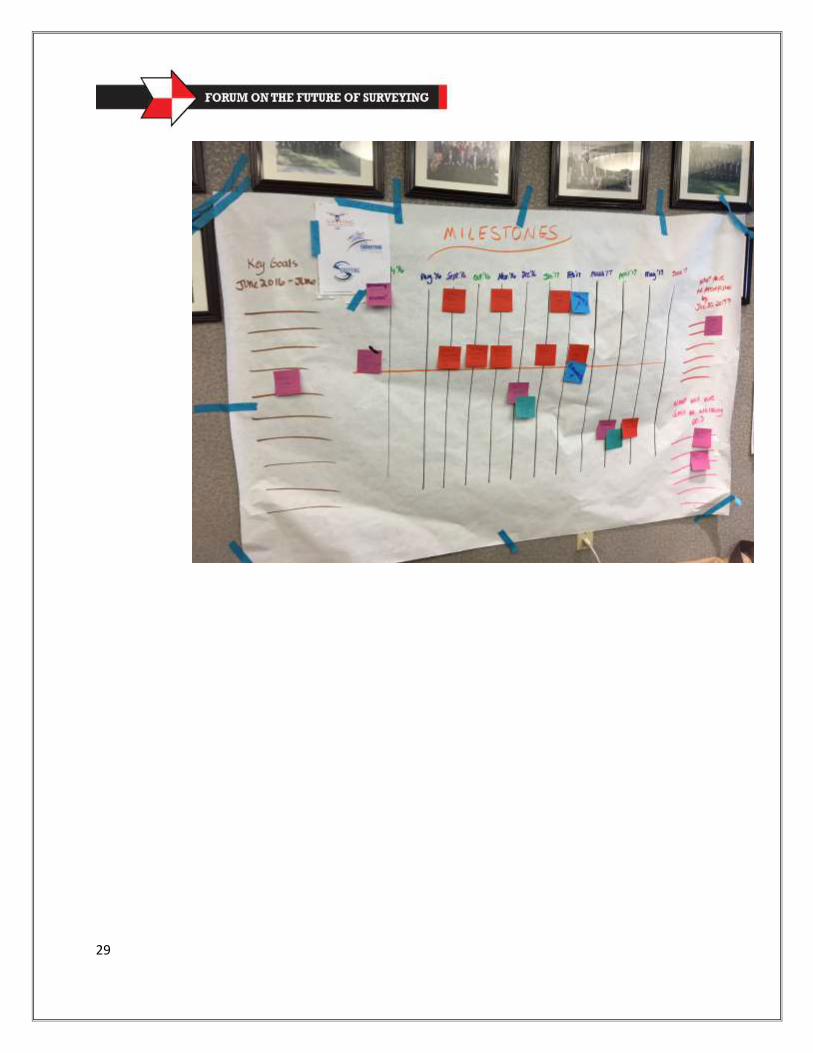
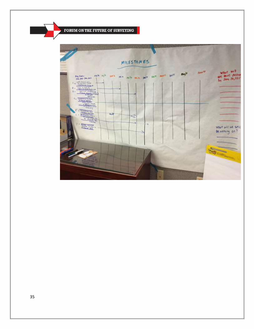
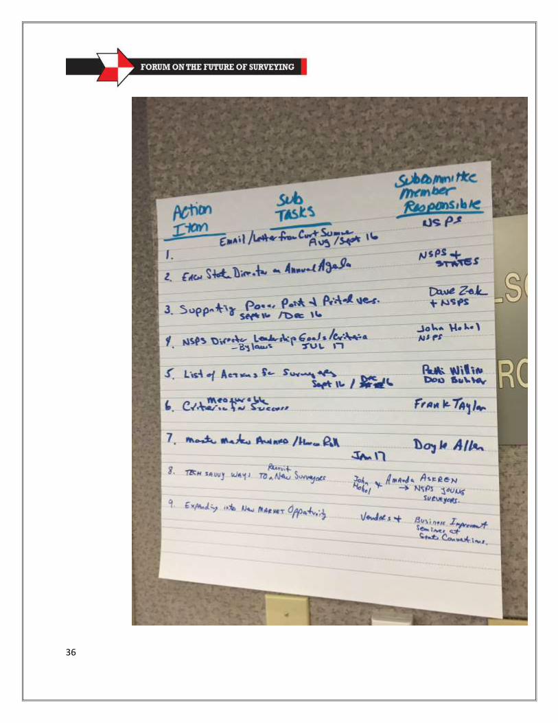
Logical Breakdown of Group and Passions Timelines and Milestone Schedules Task Assignments and Responsibilities
IX. Summary of the Day (4:00-4:30) X. 4:30 Conclusion (5 minutes)
4
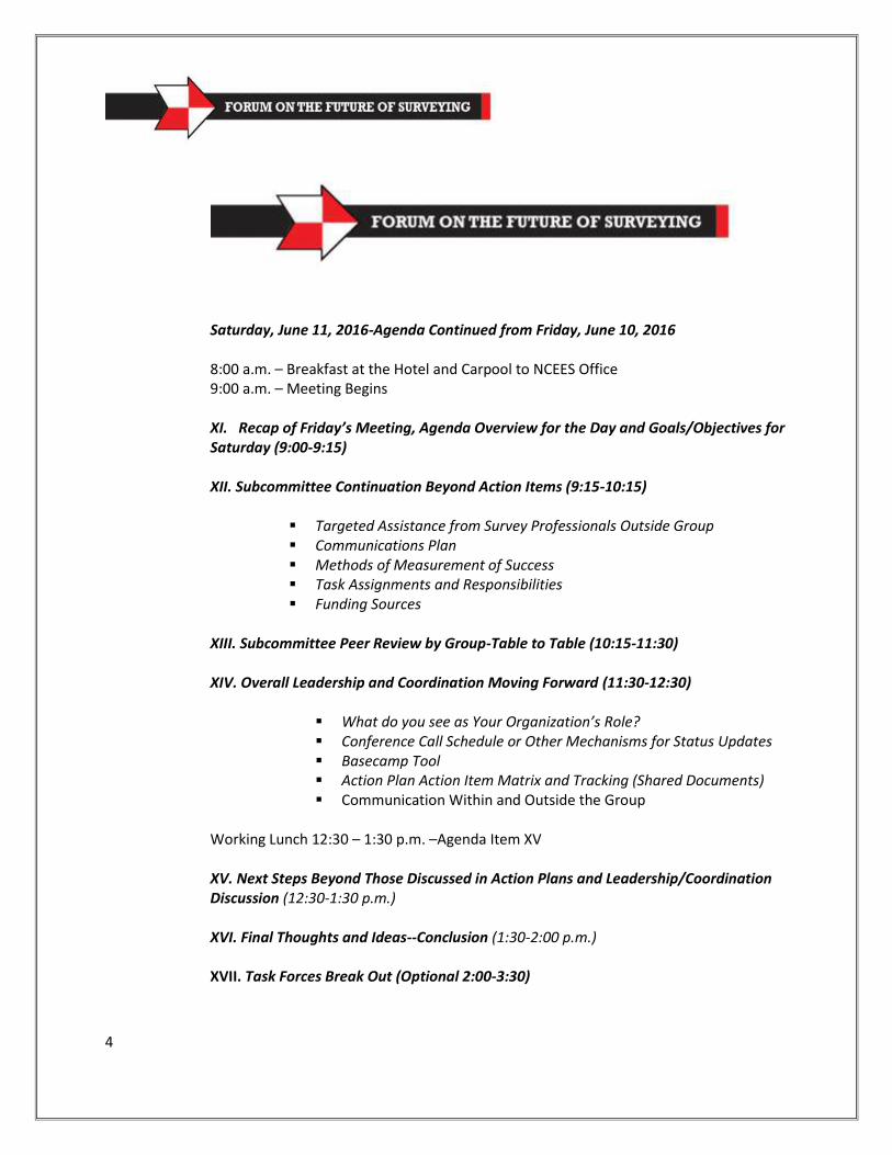
Saturday, June 11, 2016-Agenda Continued from Friday, June 10, 2016 8:00 a.m. – Breakfast at the Hotel and Carpool to NCEES Office 9:00 a.m. – Meeting Begins XI. Recap of Friday’s Meeting, Agenda Overview for the Day and Goals/Objectives for Saturday (9:00-9:15) XII. Subcommittee Continuation Beyond Action Items (9:15-10:15)
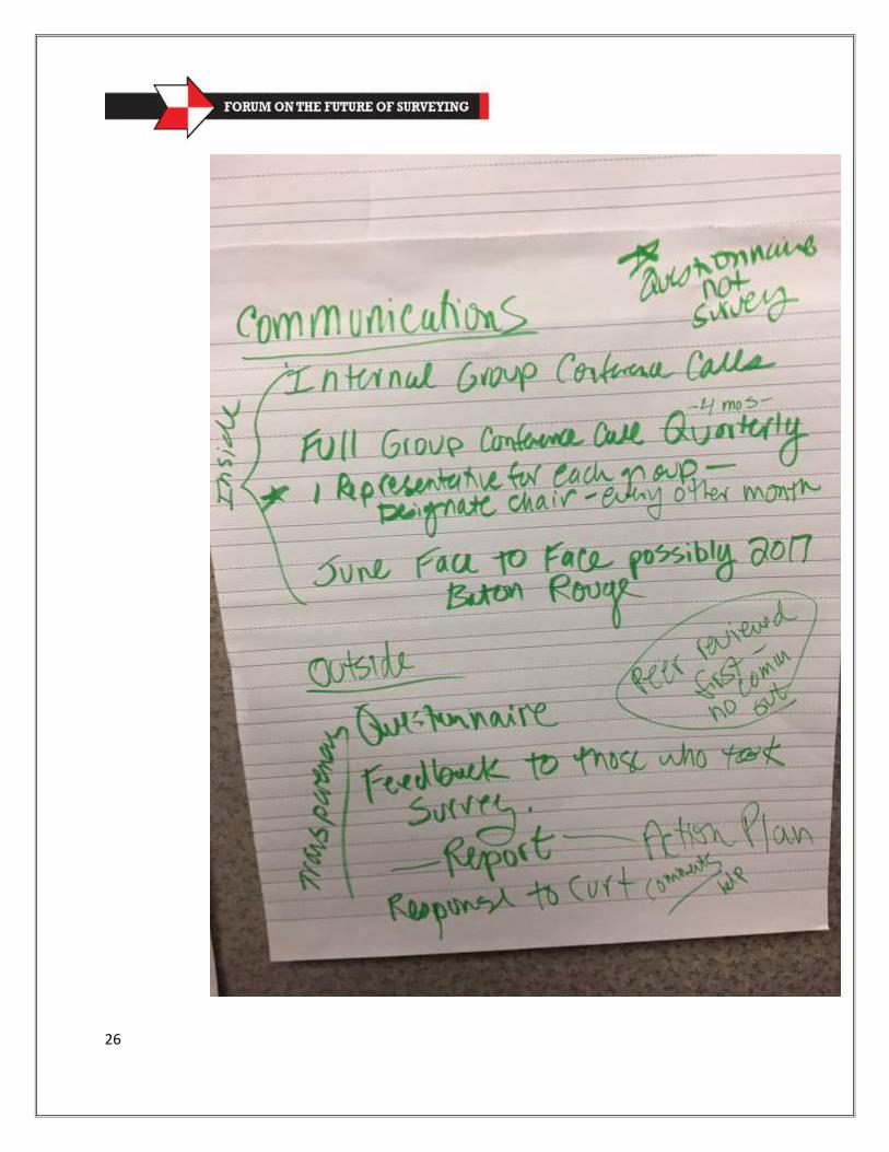
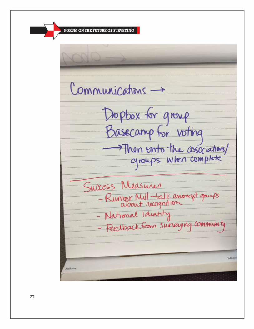
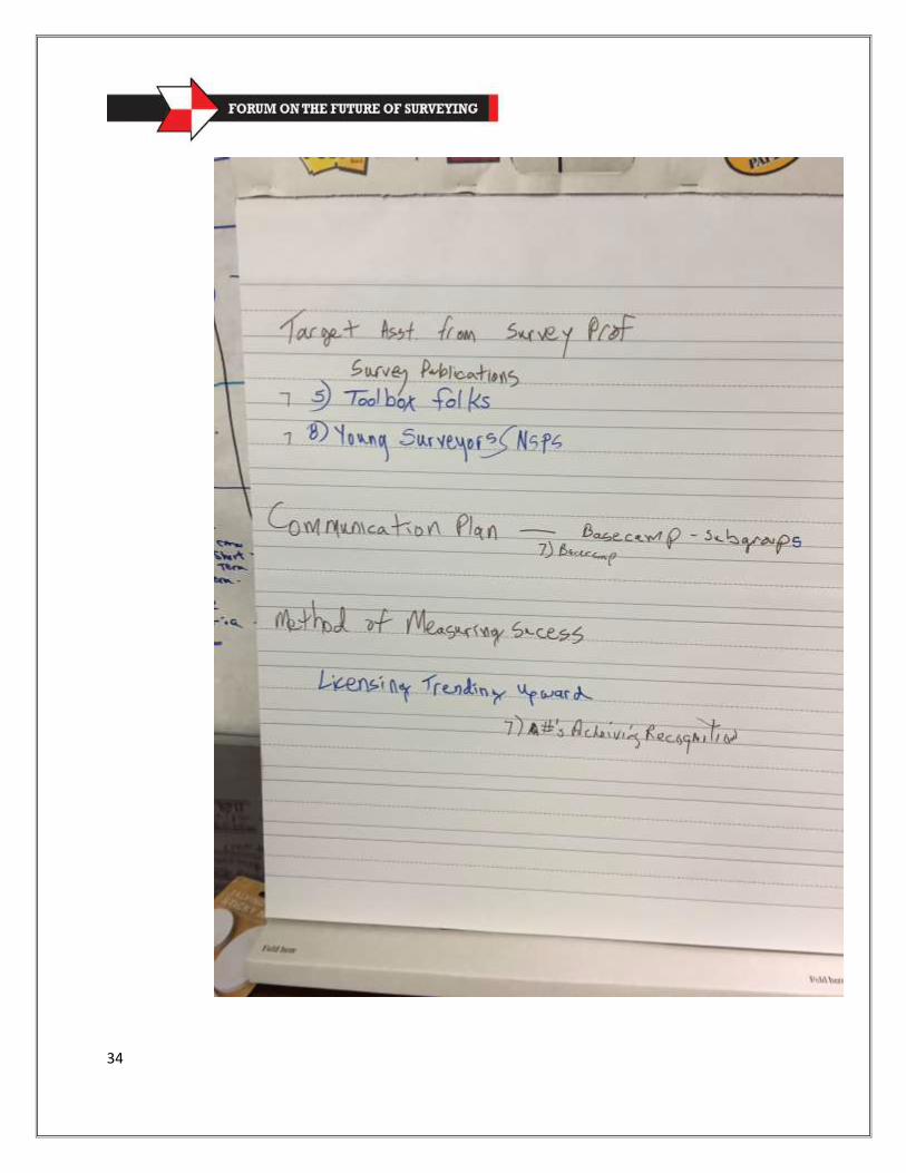
Targeted Assistance from Survey Professionals Outside Group Communications Plan Methods of Measurement of Success Task Assignments and Responsibilities Funding Sources
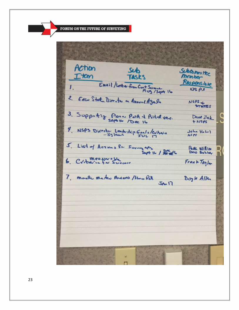
XIII. Subcommittee Peer Review by Group-Table to Table (10:15-11:30) XIV. Overall Leadership and Coordination Moving Forward (11:30-12:30)
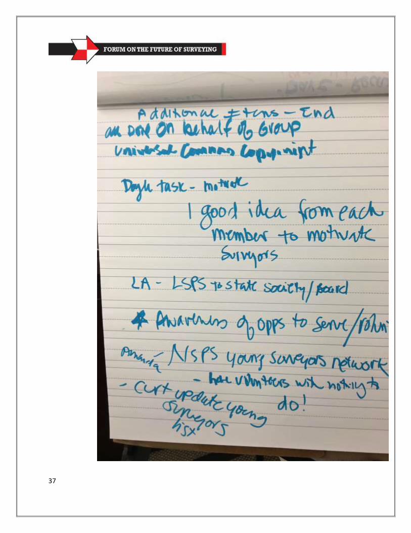
What do you see as Your Organization’s Role? Conference Call Schedule or Other Mechanisms for Status Updates Basecamp Tool Action Plan Action Item Matrix and Tracking (Shared Documents) Communication Within and Outside the Group
Working Lunch 12:30 – 1:30 p.m. –Agenda Item XV XV. Next Steps Beyond Those Discussed in Action Plans and Leadership/Coordination Discussion (12:30-1:30 p.m.) XVI. Final Thoughts and Ideas--Conclusion (1:30-2:00 p.m.) XVII. Task Forces Break Out (Optional 2:00-3:30)
5
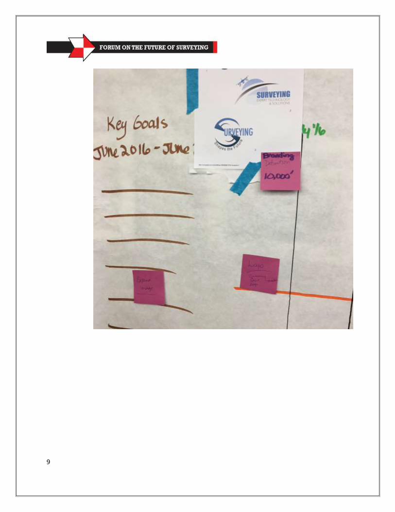
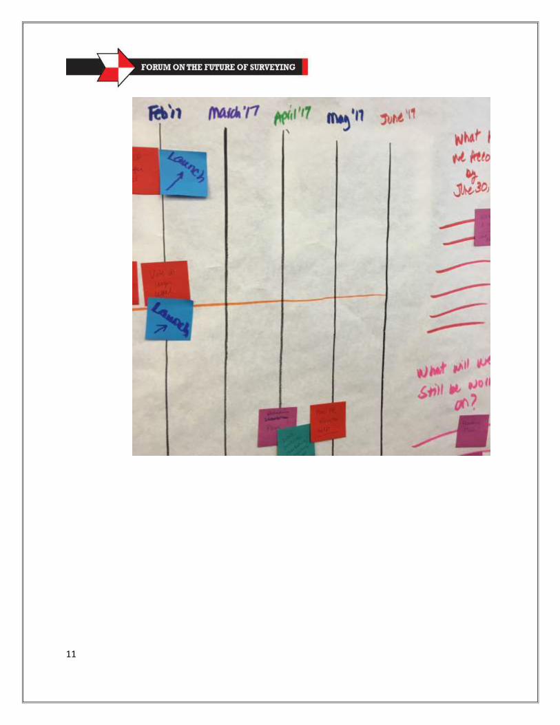
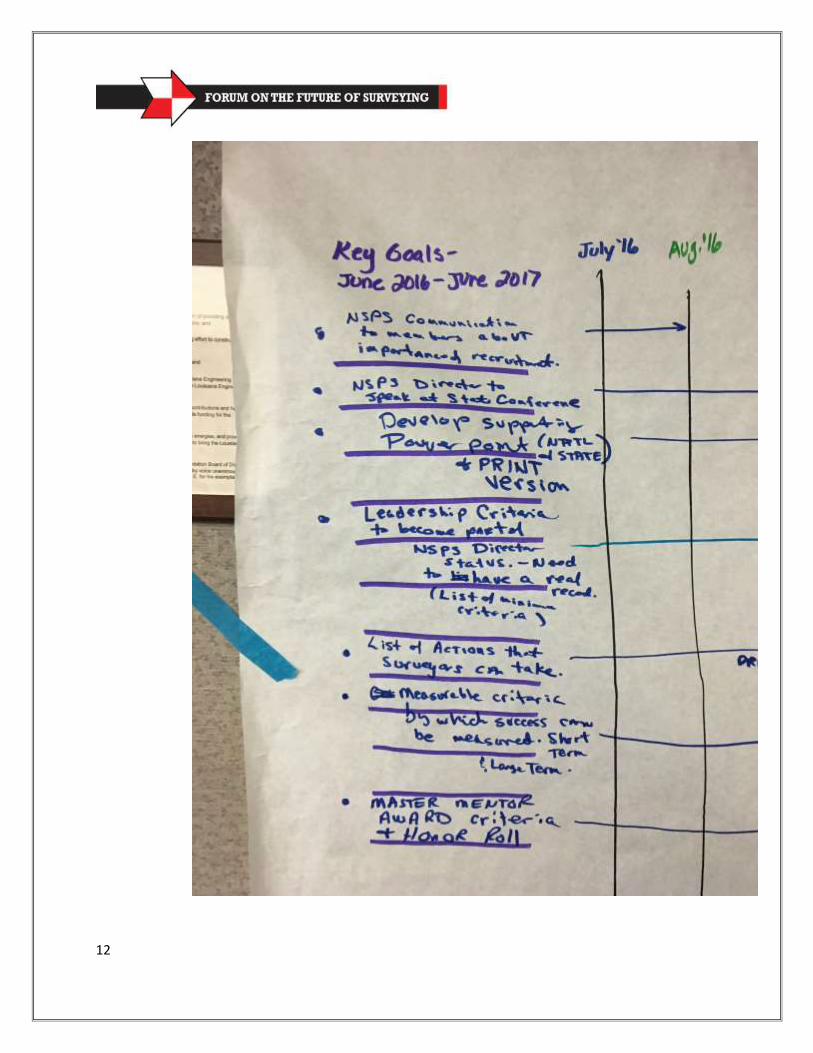
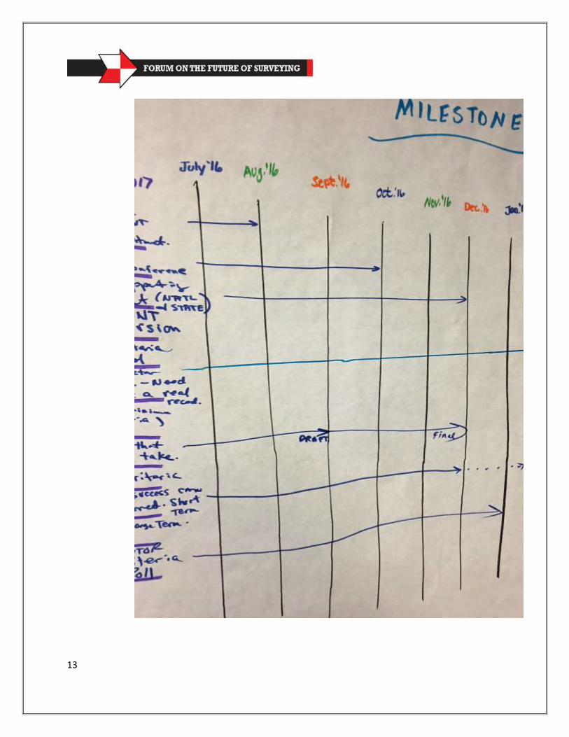
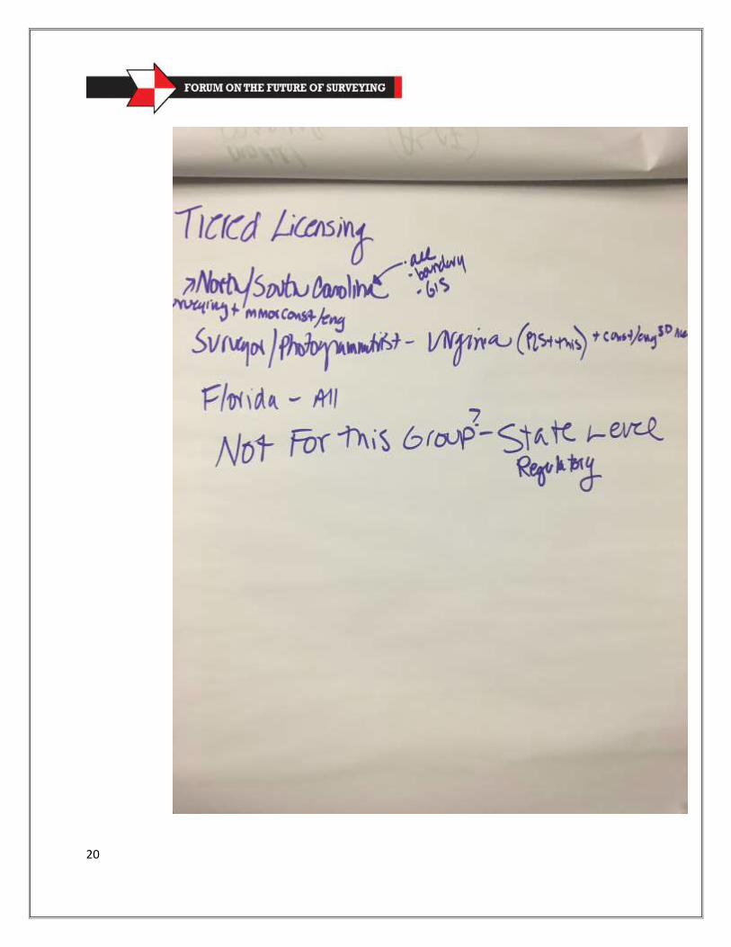
Appendix 2: Notes from Around the Room
1

2
3
4
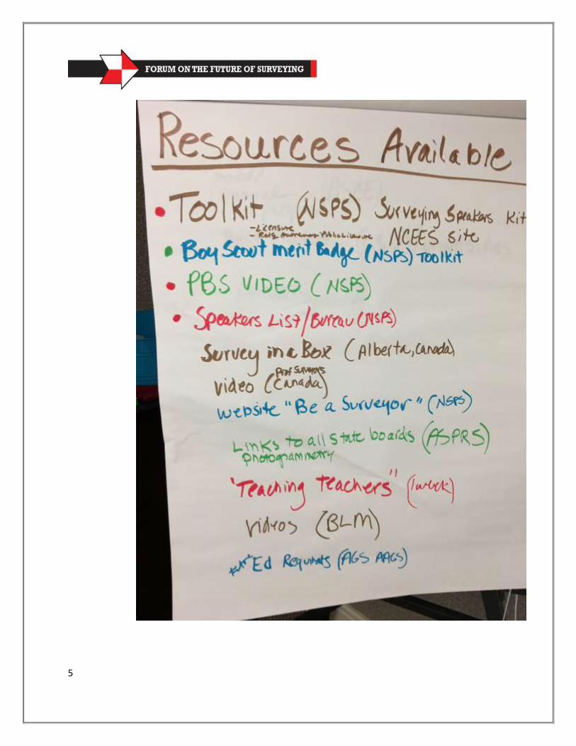
5
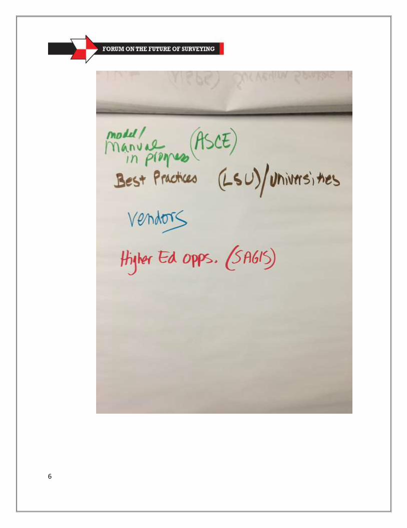
6
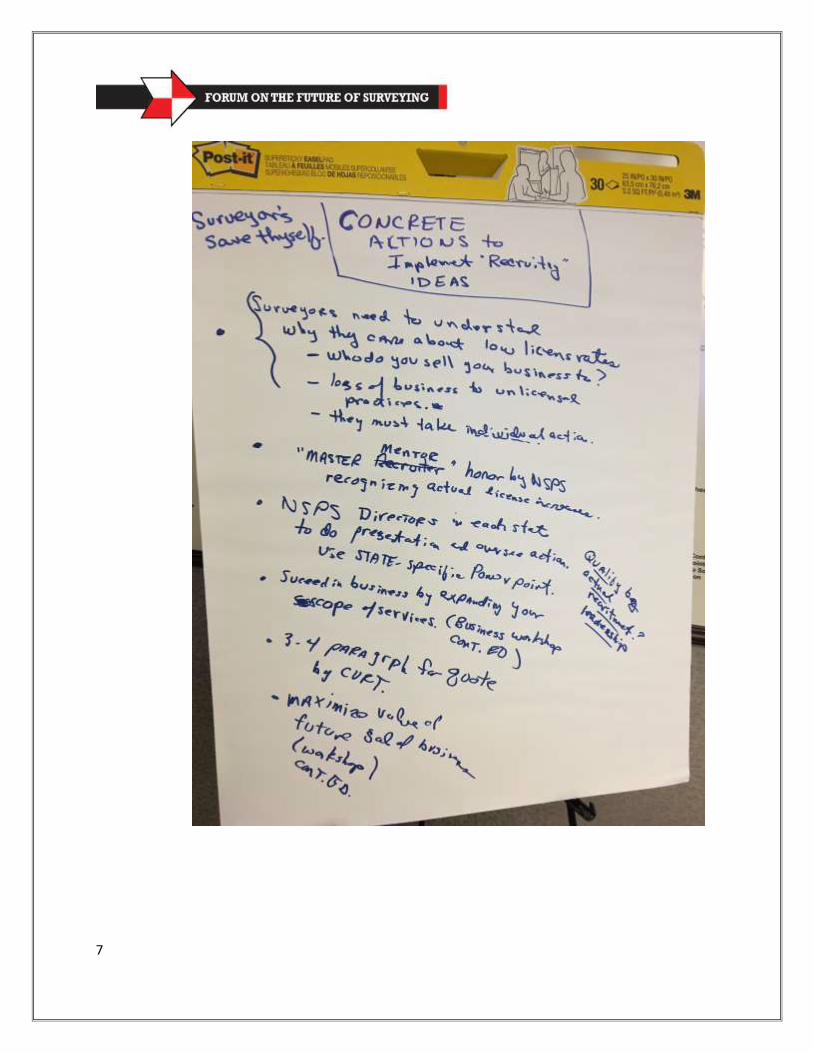
7
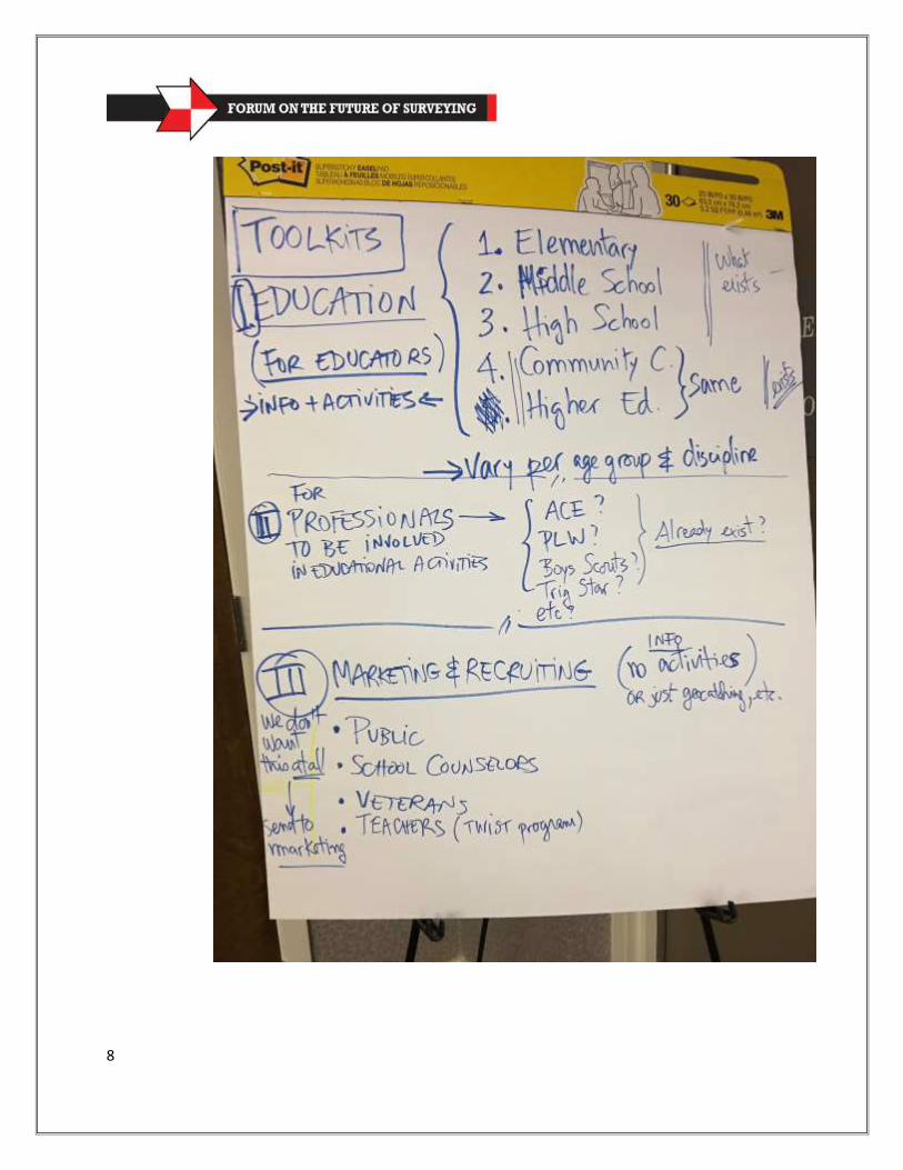
8
9

10
11
12
13
14

15
16
17

18
19
20

21
22
23

24
25
26
27
28
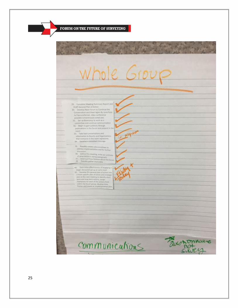
29
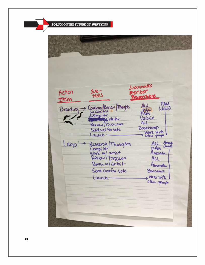
30
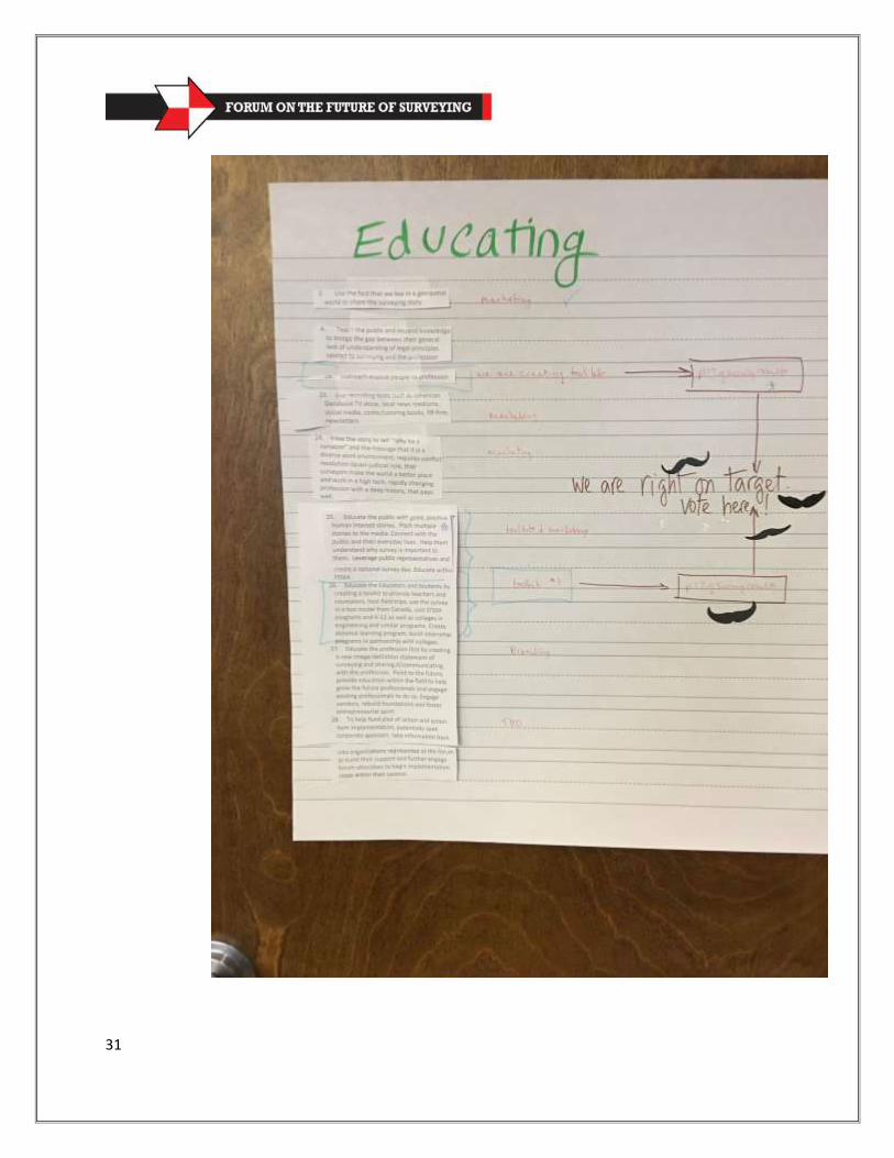
31
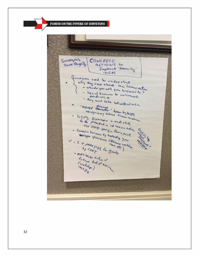
32
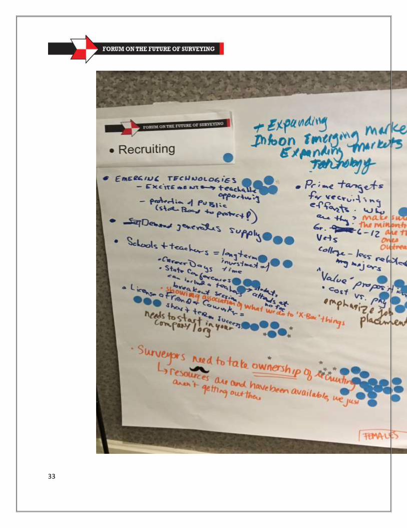
33
34
35
36
37
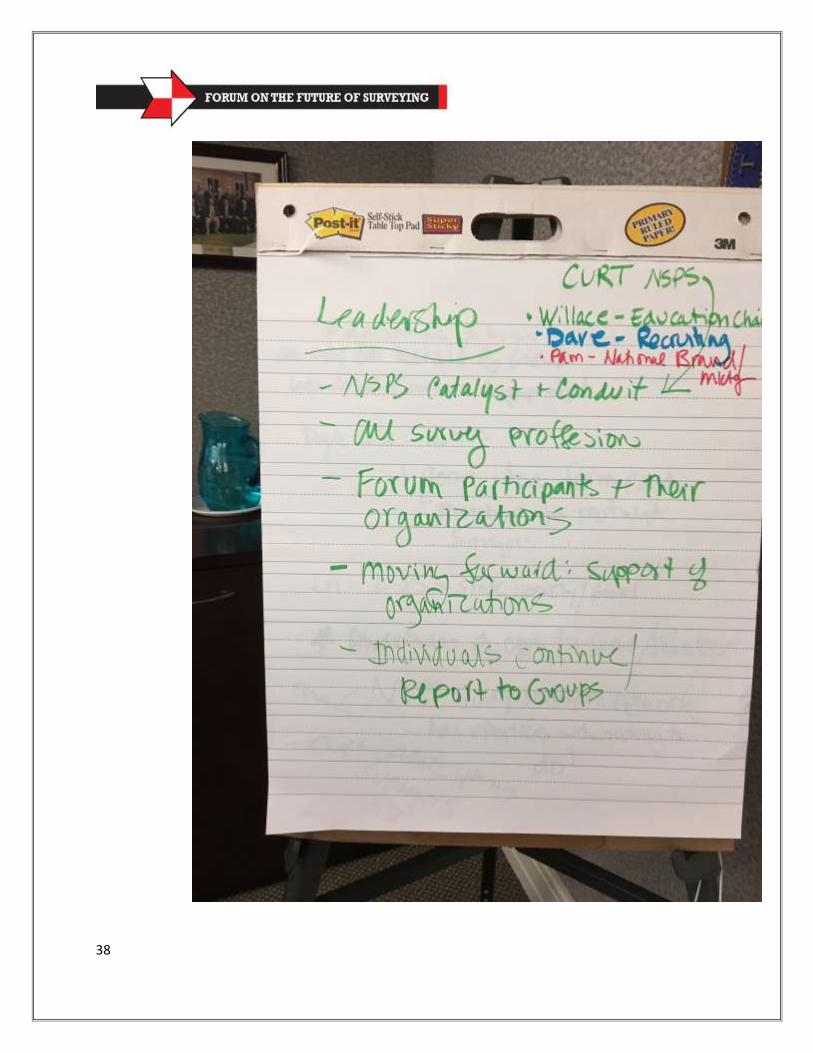
38
39
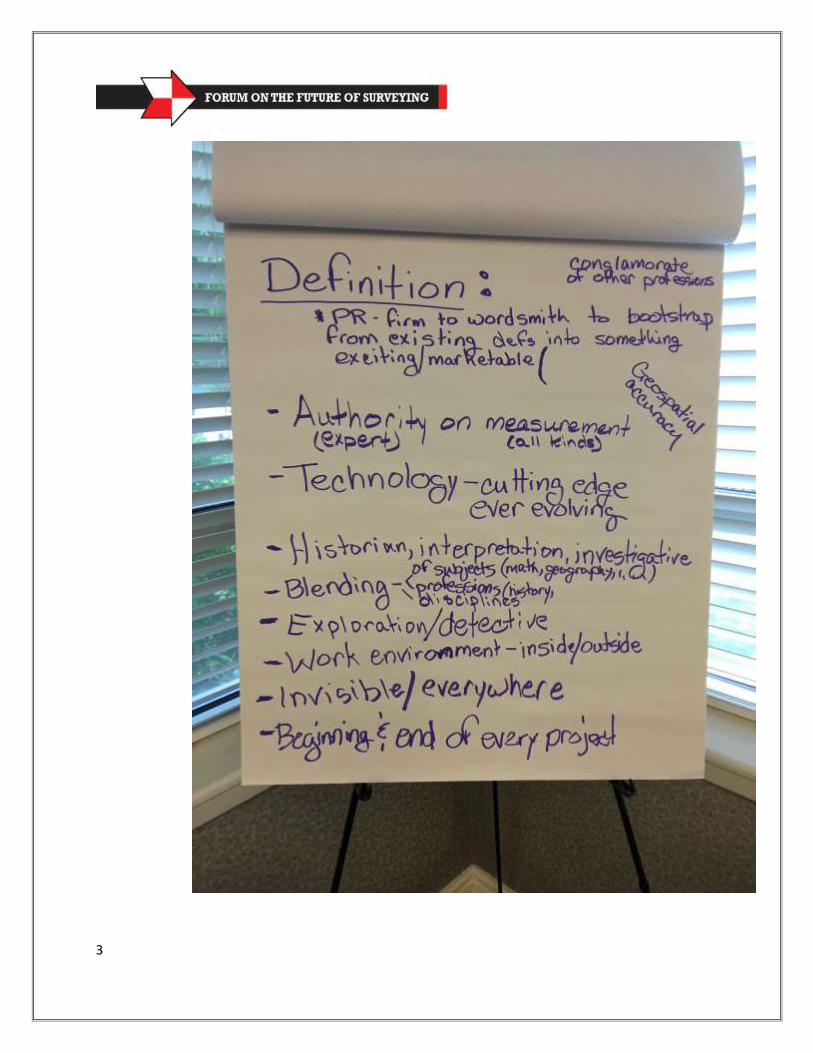
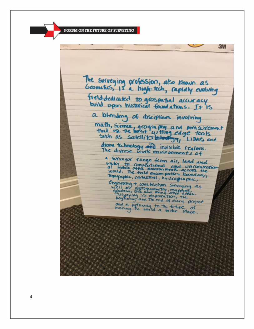
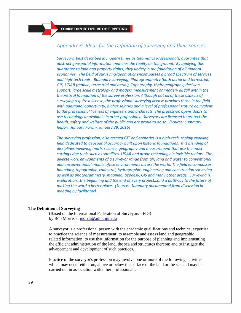
Appendix 3: Ideas for the Definition of Surveying and their Sources Surveyors, best described in modern times as Geomatics Professionals, guarantee that abstract geospatial information matches the reality on the ground. By applying this guarantee to land and property rights, they underpin the foundation of all modern economies. The field of surveying/geomatics encompasses a broad spectrum of services and high-tech tools. Boundary surveying, Photogrammetry (both aerial and terrestrial) GIS, LiDAR (mobile, terrestrial and aerial), Topography, Hydrogeography, decision support, large scale metrology and modern measurement or imagery all fall within the theoretical foundation of the survey profession. Although not all of these aspects of surveying require a license, the professional surveying license provides those in the field with additional opportunity, higher salaries and a level of professional stature equivalent to the professional licenses of engineers and architects. The profession opens doors to use technology unavailable in other professions. Surveyors are licensed to protect the health, safety and welfare of the public and are proud to do so. (Source: Summary Report, January Forum, January 29, 2016) The surveying profession, also termed GIT or Geomatics is a high-tech, rapidly evolving field dedicated to geospatial accuracy built upon historic foundations. It is blending of disciplines involving math, science, geography and measurement that use the most cutting edge tools such as satellites, LiDAR and drone technology in invisible realms. The diverse work environments of a surveyor range from air, land and water to conventional and unconventional mobile office environments across the world. The field encompasses boundary, topographic, cadastral, hydrographic, engineering and construction surveying as well as photogrammetry, mapping, geodesy, GIS and many other areas. Surveying is exploration…the beginning and the end of every project…and a pathway to the future of making the word a better place. (Source: Summary documented from discussion in meeting by facilitator)
The Definition of Surveying
(Based on the International Federation of Surveyors - FIG)
by Bob Morris at [email protected]
A surveyor is a professional person with the academic qualifications and technical expertise
to practice the science of measurement; to assemble and assess land and geographic
related information; to use that information for the purpose of planning and implementing
the efficient administration of the land, the sea and structures thereon; and to instigate the
advancement and development of such practices.
Practice of the surveyor's profession may involve one or more of the following activities
which may occur either on, above or below the surface of the land or the sea and may be
carried out in association with other professionals:

40
The determination of the size and shape of the earth and the measurement of all data
needed to define the size, position, shape and contour of any part of the earth's surface.
The positioning of objects in space and the positioning and monitoring of physical features,
structures and engineering works, on, above or below the surface of the earth.
The determination of the position of the boundaries of public or private land, including
national and international boundaries, and the registration of those lands with the
appropriate authorities.
The design, establishment and administration of land and geographic information systems
and the collection, storage, analysis, and management of data within those
systems.
The study of the natural and social environment, the measurement of land
and marine
resources and the use of the data in the planning of development in urban,
rural and
regional areas.
41
The planning, development and redevelopment of property, whether urban or rural and
whether land or buildings.
The production of plans, maps, files, charts and reports. In the application of the foregoing
activities, surveyors take into account the relevant legal, economic, environmental and
social aspects affecting each project.
42
43
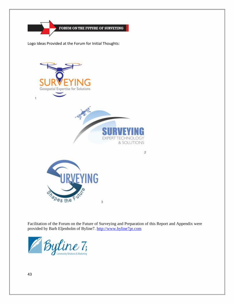
Logo Ideas Provided at the Forum for Initial Thoughts:
Facilitation of the Forum on the Future of Surveying and Preparation of this Report and Appendix were
provided by Barb Eljenholm of Byline7. http://www.byline7pr.com