planet earth is a potato...different results at different places of the earth: newton (1643-1727)...
TRANSCRIPT
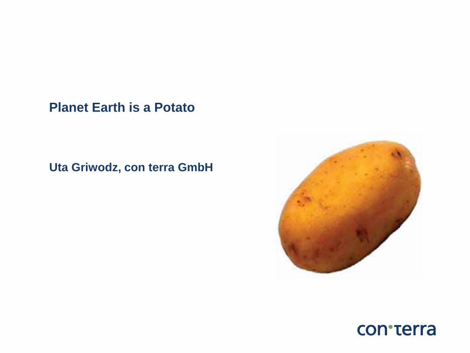
Planet Earth is a Potato
Uta Griwodz, con terra GmbH
© con terra GmbH 2
Shape of the Earth Different map projections Measuring distances Area calculation Buffering Résumé
Agenda
Shape of the Earth
© con terra GmbH 4
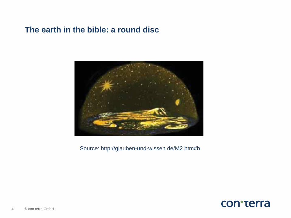
The earth in the bible: a round disc
Source: http://glauben-und-wissen.de/M2.htm#b
© con terra GmbH 5
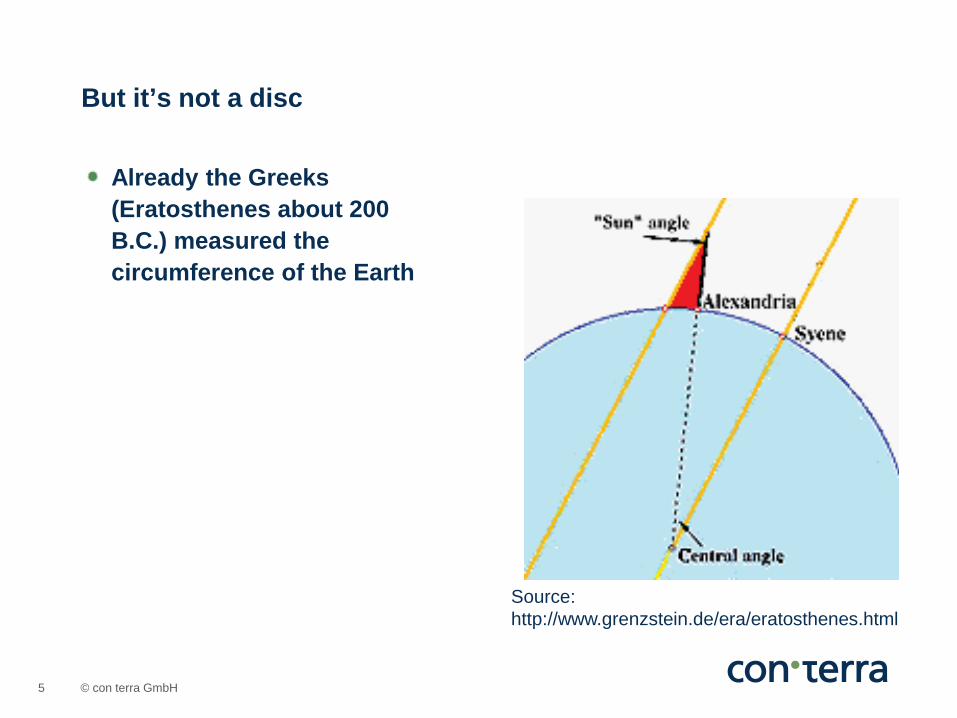
Already the Greeks (Eratosthenes about 200 B.C.) measured the circumference of the Earth
But it’s not a disc
Source: http://www.grenzstein.de/era/eratosthenes.html
© con terra GmbH 6
A spheroid
© 2007 ESRI Geoinformatik GmbH
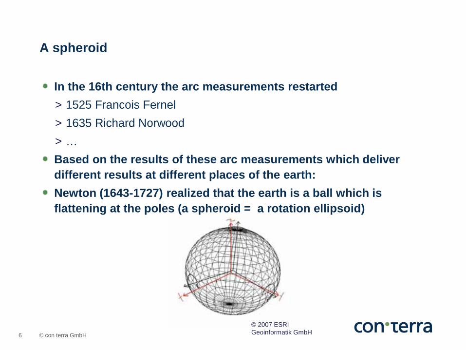
In the 16th century the arc measurements restarted > 1525 Francois Fernel > 1635 Richard Norwood > … Based on the results of these arc measurements which deliver different results at different places of the earth: Newton (1643-1727) realized that the earth is a ball which is flattening at the poles (a spheroid = a rotation ellipsoid)
© con terra GmbH 7
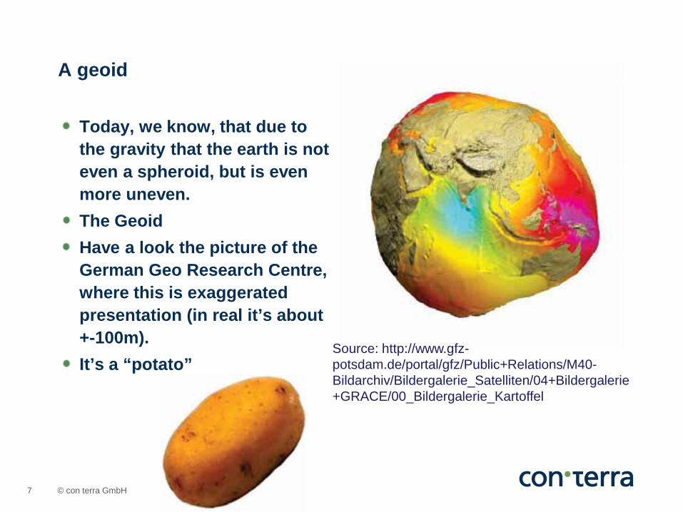
Today, we know, that due to the gravity that the earth is not even a spheroid, but is even more uneven. The Geoid Have a look the picture of the German Geo Research Centre, where this is exaggerated presentation (in real it’s about +-100m). It’s a “potato”
A geoid
Source: http://www.gfz-potsdam.de/portal/gfz/Public+Relations/M40-Bildarchiv/Bildergalerie_Satelliten/04+Bildergalerie+GRACE/00_Bildergalerie_Kartoffel
© con terra GmbH 8
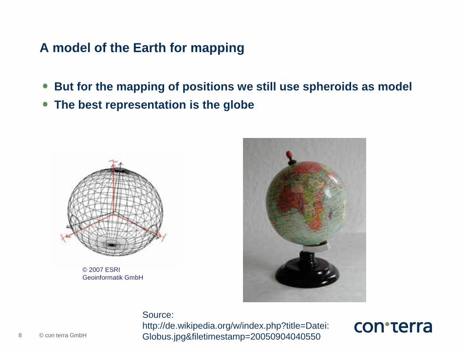
But for the mapping of positions we still use spheroids as model The best representation is the globe
A model of the Earth for mapping
Source: http://de.wikipedia.org/w/index.php?title=Datei:Globus.jpg&filetimestamp=20050904040550
© 2007 ESRI Geoinformatik GmbH
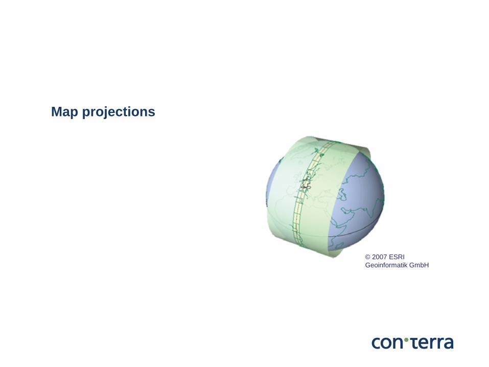
Map projections
© 2007 ESRI Geoinformatik GmbH
© con terra GmbH 10
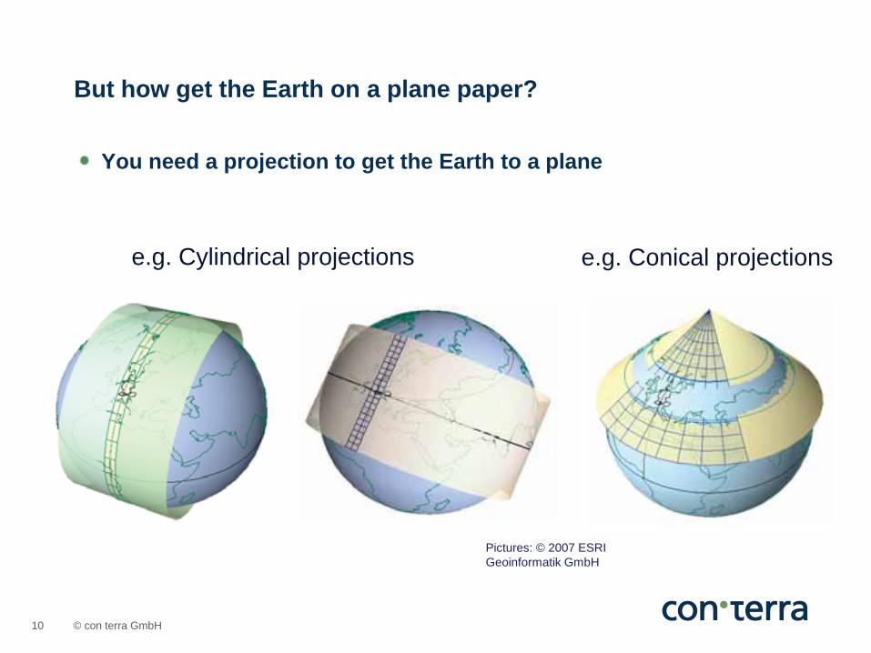
You need a projection to get the Earth to a plane
But how get the Earth on a plane paper?
e.g. Cylindrical projections e.g. Conical projections
Pictures: © 2007 ESRI Geoinformatik GmbH
© con terra GmbH 11
You will never get everything „right“. You have to choose between > area accurate > angle accurate (conform) > distance accurate (which you can receive only along defined lines,
not for a whole map)
There is no projections with accurate area, angle and distances On a plane map you will always have distortion
Effect of map projections

© con terra GmbH 12
Think of an orange!
You will never get it to a plane
Picture: © 2007 ESRI Geoinformatik GmbH
© con terra GmbH 13
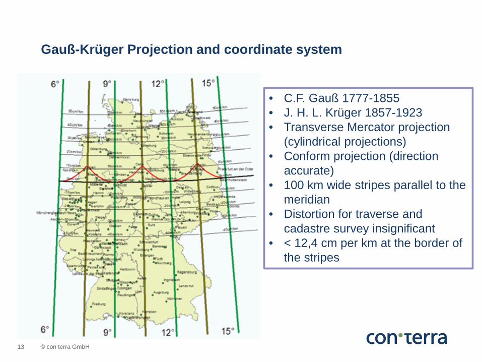
Gauß-Krüger Projection and coordinate system
• C.F. Gauß 1777-1855 • J. H. L. Krüger 1857-1923 • Transverse Mercator projection
(cylindrical projections) • Conform projection (direction
accurate) • 100 km wide stripes parallel to the
meridian • Distortion for traverse and
cadastre survey insignificant • < 12,4 cm per km at the border of
the stripes
© con terra GmbH 14
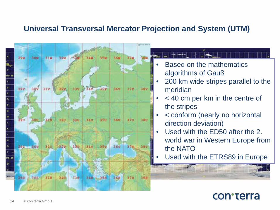
Universal Transversal Mercator Projection and System (UTM)
• Based on the mathematics algorithms of Gauß
• 200 km wide stripes parallel to the meridian
• < 40 cm per km in the centre of the stripes
• < conform (nearly no horizontal direction deviation)
• Used with the ED50 after the 2. world war in Western Europe from the NATO
• Used with the ETRS89 in Europe
© con terra GmbH 15
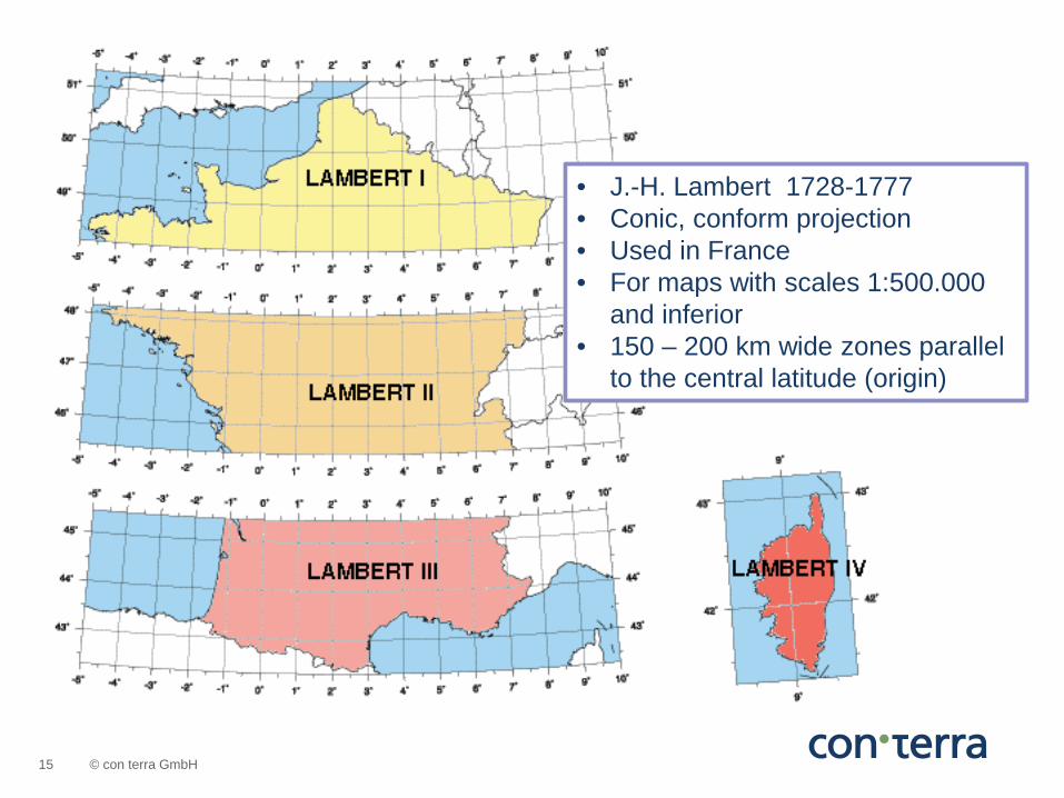
• J.-H. Lambert 1728-1777 • Conic, conform projection • Used in France • For maps with scales 1:500.000
and inferior • 150 – 200 km wide zones parallel
to the central latitude (origin)
© con terra GmbH 16
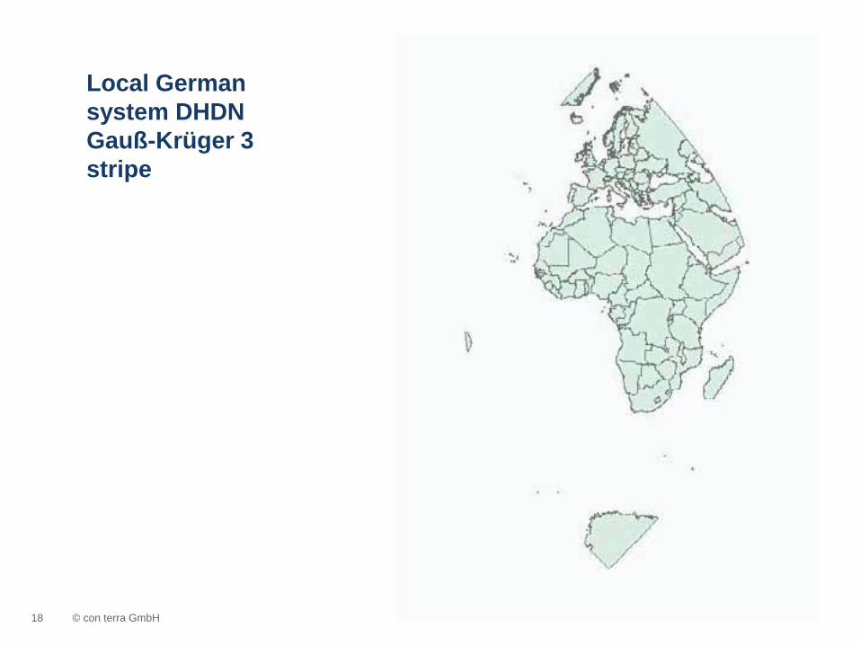
These are projections for a local area With only small distortions in an explicit area They were use for printed maps Usually for scale 1:500.000 and inferior Not used for global maps If you use the „old“ local coordinate system to draw the whole world, you get the following results:
Local coordinate systems / map projections
© con terra GmbH 17
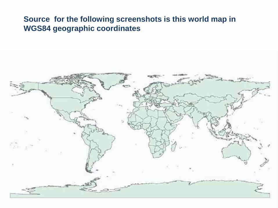
Source for the following screenshots is this world map in WGS84 geographic coordinates
© con terra GmbH 18
Local German system DHDN Gauß-Krüger 3 stripe

© con terra GmbH 19
Local European System ETRS89 UTM Zone 32 N

© con terra GmbH 20
Local France System: Lambert Zone I
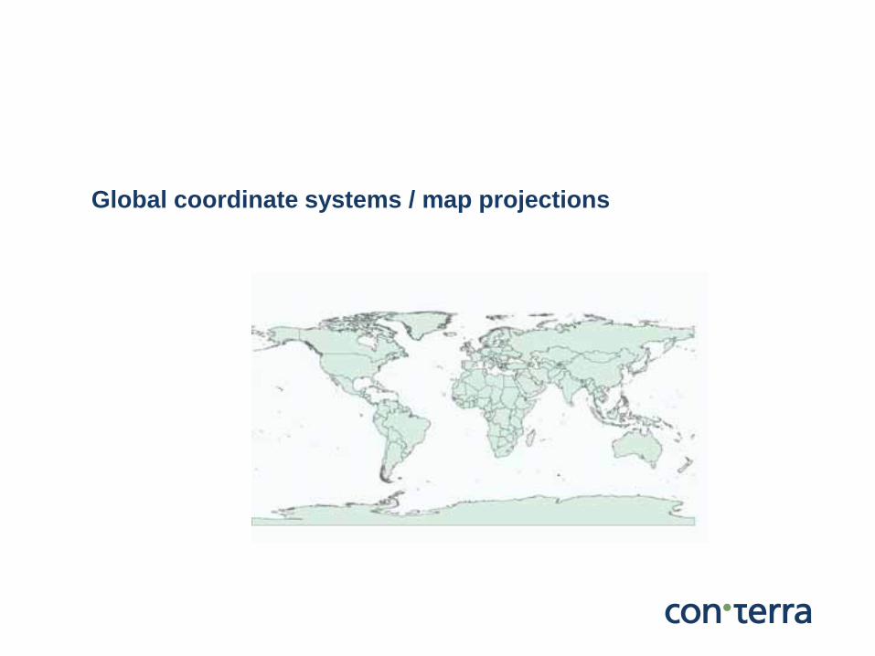
Global coordinate systems / map projections
© con terra GmbH 22
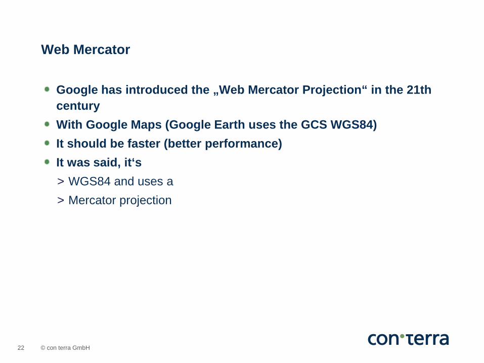
Google has introduced the „Web Mercator Projection“ in the 21th century With Google Maps (Google Earth uses the GCS WGS84) It should be faster (better performance) It was said, it‘s > WGS84 and uses a > Mercator projection
Web Mercator
© con terra GmbH 23
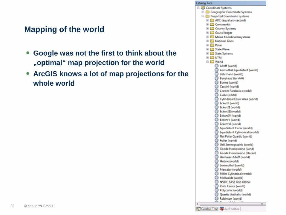
Google was not the first to think about the „optimal“ map projection for the world ArcGIS knows a lot of map projections for the whole world
Mapping of the world
© con terra GmbH 24
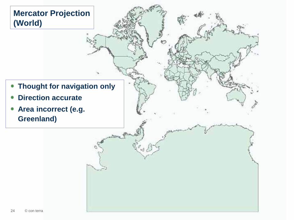
Mercator Projection (World)
Thought for navigation only Direction accurate Area incorrect (e.g. Greenland)
© con terra GmbH 25
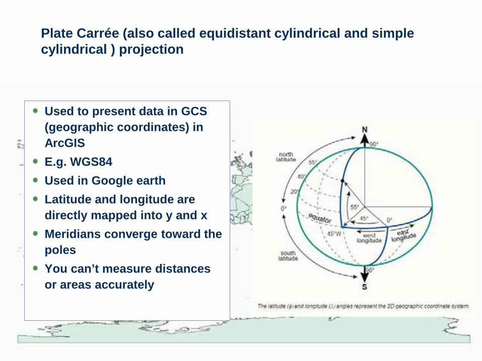
Plate Carrée (also called equidistant cylindrical and simple cylindrical ) projection
Used to present data in GCS (geographic coordinates) in ArcGIS E.g. WGS84 Used in Google earth Latitude and longitude are directly mapped into y and x Meridians converge toward the poles You can’t measure distances or areas accurately

© con terra GmbH 26
Web Mercator
Datum WGS84, but take a sphere as model, not a spheroid Mercator projection (but not a real one) Not really conform (= not direction accurate) Not distance accurate Not area accurate Accurate at the equator, less accurate towards the poles

© con terra GmbH 27
The distortion of projections are often shown with indicatrixs (Tissot’s indicatrix)
Distortion

© con terra GmbH 28
Web Mercator
ETRS89 Zone 32N Plate Carrée (GCS WGS84)
© con terra GmbH 29
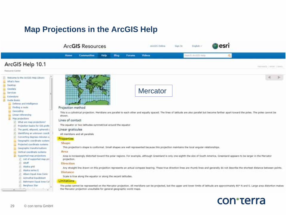
Map Projections in the ArcGIS Help
Mercator
© con terra GmbH 30
WGS84 (geographic coordinates) Web Mercator
Famous in the „Web World“ is the use of
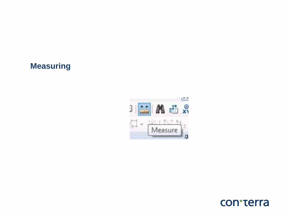
Measuring
© con terra GmbH 32
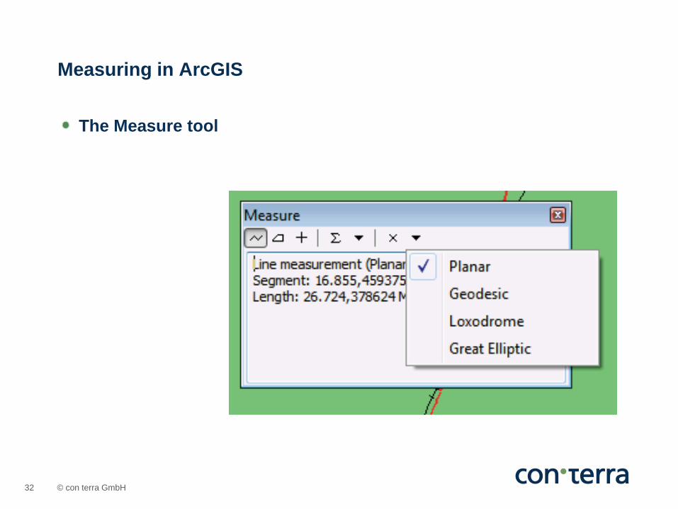
The Measure tool
Measuring in ArcGIS
© con terra GmbH 33
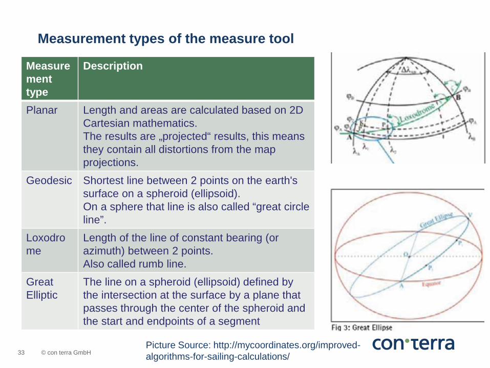
Measurement type
Description
Planar Length and areas are calculated based on 2D Cartesian mathematics. The results are „projected“ results, this means they contain all distortions from the map projections.
Geodesic Shortest line between 2 points on the earth's surface on a spheroid (ellipsoid). On a sphere that line is also called “great circle line”.
Loxodrome
Length of the line of constant bearing (or azimuth) between 2 points. Also called rumb line.
Great Elliptic
The line on a spheroid (ellipsoid) defined by the intersection at the surface by a plane that passes through the center of the spheroid and the start and endpoints of a segment
Measurement types of the measure tool
Picture Source: http://mycoordinates.org/improved-algorithms-for-sailing-calculations/
© con terra GmbH 34
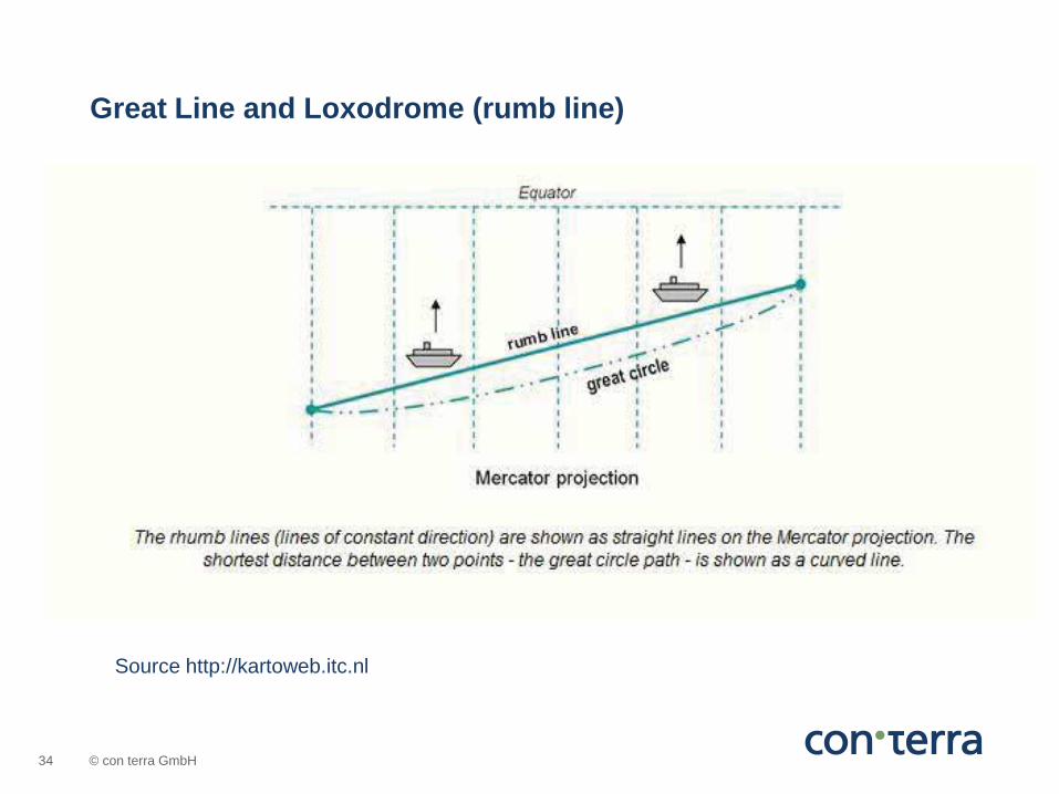
Source http://kartoweb.itc.nl
Great Line and Loxodrome (rumb line)

© con terra GmbH 35
Measure results ArcGIS Desktop Oslo - Drammen
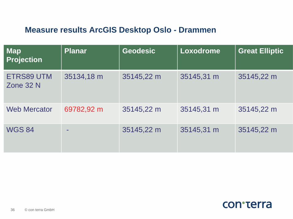
© con terra GmbH 36
Map Projection
Planar Geodesic Loxodrome Great Elliptic
ETRS89 UTM Zone 32 N
35134,18 m
35145,22 m
35145,31 m
35145,22 m
Web Mercator 69782,92 m
35145,22 m
35145,31 m
35145,22 m
WGS 84 - 35145,22 m
35145,31 m
35145,22 m
Measure results ArcGIS Desktop Oslo - Drammen
© con terra GmbH 37
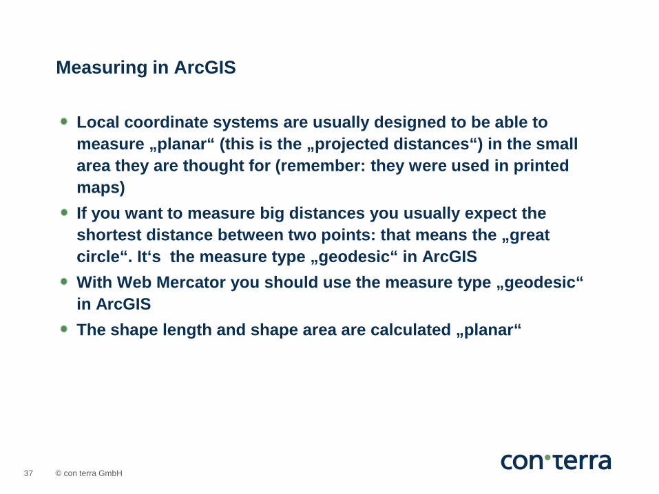
Local coordinate systems are usually designed to be able to measure „planar“ (this is the „projected distances“) in the small area they are thought for (remember: they were used in printed maps) If you want to measure big distances you usually expect the shortest distance between two points: that means the „great circle“. It‘s the measure type „geodesic“ in ArcGIS With Web Mercator you should use the measure type „geodesic“ in ArcGIS The shape length and shape area are calculated „planar“
Measuring in ArcGIS
© con terra GmbH 38
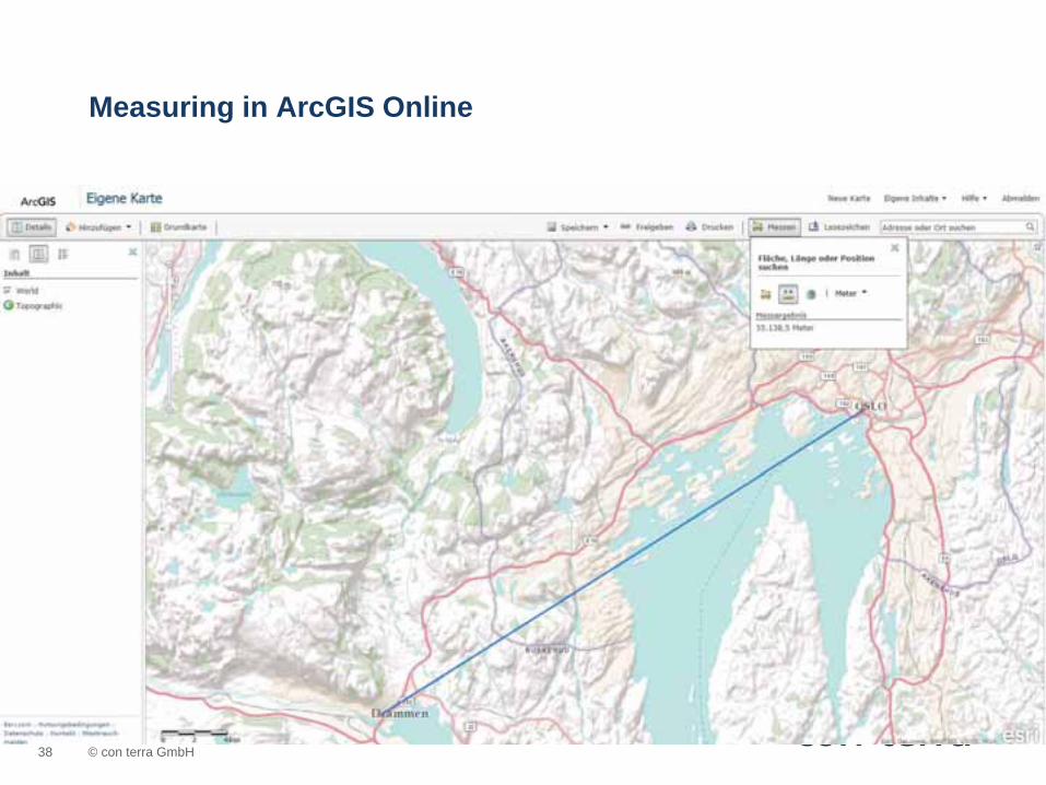
Measuring in ArcGIS Online
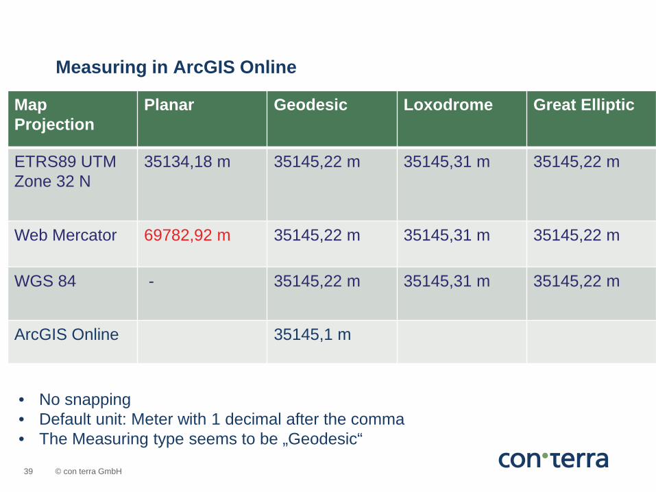
© con terra GmbH 39
Map Projection
Planar Geodesic Loxodrome Great Elliptic
ETRS89 UTM Zone 32 N
35134,18 m
35145,22 m
35145,31 m
35145,22 m
Web Mercator 69782,92 m
35145,22 m
35145,31 m
35145,22 m
WGS 84 - 35145,22 m 35145,31 m
35145,22 m
ArcGIS Online 35145,1 m
Measuring in ArcGIS Online
• No snapping • Default unit: Meter with 1 decimal after the comma • The Measuring type seems to be „Geodesic“
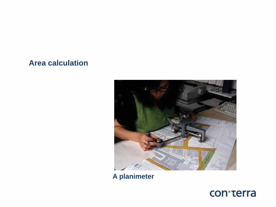
Area calculation
A planimeter

© con terra GmbH 41
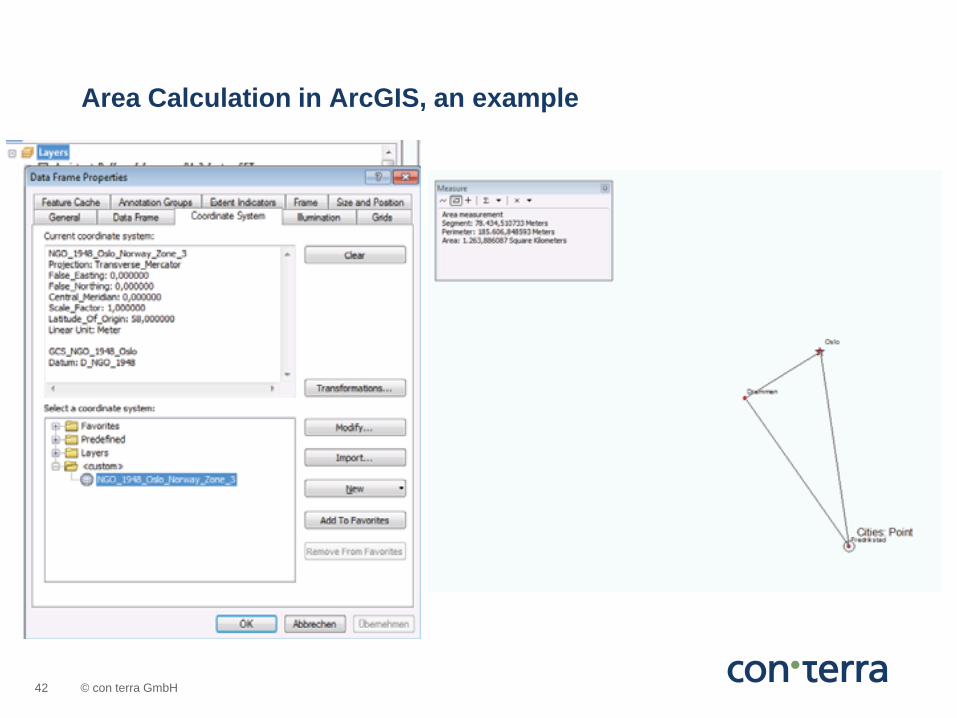
Measure Tool Only Measure Type: “Planar” No Area Calculation in GCS The results depend on the Coordinate System of the Data Frame
Area calculation in ArcGIS
© con terra GmbH 42
Area Calculation in ArcGIS, an example
© con terra GmbH 43
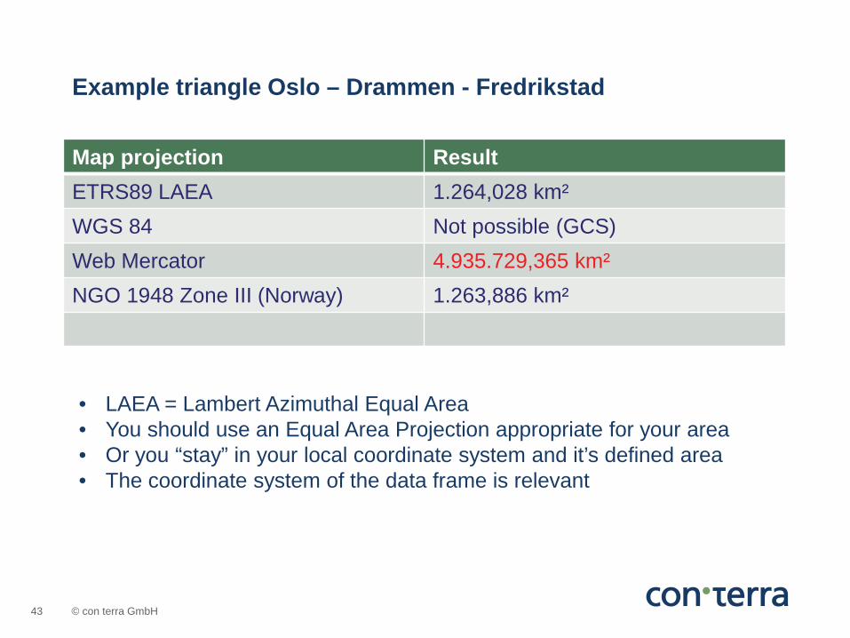
Map projection Result ETRS89 LAEA 1.264,028 km² WGS 84 Not possible (GCS) Web Mercator 4.935.729,365 km² NGO 1948 Zone III (Norway) 1.263,886 km²
Example triangle Oslo – Drammen - Fredrikstad
• LAEA = Lambert Azimuthal Equal Area • You should use an Equal Area Projection appropriate for your area • Or you “stay” in your local coordinate system and it’s defined area • The coordinate system of the data frame is relevant

© con terra GmbH 44
Area calculation in ArcGIS Online
© con terra GmbH 45
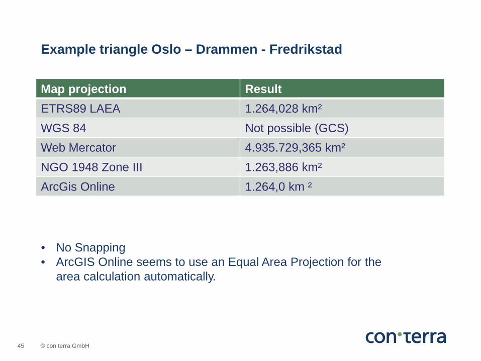
Map projection Result ETRS89 LAEA 1.264,028 km² WGS 84 Not possible (GCS) Web Mercator 4.935.729,365 km² NGO 1948 Zone III 1.263,886 km² ArcGis Online 1.264,0 km ²
Example triangle Oslo – Drammen - Fredrikstad
• No Snapping • ArcGIS Online seems to use an Equal Area Projection for the
area calculation automatically.
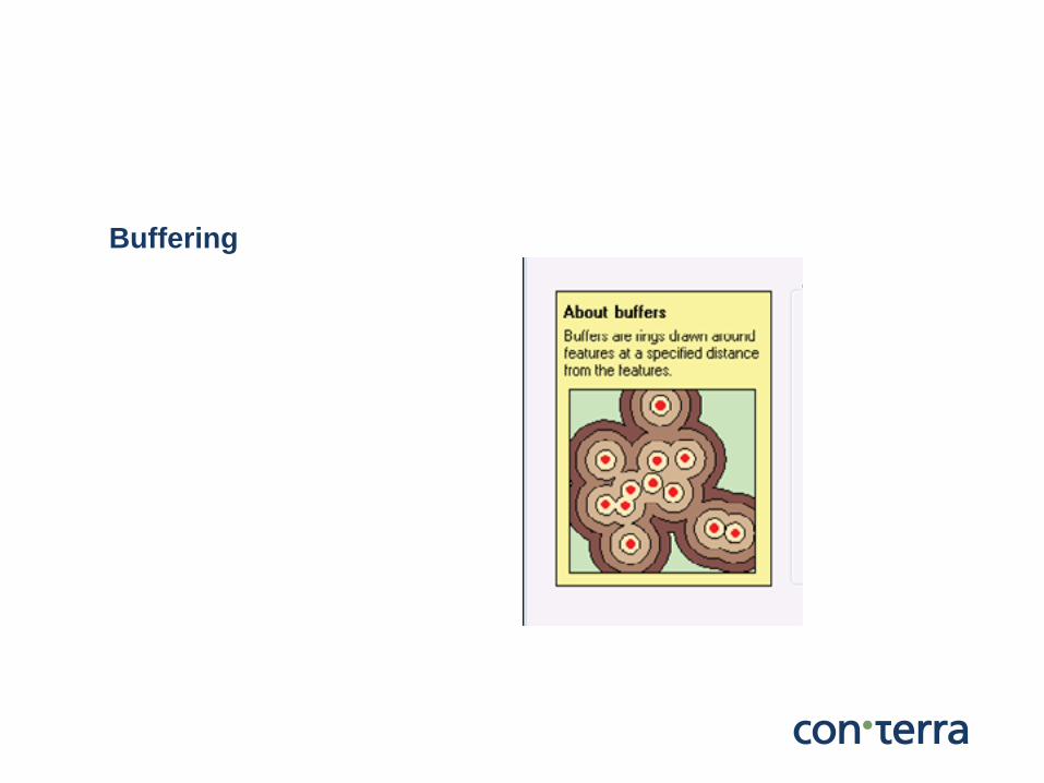
Buffering

© con terra GmbH 47
2 Buffer tools in ArcGIS
Buffering
Buffer tool in ArcToolbox Buffer Wizard in ArcMap

© con terra GmbH 48
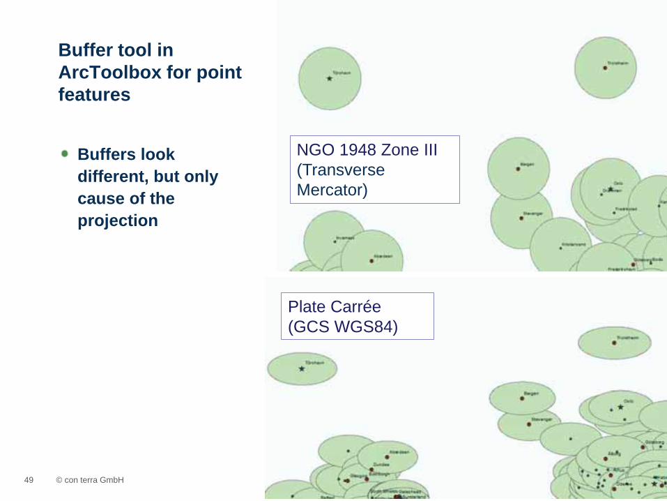
Till ArcGIS 10.0 you have to distinguish between point and line/area features For points „geodesic“ buffers are created New in ArcGIS 10.1: The Buffer tool now creates true geodesic buffers for line and polygon input data
Buffer tool in ArcToolbox
© con terra GmbH 49
Buffers look different, but only cause of the projection
Buffer tool in ArcToolbox for point features
Plate Carrée (GCS WGS84)
NGO 1948 Zone III (Transverse Mercator)
© con terra GmbH 50
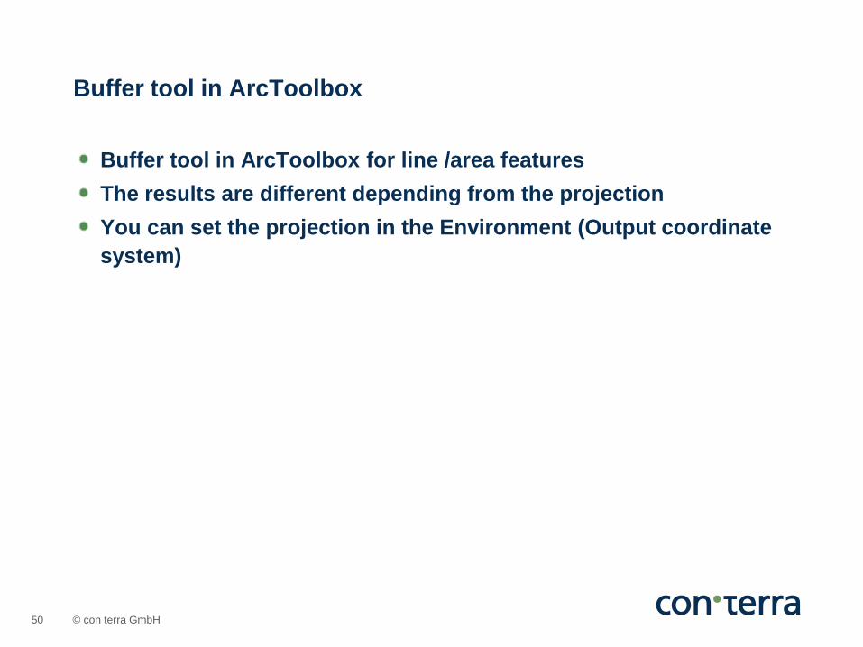
Buffer tool in ArcToolbox for line /area features The results are different depending from the projection You can set the projection in the Environment (Output coordinate system)
Buffer tool in ArcToolbox
© con terra GmbH 51
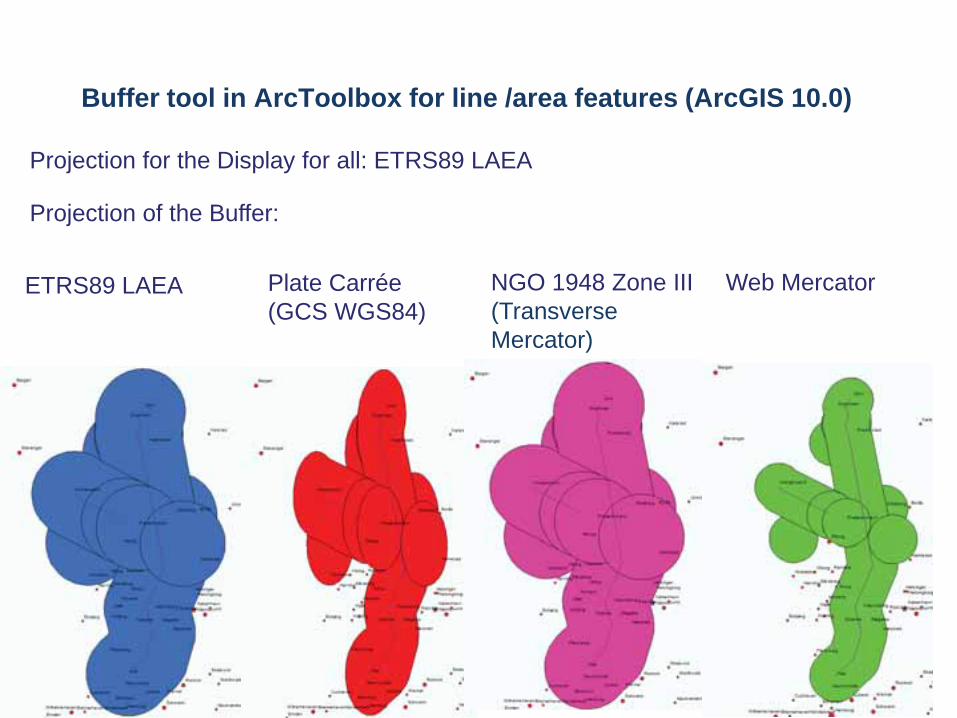
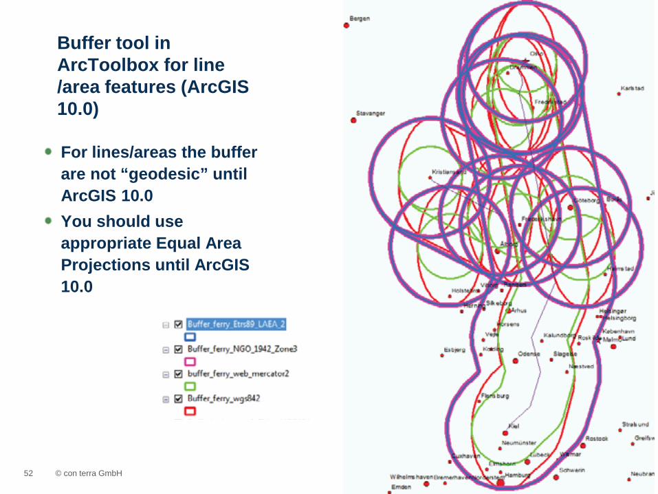
Buffer tool in ArcToolbox for line /area features (ArcGIS 10.0)
NGO 1948 Zone III (Transverse Mercator)
Plate Carrée (GCS WGS84)
Web Mercator ETRS89 LAEA
Projection of the Buffer:
Projection for the Display for all: ETRS89 LAEA
© con terra GmbH 52
For lines/areas the buffer are not “geodesic” until ArcGIS 10.0 You should use appropriate Equal Area Projections until ArcGIS 10.0
Buffer tool in ArcToolbox for line /area features (ArcGIS 10.0)

© con terra GmbH 53
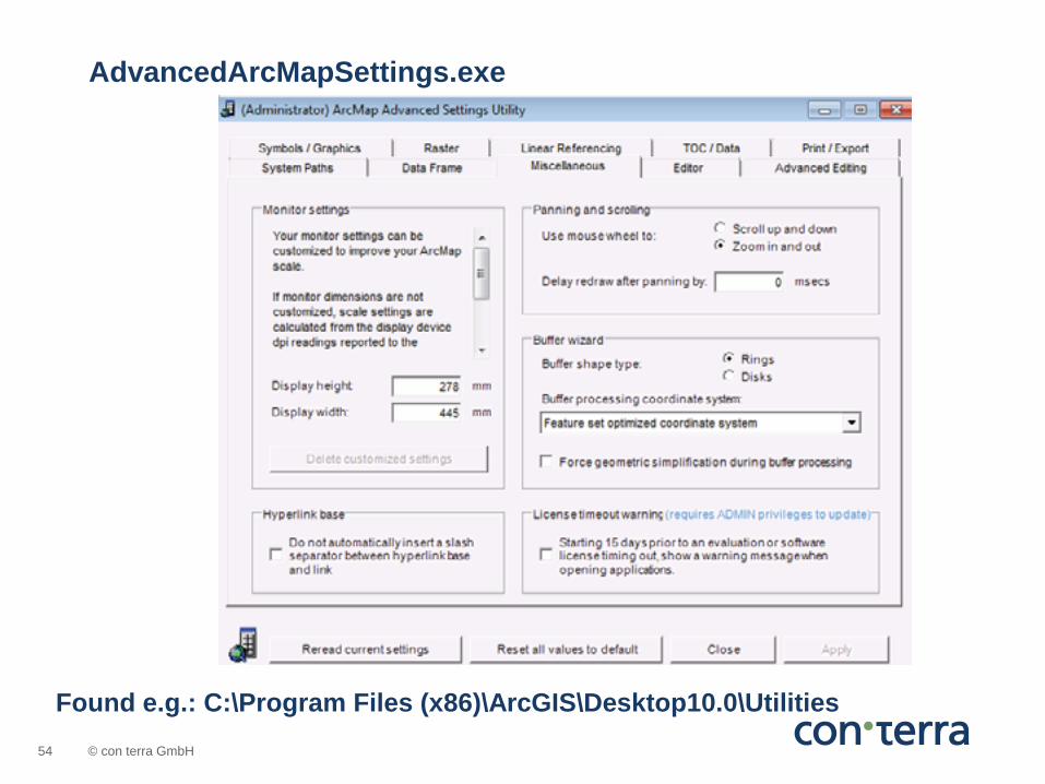
The behaviour of the Buffer Wizard is dependent of the Settings \Utilities\AdvancedArcMapSettings.exe
Buffer Wizard in ArcMap
© con terra GmbH 54
Found e.g.: C:\Program Files (x86)\ArcGIS\Desktop10.0\Utilities
AdvancedArcMapSettings.exe
© con terra GmbH 55
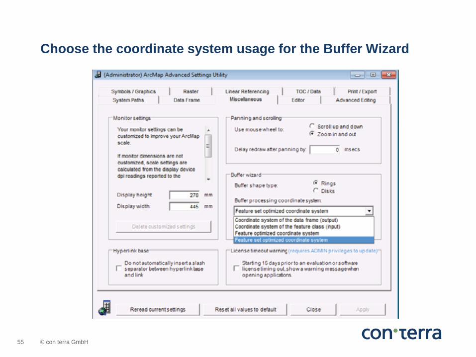
Choose the coordinate system usage for the Buffer Wizard
© con terra GmbH 56
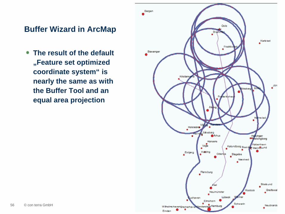
The result of the default „Feature set optimized coordinate system“ is nearly the same as with the Buffer Tool and an equal area projection
Buffer Wizard in ArcMap

Résumé
© con terra GmbH 58
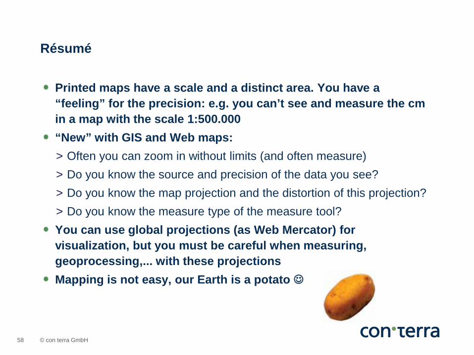
Printed maps have a scale and a distinct area. You have a “feeling” for the precision: e.g. you can’t see and measure the cm in a map with the scale 1:500.000 “New” with GIS and Web maps: > Often you can zoom in without limits (and often measure) > Do you know the source and precision of the data you see? > Do you know the map projection and the distortion of this projection? > Do you know the measure type of the measure tool? You can use global projections (as Web Mercator) for visualization, but you must be careful when measuring, geoprocessing,... with these projections Mapping is not easy, our Earth is a potato
Résumé
© con terra GmbH 59

© con terra GmbH 60
Thank you!
Hamburg
Hannover Münster
Bonn
Wiesbaden
Leipzig
Zürich
Burgdorf
Nyon
Kranzberg
Uta Griwodz [email protected] con terra – Gesellschaft für Angewandte Informationstechnologie Martin-Luther-King-Weg 24 48155 Muenster Germany Telephone +49 251 747 45 0 www.conterra.de
© con terra GmbH 61
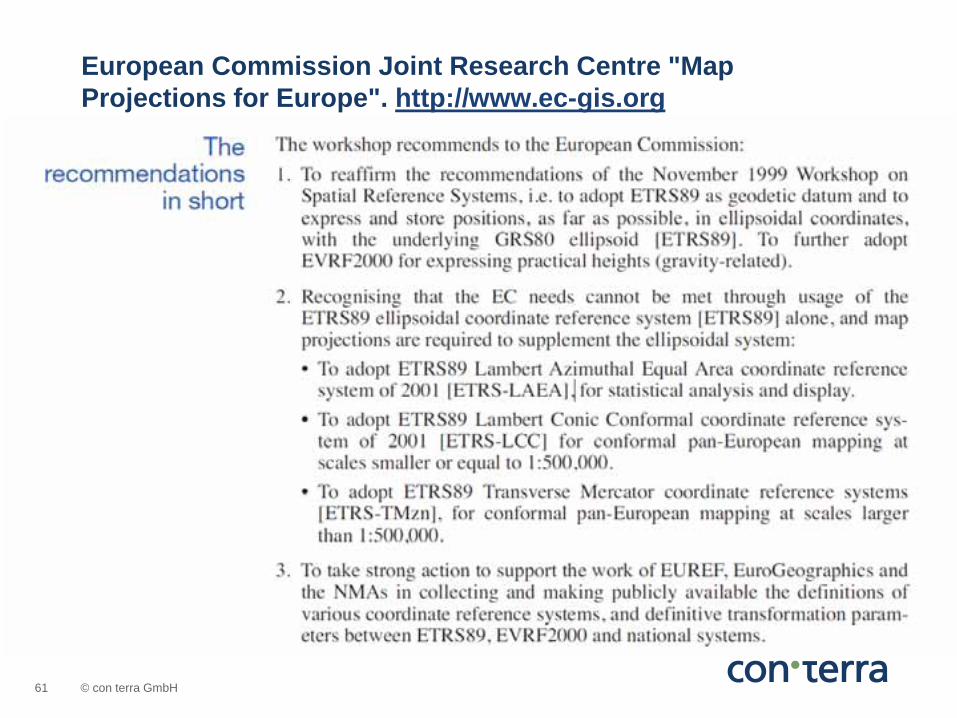
European Commission Joint Research Centre "Map Projections for Europe". http://www.ec-gis.org

© con terra GmbH 62
ETRS89 / LAEA Europe EPSG- Code 3035 Single CRS for all Europe. Used for statistical mapping at all scales and other purposes where true area representation is required Lambert Azimuthal Equal Area Projection
ETRS89 LAEA
© con terra GmbH 63
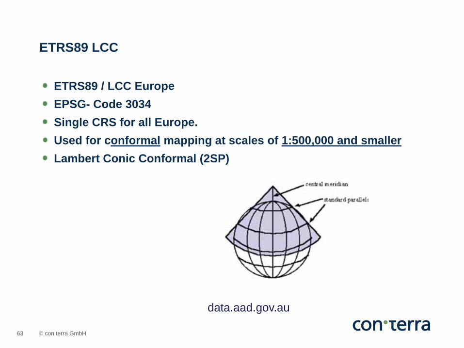
ETRS89 / LCC Europe EPSG- Code 3034 Single CRS for all Europe. Used for conformal mapping at scales of 1:500,000 and smaller Lambert Conic Conformal (2SP)
ETRS89 LCC
data.aad.gov.au
© con terra GmbH 64
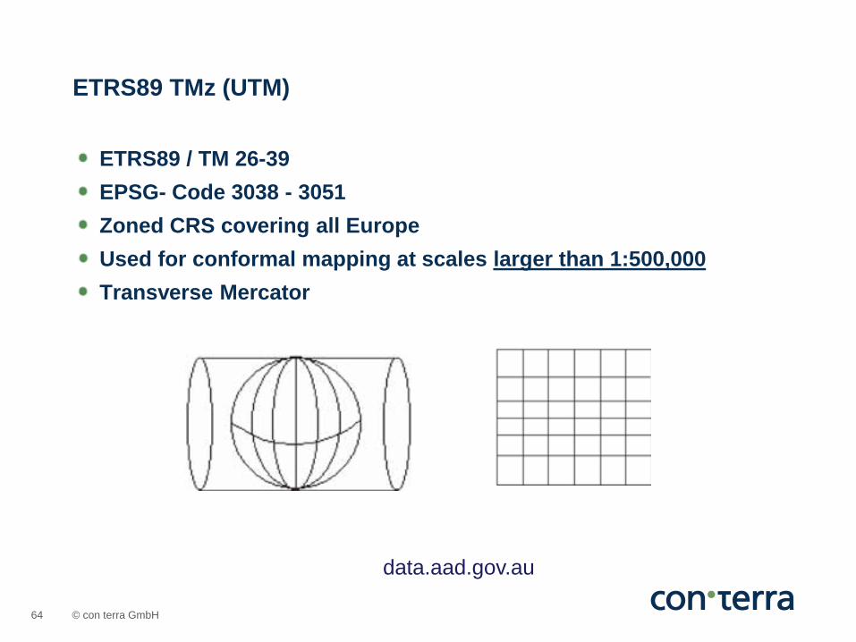
ETRS89 / TM 26-39 EPSG- Code 3038 - 3051 Zoned CRS covering all Europe Used for conformal mapping at scales larger than 1:500,000 Transverse Mercator
ETRS89 TMz (UTM)
data.aad.gov.au

© con terra GmbH 65
Peters Projection, Peters World Map
© con terra GmbH 66
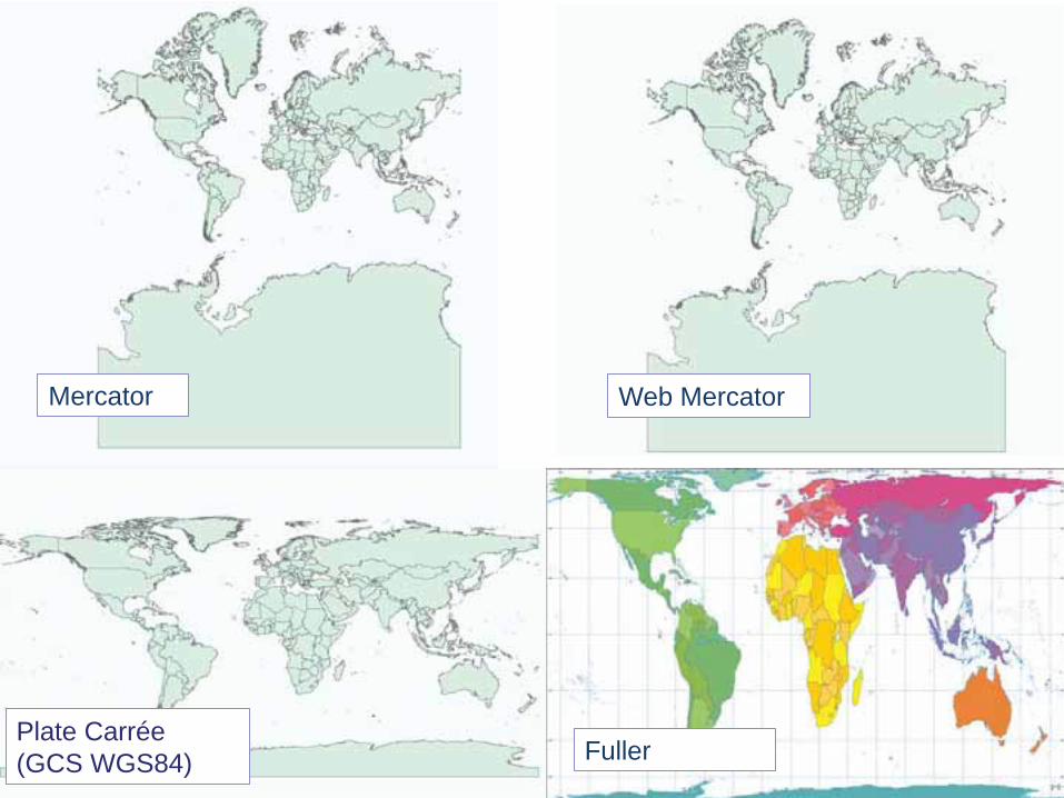
Mercator Web Mercator
Plate Carrée (GCS WGS84) Fuller
© con terra GmbH 67
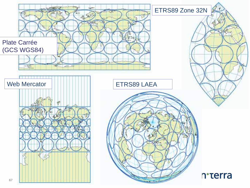
Web Mercator
ETRS89 Zone 32N
Plate Carrée (GCS WGS84)
ETRS89 LAEA
© con terra GmbH 68
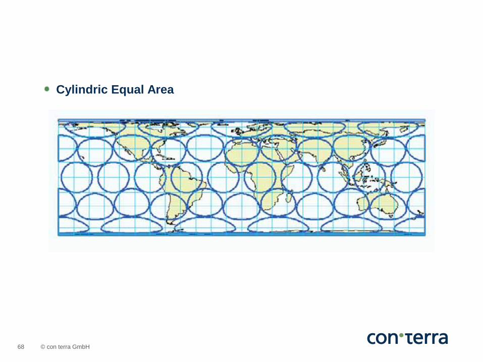
Cylindric Equal Area