planning application pl15/025566 - 180-182 manningham road
TRANSCRIPT

COUNCIL AGENDA 29 March 2016
PAGE 1 Item No:
Planning Application PL15/025566 - 180-182 Manning ham Road Bulleen - Construction of a three-storey apart ment building comprising 25 dwellings and the creation a nd alteration of access to a road in a Road Zone, Cate gory 1
Responsible Director: Director Planning & Environment File No. PL15/025566 Neither the responsible Director, Manager nor the Officer authoring this report has a conflict of interest in this matter. Land: 180-182 Manningham Road, Bulleen Zone Residential Growth Zone, Schedule 2
Design and Development Overlay, Schedule 8-1 (DDO8-1) Applicant: Archestral Designs Ward: Koonung Melway Reference: 32J8 Time to consider: 28 February 2016
SUMMARY
It is proposed to develop two residential lots known as 180 and 182 Manningham Road, Bulleen (total area of 1800 square metres) with a three-storey, apartment building comprising twenty-five (25) dwellings with associated basement car parking.
The proposal also includes the creation and alteration of access to Manningham Road, by widening one crossover to provide access and removing a second crossover.
The application was advertised and one (1) objection was received. Grounds mainly relate to overshadowing, proximity of the basement to the site boundary, increased on-street car parking and the number of high rise buildings in the area.
This report concludes that the proposal generally complies with the Manningham Planning Scheme, including Clause 55 and the requirements of Schedule 8 to the Design and Development Overlay (Residential Areas adjacent to Activity Centres and along Main Roads). These controls recognise that there will be a substantial level of change in dwelling yields and built form at the site.
The proposed development sits comfortably within the changing Manningham Road streetscape, as it is not dissimilar in scale and design to other higher density apartment-style developments that have been developed along this section of the road. This reflects the preferred character of the area and the built form outcome sought along main roads under DDO8 – Main Road sub-precinct.
The building is attractive in appearance and appropriately designed to graduate from the side and rear boundaries as building height increases. The building also incorporates generous boundary setbacks to allow for landscaping and protect surrounding residents from unreasonable visual and amenity impacts.

COUNCIL AGENDA 29 March 2016
PAGE 2 Item No:
Whilst the overall building has a maximum height of 12.5 metres, the section above the 11 metre preferred height is limited to rooftop structures associated with a communal roof terrace that is centrally located and screened from view.
It is recommended that the application be supported subject to a number of conditions.
1 BACKGROUND
The Site
1.1 The site is situated on the southern side of Manningham Road, approximately 20 metres to the east of its intersection with Harold Street.
1.2 The site comprises two irregularly shaped lots known as 180 and 182 Manningham Road. They have a combined width of 39 metres, a depth of 51.37 metres and a total area of 1800 square metres.
1.3 The site presently accommodates two single-storey, detached dwellings. Two vehicle crossings in the central part of the frontage provide access. Private open spaces are located to the south of the respective dwellings and a swimming pool is located at the south-east corner, to the rear of the dwelling at 182 Manningham Road.
1.4 The most significant feature of the site is its topography that drops from the north-east (front) to the south-west (rear) by approximately 4.4 metres. A 1.83 metre wide easement runs adjacent to the southern (rear) boundary.
1.5 No fence is located on the frontage. Paling fences up to 2.1 metres in height are located on the western and eastern boundaries. A 1.6 metre high paling fence is located on the southern (rear) boundary.
1.6 The land titles are not constrained by covenants or Section 173 Agreements.
The Surrounds
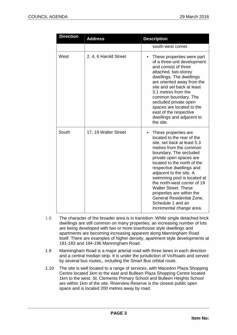
1.7 The site has abuttals with six (6) properties, which can be described as follows:
Direction Address Description
East 184 Manningham Road • This property is developed with a two-storey, brick dwelling set back 11.8 metres from the frontage and 1.8 metres from the common boundary. Two vehicle crossings provide access to a large paved area within the front setback and the garage incorporated into the north-western corner of the dwelling. The secluded private open space is located to the south of the dwelling and includes a swimming pool at the
COUNCIL AGENDA 29 March 2016
PAGE 3 Item No:
Direction Address Description
south-west corner.
West 2, 4, 6 Harold Street • These properties were part of a three-unit development and consist of three attached, two-storey dwellings. The dwellings are oriented away from the site and set back at least 3.1 metres from the common boundary. The secluded private open spaces are located to the east of the respective dwellings and adjacent to the site.
South 17, 19 Walter Street • These properties are located to the rear of the site, set back at least 5.3 metres from the common boundary. The secluded private open spaces are located to the north of the respective dwellings and adjacent to the site. A swimming pool is located at the north-west corner of 19 Walter Street. These properties are within the General Residential Zone, Schedule 1 and an incremental change area.
1.8 The character of the broader area is in transition. While single detached brick dwellings are still common on many properties, an increasing number of lots are being developed with two or more townhouse style dwellings and apartments are becoming increasing apparent along Manningham Road itself. There are examples of higher density, apartment style developments at 181-183 and 194-196 Manningham Road.
1.9 Manningham Road is a major arterial road with three lanes in each direction and a central median strip. It is under the jurisdiction of VicRoads and served by several bus routes,, including the Smart Bus orbital route.
1.10 The site is well located to a range of services, with Macedon Plaza Shopping Centre located 1km to the east and Bulleen Plaza Shopping Centre located 1km to the west. St. Clements Primary School and Bulleen Heights School are within 1km of the site. Riverview Reserve is the closest public open space and is located 200 metres away by road.

COUNCIL AGENDA 29 March 2016
PAGE 4 Item No:
2 PROPOSAL
2.1 It is proposed to remove the existing buildings and construct a three-storey apartment building with an associated basement car park.
2.2 The building contains 25 dwellings, including one, one-bedroom apartment and 24 two-bedroom apartments. The apartments vary in floor area between 57.7 and 91.5 square metres.
2.3 The ground level consists of nine, two-bedroom apartments and one, one-bedroom apartment. With the exception of Apartment 9, all of them are provided with ground level courtyards or access to ground level private open space areas. Dwelling 9 is provided with a north-facing balcony that orients towards the front of the site.
2.4 The first floor level consists of nine two-bedroom apartments, each provided with one or two balconies that range from 8.1 square metres to a total of 26.8 square metres.
2.5 The second floor level consists of six two-bedroom apartments, each provided with a balcony that range from 8.9 to 19.6 square metres.
2.6 A communal roof terrace with an area of 63.9 square metres is provided at the top level, with access provided by a staircase and lift. It also provides access to a screened area for roof plant and building services.
2.7 The building has a site coverage of 60% and provides a density of one dwelling per 72 square metres. The pervious site coverage is 31.5%.
2.8 An important feature of the building is that it steps down from north to south in three split level sections to follow the slope of the land. The northern section is situated 1.2 metres higher than the central section and a further 0.35 metre higher than the southern section. This ensures the ground level is not cut in or elevated more than 1.2 metres above / below natural ground level, except a small portion mid way along the west elevation where there is a significant dip in the topography.
2.9 The building is highest when viewed on the west elevation due to the fall of the land. The roof of the second floor over the three portions of building that step with the fall of the land is 10.9 metres, 11 metres and 10.15 metres in height respectively. This compares to heights of 9.5 metres, 10.2 metres and 9.7 metres along the eastern boundary.
2.10 However, the maximum height of the building is 12.5 metres above natural ground level, measured at the rooftop structure. All habitable floor space of the apartments is within the maximum height of 11 metres.
2.11 The building has the following minimum setbacks to site boundaries:
• Manningham Road (north) boundary:
• Basement – 4 metres
• Ground level – 6 metres
• First floor – 6 metres
• Second floor – 6.85 metres
• Roof terrace – 17.5 metres
• Eastern boundary:

COUNCIL AGENDA 29 March 2016
PAGE 5 Item No:
• Basement – 3 metres
• Ground level – 3 metres
• First floor – 3 metres
• Second floor – 5.1 metres
• Roof terrace – 15.6 metres
• Western boundary
• Basement – 3 metres
• Ground level – 3 metres
• First floor – 4.5 metres
• Second floor – 9.1 metres
• Roof terrace – 9.1 metres
• Southern boundary
• Basement – 4 metres
• Ground level – 4 metres
• First floor – 5.85 metres
• Second floor – 8.9 metres
• Roof terrace – 11.3 metres
2.12 The proposed building has a stylish modern architectural design, which includes a flat roof and articulated façade presentations on all sides. The façades consist of a mix of face brick, timber and render cladding with various express joints and treatments.
2.13 The pedestrian entry to the building is provided via a footpath in the central section of the frontage. It leads to the entry foyer and the upper and lower lift lobbies on the ground level of the building.
2.14 A lift with openings on opposite sides allows access between the split levels of the building. The lift and a staircase provide internal access to all levels and allow barrier-free access to the front entries of all apartments. Six apartments have two interior steps to facilitate the third step down in height.
2.15 Vehicle access is provided via a new 7.95 metre wide crossover on the western end of the frontage, which incorporates part of the existing vehicle crossover for 180 Manningham Road. It leads to a driveway ramp that provides access to the basement car park.
2.16 The basement consists of 30 car parking spaces, including 5 visitor car parking spaces. It also consists of a waste storage room, a water tank and a storage space for each apartment. Vehicle access is restricted by a automated security grill. A separate pedestrian ramp to the west of the driveway also provides external access.
2.17 No existing trees are retained within the site. Canopy trees are proposed adjacent to the site boundaries.

COUNCIL AGENDA 29 March 2016
PAGE 6 Item No:
2.18 A 1.8 metre high front fence is provided within the front setback, set back 1.3 metres from the frontage and includes metal infill sections with 50 per cent transparency.
2.19 Documentation supporting the application included a sustainability management plan, car parking and traffic report, and waste management plan. Information from these documents is referenced where necessary in the report.
3 PRIORITY/TIMING
3.1 The proposal was presented to a Sustainable Design Taskforce meeting on 14 July 2015.
3.2 The statutory time for considering a planning application is 60 days. Allowing for the time taken to advertise the application, the statutory time lapsed on 28 February 2015.
4 POLICY IMPLICATIONS
4.1 The Planning and Environment Act 1987 is the relevant legislation governing planning in Victoria. The Act identifies subordinate legislation in the form of Planning Schemes to guide future land use and development.
4.2 Section 60 of the Act outlines what matters a Responsible Authority must consider in the determination of an application. The Responsible Authority is required to consider:
• the relevant planning scheme; and
• the objectives of planning in Victoria; and
• all objections and other submissions which it has received and which have not been withdrawn; and
• any decision and comments of a referral authority which it has received; and
• any significant effects which the responsible authority considers the use or development may have on the environment or which the responsible authority considers the environment may have on the use or development.
4.3 Section 61(4) of the Act makes specific reference to covenants. The subject site is not burdened by any covenant.
4.4 It is further noted that the subject land is also not encumbered by any Section 173 Agreements.
5 MANNINGHAM PLANNING SCHEME
5.1 The site is included in the Residential Growth Zone, Schedule 2 under the provisions of the Manningham Planning Scheme.
5.2 A planning permit is required to construct two or more dwellings on a lot in the Residential Growth Zone.
5.3 The purpose of the Residential Growth Zone relates primarily to providing housing at increased densities, encouraging a diversity of housing types and encouraging a scale of development that provides a transition between areas

COUNCIL AGENDA 29 March 2016
PAGE 7 Item No:
of more intensive use and development and areas of restricted housing growth.
5.4 An assessment for buildings and works for two or more dwellings is required under the provisions of Clause 55 of the Manningham Planning Scheme.
5.5 The purpose of Clause 55 is generally to provide well designed dwellings with considered regard to internal amenity, while at the same time, maintaining the amenity and character of the locality, with particular emphasis on the amenity of adjoining residents.
5.6 The site is affected by the Design and Development Overlay Schedule 8 (DDO8) of the Manningham Planning Scheme
5.7 The Design Objectives of the DD08 are:
• To increase residential densities and provide a range of housing types around activity centres and along main roads.
• To encourage development that is contemporary in design that includes an articulated built form and incorporates a range of visually interesting building materials and façade treatments.
• To support three storey, ‘apartment style’, developments within the Main Road subprecinct and in sub-precinct A, where the minimum land size can be achieved.
• To support two storey townhouse style dwellings with a higher yield within subprecinct B and sub-precinct A, where the minimum land size cannot be achieved.
• To ensure new development is well articulated and upper storey elements are not unduly bulky or visually intrusive, taking into account the preferred neighbourhood character.
• To encourage spacing between developments to minimise a continuous building line when viewed from a street.
• To ensure the design and siting of dwellings have regard to the future development opportunities and future amenity of adjoining properties.
• To ensure developments of two or more storeys are sufficiently stepped down at the perimeter of the Main Road sub-precinct to provide an appropriate and attractive interface to subprecinct A or B, or other adjoining zone.
• Higher developments on the perimeter of sub-precinct A must be designed so that the height and form are sufficiently stepped down, so that the scale and form complement the interface of sub-precinct B or other adjoining zone.
• To ensure overlooking into adjoining properties is minimised.
• To ensure the design of carports and garages complement the design of the building.
• To ensure the design of basement and undercroft car parks complement the design of the building, eliminates unsightly

COUNCIL AGENDA 29 March 2016
PAGE 8 Item No:
projections of basement walls above natural ground level and are sited to allow for effective screen planting.
• To create a boulevard effect along Doncaster Road and Manningham Road by planting trees within the front setback that are consistent with the street trees.
• To encourage landscaping around buildings to enhance separation between buildings and soften built form.
5.8 Planning permission is required for buildings and works which must comply with the requirements set out in either Table 1 or Table 2 of the Schedule.
5.9 Being located within the Main Road Sub-Precinct (DDO8-1), the maximum allowable height for land more than 1800 square metres in area is 11 metres. A permit can be granted to allow higher buildings.
5.10 There is a range of policy requirements outlined in this control under the headings of building height and setbacks, form, car parking and access, landscaping and fencing.
State Planning Policy Framework
5.11 Clause 15.01-1 (Urban Design) seeks to create urban environments that are safe, functional and provide good quality environments with a sense of place and cultural identity. Strategies towards achieving this are identified as follows:
• Promote good urban design to make the environment more liveable and attractive.
• Ensure new development or redevelopment contributes to community and cultural life by improving safety, diversity and choice, the quality of living and working environments, accessibility and inclusiveness and environmental sustainability
• Require development to respond to its context in terms of urban character, cultural heritage, natural features, surrounding landscape and climate.
• Ensure transport corridors integrate land use planning, urban design and transport planning and are developed and managed with particular attention to urban design aspects
• Encourage retention of existing vegetation or revegetation as part of subdivision and development proposals.
5.12 Clause 15.01-4 (Design for Safety) seeks to improve community safety and encourage neighbourhood design that makes people feel safe. The strategy identified to achieve this objective is to ensure the design of buildings, public spaces and the mix of activities contribute to safety and perceptions of safety.
5.13 Clause 15.01-5 (Cultural Identity and Neighbourhood Character) seeks to recognise and protect cultural identity, neighbourhood character and sense of place. The clause emphasises the importance of neighbourhood character and the identity of neighbourhoods and their sense of place. Strategies towards achieving this are identified as follows:

COUNCIL AGENDA 29 March 2016
PAGE 9 Item No:
• Ensure development responds and contributes to existing sense of place and cultural identity.
• Ensure development recognises distinctive urban forms and layout and their relationship to landscape and vegetation.
• Ensure development responds to its context and reinforces special characteristics of local environment and place.
5.14 Clause 15.02-1 (Energy and Resource Efficiency) seeks to encourage land use and development that is consistent with the efficient use of energy and the minimisation of greenhouse gas emissions.
5.15 Clause 16.01-1 (Integrated Housing) seeks to promote a housing market that meets community needs. Strategies towards achieving this are identified as follows:
• Increase the supply of housing in existing urban areas by facilitating increased housing yield in appropriate locations.
• Ensure housing developments are integrated with infrastructure and services, whether they are located in existing suburbs, growth areas or regional towns.
5.16 Clause 16.01-2 (Location of Residential Development) seeks to locate new housing in or close to activity centres and employment corridors and at other strategic redevelopment sites that offer good access to services and transport. Strategies towards achieving this are identified as follows:
• Increase the proportion of housing in Metropolitan Melbourne to be developed within the established urban area, particularly at activity centres, employment corridors and at other strategic sites, and reduce the share of new dwellings in greenfield and dispersed development areas.
• In Metropolitan Melbourne, locate more intense housing development in and around Activity centres, in areas close to train stations and on large redevelopment sites.
• Encourage higher density housing development on sites that are well located in relation to activity centres, employment corridors and public transport.
• Facilitate residential development that is cost-effective in infrastructure provision and use, energy efficient, incorporates water efficient design principles and encourages public transport use.
5.17 Clause 16.01-4 (Housing Diversity) seeks to provide for a range of housing types to meet increasingly diverse needs. Strategies towards achieving this are identified as follows:
• Ensure housing stock matches changing demand by widening housing choice, particularly in the middle and outer suburbs.
• Encourage the development of well-designed medium-density housing which respects the neighbourhood character.
• Improves housing choice.

COUNCIL AGENDA 29 March 2016
PAGE 10 Item No:
• Makes better use of existing infrastructure.
• Improves energy efficiency of housing.
• Support opportunities for a wide range of income groups to choose housing in well serviced locations.
5.18 Clause 16.01-5 (Housing affordability) seeks to deliver more affordable housing closer to jobs, transport and services.
Local Planning Policy Framework (LPPF) Municipal Strategic Statement
5.19 Clause 21.03 (Key Influences) identifies that future housing need and residential amenity are critical land-use issues. The MSS acknowledges that there is a general trend towards smaller household size as a result of an aging population and smaller family structure which will lead to an imbalance between the housing needs of the population and the actual housing stock that is available.
5.20 This increasing pressure for re-development raises issues about how these changes affect the character and amenity of our local neighbourhoods. In meeting future housing needs, the challenge is to provide for residential redevelopment in appropriate locations, to reduce pressure for development in more sensitive areas, and in a manner that respects the residential character and amenity valued by existing residents.
5.21 Clause 21.05 (Residential) outlines the division of Manningham into four Residential Character Precincts. The precincts seek to channel increased housing densities around activity centres and main roads where facilities and services are available. In areas which are removed from these facilities a lower intensity of development is encouraged. A low residential density is also encouraged in areas that have identified environmental or landscape features.
5.22 The site is within “Precinct 2 –Residential Areas Surrounding Activity Centres and Along Main Roads”.
5.23 This area is aimed at providing a focus for higher density development and a substantial level of change is anticipated. Future development in this precinct is encouraged to:
• Provide for contemporary architecture and achieve high design standards
• Provide visual interest and make a positive contribution to the streetscape
• Provide a graduated building line from side and rear boundaries
• Minimise adverse amenity impacts on adjoining properties
• Use varied and durable building materials
• Incorporate a landscape treatment that enhances the overall
5.24 Within this precinct, there are three sub-precincts which each stipulate different height, scale and built form outcomes to provide a transition between each sub-precinct and adjoining properties, primarily those in

COUNCIL AGENDA 29 March 2016
PAGE 11 Item No:
Precinct 1 – Residential Areas Removed from Activity Centres and Main Roads.
5.25 The three sub-precincts within Precinct 2 consist of:
Sub-precinct – Main Road (DDO8-1) is an area where three storey (11 metres) ‘apartment style’ developments are encouraged on land with a minimum area of 1,800m². Where the land comprises more than one lot, the lots must be consecutive lots which are side by side same sub-precinct. All development in the Main Road sub-precinct should have a maximum site coverage of 60 percent. Higher developments on the perimeter of the Main Road sub-precinct should be designed so that the height and form are sufficiently stepped down, so that the scale and form complement the interface of sub-precinct A or B, or other adjoining zone. Sub-precinct A (DDO8-2) is an area where two storey units (9 metres) and three storey (11 metres) ‘apartment style’ developments are encouraged. Three storey, contemporary developments should only occur on land with a minimum area of 1800m2. Where the land comprises more than one lot, the lots must be consecutive lots which are side by side and have a shared frontage. The area of 1800m2 must all be in the same sub-precinct. In this sub-precinct, if a lot has an area less than 1800m2, a townhouse style development proposal only will be considered, but development should be a maximum of two storeys. All development in Sub-precinct A should have a maximum site coverage of 60 percent. Higher developments on the perimeter of sub-precinct A should be designed so that the height and form are sufficiently stepped down, so that the scale and form complement the interface of sub-precinct B, or other adjoining zone. Sub-precinct B (DDO8-3) is an area where single storey and two storey dwellings only will be considered and development should have a maximum site coverage of 60 percent. There is no minimum land area for such developments.
5.26 The site is located within Sub-Precinct – Main Road (DDO8-1).
5.27 Clause 21.05-2 Housing contains the following objectives:
• To accommodate Manningham’s projected population growth through urban consolidation, infill developments and Key Redevelopment Sites.
• To ensure that housing choice, quality and diversity will be increased to better meet the needs of the local community and reflect demographic changes.
• To ensure that higher density housing is located close to activity centres and along main roads in accordance with relevant strategies.
• To promote affordable and accessible housing to enable residents with changing needs to stay within their local neighbourhood or the municipality.

COUNCIL AGENDA 29 March 2016
PAGE 12 Item No:
• To encourage development of key Redevelopment Sites to support a diverse residential community that offers a range of dwelling densities and lifestyle opportunities.
• To encourage high quality and integrated environmentally sustainable development.
5.28 The strategies to achieve these objectives include:
• Ensure that the provision of housing stock responds to the needs of the municipality’s population.
• Promote the consolidation of lots to provide for a diversity of housing types and design options.
• Ensure higher density residential development occurs around the prescribed activity centres and along main roads identified as Precinct 2 on the Residential Framework Plan 1 and Map 1 to this clause.
• Encourage development to be designed to respond to the needs of people with limited mobility, which may for example, incorporate lifts into three storey developments
5.29 Clause 21.05-4 (Built form and neighbourhood character) seeks to ensure that residential development enhances the existing or preferred neighbourhood character of the residential character precincts as shown on Map 1 to this Clause.
5.30 The strategies to achieve this objective include:
• Require residential development to be designed and landscaped to make a positive contribution to the streetscape and the character of the local area.
• Ensure that where development is constructed on steeply sloping sites that any development is encouraged to adopt suitable architectural techniques that minimise earthworks and building bulk.
• Ensure that development is designed to provide a high level of internal amenity for residents.
• Require residential development to include stepped heights, articulation and sufficient setbacks to avoid detrimental impacts to the area’s character and amenity.
5.31 Clause 21.10 (Ecologically Sustainable Development) highlights Council’s commitment to ESD and outlines a number of ESD principles to which regard must be given. These are:
• Building energy management
• Water sensitive design
• External environmental amenity
• Waste management
• Quality of public and private realm
• Transport

COUNCIL AGENDA 29 March 2016
PAGE 13 Item No:
Local Planning Policy
5.32 Clause 22.08 (Safety through urban design) applies to all land in Manningham. It endeavours to provide and maintain a safer physical environment for those who live in, work in or visit the City of Manningham. The policy seeks attractive, vibrant and walkable public spaces where crime, graffiti and vandalism in minimised.
5.33 Clause 22.09 (Access for disabled people) also applies to all land in Manningham. It seeks to ensure that people with a disability have the same level of access to buildings, services and facilities as any other person. The policy requires the needs of people with a disability to be taken into account in the design of all proposed developments.
Particular Provisions
5.34 Clause 52.06 (Car Parking) is relevant to this application. Pursuant to Clause 52.06-5, car parking is required to be provided at the following rate:
• 1 space for 1 and 2 bedroom dwellings
• 2 spaces for 3 or more bedroom dwellings
• 1 visitor space to every 5 dwellings for developments of 5 or more dwellings
5.35 Clause 52.06-8 outlines various design standards for parking areas that should be achieved.
5.36 Clause 52.29 (Land Adjacent to a Road Zone Category 1) seeks to ensure appropriate access to identified roads. A permit is required to create or alter access to a road in a Road Zone, Category 1. All applications must be referred to VicRoads for comment.
5.37 Clause 52.34 (Bicycle Facilities) seeks to encourage cycling as a mode of transport and provide secure, accessible and convenient bicycle parking spaces.
5.38 Clause 55 (Two or More Dwellings on a Lot) applies to all applications for two or more dwellings on a lot. Consideration of this clause is outlined in the Assessment section of this report.
General Provisions
5.39 Clause 65 (Decision Guidelines) outlines that before deciding on an application, the responsible authority must consider, as appropriate:
• The State Planning Policy Framework and the Local Planning Policy Framework, including the Municipal Strategic Statement and local planning policies.
• The purpose of the zone, overlay or other provision.
• The orderly planning of the area.
• The effect on the amenity of the area.
6 ASSESSMENT
6.1 Council has, through its policy statements throughout the Planning Scheme, and in particular by its adoption of Schedule 8 to the Design and Development Overlay over part of this neighbourhood, created a planning

COUNCIL AGENDA 29 March 2016
PAGE 14 Item No:
mechanism that has, and will in time, alter the existing neighbourhood character along Manningham Road and in some adjoining side streets.
6.2 Council’s planning preference is for higher density, multi-unit developments which can include apartment style developments on larger lots. This higher density housing thereby provides for the “preferred neighbourhood character” which is guided by the design elements contained within the Schedule 8 to the Design and Development Overlay, in conjunction with an assessment against Clause 21.05 and Clause 55 – Rescode. The resultant built form is contemplated to have a more intense and less suburban outcome.
6.3 An apartment development across this site is generally consistent with the broad objectives of Council’s planning policy outlined at Clause 21.05 of the Manningham Planning Scheme. The policy encourages urban consolidation (and apartment buildings) in this specific location due to its capacity to support change given the site’s main road location and proximity to services, such as public transport. The policy anticipates a substantial level of change from the existing character of primarily single dwellings and dual occupancies which has occurred in the past.
6.4 The consolidation of two lots with a combined area of 1800 square metres also provides opportunities for increased development as the larger area allows increased setbacks to compensate for its larger scale in comparison to traditional medium density housing. Given the site area, the proposal is permitted an 11 metre preferred building height under DDO8.
6.5 An assessment of the proposal will be made based on the following clauses:
• Local Planning Policy Framework
• Schedule 8 to the Design and Development Overlay (DDO8)
• Clause 52.06 Car Parking
• Clause 52.29 Land Adjacent to a Road Zone Category 1
• Clause 52.34 Bicycle Facilities
• Clause 55 Two or More Dwellings on a Lot
• Clause 65 Decision Guidelines
Local Planning Policy Assessment
Clause 21.05 Residential
6.6 The development site is situated within Precinct 2 – Residential Areas Surrounding Activity Centres and Along Main Roads, where high density is encouraged. Given the site is located on a main road and has an area of 1800 square metres, a maximum building height of 11 metres is applicable. A maximum site coverage of 60% is also sought by this policy. The height and site coverage of the development will be discussed later in this report in the assessment against DDO8.
6.7 The proposal provides generous setbacks to all boundaries, thereby providing spacing and good separation from/to adjoining properties. Consequently, opportunities for landscaping can be realised along the perimeter of the site, in particular adjacent to sensitive interfaces to the side and rear.

COUNCIL AGENDA 29 March 2016
PAGE 15 Item No:
6.8 There are a number of subtle design aspects in setbacks and massing that can be highlighted, including the third portion of the building that steps down at the rear of the site via two steps within six apartments to ensure minimal overlooking and suitable transitions to the properties at the rear of the site in the incremental change area.
6.9 Further, the side setback along the western boundary, where the building is viewed highest is particularly generous at 3 metres at ground level, 4.5 metres at first floor level and 9.1 metres at second floor level.
6.10 In addition to good setbacks, the design response across all elevations is considered to be of a high standard. Visual interest is provided across all elevations by the incorporation of a variety of building materials and finishes. Articulation is offered via a combination of articulation, graduation and the incorporation of balconies, fascias and framing elements.
6.11 Overall, the design response is considered to be consistent with Council’s policy expectations at Clause 21.05 Residential.
Clause 21.10 Ecologically Sustainable Development
6.12 Council’s MSS outlines ESD requirements to be incorporated into larger developments within the municipality. It is considered that by the preparation of a Sustainability Management Plan, and minimal issues which have arisen as a result of its assessment by Council’s Strategic Sustainability Planner, that the proposal offers a number of positive ESD measures.
Clause 22.08 Safety through Urban design
6.13 Council’s Local Planning Policy at Clause 22.08 applies to all land in the municipality and therefore has a broad range of objectives and policy requirements in relation to the design of buildings, street layout/access, lighting and car parks.
6.14 While a number of items are not relevant to this application, a number of the requirements in relation to building design are, including “Buildings be orientated to maximise surveillance of entrances and exits from streets” and “The location of building entrances and windows maximise opportunities for passive surveillance of streets and other public spaces”.
6.15 It is considered the design response is consistent with the requirements of this clause with a concerted effort made to ensure the public and private realms interact.
Clause 22.09 Access for Disabled People
6.16 The Access for Disable People Policy is based on the Disability Discrimination Act and requires that persons with a disability have the same level of access to buildings, services and facilities as any other person. It requires that the design of new building account for the needs of persons of limited mobility.
6.17 The development provides at grade access from Manningham Road to the front entry of the building. A lift provides internal access to all levels of the building and the entries to all apartments. This is considered to be a satisfactory design response for persons of limited mobility.
6.18 In the tables below, Officers have used the term ‘Met’ where an objective and performance standard or policy requirement is achieved, ‘Considered met’

COUNCIL AGENDA 29 March 2016
PAGE 16 Item No:
where the objective is met, but the performance standard or policy requirement is not achieved, and ‘Met subject to condition’ where either the objective or the performance standard or policy requirement has not been met and modifications are required.
Schedule 8 to the Design and Development Overlay
6.19 The assessment follows against the design requirements of the DDO8:
Design Element Level of Compliance DDO8-1 (Main Road Sub -Precinct)
• The minimum lot size is 1800 square metres, which must be all the same sub-precinct. Where the land comprises more than one lot, the lots must be consecutive lots which are side by side and have a shared frontage
• 11 metres provided the condition regarding minimum land size is met. If the condition is not met, the maximum height is 9 metres, unless the slope of the natural ground level at any cross section wider than eight metres of the site of the building is 2.5 degrees or more, in which case the maximum height must not exceed 10 metres.
Considered Met The site has an area of 1800 square metres that is entirely within the Main Road Sub-Precinct. The site therefore has a maximum building height requirement of 11 metres. The building has a maximum height of 12.5 metres, which exceeds the preferred height requirement by 1.5 metres. The purpose of providing discretion in building height on the Main Road Sub-Precinct is to allow flexibility to achieve design excellence. This might be through providing a ‘pop-up’ level to provide visual interest to an otherwise flat roof form, or a design feature at a ‘gateway’ site. The discretion is only provided to the sub-precinct because main road streetscapes are typically less intermit environments compared to local streets and therefore can absorb some additional height. The portion of built form above a height of 11 metres is limited to the rooftop structure that provides for communal access to the roof terrace area. It is centrally located within the site and covers a small area of 42.3 square metres. It is also set back more than 15 metres from all site boundaries and would only be visible when the site is viewed from a distance. All habitable floor space (including the three levels of the apartment building) is within the maximum height limit of 11 metres. The maximum height of the rooftop structure at 12.5 metres above natural ground level is limited to the south-west corner due to the slope of the land. The

COUNCIL AGENDA 29 March 2016
PAGE 17 Item No:
north-east corner of the structure has a height of 11.2 metres. In providing discretion to the building height, a communal rooftop terrace area can be provided for the enjoyment of residents and improve on-site amenity. Overall, it is considered that the height of the building is acceptable and will not have unreasonable impacts on the streetscape or adjoining properties.
• Minimum front street setback is the distance specified in Clause 55.03-1 or 6 metres, whichever is the lesser.
Considered Met The ground and upper levels of the building has a street setback of 6 metres. A small section of the basement projects into the 6 metre street setback to provide a car parking space and some storage areas. This is considered to be acceptable as the non compliance is below ground and will not prevent proper landscaping of the front setback.
Form • Ensure that the site area
covered by buildings does not exceed 60 percent.
Met The building has a site coverage of 60%.
• Provide visual interest through
articulation, glazing and variation in materials and textures.
Met The building incorporates a mixture of colours and materials to provide visual interest. Articulation is also provided by the stepping of walls, the use of balconies, glazing, fascias and framing elements.
• Minimise buildings on boundaries to create spacing between developments.
Met There are no building sections constructed on the boundaries. Building setbacks are at least 3 metres along the side and rear boundaries to provide spacing between the building and the adjoining properties. This spacing can accommodate landscaping, courtyards and light into adjacent rooms. This is considered to be a good outcome for adjoining properties and the streetscape.
• Where appropriate ensure that buildings are stepped down at the rear of sites to provide a transition to the scale of the adjoining residential area.
Met The building is stepped down from north to south in three split level sections to follow the slope of the land. The northern section is situated 1.2 metres higher than the central section and a further 0.35 metre higher than the southern section.

COUNCIL AGENDA 29 March 2016
PAGE 18 Item No:
The upper levels of the building are graduated to provide increased setbacks to the rear boundary, which allows the building to be stepped down and provide a transition to the scale of the adjoining properties to the rear.
• Where appropriate, ensure that buildings are designed to step with the slope of the land.
Met As above, the building is designed with steps of 1.2 metres and 0.35 metre to respond to the slope of the land. This reduces the elevation of the building above the natural ground level and the associated visual impact, providing a suitable transition to the adjoining residential properties within the incremental change area.
• Avoid reliance on below ground light courts for any habitable rooms.
Met The building does not rely on below ground light courts for any habitable rooms.
• Ensure the upper level of a two storey building provides adequate articulation to reduce the appearance of visual bulk and minimise continuous sheer wall presentation.
Not applicable
• Ensure that the upper level of a three storey building does not exceed 75% of the lower levels, unless it can be demonstrated that there is sufficient architectural interest to reduce the appearance of visual bulk and minimise continuous sheer wall presentation.
Met The second floor level of the building covers 67.3% of the first floor level, which is considerably smaller than the 75% requirement. The second floor is also graduated from the lower levels to reduce its prominence and visual bulk. Overall, the building is well articulated and provides visual interest.
• Integrate porticos and other design features with the overall design of the building and not include imposing design features such as double storey porticos.
Met There are no porticos or imposing design elements proposed. Design features are considered to be well integrated into the overall design of the building.
• Be designed and sited to address slope constraints, including minimising views of basement projections and/or minimising the height of finished floor levels and providing appropriate retaining wall presentation.
Met The building is stepped down from north to south in three split level sections to follow the slope of the land. The projection of the basement above natural ground level is limited to the west elevation and the western part of the south elevation. It is limited to 1.2 metres and will be screened from the adjoining

COUNCIL AGENDA 29 March 2016
PAGE 19 Item No:
properties by boundary fences. • Be designed to minimise
overlooking and avoid the excessive application of screen devices.
Met Screens are provided to upper level balconies to prevent direct views into the habitable room windows or secluded private open spaces of the adjoining properties. There is no excessive application of screen devices partly due to the proposed planter boxes at the edge of the balconies that will prevent downward views. Overlooking impacts will be further discussed in the assessment against Clause 55.04-6 of the Manningham Planning Scheme.
• Ensure design solutions respect the principle of equitable access at the main entry of any building for people of all mobilities.
Met The footpath to the building entry is appropriately graded to allow for equitable access by people of all mobilities.
A lift provides access to the basement car park and entries of all dwellings.
• Ensure that projections of basement car parking above natural ground level do not result in excessive building height as viewed by neighbouring properties.
Met The basement projects above natural ground level on the west elevation and western part of the south elevation. The projection is not considered to be excessive and will not result in unreasonable visual impacts. The upper levels of the building are also graduated and the overall height on the western and southern elevations does not exceed 11 metres in height. As indicated previously, the building setbacks on the western boundary are particularly generous to take into account wall heights that are approximately 1.2 metres higher than if the basement projection did not occur.
• Ensure basement or undercroft car parks are not visually obtrusive when viewed from the front of the site.
Met Across the frontage of the site, the basement is not visible as it is below ground level.
• Integrate car parking requirements into the design of buildings and landform by encouraging the use of undercroft or basement parking and minimise the use of open car park and half basement parking.
Met All car parking spaces are provided within the basement car park.
• Ensure the setback of the basement or undercroft car park is consistent with the front
Met The basement is generally consistent with the front building setback of 6 metres,

COUNCIL AGENDA 29 March 2016
PAGE 20 Item No:
building setback and is setback a minimum of 4.0m from the rear boundary to enable effective landscaping to be established.
except for a section with a length of 5 metres that is set back 4 metres from the frontage. The minor encroachment into the front setback is utilised as paving and will not result in reduced landscaping opportunities. The basement is set back at least 4 metres from the rear boundary, which provides adequate room for effective landscaping to be established.
• Ensure that building walls, including basements, are sited a sufficient distance from site boundaries to enable the planting of effective screen planting, including canopy trees, in larger spaces.
Met The development provides appropriate wall setbacks to side and rear boundaries to allow for screen planting that soften the appearance of the built form.
• Ensure that service equipment, building services, lift over-runs and roof-mounted equipment, including screening devices is integrated into the built form or otherwise screened to minimise the aesthetic impacts on the streetscape and avoids unreasonable amenity impacts on surrounding properties and open spaces.
Met subject to conditions The plant equipment on the roof is located away from the sides of the building and is screened to minimise any visual and amenity impacts on the street and adjoining properties. Permit conditions will also require any service equipment to be screened to avoid unreasonable amenity impacts (Conditions 21-23 ).
Car Parking and Access • Include only one vehicular
crossover, wherever possible, to maximise availability of on street parking and to minimise disruption to pedestrian movement. Where possible, retain existing crossovers to avoid the removal of street tree(s). Driveways must be setback a minimum of 1.5m from any street tree, except in cases where a larger tree requires an increased setback.
Met subject to conditions There is only one vehicular crossover proposed. While a street tree will need to be removed, it is juvenile and can be replaced at the permit holder’s expense (Condition 12).
• Ensure that when the basement car park extends beyond the built form of the ground level of the building in the front and rear setback, any visible extension is utilised for paved open space or is appropriately screened, as is necessary.
Met Small sections of the basement extend beyond the ground level of the building in the front, side and rear setbacks. These areas have been appropriately utilised as paved open space (courtyards) or the footpath leading to the main building entry.

COUNCIL AGENDA 29 March 2016
PAGE 21 Item No:
• Ensure that where garages are located in the street elevation, they are set back a minimum of 1.0m from the front setback of the dwelling.
Not applicable
• Ensure that access gradients of basement carparks are designed appropriately to provide for safe and convenient access for vehicles and servicing requirements.
Met subject to condition Council’s Engineers require the driveway gradients to comply with Design Standard 3 in Clause 52.06-8 of the Manningham Planning Scheme. The driveway gradients will be required to be modified by a permit condition (Condition 1.17).
Landscaping • On sites where a three storey
development is proposed include at least 3 canopy trees within the front setback, which have a spreading crown and are capable of growing to a height of 8.0m or more at maturity.
• On sites where one or two storey development is proposed include at least 1 canopy tree within the front setback, which has a spreading crown, and is capable of growing to a height of 8.0m or more at maturity.
Met subject to condition The site plan shows the front setback has adequate space for the planting of three canopy trees. This will be reinforced by the permit condition requiring a landscaping plan (Condition 8.6 ).
• Provide opportunities for planting alongside boundaries in areas that assist in breaking up the length of continuous built form and/or soften the appearance of the built form.
Met The site plan shows the site will allow the planting of numerous canopy trees within the side and rear setbacks, which assist to soften the appearance of the built form.
Fencing • A front fence must be at least
50 per cent transparent.
• On sites that front Doncaster, Tram, Elgar, Manningham, Thompsons, Blackburn and Mitcham Roads, a fence must: • not exceed a maximum
height of 1.8m • be setback a minimum of
1.0m from the front title boundary
and a continuous landscaping treatment within the 1.0m setback must be provided.
Met subject to condition The fence incorporates sections with open style metal infill panels that achieve 50 per cent transparency. This will help integrate the development with the street and generate connection between the development and landscaping along the site frontage. The front fence has a maximum height of 1.8 metres. The front fence is set back 1.29 metres from the Manningham Road frontage. A continuous landscaping treatment

COUNCIL AGENDA 29 March 2016
PAGE 22 Item No:
between the frontage and the fence will be required by a permit condition (Condition 8.9).
6.20 Having regard to the above assessment against the requirements of Schedule 8 to the Design and Development Overlay, it is considered that the proposed design respects the preferred neighbourhood character and responds to the features of the site.
6.21 A high level of compliance is achieved in respect of the layout, built form, design, car parking, front fencing and opportunities for landscaping as articulated in the DD08.
Clause 52.06 Car Parking
6.22 Prior to a new use commencing or a new building being occupied, Clause 52.06-2 requires that the number of car parking spaces outlined at Clause 52.06-6 to be provided on the land or as approved under Clause 52.06-3 to the satisfaction of the Responsible Authority.
6.23 This clause requires resident car parking at a rate of one space for each dwelling with one or two bedrooms and two spaces for each dwelling with three or more bedrooms.
6.24 Visitor car parking is required at a rate of one car parking space for every 5 dwellings.
6.25 The proposal requires 25 resident car parking spaces and 5 visitor car parking spaces. The proposed parking provision complies with the requirement.
6.26 The following table provides an assessment of the proposal against the seven (7) design standards of Clause 52.06-8:
Design Standard Met/Not Met 1 – Accessways Met with condition
The accessway to the basement car park meets the minimum width and height clearance requirements. The car park has also been designed so all vehicles can exit the site in a forward direction, including vehicles parked in the last space of a dead-end accessway. The driveway also allows two way traffic so no passing bay needs to be provided. A permit condition will require a visibility splay area on the western edge of the driveway at the frontage, with obstructions not exceeding 900mm in height (Condition 1.16 ).
2 – Car Parking Spaces Met Car parking spaces are provided in accordance with the requirements, with dimensions of 2.6 metres wide, a length of 4.9 metres and accessed from an aisle width of at least 6.4 metres. Clearance is provided adjacent to car parking spaces as per the standard.
3 – Gradients Met subject to condition The driveway ramp includes a transition section of less than 2 metres, which does not comply with the

COUNCIL AGENDA 29 March 2016
PAGE 23 Item No:
standard. The driveway has been assessed by Council’s Engineering and Technical Services Unit, which requires the driveway to be modified to comply with the standard. This will be required by a permit condition (Condition 1.17).
4 – Mechanical Parking Not applicable No mechanical parking proposed.
5 – Urban Design Met subject to condition The vehicle crossing and accessway is locate to the western side of the site and will not dominate the landscape. The entry into the basement car park will not dominate the streetscape as it is recessed from the frontage, located beneath the ground level of the building and below natural ground level. A permit condition will require the pedestrian ramp adjacent to the driveway to be changed to stairs to reduce the extent of retaining walls required within the front setback and improve the streetscape presentation by allowing more landscaping opportunities (Condition 1.19).
6 – Safety Met The basement car park is appropriately secured by an automatic door.
7 – Landscaping Met No ground level car parking is proposed. Landscaping is provided to soften the appearance of the accessway.
Clause 52.29 Land Adjacent to a Road Zone Category 1
6.27 The proposal seeks to alter access to Manningham Road by removing the existing crossover for 182 Manningham Road and widening the crossover for 180 Manningham Road to provide access.
6.28 The decision guidelines of this Clause include the views of the relevant road authority.
6.29 As VicRoads have no objection to the proposal, the access arrangement to Manningham Road is considered appropriate.
Clause 52.34 Bicycle Facilities
6.30 In developments of four or more storeys, 1 bicycle space is required to each 5 dwellings (resident) and 1 bicycle space is required to each 10 dwellings (visitor).
6.31 No bicycle spaces are required to be provided as the building is three storeys. In any case, the proposal provides a bicycle space at the rear of the car parking space for each dwelling, three spaces at the south-western corner of the basement and two spaces adjacent to the building entry on the ground level.
Clause 55 Two or More Dwellings on a Lot

COUNCIL AGENDA 29 March 2016
PAGE 24 Item No:
6.32 This Clause sets out a range of objectives which must be met. Each objective is supported by standards which should be met. If an alternative design solution to the relevant standard meets the objective, the alternative may be considered.
6.33 The following table sets out the level of compliance with the objectives of this clause:
Clause 55 Assessment – Two or more dwellings on a l ot
OBJECTIVE OBJECTIVE MET/NOT MET
55.02-1 Neighbourhood Character To ensure that the design respects the existing neighbourhood character or contributes to a preferred neighbourhood character. To ensure that development responds to the features of the site and the surrounding area.
Met As outlined in the assessment of the proposal against the policy requirements of the Schedule 8 to the Design and Development Overlay (DD08), it is considered that the proposed apartment development responds positively to the preferred neighbourhood character, and respects the natural features of the site and its surrounds.
55.02-2 Residential Policy To ensure that residential development is provided in accordance with any policy for housing in the State Planning Policy Framework and the Local Planning Policy Framework, including the Municipal Strategic Statement and local planning policies. To support medium densities in areas where development can take advantage of public transport and community infrastructure and services.
Met The application was accompanied by a written statement that has demonstrated how the development is consistent with State, Local and Council policy.
55.02-3 Dwelling Diversity To encourage a range of dwelling sizes and types in developments of ten or more dwellings.
Met The proposed building predominantly provides two bedroom apartments, complemented by a single one bedroom apartment. There is variety in the overall apartment size, orientation and the sizes of balconies / ground level open space areas.
55.02-4 Infrastru cture To ensure development is provided with appropriate utility services and infrastructure. To ensure development does not unreasonably overload the capacity
Met subject to condition The site has access to all services. The applicant will be required to provide an on-site stormwater detention system to alleviate pressure on the drainage system (Condition 13).

COUNCIL AGENDA 29 March 2016
PAGE 25 Item No:
OBJECTIVE OBJECTIVE MET/NOT MET
of utility services and infrastructure.
55.02-5 Integration with street To integrate the layout of development with the street.
Met The development is oriented towards the site frontage. The pedestrian entry is flanked by planter boxes on both sides to achieve the integration with the street. The front fence is also partly transparent to improve the integration with the street and allow for passive surveillance opportunities.
55.03-1 Street Setback To ensure that the setbacks of buildings from a street respect the existing or preferred neighbourhood character and make efficient use of the site.
Met The ground and upper levels of the building are set back at least 6 metres from the site frontage, which complies with the DDO8 requirement.
55.03-2 Building Height To ensure that the height of buildings respects the existing or preferred neighbourhood character.
Considered Met The building has a maximum height of 12.5 metres, which is 1.5 metre higher than the 11 metre preferred height requirement under DDO8. For the reasons discussed earlier in the report (section 6.19) under the DDO8 assessment, the maximum building height is considered appropriate.
55.03-3 Site Coverage To ensure that the site coverage respects the existing or preferred neighbourhood character and responds to the features of the site.
Met The site coverage of 60% complies with the standard.
55.03-4 Permeability To reduce the impact of increased stormwater run-off on the drainage system. To facilitate on-site stormwater infiltration.
Met With 31.5% of the site being pervious, the proposal is compliant with the standard.
55.03-5 Energy Efficiency To achieve and protect energy efficient dwellings. To ensure the orientation and layout of development reduce fossil fuel energy use and make appropriate use of daylight and solar energy.
Met Living rooms are predominantly oriented to the north, east or west to maximise exposure to sunlight. There is only one apartment (Dwelling 5) that can be considered south-facing. The applicant has submitted a Sustainability Management Plan (SMP) outlining ESD methods that will be utilised through construction to achieve a sustainable
COUNCIL AGENDA 29 March 2016
PAGE 26 Item No:
OBJECTIVE OBJECTIVE MET/NOT MET
building. The report has been considered to be satisfactory by Council’s Sustainability Officer subject to some changes that will be required as permit conditions (Condition 3 ).
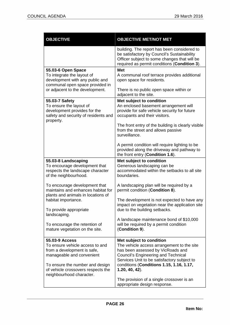
55.03-6 Open Space To integrate the layout of development with any public and communal open space provided in or adjacent to the development.
Met A communal roof terrace provides additional open space for residents. There is no public open space within or adjacent to the site.
55.03-7 Safety To ensure the layout of development provides for the safety and security of residents and property.
Met subject to condition An enclosed basement arrangement will provide for safe vehicle security for future occupants and their visitors. The front entry of the building is clearly visible from the street and allows passive surveillance. A permit condition will require lighting to be provided along the driveway and pathway to the front entry (Condition 1.6 ).
55.03-8 Landscaping To encourage development that respects the landscape character of the neighbourhood. To encourage development that maintains and enhances habitat for plants and animals in locations of habitat importance. To provide appropriate landscaping. To encourage the retention of mature vegetation on the site.
Met subject to condition Generous landscaping can be accommodated within the setbacks to all site boundaries. A landscaping plan will be required by a permit condition (Condition 8 ). The development is not expected to have any impact on vegetation near the application site due to the building setbacks. A landscape maintenance bond of $10,000 will be required by a permit condition (Condition 9 ).
55.03-9 Access To ensure vehicle access to and from a development is safe, manageable and convenient To ensure the number and design of vehicle crossovers respects the neighbourhood character.
Met subject to condition The vehicle access arrangement to the site has been assessed by VicRoads and Council’s Engineering and Technical Services Unit to be satisfactory subject to conditions (Conditions 1.15, 1.16, 1.17, 1.20, 40, 42). The provision of a single crossover is an appropriate design response.

COUNCIL AGENDA 29 March 2016
PAGE 27 Item No:
OBJECTIVE OBJECTIVE MET/NOT MET
55.03-10 Parking Location To provide convenient parking for resident and visitor vehicles. To avoid parking and traffic difficulties in the development and the neighbourhood. To protect residents from vehicular noise within developments.
Met subject to condition The provision of basement car parking with lift and stair access to all apartments provides convenience for all residents and visitors who park on site. A permit condition will require the provision of an intercom system to allow visitor access to the basement (Condition 32 ). There is unlikely to be any noise transfer from the use of the basement to the extent it would be a disturbance to nearby properties.
55.04-1 Side and Rear Setbacks To ensure that the height and setback of a building from a boundary respects the existing or preferred neighbourhood character and limits the impact on the amenity of existing dwellings.
Met The building exceeds the required setback to the side and rear boundaries as follows: Western boundary The ground level is set back 3 metres (1.5 metres required). The first floor level is set back 4.5 metres (3 metres required). The second floor level is set back 9.1 metres (6.1 metres required). Eastern boundary The ground level is set back 3 metres (1 metre required). The first floor level is set back 3 metres (2 metres required). The second floor level is set back 5.1 metres (5.3 metres required). Southern boundary The ground level is set back 4 metres (1.5 metres required). The first floor level is set back 5.85 metres (4.1 metres required). The second floor level is set back 8.9 metres (6.1 metres required).
55.04-2 Walls on Boundaries To ensure that the location, length and height of a wall on a boundary respects the existing or preferred neighbourhood character and limits the impact on the amenity of existing dwellings.
Not applicable No walls on boundaries are proposed.
55.04-3 Daylight to Existing Windows
Met The existing habitable room windows within

COUNCIL AGENDA 29 March 2016
PAGE 28 Item No:
OBJECTIVE OBJECTIVE MET/NOT MET
To allow adequate daylight into existing habitable room windows.
the adjoining properties to the south are located away from the common boundary and will not be unreasonably affected.
55.04-4 North Facing Windows To allow adequate solar access to existing north-facing habitable room windows.
Met There are no north-facing windows within 3 metres of the site’s southern boundary.
55.04-5 Overshadowing Open Space To ensure buildings do not significantly overshadow existing secluded private open space.
Met As demonstrated by the submitted shadow diagrams, shadows cast by the building into the adjoining properties to the south and west do not extend beyond shadows cast by the boundary fences. Although shadows cast by the building will cover the secluded private open space of the adjoining property to the east, the portion of open space affected is less than what is permissible pursuant to the standard. Overshadowing impacts will also be limited to the afternoon and will not have unreasonable off-site amenity impacts.
55.04-6 Overlooking To limit views into existing secluded private open space and habitable room windows.
Met subject to condition East On the ground level, there is no unreasonable overlooking as courtyards are slightly below ground level and views will be restricted by the new boundary fence (2.1 metres high with 450mm high lattice) and landscaping. On the upper levels, windows and balconies with views to the habitable room windows and the secluded private open space are generally screened to limit overlooking. Windows and balconies that overlook the front setback of the adjoining property to the east have not been screened, as they do not have views into a secluded private open space or habitable room windows. A permit condition will require any views from the balcony of Dwelling 16 to the secluded private open space of the adjoining property to the east to be screened in accordance with the standard (Condition 1.1.1 ). South

COUNCIL AGENDA 29 March 2016
PAGE 29 Item No:
OBJECTIVE OBJECTIVE MET/NOT MET
Views from the ground level windows and private open space of Dwelling 5 are restricted by boundary fence. Further, conditions will require significant screen planting along this interface (Condition 8.7 ). The south-facing bedroom and kitchen windows of Dwelling 6 are elevated above natural ground level and allow views into the adjoining secluded private open space. A permit condition will therefore require them to be screened in accordance with the standard (Condition 1.1.3 ). A permit condition will require the Dwelling 6 balcony on the elevation plans to be shown at FL77.70 so it is consistent with the ground floor plan (Condition 1.11 ). The south-facing windows of the upper level are appropriately obscure glazed to comply with the standard. As the first floor balconies (of Dwellings 16 and 17) are within 5.3 metres of the southern boundary, the plan needs to demonstrate that the planter boxes do achieve the level of screening required. A permit condition will require any views into the adjoining secluded private open spaces be screened in accordance with the standard (Conditions 1.1.1, 1.1.2). The balconies on the second floor are set back at least 7.2 metres from the southern boundary and their views to the adjoining secluded private open spaces will be limited by planter boxes and the boundary fence. No further screening will therefore be required. West Although the ground level balconies are elevated above natural ground level, there will not be unreasonable overlooking into adjoining secluded private open spaces and habitable room windows given they are situated on a lower level than the site and screened by the boundary fence.

COUNCIL AGENDA 29 March 2016
PAGE 30 Item No:
OBJECTIVE OBJECTIVE MET/NOT MET
The generous 3 metre setback to the western boundary also allows for sufficient landscaping opportunities to provide screening. A permit condition will require screen planting adjacent to the western boundary and opposite the balconies to further reduce any overlooking impacts (Condition 8.8 ). A permit condition will also require the clotheslines adjacent to the western boundary fence to be relocated to accommodate the screen planting (Condition 1.13 ). The upper level windows and balconies are appropriately screened and will not result in unreasonable overlooking into the adjoining properties to the west.
55.04-7 Internal Views To limit views into the secluded private open space and habitable room windows of dwellings and residential buildings within a development.
Met Fences and screens are provided between adjacent courtyards and balconies to prevent direct internal views. Upper level windows and balconies are appropriately screened to limit views into lower level secluded private open spaces.
55.04-8 Noise Impacts To contain noise sources in developments that may affect existing dwellings. To protect residents from external noise.
Met subject to condition The noise sources that can be considered under this control relate to the building services. Council cannot consider normal domestic noise such as from people and private mechanical equipment. The placement of air-conditioning units should be regulated to ensure appropriate positioning (mainly for aesthetic reasons) (Condition 21 ). Plant on the roof of the building will be visually screened, together with building services including electrical substations and air inlets for the mechanical basement ventilation. Overall, it is considered that there are no external noise sources that may impact unreasonably on existing or future residents.

COUNCIL AGENDA 29 March 2016
PAGE 31 Item No:
OBJECTIVE OBJECTIVE MET/NOT MET
55.05-1 Accessibility To encourage the consideration of the needs of people with limited mobility in the design of developments.
Met The proposed development allows barrier-free access for people with limited mobility to the front entry of the building. The lift provides access to the basement car park, roof terrace and entries of all dwellings.
55.05-2 Dwelling Entry To provide each dwelling or residential building with its own sense of identity.
Met The apartments all derive pedestrian access from the central entry path and foyer on the frontage. The building entry is well identified and sheltered by a canopy.
55.05-3 Daylight to New Windows To allow adequate daylight into new habitable room windows.
Met All habitable rooms will have external windows to ensure they have adequate solar access. The windows have adequate light court areas. There are no habitable rooms that rely on borrowed light, open to a light well or rely on below ground light courts.
55.05-4 Private Open Space To provide adequate private open space for the reasonable recreation and service needs of residents.
Met Nine out of ten ground floor dwellings are provided with secluded private open space which consists of paved courtyards and landscaped gardens. The total amount of secluded private open space afforded to each dwelling at ground level ranges from 38 square metres to 135.4 square metres. It is considered that the spaces are sufficient in area for the recreation and service needs of residents and the provision of landscaping. The remaining dwellings are provided with secluded private open space in the form of a balcony that range from 8.1 square metres to 26.8 square metres. They comply with the standard. The residents also have access to the communal roof terrace, which also provides for the recreation needs of residents.
55.05-5 Solar Access to Open Space To allow solar access into the secluded private open space of new dwellings and residential buildings.
Met Due to the nature of the proposal as an apartment building, it is not possible to provide all private open space areas with a northern aspect.
However, south-facing courtyards have been minimised, and where proposed include a

COUNCIL AGENDA 29 March 2016
PAGE 32 Item No:
OBJECTIVE OBJECTIVE MET/NOT MET
west or east orientation to provide some solar access.
55.05-6 Storage To provide adequate storage facilities for each dwelling.
Met Storage spaces have been provided within the basement car park for all dwellings. Although they are less than 6 cubic metres, the volume provided is considered adequate for the storage needs of residents living in two-bedroom apartments.
55.06-1 Design Detail To encourage design detail that respects the existing or preferred neighbourhood character.
Met subject to condition The proposed architectural design is of a high standard and offers a contemporary statement that responds positively to the preferred neighbourhood character. The window and door proportions enhance visual interest and provides for a good mixture of horizontal and vertical elements. This in turn provides a good level of articulation. Visual interest is provided by the stepping of walls, graduation of the upper levels and the use of balconies, fascias and framing elements. The incorporation of different materials and finishes provide further visual interest to the building. A permit condition will require a schedule of materials and finishes with colour samples to be provided (Condition 1.2 ).
55.06-2 Front Fence To encourage front fence design that respects the existing or preferred neighbourhood character.
Met As discussed, the proposed front fence complies with the DDO8 requirements. The fence therefore respects the preferred character of the area.
55.06-3 Common Property To ensure that communal open space, car parking, access areas and site facilities are practical, attractive and easily maintained. To avoid future management difficulties in areas of common ownership.
Met The basement and common areas throughout the building will be maintained by an Owners’ Corporation. There are no apparent difficulties associated with future management of these areas.

COUNCIL AGENDA 29 March 2016
PAGE 33 Item No:
OBJECTIVE OBJECTIVE MET/NOT MET
55.06-4 Site Services To ensure that site services can be installed and easily maintained. To ensure that site facilities are accessible, adequate and attractive.
Met subject to condition s To ensure the appearance of the building does not detract from any elevation, a permit condition will require retractable clotheslines to be installed within all ground level open spaces and balconies to ensure that they are not visible from the street or adjoining properties (Condition 1.12 ). Permit conditions will require the clotheslines for Dwellings 6 and 9 to be relocated as they are currently inaccessible by the residents (Condition 1.13 ). Mailboxes will be required to be conveniently located at the frontage to comply with Australia Post requirements (Condition 1.4 ). The design details of the building's front entry, including an elevation drawing of the letterboxes and screening of service cabinets will be required by a permit condition (Condition 1.5 ).
7 REFERRALS
7.1 Given the proposal to alter access to Manningham Road from 180 and 182 Manningham Road, it is a statutory requirement to refer the application to VicRoads as a determining referral authority.
7.2 VicRoads have no objection to the proposal subject to the inclusion of three (3) permit conditions (Conditions 40-42 ).
7.3 The application was referred to a number of Service Units within Council the following table summarises their responses:
Service Unit Comments
Engineering & Technical Services Unit (Drainage)
• There is adequate point of discharge for the site. All runoff is to be directed to the point of discharge (Condition 15).
• Provide an on-site stormwater detention system (Condition 13 ).
Engineering & Technical Services Unit (Vehicle Crossing)
• The existing tree within the location of the proposed vehicle crossover relocated to the satisfaction of Council’s Parks and Recreation Unit (Condition 12 ).
• The edges of the vehicle crossover need to be on a 60 degree angle to the road from the property boundary (Condition 1.15 ).
• The width of the driveway (wall to wall)

COUNCIL AGENDA 29 March 2016
PAGE 34 Item No:
Service Unit Comments
increased to no less than 6.5 metres within the first 10 metres of the property and the crossover width widened as per the requirements of VicRoads (Condition 40.2).
• A “Vehicle Crossing Permit” is required. Engineering & Technical Services Unit (Access and Driveway)
• The proposed retaining walls, water and gas meter enclosures should not obstruct the visibility sight triangles (Condition 1.16).
• The transition grade of 1 in 5.7 on the driveway for a length of one metre does not comply with Design Standard 3 in Clause 52.06-8 of the Manningham Planning Scheme and needs to be at least 2 metres in length (Condition 1.17 ).
Engineering & Technical Services Unit (Traffic and Car Parking)
• The dimensions of the car parking spaces comply.
• There are no traffic issues in the context of the traffic and the surrounding street network.
• The number of car parking spaces provided accord with the requirements.
Engineering & Technical Services Unit (Car Parking Layout)
• Sliding doors need to be provided to Stores 3, 6-10 and 12 to avoid opening into car parking spaces.
• A sliding door provided to the staff WC door to avoid opening into a reversing bay.
• A pedestrian warning sign and bollard need to be provided to the north of the car parking space for Dwelling 5 to improve pedestrian safety to the storage area.
Engineering & Technical Services Unit (Construction Management)
• A construction management plan is required (Condition 4 ).
Engineering & Technical Services Unit (Waste)
• A private waste collection will be required. • The submitted Waste Management Plan
needs to be approved as part of the permit (Condition 5 ).
Engineering & Technical Services Unit (Bicycle Parking)
• Bicycle parking provision is satisfactory.
Strategic Projects Unit (Sustainability)
• Amendments to the submitted Sustainability Management Plan are required before approval (Condition 1.8, 1.9, 3 ).
Energy Efficiency – Lighting • LED fittings throughout due to cost parity to
fluorescents (including T5s) which are becoming obsolete from higher OMR costs, reduced performance in low external
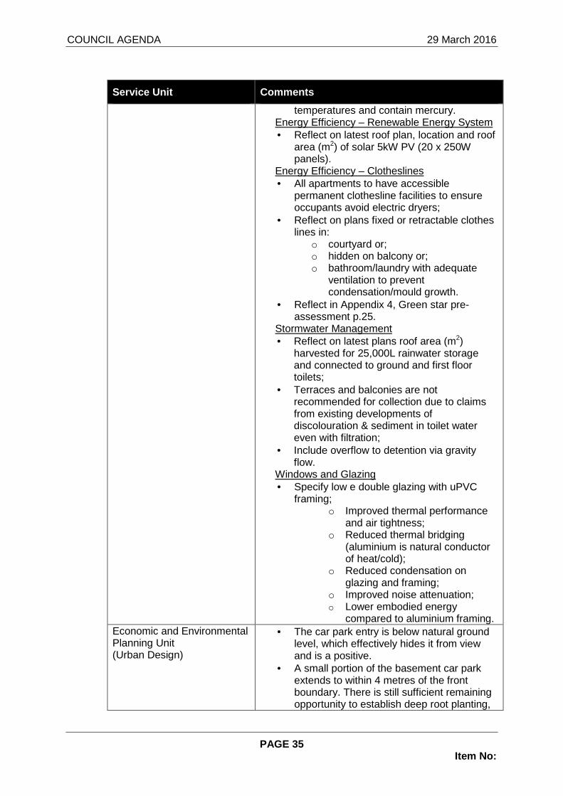
COUNCIL AGENDA 29 March 2016
PAGE 35 Item No:
Service Unit Comments
temperatures and contain mercury. Energy Efficiency – Renewable Energy System • Reflect on latest roof plan, location and roof
area (m2) of solar 5kW PV (20 x 250W panels).
Energy Efficiency – Clotheslines • All apartments to have accessible
permanent clothesline facilities to ensure occupants avoid electric dryers;
• Reflect on plans fixed or retractable clothes lines in:
o courtyard or; o hidden on balcony or; o bathroom/laundry with adequate
ventilation to prevent condensation/mould growth.
• Reflect in Appendix 4, Green star pre-assessment p.25.
Stormwater Management • Reflect on latest plans roof area (m2)
harvested for 25,000L rainwater storage and connected to ground and first floor toilets;
• Terraces and balconies are not recommended for collection due to claims from existing developments of discolouration & sediment in toilet water even with filtration;
• Include overflow to detention via gravity flow.
Windows and Glazing • Specify low e double glazing with uPVC
framing; o Improved thermal performance
and air tightness; o Reduced thermal bridging
(aluminium is natural conductor of heat/cold);
o Reduced condensation on glazing and framing;
o Improved noise attenuation; o Lower embodied energy
compared to aluminium framing. Economic and Environmental Planning Unit (Urban Design)
• The car park entry is below natural ground level, which effectively hides it from view and is a positive.
• A small portion of the basement car park extends to within 4 metres of the front boundary. There is still sufficient remaining opportunity to establish deep root planting,

COUNCIL AGENDA 29 March 2016
PAGE 36 Item No:
Service Unit Comments
and this encroachment is of no concern. • The development exceeds the maximum
height requirement, however this is limited to a portion of a roof terrace structure and will not significantly add to the visual bulk of the building.
• The development incorporates a suitably varied and interesting material and colour palette, including rendered finishes, timber-look metal screening, and brickwork.
• The building is well articulated and employs glazing, framing elements, recesses and extrusions.
• The building has split-levels which enables it to step down the site topography.
• A portion of the basement extends above natural ground level. This is of little concern.
• The front fence is a mix of solid wall and permeable fence and will provide ample opportunity for landscape elements to soften the presentation of the ground floor level of the development.
• The building entry tapers from the front door of the development to a narrow point, before opening into a lift lobby. It is an unusual configuration, but I don’t think causes any concern with regard to functionality.
• The split level can be negotiated via the double-sided lift.
• Appropriate low-level pedestrian lighting should be provided for the pedestrian ramp servicing the basement car park (Condition 1.6).
• I note that a large electrical substation is proposed to be located within the landscaped frontage of the development and would ask that consideration be given to locating it in a more discrete location, or for its incorporation into the design of the apartment building or masonry wall along part of the frontage (Condition 1.7 ).
7.4 As appropriate, the requirements of internal departments and external authorities will be added in the form of planning permit conditions or notes.
8 CONSULTATION
8.1 The planning application was placed on public notice for a three (3) week period which concluded on 20 January 2016. The public was notified by the

COUNCIL AGENDA 29 March 2016
PAGE 37 Item No:
sending of letters to nearby properties and by the display of two (2) signs at the site frontage to Manningham Road.
8.2 Council has received one (1) objection from the following property:
Address 4 Harold Street, Bulleen (abutting property to the west)
8.3 The following is a summary of the grounds upon which the above properties have objected to the proposal:
• Increased number of high rise buildings in the area
• Overshadowing due to building height
• Increased on-street car parking on Harold Street
• Potential damage to property due to the proximity of the basement excavation to the site boundary
8.4 A response to the above grounds is provided in the below paragraphs:
Increased number of high rise buildings in the area
8.5 Neighbourhood character has been discussed in the assessment against DDO8 and Clause 55.02-1 of the Manningham Planning Scheme.
8.6 The site is located within Precinct 2: Residential Areas Surrounding Activity Centres and along Main Roads, in which Council’s development preference is for a substantial change and higher density developments. The proposed apartment building therefore corresponds with the planning policies and considered appropriate.
8.7 The increasing number of apartment style developments along Manningham Road is reflective of the preferred character sought by planning policy.
Overshadowing due to building height
8.8 The shadow diagrams submitted by the applicant indicate that shadows cast by the building into the adjoining properties to the west will not extend beyond shadows cast by the boundary fence.
8.9 The extent of shadows cast into the adjoining properties to the west is not considered unreasonable and will be reduced by the setback of the building from the western boundary, the articulation in built form and graduation of the upper levels.
Increased on-street car parking on Harold Street
8.10 The development provides a sufficient number of car parking spaces within the basement as required by Clause 52.06 of the Manningham Planning Scheme.
8.11 Any existing parking problems on the Harold Street cannot be addressed through the current planning application, nor should the burden of relieving these existing problems be imposed on the developer of the subject land when the required number of car parking spaces have been provided.
Potential damage to property due to the proximity o f basement excavation to the site boundary

COUNCIL AGENDA 29 March 2016
PAGE 38 Item No:
8.12 The setback of 3 metres between the basement and the western boundary is not considered to be unreasonable and not dissimilar to setbacks provided by other similar style developments.
8.13 Potential damage to the adjoining property from construction is a civil matter that needs to be addressed by the building surveyor responsible for the development.
8.14 New boundary fencing is proposed along the side and rear boundaries.
9 CONCLUSION
9.1 It is considered appropriate to support the application, subject to some design changes to the building and the inclusion of suitable management plan conditions.
9.2 The construction of a well designed and visually interesting apartment building is consistent with the vision of the Manningham Planning Scheme, in particular Clause 21.05 Residential, Schedule 8 to the Design and Development Overlay (DDO8) and Clause 55 (ResCode). It will allow an increase in housing density and diversity in a location that has good access to services.
9.3 The proposal has also achieved an acceptable balance between considering the amenity of nearby properties and its attention to the internal amenity of future occupants.
9.4 It is therefore considered appropriate to support the planning application, subject to changes to be required by conditions.
RECOMMENDATION That having considered all objections A NOTICE OF D ECISION TO GRANT A PERMIT be issued in relation to Planning Application No. P L15/025566 for the development of No. 180-182 Manningham Road (Lot 6 and Lot 7 on PS 041476) for the purpose of the construction of a three-storey apartment building w ith associated basement car parking and the creation and alteration of access t o a road in a Road Zone, Category 1 and for no other purpose in accordance with the end orsed plan and subject to the following conditions-
1. Before the development starts, two copies of ame nded plans drawn to scale and dimensioned, must be submitted to and app roved by the Responsible Authority. When approved the plans will be endorsed and will then form part of the permit. The plans must b e generally in accordance with the plans submitted with the applic ation (prepared by Archestral Design, Revision B, dated 23 November 20 15) but modified to show:
Built form
1.1. Section diagrams to demonstrate the following windows and balconies screened in accordance with Standard B22 of Clause 55.04-6 of the Manningham Planning Scheme:
1.1.1. The balcony of Dwelling 16;
1.1.2. The balcony of Dwelling 17;

COUNCIL AGENDA 29 March 2016
PAGE 39 Item No:
1.1.3. The south-facing bedroom and kitchen windows of Dwelling 6.
1.2. A schedule of materials and finishes with colo ur samples of all external walls, roofs, fascias, window frames, pavi ng (including terraces, balconies, roof terraces, stairs), fencin g, privacy screens, roof top plant screens, retaining walls and drivewa y surfacing (must not be plain concrete).
Site services
1.3. A notation to indicate the rainwater tank has a capacity of at least 25,000 Litres as per the Sustainable Management Pla n required by Condition 3 of this permit;
1.4. The mailboxes relocated to the site frontage t o comply with Australia Post requirements;
1.5. The design details of the building's front ent ry, including an elevation drawing of the letterboxes and screening of service cabinets;
1.6. Location and details of external lighting alon g the footpath leading to the front entry and the driveway ramp to provide for the safety of the residents and visitors;
1.7. The electrical substation relocated to a the n orth-eastern corner, appropriately treated and screened to reduce its vi sual presence in the streetscape to the satisfaction of the Responsi ble Authority;
1.8. The location and roof area (m 2) of the solar panels on the roof plan, as per the Sustainable Management Plan required by Condition 3 of this permit;
1.9. A notation to indicate the roof area (m 2) harvested for the 25,000L rainwater storage and the water is connected to gro und and first floor toilets;
1.10. An indicative location of the stormwater dete ntion system or systems which must be located outside of easements and screen landscaped areas;
Open space
1.11. The balcony of Dwelling 6 have a floor level on the elevation plans consistent with the ground floor plan (at 77.70);
1.12. The location of retractable clotheslines to a ll ground level open spaces and balconies, designed so they are not visi ble from the street or adjoining properties;
1.13. Clotheslines relocated away from the western boundary fence to accommodate screen planting;
1.14. The clotheslines for Dwellings 6 and 9 reloca ted so they are accessible by residents;
Access and car parking
1.15. Both sides of the vehicle crossover is on a 6 0 degree angle to the road carriageway;

COUNCIL AGENDA 29 March 2016
PAGE 40 Item No:
1.16. A visibility splay areas on the western side of the driveway at the frontage to comply with Design Standard 1 in Clause 52.06-8 of the Manningham Planning Scheme and all obstructions wit hin these areas do not exceed a height of 900mm;
1.17. The gradient of the driveway modified to comp ly with Design Standard 3 in Clause 52.06-8 of the Manningham Plan ning Scheme;
1.18. A notation to indicate all storage spaces wit hin the basement car park are enclosed by cyclone wire;
1.19. The pedestrian ramp to the west of the drivew ay replaced by stairs to reduce the extent of retaining walls and allow m ore landscaping opportunities within the front setback;
1.20. The requirements of VicRoads as per Condition 44 of this permit.
Endorsed Plans
2. The development as shown on the approved plans m ust not be modified for any reason, without the written consent of the Responsible Authority.
Sustainability Management Plan
3. Before the development starts or the issue of a building permit for the development, whichever is the sooner, two copies of an amended Sustainability Management Plan (SMP) must be submit ted to and approved by the Responsible Authority. When approve d the Plan will form part of the permit. The recommendations of the Plan must be incorporated into the design and layout of the deve lopment and must be implemented to the satisfaction of the Responsible Authority before the occupation of any dwelling. The Plan must be genera lly in accordance with the plan prepared by Sustainable Development C onsultants, dated October 2015 but modified to show the following:
3.1. Energy Efficiency – Lighting
3.1.1. LED fittings throughout
3.2. Energy Efficiency – Clotheslines
3.2.1. All apartments have accessible permanent clo thesline facilities to ensure occupants avoid electric dryer s. This also needs to be reflected in the Green star pre-assessment in Appendix 4;
3.3. Stormwater Management
3.3.1. Terraces and balconies are not recommended f or collection due to claims from existing developments of discolouration & sediment in toilet water even with filtration;
3.3.2. Include overflow to detention via gravity fl ow;
3.4. Windows and Glazing
3.4.1. Specify low e double glazing with uPVC frami ng; ○ Improved thermal performance and air tightness;
○ Reduced thermal bridging (aluminium is natural conductor of heat/cold);

COUNCIL AGENDA 29 March 2016
PAGE 41 Item No:
○ Reduced condensation on glazing and framing;
○ Improved noise attenuation;
○ Lower embodied energy compared to aluminium framing.
Construction Management Plan
4. Before the development starts, two copies of a C onstruction Management Plan must be submitted to and approved b y the Responsible Authority. When approved the plan will form part of the permit. The plan must address, but not be limited t o, the following:
4.1. A liaison officer for contact by residents and the responsible authority in the event of relevant queries or probl ems experienced;
4.2. Hours of construction;
4.3. Delivery and unloading points and expected fre quency;
4.4. On−site facilities for vehicle washing;
4.5. Parking facilities/locations for construction workers;
4.6. Other measures to minimise the impact of const ruction vehicles arriving at and departing from the land;
4.7. Methods to contain dust, dirt and mud within t he site, and the method and frequency of clean up procedures;
4.8. The measures for prevention of the unintended movement of building waste and other hazardous materials and po llutants on or off the site, whether by air, water or other means;
4.9. An outline of requests to occupy public footpa ths, road reserves, verges, or roads, and anticipated disruptions to lo cal services;
4.10. The measures to minimise the amount of waste construction materials;
4.11. Measures to minimise impact to existing bound ary and front fencing on adjoining properties;
4.12. The measures to minimise noise and other amen ity impacts from mechanical equipment/construction activities, espec ially outside of daytime hours; and
4.13. Adequate environmental awareness training for all on−site contractors and sub−contractors.
Waste Management Plan
5. Before the development starts, or the issue of a building permit for the development, whichever is the sooner, an amended Wa ste Management Plan must be submitted and approved to the satisfac tion of the Responsible Authority. When approved, the plan will form part of the permit. The Plan must generally be in accordance wi th the plan prepared by LID Consulting, dated 26 October 2015 but modifi ed to provide for:
5.1. A private waste contractor to undertake waste collection from within the basement of the development;

COUNCIL AGENDA 29 March 2016
PAGE 42 Item No:
5.2. No private waste contractor bins can be left o utside the development boundary or left unattended at any time on any street frontage for any reason.
Management Plan Compliance
6. The Management Plans approved under Conditions 3 , 4 and 5 of this permit must be implemented and complied with at all times to the satisfaction of the Responsible Authority unless wi th the further written approval of the Responsible Authority.
7. Prior to the occupation of each building, writte n confirmation from the author of the approved Sustainability Management Pl an, or a similarly qualified person or company, must be submitted to t he Responsible Authority. The report must confirm that the sustain able design features/initiatives specified in the Sustainabilit y Management Plan have been satisfactorily implemented in accordance with the approved plans.
Landscaping
8. Before the development starts, a detailed Landsc ape Plan must be prepared by a landscape architect showing species, locations, approximate height and spread of proposed planting, and must be submitted to the Responsible Authority for approval . Such plan must be generally in accordance with the approved plan, and must show:
8.1. Any details as relevant or directed by any oth er condition of this Permit;
8.2. A planting schedule detailing species, numbers of plants, approximate height, spread of proposed planting and planting/pot size;
8.3. Location, species and number of proposed plant ings;
8.4. Surface treatments;
8.5. Details of site and soil preparation, mulching and maintenance;
8.6. A minimum of three (3) canopy trees, capable o f reaching a minimum mature height of 8.0 metres, within the fro nt setback of the site. The trees must be a minimum height of 1. 5 metres at the time of planting;
8.7. Screen planting adjacent to the southern bound ary, capable of reaching a mature height of 3.0 metres. The trees m ust be a minimum height of 1.5 metres at the time of plantin g;
8.8. Screen planting adjacent to the western bounda ry, capable of reaching a mature height of 3.0 metres. The trees m ust be a minimum height of 1.5 metres at the time of plantin g;
8.9. A continuous landscaping treatment between the front fence and site frontage.
The use of synthetic grass as a substitute for open lawn area within secluded private open space or a front setback will not be supported. Synthetic turf may be used in place of a pproved paving decking and/or other hardstand surfaces.
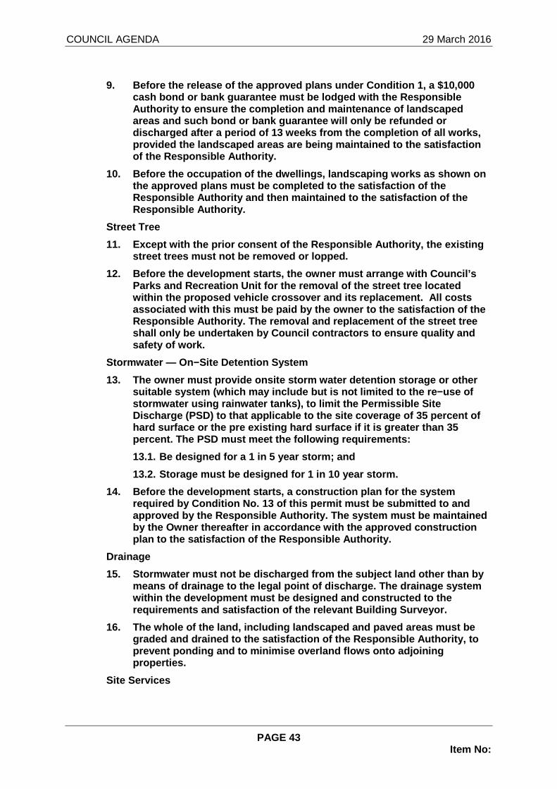
COUNCIL AGENDA 29 March 2016
PAGE 43 Item No:
9. Before the release of the approved plans under C ondition 1, a $10,000 cash bond or bank guarantee must be lodged with the Responsible Authority to ensure the completion and maintenance of landscaped areas and such bond or bank guarantee will only be refunded or discharged after a period of 13 weeks from the comp letion of all works, provided the landscaped areas are being maintained to the satisfaction of the Responsible Authority.
10. Before the occupation of the dwellings, landsca ping works as shown on the approved plans must be completed to the satisfa ction of the Responsible Authority and then maintained to the sa tisfaction of the Responsible Authority.
Street Tree
11. Except with the prior consent of the Responsibl e Authority, the existing street trees must not be removed or lopped.
12. Before the development starts, the owner must a rrange with Council’s Parks and Recreation Unit for the removal of the st reet tree located within the proposed vehicle crossover and its repla cement. All costs associated with this must be paid by the owner to t he satisfaction of the Responsible Authority. The removal and replacement of the street tree shall only be undertaken by Council contractors to ensure quality and safety of work.
Stormwater — On−Site Detention System
13. The owner must provide onsite storm water deten tion storage or other suitable system (which may include but is not limit ed to the re−use of stormwater using rainwater tanks), to limit the Per missible Site Discharge (PSD) to that applicable to the site cove rage of 35 percent of hard surface or the pre existing hard surface if it is greater than 35 percent. The PSD must meet the following requiremen ts:
13.1. Be designed for a 1 in 5 year storm; and
13.2. Storage must be designed for 1 in 10 year sto rm.
14. Before the development starts, a construction p lan for the system required by Condition No. 13 of this permit must be submitted to and approved by the Responsible Authority. The system m ust be maintained by the Owner thereafter in accordance with the appr oved construction plan to the satisfaction of the Responsible Authori ty.
Drainage
15. Stormwater must not be discharged from the subj ect land other than by means of drainage to the legal point of discharge. The drainage system within the development must be designed and constru cted to the requirements and satisfaction of the relevant Build ing Surveyor.
16. The whole of the land, including landscaped and paved areas must be graded and drained to the satisfaction of the Respo nsible Authority, to prevent ponding and to minimise overland flows onto adjoining properties.
Site Services

COUNCIL AGENDA 29 March 2016
PAGE 44 Item No:
17. All services, including water, electricity, gas , sewerage and telephone, must be installed underground and located to the sa tisfaction of the Responsible Authority.
18. All upper level service pipes (excluding stormw ater downpipes) must be concealed and screened respectively to the satisfac tion of the Responsible Authority.
19. Communal lighting must be connected to reticula ted mains electricity and be operated by a time switch, movement sensors or a daylight sensor to the satisfaction of the Responsible Autho rity.
20. In the event of gas being supplied to the appro ved dwellings, the owner must liaise with the relevant service authority to determine an appropriately discrete location for the placement o f gas meters to the satisfaction of the Responsible Authority. Where no such placement is possible, meters must be “banked” and provided with a neatly designed, durable screen surround (in stained timber, or dark coloured, perforated metal sheeting, for instance) to the satisfaction o f the Responsible Authority.
21. Any air-conditioning unit erected on the walls, roofs or balconies of the approved dwellings must be so located, as to not ad versely affect the amenity of the area by way of appearance/visual pro minence to the satisfaction of the Responsible Authority. Where t he Responsible Authority identifies a concern about visual appeara nce, appropriately designed/finished screening must be installed and m aintained to the satisfaction of the Responsible Authority.
22. All plant and equipment that is not installed w ithin the building must otherwise be installed in the area of plant and equ ipment on the roof of the building, unless otherwise agreed in writing wi th the Responsible Authority.
23. Unless depicted on a Roof Plan approved under C ondition 1 of this permit, no roof plant (includes air conditioning un its, basement exhaust ducts, solar panels or hot water systems) which is visible to immediate neighbours or from the street may be placed on the roof of the approved building, without details in the form of an amendin g plan being submitted to and approved by the Responsible Author ity.
24. A centralised TV antenna must be installed and connections made to each dwelling to the satisfaction of the Responsibl e Authority.
25. No individual dish antennae may be installed on the overall building to the satisfaction of the Responsible Authority.
26. Any clothes−drying rack or line system located on a balcony must be lower than the balustrade of the balcony and must n ot be visible from off the site to the satisfaction of the Responsible Aut hority.
27. Letterboxes must be designed and located to sat isfy the requirements of Australia Post to the satisfaction of the Responsib le Authority.
Access
28. Prior to occupation of the approved dwellings, any new or modified vehicular crossover must be constructed in accordan ce with the plans

COUNCIL AGENDA 29 March 2016
PAGE 45 Item No:
endorsed under Condition 1 of this permit to the sa tisfaction of the Responsible Authority.
29. Driveway gradients and transitions as shown on the plan approved under Condition 1 of this permit must be generally achieved through the driveway construction process to the satisfaction o f the Responsible Authority.
30. Redundant crossovers must be removed and the fo otpath and kerb and channel reinstated to the satisfaction of the Respo nsible Authority.
31. Any security door/grille to the basement openin g must maintain sufficient clearance when fully open to enable the convenient passage of rubbish collection vehicles which are required to e nter the basement and such clearance must also be maintained in respect o f sub-floor service installations throughout areas in which the rubbish truck is required to travel to the satisfaction of the Responsible Autho rity.
32. An intercom and an automatic basement door open ing system (connected to each dwelling) must be installed, so as to facilitate convenient 24 hour access to the basement car park by visitors, to the satisfaction of the Responsible Authority.
Car Parking
33. Before the occupation of the approved dwellings , all basement parking spaces must be line−marked, numbered and signposted to provide allocation to each dwelling and visitors to the sat isfaction of the Responsible Authority.
34. Visitor parking spaces must not be used for any other purpose to the satisfaction of the Responsible Authority.
Earthworks
35. The extent and depth of cut and fill must not e xceed that shown on the plans endorsed under Condition 1 of this permit wit hout the written consent of the Responsible Authority.
36. All retaining walls must be constructed and fin ished in a professional manner to ensure a neat presentation and longevity to the satisfaction of the Responsible Authority.
Fencing
37. Prior to the occupation of the approved dwellin gs, all fencing must be erected in accordance with the plans endorsed under Condition 1 of this permit to the satisfaction of the Responsible Autho rity.
Maintenance
38. Buildings, paved areas, drainage and landscapin g must be maintained to the satisfaction of the Responsible Authority.
39. Privacy screens, obscure glazing, replacement b oundary fencing as shown on the approved plans must be installed prior to occupation of the dwellings to the satisfaction of the Responsibl e Authority and maintained thereafter to the satisfaction of the Re sponsible Authority. The use of the obscure film fixed to transparent wi ndows is not considered to be obscured glazing of an appropriate response to screen overlooking.

COUNCIL AGENDA 29 March 2016
PAGE 46 Item No:
VicRoads Conditions
40. Prior to the commencement of the development, a mended plans must be submitted to and approved by the Responsible Author ity. The plans must be generally in accordance with the submitted plans and amended to show:
40.1. A visibility splay along the northern edge of the internal driveway, in accordance with Design Standard 1 – Accessways p ursuant to Clause 52.06-8 of the Manningham Planning Scheme; a nd
40.2. The width of the driveway (wall-to-wall) incr eased to no less than 6.5 metres for the first 10 metres within the prope rty boundary and the crossover width widened accordingly.
41. Prior to the occupation of the dwellings, all r edundant and unused crossovers must be wholly reinstated with kerb and channel to the satisfaction of the Responsible Authority, and at n o cost to VicRoads.
42. Vehicles must enter and exit the land in a forw ard direction at all times.
Time Limit
43. This permit will expire if one of the following circumstances apply:
43.1. The development and use are not started withi n two (2) years of the date of the issue of this permit; and
43.2. The development is not completed within four (4) years of the date of this permit.
The Responsible Authority may extend these periods referred to if a request is made in writing by the owner or occupier either before the permit expires or in accordance with Section 69 of the Planning and Environment Act 1987.
“Refer Attachments”
* * * * *