planning for economic development - planning-org … · planning for economic development ......
TRANSCRIPT

APA Economic Development Task Force Report
Planning for Economic Development
March 31, 2015
Submitted to:
William Anderson, FAICP, President of APA and the APA Board of Directors
National Planning Conference 2015
Seattle, Washington
Submitted by:
APA Economic Development Task Force
Julie Herlands, AICP, Task Force Chair*
Ebonie Atkins*
Rian Harkins, AICP**
Emil Malizia, Ph.D., FAICP*
Adam Mawyer*
John A. Provo, Ph.D.*
* Economic Development Division
** Housing and Community Development Division

i
CONTENTS
I. Purpose and Report Outline ................................................................................................................... 1
II. Context ................................................................................................................................................... 3
Introduction .......................................................................................................................................... 3
Framework ............................................................................................................................................ 3
National and Regional Economies ................................................................................................... 3
Economic Growth and Development ............................................................................................... 3
Economic Base Theory ..................................................................................................................... 3
Regional Context ................................................................................................................................... 4
Planning Implications ............................................................................................................................ 4
Growth Facilitation .......................................................................................................................... 5
Development Enhancement ............................................................................................................ 5
Local Economic Activities ................................................................................................................. 6
III. Mini-Case Studies ................................................................................................................................... 7
Gainesville, Florida: Planning for Innovation ........................................................................................ 7
Resources ....................................................................................................................................... 10
Atlanta Regional Commission: Planning Regionally for Local Economic Impact ................................ 11
Resources ....................................................................................................................................... 14
Pacific Boulevard–Huntington Park, California: Planning for Changing Economies and Populations 15
Resources ....................................................................................................................................... 16
Devens, Massachusetts: Planning for Economic Diversification and Sustainability ........................... 18
Resources ....................................................................................................................................... 20
Greater Grand Forks, North Dakota-Minnesota: Planning for Economic Recovery and Resiliency ... 22
Resources ....................................................................................................................................... 24
IV. Conclusion: What Are the Takeaways for Planners? ............................................................................ 26

1
I. Purpose and Report Outline
A recent APA survey of the general public found that “two-thirds of Americans believe their community
needs more planning to promote economic recovery.” This finding seemed to be a stretch for planners
or at worst, a contradiction. What exactly does this statement mean? Aren’t planners regulators? Can
planners create jobs? And if so, what can planners actually DO to make this happen?
This Task Force was borne out of these types of questions. The President of APA, William Anderson,
FAICP, created the Task Force and appointed its chair. Mr. Anderson directed the Task Force to provide
APA members—planners first—with tools to tell the story of how planning is essential to economic
development in this country. To do this, the Task Force took a three-pronged approach:
I. Part One provides information directly for planners to be able to understand and analyze their
economy. It covers topics such as the difference between economic growth and economic
development; understanding the local context and parts in a regional economy; and the types
of information that will enable planners to better understand their regional and local
economies. This section is meant to be accessible to planners—and provide an array of areas in
which local planners can promote economic development and growth.
II. Part Two includes mini-case studies driven by planning specializations. The Task Force used APA
Divisions as the drivers to select a range of examples. That is, the goal was to identify how
specialized areas of planning connect with and contribute to economic development. The
selection of mini-case studies was also meant to reflect geographic diversity. A criteria matrix
was developed by the Task Force to aid in the selection.
III. Part Three is the conclusion and takeaways—the “so what?” What does this all mean for
Planners today?
The Task Force was comprised of members of the Economic Development Division, Housing and
Community Development Division, and graduate planning students from Virginia Tech. The dedication,
critical thinking, and outstanding efforts of the Task Force members made this report possible. Task
Force members are:
Julie Herlands, AICP, Chair (Principal, TischlerBise; Immediate Past Chair, APA Economic Development
Division)
Ebonie Atkins (Master’s Candidate, Urban and Regional Planning, Virginia Tech; Research Assistant,
Virginia Tech Office of Economic Development)
Rian Harkins, AICP (Community Development Specialist, Southeast Nebraska Development District;
Member, APA Housing and Community Development Division)

2
Emil Malizia, Ph.D., FAICP (Professor, Department of City and Regional Planning and Director, Institute
for Economic Development, University of North Carolina at Chapel Hill; Member, APA Economic
Development Division)
Adam Mawyer (Master’s Candidate, Urban and Regional Planning, Virginia Tech; Research Assistant,
Virginia Tech Office of Economic Development)
John A. Provo, Ph.D. (Director, Virginia Tech Office of Economic Development; Chair, APA Economic
Development Division)

3
II. Context1
Introduction
The August/September 2012 issue of Planning magazine reported the results of the national scientific
survey conducted for APA earlier that year which showed broad popular support for planning. Over 60
percent of the respondents expect planners to address basic needs, namely job creation, education,
safety, neighborhood protection, and clean water. Can planners help carry out meaningful local
economic development strategies and build community assets for sustainable economic development?
The following discussion addresses this question.
Framework
National and Regional Economies
The U.S. national economy is not one entity but rather a collection of regional economies. With the
exception of agriculture and other natural resource-intensive industries, regional economic activity is
organized functionally into labor market areas (LMAs). Each LMA includes one metro area and its
surrounding sphere of influence. LMAs represent the correct unit of analysis for understanding
economic development. LMAs are open regions susceptible to global competition which makes staying
competitive more important and sustaining economic development more difficult.
Economic Growth and Development
Economic growth and economic development are complementary and mutually supportive but
different concepts. Economic growth is about bigger–more jobs, larger tax base and more investment
in the regional economy. Economic development is about
better–better jobs, higher household incomes, more
innovation, widely shared benefits, and an improved
regional economic structure. Planners should focus on
ways to achieve both economic development and economic growth while understanding the differences
between them.
Economic Base Theory
Economic or export base theory has been used to understand regional economies since the 1930s. All
goods and services produced in the region are either traded/exported or not traded/local. Industries
that sell to the rest of the world receive revenue that is largely spent locally. The multiplier effect
1 This chapter was written by Emil Malizia, PhD, FAICP.
Economic growth is about bigger.
Economic development is about better.

4
measures the effects on output, earnings, or employment to gauge the impacts on the regional
economy. Thus, the economy’s strength depends on the competitiveness of its traded industries.
Regional Context Planning for economic growth and development should occur at the regional level which corresponds
most closely to the functioning economy.
Unfortunately, economic development practice involves
each municipality, county, or state competing with their
peers. Place competition leads to imitation. But no
silver-bullet exists; no one size fits all. Since
cooperative, coordinated, and unique development strategies formulated at the regional level are
extremely rare, planners need to find ways to contribute at the local level in spite of weak or
nonexistent regional planning.
Economic developers rely heavily on financial incentives to attract investment in the near term which
depletes resources needed for education and
infrastructure that would benefit all companies in the long
term. The shorter term emphasis on exploiting existing
assets is different than the orientation of planners who
want to develop assets for the long term.
Planners need to understand their region’s role in the larger economic system (its economic base), find
its unique features, and begin to identify innovative ways to promote economic growth and
development. The most critical resource in the emerging knowledge economy is human capital; talent
will largely determine regional competitiveness. With new technologies and global competition,
planners need to attend to workforce development.
The region’s economic base can be viewed as a mix of skills and occupations as well as a mix of traded
and non-traded industries. One way to think of these two dimensions of the regional economy is that
industries determine what places make (produced goods and services) whereas occupations determine
what places do (activities of workers).
Planning Implications Planners fill different jobs in the public, non-profit, and for-profit sectors. They may focus on land use,
transportation, city design, eco-systems (environment), housing, community development, economic
development, etc. To flesh out planning implications in a concise manner requires narrowing the range
of planning practice. Within the domains of city and regional planning that pertains primarily to the built
environment—namely land-use and transportation planning—the emphasis here is on comprehensive
planning. Planners can use comprehensive planning to guide future development of the built
Economies are regional.
Land use decisions are local.
Inherent tensions exist between the
short-term focus of economic
developers and the long-term
orientation of planners.

5
environment while articulating their jurisdiction’s role in economic growth and development. Each place
is unique in ways planners know better than most.
Growth Facilitation
Planners should learn how to help traded sectors grow by emphasizing land use, access, proximity, and
location. Planners facilitate economic growth by providing the land and infrastructure needed for
growth. This task involves translating expected changes in employment for traded/exporting industries
into space needs and land requirements, finding proper locations for this growth increment and
identifying the public investments necessary to support it in a cost effective manner.
Reserving land for basic industries is vitally important for
economic growth. Knowledge-based sectors have much
different locational needs than traditional industries. The
number one need is the availability of talent—who
increasingly prefer vibrant centers (live-work-play locations).
Knowledge industries are cleaner, greener, and compatible with other land uses. In some places, it may
make sense to treat land for traded industries similar to the way prime agricultural land or critical
watersheds are treated, namely worthy of special attention and protection.
Development Enhancement
Traded sectors may be housed in factories, warehouses/flex space, or office buildings. Most are part of
industrial clusters that enhance productivity through external economies. Planners should promote the
proximity of different uses in each cluster. We have many ideas about how to make downtowns
attractive to young talent, but we have not thought enough about how to redevelop suburban office
parks, shopping malls, commercial strips, and major intersections for economic development.
By definition, basic industries require export channels to reach the rest of the world. Planners must find
efficient ways to provide access to physical channels and to virtual (broadband) connectivity. The
coordination of land use and transportation planning in this context is critical. Working with internet
service providers is also important.
Supporting basic industries that generate income from the rest of the world makes sense because their
growth and development will largely determine the region’s relative attractiveness. At the same time,
the vagaries and differential impact of market forces makes the idea of increasing local self-reliance
more compelling. Both local food systems and economic coops may result in higher real incomes by
reducing costs. Health care provided locally is especially important both for services and as a source of
jobs.
It may make sense to treat land for
traded industries as worthy of special
attention and protection.

6
Local Economic Activities
The approach to not-traded sectors that primarily serve local markets should be restrictive. On the basis
of market research that forecasts local commercial space needs, planners should guard against
oversupply. Understanding the limits of local sector expansion through market analysis can be used
appropriately to dampen speculative development. This approach may limit competition, but to
squander scarce and expensive public infrastructure is far worse. There is no need to generate
unnecessary competition for local markets that are limited by definition. Oversupply also has negative
impacts on the tax base as commercial spaces in areas with high vacancy and lower rents drive tax
values downward.
Where planners accommodate local activities is critically important. Planners should encourage the
redevelopment of existing commercial areas instead of developing new ones. Reusing existing
functional buildings is the most energy efficient way to add space. Commercial redevelopment should
support efficient public service delivery, rely on existing usable infrastructure, and afford fewer or
shorter auto trips. Revitalizing existing space already served by existing public investments in services
and infrastructure provides a greater return on local government investments—provided significant
reinvestment is not required. On the other hand, allowing an area to continue to decline with no
reduction in infrastructure maintenance costs and then adding new infrastructure costs elsewhere
generates two future maintenance liabilities on the public balance sheet. Therefore, planners should
encourage compact, mixed-use development, improve public transit, and revitalize downtowns.
Related to the efficient use and expansion of infrastructure, planners should understand the role of
land use decisions on a locality’s fiscal sustainability. Planners are best positioned to understand and
communicate the local revenue and cost drivers in their communities—with real opportunities for closer
interaction and collaboration between planning and finance staffs. For example, office development in
localities heavily supported by sales tax revenues—such as cities in Arizona and Colorado—has a much
different fiscal impact than areas of the country that are more heavily supported by property tax
revenues. Furthermore, the relationship between land uses and fiscal impacts has direct implications for
the responsible use of incentives. Planners are uniquely positioned to connect the dots between land
use decisions and fiscal sustainability.
Finally, planners should understand the role their jurisdiction plays in the regional economy. Planners in
central cities or suburban jurisdictions containing major employment nodes (traded sectors) should
focus on economic growth facilitation and development enhancement described above. Planners in
primarily residential jurisdictions should manage local economic activity (non-traded sectors), encourage
efficient infrastructure use, and engage with education and training institutions for workforce
development.
Above all, planners should foster cooperation among local jurisdictions with each making a unique
contribution to the regional economy. Such cooperation is vital in the face of serious external
competition.

7
III. Mini-Case Studies
This section provides mini-case studies from a range of locations and specializations to address the
overarching question: As Planners, how can we “Plan for Economic Development?” The mini-case
studies seek to answer this question from several perspectives.
Gainesville, Florida: Planning for Innovation
Through collaborative partnerships with local colleges and universities, private enterprise, and
government agencies, an “innovation community” can create a physical space to build upon human
capital and entrepreneurship with the goal of fostering economic development and growth. Planners
and economic developers work collaboratively to develop a master plan for development based on the
efficient use of physical space and maximizing the economic returns to the community. A research park
is the centerpiece for the innovation community; consisting of a host of resources that provide product
research and development, technology commercialization, as well as physical space for business start-
ups. The success of such initiatives depends on careful planning that utilizes public-private partnerships
and builds upon underutilized, existing infrastructure to create a sustainable innovation ecosystem.
Urban planners in Gainesville, Florida, have taken this approach with the development of Innovation
Square, a mixed-use complex in the city center.
When the Shands Alachua General Hospital closed in 2009, there were no plans for redevelopment of
the abandoned site. Now the location is home to Innovation Square, a 40-acre research district created
to support science and technology research in partnership with the University of Florida, Santa Fe
College, and the local community. Innovation Square is home to the Florida Innovation Hub, the UF Tech
Connect Business Resource Center, and housing complexes for both undergraduate and graduate
students. The site will feature additional resources as the project develops.
Key Takeaways
Redevelopment presented a strategic opportunity to think big. Public and private partners are using their respective roles to plan, promote, and
implement a viable live-work-play place driven by innovation. Attention to building design, transportation patterns, and public space is
contributing to the overall success of the project by creating a space that is both aesthetically pleasing and functional for both business occupants and the community.

8
The Gainesville Community Redevelopment Agency, an organization largely responsible for guiding the
development process of the research park, emphasized the effective use of planning and zoning codes
to ensure cohesive land use
patterns and block design. To
begin construction of the site, a
new Urban Mixed Use (UMU)
zoning category was created to
accommodate the mixed-use
renovation of existing
structures and multimodal
transportation plans for the
area. The UMU zoning is the foundation upon which the development framework is built. The land use
codes regulate development while allowing for creativity in individual building design. The development
framework sets
requirements for building
orientation, tree spacing,
parking lots, and other
elements of the public realm.
The entire development will
take place over ten phases:
The first three phases focus
on the core district and each additional phase will expand outward with development. In addition to
hosting science and technology related enterprises, the mixed-used master plan will serve as a live-
work-play space for residents.
With over 5 million square feet
of real estate space, the
complex has made connectivity
a priority. Pedestrian walkways
are integrated with greenways
to connect commercial
buildings to residential areas
and other amenities. Source: Innovation Square Development Summary.

9
As both a research park and a business incubator, the University of Florida Development Corporation
(UFDC) works with Innovation Gainesville, a city initiative organized by the Gainesville Chamber of
Commerce, to help attract businesses to the complex. The location of the complex provides an added
benefit to businesses. Situated between Downtown Gainesville and the University of Florida—and
within walking distance of both—the Innovation Square complex links businesses to the university and
the city center. Serving business needs to foster job creation is a central goal of the initiative. Upon
completion, it is estimated that almost 5 million square feet will be developed and bring 8,000 new
residents and workers to the area.
Source: University of Florida Development Corporation, Innovation Square Brochure: Community and Innovation Redefined.
Successful innovation centers such as Innovation Square depend on state and local support to attract
new commercial enterprises and retain businesses that existed prior to redevelopment. Creative policies
and collaborative efforts like tax incentives facilitate new business entry into the market by allowing
business owners to locate within the designated innovation district at lower cost than other locations. At
the state level a number of tax refunds and tax credits are available for businesses. In addition to sales
and income tax waivers, state incentives available in Florida like the Qualified Target Industry Tax
Refund (QTI) and the High Impact Performance Incentive Grant (HIPI) incentivize job creation and
community investment. New or existing businesses that meet eligibility requirements are given tax
refunds depending on the number and wages of the jobs created. At the local level, programs like the

10
Company Relocation Incentive, High-Wage Job Creation Incentive, and the Façade Grant Program work
in a similar fashion as state programs to attract businesses to the redevelopment area. Other incentive
programs are offered through partnerships with local utility providers to incentivize energy efficient
development.
Capitalizing on public-private partnerships, Innovation Square can serve as a model for developing an
innovation ecosystem that maintains the goal of economic development while prioritizing sound
planning and urban design. Attention to building design, transportation patterns, and public space
contributes to the overall success of the project and creates a space that is both aesthetically pleasing
and functional for both business occupants and the community.
Resources
Bredfeldt, E., Fisher, K., and Dixon, L. Creating an Innovation Economy Platform in a University
Community. Retrieved from http://fccma.org/wp-content/uploads/2012/10/Gainesville-
Innovation-Economy-Case-Study.pdf
Florida Chapter of the American Society of Landscape Architects. 2012 Award of Honor: Innovation
Square. Retrieved March 24, 2015 from http://www.flasla.org/?page=2012honorinnovation
Gainesville Area Chamber of Commerce. Innovation Square wins national award for economic
development planning. Retrieved March 26, 2015 from
http://www.gainesvillechamber.com/2012/04/innovation-square-wins-national-award-for-economic-
development-planning-2/
Gainesville Community Redevelopment Association. Gainesville, FL: Innovation Square Ninth Street.
Retrieved from http://www.cssnationaldialog.org/2/documents/Tallahassee/Fact-Sheet-
Inovation-Square-Ninth-Street.pdf
Healey, P. (1998). Building institutional capacity through collaborative approaches to urban planning.
Environment and Planning a, 30(9), 1531-1546.
Infusion Technology Center Vision and Site Plan. Retrieved February 27, 2015 from
http://infusionatinnovationsquare.com/vision-site-plan.asp
Innovation Square Development Framework. Retreived March 26, 205 from
http://innovationsquare.ufl.edu/system/files/1_8739651511_development-
framework_final_low-res.pdf
Innovation Square Vision and Plan. Retrieved February 27, 2015 from http://innovationsquare.ufl.edu/
Stone, M. (2014). With more projects in works, new tenants head to Innovation Square. The Gainesville
Sun. Retrieved from http://www.gainesville.com/article/20140723/ARTICLES/140729862?tc=ar
Voyles, K. (2008). Shands to close AGH. The Gainesville Sun. Retrieved from
http://www.gainesville.com/article/20081022/NEWS/810232981?p=4&tc=pg
11
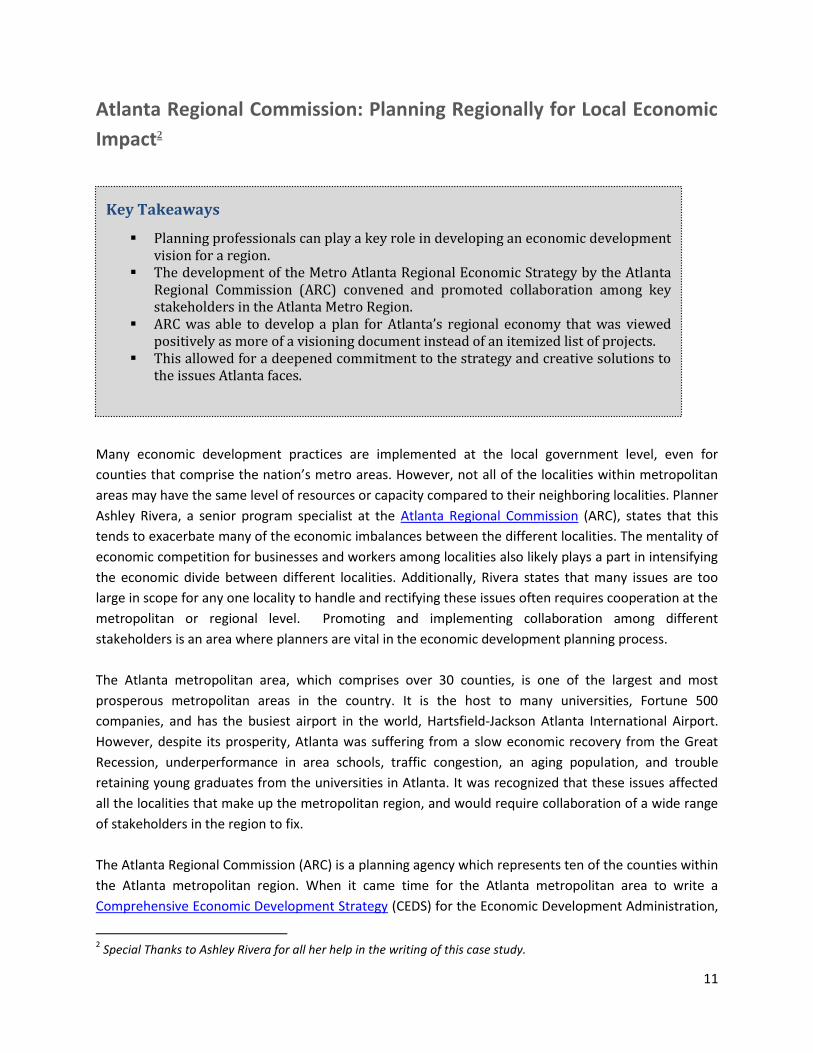
Atlanta Regional Commission: Planning Regionally for Local Economic
Impact2
Many economic development practices are implemented at the local government level, even for
counties that comprise the nation’s metro areas. However, not all of the localities within metropolitan
areas may have the same level of resources or capacity compared to their neighboring localities. Planner
Ashley Rivera, a senior program specialist at the Atlanta Regional Commission (ARC), states that this
tends to exacerbate many of the economic imbalances between the different localities. The mentality of
economic competition for businesses and workers among localities also likely plays a part in intensifying
the economic divide between different localities. Additionally, Rivera states that many issues are too
large in scope for any one locality to handle and rectifying these issues often requires cooperation at the
metropolitan or regional level. Promoting and implementing collaboration among different
stakeholders is an area where planners are vital in the economic development planning process.
The Atlanta metropolitan area, which comprises over 30 counties, is one of the largest and most
prosperous metropolitan areas in the country. It is the host to many universities, Fortune 500
companies, and has the busiest airport in the world, Hartsfield-Jackson Atlanta International Airport.
However, despite its prosperity, Atlanta was suffering from a slow economic recovery from the Great
Recession, underperformance in area schools, traffic congestion, an aging population, and trouble
retaining young graduates from the universities in Atlanta. It was recognized that these issues affected
all the localities that make up the metropolitan region, and would require collaboration of a wide range
of stakeholders in the region to fix.
The Atlanta Regional Commission (ARC) is a planning agency which represents ten of the counties within
the Atlanta metropolitan region. When it came time for the Atlanta metropolitan area to write a
Comprehensive Economic Development Strategy (CEDS) for the Economic Development Administration,
2 Special Thanks to Ashley Rivera for all her help in the writing of this case study.
Key Takeaways
Planning professionals can play a key role in developing an economic development vision for a region.
The development of the Metro Atlanta Regional Economic Strategy by the Atlanta Regional Commission (ARC) convened and promoted collaboration among key stakeholders in the Atlanta Metro Region.
ARC was able to develop a plan for Atlanta’s regional economy that was viewed positively as more of a visioning document instead of an itemized list of projects.
This allowed for a deepened commitment to the strategy and creative solutions to the issues Atlanta faces.

12
it was decided that the planning stages would be done as a collaborative effort. A CEDS is a document
meant for regional economic development planning, to be developed by a planning organization, and is
required to receive funding from the EDA. Rivera explains that the CEDS had in years past just been
comprised of the different economic development plans of the different localities. This seems to be an
issue with CEDS, as a study by the W.E. Upjohn Institute for Employment Research for the EDA
recommended that CEDS should begin to “focus more on strategic development and collaboration to
implement regional vision,” suggesting many CEDS have issues with regional collaboration. The National
Association of Development Organizations (NADO) also suggests that many CEDS are more of a list of all
the projects and initiatives in the region instead of a regional visioning document. This is most likely why
the EDA is reevaluating the CEDS process so that the CEDS, as described by the Texoma Council of
Governments3 CEDS, for example, is not “a book sitting on the shelf collecting dust or… a simple check
mark on an EDA grant applications for other projects in the region.” The ARC was inspired to try this new
approach in Atlanta, after a trip to Seattle where all localities within the Seattle metropolitan region
were able to successfully collaborate to develop their CEDS.
In 2012, ARC gathered over 100 business leaders, economic developers, planners, and local officials to
figure out what strategies and projects were being implemented within the region, and to determine
what issues needed to be
addressed. Rivera explained
that it was relatively easy to
gather these stakeholders as
they all wanted to be a part of
this necessary conversation.
They also conducted a survey of
3,500 residents to discover what
was considered by the general
public to be Atlanta’s greatest
assets and the areas that
needed improvement.
Overwhelmingly, the airport was determined to be the greatest asset while areas that needed
improvement were housing and transportation. ARC, along with Market Street Services (a community,
workforce, and economic development consulting firm) also performed an analysis of the different
initiatives and strategies in the region, an economic cluster analysis, and a competitive assessment to
gain an understanding of the state of the region.
3 Texoma Council of Governments is an association of local governments representing Cooke, Fannin, and Grayson
Counties in Texas, which all are on the state border with Oklahoma.
Word cloud of survey responses from the question:
“What is the region’s greatest strength in terms of economic competitiveness?”
Source: ARC, “Atlanta Regional Economic Competitiveness Strategy.”

13
From their research and discussion with local leaders and the public, they developed the Metro Atlanta
Competitiveness Strategy. The strategy addresses four specific areas:
Create a well-educated, 21st century workforce,
Make new businesses more prosperous while attracting new ones,
Promote innovative entrepreneurs, and
Create livable communities for new graduates and the aging population.
Four commissions were created to serve as implementers of the strategy. Due to how recent the
strategy was formulated, it is just beginning its implementation phase. However, there has been
considerable progress towards the goals outlined in the Strategy. Members of the Prosperous
Committee have formed the Aerotropolis Alliance, a group dedicated to furthering economic
development around the airport. The airport is critical to the Atlanta metro area as it borders seven
different counties and employs over 50,000 workers. The group has developed a blueprint for economic
development around the airport and is currently looking into implementing the blueprint. The city
developed an internship program with the hopes that these interns would become future residents of
Atlanta. Finally, the plan called for the implementation of the TOD Collaborative, a collaboration
between the Metropolitan Atlanta Regional Transit Authority (MARTA) and the Atlanta Neighborhood
Development Partnership (a local nonprofit) with the goal of developing mixed income housing along
the MARTA stations. These would not only include affordable and workforce housing, but retail and
commercial enterprises as well.
In developing the Metro Atlanta Regional Economic Strategy, Rivera stated that their role, besides
performing analysis for the strategy, was that of “conveners.” Their goal was not to direct people or tell
them how they should be developing, but to gather stakeholders with similar interests and goals
together in the hopes that they would come up with new ideas and innovative solutions. The Strategy
document itself even makes note of this, stating that the goal of the plan is to “complement” existing
initiatives through collaboration. Rivera says they also encouraged stakeholder and interested parties to
take leadership or collaborator roles in areas where they had greater experience or knowledge. ARC
connected these stakeholders by demonstrating that Atlanta was working together to solve issues
affecting the city and region as a whole. This approach is embodied in ARC’s tagline: Regional Impact +
Local Relevance.
Also, the collaboration of regional partners—facilitated by planners at the Atlanta Regional
Commission—facilitated the acceptance of the Metro Atlanta Regional Economic Strategy as a visioning
document. The inclusive approach served to boost real local involvement resulting in localities
identifying as more of an integrated part of the region instead of just one county in the Atlanta
Metropolitan area. In addition, the approach and level of interaction also helped to avoid local policy
debates. Ashley Rivera stated that when you pull people together for a project like this and make it
more inclusive, they will be more committed to the vision set out in the plan. This can be seen from the

14
successes that have already occurred with the Aerotropolis Alliance and the development of the
internship program.
The development of the Metro Atlanta Regional Economic Strategy shows how the principles of
community and stakeholder involvement can play an essential role in economic development planning.
By incorporating necessary stakeholders and public input, ARC was able to develop a plan that was not
just focused on one specific locality, but was able to take a larger, regional view of the major issues
Atlanta faces. The collaboration of different stakeholders also means greater collaboration on current
initiatives as well as the capacity and existing relationships to develop new initiatives as future needs
arise.
Resources
Atlanta Neighborhood Development Partnership, I. (2014). About ANDP. Retrieved February 25, 2015,
from http://www.andpi.org/about/index.html
Atlanta Regional Commission. Educated. In A. R. Commission (Ed.), Atlanta Regional Commission.
www.atlantaregional.com: Atlanta Regional Commission.
Atlanta Regional Commission. Innovate. In A. R. Commission (Ed.), Atlanta Regional Economic
Competitiveness Implementation Plan: Atlanta Regional Commission.
Atlanta Regional Commission. (Producer). (February 25, 2015). Livable. Atlanta Regional Economic
Competitiveness Implementation Plan [PDF]
Atlanta Regional Commission. Prosperous. In A. R. Commission (Ed.), Atlanta Regional Commission.
www.atlantaregional.com: Atlanta Regional Commission.
Atlanta Regional Commission. (2014a). Atlanta Regional Economic Competitiveness Strategy Executive
Summary. http://www.atlantaregional.com/local-government/economic-competitiveness:
Atlanta Regional Commission.
Atlanta Regional Commission. (2014b). Metro Atlanta Competitiveness Strategy. In A. R. Commission
(Ed.), (pp. 8). www.atlantaregional.com: Atlanta Regional Commission.
Atlanta Regional Commission. (Producer). (2014c, February 25). Metro Atlanta Regional Economic
Competitiveness Strategy Implementation Update Summary. [Powerpoint]
Grimes, S. (2015). Building an Economic Competitiveness Plan for the Atlanta Region. Atlanta Regional
Commission News Center. Retrieved March 4, 2015, from
http://news.atlantaregional.com/?p=1831
Market Street Services Inc. (2012). Regional Economic Competitiveness Strategy and Implementation
Plan (pp. 73). www.atlantaregional.com: Atlanta Regional Commission.
Market Street Services, Inc. (Producer). (2012, February 25, 2015). Metro Atlanta Regional Economic
Development Strategy Initial Research Review: Work Group Meeting. [PDF]

15
Pacific Boulevard–Huntington Park, California: Planning for Changing
Economies and Populations
Pacific Boulevard in Huntington Park, California, is an excellent example of how economic development
strategies have adapted to changing population demographics and shifts in the economic landscape.
Huntington Park is approximately 8 miles south of Los Angeles. Throughout the first half the 20th century
the city underwent a rapid ethnic makeover as the population changed from majority white to majority
Latino immigrant residents. Along with this cultural transition, industrial manufacturing plants moved
out of the area, taking with them high-paying jobs that, at one time, were the primary source of
economic stability in the region. These changes resulted in an over-burdened housing stock and
declining commercial activity. By the 1960s, blighted housing and vacant retail shops had completely
changed the urban landscape along Pacific Boulevard. City planner James G. Funk and the Huntington
Park City Council recognized the need for an extensive economic development strategy to revitalize the
area. Redevelopment of the central business district along Pacific Boulevard became the first priority. By
incorporating commercial enterprises that align with the needs of the predominantly Mexican-American
residents that occupy the area, Pacific Boulevard has sustained itself as a retail destination from the
start of the redevelopment era in the 1970s to present day.
The late 1970s marked the beginning of an aggressive plan to use financial incentives to attract real
estate developers to the area. Business owners along the Boulevard partnered with the Council to invest
hundreds of thousands of dollars to undergo a reconstruction and modernization program.
Supplemented by federal Economic Development Authority grants dollars, this project expanded public
transportation, improved pedestrian and motor vehicle mobility through sidewalk expansion and
roadway repair, and implemented building renovations for retailers. These initial improvements made
Pacific Boulevard an attractive regional retail center. Additional retail plazas along the corridor
incorporate a Mexican architectural design and feature Spanish names that appeal even more to the
majority Mexican American residents.
In 1995, the Pacific Boulevard Merchants Association formed a Business Improvement District (BID) to
promote retail activity, support businesses owners, and represent their interests to the local
Key Takeaways
Adapting to major demographic changes requires ongoing and innovative strategies to bring about economic successes.
Planners recognized these challenges in the late 1970s and focused attention and public resources on revitalization efforts to accommodate these demographic shifts.
Current efforts continue to evolve with the needs of changing populations by reinvesting in infrastructure, improving design, and focusing on place making.

16
community. Creation of this group was only one piece of the economic development plan. New
marketing strategies and creative financing mechanisms have resulted in construction of a multi-screen
movie theater, multiple shopping courtyards dispersed along the strip, and an industrial park. It is
estimated that between 4,000 and 7,000 jobs were created as a result of these efforts.
More recently Huntington Beach has recognized the need for an updated revitalization strategy. The
Pacific Boulevard Downtown
Revitalization strategy drafted in 2013
emphasizes a change in land use with
increased density, more mixed-use
design, and improved walkability. The
new plan features a civic center with
large spaces for social gatherings and
outdoor events. Additional free
parking spaces will help attract
regional shoppers. One innovative use
of existing space the community has
adopted is the “parklet,” a parking
space converted to a sidewalk mini-
park. The first of which was
introduced on Pacific Boulevard in
2014, with more to come. The goal of
these outdoor lounge spaces is to
provide a comfortable meeting place along the commercial corridor.
Appealing to local residents in building design and community character is a longstanding strength of
Pacific Boulevard. The cultural connection created there fosters local pride that translates into financial
investment by business owners and residents. The commercial activity has created jobs and increased
revenue for the city. As indicated by the long history of economic development strategies in Huntington
Park, a commercial thoroughfare such as Pacific Boulevard is never really complete, but rather, it is in a
constant state of change, evolving with the population, adapting to their needs, and embracing new
methods in planning and urban design.
Resources
City of Huntington Park. (2004). Economic Development Plan. Retrieved from http://ca-
huntingtonpark.civicplus.com/DocumentCenter/Home/View/2
Eichenfield, J., and Drapkin, D.R. Downtown Huntington Park Strategic Plan for Downtown Management.
Retrieved from http://ca-huntingtonpark.civicplus.com/DocumentCenter/Home/View/3
Kleinman, A. (2014). Former Huntington Park parking now a popular parklet, more on the way. Retrieved
from http://la.streetsblog.org/2014/06/13/former-huntington-park-parking-now-a-popular-
parklet-more-on-way/
Source: Streetsblog LA

17
Loukaitou-Sideris, A. (2002). Regeneration of urban commercial strips: Ethnicity and space in three Los
Angeles neighborhoods. Journal of Architectural and Planning Research, 19(4), 334-350.
Pierro, T. (1998). Community involvement spurs Huntington's economic development. The State Journal,
14(9), 4.
Rodino, R. J. (1998). Urban Revitalization in an Ethnic Enclave: Huntington Park CA 1965-1998. Working
paper, Department of Urban Planning, University of California, Los Angeles.
Ross, J. (1999). Huntington developer lands office building for new business park. The State Journal,
15(20), 5.
Sterngold, J. (2000, February 1). A Citizenship Incubator for Immigrant Latinos. The New York Times.
Retrieved from http://www.nytimes.com/2000/02/01/us/a-citizenship-incubator-for-
immigrant-latinos.html
Torres, V. (1995, October 16). Southern California enterprise: Pacific Blvd. beckons to Latinos: Shoppers
spark revival of Huntington Park District. Los Angeles Times. Retrieved from
http://articles.latimes.com/1995-10-16/business/fi-57589_1_huntington-park

18
Devens, Massachusetts: Planning for Economic Diversification and
Sustainability4
Devens, Massachusetts, is a small town located about an hour Northwest of Boston, and is located
directly next to the Oxbow National Wildlife Refuge. For over eighty years, the primary employer of
Devens was Camp Devens, a U.S. Army base established in 1917. In 1990, Congress signed into law the
Defense Base Closure and Realignment Act (BRAC). This law required the Department of Defense to
close down several military bases, but provided resources to aid in redevelopment of former base sites.
Fort Devens was selected as one of the bases that would be closed, eventually closing in 1996. This was
a huge blow to Devens as the base closure took away 7,000 jobs (including 2,900 civilian jobs), a payroll
of over $178 million, and was left as a superfund site due to groundwater contamination from the
operations of the base (which the Department of Defense cleaned up).
In 1993, at a charrette hosted by the Boston Society of Architects, the community of Devens developed
the idea of focusing redevelopment around the concept of sustainability. Peter Lowitt, FAICP, the
Director of the Devens Regional Commission, stated that the community “overwhelmingly supported
using sustainable redevelopment as the theme for our redevelopment efforts.” Specifically, they
included models on “industrial parks on biological systems and zero waste industrial parks.”
This idea became fully formed in 1994, when the Massachusetts General Court passed Chapter 498 of
the Acts of 1993, which established the former military base site as the Devens Regional Enterprise
Zone. MassDevelopment (then known as the Massachusetts Government Land Bank) was selected as
the primary developer of the site while the Devens Enterprise Commission was created as the land use
and planning agency within the Devens Regional Enterprise Zone. The Devens Enterprise Commission is
also the one organization to issue all permits within the Devens Regional Enterprise Zone.
4 Special Thanks to Peter Lowitt, FAICP, for his help in the writing of this case study. Pictures courtesy of Mr. Lowitt.
Key Takeaways
Planners can help communities to realize economic diversification.
After the largest employer in the town, Fort Devens, closed as part of the Defense
Base Closure and Realignment Act, the community decided they wanted to base
any future economic development on sustainability.
Through the work of Peter Lowitt, FAICP, and the Devens Enterprise Commission,
an eco-industrial park was created that promotes sustainability and stresses
quality of life features while generating economic prosperity.

19
The Devens Re-Use Plan for the new site called for the development of an eco-industrial park which
mixes sustainability with economic development. The strategy for Devens would preserve over 2,800
acres of Devens’ 4,400 acres as open space and recreational use, which would include an expansion of
the Oxbow National Wildlife Refuge. It would
also seek to promote and attract innovative and
sustainable companies by creating districts
dedicated to these goals. These included the
Environmental Business District, which was
meant for companies that develop or use
environmentally friendly products or processes,
and the Innovation and Technology Business
District, a district for new businesses and industries to locate within Devens. Lowitt was brought in as
Director of the Devens Enterprise Commission in 1999 to refocus the efforts on sustainable
development. With it, he also brought the successful model for the Eco-Industrial Park, which he had
previously used in Londonderry, New Hampshire.
By requiring all permits to be approved by the Devens Enterprise Commission, headed by Lowitt, Devens
was able to assure that all future development met the goals of the Re-Use Plan. Lowitt explains, “…As
part of the application process to get permits for projects at Devens, we ask firms how they will be
sustainable members of our corporate community. We explain its more fiscal sustainability and we use it
as an education[al] opportunity.” The one-stop permitting also allows for quick permitting which
attracts businesses as well. The “unified permitting process” (as it is referred to in the Re-Use Plan)
allowed developers to submit a comprehensive permit which provides for faster and consistent review.
In fact, the Devens Enterprise Commission guarantees it will act on permits within 75 days. Bristol-
Meyers-Squib was able to receive all their permits at the local and state level within 32 days.
The town also created the Eco-Efficiency Center, an organization that helps businesses within Devens
become more environmentally friendly and sustainable by providing workshops, roundtables, recycling
and energy efficiency assistance. Devens
also sought to have green housing and
building as well. Lowitt states “The [Devens
Enterprise Commission] Rules and
Regulations drive the development to
incorporate green infrastructure,
incentivize the use of green building
techniques, and take a holistic approach to
making development within the park
greener.” They recently developed a
residential neighborhood which was based
on regulations from LEED for
Neighborhood Development. They also have a greenhouse mitigation requirement and LEED certified
green building incentives for new development in the area as well as promoting environmentally
20
friendly buildings, and they have a model for housing that produces more electricity than it uses. Also,
any building that receives U.S. Green Building certification (LEED) will also be eligible for a green building
incentive up to $10,000. Other incentives are up to, as Lowitt explains, what “the state is willing to
offer.” This could include Tax Increment Financing (TIF) incentives, or Massachusetts Life Science Center
funding if the project is related to the life sciences.
Devens has profited from its emphasis on sustainability and open space. Eighty-seven organizations now
employ 3,600 people in the town, with an average salary of $69,210. With infrastructure improvements,
capital fund, and incentives provided by Mass Development, Devens also attracted Bristol-Myers Squibb,
a biopharmaceutical company, who has invested over $750 million in a biopharmaceutical
manufacturing campus in Devens, and employs 400 workers. Bristol-Myer Squibb, who plans to expand
their operations and add 350 new workers, was attracted to Devens due to its emphasis on
sustainability, which is a core value to the company as well. This has produced a significant change in
the economy, as the focus has shifted from mainly manufacturing to a mix of different industries,
including “warehousing and distribution, life sciences, and motion picture production studios.” The open
space and recreation facilities—especially the golf course—has aided Devens in business attraction as
well. Lowitt states, “Our recreation facilities have over 150,000 visitors a year and many prospective
employees and employers have their introduction to Devens through shuttling their children to
recreational events on our playing fields and recreation areas…[t]hey love the balance our commitment
to sustainable development…has created here at Devens.”
The redevelopment of Fort Devens shows the impact that sustainable development and the
preservation of open space on economic development. It also shows the ways planners can aide in
sustainable economic development planning through the efforts of the Devens Enterprise Commission.
By focusing first on the conservation of land and embracing sustainability, Devens has produced an
environmentally friendly community where businesses and their employees enjoy working and living.
Resources
Alliance for Nuclear Accountability. (2012). A Community Guide: Improving the links between future
land-use and clean-up decisions. In A. f. N. Accountability (Ed.). cif.nmcf.org: New Mexico
Community Foundation.
U.S Economic Development Administration. Casebook: Putting Concepts into Practice: Triple Bottom
Line Economic Development. In U.S. Economic Development Administration (Ed.).
www.devensec.com: U.S. Economic Development Administration.
United States Environmental Protection Agency. (2015, January 7th, 2015). Fort Devens. Waste Site
Cleanup & Reuse in New England. Retrieved February 25, 2015, from
http://yosemite.epa.gov/r1/npl_pad.nsf/f52fa5c31fa8f5c885256adc0050b631/DF7D910FF9A93
FAB8525691F0063F6C9?OpenDocument
Devens Eco-Efficiency Center. (2015). About the Center. Retrieved February 24, 2015, from
http://www.ecostardevens.com/index_files/about.htm

21
Devens Eco-Efficiency Center. (No Date). Tour of Devens. Retrieved February 25, 2015, from
http://www.ecostardevens.com/index_files/Page1885.htm
Devens Enterprise Commission. (2015a). Chapter 498: The Commonwealth of Massachusetts. Retrieved
February 25, 2015, from http://www.devensec.com/ch498/dec498toc.html
Devens Enterprise Commission. (2015b). Sustainable Devens. Retrieved February 25, 2015, from
http://www.devensec.com/sustain.html
Devens Community. (2015a). Devens: The place to grow. Retrieved February 24, 2015, from
http://www.devenscommunity.com/sites/default/files/downloads/Devens_Factsheet_2013.pdf
Devens Community. (2015b). History. Retrieved February, 24, 2015, from
http://www.devenscommunity.com/about-devens/history
Devens Community. (2015c). MassDevelopment from http://www.devenscommunity.com/about-
devens/history
Devens Community. (2015d). Planning. Retrieved February 24, 2015, from
http://www.devenscommunity.com/about-devens/planning
Department of Defense. (1990). Defense Base Closure and Realignment Act. www.defense.gov:
Department of Defense Retrieved from http://www.defense.gov/brac/docs/legis05.pdf.
MassDevelopment. (2015). Devens. Real Estate & Development. Retrieved February 25, 2015, from
http://www.massdevelopment.com/real-estate-development/development-projects/devens/
Fort Devens Museum. (2015, 2015). History. Retrieved February 25, 2015, from
http://www.fortdevensmuseum.org/history.php
Neely, D. (Producer). (No Date, February 25, 2015). Devens Eco-Efficiency Center. [Presentation]
Retrieved from http://www.devensec.com/sustain/DEEC_Overview.pdf
Vanasse Hangen Brustlin, I. (1994). Devens Reuse Plan. massdevelopment.com: Vanasse Hangen
Brustlin, Inc. Retrieved from http://www.massdevelopment.com/wp-
content/uploads/2009/10/Devens_Reuse_Plan.pdf.

22
Source: U.S. Army Corps of Engineers
Greater Grand Forks, North Dakota-Minnesota: Planning for Economic
Recovery and Resiliency
One of the major topics in planning at the moment is disaster recovery, mitigation, and resiliency. Since
Hurricane Katrina in 2004 and Hurricane Sandy in 2012, there has been extensive discussion on how
planners can help their communities prosper economically after a major disaster. When looking for
examples on ways to respond to a crisis, it may be best to look to history to see the ways planners can
help cities recover.
The Grand Forks Region downtown revitalization can serve as an excellent example of how planners can
help a region on the road to economic recovery. Greater Grand Forks is made up of two different areas
that cross state borders: Grand Forks in North Dakota and East Grand Forks in Minnesota. The two cities
are divided by the Red River, which flows 550 miles from Breckenridge, Minnesota, to Lake Winnipeg in
Canada. The Red River was prone to flooding, and Grand Forks had fought floods in 1897, 1950, and
1979.
In 1997, the Red River rose four inches over the fifty-foot dikes, which had been implemented to protect
the town from flooding. The populations of the
cities of Grand Forks and East Grand Forks were
evacuated, and the floodwaters surged into the
cities. The flooding also caused a fire which
destroyed part of the Grand Forks downtown
area. Overall, the total damages to both Grand
Forks and East Grand Forks totaled $2 billion.
Much of both cities’ downtowns were practically
destroyed, and many people lost their homes.
Key Takeaways
Planners can be instrumental in helping a community recover economically from a
natural disaster.
In 1997, Greater Grand Forks ND-MN suffered over $2 billion in damage after the
Red River flooded both cities.
Planners aided in the recovery through developing a plan for the revitalization of
the downtown, which included the building of a new town square and a
Greenway—as both a flood mitigation and economic development strategy.

23
Source: American Trails
To begin the process of rebuilding, both cities received around $1 billion in funding through the state
and federal government. With the aid of the publisher of the Grand Forks Herald, the local newspaper,
Grand Forks5 began revitalizing their downtown, which encouraged businesses and developers to stay
and reinvest in the city. Grand Forks also established a “Renaissance Zone” in the downtown area to
help in attracting businesses. The Renaissance Zone is a state program that allows cities to apply to have
areas of the city designated as “Renaissance Zones” and grant tax incentives to businesses who develop
projects within the zones. East Grand Forks used CDBG grants to renovate the local mall, which is now
called the Riverwalk Centre, and attract a Cabela’s (a sporting goods store) as a destination retail
location. They also used some of the funds to renovate Whitey’s, a historic bar in the area.
Several planners and planning agencies were instrumental in the revitalization of downtown Grand
Forks. A workshop was conducted by the Urban Land Institute (ULI) which detailed a list of
recommendations based on the River Forks Plan developed by the city earlier. From the workshops, ULI
drafted a vision for downtown Grand Forks to become the “heart” of the region, a sentiment which had
also been suggested at a local charrette. One of the major economic development recommendations
provided by ULI was to develop a business attraction and retention program, which can be illustrated by
the Renaissance Zone mentioned above. Camiros, a private planning firm brought in by HUD, developed
a plan for downtown based on previous charrettes, workshops, and ULI’s recommendations. The
recommendations included the construction of new office space, the re-building of the Grand Forks
Herald Building, and the building of a new town square. In 2000, the city opened the new town square,
which replaced several businesses that had been damaged beyond repair in the flood, and it now plays
host to several events including a farmer’s market. The importance of the downtown revitalization to
the overall economic recovery, as pointed out by the ULI report, is that the downtown area can attract
new businesses, workers, and residents by being a vibrant area which has numerous offerings in the
form of office space, retail, restaurants, recreation, and entertainment.
One of the most impressive ways Grand Forks used
planning to help in their economic recovery was the
development of the new flood mitigation system
and the Greenway. Grand Forks and East Grand
Forks, with help from the federal and state
governments, spent $403 million to develop a new
flood mitigation system. The new system raised the
height of levees to 60 feet, ten feet above the
height before the flood, which an LSU Study
estimates saves the taxpayers over $2.50 for every
dollar spent. In between the flood mitigation
system and the river, the city bought and
demolished several homes destroyed or damaged in
the floods, and built the Greenway, a 2,200-acre piece of open space with trails, two golf courses, three
5 This is an updated version of the document that was used in the writing of this case study.

24
disc golf courses, and many other recreational amenities. The Greenway also serves as part of the flood
mitigation system, allowing water to expand before it reaches the levees, relieving pressure on them. It
connects Grand Forks and East Grand Forks with two pedestrian bridges, and provides recreational
access to downtown Grand Forks. The original vision for the plan stated that the Greenway would
support community development by providing recreation and entertainment features, and would also
support economic development by supporting the downtown area and providing opportunities for year-
round tourism.
The recovery of Grand Forks and East Grand Forks from the 1997 flood provides a unique example of
how planners can help in the economic recovery of a community. By aiding in the development of a new
downtown and the Greenway, planners have helped Grand Forks and East Grand Forks recover and
prosper.
Resources
Federal Emergency Management Administration. Celebrating the Past, the Present, and the Future...The
Grand Forks Town Square. Journeys.
http://www.fema.gov/pdf/about/regions/regionviii/jurnys31.pdf
Anonymous. (2001). The Greenway Grand Forks, ND and East Grand Forks, MN Chapter Two: Vision and
Goals (pp. 13-17). www.greenwayggf.com.
City of Grand Forks, N. D. (2011). Grand Forks Flood Disaster and Lessons Learned. In N. D. City of Grand
Forks (Ed.). www.grandforksgov.com.
Grand Forks Historical Preservation Commission. Grand Forks, North Dakota Historical Overview.
Retrieved February 25, 2015, from http://www.gfpreservation.com/historical-overview/
North Dakota Office of the State Tax Commissioner. (2009). Renaissance Zone Act exemptions and tax
credits. www.nd.gov: Retrieved from http://www.nd.gov/tax/genforms/schedule-
rz09.pdf?20150302195936.
North Dakota Office of the State Tax Commissioner. (2013). Renaissance Zone Act Tax Incentive
Guideline. www.nd.gov/tax: North Dakota Office of State Tax Commissioner Retrieved from
http://www.nd.gov/tax/genpubs/renaissance.pdf?20150302203724.
U.S Department of Housing and Urban Development. (No Date). Recovery Snapshot: East Grand Forks
Downtown Revitalization. In U.S Department of Housing and Urban Development (Ed.), Recovery
Snapshot. www.hudexchange.info: U.S. Department of Housing and Urban Development.
Gerber, S. (2006). Disaster recovery for low-income people: Lessons from the Grand Forks flood.
Community Dividend, (September 2006). Retrieved from Federal Reserve Bank of Minneapolis
website: https://www.minneapolisfed.org/publications/community-dividend/disaster-recovery-
for-lowincome-people-lessons-from-the-grand-forks-flood
Gregory, T. (2007). Grand Forks cresting after flood of 1997, The Chicago Tribune. Retrieved from
http://articles.chicagotribune.com/2007-04-22/news/0704220035_1_red-river-grand-forks-
herald-flood
Hill, E.; St. Clair, T.; Wial, H.; Wolman, H.; Atkins, P.; Blumenthal, P.; Ficenec, S.; and Friedhoff, A. (2010).
Economic Shocks and Regional Economic Resilience. Paper presented at the Urban and Regional
Policy and Its Effects: Building Resilient Regions, Washington DC.

25
Kweit, M. G., and Kweit, R. W. (2004). Citizen Participation and Citizen Recovery in Disaster Recovery.
The American Review of Public Administration, 34(4), 354-373.
LakesnWoods.com. (2015). East Grand Forks Minnesota Community. Retrieved February 25, 2015, from
http://www.lakesnwoods.com/EastGrandForks.htm
Associated Press. (2002, April 13). City proud of recovery from 1997 flood, USA Today. Retrieved from
http://usatoday30.usatoday.com/weather/news/2002/2002-04--14-grand-forks-flood.htm
Minnesota Department of Natural Resources. (2015, 2015). Red River of the North State Water Trail.
State Water Trails. Retrieved February 25, 2015, from
http://dnr.state.mn.us/watertrails/redriver/index.html
Grand Forks County Historical Society. The Flood of 1997. Retrieved February 25, 2015, from
http://www.grandforkshistory.com/history-of-grand-forks-county-historical-society/the-flood-
of-1997/
LSU Coastal Sustainability Studio. (2007). Grand Forks, ND - Levee Construction Success Story.
Retrieved February 25, 2015, from http://resiliency.lsu.edu/planning/grand-forks-north-dakota-
levee-construction-success-story/
North Dakota Tax. Renaissance Zones. North Dakota: An Economy on the Move. Retrieved February 25,
2015, from http://www.nd.gov/tax/taxincentives/renaissance/

26
IV. Conclusion: What Are the Takeaways for
Planners?
As the Task Force contemplated our charge, questions continued to emerge:
How can planners be active participants and implementers in economic development and
growth?
How can planners be more than mere conveners?
How do planners mitigate the inherent conflicts between planning for the long term and
incentivizing short-term economic benefits?
While there may be no simple answers to the above questions, there are clear and essential roles and
responsibilities for planners to promote economic development and growth:
With more data available today than at any time in history, understanding a local economy and its
place and relationship in the regional economy is easier—and more vital than ever. Planners should
take the lead in these efforts. The Atlanta example, while still early, provides a great example for the
role of planners in providing the data, convening the stakeholders, holding meaningful and targeted
discussions, and facilitating an implementation plan with the end goal of balancing and promoting both
local and regional economic interests.
Supporting an environment to attract and retain talent has become an important business attraction
strategy. As noted in the report, this means vibrant centers—live-work-learn-play locations like
Innovation Square in Gainesville. With knowledge industries being compatible with other land uses,
does it now make sense to protect land for traded industries similar to agricultural protection? Does it
also make sense to preserve and promote “authenticity” to retain current workers and attract the
workforce of the future—e.g., the “Keep Austin Weird” approach, but institutionalized or even
incentivized.
The next wave of redevelopment—suburban malls, business parks, and employment centers—is
occurring in traditional suburban employment centers such as the City of Irvine (California) and Tyson’s
Corner (Fairfax County, Virginia). In these areas, while traditional economic development efforts to
attract and retain businesses continue, the emphasis has shifted toward more planning-centric
initiatives such as promoting residential development, walkability, and improved mobility. Will this be
the key to creating the type of environment and community desired by the current and next generation
of workers? If so, planners can take the lead.
The case studies demonstrate planners’ roles in recognizing changing economic trends, leveraging
resources to meet new and evolving needs, and addressing one-time shocks to the economy. Pacific
Boulevard foreshadowed the types of demographic changes facing many localities today. Grand Forks
provides a timely and relevant example for communities planning for economic resiliency in the face of

27
impacts from climate change and extreme weather. Devens provides a blueprint for a long-term and
sustainable approach to economic recovery and growth in response to a one-time shock to the
economy.
While answers—and more questions—will continue to emerge, we hope there is much food for thought
in this report. However, like any good research effort, we see areas for further and continued research
and debate. We hope that the discussion continues in the planning profession and particularly in areas
of planning specializations: How does your specialization support economic development? What
successes are planners achieving now, and what can planners do better to support economic
development and growth in the future? We look forward to an ongoing and healthy conversation.