please note that some formatting changes …
TRANSCRIPT
Caterham, Chaldon and Whyteleafe Neighbourhood Plan Local Green Space Assessments
APPENDIX B - Local Green Space Assessments
PLEASE NOTE THAT SOME FORMATTING CHANGES OUTSTANDING Introduction
This document describes the 22 Local Green Spaces – including clusters of spaces - to be protected by Policy CW11 of the Caterham, Chaldon and Whyteleafe Neighbourhood Plan.
All are demonstrably special to the community and also to those working and visiting the neighbourhood area.
The Local Green Spaces are:-
Caterham on the Hill 8. Hambledon Park estate 1. Civic Burial Ground
i. Hambledon Linear Park 2. Queen’s Park ii. Soper Drive
iii. Hambledon Road/Christie Walk 3. Salmons Lane Green iv. St Lawrence Way/Marcuse Road 4. Town End Recreation Ground v. St Lawrence Way/Pye Close 5. Westway Common
vi. Coulsdon Road to Chaldon Road
6. Le Personne and Banstead Roads 7. York Gate estate: 9. Oakgrove estate
i. Fairbourne Lane/ Darby Close i. Oakgrove/Blackthorn Road ii. Seymour Avenue/Green Lane: ii. Gibson Way/Driscoll Way: iii. Fairbourne Lane/ Green Lane iii. Oakgrove, opposite Woodview Way iv. Drake Avenue south to Fairbourne Lane iv. Holland Park v. Howe Drive vi. Yorke Gate/Chatfield Court
CR3 Neighbourhood Plan Group 1

Caterham, Chaldon and Whyteleafe Neighbourhood Plan Local Green Space Assessments
CR3 Neighbourhood Plan Group 2
Caterham, Chaldon and Whyteleafe Neighbourhood Plan Local Green Space Assessments
Caterham on the Hill (continued)
10. Fenemore Road Linear Park
11 Caterham Barracks development:
i. Sergeants Place
ii. Cricket Field , Coldstream Road
iii. Brigade Place
iv. Grenadier Place
v.
vi.
vii.
viii.
ix.
Weston Drive/Coldstream Road:
Alexander Crescent
Anzio Gardens
Adair Gardens
The Grove/Stirling Drive
.
Caterham Valley 12Church Hill View – land north of Church Hill
13Tillingdown Hill Recreation Area and Copse
14Timber Hill Park
15Valley Sports Ground
CR3 Neighbourhood Plan Group 3
Caterham, Chaldon and Whyteleafe Neighbourhood Plan Local Green Space Assessments
Chaldon
16Six Brothers Field
17St Lawrence Hospital former burial ground
Whyteleafe
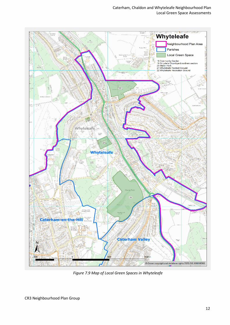
18Community Garden
19St Luke’s Churchyard (northern part excluding church)
20Manor Park
21Whyteleafe Football Ground
22Whyteleafe Recreation Ground
The figure below shows the Local Green Spaces on a series of maps, by local area. Below these, a detailed description of each, including how they meet the NPPF Local Green Space criteria, is then provided in the tables below, grouped by parish.
CR3 Neighbourhood Plan Group 4

Caterham, Chaldon and Whyteleafe Neighbourhood Plan Local Green Space Assessments
CR3 Neighbourhood Plan Group
5

Caterham, Chaldon and Whyteleafe Neighbourhood Plan Local Green Space Assessments
Figure 7.6 Map of Local Green Spaces in Caterham on the Hill
CR3 Neighbourhood Plan Group
6

Caterham, Chaldon and Whyteleafe Neighbourhood Plan Local Green Space Assessments
CR3 Neighbourhood Plan Group
7
Caterham, Chaldon and Whyteleafe Neighbourhood Plan Local Green Space Assessments
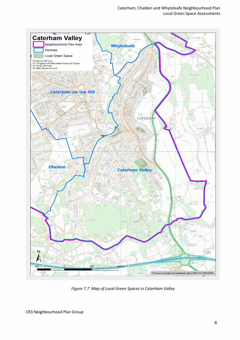
Figure 7.7 Map of Local Green Spaces in Caterham Valley
CR3 Neighbourhood Plan Group
8

Caterham, Chaldon and Whyteleafe Neighbourhood Plan Local Green Space Assessments
CR3 Neighbourhood Plan Group
9

Caterham, Chaldon and Whyteleafe Neighbourhood Plan Local Green Space Assessments
Figure 7.8 Map of Local Green Spaces in Chaldon
CR3 Neighbourhood Plan Group
10

Caterham, Chaldon and Whyteleafe Neighbourhood Plan Local Green Space Assessments
CR3 Neighbourhood Plan Group
11
Caterham, Chaldon and Whyteleafe Neighbourhood Plan Local Green Space Assessments
Figure 7.9 Map of Local Green Spaces in Whyteleafe
CR3 Neighbourhood Plan Group
12

Caterham, Chaldon and Whyteleafe Neighbourhood Plan Local Green Space Assessments
Caterham on the Hill Name and Address Description/Purpose/ How the space meets the NPPF criteria
1. Civic Burial Ground Church Road: CR3 6SA Size: 2.86 ha
The Civic Burial Ground is accessible to the public and, as the photograph shows, there are fine views from it. Whilst the land is within the Green Belt, the designation of Local Green Space is felt to reflect the long standing community significance of the space. It is owned by Tandridge District Council, as is the access track which is included in the designation.
2. Queen’s Park Queen’s Park Road: CR3 5RB Size: 9.83 ha
Queen’s Park was created to commemorate Queen Victoria’s Diamond Jubilee in 1897.
This landmark public park is the flagship outdoor space for the District and central to the identity of Caterham Hill. The park is widely used for exercise, recreation and sports, having full length football and cricket pitches, two International standard croquet pitches, a bowling club and tennis courts. It has the largest children’s play area in the District attracting visitors from beyond the local community, it achieved 80%+ for quality in the 2015 Tandridge Open Space Study.
The park has a distinctive openness bounded by mature trees. It is central to the Neighbourhood Character Area identified by the local community. It is very accessible, bordered by housing and the majority of users walk around or across on several paths.
CR3 Neighbourhood Plan Group 13

Caterham, Chaldon and Whyteleafe Neighbourhood Plan Local Green Space Assessments
Name and Address Description/Purpose/ How the space meets the NPPF criteria
Whilst currently in the Green Belt, although there is concern about proposals to change this; Local Green Space status would provide a viable safeguard for the site for the community.
3. Salmons Lane Green Salmons Lane/Whyteleafe Road: CR3 5LT Size: 0.90 ha
This triangular parkland space is set within a busy area, surrounded by dense housing developments It is a gateway site, giving a strong visual impression when entering Caterham Hill along a principal access route (Whyteleafe Road).
The space is a central feature of the Neighbourhood Character Area, forming an attractive village green between the former Salmons manor house to the east and the RAF Kenley Conservation Area to the NW. Its use for recreation, fitness will increase as the population it serves increases.
However, it is otherwise unprotected. Given the pressure on development land within the settlement area it is important that this special place can continue to be enjoyed by future generations through its Local Green Space designation.
4. Town End Recreation Ground
Banstead Road/Town End: CR3 5QH
Size: 1.43 ha
This open recreational area and children’s playground serves the most heavily built up part of Caterham Hill. It is well used by the local community which surrounds it and has historic associations with RAF Kenley, containing a communal air raid shelter. Notably a Junkers JU 88 A-14 was shot down and crashed here in 1943.
This green spaces will be of particular importance for a growing urban population.
The recreation ground is otherwise unprotected and Local Green Space status will safeguard it for the future.
CR3 Neighbourhood Plan Group 14

Caterham, Chaldon and Whyteleafe Neighbourhood Plan Local Green Space Assessments
Name and Address Description/Purpose/ How the space meets the NPPF criteria
5. Westway Common
Westway/Chaldon Road: CR3 5TP Size: 5.49 ha
The Common is at the heart of the Hill community and its character, as a separate historic settlement.
It is a well-used recreational space and hosts the Caterham Carnival and visiting travelling fairground shows. The Beacon fire-signal is commonly lit, most recently for the WW1 centenary commemoration. The Common includes the allotments (across the Westway road) where there is a strong community of Horticultural Society growers.
Historically Caterham Common was communal, shared by and for local residents who had grazing rights. Responsibility now lies with Surrey County Council, however the legal standing of common land and its protection can be ambiguous. Safeguarding as a Local Green Space would ensure its long term future.
CR3 Neighbourhood Plan Group 15
Caterham, Chaldon and Whyteleafe Neighbourhood Plan Local Green Space Assessments
Name and Address Description/Purpose/ How the space meets the NPPF criteria
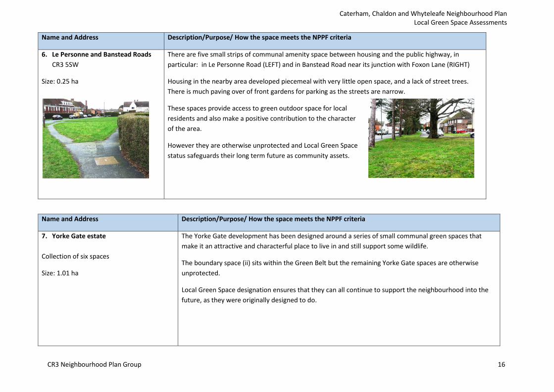
6. Le Personne and Banstead Roads CR3 5SW
Size: 0.25 ha
There are five small strips of communal amenity space between housing and the public highway, in particular: in Le Personne Road (LEFT) and in Banstead Road near its junction with Foxon Lane (RIGHT)
Housing in the nearby area developed piecemeal with very little open space, and a lack of street trees. There is much paving over of front gardens for parking as the streets are narrow.
These spaces provide access to green outdoor space for local residents and also make a positive contribution to the character of the area.
However they are otherwise unprotected and Local Green Space status safeguards their long term future as community assets.
Name and Address Description/Purpose/ How the space meets the NPPF criteria
7. Yorke Gate estate
Collection of six spaces
Size: 1.01 ha
The Yorke Gate development has been designed around a series of small communal green spaces that make it an attractive and characterful place to live in and still support some wildlife.
The boundary space (ii) sits within the Green Belt but the remaining Yorke Gate spaces are otherwise unprotected.
Local Green Space designation ensures that they can all continue to support the neighbourhood into the future, as they were originally designed to do.
CR3 Neighbourhood Plan Group 16
Caterham, Chaldon and Whyteleafe Neighbourhood Plan Local Green Space Assessments
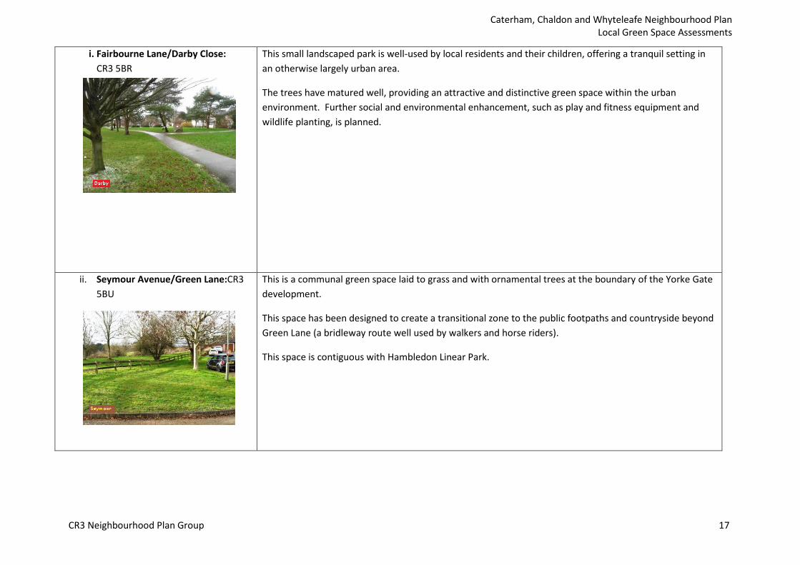
i. Fairbourne Lane/Darby Close: CR3 5BR
This small landscaped park is well-used by local residents and their children, offering a tranquil setting in an otherwise largely urban area.
The trees have matured well, providing an attractive and distinctive green space within the urban environment. Further social and environmental enhancement, such as play and fitness equipment and wildlife planting, is planned.
ii. Seymour Avenue/Green Lane:CR3 5BU
This is a communal green space laid to grass and with ornamental trees at the boundary of the Yorke Gate development.
This space has been designed to create a transitional zone to the public footpaths and countryside beyond Green Lane (a bridleway route well used by walkers and horse riders).
This space is contiguous with Hambledon Linear Park.
CR3 Neighbourhood Plan Group 17

Caterham, Chaldon and Whyteleafe Neighbourhood Plan Local Green Space Assessments
iii. Fairbourne Lane/ Green Lane: CR3 5AZ
This open recreational space creates a well-used small village green around which the housing is grouped.
Like Seymour Avenue, it is an integral part of the successful boundary treatment of the development, creating a transitional zone spatially and visually and providing public access from the urban area into to Green Lane and the countryside beyond.
iv. Drake Avenue south to Fairbourne Lane: CR3 5AW
This is an attractive broad strip of landscaped grass with mature trees and some shrubby areas. It provides an important habitat for wildlife.
The space transforms this central part of the Yorke Gate development, creating a sense of openness and light yet close to the residents who benefit.
CR3 Neighbourhood Plan Group 18
Caterham, Chaldon and Whyteleafe Neighbourhood Plan Local Green Space Assessments
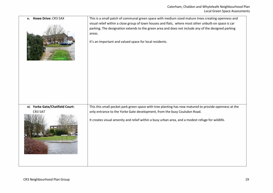
v. Howe Drive: CR3 5AX This is a small patch of communal green space with medium sized mature trees creating openness and visual relief within a close group of town houses and flats, where most other unbuilt-on space is car parking. The designation extends to the green area and does not include any of the designed parking areas.
It’s an important and valued space for local residents.
vi. Yorke Gate/Chatfield Court: CR3 5AT
This this small pocket park green space with tree planting has now matured to provide openness at the only entrance to the Yorke Gate development, from the busy Coulsdon Road.
It creates visual amenity and relief within a busy urban area, and a modest refuge for wildlife.
CR3 Neighbourhood Plan Group 19
Caterham, Chaldon and Whyteleafe Neighbourhood Plan Local Green Space Assessments
8. Hambledon Park estate
Collection of six spaces
Size: 4.43 ha
The Hambledon Park development, despite being of an urban density, has been designed to incorporate a linear park and a series of smaller green spaces. They make it an attractive and characterful place to live. The linear park creates a broad corridor from Green Lane right through between the estates of Yorke Gate and of Hambledon. There are habitats for people and wildlife to enjoy throughout.
Local Green Space designation ensures the survival of these several spaces into the future.
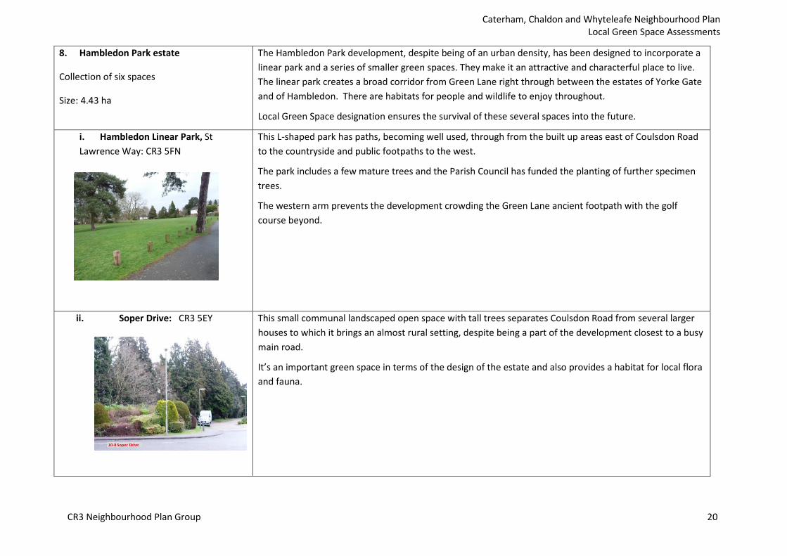
i. Hambledon Linear Park, St This L-shaped park has paths, becoming well used, through from the built up areas east of Coulsdon Road Lawrence Way: CR3 5FN to the countryside and public footpaths to the west.
The park includes a few mature trees and the Parish Council has funded the planting of further specimen trees.
The western arm prevents the development crowding the Green Lane ancient footpath with the golf course beyond.
ii. Soper Drive: CR3 5EY This small communal landscaped open space with tall trees separates Coulsdon Road from several larger houses to which it brings an almost rural setting, despite being a part of the development closest to a busy main road.
It’s an important green space in terms of the design of the estate and also provides a habitat for local flora and fauna.
CR3 Neighbourhood Plan Group 20

Caterham, Chaldon and Whyteleafe Neighbourhood Plan Local Green Space Assessments
iii. Hambledon Road/Christie Walk: CR3 5EX
Located at the main entrance to the development, this hedged area of landscaping with mature conifers creates a positive first impression and a character landmark, especially the two large Scots pines.
It forms a wildlife oasis, particularly for nesting and roosting birds and has a group value with the Coulsdon Road tree belt in screening the development from the busy main road.
iv St Lawrence Way/Marcuse Road: CR3 5FP
This small green space is bounded by thick tree and shrubby growth hiding a ‘secret garden’ of shaded ornamental planting on this corner plot - a haven for small bird and insect life.
CR3 Neighbourhood Plan Group 21

Caterham, Chaldon and Whyteleafe Neighbourhood Plan Local Green Space Assessments
v St Lawrence Way / Pye Close: This pocket park is surrounded by townhouses, adding a feeling of openness and visual appeal to an CR3 5FQ otherwise urban street scene. It adds some green space for wildlife and also helps absorb storm water,
reducing flash flood run off. The space is popular with residents, including children, seeking outdoor space to play in an otherwise urban area.
Vi Coulsdon Road to Chaldon Road: CR3 5EY/CR3 5PN
This dense but narrow* tree belt stretches south along Coulsdon Road from the Westway roundabout and then turns west along Chaldon Road to Clifton Hill School.
It provides year round screening from the busy road for the Hambledon Park and Oakgrove estates being largely of evergreen trees. The trees are an important wildlife refuge and corridor, for instance for foxes, squirrels and birds, and helps to slow surface water flow to drains. The tree belt within the site is protected with Tree Protection Orders. Together with the fine cast-iron railings and brick piers, the tree belt is a surviving feature from the Victorian hospital, which used to be housed on this site.
Local Green Space designation ensures continued to support of the environment for local people and wildlife into the future.
CR3 Neighbourhood Plan Group 22
Caterham, Chaldon and Whyteleafe Neighbourhood Plan Local Green Space Assessments
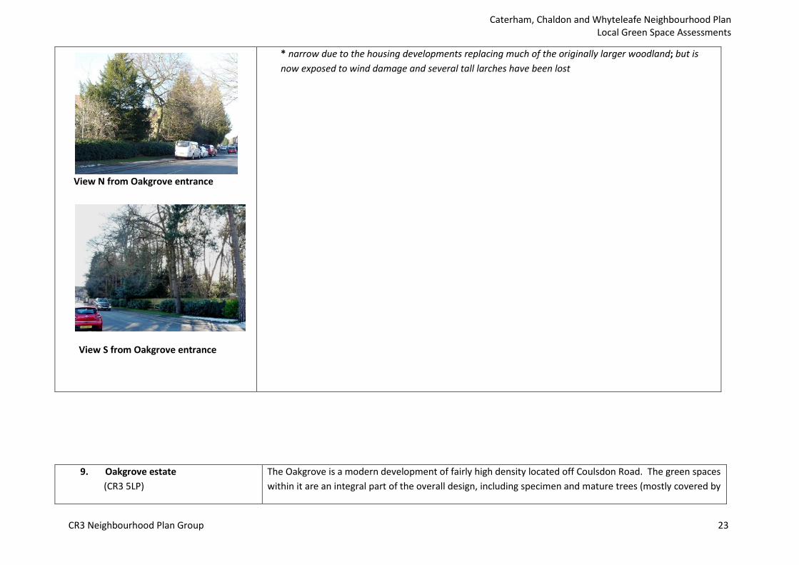
* narrow due to the housing developments replacing much of the originally larger woodland; but is now exposed to wind damage and several tall larches have been lost
View N from Oakgrove entrance
View S from Oakgrove entrance
9. Oakgrove estate (CR3 5LP)
The Oakgrove is a modern development of fairly high density located off Coulsdon Road. The green spaces within it are an integral part of the overall design, including specimen and mature trees (mostly covered by
CR3 Neighbourhood Plan Group 23
Caterham, Chaldon and Whyteleafe Neighbourhood Plan Local Green Space Assessments
Collection of four spaces.
Size: 1.47 ha
Tree Preservation Orders) retained from the Hospital. Local Green Space status allows these elements of the development to be safeguarded for the enjoyment of present and future communities.
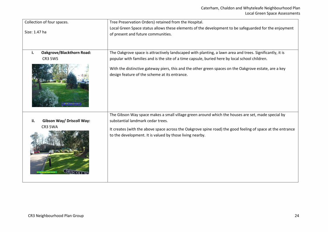
i. Oakgrove/Blackthorn Road: CR3 5WS
The Oakgrove space is attractively landscaped with planting, a lawn area and trees. Significantly, it is popular with families and is the site of a time capsule, buried here by local school children.
With the distinctive gateway piers, this and the other green spaces on the Oakgrove estate, are a key design feature of the scheme at its entrance.
ii. Gibson Way/ Driscoll Way: CR3 5WA
The Gibson Way space makes a small village green around which the houses are set, made special by substantial landmark cedar trees.
It creates (with the above space across the Oakgrove spine road) the good feeling of space at the entrance to the development. It is valued by those living nearby.
CR3 Neighbourhood Plan Group 24
Caterham, Chaldon and Whyteleafe Neighbourhood Plan Local Green Space Assessments
Name and Address Description/Purpose/ How the space meets the NPPF criteria
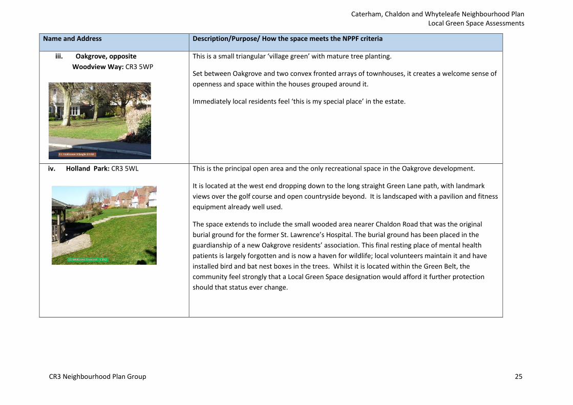
iii. Oakgrove, opposite Woodview Way: CR3 5WP
This is a small triangular ‘village green’ with mature tree planting.
Set between Oakgrove and two convex fronted arrays of townhouses, it creates a welcome sense of openness and space within the houses grouped around it.
Immediately local residents feel ‘this is my special place’ in the estate.
iv. Holland Park: CR3 5WL This is the principal open area and the only recreational space in the Oakgrove development.
It is located at the west end dropping down to the long straight Green Lane path, with landmark views over the golf course and open countryside beyond. It is landscaped with a pavilion and fitness equipment already well used.
The space extends to include the small wooded area nearer Chaldon Road that was the original burial ground for the former St. Lawrence’s Hospital. The burial ground has been placed in the guardianship of a new Oakgrove residents’ association. This final resting place of mental health patients is largely forgotten and is now a haven for wildlife; local volunteers maintain it and have installed bird and bat nest boxes in the trees. Whilst it is located within the Green Belt, the community feel strongly that a Local Green Space designation would afford it further protection should that status ever change.
CR3 Neighbourhood Plan Group 25

Caterham, Chaldon and Whyteleafe Neighbourhood Plan Local Green Space Assessments
Name and Address Description/Purpose/ How the space meets the NPPF criteria
10. Fenemore Road Linear Park CR8 5GJ
Size: 0.66 ha
.
Also known as Kenley Park, this area is within a dense urban housing estate adjoining the Conservation Area designated for RAF Kenley. The naming of streets after WW2 fighter pilots is an extra link.
This linear park, with an avenue of mature trees (protected by Tree Preservation Order), creates a green corridor for people and wildlife. It runs through from the built-up area to the public open spaces of the airfield providing walking space and a green outlook for many of the houses.
Residents are adamant that it should be preserved and enhanced for the future, hence Local Green Space designation ensures this long term safeguarding.
11. Caterham Barracks development
Collection of nine spaces
Size: 2.60 ha
Caterham Guards Barracks is a principal part of the military heritage of Caterham, a former garrison town. It is now a developed as housing but still combines historic conservation with new build, the success of which is reflected in its Conservation Area status.
The garden squares and other green spaces are an integral part of the design, including the retained historic buildings. They are valued by the residents and well landscaped and maintained on their behalf. It is important that all these green spaces within the modern development (that now extends 1.5 km of along Coulsdon Road) are permanently safeguarded as community assets. Local Green Space designation gives that assurance.
i. Sergeants Place: CR3 5ZD This small garden square provides an open landscaped setting to the tall buildings that enclose it on three sides - a row of social housing, the animal hospital and the rear of one of the historic barracks blocks all face Brigade Place.
It has areas laid to lawn and clipped ornamental hedging. Mature oaks had created a distinctive character nucleus along the main thoroughfare (Guards Avenue), but these had to be felled recently due to disease.
CR3 Neighbourhood Plan Group 26

Caterham, Chaldon and Whyteleafe Neighbourhood Plan Local Green Space Assessments
The square thus has potential for compensatory environmental enhancement, perhaps by replanting with smaller ornamental trees chosen for visual amenity and wildlife value. It would also be a good location for a fountain or piece of public art, funds permitting. The designation excludes the parking area.
ii. Cricket Field Coldstream Road CR3 5DU
This large main public open space, forms a central focus in the southern half of the Barracks estate. It is bordered by the two principal roads (Guards Avenue and Coldstream Road) and is surrounded by the three storey townhouses and flats.
It is indeed regularly used as recreational space by residents from all parts of the estate including for the Caterham Children’s Centre, an important community resource for young families that has recently moved into the Cricket Pavilion.
Designation excludes the buildings and parking spaces in the SE and NW corners.
CR3 Neighbourhood Plan Group 27
Caterham, Chaldon and Whyteleafe Neighbourhood Plan Local Green Space Assessments
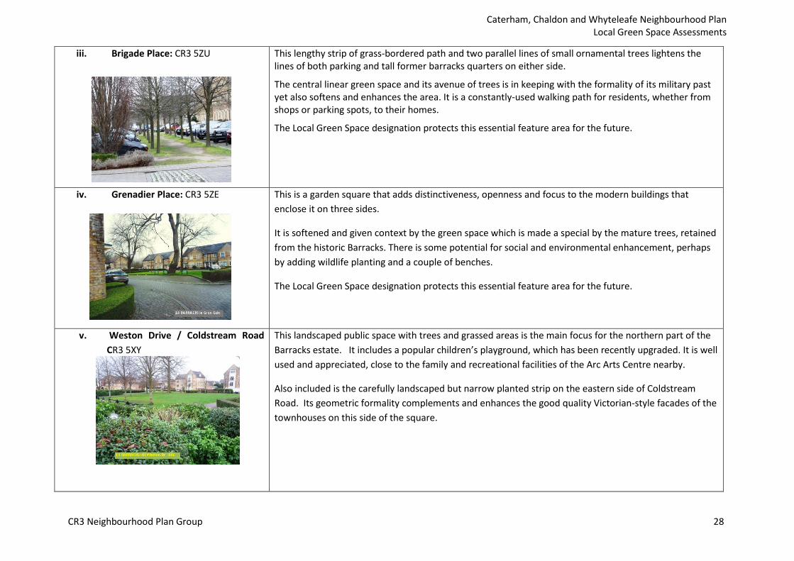
iii. Brigade Place: CR3 5ZU This lengthy strip of grass-bordered path and two parallel lines of small ornamental trees lightens the lines of both parking and tall former barracks quarters on either side.
The central linear green space and its avenue of trees is in keeping with the formality of its military past yet also softens and enhances the area. It is a constantly-used walking path for residents, whether from shops or parking spots, to their homes.
The Local Green Space designation protects this essential feature area for the future.
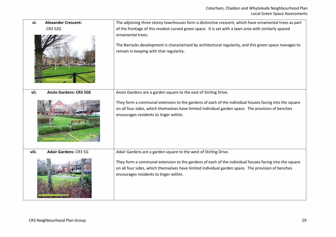
iv. Grenadier Place: CR3 5ZE This is a garden square that adds distinctiveness, openness and focus to the modern buildings that enclose it on three sides.
It is softened and given context by the green space which is made a special by the mature trees, retained from the historic Barracks. There is some potential for social and environmental enhancement, perhaps by adding wildlife planting and a couple of benches.
The Local Green Space designation protects this essential feature area for the future.
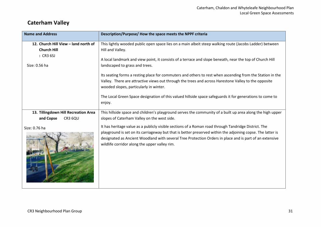
v. Weston Drive / Coldstream Road CR3 5XY
This landscaped public space with trees and grassed areas is the main focus for the northern part of the Barracks estate. It includes a popular children’s playground, which has been recently upgraded. It is well used and appreciated, close to the family and recreational facilities of the Arc Arts Centre nearby.
Also included is the carefully landscaped but narrow planted strip on the eastern side of Coldstream Road. Its geometric formality complements and enhances the good quality Victorian-style facades of the townhouses on this side of the square.
CR3 Neighbourhood Plan Group 28
Caterham, Chaldon and Whyteleafe Neighbourhood Plan Local Green Space Assessments
vi. Alexander Crescent: CR3 5ZG
The adjoining three storey townhouses form a distinctive crescent, which have ornamental trees as part of the frontage of this modest curved green space. It is set with a lawn area with similarly spaced ornamental trees.
The Barracks development is characterised by architectural regularity, and this green space manages to remain in keeping with that regularity.
vii. Anzio Gardens: CR3 5GE Anzio Gardens are a garden square to the east of Stirling Drive.
They form a communal extension to the gardens of each of the individual houses facing into the square on all four sides, which themselves have limited individual garden space. The provision of benches encourages residents to linger within.
viii. Adair Gardens: CR3 5G Adair Gardens are a garden square to the west of Stirling Drive.
They form a communal extension to the gardens of each of the individual houses facing into the square on all four sides, which themselves have limited individual garden space. The provision of benches encourages residents to linger within.
CR3 Neighbourhood Plan Group 29

Caterham, Chaldon and Whyteleafe Neighbourhood Plan Local Green Space Assessments
ix. The Grove/Stirling Drive: CR3 5QD
This boundary space lies between the Barracks development and Coulsdon Common (LB Croydon).
It is a grassed area with ornamental trees and allows pedestrians access into the adjoining countryside. It also serves to divert the boundary road (The Grove) to disrupt straight through speeding so close to housing.
Its designation as LGS is just the protection it needs for the future.
CR3 Neighbourhood Plan Group 30
Caterham, Chaldon and Whyteleafe Neighbourhood Plan Local Green Space Assessments
Caterham Valley
Name and Address Description/Purpose/ How the space meets the NPPF criteria
12. Church Hill View – land north of Church Hill : CR3 6SJ
Size: 0.56 ha
This lightly wooded public open space lies on a main albeit steep walking route (Jacobs Ladder) between Hill and Valley.
A local landmark and view point, it consists of a terrace and slope beneath, near the top of Church Hill landscaped to grass and trees.
Its seating forms a resting place for commuters and others to rest when ascending from the Station in the Valley. There are attractive views out through the trees and across Harestone Valley to the opposite wooded slopes, particularly in winter.
The Local Green Space designation of this valued hillside space safeguards it for generations to come to enjoy.
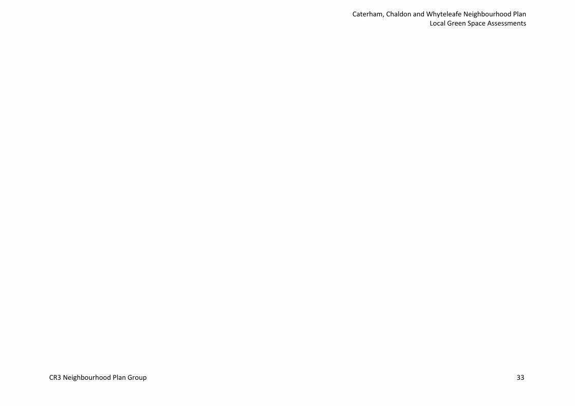
13. Tillingdown Hill Recreation Area and Copse CR3 6QU
Size: 0.76 ha
This hillside space and children’s playground serves the community of a built up area along the high upper slopes of Caterham Valley on the west side.
It has heritage value as a publicly visible sections of a Roman road through Tandridge District. The playground is set on its carriageway but that is better preserved within the adjoining copse. The latter is designated as Ancient Woodland with several Tree Protection Orders in place and is part of an extensive wildlife corridor along the upper valley rim.
CR3 Neighbourhood Plan Group 31

Caterham, Chaldon and Whyteleafe Neighbourhood Plan Local Green Space Assessments
14. Timber Hill Park
Timber Hill Road: CR3 6LD
Size: 0.66 ha
15. Valley Sports Ground
White Knobs Way: CR3 6RH Size: 2.47 ha
This tranquil open parkland area is a highly valued public open space just a few minutes’ walk from the Valley shopping area.
It has recreational space, benches, a popular modern childrens’ playground and tree planting around the perimeter. There is an iconic view past the Victorian houses to the landmark of St John’s church.
The site also has historic value with a communal WW2 air raid shelter surviving on the west side.
Local Green Space designation ensures the park is safeguarded as a community asset into the future as intended by the original benefactors; it was gifted by the Asprey family in 1900, under covenant, for use as a public open space by the people of Caterham into perpetuity.
Also known as “White Knobs”, this is the only public recreation ground in close proximity for the residents of St John’s area of Caterham.
It attracts visitors and sports clubs from a wide area beyond, having a pavilion, children’s play space and a full sized football pitch.
It is one of the few designated children’s play spaces that achieved 80%+ for quality in the 2015 Tandridge Open Spaces Study.
The space is part of a wider area which has the status of Biodiversity Opportunity Area and Potential Site of Nature Conservation Importance. Local Green Space designation supports that aim by providing long term safeguarding of a valued social and environmental asset.
CR3 Neighbourhood Plan Group 32
Caterham, Chaldon and Whyteleafe Neighbourhood Plan Local Green Space Assessments
CR3 Neighbourhood Plan Group 33

Caterham, Chaldon and Whyteleafe Neighbourhood Plan Local Green Space Assessments
Chaldon Parish
Name and Address Description/Purpose/ How the space meets the NPPF criteria
16. Six Brothers Field, Hilltop Lane, Chaldon
Size: 2.61 ha
Six Brothers Field is Chaldon's main recreational area. It is accessible by foot along the public bridleway. It provides 2.7 hectares of pastureland and a prepared cricket pitch.
This peaceful field in the centre of the parish is surrounded by mature trees. It is extensively used by the local residents for recreational activities such as cricket, local scout groups, dog walking and the annual Chaldon Picnic.
The area was gifted to the National Trust in 1926 by Martin Coles Harman for the benefit of Chaldon residents. One of six brothers, he asked that the field be known as Six Brothers Field. It is managed through a local committee with the National Trust’s cooperation. Although not public land yet, there is currently unrestricted access from Hilltop Lane and Rook Lane.
Whilst the space is Green Belt land, the local community believe that Local Green Space designation would add an important layer of protection that recognises the significance of this space to Chaldon.
17. St Lawrence Hospital former burial ground, Hilltop Lane, Chaldon
Size: 1.37 ha
St. Lawrence’s Hospital Former Burial Ground is in the ownership of Chaldon Village Council.
Consecrated in 1915, it remains so; burials started in 1916 and continued until 1964, of some 3,600 persons. The historical story is also kept in public memory by communication with descendants of those buried. Guided tours of the site are part of the Caterham Festival Programme.
The site is accessible by footpath and bridleway from Green Lane and modern housing estates beyond)or from the Golf Club House yet provides a haven for wildlife The site is managed by residents jointly with Downlands Countryside Management.
Although it is in the Green Belt and the Surrey Hills Area of Great Landscape Value, the recreational, and in particular, the spiritual importance warrants its protection by designation as a Local Green Space.
A 20ft strip around the perimeter, included as part of this Green Space belongs to the Surrey National Golf Club but is covenanted as a buffer to the Golf Club grounds.
CR3 Neighbourhood Plan Group 34

Caterham, Chaldon and Whyteleafe Neighbourhood Plan Local Green Space Assessments
CR3 Neighbourhood Plan Group 35
Caterham, Chaldon and Whyteleafe Neighbourhood Plan Local Green Space Assessments
Whyteleafe Parish
Name and Address Description/Purpose/ How the space meets the NPPF criteria
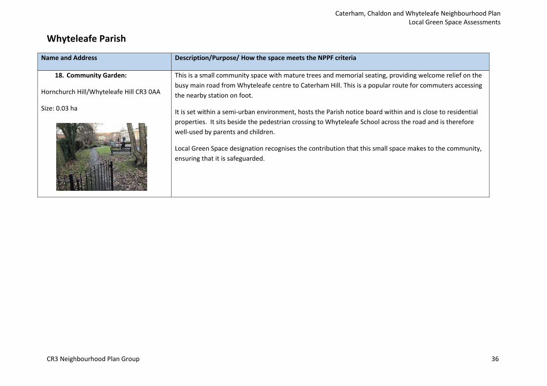
18. Community Garden:
Hornchurch Hill/Whyteleafe Hill CR3 0AA
Size: 0.03 ha
This is a small community space with mature trees and memorial seating, providing welcome relief on the busy main road from Whyteleafe centre to Caterham Hill. This is a popular route for commuters accessing the nearby station on foot.
It is set within a semi-urban environment, hosts the Parish notice board within and is close to residential properties. It sits beside the pedestrian crossing to Whyteleafe School across the road and is therefore well-used by parents and children.
Local Green Space designation recognises the contribution that this small space makes to the community, ensuring that it is safeguarded.
CR3 Neighbourhood Plan Group 36
Caterham, Chaldon and Whyteleafe Neighbourhood Plan Local Green Space Assessments
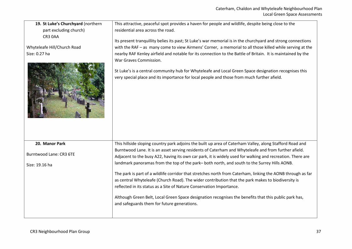
19. St Luke’s Churchyard (northern part excluding church) CR3 0AA
Whyteleafe Hill/Church Road Size: 0.27 ha
This attractive, peaceful spot provides a haven for people and wildlife, despite being close to the residential area across the road.
Its present tranquillity belies its past; St Luke’s war memorial is in the churchyard and strong connections with the RAF – as many come to view Airmens’ Corner, a memorial to all those killed while serving at the nearby RAF Kenley airfield and notable for its connection to the Battle of Britain. It is maintained by the War Graves Commission.
St Luke’s is a central community hub for Whyteleafe and Local Green Space designation recognises this very special place and its importance for local people and those from much further afield.
20. Manor Park This hillside sloping country park adjoins the built up area of Caterham Valley, along Stafford Road and Burntwood Lane. It is an asset serving residents of Caterham and Whyteleafe and from further afield.
Burntwood Lane: CR3 6TE Adjacent to the busy A22, having its own car park, it is widely used for walking and recreation. There are
Size: 19.16 ha landmark panoramas from the top of the park– both north, and south to the Surrey Hills AONB.
The park is part of a wildlife corridor that stretches north from Caterham, linking the AONB through as far as central Whyteleafe (Church Road). The wider contribution that the park makes to biodiversity is reflected in its status as a Site of Nature Conservation Importance.
Although Green Belt, Local Green Space designation recognises the benefits that this public park has, and safeguards them for future generations.
CR3 Neighbourhood Plan Group 37
Caterham, Chaldon and Whyteleafe Neighbourhood Plan Local Green Space Assessments
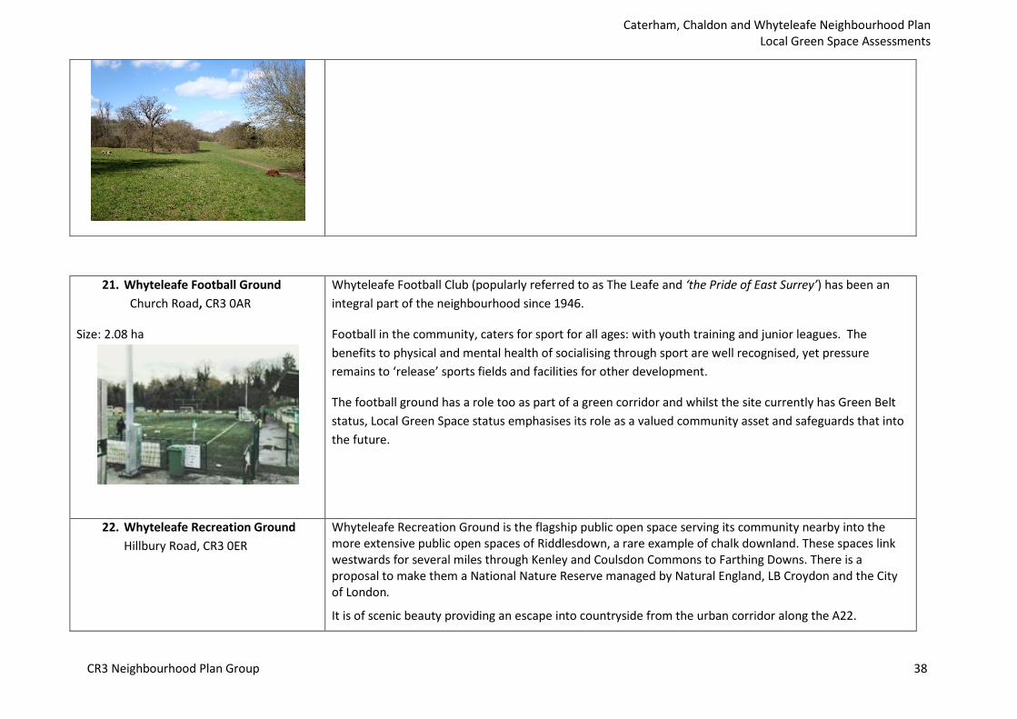
21. Whyteleafe Football Ground Church Road, CR3 0AR
Size: 2.08 ha
Whyteleafe Football Club (popularly referred to as The Leafe and ‘the Pride of East Surrey’) has been an integral part of the neighbourhood since 1946.
Football in the community, caters for sport for all ages: with youth training and junior leagues. The benefits to physical and mental health of socialising through sport are well recognised, yet pressure remains to ‘release’ sports fields and facilities for other development.
The football ground has a role too as part of a green corridor and whilst the site currently has Green Belt status, Local Green Space status emphasises its role as a valued community asset and safeguards that into the future.
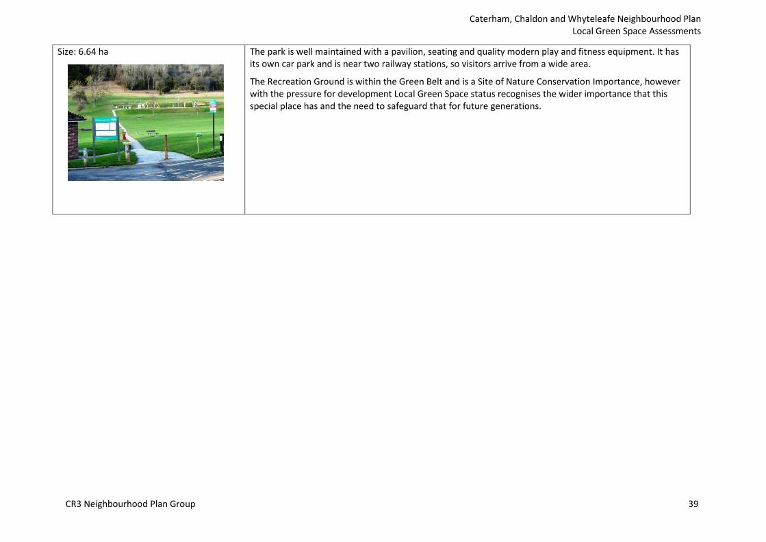
22. Whyteleafe Recreation Ground Hillbury Road, CR3 0ER
Whyteleafe Recreation Ground is the flagship public open space serving its community nearby into the more extensive public open spaces of Riddlesdown, a rare example of chalk downland. These spaces link westwards for several miles through Kenley and Coulsdon Commons to Farthing Downs. There is a proposal to make them a National Nature Reserve managed by Natural England, LB Croydon and the City of London.
It is of scenic beauty providing an escape into countryside from the urban corridor along the A22.
CR3 Neighbourhood Plan Group 38
Caterham, Chaldon and Whyteleafe Neighbourhood Plan Local Green Space Assessments
Size: 6.64 ha The park is well maintained with a pavilion, seating and quality modern play and fitness equipment. It has its own car park and is near two railway stations, so visitors arrive from a wide area.
The Recreation Ground is within the Green Belt and is a Site of Nature Conservation Importance, however with the pressure for development Local Green Space status recognises the wider importance that this special place has and the need to safeguard that for future generations.
CR3 Neighbourhood Plan Group 39