political ec onomy fsm - ergonline.org · activities with varied needs fulfilling many social and...
TRANSCRIPT

2ndd Floor, HouPhone
PCa
Econose # 304, Roe: 880‐2‐989
Fax 880‐2
Politicase Stud
Su
WaterA
27 M
Su
omic Reoad # 19/B, N91783, 880‐22‐8810636, W
cal Ecdies on
bmitted to
Aid Bangl
March 20
bmitted by
search GNew DOHS, M2‐9889559, Web: http://
conomFringes
o
ladesh
16
y Group (EMohakhali, De‐mail: info@/www.ergon
my of s of Dha
ERG) Dhaka ‐ [email protected]
FSM aka City
6, Bangladesorg,
y
sh
ER
G-W
ASH
Rep
ort #
2

ii
Political Economy of FSM Case Studies on Fringes of Dhaka City
Prepared by
Sajjad Zohir
with support from Umama Rahman and Mizanur Rahman
27 March 2016
_______________________
Sajjad Zohir is currently the Executive Director of Economic Research Group, and the Principal Investigator of the ERG study on WASH. He remains responsible for the main report. Umama Rahman and Mizanur Rahman were responsible for case studies and field surveys. The paper was prepared in fulfillment of ERG’s commitment to the WaterAid Bangladesh. For comments and suggestions, please contact the principal author at [email protected] or [email protected].

iii
Table of Contents
List of Acronyms ........................................................................................................................................... iv
1. Introduction .............................................................................................................................................. 1
2. Brief on the state of FSM in Dhaka City .................................................................................................... 2
3. Description of the Study Areas and FSM practices ................................................................................... 7
3.1 Merul Badda ....................................................................................................................................... 8
3.2 Dhaka Uddyan .................................................................................................................................. 10
4. Selected Issues on the Political Economy of FSM and Recommendations ............................................. 12
References .................................................................................................................................................. 18
Annex 1: Maps and Charts .......................................................................................................................... 19
Annex 2: BNBC 2012 on Septic Tanks ......................................................................................................... 24
Annex 3: Statistical Tables .......................................................................................................................... 26

iv
List of Acronyms BNBC Bangladesh National Building Code BOD Biochemical Oxygen Demand COD Chemical Oxygen Demand DAP Detailed Area Plan DCC Dhaka City Corporation DeWATS Decentralized Wastewater Treatment Systems DMDP Department of Manpower Development and Placement DNCC Dhaka North City Corporation DO Dissolve Oxygen DPZ Detailed Planning Zone DSP Digital Signal Processing DTW Deep Tube Well DU Dhaka Uddyan DWASA Dhaka Water Supply and Sewerage Authority ERG Economic Research Group FGD Focus Group Discussion FSM Fecal Sludge Management JICA Japan International Cooperation Agency MB Merul Badda MLD Millions Liters per Day PSTP Pagla Sewage Treatment Plant RAJUK Rajdhani Unnayan Kartripakkha SN Sewage Network SNV SNV Netherlands Development Organisation SWDN Storm Water Drainage Network TDS Total Dissolved Solids UP Union Parishad WAB WaterAid Bangladesh WASA Water Supply & Sewerage Authority WASH Water, Sanitation and Hygiene
1
A Case Study on Fecal Sludge Management (FSM) at the Fringes of Dhaka City
1. Introduction
‘Fringe’, defined in dictionaries as marginal or border areas, often provides interesting insights
into workings of the ‘core’, and into the relations between the ‘core’ and the ‘periphery’1. One
such relation involves the ways core’s ‘garbage’ gets dumped in the periphery which the
clustered communities in the fringes have to deal with constantly. Our engagement with the
fringes initially began with the urge to pretest designs applied elsewhere (Shakhipur), and to
form counterpart images of various hypothetical types of FSM. Two locations were chosen:
Dhaka Uddyan (DU) on the western side of Dhaka city near the bank of Turag/Buriganga River;
and Merul Badda (MB) on the eastern side of the city bordered by canals which flow into Balu
River. The cases are interesting on at least two counts: (i) Following Beesley (1993), one would
expect diversity in both administrative governances and FSM practices, and (ii) Final destination
of human excreta happen to be water-bodies (or low-lying areas) adjacent to the fringes and
alleged encroachments in these water-bodies are likely to be closely linked with the ways FSM is
practiced.
The systematic approach to abstracting FSM practices is now widely accepted; beginning with
characterization of containment, availing different modes of transport, undergoing treatment (or,
remaining untreated), and eventually excreta being disposed into the physical environment we
live in. On-site practices by households are often decided a priori by property developers, and
these include toilets, other on-site facilities (such as, septic tanks) where human excreta are
discharged, and the methods of disposing excreta to conveyors available immediately outside the
compounds. The choices on practices adopted onsite are expected to be influenced by the
physical infrastructure which shapes the community living, and the latter is expected to be
formed by the structure of governance (to be further elaborated later) as well as by the larger
infrastructure environment within which the communities operate. Inquiring these relations and
1 Pryor (1968) distinguished ‘urban fringe’ from ‘rural-urban fringe’ in terms of demographic factors. Beesley (1993) views urban fringe as a multi-functional area, characterized by diversity, mixes of land use, people, and activities with varied needs fulfilling many social and economic roles. If one follows Sinha’s (Sinha 1997) classification of fringe into rural (outer) and urban (inner), our study areas would fall under the latter category.

2
finding evidence on the direction of these relations are some of the key objectives of current
undertaking.
Case studies are inherently conducted to get new insights and patterns, and are therefore open-
ended to some degree. The present exercise, a component of the ERG study on political economy
of WASH is no exception. The study was motivated by search for patterns, and was carried out
with regular field visits, visual documentation that were later discussed among team members to
develop common understanding on types of FSM In addition, satellite maps and reports were
reviewed to articulate understanding about the type and nature of governance, and consultations
through FGDs as well as interviews of office employees and individual residents were
undertaken. All these were supplemented by household level questionnaire survey with specific
queries (hypothesis). An important component of the exercise was the review of journal and
seminar papers, plans and reports that often deal with specialized disciplines in science.
Section 3 of this report describes the states of FSM and administrative governances in the two
study areas. Possible relations between the FSM practices and governance are discussed and
limited evidence is presented in Section 4. This report also summarizes few lessons and ties
those with other observations for recommendation on policies and actions that may improve the
overall state of sanitation in the city. Prior to all these, a brief detour is made in Section 2 to
provide an overview of FSM in Dhaka city.
2. Brief on the state of FSM in Dhaka City
The creation of a river bank for human habitat was historically influenced by several factors such
as water for living (both drinking and cultivation), communication through open water bodies,
and for easy disposal of human wastes washed down the streams2. Literature on the subject
mention of the first two factors, and overlooks possibly due to unpleasantness in dealing with the
topic, the third, which is the subject of query in this paper. With human habitats making inroads
into landmass, away from the rivers, roads and irrigation networks developed to address
connectivity and cultivation. Sewerage also had to be developed to allow the human habitats to
2 See Figure 1 for locations of early river valley civilizations.

3
attain a degree of civility3. Yet, essentially the disposal of human excreta and wastewater into
open water-bodies by the sewerage network was merely an extension of the millennia-old
tradition. That tradition was embedded in an attitude of passing private cost to the larger
(often away from sight) collectives, a subject that Economists coin as ‘externality’; not
accounted for in private decisions. Our obsession with mega infrastructure to ensure personal
hygiene has often disregarded the safety of the collectives, which are normally addressed in
small scale, community level initiatives. However, the mega initiatives have quite often paved
ways for large-scale disaster from ill-governance of the mega infrastructure. Transition at the
level of collectives call for ‘safe disposal,’ that bars return of the disease vectors or pathogens to
the community and subsequently to a system with zero negative externality (or even a positive
externality). The latter obviously is an ideal scenario that can only be achieved with cost-
effective treatment technology to allow complete absorption of the wastes in nature.4 The
discussion that follows in this and subsequent sections need to be placed within the general logic
outlined above.
The sewage system of Dhaka city was initiated in 1923 and improved subsequently. The pace of
growth had been gradual over many years; and the city experienced significant growth in
population since the 1950s.5 During the period between 1955 and 1996, more than 60 percent of
the new land was transformed from rural to urban use. As was predicted, the urbanization
process altered most of the low-lying areas and fringe areas from rural to urban landscapes by
2010 (see Figures 2 and 3). The process shrank the size of closed and open water-bodies that
persistently swallowed the human sludge. The size of sludge discharge increased in proportion to
growth in human population, but the sewage network failed to expand at a pace sufficient to
compensate for the loss in natural outlets in surrounding neighborhoods. Around 885 km of
sewer line (DSP 2015) is used to collect and transport liquid wastes from domestic, commercial
and industrial units. The infrastructure is alleged to cover only about 20 % of the city dwellers.
The numbers get less innocuous on account of high proportion of the sewage network alleged to
3 The cultural factor is no less important in defining ‘civility’ than the health hazards associated with co-habiting with own excreta. 4 Composting and using biogas are examples. Hypothetically, one may also consider 5 Maathuis et al (2014).

4
be dysfunctional; unrecorded cross-connections with storm water drainage, and due to variations
in meanings of terms and statistics that capture sanitation coverage.
DWASA6 operates one sewage treatment plant (PSTP) at Pagla, on an area of 110.5 ha about 8
km from the city. It was originally constructed in 1978 with a design capacity of 120 MLD (peak
flow rate). DSP (2015) notes that due to damage of the trunk, sewer mains and sewage system,
the actual flow rate entering the Pagla STP is approximately 30-40 MLD”, which is far less than
250-300 MLD, currently claimed to generate within the catchment served by the central sewage
system. The indifference towards depleting sewerage and treatment capacity may have
been further aggravated due to conclusive findings on unacceptable wastewater quality.
Amin et al (1998) found presence of pollutants in the final waste matter of the treatment plant, to
have exceeded the permissible limits of environmental quality standards allowed for discharge
into a surface water body.7
The city’s expansion away from the Buriganga river, along narrow strips towards north-west had
biased the city’s sewage network (SN) as well (see Figure 4). The city subsequently expanded to
the eastern low-lying areas such as Gulshan, Uttara8 and Baridhara,which were outside the
network. In most parts of the city sewer lines were built to carry the waste water (and not the
excreta) because until the 1980’s, private houses normally had long-lasting underground septic
tanks with the feature of anaerobic digester. Till then, cities rarely faced major water logging,
and residents were yet to face the discomfort of floating sludge coming out of those septic tanks9.
The scenario however changed rapidly during the 1980s with unplanned urbanization blocking
the natural waterways causing increased water-logging. The latter called for installation of Storm 6 Dhaka Water Supply and Sewerage Authority. 7 The abnormally high figures of BOD, COD, TDS and a very low level of DO content indicated the presence of pollutants having origins other than usual domestic sewage; and presence of heavy metals at objectionable levels particularly in the sludge bed, indicated contaminations from industrial pollutants, particularly from tanneries, textiles, zinc & nickel plating and other chemical industries that are located within and outskirts of the city. Amin et al (1998) therefore concluded that “decomposed sludge materials are not suitable for use directly as fertiliser or in land filling operation”. 8 A close look at Figures 2 and 3 reveals how the city moved from the south (bank of Buriganga) to the north (Turag canal) along the strip of high land, and subsequently (particularly, since the late 1980’s), expanded sideways into low-lying areas on both sides, particularly to the east. In the absence of adequate measures to protect ecology and natural drainages, the latter paved the way to private encroachments into open water bodies that were once the property of state (or, state agencies), and had acted . 9 Our field visits to Khulna city revealed the extreme outcomes of water-logging. The same was found in the low-lying pockets of Merul Badda.

5
Water Drainage Network (SWDN) connecting large water bodies for fast drainage of water into
rivers beyond sluice gates. A number of things are said to have happened simultaneously, each
reinforcing the other to a pathetic state of FSM, currently perceived almost irreversible. First,
demand for housing led to intrusion into the natural drainage system which led to frequent water-
logging and overflowing of septic tanks that were already in place. Second, those outside the
sewage network chose to connect their septic tanks directly with SWDN, thus reducing the risk
of sludge overflow. Most importantly, the new buildings in those areas avoided constructing
septic tanks; and the apartment buildings needed hardly a 2’x2’x4’ (LxWxH)-sized pit to channel
the sludge directly to the deep seated SWDN.10 In the process, the term ‘septic tank’ acquired
multiple meanings and the frequency of emptying those could no more be comparable and
unambiguously interpreted.11 The legalities around septic tanks are highlighted separately in
Box 1 and Annex 2. Third, with commercially motivated property developers defining the
landscape of the city, the opportunity to pass the sludge through storm water drainages or to
water bodies in the fringes continue to be availed. Fourth, unobstructed disposal of industrial
(chemical) waste in open water-bodies may have negatively influenced the incentive to put
efforts for treating wastewater12. Such disposals may have also been prompted by the urge to
acquire new land for housing, leading to encroachment of public land and water bodies. The
latter phenomenon is alleged to have disrupted the natural drainage system, which in turn,
encouraged people to avail the storm water drainage network.13
10 Random interviews revealed the ignorance of most residents of apartment buildings regarding septic tanks and the final outlets of wastewater. The property developers 11 Several empirical studies of recent vintage compile such information. An apartment building with 2’x2’x4’ pit may empty it 3 times a year, while an old functional anaerobic digester may not demand attention in 10 or more years. There are many of the old ones, which have lost the anaerobic characteristic because of discharges of chemicals (Harpic, for example) and paper tissues that go with ‘modern’ living; and may demand more frequent emptying. 12 Consider environmental output, (say) Q to represent the quality of surface water, which is a function of quality of treated waste water and the quality of industrial and other wastewater flowing into the body of surface water. It can be argued that marginal improvements in surface water quality from an additional effort to treat household wastewater will decline as the size of untreated industrial wastewater increases. 13 A 1987 JICA report identified three major Khal systems in Greater Dhaka City: (i) Degun-Ibrahimpur-Kallyanpur Canal system draining into the Buriganga and Turag Rivers; (ii) the Gulshan-Banani-Begunbari-Dhanmondi Canal system draining into the Balu River; and (iii) the Dholai-Jerani-Segunbagicha Canal system draining into the Buriganga and Balu Rivers. Among these, the Begunbari Canal flowed as an open channel between Airport Road and DIT Road through Hateer Jheel, and is the largest storm-water detention area in Dhaka City. Mentioning these, Ahmed and Mohuya (2013) further notes that “in more recent years, domestic waste water discharge into the storm sewers of the city has led to deterioration in the quality of storm sewers which in turn pollute the receiving water bodies.”

6
Box 1: The difficulty of being Legally Correct
The DSP (2015) recognizes the problem rising due to undesired connections between sewage
and storm water drainage systems (Policy SANI/1.1). It therefore recommends that “future
sewerage system is to be designed based on a 'separate system' concept whereby used water is
collected separately in a network of underground sewers that lead to a treatment plant whereas
storm water and surface runoff are collected in open drains and channeled to rivers and
reservoirs.” While the report falls short of making recommendations on feasible ways out of the
disorder, large scale projects are being undertaken (Dasherkandi Sewerage Treatment Plant
As a buyer of a new apartment in Dhaka city, you put your trust on a ‘deed’, a piece of paper whose relevance and legal acceptability is often not assured. Amidst making sense of the discrepancy between the claimed size of the apartment and your assessed measure, and the endless efforts to get the delivery with minimum delay, one hardly gets the time to figure out if the basic building codes are adhered to by the construction company/Developer. Yet, it is the owner (buyer) on whom the onus of all ‘illegality’ will befall. If you have the technical knowledge, you would like to ensure that sufficient electricity load has been approved. But one hardly bothers where the septic tank is! Generally, these new owners start to enquire about it only when there are overflows, or the smells exceed the tolerance level of the nostrils. The state of knowledge amongst the supply-side agents is no less pathetic. Our field queries revealed that the Architect (who often is the Developer) either does not know or pretends not to know that no septic tank had been constructed. Her/his immediate answer had been: “it is there in the design, which has approval from RAJUK!” With a long list of intermediaries, and multi-dimensional rent-sharing, information is difficult to locate. It was finally contractors of construction laborers (civil) who confessed that the excreta went directly to the storm sewerages; and the buildings in Gulshan and Banani, constructed after 1988 do not have septic tanks. Others interviewed provided further details on the size of the conveyer pit. When questioned, people at public health engineering and RAJUK claimed that no Act exists that requires installing a septic tank to be mandatory – “it is an item to be included in the design, but nothing requires it to be implemented”! Some however had more pragmatic answer: “if you are unable to expand the sewage network to accommodate the newly built houses in certain areas, you cannot deny them access to whatever means available – be those open drains, closed water-bodies or the storm-water drainage network!” The same logic resonated elsewhere, for example, to rationalize privately operated DTWs. But the building codes clearly mention of the requirement (1.13.15 in BNBC), “A septic tank shall be provided within the premises for disposal of sewage, whether any public sewer is available or not. The location, design and construction of the septic tank shall conform with the requirements of this Code.” Relevant excerpts from BNBC 2012 are included in Annex 2. While there are newly introduced time frames for emptying, the onus to meet those obligations would ‘legally’ lie on occupants/owners, irrespective of the kind of constructions done! In a regime of property developers lacking accountability to its clients and having complete disregard for the contracts, and in the presence of a small-sized rent-seeking administrators in the field, rules are likely to be violated at the design and implementation phases, since the burden can be effectively passed on to the clients (owners), whose interests are not paid heed to in formulation of those rules.

7
project) to build treatment plants tied to composting14. A parallel effort at the micro level is in
widening the use of mechanized emptying of septic tanks (or on-site containers) through changes
in regulatory frameworks and by promoting safe disposal through co-composting. A second
micro-level initiative is spearheaded by WaterAid Bangladesh (WAB) known as DeWATS, a
community level initiative where the externalities of individual actions are internalized through
community level containment, transport, treatment and disposal. One also finds collaborations
(such as between WAB and SNV) to combine the two micro-level initiatives, realized through
city corporations, and supporting regulatory changes such as introducing new building codes to
ensure emptying septic tanks in short intervals (say, annually).15
3. Description of the Study Areas and FSM practices
Considering Dhanmondi, Mohammadpur, Farmgate, Mohakhali, Banani and Gulshan to be the
center of the city that gradually spread north towards Uttara, two obvious choices of the fringes
were the land and water bodies beyond the eastern embankment of Kuril Bishaw Road, and those
beyond the western embankment running from Sadar Ghat to Gabtali. More specifically, we
chose Merul Badda on the east and Dhaka Uddyan (DU), a housing society in Ramchandrapur in
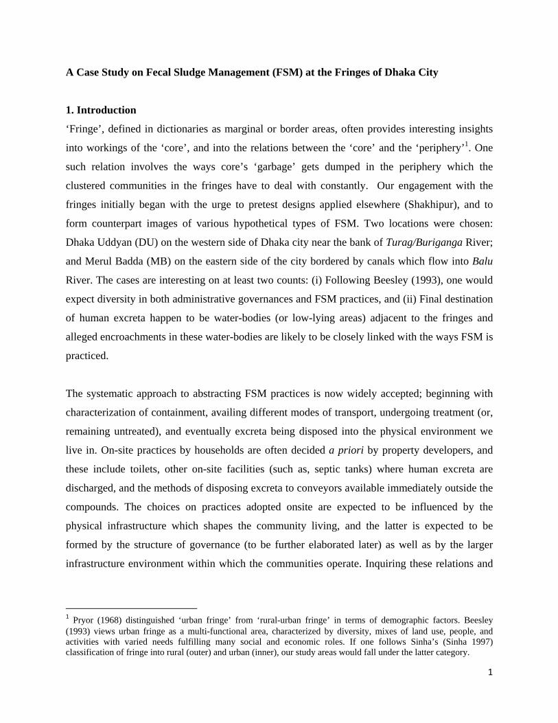
the west. Figures 3 and 5 capture the two areas within the bounds of Dhaka city. One may note,
DU is in Ramchandrapur, which is shown as a part of DPZ 9 in RAJUK map. Merul Badda is in
Badda Union, outside the DCC area, and bordering both DPZ 11 on north-west and DPZ-6 in the
south-west. The area is in close proximity to Hatir Jheel, which is in DPZ-6, and therefore has
similarities with those of DPZ-6. Since there is a RAJUK compound in the selected area (in
Merul Badda), which appears to overlap with DPZ-11, Figure 4C shows a map of the latter area
only.16 For the purpose of comparison, additional data on DPZs from DAP (2011) are
summarized in Table A1. For reasons discussed earlier, figures on household coverage under
14 Dasherkandi Sewerage Treatment Plant project is the first, under DWASA, to get the go ahead signal (See, “DWASA inks deal with HydroChina”, Financial Express, 2 September 2015). 15 In spite of a GoB decision in 1980 declaring the practice of manually removing fecal sludge with buckets illegal, the practice continues to be widespread (Opel et al 2012). DSK has long been engaged in supporting mechanical emptying in Dhaka. Finding an appropriate place to safely dispose the fecal sludge has been an ongoing problem (DFID 2005). 16 The practice of department-specific zoning is mind-boggling. The land registry offices go by Mouzas with names in land deeds which are parts of forgotten history; the City Corporations use Wards and their zones are different from those considered under the Development Planning Zones (DPZ) defined by RAJUK. Even RAJUK’s DPZ-based zoning is not the same as the Location-based zoning!

8
sewage may not be relied upon. Generally however, the two areas have less than average
sanitation facilities. Rest of the section considers the individual areas and describes the current
FSM practices.
3.1 Merul Badda
25 years ago Merul Badda was a low-lying area covered by rivers, canals and other water bodies.
It was a rural setting with a thin population and had no proper sanitation system in place. Most
households used kaccha latrine, and only a few rich households used pit latrine. The regular
wage earners in Dhaka’s service sector could still afford a piece of land and many gambled in
favor of Badda (as opposed to Uttara) because of the closer proximity to city center. While a
large part of the western segment went into the hands of large and powerful housing estates (such
as, Basundhara), Merul Badda had several types of housing clusters; private, Aftab Nagar
Housing, and a cluster of RAJUK-developed and allocated plots.
Figure 7A identifies three segments on a Google map of Merul Badda: RAJUK compound,
Ananda Nagar and Aftab Nagar Housing. Only a part of Ward 21 accounts for just the RAJUK
compound which falls under the North DCC,while the rest are in Badda and Nandipara unions.
Within Ananda Nagar (private houses), there are two segments; an area where FMS exists for
private initiatives to construct drains with support from Union Parishad and the second includes
scattered segments where no drain or sewerage exists. The drains were constructed during 2008,
and every household connected their wastewater outlets with the drain. Some houses in the area
have septic tanks while others have closed pits where sludge and water are deposited at first and
from where the more liquid matter reach the drain. People use pit or ring slab latrines for
temporary containments in places that have no drains, before channeling the waste material to
open fields or water bodies. There are also many kaccha or hanging latrine, often jointly shared
from where the excreta goes directly to water bodies. Although only few households in the ‘no
drain’ zone have septic tanks, increased incidence of water-logging eventually meant that all
households in the area were discharging their sludge into close or open water bodies within close
proximity.

9
RAJUK Badda was an aberration from the usual mega housing projects undertaken by RAJUK
or (was undertaken by its predecessor DIT). It was a special project to accommodate the owners
displaced by land acquisitions for Gulshan, Banani and Uttara during late 1970’s and early
1980’s. The plot allocation was however made during mid 1990’s and the buildings started to
surface from 1999. While land filling was done by RAJUK, sewage lines were installed only in
2008. In early years the households either opted for septic tanks or to discharge excreta to nearby
open areas or closed water bodies such as ditches or lakes thus directly availing the sewage
appears to be a preferred option these days. During the past ten years, the roads in Rajuk were
elevated by about 2-4 feet, which led to water-logging and overflowing of the septic tanks in
houses built earlier. The residents, 80 % of whom are tenants, complained that the tanks were
getting filled sooner than expected (within 2-3 years) and they spend about Tk. 8 to 10 thousand
for cleaning purposes each time.
AftabNagar is a semi-developed housing compound which the developer bought from private
owner and land development largely involved land filling. While provisions were negotiated for
piped water17 and electricity, no provision was made for piped gas (until 2014) and there were
also no sewer lines or drains. Thus, those who constructed houses, had either built septic tanks or
opted to discharge sludge and waste water into open spaces and nearby canals. Recently, a drain
covering a part of AftabNagar, was built by house owners and the developer at the expense of the
owners. This construction allowed some households to avail the drains for transferring excreta
and wastewater to the (Banashree) canal nearby, without having to deal with the sight and smell.
Currently, AftabNagar authority is negotiating with DWASA to build sewage line, even though
the latter will dispose all the wastes to the same Banashree canal. It is alleged that not only prior
permission from WASA is required, but that they will also have to engage WASA-enlisted (and
assigned) contractors. It is also alleged that all the expenses will have to be borne by the
landowners in the area. In depth field inquiries also revealed that such a move was known long
before, and AftabNagar authority had accordingly taken certain fees for waste water
management during the time of selling the land.
17 In this regard, one may note that DWASA charges double the tariffs for water on account of sewerage, even when the service of sewer lines is not provided.

10
3.2 Dhaka Uddyan
Dhaka Udyan is a housing compound in Ramchandrapur, under Ward 33. The three maps in
Figure 6 show its location, while Figure 7A zooms in on the area18. It is surrounded by several
housing (Turag on the north, and Nabinagar & Chandrima on the south). The fringe
characteristics arise due to it being outside the embankment (Gabtoli to Babu Bazar road on the
east, and Turag river on the west).
As recent as 2011, the DAP/DMDP would not recommend the place for land filling and urban
housing. While details on the observations are quoted in Box 2, here is one to take note of:
“Some housing schemes of private ownership which has been developed in recent years especially in Ramchandrapur area which needs to be amortized in order to ensure efficient drainage and to retain the character of flood flow and sub-flood flow zones as enunciated in the Structure Plan. The upper part of this area will be retained for agriculture as mentioned in DMDP. However this area is shown as Non-conforming use as the Structure Plan recommendation is violated.”
Dhaka Udyan Housing on papers is an entity under the Dhaka Uddyan Multipurpose Cooperative
Society Ltd. Established in 2001. The founder members and shareholders of the Cooperative
Society are alleged to have been farmers of Keraniganj, whose land went to river bed and are
claimed to have resurfaced on Dhaka Udyan side. Thus, Dhaka Uddan is a ‘housing project’, run
by a co-operative society of ‘landowners’ who allegedly put claims that their land was lost to
rivers on Keraniganj side and resurfaced on the Dhaka side. According to DU (Dhaka Uddan)
authority, there were landowners who have ‘null’ land in the river bank; and Haji Dill
Muhammad the founder president of the Society, led the initiative to develop this null land (since
1997-98 till his death).
An alternative narrative however suggests that Late Haji Dil Mohammad, the founder President
of the Society, lived in a neighboring housing (Shekhertak Nobodoy Housing) and had no
18 Even though the DU office claimed its jurisdiction to lie within a smaller perimeter, there are reasons to believe that the size has been increasing. It is our understanding that there are competing agencies and the performance is assessed in terms of one agency’s ability to negotiate resources and security from the agencies of local government.

11
ownership of any “null” land in Dhaka Udyan19. The alternative narrative was echoed by people
who have been residents in the area for many years; and appear to conform with initiatives one
observes in reclamation of land from riverbed; a phenomenon that underlies the rise of several
large scale private housing societies in the fringes over last two decades or more. More
importantly, these claims are known to have been facilitated by the pace of land-filling and
human wastes, both in forms of excreta and solid wastes have been cheap sources of filling
materials. Human habitats in fringes under the leadership of an organized authority, ensured,
decided on resource allocations for certain essential infrastructure at the local levels and enabled
negotiation with the City Corporation authority who are the legal owners of the city’s solid
wastes (‘garbage’).
Box 2: DAP/DMDP Observations on Ramchandrapur where DU is located
19 Currently, Haji Zahir Uddin, son of Late Haji Dil Mohammad, is the President of the Society. One rickshaw-puller, residing in DU for many years accepted that there were cases of Null land, but asserted that the whole area was developed by river filling with sand transported by boats.
The DAP 2011 made the following observations on Ramchandrapur, where Dhaka Uddyan is located: “On the western side of Embankment, there are few Developers who have developed the lands on sub-Flood Flow Zone and have created residential plots, building and mosques, etc. for middle income group by filling the land.” “Solid waste management is a big health hazard especially in ward 42, 43 sweepers lane. Obnoxious smell and piling of solid waste on roads is a regular feature.” (Author’s remark: The observation refers to the area inside the embankment immediately adjacent to Dhaka Uddyan.) “The consultants visited Ramchandrapur area several times and found that most of the lands have been filled by private developers and individuals and constructed a considerable number of structures including residential houses, Mosque and other buildings, etc.” “Some housing schemes of private ownership which has been developed in recent years especially in Ramchandrapur area which needs to be amortized in order to ensure efficient drainage and to retain the character of flood flow and sub-flood flow zones as enunciated in the Structure Plan. The upper part of this area will be retained for agriculture as mentioned in DMDP. However this area is shown as Non-conforming use as the Structure Plan recommendation is violated.” “To ensure flow of flood water the area in Ramchandrapur will remain as it is as shown in the Structure Plan. Therefore, consultants have shown the northern portion as non-conforming use and the southern part as flood flow zone. From northern part of Ramchandrapur area existing residential area will be considered as non-conforming use which will be gradually shifted to ensure flood flow.” A small rural settlement (Banila) along the river Buriganga will be kept under rural homestead category. Source: DAP for DMDP Area, Group – C, RAJUK

12
In spite of the observations cited in Box 2, the housing authority/cooperative society was
successful in getting the attention of the Dhaka City Corporation (North), which started road
construction and sewage connection in 2010, ultimately finishing in 2013. The DU authority also
acknowledged the supports they had to mobilize from local parliamentarians. Allegedly, this was
realized through a DCC project.However, all expenses including construction expenditure
(formal as well as informal) was borne by the landowners20. The situation was similar for gaining
access to other utilities such as gas, electricity, WASA deep tubewell, sewage, drainage, and
even the DNCC road in the area. The cost agreed upon with coordination from the DU authority
has so far been distributed among the plot owners.
While the environment of the area improved with a central sewer line in place, all the fecal
sludge was dumped directly into Turag River. The area outside the coverage of this sewer line
continues to use own septic tanks or ring slabs. In many cases, the ring slabs were found to be
overflowing and the spillages rolled along the road to the same destination. It is therefore no
wonder that 95% of the owners do not live in the area21. Most of the houses are single-storied tin
sheds with common latrine shared by several. Two types of tenure status dominate: (i) both the
house and land are owned by same owner who appoints a resident manager, and (ii) ‘house
owners’ lease-in the land from landowners normally for 5 years, and build temporary houses to
rent-out for a profit.22 These are mostly temporary tin shed houses which use kaccha or pit
latrine.
4. Selected Issues on the Political Economy of FSM and Recommendations
Observations drawn from the descriptions and discussions in previous sections are narrated,
along with presentation of few additional data. We draw upon the secondary findings and
observations, as well as quantitative findings from questionnaire surveys, to verify each of the
assumptions (and assertions) made in the chain of arguments proposed.
20 The DU office suggested that each landowner had to pay Tk. 9000 taka per katha to meet expenses for sewer line. 21 Most owners are government officers (active or retired), bank officials and business people. The residents are typically CNG drivers, rickshaw pullers, truck drivers, garments workers, etc. 22 50 % house owners who rent the land and build house are living there.

13
Proposition 1:
Quality of living shaped by sanitary environment we live in is prone to product differentiation.
Especially when the technology available imposes a trade-off where one person’s drive towards
improved sanitation results in a worsened situation in another location where financially less
empowered people are compelled to live.
This gets reflected in prices of land where expectations may play additional roles. The price
differences reflect product differences that are expected to be more prominent in cases of rental
price, since those correspond to current flow of services as well as in investments to produce
those services. Table 2 summarizes the land prices and rental prices of properties in five
(captured in four) zones studied in the two areas. One can find close correspondence between
rental prices and quality of services when the sanitary environment varies significantly, such as
between Rajuk/AtabNagar and Ananda Nagar. However, we found no significant difference in
rental prices between the ‘drain’ and ‘no-drain’ zones in Ananda Nagar, because it made little
difference for the tenants living in the area. The fact that 100% of houses in Rajuk are (brick)
buildings and it is more than 96% in Aftab Nagar; while less than two-third in ‘drain’ zone and
less than 40% of ‘no-drain’ zone in Ananda Nagar are brick buildings, corroborate the same
proposition (Table 3). It is further reconfirmed by differential engagement of property developers
in the four areas; developers are yet to move into Ananda Nagar while the percentage of
surveyed buildings constructed by developers are respectively 13% and 43.5% in Rajuk and
AftabNagar (Table 4).
The second set of propositions and observations are on responses expected from persons or
agencies with regards to onsite provisions for FSM, given a regime of rules and enforcements.
The agent in question may be an individual, a single owner constructing a new building or she/he
may be an owner of an existing building with specific facilities already in place (such as septic
tanks), or it may be a property developer keen on selling its share of apartments and move away.
As a follow up, responses of agencies to the transportation issue are also addressed under an
observation.

14
Proposition 2:
Households’ choices are influenced by the community level infrastructure made accessible to
them. One area where this has significantly changed the trajectory of urban living, is in our shift
away from traditional septic tank (considered anaerobic digester).
When buildings constructed in 2008 (the year when sewer line and drains were constructed in
two separate segments in Merul Badda) and afterwards are compared with those constructed
before (see Table 5), one finds significant reduction in construction of onsite septic tanks in
Rajuk and in the ‘drain’ zone of Ananda Nagar. In this regard, the report made several other
observations which are mentioned below:
Observation 1:
People use the term ‘septic tank’ in reference to onsite infrastructures which vary widely and all
of which do not necessarily serve the same purpose. Thus, there are functioning anaerobic
digesters in highland areas (with no water-logging) where easy passage for the sludge is not
available. There are similar structures made non-functional due to water-logging or due to
infusion of bacteria-killing agents and there are various types of (converted or original) conveyor
chambers to facilitate direct discharges to drains or sewer lines outside the compound. It is
therefore important to recognize the differences in the nature of demand for cleaning/emptying
services, as well as in the frequency of such demands by a building unit.23
Observation 2:
Of several initiatives to redefine the BNBC, one aims at introducing mandatory requirement of
emptying septic tanks at shorter intervals regardless of the differences in currently installed
septic tanks. It is premised on the expectation that such rules will automatically enhance the
demand for services (and therefore the market size), making commercial operations of emptying
septic tanks with vacutugs viable. While such rules may apply to specific localities (pre-
identified zones), its indiscriminate application may backfire on account of non-enforceability. In
23 Empirical observations on the distribution of responses by frequency of emptying on-site systems, reported in Chowdhury and Kone (2012), support the observation. The authors also reported the importance of ‘availability’ in the choice of modes, but failed to recognize that such criterion is emphasized in cases of emergencies – arising out of psychological inertia as well as sudden disaster caused by water-logging.

15
addition, the research team separately investigated into incentive issues pertaining to operation of
mechanized emptying. While this has not been discussed in this report, they remain very
pertinent in making provisions of the service financially and institutionally viable. Finally as will
be discussed shortly, the mega infrastructure on transportation, treatment and disposal will shape
the future of this service market, as well as household and community-level adaptation. At the
same time local/community level initiatives will influence the performance of the mega
infrastructure; and there are issues beyond service markets, such as micro-incentives of the
operators.
Observation 3:
The market for properties has at least three stakeholders; owners to be, property developers and
regulators24. The outcomes at on-site provisions are however determined by alliances (and rent-
sharing) between the property developers and regulators (RAJUK and other agencies). Ironically,
these agencies are not accountable for violating the written rules and laws. The case of septic
tank has been illustrated. Unless the group of owners, on whom the onus lie and who will benefit
or suffer due to those outcomes, are empowered in this market problem with enforcement are
likely to persist.
The following set of observations/propositions relate to community-level activities and
responses.
Proposition 3:
Power and rent-sharing for an apparent win-win arrangement, surfaces in affairs at community
and national (mega) levels when ‘public money’ is involved.
Of the areas studied for the present paper, Rajuk in Badda was an obligation to households
displaced due to RAJUK’s land acquisition that may not have been adequately fulfilled.25 The
case of DU suggests that the community could get the work done if there were no legal bar
taking initiatives in their own hands. Similarly, AftabNagr is said to have made progress in
negotiations to receive sewerage lines in the housing compound. Such a change had to be
24 We abstract from several intermediary agencies as well as leave aside the original owners, financial institutions and other toll collectors. 25 There was long delay, and there are complains that the land filling was inadequate.

16
confined to drain construction with UP money in Ananda Nagar, but cannot be stretched to sewer
lines since the area is outside the DCC jurisdiction, even though DCC’s garbage and human
excrement end up in the water-bodies of the union!
Observation 4:
Landowners perceive gains in the provisioning of basic utilities, such as sewer lines and
therefore are keen on paying a price to get it. The state represented by government agencies has
obligations to the citizens, and therefore allocates resources to provide such utilities. Having
quasi-monopoly (or, monopsony) power allow intermediary agencies to collaborate with political
leaders who control public resources and deliver public utilities (such as, sewer lines) when the
incentives are high. Clearly, the rules of non-entry (and exclusivity) are the basis of such rent-
seeking and one may like to investigate the possibility of formulating alternative rules for service
delivery.
Observation 5:
Communities can negotiate better when they are represented by agencies whose interests are tied
to the interests of the community. The housing societies (or agencies), such as Aftab Nagar or
DU Housing are two such examples. The role brings additional earning for these agencies. There
is an additional interest of these agencies in the fringes where the opportunities to acquire new
land (by encroaching public water bodies) exist, and control over movements (transportation and
disposal) of solid, as well as human wastes assure that additional rent26.
As noted in previous sections, having sewer lines installed solves problems for some people (and
for a finite time), but adds new problems to the wider physical environment. The last set of
propositions/observations addresses the issue.
Proposition 4:
Given the constraints set by technology, best possible solution to the problems of FSM lie in
internalizing the externality of actions at each tiers, from individuals, households, communities
26 Field surveys in Badda revealed that some land owners were willing to pay a price and requested the waste management authority of the community to fill their land by throwing household waste.

17
to nation and possibly, regions. For example,, if a community is compelled (say, by law) to treat
human wastes within its vicinity before passing it to a distant place for further treatment and
disposal, people in the community will have to come to terms with the negative fallouts of
(sanitary-wise) wrong behavior. This will encourage them to account for those negatives while
making decisions and act.27
Observation 6:
In reality, project undertakings rarely account for (economic) rational choices in a temporal
setting. One my cite several reasons : (i) individuals are oblivious to the environmental disasters
their shot-term profit-seeking actions cause, partly because of lack of awareness, and partly
because they perceive their current abode as temporary (ii) education and upbringing often bias
us in favor of thoughtless mechanistic solutions, and with public money,
procurements/engagements in large-scale infrastructure projects are too attractive to many
agencies on the supply side and (iii) the society fails to breed institutions who will find it to its
own interest to protect the environment.
27 Internalizing negative externality means that actors (households or communities) account for the negative consequences of their actions on others (termed as externality) while choosing their actions.

18
References Ahmed, Sharif Uddin and Farzana Ahmed Mohuya (2013). “Growth and Development of Dhaka North: 1971-2011”, Journal of the Asiatic Society of Bangladesh (Hum.), Vol. 58(2), 2013, pp. 303-334. Alom, M.M. and M.Z.H. Khan (2014). “Environmental and Social Impact Due to Urban Drainage Problems in Dhaka City, Bangladesh”, International Journal of Engineering and Advanced Technology (IJEAT) ISSN: 2249 – 8958, Volume-3 Issue-6, August 2014. Amin, A.F.M. Saiful, S.A.J. Shamsuddin and M.M. Alam, “Optimization of sewage treatment process at Pagla”, Islamabad, 1998 Beesley, Kenneth B. 1993. Sustainable Development and the Rural‐Urban Fringe: a Review of the Literature, Institute of Urban Studies, University of Winnipeg. Chowdhry, Sangeeta and Doulaye Kone (2012). Business Analysis of Fecal Sludge Management: Emptying and Transportation Services in Africa and Asia, Draft Final Report, Bill & Melinda Gates Foundation, September. DFID (2005). Decentralized Domestic Waste Water and Fecal Sludge Management in Bangladesh, 2005. DSP (2015). Dhaka Structure Plan, 2016-2035, prepared for RAJUK, by Saman, Han_A, Devcon and Sheltech, July 2015. Maathuis, BHP, CM Mannaerts and Nasreen Khan (). Evaluating Urban Stormwater Drainage Using GIS and RS Techniques—A Case Study in Dhaka, Bangladesh, posted in Research Gate since July 2014. Opel, Aftab, M.F. Ahmed, M. K. Bashar (2012). “Fecal Sludge Management in Bangladesh: an issue that need urgent attention”, a paper presented in Asia regional Sanitation and Hygiene Practice Workshop. Pryor, R. J. 1968. “The Sampling frame for Rural‐Urban Fringe”, The Prof. R. Geogr., Vol.20, 1968. cited in Kashem et al. Rahman, Mujibur (2009). “Sanitation Gap Analysis in Bangladesh”, prepared for GSF. RAJUK (2011). Rajuk’s planning and development activities and conservation measures for the lakes and success stories from Dhaka, August 2011. RAJUK (). DAP for the Metropolitan Development Plan (DMDP) of Location 4, Report - V, Final report, DDC. RAJUK (). DAP for the Metropolitan Development Plan (DMDP) of Area: Group - C, Final report. RAJUK/BNBC (2012). Bangladesh National Building Code 2012. Sinha, R. L. P. 1997. “Urban Fringe: Approaches and Policy Options”, ITPI Journal, Vol. 15, No. 1-4 (167-170), June 1997, Institute of Town Planners, New Delhi, India cited in Kashem et al. WB (2007). Dhaka Metropolitan Development Plan: Strategic Environmental Assessment, prepared for the World Bank, by SENES Consultants Limited, in association with Techno Consult International Limited, Dhaka, Bangladesh, August.

19
Annex 1: Maps and Charts
Figure 1: Early civilizations on river banks
Source: http://www.rcet.org/twd/students/socialstudies/ss_extensions_1intro.html Figure 2: Green Area Changes in RAJUK Area
Source: Map-10.1 in DSP (2015). Original Source cited: Survey Report RDP, RAJUK, 2013

20
Figure 3: Boundary of Dhaka in historical times Figure 4: Sewerage System of Dhaka City Figure 5: Merul Badda in Location 10
Moghul Period : 10 km2 British Period : 22 km2 Pakistan Period : 85 km2 Bangladesh Period (DMDP): 1528 km2 Source: WB (2007). Source: Map 2-6, in DAP (2011)
Source: DMDP, Location 4, Report – V, DDC
Merul Badda
21
Figure 6: Location of the Study Area Figure 6A. DPZs in RAJUK’s Group-C area Figure 6B. DPZ-11 in the eastern fringe Figure 6C. DPZ-9 in the western fringe
Source: Map 3-5, Final Report, Chapter III: Development Plan Proposals, RAJUK; Page 121
Source: Map 3-28, Source: Final Report, Chapter III: Development Plan Proposals, RAJUK; Page 203
Source: Map 3-25, Final Report, Chapter III: Development Plan Proposals, RAJUK; Page 192

22
Figure 7: Details on the Study Areas with suggested zonings
Figure 7A: Zoning of Merul Badda
Figure 7B: Zoning of Dhaka Uddyan
Note: The DU office map and few other sources identify the river on the east as Turag, while The google map, where from these figures were generated, identify the river to be Buriganga.

23
Figure 8: Pathways of Human Excreta
Sanitary Toilet
Septic tank Sewerage line/storm drainage Canal/River
Septic tank Drain Canal/River
Drain Canal/River
Ring slab/septic tank cleaned by sweeper Canal/River
Ring slab overflow Flooded road finally washed to river
Kaccha/Pit latrine
Cleaned by sweeper Disposed to river
Drain Canal/River
Deposit to Ring slab closed waterbody
Hanging latrine Nearby water body Canal/River

24
Annex 2: BNBC 2012 on Septic Tanks Requirements on Septic Tanks – Selected Excerpts from Bangladesh National Building Code 2012 On safe distance from water source and Definition of Terms Page 8-235: 5.23.5 Location of Water Source The minimum distance of water source and pump suction line from potential sources of contamination shall be in accordance with Table 8.5.16. [which is mentioned to be 8 meters for septic tanks.] Page 8-240: SANITARY SEWER (also known as Sewer): A sanitary sewer is a pipe which carries sewage and excludes storm, surface, and ground water. SEPTIC TANK: A septic tank is a watertight settling tank which receives the discharge of a drainage system or part thereof and is designed and constructed so as to separate solids from the liquid, digest organic matter through a period of detention, and allow the liquids to discharge into the soil outside the tank through a system of open joint or perforated piping or disposal pit (Fig 8.6.15). SEWAGE: The sewage is any liquid waste containing animal or vegetable matter in suspension or solution and may include liquids containing chemicals in solution. SLUDGE: A settled portion of the sewage or waste water effluent from a sedimentation tank in semi‐solid condition. SOAK PIT (also known as SEEPAGE PIT or SOAK WELL): A pit, dug into permeable soil lined to form a covered perforated chamber or filled with sand at the bottom and gravel or broken bricks at the top into which effluent from septic tank or storm water is led and from which these may soak away into the ground. Excerpts from Part 8, Chapter 6 on Sanitary Drainage 6.9.12.1 Septic tank(s) (Fig 8.6.15 and 8.6.16) discharging into either a subsurface disposal field or one or more seepage pits shall be required for the approval of drainage and sanitation plans for the places where public sewers are not available. 6.9.12.2 Such disposal method shall be designed by a licensed professional in accordance with the requirement of the provisions of this Code and regulations of the concerned authorities. 6.9.12.3 The design of such system shall be on the basis of location with respect to wells or other sources of water, soil permeability, ground water elevation, area available and maximum occupancy of the building. 6.9.12.4 Sullage water shall not be discharged into the septic tank. 6.9.12.5 Effluent from septic tank(s) shall not discharge into open water courses. 6.9.12.6 The minimum distance for various components of the disposal system shall be in accordance with Table 8.6.11. 6.9.12.7 The flow into a septic tank may be calculated on the basis of plumbing fixtures discharging soil wastes simultaneously into it. The capacity of septic tank for residential buildings shall be determined according to the formula in Appendix 8.6.C. For other occupancies a reduction factor shall be used as shown in Table T1 in Appendix 8.6.C.

25
6.9.12.8 The septic tank shall have a minimum liquid capacity of 2000 liters, minimum width 1 m and minimum liquid depth 1 m. The minimum length of a septic tank shall be at least thrice its width. It is recommended that the maximum length of a septic tank shall be not more than 4 times its width. 6.9.12.9 The maximum size of a septic tank shall be limited to the number of users not exceeding 300 persons for residential buildings. 6.9.12.10 The volume required for digested sludge and scum may be computed on the basis of 0.04 m3/capita/year. There shall be a clearance between top of the liquid level and bottom of the tank cover slab which shall be at least 300 mm. 6.9.12.11 The liquid retention time of a septic tank shall be at least 1 day. 6.9.12.12 The de sludgging frequency of a septic tank shall be at least 6 months interval and maximum once a year. 6.9.12.13 It is recommended to use two chamber septic tank when the capacity of a septic tank exceeds 3000 liters. The inlet compartment of a two chamber septic tank shall have a capacity not less than two‐third of its total capacity (Fig 8.6.16).

26
Annex 3: Statistical Tables Table A1: Summary Statistics on DPZs
DPZ
Water Supply Sewerage Drainage Electricity Gas
Tap Tube Wells Yes
No sewerage
Drain/no water
logging
No drain or
Blocked Drain
House-hold
connec-tion None
House-hold
connec-tion
No Line
1 82.40 17.78 90.35 9.64 26.60 73.50 98.67 1.30 95.00 5.00
2 76.78 23.20 94.98 5.03 42.35 57.34 98.70 1.30 66.00 34.0
0
3 90.98 9.01 83.50 16.44 98.42 1.38 90.03 9.96 90.35 9.64
4 91.94 8.08 95.97 4.02 62.07 37.92 98.42 1.47 96.30 3.69
5 84.00 16.00 85.50 14.50 30.84 69.16 90.50 9.50 83.60 17.0
0
6 76.49 23.50 46.60 53.39 11.25 88.74 93.70 6.29 83.00 6.00
7 94.00 5.91 95.71 4.29 20.22 71.46 97.56 2.44 94.83 3.20
8 87.00 13.00 88.00 12.00 40.00 60.00 95.00 5.00 92.00 19.0
0
9 88.83 11.14 91.09 8.91 43.20 56.80 97.70 2.30 81.40 18.6
0
10 82.00 18.00 92.00 8.00 22.00 78.00 96.00 4.00 84.00 44.0
0
11 67.00 33.00 77.00 23.00 52.00 48.00 99.00 1.00 78.00 26.0
0
12 73.50 26.40 81.60 18.30 26.00 74.00 94.00 6.00 70.00 24.0
0
13 88.00 12.00 86.00 14.00 33.50 66.46 97.00 3.00 81.00 19.0
0 Note: Wards 2 to 5 for DPZ 12. Source: DAP (2011). Table A2: Land Price and Apartment rents Land in Katha Rent per apartment Monthly
rent of mess
Location Price in taka
Average size
Monthly taka
Size in sft.
Rajuk, sewerage since 2008, inadequate land elevation in some parts, adjacent to Pragati Sarani
70 - 80 2.5 13000 – 14500
750 – 800
4000/ 90sft
Aftab Nagar, No sewerage, widely spread (some parts are close to Pragati Sarani, while the interior segment is close to water bodies where excreta and solid wastes from of other areas dumped
28 – 100 3 or more
14000 1300 Not app
Merul Badda, water logging, drain and no-drain zones are adjacent; Close to water bodies where excreta and solid wastes of other areas are dumped
25 - 40 2 or more
7500 600 2500/ 100 sft
DU, sewerage in a large segment since 2012-13, No water logging; Close to water bodies where excreta and solid wastes of other areas are dumped
30/40 – 60/70
5 9000 – 13500
800 – 1100
2300 – 2500/ 100sft
Note: (1) Generally, rental prices do not vary much across drain and no-drain zones in Merul Badda. (2) In DU, there may be 10 rooms in one compound, each having a size of roughly 100 sq. ft.

27
(3) The Silicon Development Project, an area apparently being developed through sand/land filling of Turag on the west, advertises land sales at a price of Tk. 2 to 3 lac per katha. Source: Own survey. Table A.3: Distribution of Survey Households by Building types (row %)
Area brick
building half
building Tin-
sheds other Rajuk 100.00 0.00 0.00 0.00 Ananda Nagar_drain 65.63 21.88 12.50 0.00 Ananda Nagar_No drain 37.93 41.38 17.24 3.45 Aftab Nagar 96.00 4.00 0.00 0.00
Source: Own survey. Table A.4: Involvement of Owners and Developers in Building Construction
Area Constructed by brick building Rajuk self 87.10 Rajuk developer 13.00 Ananda Nagar_drain All self 100.00 Ananda Nagar_No drain All self 100.00 Aftab Nagar self 56.52 Aftab Nagar developer 43.48
Source: Own survey. Table A.5: Presence of Septic tanks, by period of construction and sub-areas
Location Construction Period % constructed ‘septic’ tanks
% of those with septic tanks, who reported of cleaning
Rajuk Before 2008 88.24 2008 or later 76.92 Rajuk – all periods 83.33 42.31
Ananda Nagar with drain
2007 or before 57.14
66.67 2008 or later 36.36 Ananda Nagar_drain - all 48.00
Ananda Nagar with no drain
2007 or before 33.33 2008 or later 30.00 Ananda Nagar_no drain - all 30.77 12.50
Aftab Nagar 2007 or before 100.00 2008 or later 91.30 Aftab Nagar – all periods 91.67 8.70
Source: Own survey.

28
Annex 4: Images of FSM Status in Study Areas 4A. Dhaka Uddyan Types of Latrine
Shared Latrine
Shared Latrine Katcha Latrine Katcha Latrine
Pit Latrine
Pit Latrine
Madrasa toilet
Modes of Disposal
Septic tank in a shared house
Overflows from ring slabs
Overflows from ring slabs
Central drain disposal
Into open space
And into river

29
4.B Merul Badda
Hanging Latrine
Tin shed Latrine
Modern Latrine
Open space
Tin shed Latrine with pit temporary reserve tanks
Open drain
Open space