politics of space in indonesia: land grabbing, agrarian ... · politics of space in indonesia: land...
TRANSCRIPT

Politics of Space in Indonesia: Land Grabbing, Agrarian Reform and Counter Mapping
Irendra Radjawali
Workshop Data. Networks. Civil Society. Southeast AsiaFIW – Bonn, GermanyMay 19-20, 2017

Accelerating Agrarian Reform : Towards Economic Equality
Introduction Agrarian Reform and One Data Challenges & Counter Mapping Discussion
Agrarian Reform Law 1960 Often Portrayed as the
product of PKI [ Indonesian Communist Party]
Linked to the Economic Prosperity
Re-gain momentum through Jokowi’s presidency - NAWACITA
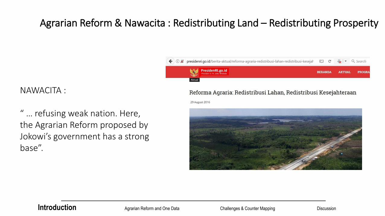
Agrarian Reform & Nawacita : Redistributing Land – Redistributing Prosperity
NAWACITA :
“ … refusing weak nation. Here, the Agrarian Reform proposed by Jokowi’s government has a strong base”.
Introduction Agrarian Reform and One Data Challenges & Counter Mapping Discussion

ONE DATA INDONESIA and ONE MAP POLICY
Introduction Agrarian Reform and One Data Challenges & Counter Mapping Discussion

SPEEDING UP AGRARIAN REFORM
Coordinating Minister of Economic form Agrarian Reform Team Minister of Internal
Affairs Minister of Agrarian
and Spatial Planning Minister of
Environment and Forestry
Minister of Agriculture Minister of State
Owned Enterprise Minister of Village,
Transmigration and Outer Area
Presidential Staff Chief
Introduction Agrarian Reform and One Data Challenges & Counter Mapping Discussion

Agrarian Reform : Government’s perspective1. Reducing inequality
access to land2. Creating land-based
sources for people’ wealth
3. Creating jobs reducing poverty
4. Improving people’s access to economic sources
5. Increasing food security and food sovereignty
6. Improving environmental quality and resolving agrarian conflicts
Introduction Agrarian Reform and One Data Challenges & Counter Mapping Discussion

Agrarian Reform : Government’s perspective Government will allocate land ownership through TORA [Land as Object of Agrarian Reform] and giving access to community for managing land through Social Forestry scheme
9 MiO Ha of TORA and 12.7 MiO Ha of Social Forestry [Germany : ~ 35.7 MiO Ha]
Government is still in data acquisition process for resolving agrarian conflicts
Introduction Agrarian Reform and One Data Challenges & Counter Mapping Discussion

Challenges

Research : “The political ecology of Kapuas River, West Kalimantan, Indonesia”
Partnering with The University of Tanjungpura Pontianak, Borneo Tribune Institute, Lembaga Gemawan, Swandiri Institute, FAMKI (Forum Aliansi Masyarakat Korban Investasi) – Sintang
Developing a Participatory Hydro Political Appraisal [PHPA] – Action Research in 7 Villages
Citizen Researcher Groups, River Transect
Ketungau Hilir Meliau
Menua Sadap
Ambalau
Serawai
Tayan
Pontianak
Introduction Agrarian Reform and One Data Challenges & Counter Mapping Discussion

Concession Size (Ha) Proportion(%)
Kelapa Sawit 4.962.022,28 33 %
HPH 2.808.902 19 %
HTI [HutanTanamanIndustri]
6.581.911 44 %
Pertambangan 5.074.338,81 34 %
Total 19.427.173,09 130 %
Contested Space in Kalimantan Barat
Land Grab
Conflicts, Dispossession, Criminalization
Overlapping concessions
Elite capture, Political Clientilism [after local election so many concession are issued]
Asymmetrical Access to Information
Data is everywhere but it is also nowhere
Luas Kalimantan Barat ~ 14,5 Juta Ha
Introduction Agrarian Reform and One Data Challenges & Counter Mapping Discussion

“Space” in Kalimantan Barat
Introduction Agrarian Reform and One Data Challenges & Counter Mapping Discussion

Counter Mapping and Counter Cartography

DIY and DIWO [Do It Yourself] & [Do It With Others]
Introduction Agrarian Reform and One Data Challenges & Counter Mapping Discussion
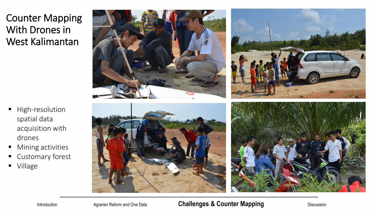
Counter Mapping With Drones in West Kalimantan
High-resolution spatial data acquisition with drones
Mining activities Customary forest Village

Customary Forest Drone Mapping in Papua
Introduction Agrarian Reform and One Data Challenges & Counter Mapping Discussion

Introduction Agrarian Reform and One Data Challenges & Counter Mapping Discussion

Community Squadrone 2.0
60-120 mins per mission > 1,000 Ha area mapped per mission => 4,000
Ha per day Resolution 1 pixel >= 3 cm [ satellite images =
50 cm] Carrying various sensors ~ 1,500 EUR Medan, Pontianak, Bandung, Palangkaraya Adopted by some organizations: Aliansi
Masyarakat Adat Nusantara (AMAN / Indigenous People Alliances), Walhi (Friends of Earth Indonesia), Alliances of Indigenous People in Central America

Counter Cartography: Web-based GIS on Conflicts
www.conflict-investment.org www.tanahkita.id
Introduction Agrarian Reform and One Data Challenges & Counter Mapping Discussion

Discussion Property vis-à-vis Access [Ribot & Peluso, 2003] ?
Access : “The ability to derive benefits from things” – more akin a bundle of powers
Property : “The right to benefit from things” – a bundle of rights
Rendering Technical [Tania Murray Li, 2007] vis-à-vis rendering political?
Agrarian Reform : Availability of Data, Access to Data, Triangulation, Elite Capture Risk?
Data Acquisition – Data Analytics – Data Articulation
Rivalry between NGOS – The Age of Project
Inclusivity of Technology [Science of the Mass, Citizen Researchers, Collective Production of Knowledge] – Critical Research is needed

“We map-makers must make a point of demolishing the illusion that there can be an official, universally accepted representation of the world’s political divisions.” (Philippe Rekacewicz)
The goal of science is to make the wonderful and complex understandable and simple, but not less wonderful – Herb Simon-
[email protected] | +6281381714337 | @bluelittledot
Danke
L’essentiel est invisible pour les yeux – Antoinne de Saint Exupery -
There are three kind of lies: lies, damned lies and statistics – Disraeli -