predicting vessel movements on water
TRANSCRIPT
Predicting Vessel Movements on Water
Jim Taysom
Approved for Public Release – NGA Case #15-162

2Approved for Public Release – NGA Case #15-162
(U) Purpose: To illustrate the use of farthest on circle analysis in the support of maritime intelligence.
(U) Bottom line: Farthest on circle analysis illustrates how long it takes to reach all accessible location from a starting point.
Farthest on Circle
3Approved for Public Release – NGA Case #15-162
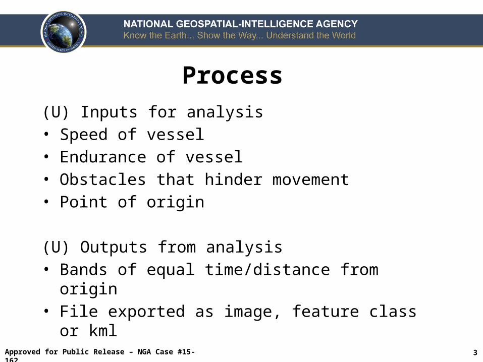
(U) Inputs for analysis• Speed of vessel• Endurance of vessel• Obstacles that hinder movement• Point of origin
(U) Outputs from analysis• Bands of equal time/distance from origin• File exported as image, feature class or kml
Process

4Approved for Public Release – NGA Case #15-162
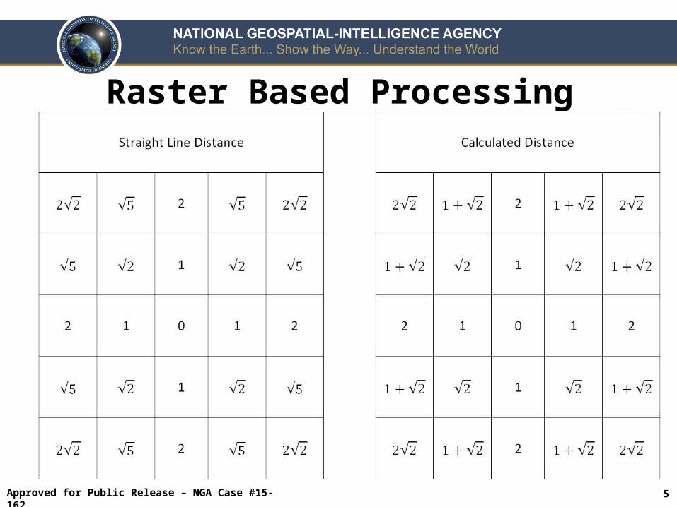
(U) Pros• Can be used for large areas• Precision error is regular• Small obstacles are taken into account
(U) Cons• Up to 8% shortfall in intermediate directions (NNE,
ENE, ESE, SSE, ect…)• Usually processed with assumed slack water
conditions
Raster Based Processing
5Approved for Public Release – NGA Case #15-162
Raster Based Processing
6Approved for Public Release – NGA Case #15-162
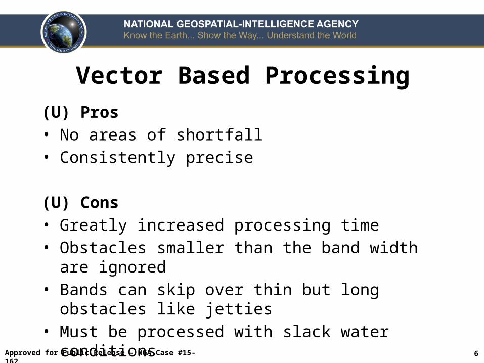
(U) Pros• No areas of shortfall• Consistently precise
(U) Cons• Greatly increased processing time• Obstacles smaller than the band width are ignored• Bands can skip over thin but long obstacles like
jetties• Must be processed with slack water conditions
Vector Based Processing

7Approved for Public Release – NGA Case #15-162

8Approved for Public Release – NGA Case #15-162
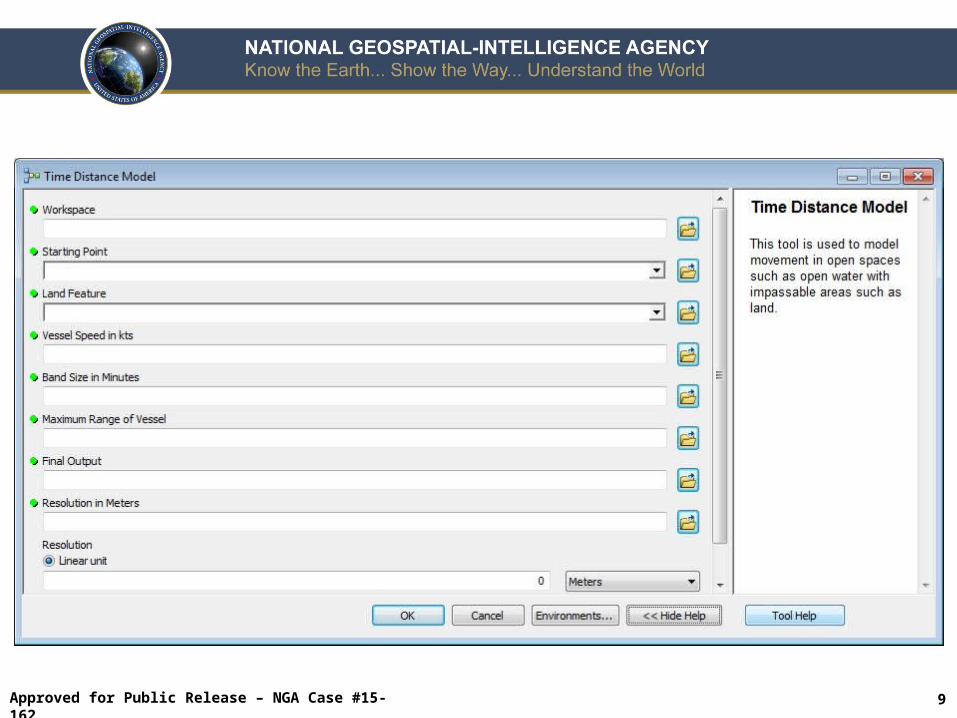
9Approved for Public Release – NGA Case #15-162
10Approved for Public Release – NGA Case #15-162
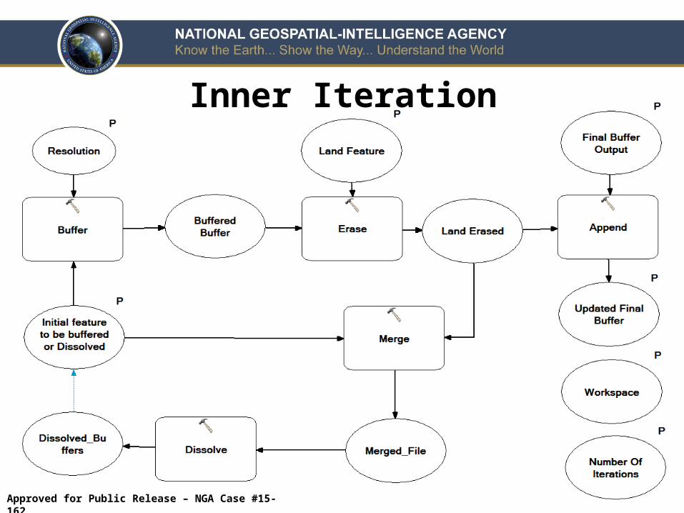
Inner Iteration
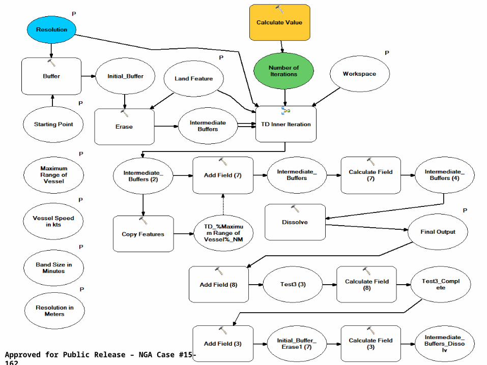
11Approved for Public Release – NGA Case #15-162
12Approved for Public Release – NGA Case #15-162
(U) Used for farthest on circle analysis• Depicts all accessible areas by a vessel• Useable for maritime operations• Estimates time need to reach an area
(U) Farthest on circle analysis illustrates how long it takes to reach all accessible locations
Discussion

nga.mil | @nga_geoint | facebook.com/natlgeointagency
Approved for Public Release – NGA Case #15-162