presentation (pdf format) - university of south australia
TRANSCRIPT
1
1
University of SA
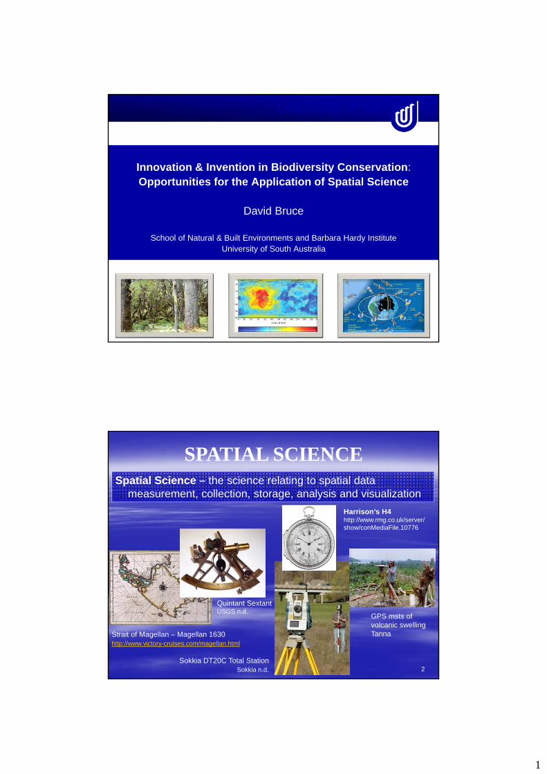
Innovation & Invention in Biodiversity Conservation:Opportunities for the Application of Spatial Science
David Bruce
School of Natural & Built Environments and Barbara Hardy InstituteUniversity of South Australia
2
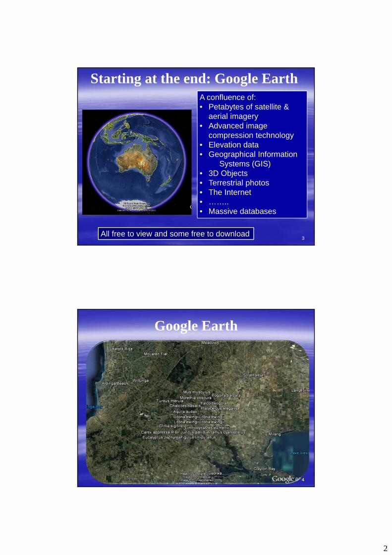
SPATIAL SCIENCESpatial Science – the science relating to spatial data
measurement, collection, storage, analysis and visualization
Strait of Magellan – Magellan 1630http://www.victory-cruises.com/magellan.html
Quintant SextantUSGS n.d.
Sokkia DT20C Total StationSokkia n.d.
GPS msts of volcanic swelling Tanna
Harrison’s H4http://www.rmg.co.uk/server/show/conMediaFile.10776
2
3
Starting at the end: Google EarthA confluence of:• Petabytes of satellite &
aerial imagery• Advanced image
compression technology• Elevation data• Geographical Information
Systems (GIS)• 3D Objects• Terrestrial photos• The Internet• ……..• Massive databases
All free to view and some free to download
4
Google Earth

3
5
Google Earth
6
Google Earth
4
7
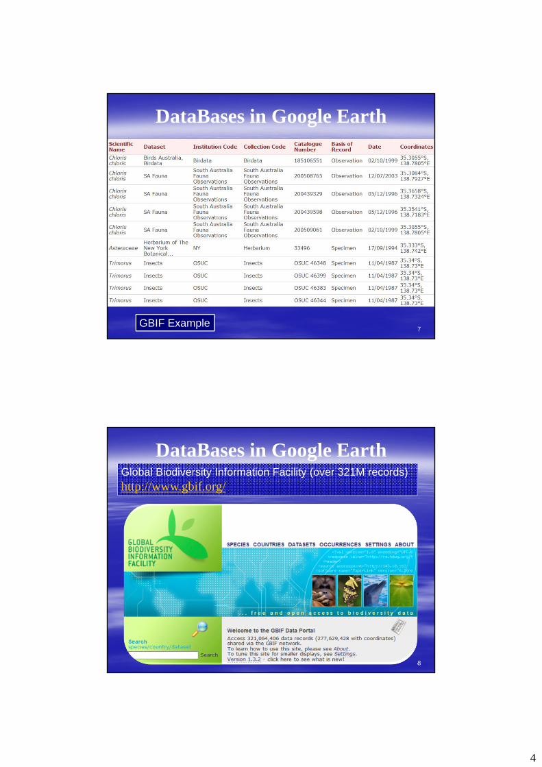
DataBases in Google Earth
Global Biodiversity Information Facility
http://www.gbif.org/
GBIF Example
8
DataBases in Google EarthGlobal Biodiversity Information Facility (over 321M records)http://www.gbif.org/

5
9
DataBases in Google EarthGlobal Biodiversity Information Facility (over 321M records)http://www.gbif.org/
10
DataBases in Google EarthGlobal Biodiversity Information Facility (over 321M records)http://www.gbif.org/

6
11
THE CONNECTOR Geography - X, Y, Z, T
X, Y, Z – based on an Earth Centre (where ever that is!)
T – intimately connected to x, y, z (Einstein) but so important in the Biodiversity record
12
A confluence of spatial technologies:applications to biodiversity recording
GNSS
Imaging
Visualization
Scanning

7
13
Global Navigation Satellite Systems (GNSS)
All systems utilize the concept of trilateration to determine X,Y, Z position (with respect to an Earth centre) by measuring time (distance / time) from a series of orbiting satellites.
Trilateration: determinationof position from 3 or moredistances – not triangulation
http://www.romsaf.org/billeder/fix_rotation.gif
14
GNSSGNSS – Global Navigation Satellite Systems
A series of satellite constellations utilized for Earth positioning. These include:
• Global Positioning System (GPS) – USA• Globalnaya Navigatsionnaya Sputnikovaya Sistema
(GLONASS) – Russia• Quasi-Zenith Satellite System (QZSS) – Japan• Galileo – European Union• BeiDou (Compass) Navigation Satellite System – China• Indian Regional Navigation Satellite System (IRNSS) –
India

8
15
GNSSThe number of GNSS satellites will increase from
approximately 30 to over 100 by 2015
http://www.gpsworld.com/gnss-system/preparing-next-generation-the-multi-gnss-asia-demonstration-campaign-12358
16
GNSS Increase in GNSS satellite numbers
Increase in GNSS frequencies (provides for ionosphereicdelay modelling)
Provision of a permanent “differential” signal (DGNSS)
….. will lead to cm (X,Y, Z) precision in small mobile devices
The benefits to biodiversity site recordingare immense
9
17
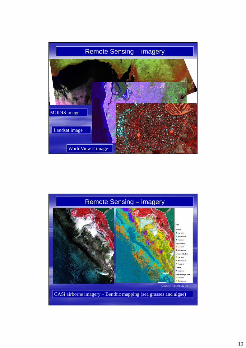
REMOTE SENSING
Digital images and subsequent computer analysis of our Earth from space orbiting satellites.
Provide daily low spatial resolution images of whole planet
Provide high spatial resolution (0.5 – 2m) images of most of the planet every few days
Hyperspectral images provide large number of spectral samples but, at this stage, at lower spatial resolutions from space. From the air they enable veg species mapping
Aerial UAV with sensors now provide very high resolution (cm) multi-spectral imagery of any ground location
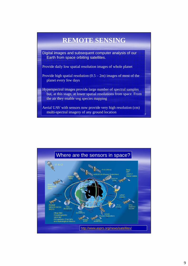
http://www.asprs.org/news/satellites/
Where are the sensors in space?
10
MODIS image
Remote Sensing – imagery
Landsat image
WorldView 2 image
CASi airborne imagery – Benthic mapping (sea grasses and algae)
Remote Sensing – imagery
(Courtesy: CSIRO L& W)
11
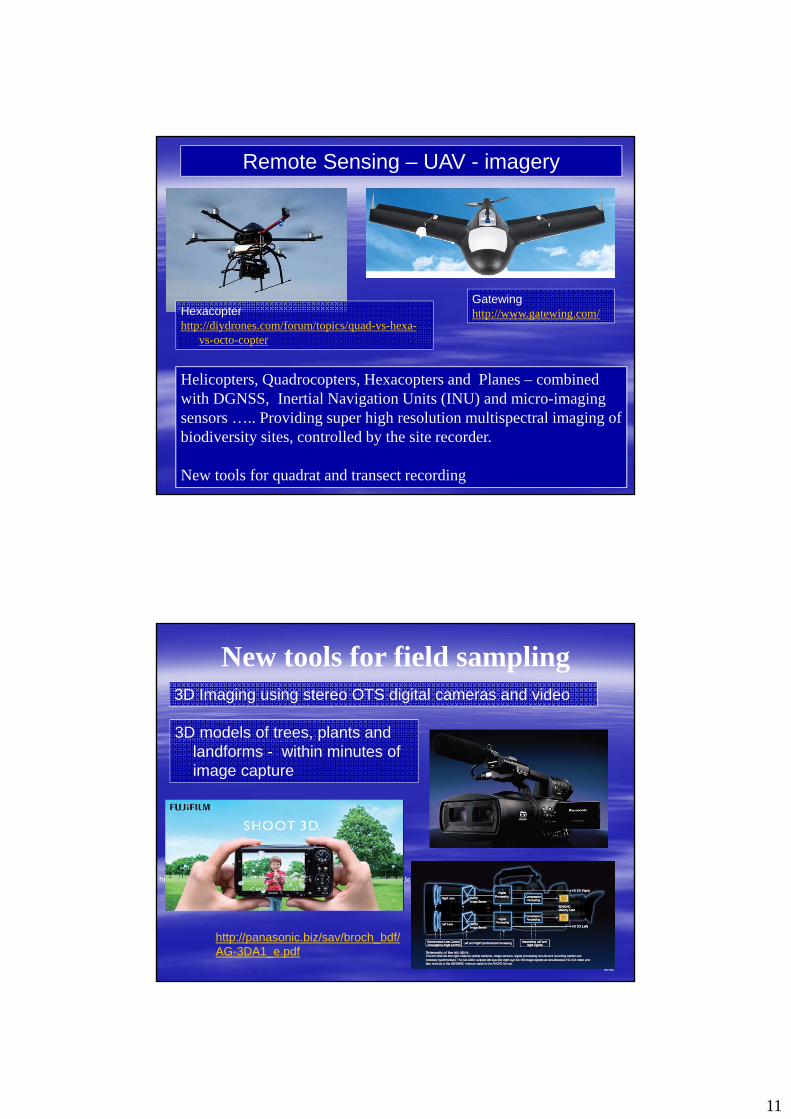
Helicopters, Quadrocopters, Hexacopters and Planes – combined with DGNSS, Inertial Navigation Units (INU) and micro-imaging sensors ….. Providing super high resolution multispectral imaging of biodiversity sites, controlled by the site recorder.
New tools for quadrat and transect recording
Remote Sensing – UAV - imagery
Gatewinghttp://www.gatewing.com/Hexacopter
http://diydrones.com/forum/topics/quad-vs-hexa-vs-octo-copter
22
New tools for field sampling
3D models of trees, plants and landforms - within minutes of image capture
http://panasonic.biz/sav/broch_bdf/AG-3DA1_e.pdf
http://www.youtube.com/watch?v=kZGBJoq0XYs&feature=mfu_in_order&list=UL
3D Imaging using stereo OTS digital cameras and video

12
23
New tools for field sampling
For example the Creaform – Handyscan 3D MaxScanhttp://www.creaform3d.com/en/default.aspx
Handyscan 3D annual scanning contest – 2007 winner
http://www.youtube.com/watch?v=kZGBJoq0XYs&feature=mfu_in_order&list=UL
3D Laser scanning combined with terrestrial photogrammetry of natural features
24
For example the Creaform – Handyscan 3D MaxScanhttp://www.creaform3d.com/en/default.aspx
New tools for field sampling
Portable laser scanning
13
25
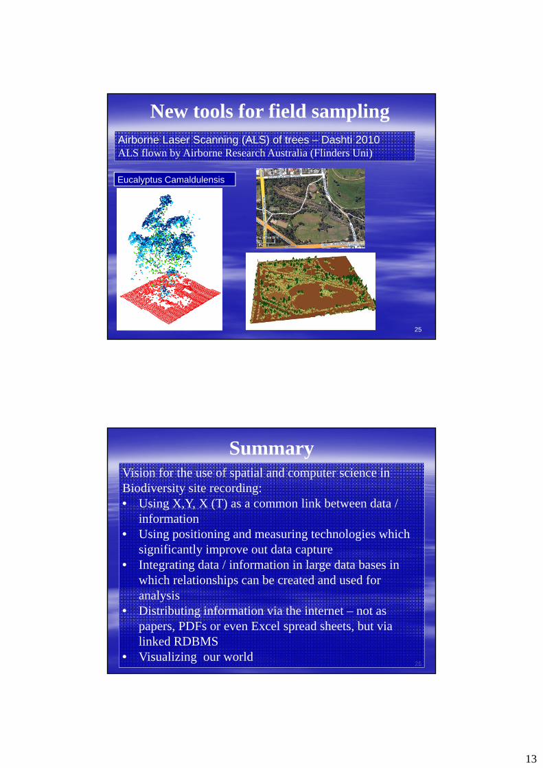
New tools for field samplingAirborne Laser Scanning (ALS) of trees – Dashti 2010ALS flown by Airborne Research Australia (Flinders Uni)
Eucalyptus Camaldulensis
26
SummaryVision for the use of spatial and computer science in Biodiversity site recording:• Using X,Y, X (T) as a common link between data /
information• Using positioning and measuring technologies which
significantly improve out data capture• Integrating data / information in large data bases in
which relationships can be created and used for analysis
• Distributing information via the internet – not as papers, PDFs or even Excel spread sheets, but via linked RDBMS
• Visualizing our world

14
27
ReferencesBerni , J.A., P.J. Zarco-Tejada , L. Suárez , V. González-Dugo, E. Fereres, 2009, Remote
Sensing of Vegetation from UAV Platforms Using Lightweight Multispectral and Thermal Imaging Sensors, ISPRS Inter-Commission WG I/V
http://www.isprs.org/proceedings/XXXVIII/1_4_7-W5/paper/Jimenez_Berni-155.pdf
Dashti, D. Bruce, J. Hacker , 2011, Individual Tree mapping and Classification Using High Density Airborne LIDAR, International Conference on Sensors & Models in Remote Sensing and Photogrammetry, ISPRS WG1/4, Tehran, Iran
Global Biodiversity Information Facilityhttp://www.gbif.org/
Google Earth http://www.google.com/earth/index.html
Sokkia n.d.http://www.newenglandlaser.com/blog/Sokkia.htm
USGS n.d. Multimedia galleryhttp://gallery.usgs.gov/photos/07_22_2009_j51Qi76Hgb_07_22_2009_17