proceedings report - pacific...
TRANSCRIPT
1
Regional Technical Training Workshop Series 4th Environmental Perspectives of Deep Sea Mineral Activities 9th – 13th December 2013, Nadi, Fiji
Proceedings Report
2
Contents 1. Introduction ...................................................................................................................... 5
2. Background ....................................................................................................................... 5
3. Workshop .......................................................................................................................... 5
4. Summary Outcomes .......................................................................................................... 7
5. Objective 1: Current State of Knowledge (Presentation Summaries) ............................ 13
6. Objective 2: Information and Experience Sharing Between Nations (Presentation Summaries) .................................................................................................................................... 26
7. Objective 3: Review of the EIA Template........................................................................ 33
Seafloor Massive Sulphides ............................................................................................. 33
Manganese Nodules........................................................................................................ 37
Cobalt-Rich Crusts ........................................................................................................... 38
8. Objective 4: To Assess Regional Issues. .......................................................................... 44
Strategic Environmental Assessment.............................................................................. 44
Marine Spatial Planning .................................................................................................. 46
Regional Cooperation ...................................................................................................... 49
9. Objective 5: Launch of the SPC-UNEP/GRID-Arendal Deep Sea Minerals Report .......... 52
10. Objective6: DSM Documentary ‘Out of Darkness’ Release ............................................ 53
This document has been produced with the financial assistance of the EU. The views expressed herein can in no way be taken to reflect the official opinion of the European Union.

3
List of Acronyms AUVs Autonomous Underwater Vehicles
CCFZ Clarion Clipperton Fracture Zone
CITES Convention on International Trade in Endangered Species
CRC Cobalt Rich Crusts
CROP Council of Regional Organisations in the Pacific
CSO Civil Society Organisation
DEC Department of Environment and Conservation
DOE Department of Environment
DOSI Deep-Ocean Stewards Initiative
DSM Deep Sea Minerals
EA Environmental Assessment
EBM Ecosystem-Based Management
EBSA Ecologically or Biologically Significant Areas
eCS Extended Continental Shelf
EEZ Exclusive Economic Zone
EIA Environment Impact Assessment
EIS Environmental Impact Statement
EITI++ The Extractive Industries Transparency Initiative Plus Plus
EMP Environmental Management Plan
EMU Evaluation and Measurement Unit
ERA Environment Risk Assessment
ESIA Environmental and Social Impact Assessment
EU European Union
FFA Forum Fisheries Agency
FPIC Free Prior and Informed Consent
HOVs Human–Occupied Vehicles
HROVs Hybrid Remotely Operated Vehicles
IMO International Maritime Organization
INDEEP International Network for Scientific Investigations of Deep-Sea Ecosystems
ISA International Seabed Authority
KIOST Korean Institute of Ocean Sciences and Technology
LMMA Locally Managed Marine Area
MEA Multi-lateral Environmental Agreement
MIDAS Managing Impacts of Deep-Sea Resource Exploitation
MN Manganese Nodules
MPA Marine Protected Area
MRD Ministry of Lands and Mineral Resources
MSP Marine Spatial Planning
NGO Non-Governmental Organisation
NIWA National Institute of Water and Atmospheric research
P-ACP Pacific - African, Caribbean and Pacific Group of States
PIANGO The Pacific Islands Association of Non-Governmental Organisations
PIC Pacific Island Country
PNA Parties to the Naru Agreement
REE Rare Earth Elements
4
RLRF Regional Legislative and Regulatory Framework
ROV Remotely-Operated Vehicle
ROVs Remotely Operated Vehicles
SEA Strategic Environment Assessment
SMS Seafloor Massive Sulphides
SPC Secretariat of the Pacific Community
SPREP Secretariat of the Pacific Regional Environment Programme
TOR Terms of Reference
UNCLOS UN Convention on the Law of the Sea
UNEP/GRID United Nations Environment Programme/Global Resource Information Database
VANGO Vanuatu Association of NGOs
5
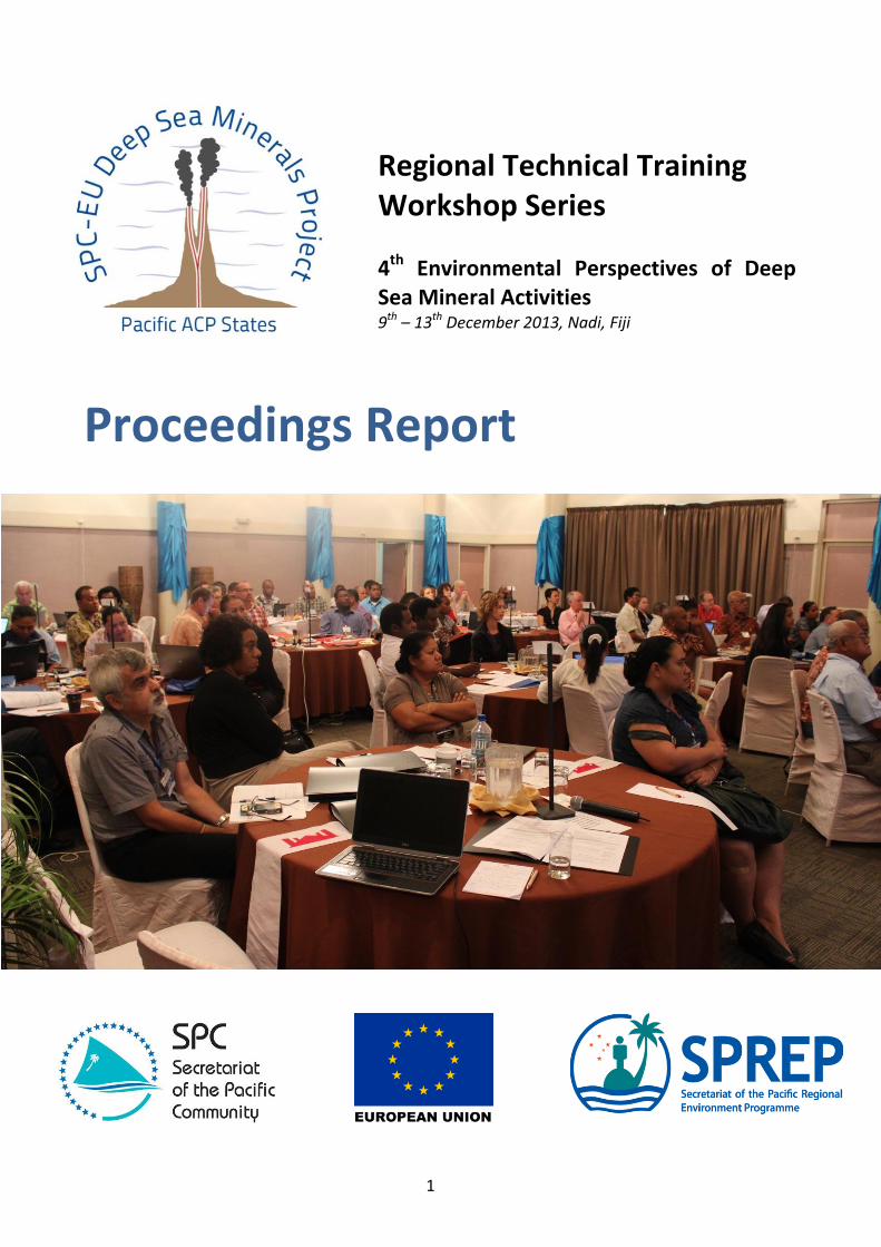
1. Introduction The 4th regional technical training workshop ‘Environmental Perspectives of Deep Sea Mineral Activities’ was held at the Tanoa International Hotel, Nadi, Fiji, from 9th to 13th December 2013. The workshop was co-ordinated by the Secretariat of the Pacific Community (SPC) through the SPC-European Union (EU) Deep Sea Minerals (DSM) Project and the Secretariat of the Pacific Regional Environment Programme (SPREP). Seventeen Pacific Island countries and territories were represented at the workshop, by 37 Government officials. Additionally, representatives of 17 non-governmental organisations, and 10 private sector companies also participated. 89 Participants attended in total. A list of participants can be found on the Project’s website: www.sopac.org/dsm/index.php/technical-training.
2. Background
In 2012, the SPC-EU DSM Project initiated a regional technical training programme, consisting of a series of one-week workshops to inform stakeholders about the technical, legal, economic and environmental concerns of deep sea mining. This workshop is the 4th in the series. Details of the previous workshops can be found on the Project’s website: www.sopac.org/dsm/index.php/technical-training. The current workshop on ‘Environmental Perspectives of DSM Activities’ provided further insight and built upon the introduction of environmental aspects delivered in the 1st workshop: ‘Geological, Technological, Biological and Environmental Aspects of DSM’ held in August 2012.
3. Workshop
The workshop benefitted from the attendance of a number of experts in relevant fields and, in particular, world-leading expert scientists in the marine biology of deep-ocean ecosystems, Prof Cindy Van Dover of Duke University USA, and Dr Malcolm Clark of the New Zealand National Institute of Water and Atmospheric research (NIWA), who were contracted by the SPC-EU DSM Project to deliver a number of training sessions. The workshop began with a series of educational and informative presentations on DSM environmental considerations from international experts. Government representatives from Fiji, PNG and Tonga shared their DSM experiences, as did the private sector and civil society groups. Workshop participants then split into working groups to address specific topics that had been highlighted as priority areas:
(1) Template for Seafloor Massive Sulphides Environment Impact Assessment (EIA) (2) Template for Manganese Nodules EIA (3) Template for Cobalt-rich Crusts EIA (4) Strategic Environmental Assessment Guidelines (5) Marine Spatial Planning (6) Regional Cooperation
Primary Objectives
1. Provide current state of knowledge of the deep sea environment to the participants through presentations from world-renowned experts.
6
2. Encourage information and experience sharing between nations, particularly in relation to national responsibilities within the Environmental Impact Assessment (EIA) process, such as evaluating the EIA, establishing the Environmental Management Plan (EMP), monitoring and enforcement.
3. Review the EIA template developed by the International Seabed Authority (ISA) and SPC with consideration to the three mineral deposit types.
4. Assess regional issues, particularly any policy needs. Secondary Objectives
5. Launch the SPC-UNEP/GRID-Arendal Deep Sea Minerals Report. 6. Show the second SPC-EU DSM Project Documentary ‘Out of Darkness’.
Additional documents from this workshop, including opening speeches, participant list, agenda, and presentations are available on the DSM Project’s website: http://www.sopac.org/dsm/index.php/regional-meetings-and-trainings/33-spc-sprep-organised-pacific-acp-states-regional-training-workshop-on-environment-perspectives-of-deep-sea-minerals-activities-9-13-december-2013.
7
4. Summary Outcomes This Summary of Workshop Outcomes was drafted through a representative ad-hoc drafting committee and discussed and agreed in plenary by the Workshop Participants. It covers 11 key areas:
A. Development Drivers B. Knowledge C. Environmental Impacts D. Strategic Environmental Assessment E. Environmental Impact Assessment F. Marine Spatial Planning G. Management H. Legal Issues I. Capacity Gaps J. Regional Approach K. Future Action
A: Development Drivers 1. There are a number of drivers for Pacific Island countries to develop their DSM sector,
including economic growth, social development and limited alternative economic development options. For industry, the main drivers are geological potential, growing demand for minerals and rare metals coupled with low grade of terrestrial mineral deposits.
2. More information about the potential of the industry will assist to manage expectations about the scale and timing of development, and inform Government decisions.
3. The EIA process should inform the developer’s feasibility study where a decision to apply, or not, for a mining licence is made.
B: Knowledge 4. The deep ocean is large, diverse and complex, with a number of dominant physiographic
features well known and many other features still to be discovered. A diverse fauna inhabits the deep sea, with many species undescribed or undiscovered; this fauna varies from one region to the other.
5. Access to the deep sea has improved in recent decades, but understanding the ecology of the deep sea is limited by the high cost of research and exploration (requiring expensive ships and technology). Most of the deep sea remains unexplored.
6. Multidisciplinary science is needed, and involves collaboration between mining industry, research institutions, government agencies and other stakeholders.
7. Some key scientific points that need to be addressed are: • Structure. Multiple habitats, "ecosystem" organisation. • Dynamics. How variable, over what spatial scale. • Connectivity. Linkages between habitats, depths, ocean basins. • Future ocean structure and function - climate change. • Human impacts. Fishing, mining, waste disposal, litter and other uses.
8. Site-specific information on species composition, abundance, and biological characteristics is needed to determine vulnerability to impact.
9. Slow growth rates and reproduction, connectivity, and adaptation to food-poor conditions are key limiters in the resilience of manganese nodule and crust environments to human impacts.
8
10. Studies in other regions may be used to inform the first steps in developing DSM exploration activities in the region.
C: Environmental Impacts 11. Environmental assessment is a planning process that should be done at two levels:
strategic environment assessment (SEA) and project-specific environmental impact assessment (EIA).
12. All stages of DSM activities (prospecting, exploration and mining) need to be subject to some form of environmental assessment. The type of assessment required will vary in complexity and intensity, depending on the stage of development and the level of risk involved.
13. A challenge for governments is to address cumulative impacts that may arise from natural processes, multiple marine uses in the same area, or multiple DSM activities occurring in proximity (which may be at different times or in different jurisdictions).
14. It must be recognised that deep sea mining by its nature will be destructive in the local scale, and may lead to species loss. The impacts on the wider ecosystem level need to be evaluated and managed.
15. More information about oceanographic processes is required to understand the potential impacts on the water column, ecosystems and human communities.
16. Variable currents near the deep seabed mean that it is uncertain how far sediment plumes may or may not travel up the water column, and/or linger as a cloud. The extent will depend on individual sites and technology used.
17. Fisheries are an important source of income for Pacific Islands. It will be important to predict and prevent unwanted impacts on fish populations from DSM activities, which may particularly occur in relation to seamounts. Because of the depths currently fished (<600 m) compared to the depths of DSM currently targeted (>1000 m), direct impacts are unlikely; but indirect impacts on fish of DSM activities may include changes to the water column or primary productivity from increased marine traffic, surface discharges, or chemical ‘leaks’ when ore is lifted through the water column.
18. The three types of DSM deposits are significantly different in their physical and biological characteristics. Mining methods will be different so the management of their impacts will require different requirements.
19. Considerations for assessing the capacity for system recovery should include the biological characteristics of different species, habitat variability, oceanography, underwater acoustics, etc.
D: Strategic Environmental Assessment (SEA) 20. An SEA:
• is a tool for regional/provincial/sector-wide planning; • addresses, at a strategic and wide-scale level, the environmental impacts of potential
developments and resources uses; • is a systematic process to assist transparent and informed decision-making; • should lead to environmental considerations, sustainability principles, and international
obligations being factored into policy and planning in other sectors; and • enables consideration of cumulative and trans-boundary impacts.
E: Environmental Impact Assessment 21. An EIA should:
ideally be nested within a regional SEA;

9
encompass the full range and life cycle of the proposed activity; and take an ‘ecosystem-based approach’ with a comprehensive description of all
communities, appropriate spatial coverage, and detail the biological responses, connectivity, and resilience of the animals to the impact.
22. The ISA published an EIA template for the environmental management of DSM activities. Countries can modify the template to suit their national settings.
23. An EIA results in an environmental impact statement (EIS) (or EIA Report), which should comprise (i) Environment Risk Assessment (ERA), (ii) Environment Impact Assessment (EIA), (iii) Environment Management Plan (EMP). The EIS may present impacts by location (e.g. depth strata) or by receptor (e.g. biological groups).
24. The ERA should be conducted early in the process, and continually reviewed and updated. 25. It is important that an EIS presents information in a way that is easily understood by
stakeholders. For example, it could include key messages and a summary at the start of each chapter.
F: Marine Spatial Planning (MSP) 26. MSP is:
• a planning process to identify a balance of economic, social and ecological sustainability and to support informed and coordinated decision making for marine resources;
• a mechanism for integrated decision making, identifying potential non-compatible resource uses and minimising conflict;
• a participatory process, inclusive of multiple sectors, government departments and resource users; and
• an iterative process, which involves refinement and revision over time. 27. Essential components of MSP include:
• future scenario planning; and • the need for engagement and participation of all stakeholders, such as using maps to
identify both resources and resource users (e.g. Locally Managed Marine Areas). 28. MSP requires Ecosystem Based Management (EBM). EBM takes a balanced approach to
managing whole ecosystems, and integrates all sectors that impact or are impacted by the ecosystem, recognising the connections within and across ecosystems. ‘Ridge to reef’, can be expanded to ‘ridge to deep sea’.
29. There are other management strategies, such as Species Management, Marine Protected Areas, Watershed Management, and Integrated Coastal Zone Management.
G: Management 30. Successful management of DSM activities is reliant on a cooperative and integrated
approach between all stakeholders (villagers/communities, industry, civil society and government).
31. Stakeholders are required to sort through complex information in weighing up different values and making decisions about difficult trade-offs.
32. Information sharing is important for transparent assessment processes and giving the public confidence about the integrity of these processes.
33. The requirement for transparent and accurate sharing of information applies to all stakeholders: government, industry, civil society and villagers/communities.
34. Before DSM licensing and individual project EIAs, it is important to have cross-agency dialogue, public consultation, wider planning schemes (such as marine spatial planning, based on strategic environmental management), and institutional arrangements in place. This could apply at sectoral, national, and regional levels.
10
35. Civil society has a role to play in promoting rights-based approaches and shaping development policies, and can be involved in DSM decisions via the establishment of a ‘citizens advisory committee’.
36. Civil society is very diverse, encompassing a range of community groups and value systems. 37. Effective meaningful consultation depends on an open (not pre-determined) outcome. 38. Data collection, access, exchange and management arrangements need to be put in place
to facilitate informed decision making, with an understanding of where to draw the line with respect to the level of information required to make decisions.
39. Baseline environmental studies are essential for ongoing environmental management and for progressing basic scientific understanding of the deep sea environment.
40. New scientific techniques and baseline sampling processes are being developed. 41. Baseline data collection should commence at the start of exploration and be staged
throughout the exploration phases and not left until the mining EIA stage. 42. The EIS should be followed up by site monitoring and remediation as part of adaptive
management. 43. Data from other activities and sources (e.g. identification of historical shipwreck sites) can
be used to inform the collection of baseline data. 44. A consistent approach to the design of sampling, data collection programs and data storage
formats, will allow for comparisons across the Pacific region. However, it will also be necessary to allow for adaptability to specific project sites and advances in science and techniques.
45. In doing baseline assessments, it is important to look at the dominant functional groups in an ecosystem, which can be identified through community structure and food web analyses.
46. Where relevant, a good reserve site/sites should be identified to provide source stock for re-colonisation of a mined site.
47. Proper environmental management planning and a commitment to best environmental practice are necessary for any DSM development.
48. Trans-boundary impacts should also be anticipated and managed. 49. Rehabilitation of deep sea mining sites is an expensive possibility, and Governments can
include this within the scope of the EIA and/or the permit conditions. Long-term monitoring of these sites is recommended.
50. Transparent financial management (e.g. by application of the Extractive Industry Transparency Initiative) and equitable sharing of benefits from deep sea mining, will be essential to secure positive economic development.
H: Legal Issues 51. Maritime boundaries need to be measured and declared, in order for States to know where
their jurisdiction lies. 52. The precautionary principle must be applied to all DSM activities. 53. Most countries in the Pacific are engaged or are about to engage with DSM exploration,
either in national jurisdiction, or the Area; and these countries have also commenced the process of reviewing existing or developing new laws to regulate DSM. 54. States who permit DSM activities within their Exclusive Economic Zone (EEZ), or who
sponsor DSM activities in the Area, bear ultimate responsibility to ensure that those activities comply with UN Convention on the Law of the Sea (UNCLOS) and other international law environmental obligations to which they are a party.
55. National law should be used to place requirements on the DSM operators, such as to share data, to meet environmental standards, and to include financial liability for non-
11
compliance with the laws (e.g. environmental bond). This law must be informed by science (and scientific research should be targeted to inform the law), and it is important that the law is based upon national policy and developed with widespread stakeholder consultation. 56. There are existing international frameworks (e.g. UNCLOS, Multi-lateral
Environmental Agreements (MEAs), International Maritime Organization (IMO) conventions on safety and environment) that can be drawn upon to develop a regional assessment framework. This should be informed by clear analysis of countries’ existing multi-lateral agreements, and how DSM activities will affect these agreements.
57. Management tools, such as EIA, SEA and MSP can be required by law as a firm commitment towards achieving objectives for environmental management.
I: Capacity Gaps 58. Work needs to be undertaken to link land management processes and coastal
management processes more effectively. 59. National environment service representatives note the following ‘gaps’:
• Lack of in-country expertise (and some laws require Government consultants to be locally registered).
• DSM is not expressly covered in national environment laws. • Absence to date of cost/benefit analysis of DSM development: to determine what
impact is acceptable. • Fragmentation of mandate and regulations and lack of coordination across Government. • Lack of scientific data to inform national policy/laws. • Staff capacity to know when an EIA should be required, terms of reference for a DSM
EIA and how to review the EIA and monitor against it. • Lack of capacity to implement and enforce legislation. • A lack of funding/budget allocation. • Capacity to know how and when to conduct public education and consultation.
J: Regional Approach 60. All Pacific Island countries are members of the International Seabed Authority and more
co-ordinated engagement from the region in that forum could influence the regime to maximise benefits conferred on developing States.
61. There are opportunities for Pacific Island countries to operate collectively via a regional body (underpinned by a regional treaty?) to set minimum standards and harmonised licensing and fiscal regimes, to promote data-sharing between countries, to pool human and technical resources and to act as a regional bloc in relevant negotiations.
62. As a region we can learn from our neighbours, our history, and other development sectors (e.g. offshore oil and gas).
K: Future Action 63. The Applied Geoscience and Technology Division of SPC and the Forum Fisheries Agency
are to bring fisheries and DSM officials together – and examine how DSM policies and procedures can learn from and complement fishery policies. [Ensure all SPC members are invited.]
64. Governments are to engage more actively with the ISA (with SPC-SOPAC Division support), including arrangements to access environmental data.
12
65. There is a potential for capacity-building through ‘telepresence’ (real-time, on-line video, audio, and instant messaging) from the seafloor in collaboration with scientists from Duke University and other research institutions and scientists. 66. Interested stakeholders are to engage with Global Ocean Commission, ISA, and
other initiatives (e.g. Deep-Ocean Stewards Initiative (DOSI) and Managing Impacts of Deep-Sea Resource Exploitation (MIDAS)), regarding the comprehensive environmental management of the High Seas and the Area, and draw on these initiatives for national jurisdiction.
67. Regional universities should be involved in future DSM activities. 68. SPC and the National Institute of Water and Atmospheric Research (NIWA) are to
collaborate on the development of DSM Research Guidelines (Prospecting and Exploration). The Guidelines will: • be drafted in consultation with stakeholders, including regional universities, SPREP,
Marine Sector Working Group, and NGOs; • link to existing regional processes (e.g. Oceanscape); • provide a framework for research that supports good environmental management of
deep sea mining activities; • ensure research meets regional and not just national needs; • support the development of region-wide understanding of biological and ecological
communities; and • identify what is important to measure, how it can be measured and the frequency of
monitoring required once a deep sea mining operation commences. 69. SOPAC Division of SPC and SPREP (and other stakeholders) are requested to collaborate on
provision of support to Pacific Island Governments (for individual countries, and/or regionally) including: • Finalising and sharing the EIA guidelines worked on during the meeting. • Developing Environmental Management Plan (EMP) guidelines. • Developing regional SEA guidelines for DSM activities. • Continuing discussion on implementing management tools on a regional level, and
integrating environmental planning and management tools into existing regional commitments such as Coral Triangle and Oceanscape.
• Updating and expanding regional impact assessment guidelines. • Providing impact assessment training. • Providing relevant policy and legislative assistance.
70. The next SPC DSM Project meeting deep sea mining workshop in the first quarter of 2014 will cover fiscal regimes and models of managing extractive industry wealth so as to provide long-term sustainable benefits for Pacific Island countries from the development of non-renewable DSM resources.
71. The DSM Project will work with SPREP and other stakeholders to produce an options paper for strengthened regional cooperation.
72. Countries should work to bring management approaches onto one management system (e.g. a GIS map) to start linking to broader marine management processes. 73. Assistance is requested by Pacific - African, Caribbean and Pacific Group of States (P-
ACP) States in relation to the management of marine genetic resources.

13
5. Objective 1: Current State of Knowledge (Presentation Summaries)
Deep sea minerals: A new development opportunity for the Pacific Mr Akuila Tawake (SPC) Mr Tawake gave an overview of global DSM geology with specific examples within the Pacific Islands region. He covered tectonic and geological settings, mineral types, metal prices, supply and demand, exploration and mining interests, and technology development. Points covered by Mr Tawake included: Geological potential should be recognized as the driver of any DSM development. Before a decision is made to mine or not, a feasibility study (to examine a deposit’s viability)
and an EIA both need to be conducted. Proper environmental management planning and a commitment to best environmental practice are necessary for any DSM development.
The global demand for copper has been increasing over time and this trend is likely to continue to support economic development in emerging economies like China or India.
Copper used to be mined at a grade of 6.5 per cent and now it is mined at only about 1.3 per cent.
Land-based mining currently occurs in four Pacific countries: PNG, New Caledonia, Fiji and Solomon Islands. The DSMs industry opens up new development opportunities for other countries in the Pacific.
There are three companies in the region that currently hold deep sea exploration licences: Nautilus Minerals, Neptune Minerals (trading as Bluewater Metals) and the Korean Institute of Ocean Sciences and Technology (KIOST).
Pacific Island Countries (PICs) have a total area of about 38.5 million km2 of EEZ and, for some, DSM may represent the only exploitable natural resource sector apart from fish.
Seafloor Massive Sulphides (SMS):
SMS form on and below the seafloor (between 1000 m and 5000 m) as a consequence of the interaction of seawater with magma in the sub-sea-floor where the seawater is heated to a point where it is able to dissolve minerals from the surrounding rocks. As the water rises and vents out from the seafloor into the ocean, the sharp temperature contrast rapidly cools the water and the dissolved minerals precipitate out, producing hydrothermal vent chimneys and deposits rich in metals, such as copper, gold, zinc and silver.
Papua New Guinea, Solomon Islands, Vanuatu, Fiji and Tonga are known to have SMS deposits.
SMS deposits in the deep sea are higher in mineral content compared to current on-land deposits and the deposits are a smaller size (without overburden).
Manganese Nodules (MN):
MN are pebble to potato sized rocks at flat sedimented-abyssal plains in the very deep ocean (between 4000 m to 6000 m). The rocks form around a small nucleus and build up thin layers upon layers of minerals, such as manganese, iron, nickel, copper, cobalt and rare-earth elements over a very long time (millimetres per million years).
Cook Islands and Kiribati are known to have MN.
Clarion Clipperton Fracture Zone (CCFZ) is the Manganese Nodule (MN) rich area between Mexico and the Line Islands of Kiribati. This marine space lies outside national jurisdiction and is managed by the ISA. Nauru, Kiribati and Tonga have been granted exploration contracts in the CCFZ by the ISA.
14
Cobalt Rich Crusts (CRC):
CRC precipitate onto nearly all rock surfaces that are free of sediment in the deep ocean. However, their thicknesses vary from less than 1 mm to over 200 mm. They are most commonly found on the sides of seamounts, from 600 m to 7000 m. CRC can contain manganese and iron oxides with cobalt, nickel, copper, platinum and Rare Earth Elements (REE).
China controls 95 per cent of the world’s REE and can, therefore, limit the supply to other countries. CRC of the Pacific Ocean are believed to contain REE and could provide an alternate source. CRCs are calculated to have two to three times the REE concentration of the MN in the CCFZ.
The nature of deep sea mining projects is that they have long exploration phases. For the DSM Solwara 1 Project in PNG, the first exploration license was issued in 1997 and the mining licence was granted in 2011.
Characteristics of the Deep Sea Environment - Part I Prof Cindy Van Dover (Duke University) Prof Van Dover discussed marine scientific research on deep sea biology and the biological communities associated with DSM deposits. She addressed the importance of community connectivity in the deep ocean and the interaction between deep sea and the upper ocean. Points covered by Prof Van Dover included: Access to the deep sea has improved in recent decades, but understanding the ecology of
the deep sea requires expensive ships and technologies. Such technology includes Human–occupied vehicles (HOVS), remotely operated vehicles
(ROVS), autonomous underwater vehicles (AUVS), hybrid ROVS (HROVS) and telepresence. The deep ocean is complex, with a number of dominant physiographic features including:
mid-ocean ridges, subduction zones, fracture zones, transform faults, back-arc basins, seamounts, abyssal plains, canyons, shelves and slopes. Some physiographic features are well known and other features are still to be studied or even discovered.
Sea floor spreading centers, where hydrothermal vents (the site of SMS) occur, are not the same everywhere in the ocean. In the East Pacific Rise, tectonic plates are spreading fast. This means that hydrothermal vents are short lived. There is so much volcanism as these plates are being pulled very fast where the vents are often run over by lava. The mid Atlantic ridge, in contrast, is slow spreading with longer lived vents. Fast spreading and slow-spreading ridges influence the biology at the sites. Transform faults have little or no hydrothermal activity.
Abyssal plains, where MN occur, tend to be flat. Diverse fauna inhabit the deep sea with many species still undiscovered; this fauna varies
from one region to the other and are generally adapted to food-poor conditions. There are many different zones in the sea – for example different depth ranges can be
characterised as follows: Epipelagic (where there is light penetration and photosynthesis); Mesopelagic; Bathypelagic; Abyssopelagic; and Hadal. The ocean is three-dimensional and mixing occurs across zones.
Other factors, including water salinity, oxygen-levels and temperature affect what lives there.
Biologist classify organisms by their size, i.e. megafauna (greater than 2 cm) and microfauna (<250 microns >42 microns).
Characteristics of the Deep Sea Environment - Part II
15
Dr Malcolm Clark (NIWA) Dr Malcolm Clark discussed various deep sea environments – including hydrothermal vents, cold seeps, oxygen minimum zones, seamounts, canyons, trenches - and how the varying conditions within these environments affect biodiversity and the physiology of seabed organisms. Points covered by Dr Clark included: The deep sea has complex topography and the different environments support different
fauna and different mineral deposits. A diverse fauna inhabits the deep sea, with many species undescribed or undiscovered; this
fauna varies from one region to the other. The biological characteristics of deep sea animals are not well known, but key factors
affecting levels of resilience to human impacts are slow growth rates and reproduction and adaptation to food-poor conditions.
Sedimented abyssal plains make up the majority of the seabed environment. Abyssal plains are dominated by soft sediment (muds, oozes, sands) and this is where MN can be found.
Hydrothermal vents occur at sites of volcanic activity. Conditions vary at each vent. Hydrothermal vents are common in the South West Pacific. Hydrothermal vent communities are adapted to the particular chemical and temperature conditions of their respective hydrothermal vents. Vent communities do not need sunlight, but instead rely on chemosynthesis bacteria that convert Sulphur-rich fluids into energy. Vent communities are typically not highly diverse but very high in biomass.
Cold seeps occur along continental margins on seafloor areas where methane and other hydrocarbons seep through sediments. They support distinct seep communities.
Seamounts are (usually volcanic) areas of elevated seafloor topography and can extend thousands of metres in elevation. They are ecologically important as they provide hard substrate, have high biodiversity (including an abundance of corals and sponges), and are feeding grounds for fisheries. Seamounts are very poorly sampled to date. They are important for SMS and CRC resources.
Canyons form as deep incisions in shelf and continental margins around the world. They are home to diverse, abundant and densely populated communities of corals and sponges.
Trenches are defined as canyons deeper than 6000 m and occur in areas of subduction of tectonic plates. Trenches have low biodiversity. Although there is often an abundance of life, the fauna are usually small and dominated by scavenging amphipods. There are several trenches in the South West Pacific, including the Kermadec, Tonga, New Hebrides and Marianas Trench. Fish have been recorded in trenches at around 8000 m depths.
Physiological parameters, such as the amount of light, temperature, salinity, oxygen and pressure affect the way that organisms function, feed and reproduce.
Depth affects how organisms feed. As you descend, there is a reduction in suspension feeders and an increase in deposit feeders. Deeper still, mobile deposit feeders replace sessile deposit feeders. Omnivorous scavengers replace carnivores and at abyssal depths, the ratio of surface to subsurface feeders is 50:50.
Biodiversity initially increases as you descend and peaks for many taxa at about 2000 m before declining.
Energy conservation is a priority on the seabed. Deep sea organisms tend to exhibit year-round low fecundity (as animals do not want to expend a lot of energy on breeding), as well as slow growth rates.
The International Network for Scientific Investigations of Deep-Sea Ecosystems (INDEEP) produces regular “Deep Sea Newsletters”, which provide an update of global deep sea environment research.
16
Environment and Biology Associated with Manganese Nodules and Crusts Dr Malcolm Clark (NIWA) Dr Clark discussed the environments in which Manganese Nodules, and Ferromanganese /Cobalt Rich Crusts occur, as well as highlighting some biological information about the different fauna associated with these seabed environments. Although scientific knowledge of such depths is very limited, past Japan-SOPAC surveys provide some insight into Crust fauna. Dr Clark stressed that in order to avoid the extinction of species, it will be necessary to take into account the implications of mining operations on biological linkages, and to ensure that organisms disrupted in one area may move to another area with the same conditions in order to recolonize or repopulate. Points covered by Dr Clark included:
Manganese Nodules (MN) MN form over millions of years, and are found at 4000-5000 m depths on the abyssal plain. MN have lower faunal coverage compared to other DSM types. Organisms associated with MN are either filter or deposit feeders. Some animals may live on the hard substrate provided by nodules. These tend to be smaller
animals (there are limited macrofauna), but are not only protozoa (single-cell animals). In the CCFZ, 73 species have been recorded, 90 per cent of which are foraminifera.
Other animals and higher biodiversity are found in the sediment in which the nodules sit – new species are frequently discovered upon sampling, although the number of species is still low.
Ferromanganese/Cobalt Rich Crusts (CRC) CRC occur at 800-2500 m depths and have a different associated biology at different
depths. CRC is a hard substrate with no sediment and is able to accommodate very high density of
sessile fauna. CRC are found on seamounts, which may host high productivity seamount communities. The distribution of benthic species on CRC habitats is not related to the mineral content.
Rather, there is a strong correlation with depth. Connectivity Recovery from disturbance by species is very slow (except perhaps for those at actively venting SMS sites), so it is important to incorporate conservation areas with similar environmental conditions into mining plans, which can feasibly accommodate migration of affected organisms/communities.
Environment Biology Associated with Seafloor Massive Sulphides Prof Cindy Van Dover (Duke University) Prof Cindy Lee Van Dover discussed hydrothermal vents where SMS are found and some of the organisms they support. Points covered by Prof Van Dover included: SMS is formed by hydrothermal vent activity. The vents can vary in size and might be the
size of a room or table. After a period of time, some vents may cease to vent and become inactive or dormant.
Hydrothermal vents are often naturally disrupted (particularly at fast spreading centres). Earthquakes can alter the location of a vent, and when a seafloor eruption occurs, the hydrothermal system changes too.

17
Some hydrothermal animals (those living at the actively venting sites) have chemoautotrophic bacteria living inside them that convert hydrogen sulphide (a chemical that is abundant around hydrothermal vents but which is usually poisonous to living creatures), oxygen and carbon dioxide into energy (‘chemosynthesis’).
Sampling of SMS deposits in the Fiji Basin showed presence of mussels, black snails, tubeworms, and hairy snails: dominant animals that have chemoautotrophic bacteria.
Inactive hydrothermal vents do not have the same chemoautotrophic associations for energy production. There are chemoautotrophic bacteria present but they live directly on the rock surface rather than inside animals.
Biologists know very little about inactive hydrothermal vents so this is an area that requires further study.
Oxygen, temperature, sulphide levels, predation and competition are some of the factors that control where organisms will occur in hydrothermal vents.
Ecosystem services of hydrothermal vents include biodiversity, primary production, geochemical cycling, mineral resources, genetic resources, knowledge, and cultural services (such as documentary film).
There may also be commercial application for genetic resources found at vent sites, for example novel enzymes, which have pharmaceutical, therapeutic or cosmetic applications.
Hydrothermal vents hold important lessons as to how animals adapt to extreme environments.
DSM: International Law, and National Laws in the Pacific Hannah Lily (SPC) Ms Hannah Lily discussed the importance of science informing national and regional laws, policies and governance mechanisms. Points covered by Ms Lily included: The principal source of international law for DSM is the UN Convention on the Law of the
Sea (UNCLOS): an international treaty that deals with the management of ocean space and resources, with 166 state parties, including all of the Pacific Islands.
UNCLOS recognises the competing interests of maximising benefits to be derived from ocean resources, while protecting and preserving the sea for future generations.
UNCLOS divides the sea space up into a series of maritime zones. It is important for States to finally measure and declare those boundaries, in order to know the extent of their national jurisdiction.
National jurisdiction includes the Exclusive Economic Zone (EEZ), measured 200 nautical miles from the coastal baseline. Some countries can claim another 150 nautical miles of seabed if they have specific geological features as described in UNCLOS. This is called the extended Continental Shelf (eCS).
All seabed beyond that is international jurisdiction known as “the Area”. The DSM of the Area are designated ‘the common heritage of mankind’ and administered by the International Seabed Authority. The Area includes a wide expanse of seabed in the North Pacific (between Mexico and Hawaii/Kiribati Line Islands), called the Clarion Clipperton Fracture Zone, which is MN-rich. Several exploration tenements have been issued by the ISA to States or State-sponsored companies. Exploration contracts for CRC and SMS have also been issued in other locations in the Area. UNCLOS provides special access rights to such areas for developing countries.
For national jurisdiction (EEZ and eCS), States have sovereign rights over the minerals. States can set their own rules for DSM activities, provided these adhere to international
environmental obligations (e.g. contained in UNCLOS and the Convention on Biological Diversity), including duties to protect and preserve the marine environment (particularly
18
rare or fragile ecosystems like the hydrothermal vent sites, and through use of a network of Marine Protected Areas), to monitor risks and impacts to the marine environment and to minimise likelihood of pollution and accidents.
The Precautionary Principle, prior EIA and employment of Best Environmental Practice are also binding requirements for DSM activities.
International Maritime Organisation conventions about shipping (safety at sea, waste management at sea, etc.) also apply to DSM research and mining vessels.
The State is responsible for the conduct of DSM activities within its EEZ or under its sponsorship in the Area, and must uphold the environmental standards and obligations.
In order to have ‘effective control’ of its EEZ and eCS, national laws to regulate DSM activities must be enacted and implemented.
This should include a licensing regime with checks and balances throughout, a functioning EIA process and ongoing monitoring and enforcement (penalties).
The national laws should cover: environmental management, safety at sea, other sea users’ rights, data collection, local capacity building, income generation (royalties, fees, taxation) and revenue management, aiming for long-term sustainability.
Cross-government dialogue and public consultation are essential to inform the design of the regime and other DSM decisions – and wider marine spatial planning and strategic environment assessment is recommended (rather than addressing DSM in isolation).
A challenge for DSM management is that environmental laws across the region tend to be basic, flawed and/or out-dated; and there are capacity issues in-country.
Scientific data is required to inform the legal framework. This is a challenge for DSM as there are so many unknowns. But we will only learn more, as more DSM activities are permitted to occur. The laws, therefore, need to be adaptive and precautious.
There is a need not only for science to inform the law, policy and permitting decisions – but also for the State decision-makers to inform the terms of the DSM scientific research, to ensure the right data to assist those decisions is being collected.
Further consideration could be given to increased regional coordination by the Pacific Island countries for DSM policy, law and management.
Oceanic and Deep Sea Fishery Resources of the Pacific: the Potential Impacts of Deep Sea Mining Dr Malcolm Clark (NIWA) Dr Malcolm Clark ran through the background of oceanic and deep sea fisheries in the Pacific, focussing on tuna and snapper fisheries before describing some of the potential impacts of deep sea mining on fisheries and highlighting important issues to consider in order to mitigate these impacts. Points covered by Dr Clark included: Fisheries are a significant industry in the Pacific, and tuna stocks are economically very
important for many countries. Most fisheries are either inshore, or offshore in surface waters, which reduces potential
conflict with DSM activities (through depth separation). Biological information for many fish species or life history stages is lacking, as is
understanding of connectivity of populations, e.g. how species respond to disturbances to their environment.
There is a need to integrate environmental assessment and management of fisheries and DSM mining together.
There are four commercial tuna fisheries – Skipjack (short lived mature young), Albacore, Bigeye, and Yellow Fin.
Three methods are used for tuna fisheries – purse-seine, longline, and pole and line.

19
Western and Central Pacific fisheries make up over half of the world’s catch of tuna. The economic value of tuna is very important to Pacific Island countries.
Seamounts are important to all commercially significant fisheries – tuna and snapper alike. There is a ‘seamount effect’ – with more fish species found on seamounts than other habitats, and a decrease observed with distance from the seamounts.
Seamount benthos is severely affected by fishing – and the same will be true with CRC mining if that occurs in the future. Recovery is very slow.
DSM management needs to be integrated with complex fisheries regime and informed by the precautionary principle and an ecosystem approach.
For fisheries, it is important to consider impacts of DSM mining at both the surface and midwater level.
Effects of DSM mining on fisheries could be detrimental, depending primarily upon surface and mid-water impacts of water chemistry and sedimentation from processing operations or waste.
If DSM mining presents a possibility of a surface sediment plume, this could shade optimum clarity of water, which could reduce primary production and affect the behaviour of surface/deep-diving mammals and birds through changes in water clarity, changes in water chemistry, particle loading and toxins.
Impacts of DSM mining waste disposal from the surface deeper into the water column, or a sediment plume rising up the water column from the seabed could include plankton/mesopelagic fish mortality, bioaccumulation of toxic metals through the food chain, potential oxygen depletion and effects on deep-diving marine mammals.
Benthic impacts – where DSM disrupts the seabed directly – will be less important for tuna but, perhaps, may have some impact on deep snapper fisheries near seamounts.
The downstream dispersal of mining products should also be considered.
Global Initiatives: Protection and Conservation of Deep Seabed Resources Prof Cindy Van Dover (Duke University) Prof Van Dover discussed five global initiatives, looking at protection and conservation of DSM areas; Dinard Workshop; Sète Workshop; VentBase; DOSI; and MIDAS. Prof Van Dover made the following points: Marine reserve networks.
Strategic, replicated networks of reserves are one example of an important management tool that protects marine ecosystems and mitigates against the impact of human activities.
It is important to identify genetically similar populations to establish distribution patterns of habitats so that they are represented in the reserve network.
There should be replicated networks within management units to provide redundancy in case of natural catastrophe or uncertain events. These management units are fundamentally based on biogeography provinces.
Reserves should be studied in as much detail as required for the EIA in the mine site, and be closely monitored so activities can be stopped if there is damage to a reserve site.
Reserves will need to be established in different regions. For example, there is genetic isolation across the Lau and north Fiji basin, therefore, reserves needs to be setup in both these regions.
Restoration of the deep sea following a major anthropogenic disturbance.

20
The cost of carrying out restoration is quite high. A deep sea coral restoration experiment is estimated to cost over FJD 700 m.
As a consequence, efforts to avoid, minimize, and offset impacts should be significantly enhanced.
It is more realistic to aim to bring the ecosystem services back than full recovery of each species.
There may be corporate responsibility with regards to restoration. Nautilus Minerals designed an experiment to facilitate recovery after SMS mining has taken place. The idea is to re-establish the three-dimensional nature of some sites by introducing artificial hard substrates.
Active hydrothermal vent sites (SMS) meet the criteria to be classified as Ecologically or Biologically Significant Areas (EBSA) in accordance with the Convention on Biological Diversity. The EBSA idea is to identify sites that are of importance and then define regional frameworks for the protection of biodiversity.
Development of DSM Research Guidelines. Dr Malcolm Clark (NIWA) Dr Clark briefly ran through a new initiative planned for 2014 by SPC-EU DSM Project and NIWA: the development of a regional “Deep Sea Minerals Research Guidelines”. As science needs to underpin our ability to measure and understand the effects of DSM mining, and informs policy, legislation, and the mitigation of impacts, the guidelines will identify what science is needed to ensure sound environmental management of DSM activities. It will involve a review and collation of existing guideline documents (such as ISA reports on MN (1999), SMS and crusts (2007)). The development of regional DSM research guidelines would not stop any country from developing stricter rules or developing their own guidelines, but is anticipated to assist to: Guide individual contractors to ensure that their research meets the needs of the region. Generate a level of consistency between the research carried out by different contractors in
different countries. Enable a regional-scale understanding of the environment and biological communities. This
is critical to evaluate the significance of science results from the more localised studies.
Baseline Environmental Data Collection: Solwara 1 Case Study Prof Cindy Van Dover (Duke University) Prof Cindy Van Dover discussed the work Duke University conducted under contract to Nautilus Minerals on baseline studies at the Solwara 1 site (Papua New Guinea). Other scientists looked at different aspects, but Duke University’s focus was on the macro-fauna of hard sub-strata at active and inactive vents and the laboratory carried out some comparison with other hydrothermal sites around the world. Relevant findings included: Mining would present major disturbance and potential impact on hydrothermal vent
ecosystems. Baseline data were collected on the community structure for the Solwara 1 (proposed
mining) site and South Su (proposed reference site). These data included quantitative metrics against which recovery from a mining event can be assessed, taking into account natural variability that should also be assessed prior to mining.
Population genetic data for key indicator species in the Manus Basin indicate that the scale of the management unit is at basin level (rather than patch, mound, or site).

21
South Su, the near-by reference site to Solwara 1 designated by Nautilus Minerals with scientific input, appears to be a good choice of reserve site on the basis of intensive sampling conducted. South Su is nearby to Solwara 1, where there is a large active volcanic system (with hydrothermal venting and vent animals) between the two sites. South Su is upstream from Solwara 1, and has additional diversity not found at Solwara 1 and offers strong potential for re-population of Solwara 1 and other vent sites in Manus basin post-mining.
Although a lot of qualitative data was collected, time series data is lacking. It would be good to go back and collect similar samples a second time.
The potential impacts from mining are physical, chemical or biological. Mining is likely to modify the fluid flux regimes. There will be a sediment plume,
sedimentation, additional light and noise, filtration of bottom water near vents and the plumes from the return water.
There is a potential for local, regional, or global extinction of endemic species (only found at the mine site), and decrease in seafloor primary production through chemosynthesis.
The elimination or reduction of local population will result in reduced reproductive output and loss of larvae and zooplankton in the system.
A mining event can possibly open up additional hydrothermal vent pluming and cause more vent fluid to come through the seafloor, which would actually increase the biological productivity, and the populations of vent animals.
Importance of Establishing an Environmental Baseline Mr Tom Dettweiler (Odyssey Marine exploration) and Mr Michael Wright (ERIAS Group) Mr Dettweiler gave a brief introduction to the operations of Odyssey Marine and discussed the importance of explorers establishing environmental baselines. Key points included – Odyssey has years of experience in locating and recovering historic shipwrecks. Many of the
same techniques can be used in DSM exploration. In 2010, the RV Dorado Discovery owned and operated by Odyssey was the first commercial
purpose-built DSM exploration vessel. In August 2010, the RV Dorado travelled through the seas of PNG, Solomon Islands,
Vanuatu, Fiji and Tonga, exploring all the DSM exploration tenements that Neptune Minerals, Inc. (trading as Bluewater Metals) held at that time.
Odyssey has also conducted discovery and exploration cruises of major phosphate developments in the East Pacific.
To assist with baseline data collection, Odyssey put as many sensors as possible onto anything put into the water including the: • Seafloor drill system, used for testing/exploratory purposes for SMS deposits to drill a
few scatter holes (up to 6 metres), to learn more about the resources from the samples taken;
• Remotely-operated vehicles (ROV); and • Other remote sensing equipment, such as multibeam or tow-yo plume sensing
equipment. Mr Michael Wright then presented on the basis of his work previously as an environmental consultant (at Coffey Natural Systems), working on the Solwara 1 Environmental Impact Statement (EIS) and as Nautilus’ Solwara 1 Project Environmental Manager. Key points included: There are generally four stages of DSM exploration:
22
• Stage 1 – a vessel will go out and obtain seafloor bathymetry data. • Stage 2 – an ROV operated from the research vessel will be used to take samples and
provide a closer look at the geology associated with potential sites of interest identified in the bathymetry data;
• Stage 3 – systematic ROV transects will be flown to identify the size of the DSM deposit; and
• Stage 4 – systematic drilling (in the case of SMS) will occur to remove core samples to ‘prove’ the resource (prospect evaluation and resource definition).
Baseline environmental data should be collected during each of these four stages. Methods of data collection include using:
• Multi-beam and/or towed instruments to collect water column data; and • ROVs to collect data about habitats, biodiversity to map biological communities to
collect water samples from vent plumes, etc. Baseline Environmental Programmes are generally designed by a combination of:
• The proponent company: (in-house personnel or consultants specialising in environmental science, engineering, and geology;
• Leading scientists working for research institutions; • Government officials working for the environment authority; and • Other relevant stakeholders.
The data and samples may also be collected by a variety of actors: • A dedicated, multidisciplinary science team put together by the proponent company; • The host country’s academics and scientists, where applicable; and • Government personnel.
The point of collecting this data is to use it to inform and improve: • Mining project design; • Environmental Impact Assessment; • Environmental Management Plans; • Monitoring of the mining project and its impacts, once it commences; and • Published scientific papers to share the learning more widely, and enable peer review.
Environmental Impact Assessment for Deep Sea Mineral Development Sefanaia Nawadra (SPREP) Underlying DSM management involves important and recurring issues:
• How to effectively manage and share data; • The legacy of terrestrial mining, and issues of reputational risk; • Whether deep sea mining will really deliver on expectations; • Difficulty at this stage to know what the real costs and benefits are; • Deciding how benefits will be equitably distributed, and shared inter-generationally; • The need for robust consultation and engagement with all relevant stakeholders
committed to work together to ensure that all aspects of DSM are covered in relevant national policy and laws;
• The shift towards a ‘green economy’; • How to promote corporate social responsibility; • A need for effective community engagement; and • Application of the precautionary principle.
SPREP has a long-standing relationship with SPC/SOPAC and the two organisations have common platforms. DSM was initially an area in which SPREP was hesitant to work but now,
23
recognising the interest from Pacific Island Governments to engage in DSM, SPREP have agreed to work together with the SPC-EU DSM Project.
There are many international frameworks and tools that we can draw from for guidance: • The UNCLOS; • Multilateral environmental agreements; • International Maritime Organisation Conventions on safety and preventing marine
pollution; • Global and regional or UN grouping (e.g. Small Island Developing States) declarations
and plans on sustainable development; • The regional Noumea and Waigani Conventions; • Pacific Oceanscape (which lists key priorities that include jurisdictional rights and
responsibilities, good ocean governance, sustainable development, management and conservation, marine spatial planning, monitoring etc), and
• The regional agency (Council of Regional Organisations in the Pacific (CROP)) Marine Sector Working Group
Environmental Assessment (EA) is a planning process and needs to be carried out at two levels:
(i) SEA; and (ii) Individual project EIA.
Continuous improvement and adaptive management will be essential for DSM, where we start out with little scientific data to inform decision-making.
Ideally, SEA is carried out before an individual project EIA. SEA can be applied on a wider scale, over a wider area, looking at wider impacts, including cumulative impacts if more than one project were to be permitted. An SEA provides context within which an EIA should be considered.
The EA process involves different stages: • Early engagement – what we are doing now – implementation of policy and legislation;
establishing operational standards and guidelines; carrying out strategic assessments and planning; establishing baselines; identification and dialogue with stakeholders; understanding issues and concerns.
• Screening – initial research/prospecting. • Scoping – determine the terms of reference, prescribe how assessments are to be
presented. • Assessment – vetting and registration of consultants; engaging local institutions to build
capacity; observers are part of the assessment team. • Review and decision – by technical independent experts, including public consultation
and engagement. • Mitigation and management planning – to be agreed and implemented on best available
information at the time, monitoring, continual improvement and adaptive management.
Lessons Learned, Strengths and Challenges of EIA Process Carried Out for Solwara I – Perspectives for Improving the Process in the Pacific Dr John Luick (South Australian Research and Development Institute) *In accordance with a request by Dr Luick not to have the original slides he presented at the workshop published, please refer to Dr Luick’s blog for a revised version of his presentation.
24
In September 2012, Dr. Luick was hired as a consultant by the Deep Sea Mining Campaign1, to assess and publish his findings2 on the physical oceanography component of Nautilus Minerals’ Environmental Impact Statement (EIS) for the Solwara 1 Project3. Key points included: An EIS should be subject to strong independent review by third party experts completely
disassociated from the Governmental approvals process, and the results of such independent reviews should be made publicly available.
In this regard, for Solwara 1, PNG’s Department of Environment and Conservation (DEC) engaged a consultant to conduct an independent assessment of the EIS.
The Solwara 1 EIS focused only on the bottom layer of the ocean and almost no content pertaining to the surface currents at the Solwara 1 site. This appeared to be a deliberate decision by Nautilus Minerals on the basis that the risks at the surface had been engineered out. As a result of the potential risks at the surface not being included, local communities may justifiably have concerns that the EIS does not address this issue.
Some of the oceanographic analysis and modelling were not adequate to give certainty that upwelling would not carry sediments to the surface.
Had the same approach been taken with the oceanography that had been taken with the marine biology in the EIS (i.e. carried out by professional scientists and published in the scientific literature), this could have been avoided.
According to Nautilus, some of these criticisms could be addressed in the consultants’ reports that are, unfortunately, “Commercially Confidential”.
It is recommended that public versions of any such important supporting documents be released for public review, as a matter of standard practice.
Strategic Environmental Assessment (SEA) and Regional Cooperation Mr Tepa Suaesi (SPREP) SEA (also known as Strategic Impact Assessment) is a systematic and transparent process
that addresses environmental effects of strategic proposals. It informs and includes policy, plans and programme decisions but is undertaken when decisions and alternatives are still open.
Like an EIA, SEA applies the same aims and principles, and is an instrument for decision making.
The SEA is higher-level and important as a standalone, prior assessment: because the EIA process is project specific, and may be insufficient by itself to understand the wider issues and impacts in the context of the sustainable development agenda.
The aim and objective of SEA is to: • Inform State policy and decision-making, e.g. about the development of a new industry
or sector; • Contribute to environmentally sound and sustainable development; • Identify and address cumulative effects (taking into account more than one project
taking place in close proximity in time or space – or taking into account different uses of the same area); and
• Reinforce EIA by clarifying the wider context of an individual project, and reducing the time and effort for review of an individual EIA.
1 An Australian-based NGO, working with partners (e.g. in Canada and PNG), to campaign to stop DSM mining:
www.deepseaminingoutofourdepth.org/. 2 http://austides.com/EIS%20Review%20Luick.pdf
3 http://www.cares.nautilusminerals.com/Downloads.aspx
25
The SEA can exist as a stand-alone or it can be embedded into national policies and plans. SPREP offers regional support to countries in terms of training and developing guidelines,
etc. for SEA, generally. A DSM-specific SEA may be jointly supported by SPREP and SPC-EU DSM Project.
What is Marine Spatial Planning and What is its Role in the Pacific? Dr Tim Carruthers (SPREP) Marine Spatial Planning (MSP) is a process to support informed and coordinated decision
making for marine resources, inclusive of multiple sectors (government departments as well as resource users).
MSP is targeted to deliver a balance of economic, social and ecological sustainability. MSP is based within the Ecosystem-Based Management (EBM) approach, which is the most
integrated management strategy. Other management strategies include species management, marine protected areas (MPAs), watershed management, and integrated coastal zone management.
The EBM approach recognises the connections within and across ecosystems and can be implemented to different extents: • No EBM or low EBM – individual species management, for example, fisheries; • Incremental EBM – managing groups of species, for example, fisheries and offshore
energy to avoid user conflicts; and • Comprehensive EBM – managing whole ecosystems.
An example of a small-scale integrated best solution, arising from effective use of MSP is reducing ship and whale collision. The method applied is to use spatial data and MSP to propose a new route. As a result, this action increased the travel time of ships by 10-22 minutes and collisions with baleen whales reduced by 81 per cent.
MSP involves participation and engagement of communities who know more about their land and surrounding waters. It will involve maps to identify both resources and resource users, for example, Locally Managed Marine Areas (LMMA).
26
6. Objective 2: Information and Experience Sharing Between Nations (Presentation Summaries)
Environmental Perspectives of Deep Sea Mineral Activities: Domestic Environmental and Resource Laws Clark Peteru (SPREP) DSM policy needs to be developed, taking into account views of mining and environment
sectors, as well as local communities. EIA, economic and similar analyses allow for better decision making. Transboundary nature of ecosystems, migratory fish species and pollution suggests a
collaborative approach by Pacific Island countries is needed. A rigorous governance process is needed to ensure the integrity of the entire process and to
ensure the benefits are used to the advantage of all. Mr Peteru discussed several international conventions relevant to seabed mining:
• Convention on Biological Diversity • Nagoya Protocol • Noumea Convention 1986 • Dumping Protocol 1986 • MARPOL 1973, (as modified by the Protocol of 1978) • Basel/Waigani
PNG: National Environmental Management Regime for DSM Activities. What are the Gaps and Assistance Needed? Gretel Orake (Mineral Resources Authority, PNG) Ms Orake discussed the National environmental regime for DSM activities in PNG and highlighted some challenges to effective regulation. PNG legislation that relates to DSM
• The mining act 1992 regulates seabed mining – definition of land was amended to include the seabed.
• Mining Act requires mine feasibility studies, which include geological resource estimates, capital and operational expenditure reports and consideration for socio-economic and environment impact.
• The issuance of an environmental permit from the Department of Environment is a prerequisite for application of a mining lease from the Mineral Resources Authority.
• A mining lease application must be supported by a feasibility report or mining proposal for development.
• Environment Act requires the submission of an environmental impact assessment and environment management plan.
• Mining act requires consideration of benefit sharing but it does not outline specific standards or conditions. This is one priority area of the current mining legislation and regulation review.
Challenges • The use of scientific information to inform policy and legislative review in a timely
manner. • Setting water quality measurements standards, environmental management standards,
ecosystem approach, and sustainable development principle. • Cost benefit analysis determine if development is worthwhile – how much degradation
is acceptable, what level of risk is acceptable, and calculate environmental bonds.
27
• The time taken to pass and amend legislation to suit current conditions. • Lack of a nation-wide environment reporting framework – what is happening on land,
pollution coming in to the sea and how this connects to what’s happening in the sea and back on to the land.
• Who reports what? The provincial government does not have the capacity to report back to the national government on their environmental monitoring.
Tonga: National Environmental Management Regime for DSM Activities Ms Mafile'o Masi (Ministry of Lands, Environment, Climate Change and Natural Resources) Ms Masi discussed the environmental management regime of deep sea mining in Tonga, the gaps and type of assistance required. Environmental Impact Assessment Act passed in 2003 provides for the application of minor
and major development activities in Tonga. Environmental Impact Assessment Regulations 2010. Waste Management Act 2005 regulates proper collection and disposal of waste. The Environment Impact Assessment Act provides provision for the establishment of marine
protected areas. Environment Management Act 2010, seen as the umbrella environment act, that basically
establishes the ministry of lands, environment, climate change and natural resources. Minerals Act 1949 provides for the control of minerals found in the kingdom. Petroleum Mining Act 1969 deals with exploration and mining of petroleum. Continental Shelf Act 1970 under the prime minister’s office. Marine Pollution Prevention Act 2002. Fishery Management Act 2002 that regulates any poison, explosion, chemicals with regards
to fishing. Gaps and assistance needed
• The national environmental laws are out-dated. • The fragmentation of mandate affects decision making. • Lack of baseline data. Some of the mining companies in Tonga have done baseline
surveys but have yet to report the results. • The lack of technical expertise and capacity. • The lack of enforcement capacity. • Lack of public awareness. • Lack of adequate finances. • Need to review existing legislation. • Need to have a data system in place to store data.
Cook Islands: National Environment Management Regime for DSM Activities. What are the Gaps and Assistance Needed? Mr Vavia Tangatataia (National Environment Service) Mr Tangatataia gave a brief overview of the ministries and authorities that are relevant to seabed mining regulation in the Cook Islands before highlighting some of the gaps in the seabed mineral governance regime. Agencies and ministries involved with DSM
• The Cook Islands Sea Bed Mineral Authority - for regulating sea bed mineral activity and issuing of licenses in the Cook Islands.
• Ministry of Finance and Economic Management, which manages the revenue and determines the policy in the Cook Islands.
28
• Ministry of Transport that is responsible for maritime shipping issues. • National Environment Service - for the protection of the natural environment in the
Cook Islands. Some of the gaps that need to be filled
• The environment management framework and the Environment Act 2003. Currently, the act does not reflect the deep sea mining requirements. There is a need to review and amend the Environment Act 2003 and also the policies within our agency’s guidelines.
• The project application process needs to be improved with regards to deep sea mining. • The monitoring and compliance in relation to deep sea mining. • Staff capacity building in relation to deep sea mining and EIA requirements. • The need to develop staff capacity to access and analyse EIA data. • Lack of existing data for DSM.
Fiji: National Environmental Management Regime for DSM Activities. Ms Eleni Tokaduadua (Department of Environment (DOE), Fiji) Ms Tokaduadua gave an overview of Fiji’s Guiding Environmental Policies, Environment Management Act 2005, EIA process, gaps and needs. International Frameworks: CBD, Nagoya Protocol, Cartagena Protocol, Convention on
International Trade in Endangered Species (CITES), Convention on Wetlands of International Importance, Stockholm Convention on Persistent Organic Pollutants.
National Legislation: Environment Management Act 2005, Environment Management (EIA Process) Regulations 2007, Environment Management (Waste Recycling and Disposal) Regulations 2007, Endangered and Protected Species Act 2002, and Ozone Depleting Substances Act.
National and community-based projects externally funded to assist in the implementation of biodiversity conservation and waste management strategies.
Partnership work is crucial in addressing our priorities (goverment sectors, (non-governmental organisations (NGOs), CROP, donors, other governments, communities).
Gaps that need to be filled • EIA Regulation – Environment Management (EIA Process) Regulation 2007 – no
specification on DSM. • EIA Guideline (Generic) – not tailored for specific developments. • Improvement of Terms of References (TORs). • Challenges in registering consultants for DSM activities. • Lack of a review committee. • Lack of resources – funding mechanism, capacity, expertise. • Lack of science to support decision-making and advisory roles of DOE. • Lack of information – on past and current DSM work. • Unclear roles and uncoordinated approach between DOE and Mineral Resources
Department (MRD) and the developer/proponent. • Lack of public consultation and understanding, where and when it is needed. • Overlapping and unclear regulatory roles within government, e.g. Environment
Management Unit (EMU) vs EIA admin. Needs
• Review or formulation of the EIA regulations and guidelines to address DSM. • Clear strategy or guideline to help countries in mobilising resources for DSM. • Improve information access and exchange for decision-making process and advisory
roles.

29
• Engage NGOs, CROP and academic institutions to support long-term scientific assessment for the region.
• Region to have a stronger voice and presence in the international arena on DSM. • Formation of national technical and review committees to support work on DSM. • Innovative and transparent communication approaches to stakeholders and resource
owners to build better understanding and support. • Investment in capacity building and training for environment authorities at the national
level. • Engage at sub-regional for lessons learnt from our neighbouring countries.
Environmental Aspects of Deep Sea Mining within National Jurisdiction – The Solwara 1 Project (PNG) William Saleu (Nautilus Minerals) Solwara 1 Project:
• Bismarck Sea, Papua New Guinea, 30 km from nearest coast, small extraction site of 0.11 km2.
• It is a well-studied area. Weakly active hydrothermal vent site. Social and environmental advantages:
• High grades of copper, gold, zinc & silver. • Minimal overburden, which on land can be 75 per cent of material moved. • Less ore needed to provide the same amount of metal; small physical footprint. • No indigenous or native populations to disrupt. • No blasting, no toxic chemicals, reusable infrastructure, etc.
Nautilus’ approach is for early, transparent and inclusive stakeholder engagement, with inclusive multi-stakeholder workshops to develop Environmental and Social Impact Assessments (ESIAs), EISs, EMPs, monitoring programmes, etc. ongoing community awareness and consultations.
Nautilus is transparent. The EIS and supporting studies are on the website. EIA researchers have freedom to publish their results. Independent reviewers are engaged by PNG Government.
Mitigation strategies include; setting aside a reference site (South Su), refuge areas, animal relocation and artificial substrates.
What is in it for PNG? • Employment and training opportunities. • Skills and technology transfer. • Business and community development support. • Taxes and royalties. • Community Development Fund.
Exploration Company Perspective. Dr Tim McConaughy (Neptune Minerals) Neptune Minerals is at the exploration stage. Dr McConaughy showed a short movie of the conceptual mining system and discussed an experiment on the sea floor where massive sulphide was recovered and the indicated impacts. It is a crawl-to-walk-to-run process. Tenement Acquisition and Maintenance →Exploration
→Spot Sampling →Drilling and Resource Definition →Validation Sampling →Mining. In terms of environmental management, the ship operates on stringent guidelines; on-
board safety is strictly observed.
30
Environmental aspects of exploration are minor. Sea floor mining will disturb the sea floor as does any operation on land; it is up to us to
understand what those impacts are going to be and mitigate as best we can.
Environment Perspectives of Deep Sea Mining Activities. Charles Roche (MPI) MPI is a civil society organisation which specializes in mining. There is extensive knowledge
of terrestrial mining impacts and the way this industry works, however, there is not enough understanding of marine ecosystems.
MPI works with individual projects, trying to revolutionize the mining industry in order to increase the equitable distribution of the benefits and decrease social injustice and environment impacts of the mining and energy industries.
There are pre-requisites for effective collaboration/involvement of civil society groups, however, the outcome should not be predetermined.
The impacts of terrestrial mining are both good and bad. There are different views out there and it is good for communities and governments to recognise that.
DSM is an alternate development option. The Pacific people can choose for it to happen in their region if they think it is going to address their needs not the industry’s needs.
Communities must be engaged in the decision making process. It is about making sure we are hearing from sources of information that do not have an
agenda. Solwara 1 Project has approximately 200,000 tonnes of copper, and PNG alone can
generate 26.83 million tonnes of copper. Chile has identified 650 million tonnes of copper; therefore, there is no need to extract 200,000 tonnes of copper out of the ocean. There are other places where you can locate the same resources, even more.
Another very important commodity is rare earth elements. It is the same principle, we need to remember that there are other supplies out there that, given a change in circumstances, may also come into the market.
Governance, The Extractive Industries Transparency Initiative Plus Plus (EITI++), government issues, corruption, lack of capacity are big obstacles for looking at deep sea mining and evaluating whether it can work. Need to evaluate whether it is appropriate for the Pacific islands or whether the environmental and social impacts are just too high.
There are concerns at a national level and the Pacific region. For instance, 32, 000 people signed a petition in PNG, opposing Solwara 1.
DSM Environmental Concerns: A cCllaboration Opportunity for the Pacific Region – Civil Society Perspective. Ms Laisa Vereti (PIANGO) The Pacific Islands Association of Non-Governmental Organisations (PIANGO) – is a network
of Pacific development NGOs. It is a regional platform of 20 national umbrella NGOs, which are the national liaison units at country level.
PIANGO responds to priority concerns (regional and global concerns) and also acts as a think tank for Pacific NGO leaders.
Civil society organisations (CSOs) play a vital role in enabling people to claim their rights, encourage community-based approaches in shaping and developing policy; also in forming partnerships to oversee implementation.
CSOs provide services in areas that complement those provided by the state; therefore, it is important to enable CSOs to exercise their role as independent development actors.
31
The area of concern is to have governments implement a clear process and mechanisms for transparency and accountability.
It is important that national policy, legislation and regulations are in place before engaging the development of EIA templates, and a regional marine scientific research framework.
There are important questions that need to be asked. For example, is DSM a priority, and if it is, what happens if the DSM Project comes to an end in 2016? Are there any mechanisms for sustainability, etc.?
So far, there has been no mention of the EITI. For the region, only the Solomon Islands is a member of the EITI, even though they are still working on compliance.
Although PNG, Vanuatu and the Solomon Islands have engaged in DSM activities, they are not members of the EITI.
Vanuatu Situation: Civil Society Collaboration with Government on DSM. Mr Charlie Harrison (VANGO) Vanuatu Association of NGOs (VANGO) will be part of a public awareness consultation in
early 2014. Funding is being sourced from SPC/SOPAC and other development partners, as well as the Vanuatu Government.
The process will draw on the principles and approaches embedded in “Free Prior and Informed Consent” (FPIC) and the Precautionary Principle.
It will be open and transparent and will ensure that if any licenses are awarded, it is with the consent of Vanuatu’s civil society and on the basis of independently verified science-based risk assessments.
The national government has adapted the concepts of FPIC to include all of civil society and to honour the power of civil society to also veto DSM as a development path for Vanuatu.
The consultation process for Vanuatu is a collaborative effort between the national government through the Ministry of Natural Resources, Lands, and Geology and Mines, and civil societies.
It is being coordinated within a Secretariat that sits within the Department of Geology and Mines.
The consultation will cover the archipelago consisting of six provinces. The consultation will focus on:
• informing people about the prospecting licenses already issued (99 per cent have no idea they exist);
• awareness on what the prospecting process actually involves; • understanding people’s views on DSM; • ownership of minerals and benefit sharing; and • Consultation that will inform the development of the DSM national policy and the
amendment of existing mining laws. Vanuatu national consultations aim to model best practice Public Participation in Deep Sea
Mining Decision-Making.
PNG Perspective. Thomas Imal (Centre for Environmental Law and Community Rights) The “Centre for Environmental Law and Community Rights” has various projects working
with local communities in PNG (15 provinces out of the 20 in PNG). Some of this work is related to logging and on-land mining.
Since DSM came into place, requests have been received for assistance by coastal communities. While we can appreciate discussions on the scientific aspects of DSM, in
32
reality, we are dealing with people’s livelihoods and, for the communities near the Solwara 1 Project, the ocean is basically their next door supermarket. Therefore, we have to understand and consider their perspectives on this.
PNG is a party to the Coral Triangle Initiative; they have in this zonation about 76 per cent of coral species in the world and PNG is a frontier to this Coral Triangle; therefore, in an environmental perspective, deep sea mining is a cause for concern.
Additionally, the Magadus Square, which is a tuna hub, is located near the area of the Solwara 1 Project.
Shark calling has been a practice from past generations and a general concern is how the sound from the operations from the Solwara 1 Project will affect this traditional practice.
The EEZ for PNG was declared a Whale Sanctuary in 2005 by the PNG Government. It is important to note that in any project development, including DSM – all local
communities, especially the coastal communities, need to have a say and should participate in the project.
Deep sea mining has not occurred anywhere in the world. PNG has vast experience with on-land mining, which has been fraught with problems– it is likely that the same problems are now going to be transferred to the ocean.
All these issues are of much concern to the people of PNG and it is expected that regulatory frameworks, policy and laws for DSM should capture all these concerns.
PNG does not want any fragmentation in the policy or laws. With PNG’s experience, dealing with the issues that they face with terrestrial mining, they hope that deep sea mining can begin with both Government and civil societies collaborating.
Many times Government sees agencies as anti-development but agencies speak for the silent majority in PNG and request that Government involve CSOs and the communities at large through public awareness programmes and forums.
There needs to be learning and improvement from the history of land-based mining in PNG and lessons learned from on-land mining need to be considered.

33
7. Objective 3: Review of the EIA Template The EIA template developed by the International Seabed Authority (ISA) and SPC4 was reviewed with consideration to the three mineral deposit types; SMS, Nodules and Crusts. Below are comments and suggested amendments (in red) on the relevant sections as discussed with the working groups. Please refer to the original ISA template for full details, including original comments and sub-sub sections.
Seafloor Massive Sulphides 1 EXECUTIVE SUMMARY Include a non-technical executive summary in local language 2 INTRODUCTION 2.1 Background 2.2 Project history 2.3 Project proponent This section should summarize the credentials of the Contractor proposing the development, including major shareholders, other tenements owned or applied for, and their jurisdictions, etc Include scope of the environmental assessment, what is included, what is not based on earlier assessments or work 2.4 Purpose of and justification for the development The purpose of this section is to ensure that only development activities that are in line with the Authority’s <<Should be kept to the authority, if this is adapted by the country, change it to the country>> goals and objectives are considered for approval. 3 POLICY, LEGAL AND ADMINISTRATIVE FRAMEWORK National standards, principles and guidelines to come first, then international 3.1 Applicable mining and environmental legislation, policy and agreements 3.2 Other legislation, policy and regulations 3.3 Relevant international agreements 3.4 Other International environmental standards, principles and guidelines 4 STAKEHOLDER CONSULTATIONS Include justification why they are relevant i.e., how stakeholders were identified 4.1 Relevant jurisdiction consultation requirements 4.2 Stakeholders 4.3 Public consultation and disclosure programme 4.3.1 add subsection: Consultation program Note: it’s up to the assessor to decide if the consultation was satisfactory 5 DESCRIPTION OF THE PROPOSED DEVELOPMENT Suggestion to set up project description 5.1 Project area definition - Location Include NIWA words. Acknowledge the 3D nature of the project area i.e., include depth (surface to seafloor) 5.2 Project components
4 ISA (2012) Environmental Management Needs for Exploration and Exploitation of Deep Sea Minerals. ISA
Technical Study No. 10
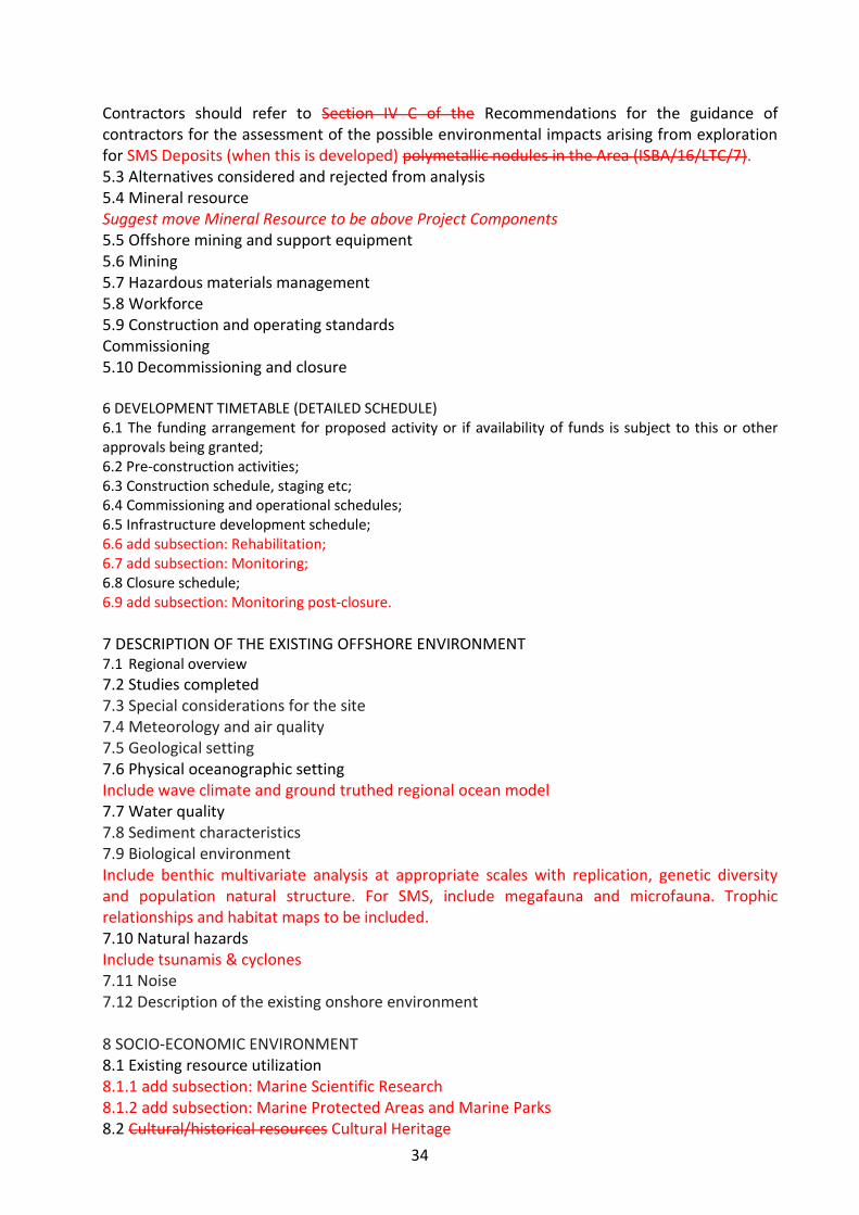
34
Contractors should refer to Section IV C of the Recommendations for the guidance of contractors for the assessment of the possible environmental impacts arising from exploration for SMS Deposits (when this is developed) polymetallic nodules in the Area (ISBA/16/LTC/7). 5.3 Alternatives considered and rejected from analysis 5.4 Mineral resource Suggest move Mineral Resource to be above Project Components 5.5 Offshore mining and support equipment 5.6 Mining 5.7 Hazardous materials management 5.8 Workforce 5.9 Construction and operating standards Commissioning 5.10 Decommissioning and closure 6 DEVELOPMENT TIMETABLE (DETAILED SCHEDULE) 6.1 The funding arrangement for proposed activity or if availability of funds is subject to this or other approvals being granted; 6.2 Pre-construction activities; 6.3 Construction schedule, staging etc; 6.4 Commissioning and operational schedules; 6.5 Infrastructure development schedule; 6.6 add subsection: Rehabilitation; 6.7 add subsection: Monitoring; 6.8 Closure schedule; 6.9 add subsection: Monitoring post-closure.
7 DESCRIPTION OF THE EXISTING OFFSHORE ENVIRONMENT 7.1 Regional overview
7.2 Studies completed 7.3 Special considerations for the site 7.4 Meteorology and air quality 7.5 Geological setting 7.6 Physical oceanographic setting Include wave climate and ground truthed regional ocean model 7.7 Water quality 7.8 Sediment characteristics 7.9 Biological environment Include benthic multivariate analysis at appropriate scales with replication, genetic diversity and population natural structure. For SMS, include megafauna and microfauna. Trophic relationships and habitat maps to be included. 7.10 Natural hazards Include tsunamis & cyclones 7.11 Noise 7.12 Description of the existing onshore environment 8 SOCIO-ECONOMIC ENVIRONMENT 8.1 Existing resource utilization 8.1.1 add subsection: Marine Scientific Research 8.1.2 add subsection: Marine Protected Areas and Marine Parks 8.2 Cultural/historical resources Cultural Heritage
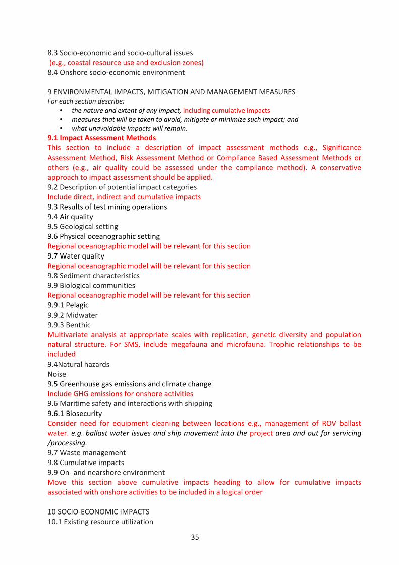
35
8.3 Socio-economic and socio-cultural issues (e.g., coastal resource use and exclusion zones) 8.4 Onshore socio-economic environment 9 ENVIRONMENTAL IMPACTS, MITIGATION AND MANAGEMENT MEASURES For each section describe:
• the nature and extent of any impact, including cumulative impacts • measures that will be taken to avoid, mitigate or minimize such impact; and • what unavoidable impacts will remain.
9.1 Impact Assessment Methods This section to include a description of impact assessment methods e.g., Significance Assessment Method, Risk Assessment Method or Compliance Based Assessment Methods or others (e.g., air quality could be assessed under the compliance method). A conservative approach to impact assessment should be applied. 9.2 Description of potential impact categories Include direct, indirect and cumulative impacts 9.3 Results of test mining operations 9.4 Air quality 9.5 Geological setting 9.6 Physical oceanographic setting Regional oceanographic model will be relevant for this section 9.7 Water quality Regional oceanographic model will be relevant for this section 9.8 Sediment characteristics 9.9 Biological communities Regional oceanographic model will be relevant for this section 9.9.1 Pelagic 9.9.2 Midwater 9.9.3 Benthic Multivariate analysis at appropriate scales with replication, genetic diversity and population natural structure. For SMS, include megafauna and microfauna. Trophic relationships to be included 9.4Natural hazards Noise 9.5 Greenhouse gas emissions and climate change Include GHG emissions for onshore activities 9.6 Maritime safety and interactions with shipping 9.6.1 Biosecurity Consider need for equipment cleaning between locations e.g., management of ROV ballast water. e.g. ballast water issues and ship movement into the project area and out for servicing /processing. 9.7 Waste management 9.8 Cumulative impacts 9.9 On- and nearshore environment Move this section above cumulative impacts heading to allow for cumulative impacts associated with onshore activities to be included in a logical order 10 SOCIO-ECONOMIC IMPACTS 10.1 Existing resource utilization
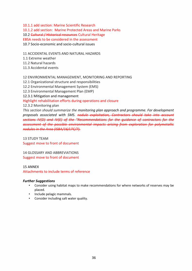
36
10.1.1 add section: Marine Scientific Research 10.1.2 add section: Marine Protected Areas and Marine Parks 10.2 Cultural / Historical resources Cultural Heritage EBSA needs to be considered in the assessment 10.7 Socio-economic and socio-cultural issues 11 ACCIDENTAL EVENTS AND NATURAL HAZARDS 1.1 Extreme weather 11.2 Natural hazards 11.3 Accidental events 12 ENVIRONMENTAL MANAGEMENT, MONITORING AND REPORTING 12.1 Organizational structure and responsibilities 12.2 Environmental Management System (EMS) 12.3 Environmental Management Plan (EMP) 12.3.1 Mitigation and management Highlight rehabilitation efforts during operations and closure 12.3.2 Monitoring plan This section should summarize the monitoring plan approach and programme. For development proposals associated with SMS. nodule exploitation, Contractors should take into account sections IV(D) and IV(E) of the “Recommendations for the guidance of contractors for the assessment of the possible environmental impacts arising from exploration for polymetallic nodules in the Area (ISBA/16/LTC/7). 13 STUDY TEAM Suggest move to front of document 14 GLOSSARY AND ABBREVIATIONS Suggest move to front of document 15 ANNEX Attachments to include terms of reference Further Suggestions
• Consider using habitat maps to make recommendations for where networks of reserves may be placed.
• Include pelagic mammals. • Consider including salt water quality.
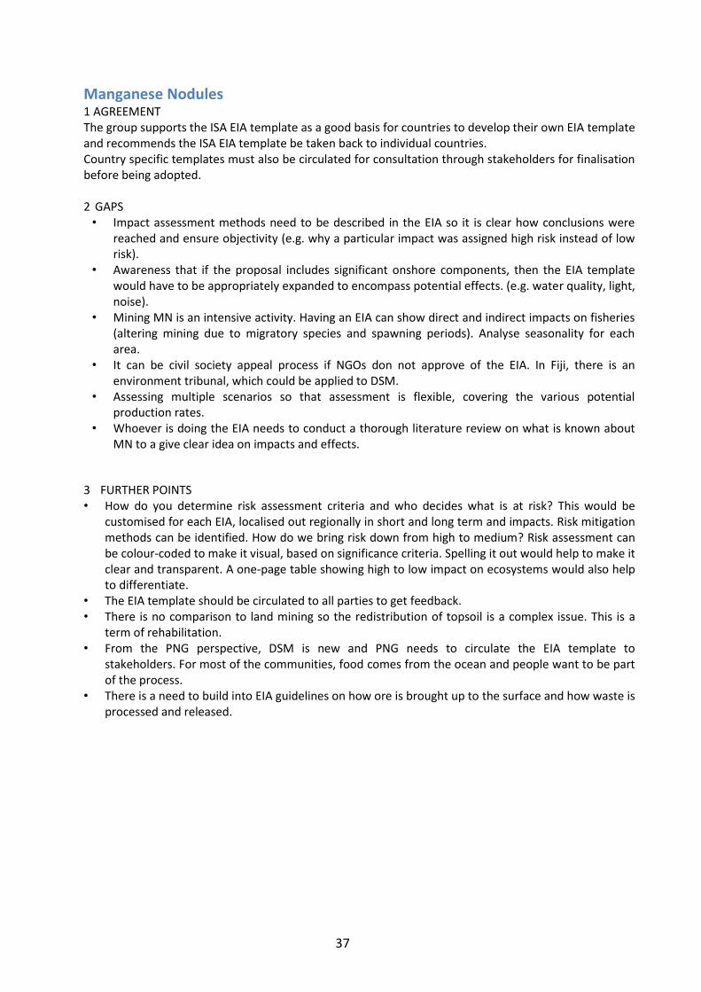
37
Manganese Nodules 1 AGREEMENT The group supports the ISA EIA template as a good basis for countries to develop their own EIA template and recommends the ISA EIA template be taken back to individual countries. Country specific templates must also be circulated for consultation through stakeholders for finalisation before being adopted.
2 GAPS • Impact assessment methods need to be described in the EIA so it is clear how conclusions were
reached and ensure objectivity (e.g. why a particular impact was assigned high risk instead of low risk).
• Awareness that if the proposal includes significant onshore components, then the EIA template would have to be appropriately expanded to encompass potential effects. (e.g. water quality, light, noise).
• Mining MN is an intensive activity. Having an EIA can show direct and indirect impacts on fisheries (altering mining due to migratory species and spawning periods). Analyse seasonality for each area.
• It can be civil society appeal process if NGOs don not approve of the EIA. In Fiji, there is an environment tribunal, which could be applied to DSM.
• Assessing multiple scenarios so that assessment is flexible, covering the various potential production rates.
• Whoever is doing the EIA needs to conduct a thorough literature review on what is known about MN to a give clear idea on impacts and effects.
3 FURTHER POINTS • How do you determine risk assessment criteria and who decides what is at risk? This would be
customised for each EIA, localised out regionally in short and long term and impacts. Risk mitigation methods can be identified. How do we bring risk down from high to medium? Risk assessment can be colour-coded to make it visual, based on significance criteria. Spelling it out would help to make it clear and transparent. A one-page table showing high to low impact on ecosystems would also help to differentiate.
• The EIA template should be circulated to all parties to get feedback. • There is no comparison to land mining so the redistribution of topsoil is a complex issue. This is a
term of rehabilitation. • From the PNG perspective, DSM is new and PNG needs to circulate the EIA template to
stakeholders. For most of the communities, food comes from the ocean and people want to be part of the process.
• There is a need to build into EIA guidelines on how ore is brought up to the surface and how waste is processed and released.

38
Cobalt-Rich Crusts 1 EXECUTIVE SUMMARY 2 INTRODUCTION
Scope of the environmental assessment – what is included, what is not based on earlier assessments or work. Link to other supporting documentation.
Includes background on what is being applied for – the overall mining activity, the area, activity, etc.
The format (i.e. structure) of the EIA document – especially for larger projects where there is a lot of detail (in line with EEZ Act requirements for EIAs to be appropriate to scale and significance of the project).
A short summary to reflect consultation and who have been consulted will be summarized in chapter 5.
3 POLICY, LEGAL AND ADMINISTRATIVE FRAMEWORK 4 STAKEHOLDER CONSULTATIONS Note: Option for countries to move this section to section 5 ‘Description of proposed
development’.
5 DESCRIPTION OF THE PROPOSED DEVELOPMENT 5.1 add section: Project purpose and need. Include (type of mineral resources, why the operations is needed, and background to the project, including aspects of the discovery of resources, development of techniques etc.) 5.2 Project area definition 5.2.1 Location Include co-ordinates of project area, Map with boundaries (and how boundaries expect to change with time) and any closed/exclusion areas 5.3 Project components 5.3.1 add section: Project duration and phasing Overall life of project, duration of different operational phases (timeline) for mobilisation to decommissioning 5.3.2 add section: Project scale Spatial scale of the operation, including how it evolves through time, include volumes of material extracted, processed, deposited etc., as well as area 5.4 Alternatives considered and rejected from analysis 5.6 Mineral resource 5.7 Offshore mining and support equipment Describes any equipment needed for support (e.g., tender, supply vessels, barges), includes materials handling in hazardous materials. Describe frequency of vessel movements for support, supply, barge removal etc. 5.8 5.7.1 Mining Make subsection of 5.7 Methods of extraction (dredging, coring, …), processing operation (on-site/off-site operations, transport of material off-site, waste disposal – including hazardous waste). A schematic diagram should be included of the key components of the operation. 5.7 Hazardous materials management Make subsection of 5.7 5.8 Workforce

39
Make subsection of 5.7 5.9 Construction and operating standards Make subsection of 5.7 5.10 Commissioning Make subsection of 5.7 5.11 Decommissioning and closure Make subsection of 5.7 6 DEVELOPMENT TIMETABLE (DETAILED SCHEDULE)
Not separated out as separate section but included in section 5. 7 DESCRIPTION OF THE EXISTING OFFSHORE PHYSICAL ENVIRONMENT 7.1 add section: Key messages Overview of key content covered in this section (this is a box with up to 6 bullet points of the main aspects covered, or the main findings) 7.2 Regional overview General regional context (includes map). Include site specific issues and characteristics, particularly sensitive environments. This is a brief section, but provides the broader scale context for the more detailed site-specific description below 7.3 Studies completed 7.4 Special considerations for the site 7.5 Meteorology and air quality General overview of climatology, e.g. wind directions and speeds, seasonal patterns. This
section may be most relevant to surface operations
7.6 Geological setting Describe in detail the nature and extend of Cobalt-Rich Crusts including their thickness and
aerial extend on the seamounts
7.7 Physical oceanographic setting Detail is required on changes with depth (near field and far field) within the vicinity and away at
least 10 kilometres from the seamounts
7.8 Water quality Describe water mass characteristics at the site at various depths, including nutrients, particle
loads, temperature and dissolved gas profiles, geochemistry (chemical composition) etc.
7.9 Seabed sediment characteristics 7.10 Biological environment Removed to its own section 7.11 Natural hazards 7.12 Noise 7.13 Description of the existing onshore environment Removed to its own section 7.14 add section: Summary of existing physical environment Bring together key findings e.g. any sensitive environments or highly valued areas. This will be up to a page, and more extensive than the Key messages in the first section. 8 New section: DESCRIPTION OF EXISTING BIOLOGICAL ENVIRONMENT The format of this could be handled in many different ways. However, it is useful to structure it by depth as this reflects the likely division of impacts in the 3 main areas of the water column. It is the approach taken by the ISA.

40
8.1 Key messages Overview of key content covered in this section (this is a box with up to 6 bullet points of the
main aspects covered, or the main findings)
8.2 Regional Overview
General regional context. Include site specific issues and characteristics, particularly sensitive
environments. Existing conservation areas, protected species etc. Reference to previous studies
will be helpful. This is a brief section, but provides the broader scale context for the more
detailed site-specific description below.
8.3 Biological communities
• From the surface down to 200m -this includes plankton (phytoplankton and zooplankton), surface/near surface fish such as tunas, also seabirds and marine mammals
• Open water from a depth of 200m down to 50m from the seafloor and includes zooplankton, mesopelagic and bathypelagic fishes, deep-diving mammals
• Benthic invertebrate and fish communities, including infauna and demersal fish up to a distance of 50m above the sea floor.
In this template review, we suggest to structure by animal group, but still expect a description of depth so that impacts on the surface, midwater and near seafloor can be determined. 8.3.1 Planktons (Phytoplankton, zooplankton) 8.3.2 Mesopelagic fauna (fish, squids, macrozooplankton) 8.3.3 Fish (assemblages, pelagic, demersal) 8.3.4 Marine mammals (Cetaceans, pinniped, turtles) 8.3.5 Seabirds 8.3.6 Benthic invertebrates 8.4 Summary of existing biological environment Bring together key findings, e.g. any sensitive environments or highly valued areas. This will be
up to a page, and more extensive than the Key messages in the first section.
9 DESCRIPTION OF EXISTING ONSHORE ENVIRONMENT Describe the conditions of the area where onshore processing operations will be located, as
well as any relevant environmental information on transit lanes/areas/zones. With available
land, as in the case of smaller countries, it is important to have the whole operation described
in this section; how often shipment, traffic, onshore environment and issues on Biosecurity and
MARPOL (Marine Pollution Agreement) and other agreements, to include any activity related to
offshore mining, stockpile, mineral processing, set up base operations locally, etc.
10 DESCRIPTION OF EXISTING SOCIO-ECONOMIC ENVIRONMENT 10.1 add section: Key messages Overview of key content covered in this section within national jurisdiction
10.2 Existing resource utilization uses 10.2.1 Fisheries If the project area occurs within an area used by fisheries, then this needs to be described here – deep sea snapper, blue nose, alfonsinos) 10.2.2 add section: Tourism This section describes marine cruise liners, game fishing, trawling and tourism activities
10.2.3 Other

41
Other uses of the project area not related to fisheries or marine traffic (e.g. recreational
activities (sailing, diving, big game fishing), telecommunications cables, other mineral
exploitation projects (oil and gas), other minerals, etc.)
10.3 Cultural historical resources Environment 10.4 add section: Historic resources 10.5 Socio-economic and socio-cultural issues Adjacent coastal communities’ regional demographic and economies
10.6 add section: Summary of existing socio-cultural environment Bring together key findings e.g. any existing interests
11 New section: ASSESSMENT OF IMPACTS ON PHYSICAL ENVIRONMENT AND PROPOSED MITIGATION MEASURES Insert similar wording to section 12 plus: This may need to consider effects that may happen during construction/development (pre-commissioning), operational, and decommissioning phases, as well as the potential for accidental events. 11.1 Key messages 11.2 Identification of threats Summarise the results of a previous Ecological Risk Assessment. This is expected to be a
separate report, with only the summary provided here to highlight the major issues of concern.
The ERA identifies the key parts of the project that have potential to impact the existing
environment. The detail is in the associated ERA, and this frees the EIA to focus on the main
impacts and not have a lot of detailed description of minor effects.
11.3 Meteorology and air quality
11.4 geological setting
11.5 physical oceanographic setting
11.6 Water quality
11.7 Seabed sediment characteristics
11.8 Natural hazards Are there any impacts of the operation on natural hazards (any chance of increasing
earthquake risk, or volcanic activity)? Are there any impacts of regular natural events on the
operation of the mining, and plans for these hazards?
11.9 Noise 11.10 Greenhouse gas emissions and climate change 11.11 Maritime safety and interactions with shipping 11.12 Waste management 11.13 Cumulative impacts 9.9 On- and nearshore environment Separate out into new section (section 12) 11.14 Summary of residual effects
11 New section: ASSESSMENT OF IMPACTS ON BIOLOGICAL ENVIRONMENT AND PROPOSED MITIGATION MEASURES This section will be structured to focus on aspects of greatest risks to the biological environment. Before EIA is written, an ecological risk assessment (ERA) should be carried out, which will evaluate the likelihood and consequences of the mining operation having an impact on the biological environment. This means the EIA will describe in greater detail the main

42
impacts on the biological environment and not elements of minor risks (e.g. sediment plume affecting phytoplanktons on surface water). 11.1 Key Messages
11.2 Identification of threats As per 11.2
11.3 Planktons (Phytoplankton, zooplankton) 11.4 Mesopelagic fauna (fish, squids, macrozooplankton) 11.5 Fish (assemblages, pelagic, demersal) 11.6 Marine mammals (Cetaceans, pinniped, turtles) 11.7 Seabirds 11.8 Benthic invertebrates 11.9 Other issues Outline where there are other more general issues, such as maritime safety, biosecurity, waste
management, etc.; aspects of existing conservation areas, management plans, etc. Cumulative
impacts: where there are multiple uses, hazards, etc.
11.10 Summary of existing biological environment A table may be a useful summary format.
12 New section: ASSESSMENT OF IMPACTS ON THE ONSHORE ENVIRONMENT AND PROPOSED
MITIGATION
Separate out this section from section 10
13 ASSESSMENT OF IMPACTS ON SOCIO-ECONOMIC IMPACTS ENVIRONMENT AND PROPOSED
MITIGATION
13.1 Key messages
13.2 Existing resource utilisation uses
13.3 Cultural/Historic resources environment
13.4 new section: Historic resources
13.5 Socio-economic and socio-cultural issues description
13.6 new section: Summary of residual effects
14 ACCIDENTAL EVENTS AND NATURAL HAZARDS 14.1 Extreme weather 14.2 Natural hazards 14.3 Accidental events
15 ENVIRONMENTAL MANAGEMENT, MONITORING AND REPORTING 15.1 Organizational structure and responsibilities 15.2 Environmental Management System (EMS) 15.3 Environmental Management Plan (EMP) 15.3.1 Mitigation and management 15.3.2 Monitoring plan
16 new section: REFERENCES This section should provide details of reference materials used in sourcing information and/or
data used in the Environmental Impact Statement.
43
13 STUDY TEAM 14 GLOSSARY AND ABBREVIATIONS 15 ANNEX APPENDICES Include technical reports carried out for parts of EIA (e.g. the ERA, other important studies,
such as sediment plume modelling, ecotoxicity research)

44
8. Objective 4: To Assess Regional Issues. Strategic Environmental Assessment Process that we need to undertake at the regional and national level 1 General Principals
• SEAs should be subject to review • Countries should be firmly committed • All countries should seriously consider conducting SEA on a national level before any
DSM activities take place • SEA should include inputs from all relevant stakeholders • SEA can help influence good decision making • SEA will set standards and thresholds for DSM activity.
2 National Level • Country needs to first agree to undertake SEA • Identify competent authority (create new or use existing one)
- SEAs should be recognised in national policies - Review existing legislation/policies - Ensure there is a Legal framework for DSM that incorporates SEA requirements
at national level (and EIA) • Need close collaboration between minerals departments and environment departments
and relevant stakeholders - Create working group consisting of all relevant stakeholders
• Awareness of SEA needed - May seek assistance from SPC/SPREP - Workshops to inform stakeholders
• Formulation of SEA - Look at framework and capacity for carrying out SEA - Identify opportunities and options for how SEA can be incorporated/
implemented - Transboundary issues consideration - Research, including any baseline studies - Spatial planning
• Institutional capacity building should be considered parallel to SEA guideline formulation
3 Regional Level
• Region to recognize the need to have a regional SEA – Commitment from leaders – Information is needed to inform this
• Initial Workshop – To determine if SEA for region should be pursued (This could inform regional
leaders) • Work on legal framework • Can learn from EU experience in SEAs for assistance on creating DSM • Will need to be coordinated by the CROP agencies
4 Proposal for an institutional arrangement that can help coordinate SEA in the region

45
• Need a unit that is recognized by countries, Council of Regional Organizations in the Pacific (CROP), academic community
• Will sit in a CROP agency and will facilitate the discussions/meetings on SEA • Roles of unit:
– Research – Facilitate input – Look at outcomes of meetings and see how we can realistically implement
outcomes 5 Limitations
• Sharing of information • Transboundary issues • Institutional Capacity
Working Group Members Mr Lowell Alik (RMI) – Environmental Protection Agency Mr Tom Dettweiler (USA) - Odyssey Marine Exploration Ms Eleni Tokaduadua (Fiji) - Department of Environment Ms Alex Herman (Cook Islands) - Seabed Minerals Authority Ms Gretel Orake (PNG) - Minerals Resources Authority Ms Marii Marae (Kirabati) - Environment and Conservation Division Ms Ferila Brown (Samoa) - Ministry of Natural Resources & Environment Ms Moe Saitala (Tuvalu) - Department of Environment Mr Willie Atu (Solomon Islands) - The Nature Conservation Mr Apete Soro (Fiji) – Mineral Resources Department Ms Alison Swaddling (Fiji) - SPC Mr Tepa Suaesi – (Samoa) SPREP
46
Marine Spatial Planning Summary of Key Outcomes 1 Current efforts and potential of integrated marine planning:
• Specific relevance to DSM, currently being developed at sub island scale (e.g. Fiji), island group scale (e.g. Tonga) and significant portion of EEZ (e.g. Cook Islands) (and recognise many other efforts in the region, particularly inshore).
• Provides a clear identification of critical knowledge gaps and needs so a targeted effort can be made to fill these data needs.
• Marine Spatial Planning outputs can be used explicitly for assessment of cost benefit analyses of actions and resource uses, supporting decision making in regard to location and prioritization of DSM mining.
• Essential for marine spatial planning to start with engagement from multiple sectors, multiple governance levels and civil society.
2 What can SPREP/SOPAC/DSM project provide?
• Develop information to communicate Marine Spatial Planning explanation, context, aim and mechanism – how it can support multiple sector planning.
• Look for opportunities for joint CROP support in terms of marine management, and responding to requests for multi CROP agency support to assist in the cross sectoral discussion for integrated marine planning (marine spatial planning) – access through Marine Sector Working Group.
• Mechanisms and direction on linkages between multiple data types held by different CROP agencies, countries and contractors – framework and guidelines for sharing in order to build increased regional knowledge over time.
3 Sustainability and Implementation:
• Sustainable integrated marine planning process requires the linking of community management processes with national legislative process and international commitments.
• Sustainable integrated marine management requires committed staff to carry out and continue the marine spatial planning process, and provide training and capacity building to ensure continuation of effort and continuity over time.
Notes in Full from Discussion: 4 How might it be useful? Wallis and Futuna: working to establish PGEM status for lagoon, including traditional management, mapping lagoon. New project INTEGRE integrated management of coastal zone, considering land impacts.
Tonga: National hosting for GEF grant, community management areas for fisheries and conservation. Establishing a ‘green hub’ but close to area of DSM resources. Need for ridge to reef planning. Can marry to government urban management plan. Managing historical areas on land and linking terrestrial and marine. Starting with Ha’apai group as the conservation hub where fisheries legislation can be enforced for special management areas. Multiple processes driving the process – with SMA process, so driven by Civil Society and has linked to fisheries act – then engaging to the national government process for sustainability. Strong engagement with community.
Fiji: WCS – developing a marine protected area between two main islands, in collaboration with Environment Department, develop institutional framework. Liaise with mining, tourism and fishing industries. Have carried out some community based workshops. Working to common aims of growing economy while keeping environment intact. Batua seascape. Considering buffer area for mining (150km) the mining deposits are not within the planning area, however is less than 150km away – so mining industry needs to additionally be engaged in the process. Also need to consider migratory species.

47
Cook Islands: - have used marine spatial planning for climate change predictions. Using Seasketch has been used in California and Haraki Gulf. Have integrated with programs to deliver computers to outer islands, so that Seasketch has been installed on those computers and being used through schools as well.
SOPAC: developing marine minerals database – and access point in relation to policy, where surveys have been taken. Aim to have up and running by early 2014.
Fiji Law Society: provides input and advice in implementation of environmental law - over 50 pieces of legislation that has some environmental relevance. For example offshore fisheries decree from 2012 that may have implications for offshore DSM activities. How to improve communications between different stakeholders and resource users. Work closely with CTI. Strengthening coastal management and fisheries. Fiji is developing Protected Areas legislation, and conceptualizing work towards a Marine Spatial Planning Act (proposed by WCS).
5 How can it be applied in a national context? What is the process – engaging all stake holders around the table and having key data layers, looking for areas of clear resource designation and identify areas that have multiple potential uses, to engage conversations of which is the priority use for an area and how that may link or coordinate with other resource uses. Currently being developed at sub island scale (eg Fiji), island group scale (eg Tonga) and significant portion of EEZ (eg Cook Islands). 6 What can SPREP/SOPAC/DSM project provide to support? SPREP support to MSP process for identified target island group (Tonga: Ha’apai Group)
Develop information to communicate Marine Spatial Planning explanation, context, aim and mechanism.
Provide training and support to MSP team (2 staff) and look at other mechanisms, such as having them attend workshops or work with AAMP in New Caledonia.
Look for opportunities for joint CROP support in terms of marine management, and responding to requests for multi CROP agency support to assist in the cross pectoral discussion for integrated marine planning (marine spatial planning).
Provide information on timescale of potential development of DSM mining and potential return, so can be balanced with investment by countries in preparation for potential mining.
7 How can the resulting plans be implemented? Sustainability for an integrated marine planning process needs the linking of community
management processes with national legislative processes and international commitments.
Sustainability needs committed staff to carry out and continue the marine spatial planning process, and have those positions institutionalized to ensure the continuation of effort and continuity over time.
Cook Islands has Deep Sea Mineral Authority, NES, MMR, community and traditional leaders – lessons learned.
Participants: Mrs Anne Littaye (New Caledonia) – PACIOCEA Mr Atoloto Molau (Wallis Futuna) – Environment Department Ms Laisa Vereti (Fiji) -Pacific Islands Association of NGOs Ms Pelenatita Kara (Tonga) – Civil Society Forum of Tonga Mr Manoa Malani (Fiji) - World Conservation Society Ms Elizabeth W. Koteca (Cook Islands) – Office of the Prime Minister Ms Kiji Vukikomoala (Fiji) - Environmental Law Association Dr John Luick (Australia) - SARDI Ms Vira Atalifo (Fiji) – SPC

48
Dr Tim Carruthers (Samoa) - SPREP

49
Regional Cooperation 1 SUMMARY OF KEY OUTCOMES 1.1 Significant reasons in favour of strengthening regional coordination were identified. 1.2 It is noted that SOPAC Division was tasked by its member countries at the last annual meeting to
develop an ‘options paper’ to explore different models of regional cooperation for DSM management. It is recommended that this work proceed, but that SOPAC include a wider group of interested stakeholders in developing that paper.
1.3 It is recommended to set-up an open-ended working group (including stakeholders already engaged with SOPAC Division’s DSM Project, and others). This could be done under the Forum, or via existing initiatives, e.g. the Marine Sector Working Group.
2 REASONS IN FAVOUR OF STRONGER REGIONAL COORDINATION 2.1 The following reasons in favour of stronger regional coordination were identified: 2.2 Increased influence on the international stage (e.g. ISA). 2.3 Minimum standards for environmental protection measures being upheld across the region. 2.4 Set commercial/financial terms, to avoid ‘powerful’ companies playing countries off against each
other, and driving down royalty rates (as has been observed with on-land mining, e.g. in Australia.)
2.5 A harmonised regime across the region will provide a secure, familiar and certain regime for companies, which will make the Pacific EEZs a more attractive operating and investment environment.
2.6 Individual Governments have limited resources and could not be expected each to have a DSM specialist geologist, biologist, lawyer, economist, etc. in-country, and it is unlikely there would be enough demand in one country to have these staff full-time. Pooling resources on a regional level will enable Governments to draw upon a team of relevant experts (e.g. to conduct/review EIAs) and, if serving all countries in the region, full-time staff can be retained.
2.7 Using a regional resource for DSM work will retain within the region the knowledge garnered from one DSM operation, and this learning can inform another country’s work. This will not happen if individual countries hire external consultants.
2.8 Government can be assured that a regional team of technical experts working for an intergovernmental agency is independent and impartial and working in the countries’ best interests.
2.9 There is possibility of transboundary DSM operations, where deposits straddle national maritime borders, or are located in sites subject to shared extended continental shelf claims. Companies are unlikely to invest in such projects if they have to navigate two entirely different regulatory systems, and without assurance that the countries are managing the site cooperatively.
2.10 Marine spatial planning and strategic environment assessment on a regional scale would be facilitated.
2.11 Managing transboundary impacts, impacts on migratory species, or cumulative impacts where different DSM sites are located close to each other but in different national jurisdictions, would be easier.
2.12 If exploration cruises can move easily across national maritime boundaries without undue bureaucracy, then more than one country can be covered in one cruise.
2.13 Pacific Islands share priorities and vulnerabilities (e.g. climate change). The inter-relation between DSM and other priority areas can be managed more holistically on a regional level, and with countries sharing their experiences.
2.14 Implementation of the Regional Legislative and Regulatory Framework (RLRF) and agreed common standards can be monitored and reviewed on a regional basis.
2.15 DSM is not a standalone issue. Having a centralised body for the region will assist DSM work across the region to feed into wider environmental management initiatives.
2.16 A regional body can hold, analyse, and share (as appropriate) geological and environmental data for the region’s benefit. Environmental data, gathered from research in one country’s marine space, can inform another country’s environmental management and planning.

50
2.17 Regional cooperation could assist in case of disputes with companies. 3 SUGGESTIONS OF OPTIONS FOR WHAT THE COORDINATION WOULD COMPRISE 3.1 We can learn from the Forum Fisheries Agency (FFA) and Parties to the Naru Agreement (PNA)
experiences, which have seen parties that share common benefits from fisheries, cooperating to dictate process, minimum terms and conditions, conservation measures, and pricing on a regional level. This has led to increased national benefits, and enhanced regional voice at the international level.
3.2 The ISA set-up could also be a useful model for a regional arrangement. 3.3 There is potential for the regional cooperation to include four different areas: (i) policy, (ii) legal,
(iii) technical support, and (iv) commercial relations. 3.4 The regional approach should also encompass fiscal considerations: realistic financial modelling of
the resource potential, how to calculate likely profits/costs, how to design a tax/royalty regime, and financial management standards, like the Extractive Industry Transparency Initiative.
3.5 A regional agreement, setting high-level common understandings and standards would be a good first step and may be easy to achieve, given wording already included in the Pacific Plan, Leaders’ Communiques, and the RLRF on this subject.
3.6 This could be done by way of a protocol to the Noumea Convention: an important first step would be to encourage more countries to sign up to the Convention that already contains Articles on preventing pollution from seabed exploration and exploitation, and EIA requirements.
3.7 More detail, e.g. setting up institutions, or deciding on the content of regional template application forms, licences, EIA templates, etc. can follow.
3.8 Types of common conditions that could be included in the regionally agreed terms/conditions for DSM activities would include the regulatory terms described in the RLRF, e.g. minimum technical and financial qualifications for contractors, when an EIA is triggered and what it must include, requirement to pay an environmental bond, biodiversity off-setting, corporate social responsibility provisions (e.g. capacity-building or community investment), transparency mechanism, etc.
3.9 An agreement could also formalise stakeholder engagement provisions, and public participation mechanisms.
3.10 A new secretariat body could be formed (like the PNA), existing agencies could be used (e.g. SOPAC) or existing structures could be modified (e.g. the Marine Sector Working Group, which is responsible for Pacific Oceanscape framework implementation) could be formalised into a Marine Council).
3.11 A regional body could provide regulatory services to individual Governments e.g. receiving licensing applications, reviewing EIA reports, reviewing annual performance reports, monitoring operations, carrying out inspections.
3.12 A regional body could run an observer/inspector training programme, so there is a pool of independent observers countries can call upon.
3.13 A regional body can work with the ISA and DSM companies to secure capacity-building and training opportunities for Pacific Island nationals.
4 HOW TO MOVE FORWARD 4.1 SOPAC Division DSM Project has been a very useful project, and has brought the countries into
contact with each other. The DSM Project will end in two years’ time. The countries should continue to strengthen the relationship, and will need funding to do so. Governments should highlight this as a priority, and should include the proposal of strengthened regional DSM collaboration in discussions about funding options (e.g. EU EDF 11).
4.2 Any regional initiative must fit within the Pacific Plan. To date, the Pacific Plan has included regional cooperation with regards to the regulation of DSM activities. The Leaders in 2012 endorsed the RLRF and recommended its use by the region. The Leaders will meet in April to consider 36 recommendations to re-draft the Pacific Plan, to focus on collaboration, integration and coordination. This includes changing the name to ‘Framework for Pacific Regionalism’. It is

51
important to ensure that these outcomes are fed into the Leaders’ discussions and the Pacific Plan; and also the CRGA meeting next year.
4.3 The relevant processes, legal and financial implications need to be presented and discussed by Leaders and by regional agencies.
4.4 SOPAC Division was tasked by its member countries at the last annual meeting to develop an ‘options paper’ to explore different models of regional cooperation for DSM management. It is recommended that this work proceed, but that SOPAC include a wider group of interested stakeholders in developing that paper.
4.5 It is suggested to set-up an open-ended working group (including stakeholders already engaged with SOPAC Division’s DSM Project (e.g. like Pacific Island Forum Secretariat), and others, e.g. University of the South Pacific, South Pacific Tourism Organisation). This could be done under the Forum, or via existing initiatives, e.g. the Marine Sector Working Group.
4.6 As well as the Pacific Plan, there are a number of existing initiatives and treaties that have relevance to DSM (e.g. Pacific Island Regional Ocean Policy and Oceanscape; the Noumea Convention), which are summarised in the RLRF. These should be taken into account in developing the options paper.
4.7 The PNA has developed a paper on the subject, which was presented to the Pacific Plan review team. This should be taken into account.
4.8 It was acknowledged that not all Pacific Island countries and territories are signatories to the Noumea Convention, nor members of the SOPAC Division DSM Project, so it will be important to move forward via a network with the full membership (e.g. SPC).
4.9 Pacific Island countries should attend the ISA annual meeting, and should participate in the pre-meeting preparatory workshop to be convened by the SOPAC Division DSM Project.
WORKING GROUP MEMBERS Ms Teina Mackenzie (Cook Islands) - TIS Ms Nannette Malsol (Palau) - Ministry of Natural Resources, Environment and Tourism H.E. Mr Gerson Jackson (FSM) - Embassy of the Federated States of Micronesia Mr Charles Roche (Australia) - Mineral Policy Institute Mr Netani Sukanaivalu (Fiji) - Neptune Minerals Ms Teporea Toliniu Lavatai (American Samoa) - Department of Marine and Wildlife Resources Mr Michael Perez (Tokelau) - Department of Economic Development, Natural Resources & Environment Ms Hannah Lily (Fiji) - SPC Mr Clark Peteru (Samoa) - SPREP Mr Stuart Chape (Samoa) - SPREP Ms Seni Nabou (Fiji) - Greenpeace – participating without prejudice to Greenpeace’s position on seabed mining Ms Helen Rosenbaum (Australia) - DSM Campaign – joining the group as an observer

52
9. Objective 5: Launch of the SPC-UNEP/GRID-Arendal Deep Sea Minerals Report
The SPC-EU DSM Project launched the Pacific Marine Minerals Assessment Report at the workshop. This publication, prepared in partnership with UNEP Grid-Arendal, provides a synthesis and review of existing knowledge and information on DSM and is targeting a broad range of audience. It is also designed as a tool for managers and national experts who are engaged in developing national legislation, policy, technical and environmental guidelines and strategies related to various aspects of DSM. The Report series was guided and supported by a technical Steering Committee, comprising some 60 world-renowned experts, as well as representatives of the SPC-EU DSM Project and key stakeholders in the region. Volume 1, split into three sections, examines the geology and associated biology of the three principal DSM deposit types found in the Pacific Region; A) Seafloor Massive Sulphides, B) Manganese Nodules, and C) Cobalt-Rich Ferromanganese Crusts, and the environmental and technical aspects related to DSM extraction. Volume 2 provides a green economy context for examining how deep sea mining could be profitable, sustainable and meet the needs of Pacific Island countries without sacrificing cultural heritage, community values or the health of ocean ecosystems. The work of the DSM Project has helped generate important questions for countries to consider: Can minerals be extracted without significantly affecting environmental sustainability, marine life, and local communities? Can revenue support long-term development goals? Is it a good idea to start a new industry when exploitation of other resources has unsolved problems? This report series collates information to help find ways to answer these questions. To access these volumes please visit: http://www.sopac.org/dsm/index.php/publications-and-reports
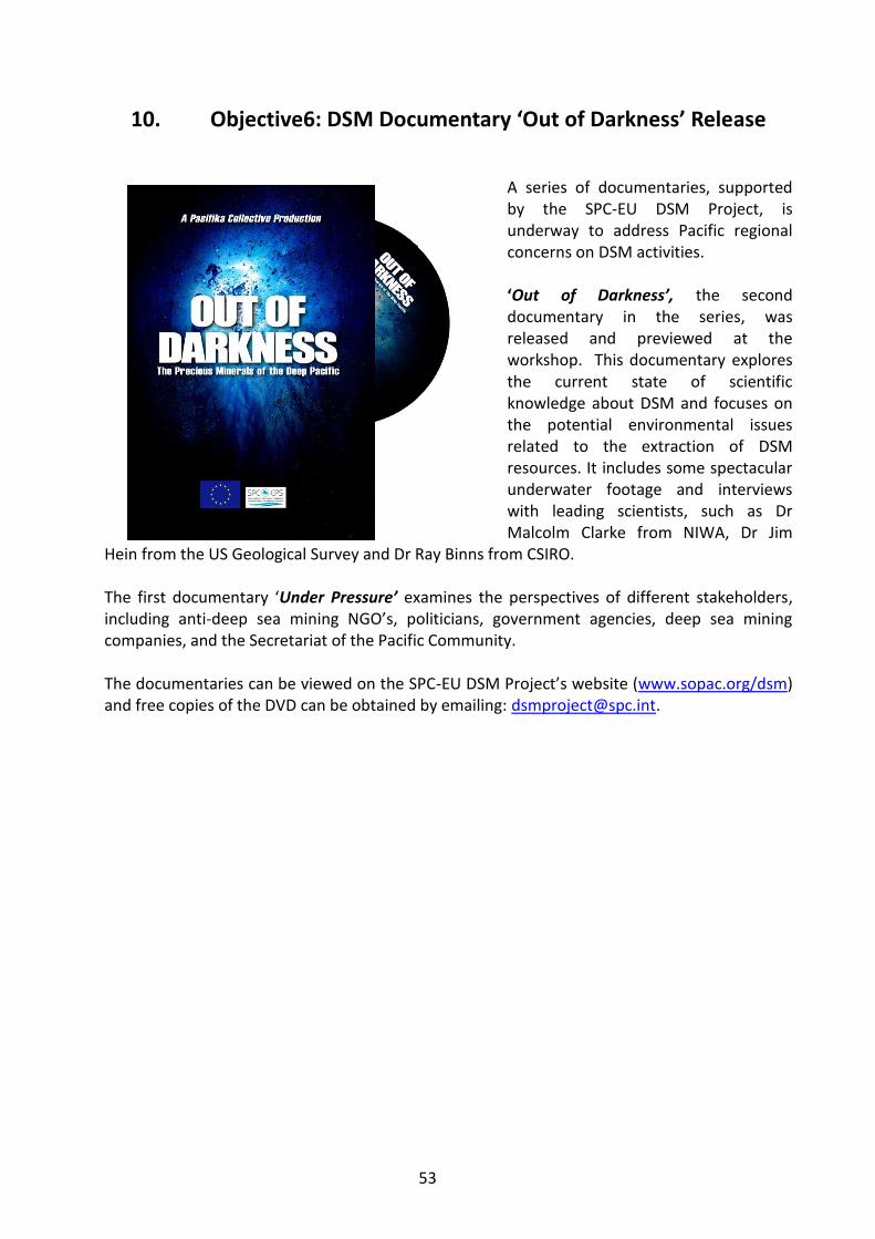
53
10. Objective6: DSM Documentary ‘Out of Darkness’ Release
A series of documentaries, supported by the SPC-EU DSM Project, is underway to address Pacific regional concerns on DSM activities. ‘Out of Darkness’, the second documentary in the series, was released and previewed at the workshop. This documentary explores the current state of scientific knowledge about DSM and focuses on the potential environmental issues related to the extraction of DSM resources. It includes some spectacular underwater footage and interviews with leading scientists, such as Dr Malcolm Clarke from NIWA, Dr Jim
Hein from the US Geological Survey and Dr Ray Binns from CSIRO. The first documentary ‘Under Pressure’ examines the perspectives of different stakeholders, including anti-deep sea mining NGO’s, politicians, government agencies, deep sea mining companies, and the Secretariat of the Pacific Community. The documentaries can be viewed on the SPC-EU DSM Project’s website (www.sopac.org/dsm) and free copies of the DVD can be obtained by emailing: [email protected].