processing airborne lidar & images - bentleyuser.dk · lidar & images arttu soininen...
TRANSCRIPT

Processing AirborneLidar & Images
Arttu Soininen
Software developer
Terrasolid Ltd

Processing applications
• TerraScan for MicroStation 5 100 €
– laser data processing
• TerraModeler for MicroStation 3 400 €
– terrain modeling
• TerraMatch for MicroStation 5 100 €
– fix systematic errors in laser data
• TerraPhoto for MicroStation 5 100 €
– orthorectifying images
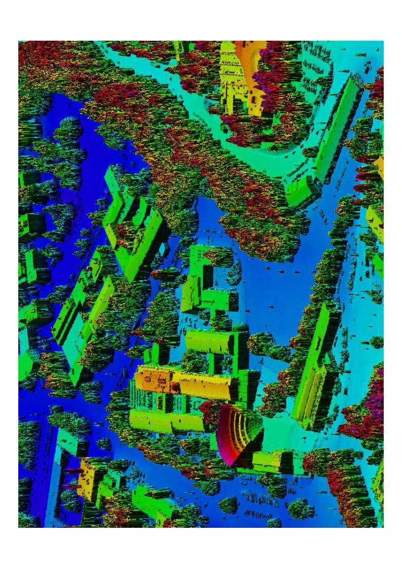

Triangulated surface
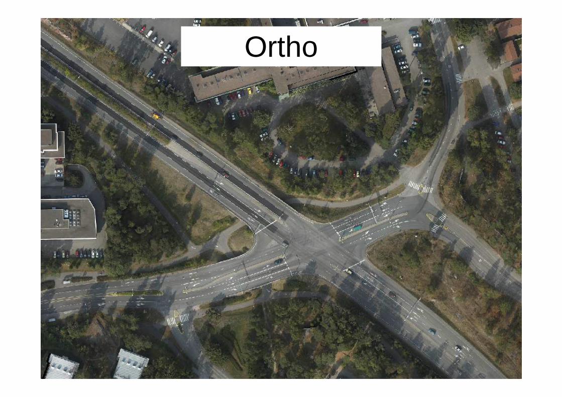
Ortho

Building vectorization

Model visualization

Model visualization

Airborne / Mobile Scanning
Compute Xyz PointsSystem Specific Software
Compute TrajectoryGPS / IMU Software
Match, Classify, Thin, Vectorize...Terra Applications

ProductsTerraMatch
TerraPhoto
TerraScan
Quality
Ortho photosTrue orthos if buildings vectorized
Perspective views for vectorizationand for classification
Ground model• classified ground points• model keypoints for TIN• lattice• breaklines
Other classified objects as point clouds
Vectorization• buildings• transmission lines• breaklines
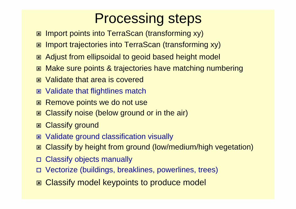
Processing steps� Import points into TerraScan (transforming xy)�
� Import trajectories into TerraScan (transforming xy)�
� Adjust from ellipsoidal to geoid based height model
� Make sure points & trajectories have matching numbering
� Validate that area is covered
� Validate that flightlines match
� Remove points we do not use� Classify noise (below ground or in the air)�
� Classify ground
� Validate ground classification visually� Classify by height from ground (low/medium/high vegetation)�
� Classify objects manually� Vectorize (buildings, breaklines, powerlines, trees)�
� Classify model keypoints to produce model

Processing Steps1. Match flightlines
� Fine tune calibration� Improve positional accuracy
2. Classify� Ground, vegetation, building...
3. Create delivery products� Contours� Powerline model� 3D vector models� Timber volume
Expert workComputer time
Lower skill workHuman time
Application specific expertise
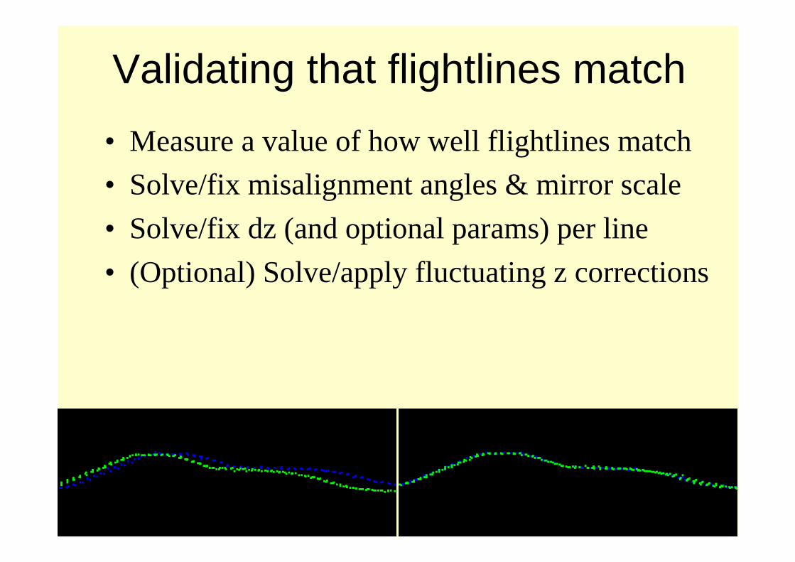
Validating that flightlines match
• Measure a value of how well flightlines match
• Solve/fix misalignment angles & mirror scale
• Solve/fix dz (and optional params) per line
• (Optional) Solve/apply fluctuating z corrections

Removing unneeded points
• Outside project area• Over water bodies
• Collected when aircraft was turning
• Lower quality when better quality is available
• Edges of scan lines

Why to cut edges of scan lines?• Produce more consistent pattern of points• Remove less accurate points
• Many error sources increase at edges:– heading, roll, mirror scale
– poor measurement angle

Point classification• Automatic and manual routines
1 Default2 Ground3 Low vegetation4 Medium vegetation5 High vegetation6 Building7 Low point8 Model keypoints9 Vector building10 Bridge11 Wire12 Tree13 Breakline ground

Smoothing• Laser data is dense but noisy• Smoothing modifies point elevations in places
where that produces a smooth surface
• Produces a prettier surface

Model keypoints• Selects points which are most relevant for
creating a triangulated surface model• User specifies maximum difference between
keypoint TIN and ground laser points

Vectorizing Breakline Features
• Draw road feature in 2D using on top of ortho• Drape to follow laser surface

Vectorizing Breakline Features• End result is a 3D vector which
follows the general laser surface• Logic written for and makes use
of high density of laser data

Vectorizing buildings
• Approximate models -- automatic• Accurate models – require manual work• User modifies edges
with the help of
camera images
• Resulting 3D model
has walls starting from
below ground

Vectorizing transmission lines
• Goals:– Mapping of towers and wires
– Search danger trees
– Modeling for increased capacity
• One or more cameras during flight

Tower & laser points
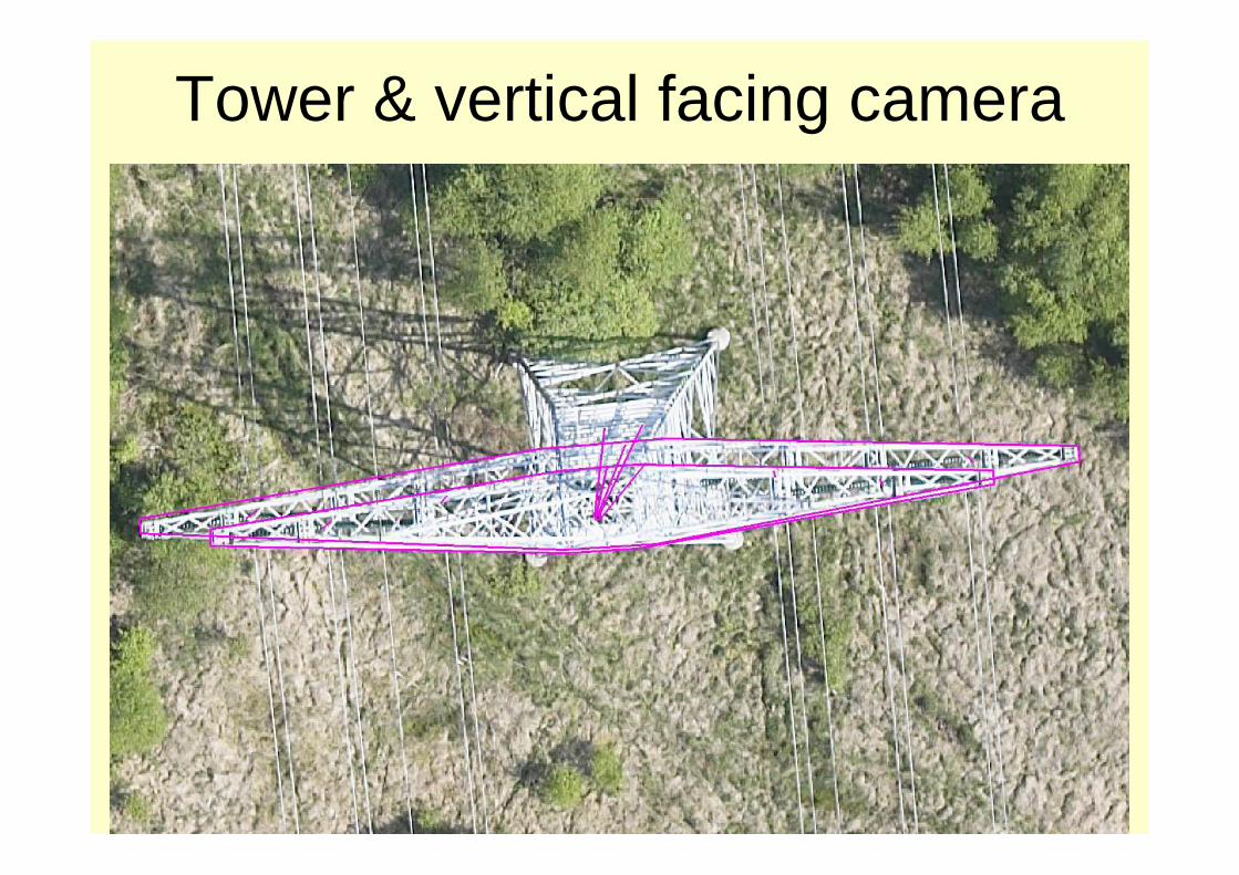
Tower & vertical facing camera

TerraPhoto task
• Produce orthorectified images• Provide perspective views for
– laser data classification
– building vectorization
– powerline tower vectorization
• Display background raster images• Render scenes with large image volume
• Produce flythru animations
TerraPhoto for MicroStation or TerraPhoto Viewer
TerraPhoto for MicroStation

TerraPhoto
• Written for digital cameras integrated with laser scanners
• Assumes raw positioning for images is good– computed from GPS/IMU
– best systems provide one pixel level raw positioning
• Does not need any known points
• Uses laser surface as the rectification surface
• Can derive all camera parameters

Perspective view principle• View the world as seen by one camera image• Viewer eye is at camera focal point xyz
• Compare any 3D information against the image

Perspective views
Building vectorization