program overview - ngl.cengage.com · north america central america & the caribbean south...
TRANSCRIPT
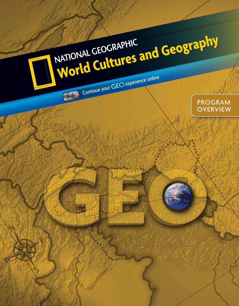
World Cultures and Geography
Continue your experience online
PROGRAM OVERVIEW
Print Path
Digital Path
Eastern Hemisphere Western Hemisphere with Europe
The National Geographic Society mission, maps, images, and research resound throughout the program!
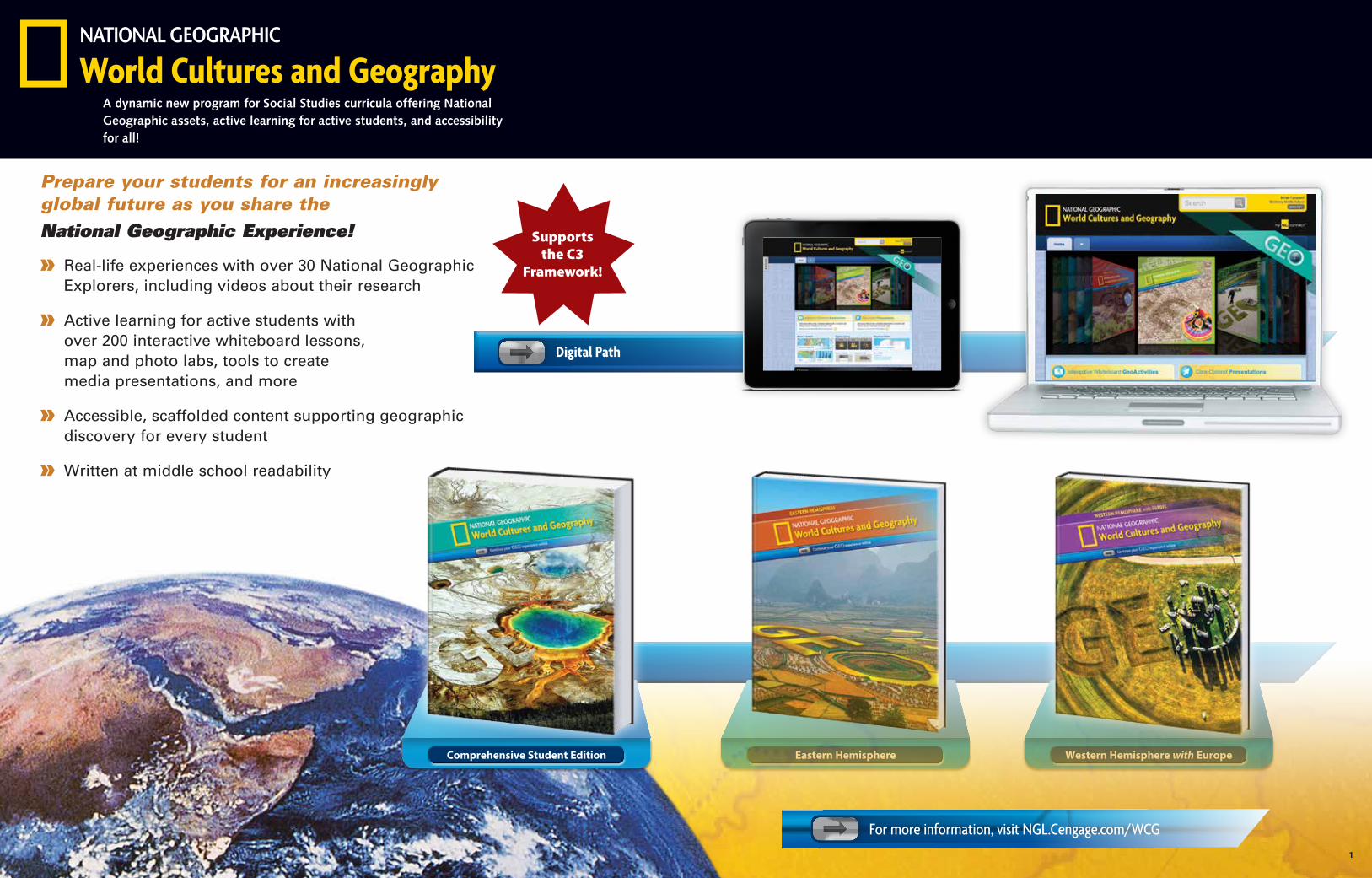
Prepare your students for an increasingly global future as you share the National Geographic Experience!
» Real-life experiences with over 30 National Geographic Explorers, including videos about their research
» Active learning for active students with over 200 interactive whiteboard lessons, map and photo labs, tools to create media presentations, and more
» Accessible, scaffolded content supporting geographic discovery for every student
» Written at middle school readability
Comprehensive Student Edition
World Cultures and GeographyA dynamic new program for Social Studies curricula offering National Geographic assets, active learning for active students, and accessibility for all!
Supports the C3
Framework!
1
For more information, visit NGL.Cengage.com/WCG
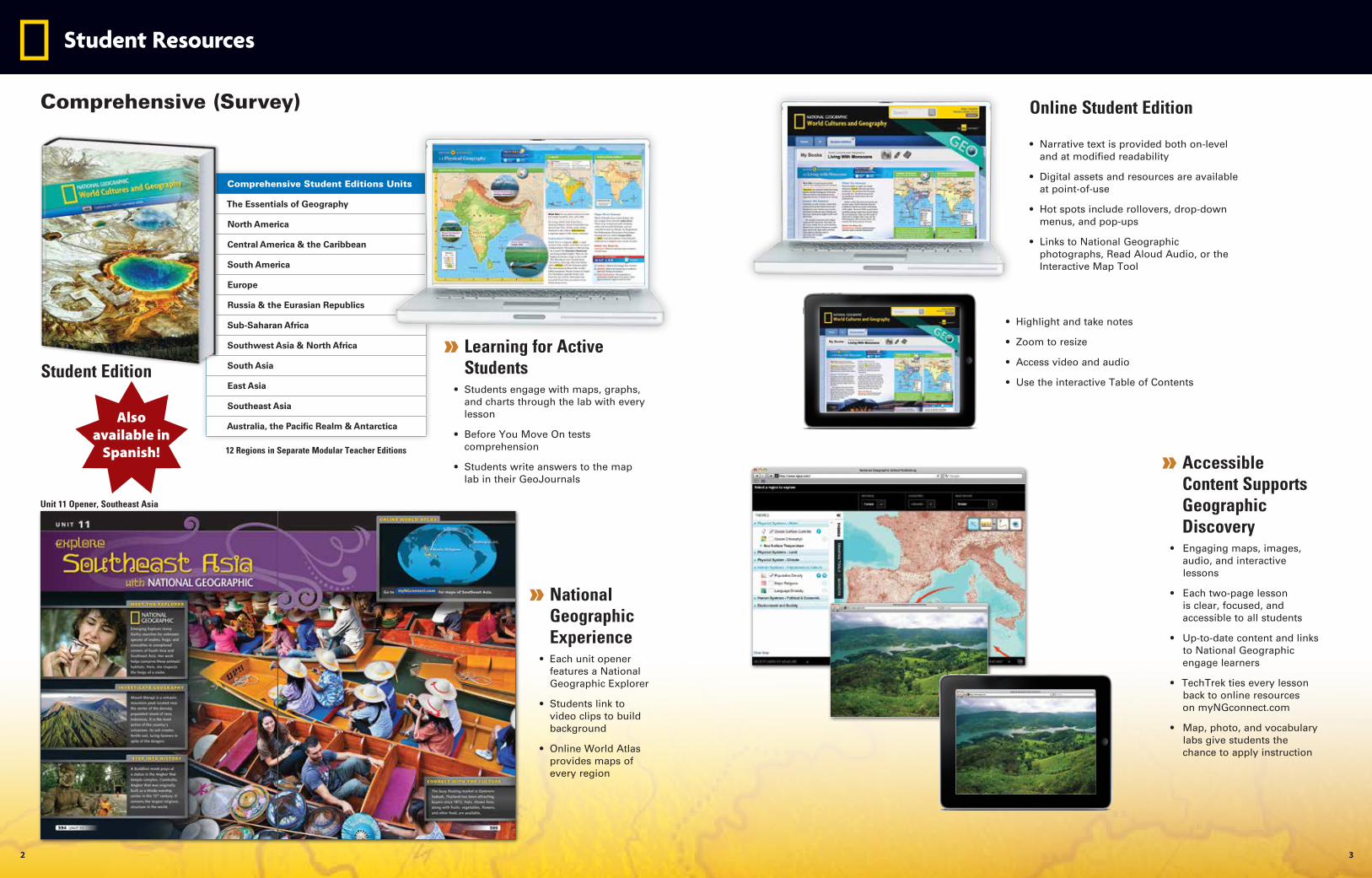
Student Resources
Online Student Edition
» Accessible Content Supports Geographic Discovery
• Engaging maps, images, audio, and interactive lessons
• Each two-page lesson is clear, focused, and accessible to all students
• Up-to-date content and links to National Geographic engage learners
• TechTrek ties every lesson back to online resources on myNGconnect.com
• Map, photo, and vocabulary labs give students the chance to apply instruction
» National Geographic Experience
• Each unit opener features a National Geographic Explorer
• Students link to video clips to build background
• Online World Atlas provides maps of every region
Unit 11 Opener, Southeast Asia
• Narrative text is provided both on-level and at modified readability
• Digital assets and resources are available at point-of-use
• Hot spots include rollovers, drop-down menus, and pop-ups
• Links to National Geographic photographs, Read Aloud Audio, or the Interactive Map Tool
Comprehensive Student Editions Units
The Essentials of Geography
North America
Central America & the Caribbean
South America
Europe
Russia & the Eurasian Republics
Sub-Saharan Africa
Southwest Asia & North Africa
South Asia
East Asia
Southeast Asia
Australia, the Pacific Realm & Antarctica
» Learning for Active Students
• Students engage with maps, graphs, and charts through the lab with every lesson
• Before You Move On tests comprehension
• Students write answers to the map lab in their GeoJournals
12 Regions in Separate Modular Teacher Editions
Comprehensive (Survey)
Student Edition
Also available in
Spanish!
• Highlight and take notes
• Zoom to resize
• Access video and audio
• Use the interactive Table of Contents
2 3
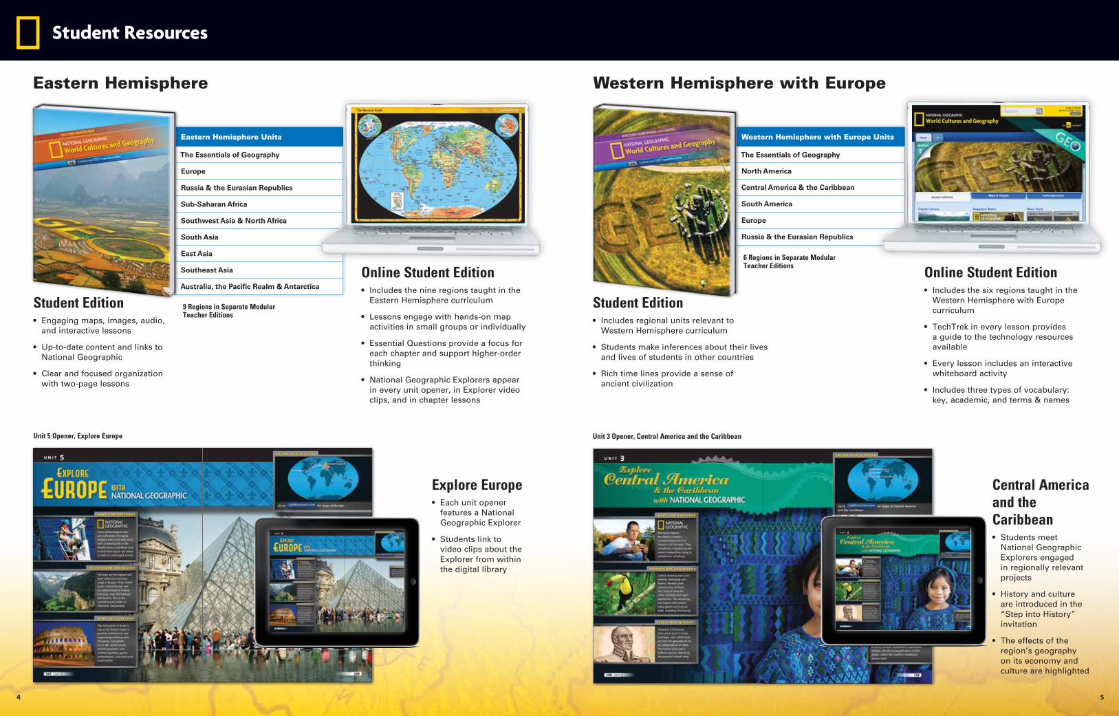
Student Resources
Eastern Hemisphere Western Hemisphere with Europe
9 Regions in Separate Modular Teacher Editions
6 Regions in Separate Modular Teacher Editions
Online Student Edition• Includes the nine regions taught in the
Eastern Hemisphere curriculum
• Lessons engage with hands-on map activities in small groups or individually
• Essential Questions provide a focus for each chapter and support higher-order thinking
• National Geographic Explorers appear in every unit opener, in Explorer video clips, and in chapter lessons
Online Student Edition• Includes the six regions taught in the
Western Hemisphere with Europe curriculum
• TechTrek in every lesson provides a guide to the technology resources available
• Every lesson includes an interactive whiteboard activity
• Includes three types of vocabulary: key, academic, and terms & names
Eastern Hemisphere Units
The Essentials of Geography
Europe
Russia & the Eurasian Republics
Sub-Saharan Africa
Southwest Asia & North Africa
South Asia
East Asia
Southeast Asia
Australia, the Pacific Realm & Antarctica
Western Hemisphere with Europe Units
The Essentials of Geography
North America
Central America & the Caribbean
South America
Europe
Russia & the Eurasian Republics
Student Edition• Engaging maps, images, audio,
and interactive lessons
• Up-to-date content and links to National Geographic
• Clear and focused organization with two-page lessons
Student Edition• Includes regional units relevant to
Western Hemisphere curriculum
• Students make inferences about their lives and lives of students in other countries
• Rich time lines provide a sense of ancient civilization
Explore Europe• Each unit opener
features a National Geographic Explorer
• Students link to video clips about the Explorer from within the digital library
Central America and the Caribbean• Students meet
National Geographic Explorers engaged in regionally relevant projects
• History and culture are introduced in the “Step into History” invitation
• The effects of the region’s geography on its economy and culture are highlighted
Unit 5 Opener, Explore Europe Unit 3 Opener, Central America and the Caribbean
4 5
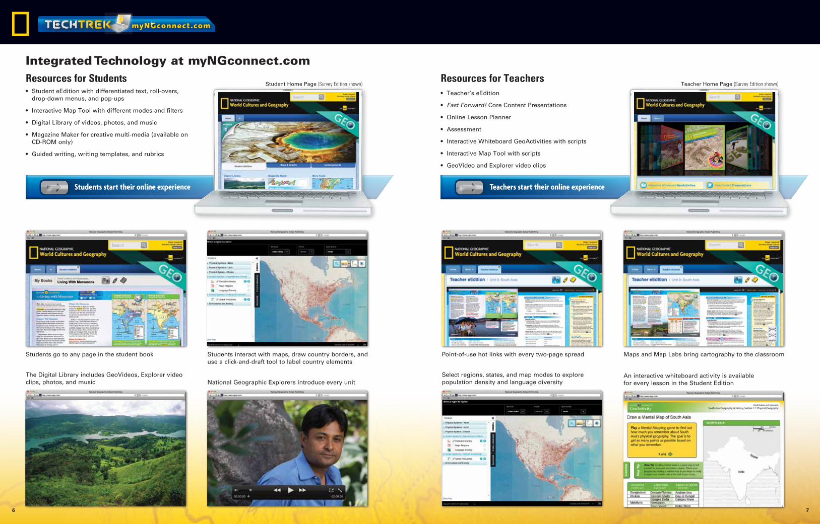
• Student eEdition with differentiated text, roll-overs, drop-down menus, and pop-ups
• Interactive Map Tool with different modes and filters
• Digital Library of videos, photos, and music
• Magazine Maker for creative multi-media (available on CD-ROM only)
• Guided writing, writing templates, and rubrics
• Teacher’s eEdition
• Fast Forward! Core Content Presentations
• Online Lesson Planner
• Assessment
• Interactive Whiteboard GeoActivities with scripts
• Interactive Map Tool with scripts
• GeoVideo and Explorer video clips
Teachers start their online experienceStudents start their online experience
Student Home Page (Survey Edition shown) Teacher Home Page (Survey Edition shown)
National Geographic Explorers introduce every unitThe Digital Library includes GeoVideos, Explorer video clips, photos, and music
Students interact with maps, draw country borders, and use a click-and-draft tool to label country elements
Students go to any page in the student book Maps and Map Labs bring cartography to the classroomPoint-of-use hot links with every two-page spread
An interactive whiteboard activity is available for every lesson in the Student Edition
Select regions, states, and map modes to explore population density and language diversity
Integrated Technology at myNGconnect.comResources for TeachersResources for Students
myNGconnect.com
6 7
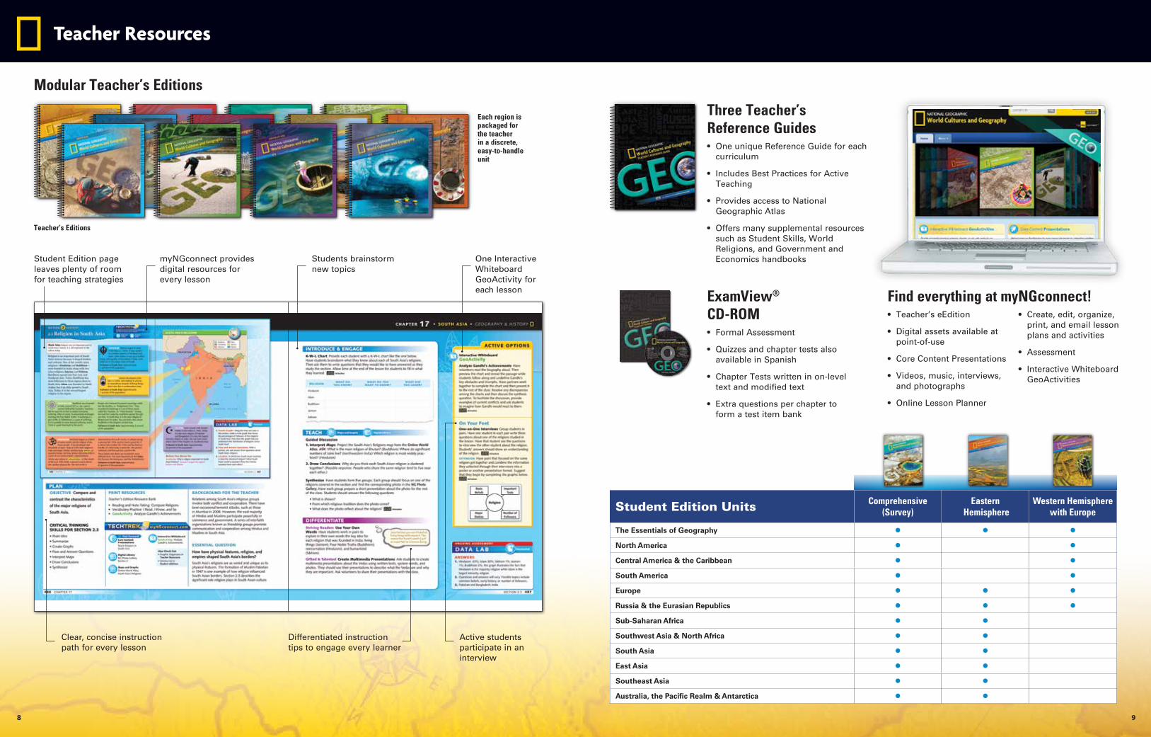
Each region is packaged for the teacher in a discrete, easy-to-handle unit
Three Teacher’s Reference Guides• One unique Reference Guide for each
curriculum
• Includes Best Practices for Active Teaching
• Provides access to National Geographic Atlas
• Offers many supplemental resources such as Student Skills, World Religions, and Government and Economics handbooks
ExamView® CD-ROM• Formal Assessment
• Quizzes and chapter tests also available in Spanish
• Chapter Tests written in on-level text and modified text
• Extra questions per chapter to form a test item bank
Find everything at myNGconnect! • Teacher’s eEdition
• Digital assets available at point-of-use
• Core Content Presentations
• Videos, music, interviews, and photographs
• Online Lesson Planner
• Create, edit, organize, print, and email lesson plans and activities
• Assessment
• Interactive Whiteboard GeoActivities
Student Edition Units Comprehensive (Survey)
Eastern Hemisphere
Western Hemisphere with Europe
The Essentials of Geography • • •North America • •Central America & the Caribbean • •South America • •Europe • • •Russia & the Eurasian Republics • • •Sub-Saharan Africa • •Southwest Asia & North Africa • •South Asia • •East Asia • •Southeast Asia • •Australia, the Pacific Realm & Antarctica • •
Teacher Resources
Teacher’s Editions
Modular Teacher’s Editions
One Interactive Whiteboard GeoActivity for each lesson
Active students participate in an interview
Differentiated instruction tips to engage every learner
Clear, concise instruction path for every lesson
Student Edition page leaves plenty of room for teaching strategies
myNGconnect provides digital resources for every lesson
Students brainstorm new topics
8 9
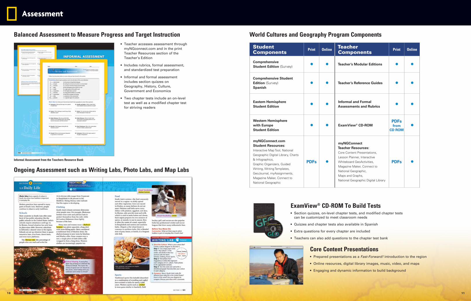
Balanced Assessment to Measure Progress and Target Instruction World Cultures and Geography Program Components• Teacher accesses assessment through
myNGconnect.com and in the print Teacher Resources section of the Teacher’s Edition
• Includes rubrics, formal assessment, and standardized test preparation
• Informal and formal assessment includes section quizzes on Geography, History, Culture, Government and Economics
• Two chapter tests include an on-level test as well as a modified chapter test for striving readers
Assessment
Informal Assessment from the Teachers Resource Bank
Ongoing Assessment such as Writing Labs, Photo Labs, and Map Labs
Core Content Presentations• Prepared presentations as a Fast-Forward! introduction to the region
• Online resources, digital library images, music, video, and maps
• Engaging and dynamic information to build background
ExamView® CD-ROM To Build Tests• Section quizzes, on-level chapter tests, and modified chapter tests
can be customized to meet classroom needs
• Quizzes and chapter tests also available in Spanish
• Extra questions for every chapter are included
• Teachers can also add questions to the chapter test bank
Student Components
Print Online Teacher Components
Print Online
Comprehensive Student Edition (Survey) • • Teacher’s Modular Editions • •
Comprehensive Student Edition (Survey) Spanish
• • Teacher’s Reference Guides • •
Eastern Hemisphere Student Edition • • Informal and Formal
Assessments and Rubrics • •
Western Hemisphere with Europe Student Edition
• • ExamView® CD-ROMPDFs from
CD ROM•
myNGConnect.com Student Resources: Interactive Map Tool, National Geographic Digital Library, Charts & Infographics, Graphic Organizers, Guided Writing, Writing Templates, GeoJournal, myAssignments, Magazine Maker, Connect to National Geographic
PDFs •
myNGConnect Teacher Resources: Core Content Presentations, Lesson Planner, Interactive Whiteboard GeoActivities, Magazine Maker, Connect to National Geographic, Maps and Graphs, National Geographic Digital Library
PDFs •
10 11
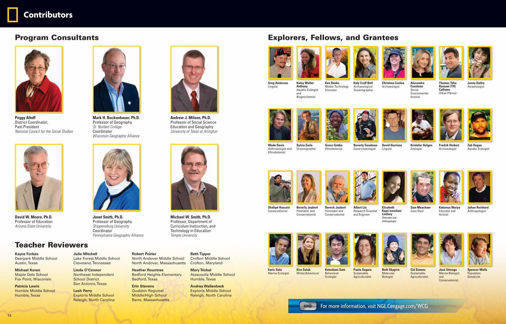
Peggy AltoffDistrict Coordinator,Past President National Council for the Social Studies
Mark H. Bockenhauer, Ph.D.Professor of GeographySt. Norbert College CoordinatorWisconsin Geographic Alliance
Andrew J. Milson, Ph.D.Professor of Social ScienceEducation and GeographyUniversity of Texas at Arlington
David W. Moore, Ph.D.Professor of EducationArizona State University
Janet Smith, Ph.D.Professor of GeographyShippensburg University Coordinator Pennsylvania Geographic Alliance
Michael W. Smith, Ph.D.Professor, Department of Curriculum Instruction, and Technology in Education Temple University
Greg AndersonLinguist
Jenny DaltryHerpetologist
Thomas Taha Rassam (TH) CulhaneUrban Planner
Alexandra CousteauSocial Environmental Activist
Katey Walter AnthonyAquatic Ecologist and Biogeochemist
Christina ConleeArchaeologist
Ken BanksMobile Technology Innovator
Katy Croff BellArchaeological Oceanographer
Wade DavisAnthropologist and Ethnobotanist
Zeb HoganAquatic Ecologist
Fredrik HiebertArchaeologist
Kristofer HelgenZoologist
Sylvia EarleOceanographer
David HarrisonLinguist
Grace GobboEthnobotanist
Beverly GoodmanGeoarchaeologist
Shafqat HussainConservationist
Johan ReinhardAnthropologist
Kakenya NtaiyaEducator and Activist
Sam Meacham Cave Diver
Beverly JoubertFilmmaker and Conservationist
Elizabeth Kapu’uwailani LindseyFilmmaker and Anthropologist
Dereck JoubertFilmmaker and Conservationist
Albert LinResearch Scientist and Engineer
Enric SalaMarine Ecologist
Spencer WellsPopulation Geneticist
José UrteagaMarine Biologist and Conservationist
Cid Simoes Sustainable Agriculturalist
Kira SalakWriter/Adventurer
Beth ShapiroMolecular Biologist
Katsufumi SatoBehavioral Ecologist
Paola SeguraSustainable Agriculturalist
Kayce Forbes Deerpark Middle School Austin, Texas
Michael Koren Maple Dale School Fox Point, Wisconsin
Patricia Lewis Humble Middle School Humble, Texas
Julie Mitchell Lake Forest Middle School Cleveland, Tennessee
Linda O’Connor Northeast Independent School District San Antonio, Texas
Leah Perry Exploris Middle School Raleigh, North Carolina
Robert Poirier North Andover Middle School North Andover, Massachusetts
Heather Rountree Bedford Heights Elementary Bedford, Texas
Erin Stevens Quabbin Regional Middle/High School Barre, Massachusetts
Beth Tipper Crofton Middle School Crofton, Maryland
Mary Trichel Atascocita Middle School Humble, Texas
Andrea Wallenbeck Exploris Middle School Raleigh, North Carolina
Program Consultants
Teacher Reviewers
Explorers, Fellows, and Grantees
Contributors
12
For more information, visit NGL.Cengage.com/WCG
Learn more about GEO
NGL.Cengage.com/WCG888-915-3276
MA
R/1
5
Go interactive with myNGconnect.comWorld Cultures and Geography