public realm research proposal
DESCRIPTION
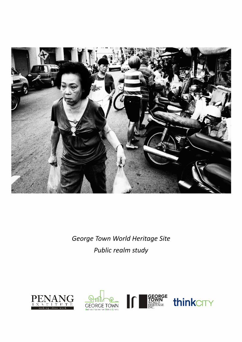
This public realm study proposes to document the daily rhythms of the George Town World Heritage Site, with the aim of bringing new insights into to the everyday life of George Town’s public spaces while developing a detailed map of the quality of the built environment.TRANSCRIPT
George Town World Heritage Site
Public realm study

Introduction
This public realm study proposes to document the daily rhythms of the George Town WorldHeritage Site, with the aim of bringing new insights into to the everyday life of GeorgeTown’s public spaces while developing a detailed map of the quality of the builtenvironment.
This project will demonstrate the spatial and temporal dimensions of differentiation in thepublic realm, exploring the use of both formal and informal public spaces. It aims to capturevisually the richness of life found in the public realm of George Town’s historic core.
Simultaneously, a detailed assessment of the qualities of the built environment will beundertaken, measuring the accessibility and connectivity that enables all to share thesespaces.
The purpose: to develop a public realm strategy utilising a landscape approach toconservation that can address the deficits in the built environment and deliver the SpecialArea Plan strategies without negatively impacting on the life blood of this unique publicrealm.
Small urban places are “priceless,” and the city street is “the river of life…where we come
together.” - William Whyte
The remainder of this proposal is structured as follows:
Rationale
Policy review
Literature review
Study area
Method
Outputs
Appendix
page1
Rationale
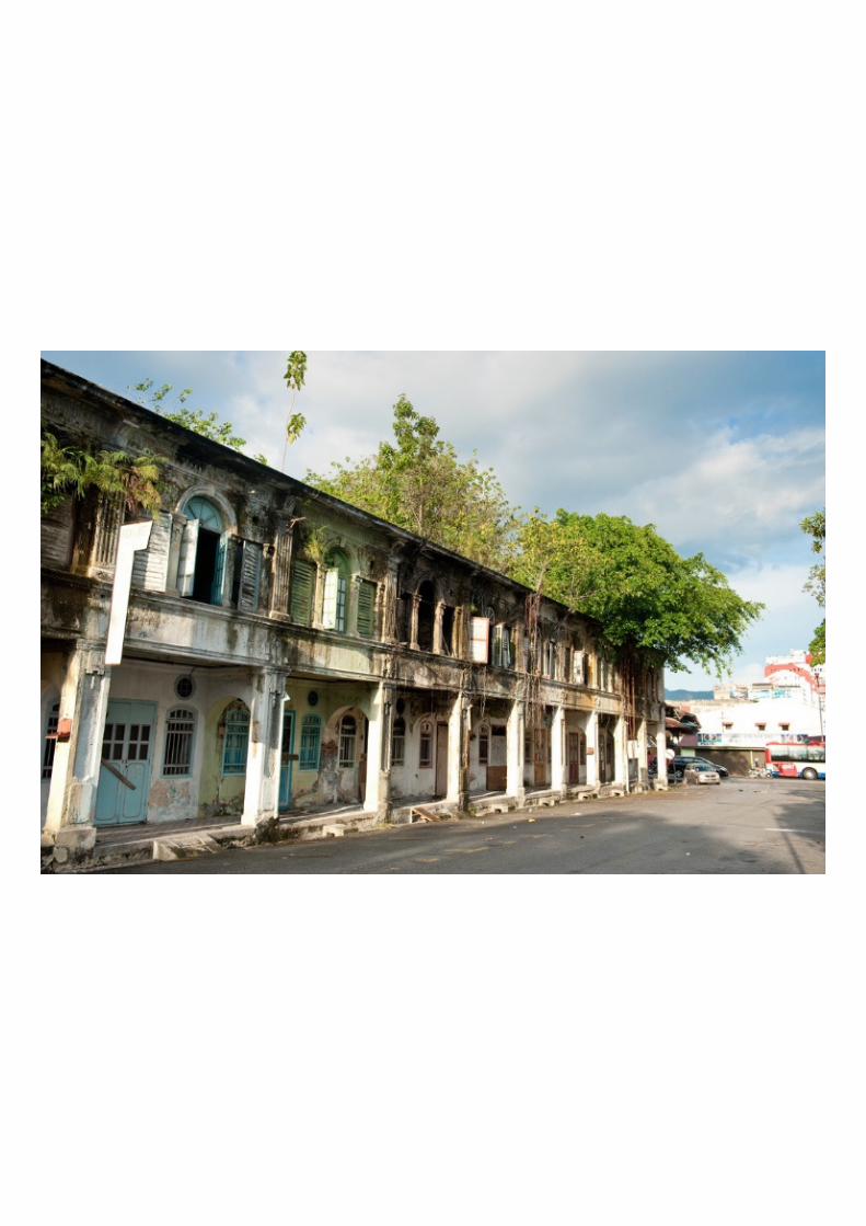
Since George Town’s inscription as a World Heritage Site in 2008, significant work has beenundertaken to better understand the city. Population and Land Use have been studied indepth with full census’ undertaken. Heritage buildings have been documented and assessed,support has been provided to conserve and restore the unique architecture. A Special AreaPlan and a Heritage Management Plan have been developed to secure the futuresustainability of the cities built heritage.
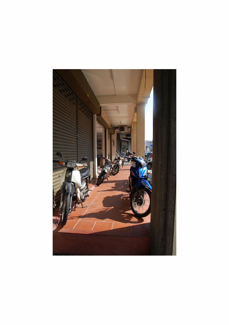
While great attention has rightly been placed on the buildings of George Town, theirarchitectural styles, their unique features and the building techniques used, the spacesbetween the buildings have however received less attention. Equal recognition needs to begiven to both the living and built aspects of the urban landscape and recognition of thetangible and intangible components of each.
It is George Town’s multi-cultural living heritage that makes the urban landscape of value.The interchange of human values create a unique culture and townscape without parallelanywhere in East and South East Asia and we would therefore argue that a greaterunderstanding of the public realm is vital.
The Special Area Plan promotes a landscape approach to conservation which considers thespatial organisation of the city as a whole to determine the complex use of space and theurban flow of human traffic. Historic and modern urban rhythms of pedestrian and vehiculartraffic reveal the historic layering and accumulation of culture and tradition as seen intraditional and modern settlement patterns, gathering spaces, cultural/religious/commercialenclaves.
The interconnectedness of the built and living elements is complex and collectivelycontributes towards the cultural sense of place. When looking at the long term sustainabilityof the George Town World Heritage site, it is important to retain the strong sense ofconnectivity between working, living and recreational opportunities in the city. Thisconnectivity is manifested in the accessibility of the city, accessibility to social gatheringspaces and to public amenities such as parks, places of worship etc.
As George Town develops economically as a living city its infrastructure and facilities will berequired to support an increasing number of users. The adaptive reuse of traditionalshophouses is essential to George Town’s regeneration and economic growth, howeverthese changes must be managed and a balance struck to ensure that they do not dilute theOutstanding Universal Values of the Site.
page2
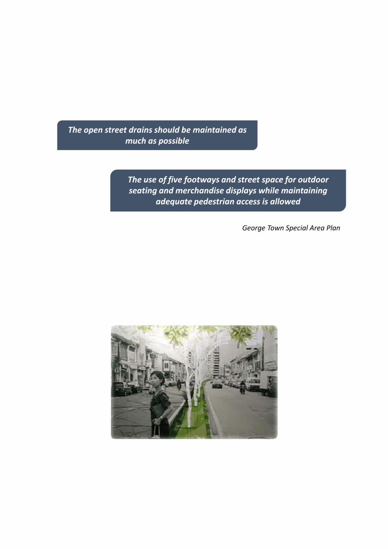
George Town Special Area Plan
The open street drains should be maintained as
much as possible
The use of five footways and street space for outdoor
seating and merchandise displays while maintaining
adequate pedestrian access is allowed

Policy review
The Special Area Plan sets out a number of objectives for improving connectivity in thepublic realm:
• Public space connectivity – in the effort to green the city and towards reducing carbonemissions, a series of parks and public open spaces are proposed in addition to existingpublic open spaces. This proposed network of public open spaces are to beinterconnected via a landscaped pedestrian network
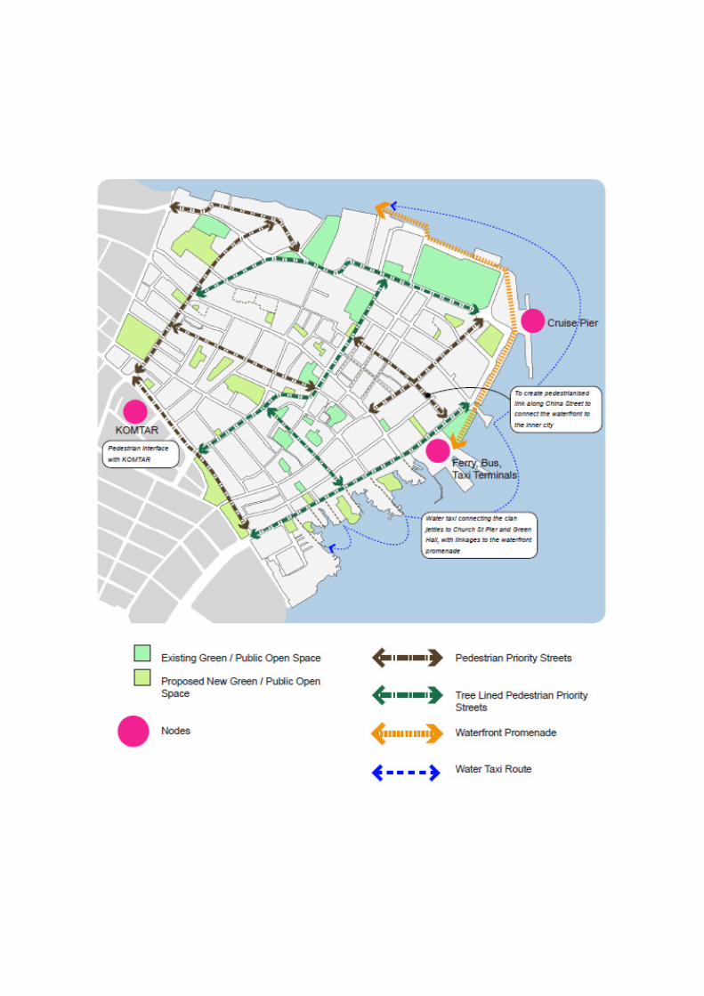
• Nodes connectivity – The three main nodes that bring the highest number of pedestriansinto the World Heritage Site are Komtar, Weld Quay and Swettenham Pier and thesenodes should be connected to the pedestrian network
• Waterfront connectivity – Linkages between the waterfront and the inner city should bedeveloped with the aim to facilitate pedestrian movement between these two areas
Public realm, access and circulation are further addressed with detailed strategies andactions (see following pages) however it could be argued that progress against theseobjectives has been slow. The ‘Greening of George Town’ project which began in 2010 hasstalled, and not extended past its first pilot street - The greening of Carnarvon Street.
Greening of George Town Master Plan
page3

Proposals from the Special Area Plan

Policy review - Strategies
• H1.1) Implement green open space and public access network master plan, with community consultations integrated into the planning process.
H1) Design streets with comfortable spaces for casual encounters and gatherings, utilising excess and unused street spaces to create landscaped or useable spaces.
• H2.1) Ensure consistency and continuity in the design of streetscape elements.
• H2.2) Enforce the use of high quality, sustainable, durable material in the design of streetscapes
• H2.3) Include and integrate public art improvements into street improvement projects.
• H2.4) Ensure that streetscape and pedestrian projects meet universal design principles.
H2) Create a high quality, functionally designed streetscape that enhances the experience of the WHS.
• H3.1) Provide an orderly streetscape environment that minimises visual clutter such as utility, signage's, etc
• H3.2) Ensure conformity of new developments to the scale of historic urban structure and respect for the historic context.
H3) Create a non-distracting design aesthetics that do not compete with the heritage structures in the design of new architecture and streetscape elements.
page4
Under the Public Realm section of the Special Area Plan the following strategies and actions are
set out:

George Town Special Area Plan
A summary of proposals from the Special Area Plan

Policy review - Strategies
• I2.1) Remove barriers on select stretches of five-footways.
• I2.2) Implement backlane connectivity, landscaping and lighting plan for pedestrian use.
• I2.3) Enable shared streets that prioritise pedestrians but accommodate vehicles at slow speeds.
I2) Facilitate the continuity of pedestrian access and connectivity where possible.
• I3.1) Ensure adequate lighting and quality pedestrian space.
• I3.2) Plan safe, convenient crossings on surface streets wherever possible, instead of using pedestrian bridges or tunnels.
• I3.3) Minimise the impact of loading on pedestrian orientated street through the use of marked loading zones, restricted loading hours and other loading management strategies.
I3) Maximise pedestrian security and giving pedestrian right of way priority on streets in WHS.
page5
Under the Access & Circulation section of the Special Area Plan the following strategies and
actions are set out:

Literature review
This study draws on a wide range of literature about the development of urbanenvironments. From the role of spatial planning to the wide ranging impacts of the urbanenvironment on its users liveability and wellbeing.
Built environment, form & control
Places are created and shaped by those in control of resources and with certain interests,which affects our degree of access to, and the way we use, those spaces. Authors such asDavies (1990) and Mitchell (1995) observe trends within post-modern urbanism which seethe role of public space changing, increasingly controlled by subtle design strategies andnew technologies and the creeping privatisation of the public realm, the democratic valuesimbued in ‘public’ spaces are being lost.
Built environment & equality
Urban spaces that are inclusive are designed to provide opportunities for a wide range ofpeople to participate in these spaces. Women, the young and the elderly are easily excludedby poor quality urban environments as are people with disabilities. People fromdisadvantaged backgrounds can equally be excluded from ‘new’ developments in the publicrealm. A failure to bring together all the different activities that make up a city canundermine any sense of shared interests and common purpose. Sassen (1996) explores thenew dynamics of inequality in the globalised city, and asks the question: Whose city is it?
Built environment & health
The built environment provides the setting and backdrop by which we live our lives, andimpacts on our senses, our emotions, participation in physical activity and community life,our sense of community, and our general wellbeing. Jackson (2003) highlights the emergingwork on how the way we construct our built environment holds potential for addressingmany of the current public health concerns, including obesity, cardiovascular disease,diabetes, asthma, injury, depression, violence, and social inequities. Evans (2003) exploresthe relationship between the built environment and mental health. Personal control, sociallysupportive relationships, and restoration from stress and fatigue are all affected byproperties of the built environment.
Built environment & travel behaviour
The potential to moderate travel demand through changes in the built environment is thesubject of many empirical studies. Ewing. R & Cervero. R (2001) summarise a body ofresearch around the elasticity of travel demand with respect to the density, diversity anddesign of the built environment. The body of research explores the extent to which the builtenvironment or socio-economic characteristics most influence travel behaviours. Thenumber of vehicle miles/hours travelled are more significantly influenced by the builtenvironment while mode choices depend on both the built environment and socio-economics, with greater emphasis on the latter.
page6
Literature review (cont.)
Built environment & safety
Newman (1972) formulated a theory of defensible space as a means of reducing crime inurban areas. The theory stated that spaces that convey likelihood of observation are lesslikely to attract potential criminals. While other scholars focus on the social aspect of crimeprevention, arguing when there is a strong sense of community, the physical aspects of thespace may be more effective in deterring crime than when the residents do not know andtrust one another. The "broken window" thesis (Wilson & Kelling) states thatneighbourhoods characterised by signs of neglect and decay are evidence that residents ofthe area feel vulnerable. These indicators may serve as a signal that residents are not likelyto respond to criminal activity. The physical deterioration also results in a greater fear ofcrime among the residents. Increased fear of crime results in greater withdrawal anddiminution of the sense of community, which then makes crime even more likely.
Built environment, sense of place & social capital
There is no single theory of ‘sense of place’. Rather, it is understood in many different wayswithin the academic literature. Sense of place however often refers to the feeling ofattachment or belonging to a physical environment, such as a place or neighbourhood, andthe sense of personal and collective identity that comes from this sense of belonging. Whencherished places, spaces, and settings are destroyed or irrevocably changed beyond theircontrol, they feel a sense of loss and grief. Social capital is a term which refers to benefits interms of wellbeing, good health and civil engagement which are generated though theinteractions between people and it is clear that the more actively involved people are inplace shaping , including active engagement in heritage – and the greater the opportunitiesfor bridging and linking forms of social capital.
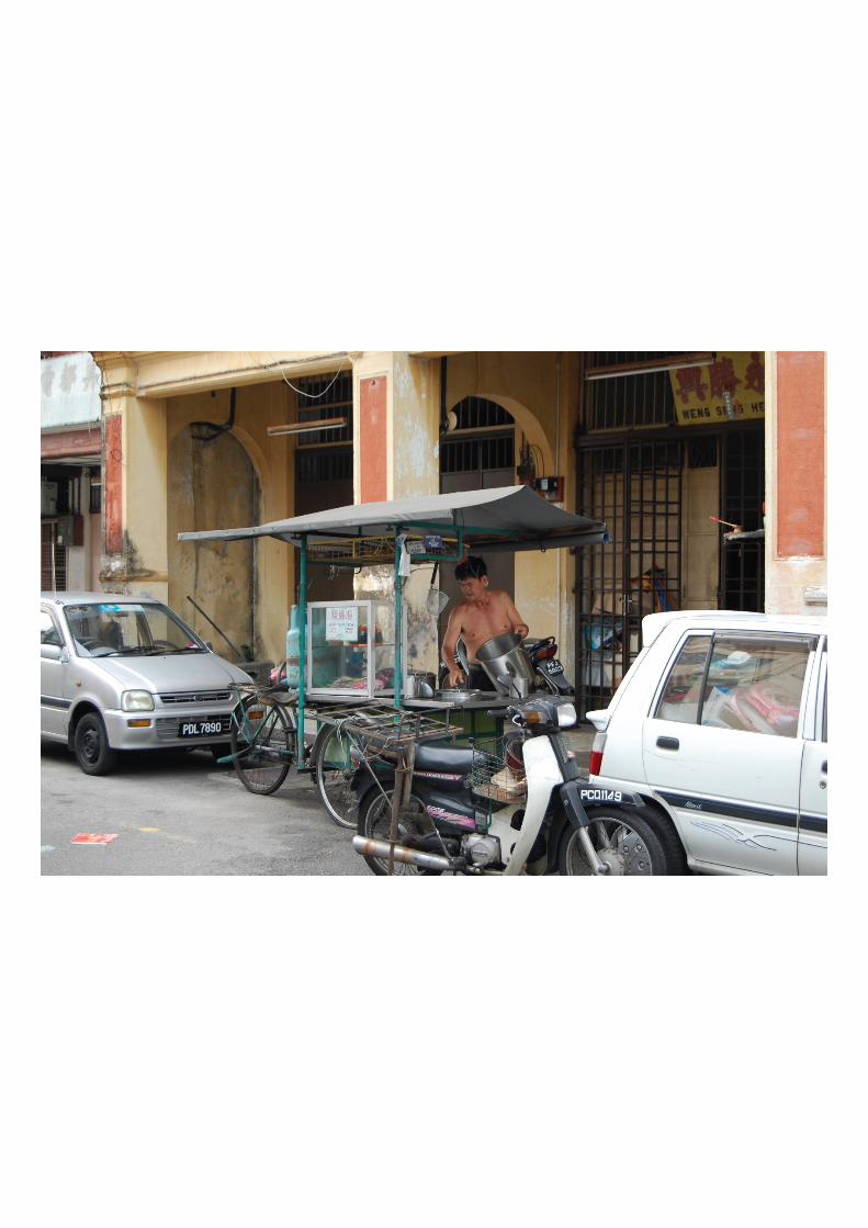
Built environment, walkability & accessibility
Jacobs’s (1961) most significant contribution to urban planning was her understanding thatstreets and sidewalks, as much as parks, are the true public spaces of a city. At a time whenmany planners were arguing that streets were wasteful, and that pedestrians needed to beseparated from cars, Jacobs looked closely at how streets and sidewalks are actually used invibrant urban districts. She concluded that a fine-grained mixture of uses and activities mustbe supported by a continuous network of small blocks and frequent streets, intensified bysiting parks, squares, and public buildings at key locations.
page7
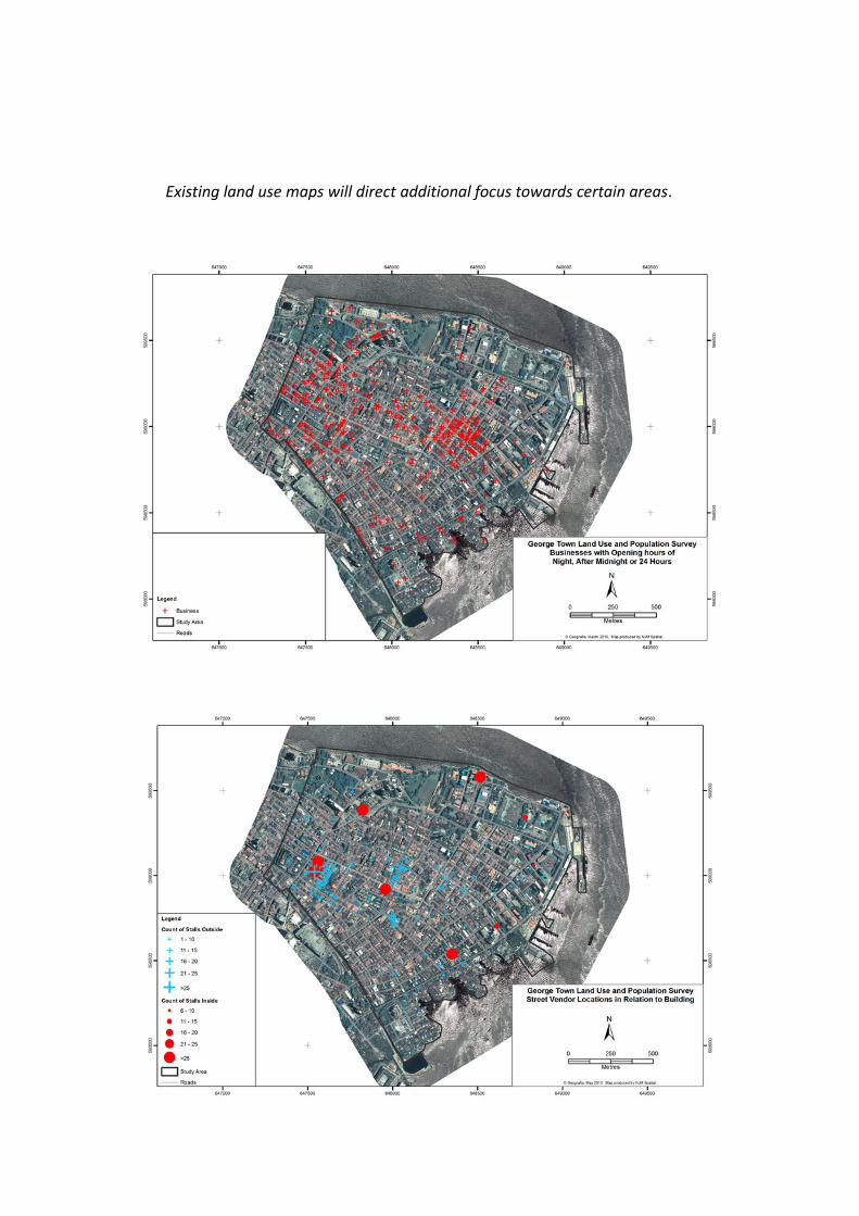
Existing land use maps will direct additional focus towards certain areas.
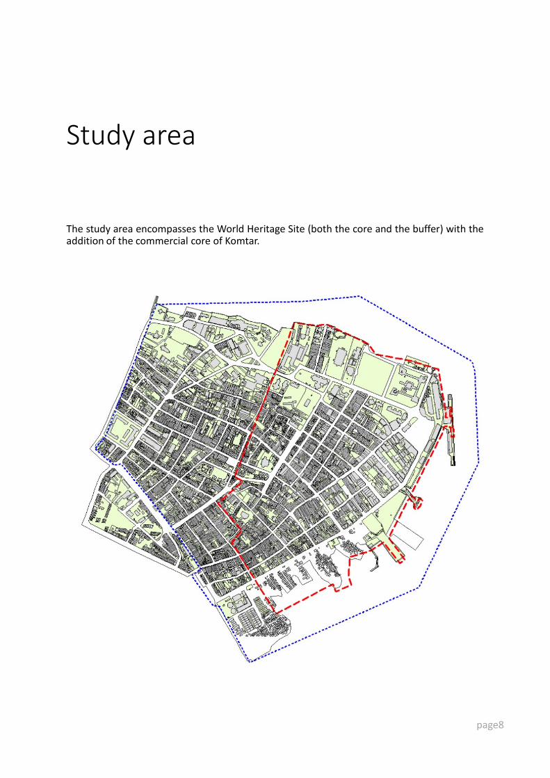
Study area
The study area encompasses the World Heritage Site (both the core and the buffer) with theaddition of the commercial core of Komtar.
page8
Objectives
The built environment provides the setting and backdrop by which we live our lives, andimpacts on our senses, our emotions, participation in physical activity and community life,our sense of community, and general wellbeing. Meanings are generated by buildings andspaces, which we ‘read’ as we pass through them. Places are created and shaped by those incontrol of resources and with certain interests, which affects our degree of access to, andthe way we use, those spaces.
The study objectives are as follows:
1. To capture a visual record of life in the public realm of George Town World HeritageSite;
2. To examine how public life plays out in the built environment, from formal publicspaces such as parks and squares to informal spaces such as streets and back lanes;
3. To document and map the spaces that form the public realm of the George TownWorld Heritage Site;
4. To assess the quality of the built environment at a micro level, mapping anddocumenting connectivity and accessibility, building up analysis to the meso and macrolevel;
5. To develop recommendations for improving the built environment while enhancingrather than displacing the public life that is integral to the cities Outstanding UniversalValue’s;
6. Developing an assessment framework for benchmarking and monitoring pedestrianaccessibility conditions;
7. Providing a decision making aid for policy makers in prioritising interventions, forcomparison of alternatives and assessing cost effectiveness etc.
page9

Methods
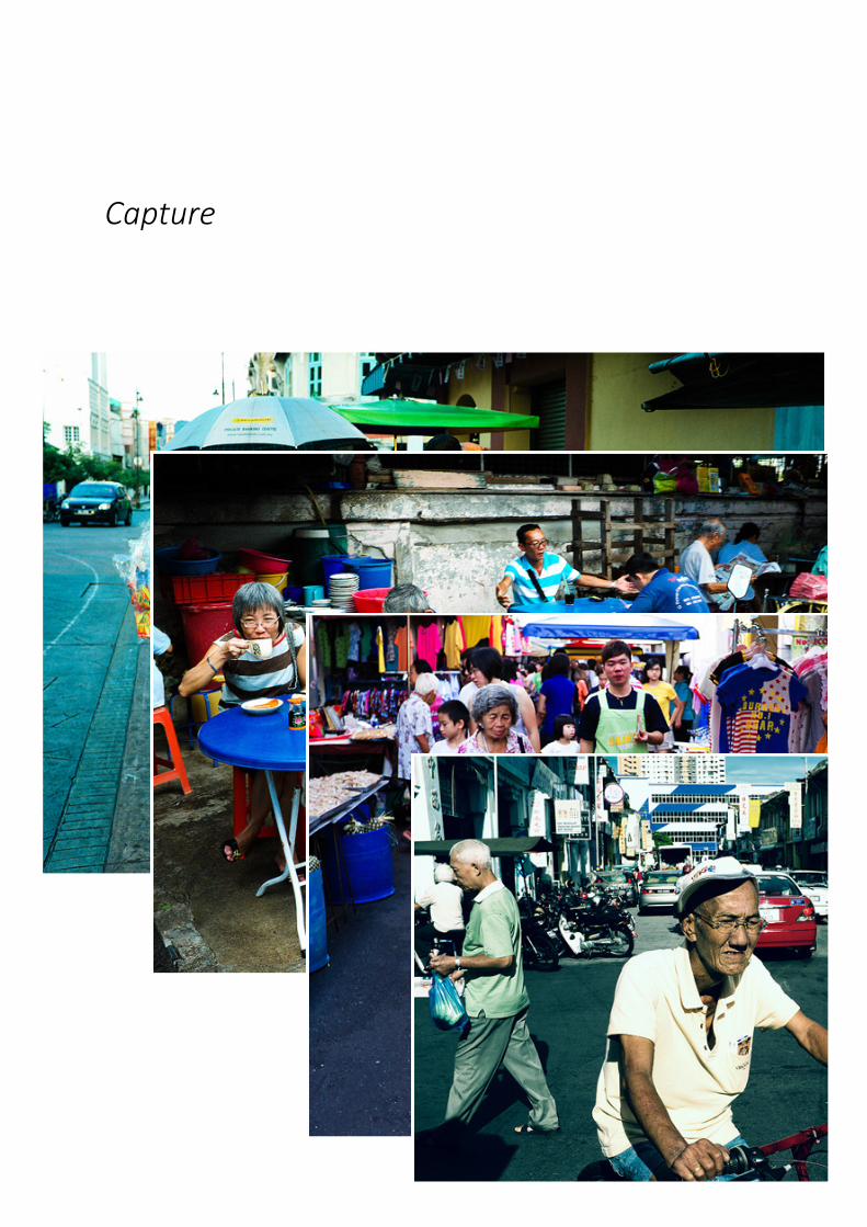
Capture
At various times of day and on various days of the week, an informed photographer will beemployed to capture the relationship between public life and the built environment.
Observe
A number of selected spaces, formal and informal, centres of activity will be studied ingreater depth. A detailed observation will be undertaken using time-lapse photography todisplay a typical day in the life of each space.
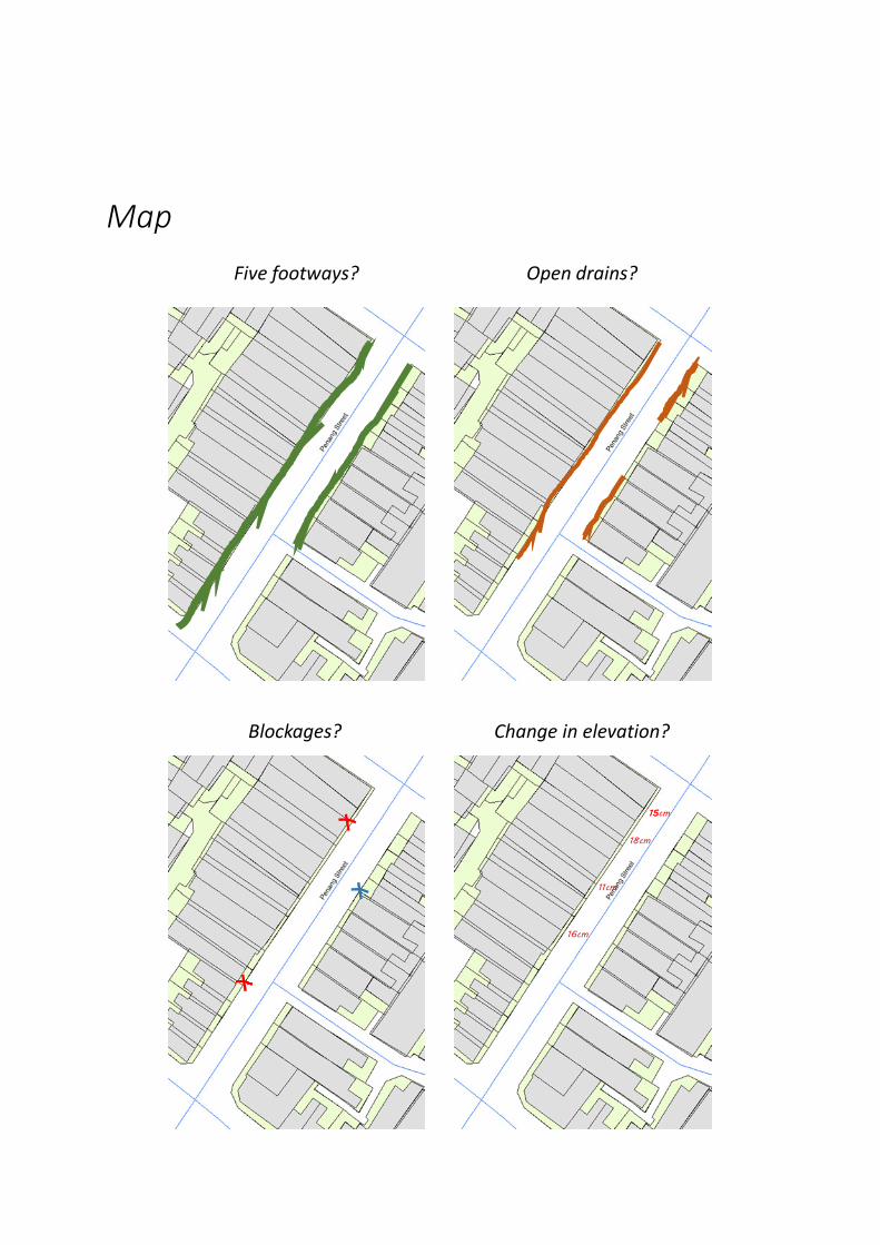
Map
The features of the built environment with particular reference to pedestrian infrastructurewill be recorded, from the extent of the five footway to the permanent and temporaryblockages, to the extent of changes in elevation. Where do additional pavements feature,what’s the street lighting like…
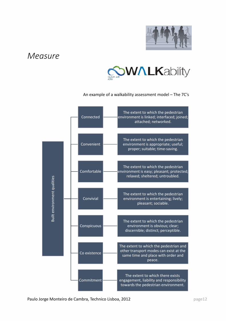
Measure
How and to what extent can the built environment encourage people to walk, and how tomeasure the intensity of that link? Interviews will be held with experts to support theidentification of the relevant environmental features in defining pedestrian friendlyenvironments which will inform the development/refinement of a walkability model.
Analyse
Analysis will be built up from the nano and micro scale of the intersection and streetsegment to the meso scale of the city zone to the macro scale of the neighbourhood andfinally to the global scale of the city.
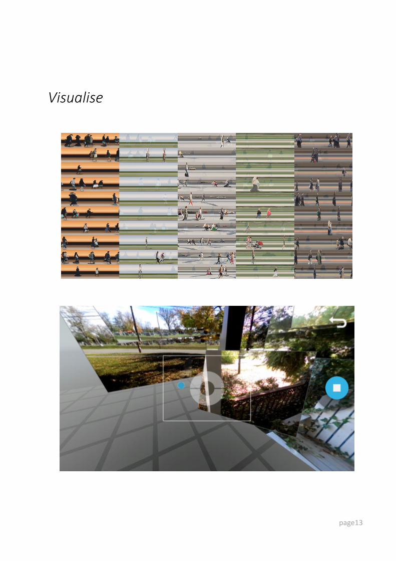
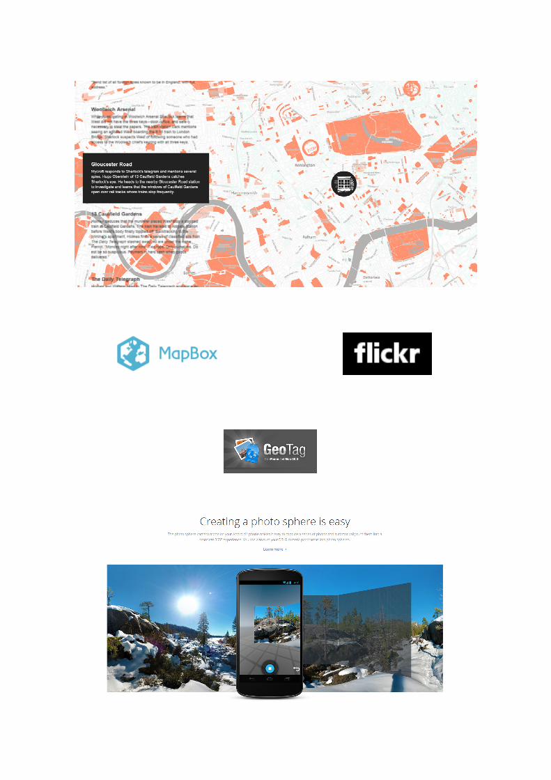
Visualise
Working with creative technology and arts a range of visualisation techniques will beemployed to communicate the projects findings in a way which is visually engaging whilealso informative.
page10
Capture

Observe
‘This highly influential film in architecture and planning circles by William H. Whyte analyses
the success and failures of urban spaces. Observing the natural order of spaces and the way
people move through them, Whyte provides an intuitive critique of urban spaces and ways
these spaces can be improved’
- Luke Keller
page11
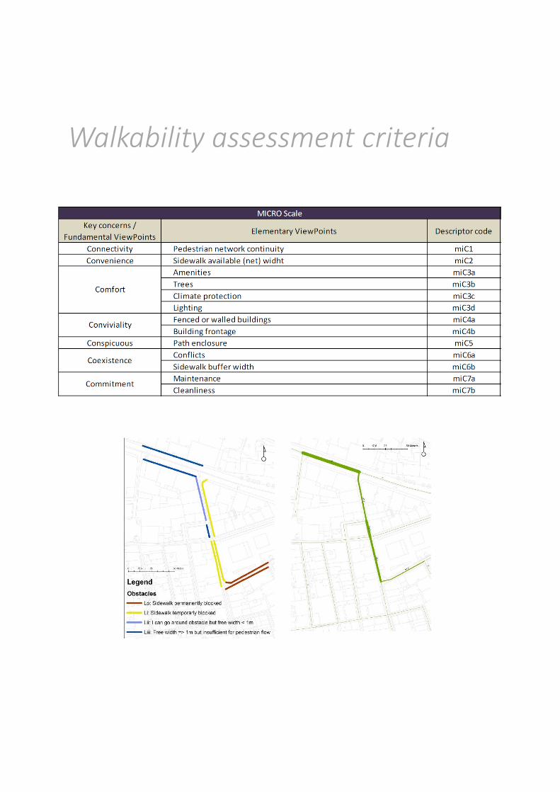
Five footways? Open drains?
Blockages? Change in elevation?
15cm
18cm
15
16cm
11cm
Map
MeasureB
uil
t e
nv
iro
nm
en
t q
ua
liti
es
ConnectedThe extent to which the pedestrian
environment is linked; interfaced; joined; attached; networked.
ConvenientThe extent to which the pedestrian environment is appropriate; useful;
proper; suitable; time-saving.
ComfortableThe extent to which the pedestrian
environment is easy; pleasant; protected; relaxed; sheltered; untroubled.
ConvivialThe extent to which the pedestrian environment is entertaining; lively;
pleasant; sociable.
ConspicuousThe extent to which the pedestrian
environment is obvious; clear; discernible; distinct; perceptible.
Co existence
The extent to which the pedestrian and other transport modes can exist at the
same time and place with order and peace.
CommitmentThe extent to which there exists
engagement, liability and responsibility towards the pedestrian environment.
An example of a walkability assessment model – The 7C’s
Paulo Jorge Monteiro de Cambra, Technico Lisboa, 2012 page12

Analyse
Global
Macro
Meso
Micro
City scale
Neighbourhood scale
Block scale
Street scale
Junction scaleNano
The varying scales of the analytical framework
Visualise
page13
Outputs
Online
A web based repository will be developed bringing together existing web based servicesembedded in a shared space. This mash up of existing media technologies will bringtogether video, photography and mapping in one space. It is intended that this space will beopen to contributions so the public can add to the map and continue to build this repositoryas a resource for championing built environment improvements.
Exhibition
A physical exhibition of photography and video including community contributed. Opened bythe Chief Minister, attended by the press, owned by the people.
Maps
Detailed GIS map layers will be produced to allow detailed examination down to the micro level.
Report
A written report will summarise the project and present a multi scalar analysis of thematerial with a range of recommendations expected to emerge.
page14

Appendix
Outstanding Universal Values
• Criterion (i): Melaka and George Town, Malaysia, are remarkable examples of historiccolonial towns on the Straits of Malacca that demonstrate a succession of historical andcultural influences arising from their former function as trading ports linking East andWest. These are the most complete surviving historic city centres on the Straits ofMalacca with a multi-cultural living heritage originating from the trade routes from GreatBritain and Europe through the Middle East, the Indian subcontinent and the MalayArchipelago to China. Both towns bear testimony to a living multi-cultural heritage andtradition of Asia, where the many religions and cultures met and coexisted. They reflectthe coming together of cultural elements from the Malay Archipelago, India and Chinawith those of Europe, to create a unique architecture, culture and townscape.
• Criterion (ii): Melaka and George Town represent exceptional examples of multi-culturaltrading towns in East and Southeast Asia, forged from the mercantile and exchanges ofMalay, Chinese, and Indian cultures and three successive European colonial powers foralmost 500 years, each with its imprints on the architecture and urban form, technologyand monumental art. Both towns show different stages of development and thesuccessive changes over a long span of time and are thus complementary.
• Criterion (iii): Melaka and George Town are living testimony to the multi-cultural heritageand tradition of Asia, and European colonial influences. This multi-cultural tangible andintangible heritage is expressed in the great variety of religious buildings of differentfaiths, ethnic quarters, the many languages, worship and religious festivals, dances,costumes, art and music, food, and daily life.
• Criterion (iv): Melaka and George Town reflect a mixture of influences which have createda unique architecture, culture and townscape without parallel anywhere in East andSouth Asia. In particular, they demonstrate an exceptional range of shophouses andtownhouses. These buildings show many different types and stages of development ofthe building type, some originating in the Dutch or Portuguese periods.
The Historic Urban Landscape is the urban area understood as a historic layering of cultural
and natural values extending beyond the notion of ‘historic centre’ or ‘ensemble’ to include
the broader urban context and its geographical setting. This wider context includes the
sites topography, geomorphology and natural features, its built environment, both historic
and contemporary; its infrastructure both above and below ground; its open spaces and
gardens; its land use patterns and spatial organisation; its visual relationships; and all other
elements of the urban structure.
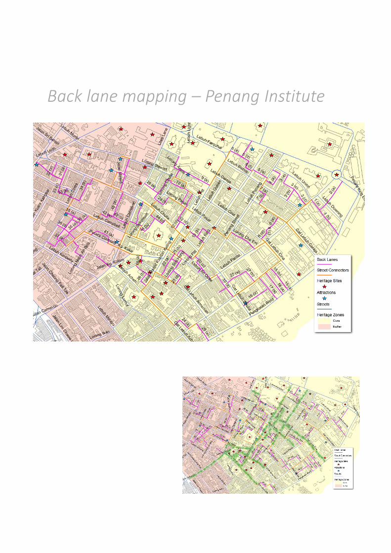
Back lane mapping – Penang Institute
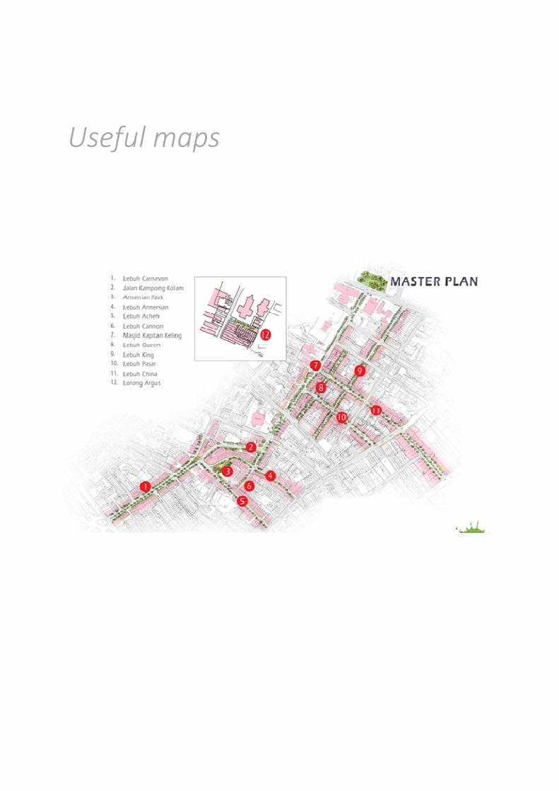
Useful maps
Walkability assessment criteria

Bibliography
Davies. M (1990) City of quartz, London: Vintage
Evans. G (2003) The built environment and mental health, Journal of Urban Health,December 2003, Volume 80, Issue 4, pp 536-555
Ewing. R & Cervero. R (2001) Travel and the Built Environment: A Synthesis, Journal of theTransportation Research Board, Volume 1780 / 2001, 87-114
Jacobs. J (1961) The Death and Life of Great American Cities, Vintage
Jackson. R (2003) The Impact of the Built Environment on Health: An Emerging Field,American Journal of Public Health. 93(9): 1382–1384.
Mitchell. D (1995) The End of Public Space? People's Park, Definitions of the Public, andDemocracy, Annals of the Association of American Geographers, Volume 85, Issue 1
Newman. O (1972) Defensible Space – Crime prevention through urban design, Macmillan
Sassen. S (1996) Whose City Is It? Globalization and the Formation of New Claims, PublicCulture 1996, 8: 205-223
Schweitzer. J, Woo Kim. J, Mackin. J (1999) The Impact of the Built Environment on Crimeand Fear of Crime in Urban Neighborhoods, Journal of Urban Technology, Volume 6, Number3, pages 59–73.
Wilson. J & Kelling. G (1982) "Broken windows: The police and neighborhood safety", TheAtlantic Monthly