pu‘u ali‘i conservation fencing project upper...
TRANSCRIPT

FINAL
ENVIRONMENTAL ASSESSMENT
PU‘U ALI‘I CONSERVATION FENCING PROJECT
Upper Pu‘u Ali‘i Plateau Pu‘u Ali‘i Natural Area Reserve
Moloka‘i
In accordance with: Chapter 343, Hawai‘i Revised Statutes National Environmental Protection Act
National Historic Preservation Act, Sect. 106 Endangered Species Act, Sect. 7
Prepared by:
Department of Land and Natural Resources, Division of Forestry and Wildlife 1151 Punchbowl Street, Room 325
Honolulu, HI 96813
In consultation with staff of: Kalaupapa National Historic Park Natural Resource Management
PO Box 2222 7 Puahi St.
Kalaupapa, Hawai‘i 96742

2
TABLE OF CONTENTS Project Summary 3 Project Background and Need 6 Alternatives Considered 9 Project Description 10 Description of the Affected Environment 12 Potential Environmental Impacts of the Project 18 Mitigation of Potential Impacts 21 Anticipated Determination and Findings and Reasons Supporting the Anticipated Determination 22 List of Permits Required 26 Environmental Assessment Preparation Information 26 References 26 List of Tables, Figures, and Appendices 29

3
PROJECT SUMMARY
Project Name: Pu‘u Ali‘i Conservation Fencing Project Upper Pu‘u Ali‘i Plateau Pu‘u Ali‘i Natural Area Reserve Moloka‘i. Project Location: Pu‘u Ali‘i Natural Area Reserve County of Kalawao District of Kalawao Island of Moloka‘i
TMK 6-1-001-002 (State of Hawai‘i)
Land Use Conservation District, Protective Subzone Applicant: State of Hawai‘i
Department of Land and Natural Resources Division of Forestry and Wildlife (DOFAW) Natural Area Reserves System (NARS)
Approving Agency: Department of Land and Natural Resources P.O. Box 621 Honolulu, Hawai‘i 96809
Anticipated Determination: Finding of No Significant Impact [FONSI] Agencies/Individuals Consulted: Advisory Council on Historic Preservation U.S. Environmental Protection Agency U.S. Fish and Wildlife Service U.S. Geological Survey, Biological Resource
Discipline National Park Service Natural Resources Conservation Service U.S. Senator Daniel Inouye U.S. Senator Daniel Akaka U.S. Representative Mazie Hirono U.S. Representative Neil Abercrombie Department of Agriculture Department of Health, Kalaupapa office DLNR – State Historic Preservation Division DLNR – Division of Conservation and Resources
Enforcement DLNR – State Parks

4
DLNR – Office of Conservation and Coastal Lands Department of Hawaiian Home Lands Office of Environmental Quality Control Kalaupapa Patient Advisory Council Molokai Island Burial Council Office of Hawaiian Affairs Natural Area Reserves Commission University of Hawaii, Environmental Center State Representative Mele Carroll State Representative Sol Kahoohalahala State Senator J. Kalani English Maui County Council Member Danny Mateo Rural Development Project Alu Like: Molokai Island Center Maui County Department of Planning Maui County Department of Public Works Maui County Department of Water Supply Molokai Planning Commission Molokai Community Service Council Molokai/Lanai Soil and Water Conservation District Ke Aupuni Lokahi Bishop Museum, Hawaii Biological Survey Conservation Council for Hawaii Earthjustice Legal Defense Fund Hawaii Audubon Society Hawaiian Botanical Society Historic Hawaii Foundation Hui Malama I Na Kupuna O Hawaii Nei Hui Malama O Moomomi IDEA Kamehameha Schools Ka Ohana O Kalaupapa Kawela Plantation Homeowners’ Association Board Mediation Center of Molokai Moanalua Gardens Foundation Molokai 4-H Molokai Ranch Molokai Visitors Association Native Hawaiian Plant Society Puu o Hoku Ranch Queen Lilioukalani Childrens Center Joyce Kainoa William Akutagawa Malia Akutagawa Dr. Emmet Aluli Alton Arakaki

5
Riki Cooke Shannon Crivello Glenn and Kathy Davis Clifford Dudoit, Kapualei Ranch Crysal Egusa Don Habon Vanda Hanakahi Adolph Helm Shigenobu Inouye Kalani Johnston Moses and Mary Kalilikane Moke Kim Kalani Mahiai Walter Mendez Edmund Pedro Russel Phifer Ron Rapanot, Sr. Joe Reich Kauila Reyes Heli Silva Joann Simms Summary of Action
The State of Hawai‘i Department of Land and Natural Resources (DLNR), in cooperation with Kalaupapa National Historic Park (KALA), National Park Service, U.S. Department of the Interior, proposes to construct new animal exclusion fences at Pu‘u Ali‘i Natural Area Reserve (NAR) on Moloka‘i. The project would protect approximately 484 acres of the 1,330 acre Reserve with animal-proof fences, followed by the removal of all feral ungulates from within the fenced enclosure. Approximately 5 miles of new fence will connect to a fenced unit (South Unit) completed recently by KALA staff. Combined with the existing fencing, the proposed fencing will result in the protection of approximately 75% of the NAR from the damaging impacts of feral animals, providing long-term protection for important native forest and watershed. The natural ecosystem of Pu‘u Ali‘i is still fairly intact, but ungulate activity in many parts of the Reserve is at unacceptably high levels. In similar landscapes throughout Hawai‘i, feral pigs and goats cause significant damage to native vegetation. Irreversible alteration of forest structure, spread of alien weeds, loss of sensitive plant and animal species, and invasion of avian disease causing mosquitoes are some results of severe and prolonged ungulate activity. Natural recovery is possible if animals are removed, but is often limited once a critical threshold of habitat degradation is passed. Continued animal disturbance in Pu‘u Ali‘i NAR will lead to further declines in forest health, and rare elements of the Reserve (plants and animals) may be lost.

6
The primary objective of this project is to prevent further damage to a portion of the Reserve in which the native vegetation is still fairly pristine. Removing animals from the area now is a critical component of long-term protection of the native forest. This Environmental Assessment describes two project alternatives: building fences as described above and a no action alternative. The project is expected to have primarily positive effects on the resources protected in the Reserve. No significant adverse effects are anticipated with regard to the environment, archaeological features, view planes, or public access or use of this area during or after construction of the proposed fencing.
PROJECT BACKGROUND AND NEED Native ecosystems of the Hawaiian Islands provide among the world’s most spectacular examples of the ecological and evolutionary processes of speciation and adaptation. Millions of years of isolation from continental land masses, combined with a full range of available habitats (from wet forest to dry coastal grasslands), resulted in the creation of countless new lineages of plants and animals from relatively few colonizing events. Notable examples are the endemic Hawaiian honeycreepers (Drepanididae), lobeliads (Campanulaceae: Lobelioideae), and pomace flies (Drosophilidae), each of which are represented by dozens of species exhibiting a variety of forms and habits, and each having evolved from perhaps a single colonizing species. Rates of endemism (i.e., percent of species found nowhere else on earth) are extremely high: 99 percent for terrestrial insects, spiders, and land snails, 90 percent for plants, and higher than 80 percent for breeding birds. These biological resources are integral elements of the natural and cultural heritage of the Hawaiian Islands and their people. With the arrival of humans and consequent introduction of invasive plants, animals, and disease, and development, many of the unique biological resources have declined. Ninety percent of the native dryland habitat, 61% of mesic habitat, and 42% of wetland habitat is estimated to be lost, with less than 40% of the land surface covered in native vegetation today. An estimated half of the native bird species have been lost to extinction, and the majority of those surviving are federally listed as endangered. Two hundred and seventy three plants are listed as threatened or endangered, and another 85 are candidates for listing.
In 1972, Chapter 195 of the Hawai‘i Revised Statutes (HRS 195) created the Natural Area Reserves System, to preserve and protect Hawai‘i’s unique flora and fauna, as well as important geological features, for the benefit and enjoyment of future generations. This legislation mandates the Department of Land and Natural Resources to protect NAR lands so that natural resources remain as unmodified as possible. Pu‘u Ali‘i NAR was created in 1985, in order to protect the significant biological resources of the area.

7
In 1996, the Natural Area Reserve Commission adopted Management Policies to guide management activities within the NARS. These policies state:
• In Reserves, strategies to reduce populations of non-native animals to the lowest
possible level will be employed. • Sustained yield management of animals for hunting is contrary to the intent of the
NARS. • Where practicable [emphasis added], regulated public hunting will be used to
control these animals.
Periodic transect based surveys over the past decade have documented continuing ungulate disturbance throughout Pu‘u Ali‘i NAR. The level of disturbance varies with topography and vegetation type, but all natural communities within the Reserve are affected. Pigs are causing most of the damage in the core of the Reserve; goats are a secondary threat and primarily affect vegetation on the steep walls and plateau edges. Deer also likely to be in the Reserve; but due to their secretive nature, they are seldom observed. There is ample evidence to support the conclusion that these animals constitute a severe threat to the integrity of the Reserve by their continued destruction of vegetation, which facilitates soil erosion, the spread of weed species, and avian malaria.
On-going dialogue between agencies and concerned members of the public on the issue of animal control eventually led to the formation of the Moloka‘i Hunting Test Working Group, and later the East Moloka‘i Watershed Partnership. Through these associations, DOFAW, KALA, and The Nature Conservancy have facilitated a cooperative volunteer hunting program intended to reduce erosion and other impacts of pigs, goats and deer in watersheds and other protected natural areas on Moloka‘i, including Pu‘u Ali‘i NAR. In the early 1990s, two fences were constructed in Pu‘u Ali‘i (Figure 1 contains a map which illustrates existing fences in Pu‘u Ali‘i NAR). DOFAW constructed a 1.5-mile long fence that bisected the Reserve from east to west, and The Nature Conservancy constructed a 1.25-mile long fence that roughly followed the southern Reserve boundary. The fences divided the Reserve into two units of roughly equal size – a northern and southern unit. Between 1994 and 2000, approximately 30 organized hunts took place in Pu‘u Ali‘i. Two to four times a year, volunteer hunters and their dogs were flown to the Reserve for hunts lasting up to three days. Roughly 80 pigs and 20 goats were removed from the Reserve during this period. Most of the cost of these helicopter flights was paid out of the NARS program operating budget. Monitoring of animal activity during this time period showed that this program was not enough to reduce impacts to an acceptable level. The steep, rugged terrain and thick vegetation within the Reserve discouraged many hunters from participating in these trips, and it was difficult to recruit enough volunteers to maintain an adequate level of

8
hunting pressure. In addition, ungulates proved able to traverse the cliffs around the Pu‘u Ali‘i plateau, negating the effectiveness of the strategic fences. During hunts, animals were often able to evade dogs by descending onto the steep cliffs, only to return to the plateau after the hunt was over. The failure of these attempts to adequately reduce animal damage is similar to experiences reported from other natural areas in Hawai‘i. It has been repeatedly shown that the crucial primary step in the protection of Hawaiian native ecosystems is the permanent removal and exclusion of all feral ungulates. As the topography was not steep enough to deter animal ingress within the NAR’s south unit along the Pelekunu and Waikolu ridgelines, between 2004 and 2007, two actions were taken to prevent animal incursion into the south unit. First, the existing fence lines were retrofitted to increase their height. Second, new sections of fence were installed along the Pelekunu and Waikolu ridgelines oriented roughly along a north-south line. Connected to the existing fence lines running east-west across the plateau, these new sections have effective made the south unit inaccessible to deer, goats, and pigs from the outside. With this project now complete, and with the recent increase of State funds available for natural area reserve management, DOFAW now proposes to fence the northern portion of the Reserve to expand protection of native forest and prevent irreversible degradation of natural resources. Protection of Pu‘u Ali‘i NAR is consistent with the goals of the East Moloka‘i Watershed Partnership (EMoWP), formed in 1999. The formation of the EMoWP occurred as one of the results of the grass-roots, community-wide strategic planning process of the USDA Empowerment Zone application. The resulting strategic plan clearly states the intention of the Moloka‘i community to take action to protect the Moloka‘i watershed and its many rare and endangered native species, to reduce erosion and sedimentation of the near-shore reefs.
This project involves construction of approximately 5 miles of new fence, connecting to the existing fencing protecting the southern portion of the Reserve. This new fence will follow the rims of Pelekunu and Waikolu valleys and will deter animals from entering the northern half of the NAR. Short segments of strategic fencing will also be constructed along selected ridgelines on the northern boundary to further restrict animal entry into the northern unit. When combined with the existing fencing, the proposed project is anticipated to protect approximately 1,000 acres, or 75% of the Reserve. Upon completion of the new fences, all ungulates will be removed from the northern unit with the use of volunteer hunters. The removal of the last few animals will require using alternative methods such as baiting and trapping or snaring inside the enclosure. Alternative methods will be discussed and agreed upon by the Moloka‘i Hunter’s Working Group. Control of invasive weeds, and augmenting populations of rare and endangered plants by out-plantings, may then be feasible. The proposed fencing project is consistent with State law, the Maui County General Plan, and the Moloka‘i Community Plan. The project provides long-term protection to

9
areas within the Natural Area Reserves system, as encouraged by HRS Chapter 195 and will perpetuate endangered species and their habitat, as encouraged by HRS Chapter 195D. The fencing is consistent with the Maui County General Plan (1990), specifically Environment Objective 1 “to preserve and protect the county’s unique and fragile environmental resources” and the related policies to “(a) preserve for present and future generation the opportunity to experience the natural beauty of the islands; (b) preserve scenic vistas and natural features; (c) support programs to reduce air, land and water pollution; (d) support programs to protect rare and endangered species and programs which will enhance their habitat, and (e) discourage the introduction of noxious foreign species into Maui County’s unique island ecosystems.” The proposed project is also consistent with the Moloka‘i Community Plan (2001) goal to “preserve, protect and manage Moloka‘i’s exceptional natural land and water resources to ensure that future generations may continue to enjoy and protect the island environment,” and the following related objective/policy to “protect and encourage the restoration of native habitats through government and private conservation, land management and educational programs.” Pu‘u Ali‘i NAR also forms a major portion of the watershed for the Moloka‘i Irrigation System administered by the State of Hawai‘i to provide water to the Kualapu‘u Reservoir for agriculture. Protection of the native vegetation in the watershed facilitates longer term flow of water into the irrigation tunnel even during prolonged periods of drought, as experienced during summers and El Nino events over the past decade. In addition, the protection of native forest in Pu‘u Ali‘i NAR through fencing and ungulate removal implements the USFWS Recovery Plan for the Multi-Island Plants and Moloka‘i Plant Cluster, the Revised USFWS Recovery Plan for Hawaiian Forest Birds, and the State of Hawai‘i Comprehensive Wildlife Conservation Strategy.
Pu‘u Ali‘i NAR is State-owned land within the Conservation District and within the boundaries of Kalaupapa National Historic Park. These facts trigger the need for an Environmental Assessment to be written in accordance with Chapter 343, HRS. Federal (DOI) involvement also requires compliance with the National Environmental Policy Act (NEPA), section 106 of the National Historic Preservation Act (NHPA), as amended, and section 7 of the Endangered Species Act (ESA).
ALTERNATIVES CONSIDERED Two project alternatives are described: the proposed fencing (preferred alternative) and a no-action alternative. Alternative 1. Construction of approximately 5 miles of ungulate-proof fencing to form an approximately 484-acre unit in the northern portion of Pu‘u Ali‘i plateau, followed by animal removal The preferred alternative is to construct approximately 5 miles of ungulate-proof conservation fencing, followed by conservation actions such as animal removal, weed

10
control, and outplanting. It is anticipated that the near vertical drop of the sea cliffs along the northern boundary will serve as an adequate barrier to animal intrusion along this edge of the enclosure. However, if it later determined necessary as a result of monitoring, short strategic fences may also be constructed on selected ridgelines as needed to further restrict animal movement and aid in removing the animals that remain inside the enclosure. Strategic fencing on ridges connected to waterfalls may also need to be employed on the northern rim as the terrain is too steep to fence this boundary in its entirety. This will allow managers to reduce or eliminate ungulate disturbance in a significant portion of Pu‘u Ali‘i NAR. Without fencing, animal populations cannot be effectively reduced within the project area. The exclusion of ungulate would allow for the recovery of damage that has occurred, and for the restoration of the rare and endangered species found within the fenced area. The proposed fencing will enable long-term protection against a major threat to the continued existence of the biological resources the NAR was established to protect. Ultimately, the preferred alternative is expected to prevent further decline of native forest, protect watershed, support restoration, protect important habitat for forest birds, and contribute to the recovery of several rare plant and animal species. Alternative 2. No action: The no-action alternative would result in no new fences being constructed on the northern portion of the Pu‘u Ali‘i Plateau. Ungulate control in the project area would be restricted to the present program of aerial shooting and ground hunts with volunteers. This alternative is not recommended, as it continues a program that is ineffective. It is unlikely that funding would continue to be available to support ground hunting, as the cumulative cost of using helicopters to ferry hunters to this remote area is prohibitively expensive and the hunts have been ineffective in reducing animal numbers. Also, the rugged terrain and dense vegetation will continue to discourage volunteers from participating, making it difficult to continue the program over the long-term. Further, this alternative is not preferred because it implies an acceptance of the status quo and continued degradation of the native resources in the Reserve, as animal populations increase within this native forest and watershed area. Goats and deer will penetrate farther into the forest, and deforestation and erosion will accelerate. With no action, the native forest may eventually disappear, further reducing habitat for endangered plant and animal species and depriving future generations of the opportunity to appreciate these resources.
PROJECT DESCRIPTION Fence construction will be coordinated by the Kalaupapa Natural Resources staff, in collaboration with DOFAW Maui NARS staff. Map A illustrates the proposed fence alignment. The fenceline follows the rims of Waikolu and Pelekunu valleys, respectively the western and eastern boundaries of the proposed unit. Due to the steepness of the

11
northern boundary, continuous fencing along this boundary is not feasible. It is anticipated that the near vertical drop of the sea cliffs will serve as an adequate barrier to animal intrusion along this edge. However, if it is determined necessary as a result of monitoring, short segments of strategic fencing may be constructed on selected ridgelines to prevent animal entry into the area. The final alignment of these strategic fences will be determined at a later date with additional reviews as required by NEPA, NHPA, and the ESA. The expected specifications for the project are described below and construction drawings are included as Figure 3. Minor changes may be made as needed based on the terrain, conditions, and professional judgment to improve the effectiveness and/or life span of the fencing.
Hogwire fences will be constructed to prevent entry by pigs, goat, and deer. The fencing is anticipated to be approximately seven feet tall, made of steel posts and steel wire. To construct the fencing, a corridor no wider than four feet will be cleared of vegetation if necessary using powered and non-powered hand tools. Final fence alignments will be selected to minimize removal of native trees and vegetation. Fence construction will involve driving ten-foot galvanized t-posts into the ground approximately eight feet apart along the fence route. Two-foot galvanized anchors will be placed between posts. High tensile galvanized or bezinal-coated steel woven wire mesh three to four feet high will be attached to the outside of the posts, and four foot plastic deer mesh will be hung on the top from nine-gauge bezinal wire. One strand of smooth wire will run along the top of the fencing. One strand of barbed wire will run along the ground at the base of the fencing, or alternatively, a continuous apron of hog wire will be laid horizontally on the ground and attached to the outside of the standing fence with hog rings to prevent entry by feral animals. Self-closing swinging gates will be installed strategically at historical access points and other strategic areas for hunting and management activities. Due to the remote nature of the project area, the fencing crew will transport themselves, materials, supplies, and equipment to the project area using helicopters. Temporary campsites may be established to support fence construction and future maintenance and management activities. The temporary campsites will use 12-inch pre-poured cement blocks, leveled with wood blocks, to serve as footings for three use area platforms: (1) 16’ x 16’ reinforced helicopter landing pad, consisting of a wooden platform leveled on removable concrete footings; (2) 34’ x 16’ camping platform, consisting of a wooden platform leveled on removable concrete footings and mounted with two polyvinyl sheds and water catchments; and (3) 4’ x 4’ outhouse platform, mounted with a custom removable outhouse with tank that will be flown in and out, and will be pumped and disposed of by a certified waste management company. High use campsite trails may be maintained with removable concrete grass blocks to support soft areas and mitigate the impacts of high-frequency foot traffic between platforms.
Rare plant surveys and archaeological surveys were conducted along the proposed east and west boundaries and future surveys will be conducted, as applicable, for the

12
shorter segments of strategic fencing along the proposed north boundary as well as the final fence corridors before any construction activities commence to confirm that the final alignment avoids sensitive natural and cultural resources. During all construction activities, if any unanticipated archaeological sites, artifacts, or burials are encountered, fence construction will halt and the appropriate agencies notified to discuss further action, including re-routing the fence line to avoid these elements. Upon completion of the new fences, all ungulates will be removed from the unit using a combination of methods, beginning with the use of volunteer hunters. The removal of the last few animals will require using alternative methods such as baiting and trapping or snaring inside the enclosure. Alternative methods will be discussed and agreed upon by the Moloka‘i Hunter’s Working Group. The fenced area will be monitored afterwards periodically for ungulate ingress, and the fencing will be inspected and maintained on a regular basis. Control of invasive weeds, and augmenting populations of rare and endangered plants by out-plantings, may also occur after the fencing is complete. Fence construction is planned to occur once all permissions and approvals have been received.
Summary of project costs:
Fence construction and animal removal $421,531 In-kind contributions $157,000 TOTAL $578,531
The high cost of fencing per unit acre is related to several factors. First, the area is remote and roadless and requires that all logistical aspects of the project involve helicopter support from the island of Maui. Second, the terrain is very steep and dissected by rivers and streams requiring the construction of fences on steep slopes with specialized stream guards. Third, inclement weather and rain are common in the mountains and slow progress by creating difficult working conditions. Finally, the animal removal component of the project is critical to the long-term success of the project and it will be expensive to effectively hunt and trap all the animals within the area. The funding source for this project comes from the National Park Service Natural Resource Protection Program’s Resources Management fund open through national competition Park Service wide. Additional funding is available from the State Natural Area Reserve Special Fund.
DESCRIPTION OF THE AFFECTED ENVIRONMENT General Setting Pu‘u Ali‘i Natural Area Reserve (TMK 6-1-001-002) was established in 1985 by State Executive Order 3302, and is located in a remote portion of northern Moloka‘i on the east Moloka‘i volcanic shield. The reserve is primarily composed of a northwest-sloping, stream-dissected plateau surrounded by valley walls that drop off steeply on

13
the north, east and west and totals approximately 1,330 acres. Elevation of the plateau ranges from 4200’ at the summit to approximately 2200’ at the top of the sea cliffs on the northern edge. Rainfall averages below 70 inches annually at lower elevations, increasing to 120 inches in the summit region. Much of the year, the area is shrouded in clouds. Soils in the project area are Tropaquods (rTO), rough mountainous land (rRT), and Amalu-olokui association, 3-20% slopes (rAOD). Tropaquods consist of steepwalled gulches and mountainsides, with slopes ranging from 30 to 70%. Rough mountainous land consists of very steep land broken by intermittent drainage channels. Amalu-olokui association soils consists of Amalu peaty silty clay, 3-20% slopes, and Olokui silty clay loam, 3-30% slopes. All three soils are used for watershed and wildlife habitat. There are no roads to or through the Reserve. Rough dirt roads provide access to the Kamakou Preserve, and a foot trail connects the Preserve to Pu‘u Ali‘i NAR. The terrain within the NAR is very rough. Access to the interior of the NAR is infrequent and usually by helicopter. Three helicopter landing zones and a small management cabin have been established within the Reserve to facilitate management. The Hawai‘i State Department of Land and Natural Resources, Division of Forestry and Wildlife has primary responsibility for the Pu‘u Ali‘i NAR. The Pu‘u Ali‘i plateau is also located within the designated boundaries of Kalaupapa National Historical Park. Management of the NAR takes place under a Cooperative Agreement between the National Park Service and DOFAW. The Reserve’s south boundary adjoins Kamakou Preserve, managed by The Nature Conservancy through the Natural Area Partnerships Program. The Nature Conservancy, DOFAW, and KALA are members of the East Moloka`i Watershed Partnership, formed to manage native ecosystems and watersheds and to reduce erosion causing agents on a regional basis. Partners assist with fencing and feral animal control on adjacent lands. Current Land Use The project area is located within the Protective subzone of the State Conservation District and within the County Special Management Area. Current land uses in the NAR are primarily composed of rare plant and bird surveys and monitoring, weed control, conservation research, and occasional recreational hunting. Flora The NAR is dominated by native vegetation. Five natural communities were observed in the Pu‘u Ali‘i NAR during a January 1989 Heritage survey: ‘Ōhi‘a/‘Ōlapa Montane Wet Forest, ‘Ōhi‘a/Mixed Shrub Montane Wet Forest, ‘Ōhi‘a/Uluhe Montane Wet Forest (which forms patches within the ‘ōhi‘a/‘ōlapa forest on steep slopes), ‘Ōhi‘a-dominated shrubland, and a mixed fern/mixed shrub cliff community. The two shrubland

14
communities are found primarily on the steep slopes and extend from the adjacent valley walls onto the Reserve's western edge and eastern extension at ‘Ōhi‘alele. In Pu‘u Ali‘i Reserve, a wet forest dominated by ‘ōhi‘a (Metrosideros polymorpha) and ‘ōlapa (Cheirodendron trigynum) covers a large portion of the gentle to moderately sloping terrain. ‘Ōhi‘a/‘Ōlapa Montane Wet Forests are generally found above 3,000 feet elevation and are known from the islands of Kaua‘i, O‘ahu, Moloka‘i, Maui, Lana‘i and Hawai‘i. In the NAR, ‘ōhi‘a dominates more than 60 percent of the ‘ōhi‘a/‘ōlapa forest canopy. The codominant ‘ōlapa often exceeds 25 percent cover, though rarely attains 40 percent cover. The most common trees in the secondary tree layer are kāwa‘u (Ilex anomala), kōlea (Myrsine lessertiana), and kōpiko (Psychotria spp.). Hāpu‘u ferns (mostly Cibotium chamissoi, some C. glaucum) are often prominent. The diverse native shrub and fern layer in the understory includes shrubs such as kanawao (Broussaisia arguta), ‘ōhelo kau lā‘au (Vaccinium calycinum), pilo (Coprosma ochracea), kāmakahala (Labordia hedyosmifolia), manono (Hedyotis terminalis) and saplings of ‘ōhi‘a and ‘ōlapa. Native ferns are well represented by hō‘i‘o (Athyrium sandwichianum), ‘ākōlea (Athyrium microphyllum), Elaphoglossum spp., wahine noho mauna (Adenophorus spp.), ‘ae (Polypodium pellucidum) and Dryopteris spp. Epiphytic filmy ferns, mosses and liverworts are abundant. Where pig damage is minimal, native herbs such as ‘ala‘ala wai nui (Peperomia macraeana) and pa‘iniu (Astelia menziesiana) are also abundant. A total of 34 rare plant taxa have been reported from the Pu’u Ali’i NAR and surrounding area (Table 1). Of these, 10 have been confirmed within the NAR boundaries. The 24 taxa known from adjacent areas may be found within the Reserve in future surveys. During rare plant surveys conducted in 1989, Cyrtandra biserrata and Cyanea solenocalyx were observed within the NAR along a side branch of Waikolu Stream near a small waterfall. This species of Cyrtandra is known only from the wet forests of eastern Moloka‘i (Wagner et al. 1990). Cyanea solenocalyx is known only from the wet forests of eastern Moloka‘i (Wagner et al. 1990). Several fruiting plants of Lobelia hypoleuca were also seen in the west central part of the Reserve along a side branch of Waikolu Stream, above a large waterfall. Lobelia is found in mesic and wet forests throughout the main islands. Fauna Birds make up the native terrestrial vertebrate fauna on Moloka‘i. Of the seven endemic birds known from Pu‘u Ali‘i NAR, two are listed endangered by the U.S. Fish and Wildlife Service (Moloka‘i creeper or kākāwahie (Paroreomyza flammea) and Moloka‘i thrush or oloma‘o (Myadestes lanaiensis)), and one is considered endangered by the State of Hawai‘i (‘i‘iwi (Vestiaria coccinea)) (Table 2). The kākāwahie is federally listed as endangered. As it was last recorded on the Reserve's eastern boundary in 1963, it is likely now extinct. The oloma‘o is also federally listed as endangered, was last observed in 1988, and is possibly extinct. ‘I‘iwi

15
is considered endangered by the State of Hawai‘i for Moloka‘i, O‘ahu, and Lana‘i, but is a common species on Maui, Kaua‘i, and Hawai‘i. The USFWS 1979-80 Forest Bird Survey of Moloka‘i found a relict distribution in the Oloku‘i NAR and the Kamakou Preserve. ‘I‘iwi was last reported in the Reserve near the in two separate location near the rim of Pelekunu Valley in 2005 and 2006. Three more common endemic bird species known from the NAR include the Hawaiian owl or pueo (Asio flammeus sandwichensis), ‘apapane (Himatione sanguinea) and ‘amakihi (Hemignathus virens wilsoni). The pueo is common on Moloka‘i. ‘Apapane was commonly heard and ‘amakihi was heard less frequently during a January 1989 survey. In recent years two endemic seabirds, the threatened ‘a‘o or Newell’s shearwater (Puffinus auricularis newelli) and the endangered ‘ua‘u or Hawaiian petrel (Pterodroma sandwichensis) have been heard calling on east Moloka‘i. Historically they have been found on cliffs in Moloka‘i valleys. It is not known whether nesting occurs or if significant habitat exists in Pu‘u Ali‘i NAR for either species. Burrows are usually found in rugged terrain in forested areas and are very difficult to locate. In addition to the endemic birds reported from the Reserve, one rare migrant raptor and ten nonnative birds have been reported. During a 1989 survey, a single peregrine falcon (Falco peregrinus), listed as endangered by the U.S. Fish and Wildlife Service and an occasional to frequent migrant to Hawai‘i, was seen from the edge of Pelekunu Valley in pursuit of an ‘amakihi. Nonnative forest birds commonly heard in Pu‘u Ali‘i NAR include Japanese white-eye (Zosterops japonicus), red-billed leiothrix (Leiothrix lutea) and Japanese bush-warbler (Cettia diphone). Nonnative mammals in the reserve include feral pigs (Sus scrofa) and goats (Capra hircus). It is likely that rats (Rattus spp.) and mongooses (Herpestes auropunctatus) are present in the forest portion of the reserve. Native invertebrate fauna in the Reserve is very diverse and includes intricate land snails. Native invertebrates incidentally sighted in the Reserve include crickets, drosophilid flies, Hawaiian happyface spiders, tornatellinid snails, and succinid snails. Since the native forests and shrublands are relatively intact, it is probable that additional invertebrate taxa would be discovered with more extensive survey work. Four species of achatinellid land snails have been reported from the Pu‘u Ali‘i NAR area (Table 3). Partulina tessellata, P. redfieldii, P. proxima, and P. mighelsiana were found on or near the southern boundary of the NAR in adjacent Kamakou Preserve in 1988. Because habitats of Kamakou Preserve and Pu‘u Ali‘i NAR are similar, it is highly probable that all four species occur in the Reserve. During recent rare plant surveys, Partulina mighelsiana and other native land snails (as-yet unidentified to the species-level) were incidentally observed in the NAR. Malacologists believe virtually all Hawaiian land snails are rare and in danger of extinction.

16
Significant and Sensitive Habitats Pu‘u Ali‘i Natural Area Reserve is significant habitat simply by virtue of being a Natural Area Reserve. The State Natural Area Reserves System was established to “preserve in perpetuity specific land and water areas which support communities, as relatively unmodified as possible, of the natural flora and fauna, as well as geological sites of Hawai‘i.” (HRS Chapter 195). Currently, there are 19 Reserves established statewide, each established to protect unique natural resources of Hawai‘i, including rare native plants and animals that occur nowhere else in the world. In addition, the general project area includes federally designated critical habitat for the following plants: Adenophorus periens, Clermontia oblongifolia ssp. brevipes, Cyanea procera, Lysimachia maxima, Phyllostegia mannii, and Schiedea nuttallii. Finally, the Revised Recovery Plan for Hawaiian Forest Birds identifies the project area as recovery habitat for ‘ākohekohe (crested honeycreeper (Palmeria dolei)) and the Maui parrotbill (kīkēkoa (Pseudonestor xanthophrys)), endangered forest birds currently found only on Maui, but historically present on Moloka‘i. Archaeological Sites and Cultural Resources The steps that have been taken thus far to determine the cultural and historical significance of the project area are as follows: (1) a general literature review was conducted for reports or studies with relevant information regarding the NAR or surrounding area; (2) review of information gathered during consultation for previous fencing projects in Pu‘u Ali‘i NAR was reviewed; (3) scoping letters were sent in March 2007 to a variety of Section 106 stakeholders, including agencies, organizations, and individuals that might be interested in the project or have relevant information about potential impacts on archaeological features or traditional and cultural practices; and (4) an archaeological field survey was conducted along the fence corridor of the western and eastern boundary by Mr. Adam Johnson, a qualified archaeologist, to identify any surface archaeological features within the fencing corridor. In addition to the field survey work, Mr. Johnson conducted a literature search and review of archaeological studies within Kalaupapa National Historical Park. His report, which includes a section on probability findings on cultural uses of the Pu‘u Ali‘i Natural Area Reserve, is currently under internal review. The following excerpts from his draft report are included here:
Because the project area is located at a high elevation, within a wet montane forest environment, it is not anticipated to contain high site density. The project area is located in a rough, mountainous setting that would not have been suitable for agriculture or permanent habitation. More likely, the project area would have been periodically visited by kanaka maoli (Native Hawaiians) for forest resource extraction. The region

17
may also have been visited and traversed during travel between the various ahupua‘a of the area. The one previous archaeological survey conducted by the National Park Service directly adjacent to the current project area did not identify any historically significant resources. Thus, it is expected that the project area is a low probability area for archaeological remains. The site types believed to most likely be encountered during the survey would be historic trails and perhaps ahu - sites that would demarcate travel into/out of and between the large valleys located on the northeastern coast of Moloka‘i. Temporary habitations sites, such as rockshelters, that may have been used during periods of resource gathering could also be present within the project area. Also, because the current portions of the project area are possibly located within the wao kanaka – the upland forest resource zone utilized by native Hawaiians. Other, higher elevation, reaches of the project are located within the wao akua – the realm of the gods, a deeply spiritual place that, as discussed in Handy and Handy (1971), would have been associated with many spirits. Therefore, because of intangible associations the area may have to traditional Hawaiian cultural practices, the Pu‘u Ali‘i area as a whole may potentially have much cultural significance to kanaka maoli (Native Hawaiians).
Due to the remoteness of the project area, visitation is minimal and is primarily limited to the vicinity of the Pelekunu Trail. During pre-consultation, Joyce Kainoa, long time North Shore resident, expressed concern for obstructions to the Pelekunu Rim Trail that her ‘ohana uses to access their home. The fence alignment has been designed to keep the fencing entirely off of the Pelekunu rim so as to not impede transit or disturb the enjoyment of the Pelekunu Rim trail. Traditional uses of the wet mountain forests may have included the gathering of plant material and bird feathers. Present NAR regulations prohibit the collection of plant, animal or mineral material, except by special use permit. There have been no applications for special use permits for gathering for traditional purposes in Pu‘u Ali‘i NAR. However, the proposed fencing is not anticipated to impede public access to the area should a request for permission to exercise traditional gathering rights be made. The proposed fence will provide long-term protection for native forest that contains native plants, some of which were used historically by Native Hawaiians for ethnobotanical or medicinal purposes. Providing long-term protection for these native plants is anticipated to positively impact traditional and cultural practices. Consultation with the Moloka‘i Island Burial Council on the previous fencing project in Pu‘u Ali‘i brought to the attention of the NPS cultural resource specialist that there are mo‘olelo (legends) specific to the Pu‘u Ali‘i area. However, the fencing was not

18
anticipated to have an adverse effect on this aspect of Molokai’s traditional Hawaiian cultural heritage and no additional concerns were raised during or after fence construction. As the project site is immediately adjacent to the previous fencing project, it likewise is not anticipated to have an adverse effect on Molokai’s traditional Hawaiian cultural heritage. Based on the archaeological surveys conducted from May 14-18, 2007, there are no historic sites or archaeological features within the currently proposed fencing corridor that may be impacted by the fencing. There was one potentially historic site identified, a historic era petroglyph, during the field survey. An arrow was found carved into a boulder on an eroded ridge halfway along the alignment on the western boundary (on the rim of Waikolu Valley). The site was marked with orange and white stripped flagging and GPS coordinates of the location were recorded to ensure that the site is avoided during fence construction. It is unlikely that additional historic sites are present, due to the elevation and topography of the planned fencing corridor. However, if additional sites are found, fence construction activities in the area will cease, and the site will be assessed by a professional archaeologist and consultation with appropriate parties will occur.
POTENTIAL ENVIRONMENTAL IMPACTS OF THE PROJECT Vegetation The proposed fence corridor has been selected and surveyed by a trained Park wildlife biologist. The installation of approximately 5 miles of fencing will entail clearing a four-foot wide corridor through the vegetated areas as necessary and installing a hogwire fence supported and anchored with galvanized steel posts. Native vegetation dominates the landscape and some native vegetation will have to be cut and removed. The amount of clearing required in a given area will vary depending on the predominant vegetation type and the amount of previous disturbance. Some of the proposed fence line passes through areas that have been disturbed by feral ungulates. The fence alignment takes advantage of existing game trails wherever possible, and in many sections, it may be possible to weave the fence between the trees with minimal clearing. However, in some locations, the fence route must pass through an area supporting a denser native understory of short trees, shrubs ferns and mosses. Clearance of some of this native vegetation is unavoidable. Wildlife There are no foreseen negative impacts to native bird populations. Because most of the vegetation clearing required will be limited to understory ferns and shrubs, the chance of damage to nests is minimal. One objective of the fence is to minimize damage to the forest caused by digging from animals that result in breeding areas for mosquitoes that typically vector diseases that harm native birds, so the overall impact to native birds is expected to be positive. Rare snails may be on brush cleared for the fence, but no

19
significant impact is anticipated because it is presumed that they will survive and relocate to new sites from cut branches. Archaeological and Cultural Resources No impacts to archaeological or cultural resources are anticipated as a result of the proposed fencing project. Based on the remote location of the project area, no historic sites are anticipated, and the final fence alignment will be surveyed (and any sites identified recorded) prior to construction to confirm that no historic sites are present. If any sites are identified, impacts will be avoided by re-routing the fence alignment as necessary to protect the identified site. As required by the National Historic Preservation Act (NHPA), Section 106 consultation has been initiated for this project between the National Park Service, the Hawai‘i State Historic Preservation Division, and other applicable Section 106 stakeholder groups. The Section 106 consultation process is planned to run concurrently with the NEPA and State Chapter 343 environmental review process. Although remote, the project area may have been used traditionally by Native Hawaiians for gathering of plant material and birds. Present NAR regulations prohibit the collection of plant, animal or mineral material (except by special use permit). Also, gathering of certain plant and animal species is further restricted by State and Federal endangered species law. Construction of fences will have no effect on existing regulations, and hence are not anticipated to affect Native Hawaiian gathering rights. The incorporation of self-closing gates at historical access points will facilitate continued public access to the area. As the intent of the fence is to protect and restore natural resources, the long-term impact on gathering rights may be positive. Economic The proposed action involves the expenditures of funds necessary to construct the fencing, including the purchase of fencing materials, the hiring or contracting of crews, and the purchase or rental of equipment including helicopters, and after fence construction, to remove animals and to restore the project area. The estimated total cost of the conservation project is in excess of $500,000
The project is not expected to have any major negative economic impacts. Positive economic impacts will result from the release of project funds into the State economy through the purchase of goods and services from local vendors and through the hiring of local term laborers to construct the fence. Soils No significant impacts are anticipated. There may be some minor erosion caused by establishment of foot trails along the fence corridor. The net benefit from vegetation recovery after ungulates are removed from within the fence is expected to more than compensate for this minor impact.

20
Noise Hand held gas powered drills will be used on rocky surfaces to drill holes for post installation. Drill noise may be audible at distances up to 200 meters depending on wind direction and terrain. This disturbance should not exceed three weeks. An MD500 light helicopter will be used to transport fence materials to the jobsite. Helicopter operations typically should not exceed more than one hour two days a week. Visitors to this area are primarily hikers and hunters who may occasionally see or hear the aircraft. Overall, noise impacts are not considered significant. Visual In addition to the physical impact installation of fencing may have on any historic properties, the visual impact of installed fencing on view planes of the area was also considered. Care was taken to set the fence alignment away from the Pelekunu rim so that it will not impact or be visible from the Pelekunu rim trail. Public Access One long-term result of this project will be that the area is no longer available for public hunting. However, because of the remoteness of the project area, few hunters are known to visit this area regularly. In addition, over the short term, hunting opportunities may improve, as volunteer hunters will be used to remove feral animals from within the fenced enclosure. Other appropriate public uses such as hiking, nature study, etc. will not be affected. Water/Streams Due to the method of fence construction and the limited corridor to be disturbed, no significant changes in the normal runoff or percolation patterns are anticipated as a result of this project. Over the long-term, by excluding feral animals from native forest and watershed, the proposed fencing is anticipated to positively impact water quality. Alien Species Disturbance along the fencing corridor, as well as the transport of fence materials, equipment, and crew, could increase the potential accidental introduction or spread of non-native plants and invertebrates (including ants) to and within the project site. Air Pollution Limited air pollution from helicopter sling loads and the use of small power tools will be unavoidable during fence construction. Use of this equipment is temporary and is not anticipated to significantly contribute to the overall air quality in the region.

21
MITIGATION OF POTENTIAL IMPACTS While this project is not expected to have any significant negative impacts on the environment, the following items have been identified as possible areas of concern. Planned actions to mitigate possible negative effects are described below. Vegetation Before construction, the fence corridor will be surveyed by a botanist for rare or endangered plant species. If located, the fence will be rerouted to avoid harm to these plants. In addition, final fence alignments will be selected to minimize the removal of live trees, including ‘ōhi‘a, and native shrubs. Attempts will be made to install fence in fern-dominated areas because ferns typically grow back rapidly. Cut vegetation will be left to decompose, providing habitat for native decomposition organisms. All fence construction activities including the clearing of the corridor will be carried out under the direct supervision of trained Park personnel. Fence construction crews will consist of experienced Kalaupapa NHP staff. Kalaupapa’s fencing crew has had extensive experience constructing pig resistant fences in ecologically sensitive, remote areas with minimal impact. Wildlife
In order to minimize impacts to the native achatinellid land snails, the fence will be rerouted whenever possible to minimize the removal of large ‘ohi‘a trees and other known host vegetation. Any trimming or cutting of trees or shrubs in areas known or expected to host tree snails will be done only after the vegetation has been carefully inspected for snails. Cleared vegetation will be placed on native vegetation so that any undetected native tree snails will have an opportunity to reach a replacement host plant. Archaeological and Cultural Resources An inventory level archaeological survey along the proposed fencing corridor for the east and west boundaries of the north unit confirmed that there are no surface archaeological features. As required by the National Historic Preservation Act (NHPA), Section 106 consultation has been initiated between the National Park Service, the Hawai‘i State Historic Preservation Division, and other applicable Section 106 stakeholder groups. If concealed historic properties, such as archaeological resources, are inadvertently encountered during project activities, all necessary steps will be taken to protect them, including notifying and consulting with all appropriate parties, including the Park’s cultural resource specialist and the State Historic Preservation Division, prior to resuming the project. Convenient gates will be designed and constructed along access points and trails to limit impacts of the fences on any person accessing the area for traditional and cultural practices. Care has been taken to propose a fenceline corridor that is located entirely away from the Pelekunu Valley Rim so as to not impede access or disturb the enjoyment of the historic rim trail.

22
Alien Species The disturbance to the ground surface and vegetation involved with building a fence may create conditions suitable for the establishment of weedy plants. The following practices will be implemented to minimize the introduction of alien plants and insects and to reduce the possibility of establishment. First, boots, equipment and materials will be inspected for seeds, eggs, larvae, etc., prior to delivery and/or entry into the project area, and cleaned as necessary. All construction workers will be instructed on specific procedures to prevent the spread or introduction of noxious alien plants in the project area. In addition, precautions will be taken to prevent spreading alien plants already found in the project area, and all food, refuse, tools, gear, and construction scrap will be removed upon completion of work. Noise An MD500 light helicopter will be used to transport fence materials to the jobsite. This aircraft is the smallest and quietest available to accomplish this task. Operations will typically be limited to one hour of flight two times per week during construction. Visual Care was taken to align this fence away from the rim of Pelekunu valley to limit visibility of the fencing. During the process of selecting the final fence corridor, personnel will be placed at various points along the trail to work with and redirect the alignment team as necessary. If any section of the fence remains visible to the public after installation, paint will be used to camouflage and conceal that portion from public view. Public Access The Pelekunu trail, which is the main public access to the Pu‘u Ali‘i area, will not be obstructed by the new fences. Gates will also be installed at various locations around the fence perimeter to allow access to the interior unit.
ANTICIPATED DETERMINATION AND FINDINGS AND REASONS SUPPORTING THE ANTICIPATED DETERMINATION
The goal of the proposed fencing project is to provide long-term protection for approximately 484 acres of native forest from the damaging effects of feral ungulates. Without fencing, pigs, goats, and deer could be expected to degrade the native forest, impairing watershed and reducing the quality of important habitat for native birds, invertebrates, and plants. It is not expected that this project will have a significant adverse effect on the environment, and a Finding of No Significant Impact (FONSI) is anticipated. The

23
anticipated FONSI is based on the evaluation of the project in relation to the following criteria identified in the Hawai‘i Administrative Rules § 11-200-12:
1. Involves an irrevocable commitment to loss or destruction of any natural or cultural resource.
The intent of this project is to benefit natural resources (native plants and animals) protected in Pu‘u Ali‘i NAR. Some common native plants may be damaged during fence construction, but not to any significant degree. Regeneration of vegetation after removal of ungulates is expected to more than offset damage incurred during construction. No archaeological sites have been identified in the immediate vicinity of the fence alignment. The project may indirectly benefit the preservation of sites in the area, as trampling and soil disturbance by hooved animals will be stopped. The long-term goal of the proposed action is not loss or destruction of any natural or cultural resource, but protection and enhancement of existing native forest, watershed, and habitat for native plants and animals.
2. Curtails the range of beneficial uses of the environment.
The proposed action will not curtail beneficial uses of the environment. Instead, the project will protect important native forest, watershed, and habitat. Appropriate public access to and use of the area will not be affected. The site will remain open space, managed as a NAR. The only use that will be curtailed over the long-term is the hunting of feral animals in an approximately 484-acre area; hunting will continue to be available in many areas nearby. Protection of the watershed and native species through fencing increases the beneficial uses of the environment.
3. Conflicts with the state’s long term environmental policies or goals and
guidelines as expressed in Chapter 344, Hawai‘i Revised Statutes (HRS), and any revisions thereof and amendments thereto, court decisions, or executive orders.
The proposed action is consistent with the environmental policies established in Chapter 344, HRS, contributes to the conservation of threatened and endangered species, as covered by Chapter 195D, HRS, and implements the mandate of Chapter 195, HRS, establishing the natural area reserve system and encouraging that actions be taken which "...preserve in perpetuity specific land and water areas which support communities, as unmodified as possible, of the natural flora and fauna..." The fencing implements the goals and objectives of the East Moloka‘i Watershed Partnership and is consistent with the policies outlined in the Memorandum of Understanding of the Hawai‘i Association of Watershed Partnerships. Finally, protection of the native forest of Moloka‘i at Pu‘u Ali‘i implements the Hawai‘i Comprehensive Wildlife Conservation Strategy (2005), the Recovery Plan for Multi-Island Plants (1999) and for the Moloka‘i Plant Cluster (1996), and the Revised Recovery Plan for Hawaiian Forest Birds (2006).

24
4. Substantially affects the economic or social welfare of the community or state. The proposed fencing will not substantially affect the economic or social welfare of the community or State. Fencing is not expected to have negative impact on the economy, as there is no present economic use of the site, and funds for implementation are coming from grants and normal government operational budgets. Social impacts are expected to be positive, as the community will benefit from the protection and restoration of this unique example of Moloka‘i’s rapidly vanishing natural heritage, in the form of improved opportunities for nature appreciation, education, and research. Community members will benefit from the recovery of meat from animals taken by volunteer hunters as animals are removed from the enclosure.
5. Substantially affects public health. The proposed fencing is not anticipated to substantially affect public health. The project site is in remote wilderness. The nearest urban area is at Kalaupapa settlement, several miles away. Implementation is not expected to create any off-site effects, other than short-term noise generated by small power tools, and occasional use of helicopters.
6. Involves substantial secondary impacts, such as population changes or effects on public facilities.
The proposed fencing is not anticipated to result in any substantial secondary impacts. No public facilities will be impacted. No change of population will result from this project.
7. Involves a substantial degradation of environmental quality. The proposed fencing does not involve a substantial degradation of environmental quality. Instead, the intent of the project is to improve environmental quality by protecting and restoring a native forest system. Off-site benefits may include reduced soil erosion and watershed enhancement; improving stream water quality, nearshore water quality, and the health of reef ecosystems.
8. Is individually limited, but cumulatively has considerable effect upon the
environment or involves a commitment for larger actions. The proposed fencing is a stand-alone project that will affect only this one site. Other forest/watershed protection projects are being developed on Moloka‘i; a regional conservation plan that addresses all of these sites and allows for leveraging of resources should be addressed by the East Moloka‘i Watershed Partnership, but is beyond the scope of this document. Any cumulative effect on the environment of these forest/watershed protection projects is anticipated to be positive.

25
9. Substantially affects a rare, threatened or endangered species or its habitat. The project will not negatively affect a rare, threatened or endangered species or its habitat. The purpose of the project is to protect a native Hawaiian rain forest, and the plant and animal species found therein. Numerous rare plant species are known from Pu‘u Ali‘i NAR; all will benefit from increased protection, as will other species that could potentially be reintroduced to the area. The project site is within an area proposed as critical habitat for plants by the U.S. Fish and Wildlife Service; the project implements recommendations of the Service for endangered species recovery. The fencing will also provide a benefit to native forest birds by protecting potential habitat, as recommended by the Revised Recovery Plan for Hawaiian Forest Birds and the Recovery Plans for Multi-Island Plants and the Moloka‘i Plant Cluster.
10. Detrimentally affects air or water quality or ambient noise levels. The proposed fencing will have no detrimental effects on air quality, water quality or noise levels. Some noise will be generated during fence construction, primarily from small power equipment and hand tools, with occasional operation of helicopters. This activity will take place only during daylight hours, and far from any residential area. Construction noise will be localized and temporary. Over the long term, regional water quality may be improved when increased vegetative cover reduces soil erosion.
11. Affects or is likely to suffer damage by being located in an environmentally sensitive area such as a flood plain, tsunami zone, beach, erosion-prone area, geologically hazardous land, estuary, fresh water, or coastal waters.
The project area is in an environmentally sensitive, high rainfall area, prone to landslides due to extremely steep terrain. The final fence alignments will be set back from cliffs, and where gulches are crossed, natural barriers such as waterfalls will be used to minimize stream crossings. There is a remote possibility that the fencing could be damaged by a storm event or landslide. However, the value of protective fencing that excludes feral ungulates from native forest outweighs the potential costs associated with loss of fencing due to damage. The proposed action will not damage, but protect, environmentally sensitive areas.
12. Substantially affects scenic vistas or view planes identified in county or state plans or studies.
The project is within the Kalaupapa National Historic Park, as well as the Moloka‘i Cliffs National Natural Landmark. The project has been designed not to affect the scenic quality of these areas. Fence alignments will be chosen to use terrain and vegetation to screen the fence from public view. For the most part, the fence is not anticipated to be visible to most residents or visitors due to the remote location of the fencing. Based on experience with fences in similar terrain and elevation, the fencing is not expected to be noticeable from a distance. As a result, the project is not anticipated to negatively affect scenic vistas or view planes of the area.

26
13. Requires substantial energy consumption.
The proposed fencing project will not require substantial energy consumption, but instead will consume small amounts of energy during construction through the use of small power tools and the transportation of materials and crew. After completion of the project, there will be minimal demand for energy use, limited to periodic helicopter flights to support fence maintenance.
LIST OF PERMITS REQUIRED Construction of the project requires permission of the Department of Land and Natural Resources. No other permits are anticipated at this time.
ENVIRONMENTAL ASSESSMENT PREPARATION INFORMATION This Environmental Assessment was prepared by staff of: Natural Area Reserves System DLNR, DOFAW, State of Hawai‘i 1151 Punchbowl Street, Room 325 Honolulu, HI 96813 and Kalaupapa National Historic Park National Park Service US Department of the Interior PO Box 2222 7 Puahi Street Kalaupapa, HI 96742
REFERENCES
Banko, W. E. 1980a. History of Endemic Hawaiian Birds, Part I. Population Histories Species Accounts, Sea Birds: Hawaiian Dark-rumped Petrel (‘Ua‘u). Cooperative National Park Resources Studies Unit. University of Hawai‘i. Avian History Report 5B.
Banko, W. E. 1980b. History of Endemic Hawaiian Birds, Part I. Population Histories-
Species Accounts, Sea Birds: Newell Shearwater (‘A‘o). Cooperative National Park Resources Studies Unit. University of Hawai‘i. Avian History Report 5A.
Cuddihy and Stone. 1990. Alteration of Native Hawaiian Vegetation: Effects of Humans,

27
their Activities, and Introductions. Honolulu, Hawai‘i. Giambelluca, T. W., M. A. Nullet, and T. A. Schroeder. 1986. Rainfall Atlas of Hawai‘i.
Water Resources Research Center/Department of Meteorology, University of Hawai‘i at Manoa. State of Hawai‘i, DLNR, Division of Water and Land Development, Report R76. Honolulu, Hawai‘i.
Herbst, D. V. Personal Communications, June 1988. Endangered Species Botanist,
Office of Environmental Services, U.S. Fish and Wildlife Service, 300 Ala Moana Blvd., #6307, Honolulu, Hawai‘i 96850.
Jacobi, J. D. 1985. Vegetation Maps of the Upland Plant Communities on the Islands
of Hawai‘i, Maui, Molokai, and Lanai. U.S. Fish and Wildlife Service. Mauna Loa Field Station, Volcano, Hawai‘i.
Johnson, Adam. 2007. Surface Survey of the Proposed Pu‘u Ali‘i North Unit Fence
Unit, Waikolu Ahupua‘a, Ko‘olau District, Island of Moloka‘i. Department of the Interior, National Park Service, Kalaupapa National Historical Park.
Natural Area Reserves System. 1988. Natural Area Reserves System Inventory Field
Manual. Division of Forestry and Wildlife, Department of Land and Natural Resources, State of Hawai‘i. Honolulu, Hawai‘i.
Palmer, Daniel D. 2003. Hawai‘i’s Ferns and Fern Allies. University of Hawai‘i Press:
Honolulu. Pukui, M.K., S.H. Elbert, and E.T. Mookini. 1974. Place Names of Hawaii. University
of Hawai‘i Press: Honolulu. Pyle, R. L. 1988. Checklist of the Birds of Hawai‘i--1988, in: ‘Elepaio 48 (11): 95-106. Scott, M. J., S. Mountainspring, F. L. Ramsey, and C. B. Kepler. 1986. Forest Bird
Communities of the Hawaiian Islands: Their Dynamics, Ecology, and Conservation. Studies in Avian Biology No. 9, Cooper Ornithological Society. Allen Press, Lawrence, Kansas.
St. John, H. 1987. Diagnoses of Lysimachia species (Primulaceae). Hawaiian Plant
Studies 159. Phytologia 64(10): 43-50. State of Hawai‘i, Department of Land and Natural Resources. 2005. Hawai‘i
Comprehensive Wildlife Conservation Strategy. Honolulu, HI. Accessed at www.dofaw.net/cwcs/ (2006).
State of Hawai‘i. 1997. Management Policies of the Natural Area Reserves System. State of Hawai‘i. 1991. Puu Alii Natural Area Reserve Management Plan.

28
State of Hawai‘i, Division of Forestry and Wildlife. 1988. Preliminary Report of the
Molokai Forest Bird Survey. Department of Land and Natural Resources, State of Hawai‘i.
State of Hawai‘i. Hawai‘i Revised Statutes, Chapter 195. State of Hawai‘i. Hawai‘i Administrative Rules, Title 13-209. State of Hawai‘i, Division of Forestry and Wildlife. No Date. Endangered and
Threatened Animals and Plants of Hawai‘i. Department of Land and Natural Resources, State of Hawai‘i.
U.S. Department of Agriculture, Soil Conservation Service in cooperation with the
University of Hawai‘i Agriculture Experiment Station. 1968. Soil Survey of the Island of Moloka‘i, State of Hawai‘i. Accessed at www.ctahr.hawaii.edu/soilsurvey (2006).
U.S. Fish and Wildlife Service. 2006. Revised Recovery Plan for Hawaiian Forest Birds.
Portland, Oregon. U.S. Fish & Wildlife Service. 2003. Final Rule: Endangered and Threatened Wildlife and
Plants; Final Designations and Nondesignations of Critical Habitat for 42 Plant Species from the Island of Molokai, HI. 50 CFR Part 17. Vol.. 68, No. 52, 12982. Department of the Interior.
U.S. Fish and Wildlife Service. 1999. Recovery Plan for Multi-Island Plants. Portland,
Oregon. U.S. Fish and Wildlife Service. 1998. Moloka‘i II: Addendum to the Recovery Plan for
the Moloka‘i Plant Cluster. Portland, Oregon. U.S. Fish and Wildlife Service. 1996. Recovery Plan for the Moloka‘i Plant Cluster.
Portland, Oregon. U.S. Fish and Wildlife Service. 1989. Endangered and Threatened Wildlife and Plants;
Animal Notice of Review. 50 CFR Part 17, Vol. 54, No. 4. Department of the Interior. U.S. Government Printing Office, Washington, D.C.
U.S. Fish and Wildlife Service. 1985. Endangered and Threatened Wildlife and Plants;
Review of Plant Taxa for Listing as Endangered or Threatened Species; Notice of Review. Federal Register, 50 CFR Part 17. Vol. 50, No. 188. Department of the Interior. U.S. Government Printing Office, Washington, D.C.
U.S. Fish and Wildlife Service. No date. U.S. Fish and Wildlife Service Incidental
Sightings 1979, Miscellaneous Hawai‘i and Moloka‘i.

29
Wagner, W. L., D. R. Herbst and S. H. Sohmer. 1990. Manual of the Flowering Plants
of Hawai‘i. Bishop Museum Press, Honolulu, Hawai‘i.
LIST OF TABLES, FIGURES, AND APPENDICES
Table 1: Rare Plants of Pu‘u Ali‘i Natural Area Reserve Table 2: Rare Birds of Pu‘u Ali‘i Natural Area Reserve Table 3: Rare Snails of Pu‘u Ali‘i Natural Area Reserve Figure 1: Map of Proposed and Existing Fencing, Pu‘u Ali‘i NAR Figure 2: Contour Map of Pu‘u Ali‘i NAR Vicinity Figure 3: Pu‘u Ali‘i Ungulate Activity During Hunting Test Figure 4: Location of Pu‘u Ali‘i State Natural Area Reserve Within Kalaupapa National Historical Park Figure 5: Construction Drawings Appendix 1: Comments received during NEPA, Chapter 343, and NHPA Section 106 Scoping Appendix 2: Comments and responses to comments received during Public Comment Period

TABLE 1
RARE PLANTS OF PU‘U ALI‘I NATURAL AREA RESERVE
______________________________________________________________________________________ Scientific Name Federal Status Status in Reserve Adenophorus periens E ? Bidens wiebkei E ? Canavalia molokaiensis E ? Clermontia oblongifolia ssp. brevipes E ? Cyanea procera E ? Cyanea profuga SOC ? Cyanea solanaceae SOC ? Cyanea solenocalyx SOC * Cytrandra biserrata SOC * Cyrtandra halawensis SOC ? Cyrtandra hematos SOC ? Cyrtandra macrocalyx SOC x Diella erecta E ? Eurya sandwicensis SOC x Exocarpos gaudichaudii SOC ? Gardenia remyi SOC ? Haplostachys linearifolia --- ? Hedyotis mannii E ? Hesperomannia arborescens E ? Hibsicus kokio ssp. kokio SOC ? Huperzia sulcinervia --- ? Joinvillea ascendens ssp. ascendens C x Lagenifera maviensis SOC ? Lobelia dunbarii ssp. dunbarii SOC ? Lobelia dunbarii ssp. paniculata SOC ? Lobelia hypoleuca --- * Lysimachia ternifolia --- ? Melicope reflexa E ? Phyllostegia mannii E * Phyllostegia mollis E ? Phyllostegia stachyoides SOC ? Plantoago princeps var. laxiflora E ? Plantathera holochila E ? Ranunculus mauiensis C ? Schiedea diffusa SOC ? Schiedea pubsecens var. pubescens C ? Sicyos cucumerinus SOC ? Stenogyne bifida E ? Vandenboschia draytoniana --- x Zanthoxylum hawaiiense E x Federal Status: Status in Reserve: SOC = Species of Concern * = confirmed, seen during 1989 survey or later. E = Endangered x = cited in recent literature but not observed during survey. C = Candidate for listing ? = historically known from the vicinity/similar habitat;
no recent observations. Based on Pu‘u Ali‘i Management Plan (1991). Taxonomy follows Wagner et. al. (1990) revised

31
TABLE 2
RARE BIRDS OF PU‘U ALI‘I NATURAL AREA RESERVE ______________________________________________________________________________________ Scientific Name Population Estimate Federal/State HHP (Common Name) (Moloka‘i)1 Status2 Rank3 ______________________________________________________________________________________ Myadestes lanaiensis rutha 19 + 38 LE 1 (Moloka‘i thrush or oloma‘o) Paroreomyza flammea (kākāwahie, Moloka‘i creeper) (poss. extinct) LE H Vestiaria coccinea (‘i‘iwi) 80 + 65 E 1
1 Birds/km2 with a 95% confidence interval (Scott et al. 1986) 2 Key to Federal/State Status: LE Endangered (USFWS 1989) E Moloka‘i population considered endangered by the State of Hawai‘i only (DLNR 1986) 3 Key to Hawai‘i Heritage Program Ranks: 1 Critically imperiled globally (typically 1-5 occurrences) H Historically known; no observations since 1972 throughout its range

TABLE 3 RARE SNAILS OF PU‘U ALI‘I NATURAL AREA RESERVE
______________________________________________________________________________ Current Occurrences HHP Scientific Name in Reserve1 Rank2 ______________________________________________________________________________ Partulina mighelsiana 2 1 Partulina proxima 1 1 Partulina redfieldii 2 1 Partulina tessellata 2 1 ______________________________________________________________________________ 1 Current occurrences reported since 1972 2 Key to Hawai‘i Heritage Program Ranks: 1 Critically imperiled globally (typically 1-5 occurrences) ______________________________________________________________________________

Figure 1. Map of Proposed and Existing Fencing, Pu‘u Ali‘i NAR

34
Figure 2: Pu‘u Ali‘i Ungulate Activity During Hunting Test
Figu
re 2

35
Figure 3: Construction Drawings

36

37
Appendix 1: Comments received during
NEPA, Chapter 343, and NHPA Section 106 Scoping
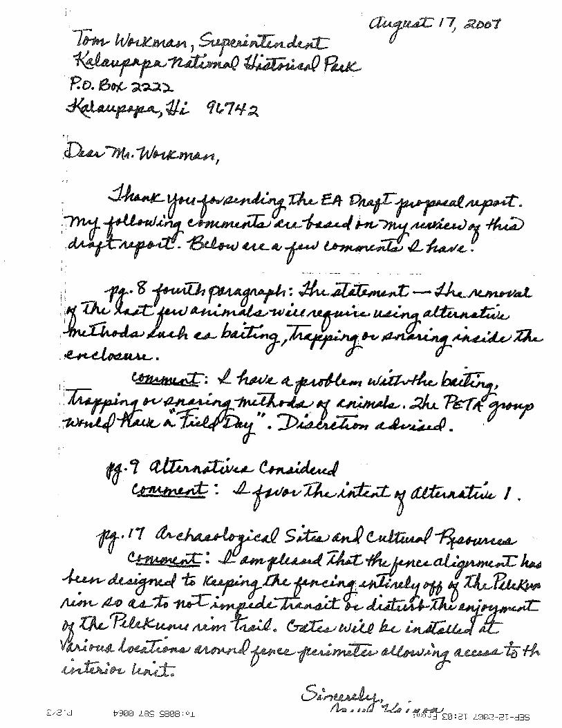
Advisory Council on Historic Preservation Office of Hawaiian Affairs Department of Land and Natural Resources, State Historic
Preservation Division County of Maui, Department of Public Works and Environmental
Management, Development Services Administration Historic Hawaii Foundation


44
Appendix 2: Comments and Responses to Comments Received during Public Comment Period
U.S. Fish and Wildlife Service Advisory Council on Historic Preservation Office of Hawaiian Affairs Department of Land and Natural Resources, State Historic
Preservation Division County of Maui, Department of Public Works and Environmental
Management, Development Services Administration Joyce Kainoa