quarrying plan and progressive closure · pdf fileordinary river sand at b muda block - 5...
TRANSCRIPT
0
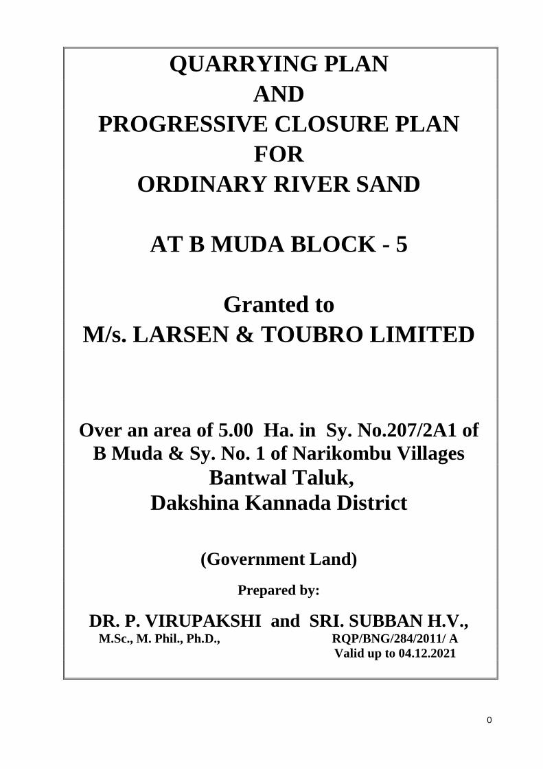
QUARRYING PLAN AND
PROGRESSIVE CLOSURE PLAN FOR
ORDINARY RIVER SAND
AT B MUDA BLOCK - 5
Granted to M/s. LARSEN & TOUBRO LIMITED
Over an area of 5.00 Ha. in Sy. No.207/2A1 of B Muda & Sy. No. 1 of Narikombu Villages
Bantwal Taluk , Dakshina Kannada District
(Government Land)
Prepared by:
DR. P. VIRUPAKSHI and SRI. SUBBAN H.V., M.Sc., M. Phil., Ph.D., RQP/BNG/284/2011/ A Valid up to 04.12.2021

1
2
3
4

5
Contents
Sl. No. Particulars Page No.
Introduction 1
1.0 General 3
2.0 Location and Accessibility 4
PART-A
3.0 Geology and Exploration 7
4.0 Quarrying 10
5.0 Blasting 15
6.0 Mine Drainage 16
7.0 Stoking of Mineral rejects and Disposal of Waste 17
8.0 Use of Mineral 18
9.0 Others 18
10.0 Mineral Processing 19
Part –B
11.0 Environment Management Plan 20
6
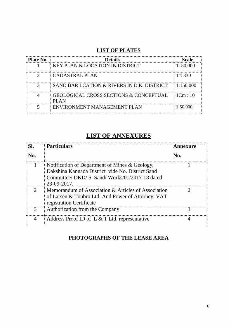
LIST OF PLATES
Plate No. Details Scale 1 KEY PLAN & LOCATION IN DISTRICT 1: 50,000
2 CADASTRAL PLAN 1” : 330
3 SAND BAR LCATION & RIVERS IN D.K. DISTRICT 1:150,000
4 GEOLOGICAL CROSS SECTIONS & CONCEPTUAL PLAN
1Cm : 10
5 ENVIRONMENT MANAGEMENT PLAN 1:50,000
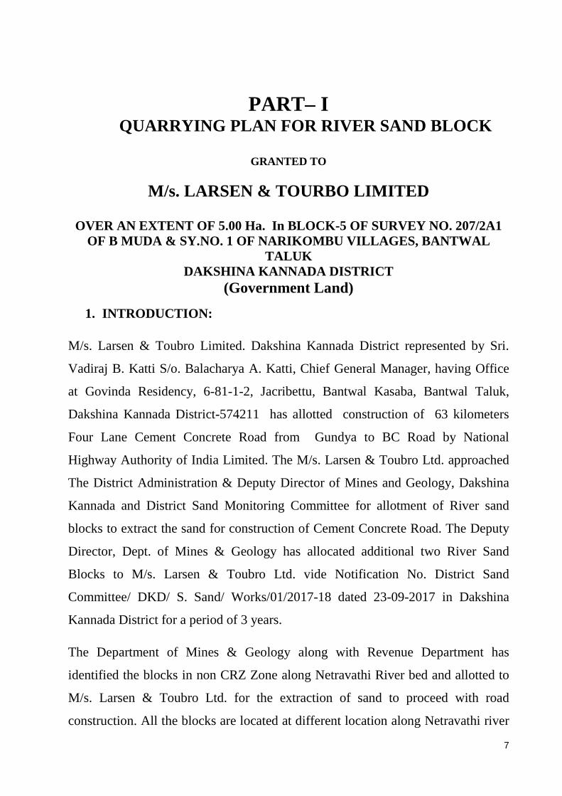
LIST OF ANNEXURES
Sl.
No.
Particulars Annexure
No.
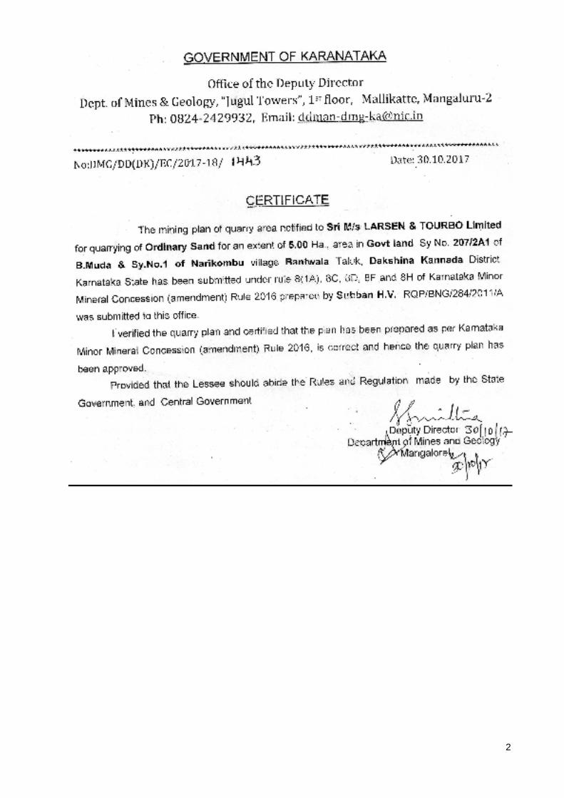
1 Notification of Department of Mines & Geology, Dakshina Kannada District vide No. District Sand Committee/ DKD/ S. Sand/ Works/01/2017-18 dated 23-09-2017.
1
2 Memorandum of Association & Articles of Association of Larsen & Toubro Ltd. And Power of Attorney, VAT registration Certificate
2
3 Authorization from the Company 3
4 Address Proof ID of L & T Ltd. representative 4
PHOTOGRAPHS OF THE LEASE AREA
7
PART– I QUARRYING PLAN FOR RIVER SAND BLOCK
GRANTED TO
M/s. LARSEN & TOURBO LIMITED
OVER AN EXTENT OF 5.00 Ha. In BLOCK -5 OF SURVEY NO. 207/2A1 OF B MUDA & SY.NO. 1 OF NARIKOMBU VILLAGES , BANTWAL
TALUK DAKSHINA KANNADA DISTRICT
(Government Land)
1. INTRODUCTION :
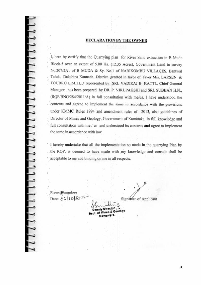
M/s. Larsen & Toubro Limited. Dakshina Kannada District represented by Sri.
Vadiraj B. Katti S/o. Balacharya A. Katti, Chief General Manager, having Office
at Govinda Residency, 6-81-1-2, Jacribettu, Bantwal Kasaba, Bantwal Taluk,
Dakshina Kannada District-574211 has allotted construction of 63 kilometers
Four Lane Cement Concrete Road from Gundya to BC Road by National
Highway Authority of India Limited. The M/s. Larsen & Toubro Ltd. approached
The District Administration & Deputy Director of Mines and Geology, Dakshina
Kannada and District Sand Monitoring Committee for allotment of River sand
blocks to extract the sand for construction of Cement Concrete Road. The Deputy
Director, Dept. of Mines & Geology has allocated additional two River Sand
Blocks to M/s. Larsen & Toubro Ltd. vide Notification No. District Sand
Committee/ DKD/ S. Sand/ Works/01/2017-18 dated 23-09-2017 in Dakshina
Kannada District for a period of 3 years.
The Department of Mines & Geology along with Revenue Department has
identified the blocks in non CRZ Zone along Netravathi River bed and allotted to
M/s. Larsen & Toubro Ltd. for the extraction of sand to proceed with road
construction. All the blocks are located at different location along Netravathi river

8
bed in Puttur, Belthangadi and Bantwal taluks of Dakshina Kannada District are
as follows.
Sl. No.
Name of the Sand Block
Location of Block Sy. No.
Extent in Ha.
Sand Availiable in MT
Tenure of the Lease
1 B Muda Block-3
B Mooda village Bantwal Tq. Netravathi River
207/2/A1
5.00 68000 3 Years
2 B Muda Block-5
B Mooda village Bantwal Tq. Netravathi River
207/2/A1 & 1
5.00 68000 3 Years
Since the river sand s annually replenishable resource in coastal district of
Karnataka, the above two blocks were allocated for extraction of sand to M/s.
Larsen & Toubro Limited for a period of 3 years.
The applicant is submitting quarrying plan for B Muda Block-5 seeking approval
of quarrying plan and Environmental clearance to start the quarrying activity for
road construction for a period of 3 years. The Gazette Notification from Deputy
Director, Department of Mines & Geology, Dakshina Kannada District,
memorandum of Association & Article of Association of Larsen & Toubro Ltd.,
authorization from the company, address proof and ID is enclosed in Annexure 1-
4.
The applicant has approached the RQP for preparation of quarrying Plan for first
three years; The applicant is intended to extract river sand for construction of
cement concrete National Highway Road from Gundya to B.C. Road. The area is
found to have deposit of river sand covering the lease area. Detailed study of the
area has been done by the RQP along with applicant to assess the quality and
quantity of the river sand available in the area. The deposits of river sand material
perish shallow depth. In view of the proposed development, the applicant intends
to go for production of 68000 Tons for 3 years by manual extraction of river sand.
9
The applicant is submitting quarrying plan for a period of first three years to
extract the river sand as pre-requisite to getting approval from the Department of
Mines & Geology and Environmental Clearance from DEIAA as per the
provisions Rule 8(1A), 8C,D,F and 8H and Karnataka Minor Concession
(Amendment) Rules 2013 In line with the Gazette of India S.O. No. 141 (E) dated
15th January, 2016, issued by the Ministry of Environment and Forest & Climate
Change, Government of India to proceed with Sand extraction.
The Netravathi River is flowing at B-Muda – Narikombu Villages east to west
with shallow sand bars/ deposits all along the river course. The quarry plan is
prepared with specific aims as given below:
1. Systematic, scientific and safe sand quarrying with a view to protect
environment and minimize environmental degradation to ensure security of
the people living around.
2. Conserve and maximum utilization of reserves by minimizing the wastage.
3. Planned dumping and storage of waste thereby protecting soil cover and
maintenance of clean and hygienic environment.
4. The quarrying operations will be conducted by manual method.
10
1. GENERAL:
The applicant intends to extract river sand for construction of National
Highway from Gundya to B.C. road and having good business experience.
a. Name and address of the applicant
: M/s. LARSEN & TOUBRO LIMITED. Represented by SRI. VADIRAJ B. KATTI Chief General Manager M/s. Larsen & Toubro Limited. Govinda Residency, 6-81-1-2 Jacribettu, Bantwal Kasaba Bantwal Taluk, Dakshina Kannada District-574211 Ph: 91 9480690200
b. Status of the applicant : Company
c. Minerals/ Which are occurring in the area and which intends to mine:
: River Sand
d. Period for which the quarry lease is proposed to be applied: 3 Years.
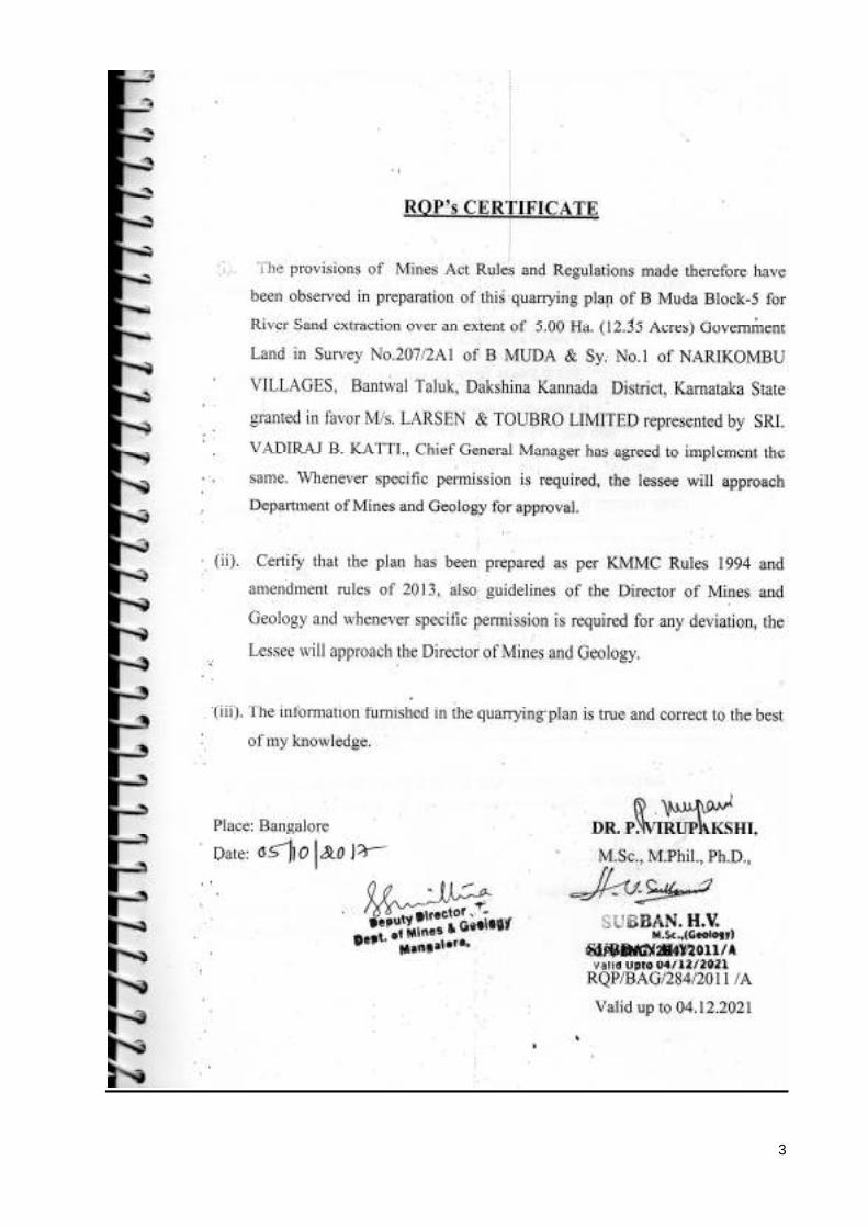
e. Name and address of RQP
DR. P. VIRUPAKSHI , M.Sc. M.Phil., Ph.D. No. 273, 8th Main, BCC Layout Chandra Layout, Vijaya Nagara Bengaluru-560 040 Ph: 9986749095 and Sri. Subban H.V. RQP/BNG/284/2011/A # 58, 26th Main, Behind BHEL Colony Nandini Layout Bengaluru- 560 096 Phone: +91 916137429
f. Reference No. and Date of consent letter from the State Govt. :
The Deputy Director, Department of Mines & Geology, Dakshina Kannada
notified the area over an extent of 5.00 Ha. vide Notification No. No.
District Sand Committee/ DKD/ S. Sand/ Works/01/2017-18 dated 23-09-
2017. (Annexure-1)
11
2.0 LOCATION AND ACCESSIBILITY:
Details of the Area (with Location Map)
Details of the Area (with location map)
a. District and State
: Dakshina Kannada District Karnataka State
Taluk : Bantwal
Villages : B Muda & Narikombu
Survey. No : 207/2A1 & 1
Lease Area (Acres) : 5.00 Ha. (12.35 Acres)
b. Whether the area is recorded to be in the forest (Please specify whether protected, reserved etc.) : No
c. Ownership occupancy : Government Land
d. Existence of public road/ railway line, if any nearby & approximate distance:
The lease area is located at Sy. No. 207/2A1& 1 in B Muda and
Narikombu village limits about 1.62 Km. east of B.C Road Town, about
1.40 Km. South East of Panemangalur village, about 1.70 Km. south
westeast of Narikombu Village, about 1.8 Km. north of Nandavar
village, about 2.6 Km. North of Dasaragudde village, about 3.50 Km.
north of Karaje village and 1.5 Km. south of Bantwal Town which is taluk
headquarter and about 24.00 Km. east of Mangalore Town where all the
welfare amenities are available. The proposed sand block is connected by
village road to Panemangaluru which is on National Highway 75.
The nearest railway station is Bantwal at a distance of 1.10 Km wast of
the lease area. The nearest airport is Mangalore International Airport
which is 46.00 Kms. The sand blocks/ lease area can be reached through
private road to Panemangalur village Road. The lease area is surrounded
by moderate to dense vegetation along the river banks and sand deposits

12
along the river bed. Power connections are available at Panemangaluru
village, Telecommunication facility is available at above habitations,
Dispensary is located at Panemangaluru, BC Road and Bantwal to the
lease area.
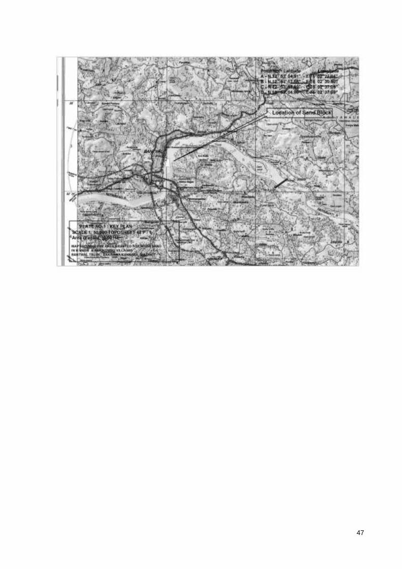
e. Toposheet No. with Latitude and Longitude: The quarry area falls part of
Survey of India Toposheet No. 48 P / 1 of 1:50, 000 Scale (Plate No.1)
GPS Readings (Datum: WGS 84)
Point No. Latitude Longitude B Muda Block-5
A N 120 53’ 04.81” E 750 02’ 27.04” B N 120 53’ 17.86” E 750 02’ 30.50” C N 120 53’ 17.92” E 750 02’ 37.09” D N 120 53’ 04.90” E 750 02’ 37.08”

13
f. Land use Pattern (Forest, Agricultural, and Grazing and Barren etc.):
The sand blocks demarcated along the river bed for sand mining is Government
land. It is sand bed and underlined by Granitic Gneiss sheet rock as visible in low
lying and river meanderings.
The present Land Use pattern of the quarry Area is as follows
Sl. No.
Land use Category Present Land Use
(Ha.)
1 Quarry workings - 2 Waste dumps - 3 Roads -

14
4 Rock boulder storage - 5 Buffer zone/Green belt - 6 Infrastructure - 7 Untouched Area/ Reserved for
future activity 5.00
Total 5.00
g. Attach a general location and vicinity map showing area boundaries and
existing and proposed access routes. It is preferred that the area to be marked
on a Survey of India Topographical map or a cadastral map or forest map as
the case may be. However if none of the these area available, the area should
be shown on an accurate map of 1:5000 Scale
Location of Quarry Lease area is marked on 1:50,000 scale Survey India
Toposheet 48 P / 1 (Plate-1) and 1” : 330’ Cadastral map (Plate No. 2)

15
PART-A
3.0 GEOLOGY AND EXPLORATION:
a. Briefly describe the topography and general geology and local / mine
geology of the mineral deposit including drainage pattern:
Topography: Bantwal Taluk of Dakshnina Kananda District coming under
western slopes, highly undulating topography covered by hillocks and
mounds overlaid by lateritic soil followed by Peninsular Gneiss. The area is
underlined by peninsular gneiss and the ground sloping towards west. The
River Netravathi is flowing across the taluk with a gentle slope with sand
deposits along the river bed. The altitude of the area is 14 to 15 Meters
above mean sea level. The general slope of the area is towards North West.
Topography is both structurally and lithologically controlled. The sand
block area is very gently sloping terrain towards west with gneissic rock
exposures trending North- South direction exposed below the sand. The
sand block area is part of middle part of Netravathi river bed and flows
towards west and joins in to Arabian Sea.
General Geology: Dakshina Kannada District consists of early Precambrian
Gneiss, Granulites and Granites overlaid by tertiary Literates and bentonitic
clays followed by younger quaternary alluvium. The eastern part of the
district is bordered by Sahyadri ranges of Westren Ghats, especially in
Malavantige and Dharmastala part of Belthangadi Taluk consists of slivers
of low grade schist of Bababudan group such as meta-volcanic Banded Iron
Formations. The eastern part of Suliya Taluk consists of high grade
schistose metamorphic formations especially with high alumina meta-
sediments which have been intruded by Agerine Syenites and Pegmatites.
The Pegmatite’s are pinkish brown and whitish mineral veins consist of

16
large grains of soda-potash feldspars and quartz veins from integral part of
the Granitic Gneisses.
Recent Soil tertiary Laterites Late Precambrian
Pegmatites Dolerites
Achaean Peninsular Gneissic complex
Charnockites / Granites and Gniesses
Dharwar super Group Amphibolite and Hornblende Schist
Dolerites: The Precambrian Gneisses and Schists cross cut by dolerite
dykes varying thickness ranging from few centimeters to kilometers
traversing gneisses.
Laterites: Laterite which forms ubiquitous formations in the coastal region
consists of supergene weathering products made-up of mainly Iron and
aluminous hydroxides.
Soils: The Granitic Gneiss outcrops, schist’s, dolerites are covered by thin
cap of loamy soil formed by weathering of Gneisses.
4. Fluvial Geomorphology (Origin of Sand):
The west coast rivers of Karnataka originate all along Sahyadries (Westren
Ghats) at higher elevations i.e. more than one thousand meters above mean
sea level and flow westerly along down the gradient courses in undulatin
fluvial channels and ultimately join the Arabian Sea at Zero Mean Sea level.
The Major rivers of Dakshina Kannada are Natravathi, Gurpur (Phalguni)
rivers. The Gundiya Hole joins near Balya with Kumaradhara and joins with
Netravathi at Uppinangadi. River Gurpur joins Netravathi at the estury of
later near te coast of Mangalore city. The other rivers in the district are
Mulki (Shambavi), Pavanje (Nandini) and Payaswini. The origins of West
Coast Rivers is post Sahyadri Upliftment event and have been affected by

17
recent neo-tectonic movements as evidenced by significant tectonic warp
patterns in the fluvial geomorphology.
Natravathi River: Netravathi River originates near Arasinamakki Gudda
(1177 M) on Sahyadri ranges of Western Ghats flows down the gradient of
Sahyadris towards west, several streams join together to form River
Netravathi. Another sub river Kumaradhara joins with Netravathy at
Uppinangadi in Puttur Taluk. The pH of Netravathi river water ranges from
6.7 to 7.3 and the TDS ranges from 61 to 145. Out of cumulative discharge
in Netravathi about 93% of annual discharge flows during the monsoon
season spanning from June to October in an year.
SEDIMENTATION: Due to Natural gradient the west flowing coastal rivers
carry substantial quantities of sedimentation derived from the weathering and
erosion of different rock formations in the drainage catchment area. The Western
Ghats and the catchments are blessed with copious rainfall normally between the
months of June to October every year. The runoff derived from the luxuriant
rainfall carry lot of weathered and eroded particles from the catchment area which
eventually find their way into down the gradient following the streams and rivers.
RATE OF SEDIMANTATION: The rate of sedimentation in the west flowing
rivers assessed by field research studies during past five years in the field ranges
from 0.5 to 3 meters per year. In the initial and upper reaches of the river course
of Netravathi River the rate of sedimentation is about 0.5 meters per year. In the
middle reaches the sedimentation deposition ranges from 1 to 1.5 meters and along
the lower reaches towards coastal estuaries it ranges’ fro, 2.00 to 3.00 Meters per
annum.
MINEROLOGY & GRAIN SIZE DISTRIBUTION: The sandy sediments
consist of quartz, feldspar, laterite particles, fine sized rock fragments, clay
fractions and organic remains. The upstream reaches contain largely of coarse sand
admixed with different sizes of pebbles, whereas the grain size decreases as we go

18
downstream towards estuaries. Thick sedimentation of fine sand can be found in
estuary beds and proximal tidal reaches. Results of the representative grain size
analysis of the 13 river samples collected from Netravathi river of Dakshina
Kannada district is presented in the below table. In the middle and upper stretches
of the coastal rivers the coarse fraction (20 size mesh ASTM) ranges from 38 to 63
from the sieve analysis.
CHEMICAL COMPOSITION: Previous studies conducted for analysis of sands
samples collected from major rivers of Dakshina Kannada District revealed that
the SiO2 content ranges from 78 to 86% reflects the presence of Quartz grains
derived from silica rich acidic granitic rocks, the Al2O3 content ranges from 2.6 to
8.5%, FeO ranges from 0.4 to 0.7% suggesting minor contribution from laterite.
The CaO and MgO Content ranges from 1.9 to 4.1% and 0.1 to 1.7% respectively
and alkalies (Na2O) from 0.5 to 1.1 and K2O from 0.7 to 1.1 suggesting
contribution from the gneissic and granitic provenance rock.
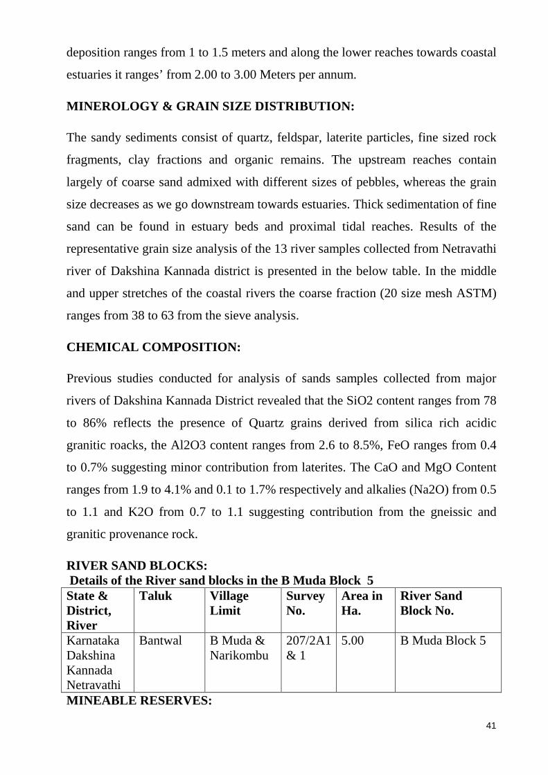
RIVER SAND BLOCK BOUNDARIES:
Sl. No.
Name of the Sand Block
Location of Block
Sy. No. Longitude Latitude Extent in Ha.
1 B Muda Block-5
Karnataka Dakshina Kannada Bantwal Tq. Between B Muda-Narikombu Villages Netravathi River
207/2/A1 & 1
A-N 120 53’ 04.81” B-N 120 53’ 17.86” C-N 120 53’ 17.92” D-N 120 53’ 04.90”
E 750 02’ 27.04” E 750 02’ 30.50” E 750 02’ 37.09” E 750 02’ 37.08”
5.00
The river Sand Block at B Muda fall in B Muda, Narikombu villages, Bantwal
Taluk in Survey of India Toposheet 48 P/1. The delineation of sand block and the

19
sketch was done by Department of Mines and Geology and verified by the
qualified person during the field visit during last week of March 2017.
Geographic Coordinates of the boundaries of the river Sand blocks:
Block No. Village Corner Point
Direction Longitude Latitude
B Muda Block-4 A North East A-N 120 53’ 04.81” E 750 02’ 27.04”
B South East B-N 120 53’ 17.86” E 750 02’ 30.50”
C South West C-N 120 53’ 17.92” E 750 02’ 37.09”
D North West D-N 120 53’ 04.90” E 750 02’ 37.08”
EXPLORATION OF SAND: The river sand is being extracted traditionally since
several decades. The River Sand blocks are accessible by connecting roads and
consist of annually replenishing mineable reserves of ordinary river sand suitable
for construction purposes. The river sand is replenish able minor mineral resource
that are being recharges annually in the river bed along with inflow of surface
water as a result of natural erosion in the catchment area and transportation along
the river channel in the downstream direction.
DEMARCATION OF RIVER SAND BLOCK : The River sand blocks have
been demarcated by Department of Mines and Geology after observing guidelines
by the Karnataka State Government in Karnataka Minor Mineral Concession
(Amendment) Rules 2013 an 2016.
As per KMMC Rule (8 V (d) defines environmental buffer to be left unharmed
during sand extraction along the river bed margins. Only the central ¾ portion of
the width of the river bed may be mined for river sand leaving out 1/8 of the river
bed margins on either bank is banned extraction of sand. Further after every 1000
meters of sand extraction zones along the river bed a gap of 50m should be left as
un-minable buffer as per the KMMC rule 2013 & 2016 Rule 8 V (a).
20
Further, the buffer Zone on either side of the Bridge is specified as 5 times the
bridge span (which should be less than 250M) on upstream direction and 10 times
the bridge span (not less than 500 M) on the downstream direction.
Rule 8V (e) of KMMC (Amendment) Rules, 2013 and 2016 states that no vehicle
for loading of sand , machineries other than used for loading shall be allowed
within Ten Meters from the border of the river bank to ensure the river bank
protection.
ESTIMATION OF MINABLE RESERVES: Reserves of river sand are
estimated by volumetric method based on the cross sectional area of influence
taken as thickness of the estimating block and the specific gravity of the sand. The
river sediments contain about 20% of very coarse sand. Hence the recovery can be
taken conservatively as 80% even though coarser sand can also used especially as
filler base for road works.
The estimation of reserves has been categorized in to proved, probable and
possible reserves. The data on average thickness of annually recharging layer of
river sand based on realistic observations during the past five years is utilized for
estimation of proved category of river sand river sand reserves.
Since the river sand is used for cement concrete Road construction purpose mixed
with gravel, the coarse and small pebbles can also be used for the construction,
hence the recovery percentage will be taken as 80% of volume.
Estimation of Proved and Probable reserves in the River Sand Blocks.
Level & Category
Block Area M2
Avg. Thickness In M
Volume in M 3
Volume after Recovery of 80% in M3
Specific Gravity
Saleable Quantity in MT
Wastage 20% in MT
B Muda Block-5 Annual replenishing
50000 1.00 50000 40000 1.7 68000 17000
21
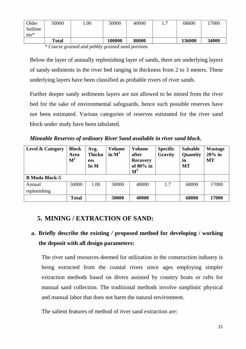
Older Sediments*
50000 1.00 50000 40000 1.7 68000 17000
Total 100000 80000 136000 34000 * Coarse grained and pebbly grained sand portions
Below the layer of annually replenishing layer of sands, there are underlying layers
of sandy sediments in the river bed ranging in thickness from 2 to 3 meters. These
underlying layers have been classified as probable rivers of river sands.
Further deeper sandy sediments layers are not allowed to be mined from the river
bed for the sake of environmental safeguards, hence such possible reserves have
not been estimated. Various categories of reserves estimated for the river sand
block under study have been tabulated.
Mineable Reserves of ordinary River Sand available in river sand block.
Level & Category Block Area M2
Avg. Thickness In M
Volume in M 3
Volume after Recovery of 80% in M3
Specific Gravity
Saleable Quantity in MT
Wastage 20% in MT
B Muda Block-5 Annual replenishing
50000 1.00 50000 40000 1.7 68000 17000
Total 50000 40000 68000 17000
5. MINING / EXTRACTION OF SAND :
a. Briefly describe the existing / proposed method for developing / working
the deposit with all design parameters:
The river sand resources deemed for utilization in the construction industry is
being extracted from the coastal rivers since ages employing simpler
extraction methods based on divers assisted by country boats or rafts for
manual sand collection. The traditional methods involve simplistic physical
and manual labor that does not harm the natural environment.
The salient features of method of river sand extraction are:

22
1. The extraction and collection of sand from the river channel shall be
carried out manually.
2. There is no layer of top soil in the case of river sand deposits.
3. No kind of drilling and blasting are required for the extraction and
collection of sand from the river channel.
EXTRACTION OF ORDINARY SAND: The delineated river sand blocks are
good deposits of ordinary sand. The sand deposition occurs every year due to
erosion in the upper reaches and deposition of sediments in the middle and
lower reaches. Thickness of the river sand deposition ranges from 1.00 to
1.50 meters in the coastal river channels. The earlier studies, the grain size
distribution of sand in ASTM sieve sizes generally from coarse to medium
with fine sand occurring in areas proximal to the estuaries. The representative
chemical analysis of Dakshina Kannada river sands has been completed
earlier by Dr. B. M. Ravindra, indicates that SiO2 content in these sands
ranges from 78 to 86%. The high silica sands are in great demand in quality
construction works.
The process of extraction of the ordinary sand is traditionally carried out in
the region by manual methods by scooping and collection of sand. The
continuous process of accumulation of sands on the river bed often leads to
obstruction of free flow of river water. The extraction also helps in
decongesting the sediments and smoother flow of water in the river channels
especially during monsoon season.
Working Depth: The deposition of sandy sediments occur on recurrent basis
in the river channel during inflow of fresh water in the river channel,
depending on the sediment load carried by the flowing water. The deposition
of sand shall be more during monsoon period when the river waters charged
with heavy sediment loads in suspension run in full level or flood conditions.
Non – Blasting: The river sand extraction activity does not involve any kind
of blasting operations.
23
Labours: The average no. of labors working in the sand extraction center
happens to be 5 to 10 skilled men who share the labor activities such as
diving/ removing and collection of sand carrying the collected sand in head
loads onto the sand stocks on the sand ports.
LODING AND TRANSPORTATION: The sand is extracted from the river bed
by traditional method of scooping and gathering in baskets. The collected
sand of the bucket or sand basket are poured on to the board or raft such that
water portion flows back in to the river when the sand is under shallow water.
The boats / rafts or head loads are carried to shore near to sand port. The sand
collected in individual baskets using hand shovels. The sand collected in
individual baskets shall be carried head load and dumped into the trucks for
transportation.
The sand is transported to the destination in trucks of different sizes
depending upon the requirement.
TONNAGE AND GRADE OF PRODUCTION: The average sand production
from the sand ports ranges from 60 to 160 Metric tons per day depending
upon the requirement of road construction industry. Very coarse grained
sands and those containing pebbly fractions more than 25% retention in 20
ASTM mesh size in general require sieving before utilization in the
construction.
YEAR WISE SAND MINING DEVELOPMENT PLAN: The average annual
production anticipated in the river sand blocks are about 26667 MT per year.
Details of anticipated production plan from the next two years of the plan
period in the sand block as shown in the table below.
ANTICIPATED AVERAGE ANNUAL PRODUCTION : The average annual
production for next three years in Netravathi River bed in B Muda &
Narikombu Block 5 and is as shown below.

24
Category of
reserves
Area in M2
Depth in M
Volume M3
Recovery %
Volume after
Recovery Specific Gravity
Net Reserve
s in MT
Wastage
10% MT
B Muda Block -5 Year 1 50000 0.5 25000
80%
20000 1.7 34000 8500 Year 2 50000 0.4 20000 16000 27200 6800 Year 3 50000 0.1 5000 4000 6800 1700
Sub Total 50000 40000 68000 17000
WASTAGE: In the river sand deposits, the percentage of wastage is very less
since all the material can be utilized for different sorts of construction
purpose. However in case of coarse sand deposits and in present case most of
the sand deposits are extracted, the wastage can be placed at 20% loss or
(1:02) of produced material.
EXPECTED LIFE OF THE SAND BLOCK: The proved extractable reserves of
river sand in the blocks as estimated up to a depth of 1.00 meter depth in the
river bed is 68000 tons. The amount of sand estimated for extraction during a
year also happens to be the order of sand deposition that occurs annually in
the middle level of west flowing rivers in the district. The range of annual
deposition of sandy sediments in the middle pediment levels of the coastal
rivers happens to be 1 to 1.5 m thick layers every year.
The annual cycle of weathering erosion fluvial transportation and deposition
of sediments in the river channel is a perpetual natural process under the
present environmental and geological conditions.
COST OF PRODUCTION: Based on the present cost of production by taking
men and material, machinery required, power and other facilities to provide
men and material the cost of current extraction is about Rs. 6.00 to 8.00 per
cubic feet at ex-sand port, excluding the cost of royalty and taxes to be paid to
the Government, Transportation and delivery to the destination site.
6. ANNUAL REPLENISHMENT OF SAND:

25
The river sand is probably the only the renewable resource that can be
classified as renewable mineral in the world. The environmental cycle of
weathering, erosion, precipitation, runoff and river flow in the natural being
annual cyclic phenomenon, the deposition of sand in the river bed is a
recurrent feature in all active rivers. The rate of sediment deposition in the
west flowing rivers like Netravathi ranges from 0.5 M in the upper reaches to
3.00 M in the lower reaches towards estuary. In the middle reaches an
average annual deposition of 1.5 M sand rich sediments per can be expected.
Pros and Cons of Sand Extraction: Many people have opined reservations
regarding the process of extraction process of extraction and utilization of
sand resources from the river beds from viewpoint of preserving natural
environment.
However, the geological studies and observations over the year in coastal
river environment reveal that regular extraction of sand from the river beds,
without harming its natural environments would be useful in preserving the
hydrological balance as well as the regional tectonic stability.
In case the sand is not extracted on a regular basis, the repeated hights would
massively increases the sediment load in the river and the accumulation of
sand over the year and clog the river channels choking the natural drainage
course of the rivers towards the sea. Sediment clogged river channels would
increase process towards flood condition as well as erosion of river banks and
river flood plains and severe sea erosion.
Coastal Karnataka is sensitive tectonic zone, where in neo tectonic crustal
plate movements have repeatedly expressed in the form of a sequence of
micro seismic activities. In the back ground of neo tectonic sensitivity it has
been found that manual and orderly extraction of annual accumulated sand
would have beneficial effect on the tectonic stability of the region by
decreasing the burden of sediment load. Similarly manual extraction of sand

26
would be immensely useful in preserving the hydrological balance by
allowing free flow of fluvial discharge.
Silting of Dam basins is major issue to be pondered over from the viewpoint
of environmental hazards. Available data shows that in case the MRPL dam
built across Netravathi near Sirapadi, the accumulation of sand silts on the
river bed upstream side is about 4 to 5 meters for a distance up to 2 Km from
the dam. Government of Karnataka in its KMMC (Amendment) Rules 2103
has stipulated that in the river beds 250 m on upstream and 500 M on the
downstream sand should not be removed. However the massive weight of
accumulation of sand and silt if not removed is going to be exerting
unwarranted load on the structure of the dams that may induce seismic
activities in the long course.
7. MINERAL STACKS AND DISPOSAL OF WASTE :
The stacking of mineral rejects generally does not arise in this case, since
there are is no top soil cover in the river sand and deposits the question of
stacking of the top soil does not arise.
The river sand extracted from the river bed is loaded directly in to the trucks
parked in the sand ports on the river banks. Whenever there is less demand,
surplus extraction would be stored in corner of the sand port for loading in to
the trucks when demand arises.
During monsoon season the process of sand extraction from the river bed is
discontinued due to deep column of standing inflow water or due to the floods
or due to environmental reasons. For such inclement seasons sand is collected
and stored in yards away from the sand ports usually in open areas with easier
access to roads.
8. MINOR MINERAL USE:
27
The river sand is an essential component in construction industry being
indispensable role in the strengthening the gravel-sand-cement concrete
mixtures. In concrete mixtures it provides additional coherence and
consistency for the binding media. Fine sand are in high demand especially
for decorative surface finishing. The quartz rich sand are more durable than
other kinds of sand (basaltic trap, calcareous etc), since SiO2 is a chemically
erosive resistant and durable mineral.
9. AMENITIES AND SERVICES:
The coastal reason is quite developed in terms of socio-economic
infrastructure and is blessed with general amenities required for the
extraction, transportation and delivery of quality grade of quartz rich river
sand products.
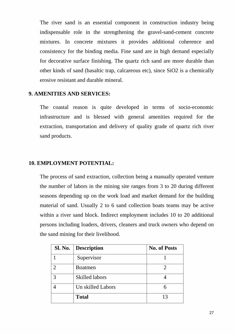
10. EMPLOYMENT POTENTIAL:
The process of sand extraction, collection being a manually operated venture
the number of labors in the mining site ranges from 3 to 20 during different
seasons depending up on the work load and market demand for the building
material of sand. Usually 2 to 6 sand collection boats teams may be active
within a river sand block. Indirect employment includes 10 to 20 additional
persons including loaders, drivers, cleaners and truck owners who depend on
the sand mining for their livelihood.
Sl. No. Description No. of Posts
1 Supervisor 1
2 Boatmen 2
3 Skilled labors 4
4 Un skilled Labors 6
Total 13

28
11. MINERAL PROCESSING:
The River sand extraction as described in earlier sections is a basic manually
operated venture. The river sand resources of the non-CRZ zone are free from
salinity content. Lack of saline content in the sand increases the life of civil
structure and the quality of construction.
The grain size distribution composition of the river sands is significiant factor
in the construction industry. Coarse grained sands are preferred for mixing
with cement and gravel in the structural concrete, whereas the fine sand is
desired for finishing works like outer surface of the structural walls.
Hence the sample process of sieving the sand using approximate sieve/ screen
sizes would be useful for getting desired sand sizes preferred for demanding
civil works and the quality construction applications.

29
PART-B
11.0 ENVIRONMENTAL MANAGEMENT PLAN
a. Base line Information:
i. Existing land use pattern indicating the area already degraded due to
quarrying, pitting/ mining, dumping, road, processing plant, workshops,
township etc,. in tabular form.
The objective of environmental Management Plan is to assess the
environmental conditions prevailing in the river sand extraction site and find
preventive measures to advert any possible adverse impact of the quarrying
operations on the environment. Besides the statutory Environmental clearance
from District Environmental Impact Assessment Authority (DEIAA)
constituted by Ministry of Environment & Forests (MoEF) has been
mandatory prerequisite from January 2016 for grant of quarrying permission.
Since a full pledged chapter on Environmental Management Plan has been
provided in detail (Part-1) of this project, only significant aspects have been
summarized here in this chapter.
Table: 2.1 Villages and population existing within 5.00 Km. radius (buffer
Zone) of B Muda Block (As per 2011 Census).
Sl. No.
Village Direction Households Population Male Female
1 Bantwal N 76405 395380 196708 198672 2 Amtadi NW 1277 5574 2679 2895 3 Kallige SW 910 4205 2034 2171 4 Sajapamudanuru SW 1482 7609 3776 3833 5 Panimangaluru E 1509 8864 4454 4410 6 Narikombu E 1493 7800 3864 3936 7 Shamburu E 449 2379 1209 1170 8 Amaturu SE 671 3115 1528 1587 9 Kalladka SE 960 5788 3002 2786 Total 85156 440714 219254 221460

30
ENVIRONMANTAL CONDITIONS OF MINING:
The Karnataka Minor mineral Concession Rules (Amendment) 2013 has
imposed he following environmental safeguard conditions vide. State
Government Notification No. Cl 357 MMN 2012, Bangalore dated 16-12-2013.
“8V. Environmental Protection measures in River Sand quarrying :
1. For ensuring safety of river beds/its structure / adjoining areas during river
sand quarrying the following measures e taken;
(a). Maintain at least an unmanned block of fifty meters after every block of
1000 meters where mining is undertaken or proportionate;
(b). No quarry shall be permitted in a river bed up to a distance of five times
of span of a bridge on up-stream and ten times the span of such bridge on
down-stream of the river, subject to a maximum of 250 meters on the up-
stream side and 500 meters on the downstream side.
(c). The areas which are located adjoining to the village or traditionally used
by the villagers shall be left and declared as no sand mining area by limiting
to 250 meters length or as decided by taluk committee.
(d). Sand quarrying shall be restricted to the central ¾ width of the river at
the center by leaving a 1/8 margin of the river width from the river bank all
along the river length of the block as buffer zone.
(e). No vehicles for loading of sand , machineries other than used for
loading shall be allowed within ten meters from the border of the river bank
to ensure the river bank protection.
(f). Suitable indigenous plant species like bellary jaly or any other variety
shall be planted on specified stretch of the river bank to prevent river
ingression and also to maintain river bank stability.
(g). Along with the royalty, Environment Management fee per cubic meter at
the rate specified by the Government from time to time shall be collected and
the same shall be credited to “Corpus fund” and shall be utilized for
rehabilitation and reclamation activities.
31
(h). The production quality shall be based on the approved quarry plan.
ensure river approach channel is not obstructed and that repaired bank
(i). Access routes, if they are not beneficial to the local community would
need to be ploughed and re-planted with native species;
(j). Close and restore river bank where access ramps have been restored,
ensure river approach channel is not obstructed and that repair bank is
restored to normalcy.
(k). any violations observed shall be brought to the notice of District
Monitoring committee along with a mahajar/ joint inspection report by the
member of district monitoring committee by temporarily suspending the
work by an order and be placed to further decision by the district Monitoring
Committee in the matter.
(l). Further the District Monitoring Committee shall review by giving an
opportunity to the successful bidder and pass an order to resume the sand
quarrying by allowing him to enter to rectify the mistakes or by
compensating the damages.
(m). The District Monitoring Committee upon hearing and based on reports
may direct the concerned to restore or cancel or direct initiation of legal
proceedings if any.”
ENVIRONMANTAL MANAGEMENT PLAN FOR RIVER SAND
EXTRACTION
In case the present sand Block B Muda Block 5 are no bridges involved in the
250 M proximity of the blocks. The natural flowing courses of the river are not
to be blocked or diverted in any manner during the course of extraction of sand.
The following sets of pro-environmental guidelines are to be followed in order
to prevent or at least to mitigate any possible environmental adverse effects that
may crop up.
32
Environmental Safeguards:
Harvesting of river bed minerals and other associated activities have been
considered to be the main sources of environmental degradations. Care should
be taken to prevent damage of river bank due to construction of access ramps in
to the river bed. Similarly care should be taken to prevent causing any kind of
damage to vegetation and disturbance to ground water resources. Any act that
may lead to soil erosion is to be avoided so also any possible inducement for
changes in the river course to be prevented.
Buffer Zone along the river banks:
In order to prevent damage to the river banks in the process of sand extraction
KMMC (Amendments) Rules, 2013 have been recommended that 1/8 (or
12.5%) of the river width on either river bank margin has to be left out as area
of no mining.
The average width of the river Netravathi is about 420 M near Bantwal, width
measured in toposheet from 360 to 472 m in straight course. Therefore , in
accordance with the recent KMMR (Amendments) 2013, the sand can be
extracted only in the central 300 m wide zone, falling within the approved
block, leaving out 50meters of buffer towards periphery of either river banks.
Public Structure:
The presents block is located about 250 Meters from the nearest national
Highway connecting Mangalore city with Hassan. The river sand blocks are
located more than 1.10 Km. away from the nearest Railway line connecting
Mangaluru and Hassan Railway stations. There are no irrigation canals or public
structures or monuments in the said block/ cluster area. The open area and fields
near the river bank of the river sand blocks have remained mostly as fallow
lands on the way to urbanization.
Sand Replenishment:
33
The river bed areas involved in the sand extraction during the one post monsoon
season will get refilled with fresh layer of sand deposit in the following rainy
season along with inflow of seasonal fluvial discharge derived from the rains
and resultant of runoff along with weathered and eroded material from the
catchment area.
Sand Distribution:
One of the positive advantages of manual sand extraction in the river beds is
that with constant movement of the flow currents within the rivers and the sand
extracted areas gets filled with sediments from the adjoining areas preventing
formation of depressions under water in the river bed.
Depth of Sand Extraction:
The depth and quantity of sand extraction of sand deposits in the river beds, in
the case of manual extraction by divers using buckets or porous baskets nets is
naturally restricted since they can fetch only the upper most (replenishing) layer
of sand deposited in the river bed.
Transportation of Sand:
The sand extracted from the river is usually wet for some time. After passage of
couple of days the sands heaped as stocks gets dry. While transporting dry
sands, care should be taken to cover the trucks with tarpaulin or equivalent
covers such that lose dust particles emanating from the dry sands in the vehicles
do not pollute the air environment along the course of its journey to the desired
destinations.
Existing Approach roads:
Existing approach roads may be effectively made use since, most of the river
sand blocks being in use since many years, have already been provided with
adequate existing approach roads. Construction of new approach roads in

34
agricultural lands may be controlled to bare minimum in order to prevent
degradation of fertile lands suitable for agriculture purposes.
Existing sand ports and stock yards:
The existing sand ports on the river banks for unloading sand from the boats
should be effectively used on sharing basis, where a number of extractors work
together. Construction of new sand ports should be avoided so as to prevent
unwarranted environmental degradation of land on the river banks and access
routes.
MITIGATION MEASURES:
The mitigation measures proposed for decreasing possible land, air and water
environmental degradation effects in and around the sand extraction sites are
outlined here below:
· There shall be no changes or alteration or blocking of flow paths in the
river flow course during the extraction of sand from the river bed.
· The extraction sand shall be exclusively manual in small quantities at a
time such that the process would not hamper natural movement of
organisms and biota within the fluvial environment.
· Existing approach /accesses roads shall be utilized as for as to avoid
possible damages to land environment during construction of new
approaches.
· New access points to the river bed if necessary shall be decided basig on at
least steepness of river bank and least human activity.
· New accesses roads from public roads and up to river bank if necessary
shall be aligned in such a way that it would cause least environmental
damage.
· Haulage roads parallel to river bank and the roads connecting accesses to
river bed will be made away from the bank.
35
· Maximum number of accesses roads to river bed shall be provided for
which cutting of river banks will be avoided and ramps are to be
maintained.
· Sand extraction pattern and schedule shall be coeval with (or Synchronized
with) the river flow direction and the general gradient of the land.
· Sand extraction activity shall be terminated in monsoon season and at the
time of floods.
· Care will be taken to ensure that ponds are not formed in the dry river bed.
· Planting of saplings species adaptable to the native environs as part of
vegetarian development is proposed along the banks of the river and along
the sides of the approach roads to arrest soil erosion and strengthening of
banks as well for arresting possible emanation of air pollution in the dry
season.
· On unpaved approach roads water sprinkling will be done on the roads
during dry season on regular basis.
· Care shall be taken to prevent spillage while loading and transporting the
river sands and the load carrying vehicles shall be covered with tarpaulin or
other similar appropriate covering material.
· During the dry season, the transporting vehicles especially in the unpaved
access roads shall ply at low speeds not exceeding 25 Km. per hour so that
dust from the roads fly and pollute the surrounding environment.
· The lower speeds recommended for the transporting vehicles shall reduce
the noise pollution from the vehicles that may possibly disturb birds,
animals and people in the surrounding region.
· Fortnightly scraping of the unpaved road shall b made in order to keep the
roads in proper and leveled condition so as to ensure smooth flow of
vehicles as well as to prevent spillage of sand en route.
· Overloading shall be avoided by imparting prior awareness and
admonishment.
36
· Proper tuning of vehicles shall be ensured to keep the harmful gas emission
from the vehicles within the prescribed norms.
37
Part: 2 B
PROGRESSIVE QUARRY CLOSURE PLAN
The objectives of the Progressive Quarry closure plan is to assess the
environmental friendly conditions and precautionary and preparatory measures
prevailing in the river sand block for systematic closure of the site to any
possible adverse impact on the sand extraction on the environment and
employees. The progressive quarry closure plan is statutory requisite for the
Mining Plan and the Environmental Clearance from the State / District
Environment Impact Assessment Authority (SEIAA/ DEIAA) of Ministry of
Ecology and Forests (MoEF), for the grant of sand extraction permission by the
District Sand Monitoring Committee.
RIVER SAND BLOCK BOUNDARIES
The B Muda river sand block-5 falls within the Survey India Toposheet No. 48
P/1.
Summarized general information of the river sand project.
Quarry Owner/ Proponent
M/s. Larsen & Toubro Limited. Dakshina Kannada District
Postal Address Represented by Sri. Vadiraj B. Katti S/o. Balacharya A. Katti Chief General Manager. Office at Govinda Residency 6-81-1-2, Jacribettu Bantwal Kasaba Bantwal Taluk, Dakshina Kannada District-574211 Ph:+91 9480690200
Name of Minor Mineral Ordinary river sand
Proceeding date The DD, MGD has allotted additional 2 River Sand Blocks to M/s. L & T Ltd. vide Notification

38
No. District Sand Committee/ DKD/ S. Sand/ Works/01/2017-18 dated 23-09-2017 in Dakshina Kannada District for a period of 3 years.
Aerial extent of sand
block
5.00 Ha.
River and title of land Netravathi River bed, Government revenue land
Type of Land River and river bank surrounded by lush greenery.
Survey no. & Village
block
Sy. No.207/2A1 B Muda Village, Bantwal
Taluk
SOI Top sheet 48 P/1 of 1:50000 scale
District headquarters Mangaluru
Nearest Airport Bajpe, Mangaluru
Nearest Highway NH 75 Mangaluru to Bengaluru via. BC Road
Nearest railway station Bantwal (1.1.00Km); Mangaluru (24.00 Km.)
Category of Quarry B2
Average annual
production of the block/
cluster
22667 MT/ Annum
Geographic Coordinates of River Sand Block
Block No. Corner Point
Corner Direction
Longitude Latitude
B Muda Block- 5
A South West N 120 53’ 04.81” E 750 02’ 27.04”
B North West N 120 53’ 17.86” E 750 02’ 30.50”
C North East N 120 53’ 17.92” E 750 02’ 37.09”
D South East N 120 53’ 04.90” E 750 02’ 37.08”
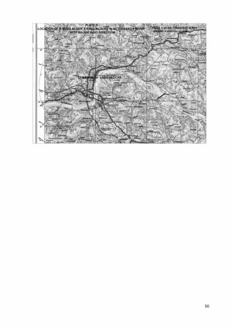
Topographic Layout plan of the river block area has been provided in Plate -3
Geological map and the sections of the area are shown in Plate-4.
Environmental layout and buffer around River Sand Block and the cluster is
presented in Plate-5. Photographs of the quarry are shown at the end.
39
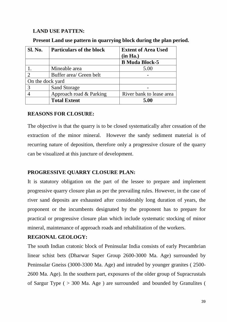
LAND USE PATTEN:
Present Land use pattern in quarrying block during the plan period.
Sl. No. Particulars of the block Extent of Area Used (in Ha.)
B Muda Block-5 1. Mineable area 5.00 2 Buffer area/ Green belt - On the dock yard 3 Sand Storage - 4 Approach road & Parking River bank to lease area Total Extent 5.00 REASONS FOR CLOSURE: The objective is that the quarry is to be closed systematically after cessation of the
extraction of the minor mineral. However the sandy sediment material is of
recurring nature of deposition, therefore only a progressive closure of the quarry
can be visualized at this juncture of development.
PROGRESSIVE QUARRY CLOSURE PLAN:
It is statutory obligation on the part of the lessee to prepare and implement
progressive quarry closure plan as per the prevailing rules. However, in the case of
river sand deposits are exhausted after considerably long duration of years, the
proponent or the incumbents designated by the proponent has to prepare for
practical or progressive closure plan which include systematic stocking of minor
mineral, maintenance of approach roads and rehabilitation of the workers.
REGIONAL GEOLOGY :
The south Indian cratonic block of Peninsular India consists of early Precambrian
linear schist bets (Dharwar Super Group 2600-3000 Ma. Age) surrounded by
Peninsular Gneiss (3000-3300 Ma. Age) and intruded by younger granites ( 2500-
2600 Ma. Age). In the southern part, exposures of the older group of Supracrustals
of Sargur Type ( > 300 Ma. Age ) are surrounded and bounded by Granulites (
40
2500 –2600 Ma. Age) . The Gneisses, Granites and Granulites have been traversed
by numerous East-West trending set of Dolerite dykes.
The Precambrian geological formations in the Karavali are covered under veneer
of Laterite and alluvium.
TOPOGRAPHY & FLUVIAL GEOMORPHOLOGY:
The low lying topography of the coastal terrain (Karavali) terminates in elevated
Sahayadri ranges in the eastern borders of the district. The rives of the west coast
of Karnataka originates in the Sahayadris (Western Ghats) at elevations exceeding
on thousand meters above mean sea level and flow westerly along down the
gradient course in undulating fluvial channels and ultimately join the Arabian sea.
The two major rivers in Dakshina Kannada district are Netravathi and Gurpura
(Phalguni), river Kumaradhara joins Netravathi at Uppinangadi and Gundya Hole
joins Kumaradhara at Balya. River Gurpura joins Netravathi river at the estuary of
the later, near the coast south of Mangalore city. The other rivers in the district
include Mulki (Shambavi), Pavanje (Nandini) and Payaswini.
SEDIMENTATION:
Due to Natural gradient the west flowing coastal rivers carry substantial quantities
of sedimentation derived from the weathering and erosion of different rock
formations in the drainage catchment area. The Western Ghats and the catchments
are blessed with copious rainfall normally between the months of June to October
every year. The runoff derived from the luxuriant rainfall carry lot of weathered
and eroded particles from the catchment area which eventually find their way into
down the gradient following the streams and rivers.
RATE OF SEDIMANTATION:
The rate of sedimentation in the west flowing rivers assessed by field research
studies during past five years in the field ranges from 0.5 to 3 meters per year. In
the initial and upper reaches of the river course of Netravathi river the rate of
sedimentation is about 0.5 meters per year. In the middle reaches the sedimentation
41
deposition ranges from 1 to 1.5 meters and along the lower reaches towards coastal
estuaries it ranges’ from 2.00 to 3.00 Meters per annum.
MINEROLOGY & GRAIN SIZE DISTRIBUTION:
The sandy sediments consist of quartz, feldspar, laterite particles, fine sized rock
fragments, clay fractions and organic remains. The upstream reaches contain
largely of coarse sand admixed with different sizes of pebbles, whereas the grain
size decreases as we go downstream towards estuaries. Thick sedimentation of fine
sand can be found in estuary beds and proximal tidal reaches. Results of the
representative grain size analysis of the 13 river samples collected from Netravathi
river of Dakshina Kannada district is presented in the below table. In the middle
and upper stretches of the coastal rivers the coarse fraction (20 size mesh ASTM)
ranges from 38 to 63 from the sieve analysis.
CHEMICAL COMPOSITION:
Previous studies conducted for analysis of sands samples collected from major
rivers of Dakshina Kannada District revealed that the SiO2 content ranges from 78
to 86% reflects the presence of Quartz grains derived from silica rich acidic
granitic roacks, the Al2O3 content ranges from 2.6 to 8.5%, FeO ranges from 0.4
to 0.7% suggesting minor contribution from laterites. The CaO and MgO Content
ranges from 1.9 to 4.1% and 0.1 to 1.7% respectively and alkalies (Na2O) from 0.5
to 1.1 and K2O from 0.7 to 1.1 suggesting contribution from the gneissic and
granitic provenance rock.
RIVER SAND BLOCKS : Details of the River sand blocks in the B Muda Block 5 State & District, River
Taluk Village Limit
Survey No.
Area in Ha.
River Sand Block No.
Karnataka Dakshina Kannada Netravathi
Bantwal B Muda & Narikombu
207/2A1 & 1
5.00 B Muda Block 5
MINEABLE RESERVES:
42
Details of Minable reserves in River sand blocks in the B Muda Block-5
Level & Category Block Area M2
Avg. Thickness In M
Volume in M 3
Volume after Recovery of 80% in M3
Specific Gravity
Saleable Quantity in MT
Wastage 20% in MT
Kadeshvalya Block-5 Annual replenishing
50000 1.00 50000 40000 1.7 68000 17000
Total 50000 40000 68000 17000
EXTRACTION OF ORDINA RY SAND The delineated river sand blocks good deposits of ordinary sand. The sand
deposition occurs every year due to erosion in the upper reaches and deposition of
sediments in the middle and lower reaches. Thickness of the river sand deposition
ranges from 1.00 to 1.50 meters in the coastal river channels. From the earlier
studies the grain size distribution of sand in ASTM sieve, generally from coarse to
medium with fine sand occurring in areas proximal to the estuaries. The
representative chemical analysis of Dakshina Kannada river sands has been taken
from earlier studies by Dr. B. M. Ravindra, indicates that SiO2 content in these
sands ranges from 78 to 86%. The high silica sands are in great demand in quality
construction works.
IMPLEMENTATION OF QUARRY PLA N: The process of extraction of the ordinary sand is traditionally carried out in the
region by manual methods involving labors skilled in collection of sand. The
continuous process of accumulation of sands often leads to obstruction of free flow
of river water. The extraction also helps in decongesting the sediments and
smoother flow of water in the river channels especially during monsoon season.
It is obligatory on the part of river sand extractors permitted by the proponent to
implement th Quarry Plan and progressive closure in totally. For any deviations or
specific changes the proponent has to approach the authorities of Department of
Mines and Geology and District Sand Monitoring Committee.
ENVIRINMENTAL MANAGEMENT PLAN
43
Harvesting of river channel minerals and other associated activities have been
considered to be the main sources of environmental degradation. Care should be
taken to prevent damage of river bank due to construction of access ramps in to the
river channel. Similarly care should taken to prevent causing any kind of damage
to vegetation and disturbance to ground water resources. Any act that may led to
soil erosion is to be avoided so also any possible inducement for changes in the
river course is to be prevented.
The mitigation measures proposed for decreasing possible land, air and water
environmental degradation effects in and around the sand extraction sites are
outlined here below:
· There shall be no changes or alteration or blocking of flow paths in the
river flow course during the extraction of sand from the river bed.
· The extraction sand shall be exclusively manual in small quantities at a
time such that the process would not hamper natural movement of
organisms and biota within the fluvial environment.
· Existing approach /accesses roads shall be utilized as far as to avoid
possible damages to land environment during construction of new
approaches.
· New access points to the river bed if necessary shall be decided based on at
least steepness of river bank and least human activity.
· New accesses roads from public roads and up to river bank if necessary
shall be aligned in such a way that it would cause least environmental
damage.
· Haulage roads parallel to river bank and the roads connecting accesses to
river bed will be made away from the bank.
· Maximum number of accesses roads to river bed shall be provided for
which cutting of river banks will be avoided and ramps are to be
maintained.

44
· Sand extraction pattern and schedule shall be coeval with (or Synchronized
with) the river flow direction and the general gradient of the land.
· Sand extraction activity shall be terminated in monsoon season and at the
time of floods.
· Care will be taken to ensure that ponds are not formed in the dry river bed.
· Planting of saplings species adaptable to the native environs as part of
vegetarian development is proposed along the banks of the river and along
the sides of the approach roads to arrest soil erosion and strengthening of
banks as well for arresting possible emanation of air pollution in the dry
season.
· On unpaved approach roads water sprinkling will be done on the roads
during dry season on regular basis.
· Care shall be taken to prevent spillage while loading and transporting the
river sands and the load carrying vehicles shall be covered with tarpaulin or
other similar appropriate covering material.
· During the dry season, the transporting vehicles especially in the unpaved
access roads shall ply at low speeds not exceeding 25 Km. per hour so that
dust from the roads fly and pollute the surrounding environment.
· The lower speeds recommended for the transporting vehicles shall reduce
the noise pollution from the vehicles that may possibly disturb birds,
animals and people in the surrounding region.
· Fortnightly scraping of the unpaved road shall b made in order to keep the
roads in proper and leveled condition so as to ensure smooth flow of
vehicles as well as to prevent spillage of sand en route.
· Overloading shall be avoided by imparting prior awareness and
admonishment.
· Proper tuning of vehicles shall be ensured to keep the harmful gas emission
from the vehicles within the prescribed norms.
TOP SOIL MANAGEMENT : There is no top soil layer existing in the river sand bed.

45
DISPOSAL OF QUARRYING EQUIPMENTS & MACHINERY : The river sand extraction being a manually operated process, the equipment and
the machinery involved is limited to sand collection boats with or without
mechanical loaders and transporting vehicles. The equipments involved in the sand
extraction process can be disposed off during the progressive closure plan.
SECURITY & DISASTER MANAGEMENT :
The Lessee has to personally supervise the river sand extraction operations and
takes every care of the safety and security of the labors involved. The careful and
skillful operations, reduces the possibility of any disaster and risk to the lives of
labors.

46
47

48

49
50