rcmrd role in disaster risk reduction in member statesrcmrd role in disaster risk reduction in...
TRANSCRIPT

RCMRD Role in Disaster Risk Reduction in Member States
- The SERVIR Africa Regional Disaster
Information Management Support Program
Denis Macharia
United Nations International Conference on Space-based Technologies for Disaster Management -
"Disaster risk identification, assessment and monitoring", 23-25 October 2013, Beijing, China.

2

SERVIR SERVIR as Inter-agency collaboration between
NASA and USAID combines:
NASA ‘s goal 3A: “ Study Earth from space to
advance scientific understanding and meet
societal needs”
and
USAID science and technology aim: “ integrating
science, technology, and innovation in the practice
of development to solve today’s most pressing
development challenges around the globe”
3

SERVIR Project Elements
4

The Regional Disaster Information Management
Support Program
5

The Philosophy
All disasters have a significant geographic aspect in their causation, impacts and response.
Communities can better prepare for, respond to and recover from disasters if they have a good understanding of the spatial dimension.
SERVIR, through its partners, is uniquely structured and positioned to bring this critical perspective to assist some of the worlds most vulnerable populations.
SERVIR will assist governments in hub member states in their efforts to protect and assist their most vulnerable communities.
6
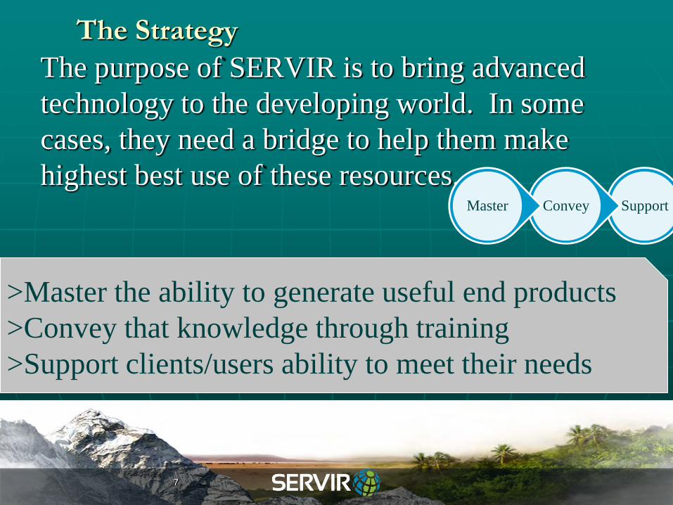
The Strategy
The purpose of SERVIR is to bring advanced
technology to the developing world. In some
cases, they need a bridge to help them make
highest best use of these resources. Support Convey Master
>Master the ability to generate useful end products
>Convey that knowledge through training
>Support clients/users ability to meet their needs
7
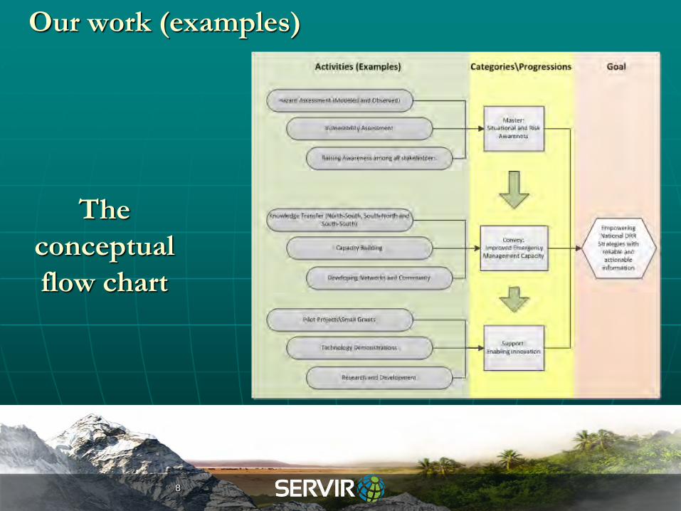
The
conceptual
flow chart
Our work (examples)
8

Our work (examples)
9

SERVIR WEB-PORTAL: One stop
10

Data and Data products
11

Applications - WATER:
Hydrologic Forecasting
Linking NASA earth observations and Kenya Met Dept data in CREST model of Oklahoma
University.
Calibration in collaboration with Kenya Water Dept.
The simulations will provide early warning for floods )
Spatial resolution: 1 km, temporal 3 hrs.
Also of value to agricultural sector, for monitoring and forecasting soil moisture. Developing flood extent tools together with USGS, to increase usefulness
12
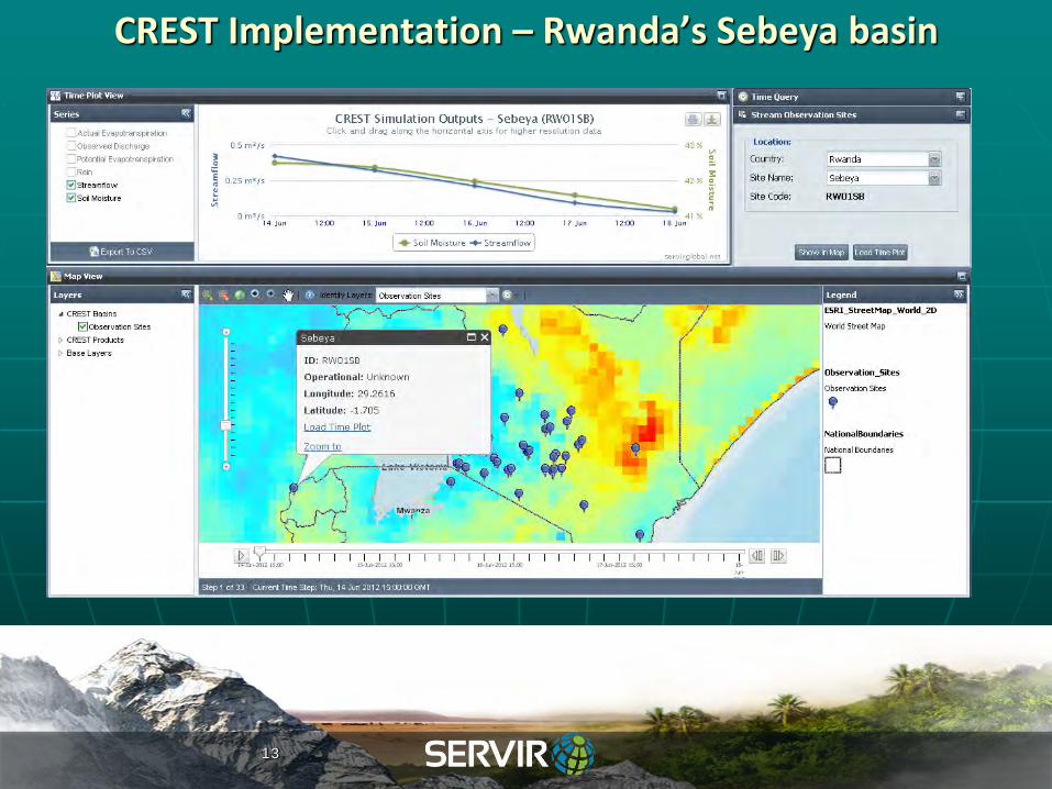
CREST Implementation – Rwanda’s Sebeya basin
13

Flood warning ‘intelligent’ tools: The Wireless Sensor
Network (WSN)
Ground-based network of sensors spread out
over small geographic areas (3-4 square
miles) per node
Ability to measure environmental conditions
(Soil moisture levels, rainfall, seismic activity,
streamflow levels)
Ability to operate autonomously
Intelligent power management: reduced need
for external electricity)
Uses low-cost, low power solar cells in the
sensors
Piloted in Bangladesh (ICIMOD), plans to
pilot in Kenya, Rwanda
14

GIS Flooding Tools
GFT are an ArcGIS-based
extension, written in Python
and VB.NET to produce flood
inundation patterns given a
known discharge.
Initially developed for ArcGIS
9x but are being ported to
ArcGIS 10x
Developed Jointly by USGS
and SERVIR-Africa.
15
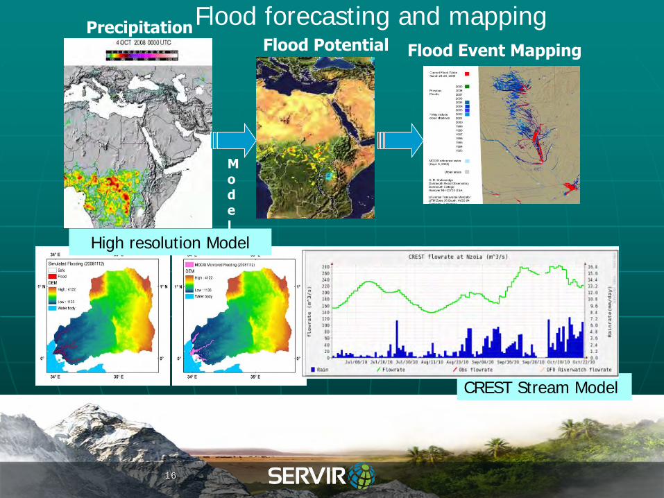
Flood forecasting and mapping
Model
Flood Potential Precipitation
CREST Stream Model
High resolution Model
Flood Event Mapping
16

Charter Activation 309, RADARSAT Image
Flood Disaster Rapid Map
International Charter Activation
17

Applications - HEALTH: Rift Valley Fever in Africa
Rift Valley Fever Risk Map (Livestock and human disease transmitted by mosquito)
Uses NDVI, Precipitation and Temperature information
Sensors: MODIS and AVHRR
18

Applications: other projects
• Rapid mapping • Charter activation
• Drought early warning • Crop monitoring
19
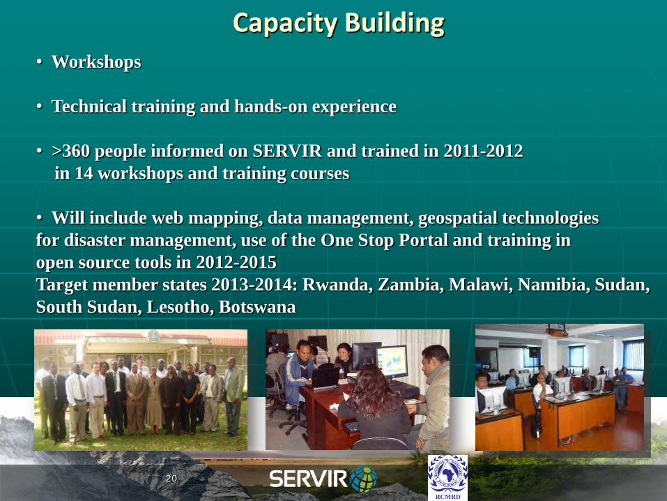
Capacity Building • Workshops
• Technical training and hands-on experience
• >360 people informed on SERVIR and trained in 2011-2012
in 14 workshops and training courses
• Will include web mapping, data management, geospatial technologies
for disaster management, use of the One Stop Portal and training in
open source tools in 2012-2015
Target member states 2013-2014: Rwanda, Zambia, Malawi, Namibia, Sudan,
South Sudan, Lesotho, Botswana
20
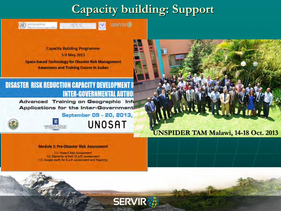
Capacity building: Support
21
UNSPIDER TAM Malawi, 14-18 Oct. 2013

Open source data and Tools: Examples
MODIS receiving station (Terrestrial and marine scope)-Installation in
2013>>
ISERV on board Japanese satellite (HJ II)-Dedicated to disasters
EO 1 (Earth Observing 1)-terrestrial scope
TRMM (Tropical Rainfall Monitoring Mission)- Microwave radar
satellite
SPOT VGT (vegetation conditions)
Meteosat second generation- rainfall estimates (optical satellite)
22

Thank you
Denis Macharia
dmacharia(at)rcmrd.org
RCMRD
rcmrd(at)rcmrd.org
RCMRD
www.rcmrd.org SERVIR Global
servirglobal.net