re-visioning new orleans
DESCRIPTION
Draft. Please contact me or find published paper before citing.TRANSCRIPT

Re-visioning New Orleans – mapping ecologies of power and deprivation
Stephen Read Alexander Vollebregt
Spacelab in New Orleans
The increasing vulnerability of our man-made world in the face of environmental change was starkly revealed when Hurricane Katrina struck and devastated New Orleans in August 2005. Architecture and urban research has since then treated the city as a laboratory for the problem of living with environmental risk and has responded by coming up with many innovative solutions (as the exhibition in the US pavilion at the 2006 Venice Biennale demonstrated). But when Hurricane Katrina struck, it opened up a whole spectrum of sustainability concerns that went way beyond the purely environmental. These included concerns of social inequality, structural racism, and the presence of an underclass lacking the means and the power to flee the devastation Katrina provoked.
New Orleans is just one racially divided city among many in the United States and its problems at this level are by no means unique. A massive social segregation has emerged historically in US cities along with the evolution of a metropolitan urban form that leaves big business downtown, often alongside poor and usually Black or Hispanic residential populations, while the more affluent disperse to a much wider suburban region which includes other business and commercial ‘edge-city’ type centers. This has been as much a spatial as a social event and has involved a wholesale reconfiguration of centrality and peripherality in American cities. Social divisions became associated with the peripheral and marginal spaces of these cities, and the issues of social and spatial division have become therefore a possible topic for research in urban form and urban design. Urban design on its own will not solve these problems of course, but what it can do is address the spatial ecologies involved as well as a dimension of intervisibility and ‘public sphere’ that is often overlooked in more mainstream social research. This is something that has come to the fore in recent French scholarship in relation to a mostly immigrant underclass hidden from view in les banlieues of many large French cities. Pierre Bourdieu called these immigrants atopos (out of place); New Orleans and the cameras of CNN presented us after Katrina with the even more startling and disturbing vision of a people out of place in the city of their birth.
New Orleans had been shrinking and dissipating as a result of suburbanization processes since well before Katrina, and the focus of attention in our research would be on trying to understand its well-known vitality in its more central parts as well as its problematic social divisions and inequalities. We were looking to try to understand the complex social ecologies of this city and the way we might be able to use these understandings to imagine a place open to more enabling ways of life and a richer and less divided public. We wanted also to demonstrate the ways the urban design discipline could contribute to problems which in truth require a coordinated response from a broad range of political and professional actors. We felt though that the vital and constructive part that

planning and design can play in such a response is often not well understood or appreciated by other interests and disciplines and saw our role as one of revealing how urbanism and urban design could contribute towards ameliorating divisions that have become spatially entrenched and opening the way to a more equitable and prosperous future for all the citizens of New Orleans. We wanted to demonstrate that there are other cities, and liberating and enabling possibilities for new cities in the ruins of the particular city we found before us, if only we would put the effort into imagining them.
Spatial ecologies and ‘Ordinary Cities’
There has been in the last several decades a dominant perspective propagated on the contemporary city and its function and meaning in the social and geographic disciplines. This view, developing over time from a so-called World Cities to a Global Cities perspective, has seen contemporary cities as existing in a network of global transactions and flows, strongly linked to the global economy (Friedmann; Sassen). This view has understood different cities as existing in a functional hierarchy in relation to their roles in this economy. Certain cities (Global Cities), contain high concentrations of the ‘advanced producer services’ that support this economy, exerting a controlling influence on it, while others tend to become relegated to positions of ‘structural irrelevance’ in the whole picture (Castells). While this view has contributed much to our knowledge of cities in general, it has had an unfortunate effect on other more ordinary and less prominent cities in the Global Cities perspective, rendering the ways they participate in a ‘world of cities’ and mediate and enable the lives of their populations as at best problematic, and at worst as simply negative (Amin & Graham; Robinson). The Global Cities view finds it difficult to fully engage with and value the ways cities are constructed around multiple interests, ranging over all sectors and scales, and the ways people exploit the multifarious spatialities of the city to actively construct and underline value in their own lives.
In practice its response to lower-ranking cities is often to propose sets of neo-liberal strategies designed to move the city in question up the ranks of the Global Cities list, and to sideline questions around multiplicities of interests and opportunity in favor of factors particularly related to the insertion of the city into a narrowly defined global economic circuit (Robinson). In New Orleans today, the relative lack of response from Federal Government to the crisis may reflect the fact that the city is seen as ultimately not very relevant to the national economy (Glaeser). In its extremely narrow perspective on ‘global flows’, ‘advanced producer services’ and highly educated and well-paid ‘creative classes’ a neo-liberal perspective often simply fails to see the depth of the total economy, and the role of this total depth in supporting the lives of untold millions of people world-wide – a fact pointed up by the observation that while there are very few officially designated Global Cities today, there is no city in the world that is not globalizing.
We take the view that cities, rather than simply being closed sites incorporated, or not, into a singular global economy, are by their nature particular generators of multifarious spatially located and situated social and economic opportunity – some of which may well end up being incorporated into formal economic structures, but that may also contribute to the rich fabric of partial formality and
informality that enlivens the spaces of countless Ordinary Cities all over the world. The real everyday welfare of people is as much, and in very many cases more, dependent on situated opportunities for initiative and open potentials for livelihood than they are on the more formal structures and designated spaces of the global economy. At the same time, the everyday spaces that people inhabit are replete with qualities that enrich lives and that people incorporate into their everyday lives by choice.
Models, maps, modes of seeing
No single person can see the whole of the city – just as no single person, no matter how wise or well-read can know the whole of reality. It is not just that the city (or reality) is too big for us – there is another more important point and principle: this is that different starting points and different situated perspectives on the world are part of the very warp and weft of reality (Mol). We exist in a reality that is multiple, and that can be ‘framed’ in multiple different ways depending on our particular concerns and the focuses of our attention. Or, in other words, the world can be all the time true and objective – yet change into a ‘version’ different to the first with only a shift of the angle from which it is viewed (Goodman). In the same way we may encounter different objective ‘versions’ of the same real city depending on the focus and the eyes with which we choose to look at it. New Orleans looks different depending on where one lives in it, where one works (or doesn’t), where one sends one’s kids to school, and where one goes shopping or out to eat or drink. In a city as socially divided as New Orleans, whether one is rich or poor, Black or White, or for that matter tourist, business traveler, or inhabitant, has a substantial effect on what New Orleans looks like and the opportunities the city presents.
This issue of ‘perspective’ doesn’t only affect the experience of the inhabitants of the city: it is at the same time an issue of methodology, an object of research, and one of our basic tools for the planning or design of real urban spaces. As urban researchers and designers, we see cities through the lenses of different models of the city, bringing the values incorporated into these models to the views we construct. But we also, as part of our practice, collect data and build images of what particular cities are – and we may do this in a slightly less value-led way. Carefully tracing and tracking the contours of real cities will inevitably expose more than the limited view of differently valued territories the more abstract and schematic models present to us. It will inevitably expose layerings of function and meaning, of formality and informality, of the expected and the unexpected, of growth and decay, of a generally more complicated, co-implicated, foldedness of different perspectives and ‘worlds’ over and within other ‘worlds’. It will expose richness and variety, and the object’s own refusal to reduce to a singular perspective. It is this refusal – and the ‘remainder’ that is always left outside particular models – that seems to us to be an essential part of the very nature of cities. We take it that different communities and interests will find in these overlaid orders the means to articulate different lives, each as coherent ‘worlds’, some working within larger and some within smaller spatial ranges and horizons, and almost all exposed at critical junctures within these spatial webs to other communities, other interests, other ‘worlds’. This highly intricate and overlaid spatial ordering is part of the way that different urban lives and different urban ‘worlds’ pass each other on the street, setting up conditions
of co-presence and intervisibility that is part of the vital and even conflictual nature of polis (Arendt).
We start from the position that the first task of mapping is the building of vision – and the elimination of false and over-schematic vision. We begin researching a city like New Orleans with already-formed impressions. We come with personal maps of the city based in our own experience and we bring to the task of seeing already-formed perceptions based in city models that may be outdated or may not reflect the depth of the surface we are working with. We need to critique these impressions as well as build on them because as urbanists we need to serve and reflect more than our own experience and our presuppositions. We use techniques therefore to extend the bounds of our experience and to shift our points of view to different levels. Literal maps of the distributions of all sorts of urban elements and features (from lawyer’s offices to McDonalds to ATM machines and churches) are a powerful way to test presuppositions. But, more importantly, they are a means to expose the delicate spatial orders which distribute these features and weave coherent ways of being in the city through other coherent ways of being in the city; lives through other lives; communities through other communities; ‘worlds’ through other ‘worlds’.
Different urban ‘worlds’ divide along shear lines provoked by space-time differentials (Lefebvre) – differences in speed and scale that at the metropolitan scale (one sees it here most clearly) are themselves products of everyday and strategic movements (and the placements of the infrastructures that enable them).
Seeing the ‘shape’ of New Orleans
The Spacelab Research Laboratory for the Contemporary City has for the last two years been running its MSc graduation studio as a research project focused each year on one particular city. The 2006-7 graduating class, consisting of 15 students, worked alongside Spacelab staff to undertake the complex task of compiling a design vision for New Orleans. The following examples derive from work carried out by both students and Spacelab faculty and researchers.
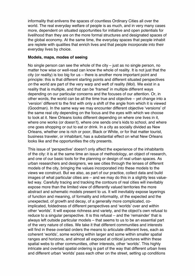
One of the most important outcomes of our first phase of mapping was the discovery of the shape of metropolitan New Orleans. This shape was not at the level of our direct experience immediately obvious to us because we were encountering the city by way of movement on foot and by public transport. For suburbanites and business and shopping commuters however the axis connecting the CBD downtown with suburban centers including an edge city business and commercial pole at the crossing of the Interstate 10 and North Causeway Boulevard at the edge of Lake Pontchartrain, constitutes the dominant movement axis of the city. Parallel motorways carry a huge part of the city’s total daily traffic and this traffic and this infrastructure itself reflects the single dominant metropolitan movement pattern; a shuttle – for many people a daily commute – between the suburbs and the historic parts of the city. We came to realize that this axis constitutes in a very real sense the ‘power axis’ of the city, distributing the most commercially valued and highly used parts of the city in a direct relation to itself.

Figure 1. New Orleans: a city structured by power.
Figure 2. The ‘power axis’ of New Orleans with the CBD, the French Quarter and the Superdome anchoring one end, and suburban centers and airport anchoring the other.
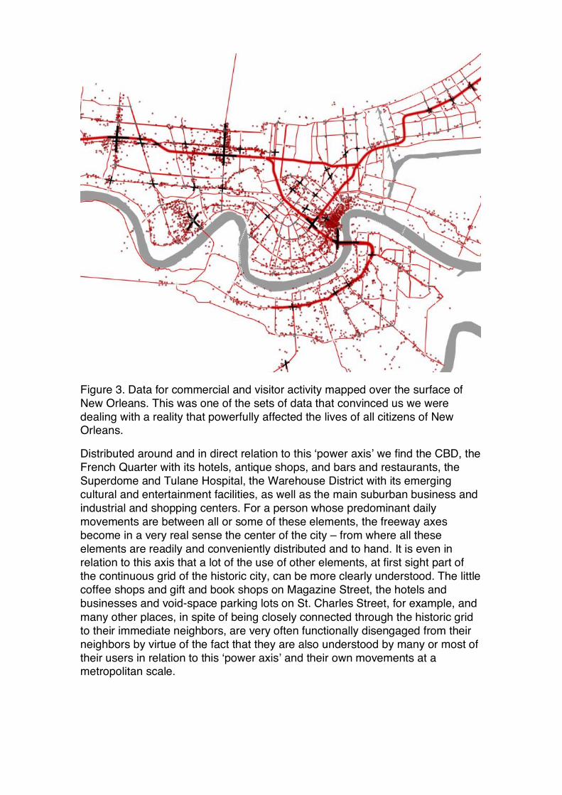
Figure 3. Data for commercial and visitor activity mapped over the surface of New Orleans. This was one of the sets of data that convinced us we were dealing with a reality that powerfully affected the lives of all citizens of New Orleans.
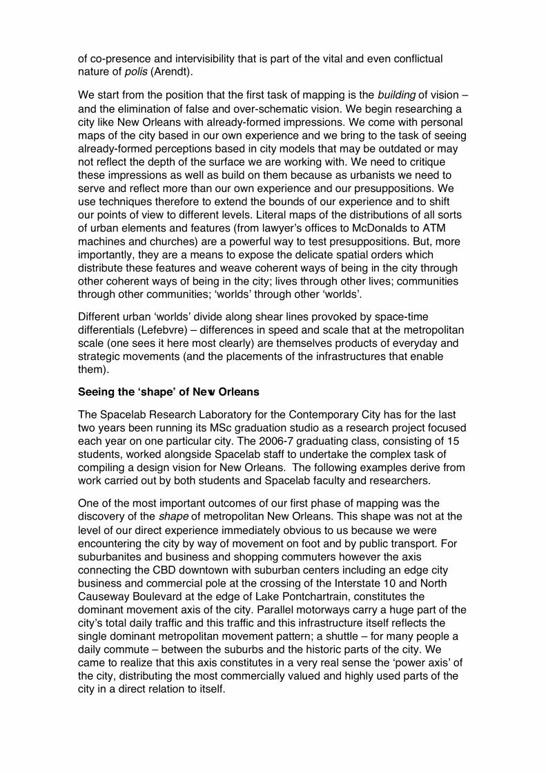
Distributed around and in direct relation to this ‘power axis’ we find the CBD, the French Quarter with its hotels, antique shops, and bars and restaurants, the Superdome and Tulane Hospital, the Warehouse District with its emerging cultural and entertainment facilities, as well as the main suburban business and industrial and shopping centers. For a person whose predominant daily movements are between all or some of these elements, the freeway axes become in a very real sense the center of the city – from where all these elements are readily and conveniently distributed and to hand. It is even in relation to this axis that a lot of the use of other elements, at first sight part of the continuous grid of the historic city, can be more clearly understood. The little coffee shops and gift and book shops on Magazine Street, the hotels and businesses and void-space parking lots on St. Charles Street, for example, and many other places, in spite of being closely connected through the historic grid to their immediate neighbors, are very often functionally disengaged from their neighbors by virtue of the fact that they are also understood by many or most of their users in relation to this ‘power axis’ and their own movements at a metropolitan scale.
Figure 4. The intersection of Magazine Street and Washington Avenue.
Figure 5. The historic St. Charles Street in the vicinity of Jackson Avenue.

We see strips of light industry and housing, office suppliers and parking lots, burger bars and better quality restaurants, cheap and expensive hotels, as each functional unit becomes accessed from the metropolitan scale and not via or in relation to its immediate neighbors. An historic road becomes simply a feeder conveying traffic by the most direct route to particular destinations. St. Charles Street with its high volume of traffic starts to make sense as a distributor for highly mobile people moving between elements in a city that is for them a collection of disparate things distributed at a metropolitan scale. Even the more urbane continuity of Magazine Street is interrupted (also enlivened) at its major intersections by coffee shops and gift shops which profit from this ‘drop-in’ movement behavior.
Before the metropolitanization of New Orleans, St. Charles Street was the dominant but more genteel ‘spine’ of a city strung between the French Quarter/CBD and Audubon Park and centering the fabric around it; today it is a metropolitan scaled traffic route that loses contact almost completely with its surrounding fabric as it orients itself functionally instead to the metropolitan-scaled traffic using it. It is important to understand that historic places change, even before their local spatial layouts change, simply as a result of the fact that they exist as a set of potentials for location and access in a transformed larger spatial field. The metropolitanization of cities, as a product of the (differentially) increased mobility of its inhabitants, has changed every space in them, not just the larger scaled ones. This is the dynamic that has in the United States lead to particular patterns of social segregation. But it is also responsible for different types of functional fragmentation, and for the disarticulation of many finely drawn historical orders. There should be nothing very surprising any more about any of this, and a certain disarticulation can even enliven and particularize places, and may still draw disparate interests into co-presence in public space. But we do need to recognize – as we began to recognize in this case – that the movement we see in contemporary streets is not equivalent to historic movements, and that St. Charles Street has changed forever.
But spatial fragmentation doesn’t end here in New Orleans, because it is around the edges of some of the most dominant elements in this new metropolitan distribution of the city, the CBD and the French Quarter, that a ‘shadow’ of deprivation and neglect emerges in the fabric. It was in fact the evidence of this ‘shadow’ as a direct consequence of the powerful orientation of urban elements to the metropolitan scale and to the ‘power axis’ that convinced us we had to take this ‘power axis’ seriously. An area like the CBD or the French Quarter, oriented by suburbanization and metropolitanization to the dominant axis, establishes at the same time around itself an edge, beyond which the interest of the metropolitan (or national or global) visitor will not ordinarily extend. Commuting office workers exist in a circuit of home, parking garage, work, sandwich bar or restaurant for lunch, and perhaps bar or restaurant after hours, and back home again. National or international tourists exist in a circuit of airport, hotel, and (for the most part) the French Quarter, then back to the airport. Just beyond the horizons of these circuits, the neighborhoods of Treme and Marigny show that uneasy mix of edginess and vitality, deprivation and gentrification, that mark many edge-of-center urban environments. Further north, beyond Claiborne Avenue in the 6th Ward, gangs and gun-crime are in the news and the neighborhood is regarded as ‘high-poverty’.

Figure 6. The orientation of better valued areas (like the CBD and French Quarter) to the metropolitan scaled infrastructure, and their dislocation from the areas close to them sets up a divisive ‘ecology’ of rich and poor areas.
Re-visioning New Orleans
We needed to see New Orleans twice: the first time we had to build a picture of what New Orleans was; the second time we had to imagine what New Orleans might be. Building a picture of what New Orleans was meant going beyond personal, popular or commonplace understandings of the city – we found, reflected in the dominant movement patterns, and in the distribution of the high-end economy and high-valued functions, a version of the shape of the city around an ‘axis of power’ that clearly revealed not only power but also its ‘shadow’ of deprivation in the urban surface. This seemed to constitute a hard reality that, like it or not, conditions the lives of all citizens of New Orleans – either positively or negatively depending on where one happens to live. The vision of New Orleans we came up with was a direct response to this hard reality.
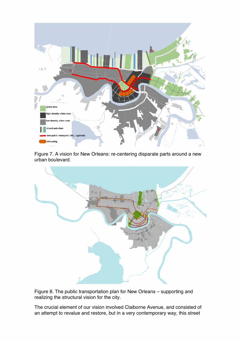
Figure 7. A vision for New Orleans: re-centering disparate parts around a new urban boulevard.
Figure 8. The public transportation plan for New Orleans – supporting and realizing the structural vision for the city.
The crucial element of our vision involved Claiborne Avenue, and consisted of an attempt to revalue and restore, but in a very contemporary way, this street

that used to be the heart of the city for the Black community. The idea is in essence to ‘rescale’ this community by bringing the metropolitan center closer to poorer parts of the city. This involved creating another metropolitan scaled infrastructural axis, one that instead of narrowly connecting economic power with economic power, co-centers disparate parts of New Orleans (including poor neighborhoods, suburban and edge of urban work opportunities, and shopping and cultural areas). It would follow the line of the historic crescent and take traffic pressure off St. Charles Street. We see this boulevard as also in the future becoming the natural line of expansion of the CBD to the east and as in the shorter term opening new opportunities for the establishment of cultural and entertainment facilities capable of connecting the tourist center with poor communities. Our post-Katrina rehousing strategy also involved the densification of higher-lying areas of the 6th and 7th wards, Treme and Marigny, Magnolia and Milan (along the line of this new axis) by rehousing poor communities that previously occupied lower-lying and vulnerable areas. We proposed that the Claiborne axis also be a major part of a comprehensive replanning of the public transport network of New Orleans. This public transport plan is intended to support and underline the structural vision, to try to replace as much car traffic as possible with public transport, and to realize our vision of a metropolitan space for the poorer communities.
The boulevard itself is intended to provoke a ‘revaluing’ of the neighborhoods which border it; Treme, Marigny, the 6th and 7th wards, Magnolia and Milan. We have to recognize what precisely happens to the spaces of these neighborhoods is as much a matter of politics as it is of a repositioning of these neighborhoods in relation to metropolitan space, but we believe that our proposal offers these neighborhoods the urban infrastructures which can contribute to the realization of a comprehensive social and political vision.
Each of the students proposed and designed individual projects to support and to underline this collective vision and the vision and the complete results of their work will be collected in a publication for presentation in New Orleans.
Bibliography:
Amin, A. & S. Graham (1997), ‘The Ordinary City’, Transactions of the Institute
of British Geographers 22: 411-29
Arendt, H. (2002) ‘The Public and the Private Realm’, in Peter Baehr (ed.), The
Hannah Arendt Reader, Penguin, London.
Bourdieu, P. (1991) ‘Preface’, in Sayad Abdelmalek, L’immigration: Ou les
Paradoxes de l’Alterite, De Boeck-Wesmael, Brussels.
Castells, M. (1983) The City and the Grassroots, Edward Arnold, London.
Friedmann, J. (1995), “The World City Hypothesis”, in: P. Knox & P. Taylor (eds.) World Cities in a World System, Cambridge University Press, Cambridge.

Glaeser, Edward L. (2005) “Should the Government Rebuild New Orleans, Or Just Give Residents Checks?,” The Economists' Voice: 2:4, Article 4. Available at: http://www.bepress.com/ev/vol2/iss4/art4
Goodman, N. (1978) Ways of Worldmaking, Indianapolis.
Lefebvre, H. (2003), The Urban Revolution, trans. Robert Bononno, University of Minnesota Press, Minneapolis.
Mol, A. (2002), The Body Multiple: Ontology in Medical Practice, Duke University Press, Durham, NC.
Robinson, J. (2006), Ordinary Cities: Between modernity and development, Routledge, London.
Sassen, S. (2001), The Global City, Princeton University Press, Princeton.