recent volcanism near dotsero, colorado...
TRANSCRIPT

RECENT VOLCANISM NEAR DOTSERO, COLORADO
by
Robert F. Giegengack, Jr.
B.A., Yale University, 1960
A Thesis submitted to the faculty of the Graduate
School of the University of Colorado in Partial
fulfillment of the requirements for the Degree
Master of Science
Department of Geology
1962

i

Tliis Thesis for the M.S. degree by
Robert F. Glegengack, Jr.
has been approved for the
Department of Geology
by
C
C.
Date TV./.,., >r -
Gicgengack, Robert F. Jr. (M.S., Geology)
Recent Volcanism near Dotsero, Colorado
Thesis directed by Professor Warren 0. Thompson
The Dotsero Crater and associated volcanic rocks are located a
mile northeast of the junction of the Eagle and Colorado rivers at
Dotsero, Colorado. The area is underlain by Pennsylvanian and Permian
sedimentary rocks of the Minturn and Maroon formations in which simple
structures locally are truncated by an erosion_surface covered with a
series of Tertiarylaya flows.
One mile east of Dotsero, the Eagle River flood plain is overlain
and partially blocked by a younger basalt flow. The lava seems to have
issued from the vicinity of a deep, steep-sided explosion crater a mile
north of the Eagle River. This feature, known locally as the Blowout,
is developed principally in bedrock. The floor of the depression and
the area immediately surrounding it are covered with a thick mantle of
volcanic ash, which thins rapidly away from the source, locally lying
on the lava surface.
A charcoal sample, recovered from a tree which had been buried by
the falling ash, was dated by the Cl4 method, and found to be 4150 *
300 years old. The DotseroC_rater is thus the most recent documented
sou^xeoJ_jvo_Lcajiic_rocks in the state of Colorado.
The ash is recognizable as a distinct stratum in many of the flu-
vial deposits of the Eagle River and its tributaries; this radiocarbon
date may prove useful in dating post-Wisconsin periods of alluviation
and canyon- cut ting in the local watershed.
This abstract of about 250 words is approved as to form and content.I reconmend its publication.
S igned _ / a.-c-l c - &Instructor in charge of dissertation
5
CONTENTS
INTRODUCTION Page 1
ACKNOWLEDGEMENTS
TOPOGRAPHY AND DRAINAGE
PREVIOUS STUDY
STRATIGRAPHY OF THE PRE-QUATERNARY ROCKS
Minturn Formation
Maroon Formation
Unnamed Tertiary Rocks
STRUCTURE OF PRE-QUATERNARY ROCKS
STRATIGRAPHY AND STRUCTURE OF QUATERNARY ROCKS
Intrus ive Rocks
Extrusive Rocks
Lava Flow
Pyroclastic Rocks
Consolidated Lapilli Tuff
Lapilli Tuff
DATING OF THE QUATERNARY VOLCANIC ROCKS
INTERPRETATION
ECONOMIC GEOLOGY
BIBLIOGRAPHY
1
4
6
6
8
9
9
11
14
14
16
16
22
22
27
32
37
40
41

ILLUSTRATIONS
Figure 1. Index Map Page 2
2. Vertical air photograph 5
3. View into crater 5
4. Dip slope of salt anticline 12
5. Sill intruding Maroon sandstone 15
6. Dike in Maroon sandstone 15
7. View north from southeast rin of Blowout 17
8. Lava outcrop on north wall of Blowout 18
9. View of lava flow surface 20
10. View of lava flow surface 20
11. Leading edge of basalt flow 21
12. Outcrop of consolidated lapilli tuff 23
13. Consolidated lapilli tuff 25
14. Consolidated lapilli tuff 25
15. View southwest from northeast rim of Blowout .... 26
16. Lapilli tuff outcrop 29
17. Lapilli tuff outcrop 29
18. Bomb sag in lapilli tuff 31
19. Bomb sag in lapilli tuff 31
20. Volcanic ash in alluvial fan 34
21. Volcanic ash in alluvial fan 34
22. Waterworked volcanic ejecta 36
Plate 1. Geologic Map of Dotsero Region In Pocket
2. Geologic Map of the Dotsero Crater and LavaF low In Pocket

3. Stratigraphic Relationships ofPre-Quaternary Rocks
4. Generalized Structure across the DotseroRegion 13
I

INTRODUCTION
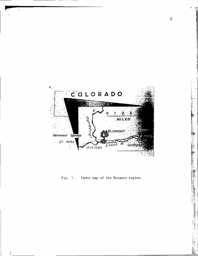
The Dotsero Crater and associated volcanic rocks are located
mediately northeast of the junction of the Eagle and Colorado rivers at
Dotsero in Eagle County, Colorado. Route U.S. 6 & 24 crosses the lava
flow 3 miles east of the point where the road emerges from the upper
end of Glenwood Canyon.
The crater and adjacent area were napped in August and early Septem-
ber of 1961. Most of the field work was limited to the triangle of
land defined on the south by the Eagle River, on the northwest by the
Colorado River, and by Trail Gulch to the east. Field data recorded on
aerial photographs later were transferred to a base map, which consists
of a 1:31680 U.S. Forest Service sheet enlarged to 1:15840 by means of
a Saltzmami projector. A more detailed, large-scale map of the crater
and Recent volcanic rocks was prepared from the photographs.
The bedrock geology, while not essential to an understanding of
the volcanism, was studied to orient the crater accurately with respect
to regional stratigraphy and structure.
A cursory petrographic study of the volcanic rocks was undertaken.
ACKNOWLEDGEMENTS
The writer is indebted to Dr. Warren 0. Thompson, who suggested
the project and supervised the research, and to Dr. William C. Bradley,
who also served as advisor. Meyer Rubin, of the Radiocarbon Laboratory
of the U.S. Geological Survey in Washington, D.C. provided the radio-
carbon date. Henry E. Holt spent a day in the field with the writer in
June 1961 and offered much helpful advice. Appreciation is extended to
those members of the faculty and student body at the University of
C O L O R A D O
MILES!
BLOWOUT
Fig. 1. Index map of the Dotsero region.
• "
I
Colorado whose interest, curiosity, and many suggestions inspired much
of vhat appears herein.

TOPOGRAPHY AND BRASSAGE
The drainage pattern in the area studied is controlled by a salt-
cored anticline breached by the Eagle River, which flours along the fo
axis. North of the river, drainage is consequent on the dip slope of
the north limb of the anticline. Host of this water finds its way to
the Colorado River to the north and northwest; in at least one instance
headvard growth of a short, steep tributary of the Eagle River has cap-
tured a. portion of the Colorado drainage.
All of the streams in the area are intermittent, with the excep-
tion of the Eagle and Colorado rivers, both through streams which derive
touch of their volume from the Cora and Park ranges to the east, and
Deep and Sweetwater creeks, tributaries of the Colorado, which drain
areas of the White River Uplift on the northwest. Gypsum Creek, which
occupies a broad, flat valley in the southeast part of the area, flows•
off the north side of Red Table Mountain and enters the Eagle River at
Gypsum.
The Dotaero Crater occupies a short, steep gully tributary to the
Eagle River a mile northeast of Dotsero. The gulch can be traced up-
stream beyond the crater, but the explosion that formed the depression
effectively blocked any through drainage. Locally known as the Blowout,
this feature is an oval-shaped, conical depression 2600 feet long and
2000 feet vide. The nearly flat floor, composed of fragments of vol-
canic and country rock, lies 400-600 feet below the rim. The crater is
developed principally in bedrock; the sides of the Blowout slope inward
at 30-33°, apparently the angle of repose of the pyroclastic fragments,
except where cliffs of sedimentary rock have steepened the slope of the
walls. Such angle of repose slopes are very unstable, and minor slides
iJr

1
Figs. 2 and 3. Left: Vertical air photo of the Dotsero Graterand associated "lava flow. Right: View into crater, lookingsouthwest.
are of almost daily occurrence. Vegetation on the crater vails is
sparse and, except in cases where it is firmly anchored to bedrock,
seems unable to contend with the constant sliding.
PREVIOUS STUDY
The Blowout and associated lava flow were briefly described by
R. E. Landon in 1933. The existence of the crater had been documented
by van Diest in 1888 and by Arthur Lakes in 1890. Lakes' account des-
cribee a day's excursion to the site, and includes several drawings and
an accurate discussion of the distribution of the volcanic rocks. M. R.
Campbell in 1922 noted the existence of the lava flow; he also reported
the presence of a "dark hill" a short distance north of the flow and
visible from the river, which he took to be the source of the lava.
Mention of the Lava flow and associated vent appears in Guide to the
Geology of_ Colorado 1960 as an entry in the road log of the West Central
Colorado field trip. Commentary is by N. Wood Bass. The crater is on
the Glenwood Springs 1-degree quadrangle, which was mapped by members
of the U.S. Geological Survey during the years 1946-1953*. The Blowout
is located on the southeast quadrant of the sheet, due to appear some-
time in 1962.
STRATIGRAPHY OF THE PRE-QUATERNARY ROCKS
This part of the Central Colorado Trough is underlain by Penn-
sylvanian and Permian sedimentary rocks of the Minturn and Maroon
formations in which simple structures locally are truncated by an ero-
sion surface which is covered with a series of Tertiary lava flows.
. Wood Bass, personal communication, 1962.
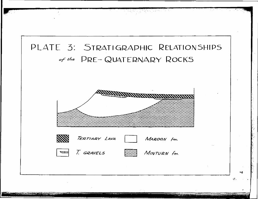
PLATE 3: STRATI GRAPHIC REIATIONSHIPS°f** PRE-QUATERNARY ROCKS
7" GGAVFLS

8
Hlnturn Formation
The Mlnturn formation consists of a series of interbedded silty
sandstones, gypsiferous siltstones and shales, and pure gypsum strata.
Mica flakes, chiefly muscovite, are present In abundance and give cer-
tain of the bedding planes a characteristic metallic glitter. Large,
veil-developed crystals of selenite occur in the lower part of the se-
quence. The section is a uniform ivory to light tan color; a heavy
rain darkens the rock, as much water seems to be absorbed by the gypsum,»•
but a day or two of sunlight evaporates the moisture and bleaches the
rock once again.
The Minturn formation is not very resistant to erosion, being ex-
tremely soft, relatively soluble, and readily disaggregated; hence it
cannot support much topographic relief. It forms prominent features
only when held up by overlying, more resistant strata, as in the cliffs
along the Eagle and Colorado rivers.
Toward the top of the section, Individual strata of sandstone and
siltstone, a dark brick-red In color, occur with increasing frequency,
grading upward into the even-bedded silty sandstone redbeds of the
Maroon formation. The Jacque Mountain limestone, which serves in other
areas to define the Minturn-Haroon boundary, is not present in this sec-
tion. As a result, the contact was defined as the top of the transition
zone, where the color changes subtly from dark brick-red to a more
brilliant red-orange. This demarcation is not readily discernible on
the outcrop; the subtlety of transition is best appreciated with the
perspective of distance, and was mapped from the other side of the can-
yon.

The writer does not propose that such a contact has any great time
or lithologic significance; it is, however, a horizon that can be recog-
nized in other nearby areas and may serve in crude correlation.
Maroon Formation
The Maroon formation is a series of bright red sandstones and silt-
stones containing layers of silty red shale. Hear the top of the sec-
tion a single horizon of gray-green crystalline limestone, a foot or so
in thickness, is exposed. The mica flakes, so striking in the Mintum,
are present in the Maroon formation as well, but do not seen to comprise
as large a percentage of the rock. In this locality, the Maroon dif-
fers from the Minturn formation principally in its tmifonn red color
and its lack of gypsum.
Large-scale cross-bedding is evident in some exposures of the
Maroon formation, and certain of the strata exhibit fine, contorted
laminae. No fossils were observed in these formations within the mapped
area.
Unnamed Tertiary Rocks
Simple structures in the sedimentary section are truncated by an
erosion surface locally veneered witih well-rounded stream gravels.
Particles are of pebble to cobble size and predominantly of granitic
and metamorphic composition. This surface at one time oust have been
more extensive than it is now, as the nearest source of such material
is the Park and Gore ranges Similar erosion surfaces
«< b strej3BB_dgPoaits have begnrecognized under_middle Tertiary- v
lava flows at many localities in Colorado, even as far away as the San
10
Juan Mountains*. This deposit may fall within the interval of the
Browna' ark formation, a Miocene (?) sequence of interbedded stream
gravels and lava flows which is a prominent member of the Tertiary sec-
tion exposed in the Flattops area <R. Kucera, 1962). A similar gravel-
bearing surface beneath a Tertiary lava flow has been described by
P. B. Schmidt (1961).
In the Dotsero area this erosion surface is overlain and preserved
by a aeries of basaltic lava flows 35-50 feet thick. The lava holds upj *
the cliff on the north aide of the Eagle River and, where not resting
on gravel, lies with angular unconformity on a gently deformed surface
of Hinturn and Maroon sediments. Very little of the original structure
of the flow is preserved; the upper surface has been removed by erosion
and weathering has destroyed any large-scale structure. Bo distinctive
joint pattern was observed. Exposed sections of the lava are weathering
by exfoliation of spheroidal boulders which, with angular, frost-wedged
chunks of relatively fresh basalt, litter the slopes below the outcrop.
Some such talus slopes include rounded cobbles weathered out from the
erosion surface beneath the basalt.
If the erosion surface is time-equivalent to other such pre-basalt
gravels in western Colorado and belongs in the Browns Park interval,
the Tertiary section in the Dotsero area is Miocene (?) in age. Dormer
(1949) describes a similar occurrence in the McCoy area and assigns a
Miocene age to the sequence on the basis of a fossil dog found in a
volcanic tuff and described by J. A. Wilson.
Kft
*Wilbur S. Burbank, personal communication, 1961.
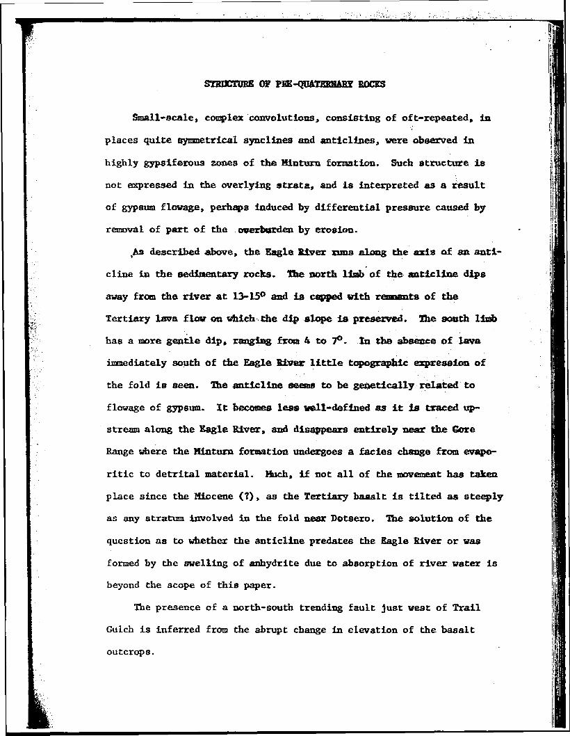
SYBDCTDBE OS PEE-QUATEBBAEY ROCKS
Small-scale, complex convolutions, consisting of oft-repeated, in
places quite symmetrical synclines and anticlines, were observed in
highly gypsiferous zones of the Minturn formation. Such structure is
not expressed in the overlying strata, and is interpreted as a result
of gypsum flovage, perhaps induced by differential pressure caused by
removal of part of the overburden by erosion.
,As described above, the Eagle River runs along the axis of an. anti-
cline in the sedimentary rocks. The north limb of the anticline dips
away from the river at 13-15° and is capped with remnants of the
Tertiary lava flow on vhich the dip slope la preserved. The sooth limb
has a more gentle dip, rangfag from 4 to 7°. In the absence of lava
immediately south of die Eagle River little topographic expression of
the fold is seen. The anticline seems to be genetically related to
flowage of gypsum. It becomes less well-defined as it is traced up-
stream along the Eagle River, and disappears entirely near the Gore
Range where the Minturn formation undergoes a facies change from evapo-
ritic to detrital material. Much, if not all of the movement has taken
place since the Miocene (?), as the Tertiary baaalt is tilted as steeply
as any stratum involved in the fold near Dotsero. The solution of the
question as to whether the anticline predates the Eagle River or was
formed by the swelling of anhydrite due to absorption of river water is
beyond the scope of this paper.
The presence of a north-south trending fault Just west of Trail
Gulch is inferred from the abrupt change in elevation of the basalt
outcrops.

12
i:
Fig. 4. Dip slope of salt anticline preserved onsurtace of Tertiary lava flow. View west along thenorth limb of the fold.
I
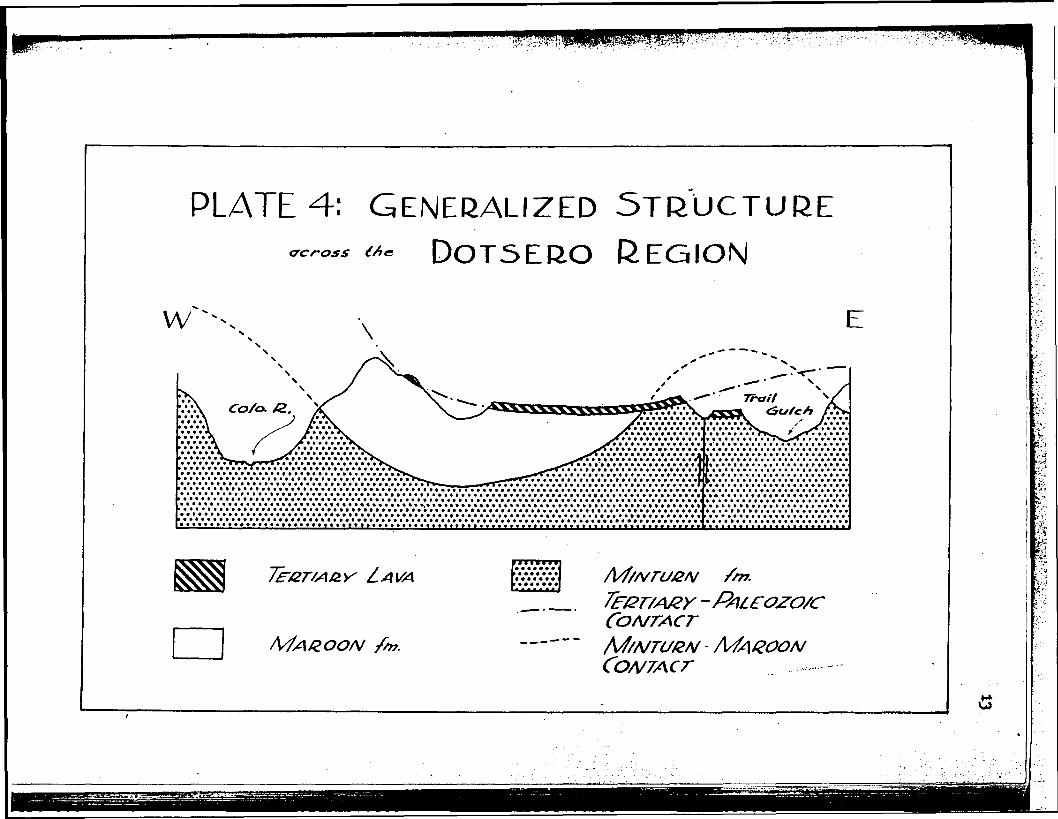
PLATE 4: GENERALIZED STRUCTURE*- DOT5ERO REGIONo'cross
f'"*-V
CONTACTMAZOON

An east-dipping monocline lies along the Colorado River north of
Dotsero, and a broad, gentle swell in the sediments which parallels the
course of Trail Gulch projects up the valley of Gypsum Creek'. This
arch is not readily discerned from the attitude of the highly contorted
beds in the Mintura formation, but becomes evident from a projection of
the pre-basalt surface and coasideratioa of regional structure. These
broad structural trends are diagramed schematically ia plate 4.
STBAHCRAPHY AHD 3HEUCTDEE Of QOAIEHHMT BOCKSi "
Superimposed upon the basenent of earlier rocks is a sequence of
Quaternary deposits, consisting of stream alluvium interbedded with a
small, thin lava flow and overlain by a layer of volcanic ash. A smalt
intrusive body which crops out within the Blowout seems to be related
to the Quaternary volcanism.
Intrusive Rocks
High on the north vail of the Blowout a small intrusive body is ex-
posed. This pluton consists of a sill 3 to 5 feet thick and 60 feet
long connected to a dike 18 inches wide which rises into the Maroon for-
mation to a point 20-25 feet above the top of the sill. The outcrop
terminates in the country rock and does not seem to be connected to the
other volcanic rocks, at least in the plane of the exposure.
The rock is a uniform steel blue in color and is finely vesicular
throughout. Petrographic examination discloses phenocrysts of olivine,
clinopyroxene, and magnetite, and microlitic laths of plagiocLase, held
in a very fine groundmass. The olivine is Fa24> or chrysotile; the
plagioclase was identified as bytownite, Any^. The phenocrysts are
quite unaltered and present a fresh, euhedral appearance, with the

15
1a
Fig. 5. Sill intruding Maroon sandstone in northwall of Blowout.
Fig. 6. Dike connected with sill in Maroon sand-stone. Exposure is in north wall of Blowout,(see Fig. 5.)
'fi
16
V-
exception of the magnetite, a small amount of which has altered to hema-
tite. A thin surface coating of limonite was observed in areas of the
outcrop. Following Wahlstrom (1955), this rock is termed an olivine
basalt.
Extrusive Rocks
Lava Flow
The lava flow is spread out on the Eagle River flood plain, where
it attains a thickness of 35 feet. It seems to have issued from the
mouth of a steep, narrow gulch in the north wall of the Eagle River
valley. Remnants of basalt plastered against the gully walls enable
the flow to be traced up the gulch to its head, where the basalt rem-
nants disappear into the end of the gulch which is here composed of
volcanic ash. In a direct line with the head of this gulch and about
100 feet farther north, the outcrop of the lava can be picked up again
where it is exposed in the south wall of the Blowout. Here the config-
uration of the lava outcrop is V-shaped, defining the form of a pre-lava
gulch which was continuous with the gully to the south Just described.
High on the north wall of the crater a much smaller, similarly V-shaped
lava body is exposed. The lava can be traced a few hundred feet north
of this outcrop, where it seems to feather out. The basalt flow is
everywhere in contact with sedimentary rock.
The distribution of lava seems to define the shape and course of a
pre-lava gulch, tributary to the Eagle River, that was filled and lined
with lava at the time of the eruption and served to funnel a quantity of
the molten basalt out onto the Eagle River flood plain. The lava proba-
bly issued from a vent in the bottom of the gulch somewhere within the
I
I

17
1
Fig. 7. Vieu north from southeast rim of Blowout.Note lava "V" overlying red sandstone. Basalt in-trusion can be seen halfway up north wall.

18
Fig. 8. Lava outcrop on north wall of Blowout.
r 19
limits of the present Blowout. The intrusive body described above may
have been connected to this conduit. The lava briefly filled die gulch,
allowing a small amount to ooze upvalley from the vent; the balance of
the molten fluid ran down the canyon through a V-shaped funnel of basalt
which adhered to the gully walls. The lava flowed across an alluvial
fan at the mouth of the gulch and out onto the flood plain. That the
gulch was filled with lava at one time is evidenced by the depth of the
V in the south wall of the crater aad die height of basalt remnants
plastered against the valley walla. It seems likely that the eruption
was of the non-violent, fissure type.
Petrographically, the flow is identical with the intrusive basalt
described above.
The surface of the lava flow, both in exposures in the gulch and
out on the flood plain* is highly vesicular. The scoriaceous zone is
as much as 8-10 feet deep and is quite fresh in appearance. A central
zone of dense, finely vesicular blue-gray lava overlies a basal layer
of blocky, fractured basalt containing inclusions of country rock. Much
of the vesicular surface is littered with loose blocks of scoria which
shift and roll when stepped on and produce a metallic clinking sound
when struck together. The vesicular surfaces are fresh and sharp
enough to destroy a pair of shoes in short order. While not readily
visible from the ground, pressure ridges concentric about the mouth of
the gulch can be observed on air photos. Large upended blocks of lava
sitting on the flow surface provide 15-20 feet of relief. The appear-
ance of the flow is typical of so-called "aa" lavas described from
Recent and historic eruptions in Hawaii (ffentworth and MacDonald 1953).
mih-g
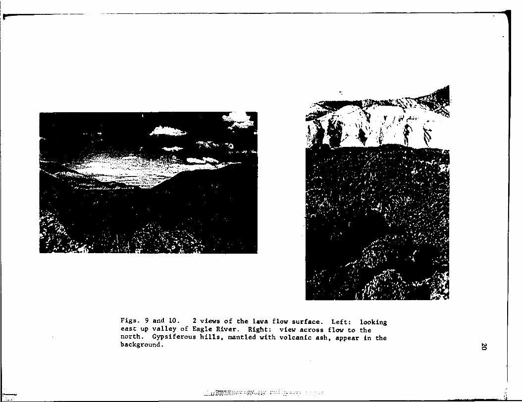
Figs. 9 and 10. 2 views of the lava flow surface. Left: lookingeast up valley of Eagle River. Right: view across flow to thenorth. Gypsiferous hills, mantled with volcanic ash, appear in thebackground.
jj VI r"-*-* -• •'" "~ " "*- '-"i'r" "-T"
21
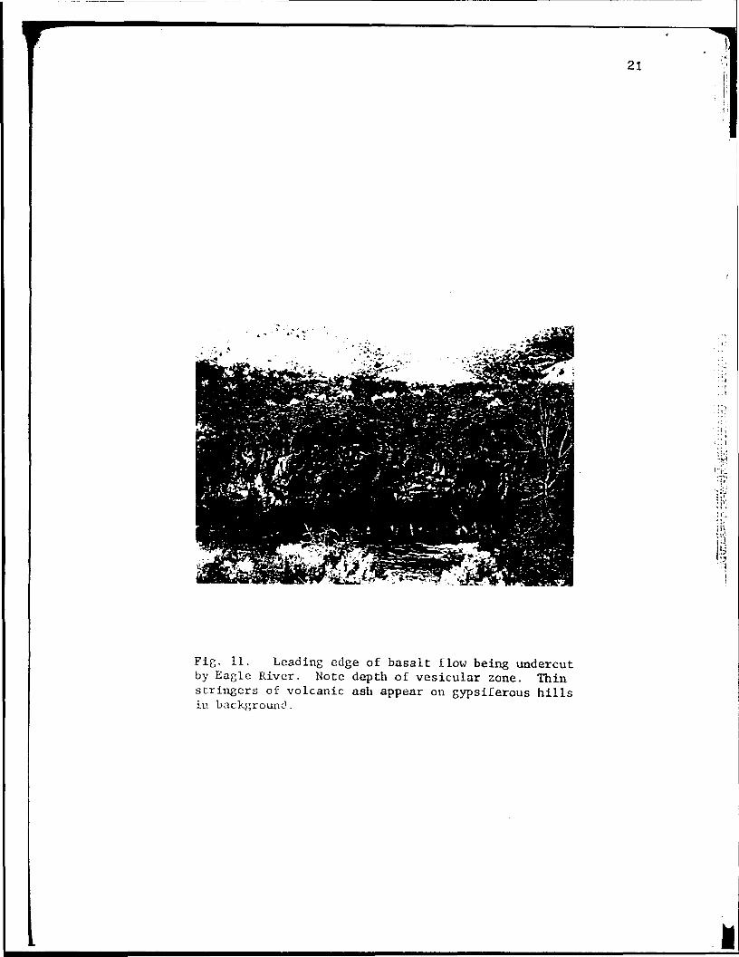
Fig. 11. Leading edge of basalt flow being undercutby Eagle River. Note depth of vesicular zone. Thinstringers of volcanic ash appear on gypsiferous hillsin background.
The lava flow may have pushed the Eagle River over to the south
side of its valley, but there is no evidence that it ever dammed the
river. No lava was found in place on the south bank. Material as loose
and poorly consolidated as the lava flow could easily have been removed
by the river; the sheer volume of the flow, however, probably was effec-
tive in crowding the river out of its channel.
The river has cut into the periphery of the lava front; fresh,
crystalline, blue-gray basalt is exposed at the river's edge and it is
here that an estimate of the depth of the vesicular zone can be made.
The leading edge of the lava is under water; apparently some alluviation
has occurred since the extrusion.
The lava flow is overlain by an alluvial fan composed of material
carried from the gulch down which the lava flowed. Much of the fan con-
sists of reworked boulders of lava derived from the V-shaped lining of
the gully; near the top of the section and close to the mouth of the
gulch the percentage of sedimentary rock particles is greater. The
intermittent stream that occupies the gulch now has cut through the lava
along much of its length and at present is downcutting in the sediments.
Pyroclastic Rocks
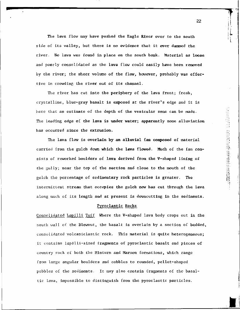
Consolidated Lap i 1 1 i Tuff Where the V-shaped lava body crops out in the
south wall of the Blowout, the basalt is overlain by a section of bedded,
consolidated volcaniclastic rock. This material is quite heterogeneous;
it contains lapilli-sized fragments of pyroclastic basalt and pieces of
country rock of both the Minturn and Maroon formations, which range
from large angular boulders and cobbles to rounded, pellet-shaped
pebbles of the sediments. It may also contain fragments of the basal-
tic lava, impossible to distinguish from the pyroclastic particles.
22I!:
It
ft
23
Fig. 12. Close-up view of outcrop of consolidatedlapilli tuff. The texture of the lower part of thesequence in this photograph is reminiscent of theappearance of the overlying lapilli tuff. Note thewell-rounded cobble of Maroon sandstone.

A very fine, brown clay matrix fills interstices, but does not seem to
be the cementing medium. Calcium carbonate, probably precipitated from
circulating ground waters, is present as well, but not in sufficient
quantity to be the cement.
With the exception of a single outcrop on the northeast rim of the
crater, this rock type seems to be restricted to a single exposure inL.
the south wall of the Blowout. Although the'outcrop is largely covered
with pyroclastic debris that has slumped down from the rim of the crater,i'
enough is still visible to indicate that there may be as much as 200
feet of the consolidated material.
The basaltic fragments that make up much of this rock are petro- ^
graphically similar to the dike and the lava flow.
The rock is uniformly bedded, but only crudely sorted. It is quite
porous, and can be disaggregated easily. Nonetheless, it resists ero-
sion, as it forms a series of scarps on the otherwise uniformly sloping
crater wall.
This rock is a clastic accumulation which may have been deposited <-
subaerially as a pyroclastic sediment, may have resulted from subaeque-
ous deposition within the lava-lined gulch, or may have accumulated as
a mudflow. In the latter two cases, erosion of the vesicular flow sur-
face may have provided the basaltic fragments present. The attitude of
the section may be a relic of mantle bedding in a pyroclastic deposit
or may be the result of a minor post-explosion collapse along the axis
of the Blowout.
The accumulation of 200 feet of material by stream deposition or
mudflow requires a substantial period of erosion; the petrographic simi-
larity of the rocks above and below this deposit seems to preclude such
fe:
W
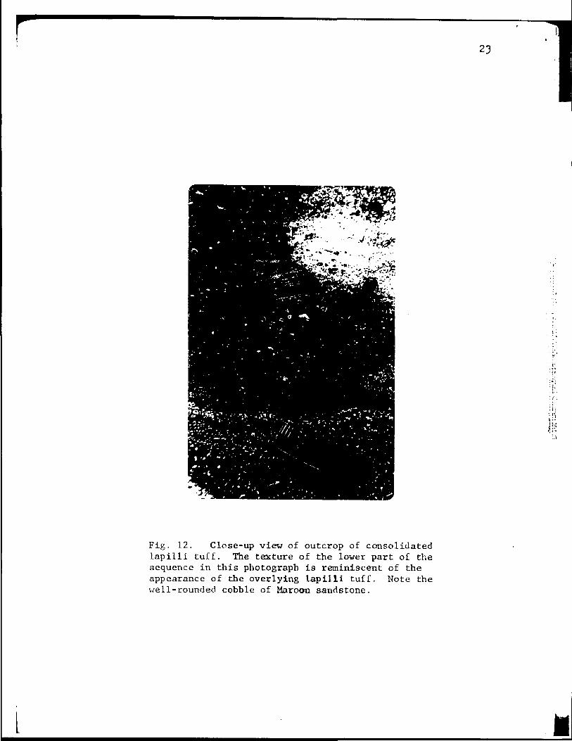
Figs. 13 and 14. Left: view of outcrop of consolidated lapillituff. Right: this resistant material stands up in steep scarpsas in this exposure in the south wall of the Blowout.
N)
26 '-Hi
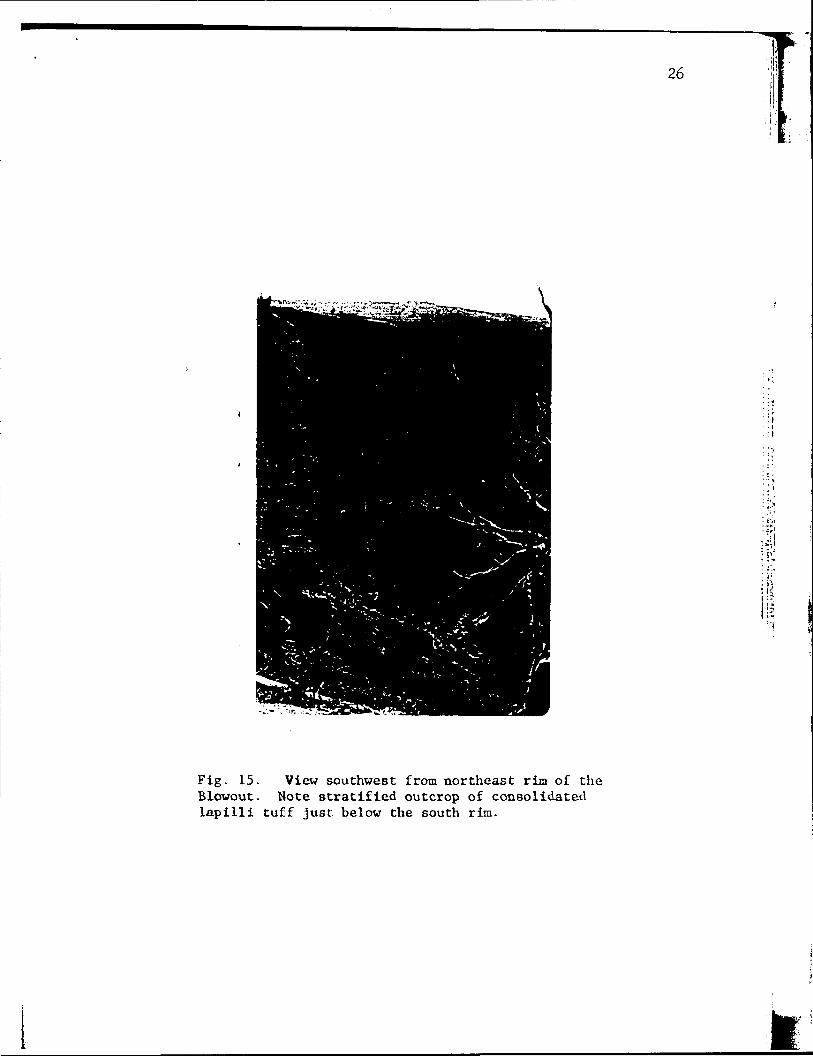
Fig. 15. View southwest from northeast rim of theBlowout. Note stratified outcrop of consolidatedlapilli tuff just below the south rim.
I

27
an interval. If the rock were the result of a general pyroclastic ex-
plosion, one would expect to find such material distributed over a wider
area, but it occurs only within the confinement of the lava-lined valley.
The best explanation seems to require a directed pyroclastic explosion
of limited volume that lacked the power to blow material ouch above the
bottom of the gulch. Such an eruption would have filled the gully in
short order but left no record up on the divides. Wentworth and .*.
MacDonald (1953) report (pp. 22-23) that basaltic eruptions in Hawaii> *
are characterized by a few hours of extrusion of fluid lavas; activity
then often becomes restricted to a short stretch of the fissure, over
which a "spatter-and-cinder cone" is built. True cinder and bombs nay
be extruded from such a feature. Often such pyroclastic particles re-
tain enough heat to be welded together upon landing; a continual series
exists, one end member of which is the case in which the pyroclastic
fragments fuse into a lava flow. The other extreme results in a clastic
accumulation in which no welding occurs. The deposit described above
probably resulted from a spatter-and-cinder cone eruption which retained
enough heat to consolidate the component clasts but still "pMrvf?iw
its clastic texture.
Wahlstrom (1955) would term this rock a lapilli tuff, since most
of the clastic fragments are between 4 and 32 mm. in diameter. Fisher
(1960) has proposed the term lapillistone for pyroclastic rocks whose
particles lie between 2 and 64 mm. in diameter. The indurated nature
of this deposit merits the additional modifier consolidated.
Lapilli Tuff All the earlier volcanic rocks are blanketed by a layer
of unconsolidated, in part fragmental, volcanic ejecta. This material
appears in fluvial deposits of the Eagle River and tributaries as far
IIpIi
I'll
east as Gypsum, but does not occur more than a mile west of die Blowout.
The ejecta seem to be diickest at the crater's rim, where excavation
has exposed 60 feet of section, which thins rapidly away from die de-
pression. Exposures in Trail Gulch are about 4 inches thick. The over-
all distribution suggests that the material was ejected from the
immediate vicinity of die crater at times when strong west winds were
blowing.
The section exposed in die Ideal Lava Products Company excavation '
on the southeast rim of die crater is a light bluish gray in color and
stands in steep scarps in die quarry vails. The material is loose and
such cliffs are unstable; slight disturbance causes slumping to die |y
angle of repose. Bedding is diia and uniform, and parallels the config-
uration of preexisting topography. Such mantle bedding occurs on slopes
as steep as 30-33°, which angle seems to be die angle of repose of die jj!$
material.
The pyroclastic fragments are raostly of lapilli size, but particles
as fine as dust and others as large as 2 feet in lengdi are present.
Fragments of die country rock are interbedded widi die section. Some
of these are angular blocks as much as 18 inches in diameter; others
range down to sand and silt size. Fragments of bodi die Maroon sand-
stone, which is exposed in die crater walls, and die underlying Hinturn
lithology are present.
Certain strata seem to contain more country rock fragments than do
others; one bed in particular is composed of about 50Z red sandstone
particles. This horizon may represent a time of collapse of the crater
walls during explosion.

29
Fig. 16. Photograph of lapilli tuff outcrop, ex-posed in Ideal Lava Products Company quarry.
Fig. 17. Same as above. Note dip of mantle bed-ding, a relic of previous ground surface.
L ft
30
Bombs of many different shapes are abundant din the bedded ejecta;
some are typically fusiform, some are ropy, others are shapeless blobs.
Where exposed in the section, these projectiles indent the Under lying
strata in bond) sags; mantle bedding occurs in the overlying layers.
The bombs are darker than the lapilli and are strongly reminiscent of
the vesicular surface of the lava flow. The bombs are present only in
the immediate vicinity of the crater.
Like all the earlier volcanic rocks, the explosive phase contains> *
phenocrysts of olivine Fa24, clinopyroxene, and magnetite, and laths of
microlitic bytounite An^- The glassy matrix has a refractive index of
1.57, said to be about average for basaltic glass (Wahlatrom 1955, pg.
286). A very few grains of quartz were observed in thin sections of the
lapilli and bombs; those seen are clear and contain no inclusions.
Large quartz grains can be seen in hand samples of fh«» bombs; such crys-
tals are clear, glaasy, and minutely fractured. Many occur as long
prisms with euhedral, parallel sides, but the crystal terminations are
not well developed. An X-ray powder pattern determination by John P.
deNeufville of the Geophysical Laboratory in Washington D.C. has estab-
lished that these grains are alpha quartz. The presence of these crys-
tals exclusively in the pyroclastic rocks and especially in the bombs
suggests that they were included at the time of the explosion; in any
event they could not have developed through magmatic fractionation of
as basic a magma as the host basalt. The quartz is in much local demand
by collectors who think the crystals are diamonds. A shaft was sunk in
the flopr of the crater in 1898 in an attempt to locate the "mother
lode". The project was abandoned at a depth of 250 feet while the hole
| I
I
SI•
-
II

Figs. 18 and 19. 2 views of bomb sacs in the bedded lapilli tuff.The presence of such features confirms the origin of this depositas a gravity ash fall. V.J

was still in ejecta*.
The generic term volcanic ash could be applied to all products of
the final explosive phase of the eruption. Following Wahlstrom (1955),
this pyroclaatic deposit is called a lap ill! tuff where the bulk of the
volume consists of particles of Lapilli aize. Individual strata in
which bombs are abundant are termed agglomerates; other layers contain-
ing numerous sandstone fragments qualify as volcanic breccias. At some
distance from the source where the ejecta is of ash size the deposit isi "
called a tuff. Fisher's (1960) terra lapillistone seems to inply a
higher degree of induration than exists In this deposit.
g OF *pnt QpaXEBJaBX VOLCANIC
The lava flow lies with unconformity on all earlier rocks - the
Paleozoic sediments and a Quaternary fan and flood plain. The consoli-
dated lapilli tuff rests directly on the lava surface and is overlain
by deposits of volcanic ash. The petrographic similarity of all die
Recent volcanic rocks precludes significant erosional activity within
the interval of the eruption; the 3 stages of extrusion probably
occurred in such rapid succession that they represent but a moment of
geologic time.
The Eagle River at present is flowing on a confined flood plain
within a steep-walled valley. Development of meanders has undercut and
truncated a series of alluvial fans which are composed of material de-
rived from the intermittent erosion of tributary gulches. The Eagle
River presently is incised to a depth of 35-50 feet below a previous
level, as estimated from a projection of these alluvial surfaces.
***
*Wm. Randall, personal communication, 1962

33
It has been suggested (Capps, 1909; Landon, 1933) that these fans
are terraces composed of outwash gravels deposited during the Last
stage of Pleistocene glaclation. It seems more likely that such nateri-
1 was deposited by tributary streams at a time, when the Eagle Elver
was higher than at present, probably when it was so choked with glacial
debris that deposition was going on. Hear the center of the valley,
these fans contain numerous granitic and metamorphic cobbles; such o
material may have been introduced by a meandering Eagle River, saturated»*
with debris from a melting glacier upstream, and subsequently reworked
by the tributary streams. The profiles of these surfaces strongly sug-
gest a series of alluvial fans or flanking pediments rather than a
system of river terraces.
In either case, the present level of the Eagle River indicates a
period of downcutting which probably occurred after the-glaciers had
melted. The river then was relatively free of debris and bad energy to
spare for active erosion and removal of material. The tributary streams,
which produced the fans are now entrenched into these features.
The volcanic rocks are superimposed upon this latest valley profile.
The lava flow lies on the flood plain below the truncated fans. The
volcanic ash can be found on top of the flanking fans where in most
cases it is the highest stratum exposed; in other instances the tuff is
overlain by a thickness of reworked pyroclastic material. Trail Gulch,
which enters the Eagle River north of Gypsum, is incised into a flood
plain the projection of which seems to coincide with the surface of the
flanking fans. The presence of volcanic ash on the flood plain surface
indicates that downcutting had begun before the volcanic explosion.
II
i!

Figs. 20 and 21. Left: view of thin stratum of^volcanic ash over-lain by thickness of waterworked pyroclastic material. Exposure ison top of an alluvial fan adjacent to the Eagle River. Right: thinstratum of volcanic ash overlain by thickness of waterworked materialand alluvial material derived from erosion of Minturn formation.Section is in a cut on Trail Gulch Road.
^ ^ W>.

r 35
Some alluviation seems to have occurred since the time of die erup-
tion. As mentioned above, certain of the exposures of ash in fluvial
sequences are overlain by water-worked tuff. A aeries of alluvial fans
from intermittent streams tributary to Trail Gulch have been cut into
by Trail Gulch Road; in these exposures as much as 4 feet of alluvial
material overlies the volcanic ash. The leading edge of the lava flow
where it: is undercut by the Eagle River is presently under water. It
does not seem likely that alluviation in the headwaters of the local»•
watershed was prompted by such a minor change in Eagle River regimen;
deposition by the intermittent streams may have been initiated simply
by the abrupt introduction of a volume of pyroclastic material.
Accumulation of ejects around the north end of the Blowout damned
up 2 small intermittent streams which previously had flowed on down the
gulch now occupied by the crater. With their drainage blocked> these
gullies began to fill with material derived from the pyroclastic cover
and the red sediments in their source areas. Headword growth of a small
intermittent stream to a distance of 3000 feet from the north end of the
Blowout has incised a steep gulch in one of the filled stream valleys;
erosion here has cut down into the red rock to expose the complete see-
tion.
Field data suggest that the volcanic rocks were extruded some time
after the close of the last glacial period, the Wisconsin. A consensus
of authoritative opinion (Emiliani, 1955, 1958; Suess, 1956; Karlstrom,
1956) indicates that this event occurred between 6 and 9 thousand years
before the present. Alluviation of the Eagle River subsequent to the
extrusion may have occurred during the Recent, or "Little Ice Age"
(Karlstrom, 1956; Suess, 1956). The presence of 2 small hot springs on
1
I

36
u-;ft:
lifeits'
Fig. 22. Waterworked volcanic ejecta overlain byred clay soil. Section is in a gulch cut in thefilled valley north of the Blowout.

37
the Colorado River just west of Dotsero (George, 1920) suggests that
residual magmatic heat may still be present at depth. The amount of
erosion of the lava lining in the gulch below the Blowout and the ex-
tent of headward growth of incision in the filled valley above suggest
that some time has elapsed since volcanic activity ceased.
A charcoal sample was recovered from a tree which had been buried
by the falling ejecta. The tree was standing erect on the southeast
rim of the Blowout and was partially exposed by excavation in the Ideal1 *
Lava Products Company quarry. The three-dimensional structure of the
branching limbs was preserved and bedding in the lapilli was undisturbed
on all sides of the trunk. The tree was traced down to the red sand-
stone in which it probably was rooted; a collapse of the unstable column
of lapilli prevented further search for evidence of the root structure.
-"" The charcoal was dated by the Radiocarbon Laboratory of the U.S.
Geological Survey in Washington D.C. and yielded an age of 4150 - 300
years before the present. The Dotsero Crater—is-thus the most-recent:
source of volcanic rocks in the state of Colorado.
MTKKPRETATIOH
Inasmuch as this thesis is concerned primarily with the Quaternary
volcanic rocks, no discussion of earlier geologic history is included.
Comprehensive treatments of Pennsylvanian-Permian history of central
Colorado are in print, and there is no lack of publications discussing
Tertiary events. A description of pre-Quaternary history in the Dotsero
area adds nothing to what already is set forth. Accordingly, the fol-
lowing discussion is limited to events which have transpired since the
Eagle River valley attained its present form.
***
38
Basaltic lava veiled out of a vent in the bottom of a small gulch
on the north side of the Eagle River. The vent previously may have
been a source of some of the Tertiary volcanic rocks. The intrusive
body exposed in the north wall of the Blowout is, however, associated
with the Recent extrusion, as indicated by the petrographlc evidence.
Molten rock filled the gulch and adhered to the canyon vails; some of
it flowed up the gulch to a point beyond the upstream limit of the vent.
Host of the lava ran down the gulch and spread out unconfined on the»*
Eagle River valley bottom. The lava may have forced the Eagle River
out of its channel. There is no evidence that the flow ever dammed the
Eagle River; if it did, it must have done so only momentarily, until
the river was able to remove enough scoria to regain its old level. It
seems probable that the lava flow crowded the river to the south side
of the valley and then singly ran out of supply or solidified.
When the lava outpouring subsided, a spatter-and-clxtder cone prob-
ably rose over a part of the vent, and produced the consolidated lapilli
tuff which appears in the south wall of the Blowout.
Increase in volatiles within the magmatic mass beneath the vent
seems to have resulted in a pyroclastic explosion that blew out quanti-
ties of the .country rock and scattered sandstone fragments and volcanic
ejects over the immediate -area. Fine ash and volcanic dust was blown
as much as 6 miles east of the crater, where it is interstratified with
fluvial deposits. The explosion beheaded a small stream valley i&ich
previously had flowed southeast from the vicinity of the crater; the old
valley profile presently is represented by a low area in the east wall
of the Blowout. The present form of the crater is due to slump and col-
lapse of the walls; in view of this shape of the Blowout several

39
alternative hypotheses for the origin of the crater might be advanced.
It seems unlikely that the depression is due to subsidence of
country rock into a nyigma chamber or digestion of the sediments' by a
molten dike, as either of these mechanisms would be expected to produce
a change in magmatic composition of the final stages of the extrusion.
Soluble gypsum and/or anhydrite is present in the Hinturn formation
which underlies the material exposed in the crater. Sinkholes are not
uncommon in the area; a large, shallow sink is developed in the gypsif-j'
erous beds of the Hinturn 4 miles northeast of the Blowout. Bo sink- '.
holes are present anywhere in the Maroon formation in the mapped area.
It would seem extremely fortuitous for such & collapse to have occurred
at the exact point which all the field evidence dictates must be the
source of the volcanic rocks.
After volcanic activity ceased, erosion and mass-wasting altered
the form of the blowout and associated volcanic features. Slump on the
sides of the crater has reduced much of the wall surface to the angle .
of repose of the pyroclastic material; fragments of the red sandstone
have fallen into the crater and are contributing to its eventual filling.
Ueadward growth of a small, intermittent tributary of the Eagle River
currently is removing what lava remains in the gulch.
The Dotsero volcano certainly is no longer active, and may be ex-
tinct. The presence of 2 hot springs not far from Dotsero has been
mentioned; these may indicate the presence of residual heat at depth.
The temperatures of the 2 springs are 83 and 84° F.; their salinities
are approximately 11 °/oo (George, 1920). Thornbury (1956, pg. 489)
warns that "any volcano that has been active as recently as the Pleisto-
cene is potentially an active volcano." In view of this admonition, it
is proposed the Dotsero Crater be classified as dormant.
. ECONOMIC GEOLOGY
The ejecta currently is being exploited by the Ideal Lava Products
>any, who operate a quarry on the southeast rim of the Blowout. The
Lapilli tuff makes excellent lightweight aggregate and is fabricated
into cinder blocks at the company's plant in Dotsero. The Eagle County
Department of Public Works quarries ejecta from a steep, unstable slope
just south,, of the Blowout and has built up a stockpile of the material
lear highway 6 & 24. The cinders supposedly are spread on secondary
roads in Eagle County, but the quarry has not been worked recently and
the stockpile remains undisturbed.
BIBLIOGRAPHY
Allen, E., and Balk, R., 1954, Mineral Resources of Fort Defiance andTohatchi Quadrangles, Arizona and New Mexico: Bull. 36, State Bur. ofMines & Min. Resources, Hew Hex. Inst. of Mining and Technology.
Bass, N. Wood, 1958, Pennsylvania!* and Permian Rocks in the SouthernHalf of the White River Uplift, Colorado: in Symposium on PennsylvanianRocks of Colorado and adjacent areas, R.M.A.G., Denver Colorado.
_, and others, 1960, Geology of West-Central Colorado inGuide to the Geology of Colorado: G.S.A. , R.M.A.G. , C.S.S.
.Campbell, M.R. , 1922, Guidebook of the Western United States; Part E,the Denver and Rio Grande Western Route: U.S.G.S. Bull. 707, pp. 130-131.
Capps, S.R. , Jr, 1909, Pleistocene Geology of the Leadville Quadrangle,Colorado: U.S.G.S. Bull. 386, pp. 17-22.
Clippinger, Donn, and Gay, Walter, 1947* Pumice Aggregate in Hew Mexico;its Use and Potentialities: Hew Hex. Bur. of Mines and Min. ResourcesBull. 28.
t Cotton, C.A. , 1944, Volcanoes as Landscape Forms: Whitcombe and TombsLtd., Wellington, Hew Zealand, 416 p.
Darton, N.H., 1916, Explosion Craters: Scientific Monthly v. 3, p. 425.
Diller. J.S., 1887, Geology of the Lassen Peak District: 8th Amnml Re-port, U.S. Geological Survey.
Dormer, H.F., 1949, Geology of the McCoy area, Colorado: G.S.A. Bull.v. 60 pp. 1215-1248.
Emiliani, Cesar e, 1955, Pleistocene temperatures: Jour. Geol. v. 63,pp. 538-578.
_ _ , 1958, Paleo temperature Analysis of Core 280 andPleistocene Correlations: Jour. Geol. v. 66 pp. 264-275.
Endlich, P.M. ,-1876, On the Erupted Rocks of Colorado, 10th Annual Re-port, U.S. Geographical and Geological Survey of the Territories, pp.199-251.
Fenner, C.N., 1920: The Katmai Region, Alaska, and the Great Eruptionof 1912: Jour. Geol. v. 28, pp. 569-606.
Fisher, Richard J. , 1960, Proposed Classification of Volcanic lasticRocks: G.S.A. Program 1960 Annual Meetings.

_, and Wilcox, Say £.» 1960, Volcanic Clastic Bocks ofthe John Day Formation in Monument Quadrangle, Horth Central Oregon:G.S.A. Program 1960 Annual Meetings.
George, R.D., 1920, General Descriptions of the Hineral Springs inHineral Waters of Colorado: Colo. Geol. Survey Bull. 11, pp. 288 and289 and map.
Gilbert, G.K., 1890, Lake Bonneville, U.S.G.S. Monograph 1.
Gregory, H.E., 1915, The Igneous Origin of the "Glacial Deposits" onthe Havajo Reservation, Arizona and Utah: Am. Jour. Sci. 4th Series, v.40, pp. 97-115.
_, Geology of the Havajo Country: A Reconnaissance ofFarts of Arizona, Hew Mexico, and Utah, U.S.G.S. Professional Paper 93.
Jaggar, T.A., 1947, Origin and Development of Craters: G.S.A. Memoir 21,pp. 337-407.
Jahna, R.H., 1952, Calderas of the Pinacate Region, Sonora, Mexico (aba.)G.S.A. Bull. v. 63 no' , 12 part 2~pp. 1332-1333.
Karlstrom, T.N.V., 1956, Radiocarbon-based Pleistocene Correlations andWorldwide Climatic Change (abs): GG.S.A. Bull. v. 67, pg. 1711.
Rueera, Richard E., 1962, Late Cenozoic Structural and Geomorphic His-tory of the Park Range and White River Plateau, Horthwest Colorado:Rocky Mountain G.S.A. Program, 1962 Annual Meetings.
Lakes, Arthur, 1890, Extinct Volcanoes in Colorado: Am. Geol. v. 5, pp.40-43.
London, Robert E., 1933, Date of Recent Volcanism in Colorado: Am.Jour. Sci. Series 5 v. 25, pp. 20-24.
Lee, Willis T., 1907, Afton Craters of Southern New Mexico: G.S.A.v. 18, pp. 211-220.
MacDonald, G.A., 1943, The 1942 Eruption of Mauna Loa, Hawaii: Am.Jour. Sci., v. 241, pp. 241-256.
MacDonald, G.F., 1953, Anhydrite-Gypsum Equilibrium Relations: Am.Jour. Sci. v. 251 no. 12, pp. 884-898.
Moore, J.G., and Peck, D.L., 1962, Accretionary Lapilli in VolcanicRocks of the Western Continental United States: Jour. Geol. v. 70 no.2, pp. 182-194.
Nichols, R.L., 1939, Pressure Ridges and Collapse-Depressions on theMcCartys Basalt Flow, New Mexico: Trans. Am Geophys. Union v. 20, pp.432-433.

_, 1946, HcCartys Basalt Flow, Valencia County, Hew Bexico:G.S.A. Bull. 57, pp. 1049-1086.
Pirsson, L.V., 1915, The Microscopical Characters of Volcanic Tuffs:Am. Jour. Sci. Series 4 v. 40, pp. 191-211.
Beiche, Parry, 1937, The Toreva-Block, a Distinctive Landslide Type:Jour. Geol. v. 45, pp. 538-548.
_, 1940, The Origia of Kilbourne Hole, Hev Headco: Am.Jour. Sci. v. 238 no. 3, pp. 212-225.
Robinson, H.H., 1913, The San Francisco Volcanic Field: B.S.G.S. Pror-feasioaal Paper 76.
Riley, Paul, 1949, Geology of an Area along the Colorado River: H.S.Thesis, Univ. of Colorado, Unpublished.
Russell, I.C., 1897, Volcanoes of Borth America: The Mac ttLltan Co.,Hew York.
_, 1887, Quaternary History of Homo Valley, California:8th Annual Report, U.S.G.S-
Schmidt, P.B., 1961, The Geology of the State Bridge Area, Colorado:M.S. Thesis, Univ. of Colorado, Unpublished.
Shearer, Eugene, 1950, Geology of die Bed Dirt Creek Area: M.S. Thesis,Univ. of Colorado, Unpublished.
Shoemaker, B.M., 1953, Collapse Origin of the Diatxemes of the Savaio-Hopi Reservation: G.S.A. Bull. v. 64, pg. 1514.
'tSmith, Robert L., 1960, Ash Flows: G.S.A. v. 71 no. 6, pp. 795-842.
Smith, W.D., and Swartzlow, C.R., 1936, Mount Mazatna: Explosion versusCollapse: G.S.A. Bull. 47, pp. 1809-1830.
Smith, W.R., 1925, Aniakchak Crater, Alaska Peninsula: U.S.G.S. Pro-fessional Paper 132, pp. 139-145.
Stockdale, Paris, 1926, Moatlake, an Amazing Sinkhole; Jour. Geol. v.44, pp. 515-522.
Suess, H.E., 1956, Absolute Chronology of the Last Glaciatlon: Sci.,v. 123, pp. 355-357.
Tazieff, Haroun, 1950, L1eruption du Volcan Gituro (Kivu, Congo Beige):Congo Beige et Ruanda-Urundi, Direction Generale des Affaires Econotoique,Service Geologique, Hemoire no. 1.
Thornbury, W.D., 1956, Principles of Geonorphology, John Wiley and Sonsinc., Hew York.

•v
ideal Lava Products CoC/nder Quarry
\OG\PLAT
OOpZOl
0-J-&SI-
NOlD3cj 0^1.dVlAl OIDCTIO
\ . • - • !\ iV '
NVldXINOI1

EXPLANATION
VO/.C4A//C
ALLUV/UM
CO'MSOL/DA LAP/LU TUFF
BASALT-
'TS*^V*^**(W-*- --JS- v -s. s. <3 l i -* <.* P ^* . -if * /
^it' fS > /",: V^Mi' >f^:;^^Y'V:^^::^.^^f'---;A .-/:
5 />->^5^ lSMt?,>;;;f
mmmmmmm
o
PLATE 2:DOT5EBO
GEOLOGIC MAPCDATEB ^w LAVA FLOW
Vz I mile