reclamation procedures for … reclamation procedures for borrow/waste/staging areas for operations...
TRANSCRIPT
12/11/08
Reclamation Procedures for Borrow/Waste/Staging Areas for Operations 12/11/08 1
RECLAMATION PROCEDURES FOR BORROW/WASTE/STAGING AREAS FOR
OPERATIONS A Reclamation Plan shall accompany any land disturbing activity associated with the project that exceeds the project limits. These include waste and borrow sites as well as applicable staging areas. Waste consists of all excavated materials that are not utilized in the construction of the project, including overburden from borrow sources and soil type base course sources. This shall include permanent or temporary stockpiles placed beyond the project limits. Borrow consists of excavated material brought in from outside of the project limits and utilized in the construction of the project. Staging areas consists of temporary areas, beyond the project limits, utilized during the pursuit of a contract, to store equipment, materials, supplies, or other activities related to the project. In order to comply with Section 107-1 of the NCDOT Standard Specifications, it is necessary to provide documentation ensuring the staging areas do not impact jurisdictional features such as, but not limited to, buffer zones, wetlands, streams, and threatened or endangered species habitats. Staging areas that do not contain erodible material or involve land disturbing activities shall require an environmental evaluation as described in the Environmental Evaluation section of these procedures. Buffer areas and wetlands found within the staging area boundary shall be delineated using highly visible fencing, with the contractor receiving compensation for highly visible fencing or equivalent. Staging areas that contain erodible material or involve land disturbing activities shall require a full Reclamation Plan submitted to the Engineer as outlined in these procedures. Staging areas located at existing office, institutional, commercial, residential, or industrial facilities that do not contain erodible material or involve land disturbing activities are exempt from an environmental evaluation and reclamation plan, unless jurisdictional features are present. Staging areas related to mobile operations that involve overnight parking of equipment are exempt from an environmental evaluation and reclamation plan. Plan Procedure • The Engineer or his representative will prepare seven copies of the reclamation plan. As an
alternative, an electronic version can be submitted to expedite review and approval. • The Engineer performs a cursory review to determine if the plan is complete and includes the
property owner signatures and the environmental assessment. • The Engineer must make a site visit. It is suggested that the Property Owner be contacted and
invited to attend this visit. Assure that the haul road is shown on map and note the site distance that will be provided for all vehicles at the proposed intersection.
• The Engineer should assure that an adequate number of devices are specified and sized to control erosion and address drainage. If the site is commercial, the mining permit cover page, location map and site plan shall be included. Devices should be sized to comply with Best Management Practices (BMP), including sediment storage volume, surface settling, and spillway capacity.
• Assure that minimum undisturbed vegetated buffers and setbacks have been delineated on the map: eg. 50’ riparian buffer for regulated basins and jurisdictional streams, 25’ buffer from wetlands (additional buffer areas may be required if it is determined that the regulated wetland and/or stream will be indirectly impacted by borrow pit operations), 50’ buffer from trout waters,
12/11/08
Reclamation Procedures for Borrow/Waste/Staging Areas for Operations 12/11/08 2
10’ setback from property lines (local ordinances may require additional setbacks). The Environmental Officer should assure that any additional buffers, such as additional buffers around watersheds or live streams not in a currently protected basin, imposed by local or statewide governing bodies, are complied with. The haul road is a part of the plan and must comply with applicable setbacks. Neither waste activities nor applicable staging areas can occur within the 100 year floodplain unless superseded by an environmental permit. Borrow activities can occur within the 100 year floodplain as long as stockpiling of borrow material is limited. No waste or Borrow activities or applicable staging areas can occur within High Quality Water Zones (water classifications include WS-1, WS-2, ORW, Class SA, and Primary Nursery Waters) unless superseded by an environmental permit. If isolated wetlands are located within the site, the Environmental Officer must contact the Division of Water Quality for consultation.
• If the site is for waste, the only waste allowed, without a permit from the Solid Waste Division, is for beneficial fill consisting of inert debris strictly limited to concrete (encapsulated rebar is OK), brick, concrete block, uncontaminated soil, rock and gravel. Asphalt, placed at least of 4 feet above the water table, is allowed but is not considered beneficial fill. If wood is present in the waste, then the rules for a Land Clearing and Inert Debris Landfill must be followed in accordance with Section 200-5, Disposition of Timber, Stumps, and Debris.
• After review by the Roadside Environmental Field Operations Engineer, the Engineer will submit approved copies of the map and plan as detailed on the Reclamation Plan Check Sheet. Any revisions must be initialed by the Engineer and Property Owner prior to final approval.
• If the pit is expanded by any dimension or size, the original environmental evaluation shall have been performed over the area in which the expansion is planned and shall account for the expansion and the expanded activity, or a new environmental evaluation shall be submitted. It is suggested that the entire parcel be included during the initial environmental evaluation.
• The boundaries of the pit and any environmentally sensitive areas within the pit or within the area of the environmental evaluation shall be physically delineated and GPS coordinates shall be provided.
• The Engineer should advise the property owner that a 1 year, post-final compliance review will be held. If corrective work is needed as a result of the 1 year, post final compliance review, the Property Owner shall allow access to DOT to perform the work.
• Minor maintenance operations may be handled with Property Owner “Release” forms. Environmental Evaluation for Borrow/Waste Site/Staging Area The attached information is provided to assist you in the review of the necessary documentation to confirm that candidate borrow/waste sites and/or staging areas do not impact wetlands, surface waters (streams, lakes or ponds), regulated riparian buffers or federally-protected species. The Division Environmental Officer will evaluate the environmental documentation that is required, along with the reclamation plan and associated checklist. Approval of the use of the borrow/waste site and/or staging area for activities exclusively in support of a North Carolina Department of Transportation project will be, in part, dependent on the presence or absence of these sensitive environmental resources at the candidate sites. In order to provide the necessary environmental documentation, the Environmental Officer will perform appropriate site investigations that will confirm or refute the occurrence of wetlands, surface waters, regulated riparian buffers and federally protected species within the impact limits of the proposed borrow/waste sites and/or staging areas and associated access or haul roads.
12/11/08
Reclamation Procedures for Borrow/Waste/Staging Areas for Operations 12/11/08 3
Once the Environmental Officer has completed thorough field inventories of the candidate borrow/waste sites and/or staging areas, appropriate documentation should be submitted to the Engineer, detailing any pertinent findings. The following information should be included in the report: • General description of candidate site location including a location map, USGS Topographic Map,
and a Soil Survey Map. • General description of the vegetative communities at and adjacent to the candidate site. • Identification, delineation, and discussion of jurisdictional wetlands at the candidate site
(including a discussion of soils, vegetation, and hydrology and completion of USACE wetland data sheets).
• Identification, delineation and discussion of jurisdictional surface waters (streams, ponds or lakes) at the candidate site. If dewatering of the pit is proposed, define the point at which the discharge effluent enters into jurisdictional waters. Identify upstream and downstream sampling locations.
• Identification, delineation and discussion of regulated riparian buffers at candidate sites and within 50 feet of candidate sites located within river basins that are subject to buffer rules. If a stream, pond or lake is depicted on the most recent U.S. Geologic Service topographic map (1:24,000 scale) or soil survey prepared by the U.S. Department of Agriculture-Natural Resource Conservation Service, (formerly Soil Conservation Service), the system is subject to the riparian buffer rule. The Environmental Officer may contact the N.C. Division of Water Quality for an on-site determination to identify inaccurately depicted surface waters or waters that the DEO determines may be blue-lined but are not depicted.
• Evaluation of potential habitat for federally protected species and surveys for federally protected species if habitat is identified at the candidate borrow/waste site and/or staging area. Biological conclusions shall be rendered for each species.
• If jurisdictional areas are identified within the proposed pit or the 400’ perimeter and dewatering/wet mining/ excavating below seasonal water table or adjacent streambed elevation is planned, the Engineer shall maintain a 400’ buffer between the land disturbing activity or obtain concurrence for the proposed activity from the USACE. When jurisdictional areas are within 400’ of the borrow pit, follow the procedures outlined in Skaggs Method for Determining Lateral Effects of a Borrow Pit on Adjacent Wetlands found on REU Field Operations website at: (http://www.ncdot.org/doh/operations/dp_chief_eng/roadside/fieldops/downloads/). Any meeting with the USACE will include the Engineer or a member of their staff. Identification of jurisdictional wetlands, surface waters, and protected riparian buffers at the site or within 400’ perimeter of the site are required. These types of maps include U.S. Geologic Service topographic map (1:24,000 scale) and soil survey prepared by the U.S. Department of Agriculture-Natural Resource Conservation Service, (formerly Soil Conservation Service), and site map. All copies of the reclamation plan shall include color topographic maps. The maps will be clear enough to allow someone unfamiliar with the locale to travel to the site and identify all points of interest discussed in the report using GPS coordinates (i.e. wetlands, surface waters, regulated riparian buffers and federally protected species). Local roads should be labeled and each map shall be prepared to scale. At least one figure should identify the boundaries of the candidate site within a larger landscape setting. Additionally, boundaries of the candidate site shall be flagged. The environmental evaluation shall consider impacts to adjacent wetlands and surface waters within a 400’ perimeter of the proposed site. • If water is to be pumped from the site, and the site falls within one of these 15 counties;
Beaufort, Carteret, Craven, Duplin, Edgecombe, Greene, Jones, Lenoir, Martin, Onslow, Pamlico, Pitt, Washington, Wayne, Wilson, the Engineer’s plan to comply with the North

12/11/08
Reclamation Procedures for Borrow/Waste/Staging Areas for Operations 12/11/08 4
Carolina Division of Water Resource’s Central Coastal Plain Capacity Use Area rules shall be discussed.
• Include State Historic Preservation Office (SHPO) Review form for borrow and waste sites. (http://www.hpo.dcr.state.nc.us/borrowpit.pdf)
• Qualifications and experience of the investigators and the methodologies employed in the investigation.
The purpose of this report is to verify whether there are wetlands, surface waters, regulated riparian buffers, or federally protected species at the site prior to the initiation of construction activities.
During Construction • Assure that if buffer zones are required, they have been physically delineated in a manner
approved by the Engineer. • Assure that approved sediment controls are adequately installed. • Require the stockpiling of topsoil for replacement on pit slopes. • Seed and mulch the stockpile and provide temporary sediment control if needed. • Inspect each pit at least weekly as a part of the routine weekly erosion control inspection. • If water is being pumped, ensure that BMP’s have been designed, installed, operated, and
maintained to minimize turbidity to the extent to avoid habitat degradation or removal of a use designation. Refer to Procedures for Monitoring Borrow Pit Discharge Special Provision for more details.
• No more than one acre of erodible slope area should be allowed prior to beginning seeding. • Excavate sites in a manner that allows for dressing and seeding of slopes in keeping with the 1
acre tolerance. • Assure that a minimum of 4 feet of water shall remain in the pit if it is to serve as a pond. • Occasionally check the site for plan conformance and either revise the plan or correct the site. • Check slope rates during construction. Slopes should be built to plan rates during the initial
disturbance to provide the best opportunity for permanent stability and limit the need for temporary seeding.
Final Inspection • Compare the final condition of the pit to the plan and amend the plan or the pit if differences
exist. The two items are required to be the same. • Upon completion of all construction activities necessary within the waste/borrow site and/or
staging area, ensure that the disturbed areas are completely stabilized with a permanent stand of vegetation. The type of vegetation should meet the reclamation plan seed mixture.
• Assure that at least 4 ft. of water is remaining in the pit if it is to serve as a pond. • Assure that at least 6 in. of soil, capable of supporting vegetation, is covering waste. • Ensure that no standing pools of water remain. If the site is required to be left in a dry condition,
ensure the topography is graded to drain to natural outlets. • Ensure that all temporary sediment controls have been removed. • Ensure that the final contours are compatible with the surrounding topography. • IN WRITING, notify the Property Owner that the project is complete and all work on the site is
complete. This notification shall refer to the property owner’s signed statement allowing site inspections and any repair work during the coming year.
12/11/08
Reclamation Procedures for Borrow/Waste/Staging Areas for Operations 12/11/08 5
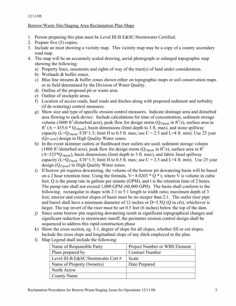
Borrow/Waste Site/Staging Area Reclamation Plan Maps
1. Person preparing this plan must be Level III-B E&SC/Stormwater Certified. 2. Prepare five (5) copies. 3. Include an inset showing a vicinity map. This vicinity map may be a copy of a county secondary
road map. 4. The map will be an accurately scaled drawing, aerial photograph or enlarged topographic map
showing the following: a) Property lines, easements and rights of way of the tract(s) of land under consideration. b) Wetlands & buffer zones. c) Blue line streams & buffer zones shown either on topographic maps or soil conservation maps
or as field determined by the Division of Water Quality. d) Outline of the proposed pit or waste area. e) Outline of stockpile areas. f) Location of access roads, haul roads and ditches along with proposed sediment and turbidity
(if de-watering) control measures. g) Show size and type of specific erosion control measures. Indicate drainage area and disturbed
area flowing to each device. Include calculations for time of concentration, sediment storage volume (3600 ft3/disturbed acre), peak flow for design storm (Q10peak in ft3/s), surface area in ft2 (A = 435.6 * Q10peak), basin dimensions (limit depth to 3 ft. max), and stone spillway capacity (L=Q10peak /CH^1.5; limit H to 0.5 ft. max; use C = 2.5 and L=4 ft. min). Use 25 year (Q25 peak) design in High Quality Water zones.
h) In the event skimmer outlets or flashboard riser outlets are used, sediment storage volume (1800 ft3/disturbed acre), peak flow for design storm (Q10peak in ft3/s), surface area in ft2 (A=325*Q10peak), basin dimensions (limit depth to 3 ft. max), and fabric lined spillway capacity (L=Q25peak /CH^1.5; limit H to 0.5 ft. max; use C = 2.5 and L=4 ft. min). Use 25 year design (Q25peak) in High Quality Water zones.
i) If borrow pit requires dewatering, the volume of the borrow pit dewatering basin will be based on a 2 hour retention time. Using the formula, V= 8.0203 * Q * t, where V is volume in cubic feet, Q is the pump rate in gallons per minute (GPM), and t is the retention time of 2 hours. The pump rate shall not exceed 1,000 GPM (60,000 GPH). The basin shall conform to the following: rectangular in shape with 2:1 to 5:1 length to width ratio; maximum depth of 3 feet; interior and exterior slopes of basin must be no steeper than 2:1. The outlet riser pipe and barrel shall have a minimum diameter of 12 inches or D=3.5Q (Q in cfs), whichever is larger. The top invert of the riser must be set 0.5 feet (6 inches) below the top of the dam.
j) Since some borrow pits requiring dewatering result in significant topographical changes and significant reduction in stormwater runoff, the perimeter erosion control design shall be sequenced to address this rapid construction phase
k) Show the cross section, eg. 3:1, degree of slope for all slopes, whether fill or cut slopes. Include the cross slope and longitudinal slope of any ditch employed in the plan.
l) Map Legend shall include the following:
Name of Responsible Party Project Number or WBS Element Plans prepared by Contract Number Level III-B E&SC/Stormwater Cert # Scale Name of Property Owner(s) Date Prepared North Arrow County Name
12/11/08
Reclamation Procedures for Borrow/Waste/Staging Areas for Operations 12/11/08 6
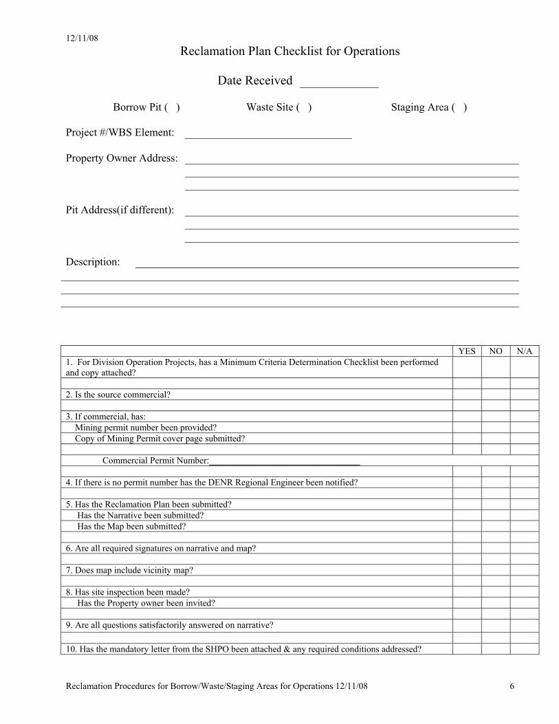
Reclamation Plan Checklist for Operations
Date Received
Borrow Pit ( ) Waste Site ( ) Staging Area ( )
Project #/WBS Element: Property Owner Address: Pit Address(if different): Description: YES NO N/A 1. For Division Operation Projects, has a Minimum Criteria Determination Checklist been performed and copy attached?
2. Is the source commercial? 3. If commercial, has: Mining permit number been provided? Copy of Mining Permit cover page submitted? Commercial Permit Number:_________________________________ 4. If there is no permit number has the DENR Regional Engineer been notified? 5. Has the Reclamation Plan been submitted? Has the Narrative been submitted? Has the Map been submitted? 6. Are all required signatures on narrative and map? 7. Does map include vicinity map? 8. Has site inspection been made? Has the Property owner been invited? 9. Are all questions satisfactorily answered on narrative? 10. Has the mandatory letter from the SHPO been attached & any required conditions addressed?
12/11/08
Reclamation Procedures for Borrow/Waste/Staging Areas for Operations 12/11/08 7
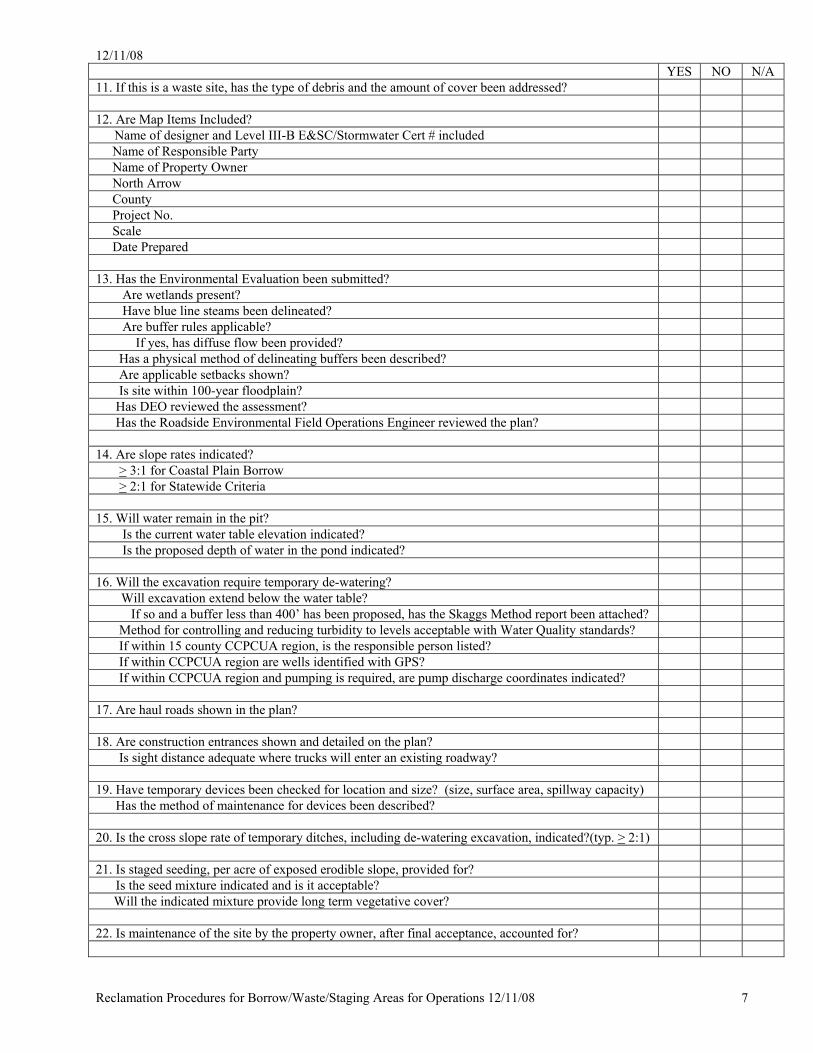
YES NO N/A 11. If this is a waste site, has the type of debris and the amount of cover been addressed? 12. Are Map Items Included?
Name of designer and Level III-B E&SC/Stormwater Cert # included Name of Responsible Party Name of Property Owner North Arrow County Project No. Scale Date Prepared 13. Has the Environmental Evaluation been submitted? Are wetlands present? Have blue line steams been delineated? Are buffer rules applicable? If yes, has diffuse flow been provided? Has a physical method of delineating buffers been described? Are applicable setbacks shown? Is site within 100-year floodplain? Has DEO reviewed the assessment? Has the Roadside Environmental Field Operations Engineer reviewed the plan? 14. Are slope rates indicated? > 3:1 for Coastal Plain Borrow > 2:1 for Statewide Criteria 15. Will water remain in the pit? Is the current water table elevation indicated? Is the proposed depth of water in the pond indicated? 16. Will the excavation require temporary de-watering?
Will excavation extend below the water table? If so and a buffer less than 400’ has been proposed, has the Skaggs Method report been attached?
Method for controlling and reducing turbidity to levels acceptable with Water Quality standards? If within 15 county CCPCUA region, is the responsible person listed? If within CCPCUA region are wells identified with GPS? If within CCPCUA region and pumping is required, are pump discharge coordinates indicated? 17. Are haul roads shown in the plan? 18. Are construction entrances shown and detailed on the plan? Is sight distance adequate where trucks will enter an existing roadway? 19. Have temporary devices been checked for location and size? (size, surface area, spillway capacity) Has the method of maintenance for devices been described? 20. Is the cross slope rate of temporary ditches, including de-watering excavation, indicated?(typ. > 2:1) 21. Is staged seeding, per acre of exposed erodible slope, provided for? Is the seed mixture indicated and is it acceptable?
Will the indicated mixture provide long term vegetative cover? 22. Is maintenance of the site by the property owner, after final acceptance, accounted for?
12/11/08
Reclamation Procedures for Borrow/Waste/Staging Areas for Operations 12/11/08 8
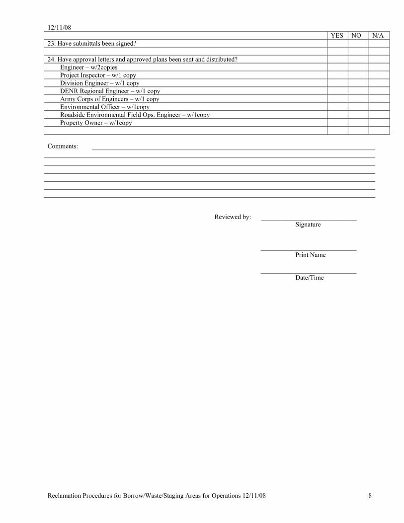
YES NO N/A 23. Have submittals been signed? 24. Have approval letters and approved plans been sent and distributed?
Engineer – w/2copies Project Inspector – w/1 copy Division Engineer – w/1 copy DENR Regional Engineer – w/1 copy Army Corps of Engineers – w/1 copy Environmental Officer – w/1copy Roadside Environmental Field Ops. Engineer – w/1copy Property Owner – w/1copy
Comments: Reviewed by: _____________________________ Signature _____________________________ Print Name _____________________________ Date/Time
12/11/08
Reclamation Procedures for Borrow/Waste/Staging Areas for Operations 12/11/08 9
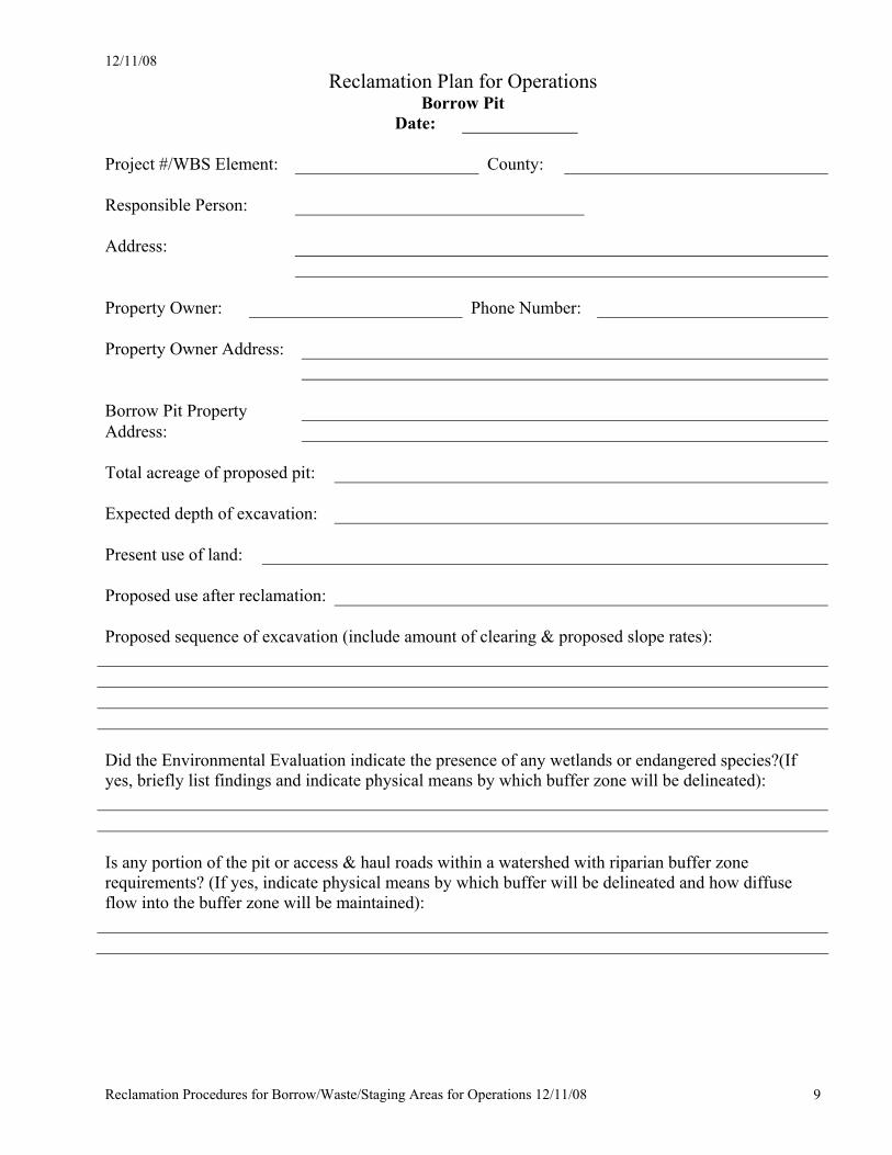
Reclamation Plan for Operations Borrow Pit
Date: Project #/WBS Element: County: Responsible Person: Address: Property Owner: Phone Number: Property Owner Address: Borrow Pit Property Address: Total acreage of proposed pit: Expected depth of excavation: Present use of land: Proposed use after reclamation: Proposed sequence of excavation (include amount of clearing & proposed slope rates): Did the Environmental Evaluation indicate the presence of any wetlands or endangered species?(If yes, briefly list findings and indicate physical means by which buffer zone will be delineated): Is any portion of the pit or access & haul roads within a watershed with riparian buffer zone requirements? (If yes, indicate physical means by which buffer will be delineated and how diffuse flow into the buffer zone will be maintained):
12/11/08
Reclamation Procedures for Borrow/Waste/Staging Areas for Operations 12/11/08 10
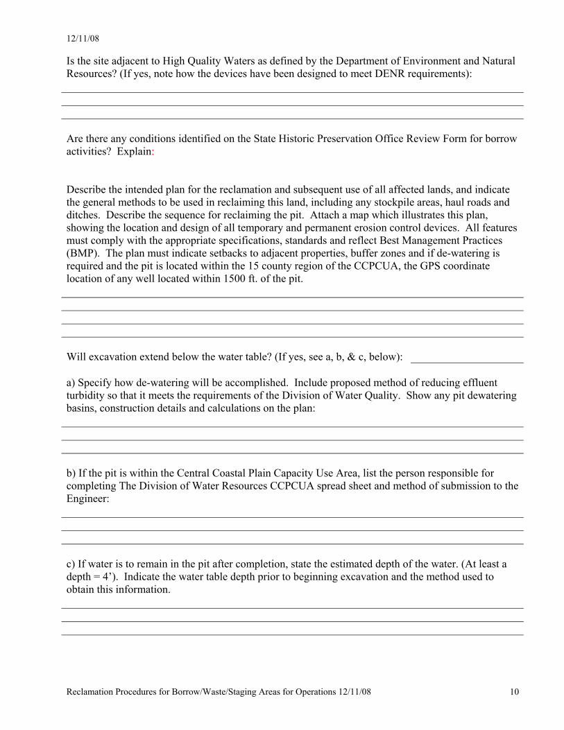
Is the site adjacent to High Quality Waters as defined by the Department of Environment and Natural Resources? (If yes, note how the devices have been designed to meet DENR requirements): Are there any conditions identified on the State Historic Preservation Office Review Form for borrow activities? Explain: Describe the intended plan for the reclamation and subsequent use of all affected lands, and indicate the general methods to be used in reclaiming this land, including any stockpile areas, haul roads and ditches. Describe the sequence for reclaiming the pit. Attach a map which illustrates this plan, showing the location and design of all temporary and permanent erosion control devices. All features must comply with the appropriate specifications, standards and reflect Best Management Practices (BMP). The plan must indicate setbacks to adjacent properties, buffer zones and if de-watering is required and the pit is located within the 15 county region of the CCPCUA, the GPS coordinate location of any well located within 1500 ft. of the pit. Will excavation extend below the water table? (If yes, see a, b, & c, below): a) Specify how de-watering will be accomplished. Include proposed method of reducing effluent turbidity so that it meets the requirements of the Division of Water Quality. Show any pit dewatering basins, construction details and calculations on the plan: b) If the pit is within the Central Coastal Plain Capacity Use Area, list the person responsible for completing The Division of Water Resources CCPCUA spread sheet and method of submission to the Engineer: c) If water is to remain in the pit after completion, state the estimated depth of the water. (At least a depth = 4’). Indicate the water table depth prior to beginning excavation and the method used to obtain this information.
12/11/08
Reclamation Procedures for Borrow/Waste/Staging Areas for Operations 12/11/08 11
Describe the proposed schedule of permanent seeding and mulching. Detail the frequency of permanent seeding and mulching. Note that a permanent stand of vegetation is required prior to a final inspection.
12/11/08
Reclamation Procedures for Borrow/Waste/Staging Areas for Operations 12/11/08 12
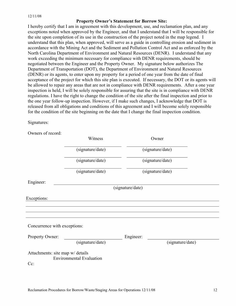
Property Owner’s Statement for Borrow Site: I hereby certify that I am in agreement with this development, use, and reclamation plan, and any exceptions noted when approved by the Engineer, and that I understand that I will be responsible for the site upon completion of its use in the construction of the project noted in the map legend. I understand that this plan, when approved, will serve as a guide in controlling erosion and sediment in accordance with the Mining Act and the Sediment and Pollution Control Act and as enforced by the North Carolina Department of Environment and Natural Resources (DENR). I understand that any work exceeding the minimum necessary for compliance with DENR requirements, should be negotiated between the Engineer and the Property Owner. My signature below authorizes The Department of Transportation (DOT), the Department of Environment and Natural Resources (DENR) or its agents, to enter upon my property for a period of one year from the date of final acceptance of the project for which this site plan is executed. If necessary, the DOT or its agents will be allowed to repair any areas that are not in compliance with DENR requirements. After a one year inspection is held, I will be solely responsible for assuring that the site is in compliance with DENR regulations. I have the right to change the condition of the site after the final inspection and prior to the one year follow-up inspection. However, if I make such changes, I acknowledge that DOT is released from all obligations and conditions of this agreement and I will become solely responsible for the condition of the site beginning on the date that I change the final inspection condition. Signatures: Owners of record: Witness Owner (signature/date) (signature/date) (signature/date) (signature/date) (signature/date) (signature/date) Engineer: (signature/date)
Exceptions: Concurrence with exceptions: Property Owner: Engineer: (signature/date) (signature/date) Attachments: site map w/ details Environmental Evaluation Cc:
12/11/08
Reclamation Procedures for Borrow/Waste/Staging Areas for Operations 12/11/08 13
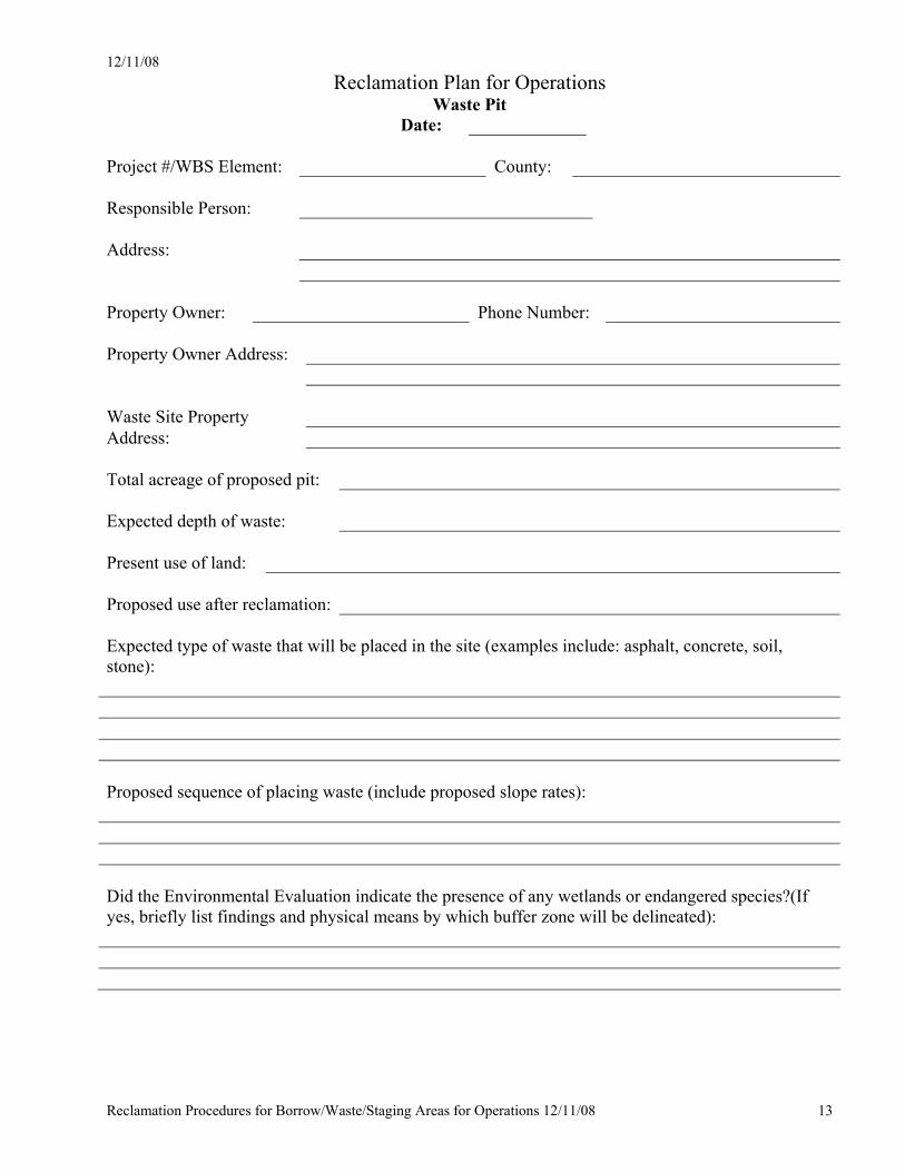
Reclamation Plan for Operations Waste Pit
Date: Project #/WBS Element: County: Responsible Person: Address: Property Owner: Phone Number: Property Owner Address: Waste Site Property Address: Total acreage of proposed pit: Expected depth of waste: Present use of land: Proposed use after reclamation: Expected type of waste that will be placed in the site (examples include: asphalt, concrete, soil, stone): Proposed sequence of placing waste (include proposed slope rates): Did the Environmental Evaluation indicate the presence of any wetlands or endangered species?(If yes, briefly list findings and physical means by which buffer zone will be delineated):
12/11/08
Reclamation Procedures for Borrow/Waste/Staging Areas for Operations 12/11/08 14
Is any portion of the pit within a watershed with riparian buffer zone regulations? (If yes indicated physical means by which buffer will be delineated and how diffuse flow will be maintained): Is the site adjacent to High Quality Waters as defined by the Department of Environment and Natural Resources? (If yes, note how the devices have been designed to meet DENR requirements): Are there any conditions identified on the State Historic Preservation Office Review Form for waste activities? Explain: Describe the intended plan for the reclamation and subsequent use of all affected lands, and indicate the general methods to be used in reclaiming this land, including any stockpile areas, haul roads and ditches. Describe the sequence for reclaiming the site. Attach a map illustrating this plan, showing the location and design of all temporary and permanent erosion control devices. All features shall comply with the appropriate specifications, standards and reflect Best Management Practices (BMP). The plan shall indicate setbacks to adjacent properties, buffer zones and wetlands. Describe the proposed schedule of permanent seeding and mulching. Detail the frequency of permanent seeding and mulching. Note that a permanent stand of vegetation is required prior to a final inspection.
12/11/08
Reclamation Procedures for Borrow/Waste/Staging Areas for Operations 12/11/08 15
Property Owner’s Statement for Waste Site:
I hereby certify that I am in agreement with this development, use, and reclamation plan, and any exceptions noted when approved by the Engineer, and that I understand that I will be responsible for the site upon completion of its use in the construction of the project noted in the map legend. I understand that this plan, when approved, will serve as a guide in controlling erosion and sediment in accordance with the Mining Act and the Sediment and Pollution Control Act and as enforced by the North Carolina Department of Environment and Natural Resources (DENR). I understand that any work exceeding the minimum necessary for compliance with DENR requirements, should be negotiated between the Engineer and the Property Owner. My signature below authorizes The Department of Transportation (DOT), the Department of Environment and Natural Resources (DENR) or its agents, to enter upon my property for a period of one year from the date of final acceptance of the project for which this site plan is executed. If necessary, the DOT or its agents will be allowed to repair any areas that are not in compliance with DENR requirements. After a one year inspection is held, I will be solely responsible for assuring that the site is in compliance with DENR regulations. I have the right to change the condition of the site after the final inspection and prior to the one year follow-up inspection. However, if I make such changes, I acknowledge that DOT is released from all obligations and conditions of this agreement and I will become solely responsible for the condition of the site beginning on the date that I change the final inspection condition. Signatures: Owners of record: Witness Owner (signature/date) (signature/date) (signature/date) (signature/date) (signature/date) (signature/date) Engineer: (signature/date)
Exceptions:
Concurrence with exceptions: Property Owner:
Engineer:
(signature/date) (signature/date) Attachments: site map w/ details Environmental Evaluation Cc: