recorded request of
TRANSCRIPT

~l. '.
•' "i
:.:. . ..~ ~ .c. ('
RECORDED AT THE REQUEST OF .1'.lID WHEN RECORDED M.~IL TO :
State of California 'State Lands Commission 1807 13th Street Sacramento, CA 95814
Attention: Leslie H. Grimes Telephone: (916) 445-1012
STATE OF CALIFORNIA--OFFICIAL BUSINESS Document entitled to free recordation p~rsuant to Government Code Section 27381
NO TAX DUE ~~~~~~---~~~~-
=--~-.-'"...,.....-_..- ..-.-_-_-__-__ SPACE ABOVE TH.IS LINE FOR RECORDER'S USE.-.---.----.---·--·-----·--
CERTIFICATE OF ACCEPTANCE AND CONSENT TO RECORDING
(Govt. Code § 27281)
This is to certify that the State of 'California, acting by
and through the State Lands Commission, an Agency of the State of
California, hereby accepts the right, title:and interest in real
property conveyed by, and consents to the recordation of, the attached
deeds or grants dated December 22, 1981, from: .
1. Wendell Wyatt as trustee for' one-ei-ghth interest -·~;
each.under two Trust AgJ;eements.dated June 3, 1977
and as to a one-eighth.interest under a Trust
Agreement dated May 21,1975 and a further one
eighth interest under a Trust Agreement dated
June 15, 1980; and
2. George R. Van Vleet and Doris Van Vleet~ his wife,
to the State of California.
said interest in real property is accepted by the
.-
~M"'~ .......,-.........____. _______. _____ • ··--··----.. -·-~-·--.... --.. .. -···-··- • - ···- -··-~-·-·-···~·~ --···-·~· ~····-··-·-·-·.- -··~·-·· - ... __ ,...,. ···-···- --·-·-----·----~--·.. ••··•
0

.. "".-;·:·
""· -1··.:. -2-,. .....
State of California in its sovereign capacity in trust for the
people thereof, as real property of the legal character.of tidelands
and submerged lan~s.
This acceptance and consent to recording is executed by
and on behalf of the State of .California by the State Lands
Commission, .acting pursuant to law, .as. approve4 and authorized by
its Calendar Item No. 24 of its.regular public meeting on December 17,
1981, .by its duly authorized undersigned officer._,·
STATE_ LAJl~rf.Jc~~ION
DATED: December 24, 1981 By: A4~··~~
/Deputy .Ch.ief, Division of Land ~agement.and Conservation .,. . . . •, : ; "' ·.
( ~

ss.STATE OF CALIFORNIA ) COUNTY OF SACRAMENTO )
On ·this .~4th day of December,. 1981, before me, the
undersigned, a Notary Public in and for the State .of California,
with principal office .in the County of Sacramento, ·personally
appeared Leslie H~ G:rimes, known to me to the Deputy Chief, Division
of Land Management and Conservation, STATE.LANDS COMMISSION, STATE
OF CALIFORNIA, the Commission that ~xecuted the within instrument,
known to me to be the person who executed the within instrument on
behalf of the Commission therein named, and acknowledged to me that
such Commission executed the within instrum.ent pursuant to a
resolution of its Commissioners.
·WITNESS my hand.and official seal.
0

" I
P.'i'.'.':~~r'rr
il: ¥;~:; .-: ~-:'..:~'-;;i,;,,.,;~·.... ·,
j,
~t~: k~,~~; : ~:~~~']'" .
~~r:~:· "'
'ij~·
. ·::.::~~: -;...~ ~.. i-
. ;.~
,, ;,•
l. '" h•11,,.~' :f.' .J~ .••
::~:< ';~.-:"":.·.
.~f~~if"U!'i ,_ ··~' \
.. -' .,.2.?.?J~t"~ ~~-'"illmholdt Land 11th!t Co.
.Q·~····: fTICIAL166"1w':· > · ~ ::r;;:()S PG 1J3 0 GRANT DEED
Dre 28 2 21 fH '8l WENDELL WYATT as Trustee, HIJME!LL ",. r. ~ ..
GRACF ·:',t' : .. !.,IHH 'f Rtt;0W {")iid~,·,.,~lli.h
Grantor
TO @ ~·:~
STATE OF CALIFORNIA, by and through its State Lands Conunission,
Grantee
After recording return to:
Mr. Les Grimes Deputy Chief Division of Land Management and
Conservation . State Lands Conunission 1807 13th Street Sacramento, CA 95814
(..---------....,\() \ -.____,../ "-...___.
I

( .,
,GRANT DEED
KNOW ALL MEN BY THESE PRESENTS, That George R. Van Vleet
and Doris Van Vleet, his wife, hereinafter called granter, for
the consideration hereinafter stated, does hereby grant, bargain, .
sell and convey unto the State of California, acting by and
through the State Lands Commission, hereinafter called grantee,
and unto grantee's heirs, ~uccessors and assigns all of that
certain real property with the tenements, hereditarnents and
appurtenances thereunto belonging or in anywise appertaining,
situated in the County of Humboldt, State of California, described
as follows, to-wit:
(See Exhibit A attached)
To Have and to Hold the same unto the said grantee and
grantee's heirs, successors and assigns forever.
The true and actual consideration paid for this transfer,
stated in terms of dollars; is zero - this is a gift.
In construing this deed and where the context so requires,
the singular includes the plural and all grammatical changes
shall be implied to make the provisions hereof apply equally to
corporations and to individuals.
In Witness Whereof, the granter has executed this instrument·
this ?. ?.,.L day of .. A eL'""'" b~.

STATE OF OREGON, ) ) SS.
County of U~ )
1981,
Personally appeared George R. Van Vleet and Doris Van Vleet,
his wife, and acknowledged the foregoing instrument to be their
voluntary act and deed.
Before me:
' ' ,·..
NoryPUbl~ for Oregon My Commission expires: /;;.. -/q-f~

·-...._. EXHIBIT A
PARCEL ONE: ~
BEGINNING In the center of Butcher Slough at a point which is di.:>t~ht .300 feet North from the quarter section line forming the south line of the northeast quarter of so,tlon J2, Townihip 6 North, Ran9e l East, H~nboldt Meridian; thence parallel to said quarter section line north 89 degrees 59 minutes west 803,8 feet, more or les5 1
to the east line of the ral I road right of way of the Arcata and Mad River Railroad Company as defined in deed from Elias Sharp dated January 6, 1876 and recorded In the office of the County Recorder of Humboldt County in Book "W'' of Deeds, Page 578; thence south 23 degrees 45 minutes west 35.6 feet to the north point of a parcel of land conveyed by William M. Campbell to California and Northern Railway Company by deed dated November I, 1901 and recordi::d In said Recorder's Office in Book 77 of Deeds, Page 75; thence along the easterly I inc of said parcel south 13 degrees 39 minutes west 275.2 feet, more or less, co the southeast corner of said parcel, which corner is situated on the above mentioned quarter section line; thence south 89 degrees 59 minutes east on the quarter section I ine to the east line of the railroad right of way conveyed by R. W. Bui I and wife to R. H. Emmerson and wife by deed recorded in the office of the County Recorder of Humboldt County, California in Book 5 of Official Records, Page 110; thence following said east line south 11 degrees 33 minutes west 94.7 feet to the interesection of said east I ine with the east line of the right of way of the Northwesten Pacific Railroad Company; thence southerly fol lowing the easterly line of the rai I road right of way to a point, thi5 point is on a prolongation easterly of the southerly line of the existing sewage disposal plant sludge beds, and Is on the north 1ine of the road leading to the Arcata Sewage Disposal Plant as referred to In Deed from City of Arcata to Durable Fir Lumber Company recorded February 27, 1952 In book 199, Page 234, Document No. 2366, Humboldt County Official Records; thence north 57 degrees 40 1/4 minutes east along the said prolongation and the north line of said road 34.58 feet to the west line of Highway lOli thence northerly along the highway following the curvt! thereof, 154.44 feet to the end of the curve; thence north 15 degrees 27 minutes west along the highway 484.72 feet; thence north 0 degrees 12 minutes east · along the highway 231 .9 feet; thence north 15 degrees 50 minutes east 890. 13 feet along the highway to its intersection with the eastern terminus of the curve in the south end of the south line of the extension of "H" Street in the Cl ty of Arcata, as said extension was conveyed to the County of Humboldt by deed recorded September 22, 1934 In Book 216 of Deeds, Page 159, Humboldt County Records; thence sti 11 along said line of "H" Street extension in a northerly direction to a point that ls distant 300 feet northerly alon9 said street from the quarter seclton 1lne first above mentioned; thence parallel with said quarter section line to the middle of Butcher Slaugh in a westerly direction; and thence northerly on same to the point of beginning,
PARCEL TWO:
The right for an electric power l lne of poles and wires extending from the nor~h line of the above described land north across the next 300 foot strip; and thence northeasterly on a line as near as practi,able to the west line of the Axel Anderson Tract of land to a connection with power 1 Ines in "1' 1 Street near Fourth Street In Arcata, being the same right granted to R, H. E~tterson and wife dated June 18, 1946 and recorded Jn the Recorder's Office of Humboldt County, California on February 13, 1947. ·
PARCEL THREE:
That portion of the southeast quarter of the northwest quarter of Seeton 32, Township 6 North, Range I East, Humboldt Meridian, described as follows: BEGINNING at a pojn~ 303 feet west of the quarter section corner in the center of said Section 32; thence north 13 degrees 30 minutes east 277 feet to a point distant 15 feet from and on the east side of the centerline of Arcata & Mad River Ral lroad as It existed on November 1, 1901; thence fol lowing a I lne parallel to and distant 15 feet from the center of said Arcata & Mad River Railroad south 31 degrees 25 minutes west 316.5 feet to a I lne running t!ast and west through the center of said Section 32; Lhence east 106 feet to the point of beginning. EXCEPTING THEREFROM any portion thereof which I Jes westerly of the easterly line of a strip of land 66 feet wide, lying 33 feet on each side of the center! int: of the main tract of the Northwestern P.icific R<iilroad Company. c,t'..-
~.......
~ '~~1~'.~~~:;~.~=~mi.t!?n.t'l~~:~~~:>~i);'1~~f~,~)11~~~~~t.!:!L~il~-~~'-~l•'·1:

EXHIBIT A -continued-
PARCEL FOUR:
That portion of the northeast quarter of the southwest quarter of Section 32, Tow~ship 6 North, Range I East, Humboldt Meridian, described as follows: BEGINNING at the quarter section corner in the center of said Section 32; thence along the quarter section I lne running east and west through the center of stlld section north 89 degrees 59 minutes west 295,3 feet to the east I lne of the railroad right of way conveyed by Ralph W. Bull and wife to R. H. Emmerson and wife by deed recorded February 13, 1947 In Book 5 of Official Records, Page 110, Recorder's File No. 1450, Humboldt County Records, and the true point of beginning of the parcel of land to be here described; thence following said east I ine south JI degrees 33 minutes west 94.7 feet to the interesectlon of said east I ine with the easterly line of the right of way of Northwestern Pacific Railroad Company; thence northerly along said easterly line to the north line of the northeast quarter of the southwest quarter of said Section 32; thence along said north line south 89 degrees 59 minutes east to the true point of beginning.
EXCEPTING THEREFROM any portion thereof that lies within a strip of land one foot wide the center! ine of which is described as follows:
COMMENCING at a point 1745.42 feet south and 314. 10 feet west of the concrete monument at the Intersection of the center line of Fifth and H Streets in the City of Arcata; and running thence from a tangent that bears south 6 degrees 56 minutes 30 seconds west along a curve to the right with a radius of 1000 feet through an angle of 4 degrees 15 minutes, a distance of 74.27 feet; thence south II degrees JI minutes 30 seconds west 97,96 feet; thence along~ curve to the left with a radius of 55 feet through an angle of 50 degrees 04 minutes 30 seconds, a distance of 4a.07 feet; thence south 51 degrees 07 minutes west 25.50 feet to the point of beginning of this description. Cfa..
(j ··--~--- -··~-.....-

/. . \
RECORDED AT THE REQUEST OF AND WHEN RECORDED Yi.AIL TO:
State of California State Lands Commission 1807 13th Street Sacramento, CA 95814
Attention: Leslie H. Grimes Telephone: (916) 445-1012
STATE OF CALIFORNIA--OFFICIAL BUSINESS Document entitled to free recordation pursuant to Government Code Section 27381
NO TAX DUE
---------------SPACE ABOVE TIIIS LINE FOR RECORDER'S USE-------------
CERTIFICATE OF ACCEPTANCE AND CONSENT TO RECORDING
(Govt. Code § 27281)
This is to certify that the State of California, acting by
and through the State Lands Commission, an Agency of the State of
California, hereby accepts the right, title and interest in real
property conveyed by, and consents to the recordation of, the attached
deeds or· grants dated December 22, 1981, from:
1. Wendell Wyatt as trustee for one-eighth interest
each under two Trust Agreements dated June 3, 1977
and as to. a one-eighth interest unde'f a Trust
Agreement dated May 21,1975 and a further one
eighth interest under a Trust Agreement dated
June 15, 1980; and
2; George R. Van Vleet and Doris Van Vleet, his wife,
(=) to the State of California.
The said interest in real property is accepted by the

..
-2-
State of California in its sovereign capacity in trust for the
people thereof, as real property of the legal character of tidelands
and submerged lands.
This acceptance and consent to recor_ding is executed by
and on behalf of the State of California by the State Lands
Commission, acting pursuant to law, as approved and authorized by
its Calendar Item No. 24 of its regular public meeting on December 17, ' 1981, by its duly authorized undersigned officer.
STATE LANDS COMMISSION
DATED: December 24, 1981 Byo L~.GRIME~ Deputy .Chief, .Division of Land Mana_ge!Ilent and ca:p_servation
~~~
~ . . ·.}
0

STATE OF CALIFORNIA ) SS.COUNTY OF SACRAMENTO )
On this 24th day of December, 1981, before me, the
undersigned, a Notary Public in and for the State of California,
with principal office in the County of Sacramento, personally
appeared Leslie H. Grimes, known to me to the Deputy Chief, Division
of Land Management and Conservation, STATE LANDS COMMISSION, STATE
OF CALIFORNIA, the Commission that executed the within instrument,
known to me to be the person who executed the within instrument on
behalf of the Corrnnission therein named, and acknowledged to me that
such Commission executed the within instrument pursuant to a
resolution of its Commissioners.
WITNESS my hand and official seal.
()

I
;
! (_)
i
l ~ E
I I l l
l t j
i l
) 23621 (
/
/ .r._...,l."ll:.':.... •"' ;;·_ulJE~T OF"'-. ____/ l-f11mboldt l.and Title OI.
016.(:-0·· - f,FF:Cl~l GRANT DEED
-- -
'.' l J ... •'E ~ iiPOS PG
GEORGE R. VAN VLEET OEC Z8 2 21 PH '8\. ~IJM~';tr.' ···o\JNTY Rf RO!~i;tf
and GRACE' ,·.~- ..,.;)1l. Ai'lil"flrr;
DORIS VAN VLEET
to /LP
. .,,,_
•,;
·.....
.;.. . :'"! .. '•t'
~~-::~~rJ~:,;: d .. .. •
-., ..
STATE OF CALIFORNIA
acting by and through the
State Lands Commission
After recording return to:
Les Grimes Deputy Chief Division of Land Management and
Conservation State Lands Commission 1807 13th Street Sacramento, California 95814
1· 13 s· .
.~:
<1.. ~.
'.,·
,"'f<;,
,.. · . i! ; ~ , .
·: ·. ! :~t·~,;~~t~·iitii"
'· ~ ..":"'•'
'
; .
GRANT DEED
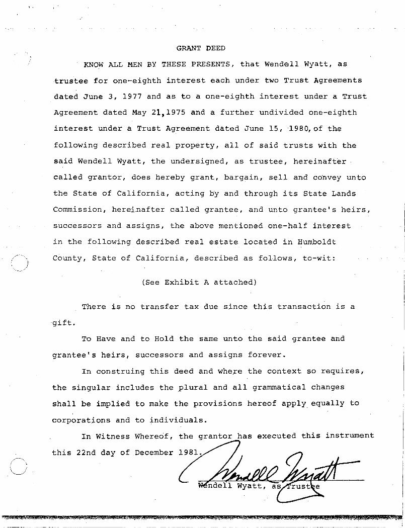
KNOW ALL MEN BY THESE PRESENTS, that Wendell Wyatt, as
·trustee for one-eighth interest each under two Trust Agreements
dated June 3, 1977 and as to a one-eighth interest under a Trust
Agreement dated May 21,1975 and a further undivided one-eighth
interest under a Trust Agreement dated June 15, 1980,of the
following described real property, all of said trusts with the
said Wendell Wyatt, the undersigned, as trustee, hereinafter
called grantor, does hereby grant, bargain, sell and co·nvey unto
the State of California, acting by and through its State Lands
Commission, herei.nafter called grantee, and unto grantee's heirs,
successors and assigns, the above mentioned one-half interest
in the following described real estate located in Humboldt
County, State of California, described as follows, to-wit:
(See Exhibit A attached)
There is no transfer tax due since this transaction is a
·gift.
To Have and to Hold the same unto the said grantee and
grantee's heirs, successors and assigns forever.
In construing this deed and whe~e the context so requires1
the singular includes the plural and all grammatical changes
shall be implied to make the provisions hereof apply. equally to
corporations and to individuals.
In Witness Whereof,
this 22nd day of .December
the granter has executed this instrument
. I
0

STATE OF OREGON ss.
County of Multnomah
December 22, 1981.
Personally appeared the above named Wendell Wyatt and
acknowledged the foregoing instrument to be his voluntary
act and deed as Trustee under the Last Will and Testament of
George R. Van Vleet, deceased.
\ . ' ~ .
• ~ 1''"1 •• .. .
(i ·, L I ....: ~(} '(1 )iL r.)f{.{_ rl4 ..,:J--v t-~
Notar:(;'Pu lie for OregonMy Commission expires: 10-14-82 : ,,
. ; .. .·.. ('
.·, .... ...~.. ( ...

----------~--~~----- -- ----------
EXHIBIT A
PARCEL ONE:
BEGINNING ~n the center of Butcher Slough at a point which is di~tant 300 feet North from the quarter section line forming the south line of the northeaft quarter of Section 32, Township 6 North, Range I East, Humboldt Meridian; thence parallel to said quarter section line north 89 degrees 59 minutes west 803,8 feet, more or less, to the east line of the railroad right of way of the Arcata and Mad River Railroad Company as defined In deed from Elias Sharp dated January 6, 1876 and recorded In the office of the County Recorder of Humboldt County In Book "W" of Deeds, Page 578; thence south 23 degrees 45 minutes west 35,6 feet to the north point of a parcel of land conveyed by William M. Campbell to California and Northern Rai !way Company by deed dated November l, 1901 and recorded In said Recorder's Office in Book 77 of Deeds, Page 75; thence along the easterly line of said parcel south 13 degrees 39 minutes west 275.2 feet, more or less, to the southeast corner of said parcel, which corner is situated on the above mentioned quarter section 1ine; thence south 89 degrees 59 minutes east on the quarter section line to the east line of the railroad right of way conveyed by R. W. Bui I and wife to R. H. Emmerson and wife by deed recorded in the office of the County Rec~rder of Humboldt County, California in Book 5 of Official Records, Page 110; thence following said east line south I I degrees 33 minutes west 94.7 feet to the interesection of said east line with the east line of the right of way of the Northwesten Pacific Railroad Company; thence southerly following the easterly line of the railroad right of way to a point, this point is on a prolongation easterly of the southerly I ine of the existing sewage disposal plant sludge beds, and Is on the north I ine of' the road leading to the Arcata Sewage Disposal Plant as referred to in Deed from City of Arcata to Durable Fir Lumber Company recorded February 27, 1952 In book 199, Page 234, Document No. 2366, Humboldt County Official Records; thence north 57 degrees 40 1/4 minutes east along the said prolongation and the north line of said road 34.58 feet to the west line of Highway 101; thence northerly along the highway following the curve thereof, 154.44 feet to the end of the curve; thence north 15 degrees 27 minutes west along the highway 484.72 feet; thence north 0 degrees 12 minutes east , along the highway 231,9 feet; thence north 15 degrees 50 minutes east 890, 13 feet along the highway to its intersection with the eastern terminus of the curve in the south end of the south line of the extension of "H" Street in the City of Arcata, as said extension was conveyed to the County of Humboldt by deed recorded September 22, 1934 in Book 216 of Deeds, Page 159, Humboldt County Records; thence still along said line of "H" Street extension in a northerly direction to a point that is distant 300 feet northerly along said street from the quarter seciton line first above mentioned; thence parallel with said quarter section 1 ine to the middle of Butcher Slough in a westerly direction; and thenc_e norther 1 y on same to the point of beginning.
PARCEL TWO:
The right for an electric power line of poles and wires extending from the north I lne of the above described land north across the next 300 foot strip; and thence northeasterly on a line as near as practicable to the west 1 ine of the Axel Anderson Tract of land to
11 111a connection with power 1ines in Street near Fourth Street in Arcata, being the same right granted to R. H. Emmerson and wife dated June 18, 1946 and recorded in the Recorder's Office of Humboldt County, California on February 13, 1947. -
PARCEL THREE:
That portion of the southeast quarter of the northwest quarter of Seeton 32, Township 6 North, Rangel East, Humboldt Meridian, described as follows: BEGINNING at a point 303 feet west of the quarter section corner in the center of said Section 32; thence north 13 degrees 30 minutes east 277 feet to a point distant 15 feet from and on the east side of the centerline of Arcata & Mad River Railroad as It existed on November I, 1901; thence following a I lne parallel to and distant 15 feet from the center of said Arcata & Mad River Railroad south 31 degrees 25 minutes west 316.5 feet to a line running east and west through the center of said Section 32; thence east 106 feet to the point of beginning. EXCEPTi~G THEREFROM any µortlon thereof which I ies westerly of the easterly line of a strip of land 66 feet wide-, lying 33 feet on each side of t'le center! ine of the main tract of the Northwestern Paci fie Rai I road Compdny. t. ·,,
CJ

····!····· .. ·- ·'" ·-··
.... •-·-"''TI"
EXHIBIT A -continued-
PARCEL FOUR:
That portion of the northeast quarter of the southwest quarter of Section 32, Township 6 North, Range I East, Humboldt Meridian, described as follows: ~ · -~ . · BEGINNING at the quarter section corner in the center of said Section 32; thence along the quarter section line running east and west through the center of stild section north 89 degrees 59 minutes west 295,3 feet to the east l lne of the railroad right of way conveyed by Ralph W. Bull and wife to R.H. Envnerson and wife by deed recorded February 13, 1947 In Book 5 of Official Records, Page 110, Recorder's File No. 1450, Humboldt County Record5, and the true point of beginning of the parcel of land to be here de5crlbed; thence following said east I ine south 11 degrees 33 minutes west 94.7 feet to the lnteresectlon of said east line with the easterly line of the right of way of Northwestern Pacific Railroad Company: thence northerly along said easterly l lne to the north line of the northeast quarter of the southwest quarter of said Section 32: thence along said north line ~outh 89 degrees 59 minutes east to the true point of beginning.
EXCEPTING THEREFROM any portion thereof that lies within a strip of land one foot wide the centerline of which is described as follows:
COMMENCING at a point 1745.42 feet south and 314. 10 feet west of the concrete monument at the Intersection of the center 1 ine of Fifth and H Streets In the City of Arcata; and running thence from a tangent that bears south 6 degrees 56 minutes 30 seconds west along a curve to the right with a radius of 1000 feet through an angle of 4 degrees 15 minutes, a distance of 74.27 feet; thence south 11 degrees 11 minutes 30 seconds we~t 97,96 foet; thence along a curve to the left with a radius of 55 feet through an angle of 50 degrees 04 minutes 30 seconds, a distance of 4a.07 feet; thence south 51 degrees 97 minutes west 25,50 feet to the point of beginning of this description. c,ll-