report - d32ogoqmya1dw8.cloudfront.net · and water quality, depleted water ... human migration and...
TRANSCRIPT

NSF Advisory Committee for Geosciences
GEO VISION REPORT

Cover photography by Howard Lasker, Craig Heinselman, SRI, and R. Slingerland, Pennsylvania State University
GEO VISIONREPORT
NSF Advisory Committee for Geosciences
OCTOBER 2009
UNRAvEliNG EARTh’S COmplExiTiES ThROUGh ThE GEOSCiENCES
2 GEO VISION REPORT

GEO VISION REPORT 3
Table of Contents
Foreword ..................................................................................................................................5
The GEO Vision: Fostering a sustainable future through
a better understanding of our complex and changing planet. .........................7
The Challenges for the Geosciences .........................................................9
ChallENGE 1: Understanding and forecasting the behavior of a complex and evolving Earth system ...........................................................9
ChallENGE 2: Reducing vulnerability and sustaining life ......................................................12
ChallENGE 3: Growing the geosciences workforce of the future ......................................14
The Geosciences at a Crossroad .................................................................17
ThE DyNamIC EarTh ..........................................................................................17
ThE ChaNGING ClImaTE ...................................................................................18
EarTh aND lIfE ......................................................................................................21
GEOSphErE-BIOSphErE CONNECTIONS ............................................. 22
WaTEr: ChaNGING pErSpECTIVES ......................................................... 24
Meeting the Challenges ....................................................................................27
aN INTErDISCIplINary apprOaCh .......................................................27
a COmmITmENT TO rESEarCh .....................................................................31
a puBlIC rOlE fOr ThE GEOSCIENCES ...............................................32
Conclusions and Recommendations ...................................................34
Acknowledgements ..............................................................................................37
Advisory Committee for Geosciences (2006-2009) ..................38
GEO Vision Working Group (Subcommittee of the AC/GEO) .........39
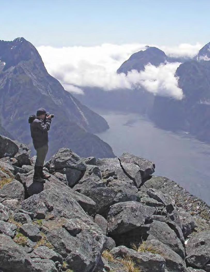
milford Sound, New ZealandK. C
uff
ey, U
niv
ers
ity
of
Cal
ifo
rnia
, Be
rkel
ey

4 GEO VISION REPORT
GEO VISION REPORT 5
The 21st century is an exciting time for scientific and engineering research, and that is especially true for the geosciences. The geosciences has evolved into a truly interdisciplinary science that incorporates and links many scientific disciplines, including the
biological sciences, social sciences, computer sciences, materials sciences, and engineering. It is unique as a discipline for it does two things at once: It investigates the physical, chemical, and biological processes at work today within the solid earth, the hydrosphere, the atmosphere, at all scales from the core to the sun; and it informs modeling, interpretation, and our understanding of the fundamental processes illuminating the history of the Earth through study of the rock record.
To understand more deeply the planet and its interactions will require the geosciences to take an increasingly holistic approach, exploring knowledge coming from all scientific and engineering disciplines. Concurrently, it is critical that the geosciences and all sciences support and nurture educational opportunities at every level and across the socio-economic spectrum. Only by doing so will we ensure a diverse and multi-talented future workforce that can meet increasingly complex scientific challenges.
In 1999, the NSF Advisory Committee for Geosciences (AC-GEO) published NSF Geosciences Beyond 2000. A long-range strategy document for the NSF Directorate for Geosciences (GEO), this report was developed through close collaborative efforts among leading geosciences researchers in government, academia, and business. By 2005, the AC-GEO recognized that the report had served the Directorate well, but that in the intervening years, new opportunities in science and emerging technological developments suggested that the plan should be revisited. The AC-GEO chartered the GEO Vision Working Group to develop an updated plan. This report is the result of that effort.
We are pleased to share the GEO Vision and recommendations advocated in this plan and look forward to working with GEO in turning this vision into solid research to meet the challenges and opportunities ahead. Indeed, the fundamental research envisioned here will transform the geosciences and will lead it to play a more visible and public role in society.
George H. DavisChair, NSF Advisory Committee for GeosciencesOctober 2009
Foreword
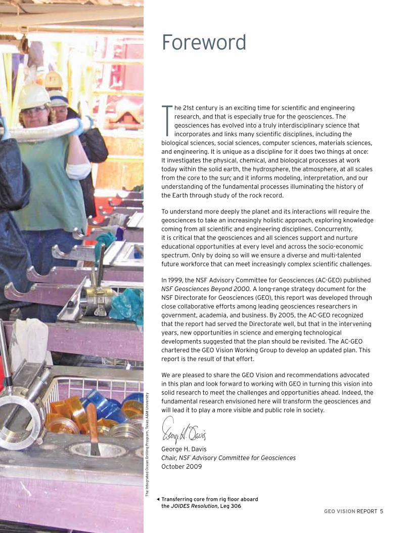
Transferring core from rig floor aboard the JOIDES Resolution, leg 306
Th
e In
teg
rate
d O
cea
n D
rilli
ng
Pro
gra
m, T
exas
A&
M U
niv
ers
ity
6 GEO VISION REPORT

GEO VISION REPORT 7
or most of its history, the Earth has experienced vast alterations, including
in its climate, in response to natural variations in the planet itself.
Although just a moment in time relative to Earth’s long history, humans
are emerging as the dominant agent of change at the Earth’s surface.
The GEO Vision: Fostering a sustainable future through a better understanding of our complex and changing planet.
crossing boundaries and disciplines to gain new perspectives.
This evolving approach is proving exceptionally useful in studying the human impact on the Earth’s landscape, oceans, atmosphere, and ecosystems. Once viewed as minor, the human influence looms ever more significant. We see evidence of this pressure in shrinking ice caps, unreliable crop yields, degraded air and water quality, depleted water supplies, and diminished biodiversity. Human migration and population growth, coupled with rising economic expectations, test the limits of the Earth’s capacity to support human societies. These same forces have led to greater concentrations of people in regions vulnerable to natural hazards such as floods, earthquakes, and rising sea levels.
Yet the challenge posed by the current scope and pace of human-induced change cannot be fully understood by only studying and modeling processes in the current environment. Indeed, to reach a greater understanding of future conditions one must study and model a wide range of proxy sources of Earth’s history, such as ice cores, cores from lake and ocean bottoms, the rock record and tree rings, to piece together a complete picture of the Earth’s continued evolution.
FGrowing societal and environmental problems demand transformative and sustained solutions. Such solutions come only with groundbreaking scientific understanding and innovation—all of which must be grounded in a greater understanding of the Earth’s history. The National Science Foundation (NSF) has supported key advances in the geosciences through the funding of basic research and the development of cutting-edge observational, computational and modeling tools.
With this report, the NSF Advisory Committee for Geosciences provides a blueprint for basic research needs for the coming decade to address these pressing issues. The scientific advances anticipated by such research, many of which will come from a new emphasis on interdisciplinary work, will offer a reasoned and scientifically sound basis for policymakers to formulate a course of action that ensures the continued vitality of life on Earth.
As a society, we face a daunting task. With the right strategic investments in research and scientific tools, and by enabling and maintaining a diverse and intellectually vibrant scientific community, we will make great strides over this next decade in realizing the GEO Vision.
Scientists and others have debated the Earth’s capacity to respond to man-made changes for some time—often backed by hard science but sometimes by mere speculation. Yet it is essential going forward that we have the scientific tools and evidence to understand and anticipate how the Earth will be transformed in the future and at what rate in response to these growing pressures.
To identify these influences and their potential impact requires an understanding of the Earth, its history, and its systems that is grounded in basic science—a science that probes and ultimately defines the Earth’s character. Such basic research is the domain of the geosciences, which seek to advance a better understanding of the Earth and its systems.
The geosciences cut a wide swath through the sciences and deal broadly with the Earth-Sun system, from studying processes on the Sun to exploring the dynamics of the Earth’s core. These disciplines encompass the physical and biological systems in the solid Earth, the hydrosphere (water and ice), the atmosphere, as well as geo-space. Geoscientists still focus on distinct elements within this system, but they are increasingly studying the system as an integrated whole,
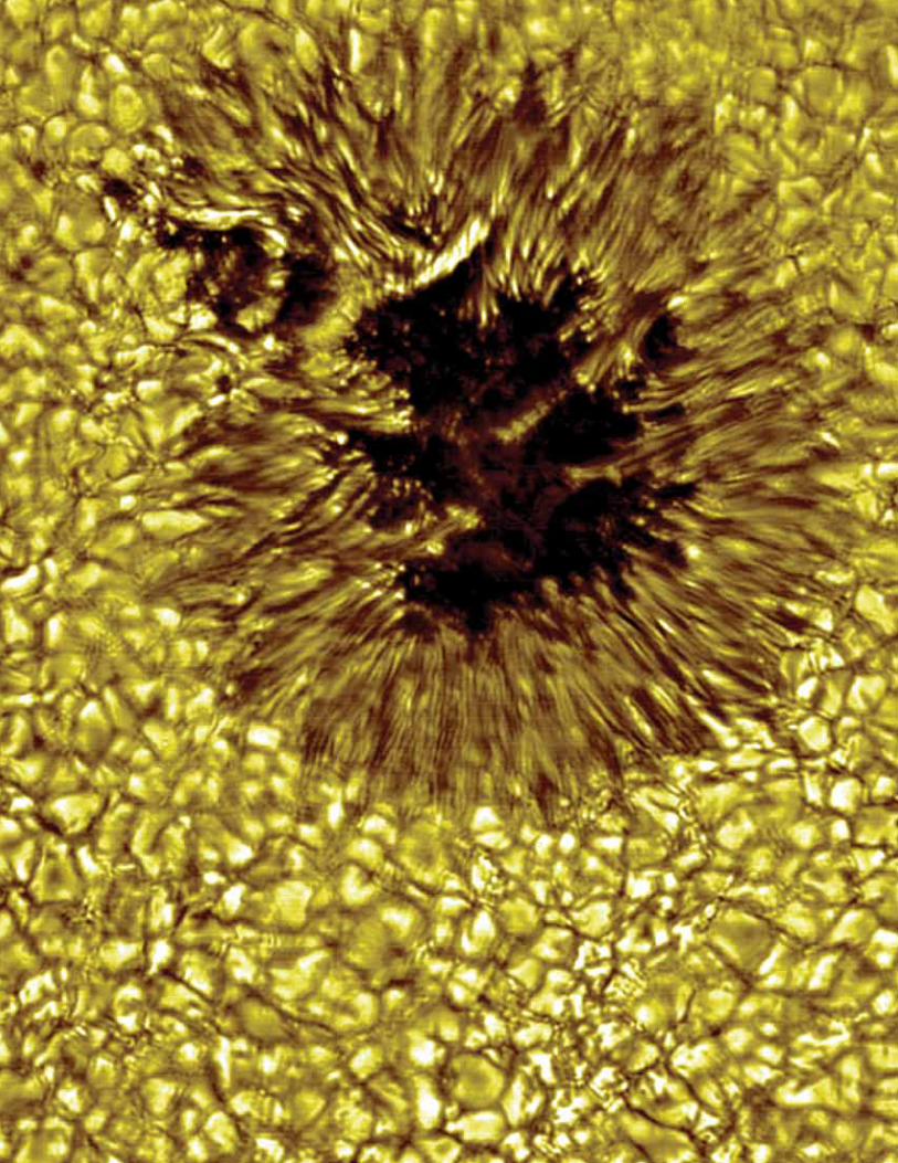
A high-resolution, close-up view of a sunspot. This image is from the Dunn Solar Telescope at the National Solar Observatory/Sacramento peak, California.
Columnar Basalt, iceland highlands
Nat
ion
al S
ola
r O
bse
rvat
ory
B.R
. Ph
illip
s, L
os
Ala
mo
s N
atio
nal
La
bo
rato
ry

8 GEO VISION REPORT
GEO VISION REPORT 9
ociety stands at a crossroads. With the growing problems of resource
depletion, energy sustainability, environmental degradation, and
climate change, we wonder if protecting the health of the planet while
achieving widespread economic prosperity can become a reality.
will require a comprehensive view of the Earth’s history, its various components, the wide array of scientific disciplines involved in its study, and the diversity of nations and people invested in its outcome. In developing this framework, the geosciences community must also address three key challenges—distinct yet profoundly connected to achieving the GEO Vision.
ChallENGE 1: understanding and forecasting the behavior of a complex and evolving Earth system
The Earth system is characterized by its complexity, its non-linear processes, and its continuous evolution—attributes that present significant hurdles to the goals of comprehension and prediction. The system’s components interact with each other on different scales, linked across time and space. Changes in one component affect the status and function of other elements, and not
The Challenges for the Geosciences
To balance these objectives, society must first take stock of the policies and management principles used to govern Earth’s resources and then make difficult decisions based on established and new priorities. These decisions must have a rational basis, built on a scientific understanding of the options and their likely consequences. At the same time, the complex processes that drive Earth systems inspire wonder and lead us to seek understanding about how the Earth works and our impact on it. Geoscientists are particularly well positioned to bring new scientific insights to this assessment process. Improving our forecasts remains critical to understanding change brought about by human activities.
To realize the GEO Vision, we issue a Call to Action to the geosciences community to establish a framework to understand and predict responses of the Earth as a system. Accomplishing our charge
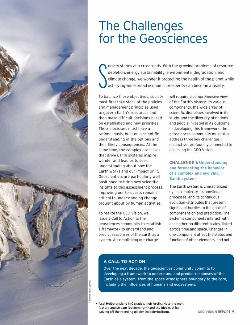
S
Axel heiberg island in Canada’s high Arctic. Note the melt feature and stream (bottom right) and the blocks of ice calving off the receding glacier (middle-bottom).
Cam
ero
n M
cNau
gh
ton
a Call TO aCTION
Over the next decade, the geosciences community commits to developing a framework to understand and predict responses of the Earth as a system—from the space-atmosphere boundary to the core, including the influences of humans and ecosystems.
10 GEO VISION REPORT
humaN CapITal DEVElOpmENT
GEO is committed to ensuring significant
cultural diversity in all fields of
science, technology, engineering, and
mathematics. A broad pool of scientists
and engineers not only enriches the
workplace, but also advances science
and engineering research by bringing a
variety of perspectives to the problems
at hand. To ensure an inclusive scientific
community, NSF and GEO must provide
national leadership, encouraging
academic institutions to use recruitment,
admissions, and retention practices that
achieve excellence through diversity.
GEO will continue as a pioneer
within NSF to increase the number of
women, underrepresented minorities,
persons with disabilities, and economically disadvantaged individuals engaged
in the geosciences. GEO’s support for mentoring, networking, and leadership
development programs—including Significant Opportunities in Atmospheric
Research and Science (SOARS) and minorities Striving and pursuing higher
Degrees of Success in Earth System Science (mS phD’S)—is nurturing a new
generation of geoscientists that represents the wealth of the country’s talent and
perspectives. By identifying the best practices in engagement, recruitment, and
retention of traditionally underrepresented students, NSF and GEO help colleges
and universities foster an environment in which all students thrive and obtain the
knowledge and tools to launch successful careers in the sciences and engineering.
always in straightforward or obvious ways. Studying one component in isolation yields an incomplete, and sometimes misleading, picture. For example, examining only the geological or only the biological components of the Earth’s evolution offers an imperfect picture of the Earth’s atmosphere. The co-
evolution and interaction of these two systems, produces the oxygen-rich environment upon which life depends.
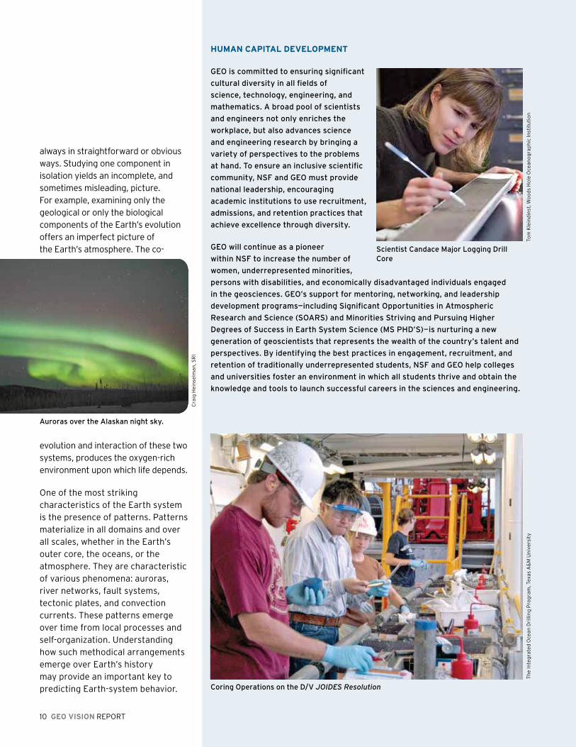
One of the most striking characteristics of the Earth system is the presence of patterns. Patterns materialize in all domains and over all scales, whether in the Earth’s outer core, the oceans, or the atmosphere. They are characteristic of various phenomena: auroras, river networks, fault systems, tectonic plates, and convection currents. These patterns emerge over time from local processes and self-organization. Understanding how such methodical arrangements emerge over Earth’s history may provide an important key to predicting Earth-system behavior.
Scientist Candace major logging Drill Core
Auroras over the Alaskan night sky.
Cra
ig H
ein
selm
an
, SR
I
Tom
Kle
ind
inst
, Wo
od
s H
ole
Oce
an
og
rap
hic
Inst
itu
tio
nT
he
Inte
gra
ted
Oce
an
Dri
llin
g P
rog
ram
, Tex
as A
&M
Un
ive
rsit
y
Coring Operations on the D/v JOIDES Resolution

Recent research on deep time is changing our knowledge of the Earth’s systems as well, by allowing us to reconstruct parameters such as atmospheric composition, sea-surface temperature, rates and modes of ocean circulation, and climate conditions from records dating from tens, hundreds, and
thousands of millions of years ago. These records are teaching us how Earth’s past climate interacted with its ecosystems, geology, and water in ways previously unimagined.
Generally, the Earth system evolves slowly over time. Abrupt shifts, however, are possible and
can cause huge transformations over relatively short time periods. Extracted ice cores from glaciers and ice caps around the world reveal conditions of the past. These cores show gradual change over centuries and millennia, interrupted by abrupt events during which the climate dramatically shifted within
uNDErSTaNDING NaTural hazarDS
in the United States each year, natural hazards such
as earthquakes, volcanic eruptions, hurricanes, floods,
landslides, wildfires, and solar storms cause numerous
deaths and cost billions of dollars in disaster aid,
At the Sorlie Bridge between Grand Forks, North Dakota, and East Grand Forks, minnesota, floodwaters from the Red River of the North crest at 54.35 feet, Tuesday, April 22, 1997. This depth was more than 24 feet above flood stage and more than four feet above the previous record.
A wildfire left very little of this home near San Bernadino, California, in October 2003.
This business in Seattle, Washington, was heavily damaged during the magnitude 6.8 Nisqually, Washington, earthquake on February 28, 2001. About 400 people were injured by the quake.
This image is from New Orleans, louisiana, in the aftermath of hurricane Katrina in August 2005.
FE
MA
ph
oto
/Kev
in G
alvi
nU
SG
S p
ho
tos
US
GS
ph
oto
sF
EM
A p
ho
to/K
evin
Gal
vin
GEO VISION REPORT 11
disruption of commerce, and destruction of homes and
critical infrastructure. GEO provides basic research and
observational infrastructure support to provide a better
understanding of the causes of natural hazards.
Generally, the Earth system evolves slowly over time. Abrupt shifts, however,
are possible and can cause huge transformations in a relatively short period of time.

12 GEO VISION REPORT
a few years or decades. Such nonlinear behavior is common to many processes on Earth, from earthquakes to reversals of the planet’s magnetic field.
We do not yet know how to forecast these abrupt events or what “tipping points” trigger rapid transitions. Forecasting such behavior depends on high-quality numerical models that incorporate observations representing the physical processes at work. It also requires a deep understanding of how these processes occurred in the geologic past. Using the past to understand the future is critical for developing reliable and accurate models. Meeting GEO’s “call to action” requires sophisticated computational and modeling resources to conduct the wide range of numerical experiments necessary for advancing understanding and reducing uncertainty. It also mandates that scientists develop novel solutions to the conundrum of how to address Earth systems that operate at different scales of time and space.
ChallENGE 2: reducing vulnerability and sustaining life
Humans have always felt vulnerable to the forces of nature. Intense and often catastrophic events, such as earthquakes, tsunamis, volcanic eruptions, space, and atmospheric storms, and floods, threaten human life and societal infrastructure. Despite advances in science and technology, human susceptibility to geo-hazards may now have reached its greatest historical level given population
OCEaN aCIDIfICaTION
Over the past few decades, atmospheric carbon dioxide (CO2) levels have risen
significantly due to fossil-fuel combustion and land-use, raising serious concerns of
global warming and climate change. The oceans slow the rate of climate change by
removing some excess CO2 from the atmosphere, so far accounting for about a third
of the total human CO2 emissions since the pre-industrial era.
Field observations, such as those from NSF-supported ocean time-series stations
off hawaii and Bermuda and the Cariaco time-series program, have documented
this ocean acidification process. Although ocean ph has varied through geologic
time, the current rate of acidification is considerably faster than rates over the last
several million years. The rate will accelerate over this century unless future CO2
emissions are curbed dramatically. While beneficial from a climate perspective,
oceanic CO2 uptake may prove detrimental to marine life by reducing surface ocean
ph and causing wholesale shifts in seawater carbonate chemistry.
Acidification alters seawater chemical speciation and the biogeochemical cycles
of many elements and compounds, such as lowering calcium carbonate saturation
states. This shift impacts shell-forming marine organisms from plankton to
benthic mollusks, echinoderms, and corals. many calcifying species show reduced
calcification and growth rates in laboratory experiments under high-CO2 conditions.
Researchers have discovered a host of other physiological effects, many negative,
in microbes, invertebrates, and fish. On the other hand, rising CO2 also causes an
increase in carbon fixation rates in some photosynthetic organisms. The ability of
marine organisms to adapt to increasing CO2 and the broader implications for ocean
ecosystems and human societies are not well known but constitute high priorities
for future research.
Corals’ colors come from symbiotic
algae cells living inside the
individual organisms, polyps, that
make up the coral. The “bleached”
coral in the photo has expelled
much of its algae in response to
the stress of unusually warm water
with the white skeleton showing
through the transparent polyps.
The coral can recover fully if high
temperatures do not persist.
Ocean acidification
may harm a wide range
of marine organisms
and their associated
food webs. mollusks—
including mussels
and oysters, which
support valuable
marine fisheries—are
particularly sensitive to
changes in seawater ph.
Ju
pit
er
Jes
sie
Kn
eel
an
d, W
oo
ds
Ho
le O
cea
no
gra
ph
ic In
stit
uti
on

growth, settlement patterns, and the expanding (and sometimes less-than-robust) infrastructure of the built human environment. Furthermore, communities that lack sufficient
An integrated and interdisciplinary approach in the geosciences will lead
to new paradigms for human interactions with the Earth and guide us to
solution-oriented applications.
GEO VISION REPORT 13
financial resources are often the most vulnerable to the forces of nature, whether they are hurricanes in New Orleans or earthquakes in China. While geo-hazards cannot
be eliminated, their effects can be managed with better appreciation of the risks and well-designed mitigation strategies.
Only within the past few decades have we come to realize how vulnerable the Earth is to human activities. We now recognize that humans have played a role in Earth system dynamics, from the growth in the ozone hole to the destruction of vital coastal wetlands, from fueling climate change to sparking the mass extinction of species. Humans are, in short, no longer a negligible influence on the Earth system. Humans rely on natural resources and the services that the Earth system provides such as water purification by wetlands, soil production, and even carbon capture. We need to harness and protect these resources and natural services.
As we look to new ways to manage vulnerability—both human and ecosystem—the emphasis must be on collaboration. Through interdisciplinary investigation and study we can have a sober and thorough examination of the challenges we face, particularly with respect to vulnerability and sustaining life.
One area that will serve as a focal point for collaborative study is the capacity for resilience. Resilience is the facility of a system to absorb disruption without crossing a threshold to a new state that threatens life. It is contrary to ecosystem sustainability, and would J
up
ite
r
14 GEO VISION REPORT
be extremely difficult to reverse. Resilient systems undergo natural variations yet resist extreme or irreversible change. With humans as a major force within the Earth system, and with their intensifying vulnerability to geo-hazards, resilience will be a central research theme for scientists studying natural and social-ecological systems now and into the future.
ChallENGE 3: Growing the geosciences workforce of the future
The vitality of the geosciences has historically originated from its integration of core disciplines within and across the atmospheric, earth, and ocean sciences. Common among the core fields are many dynamic elements, ranging from deformable media (water, air, plasma, rock, ice) under the influence of forces such as heat and gravity to the capacity for self-organization and pattern formation to the ubiquity of water. These common and compelling elements present a unique opportunity to retain current scientists and to attract the next generation of the geosciences workforce.
Moving forward, research approaches in the geosciences must broaden to further include the integration of the biological, engineering, social, and economic sciences. Likewise, the research challenges of tomorrow require that GEO develop linkages with other
GEO VISION REPORT 15
NSF directorates, Federal agencies, and international partners. Such an integrated and interdisciplinary approach in the geosciences will lead to new paradigms for human interactions with the Earth and guide us to solution-oriented applications.
This evolutionary path envisioned for the geosciences is compelling, but poses many practical challenges for the current and next-generation geosciences workforce. New curricular waters must be charted to find the proper balance between educating students about fundamental Earth system processes and learning how to facilitate application of this knowledge to problems faced by society. New strategies for engaging traditionally underrepresented communities in the geosciences must be deployed to ensure a diverse pool of talent that encompasses varied geographic, economic, and demographic representation.
Educational communities must also support emerging scientific and engineering career paths that transcend traditional geosciences enterprises; at the same time, they must engage and inspire students who are pursuing non-scientific careers. Geoscientists must make a special effort to present their policy-relevant results in a way that is meaningful to those beyond their field. Clearly stated results, along with their practical implications, allow others to comprehend the science at a level necessary for
application to the problems at hand. Policymakers can then incorporate this information into concrete proposals that affect how we do business. This real-world approach will allow science to guide policy in a heuristic and workable manner.
Ultimately, informed decision-making on geosciences issues—both for individuals and policymakers—requires basic literacy in the sciences. Despite the relevance and increasing importance of the geosciences to everyday matters, few Americans understand the fundamental workings of their planet or the complex systems that govern climate, natural hazards, and the availability of essential resources. In large part, this ignorance reflects secondary school education policies and practices that limit student access to high-quality Earth-system science content. The consolidation or elimination of higher education geosciences programs has further aggravated the problem. This situation undermines our ability to develop an innovative and diverse geosciences workforce at a time when we face vast scientific and societal challenges. The geosciences research and education communities must jointly confront the obstacles hindering achievement of broad public Earth-system science literacy and address the broader initiatives needed to reform and improve overall science, technology, engineering, and mathematics (STEM) education.
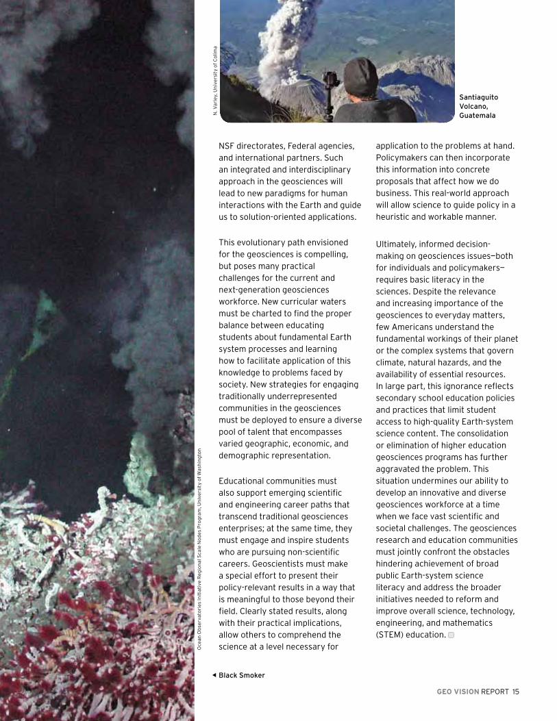
Santiaguito volcano, GuatemalaN
. Va
rley
, Un
ive
rsit
y o
f C
olim
a
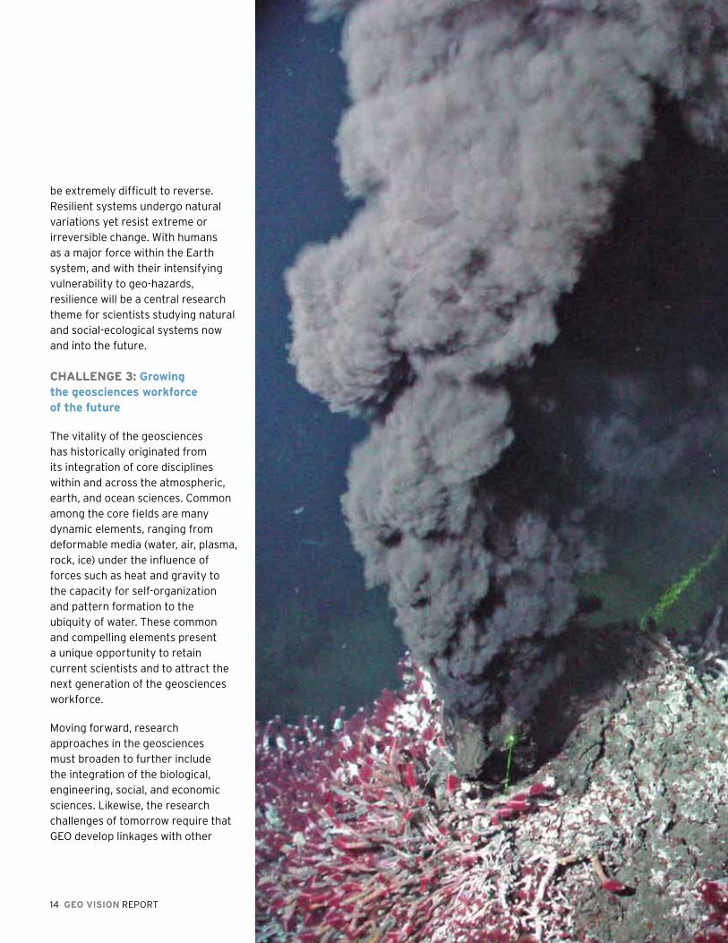
Black Smoker
Oce
an
Ob
serv
ato
ries
Init
iati
ve R
eg
ion
al S
cale
No
des
Pro
gra
m, U
niv
ers
ity
of
Was
hin
gto
n

16 GEO VISION REPORT
GEO VISION REPORT 17
The Geosciences at a Crossroad
While many challenges facing the Earth-Sun system demand our
attention, we have chosen in this chapter to focus on the most
urgent issues that pose unique and sustained hazards for the
Earth and its inhabitants.
The pace of change continues to accelerate, and the real-world challenges that present themselves will test our resolve and our ability to find solutions that advance the geosciences and benefit society.
How we address the following five natural and man-made challenges in the coming years, through thoughtful research, bold solutions, and practical policymaking, will determine how successfully we maintain and sustain the Earth-Sun system.
ThE DyNamIC EarTh
The Earth is a dynamic planet with shifts and movements that take place at different rates. Although many changes occur gradually over time, sudden disruptive events such as hurricanes, earthquakes, tsunamis, volcanoes, heat waves and even storms on the sun highlight modern society’s vulnerabilities. For example, the 2008 Sichuan Earthquake in western China killed or injured more than 400,000 people, left 4.8 million people homeless, and caused nearly $150 billion in damage, according to published news reports. In 2005, Hurricane Katrina resulted in 1,836 storm-related deaths with an estimate of more than $80 billion in property damage.
Geoscientists have made enormous strides over the past four decades in understanding the Earth’s dynamics and extreme events while also becoming more adept at predicting changes in this natural system. Although significant and fundamental questions remain, these scientists have developed new insights into earthquake and volcano behavior, weather patterns, and space weather. Meanwhile, advances in instrumentation, observing systems, and modeling have transformed views on the dynamics of such inaccessible realms as the Earth’s core and mantle. Examples include:
Documentation of the spatial and temporal variation of episodic and slip along the Cascadia Subduction Zone is leading to a new understanding of the way the Earth builds and releases stress.
The increasing reliability of hurricane prediction, with respect to both track and intensity, has yielded information that directly affects people’s lives and welfare.
The integration of new observational tools, such as highly sensitive satellite radar systems and GPS geodesy with geochemistry, has rapidly advanced our ability to predict major volcanic eruptions.
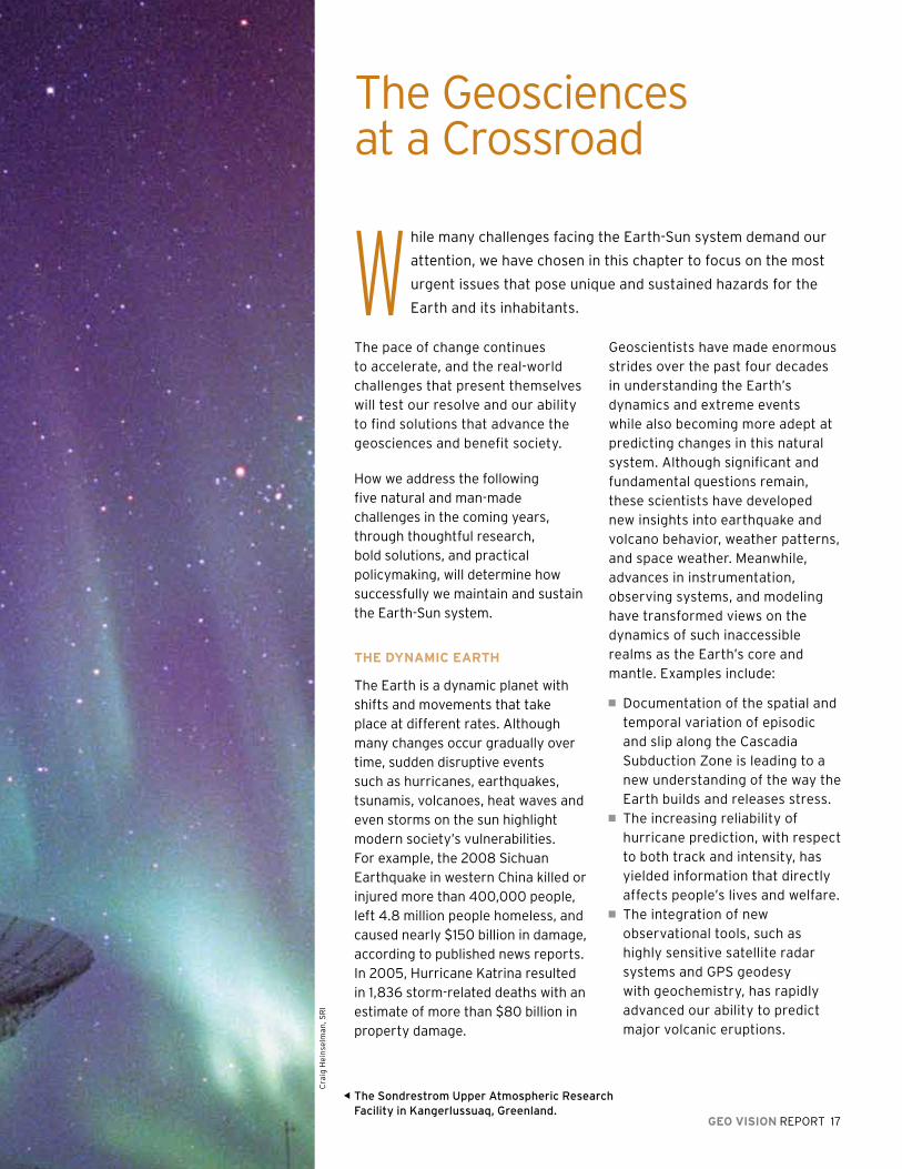
The Sondrestrom Upper Atmospheric Research Facility in Kangerlussuaq, Greenland.
Cra
ig H
ein
selm
an
, SR
I
18 GEO VISION REPORT
Over the last few years, research into space weather has resulted in greatly improved predictions of solar storms and their impact on Earth.
NSF is one of the main agencies to fund basic research into questions such as stress transfer and the history of seismicity on faults, development of mountain belts, behavior of Earth materials under extreme conditions, mantle structure and dynamics, geomagnetism, and volcanology. Each of these fundamental research topics has critical societal implications and links to other scientific and technological questions. Addressing these using new observations, experiments, and computations remains at the forefront of challenges in the geosciences.
ThE ChaNGING ClImaTE
The realization that people can alter the Earth’s global climate came early in the 20th century based on fundamental research that delved into the radiative properties of gases and measurement of those gases
Supercell thunderstrorm near murdo, South Dakota
Tra
pp
Res
ea
rch
Gro
up
, Pu
rdu
e U
niv
ers
ity
ThE ImpOrTaNCE Of ThE DEEp-TImE rECOrD Of EarTh prOCESSES
To comprehend the full range of physical, biological, and chemical processes
of Earth’s dynamic system, scientists must study deep-time records of these
processes archived in the Earth’s sedimentary carapace (crust) at all spatial and
temporal scales. These records are fingerprints of the processes that produced
them—processes that continue to shape the Earth. A deep-time perspective
(spanning the billions of years of Earth history) is critical for predicting potential
climate, energy, water, and other boundaries for human life on the planet. Without
this deep-time backdrop, the ability to make accurate predictions becomes
severely limited.
Key deep-time topics for study include:
paleoclimate. The deep-time geologic record preserves numerous examples of past
climate shifts far more extreme than those recorded by instrument data, historical
records, or even Quaternary (the geologically recent period of glaciation) standards.
many of these transitions occurred abruptly—a major concern given the large shifts
now occurring in our climate.
paleobiology. The paleontologic record documents the biosphere’s reaction to
environmental change; scientists must factor such information into predictions of
future environmental transformations.
Crustal Evolution and Dynamics. The Earth’s sedimentary rocks harbor essential
data about the continental crust evolution not found elsewhere within orogenic
(mountain-building) systems. Study of sedimentary systems complements both
geophysical research on the crust’s present state and classic structural studies
that focus on mountain belts (since creation of the sedimentary basin itself records
significant crustal deformation).
Resources for humanity. The Earth’s sedimentary rocks store the bulk of our energy
supplies for the foreseeable future: oil, gas, coal, and geothermal resources. These
rocks also house the majority of our water resources. Understanding sedimentary
architecture remains critical for managing these limited resources more wisely.
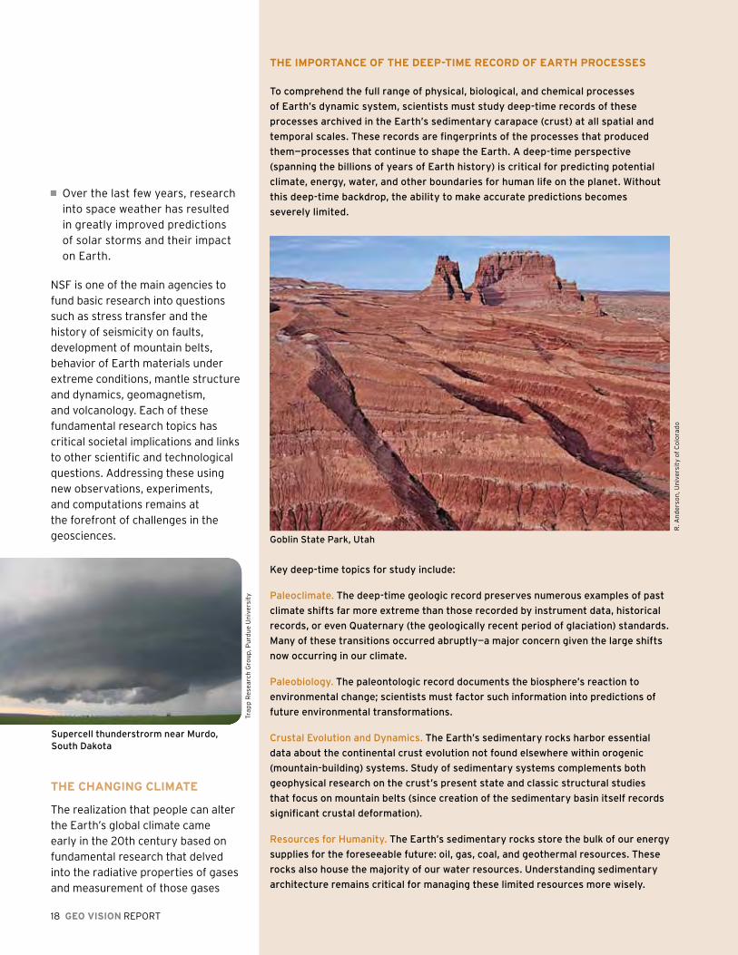
Goblin State park, Utah
R. A
nd
ers
on
, Un
ive
rsit
y o
f C
olo
rad
o

GEO VISION REPORT 19
in the atmosphere. Greenhouse gases, which absorb and emit heat, have a positive radiative forcing effect and warm the surface of the Earth. No human activity or natural process will remain unaffected by climate changes of the anticipated magnitude and pace currently facing the Earth. An effective response to climate change naturally depends upon fundamental research, but our investigations must also consider the complex interactions among water, life, atmospheric circulation, and human activities. These factors determine how and where climate change will occur, its effects on the components of the Earth system, and how humans can best mitigate these effects or, at a minimum, adapt to them.
Addressing climate change requires an understanding of the Earth’s climate in unprecedented detail. Such an investigation represents an intriguing research problem. It is evolving into one that will ultimately
BIOGEOChEmICal CyClES aND CrITICal zONE OBSErVaTOrIES
Earth’s critical zone is the layer bounded by the top of the forest canopy and
the base of the weathering horizon, according to the National Research Council.
Critical Zone Observatories (CZOs) are terrestrial observatories for documenting,
modeling, and predicting the impact of regional climate and land-use change
on water and biogeochemical cycles. in 2007, the NSF selected three pilot
observatories: the Southern Sierra Critical Zone Observatory (University of
California, merced); the Boulder Creek Critical Zone Observatory (University
of Colorado); and the Susquehanna-Shale hills Critical Zone Observatory
(pennsylvania State University).
The Southern Sierra CZO rests in the foothills of the Sierra Nevada in California
and focuses on the profound effect of the snow pack on the timing and rate of
water discharge, on the rate of exchange with the atmosphere, and on the pace of
biogeochemical processes. The Boulder Creek CZO concentrates on how changes
in the physical environment and climate change jointly produce the different
critical zone architectures in three sections of Boulder Creek. This CZO also
examines how these architectures control the biological and hydrological function
of the critical zone along the entire Colorado Front Range. The Susquehanna
Shale hills CZO is situated in a small catchment of shale bedrock in the valley and
Ridge province of pennsylvania’s Appalachian mountains. This CZO focuses on
developing a quantitative and predictive understanding of the formation, evolution,
and structure of the surface layer of loose rock (the regolith), and how this
evolution couples with the integrated water cycle from the atmospheric boundary
layer to the bedrock.
in 2009, the total number of observatories will double with the addition of new
CZOs in New mexico, Delaware, and puerto Rico.
A modeling image from the Southern Sierra Critical Zone Observatory, which func-
tions as a platform to integrate measurements and modeling.
Illu
stra
tio
n b
y J
. Pa
rks,
Un
ive
rsit
y o
f C
alif
orn
ia, M
erc
ed
Shishaldin Crater, Aleutian islands. volcano instrumented under Earth Scope program.
M. J
ack
son
, UN
AV
CO
guide high-stakes forecasts and projections, thus mandating the unprecedented obligation to rigorously test and challenge the reliability of our models.
GEO has enabled U.S. scientists and engineers to be leaders in developing new ways to observe the global climate system, both from space (COSMIC) and from the planet’s surface (COSMOS). In partnership with NASA, GEO has unrivaled capabilities to deploy observing systems in the field
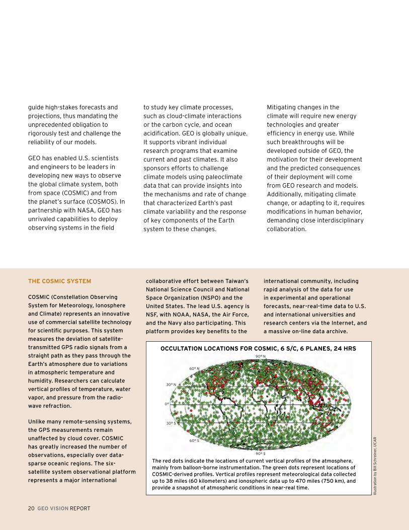
ThE COSmIC SySTEm
COSmiC (Constellation Observing
System for meteorology, ionosphere
and Climate) represents an innovative
use of commercial satellite technology
for scientific purposes. This system
measures the deviation of satellite-
transmitted GpS radio signals from a
straight path as they pass through the
Earth’s atmosphere due to variations
in atmospheric temperature and
humidity. Researchers can calculate
vertical profiles of temperature, water
vapor, and pressure from the radio-
wave refraction.
Unlike many remote-sensing systems,
the GpS measurements remain
unaffected by cloud cover. COSmiC
has greatly increased the number of
observations, especially over data-
sparse oceanic regions. The six-
satellite system observational platform
represents a major international
collaborative effort between Taiwan’s
National Science Council and National
Space Organization (NSpO) and the
United States. The lead U.S. agency is
NSF, with NOAA, NASA, the Air Force,
and the Navy also participating. This
platform provides key benefits to the
international community, including
rapid analysis of the data for use
in experimental and operational
forecasts, near-real-time data to U.S.
and international universities and
research centers via the internet, and
a massive on-line data archive.
OCCulTaTION lOCaTIONS fOr COSmIC, 6 S/C, 6 plaNES, 24 hrS
The red dots indicate the locations of current vertical profiles of the atmosphere, mainly from balloon-borne instrumentation. The green dots represent locations of COSmiC-derived profiles. vertical profiles represent meteorological data collected up to 38 miles (60 kilometers) and ionospheric data up to 470 miles (750 km), and provide a snapshot of atmospheric conditions in near-real time.
Illu
stra
tio
n b
y B
ill S
chre
ine
r, U
CA
R
90° N
90° S
60° N
60° S
30° N
30° S
0°
to study key climate processes, such as cloud-climate interactions or the carbon cycle, and ocean acidification. GEO is globally unique. It supports vibrant individual research programs that examine current and past climates. It also sponsors efforts to challenge climate models using paleoclimate data that can provide insights into the mechanisms and rate of change that characterized Earth’s past climate variability and the response of key components of the Earth system to these changes.
Mitigating changes in the climate will require new energy technologies and greater efficiency in energy use. While such breakthroughs will be developed outside of GEO, the motivation for their development and the predicted consequences of their deployment will come from GEO research and models. Additionally, mitigating climate change, or adapting to it, requires modifications in human behavior, demanding close interdisciplinary collaboration.
20 GEO VISION REPORT
GEO VISION REPORT 21
help provide additional context for the early history of our own planet.
Scientists have long understood that evolution of the Earth environment has played a central role in the evolution of life; increasingly, we are also aware of the major influence life itself has played in the Earth’s evolution. Ultimately, precision in geological age dating will help to predict potential future effects due to anthropogenic influences on the climate. Still, scientists have only a nascent comprehension of the role that individual ecosystems play in modulating surficial Earth processes and how Earth-ocean-atmospheric processes interact with minerals on
The development of new analytical techniques to
identify and investigate the oldest of Earth materials is
already beginning to offer valuable insights.
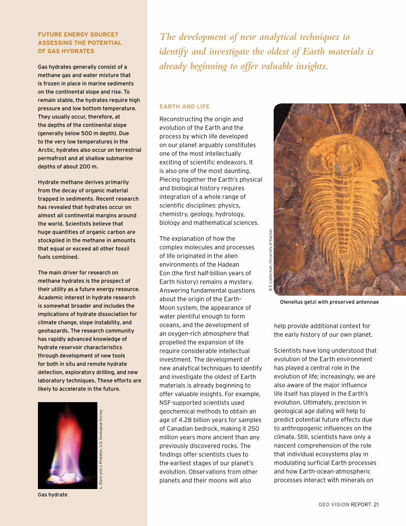
Olenellus getzi with preserved antennae
B.S
. Lie
be
rma
n, U
niv
ers
ity
of
Ka
nsa
s
EarTh aND lIfE
Reconstructing the origin and evolution of the Earth and the process by which life developed on our planet arguably constitutes one of the most intellectually exciting of scientific endeavors. It is also one of the most daunting. Piecing together the Earth’s physical and biological history requires integration of a whole range of scientific disciplines: physics, chemistry, geology, hydrology, biology and mathematical sciences.
The explanation of how the complex molecules and processes of life originated in the alien environments of the Hadean Eon (the first half-billion years of Earth history) remains a mystery. Answering fundamental questions about the origin of the Earth-Moon system, the appearance of water plentiful enough to form oceans, and the development of an oxygen-rich atmosphere that propelled the expansion of life require considerable intellectual investment. The development of new analytical techniques to identify and investigate the oldest of Earth materials is already beginning to offer valuable insights. For example, NSF-supported scientists used geochemical methods to obtain an age of 4.28 billion years for samples of Canadian bedrock, making it 250 million years more ancient than any previously discovered rocks. The findings offer scientists clues to the earliest stages of our planet’s evolution. Observations from other planets and their moons will also
fuTurE ENErGy SOurCE?
aSSESSING ThE pOTENTIal
Of GaS hyDraTES
Gas hydrates generally consist of a
methane gas and water mixture that
is frozen in place in marine sediments
on the continental slope and rise. To
remain stable, the hydrates require high
pressure and low bottom temperature.
They usually occur, therefore, at
the depths of the continental slope
(generally below 500 m depth). Due
to the very low temperatures in the
Arctic, hydrates also occur on terrestrial
permafrost and at shallow submarine
depths of about 200 m.
hydrate methane derives primarily
from the decay of organic material
trapped in sediments. Recent research
has revealed that hydrates occur on
almost all continental margins around
the world. Scientists believe that
huge quantities of organic carbon are
stockpiled in the methane in amounts
that equal or exceed all other fossil
fuels combined.
The main driver for research on
methane hydrates is the prospect of
their utility as a future energy resource.
Academic interest in hydrate research
is somewhat broader and includes the
implications of hydrate dissociation for
climate change, slope instability, and
geohazards. The research community
has rapidly advanced knowledge of
hydrate reservoir characteristics
through development of new tools
for both in situ and remote hydrate
detection, exploratory drilling, and new
laboratory techniques. These efforts are
likely to accelerate in the future.
L. S
tern
an
d J
. Pin
ksto
n, U
.S. G
eo
log
ical
Su
rvey
Gas hydrate
22 GEO VISION REPORT
the planet’s surface to create soils, weather land surfaces, and sculpt landscapes.
GEOSphErE-BIOSphErE CONNECTIONS
Chemicals that are critical to the functioning of the Earth system ultimately link the biotic (biosphere) and abiotic (hydrosphere, atmosphere, and lithosphere) constituents. Chemical species (such as carbon, nitrogen, and oxygen) move through the living and non-living parts of ecosystems, constantly being taken up, eliminated, held in reserve, and recycled at different rates and over different periods of time.
Linkages and cycling between the geosphere and biosphere occur at a wide range of physical scales. Microbial communities exist within thermal vents in the deepest ocean and extend into high mountain lakes and soils. The biological production of chemicals in the surface layer of the oceans ultimately plays an important role in atmospheric cloud formation. Full understanding
of these biogeochemical cycles, therefore, requires simultaneous consideration of both the living and non-living components.
Understanding the cycles themselves means that scientists must comprehend the mechanisms that control the dynamics of biogeochemical cycles, especially those involving the macro- and micro-nutrients needed for photosynthesis. Studies of past climates allow scientists to probe the factors that affected previous biogeochemical processes, yielding knowledge that may prove useful in predicting future changes.
One critical biogeochemical cycle is the movement of carbon through the various Earth spheres. Environmental change will shift the pathways of exchange and alter the amount of
The biological production of chemicals in the surface
layer of the oceans ultimately plays an important role
in atmospheric cloud formation.
COSmOS: aN INNOVaTIVE uSE Of TEChNOlOGy
Soil moisture is an elusive, yet critical measurement for Earth system science.
Scientists use the COsmic-ray Soil moisture Observing System (COSmOS) to fill
in the gap between large-scale remote sensing soil moisture measurements and
limited-point in situ measurements. The method—based on combining existing
technologies in an innovative way—uses the measurement of low-energy cosmic-ray
neutrons above the ground. The intensity of these neutrons is inversely proportional
to soil-water content and above-ground water.
The method allows distinction between subsurface and surface waters and
can provide a snowpack water equivalent—a critical measurement for water
management. Researchers are deploying a prototype network consisting of
50 probes as a proof-of-concept demonstration. The ultimate goal, however, is
to deploy nearly 500 probes across the United States. The measurements are
critical to a wide variety of scientific investigations, such as climate/drought
monitoring, vegetation dynamics and the carbon cycle, weather forecasting and
monthly-to-seasonal climate outlooks, land surface-atmosphere interactions, and
interdisciplinary water studies.
carbon in the loops and reservoirs of the cycle. Scientists need to understand how carbon exchange varies across ecosystem type and how disruptions to ecosystems specifically influence the flux and storage of carbon in each component. Of particular concern is the amount of carbon dioxide in the oceans. Recent studies show that the oceans are absorbing anthropogenic sources of carbon, which is leading to ocean acidification as the pH of the water drops. Declines in ocean pH harms marine organisms and habitats and may cause serious, and possibly irreparable, damage to sensitive marine ecosystems such as coral reefs.
The carbon cycle links closely with other chemical cycles, such as those involving nitrogen and phosphorus, in both terrestrial and aquatic systems.
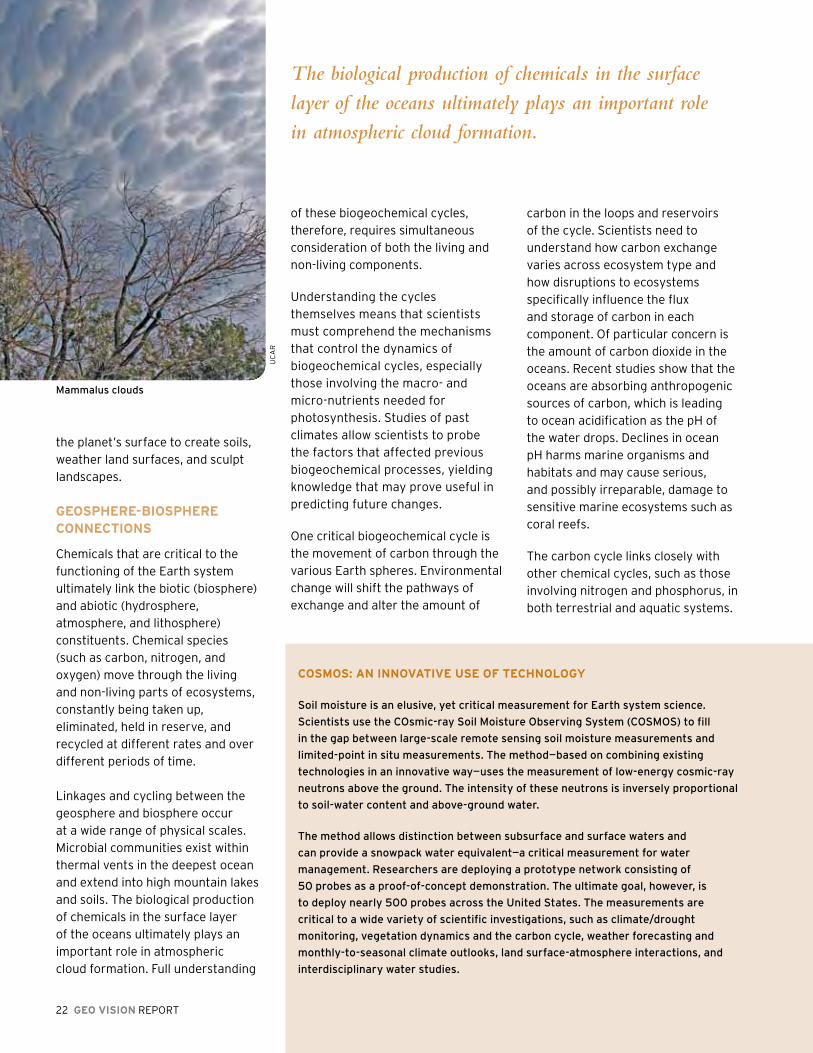
mammalus clouds
UC
AR

GEO VISION REPORT 23
phytoplankton Bloom in the Black Sea
SuSTaINING ThE
prODuCTIVITy Of ThE SEaS
Scientists have long believed that
marine animals are capable of
widespread dispersal as well as rapid
replenishment of their harvested
populations. Recent interdisciplinary
research, however, is challenging
this standard perspective. This
research incorporates physical
oceanography, analyses of DNA
sequences, geochemistry of water
and animal structures, and larval
behavior. The results suggest that
dispersal distances and replenishment
capacities are often vastly lower
than those predicted based on ocean
physics and larval life spans. in fact,
the individual “groups” of a species
(e.g., corals, shellfish, and fish) are
surprisingly insular and localized.
These findings are reshaping our
notions of how populations that reside
in locations as disparate as the polar
oceans, the tropics, and the ocean
depths, relate in both space and time.
They also have crucial implications
for the methods of harvesting natural
populations of marine resources,
as well as how we design and use
marine protected areas to sustain the
productivity of the seas, especially in
the face of environmental change.
Shrimp and crabs, hydrothermal vent area near the mariana volcanic Arc
NO
AA
Offi
ce o
f O
cea
n E
xplo
rati
on
J. D
escl
oit
res
24 GEO VISION REPORT
Recent evidence from traditional ocean studies and new molecular genomic approaches suggest that nitrogen-fixing organisms may be far more important than realized in marine systems, and they may be driving some ocean regions from nitrogen-limited to phosphorus-limited systems. Scientists think that the key microbial processes in the ocean that involve the nitrogen cycle may now be limited by trace metals delivered to the oceans by atmospheric transport, river outflow, and coastal sediments. While research continues, these
new revelations are altering our global views about the Earth’s carbon cycle. Increased nitrogen production in the ocean could be one of the key forces that drive the uptake of carbon dioxide from the atmosphere, representing a route for trapping and sequestering carbon dioxide and a new path to mitigating climate change.
WaTEr: ChaNGING pErSpECTIVES
Water is essential for life in its many forms. The world’s oceans comprise more than 97 percent of the water on Earth. The terrestrial water system extends from under the surface of the Earth (the groundwater) into the atmosphere and incorporates water in its many phases, from ice to snow to rain. The water cycle also extends into Earth’s interior, playing a role in volcanic and geothermal systems.
Economic growth and human well being wholly depend on the availability of adequate supplies of water for agriculture, energy production, transportation, ecosystem services, manufacturing, and waste management. Changes in land use (e.g., through agriculture, deforestation, and urbanization) and the construction of engineered infrastructure to manage water (e.g., dams, irrigation, water diversions, and water supply and waste systems) have inexorably altered the paths of water cycling.
Water can also pose great hazards when there is too much (exemplified
Economic growth and human well being wholly depend
on the availability of adequate supplies of water for
agriculture, energy production, transportation, ecosystem
services, manufacturing, and waste management.
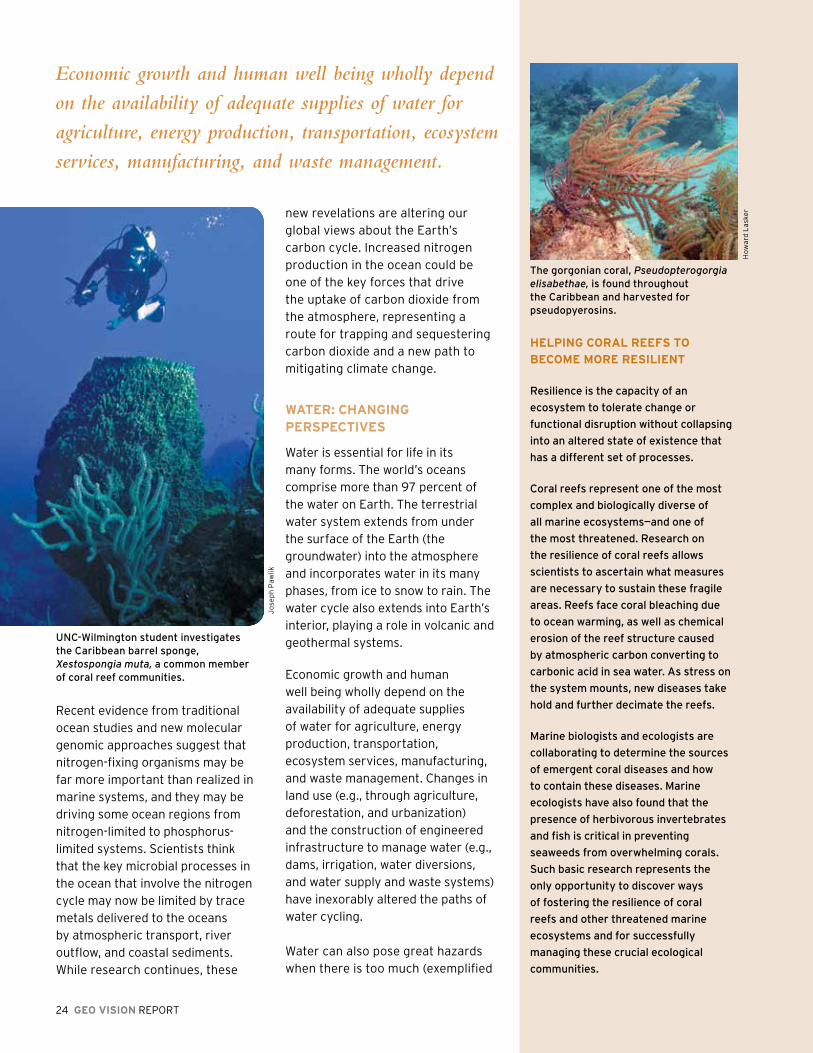
UNC-Wilmington student investigates the Caribbean barrel sponge, Xestospongia muta, a common member of coral reef communities.
Jo
sep
h P
awlik
hElpING COral rEEfS TO
BECOmE mOrE rESIlIENT
Resilience is the capacity of an
ecosystem to tolerate change or
functional disruption without collapsing
into an altered state of existence that
has a different set of processes.
Coral reefs represent one of the most
complex and biologically diverse of
all marine ecosystems—and one of
the most threatened. Research on
the resilience of coral reefs allows
scientists to ascertain what measures
are necessary to sustain these fragile
areas. Reefs face coral bleaching due
to ocean warming, as well as chemical
erosion of the reef structure caused
by atmospheric carbon converting to
carbonic acid in sea water. As stress on
the system mounts, new diseases take
hold and further decimate the reefs.
marine biologists and ecologists are
collaborating to determine the sources
of emergent coral diseases and how
to contain these diseases. marine
ecologists have also found that the
presence of herbivorous invertebrates
and fish is critical in preventing
seaweeds from overwhelming corals.
Such basic research represents the
only opportunity to discover ways
of fostering the resilience of coral
reefs and other threatened marine
ecosystems and for successfully
managing these crucial ecological
communities.
The gorgonian coral, Pseudopterogorgia elisabethae, is found throughout the Caribbean and harvested for pseudopyerosins.
Ho
wa
rd L
aske
r
GEO VISION REPORT 25
by flooding from storm surges, hurricanes and tsunamis) or too little (manifested as droughts). Accurately forecasting and mitigating the deleterious effects of such extreme events rely on a sophisticated understanding of the water cycle at various scales. Promising avenues for advancing
rEal WOrlD ENGaGEmENT fOr WaTEr rESOurCES
Water is the one critical
ingredient necessary for the
sustainability of a population.
Throughout history, people
have perished in quests
for water access. With
our changing climate and
shifting patterns of water
distribution, predicting the
availability and abundance of
water supplies has become
more critical than ever.
Recognizing the need to
approach water issues
from a multidisciplinary
perspective, the Science
and Technology Center for
Sustainability of Semi-Arid hydrology and Riparian Areas (SAhRA) engages water
managers, policymakers, and others in developing and applying its research. The
Upper San pedro Basin in Arizona is an area challenged by rapid population growth,
limited water resources, and a climate predicted to become increasingly hot and arid.
Researchers from SAhRA and members of the Upper San pedro partnership (USpp)
worked jointly to define goals for developing a hydrologic decision support system
(DSS) in managing the region’s water resources.
Combining planning scenarios and data from the USpp with the latest hydrologic
research on riparian water use, natural recharge, and water demands, SAhRA
researchers designed a DSS model that evaluates options to increase water supply
and conservation measures. it is simple to use, performs quickly, and provides visual
results. The model allows managers to evaluate the costs and potential impacts of
management options on groundwater levels, streamflow, and other environmental
factors. Translators are now converting the DSS for Spanish-speakers on both sides
of the U.S./mexico border.
additional deleterious repercussions on water quantity, water quality, and distribution. Accurately forecasting changes in precipitation patterns and understanding their subsequent impact on the local water balance may help provide the basis for attaining sustainable water resources.
A growing appreciation of the need to bridge the differences in atmospheric and hydrologic sciences makes it likely there will be a successful coupling of atmospheric and hydrologic models in the near future. This linkage would represent a major step in developing comprehensive and predictive water-cycle models. By linking specialized representations of physical, biological, human, and other systems, researchers, managers, and decision-makers can better understand and more effectively manage water systems in a changing world.
Models require both good representations of key processes and accurate data for validation. Observational networks and advanced data assimilation techniques will allow estimation of parameters in situations with few observations, yielding analyses against which model simulations can be assessed. New data integration and access capabilities will allow researchers to use data from a wide variety of sources (national, regional, and local) to unravel the complexities of the water system and explore the effects of human activities.
our understanding of water system dynamics exist despite the complex and nonlinear nature of this natural resource. Given the prospect for significant climate change, particularly with regard to precipitation patterns and extremes, the dynamics of the Earth’s water cycle will change, potentially causing
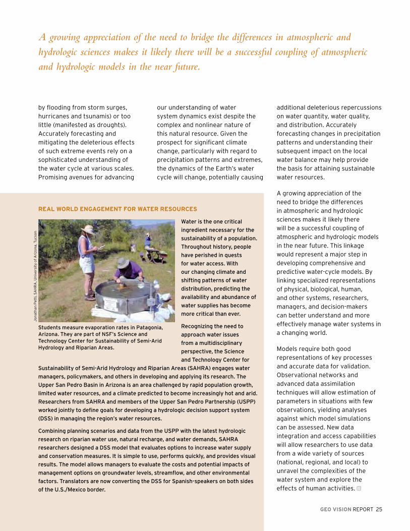
Students measure evaporation rates in patagonia, Arizona. They are part of NSF’s Science and Technology Center for Sustainability of Semi-Arid hydrology and Riparian Areas.
Jo
nat
ha
n P
etti
, SA
HR
A, U
niv
ers
ity
of
Ari
zon
a, T
ucs
on
A growing appreciation of the need to bridge the differences in atmospheric and
hydrologic sciences makes it likely there will be a successful coupling of atmospheric
and hydrologic models in the near future.

26 GEO VISION REPORT
GEO VISION REPORT 27
n the United States, the NSF is the sole research agency with the
disciplinary breadth to comprehensively address the diverse challenges
presented in this report. And it is GEO that must engage other NSF
directorates and external partners in an ambitious basic research
traditional reductionist approaches. Scientists and engineers are only beginning to recognize the full complexity and emergent properties of large-scale Earth systems (e.g., large watersheds and ecosystem dynamics). A new generation of scientists and engineers who understand the interactions among the disciplines will facilitate a more complete understanding of these expansive processes.
Meeting the Challenges
program that furthers understanding of our Earth and provides the basis for objective and sound policy formulation and decision-making. GEO’s research portfolio must address the complexity of the Earth system, its vulnerabilities, and the circumstances that affect the sustainability of life. It must also include cutting-edge disciplinary and interdisciplinary research, and build intellectual proficiency through a diverse and capable geosciences workforce and an informed public.
Many of today’s geoscientists were trained as specialists and reductionists, taught to break down complex systems into components, with understanding of the whole formed by the sum interaction of the parts. Distinct boundaries separate these traditional core-science disciplines with research institutions mirroring this intellectual alignment. This approach has served scientists reasonably well in the past, and will continue to form the foundation of important discoveries in the future. Nevertheless, large-scale issues mandate sophisticated understanding of the interacting parts. Extrapolating known small-scale behavior and properties to larger scales has challenged
I
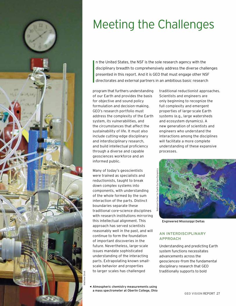
Atmospheric chemistry measurements using a mass spectrometer at Oberlin College, Ohio
aN INTErDISCIplINary apprOaCh
Understanding and predicting Earth system functions necessitates advancements across the geosciences—from the fundamental disciplinary research that GEO traditionally supports to bold
Mat
thew
Elr
od
Engineered mississippi Deltas
Nat
ion
al C
en
ter
for
Ea
rth
-Su
rfa
ce D
yna
mic
s
28 GEO VISION REPORT
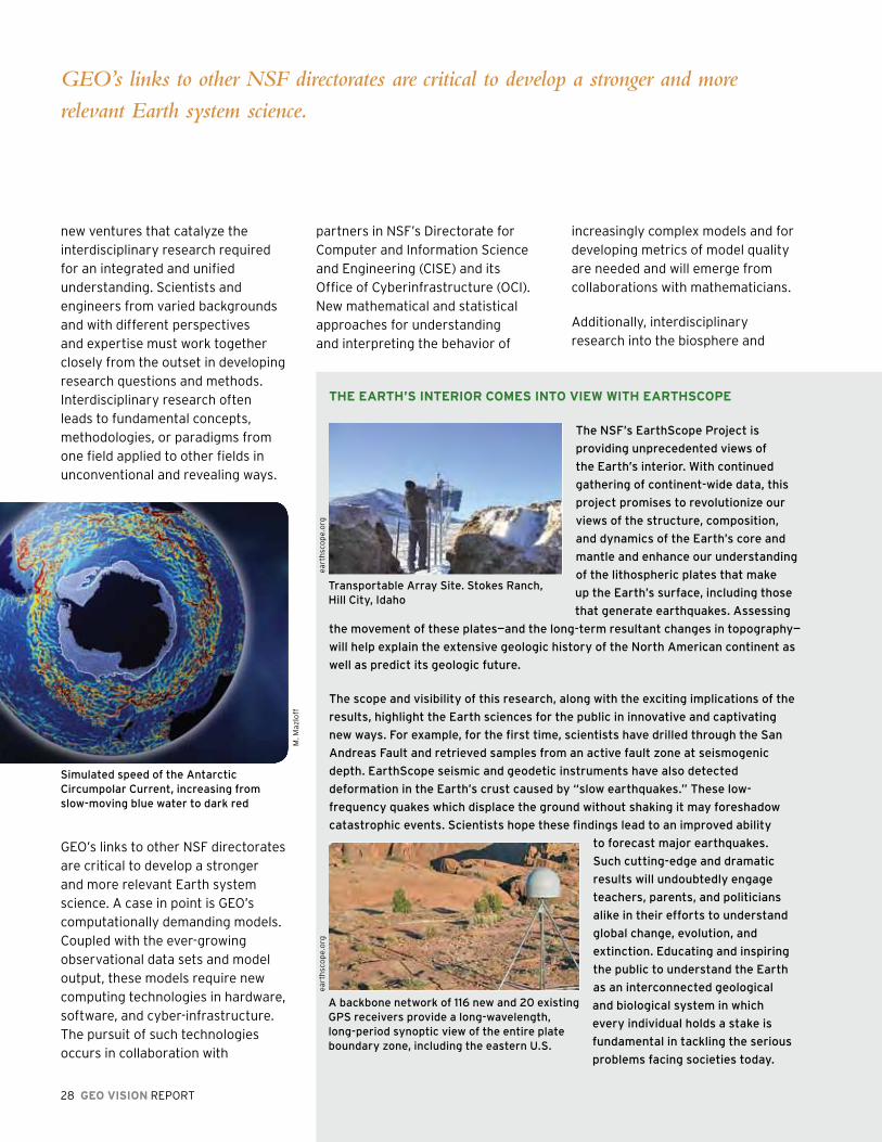
ThE EarTh’S INTErIOr COmES INTO VIEW WITh EarThSCOpE
The NSF’s EarthScope project is
providing unprecedented views of
the Earth’s interior. With continued
gathering of continent-wide data, this
project promises to revolutionize our
views of the structure, composition,
and dynamics of the Earth’s core and
mantle and enhance our understanding
of the lithospheric plates that make
up the Earth’s surface, including those
that generate earthquakes. Assessing
the movement of these plates—and the long-term resultant changes in topography—
will help explain the extensive geologic history of the North American continent as
well as predict its geologic future.
The scope and visibility of this research, along with the exciting implications of the
results, highlight the Earth sciences for the public in innovative and captivating
new ways. For example, for the first time, scientists have drilled through the San
Andreas Fault and retrieved samples from an active fault zone at seismogenic
depth. EarthScope seismic and geodetic instruments have also detected
deformation in the Earth’s crust caused by “slow earthquakes.” These low-
frequency quakes which displace the ground without shaking it may foreshadow
catastrophic events. Scientists hope these findings lead to an improved ability
to forecast major earthquakes.
Such cutting-edge and dramatic
results will undoubtedly engage
teachers, parents, and politicians
alike in their efforts to understand
global change, evolution, and
extinction. Educating and inspiring
the public to understand the Earth
as an interconnected geological
and biological system in which
every individual holds a stake is
fundamental in tackling the serious
problems facing societies today.
new ventures that catalyze the interdisciplinary research required for an integrated and unified understanding. Scientists and engineers from varied backgrounds and with different perspectives and expertise must work together closely from the outset in developing research questions and methods. Interdisciplinary research often leads to fundamental concepts, methodologies, or paradigms from one field applied to other fields in unconventional and revealing ways.
GEO’s links to other NSF directorates are critical to develop a stronger and more relevant Earth system science. A case in point is GEO’s computationally demanding models. Coupled with the ever-growing observational data sets and model output, these models require new computing technologies in hardware, software, and cyber-infrastructure. The pursuit of such technologies occurs in collaboration with
GEO’s links to other NSF directorates are critical to develop a stronger and more
relevant Earth system science.
Simulated speed of the Antarctic Circumpolar Current, increasing from slow-moving blue water to dark red
M. M
azlo
ff
partners in NSF’s Directorate for Computer and Information Science and Engineering (CISE) and its Office of Cyberinfrastructure (OCI). New mathematical and statistical approaches for understanding and interpreting the behavior of
increasingly complex models and for developing metrics of model quality are needed and will emerge from collaborations with mathematicians.
Additionally, interdisciplinary research into the biosphere and
Transportable Array Site. Stokes Ranch, hill City, idaho
A backbone network of 116 new and 20 existing GpS receivers provide a long-wavelength, long-period synoptic view of the entire plate boundary zone, including the eastern U.S.
ea
rth
sco
pe.
org
ea
rth
sco
pe.
org
GEO VISION REPORT 29
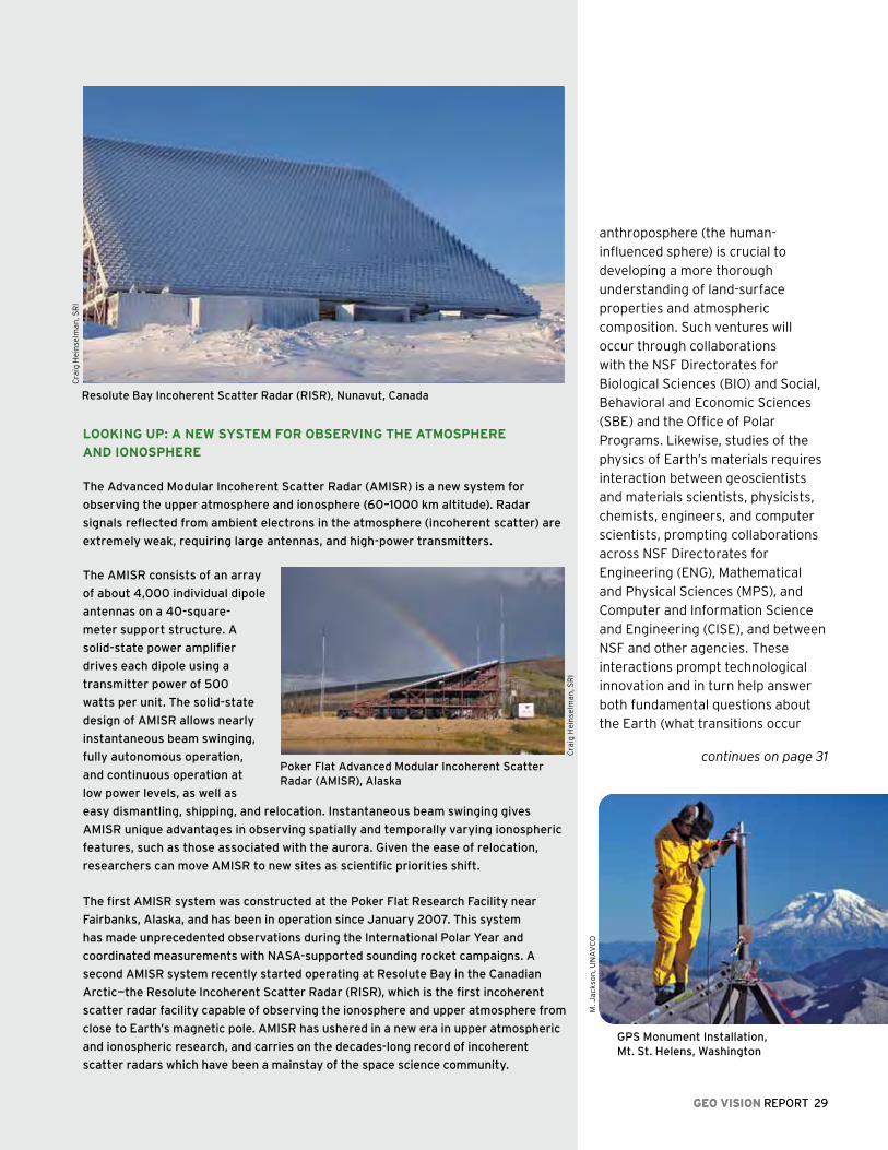
lOOkING up: a NEW SySTEm fOr OBSErVING ThE aTmOSphErE
aND IONOSphErE
The Advanced modular incoherent Scatter Radar (AmiSR) is a new system for
observing the upper atmosphere and ionosphere (60–1000 km altitude). Radar
signals reflected from ambient electrons in the atmosphere (incoherent scatter) are
extremely weak, requiring large antennas, and high-power transmitters.
The AmiSR consists of an array
of about 4,000 individual dipole
antennas on a 40-square-
meter support structure. A
solid-state power amplifier
drives each dipole using a
transmitter power of 500
watts per unit. The solid-state
design of AmiSR allows nearly
instantaneous beam swinging,
fully autonomous operation,
and continuous operation at
low power levels, as well as
easy dismantling, shipping, and relocation. instantaneous beam swinging gives
AmiSR unique advantages in observing spatially and temporally varying ionospheric
features, such as those associated with the aurora. Given the ease of relocation,
researchers can move AmiSR to new sites as scientific priorities shift.
The first AmiSR system was constructed at the poker Flat Research Facility near
Fairbanks, Alaska, and has been in operation since January 2007. This system
has made unprecedented observations during the international polar Year and
coordinated measurements with NASA-supported sounding rocket campaigns. A
second AmiSR system recently started operating at Resolute Bay in the Canadian
Arctic—the Resolute incoherent Scatter Radar (RiSR), which is the first incoherent
scatter radar facility capable of observing the ionosphere and upper atmosphere from
close to Earth’s magnetic pole. AmiSR has ushered in a new era in upper atmospheric
and ionospheric research, and carries on the decades-long record of incoherent
scatter radars which have been a mainstay of the space science community.
Resolute Bay incoherent Scatter Radar (RiSR), Nunavut, Canada
GEO VISION REPORT 29
Cra
ig H
ein
selm
an
, SR
I
anthroposphere (the human-influenced sphere) is crucial to developing a more thorough understanding of land-surface properties and atmospheric composition. Such ventures will occur through collaborations with the NSF Directorates for Biological Sciences (BIO) and Social, Behavioral and Economic Sciences (SBE) and the Office of Polar Programs. Likewise, studies of the physics of Earth’s materials requires interaction between geoscientists and materials scientists, physicists, chemists, engineers, and computer scientists, prompting collaborations across NSF Directorates for Engineering (ENG), Mathematical and Physical Sciences (MPS), and Computer and Information Science and Engineering (CISE), and between NSF and other agencies. These interactions prompt technological innovation and in turn help answer both fundamental questions about the Earth (what transitions occur
continues on page 31
GpS monument installation, mt. St. helens, Washington
M. J
ack
son
, UN
AV
CO
poker Flat Advanced modular incoherent Scatter Radar (AmiSR), Alaska
Cra
ig H
ein
selm
an
, SR
I

fuTurE OBSErVING SySTEmS: ThE OCEaN OBSErVaTOrIES INITIaTIVE
Anthropogenic ocean acidification over the 21st century and its impact on calcifying organisms.
Ocean carbon cycle and its response to global change.
Beginning construction in 2009, the Ocean Observatories
initiative (OOi) will revolutionize ocean science, providing
the first major and comprehensive means of ocean study
since the launch of environmental satellites. Researchers
will deploy the OOi system, composed of a cable network
and deep-sea buoys, in critical parts of the global and
U.S. coastal oceans. its continuous operation will capture
climate, carbon, ecosystem, and geodynamic variations
in real time unlike research vessels, which capture data
intermittently. Streaming, open-access data from the
air-sea interface, the water column, and the seafloor will
be openly available to educators and researchers, making
oceanography accessible to citizens and scholars who
might never go to sea.
Critical science issues motivated creation of the OOi,
including the ocean carbon cycle and its response to
global change, ocean acidification, the effect of climate
variability on ocean circulation, coastal ocean dynamics
and ecosystem response, and the impact of tectonically
driven fluid on the carbon cycle, deep-ocean ecosystems,
and earthquakes. Researchers will deploy deep-sea buoys
capable of withstanding harsh conditions in the Gulf of
Alaska (in collaboration with NOAA), the irminger Sea, the
Southern Ocean, and the Argentine Basin. Regional electro-
optical cabled nodes will sit at sites where extensive
methane venting either creates gas hydrates or sustains
chemosynthetic vent communities off the pacific Northwest
coast, as well as in areas important for understanding
seismic processes and hazards. The OOi will also have a
network of fixed and re-locatable coastal observatories
off both coasts and a cutting-edge, open-access cyber-
infrastructure to link marine components and to facilitate
experimentation using the entire OOi network.
Orr, J. C., V. J. Fabry, O. Aumont, L. Bopp, S. C. Doney, R.A. Feely, A. Gnanadesikan, N. Gruber, A. Ishida, F. Joos, R. M. Key, K. Lindsay, E. Maier-Reimer, R. Matear, P. Monfray and A. Mouchet, R. G. Najjar, G.-K. Plattner, K. B. Rodgers, C.L. Sabine, J. L. Sarmiento, R. Schlitzer, R. D. Slater, I. J. Totterdell, M. -F. Weirig, Y. Yamanaka, and A. Yool.
30 GEO VISION REPORT
Gin
ge
r A
mb
rust
, Ce
nte
r fo
r E
nvi
ron
me
nta
l Vis
ual
izat
ion
, Un
ive
rsit
y o
f W
ash
ing
ton
Geological processes in the seafloor.
OO
I Re
gio
nal
Sca
le N
od
es P
rog
ram
, Un
ive
rsit
y o
f W
ash
ing
ton
GEO VISION REPORT 31
Deeply aware that geosciences research transcends national boundaries, GEO supports
numerous international cooperative arrangements to enable researchers to develop
scientific and financial capabilities needed to conduct research to understand more
fully the origins of the Earth as well as its climate and environment.
in minerals under pressure?) and address environmental concerns (what controls successful sequestration of carbon?).
a COmmITmENT TO rESEarCh
Enabling this research requires a solid infrastructure of modern observational tools and advanced computational capacity
COmpuTING aND mODElING
high-performance computing has
become the mainstay of climate
modeling. As understanding of
the integrated climate system
becomes more sophisticated,
researchers are increasingly capable
of producing accurate models of
the climate system at regional
scales using advanced computer
systems. Regional-scale resolution
is necessary to generate forecasts
for assessing the possible impacts
of climate change. Access to the
highest-level computing resources
remains a major limiting factor in
creating the requisite models.
mEETING ThE INTErGOVErNmENTal paNEl
fOr ClImaTE ChaNGE ChallENGE
When the intergovernmental panel
for Climate Change (ipCC) received
the Nobel peace prize in 2007,
it reinforced the critical global
importance of understanding Earth’s
changing climate. The research
assessed by the ipCC has proven
critical to understanding climate
processes and improving climate
models as well as providing a basis
for policymaking. Yet, much of our
knowledge in areas such as ice sheet
dynamics or human impact on ecosystems remains incomplete and often goes
unrepresented in climate models.
To address those knowledge gaps, the leading climate scientists around the world
are refocusing much of their efforts to develop a deeper understanding of climate
change at the regional and local level where human and ecosystem impacts are
often most intensely felt. One such effort is the shift from a climate model to a
more complex Earth system model. The NSF’s Community Climate System model
is unique as a community effort—built, managed, and run as an open collaboration
among university investigators and national laboratories. The transition of this
model to an “Earth system” model will result in increased temporal and spatial
resolution. it will not only require greater computational resources, but it also
will demand new software development and model architecture. Ultimately,
the research enabled by from this new model will be vital as the U.S. and other
nations go forward in developing global policies on climate change.
Gif
ford
H. M
ille
r
ice cap remnant on the high plateau of north-central Baffin island, Arctic Canada
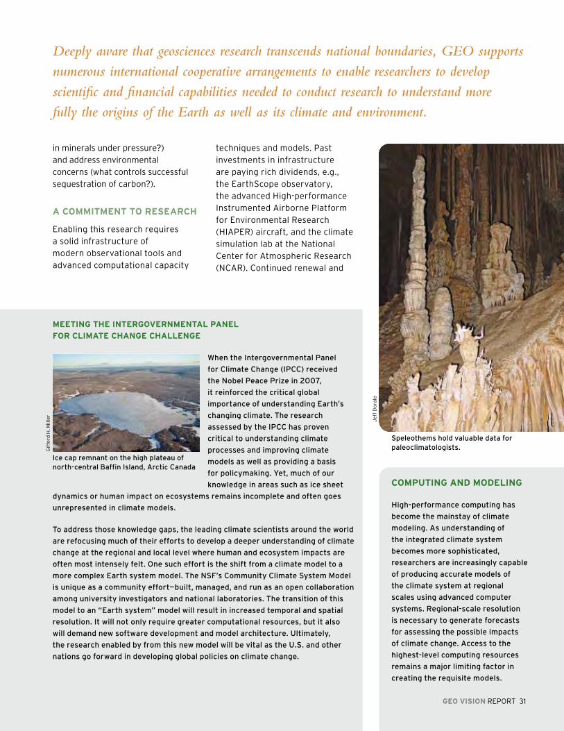
techniques and models. Past investments in infrastructure are paying rich dividends, e.g., the EarthScope observatory, the advanced High-performance Instrumented Airborne Platform for Environmental Research (HIAPER) aircraft, and the climate simulation lab at the National Center for Atmospheric Research (NCAR). Continued renewal and
Jef
f D
ora
le
Speleothems hold valuable data for paleoclimatologists.
GEO must broaden the public’s understanding of the geosciences as a vital first step.
A more educated citizenry will be better able to understand the challenges ahead, and
better prepared to solve those challenges.
32 GEO VISION REPORT
The drillship JOIDES Resolution, hawaii, may 2009.
Th
e C
on
sort
ium
fo
r O
cea
n L
ea
de
rsh
ip
development of such tools is essential. Investment in the next generation of tools—including the Ocean Observatories, the Alaska Region Research Vessel, solar telescopes, new types of sensors, as well as advanced cyber-infrastructure—will provide the basis for the next wave of advancements in understanding.
Neither models nor the observations that underlie predictions are perfect; some uncertainty will always exist in the accuracy of a prediction. Pinpointing the level of uncertainty, however, offers a sense of the magnitude of risk. Geoscientists often use forecast or projection ensembles to assess prediction uncertainty and to communicate risks in hazards and resource projections. However, such calculations require considerable manipulation, mandating the involvement of mathematicians and computer scientists.
a puBlIC rOlE fOr ThE GEOSCIENCES
Any strategy to energize the geosciences research community must engage the broader public. Increasing basic literacy in topics
such as ocean circulation, seismic processes, and carbon cycling represents the first step towards sound science-based policy decisions by officeholders that are backed by a knowledgeable public.
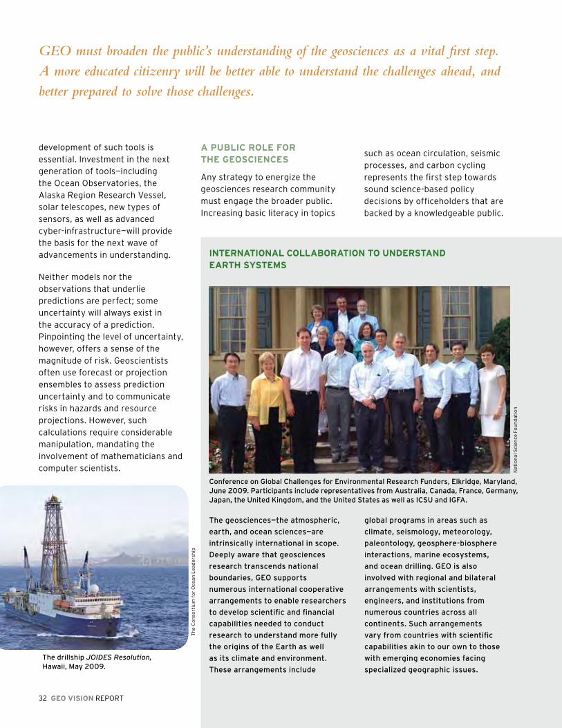
INTErNaTIONal COllaBOraTION TO uNDErSTaND EarTh SySTEmS
Conference on Global Challenges for Environmental Research Funders, Elkridge, maryland, June 2009. participants include representatives from Australia, Canada, France, Germany, Japan, the United Kingdom, and the United States as well as iCSU and iGFA.
The geosciences—the atmospheric,
earth, and ocean sciences—are
intrinsically international in scope.
Deeply aware that geosciences
research transcends national
boundaries, GEO supports
numerous international cooperative
arrangements to enable researchers
to develop scientific and financial
capabilities needed to conduct
research to understand more fully
the origins of the Earth as well
as its climate and environment.
These arrangements include
Nat
ion
al S
cie
nce
Fo
un
dat
ion
global programs in areas such as
climate, seismology, meteorology,
paleontology, geosphere-biosphere
interactions, marine ecosystems,
and ocean drilling. GEO is also
involved with regional and bilateral
arrangements with scientists,
engineers, and institutions from
numerous countries across all
continents. Such arrangements
vary from countries with scientific
capabilities akin to our own to those
with emerging economies facing
specialized geographic issues.
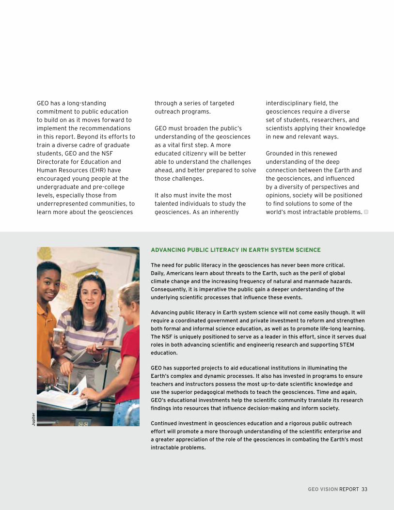
aDVaNCING puBlIC lITEraCy IN EarTh SySTEm SCIENCE
The need for public literacy in the geosciences has never been more critical.
Daily, Americans learn about threats to the Earth, such as the peril of global
climate change and the increasing frequency of natural and manmade hazards.
Consequently, it is imperative the public gain a deeper understanding of the
underlying scientific processes that influence these events.
Advancing public literacy in Earth system science will not come easily though. it will
require a coordinated government and private investment to reform and strengthen
both formal and informal science education, as well as to promote life-long learning.
The NSF is uniquely positioned to serve as a leader in this effort, since it serves dual
roles in both advancing scientific and engineerig research and supporting STEm
education.
GEO has supported projects to aid educational institutions in illuminating the
Earth’s complex and dynamic processes. it also has invested in programs to ensure
teachers and instructors possess the most up-to-date scientific knowledge and
use the superior pedagogical methods to teach the geosciences. Time and again,
GEO’s educational investments help the scientific community translate its research
findings into resources that influence decision-making and inform society.
Continued investment in geosciences education and a rigorous public outreach
effort will promote a more thorough understanding of the scientific enterprise and
a greater appreciation of the role of the geosciences in combating the Earth’s most
intractable problems.
Ju
pit
er
GEO has a long-standing commitment to public education to build on as it moves forward to implement the recommendations in this report. Beyond its efforts to train a diverse cadre of graduate students, GEO and the NSF Directorate for Education and Human Resources (EHR) have encouraged young people at the undergraduate and pre-college levels, especially those from underrepresented communities, to learn more about the geosciences
through a series of targeted outreach programs.
GEO must broaden the public’s understanding of the geosciences as a vital first step. A more educated citizenry will be better able to understand the challenges ahead, and better prepared to solve those challenges.
It also must invite the most talented individuals to study the geosciences. As an inherently
interdisciplinary field, the geosciences require a diverse set of students, researchers, and scientists applying their knowledge in new and relevant ways.
Grounded in this renewed understanding of the deep connection between the Earth and the geosciences, and influenced by a diversity of perspectives and opinions, society will be positioned to find solutions to some of the world’s most intractable problems.
GEO VISION REPORT 33
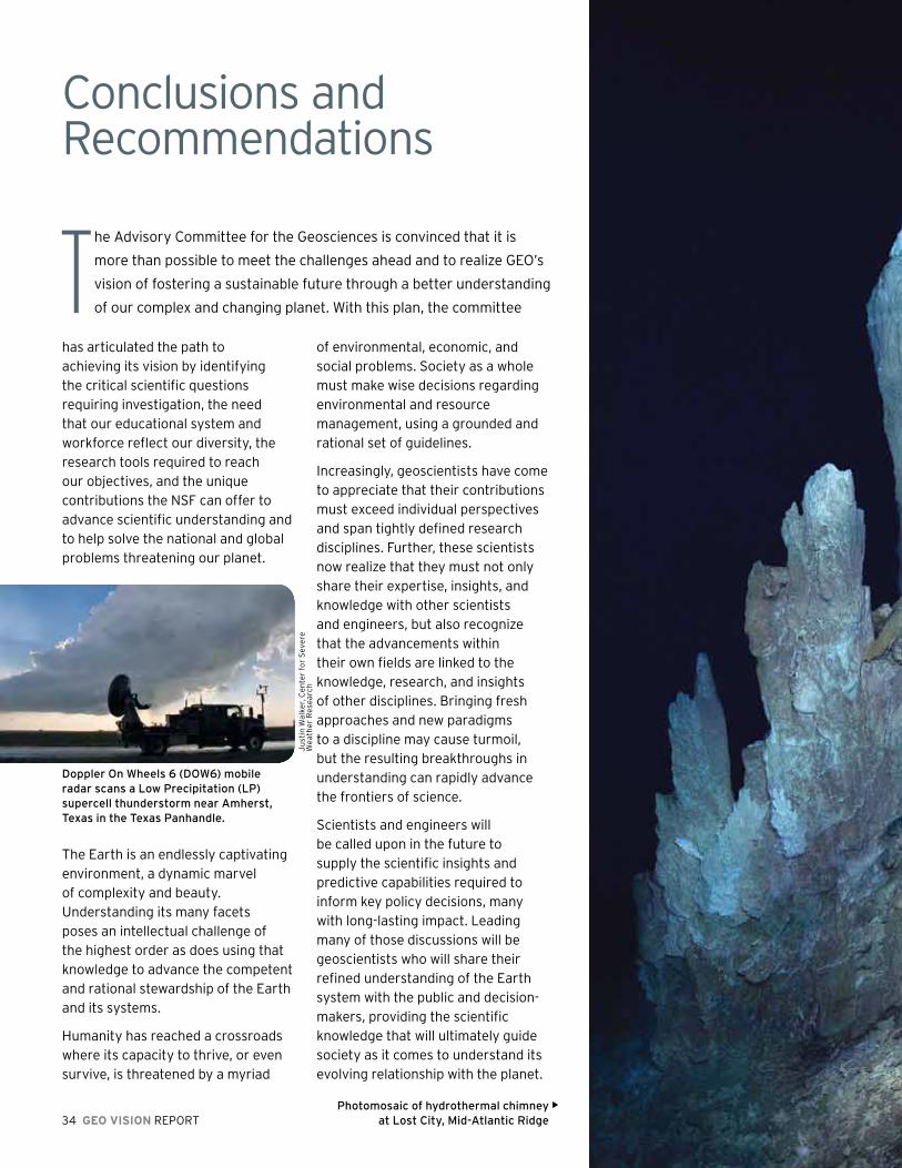
34 GEO VISION REPORT
he Advisory Committee for the Geosciences is convinced that it is
more than possible to meet the challenges ahead and to realize GEO’s
vision of fostering a sustainable future through a better understanding
of our complex and changing planet. With this plan, the committee
of environmental, economic, and social problems. Society as a whole must make wise decisions regarding environmental and resource management, using a grounded and rational set of guidelines.
Increasingly, geoscientists have come to appreciate that their contributions must exceed individual perspectives and span tightly defined research disciplines. Further, these scientists now realize that they must not only share their expertise, insights, and knowledge with other scientists and engineers, but also recognize that the advancements within their own fields are linked to the knowledge, research, and insights of other disciplines. Bringing fresh approaches and new paradigms to a discipline may cause turmoil, but the resulting breakthroughs in understanding can rapidly advance the frontiers of science.
Scientists and engineers will be called upon in the future to supply the scientific insights and predictive capabilities required to inform key policy decisions, many with long-lasting impact. Leading many of those discussions will be geoscientists who will share their refined understanding of the Earth system with the public and decision-makers, providing the scientific knowledge that will ultimately guide society as it comes to understand its evolving relationship with the planet.
Conclusions and Recommendations
Ju
stin
Wal
ker,
Ce
nte
r fo
r S
eve
re
We
ath
er
Res
ea
rch
photomosaic of hydrothermal chimney at lost City, mid-Atlantic Ridge
Thas articulated the path to achieving its vision by identifying the critical scientific questions requiring investigation, the need that our educational system and workforce reflect our diversity, the research tools required to reach our objectives, and the unique contributions the NSF can offer to advance scientific understanding and to help solve the national and global problems threatening our planet.
The Earth is an endlessly captivating environment, a dynamic marvel of complexity and beauty. Understanding its many facets poses an intellectual challenge of the highest order as does using that knowledge to advance the competent and rational stewardship of the Earth and its systems.
Humanity has reached a crossroads where its capacity to thrive, or even survive, is threatened by a myriad
Doppler On Wheels 6 (DOW6) mobile radar scans a low precipitation (lp) supercell thunderstorm near Amherst, Texas in the Texas panhandle.

GEO VISION REPORT 35
he Advisory Committee for Geosciences is energized by
the work ahead, and is committed to supporting GEO as it
confronts these challenges and achieves this vision for the
geosciences. Toward that end, our recommendations are:T Sustain and nurture the
fundamental geosciences disciplinary programs;
Reach out in bold new directions, engaging and incorporating other disciplines;
Embrace a culture that recognizes that transformational research involves an element of risk;
Invest wisely in and responsibly manage the next generation of tools, technologies, and techniques, including advanced computation to enable cutting-edge research;
Communicate the critical role that geosciences plays in reducing risks from natural hazards;
Build effective and enduring partnerships within NSF as well as with other federal agencies, the private sector, international
organizations, and other institutions outside U.S. borders;
Recognize the explicit need for the geosciences to adopt the challenge of increasing the resiliency of natural systems;
Build bridges between geoscience researchers and the K–12 classroom to promote early-childhood and young-adult understanding of geosciences concepts;
Create a broad and diverse cadre of geosciences researchers who can use creative approaches to geosciences education and literacy at all levels; and
Convey the central, and potentially pivotal, geosciences research and findings to policymakers and thought leaders in building a sustainable future.
Crepuscular rays shine through clouds off the coast of Chile.
Ch
ris
Bre
the
rto
n
De
b K
elle
y, U
niv
ers
ity
of
Was
hin
gto
n


GEO VISION REPORT 37
Acknowledgements
The Advisory Committee for Geosciences is grateful to the staff
of the NSF Geosciences Directorate who assisted in preparation
of the report. We would also like to note the important leadership
of Timothy L. Killeen, Assistant Director for Geosciences, and his
predecessor, Jarvis L. Moyers, Acting Assistant Director for GEO,
who provided the crucial resources and vision to move this report
forward. In addition, we would particularly like to acknowledge
the work of the GEO Vision Working Group and its co-chairs,
Guy Brasseur and Gail Ashley, without whose perseverance and
dedication we would not have been able to develop this plan.
The report also could not have been finished without the editing,
graphic, and publishing services of Harvey Leifert and the staff of
OmniStudio—Eileen Kessler, Sarah Kellogg, Nina Fisher, and Sherrie
Good. In the NSF Office of Legislative and Public Affairs, Kathi
“Trinka” Plaskon, Gwen Morgan, and Adrian Apodaca provided the
important first steps in designing the graphic content of the report.
Within GEO, Melissa J. Lane and Thomas W. Spence, the current
and former Executive Secretaries of AC-GEO, were instrumental in
managing and completing this project. Finally, special thanks are
due to GEO program officers and managers who took the time to
attend meetings and provide critical insights, input, and feedback.

38 GEO VISION REPORT
George H. Davis, AC-GEO Chair (2007–2009) The University of Arizona
William Brune, AC-GEO Chair (2005–2006) The Pennsylvania State University
Robert C. Beardsley, Woods Hole Oceanographic Institution
Claudia R. Benitez-Nelson, University of South Carolina
Ellen Druffel, University of California, Irvine
Douglas H. Erwin, Smithsonian Institution
Efi Foufoula-Georgiou, University of Minnesota
Joseph S. Francisco, Purdue University
Tamas I. Gombosi, University of Michigan
Vanda Grubišic, Universität Wien
James Hansen, Naval Research Laboratory
Robert C. Harriss, The National Center for Atmospheric Research
Tony Haymet, Scripps Institution of Oceanography
Mark Hixon, Oregon State University
Raymond Jeanloz, University of California, Berkeley
Louise H. Kellogg, University of California, Davis
James Kinter, Institute of Global Environment and Society, Inc.
Advisory Committee for Geosciences (2006-2009)
Walter Lynn, Lynn Incorporated
Charles Marshall, Harvard University
Larry Mayer, University of New Hampshire
Claudia Mora, Los Alamos National Laboratory
Samuel L. Myers, Jr., University of Minnesota
Norine E. Noonan, University of South Florida St. Petersburg
Maria Pirone, Harris Corporation
Mary Jo Richardson, Texas A&M University
Andrew A. Rosenberg, University of New Hampshire
David S. Schimel, NEON Inc.
Paul B. Shepson, Purdue University
Roger W. Smith, University of Alaska Fairbanks
John T. Snow, The University of Oklahoma
Sean Solomon, Carnegie Institution for Science
Craig Strang, University of California, Berkeley
Orlando Taylor, Howard University
Lonnie G. Thompson, The Ohio State University
E. Bruce Watson, Rensselaer Polytechnic Institute

GEO VISION REPORT 39
Gail Ashley, Co-Chair, Rutgers University
Guy Brasseur, Co-Chair, The National Center for Atmospheric Research
Richard Alley, The Pennsylvania State University
William Brune, The Pennsylvania State University
Russ Davis, Scripps Institution of Oceanography
Scott Doney, Woods Hole Oceanographic Institution
Dennis Hartmann, University of Washington
David Karl, The University of Hawai‘i System
James Kinter, Institute of Global Environment and Society, Inc.
Janet Kozyra, University of Michigan
Alexandra Navrotsky, University of California, Davis
Christopher Paola, University of Minnesota
Maria Pirone, Harris Corporation
Mary Jo Richardson, Texas A&M University
Eric Riggs, Purdue University
Sean Solomon, Carnegie Institution for Science
Michael Williams, University of Massachusetts
GEO Vision Working Group (Subcommittee of the AC/GEO)


Back cover photography by Joseph Pawlik, University Corporation for Atmospheric Research (UCAR), and UCAR
