report on overburden drill program robb creek project
TRANSCRIPT

42A12SE8242 2.9425 ROBB 010
Report on
Overburden Drill Program
Robb Creek Project
September, 1986
Sfr1986
By
Asarco Exploration Company of Canada Ltd.

42A12SE0242 2.9425 ROBB01OC
Table of Contents Page
Summary . . . . . . . . . . . . . .
Property, Location and Access . . .
Previous Work . . . . . . . . . . .
June 1986 Overburden Drill Program
Discussion of Pleistocene Geology .
Summary of Pleistocene Geology . .
Bedrock Geology . . . . . . . . . .
Conclusions and Recommendations . .
l
1
22-3
3-4
4-5
5
5
Attachments Scale
Property Location Map
OVB Hole Location Map
Logs for OVB Holes RB-21 to RB-30 inclusive
Three OVB Hole Sections
l inch * h mile
l inch - 1,000 feet
As Specified

SUMMARY
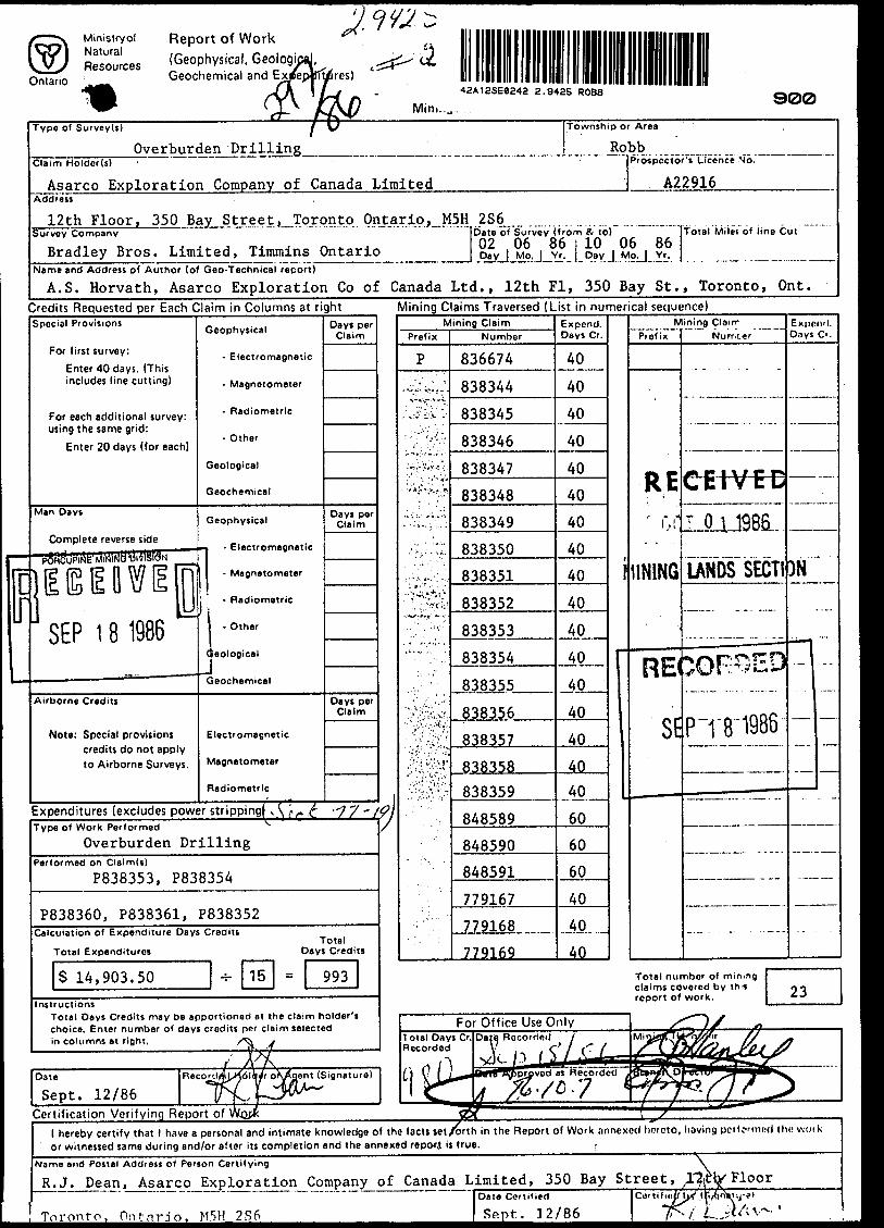
Ten reverse circulation overburden holes totalling 778 feet were drilled
by Bradley Brothers Limited on the claims of Asarco Exploration Company
of Canada Limited in Robb Township during June 1986. The holes were
drilled in an attempt to detail an anomalous gold bearing till train
detected during 1985 and 1986 reverse circulation drilling 'up-ice'
from a gold bearing quartz float boulder.
PROPERTY, LOCATION AND ACCESS
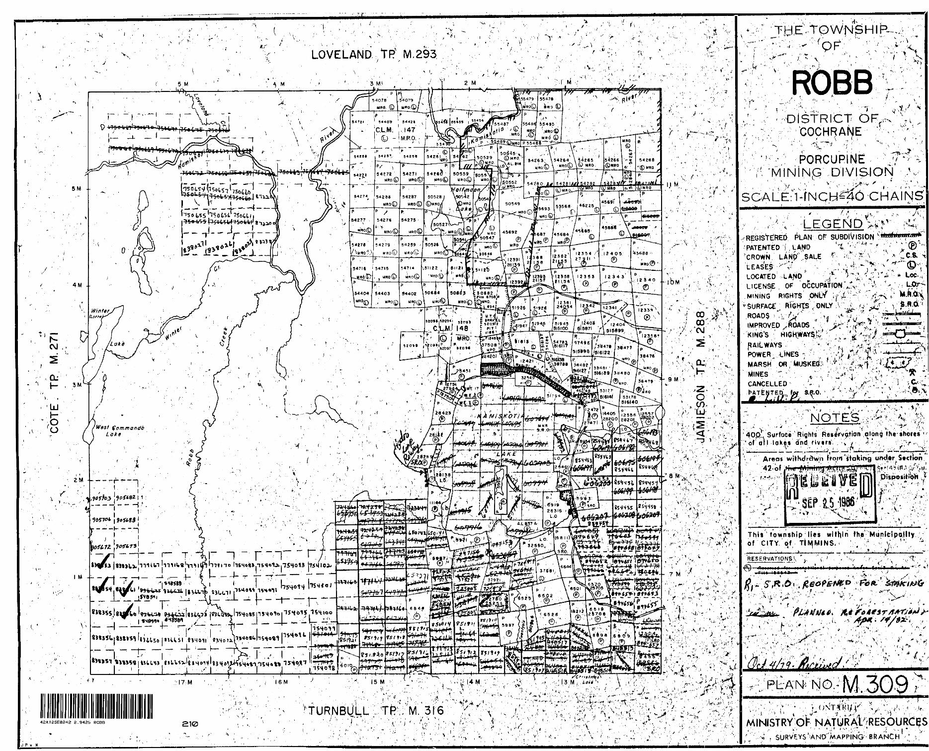
The Robb Creek claim group consists of 60 contiguous mining claims.
Fifty of the claims are located in the southwest corner of Robb Town
ship and are numbered as follows:
P754083 to P754102 inclusive
P834091 to P834094 inclusive
P836670 to P836673 inclusive
P836650 to P836653 inclusive
P848588 to P848591 inclusive
P779167 to P779170 inclusive
P838353 to P838362 inclusive
Ten claims are located in the southeast corner of Cote Township and
are numbered as follows:
P838344 to P838352 inclusive
P836674
The claim group is accessible by use of a network of gravel roads which
run from the Mallette Timber Mill (Hwy #101 west of Timmins) for approxi
mately sixteen miles west and north to Round Lake in Co"te Township. From
a point approximately one mile south of Round Lake a bulldozer road runs
eastward onto the claim group.
- 2 -
PREVIOUS WORK
Previous work on the property has been limited to sporadic prospecting
and geological surveys since the early 1900*s. This work led to a
report of a large mass of quartz 'float 1 weighing several tons found
five chains northwest of mile post XVII on the south boundary of Robb
Township. Visible gold was reported to be seen in several fragments
when the boulder was broken up (OBM 1915, Vol. 24, Pt. 3, P. 60).
Follow up prospecting and trenching in the immediate area of the boulder
in an attempt to locate the bedrock source was unsuccessful at the time
due to the drift covered nature of the area.
In March 1985, Asarco drilled ten reverse circulation overburden drill
holes 'up-ice' from the boulder in an attempt to trace it to a bedrock
source. In the summer of 1985 an additional 44 claims were staked ad
joining the original block of 16 claims bringing the total number of
claims held by Asarco to 60. Also that summer, a grid was cut over
several of the original claims and geology, magnetic and VLF-EM surveys
were completed. During the geology survey a search to relocate the
reported gold bearing quartz float boulder was successful. In January
1986, ten more reverse circulation overburden drill holes were completed.
Five holes were collared immediately 'up-ice 1 from 1985 hole RB-2 in a
pattern to delineate the anomalous till train. The other five holes
were used as reconnaissance holes to test other areas of the claim
group.
JUNE 1986 OVERBURDEN DRILL PROGRAM
A total of ten overburden drill holes were completed on the Robb Creek
property in an attempt to trace a gold bearing quartz float boulder and
anomalous till samples to a bedrock source. All ten holes were collared
'up-ice' from anomalous holes drilled in January 1986 in a pattern to
delineate the anomalous till train (see Hole Location Map).

- 3 -
The overburden drill provided by Bradley Brothers Limited consists of
a Long Year 38 Drill modified for dual tube reverse circulation drilling.
The drill is mounted on a twenty ton FN160 Flextrack Nodwell and has a
hydraulic derrick capable of handling 20 feet of rods.
In each hole, continuous sample return was monitored and logged through
the complete Pleistocene section. Whenever clastic units were identified
or suspected, samples of the minus 10 mesh material were collected. A
large amount of the plus 10 mesh pebbles and boulder chips were included
with each sample to assist in studies of till composition. The samples
average about fifteen pounds each. Bedrock chips were also collected
for several feet into bedrock.
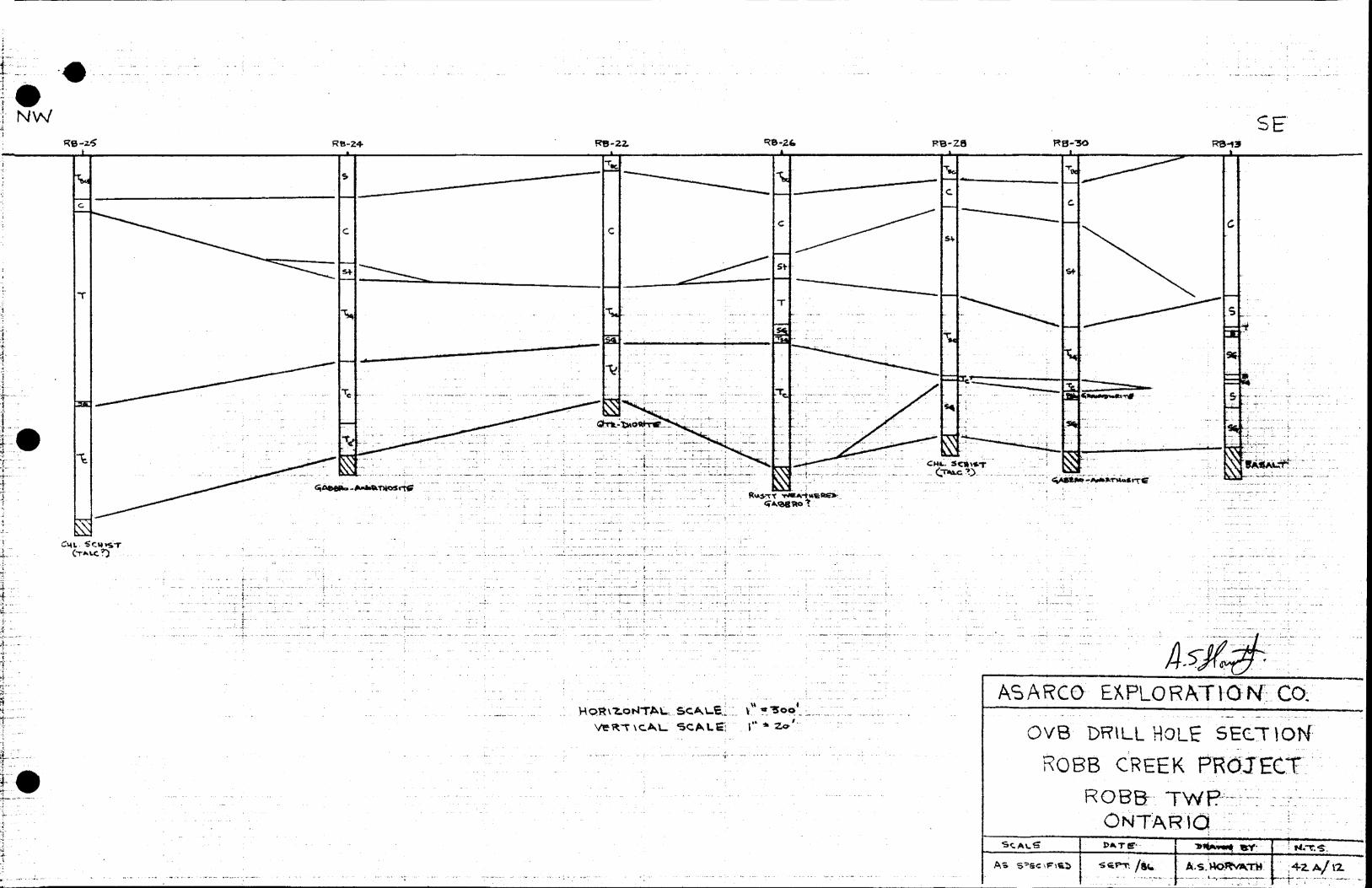
DISCUSSION OF PLEISTOCENE GEOLOGY
In the two reports covering overburden drilling programs completed on
the Robb Creek property during the winter of 1985 and 1986, a description
of Pleistocene geology based on the twenty holes completed at that
time, indicated a fairly simple section.
In summary of those reports, it was indicated that lower elastics con
sisting predominantly of sand and gravel and in some cases till were
immediately overlying bedrock. At the time, these units were all con
sidered to be part of one lodgement till. The differences in clay
content (till to sand and gravel) at the base in each hole were attributed
to a probably washing out of the fine fractions of the till in bedrock
valleys or channels dictated by bedrock topography. Overlying these
lower elastics an upper unit of sand and gravel and/or sandy gravelly
tills was present and either represented an ablation till or a reworked
till. Overlying the clastic sediments were lacustrine clay and silt
deposits.

In the spring of 1986 ten more holes were drilled to detail an anomalous
train detected in previous drilling. From the most recent ten holes
(RB-21 to RB-30 inclusive) a much more detailed Pleistocene section has
been established which indicates the section is not as simple as first
concluded. It may now be seen, that rather than two distinct clastic
units (one lodgement till overlain by a reworked or ablation till)
that at least three distinct units of clastic sediment occur on the
property. The lowermost unit consists of sand and gravel. The unit
which overlies these sand and gravels consists of a highly clay rich
till. According to the previous reports submitted, these two units
combined would have represented the lower lodgement till. This no
longer appears to be the case. The great variance of clay content
form the sand and gravel to the overlying clay rich till cannot likely
be accounted for by a simple 'washing out' mechanism since there is no
sand and gravel at the base of several holes. We can now conclude with
reasonable certainty that the lower sand and gravels and overlying clay
rich tills are not part of the same event.
Two possibilities exist as to the origin of the lower sand and gravel
deposits. This unit may represent a glacial transported very clay poor
till or a fluvial deposit from a pre-glacial river which flowed north
westerly in a channel dictated by bedrock topography.
SUMMARY OF PLEISTOCENE GEOLOGY
The Pleistocene section of the Robb Creek property may now be summarized
as follows. A lower sequence of sand and gravels occurs at the base of
the section. This unit may represent either a very clay poor till or a
pre-glacial fluvial deposit. The sand and gravel unit is preserved only
in some areas of bedrock valleys and or channels or along the slopes of
the same areas. Overlying the sand and gravel unit a second unit of very
clay rich till occurs. This unit is also responsible for the erosion of
the lower sand and gravel unit in many areas of the property especially

- 5 -
further to the north-west. Overlying the clay rich tills in virtually
all areas of the property, are sandy gravelly tills which represent either
a reworked till or an ablation till. At the top of the Pleistocene section,
overlying the clastic sediments, clay and silt deposits were formed by
glacial lake Barlow-Ojibway.
BEDROCK GEOLOGY
In the ten holes drilled, bedrock chips were collected and examined.
Six of the holes (RB-21, 23, 24, 26, 27 and 30) are a mafic intrusive
ranging from gabbro to anorthosite. Two holes (RB-25 and 28) collared
chlorite schist bedrock which may have some talc content. Hole RB-22
encountered quartz diorite intrusive and hole RB-29 encountered an
altered mafic rock probably of intrusive origin consisting predominantly
of plagioclase, quartz and chlorite with minor sericite.
CONCLUSIONS AND RECOMMENDATIONS
A more detailed section of the Pleistocene geology of the Robb Creek
property has been established. A re-evaluation of all data is now
necessary since new evidence has modified the picture considerably.
Several possibilities as to the source of the gold bearing quartz float
boulder still exist in light of the new evidence. All possibilities
must be examined hypothesizing a pre-glacial fluvial origin of the basal
sand and gravels as well as a glacial (clay poor till) origin.
Overburden drilling may be necessary in order to delineate the anomaly
train further should diamond drilling yield poor results of possible
source areas. Trenching in the area of the quartz float boulder may
prove helpful.
Respectfully submitted
A.S. Horvath
ASH:lmk

' "
^^f~
f^ J ^
^-
*——
M
-

•T
,
#
- 1
fi
——
1 8583i
e?8ssa
?
—— , ————— .RB-ZS 1
iS2- ,8 3 8 35 3
. G Cj RB-Z4
~
l ei RB-ZZ
f — 4
i sRfc-2-5
——— —
1 11 *-* B3fb4 i o*l RB-Z-! i
A/Sf-
31vi /^V X 638 355
———— H ————— ———
"B-Zfe
RB-MO
e
i— -8
3*3
•— — —
L JJ
62
-' -*
!
3I 3RB-ZI
R&-Z8e
RB--io(
3S3
^
*,
Rs-nd
) ™]
WISgo
E Ut
IT
•M ••^•B
94
t e
T
^ita..-t
83 S 35- g : xG, x s wa,s
*^.SRB^j'
•i.S^ft^57
s
Hh ———
B3S-5S^
c
E
7-.14
"I-
1If l 7 7"
tf--'85*5
4^*5iWi 99
Rkt Q ^'"
fc-^"
8?^6i !
k"0?-S^3Sl ?36tf
i\1
)tn 14*^
M
-
j
MM
1
*v,' 50 j
|I-.! "••
51
ft
H
11 1
t*
"~~ ~m
ir
* 1C*
84858*
U
*B* 94ft!
ffe^
836
ft*rB3'6
1
•7"73ifc9 :
836 6 70
1
C 5*
'89
pu———
65\i
l
; ^5a *Vi
AMj j *Wr
r:oe^ TWP. 1 {TURNIBUUUTWP
*
\stf (f* 5:
A
7j
07orir
S.
•H
f
636473
BV6
- . *k
i 8340*11 -J -10*
-*rr- ——— - e^*r !1 ft 34 O 34
'-'r- ^I "" ".V^ ;-2os
-*7S
OVB "OWiLL V\ouH LOCATION'S
Ross CRE.EK P^ojoinRo^ti Tvsjf. k ONVT
•Sc^si-t^ 1** loo o'A.S HORVATH . -SEPT./86.

100ASARCO EXPLORATION CO;
OVB DRILL HOLH 5fCT\oK
CREEK, PROJECT;
ONTARIO!
SCALE J
ASARGO
OVB DRILL HOLE SECTION1 ' ROBB CREEK PROJECT
ROBB TWPr : ;.±.''.- : - ONTARICi : l
As /au

i- - - -r ---
W
. .-,- - , - . - - .. ---. . ..~.. - ..- . i...-.I..^... r..'.. ...;. ....;... ......,.......:.... ...'..'.
:T-."!--M'"'"; -.-'-n-----
..... v. :,: . i .
- : .
.. ....... . . ........ . .... . . , - . . -, , . , ,,.;;:L::^.Ji;::...:l;;;::.:,..:il
! Eiltef^;^y [Il^S^il?^-
l- i- ---|-.--..;- - ..^.--j . ~: ......:.........j.- r . ..)OO ' "~"' ."'' ' ' - '~'~"""-
r-: 1
i..:...l-
. . .-. . ^ ..-.. ,- .: .,. ; -* - - -- - . - .
. .... -. ...-. .L
^^..,.-.... .i- -; - ' i . - ' : . ' : ;.—~... ——p ....- — .-j,. ,- .-. . -. ,,.- .. . . .. t - ,-,-. , - —— . .
- ; : - * - - , - - . —-~-.-.~.^ —...,, . ,..^'. ..^ ......,... . ^- . - .--^..- - - -,-j -.;..'__j-.. -.L................ .. :......
ASARCQ GO.OVB DRVLl HOLE SECTION;
ROBB CREEK ROBB. TW
ONTARVOA.-s WoRvm.Ti\

DATE
'tAM . 2. 7 Jifc
DRILLER
— HOLE NO. R B~8fa-21 GEOLOGIST A . S. HQRyATH 4 t,.
JODftUlM_______ HOLE LOCATION L 1W .
BIT NO. f.8fa8l37 FOOTAGE ON BIT N EW B IT (O 1 )m^——^^^^^^^^.
HOURS MOVE 4 Va. MRS. HOURS DRILL 3 '/2 HftS. OTHER P LOAT PRAM SHOP
MOVE ifj TP RB-Bfe-21 g'.SOAM- I'.OOPM
A4JQ
—
10-
3.^
4*-
m
m*
m
m
50-•w
•M
•i
*
a
a
4•1
•fli
•B
•C
70-^w
a
^•i
m
M*
*
90-
•H
•H 43 CO OiQmn
1 ——
nm
EE
i7"-*~"
'*'* "' A. -**'.l -4 X
K^:
^
SAMPLE NO.
-
—
~
~
v
.
:RB -21-01
W-*-*
M*
IR8-ai-03
HRi-U-04
~
—
DESCRIPTIVE LOG
HUMUS -1- C. 6R. CUAY
WITH SOME SILT
AS ABOV/E ^000 RETURN
G^Re^ BElfcfi SI UT WITH SOME CtAV U6NSES SOHfk P* SAND LOCAU-y a CAtC
GOOD RtTURK
TIU. J 3ANDV CXAV TIU. PtoR 1* t" ( THfcM v 30V. tLAV , PE6PLES i MAIMt TO U*.tR* Mft^jC. f IMS
SOME W*, CAlX-ITB PRMtf. * AUMtTZ
SH. coeetes
AT TIMES HBAR ^o*r*
BBDROCIf t MEO. 6R--WH, HEP.Toe.-WMO M*riC IMIR.APrxox- vol. wu. ptA*. r**wi*AR , pite*Aei.V AMMTHOM6AC8RO. ^e-S^. DiSStH. PV.( NII.TO HlMMt MA*
SsHlUCR PC STAlM ptWCTUlUS ^X
ANALYSES
t
i

IS
o
S
o
S
S
o
O
o
o
| ,
. ,
, 1
. 1
. 1
1,
, 1
. 1
. l
1 1 |.
1 1
1 1
l .
U ll.L
LL
- 1
1 i f
t j
i i
i T'J
1 1 i
r-p
-rri
p r
rrj
t-r
tT p
TT*
i n
l.i 1
1 1
1 1 1
1 1 1
1 1
i
l T 0* t M 1* O r- SI;
|p sl^ fs n
lg * K .5 ~J
"
o i
fi
*
jffe
23 I!
's' t Si
'5 r* c D
10 ro g
F
l*l?
|ill:
iI
-"o
5^
So
i^S
g n
g?
^|g
j||*
V * *
1 S
"?^
?'*
ill
*r^5
^?F
I
** 1
S3**
tw
o
"
s
O H
M 1
s*?
*o
Q w
SK r
,
^
j
2 W
* ^
f
5 1*
4. j!
J 5
5|
f"
| li ?
fif
^M
*i
g
t i
1 l
1 i
i i j
1 i
i tli
i i
i 1
i t
i t
1 i
i i
i 1
i i
i i
1 i
. ..1
. If
cT
a-^
* *O
^3
^*^
^
*
V*^
K
V ^
1 *
* *
*^
-r |iii
90 i ha to S 1 J r a? t f? |
"s1
t r* K* O
F
pejp
ffi
pS
*j;
n"?
||p
***^
* 5-5
s^g^
s |s
pzT
d*?
S
- S
^
H55
S3 '
f F
I !H
s s f
:||
*
S
J
r5"
rf
^*
*4
S
**
o .*
f f
sil
Q *
Sr ^
iiiiitiii
iiiiiiiiii
iiililii
t - 1 1 1
1 1 1 1 1
1 1 j 1 1
1 1 1 ' 1
1 1 1 ' '
' ' i
* i
5 g
*
5
S o
\ t '
vcVi
frrr i 5 v o -i t if 5 55 <> 21
0 21
5M
1*
15
?n
C
C
?
^
Dep
th
Gra
ph
ic
Log CO
^2,
"5O
^3
. f
W
D W
CO O 50 M 0 M M f o o
z f
H; CO w CO
3^
\ j^ H-
-
ffi
0)
D
0
0
H
50
gC
i-3
M
t-3
50
r H
CO
Z
fo
w^^
*
50
3 ra JJC r n
[^ DO r 9 j* 4! "d O O i-3
ffi
>O
O
c
wCO
O z
5
O ^ L|
^ E? Z
M i *3! * w OD 5* ffi
O tr1 M g *
o w
to
ffiM
W
O
f
*3
ff
W
r i? r r* r* * O ffi 50
5. 8 J*
5
M
A 00 t CO ^1
o2
Z
0 MJO P t 9 r*
1 u r*
r
gM
Q
5"
CO
3? o 0 z
^ VI
* I 1 r l W V*

DATE 9JUKI . 4/gb HOLE NO. B-fife-2.3 GEOLOGIST A. 3. HOftATri *. L.
DRILLER HOLE LOCATION LO . ^2-t3oMrRB-6b-2ZBIT NO. C.fifefllS-7 FOOTAGE ON BIT ——————-————-———————
HOURS MOVE 3A HES. HOURS DRILL 2. '/2. HRS OTHER ________
LOST J Ltd. g /gfe APTCRM06M - L.V-36 STARTER BROKffM
x:o
•M
10-
fi
20-^
—
30-1
40—
•iMB
•M
M
50-
M
M
60-m
m
MiM
•AH
•w
•M
MM
90—
90-4
M
••M
4
100 —
—o ——•H X! O* fli Q
M O
"
* ————
'.
••MM MMW
t^'
k* f v* O.* *^0 V,n
SAMPLENO.
—
-
-
r^. — -
?———
^KD'*-5"Oi
"R8"23-O3
3.--^
~-
p-
"r
^
:~
4U.MUS 4- D- BR. C4-AYQcic.c /"jAV —-———-
VARvep
si UT" wirrt "SOME" OLAY"~" ~6oop RETURMTtUL'. SANDV GRAVELLY TILL , fo5-7O f. SAMO, Z07*
TRAVEL, ~l5 lft C*AYMAPic VOLC. -f itmtus. pecsi.es FWTPOMINAIESOME OuARTt , UMBSIDNE -t" PBXSIC WOLC*.
a B?'- 3"-4- N - 4A68RD - PIABASC CO00Lft
SAND -f^RAVih.
TIM.'. 6AKDV 6RAVBU.VTIU.. BBI4E CUAV IS'/VAMO^ci^eLfiLy- MCYWACKS AKfeiujie, A*iM*rra \
WH PLA6 FELDSPAR, PROBABLE ANeRTMOSitr '
t
Xk N A L Y S E S

DATE 'jun 4. j B fe
DRILLER ijpp.1 Jonoui
BIT NO. CBfeBlSl
HOURS MOVE 1/2. HR
HOLE NO. -R8- 6fe-X4 GEOLOGIST A. fe. rtCBMAfk 4- U. MuMBS
HOLE LOCATION , Deft ' ft 32V ^ M.*,-21
FOOTAGE ON BIT (-73' pffeH ^3- Qt,-2l * gs-fl|fr-l^ t ftft- 3^*13
HOURS DRILL 5 HRS. OTHER
*Q d) Q
-
a*-
j*-:
-
.4M
M
M
fEp w**••K
W
W
*
W
IB
M
4H
•MM
10—
80-
•M
•1
M
W•H.C cr* (XQfli-SM0
.TT*'t * ' *
; V ;'-•*..';-
^E
s^f/'l 1
N'^'* *lit I f
•[/:\t;•**..\',/•''x*.
V± •^-'~ft V Al* *^A
P•4s * N
•*:\''
"ffft.^v*****\?xTjf'tlrli/.*.' I
*' A.^v'
11
*
B
M
SAMPLENO.
—
~
^
WM.M-—
.^6-24-03
i..-M
1^8-14-06
*.^
fiti.a4.ai
58-24-efr
•R* -24-05
lRt-a4-to
—
bbCKlrllVt. liUu
SAHp: M*OIUM TO COAR46SoHr v. *M. PVBBUSHIMOR OAV &OMTCNT 4-
Aoep RrruRU
tiiREy CMV VARVCO 6)60P R8TURM
6Rcv tusv AS Ageve Ck^ep KCTURMSILT: wtes tu-T WITH *o**t
TIU.: 5AMDV 6RAV*U^ TIU. WITH 10* CAAV UN H t.
LOCAU-V RARC 4M' CO8*l*S 3 "•4" UDCAU.V UP TD 10-AO'). CtAV. ALSOSANOV AT TIHBS
BBCOHeC VCRV SAMP^ WITH ftCMf ClA*/ CM4TCMT t S*/*) y < B 1?. flBVktS
* tier, l^Apn1*^ ^5'TC ftAHPVTIU., sV.M**l. , ^.CIAV
AS Aiove - nxfit you; 4 I^TROJ. i"iMWATeL t*NSiJTAHT 61.MM* STOMC . (M4C CiMi^WACKK *BOS TCSftUB t
jQtsKtami^najLtJS'3f^fS^tfi'^*t4ifJi!ftSi^i!! ffttf^-CLAW CONTBNT INCIteASCS * ffl-ff ' T6 f0^
afcO' ftftUMES SoucpQWftViNire, ceKBL0 - fc
Q tf\i . ejuARTt p WRIT* iMTRusiue SOULPAR - e*^eOP CMV TIU. , 40-60** OAV LOCAU^ UP TO tCl
1 10.; ^RCIKISH &RBV CLAY TIU.. to* Ol? BTTICR, ClAlFADfty HARPPIACKCP
CLAV BB60M6S V. ^RIRN OPUXtRBP, UHCV 4RtCM
B0PMMC& LT. BR.- W*4.^. *^MP MAFIC INTK. 8R. FROM UHOMHI6 WftATHK8iMf| **5M. *8 HfRff Wfl. PlA*. FiBunPAC PReftAet^ *iABBR6-AWORTri*SlTt, RAKB CAtft
f*^/ H \pi^ ** 1 *
A N A
-
L Y S E S

f
-/-r . i
-v.^
: i.
\v-V
^
t 6 E
o o-
T N
Ut a
St S
II' l
11t
O
l*
t tiiii
v P3*8
S S i
f*
Jlfl
flltt
T r
i-1
i p
M s *
8 o m l
Dep
thG
raph
! Lo
g w tr1
W
o
w CO o 50 M f
O
O
Z r w
w
to
w z o
93
O
C
50
CO I W f i O
O
G
W
CO
O Zo 50
CO
O
O50
>
W
50 l S
q
B M
50
S g
M M O A
(O
n m u * tc o f w z o n P t 60
T i w
Jl o w o CO **
CP D X i^ P

DAT E JIIME S /8to HOLE NO. PR - fefo- 2.6 GEOLOGIST A.S. WORVArH * L, MUM**
DRILLER nr*l .TfttvsmM HOLE LOCATION L 2.e I4*tt*j
BIT
w
NO. CBbfil34 FOOTAGE ON BIT *1S' Pi?OKI RB -6^-2*
HOURS MOVE 2-/S HR . HOURS DRILL 4 HftS OTHER STAP w^-B A -72 '
/"-.fiuTiMLJlE OM TUlvlE b
fcsjfcfr-fi-P Q
S
,o--
20-
•M
80~
•m
So-•M
*
^•i
*
fce•4
*N
^B
mm
•M
VI
*i
70-^
mmmm
to—
mmt
10-
mm *
400-
•HX! ffi P! QM 0
4
••M **t*m -
''/.' '?*
ffi
5J'Vtf*v ** ^ ^ *'^V
'/N)V* b'X*'\ i 4.S- * ^
m
SAMPLE NO.
-
:— — -
j**.,Ite-iW*
-rfte-a^-os
5**M^-^.5
^e.^-,*
M^Mf" —————————— '
:RB-U-M
^. Z.,0
—
CiO^nJ.X'lXVCi Jjwu
IUMU.S -f- D- BR. i-UAfBBMiE ClAV WITH 5oM8 GaooP RCTUI^M
SAMD 4- PCKBU8S
6R*V O^V, SOME 6ICT (bOOP RCTUR|4
TILL', 6WV CuAS TlU- 5O*9* ClAV
40-6011* SAMOt9it.t
TJftfwP ^^55*^R^5mi-'35Ml!^i e*Ay
P"^ mi* ^SrtFfc!''^ fliT "T* *H? T t t * 7f7 """"^ "*" ^"* JH^* ^33 m^^mm^fa,4A f~ fc— 4^CAHtTlCt ^fttA*4Hfft
"T*UpX* 4jO* fiO^Jb CAVW tkOCAt^V 1AP T0 SO" *^O^*
*frm*vv**K
TliX AS ABOVt
TILL AS ABeve y UOCAU.V ^feKir COBB^SWIC* VARICTV OF TVffiS
TII-L AS ABOVE
lu-rvuc 9 MAC.T O* RftTURM Afi RUSTS CMOUIMPCIAV
——————— . FOH 64 PT- ————————
ANALYSES
i
i

JUIDATE JuM. b/Sb
DRILLER
BIT NO.
HOLE NO. R6-feb-?.T GEOLOGIST A . S. HQRVATH t L..
_______ HOLE LOCATION few |(?Mi——-—
FOOTAGE ON BIT tew R iT oO
HOURS MOVE V2. Hg.
_____________TO
HOURS DRILL fe '/4 H(?S. OTHER PULL gQDS ft
BIT
A4JOQ)
'
-
16-
*-i
-
3*-
-
M
MSo-M
a
W
.
^•B
M
mm
7*— 1•M
4
••M
•1
M
•M
•B
*
96—
M
••i
M
10*——
•H•C eno* oIt} M
o
s— ——— '
- —
lEZE*/ *v ^'/*
0 *\^ * *
'tot
•io*i** 1 **. l
^J,
^•' ^?,'* b *,'o .'* uK '
SAMPLE Nn
—
~~
i-
-
l--*--tt-XI-02
i^-zn-o,
;R8-J.1-M
V
328-11-05
IK6-Z1-0fe
..:f?6-a^.o^
1^.,,-
[*,,o,
***,.*
~
D T?cri DTD'pT\ji? Trtr1
HUMUS -f p. BR. CLAY t SAMP
BElfaE CLAY WITH SOMB SAND CA . O RARE SM. PC88i.es R6TURJ4
6RBY CLAY ^OCO R6TURH
Si UT WITH SOME ti4^Y LCNSCS
TILL*. ^REY CLAY ^ eov* 10^* SAKO, to^ peceuK-LlME&T&Mfi , MAFIC VOK-. , FCl&IC INTRWS-, IMffK
VAI?. AMOUNTS Of CLAY J *OMS BOuUJflRV
6j?CY CLAY TILL , ~bo^ CLAYr
^3'-44'. GRAVELLY TILL, SANP 4 26}bCLAY,
507. P&BBLCS - MAPK: vent-TILL AS AEftt/E44' - ssuLpcey c6Ti0Kt
"BAuU^ —————————
TILL, AS ABft^/fi
TILL AS ABOVE" 6ou.LP6l? : HCP' (tJM'NCP M9^A9 , H*TP Ttt D. 4K**N
TILL, AS AW^c FREQuCNT SM- CO6PLES
SAND ^ ^HAVBL WITH PREQUCMT cotSLCs :MAPJC VOLC * IMTRuS' t*^l* LJMI*TfeMB 36 7* ,
(fKf'S 1 BASALT Q0UU00? - b"B6DROCK '. LT. t* MtD . 6R.-WM. . F, T* M*P. **HP..MA*ic
l*rrR., ^50^. WH. PIM. l*L06PAR^FROtA8I.Y ANeKlH**lTi-
*?*MJ Ai or
J\ N A L Y s E S

f s
s
- i r
1 1 i
1 1 i
TT
p r
i i -
p-r
n-r
rrr
r1 M
l S t 1 ft C C
**a?
j
li*
"- s
*35 sil
If**
j
* *
PT
"
K 5*
i"*o
^
^
^tg x
"^ si "8S
S 3
^ g
6 5
1 1 \
i ——
' ——
—
S s iS o
i' N
A k
c* sIf
ffJ
5 1
n c
|K*!
?
-s;-
,Jj
/W J
v "W 1 J
i r
z 3
1 3
* i
f *
'S' r
1 l
1 1
S 1T t o M
MM JO T CD 2
i *
E*
lg "
f^|
5-
^**
^^1
-5-
^ *
HD
s * ^
s * m
ti
-ts|
^j
fit*
;'S
ol
^ 2
i
# ^
25
j|if
Xr
5 F
e
? ^C
*
jlii'ilw
ntllii
-IIIi-
jl,,*-|. ......l.,""!-
^
M
2
^
f 2S
D
^3 II 11li li M
1 i
l
i r\ •e, M 5 Z I 9
W 1 1 1
1 aa 3 5 V * V* O 3 m M
*" 5
^ 0
5 s*
"1
5 05
I
*d
"*S
n
o 2
ffi"
| 5
*m
C^
^
f".
2 **
p s
| 5
r g
5 c
gz
Dep
thG
raph
ic
Log w
z 3:
o *5
o M
to O 50 •X)
M td r o o
z r1 to ra to i
l g I w
W z o rv r- p J* r*
O l D
SO
H
f
t*
O
O i M O Z o
w 50
O* r* i |W
O
DM
H
r R
M to O o s g M x. t
m S o f1 w z o o w o o I z c m vi

li l
11
i 11
. l
iB
j__j li t j
MM
^l
ft l
J
[ g
l J^
-y
|; l ^
ff —
-l
J|_
^..-L
JU
—I^
-B-J
-J- -^
i i
JL
I ii n
l II
w; v
19 -v-
;^/ ?;l
v.i AV
;.A?.;.V±
vv/ vN
*i*^*i
.:
iv^
yv'^
N/I
NV
.A-v
VA
fJL
vC
r..-
^..'1L
* *
A v
-*A
J-
9 . 11
T l N tp
i X.
riT
T
(T
i l
l t
i f i S
^3" * N
(S o
(P i
iV.W
^W
^vv/v
^*^^^
1?"^
-**
W /*
•X*?
*f
* v *
. "
' *
* *
V"*
***
*^*v
l"
. " /k
* * *
1
•^4^
^^*e
^^v.
?3ty
^ *: -1
; y^
"^
"TlT
r ^
T^
y--
rnri
T-r
rjr-
BCi
S
m
00
*
m
A
M i O
A
l O
c r
"s s o
l s l o
w
TT
TrT
OD S t o M
1 o
TJ m v HJ?
l
' '! v 1
I 2i i
3 *i
5 ' M s 1*5 p 'l
• l li •i -i-
Jt x 9 I f* B
l l
l l
l I
!? "9 rf
IA
o . t.
.1
l M
l i|
TT
I
TT uA
Dep
thG
raph
! Lo
g en f
td
D
w
en
O M M f
O
Q
en
w
tn
x o G
S g
W re o G 50 en S M f Ir1 t/* re w 50
to M Z o J* CP -J 8 H s M O Z CO l IS 73
(P t K* j* i
D
50 M r f
w 50 l Z. ac g w o
z 8
g •-3 P3 m S
O s z o ? OD r- S g O M en "-3

DATE ITiJRfi ^./ftL HOLE NO. 36 -^L- 2.9 GEOLOGIST
DRILLER HOLE LOCATION
BIT NO. FOOTAGE ON BIT
HOURS MOVE HOURS DRILL OTHER PAfefi 4 Z
Depth
*
-
no-
i3o-
41
m
•Ml
i*H
•B
•1
Ml
•Ml
•M
•a
•MM
•i
•l
••B
**
v
MM
•Ml
MM
•Ml
•Ml
4
M
Ml
4^
•H
O.Q
0•jSisi^Va2
7^
j
j
//•^^•^FSAMPLE
*B-Z..,r
*e.z,-,c
t"
j
iMoiA'SaAeSL' JStiT0: 1?** cuy 'TILL: srAveu./.Bet)ROC*:: neo. **. , r.-romo fcRMD.^60{ ( u*tsi*MPttOeHINATKUi t* VLAA., ftl*, 6ML. (ATttR HMtMtUfcHPe,
cRv*mu.iHit dm vims UP TO i CM t ACT^ HAm R*cte?fa^u IIABT. ——————————— X
ANALYSES
l

COH
g.
O
M
Ol.0aalcc ccozpa oKCd E*g
"21Q
OVU
en s oc oc t
•zCdC& Q
COz
oea oH o
o
K
OCOKOx
42 CCo zaa
1 p-is io x
* eneaCO 5"Z
t C1-CiM, **hC 0 1- 0cU(i c
CdOj C
22
rt.COS
o
il^ 9 53ay44
li4 f)5 ] 35*Ieao
m
Hi t- LJ. DK. (.LAV Sie,E
dUAV ^DDO RETURMSOME SANP AMP cop0i.es
•21 1 , 1 .
•tHH:1 " r
iioQo UT1•tfii L
i , l , 1 i
lllllilli
iK1 l?*d?
5 5 s
in *
1 , 1 , , 1 , 1 , , 1 1 1 . , . 1 1 1 1 1 1 1 , ,
Illililllllillllillllllll iU.'. SAMDY *RAVKUy TIU. ( STARTS OAY RfcH TH04
Oftt*eAS*5 TO iO-**1* ,
VAR.Wipe ASMkRTKIENt 61* MtftUS
F
O 1ottl1
i pi,r—- "*.*x!rr- r* * ft A ;i l't i i
g r. J
iJ ^ I3wto
• In lil
1 1 1 r ri 1 1 1 Sfi*'j i~tooft1
fi
m~
Ui-OeR! PBLSIC IMTRUS"
^RANOPieRiTC.Q
CO|r 9W40 * TRAVEL ,
7D?* SAUO WITH MMIAS 4
CAMi, OP PMOeHlWATCLV HAf4CVOLCt.* iMritUl. , 4fiM.
UiMESTOlJB . RAR8 QUARTZ -t
X-F-
d* lt®ll
1 IT I i osSA^tS
&^si Ifw
C•ste5 *
iSM1
.R ,
|in. i -
^* o*StilV
-*vC?: .-o"l"
1 j
|wii si0e |3313 S]1cClss
ki4. PUUt. FfeUttPARC IttTURtl AS CHlFSi CML MACK. MCBAtS
6R0UUO TO *L.- t*.
CLAY, P&SAtltt MM MMBTUACITC ^-.. —— -*
*5x-*f
O*CO
i
VLpc1L1 , 1 1 , 1 . 1 , 1 1 f , , 1 1 1 . 1 , 1
l ri i i | i M 1 1 i TT t j i n
i i — —
i
i
1
l
Ministry ofNaturalResources
Ontario
Report of Work(Geophysical, Geolog Geochemical and Ex
42A12SE8242 2 .9435 ROBB
Mini.. 900Type of Survey(s)
Overburden DrillingClaim Holdor(s)
Asarco Exploration Company of Canada Limited
J Township or
—... J*? 1
Area
RobbProspector's Licence No.
A22916___Address
12th Floor, 350 Bay Stree t Toronto Qntar io MSH 2 S 6Survey Company
Bradley Bros. Limited, Timmins OntarioDate of Survey (from A to)02 06 86 j 10 06 86
—Yr. | - Oay ] Mo.J Yr.
Total Miles of line Cut
Name and Address of Author (of Goo-Technical report)
A.S. Horvath, Asarco Exploration Co of Canada Ltd., 12th FI, 350 Bay St., Toronto, Ont.Credits Requested per Each Claim in Columns at right
M
r
Special Provisions
For first survey: Enter 40 days. (Thisincludes line cutting)
For each additional survey:using the same grid:
Enter 20 days (for each)
Man Days
Complete reverse side
iflrifiwiE nuSEP 1 8 1986
Airborne Credits
Note: Special provisions
to Airborne Surveys.
Geophysical
- Electromagnetic
- Magnetometer
- Radiometric
- Other
Geological
Geochemical
Geophysical
-j ' Electromagnetic
- Magnetometer
- Radiometric
- Other
( oological
Electromagnetic
Magnetometer
Radiometric
Days per Claim
Days per Claim
Days per Claim
Mining Claims Traversed (List in numerical sequence)
Expenditures (excludes power stripping} v ^ 'e ^ ^ -*J ~/ ~Type of Work Performed
Overburden DrillingPerformed on Claim(s)
P838353, P838354
P838360, P838361, P838352Calculation of Expenditure Days Credits
Total ExpendituresTotal
Days Credits
S 14,903.50Instructions
Total Days Credits may be apportioned at the claim holder's choice. Enter number of days credits per claim selected in columns at right, /^ j
Date
Sept. 12/86
Mining ClaimPrefix
P
. :,*i* X*--- .
••-- t.-V'V-' 1'--*;
.'.rj-'i-i V
, ' '. 'l'"' ^rf
- '/v;.^...V
•"'s. *'.-V--.-f - . '. . - .
' '•"•-V?""- '
. ' ^ ..'i\ m
V.-'.",v..s;'."""v:V-::^i
. Vi' L ''^' "' *' - '* ' .
' . ;. ; ;'' * '".'.r•'-V'--'."'"-'; ; ,. /.'••.- ' -j'
Number
836674
838344
838345
838346
838347
838348
838349
838350
838351
838352
838353 ___
838354
838355
838356
838357
838358
838359
848589
848590
848591
779167
779168
779169
Expend. Days Cr.
40
40
40
40
40
40
40
40
40
40
JtL 40
40
40
40
40
40
60
60
60
40
J40...
40
t
f
rvPrefix
REOf
11N1NG
——RB
SE
ining Clairr Nurr,r.*f
fHS-IWC f*\* t 1 V t U
T 0 1 1986
LANDS SECT!
•*np^O\-f\J S ' -J**"^
PT81986-
--- - - - ---
Expnii'l. Days Ci.
)N
^— -
Total number of mining claims covered by this o -j report of work. *-^
Certification Verifying Report ofl hereby certify that l have a personal and intimate knowledge of the facts set/orth in the Report of Work annexed hereto, having peiffinnd the or witnessed same during and/or after its completion and the annexed report is true.
Name and Postal Address of Person Certifying
R.J^JDean, Asarco Exploration Company of Canada Limited, 350 Bay Street,Dale Certified
Sept. 12/86Toronto, Ontario. M5H2S6
Floor

- 2 -
Attachment -1-
Claims Submitted for Assessment Credit
Cote Township
Claim No.
P836674
P838344
P838345
P838346
P838347
Robb Township
Claim No.
P838353
P838354
P838355
P838356
P838357
P838358
P838359
Robb Creek
Credit (Days)
40
40
40
40
40
Credit (Days)
40
40
40
40
40
40
40
Project
Claim No.
P838348
P838349
P838350
P838351
P838352
Claim No.
P848589
P848590
P848591
P779167
P779168
P779169
Credit (Days)
40
40
40
40
40
Credit (Days)
60
60
60
40
40
40
Total; 980 Days Credit

t ^
Byers^Jwp. (M 1265)'*. '' , ' '' ". ' f'. "- '.' ' -i " - h . " '' ' '' ! ,- 'i'
42A12SE0242 3.9425 ROBB
Massey Twp; (M;296)
THE TOWNSHIP •' " : OF'"- ./.; :.---
\
DISTRICT OFCOCHRANE
PORCUPINE X ; MINING DIVISION
SCALE: 1-INCH-4O; CHAINS
CD Oro
Q.
Occ
KOrl K.
LEGEND
PATENTED LANDCROWN LAND SALELEASESLOCATED LANDLICENSE OF OCCUPATION
MINING RIGHTS ONLYSURFACE RIGHTS ONLY ,'ROADSIMPROVED ROADS f-KING'S HIGHWAYS ,
RAILWAYS , lPOWER LINES ;- yjMARSH OR MUSKEGMINES ,. .
CANCELLED . '-'
c.aLOC-
LO. M.R.O.s.R.a
— LJ
c.
NOTES
400' Surface R ights Reservation a long the shores of al l ' lakes and 'rivers - .
JUN'23
PLAN NO. -27ONTARIO -
MINISTRY OF NATURAL RESOURCESSURVEYS AND MAPPING BRANCH l
VvV
f \ /-
r'
--
-L S-
-
*- -
-JAM
IESO
N-
TP
M.2
88
-
o
-.