reproductions supplied by edrs are the best that can be ... chase, valerie title the changing...
TRANSCRIPT

DOCUMENT RESUME
ED 439 981 SO 028 925
AUTHOR Chase, ValerieTITLE The Changing Chesapeake: An Introduction to the Natural
History and Cultural History of the Chesapeake Bay. Revised.
INSTITUTION Fish and Wildlife Service (Dept. of Interior), Annapolis,MD.; National Aquarium in Baltimore, MD. Dept. of Educationand Interpretation.
PUB DATE 1991-00-00NOTE 73p.; Designed and illustrated by Cynthia A. Belcher. For
the publication "Living in Water," see ED 431 587.Development and printing also supported by the ChesapeakeBay Trust.
AVAILABLE FROM Education Department, National Aquarium in Baltimore, 501 E.Pratt St., Baltimore, MD 21202 ($3.50). Tel: 410-576-3800;Web site: http://www.aqua.org.
PUB TYPE Guides - Classroom Learner (051)
EDRS PRICE MF01/PC03 Plus Postage.DESCRIPTORS *American Indians; *Change; *Conservation (Environment);
*Ecology; Elementary Secondary Education; Environment;*Environmental Education; Natural Resources; PhysicalGeography; Social Studies; *United States History; WaterPollution; Water Resources
IDENTIFIERS *Chesapeake Bay
ABSTRACTThis book is about changes in the Chesapeake Bay, its
animals, plants, and the surrounding land during the last 15,000 years. Somechanges were caused by natural forces while others were made by people."Chesapeake Challenges" tests the student's thinking skills. "Family Action"lists things families can do to learn more about the Chesapeake Bay region.The book tells the reader how to be a component of the Chesapeake Bay'sfuture by understanding why the Bay is in trouble and how each person canhelp. Sections of the book include: (1) "The Chesapeake Bay before European
Settlement"; (2) "The Natural History of the Chesapeake Bay"; (3) "Map of the
Chesapeake Bay and Its Watershed"; (4) "Changes in the Chesapeake Bay and itsWatershed Caused by European Settlement"; and (5) "The Chesapeake Bay Today."The volume concludes with an information section for parents and teachers.The handbook is designed to complement the National Aquarium's publication,"Living in Water." (EH)
Reproductions supplied by EDRS are the best that can be madefrom the original document.

THECHANGING
CHESAPEAKE
(NI4i$are7isi
;;1.:
1
Points of view or opinions stated in this
U.S. DEPARTMENT OF EDUCATIONOffice of Educational Research and Improvement
EDUCATIONAL RESOURCES INFORMATIONCENTER (ERIC)
lif This document has been reproduced asreceived from the person or organizationoriginating it.
0 Minor changes have been made toimprove reproduction quality.
document do not necessarily representofficial OERI position or policy.
.....
an introduction to the natural history and cultural history
of the Chesapeake BayBEST COPY AVAILABLE:
This booklet was written by Valerie Chase, Ph.D., staff biologist at theNational Aquarium in Baltimore, and designed and illustrated by CynthiaA. Belcher,
as part of a joint project between
Department of Education and InterpretationNational Aquarium in Baltimore
4111/1(kChesapeake Bay Estuary Program
U. S. Fish and Wildlife Servicee NFISH & WILDLIFE
SERVICE
Development and first printing supported by:The Chesapeake Bay Trust
National Aquarium In BaltimoreMrs. Helen Ann Patton
Fourth printing funded by
The Chesapeake Bay Trust1991 Revision
In Cooperation with National Fish and Wildlife Foundation
The manuscript was read by Calvert R. Posey, Sr., Gary Heath (MSDE), Martha Nichols, Britt Slattery (USFWS), Bronwen Lernerand Chris Bennett. Martha Nichols also helped with editorial work.
The National Aquarium in Baltimore is not affiliated with the NationalAquarium located in Washington, D.C.Any teacher, school or school district may reproduce this for class use without written permission.
It may not be sold for profit.
1)-Recycledecycled paper

The Changing ChesapeakeINTRODUCTION
The Chesapeake Bay is changing; many of its plants and animals arein danger.
Everything changes with time. Many human activities cause change.Some changes happen very fast. A forest fire set by a person destroysthousands of acres of trees in a day. It takes longer to remove a forestby cutting the trees for lumber, but the forest is still lost. Some changesare caused by building. A farm disappears as houses cover its fields.The course of history changes in an instant when a leader like John F.Kennedy or Martin Luther King, Jr. is killed. The actions of peoplewho live around the Chesapeake Bay have changed the Bay.
Change may also be caused by natural events. Sometimes it is fast.An earthquake changes land in an instant. A volcanic eruption destroysthousands of acres of forest. A hurricane changes an entire coastlineovernight. Other natural changes are so slow that we use special instru-ments to detect them. The movement of continents and the wearingdown of mountains show this very slow change.
This book is about changes in the Chesapeake Bay, its animals andplants, and the surrounding land in the last 15,000 years. Some werecaused by natural forces while others are made by people. The changesthat endanger the Chesapeake Bay are a part of our past. The changesthat we must make to save the Bay are in our future. This book lets yoube a part of the Chesapeake Bay's future by understanding why theChesapeake Bay is in trouble and how you can help.
Chesapeake Challenges andFamily ActionAs you go through this book, you willmeet Chesapeake Challenges whichtest your thinking skills. Family Ac-tion lists things to do with your familythat will help you to learn more aboutthe Chesapeake Bay region. Find theexact location of places to visit bylooking in books on day trips in thetravel section of your library. They willtell you more and give exact locations.If you are using this book with yourteacher or parents, Parent/TeacherDiscussions will help increase yourunderstanding of important Bay is-sues. If you do not have a map of yourstate, request one from:
MARYLAND Tourism1-800-543-1036
VIRGINIA Departmentof Transportation1401 E. Broad St.Richmond, VA 23219
NOTE TO PARENTS AND TEACHERS Answers to the thinkingskills questions, suggested discussion questions and instructional strate-gies, and information on ways to use this booklet with Living in Water,an aquatic science curriculum for upper elementary/middle school gradesfrom the National Aquarium in Baltimore, are located on pages 57-60.
41
TABLE OF CONTENTS
Introduction 1
The Chesapeake Bay before European Settlement 3The End of the Last Ice Age 4Map of the Chesapeake Bay Shorelines 5Climate Change in the Future 6The Land Changed as the Bay Formed 7The First Americans: Changing Ways of Life 8The Chesapeake Bay as Seen by the Europeans 9Native Americans of the Chesapeake Bay Region 10Native Americans and their Environment 11
The Natural History of the Chesapeake Bay 12The Chesapeake Bay and its Watershed 13The Chesapeake Bay Watershed 14The Chesapeake Bay's Salt Water 15What is Special About an Estuary? 16Tides in the Chesapeake Bay 17Chesapeake Habitats 18Classifying Habitats of the Chesapeake Bay 19Chesapeake Bay Food Chains 23Zooplankton in the Chesapeake Bay 24Blue Crabs in the Chesapeake Bay 25Map of the Chesapeake Bay 26Oysters 27Atlantic Menhaden 28Striped Bass 29
Map of the Chesapeake Bay and its Watershed 30
Changes in the Chesapeake Bay and its Watershed Caused by European Settlement 32European Settlement of the Chesapeake Bay 33Growing Tobacco 34The Force of Moving Water 35Using Water Power 36Travel and Trade in Early Times 37Working Boats and Ships of the Chesapeake Bay 38Fishing the Bay 42
The Chesapeake Bay Today 43Habitats in the Chesapeake Bay Watershed Today 44Muddy Water 48Too Many Nutrients 49Toxic Materials in the Bay 50Too Many Phytoplankton and No Oxygen 51Lost Underwater Grass Beds 52The Problem is People 53Meeting the Challenge 54Forests to Help the Bay 55What Can Just One Kid Do? 56
Parent/Teacher Information 57
2
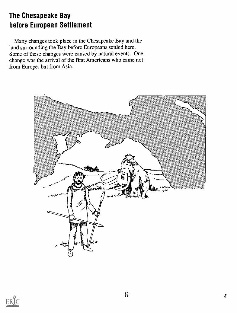
The Chesapeake Bay
before European Settlement
Many changes took place in the Chesapeake Bay and theland surrounding the Bay before Europeans settled here.Some of these changes were caused by natural events. Onechange was the arrival of the first Americans who came notfrom Europe, but from Asia.
2-
6 3

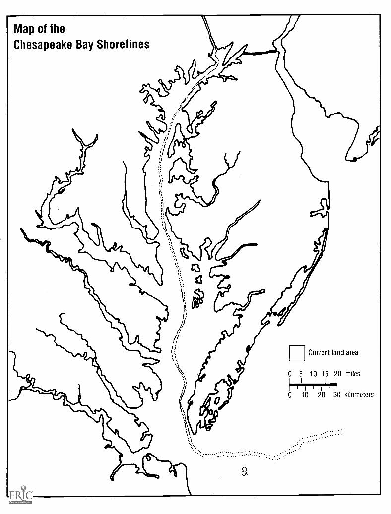
Chesapeake Challenge1. Color the spaces on the map of theold Chesapeake Bay on page 5 to seethe changes in the shape of the Che-sapeake Bay from a river valley 15,000years ago to the Bay as it is today. Useblue for the river 15,000 years ago andgreen for the Bay 3,000 years ago.
2. If you lived where you do now 8,000years ago, would you have been neareror farther from the shore of the Baythan you are today?
The End of the Last Ice AgeFour times during the last million years the great sheets of ice that
cover the polar region have slowly grown across Canada and down intothe United States. Only 20,000 years ago ice more than 180-200 m(600-700 ft) covered much of New York and Pennsylvania and evenextended into parts of Maryland. These periods are called the Ice Ages.In between these Ice Ages the Earth's climate warmed, and the icemelted. We are living during the warm period that followed the last IceAge. Earth scientists (geologists) do not know for sure what causedthese changes between warm and cold climates.
The water that formed the ice came from the ocean. When so muchwater was locked up as ice, sea level was much lower. Twenty thou-sand years ago sea level was 100 m (330 ft) lower than it is today.Where the Chesapeake Bay is now, there was a valley created by theSusquehanna River which flowed down the valley and into the AtlanticOcean.
Eighteen thousand years ago the Earth's climate began to warmslowly. As the ice melted, sea level rose. By 10,000 years ago theocean began to flood the lower Susquehanna Valley. By 3,000 yearsago, the shores of the Chesapeake Bay were almost where they aretoday. Even today sea level is still rising, but very slowly. Over the last100 years it has gone up at the rate of about 1 mm per year or about 4inches in 100 years.
`N.
gth/ A
4
IUD
7
Map of the
Chesapeake Bay Shorelines
Current land area
0 5 10 15 20 milesI
I
0 10 20 30 kilometers
a

Chesapeake Challenge1. Use the estimate given here to cal-culate how much sea level may rise in60 years, during your life.
Family Action1. Working together, list all the waysthat you and your family make carbondioxide. Can you think of some waysthat you and your family could changeyour way of life to decrease the amountof carbon dioxide you make?
2.In addition to reducing the fossil fuelyou use, your family can help reducethe carbon dioxide in the atmosphereby planting trees in your yard. Grow-ing trees use carbon dioxide whichthey get from the atmosphere.
6
Climate Change in the FutureScientists do not know what caused the changing pattern of cold and
warm climates that caused the Ice Ages. The different ideas about thecauses of the warming and cooling are called theories. Since it is notpossible to test these theories, we may never know for sure.
On the other hand, scientists often look to the future with guessesabout what will happen based on their observations of current and pastevents. These guesses are called predictions. One of the most importantpredictions for future change is increased heating of the Earth caused byincreasing amounts of carbon dioxide in the Earth's atmosphere.
People cause this change. We burn fossil fuels such as natural gas,coal, and oil to cook our food, heat our homes, run our cars and makemost of our electricity. Wood, the most common fuel for people in poorcountries, also releases carbon dioxide when it burns. Cutting andburning forests to clear land adds more.
Carbon dioxide gas absorbs the heat from the Sun. It also traps heatthat the Earth would lose to space. This trapping of heat is commonlycalled the "greenhouse effect" because it reminds people of the way agreenhouse warms up on a cold, sunny day.
The Earth's atmosphere is getting warmer. What do we know fromthe past about warm periods? As the climate heats up, more ice melts atthe North and South Poles. Sea level will start rising faster than thecurrent 1 mm per year. Predictions are as much as 2.5 cm (1 in) peryear.
7

The Land Changed as the Bay FormedAs the climate warmed and sea level rose, the plants and animals on
the land around the Chesapeake Bay changed too. During the last IceAge, the forests were similar to those that are now found in Canada.The trees were mostly spruce, fir and hemlock, whose needles remaingreen all year (evergreen). There were lush meadows and marshes onthe bottom of what is now the Chesapeake Bay and on the continentalshelf along the coast of the Atlantic Ocean.
Large plant-eating mammals roamed these meadows. They includedthe elephant-like mammoths and mastodons as well as bison, moose andelk. None of these animals are found in the Chesapeake Bay regiontoday. Elk and moose moved north as the climate warmed. Mastodonsand mammoths died out (became extinct). They may not have beenable to survive the changing climate. The eastern forest bison surviveduntil Europeans arrived. Then they were hunted to extinction. Whatevidence do we have that these animals were here? Fossil bones andteeth have been found on the bottom of the Chesapeake Bay and alongthe continental shelf.
Where did the Ice Age forests go? As the climate changed, eachgeneration of seedlings grew a little further north or a little higher in themountains where it was still cool. These same evergreen trees nowgrow in Canada and along the tops of the mountains in the easternUnited States. They were replaced in most of the Chesapeake Bayregion by trees that lose their leaves in winter such as oaks, hickories,beech and chestnuts. This area was covered in vast forests when thefirst Europeans arrived.
Chesapeake Challenge1. Plants and animals die out or be-come extinct for many reasons. Listtwo causes of extinction mentionedhere.
2. The Ice Age forests moved slowlynorth to Canada over thousands ofyears. Predict what might happen toplants and trees in the Chesapeakeregion in the future if the climatechanges rapidly due to the greenhouseeffect.
Family Action1. Explore a tiny bit of Maryland thathas survived from the Ice Age: Cra-nesville Sub-Arctic Swamp owned bythe Nature Conservancy and locatedon the border with West Virginia.
2. Discover what those Ice Age ani-mals looked like. The SmithsonianInstitution's Museum of Natural His-tory has exhibits on these animals inthe Hall of Evolution.
/
14111/11), 114\\
k\\\\I
Li
mammoth
//)
lipt :;2) ri 4(ppi , ,,)1/ Pq 4;Jig 5- ll/ k/ V Ii.11'(1 i '-'--- 0 lif f fi III4 4,01 k, Li
kl..,,.4,, v AliIkt,;', \-.1.," ii1 v\

Chesapeake Challenge1. Imagine that you were living in avillage on the shore of the ChesapeakeBay before Europeans came here. Listthe things your village site would needto make it a good place to live.
2. Imagine that you were an Indianchild of your own age living in a villagebefore Europeans came. List threethings that you might do to have fun.
Family Action1. Visit a museum that features thehistory of Native Americans such asthe Smithsonian Institution's Museumof Natural History.
2. Go camping and leave as muchmodern technology as possible athome.
8
The First Americans: Changing Ways of LifeThe first Americans came to North and South America from Asia by
walking across the land bridge exposed by lower sea level that joinedSiberia and Alaska during the last Ice Age. Archaeologists are scientistswho study human life before recorded history. They are still uncoveringnew discoveries about these first Americans. They have evidence thatpeople lived along the Susquehanna River as the Bay filled six thousandyears ago.
These first Americans hunted the mammoths, bison and caribou usingthrowing sticks (also called atlatls) and spears as weapons. They fol-lowed the herds of animals, hunting and gathering nuts, berries andother foods as they moved. Periodically the scattered small bandsgathered to trade and socialize.
The climate warmed and the herds of large animals disappeared as theforests changed and grew. The people living in the Chesapeake regionalso changed. They learned to hunt smaller game and work with wood.They gradually came to live in settled villages and to grow and harvestcrops. The most important were corn, beans and squash. They alsogrew strong tobacco which they smoked in pipes. A number of groupslived in scattered villages in the Chesapeake region when the firstEuropeans reached North America. Thinking they had reached theIndies (a region in Asia) the Europeans called these people Indians.Today they are also called Native Americans.
\Itt, 144 \V) i)1,1 No,
v,\\ tlo 4 \**4 k) t`k Ms.

The Chesapeake Bay as Seen by the EuropeansThe Spanish first settled in the New World in 1494 in the Caribbean.
By 1524 they had explored the Chesapeake Bay. It was the Englishwho founded settlements on the Chesapeake Bay, however. In 1607they founded Jamestown. From that village Captain John Smith led ex-plorations of the Bay and its surrounding land. These are his descrip-tions of the Bay and the people he found living there. (Spelling was notthe same in 1607 as now. It is changed enough for you to read.)
Of the Chesapeake Bay he wrote:
"There is but one entrance by Sea into this Country, and that is at themouth of a goodly Bay, 18 or 20 myles broad."
"Here are mountaines, hils, plaines, valleyes, rivers and brookes, allrunning most pleasantly into a faire Bay, compassed but for the mouth,with fruitfull and delightsome land."
"Virginia doth afford many excellent vegetables, and living Crea-tures, yet grasse there is little or none, but what grow in the lowMarishes: for all the Countrey is overgrowne with trees,"
Of the Native Americans he wrote:
"In March and Aprill they live much upon their fishing weires; andfeed on fish, Turkies, and Squirrels. In May and June they plant theirfields, and live most of Acornes, Walnuts, and fish. But to amend theirdyet, some disperse themselves in small companies, and live upon fish,beasts, crabs, oysters, land Tortoises, strawberries, mulberries, and suchlike. In June, July, and August, they feed upon roots, berries, fish, andgreene come.
"The men bestow their times in fishing, hunting, warres, and suchman-like exercises, scorning to be seene in any woman-like exercise,which is the cause that the woman be very painefull, and the men oftenidle. The women and children doe the rest of the worke. They makemats, baskets, pots, morters, pound their come, make their bread,prepare their victuals, plant their come, gather their come, beare allkinds of burdens, and such like."
,Pananator
Ito
ATPA:4 ei Aere
&woe4"
"_Fur cl r
Corn, Jcararar?°11;*.
a;i; Et
ITU/ ...n:q
Step( Saittp. ReLks.
0 ufttaptes beau:um'', ravlit
rgora;,kji.: Ili C.
-Worth"
nevar rode 1 2
Chesapeake Challenge1. What evidence in the writing ofCaptain Smith can you find for theimportance of the Bay in providingfood for the Indians?
2. What evidence do you find forSmith's opinion about the role of Na-tive American women? Do you thinkthe role of women among the Euro-pean settlers was different? What
about the role of women today in yourcommunity?
3. Write a page from an imaginaryjournal written by a member of CaptainSmith's company as they explored theBay.
an early map of Virginia and aEuropean view of Native Americans
9

Chesapeake Challenge1. Use a map of your state to find fiveNative American names for places-nearyou. Each name had a meaning. Forexample, Choptank means "it flows inthe opposite direction" referring to thetidal nature of the Choptank River. Usethe library to find the, meaning of thenames you found.
2. Have you ever fished using a meanssimilar to one the Indians used? Whatdid you do? Describe it.
3. Make a model of a weir used to trapfish swimming upstream.
Family Action1. Go fishing on the Chesapeake Bay orone of its rivers.
2. Contact a local nature center to seeif it sponsors canoe trips. Manymuseums and nature centers havecanoe trips, even for those who do notknow how. If you can canoe, look forplaces to rent canoes or go canoeing inthe Audubon Guide to the Mid-AtlanticStates.
Native Americansof the Chesapeake Bay Region
Archaeologists estimate that there were 65-150,000 people living insmall villages in the Bay region when Europeans first landed there.Captain John Smith generally recorded only the number of adult malesin each group he met. The numbers ranged from 20-300. Most hadfewer than 100. Many shared the same language. There were forty ormore villages in Delaware and Maryland alone. Rivers and the Bayoften formed the dividing line between groups. Today about all thatremains of these people are the Native American names we use eachday for our streets, towns, schools, rivers and the Bay itself. Chesa-peake means great shellfish bay.
The Chesapeake Bay provided many kinds of food for the Indians, asyou learned from reading Captain John Smith's words. They harvestedthese animals in ways that showed an understanding of the biology ofeach species. Many of their ways of fishing are still in use today.
Some kinds of fish were caught with baited hooks made of boneattached to lines of deer sinew or grasses. They also shot fish witharrows attached to lines or speared them from log canoes. When fishingat night, they used a small fire in the canoe. Many fish swim into or outof the Bay seasonally in large numbers. Those that swim up streams tolay their eggs were caught in weirs, traps made of poles and fibers thatwent across the stream. They also made traps of poles along the shoreto catch fish swimming up or down the Bay. Fish and other animalswere also taken in a hand-held net on a pole.
The Indians collected oysters and clams. Blue crabs were caughtmuch the way they are today with bait hung on lines. The crabs heldtight to their food as it was lifted to the surface. Mussels in the banks ofsalt marshes were collected by hand.
10
13

Native Americans and their EnvironmentThe Indians did not do much damage to their environment. There
were not very many of them. There may have been no more that 65-150,000 Native Americans in the entire Chesapeake Bay watershed.When their fields were worn out, they could move to a new place andthe forest would slowly take over the old fields. Likewise, if the gar-bage and human waste near a village became too great, they couldmove. The natural process of decay broke down the harmful parts,leaving only bits behind. Much of what we know about their way oflife comes from sifting through the trash they left behind. Animal bonesand plant remains tell us what they ate. Broken tools and pieces of potsand baskets tell us about their technology and culture.
Their tools were made of natural things: stone, bone and wood. Theirfishing nets and lines were made of plant and animal fibers. Some kindsof damage they did actually helped keep the numbers of kinds of plantsand animals high. They drove large game to hunters using fire. Wenow know that regular burning is needed by some kinds of plants andhabitats. After years of preventing forest fires, we have lost plants likethe longleaf pine which needs fire to compete with other pines.
Native Americans were skillful fighters. European settlers learnedways to fight from them that later helped win the Revolutionary War.But they lacked weapons of iron, steel, and gunpowder. Perhaps moreimportant, the Europeans brought many new diseases with them whichwere deadly for the Indians, such as measles and small pox. By 1756,war, disease and migration had reduced Maryland's Indian populationto 140 persons. A few Indians adapted to the European ways. JohnRolfe, the man who started growing tobacco in Virginia, married theIndian woman Captain John Smith called Pocahontas. Many of us haveIndians among our ancestors. Today there are still a few Native Ameri-cans living in the Chesapeake Bay region who preserve their heritage.
Chesapeake Challenge1. Visit the library and research a Na-tive American tribe of the Chesapeakeregion. The Powhatan, Piscataways,and Nanticokes are several you mightlook for. Generally, there were villageswith names similar to many of theBay's rivers. Write a short story aboutone day in the normal life of thesepeople. Include the ways they used theBay or a river in the story.
2. Compare the way the Native Ameri-cans used the Bay with our use of ittoday. Many of the uses are the same,but we are hurting the Bay while theydid not. Can you list two reasons why?
Family Action1. Check the contents of your garbagecans. The paper and other vegetablematerial will rot in time. What wouldsomeone be able to say about yourfamily and your way of life by examin-ing what would remain of your gar-bage in 1,000 years?
,, wrk,of: ft,
Aro(
401
11

The Natural History of the Chesapeake Bay
In order to understand and measure the changes in theChesapeake Bay's plants and animals, we need to know howthey live under natural, undisturbed conditions.
12 15

The Chesapeake Bay and its WatershedThe flooded Susquehanna River valley formed an estuary. An estu-
ary is a somewhat closed body of water where fresh water mixes withsalt water. An estuary opens into the ocean which is the source of thesalt water. The fresh water comes from rain or snow that falls onto theland and then drains away in streams, or comes from springs that bringgroundwater to the surface. Both join to become rivers that flow intothe estuary.
The Chesapeake Bay is enclosed by Delaware and the eastern parts ofMaryland and Virginia. On the western side are rolling hills and,farther away, the Appalachian Mountains. The Bay's opening to theAtlantic Ocean is in southern Virginia. The fresh water for the Baycomes from many rivers which drain about 64,000 square miles spreadover five states. The land which drains into the Chesapeake is called itswatershed. Everything that gets into the water anyplace in the water-shed of the Chesapeake Bay eventually ends up in the Bay.
Chesapeake Baywatershed
16
Chesapeake Challenge1. Look at the map. List the six statesin the watershed of the Bay.
2. On the map on pages 30 and 31 findand write in the names of these riversthat drain into the Bay:
Susquehanna RiverPatapsco RiverPotomac RiverPatuxent RiverRappahannock RiverYork RiverJames RiverChoptank RiverNanticoke River
3. Do you think more water enters theChesapeake Bay from the eastern sideor the western side? What evidencewould you give for your answer?
Family Action1. Locate where you live on a map.Find the stream or river nearest yourhome that flows into the ChesapeakeBay. Drive, walk, ride a bus or bicycleto it. Sit beside the stream and thinkabout the travels this water will maketo the Bay. Imagine yourself floatingalong for the ride the way a leaf might.Does it look clean or dirty? Can youthink of anything your family could doto help it? Later you will know lots ofways to help this stream or river. Fornow perhaps yourfamily could pick upany trash you see and dispose of itproperly.
2. If you live in a city, locate the stormdrain nearest your home. This draincarries rain and melted snow to water-ways that empty into the Bay. Is theretrash in the street? Anything that goesinto this drain will end up in the Bay,including all the trash. You can helpkeep the Bay clean by not throwingtrash.
13

Chesapeake Challenge1. Make a model of a watershed to seehow small streams join to becomerivers and flow into a bay. You willneed:
a baking pan or large plastic traya sheet of aluminum foil the length
of the panblocks, rocks or other objects to
be mountainsa sprinkling can or another way to
make "rain" such as a paper cupwith holes in the bottom
water
Put the blocks at one end of the pan formountains. Lay the foil in the pan ontop of the blocks. Press valleys be-tween the mountains which join andform a bay at the end away from themountains. Use the sprinkling can tomake rain in the mountains. (Thisactivity is used with permission andcomes from River Times published bythe Math and Science Center, 2401Hartman St., Richmond, Virginia23223.)
2. Describe the way the water moves inyour watershed.
3. Study the way plant nutrients collectin the Bay. Sprinkle 1/4 teaspoon of adark flavor of Kool-Aid over your wa-tershed to represent plant nutrients.Describe what happens to these plantnutrients when you make it rain. Thesame things happens to plant nutri-ents and loose dirt when it rains.
14
The Chesapeake Bay WatershedTwo things may happen to the rain and snow that falls on the Chesa-
peake Bay watershed, the land that drains into the Bay. Some of thewater runs over the land directly into streams and rivers and is calledrunoff. The rest of the water soaks into the soil and moves downthrough soil and rock until it reaches the groundwater where the spacesin the rock layers are full of water. When the groundwater meets thesurface of the earth, the water runs out as springs which also flow intostreams and eventually into the Bay. People tap into the groundwaterwhen they dig a well.
Both runoff and the water that soaks down through the soil picks upnatural chemicals from the soil that dissolve into water. You cannot seethem, but they are there in small amounts. Some of these chemicals arethings that help plants grow and are called plant nutrients. They are thesame things that are in fertilizer used in a vegetable garden or "plantfood" for a houseplant. Streams and rivers carry these plant nutrientsinto the Bay where they help make the Chesapeake Bay a good placefor plants that live in water.
watershed model
17

The Chesapeake Bay's Salt WaterWater that does not taste salty is called fresh water. Water that comes
from the ocean tastes salty because it has different kinds of chemicalscalled salts in it. Ocean water is also called sea water or salt water.
When fresh water and sea water mix, the saltiness is lower than thatof the ocean. This mix of fresh and salt water is called brackish water.The saltiness of brackish water varies from hardly any salt to almost asmuch as salt water. Most of the water in the Bay is brackish, but theamount of salt varies from place to place.
Because the Bay is partly enclosed by land, fresh water and salt watermeet and mix there. Fresh water in the Chesapeake Bay comes fromrivers, so the water is less salty at the mouths of rivers. Salt water fromthe Atlantic Ocean flows into the Bay at its opening in southern Vir-ginia so the Bay is saltier farther south.
Because fresh water is lighter than salt water, the fresh water floatsabove salt water. That means that if you test for the amount of salt inthe water (the salinity) in one place from top to bottom, the Bay will beless salty at its surface and more salty on the bottom. All of this meansthat saltiness or salinity of the Bay's water varies from north to southand from top to bottom.
Average Rainfall in MarylandNirginia by month
8
6
2
0
CDU-
5T.: a
CD = =a cZ CD
FALL SURFACE SALINITY
low (below 10 ppt.)
n medium (10-20 ppt.)
n high (20-30 ppt.)
ocean water is 35 ppt.
Chesapeake Challenge1. Look at the graph that shows theannual rainfall by month in the Che-sapeake region. What months is thesalinity of the Chesapeake Bay likely tobe lowest? What time of year is it likelyto be highest?
2. On the map on pages 30 and 31color the area of lowest salt yellow,somewhat salty green and most saltyblue.
3. Arrange these in order from saltiestwater to least salty water:
water from the surface of the Bayat its mouth
water from the surface of the Bayat the Susquehanna Riverwater from the surface at the middleof the Chesapeake Bay
water from the bottom of the Bayat its mouth

Chesapeake Challenge1. There are many estuaries in theUnited States. The Chesapeake Bay isthe largest. Use a map of the UnitedStates to locate and list three otherplaces that you predict are estuariesbased on what you have learned aboutthe characteristics of an estuary.
Family Action1. At dinner list all the things you canthink of that you eat that come from theChesapeake Bay.
16
What is Special About an Estuary?Estuaries have very high levels of plant nutrients because they are
almost enclosed by land. Freshwater runoff carries these nutrients fromthe land. Any body of water with high levels of plant nutrients has highnumbers of plants and algae. Since plants serve as food for all theanimals that live in the water, where there are lots of plants, there aremany animals.
In part because of the large food supply, estuaries are particularlygood places for many young animals to get their start. They are nurser-ies for many species of fish, shrimp and other animals that live in theocean as adults. Fish like shad, herring and striped bass (rockfish)migrate from the ocean through the estuary and into rivers to spawn, orlay their eggs. The eggs develop into larval (baby) fish which movedown into the estuary to feed and grow before leaving to live in theopen sea.
Other kinds of animals migrate to the estuary from the ocean becauseof the good supply of food. An abundant fish called menhaden comefor the phytoplankton (tiny algae in the water). Bluefish come to feedon menhaden. Waterfowl spend winters there and fly north in thespring to nest.
About half of the fish and other sea animals we eat depend on anestuary during some part of their life. When we damage an estuary, wenot only hurt the plants and animals that live there. We also destroy partof our food supply.
19

Tides in the Chesapeake BayThe force of gravity from the Moon and, to a lesser extent, the Sun
causes the water in the oceans to bulge out in some places on Earthwhile it is lower in others. If you stay in one place, the water levelalong the shore appears to rise and fall. These changes in water levelare called tides.
The tides in the Chesapeake Bay are complicated by the fact that thebulge enters at the mouth of the Bay from the ocean and moves up theBay. Before it reaches the top of the Bay, a trough of low water isalready following it up the Bay. Each 24.8 hours the water at a point inthe Bay rises and falls twice. The difference between high and low tideis about 2.5 feet at the mouth of the Bay in Virginia. It is only l to 2feet in Maryland.
The water in the rivers of the Chesapeake Bay also rises during par-ticularly heavy rains. When a strong wind blows up the Bay from thesouth, water tends to "pile up" at the top of the Bay. The combination ofa heavy rainstorm with winds from the south and a high tide causesflooding in cities such as Baltimore on rivers near the Bay.
Chesapeake Challenge1. Locate the tide chart in a newspaper.Check the sports section. Pick twolocations on the Bay. Estimate how farapart they are with your state map.Use the tide chart to calculate how fasta low or high tide travels up the Bay.
Family Action1. On a family trip to the edge of theChesapeake Bay such as a trip to a parkor Baltimore's Harborplace, note thelevel of the water at the time you arrive.Check changes during the day. Rec-ord your impressions of height andtime.
17
20

Chesapeake Challenge1. List two habitats found in shallowwater.
2. List two habitats where tides areimportant.
Chesapeake HabitatsThe Chesapeake Bay probably did not change very much after the sea
level stopped rising rapidly about 3,000 years ago. A variety of kindsof habitats (or places to live) existed then and still do. These are thekinds of habitats still found in the Chesapeake Bay.
Shoreline habitats: Tides affect the habitats along the shores of theChesapeake Bay. Sometimes they are covered by water and other timesthey are uncovered. Where waves disturb the shore, sandy beachesform. Where the water is calmer, the bottom is muddy. Large grassesgrow in many muddy places along the shore where the tide moves inand out. These form habitats we call marshes, which may cover a verylarge area. The saltiness of the water in marshes varies, depending onwhere the marsh is located. Some are even freshwater marshes.
Shallow water habitats: Other kinds of plants grow in the shallowwater just off shore. There are many different kinds of plants that growunderwater. The areas where they grow are called grass beds eventhough they are not really grasses. Another name for these plants issubmerged aquatic vegetation. (If you check a dictionary, you will fuldthat it is just a fancy way of saying underwater plants.) The kinds ofplants in an area depend on how salty the water is in that spot. Somekinds of animals also like shallow water such as oysters which livewhere the bottom is hard and the water is a certain saltiness. These arecalled oyster bars. Many places in the Chesapeake Bay have muddybottom where clams and worms live hidden in the mud.
Open water habitats: Away from shore the water gradually getsdeeper, although the deepest part of the Bay is only 52 meters (170feet). Larger fish and schools of fish are more common here. The plantsin the open water are tiny algae and cannot be seen without a micro-scope. They drift in the water in huge numbers, especially during thewarmer months.
18

Classifying Habitats of the Chesapeake BayClassification is a process in which things are grouped with other
things that are similar. Here we start with one big group: the naturalkinds of habitats in the Chesapeake Bay. This big group is divided intosmaller groups which have things in common. Classifying the differentkinds of places to live or habitats in the Chesapeake Bay is not easybecause of the differences in saltiness from place to place.
striped bass in sea grass
Chesapeake Challenge1. Use the Chesapeake Bay HabitatCards on pages 21 and 22. If this isyour own book, you might want to cutthem out. If you are using this in class,your teacher will give you the cards.Read each card carefully and then usethe classification system, or key, onpage 20 to identify each habitat. Startwith the two choices on the left. Pickthe one that matches the card and goto the next pair of choices. Soon youwill arrive at the name of your habitat.Can you get all eleven? Check youranswers in the back of this book.
1
2
3
4
5
6
7
8
9
10
11
2. Pick one of these Chesapeake Bayhabitats and research it using bookslike Life in the Chesapeake by Alice J.and Robert L. Lippson. Write one pageabout the kinds of plants and animalsyou might find there.
3. Using your research, draw a pictureof the habitat, showing the plants andanimals. Write their names on theback of the picture.
4.Write a travel ad encouraging peopleto visit the habitat you chose and illus-trate it.
19

Key
to th
e H
abita
ts o
f the
Che
sape
ake
Bay
on la
nd o
r no
t tid
alF
OR
ES
TS
AN
D S
TR
EA
MS
all o
r pa
rtun
cove
red
whe
ntid
e is
low
in w
ater
or
som
etim
esco
vere
d by
tide
s
alw
ays
cove
red
with
wat
er
23
tall
gras
ses
stic
kou
t of w
ater
no g
rass
es o
utof
wat
er
wat
er is
sha
llow
(6-1
0 ft)
wat
er is
dee
per
(mor
e th
an 6
-10
ft)
botto
m c
over
edw
ith h
ard
oyst
ersh
ells
wat
er is
sal
ty
wat
er h
as v
ery
little
or
nosa
ltine
ss
botto
m is
san
dy
botto
m n
otsa
ndy
SA
LT M
AR
SH
TID
AL
FR
ES
HW
AT
ER
MA
RS
H
SA
ND
Y B
EA
CH
botto
m is
mud
MU
D F
LAT
surf
ace
orR
OC
KY
SH
OR
Ebo
ttom
is h
ard
wat
er s
alty
SE
AG
RA
SS
BE
DS
wat
er s
light
lyW
EE
D B
ED
Ssa
lty o
r fr
esh
has
plan
tsgr
owin
g un
der-
wat
er
does
not
hav
eun
derw
ater
plan
ts
botto
m is
sof
t
SH
ALL
OW
WA
TE
R
OP
EN
WA
TE
R
OY
ST
ER
BA
R

Chesapeake Bay Habitats
2. Things living in shallow water are not uncovered bythe tides, but must be able to stand heat and cold, windand waves which make the water muddy, and even icein winter. But small fish are safer from the bigger fishthat eat them here, and there is lots of food. There maybe marshes and grass beds nearby which are places tohide if needed.
_0
0
0
4. Tall grasses grow up out of the water. Even thoughthe water has little or no salt, the tides push up the Bayor rivers far enough to cause the water level to changehere. Other plants like pond lilies also grow here. Theplants provide food for many kinds of invertebratesand fish which also hide among their stems.
b 11)1 1116
//
I
1. Where rocks are in shallow water along the shore,they may be uncovered by the tide. Manmade thingslike piers also have animals and plants that need hardsurfaces as places to attach. Where the water is salty,some seaweeds grow.
3. In the lower part of the Bay where the water is saltier,two kinds of plants may grow under the shallow water.They can only live where it is shallow because they arerooted on the bottom and need light to make food. Theplants are eaten by many animals and many more finda safe place to live among the plants. These plantsprotect the shore and reduce the muddiness of the waterby slowing the waves.
5. Fine bits of dirt make mud when they settle out of thewater. Where the muddy bottom is very shallow, it isuncovered at low tide. While this area may not looklike home to many animals, there are lots of creaturesliving down in the mud. Watch for shorebirds search-ing in the mud for some of them.

6. In some places where the saltiness is right and thereare dead oyster shells, oysters and many other animalslive. The water is deep enough to protect the animalsfrom being uncovered by the tides or disturbed by hardwaves.
8. The waves during storms push the grains of sand inever-changing patterns. During low tide the animalsthat live among the sand grains feel the summer heat orthe winter cold. Shorebirds search along the water'sedge forthese animals and for bits of food that wash infrom the Bay.
4_
10. Along the shore where the water is salty, tall grassesgrow out of the water. Tides move in and out, but someplaces are flooded only during storms and very hightides. These tough plants break down in the water toform little bits of food called detritus which manyanimals eat by filtering it out of the water.
7. In deep water little light reaches the bottom. Sinceplants need light, they do not grow here. The water isfilled with tiny, drifting algae which use the sunlightnear the surface to make food. The bottom is coveredwith mud which has settled from the water. In this openspace large schools of fish swim together.
-=`
4-
9. In shallow water where there is good light and thewater has little salt, underwater plants sometimesgrow. Some of these plants are valuable as food formany kinds of waterfowl such as ducks, geese andswans. All make places for little fish and other animalsto live and feed. These plants also slow water move-ment and protect the shore from waves.
11. Trees cover the land. Water runs among the trees.Sometimes the trees grow where there is very slowlyflowing fresh water around them.

Chesapeake Bay Food ChainsBay plants grow rooted to the bottom. Some are marsh grasses.
Others are underwater plants like seagrass, pondweed and seaweed.There are also many kinds of tiny algae which drift in the water withtides and currents. They are called phytoplankton, which means wan-dering plants. To grow they all need energy from sunlight and mineralnutrients from the soil or the water. These nutrients are chemicals thatcontain nitrogen or phosphorus. When there is not much sunlight ornutrients, plants and tiny algae grow slowly. If there is lots of light andnutrients, the plants grow fast.
Many Bay animals depend directly on these plants for food. Thealgae are filtered out of the water by clams, oysters and a fish calledmenhaden. The marsh grass is tough, but it is eaten by bacteria when itdies. They break the grass into small bits called detritus which are eatenby many animals. The underwater plants are softer. They are eaten byducks and geese, and even deer and muskrats. Some animals like snailseat different kinds of algae that grow on the surface of mud or marshgrasses.
Many small animals feed on algae and detritus. Some like wormsand barnacles live in the bottom or attached to surfaces. Others animalsdrift through the water, like the drifting algae. Because they are ani-mals, they are called zooplankton (zoo means animal). The smallzooplankton may be eaten by larger zooplankton like the jellyfish calledsting nettles or they may be eaten by small fish. The small fish becomedinner for larger fish or birds.
Different kinds of fish and birds specialize in eating the animals thatlive on or in the bottom. Blue crabs live on the bottom and eat mostanything from detritus to other animals. One kind of turtle that lives inthe salty part of the Bay, the diamondback terrapin, eats snails and otheranimals. Even raccoons eat many kinds of Bay animals which theycatch at low tide.
phytoplankton
zooplanktonsmall fish
Chesapeake Challenge1. The relationship of who eats whomis called a food chain (or food web).Place the following groups of animalsin the correct sequence with the foodproducer (plant) first:
a. diamondback terrapin, algae onmud, snailb.zooplankton, small fish, large fish,large fish-eating bird (osprey),phytoplankton
2. G roup these together into three pairsbased on their place in the food chain:bottom, middle or top.
small fish, larger fish, phytoplank-ton, fish-eating birds, underwaterplants, zooplankton
Family Action1. Take a look at your dinner tonight.Where would you fit in the food chain?What otheranimals might eat the kindsof food on your plate?
osprey
\_,
,,,,,,,,
,,,,,,,,,,,,,,,,,,,,, ,,,,,,,
\3 large fish
rX23

Chesapeake Challenges1. How big are they really? The pic-tures of Chesapeake Bay zooplanktonon this page tell you how much biggerthe drawing is than the animals are inreal life (100x means the picture is 100times bigger than the real animal.) Usea metric ruler to measure each draw-ing in millimeters (mm). Then divideby the number of times the drawingwas enlarged to find its the real size.
2. Order the kinds of zooplanktonshown on this page from smallest tolargest.
3. Pick one of the zooplankton on thispage and imagine what life would belike at that size, drifting with the watercurrents, eating and being eaten. Writea paragraph about how it would feel.
4. With your teacher's help, you cansee real zooplankton. Ask if she/he canbring some to class. (See Teacher/Parent section.)
24
Zooplankton in the Chesapeake BayThe term zooplankton means wandering (or drifting) animals. They
cannot swim strongly enough to go against currents or tides. Manypeople think that all zooplankton are tiny animals that can only be seenwith a microscope. Some are too small to see with your eyes, but manyothers are much larger. For example, jellyfish are zooplankton. Thereare thousands of kinds of animals that are zooplankton for all or part oftheir lives.
Some zooplankton feed on phytoplankton which is present in largeamounts in the Chesapeake Bay. Some even feed on tiny bacteriawhich are also common in Bay water. Different kinds of phytoplanktonin different seasons cause some zooplankton to be more successful thanothers. Larger zooplankton and small fish feed on smaller zooplankton.Zooplankton form several links in the food chain.
Some animals, such as copepods, are zooplankton all their lives.Other animals drift for only part of their lives and spend the rest swim-ming or on the bottom. Crabs and oysters drift as eggs and larvae(babies), but change as they grow. Blue crabs crawl from place to placeor swim, while oysters settle in one place forever. The eggs and larvaeof many of Chesapeake Bay fish are zooplankton until the young fishgrow large enough to swim against the currents.
Some zooplankton drift all the time, but others hide in or on thebottom some of the time and go up in the water to feed at others. Timeof day and tides are both important to these zooplankton.
The amounts and kinds of zooplankton in the Chesapeake Bay areimportant because most fish depend on them for food at some point.Striped bass larvae need the correct zooplankton to eat. No correctzooplankton, no striped bass.
Eutytemora 55X
copepods
Scottolana 55X
23Podon 65X
water flea

Blue Crabs in the Chesapeake BayBlue crabs live in estuaries all along the Atlantic and Gulf coasts, but
they are most often associated with Maryland where they are verypopular cooked in hot spices. About 1 million bushels are caught forfood each year. These crabs have swimming paddles on their fifth pairof legs which help them really get around. At one time or another bluecrabs can be found almost everywhere in the Bay.
Like all crustaceans, blue crabs shed their old, hard shell, expand andgrow a new one in order to grow larger. This is called molting. A crabthat has just molted is soft and helpless. These soft shell crabs hide inunderwater plants to avoid being eaten by fish or other crabs until theirnew shell hardens. On the other hand, a hard shelled blue crab isanything but defenseless. It uses its two claws to defend itself and to eatclams, oysters, dead fish and plants.
Male blue crabs stay in water of lower saltiness in rivers and towardthe top of the Bay. In winter the males migrate to deeper water, butduring the rest of the year they spread out into shallow water. Thefemales live in saltier water. From June to October males search forfemales ready for their last molt and mate with them when they are softshelled crabs.
Each female makes 1-2 million eggs! The fertilized eggs are carriedunder her body where they develop as she migrates toward the mouth ofthe Bay during the summer and late fall. There the eggs hatch, releasingtiny babies (larvae) called zoeae which become part of the zooplankton.They may even drift out into the ocean before being carried back intothe Bay by currents. They feed, molt and grow into another form calledmegalopae which settle to the bottom. As megalopae, they continue tofeed, grow, molt, and move with the bottom currents up the Bay. Theygradually begin to look like adult blue crabs. Crabs take from 12-20months to become adults and only live about 3 years.
Stages in the development of a blue crab
Chesapeake Challenge1. Mark the path that female crabs takein the Bay each year on the map onpage 26. Calculate the distance afemale travels from the Patapsco Riverin the upper Bay. From the Rappahan-nock River.
Family Action1. Visit a seafood market where bluecrabs are sold. Find out where thecrabs were caught. During the winteryou may not be able to find crabs. Inthe spring, you might be surprised bywhere they come from.
2. Rescue a live blue crab from themarket and keep it in a brackish wateraquarium. Observe its behavior, in-cluding feeding, swimming and de-fense. Does the crab have good vi-sion? Can it sense food in the water?Put a drop of food coloring in the waternear the back end of the crab. Wheredoes the water go?
3. Eat a cooked blue crab. Examine itseyes, legs and shell carefully beforeopening it. List at least three ways youobserve that a blue crab defends itselfagainst predators. (Hint: they are notred until they are cooked.)
4. Visit the Maryland Science Center'sChesapeake Bay exhibit. You will find agiant blue crab that welcomes you atthe exhibit entrance. Other places youcan see live blue crabs on displayinclude the National Aquarium in Bal-timore and the Virginia Marine ScienceMuseum in Virginia Beach, VA.
zoea 30Xmegalopa 30X
23-I/3X 25

0 5 10 15 20 milesHli LIT0 10 20 30 kilometers
JV

OystersOysters are related to clams and mussels. They have two rough,
heavy shells which they add to as their soft bodies grow. They need tolive on a firm bottom so that they do not get buried in mud. Male andfemale oysters release eggs and sperm to the water. The eggs becomedrifting larvae which must find a place to settle as they grow. Theygrow into baby oysters, called spat, which settle on the bottom, gener-ally on old oyster shells. Oysters make millions of eggs, but only a fewsurvive to become adults.
Oysters make a living filtering phytoplankton (tiny algae) from thewater. They also trap tiny bits of dirt in the water which are the samesize as the algae. They make pellets of their waste products and the dirtwhich they deposit on the bottom. Hence, oysters clean the water byremoving both algae and bits of dirt.
A Maryland biologist, Roger Newell, thinks that some of the changesin the Chesapeake Bay in the last 100 years might be caused by theoverharvesting of oysters. As the graph shows, oyster harvests in-creased until about 1880 and then dropped. They went down becauseso many oysters were taken that there were not enough left to producenew oysters. The Bay's oysters have also suffered from diseases andsnails called oyster drills which eat them. Dr. Newell thinks that as theoysters disappeared, the amount of phytoplankton increased because theoysters were not eating it.
Dr. Newell calculated that the oysters in the Bay in 1880 were filter-ing all the water in the Bay every 1.5-3 days. One thing we might dotoday to reduce the algae and tiny bits of dirt in the Bay's water is toprotect and increase oysters. We do know that there are too manyphytoplankton and too much dirt in the water and that oysters wouldhelp filter these out.
Chesapeake Challenge1. Research the biology of oysters anddesign a plan to increase the numberof oysters in the Chesapeake Bay.
2. Read the graph of the number ofbushels of oysters taken in Maryland.About how many million bushels didthey get in 1880? 1920? 1980?
3. Draw a Bay food chain with oysterspresent. Predict which groups of ani-mals would benefit if oysters wereremoved.
8
0
1840 1860 1880 1900 1920 1940 1960 1980 1988YEARS
3-i
young oysters on older oysters
27
Chesapeake Challenge1. Name another kind of animal dis-cussed in this booklet which filtersphytoplankton from the water.
2. Mark annual path of menhaden intoand out of the Bay on the map on page26, using a new color. They even swiminto low salinity areas like BaltimoreHarbor. Label it.
Family Action1 . Do you use menhaden in your home?Examine the labels of pet food bags tosee if your pets are eating fish meal. Ifyou have oil-based paints, check theirlabels too. If you eat eggs or chicken,you have eaten animals that were fedfish meal.
28
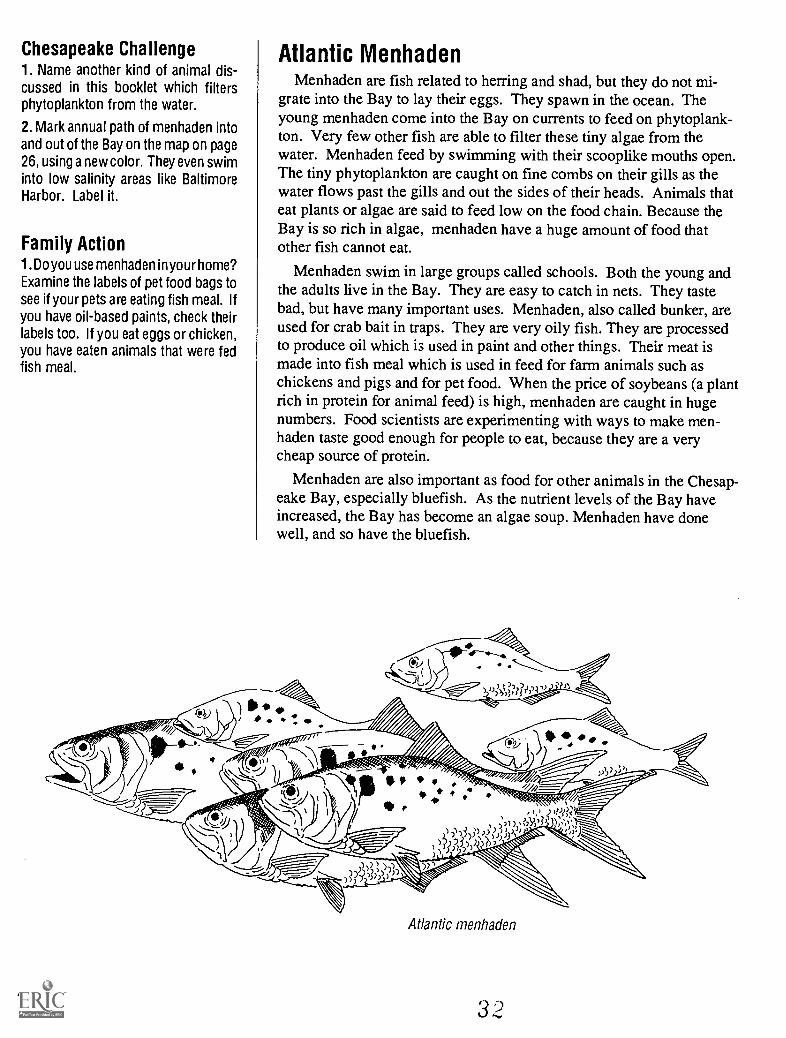
Atlantic MenhadenMenhaden are fish related to herring and shad, but they do not mi-
grate into the Bay to lay their eggs. They spawn in the ocean. Theyoung menhaden come into the Bay on currents to feed on phytoplank-ton. Very few other fish are able to filter these tiny algae from thewater. Menhaden feed by swimming with their scooplike mouths open.The tiny phytoplankton are caught on fine combs on their gills as thewater flows past the gills and out the sides of their heads. Animals thateat plants or algae are said to feed low on the food chain. Because theBay is so rich in algae, menhaden have a huge amount of food thatother fish cannot eat.
Menhaden swim in large groups called schools. Both the young andthe adults live in the Bay. They are easy to catch in nets. They tastebad, but have many important uses. Menhaden, also called bunker, areused for crab bait in traps. They are very oily fish. They are processedto produce oil which is used in paint and other things. Their meat ismade into fish meal which is used in feed for farm animals such aschickens and pigs and for pet food. When the price of soybeans (a plantrich in protein for animal feed) is high, menhaden are caught in hugenumbers. Food scientists are experimenting with ways to make men-haden taste good enough for people to eat, because they are a verycheap source of protein.
Menhaden are also important as food for other animals in the Chesap-eake Bay, especially bluefish. As the nutrient levels of the Bay haveincreased, the Bay has become an algae soup. Menhaden have donewell, and so have the bluefish.
Atlantic menhaden
32

Striped BassStriped bass (also called rockfish in the Chesapeake region) are the
most famous of the Bay fish. They are important both as sportfish andfor commercial catch. There have always been some ups and downs inthe number of rockfish. Currently, striped bass are in serious trouble.
Striped bass migrate up the Bay to almost fresh water to lay theireggs (spawn) in rivers each spring. The babies (larvae) feed on zo-oplankton and grow. As young fish, they move to saltier water to feed.Some Chesapeake Bay striped bass stay in the Bay, but others swim outinto the ocean and up the coast as far as Nova Scotia. These fish returnto the Bay to lay their eggs.
What has caused the low number of rockfish? There are a number ofideas. The problem is probably with spawning and the young fish.Acid rain is killing the eggs and larvae in some rivers. The middle At-lantic states have very acid rain. In other rivers toxic materials arekilling the young. Some people also think that the zooplankton in theBay have changed and are not right for the young fish to eat. There isone thing we do know. The size that is legal to catch and keep has beentoo small. Fishermen took the larger fish that are most successful asmothers. The bigger fish need protection as they are the best at makinggood eggs. Some state laws have increased the legal size.
States around the Bay and up the coast need to cooperate for therockfish to increase. There are still some large striped bass in the Bayso it is not too late if we can solve their problems.
Chesapeake Challenge1. Use the map on page 30 to find NovaScotia and estimate how far a stripedbass swims from the Bay to get toNova Scotia.
2. Fishing laws are made by each state.Striped bass are caught in most statesbetween North Carolina and Nova Sco-tia. How many states and provinceswould have to cooperate in makingfishing laws to protect a fish that swimsfrom the Bay to Canada?
3.Test for acid rain with special paper.Your teacher may have some or it canbe ordered from garden catalogs thatsell soil testing materials. Use a glassjar to catch the rain. Test it, and recordyour results each time it rains. 7
means the rain is not acid. Lowernumbers indicate acid conditions.Numbers lower than 5 are very acidrain. Remember March to June is thetime for fish to spawn in the Bay.
4. Research acid rain in the library.List 3 things that cause acid rain. List3 things that could be done to reduceit.
5. Mark the route of striped bass in theBay on the map on page 26. Use a newcolor and label it.
Family Action1. Check with your state fish and gamedepartment to see if there is a stripedbass hatchery you can visit.
striped bass
33 29

Che
sape
ake
Bay
Wat
ersh
ed/
\
The
Che
sape
ake
Bay
and
its
Wat
ersh
ed
wat
ersh
ed
125
250
mile
s
375
kilo
met
ers
o

land
are
a
05
10 1
5 20
mile
sI
I
010
2030
kilo
met
ers
3

Changes in the Chesapeake Bay and its
Watershed Caused by European Settlement
European settlers caused enormous changes on the landaround the Chesapeake Bay and in the Bay itself. Thesechanges came about because of the way they used the landand the Bay. While the settlers grew in numbers and inwealth, they caused changes which continue to harm the Baytoday.
32 33
European Settlement of the Chesapeake BayEnglish people made their first permanent settlement in Virginia on
what they called the James River in 1607. The sponsor of the colonywas the London Company. Their goals were to find gold and othervaluable materials and to find a sailing route to the Pacific Ocean,commonly called the Northwest Passage. They chose a point of landthat was almost surrounded by water which would be easy to defendagainst the Native Americans who lived nearby and were not entirelyhappy about the new village. The land was low and swampy with mos-quitoes that carried malaria and the sandy soil was not good for crops.They called the settlement James Towne (Jamestown) for the Englishking. Disease, hunger and conflict with the Indians caused misery anddeath among the early settlers.
After 1605 Catholics were persecuted in England. In spite of this,George Calvert, the first Lord Baltimore, converted to the Catholicreligion. After an attempt to settle Newfoundland failed because of thecold, he became interested in the Virginia area where settlers hadovercome early problems. In 1632 he got a warrant from the Englishking for the land from "the River Pattomack" to the Delaware Bay andthe 40th parallel and westward to the "Pattomack" headwaters. He diedbut his son sent a group in two small ships, the Ark and the Dove.They arrived in Maryland in spring of 1634.
The Maryland settlers learned from the Jamestown experience. Theyfirst met with the Indians, the Piscataways, and purchased a villagefrom them. They got shelter and fields already planted with crops on asite with good water and a deep creek for their ships. They renamed thevillage St. Mary's City. They did have a "war" in April and May of1635 with William Claibourne who had started a fur trading post onKent Island in 1631. He traded with the Susquehannock Indians whocame down from the north with furs. Claibourne refused to pay rent tothe new colony.
Chesapeake Challenge1. Locate the sites of Jamestown andSt. Mary's City on the map on pages 30and 31 and write in their names.
2.Compare each in terms of wherethey are in relation to the rest of thestate. Why do you think both werelater replaced as state capitols?
Family Action1. Visit Jamestown or St. Mary's City.The original buildings have mostly beenlost, but reconstructed buildings andships give you an idea about life inthese settlements. If you go duringthe winter when there are not manypeople, you can sit quietly in one of theships and imagine how scary it musthave been to cross the Atlantic Oceanin such a craft. The park at St. Mary'sCity includes a reconstruction of anIndian dwelling as well.
33 33

Chesapeake Challenge1. Graph the rate at which tobaccosales from the Virginia colony grew.
2.Tobacco was packed for shipping inhuge barrels called hogsheads. Thesewere often gotten to port by beingrolled, pulled by oxen or horses. Theroads used were called rolling roads.Have you ever seen a local road calledRolling Road? Using the index, try tolocate roads with this name on a localmap.
Family Action1. Visit a living history farm wheretobacco and other early crops are grownin much the same way that the earlycolonists did: the National ColonialFarm in Accokeek, MD south of Wash-ington, DC.
34
Growing TobaccoJamestown might have been abandoned if John Rolfe had not started
growing tobacco in 1612. The Indians grew and smoked a rough, nativetobacco. Rolfe imported better quality tobacco seeds from the Caribbeanand experimented with growing it. Tobacco was profitable for the newcolonies. The first crop was shipped to England in 1613. In 1615 2,300lbs were sent to England. By 1617, 20,000 lbs were shipped. Ten yearslater, 200,000 lbs were sent to England.
Tobacco requires many people to plant, weed and harvest it. It is alabor-intensive crop. Initially, the work of raising tobacco was done byindentured servants, people who paid for their trip to the colony by agree-ing to work for a set number of years for free. At the end of that period,often 5-7 years, they were given land, food and tools. A Dutch pirate left20 blacks he had captured in the West Indies in Jamestown, the start ofslavery. Slaves eventually replaced indentured servants as the labor forceused to raise tobacco. Early in the colony, land owners, servants andslaves lived, worked and ate together, according to archaeologists whostudy old sites. Later, as farms grew into plantations and landownersbecame wealthy, slaves lived and ate in separate quarters.
Tobacco uses up the nutrients in the soil very rapidly. It is said to"wear the soil out." New land was continuously cleared of trees to re-place the worn out fields. As tobacco growing spread, the forest disap-peared. When the land was used up, it was abandoned. Frances Trollopetravelled between Washington, DC and Richmond, Virginia in 1830. Hedescribed the trip through a wasteland of abandoned, eroded fields. Eventoday when driving on Interstate 95 between Richmond and Washington,you can see how only stunted trees grow in much of this area.
Tobacco is still grown is southern Maryland. You may see it if youtravel along country roads there in summer. In Maryland on Route 301you pass tobacco storage and auction houses in several locations, includ-ing a very large one in Upper Marlboro.
200,000
100,000
20,000
01
1613 1615 1617
40
1627

The Force of Moving WaterThe force of moving water is very powerful. Moving water has the
power to pick up and carry soil particles in a process called erosion.Tides and waves can erode shorelines. The faster water moves, thelarger are the particles it can carry. During floods, rivers can moveboulders. When water stands still, particles of soil settle out.
Rain and melting snow pick up bits of dirt and carry them intostreams and rivers. In streams where the water runs rapidly, theseparticles stay in the water. Where streams enter slower moving rivers,the sand and gravel and larger bits of soil settle to the bottom. Whenrivers enter the Bay, the water slows even more and more of the par-ticles settle out. The movement of the Bay due to tides, wind andcurrents keeps some of these particles in the water, making it lookmuddy.
Erosion increases with greater rainfall such as a big storm and whenthe water runs over steep slopes. It is also much greater when there areno plants growing in the soil to hold it in place. When Captain JohnSmith wrote about the Chesapeake Bay region, he said that the water-shed was covered with forests. The early European settlers cleared theforest for fields and for logs to build homes. Forests were also cut forfuel. Soil, especially from farms, eroded from the land and washed intorivers and the Bay, filling in the shoreline. Upper Marlboro was atobacco shipping port in the early days of Maryland. Now it is eightmiles upstream from water deep enough for a boat. It was filled in withdirt that washed off of the fields on tobacco farms.
Chesapeake Challenge1.Test the erosion power of water witha sprinkling can of water, two pencilsand two sheets of paper. Go outsideand locate a place with grass and onewith bare dirt. Put the pencils throughthe papers so that the papers look likea ship's sails. Poke one into a patch ofbare dirt and the other in grass. Usethe watering can to make it rain hardnext to the papers. Which one getsdirty? What does this tell you aboutthe value of plants in reducing ero-sion?
2. Compare the effect of a "hard" rainvs. a "gentle" rain on a pan of dirt,using a watering can. Collect the wateras it runs off. Compare the effect of thesame "rainfall" on a steep vs. a slightslope.
3. Test whether large particles of soilsettle faster than small ones with a tall,clear jar, a lid, some water and somedirt. Shake the dirt and water in theclosed jar and then let it sit. Are theredifferences in the size of the particlesthat settle to the bottom first?
Family Action1. Visit a stream near your home withyour parents right after a rain storm.What is the color of the water? Do youthink this is due to erosion? (Be care-ful around streams.)
\\ \Ju.. 6/4;;;;*0-0/.//"
Qles.t,"
.1.214.4.
01
35 -

Chesapeake Challenge1. Use a state or local map to find thename of roads or towns that have theword mill in them. How many can youlist? Can you find the stream or riverthat provided the water powerfor each?
2. Work with others to design a waterwheel that lifts a weight. You will needto do some library research on howwheels were designed in the past. Ifyou are doing this for school, have acontest to see which group can makethe water wheel that lifts a one poundweight the highest with one gallon ofwater poured no more than six inchesabove the wheel.
3. List the large, modern dams youfind on your state map. Hint: look forlakes created by the dams.
4. Draw or make a model of a dam witha fish ladder.
Family Action1. Plan a visit a mill that still works.There are a number of mills operatingas museums. Here are several:
MarylandUnion Mills Homestead and Grist-
mill, Carroll Co., MD
VirginiaTackett's Mill, Occoquan, VA
Woodlawn Plantation, Fort Belvoir,VA
Wade's Mill, Raphine, VAMabry's Mill, milepost 176, Blue
Ridge Parkway, VA
36
Using Water PowerWater power was used to do all kinds of work that we do with elec-
tricity or fuel today. Places that used water power were called mills.Water turned a large wheel. A system of gears and belts made thatturning motion drive machines. Mills used water power to grind corn orwheat. Moving water also ran machines which wove fabric, cut lumber,shaped metal and ground ore.
Where land sloped and water ran downhill, a dam was built to forcewater to flow to the water wheel. Sometimes mill ponds were made toinsure a steady flow of water all year. Where the land was flat on thecoastal plain, tidal creeks were closed to make a narrow openingthrough which the tide ran very fast in and out. A mill wheel was put inthe opening. The gears in the mill were designed so that the wheelcould turn either way.
Today rivers are dammed to generate electricity. The water turns awheel inside the generator instead of a mill wheel. We often use elec-tric power to do the same things people used to do with water power:grind grain, mill lumber and weave fabric. The large dams which makeelectricity also store water so that we have a constant water supply.
One problem with dams on streams and rivers is that they block thepath of fish that must swim upstream from the ocean to fresh water inorder to lay eggs. Some big modern dams may have "fish ladders"which make a "stream" around the dam where fish can swim uphill overa series of little waterfalls. Dams remain a problem for spawning fish,like shad and herring. In modern times the pipes that carry streamsunder roads may also create waterfalls that fish cannot get over. Oneestimate is that there are more than 750 places on Maryland streams thatstop fish from swimming upstream to lay their eggs.
undershot water mill
42

Travel and Trade in Early TimesNative Americans of the Chesapeake region traveled and traded over
a wide area. They used large log canoes to travel by water. They alsohad a system of trails through the forests, many of which became ourroads. The larger loads of the early European settlers were most easilyshipped by water. As a result their farms and villages grew along theshores of the Chesapeake and up its rivers. The Bay and its riversdetermined where these people took land and started farms. For the firsttwo hundred years of European settlement, ships and boats were themost important transportation in the Chesapeake region.
Towns for trading and shipping were started as high up rivers as boatsand ships could go. In some cases this was determined by the depth ofthe water. But many towns were established on rivers at the "fall line,"where the rolling hills (called the piedmont which means foot of themountains) meet the flat coastal plain. This is the location of the lastwaterfalls as the river flows from the mountains to the Bay. Among thecities built on the fall line are Richmond, Virginia, and Washington,DC.
Until the 1800's when canals were dug alongside the rivers, the fallline was the point at which goods and crops had to move over land. Theremains of canals can be seen along the James, Potomac andSusquehanna Rivers above the fall line even today. Boats were towedup and down the canal by mules or other animals. The C and D Canalwhich connects the upper Chesapeake Bay with Delaware Bay is still inuse, not only by ships but also by migrating striped bass. When thiscanal was enlarged in modern times, it may have changed the flow ofwater in the upper Bay, causing problems.
Chesapeake Challenge1. Locate Richmond, Washington andthe mouth of the Susquehanna Riveron the Chesapeake Bay map on pages30 and 31. Draw a dotted line with aslight curve connecting these points.Label it Fall Line. Use your state mapto find and mark two other cities thatwere built on the fall line.
2. Locate and label the C and D Canalon the same map.
Family Action1. Take a day trip to visit one of the oldcanals dug to take vessels up riverabove the fall line. Look for locks(water was pumped into or drainedfrom .a lock to raise or lower the boat),a tow path and tavern or lock keeper'shouse. Here are some places whereparks have been made which includecanals:
MarylandC and 0 Canal National Park His-
torical Park (upper center in Cum-berland, MD and lower center atGreat Falls, MD; lock #24 in Seneca,MD)
C and D Canal, Chesapeake City,MD
VirginiaThe Tidewater Connection in
Richmond, Virginia
4 3 37

Chesapeake Challenge1. Discover the name of each Chesa-peakeBay ship by using the classification systemon page 41. Start at the left hand side andmake a choice between the first two char-acters after reading the card. Follow yourchoice to the next two characters. Keepgoing until you find the name of the boat orship. Then turn the card over to check thename and learn more about the use andorigins of this vessel.
Family Action1. See these and other Chesapeake Bayboats and ships at these museums:
Maryland'Calvert Marine Museum, Solomons,MD'Chesapeake Bay Maritime Museum,St. Michael's, MD-Outdoor History Museum, St. Mary'sCity, MD'Patuxent River Park, Croom, MD'Potomac Museum, Coltons Point, MD'Baltimore Inner Harbor, Baltimore, MD
Virginia'Jamestown Festival Park, Jamestown,VA
'Mariners Museum, Newport News, VA
2. Visit other museums in the ChesapeakeBay region that also have maritime historyexhibits, but may not have boats or ships.These would be fun if you are interested inthe history of shipping or fishing in theChesapeake Bay region. They include:
Maryland'Chesapeake and Delaware Canal Mu-seum'Crisfield Historical Museum, Crisfield,MD
"Neild Maritime Museum, Cambridge,MD
'Oxford Museum, Oxford, MD'Radcliff Maritime Museum, MarylandHistorical Society, Baltimore, MD
Virginia'Chesapeake Bay Watermen's Museum,Yorktown, VA"New Comfort Point Lighthouse Mu-seum, Mathews, VA
38
Working Boatsand Ships of the Chesapeake Bay
Literally hundreds of kinds of boats and ships have sailed the Che-sapeake Bay. They have served every possible use: transportation ofpeople and cargo from across a creek or around the world, fishing,fighting wars and racing. There are some that are unique to the Bay.Nine of these working boats and ships are pictured on cards on the nextpage, along with a description. If this is your own book, you might wantto cut them out. Check with your teacher or parent first.
When reading the cards, you may find words that describe the shipsor boats that are new to you. Here are some boat terms to remember.The bow is the front (forward) of the ship and the stern, the back (aft).The poles that hold the sails upright are called the masts. A sloop hasone mast while a schooner has two or more masts close together.Sometimes they have additions to the masts called topmasts. Rakedmasts are tilted backwards toward the stern.
1
2
3
4
5
6
7
8
9 44

1. P
ower
ed b
y a
mot
or (
ofte
n an
old
car
eng
ine)
,th
ese
boat
s ar
e us
ually
30
to 4
5 fe
et lo
ng, w
ith a
smal
l cab
in in
fro
nt a
nd a
cov
ered
dec
k.
A
-
4. S
choo
ner
rigg
ed w
ith tw
o ra
ked
mas
ts a
ndto
pmas
ts, t
his
very
fas
t shi
p ca
rrie
d ca
rgo
all
over
the
wor
ld in
rec
ord
times
.
7. S
choo
ner
rigg
ed w
ith th
ree
or f
our
mas
ts; v
ery
long
and
nar
row
, with
str
aigh
t sid
es; s
low
and
barg
elik
e.
2. G
race
ful,
shar
p bo
w a
nd s
quar
ed s
tern
; asi
ngle
mas
t with
slo
op r
igge
d sa
ils.
-4
5. B
oth
ends
are
poi
nted
(do
uble
-end
ed);
mov
edby
pad
dlin
g.
8. B
oth
ends
are
poi
nted
(do
uble
-end
ed):
mad
e of
shap
ed b
oard
s; o
ne m
ast f
ixed
.
3. B
oth
ends
are
poi
nted
(do
uble
-end
ed);
mad
efr
om f
ive
logs
car
ved
with
met
al to
ols;
two
re-
mov
able
mas
ts.
6. P
ower
ed b
y a
mot
or (
usua
lly a
n ol
d ca
r en
gine
),th
ese
little
boa
ts a
re to
wed
or
hang
beh
ind
saili
ng
ship
s. T
hey
are
open
, but
may
hav
e a
hous
ing
over
the
mot
or.
9. S
choo
ner
rigg
ed w
ith tw
o cu
rved
, rak
ed m
asts
,th
e se
cond
with
a to
pmas
t; fa
st s
ailin
g sh
ip 5
4-76
ft lo
ng.
A n 0

SAIL
ING
LO
G C
AN
OE
The
se s
hips
evo
lved
from
the
log
cano
es u
sed
by th
e N
ativ
e A
mer
i-ca
ns, r
igge
d w
ith s
ails
. The
se o
pen
boat
s w
ere
fast
but
off
ered
littl
e pr
otec
tion
from
the
wea
ther
.T
hey
are
still
use
d to
day
for
race
s.
YA
WL
BO
AT
S T
hese
littl
e bo
ats
evol
ved
from
the
smal
l cra
ft c
arri
ed b
y sa
iling
shi
ps w
hich
wer
e ro
wed
ash
ore.
The
y w
ork
as m
ini t
ug-
boat
s, p
ushi
ng o
r pu
lling
sai
ling
ship
s. O
n th
eda
ys o
yste
r dr
edge
rs a
re a
llow
ed to
use
a m
otor
,th
ese
little
"pu
sh b
oats
" pr
ovid
e th
e po
wer
for
the
skip
jack
.
PUN
GY
The
se s
wif
t shi
ps e
volv
ed f
rom
the
Bal
timor
e cl
ippe
r, b
ut w
ere
desi
gned
for
use
on
the
Bay
whe
re th
ey f
requ
ently
car
ried
per
ish-
able
car
go f
rom
por
t to
port
. The
y w
ere
the
firs
tsh
ips
used
for
oys
ter
dred
ging
. Lik
e th
e ea
rly
skip
jack
s, th
ey w
ere
pain
ted
pink
and
gre
en.
The
ir d
eep
draf
t kep
t the
m o
ut o
f sh
allo
w w
ater
.
/1
SKIP
JAC
K A
s oy
ster
s be
cam
e sc
arce
, the
sesm
alle
r cr
aft w
ith f
ewer
cre
w m
embe
rs w
ere
mad
e fo
r dr
edgi
ng. S
ome
30 w
ere
still
lice
nsed
to d
redg
e in
198
0, th
e la
st c
omm
erci
al s
ailin
gfl
eet i
n th
e U
nite
d St
ates
.
-4
LO
G C
AN
OE
The
se w
ere
mad
e fr
om a
sin
gle
log
by N
ativ
e A
mer
ican
s. T
hey
wer
e ho
llow
edou
t by
repe
ated
ly b
urni
ng a
nd s
crap
ing
the
burn
edar
ea. S
ome
wer
e as
muc
h as
fif
ty f
eet l
ong.
BU
GE
YE
The
se g
race
ful s
hips
tow
ed o
yste
rdr
edge
s an
d ha
uled
veg
etab
les,
lum
ber,
and
coa
l.T
hey
wer
e al
so s
aile
d by
pir
ates
and
whi
skey
smug
gler
s. T
hey
evol
ved
from
log
cano
es, b
utw
ere
larg
er a
nd h
ad a
cov
ered
dec
k an
d ca
bin
forw
ard.
rt
DE
AD
RIS
E N
amed
for
the
stra
ight
fro
m th
ece
nter
to th
e si
de o
f th
e bo
ttom
, the
se b
oats
are
the
mos
t com
mon
wat
erm
en's
wor
kboa
t tod
ay.
The
y m
ay b
e ri
gged
for
cra
bbin
g, o
yste
r to
ngin
gor
cla
m d
redg
ing.
In
betw
een
times
, the
y ar
eus
ed f
or f
ishi
ng.
BA
LT
IMO
RE
CL
IPPE
R T
hese
fas
t and
gra
ce-
ful s
hips
evo
lved
fro
m th
ose
used
by
priv
atee
rsan
d bl
ocka
de r
unne
rs d
urin
g th
e R
evol
utio
nary
War
. The
y w
ere
com
mon
in th
e fi
rst h
alf
of th
e19
th c
entu
ry, b
ut w
ere
repl
aced
by
stea
m s
hips
and
trai
ns.
RA
MS
The
se lo
ng n
arro
w s
choo
ners
wer
e de
-si
gned
to b
e sa
iled
thro
ugh
the
24 f
t wid
e C
and
D C
anal
at t
he to
p of
the
Bay
. The
y w
ere
real
lyon
ly s
ailin
g ba
rges
, but
som
e br
ave
sailo
rs u
sed
them
in th
e oc
ean
too.

Key
to S
ome
Che
sape
ake
Bay
Boa
ts a
nd S
hips
pow
ered
by
am
otor
pow
ered
by
win
d or
han
d
49
smal
l, op
enY
AW
L B
OA
Tbo
at(o
r P
US
H B
OA
T)
larg
e (3
5-50
')bo
at w
ith c
abin
forw
ard
both
end
sna
rrow
to p
oint
(dou
ble-
ende
d)
bow
sha
rp, s
ter
flatte
ned
mov
ed b
ypa
ddlin
g, n
osa
ils
mov
ed b
y sa
ilson
two
mas
ts
mad
e of
five
logs
mad
e of
sha
ped
boar
ds
DE
AD
RIS
E
LOG
CA
NO
E
SA
ILIN
G L
OG
CA
NO
E
smal
l with
one
mas
t (sl
oop)
larg
er w
ith tw
oor
mor
e m
asts
(sch
oone
r)
two
mas
ts,
curv
ing
tow
ard
bow
(fr
ont o
fsh
ip)
two
or m
ore
mas
ts, n
otcu
rved
tow
ard
bow
tong
, fla
tsid
ed
BU
GE
YE
SK
IPJA
CK
PU
NG
Y
slee
k sc
hoon
er
scho
oner
BA
LTIM
OR
E
CLI
PP
ER
RA
M
50

Chesapeake Challenge1. Write letters to the Maryland andVirginia departments that regulate fish-ing and ask for copies of the regula-tions for sport and commercial fish-ing, oystering and crabbing in the Che-sapeake Bay. Compare the regula-tions. How are they the same? Differ-ent? Why do you think the two statesdo not agree?
Maryland Department ofNatural ResourcesTawes State Office Building580 Taylor St.Annapolis, MD 21401
Virginia Fisheries ManagementDivisionP.O. Box 756Newport News, VA 23607
Fishing the BayThe animals of the Chesapeake Bay are an important source of food.
The early settlers learned to fish from the Indians. Studies by archae-ologists show that in addition to collecting crabs and oysters, the earlycolonists commonly used a hook and line to catch fish. This was donefrom shore with little equipment. As tobacco plantations grew and therewere more mouths to feed, the colonists learned to harvest the hugeseasonal schools of shad and herring, using large nets and many per-sons. With ever larger nets, it was possible to catch almost all of thefish swimming upstream to lay their eggs, greatly reducing their num-bers.
Oysters once covered 2300 square miles of the bottom of the Bay.People learned to take oysters with scissor-like tongs. In the early1800's the New England oyster beds were over fished so the Yankeedredge boats came to the southern Chesapeake. They collected oystersby dragging a heavy iron scraper and chain net across the oyster bedswhich damaged the beds. In 1810 Virginia outlawed dredgers, allowingonly the less destructive tongs. Maryland waited until 1820 to outlawdredging. By then the Maryland watermen had learned to makedredges. They used them illegally, until dredges were made legal inMaryland around the time of the Civil War.
Many rich oyster beds were on the boundary of Maryland and Vir-ginia. Watermen from the two states fought over the oysters and theways they were taken. In the late 1800's the "Oyster Wars" became sobad that both states created oyster police to enforce the laws protectingoyster beds. Pirate dredgers operated out of both states. The tongersand dredgers did some shooting, too. The last men to die in the OysterWars were killed in 1959. A current argument concerns taking oystersusing SCUBA. Overharvesting and disease have so reduced the oystersthat there are hardly enough to fight over.
Some old fishing ways are still used. Pound nets are based on Indiandesigns for trapping fish alive. Only the valuable fish are taken and therest released. People still use baited "trot lines" for crabs. On the otherhand, most crabs caught for sale are taken in wire traps. Clams aredredged from the muddy bottom with a mechanical digging systemmounted on a boat. Some new fishing methods threaten to wipe out thefew remaining fish of some species. Gill nets catch fish as they try toswim through the wide holes in the net. They catch all fish over acertain size. The fish die so unwanted fish cannot be released. The netsaccidently kill diving birds, dolphins and sea turtles.
oyster dredge
42

The Chesapeake Bay Today
The Chesapeake Bay today is different from the way it waswhen Europeans first came. The actions of all people livingaround the Bay have changed it. This section will help youunderstand the results of the changes we have made in thewatershed and the Bay. It will also talk about changes we canmake in the way we live that will help the Bay in the future.Each of us is responsible for the future of the ChesapeakeBay.
ION14autimmina
les
Ilimaisuann
a ala DanIL a Da aern PC ao 1160 aO aa ao aa aNo 000 pc 0 De000 00 110 0
ars at*ao 00
012111111000accoossoogb Do OCHS
SO
c 9
4
44
1-1 r1 _1 I ru 1. OM1a C II=S
C INIC IMOSc
4"IC
oSaO cSaOOa00c.oc aaaaaaaaosoo
Goa. .
43

Chesapeake Challenge1. Here is a series of cards that showsome of the kinds of habitats peoplehave created in the Chesapeake Baywatershed. First, look at the pictureand text to see if you can predict whatkind of habitat you have based on yourobservation of the picture. Then usethe chart on page 47 to identify it. Ateach step you will decide between twochoices. Follow your choice to thenext pair of choices until you identifyyour habitat.
1
2
3
4
5
6
7
8
9
2. Predict the ways that each humanhabitat might affect the ChesapeakeBay. Then turn the card over to checkyour answer and see if your predic-tions are correct.
44
Habitats in theChesapeake Bay Watershed Today
When Europeans came to the Bay, the land was covered in forestswith scattered Native American villages. The land around the Bay haschanged tremendously in the last 350 years. You have learned aboutthe natural habitats of the Chesapeake Bay and the plants and animalsthat live there. All of them are affected by the changes in the Chesa-peake Bay watershed. Our lives on land have a direct impact on theBay. Can you identify the human habitats we have created in theChesapeake Bay watershed during the last 350 years and the ways theyaffect the Bay?
Chesapeake Bay Tour Boat

1. P
eopl
e liv
e in
sca
ttere
d ho
uses
with
larg
ela
wns
and
som
e sm
all t
rees
loca
ted
at a
dis
tanc
efr
om th
e ce
nter
of
a ci
ty; m
ay b
e m
ixed
with
farm
s. P
eopl
e m
ust t
rave
l by
car
to w
ork
orsh
op
4. P
eopl
e liv
e he
re in
larg
e nu
mbe
rs in
apa
rt-
men
ts o
r ho
mes
. The
y w
ork
in o
ffic
es a
nd b
uyth
ings
they
nee
d in
sho
ppin
g ce
nter
s. T
hey
trav
el m
ostly
by
car,
but
bus
es a
re a
lso
avai
l-ab
le.
7. B
ig s
hips
fro
m a
ll ov
er th
e w
orld
com
e an
dgo
, bri
ngin
g th
ings
to u
s an
d ta
king
our
pro
d-uc
ts to
oth
ers.
The
se p
lace
s ar
e lo
cate
d ne
arro
ads
and
railr
oads
for
land
tran
spor
t of
thes
eth
ings
.
54
2. L
arge
num
bers
of
smal
l boa
ts w
hich
peo
ple
use
for
recr
eatio
n or
fis
hing
are
kep
t her
e. T
hey
are
used
on
the
Bay
, lak
es o
r ri
vers
.
5. T
rees
gro
w o
n th
eir
own
from
see
ds s
prea
d by
win
d or
bir
ds. M
any
kind
s of
ani
mal
s liv
e he
re.
Peop
le m
ay h
ike,
hun
t or
fish
in th
e st
ream
s he
re.
8. F
ield
s of
cor
n, w
heat
, soy
bean
s, to
bacc
o or
vege
tabl
es c
over
the
land
or
row
s of
tree
s, a
ll of
the
sam
e ki
nd, a
re g
row
n cl
ose
toge
ther
. We
eat
som
e of
thes
e cr
ops
dire
ctly
whi
le o
ther
s ar
e fe
dto
the
anim
als
we
eat.
3. P
eopl
e ea
rn th
eir
livin
g he
re p
roce
ssin
gra
w m
ater
ials
suc
h as
mak
ing
stee
l and
che
mi-
cals
, man
ufac
turi
ng th
ings
ran
ging
fro
m c
om-
pute
rs to
car
s, a
nd p
rodu
cing
ele
ctri
city
.
6. F
ield
s of
gra
ss o
r gr
ain
may
be
grow
n to
fee
dth
e an
imal
s gr
own
here
, but
fee
d is
als
o br
ough
tin
fro
m o
ther
pla
ces.
The
ani
mal
s of
ten
live
inbu
ildin
gs o
r ba
rns.
I/VJP
'AoV
AL/
I,I,r
a,IA
re.M
.W,:e
g,,J
PV
W,r
9. T
hese
are
pla
ces
that
peo
ple
dum
p th
ings
such
as
tras
h, g
arba
ge o
r w
aste
pro
duct
s fr
omfa
ctor
ies.
The
y m
ay b
e in
the
coun
try
in o
pen
fiel
ds o
r in
citi
es n
ear
peop
le's
hom
es. S
ome
anim
als
like
sea
gulls
and
rat
s m
ay li
ve h
ere.

FAC
TO
RIE
S O
R I
ND
UST
RIE
SM
ills,
pro
cess
ing
plan
ts, c
hem
ical
pla
nts,
and
fac
tori
es u
se w
ater
in m
any
way
s. T
hey
may
use
it to
coo
l thi
ngs
whi
ch h
eatt
he w
ater
too
hot t
o su
ppor
t ani
mal
life
. The
y m
ay u
se th
e w
ater
as
a pl
ace
to d
ispo
se o
f ha
zard
ous
chem
ical
san
d m
etal
s.Fa
ctor
ies
ofte
n m
ake
toxi
c w
aste
s th
at a
re d
umpe
d in
land
fills
.
FAR
MS
FOR
AN
IMA
LS
Farm
s th
at r
aise
ani
mal
s m
aypr
oduc
e ch
icke
ns o
r eg
gs, b
eef
or m
ilk, p
ork
or la
mb.
Som
e fa
rms
that
rai
se c
attle
or
shee
p ke
ep th
em o
ut o
npa
stur
e al
l yea
r. I
f th
e gr
ass
is n
ot o
verg
raze
d an
d th
ean
imal
s ar
e ke
pt f
ence
d ou
t of
the
stre
ams,
this
kin
d of
farm
doe
s no
t pol
lute
wat
er. F
arm
s w
here
the
anim
als
are
kept
clo
se to
geth
er a
nd f
ood
is b
roug
ht to
them
hav
em
anur
e pr
oble
ms.
It w
ashe
s in
to s
trea
ms.
Mos
t far
ms
are
old.
Far
mer
s us
ed to
put
thei
r an
imal
s w
here
the
man
ure
wou
ld w
ash
away
on
purp
ose.
The
se o
ld f
arm
sne
ed to
be
chan
ged
to k
eep
the
plan
t nut
rien
ts in
man
ure
out o
f st
ream
.
LA
ND
FIL
LS
OR
DU
MPS
Lan
dfill
s or
dum
ps g
etth
ousa
nds
of k
inds
of
stuf
f du
mpe
d in
them
, fro
m h
ouse
-ho
ld g
arba
ge to
toxi
c ch
emic
als
and
low
leve
l rad
ioac
-tiv
e w
aste
. If
they
are
car
eful
ly c
onst
ruct
ed a
nd p
rope
rly
run,
they
are
rel
ativ
ely
safe
. Man
y ar
e ol
d an
d le
ak.
Som
e ar
e be
side
the
Bay
and
flo
od d
urin
g st
orm
s or
espe
cial
ly h
igh
tides
. Rai
n so
akin
g th
roug
h th
e la
ndfi
llpi
cks
up a
ll ki
nds
of c
hem
ical
s an
d ca
rrie
s th
em d
own
toth
e gr
ound
wat
er b
elow
. Peo
ple
do n
ot w
ant t
o liv
e ne
xtto
a d
ump.
As
the
popu
latio
n gr
ows,
mak
ing
mor
e an
dm
ore
garb
age,
ther
e ar
e fe
wer
pla
ces
to p
ut it
.
MA
RIN
AS
Tho
usan
ds o
f pe
ople
ow
n bo
ats
whi
ch th
eyus
e on
the
Bay
and
on
lake
s an
d ri
vers
in th
e B
ay's
wat
er-
shed
. The
se s
mal
l boa
ts c
ontr
ibut
e to
pol
lutio
n in
sev
eral
way
s. O
il an
d ga
solin
e m
ay le
ak o
r sp
ill in
to th
e w
ater
.T
he p
aint
use
d on
the
botto
ms
of th
e bo
ats
has
chem
ical
sw
hich
kill
ani
mal
s th
at m
ight
gro
w th
ere.
The
che
mic
als
ente
r th
e w
ater
and
kill
zoo
plan
kton
in m
arin
as. P
eopl
eus
e ba
thro
oms
on th
ese
boat
s an
d th
eir
sew
age
may
ent
erth
e w
ater
. Peo
ple
also
thro
w tr
ash
and
old
fish
ing
lines
and
nets
in th
e w
ater
, litt
erin
g it.
Pla
stic
tras
h m
ay k
ill a
nim
als
that
bec
ome
caug
ht in
it.
4
FOR
EST
S Fo
rest
s he
lp r
ain
and
mel
ted
snow
slo
wly
sin
kdo
wn
into
the
soil
to b
ecom
e cl
ean
grou
ndw
ater
. For
ests
prev
ent r
apid
run
off
and
soil
eros
ion
duri
ng s
torm
s. T
hey
even
abs
orb
som
e of
the
was
tes
that
far
m a
nd c
ity r
unof
fpi
cks
up s
uch
as f
ertil
izer
and
ero
ded
soil,
pre
vent
ing
thes
eth
ings
fro
m e
nter
ing
stre
ams,
riv
ers
and
the
Bay
. Tre
essh
ade
stre
ams,
kee
ping
the
wat
er c
ool f
or f
ish
in s
umm
er.
Tre
es a
lso
abso
rb c
arbo
n di
oxid
e fr
om th
e ai
r an
d m
ight
help
red
uce
the
gree
nhou
se e
ffec
t.
FAR
MS
OR
OR
CH
AR
DS
Farm
s th
at g
row
cro
ps a
ndor
char
ds e
xpos
e th
e so
il to
ero
sion
whe
n it
is p
low
ed.
Mud
dy w
ater
flo
ws
into
str
eam
s an
d ri
vers
. Fer
tiliz
ers
cont
aini
ng n
itrog
en a
nd p
hosp
horu
s ar
e us
ed to
incr
ease
plan
t gro
wth
. Pes
ticid
es a
re s
pray
ed to
kill
inse
cts.
Her
bi-
cide
s ar
e sp
raye
d to
kill
wee
ds th
at w
ould
com
pete
with
the
crop
s. S
ome
of th
ese
chem
ical
s en
ter
the
grou
ndw
ater
.T
hese
che
mic
als
may
als
o en
ter
stre
ams
and
rive
rs a
s pa
rtof
sto
rm r
unof
f.
OU
TL
YIN
G O
R R
UR
AL
DE
VE
LO
PME
NT
S W
hen
cars
and
roa
ds b
ecam
e av
aila
ble,
peo
ple
mov
ed g
reat
erdi
stan
ces
from
tow
ns. F
arm
s an
d fo
rest
s w
ere
deve
lope
din
to h
ouse
s bu
ilt o
n la
rge
lots
. Goo
d fa
rmla
nd th
at f
edpe
ople
and
for
ests
whe
re w
ild a
nim
als
and
plan
ts li
ved
isno
w c
over
ed in
mow
ed g
rass
. The
se h
ouse
s ge
t wat
erfr
om w
ells
that
rea
ch d
own
to th
e gr
ound
wat
er. T
hey
disp
ose
of s
ewag
e w
ith s
eptic
tank
s w
hich
trea
t the
wat
era
bit a
nd r
etur
n it
to th
e gr
ound
. Hou
seho
ld c
hem
ical
s lik
eso
aps
and
clea
ners
als
o en
ter
the
grou
ndw
ater
. Gro
und-
wat
er s
eeps
out
as
spri
ngs
that
run
into
str
eam
s, c
arry
ing
thes
e w
aste
s to
the
Bay
. Fer
tiliz
er, p
estic
ides
(ki
ll in
sect
s)an
d he
rbic
ides
(ki
ll w
eeds
) us
ed to
gro
w p
retty
law
nsw
ash
into
str
eam
s w
hen
it ra
ins.
The
y ar
e ca
rrie
d to
our
drin
king
wat
er a
nd in
to th
e B
ay.
CIT
IES
OR
TO
WN
S Pe
ople
in c
ities
dis
pose
of
hum
anw
aste
and
hou
seho
ld c
hem
ical
s th
roug
h a
sew
er s
yste
mw
hich
car
ries
thes
e th
ings
to a
sew
age
trea
tmen
t pla
nt.
Indu
stri
al w
aste
s m
ay a
lso
go to
sew
age
plan
ts. S
alt p
uton
roa
ds a
nd s
idew
alks
to m
elt s
now
and
ice
runs
off
into
stor
m d
rain
s.Sp
illed
oil
or g
asol
ine
also
was
hes
into
stor
m d
rain
s. F
ertil
izer
, pes
ticid
es a
nd h
erbi
cide
s ru
n of
fla
wns
whe
n it
rain
s an
d en
ter
stor
m d
rain
s. S
torm
dra
ins
empt
y in
to s
trea
ms
or d
irec
tly in
to th
e B
ay, c
arry
ing
all
thes
e ha
rmfu
l mat
eria
ls.
POR
TS
AN
D H
AR
BO
RS
Ship
s ca
n po
llute
the
Bay
inm
any
way
s. T
here
may
be
acci
dent
al f
uel o
il le
aks.
The
ym
ust d
ispo
se o
f th
eir
hum
an w
aste
and
tras
h. I
t is
tem
ptin
gto
dum
p bo
th. O
ccas
iona
lly a
shi
p br
eaks
or
runs
agr
ound
and
lose
s its
car
go w
hich
mig
ht b
e oi
l or
a ha
zard
ous
chem
ical
. The
big
pro
pelle
rs w
hich
dri
ve th
e sh
ips
stir
up
the
botto
m a
nd m
ake
the
wat
er m
uddy
. Per
haps
the
wor
stpr
oble
m w
ith s
hipp
ing
is th
at th
e B
ay a
nd it
s la
rge
rive
rsm
ust b
e co
nsta
ntly
dre
dged
to k
eep
the
wat
er d
eep
enou
ghfo
r sh
ips.
Dre
dgin
g st
irs
up th
e m
uddy
bot
tom
and
rele
ases
haz
ardo
us m
ater
ials
bur
ied
in th
e m
ud. T
he m
udth
at is
dre
dged
up
has
to b
e di
spos
ed o
f, e
ither
in s
ome
othe
r pa
rt o
f th
e B
ay o
r oc
ean
or o
n la
nd.
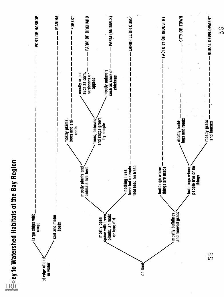
Key
to W
ater
shed
Hab
itats
of t
he B
ay R
egio
n
at e
dge
of a
ndin
wat
er
on la
nd
larg
e sh
ips
with
carg
o
53
sail
and
mot
orbo
ats
PO
RT
OR
HA
RB
OR
mos
tly o
pen
spac
e w
ith tr
ees
plan
ts, a
nim
als
or b
are
dirt
mos
tly p
lant
s an
dan
imal
s liv
e he
re
mos
tly b
uild
ings
and
mow
ed g
rass
noth
ing
lives
here
but
ani
mal
sth
at fe
ed o
n tr
ash
mos
tly p
lant
s,tr
ees
and
ani-
mal
s
tree
s, a
nim
als
and
crop
s gr
own
by p
eopl
e
MA
RIN
A
FO
RE
ST
mos
tly c
rops
such
as
corn
,F
AR
M O
R O
RC
HA
RD
soyb
eans
or
appl
es
mos
tly a
nim
als
such
as
cow
s or
FA
RM
(A
NIM
ALS
)ch
icke
ns
LAN
DF
ILL
OR
DU
MP
build
ings
whe
reth
ings
are
mad
eF
AC
TO
RY
OR
IND
US
TR
Y
build
ings
whe
repe
ople
live
or
doth
ings
mos
tly b
uild
-in
gs a
nd r
oads
mos
tly g
rass
and
hous
es
CIT
Y O
R T
OW
N
RU
RA
L D
EV
ELO
PM
EN
T

Chesapeake Challenge1. Use your aluminum foil watershedto demonstrate serious erosion (seepage 14). This time use a whole tea-spoon of Kool-Aid sprinkled over thewatershed to show what happens whenhousing developments, farms and roadprojects get hit by a big storm.
Family Action1. Conservation of soil and preventionof erosion starts at home. Look at youyard. Are there places where yourshould plant grass or shrubs to pro-tect your soil and the Bay?
2. Have you ever spotted erosion at adevelopment? Each county has lawsabout erosion control. Report erosionfrom developments to the sedimentcontrol officer. Call county govern-ment information for his/her number.
48
Muddy WaterWhen erosion takes place, dirt gets into the water. Muddy rivers
carry this dirt to the Chesapeake Bay. Erosion happens on farms inplowed or overgrazed fields, along streams where plants have beencleared from the banks, in new housing and commercial developmentswhere bulldozers tear into the soil, on road construction projects, alongshorelines no longer protected by marshes or underwater plants, on theschool yard where the grass has been worn thin by children's feet and inthe yard at home where the soil is not protected by plants. The bits ofdirt that make the water look muddy are called sediment.
Some problems with sediment in water are caused directly by the tinyparticles of dirt. In streams and rivers sediment buries fish eggs andother animals. It clogs some animals' gills, keeping them from gettingenough oxygen from the water. In the Bay and in lakes and ponds, dirtin the water blocks the sunlight from reaching the underwater plants.Since they need light to live and grow, they die. Sediment also fills instreams, rivers, lakes and the Bay.
Other problems caused by the interaction of dirt and water are not asobvious. The chemicals plants and phytoplankton need to grow are insoil. When dirt gets into the water, so do these chemicals or plantnutrients. The main nutrients that control plant growth are nitrogen andphosphorus. These nutrients get into the water (dissolve) and stay thereeven if the sediment settles out. When nutrients in the water are toohigh, phytoplankton grow faster than animals can eat them. Also, thebalance of kinds of phytoplankton may change to those that are not asgood to eat.
Some kinds of erosion are easier to control than others. Most coun-ties have laws to control sediment on construction projects. Soil andwater conservation districts work with farmers to prevent erosion, butthere are no laws that enforce good farming.
60

Too Many NutrientsPlant nutrients are needed for plant and phytoplankton growth and
reproduction. One of the special things about an estuary is that there areenough nutrients to support a great deal of plant growth so there is a lotof food for animals. But is there such a thing as too much of a goodthing? Yes. Bay scientists call it nutrient enrichment. An algal bloomoccurs which means overgrowth of phytoplankton. The kinds of algaethat increase may not be those that animals eat.
Where do the plant nutrients come from? Nutrients enter the waterwith soil. Human sewage and animal manure are both rich in plantnutrients, including nitrogen and phosphorus. Manure is used in gar-dens and on fields to increase growth. Milwaukee makes its humansewage into lawn fertilizer. Although sewage is treated, it still contrib-utes nutrients when the treated water is released into a river or the Bay.Manure frequently washes into streams with runoff and eventually getsto the Bay.
Most garden, farm and lawn fertilizers are made from chemicalsrather than manure, but they also contain nitrogen and phosphorus. Ifthey are applied just right, the nutrients end up in the plants. But it ishard to do correctly. Most people use too much fertilizer. It washes offof lawns, gardens, golf courses, and fields and into our water supply andthe Bay. It also soaks into the ground and gets into the ground water.
NITROGEN(Total Load: 64.8 million pounds)
Industry Development
Sewage
Treatment Plants
Agriculture
Chesapeake Challenge1. Use the Habitats of the ChesapeakeBay Watershed cards to make a list ofthe kinds of habitats that add plant nu-trients to rivers, lakes and the Bay.
2. Identify one habitat that protects theBay from nutrients.
Family Action1. If you have a lawn, your family canreduce its contribution to Bay pollu-tion by reducing fertilizer use. Re-
member, never before predicted rain.Be careful not to overwater your lawn.It also helps to let your grass growlonger than most people do. The longerblades of grass reduce runoff and helpthe rain soak into the ground. A longerlawn survives dry periods better, too.
SOURCES OF NUTRIENTS(FIGURES ARE FOR MARYLAND IN 1985)
Sewage
Treatment Plants
61
PHOSPHORUS(Total Load: 7.6 million pounds)
IndustryDevelopment
Forest
Agriculture
49

Chesapeake Challenge1. Use the Habitats of the ChesapeakeBay Watershed cards to make a list ofthe kinds of habitats that add toxic ma-terials to rivers, lakes and the Bay.
2. Use your aluminum foil watershed(page 14) to see what happens when afactory dumps toxic waste in a river.Use a drop of food coloring high up inthe watershed to represent the toxicwaste. Where does it go when rainfalls?
Family Action1. With a parent, do an inventory ofyour household chemicals. List thosethat are toxic. Identify them by readingthe warnings on the label. Discusswhether you really need the product.Do you use it safely? Do you store itsafely?
2. Does your family change the oil inyour own car? What do you do with it?Never dump it on the ground or downa storm drain. Take it to a gas stationto be recycled.
3. Baybook from the Alliance for theChesapeake Bay (see the back page)will help your family understand whatto do with hazardous chemicals inyour home as well as help the Bay inother ways. Contact them for a copy.
50
Toxic Materials in the BayA chemical is said to be toxic if it harms or kills plants or animals by
direct action. Many different kinds of materials are toxic. The amountof the material may be important. There are some things that areneeded or harmless in small amounts and deadly in larger amounts.
Some Bay toxic things are the heavy metals. They include materialslike lead, mercury and chromium. They get into the water when theyare refined near water or are used in a manufacturing process. Forexample, the bottom of Baltimore Harbor is rich in chromium becausethere was a plant that processed chrome ore by the harbor. Chrome isused to plate steel to make it shiny.
Organic compounds are based on carbon as are the chemicals madeby living things. Oil is an example of an organic compound that is theremains of things that lived millions of years ago. There are a numberof organic chemicals which we have learned to make and use in the last50-100 years. These are new chemicals. For many there are no bacte-ria or other things that break them down so they may remain long afterthey were used. Some of them are toxic to plants or animals. Pesticidesand herbicides are organic compounds that are made to kill insects(pests) and plants (herbs). Some organic chemicals get into the wateraccidentally as with an oil spill or pesticide in runoff. Others are dis-posed of intentionally by dumping them in the water. PCB's are anexample of this. There are also toxic chemicals that are not organiccompounds. Some are very simple such as acids from manufacturing oracid rain. Others are more complex chemicals.
There are toxic chemicals in your home as well as in factories. Manyof the cleaning compounds under your kitchen sink are harmful to youif you drink them just as they are to animals and plants that live in thewater. Sewage treatment plants and septic tanks do not remove manytoxic chemicals. The best way to deal with industrial chemicals is totreat them at the factory so that the treatment plant can be designed forthat single problem. Household chemicals should be used sparingly.
62

Too Many Phytoplankton and No OxygenThe plant nutrients entering the Bay are especially high in the spring
when heavy rains carry farm fertilizer and manure into the rivers anddown to the Bay. The phytoplankton respond with an increase ingrowth and reproduction. Longer days and warmer temperatures in thespring also help them grow. The numbers and kinds of algae are morethan the zooplankton, oysters and other algae feeders can handle.
Phytoplankton sink to the bottom and die. There they become foodfor bacteria. As the bacteria feed and increase in numbers, they useoxygen from the water. Oxygen enters the water at the surface and isalso added by plants and algae near the surface. It gets to the bottomvery slowly unless winds stir up the water. Before long, the bacteriause up all the oxygen in the bottom water. When the water has nooxygen, it is called anoxic meaning without oxygen. Animals that liveon the bottom that cannot move such as clams and oysters may die ifthere is anoxia for several weeks.
Periods of low oxygen in the deeper water of the Chesapeake Bayhave been occurring for many years. Anoxia in shallower water appearsto be increasing, but scientists do not all agree. There is agreement thatperiods of anoxia do kill Bay animals.
Chesapeake Challenge1. Look at this map that shows howdeep the water is in different parts ofthe Bay. Based on what you read,predict the places in the Bay that aremost likely to have low oxygen.
Phytoplankton
DEPTHS0-30
30-60
IIII 60+
63 51'

Chesapeake Challenge1. Imagine you are a tiny blue crab onlyan inch across. It is time for you tomolt. Both fish and larger crabs wouldlike to eat you while your new shell issoft. Write a story about searching forand finding a bed of underwater plants.What are your adventures?
Family Action1. If your family has a home along theedge of the Chesapeake Bay or one ofits rivers, consider trying to help agrass bed grow there. Contact yourstate department of fish and game forsuggestions.
52
Lost Underwater Grass BedsThere are many things that tell us the Chesapeake Bay is in trouble.
Decreases in striped bass and oysters provide clues. Perhaps the mostobvious clue was the decrease in the beds of underwater plants gener-ally called grass beds (both seagrass and weed beds). Different kinds ofunderwater plants are found in different parts of the Bay, but they are allwidely recognized by both citizens and scientists as being important forthe survival of many different animals.
Many of the grasses are important food for the ducks and geese thatspend their winters on the Bay and its rivers. Deer, beaver and musk-rats also feed on some kinds of underwater plants. The grass bedssupport many small invertebrates such as snails and tiny crustaceanswhich were food for young fish. Small fish hide from the larger fishthat eat them in the plants. Molting blue crabs hide there while they aresoft-shelled and weak. Not just underwater plants are hurt when thegrass beds decrease.
Grass beds help protect the shoreline from erosion by decreasing theforce of the waves. They also slow the movement of the water, causingbits of dirt (sediment) to settle out, so they help keep the water clearer.
Why did it happen? Some kinds of underwater plants died fromnatural diseases, but that could not explain the widespread decrease. Atfirst everyone thought the herbicides which farmers were using inincreasing amounts were to blame. Scientists do not think this is theproblem. In several cases new kinds of plants were introduced byhumans. These new plants crowded out the natural plants. Todayscientists think the main problem with most grasses is that the water inthe Bay is so muddy from erosion and so full of phytoplankton that theunderwater plants which grow rooted to the bottom are not gettingenough light. Sediment control and a decrease in nutrients may help thegrass beds recover. People are also experimenting with replanting somegrasses.

The Problem is PeopleYears ago a cartoon character called Pogo told us the truth about our
environment and its problems. "We have met the enemy. It is us."People use things and make waste. We always have. We study ancientcities by the garbage they left behind.
There were fewer than 200,000 people living on the 64,000 squaremiles watershed of the Bay in 1600. Now more than 13,000,000 livethere. The watershed of the Chesapeake Bay is filled with people andmore are being added every day. At first it was our farming practicesthat hurt the Bay during the colonial times. We cut forests for firewoodand lumber, or just to clear the land for farming. Then we built millsand factories that blocked rivers and dumped waste in the water. Webuilt cities with more people, sewage and trash. Along the way welearned to catch more fish and oysters than were good for the Bay. Webuilt roads and parking lots which keep water from soaking in andincrease runoff. We learned to make all sorts of new chemicals andfertilizers that hurt the Bay.
Something we have not done very much of is plan our growth. Thearea around the Chesapeake Bay is one of the fastest growing in thecountry. It is a good place to live and work. But if we do not startbeing more careful about where and how we build homes, roads andshopping centers, it may not be a nice place in the future. We havealready damaged the Bay. Will we destroy the watersheds and riversthat provide our drinking water?
Land use planning is currently regulated by county governments. Alltoo often short term gain is judged more important than long termbenefits. If the Chesapeake Bay and its watershed are to survive, wemay have to change the way we use the land.
4zi (-Traoco A
.0)-`)
Chesapeake Challenge1. Work with several other children todraw a plan for an ideal town on a rivernear the Bay. Some of the problemsyou need to solve are food and watersupply, transportation, waste disposal,sewage treatment, places to work,schools, housing, recreation and shop-ping. At the same time, remember totake care of the river, the Bay and thewatershed.
Family Action1. Find out when the planning commis-sion for your city or county meets.Attend a meeting with a parent.
,
tiOIt tAAA. .M
65
A.
53

Chesapeake Challenge1. Write a letter to one of the Chesa-peake Bay groups listed on the backpage. Tell them where you live andhow old you are. Ask what you can doto help the Bay.
Family Action1. Join one of the groups that works tohelp the Chesapeake Bay listed on theback page. Work on one of its projectssuch as a stream clean up.
54
Meeting the ChallengeBay area congressmen and women, particularly Senator Mathias of
Maryland, convinced the Environmental Protection Agency (EPA) tostudy the Chesapeake Bay in the early 1980's. Enough was learned toencourage the governors of Maryland, Pennsylvania and Virginia andthe mayor of the District of Columbia to sign an agreement to worktogether to save the Bay. The agreement includes a set of goals whichthe states are working to meet. Scientists do not have all the answers towhat is wrong with the Bay. The feeling is that if we wait until weknow exactly what all the problems are, we will not have anything tosave. Some of those goals include a reduction of 40% in nutrientsentering the Bay, a program to create forests along streams, rivers andthe Bay's shores and programs to protect critical areas from develop-ment. The project to study the Bay and to clean it up is being done bymany agencies of the federal government and the states, working incooperation.
The EPA provided a group for citizens' input to the program whichhas continued to serve as a source of Bay information. It was called theCitizens Program for the Chesapeake Bay, but has recently changed itsnamed to the Alliance for the Chesapeake Bay. It has worked hard tohelp the Bay agreements come about. The Alliance also serves as aninformation clearinghouse and lets everyone know what to do to helpthe Bay.
Another Chesapeake Bay organization is the Chesapeake Bay Foun-dation (CBF) which grew out of concern for the disappearance of Bayhabitats and wildlife. Like the Alliance for the Chesapeake Bay, CBFtries to work with government, business, industry, scientists and citizensto help the Bay. In addition to research and preserving habitats, CBFruns a huge education program for middle and high school students andteachers which takes them to the Bay to study it for themselves.
There are many other groups that also help the Bay, from the IzaakWalton League to Save our Streams to local school district projects likethe Gunpowder Action Project of Baltimore County or the Severn RiverMonitoring Program in Anne Arundel County.

Forests to Help the BayWe have started to clean up the water we use and send to the Bay in
pipes. Sewage and industrial wastes are getting better. But what aboutall of the things that enter the Bay with runoff? It flows into everystream and river.
When Captain John Smith described the Chesapeake Bay, the Baywas healthy and the watershed was covered with forests. We cannotreturn to that time, but we can do something about the forests. Biolo-gists have discovered that even narrow strips of forests along streams,rivers and the Bay's shore help protect the water from the effects ofrunoff. A strip of forest as little as 50 feet wide removes much of thesediment, phosphorus and nitrogen as the water flows through andsoaks into the soil. Runoff from large areas of pavement like parkinglots and roads also is helped by forests.
Planting forests along stream and river banks helps many kinds ofanimals too. The trees shade the water and keep it cool for fish insummer. Animals like crayfish find homes among the tree roots.Leaves that fall in are food for many insects that fish eat. Keepingsediment out of the water helps fish eggs and young survive.
The forest is a place for birds and other animals to live. We havedestroyed wild habitats with farms, housing developments, factories,and shopping centers. Many animals can survive with us if they have abit of wild habitat in a forest for themselves. Forests are good places forpeople, too.
Chesapeake Challenge1. Make a list of some of the animalsthat you guess might live in a forestalong a stream.
2. Design an ad for a newspaper ormagazine that "sells" the value of for-est strips along streams.
Family Action1. Call your local agricultural extensionservice (listed under county govern-ment in your phone book) to find outhow your family can help plant forestbuffer strips.
6 755

Chesapeake Challenge1. Use your reading in this book to findone other thing that you can do to helpthe Bay and its rivers.
Family Action1. Make recycling a family project. Forinformation on where you can takealuminum, glass and paper for recy-cling call these toll free numbers:
Maryland 1(800) 492-9188;Virginia 1(800) 533-7488.
56
What Can Just One Kid Do?Saving the Bay is a big project. What hope does just one kid have of
really helping? You might be surprised. You can change a few thingsthat you do every day to help. You can also teach your parents andbrothers and sisters things that they can do. You can get your Boy orGirl Scout troop, church youth group, or 4-H club involved in projectsto help the Bay.
Things to do by yourself:
1. Use less water. Turn the water off while you brush your teeth, takeshort showers or shallow baths.
2. Never litter, always throw trash in a trash can. Trash on streets androads gets washed into streams, rivers and the Bay.
3. Protect the watershed. Do not use things that make a lot of trashthat has to go in landfills. Pick fast food restaurants that use paperrather than plastic and Styrofoam.
Things to do with your family:
1. Save water. Do not run the washing machine or dishwasher unlessit's full. Do not leave the water running while washing dishes. Donot overwater the lawn or leave the hose running while washing thecar.
2. Reduce the kinds and amounts of household chemicals you use.Most people use more than needed. Read the labels. If somethinghurts people, it will not be good for the Bay.
3. Dispose of oil from the car by taking it to a recycling station at agas station. Never dump chemicals in your home drains or stormdrains.
4. If you have a yard, prevent erosion and encourage water to soak inby planting plants and letting the grass grow longer. Sidewalks anddriveways made of things like brick or gravel let the rain soak in, notrun off.
5. Recycle trash, especially things that will not decay in a landfill.Ask for paper bags rather than plastic at the grocery store. Newspa-per, glass and aluminum cans may be recycled. Use a compost bin torecycle leaves and grass clippings rather than send them to thelandfill.
6. Vote for politicians and laws that are good for the Bay.
7. If you live on a farm, contact your soil and water conservationdistrict about a conservation audit. They can help make your farm abetter place for the Bay.
6 0

Parent/Teacher Information
Instructional Strategies, Answers and InformationThis booklet is written for either home or classroom use as achildren's reader with content and thinking skills questions fore ach topic. It is appropriate fora range of age levels from upperelementary to middle school, depending on the reading levelof the children using it. It is written so that each page standsalone as a content-based lesson on some aspect of the Chesa-peake Bay and its watershed. The topics are arranged in whatthe author feels is a logical sequence, but teachers and parentsare free to rearrange them. Living in Water, a classroom-based, hands-on approach, aquatic science curriculum, is acompanion to this booklet for use in classroom science in-struction. Contact the Department of Education and Interpre-tation, National Aquarium in Baltimore to order a copy. Sug-gestions for its use with this curriculum are given below.Research proves that children benefit from working togetherin groups. If possible, have children work on some of the Che-sapeake Challenges together in groups of two to five. Childrenalso learn better if concepts are reinforced with discussion inwhich they play a major role, not as listener, but as contribu-tor. Remember to give them plenty of "wait time" to think ofanswers rather than demanding instant responses. Follow-updiscussion questions are suggested below along with answersto the Chesapeake Challenges.
The End of the Last Ice Age (page 4)1. Check colored map on page 5.
2.8,000 years ago homes were farther from the Bay as it was justbeginning to fill.
Discussion: If you have a map of the United States showing depthsoffshore, ask the children to compare the shape of the USA when sealevel was 100 m lower with the shape and size today. Note that thecontinental shelf is very narrow on the west coast, so it would not havebeen as different as the east and gulf coasts.
Living in Water: What was the climate like on land when comparedto that in the ocean during the Ice Ages? Do Activity 10 to discoverthat living in the ocean reduces extremes of temperature.
Climate Change in the Future (page 6)1. 60 times 2.5 cm = 150 cm or 60 in or 5 ft
Discussion: How many children have been to the beach in the sum-mer? What will happen to the beach? The waves will wash over thebarrier islands that form the beaches for most of the eastern USA.Other beaches may form farther inland but places like Ocean Cityand Virginia Beach will be lost.
The Land Changed as the Bay Formed (page 7)1. Plants and animals become extinct because of rapid changes inclimate or habitat. Plants and animals may also be hunted or killedto the point of extinction by people.
2. The climate changes due to the greenhouse effect may be so rapidthat the plants cannot migrate fast enough and will die out.
Discussion: Can the students think of any other things that couldcause extinction? One is the introduction of new species whichcrowd out the natural ones. Another is habitat destruction by humans.
The First Americans: Changing Ways of Life (page8)1. Water supply, animals to hunt such as fish and deer, plants to foragefor such as nuts and berries, a level site protected from the weather andenemies, materials for housing, wood for cooking, access to water andtrails for travel and trade, raw materials for weapons and handcraftssuch as baskets and pots, and good soil for crops are some things youwould need.
2. Play games with other children, sing songs, make up poems in yourhead, decorate objects with pretty designs, watch wildlife, go swim-ming, etc.
Discussion: Are these things still important today? What else mightbe added today?
The Chesapeake Bay as Seen by the Europeans(page 9)1. He names fish, crabs, and oysters.
2. He thought they did all the hard work. Women in colonial Americaalso worked hard, but men helped with agriculture and other tasks.Today women have the opportunity to do "men's work," but still haveto fight the stereotyping of women's roles. Evidence is likely to bepersonal and vary with the child.
3. For once spelling is more flexible. Look for imagination. Shareparticularly good ones with the class.
Discussion: Do you think Captain Smith liked what he saw of theChesapeake Bay and its inhabitants? Yes. Let the children give theirevidence from the readings. Consider that he was writing to encour-age more people to move to Virginia.
Native Americans of the Chesapeake Bay Region(page 10)1. Indian names are too numerous to list. For example, most of themajor rivers bear Native American names.
2. Answers vary.
3. Use sticks in modeling clay with clear plastic wrap for the surface ofthe water. Include modeling clay fish.
Discussion: Were the Indians clever in their ways of catching animalsfrom the Bay for food? Yes. Give evidence from the reading.
Native Americans and their Environment (page 11)1. Have children read some of the stories in class.
2. Many of the uses are the same, but there were many fewer Indiansthan there are people today so they did much less damage. Also, wehave new technology like plastic nets which allow us to catch nearlyevery fish.
Discussion: Why did the Native Americans put up with the newarrivals from Europe? The reading does not discuss the fact that theIndians did not feel they owned the land and so were willing to shareat first. Their numbers declined rapidly because they did not haveweapons as effective as the Europeans and because they died fromdiseases the Europeans brought.
The Chesapeake Bay and its Watershed (page 13)1. Maryland, Pennsylvania, New York, Virginia, Delaware, and WestVirginia
2. Check map on pages 30 and 31.3. Western shore. More watershed for runoff.
57

Discussion: If a watershed is a natural unit, why are the state lines insuch unnatural places? Because the colonies were divided up inEurope and because rivers formed boundaries, leaving two statessharing a river to fight over.
The Chesapeake Bay Watershed (page 14)1. Water runs in realistic patterns.
2. Water collects in smallest crinkles first and then in ever larger ones,just as water on land runs into streams which form rivers which runinto the Bay.
3. Nutrients end up in the Bay.
Discussion: Give evidence from the demonstration that a watershedis important to rivers and the Bay. The water from one becomes theother.
Living in Water: Activity 1 experiments with things that dissolve inwater.
The Chesapeake Bay's Salt Water (page 15)1. The Bay's salinity is lowest when rainfall is highest. Usually thisoccurs in the late spring although a hurricane in late summer or fallmay also lower the salinity.
2. Check the map on pages 30 and 31.
3. Water at bottom of Bay at its mouth; water at surface of the Bay atits mouth; water at surface at mid-Bay; water at surface at theSusquehanna River.
Discussion: Have any of the children ever seen the mouth of the Baywhere the salt water enters the Bay? If they have been across theChesapeake Bay Bridge and Tunnel in Virginia, they have.
Living in Water: Activities 3, 4, and 5 detail the relationship of saltto fresh water in an estuary. Activity 6 is a contest that tests forunderstanding of the concepts.
What is Special about an Estuary? (page 16)1. The mouths of most rivers where they flow into the sea formestuaries as well as the areas behind barrier islands along the coast.A few examples would be San Francisco and San Diego Bays in CA,the mouth of the Mississippi River in LA and TX, Pamlico Sound inNC, the Hudson River in NJ and NY and the St Lawrence River.
Discussion: How many of the places the children mentioned arelarge ports with big cities? Can they predict whether this is good forthe estuary? No. They will probably cite pollution.
Living in Water: Activity 8 demonstrates what happens when plantnutrients are added to water.
Tides in the Chesapeake Bay (page 17)1. Answers depend on location.
Discussion: Has anyone ever visited the ocean and observed theaction of tides there? Look for statements about water moving up anddown the beach.
Chesapeake Habitats (page 18)1. Oyster beds, grass beds.
2. Sandy beach, marshes.
Discussion: Have the students ever visited one of these habitats in theChesapeake Bay? Have them describe it.
Living in Water: Activity 2 reinforces the concept of habitats and in-troduces the students to some aquatic habitats not associated with theBay.
58
Classifying Habitats of the Chesapeake Bay(page 19)1. Check answers: 1. rocky shore 2. shallow water 3. seagrass beds4. tidal freshwater marsh 5. mud flat 6. oyster bar 7. open water 8.sandy beach 9. weed beds 10. salt marsh 11. forest
2. 3. and 4. vary.
Chesapeake Bay Food Chains (page 23)1. a. algae on mud, snail, diamondback terrapin
b. phytoplankton, zooplankton, small fish, large fish, large bird(osprey)
2. bottom: underwater plants and phytoplankton
middle: zooplankton, small fish
top: fish-eating birds, larger fish
Discussion: Ask the children to compare a Bay food chain with oneon land such as an open field where there is grass, rabbits and hawks.In each identify the producer of food (plants), the animals that eatplants (herbivores) and the animals that eat other animals (carni-vores).
Living in Water: Study aquatic food chains in Activities 28, 29 and30.
Zooplankton in the Chesapeake Bay (page 24)1. The copepods are all about 1mm. The water flea is 0.4mm.
2.Podon, Eurytemora, Acartia, Scottolana.3. Look for understanding of the concept of drifting with currents ortides in each paragraph.
4. Zooplankton can be collected in a plankton net made with a pairof panty hose and a hanger or with a proper net. See biological supplycatalogs. Live zooplankton can be projected with a 35 mm slideprojector, using deep well projection slides from Carolina BiologicalSupply. See Carolina Tips, July, 1988, for details.
Living in Water: Learn about the characteristics of fresh and saltwater as they relate to zooplankton and phytoplankton positions inthe water in Activities 19 and 20. Activity 23 studies small animalsthat are not zooplankton, but are also prey for fish.
Blue Crabs in the Chesapeake Bay (page 25)1.From the Patapsco it is roughly 425 km or 280 miles round trip.From the Rappahannock it is roughly 150 km or 100 miles.Discussion: Why do the females swim all that way? Two possibleanswers might be that the larvae require the salinity found at themouth of the Bay and that the food they need is there.
Oysters (page 27)1. The plan requires correct salinity, a hard place to attach where theywill not be buried in mud, the correct algae in the water and time togrow undisturbed. Freedom from disease and predators would benice.
2.1880: about 15 million bushels; 1920: about 5 million; 1980: about3 million.
3. With oysters gone, other things that feed on phytoplankton benefitsuch as clams and the fish called menhaden.
Discussion: Why did the fishermen take too many oysters? Greedand ignorance might be two answers.
(U
Atlantic Menhaden (page 28)1. Oysters.
2. Check map to make sure the fish come in from the ocean and gointo almost fresh water before leaving again.
Discussion: Currently, there are plenty of menhaden in the Bay.Should there be any limit on how many are caught? We might wantto learn from past mistakes with other species and regulatethe fisherybefore it is in trouble. Also, menhaden are important food for otherfish which we want to catch like bluefish and striped bass.
Living in Water: Do Activity 21 on fish anatomy.
Striped Bass (page 29)1. About 1100 km or 750 miles; estimates vary.
2. at least 11 states (North Carolina, Virginia, Maryland, Delaware,New Jersey, New York, Connecticut, Rhode Island, Massachusetts,New Hampshire, and Maine) and 2 provinces (New Brunswick andNova Scotia)
3. pH as low as 3 has been measured in Maryland rain.
4. Acid rain is a result of combustion of fossil fuels (some kinds ofcoal and oil) rich in sulfur. Electric generating plants and steel millsproduce air pollution that causes acid rain. Internal combustionengines such as those in cars and trucks that reach high temperaturesalso make air pollution that becomes acid rain. Acid rain can bereduced by reducing sulfur and nitrogen compounds in air pollution.Burning low sulfur fuel helps. Washing the fumes that go up smokestacks helps. Public transportation that reduces use of cars can help.
5. Check map to make sure that striped bass go into low salinity waterand return to the ocean.
Discussion: Much of the acid rain that falls in Maryland is the resultof air pollution in the mid-western states. At what level wouldregulations have to be made to correct this problem? The federalgovernment. Our acid rain kills trees and fish in Canada too, sointernational politics are also involved.
Living in Water: Activity 16 is a game that models the life of herringwhich, like striped bass, are fish that go out into the ocean to feed, butgo up rivers to spawn. Students will learn about the causes of deathduring this reproductive cycle, including those caused by humans.
Living in Water: Visit the National Aquarium in Baltimore to seestriped bass in the Migrating exhibit and do Activity 24 which studiesthe way fish swim.
European Settlement of the Chesapeake Bay(page 33)1. Check map locations.
2. Both are on peninsulas of land in the southeastern corner of thestate. The capitols were moved to more centrally located places laterto improve access for citizens and legislators.
Discussion: What conditions would cause people to risk going to anew place across the ocean? Some came looking for wealth: gold,silver, gems and furs. Some came to escape religious persecution.Some came because they were very poor and seeking a better life.Some were criminals who were exported from England under force.Some were relatively well-to-do, but second or third sons who couldnot inherit the family land in England. Here they could become landowners as their older brothers were in England. A few were trueexplorers or scientists who wanted to discover new places, plants,animals and people.
71
Growing Tobacco (page 34)1. Check the graph.
2. Rolling Road is a common name in many communities along theBay shores and lower rivers. In Baltimore, Rolling Road runs northand south along the western edge of town.
Discussion: Today tobacco is under attack forreasons not associatedwith erosion. Why? Smoking is a serious health risk.
The Force of Moving Water (page 35)1. The "sail" in bare dirt becomes splattered with mud. This soilwould wash away in a storm. Grass protects the soil from erosion.
2. Allard" rain causes more erosion than a "gentle" rain. The steeperthe slope, the greater the amount of erosion.
3. Rocks and gravel settle to the bottom promptly while tiny dirtparticles remain in the water much longer. This sediment helps makethe Bay look dirty.
Discussion: If you were a farmer, how would you plan your fields toreduce the loss of your valuable soil? Avoid fanning slopes. Keepplant cover as much as possible. Make furrows go across the slopesto stop runoff.
Living in Water: Start Activity 8. This activity should be completedwith pages 48 and 49 of this booklet.
Using Water Power (page 36)1. Check map and list.
2. The secret to the design of a good waterwheel is to have a heavywheel that has a lot of inertia of movement once it gets going, muchas does the flywheel of a motor or a spinning wheel.
3. Check map and list.
4. A good model fish ladder has many small jumps with places to restin quiet water occasionally and takes a looping path around a dam orother obstruction to a river.
Discussion: Are the students aware of any controversial dam proj-ects? Why might people oppose the construction of new dams?People who raft, canoe or kayak want wild rivers. Biologists worryabout fish that need to swim upstream. Farmers do not like havingtheir farms taken away and flooded. Foresters may oppose floodingforests along rivers. Dams may destroy habitats of endangeredspecies.
living in Water: Do Activity 22 to study the effect of depth on theforce of water pressure.
Travel and Trade in Early Times (page 37)1. Check map for fall line. Fredericksburg, VA, Baltimore, MD andHavre de Grace, MD.
2. Check map.
Discussion: Could the students live where they do if travel by boatwere the only means of transportation other than walking or riding ahorse along narrow paths? Some will say yes, but most will not.Discuss other means of transportation and how they might haveinfluenced settlement roads, horsedrawn wagons, railroads, trolleys,bicycles, buses and cars.
Living in Water: Activity 19 examines what makes things float orsink, very important traits in boats.
59

Working Boats and Ships of the Chesapeake Bay(page 38)1. Answers on reverse side of cards.
Discussion: Boats and ships are technological applications of anunderstanding of water, wind and power. What evidence in the cardsdid the students find for changes in technology with time? Increasedsize, better streamlining, new materials, better sail design, use ofsteam and combustion engines for power.
Fishing the Bay (page 42)1. The answers change with time as the laws may change each year.For example, when this was written, Maryland had a moratorium onfishing for striped bass and Virginia did not. Oysters come fromleased beds in Virginia while the oyster beds in Maryland arecommon property. Virginia allows the taking of female crabscarrying eggs; Maryland does not.
Discussion: Does it make sense for two states which share acommon resource to manage it in such different ways? Probably not,but many of the management laws are based on politics, not biology.
Habitats in the Chesapeake Bay Watershed Today(page 44)1. Answers on backs of cards.
2. Answers on backs of cards.
Discussion: Which habitat do your children live in? Would theyprefer to live in another? Why?
Muddy Water (page 48)1. The water gets very dark with "sediment". This models non-pointsource pollution which enters the water with runoff and is very hardto control because it is hard to figure out where it came from.Pesticides and fertilizer are examples of non-point source pollution.
Discussion: Have your children seen examples of muddy water?Have them discuss where and when. Had it rained recently?
Living in Water: Complete Activity 8 with this lesson.
Too Many Nutrients (page 49)1. Nutrients come from: sewage from cities or towns, septic tanks inrural areas, sewage from boats or ships that is not disposed ofproperly; manure from farms; and fertilizer from lawns in cities,towns or rural areas and from farms. Industries may contribute a bitas do forests.
2. Forests absorb nutrients but also release some.
Discussion: Have the children identify ways they contribute to theBay's nutrient load. Sewage is the main way, but there are othersbased on where they live.
Living in Water: Activity 8 and 9 relate directly to this topic.
Toxic Materials in the Bay (page 50)1. Every habitat except forests. Farms with animals may use fewertoxic chemicals.
2. This models the pollution that comes from a factory or sewageplant which has a specific source and is called point source pollution.It ends up in the Bay.
60 BEST COPY AVAILABLE
Too Many Phytoplankton and No Oxygen (page51)1. Low oxygen is most likely to occur in deep water where there issalty water on the bottom and fresh water on top. This layering iscalled a stratified system.
Discussion: Have the children ever seen a pond covered in algae?It forms green mats.
Living in Water: Activities 1, 3, 4, 5 and 15 relate to the formationof layered or stratified conditions in bodies of water. Activities 11,12, 13 and 14 study the use of oxygen by plants and animals as wellas the relationship of oxygen in water to temperature.
Lost Underwater Grass Beds (page 52)1. Answers vary. Look for predators and escape among grasses.
Discussion: Have the students work together to-list all the kinds ofanimals that benefit from underwater grass beds, also called sub-merged aquatic vegetation.
Living in Water: Activity 27 proves that light is important tounderwater plants.
The Problem is People (page 53)1. Have students compare and critique designs.
Discussion: The states of Maryland, Virginia and Pennsylvania andthe District of Columbia along with the U.S. Environmental Protec-tion Agency released a report in December, 1988, from a committeecalled Year 2020 Panel. It predicted a population growth of 20% bythe year 2020. The report called for limits and regulated develop-ment. Who might oppose this? People who make money fromdevelopment.
Living in Water: Activity 28 and 29 examine population growth andcontrols in natural populations. Compare them with human popula-tions.
Meeting the Challenge (page 54)1. Check the letters for spelling and content.
Discussion: Compare the answers students got from different or-ganizations. Did they all agree?
Forests to Help the Bay (page 55)1. Many kinds of birds from tiny wrens and nuthatches to hawks andowls, deer, raccoons, opossums, foxes, squirrels, chipmunks, rab-bits, snakes, lizards, insects and others. Many animals like rabbitsand deer hide in cover during the day and feed at dawn and dusk orat night.
2. Check work and share with other children.
Discussion: Where are the nearest forests? Are they just in outlyingareas? No. They are also in parks, along roads and freeways, aroundthe airports and factories, along rivers running through towns andother places.
What Can Just One Kid Do? (page 56)1. Answers vary. Encourage ideas about career options that contrib-ute to the Bay, from politicians to wildlife biologists to teachers.
Discussion: Have each child write a pledge on a card that the childpromises to undertake to help the Bay. They do not have to be signed.Post them for others to see.
12

These are just a few of the many organizations working to help the Chesapeake Bay.
United States government
Soil Conservation ServiceChesapeake Bay Liaison Office
410 Severn AvenueAnnapolis, MD 21403
Estuarine Programs OfficeDepartment of CommerceF/EPO - Universal Building1825 Connecticut Ave. NW
Washington, DC 20235
National Marine Fisheries Service1825 Connecticut Ave., NW
Washington, DC 20235
U. S. Fish and Wildlife Service180 Admiral Cochrane Drive, Suite 535
Annapolis, MD 21401
U. S. Environmental Protection AgencyChesapeake Bay Liaison Office
410 Severn Ave.Annapolis, MD 21403
Citizen Organizations
Chesapeake Bay Foundation162 Prince George StreetAnnapolis, MD 21401
Alliance for the Chesapeake Bay6600 York Rd.
Baltimore, MD 21212
Save Our Streams263 Scotts Manor Dr.
Glen Burnie, MD 21061
Council on the Environment903 Ninth Street Office Building
Richmond, VA 23219
Maryland government
Governor's Chesapeake Bay CoordinatorState House
Annapolis, MD 21401
Department of the Environment2500 Broening Highway
Baltimore, MD 21224
Department of Natural ResourcesTawes State Office Building
Annapolis, MD 21401
Department of Agriculture50 Harry S. Truman Parkway
Annapolis, MD 21401
Department of Education200 W. Baltimore StreetBaltimore, MD 21201
Virginia government
Department of ForestryP.O. Box 3758
Charlottesville, VA 22903
Department of Health109 Governor Street
Richmond, VA 23219
Department of Natural Resources9th Street Office Building
Richmond, VA 23212
Commission of Game and Inland FisheriesP. O. Box 11104
Richmond, VA 23230
Virginia Marine Resources CommissionP.O. Box 756
Newport News, VA 23607
Pennsylvania government
Pennsylvania Department of Agriculture2301 N. Cameron StreetHarrisburg, PA 17110
Office of Environmental EducationPennsylvania Department of Education
333 Market StreetHarrisburg, PA 17126
Pennsylvania Departmentof Environmental Resources
P. 0. Box 2063Harrisburg, PA 17120
Pennsylvania Fish CommissionP. 0. Box 1673
Harrisburg, PA 16105-1673

U.S. Department of EducationOffice of Educational Research and Improvement (OERI)
National Library of Education (NLE)
Educational Resources Information Center (ERIC)
NOTICE
Reproduction Basis
IC
This document is covered by a signed "Reproduction Release(Blanket)" form (on file within the ERIC system), encompassing allor classes of documents from its source organization and, therefore,does not require a "Specific Document" Release form.
This document is Federally-funded, or carries its own permission toreproduce, or is otherwise in the public domain and, therefore, maybe reproduced by ERIC without a signed Reproduction Release form(either "Specific Document" or "Blanket").
EFF-089 (3/2000)