review of past plans -...
TRANSCRIPT
REVIEW OF PAST PLANS MRP STUDIO
FALL 2017
Village of Menands, New York

1
Table of Contents
Introduction ............................................................................................................................................ 2
Methodology .......................................................................................................................................... 2
Broadway Transportation Study, Village of Menands ............................................................................. 3
River Corridor Simplified Alternatives Analysis. ...................................................................................... 5
Transportation Access and Land Use Improvement Study. ..................................................................... 6
Albany County Commercial Transportation Access Study ...................................................................... 8
I-787/Hudson Waterfront Corridor Study. 2017...................................................................................... 10
Development Strategy for the Broadway Commercial Corridor ............................................................ 12
Final Masterplan for the Menands Nature Area Feasibility .................................................................... 13
Market Feasibility Study for the Capital District Cooperative Farmers’ Market, Menands, NY .............. 14
Route 32 Linkage Study ........................................................................................................................ 16
Scenic and Recreational Development, Hudson River, Riverfront Arterial. ............................................17
Village of Menands Broadway Corridor Economic Development Initiative: Current Conditions and
Opportunities Report ............................................................................................................................ 19
Village of Menands Broadway Corridor Master Plan ............................................................................. 20
Village of Menands Broadway Corridor Design Guidelines. 2016 .......................................................... 23

2
INTRODUCTION
This document describes previous plans and studies that have involved Menands. The oldest study
dates back to 1970; the most current was done in 2016. The topics of these studies range from the
environment, land use, community improvement, streetscape, to transportation. While some
aspects of these studies have been carried out, in large part, the many recommendations in these
studies have not been fully implemented. Any new plan for a community should build on previous
planning efforts, so this review is a first step in the process of preparing a new plan for the Village
of Menands.
METHODOLOGY
Each studio member was assigned various studies to analyze and explain. After reading through
the studies, studio members summarized each plan and noted the most important aspects of the
studies focusing on the plan recommendations. This document includes the summaries of each
plan.
Studio members also extracted what they felt were the most important issues and
recommendations from these previous plans for the village to consider in its new planning effort.
These thirty issues are listed in a separate document entitled “Plan Assessment Matrix” and are
being presented to the village for discussion and feedback as an early aspect of the planning
process.

3
BROADWAY TRANSPORTATION STUDY, VILLAGE OF MENANDS
Creighton Manning Engineering, February 2002.
The “Broadway Transportation Study, Village of Menands,
Project #01-030d. CME. February 2002”, focused on
transportation, more specifically an assessment of current, at the
time (2002), and future traffic operations, including
identification and analysis of alternatives based on forecasted
operations and access needs. It also evaluated the cross-section/
intersection geometry and the need for pedestrian linkages and
bicycle accommodation.
The purpose of this study is to access the existing and
future transportation needs on the Broadway corridor
(NYS Route 32).
Daily traffic volumes along the corridor have not
changed significantly over the past 30 years, hence the
generous roadway widths and relatively low traffic
volumes provide an opportunity to reduce the number
of travel lanes. This can provide the opportunity for
roadsides enhancements such as:
● Maintenance area for snow storage
● Curb bump out for bus stops
● Bus shelters
● Bicycle and pedestrian accommodations
● Green and grey infrastructure improvement
● Roadside treatment and access management improvements

4
Due to higher than average accident rate in the central portion of the corridor access, management
improvements should be considered including: consolidate driveways,
shared access or cross easement. See table
II-11 pages 28-29 for specific
recommendations for each roadway.
Bus service is provided along Route 32,
however enhanced transit stops and
services should be considered. Also, snow
storage/maintenance strips and Broadway
design alternatives could reduce the
number of lanes to facilitate pedestrian and
bicycle access. Modifications of the Route 32/Route 378 interchange could improve truck access
to Menands Market and industrial land use areas.
Proposed Road Sections:
Figure 4 Wolfert Ave to Wards Lane: Source BTS 2002

5
Figure 5 Wolfert Ave to Wards Lane: Source BTS 2002
Reviewed by Studio Member: Aneisha Samuels
RIVER CORRIDOR SIMPLIFIED ALTERNATIVES ANALYSIS.
Capital District Transportation Authority, and IBI Group and Creighton Manning Engineering,
LLP - Jan. 23, 2015, Accessed Oct. 1, 2017.
This study provides alternatives to driving directly into downtown Albany, and initiatives to reduce
traffic congestion along the River Corridor from Albany to Troy. This study investigates allowing
commuters to park in specific lots in the surrounding neighborhoods of Albany instead of trying
to find parking in the city center. The plan illustrates that there are six stations within the BRT
corridors that are proposed to have parking facilities for commuters: Division and Woodlawn on
the Red Line, Route 378 and Kenwood/Port on the Blue Line, and Crossgates Mall and the
Harriman State Office Campus on the Purple Line. These six locations are important and stationed
strategically due to a projected increase in annual average daily traffic by up to 30%, especially in
Colonie and Menands.

6
The current spots being considered in Menands include Route 378 and the Riverview Center.
These two locations are key points for any citizen in Menands to commute to downtown Albany.
This can help with any commuter from the Village to even walk to these BRT stations since they
are conveniently placed in key areas within the Broadway corridor. Each BRT station has a full
shelter and amenities that can accommodate any commuter along the way. An improved crosswalk
will be implemented at all BRT Park & Ride stations.
Reviewed by Studio Member: Jad Edlebi
TRANSPORTATION ACCESS AND LAND USE IMPROVEMENT STUDY.
CDTC, 2008. Accessed Oct. 9, 2017.
This study focuses specifically on the Broadway corridor in
Menands. The goals of this study are to help preserve and
manage Broadway in Menands, develop the region’s
potential, link transportation and land use, and plan and build
for all modes. A well-functioning transportation infrastructure
cannot function properly if it does not provide
accommodations for all modes of travel.
The northern section of the corridor is primarily commercial and light industrial, with a small
amount of residential and recreational use north of Route 378. The southern section of Broadway
includes a mixture of commercial, industrial, residential, and institutional land uses. The road is
generally a four-lane facility providing two lanes in each direction. Flooding is a concern, as
Broadway is within the floodplain or close to it in places. Sidewalks are not continuous. Signalized
intersections are spotty and street parking is not allowed.
There are two project focus areas. Broadway (NY Route 32)/Menands Road/Market Road is one.
This intersection is south of the Route 378 overpass and it has a traffic signal. All modes of

7
transportation exist at this intersection, except for ADA ramps for visually impaired people. This
intersection is busy and needs access improvements to make businesses more accessible and to
strengthen the place in the regional and local market. The other focus area is Broadway (NY Route
32)/Route 378 WB off-ramp. This is a “T” intersection with a traffic signal. The only pedestrian
accommodations are limited sidewalks on the west side of Broadway. There are several vacant
properties that need redevelopment. There are several curb cuts that create confusion for drivers
and conflict points where accidents may occur. Levels of compatibility concerns for places along
Broadway are at a B or C. C means there is concern and B means concern is increasing. This needs
to be repaired.
The rest of the study examines different traffic flows, transit access, and safety concerns. Traffic
is heavy on Broadway as it travels through Menands. Pedestrian and bicycling access is limited
because the waterfront trail is cut off for bicycles and sidewalks are limited. The Broadway
corridor is designated as State Bike Route 9 with on-street bike lanes. These are very unsafe,
however, as there are many curb cuts. Pedestrians have the same problem with curb cuts.
Existing transit services are provided by the CDTA. Fixed bus route service extends along
Broadway, all the way to Troy. Bus Route 22 is one of the busiest routes with about 500 daily
riders within the study area. There are 100 daily boardings at site A and 50 boardings at site B.
Conclusions are that improvements are necessary to improve safety, efficiency, and access to area
land uses. Confusion among drivers, pedestrians, and bicyclists needs to be fixed by adding
medians, better signal heads, and higher visual ability.
There are several recommended alternatives to deal with the problem. Basically, the plan
recommends complete streets and uniformity along Broadway. Trailhead options and access are
important for the corridor to provide access to Broadway from other areas. Transit must provide
service to development centers and safe areas for pedestrians.
Reviewed by Studio Member: Eric Stotsky

8
ALBANY COUNTY COMMERCIAL TRANSPORTATION ACCESS STUDY
Creighton Manning Engineering, LLP. 2002
This study identifies three study areas including:
● Study Area #1: The Watervliet Arsenal/Colonie Economic Development Zone area in the
City of Watervliet and Town of Colonie
● Study Area #2: The southeastern section of the Village of Menands adjacent to Broadway
and Erie Boulevard
● Study Area #3: The Port of Albany/South End neighborhood located in the City of Albany
The Study Area #2 is generally commercial to industrial. This report proposes the development of
an extension to Erie Boulevard from just south of the Albany/Menands line to the I-787 Wards
Lane Interchange (with access between the extension and the interchange ramps), coupled with
geometric and design treatments on Broadway between Simmons Lane and Wards Lane. The study
also suggests establishing a direct truck route between I-787 and the industrial area surrounding
Erie Boulevard. The purpose is to create ease of access and mobility for commercial vehicles,
enhance economic development opportunities due to this easier access, and remove heavy vehicle
traffic from Broadway in Menands.
While there is unofficial accessing of the trail from near the Wards Lane interchange ramps, the
nearest permitted access is near Colonie Street in Albany via Erie Boulevard.
Given the City of Albany’s current efforts to develop its waterfront area, including construction of
a pedestrian bridge linking downtown Albany to the waterfront and the upcoming construction of
a promenade, picnic area, new pedestrian and bicycle facilities in a more congested part of the
current trail and other accommodations, the opportunities to promote access from Menands to this
destination and to the rest of the offerings of the trail (as well as the opportunities to leave the trail
to patronize restaurants and other establishments in Menands) should be explored.

9
In summary, in the Southeastern Menands/Broadway/Erie Boulevard study area, the opportunity
to promote more direct access to the commercial and industrial areas in the Erie Boulevard corridor
through the recommended improvement would bring with it an opportunity to pursue community
development-oriented economic development efforts along Broadway in the Village of Menands.
That is, while the Watervliet Arsenal/Colonie EDZ area saw the opportunity to bring about a more
immediate quality of life to benefit First Street residents by removing truck traffic from their street,
this study area could see an opportunity to introduce land uses in the Broadway corridor, which
while desirable from a community standpoint, might not be compatible with the present mix of
traffic traveling through the corridor. The Village can pursue an economic development effort in
which it examines the desires of the community to determine how to complement the extension of
Erie Boulevard with streetscaping, zoning and/or promotional efforts aimed at facilitating the
introduction of new businesses to the corridor.
Reviewed by Studio Member: Zeynep Tas

10
I-787/HUDSON WATERFRONT CORRIDOR STUDY. 2017.
Capital District Transportation Committee.
The I-787 Hudson/Waterfront Corridor Study was completed in August of 2017. The study area is
bounded on the north by Watervliet (I-787 Exit 9), on the south by the Port of Albany (I-787 Exit
2), on the east by the Hudson River and on the west by Route 32 (Broadway). The study has not
been released to the public yet. The plan is an effort that strategically marries transportation and
land use planning to:
● “Improve access to the Hudson River
● Support waterfront revitalization and economic development opportunities
● Integrate concepts from previous studies and fresh ideas through an involved
stakeholder process
● Support multi-modal transportation objectives (pedestrian, bicycle, transit, motor
vehicle, truck, etc.)
● Guide future planning
● Improve transportation, community, and environmental compatibility
● Account for life-cycle costs of roads and bridges
● Explore potential reductions in infrastructure maintenance costs over time”
A timeline of the planning process since the project began is listed in the following chart.

11
DATE STEP DESCRIPTION
June 2015 Public workshops
Drop in style Public Workshop on June 24th in Albany drew
over 90 interested individuals with a wide range of ideas,
concerns and questions regarding the study and the study area.
Second workshop was held in Watervliet on June 30th. There
was also a public survey available.
September
2015
Preliminary
Workshop Summary
Available
Summary of community input finds 76 participants believe
access for bikes and pedestrian should be emphasized, 46
believe the emphasis should be economic development, 34
believe it should be environmental protection. There were 29
responses that sought active recreation opportunities and 29
desired a view shed to the river. 15 or less desired shorter
transportation time, boating access, and trailhead parking.
2015-2016
Develop and evaluate
feasible strategies and
options
The planning process with consideration to community input is
carried out to produce a final plan.
June/July
2017
Receive public input
on recommendations
Allow public to engage in planning process and keeping them
informed by doing so.
August 2017 Plan completed To be made available to the public
Excerpt from I-787/Hudson Waterfront Corridor Study. 2017.
Reviewed by Studio Member: Ketura Vics

12
DEVELOPMENT STRATEGY FOR THE BROADWAY COMMERCIAL CORRIDOR
Capital District Transportation Committee. Urban Partners. 2001.
The Broadway commercial corridor extends four miles from Livingston Street in Albany to the
City of Watervliet. The main objective is to revitalize the Broadway commercial corridor and to
promote and expand retailing operations. The Wolfert corner retail district is a focal point for retail
business. It is accessible to a three-quarter mile area of the district. A development strategy for
Wolfert corner should include streetscape enhancements, north Albany home/office outlet
association, district-serving parking, business façade improvements and more. North Albany
home/office outlet association will strive to bring all warehouse based business together to promote
their business and attract regional attention. Currently there are thirteen active outlet retailers and
ten of them are directly selling their product to the public.
The Capital District regional market could dramatically change through efforts to expand the
flower market (which will be held on Saturday or three day a week). A museum showing the
history of the market and a full-service farmer’s market with retail product such as meat, fish,
bakery and deli vendors could be established.
Infrastructure and neighborhood improvements through the Broadway corridor is another part of
the plan in which adjacent neighborhoods could be improved by resetting or replacing curbs,
improving landscaping along railroad properties and private business, and removal of excessive
curb cuts and asphalt.
A market assessment report shows North Albany HOPE VI Revitalization Program and
redevelopment of the Edwin Corning Homes on Lawn Avenue have market demands and found a
lack of retail services available to this area. It shows where additional retailing business could be
established.
Reviewed by Studio Member: Dhaval Dhamelia

13
FINAL MASTERPLAN FOR THE MENANDS NATURE AREA FEASIBILITY
J. Kenneth Frasier and Associates. Village of Menands, New York 2008.
The Final Masterplan for the Menands Nature Area Feasibility Study (NAFS) was created in
December of 2008. It examines a 150-acre study area going east-west between Route 32/Broadway
and I-787, with Route 378 as a northern boundary and I-787 Exit 7W as a southern boundary. The
study area comprises one of the largest freshwater estuaries along the Hudson River, which flows
through a culvert under I-787. The rest of the area is tidal and freshwater wetlands that includes
both forested and open wetland environments. Existing and former industrial rail spurs designate
some of the area as a brownfield. The study area is described in the plan as “an ecological refuge
that is a source of untapped educational and passive recreational potential.” The Village performed
the study because they sought to incorporate the area with the bike trail going through Menands to
Schuyler Flatts Park, in Colonie. Their long-term vision includes a bike/pedestrian trail over the
Menands Bridge into Troy/North Albany. The plan also discusses the historic role of Menands as
a rail town that once had amusement parks and was the site of the New York State Agricultural
Society fair. The NAFS was modified to parallel an ongoing streetscape study that was being
conducted for the Broadway Corridor.
Methodology: First, there was a site visit/field observations of study area, which was followed by
collection of tax parcel map data to determine land ownership. Then topographic, aerial, and
wetland/soil/site suitability maps were collected and assessed to determine viable uses for the land.
The consultants then develop design concepts and consider implementation issues. The plan
categorizes its existing conditions, constraints, and opportunities for environment, historical
significance, and community involvement.
Environment: Existing trails and railroad beds can be used by acquiring land on properties that are
near the network of bike paths and trails. Acquisition can be incentivized with tax write-offs.
Constraints include acquisition, regulatory procedures involved beyond acquisition for
landowners, perception of crime by allowing access to property.

14
Wetland/Tidal estuaries are an ecologically diverse habitat located within a FEMA 100-year flood
zone. Educational and passive recreational opportunities are viable uses for this property. The soils
are favorable for the specific use of paths and trail ways. This can present the area as a destination
and its status as a wetland offers funding opportunities. Constraints include potential brownfields,
regulatory procedure of impact on wetlands, and culvert under I-787 is too small for access.
Historical Significance: Prior land uses including Al-Tro Park and the Erie Canal lend the area to
archaeological exploration to “create a sense of connection” between the past and present land
uses in Menands. Preservation of historic integrity is necessary. Constraints include regulatory
procedures of an archaeological study.
Community Involvement: Re-establish connection between Village and Hudson River, establish
pedestrian links to surrounding communities, and redevelop existing farmers market, funding
sources from public/private partnerships. Constraints include I-787, former islands are neglected
and derelict.
The plan identifies numerous potential funding and partnership sources such as NYSDHCR
Economic Development Program, NYSDHCR CDBG, NYSDHCR Technical Assistance Grant
Program, Transportation Enhancement Programs, EPF Matching Grant Program, LWRPs, Hudson
River Valley Greenway, Scenic Hudson, and more.
Reviewed by Studio Member: Ketura Vics
MARKET FEASIBILITY STUDY FOR THE CAPITAL DISTRICT COOPERATIVE FARMERS’ MARKET, MENANDS, NY
Steve Miller, April 2017
The Capital District Cooperative is farmer-owned corporation which runs a wholesale and retail
(at times) farmers market in the village of Menands. The Village hired a consultant to develop a
plan to help revitalize The Market with cooperation of The Market management. The site consists
of three major modes of operation. First, it is owned cooperatively by 150 farmer members, where

15
most of them use the market to sell their locally grown produce. Second, when the site was opened
in 1933, a wholesale produce house set up business and, since then, more wholesale produce and
other non-food related business have moved to the site. Third, is the retail farmers market where
other farmers and members of the cooperative can participate.
This plan reviewed a previous plan conducted in 2003 and then interviewed members of the board,
tenants, local economic development officials and some local businesses. The Board said that they
liked the location of the site and most of them wanted to keep the market for both wholesale and
retail produce sales. The tenants said almost the same things though some of them were unsure
that the Board and membership are committed to making the investments that they feel are
necessary to move ahead. Local economic development officials were familiar with The Market
and knew where it was, but some thought that it is somewhat isolated.
The plan outlined the type of businesses that could be recruited to this site including small food
processor, farm supply, restaurant supply, food distributor, specialized ethic food distributor, and
other types of business related to the farm and food industry (p. 11). The new Railex Facility was
mentioned, where a rail transportation and distribution company has opened a new produce
warehouse in Rotterdam, NY which is 22 miles from the Menands market.
The summary of recommendation is that physical site improvement should be done to provide
better sheds and to make the market more attractive to new retailers and consumers. The plan
recommended developing a retail farmers market, bringing in food-related business and improving
the wholesale farmer market. The plan also provided recommendations on how to improve Board
short-term and long-term operation and management in order to provide consistency and
efficiencies in the future.
Reviewed by Studio Member: Dhaval Dhamelia

16
ROUTE 32 LINKAGE STUDY
CDTC. River Street Planning and Development, et al.
2010. Accessed Oct. 9 2017
The Route 32 Linkage Study examines the Broadway
corridor from Menands to Watervliet. There are three
subsections: Menands to Colonie, Colonie to
Watervliet, and Watervliet. Each section has separate
existing conditions, transportation conditions, and
recommendations.
The Menands to Colonie section is the busiest part of
the corridor, with the most business and traffic. Menands has many shopping areas that need to
be redeveloped. The road is widest here and best suited for traffic. However, there are accidents
here and it is not particularly safe for pedestrians and bicyclists. Recommendations involve
redeveloping vacant buildings and shopping plazas, limiting access points to businesses to
decrease congestion, transportation improvements like roundabouts and traffic signals, and
encouraging future mixed-use development.
Colonie to Watervliet is a very small section. This is basically Schuyler Flatts. There is the
Town of Colonie Park and an intersection here. There are about 21,000 vehicles per day in this
part and the road narrows to two-lanes here as well. Lighting is an issue and sidewalks are
narrow and inconsistent here. This creates unsafe and limited pedestrian access. Bicycles are
not safe here. An inter-municipal zoning overlay is recommended, signage improvements are
needed, alternative transportation modes should be encouraged, and development should be
encouraged.

17
Watervliet has more residential and commercial and not much industrial development along
Broadway. The road is not as busy here. It is built within a grid network and has a lower speed
limit also. Uniform zoning guidelines should be developed, development of vacant or
undeveloped areas should be encouraged, sidewalk repair and curb extensions are useful to
pedestrians, repair the blocks around the arsenal, and create development strategies.
Implementation strategies are listed in a large Plan Implementation Matrix at the end of the Route
32 Linkage Study document. It lists the project descriptions, time frames, lead agencies, potential
funding sources, and responsible entities for maintenance.
Reviewed by Studio Member: Eric Stotsky
SCENIC AND RECREATIONAL DEVELOPMENT, HUDSON RIVER, RIVERFRONT ARTERIAL.
State of New York, Dept. Of Transportation, 1970
Developing the waterfront remains an important
objective moving forward if we must deal with the
unfortunate realities of the many acres that were
needed to build highway 787. Luckily, there are still
areas of potential development. The Scenic and
Recreational Development report outlines there are
some 200 acres in total between Albany and
Watervliet. Menands encompasses almost half of that area. This space can primarily be used for
recreation and enjoyment of nature, with the cooperation of many agencies and government bodies
to achieve this goal.
The report explained that this area should be convenient to the surrounding municipality. The
implementation of accessible entrances and exit location placements should be in ideal settings for

18
the community to utilize the parks features. The facilities that would be set up in this new park
need to be constructed in an aesthetic manner, and situated with easy access to majority of the
public. The initiative included incorporating a swimming pool and ice skating facility into this plan
as well. There is about 3-5% of the region’s population that wants to go swimming on a warm day,
while ice skating gains similar numbers in popularity.
The growth of the urban regions and increased concentration of population is accompanied by the
eagerness for the open aesthetic within the urban core. The waterfront area is ideal for much of
this development. As it pertains to the 35 acres of practical working area there should be
acknowledgement of the 15-acre remnants of tidal body of water. This area should be a prominent
attractive feature for the park. Solutions to redevelopment includes implementation of any
necessary dredging as well as planting on the shores to encourage local wildlife seeking refuge.
Creating a facility for athletic interests as well as opportunities for nature studies, conservation
work, nature trails, comfort stations and row boats meets the needs of a community with diversified
recreational interests. Parts of the waterfront region that are undevelopable, approximately 180
acres within the interchanges and on the slopes of the fill areas, should be seeded planted and
landscaped.
We should acknowledge that although there are areas that could support development of
infrastructure, we must recognize that this area is predominantly a wetland and should mainly be
used for conservation and recreational measures. The waterfront would serve as one of Menands
best features if implemented in a mindful way. The opportunity for this village to redevelop this
area along the river may garner interest from people in the surrounding region. It is important for
Menands to provide something unique that bridges the gap between Albany and Watervliet, and
this form of sophisticated recreation may fulfill that criteria. The open aesthetic landscapes coupled
with some physical recreational activities serves to encourage diverse recreational interest that this
area needs.
Reviewed by Studio Member: Sean Taylor
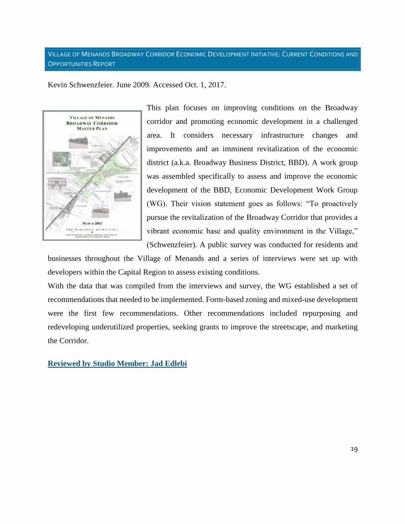
19
VILLAGE OF MENANDS BROADWAY CORRIDOR ECONOMIC DEVELOPMENT INITIATIVE: CURRENT CONDITIONS AND
OPPORTUNITIES REPORT
Kevin Schwenzfeier. June 2009. Accessed Oct. 1, 2017.
This plan focuses on improving conditions on the Broadway
corridor and promoting economic development in a challenged
area. It considers necessary infrastructure changes and
improvements and an imminent revitalization of the economic
district (a.k.a. Broadway Business District, BBD). A work group
was assembled specifically to assess and improve the economic
development of the BBD, Economic Development Work Group
(WG). Their vision statement goes as follows: “To proactively
pursue the revitalization of the Broadway Corridor that provides a
vibrant economic base and quality environment in the Village,”
(Schwenzfeier). A public survey was conducted for residents and
businesses throughout the Village of Menands and a series of interviews were set up with
developers within the Capital Region to assess existing conditions.
With the data that was compiled from the interviews and survey, the WG established a set of
recommendations that needed to be implemented. Form-based zoning and mixed-use development
were the first few recommendations. Other recommendations included repurposing and
redeveloping underutilized properties, seeking grants to improve the streetscape, and marketing
the Corridor.
Reviewed by Studio Member: Jad Edlebi

20
VILLAGE OF MENANDS BROADWAY CORRIDOR MASTER PLAN
The Saratoga Associates. 2002.
The Broadway Corridor in the Village of Menands has become
a primarily auto-oriented corridor. Once a thriving commercial
district serving the capital region, today there are numerous
vacant or underutilized sites. Buildings that have been
successfully reused have changed from commercial/retail
services to offices. Where Broadway once carried the bulk of
the commuter traffic, I-787 now serves this purpose. The
culmination of these characteristics has helped create a
pedestrian unfriendly environment that is dislocated from the
adjacent neighborhoods. This study suggests specific aesthetic
improvements to achieve the goal of creating a sense of uniformity along the Broadway Corridor.
In the study, the corridor has been broken down into three segments with the three primary
gateways highlighted. The segments include:
● North Broadway Segment – From the Colonie town line to the NYS 378 overpass
● Village Center Segment – From NYS 378 to the railroad overpass
● Mid-City Segment – from Exit 6 to Wolfert Avenue
Gateways include:
● Exit 7 – Price Chopper
● Riverview Center
● Wolfert Avenue
The study contains several recommendations that are relevant to three segments of the Broadway
corridor in Menands.

21
North Broadway Segment Recommendations:
Any reconfiguration of the Price Chopper Plaza parcel should create a consolidated
entrance that aligns with the Route 378 exit ramp. The parking on the site should be
reconfigured and landscape enhancements should be incorporated to break up the asphalt
pavement. In addition to new or rehabilitated larger scaled buildings toward the back of
the parcel, smaller buildings should be constructed closer to the road. In addition,
landscape enhancement and signage are recommended to mark this gateway into the
community.
Landscape enhancements are recommended for the 2,000’ plus area around the Route 378
exit ramp configuration along Broadway to help make this connection more attractive and
usable, as well as to foster pedestrian movements between the Village center of Menands
and the Price Chopper Plaza area. The study recommends that this area be heavily planted
with thick evergreen trees to shield the overpass so that it is virtually invisible to the
passerby.
The plan recommends the creation of an off-road bikeway east of the former Two Guys
building linking Broadway to the Schuyler Flatts trail network.
Village Center Segment Recommendations:
● To create an inviting pedestrian atmosphere the village should undertake landscape
improvements in this area along both sides of Broadway including street trees, pedestrian
lights, banners, street furniture (benches, trash receptacles), and flowers.
● In addition to these landscape enhancements, the village should consider a central planted
median from approximately the Village Hall to Menands Road. The median should be
planted with trees and flowers and appropriate identification signs.
● To accommodate for the elimination of left and right turns along this stretch of roadway, a
rear access road and associated parking should be developed on the east side of the
buildings that front Broadway in this stretch of road.
● In addition to pedestrian improvements, the village should consider enhancing the area
around the ice-skating rink and creating a larger Village Center Park. To incorporate the

22
park more closely with Broadway and the adjacent neighborhoods, a pedestrian connection
should be created from Broadway directly to the park. In addition to these westerly
connections, the park could be connected to the SPCA (the ‘Canal Trail’) and the proposed
Natural Trail System. The park could provide passive green space during the summer
months and remain an ice skating rink during the winter. All landscape improvements in
the Village Center segment should be extended to the railroad crossing.
Mid-City Segment Recommendations:
● This area will have sidewalks and street trees on both sides of the street. These
improvements will take place between the curb and the sidewalk in what is commonly
referred as the planting strip.
● In addition to these enhancements, landscape improvements should take place between the
sidewalk and the parking areas.
● In addition to landscape enhancements, it is likely that new buildings will be developed on
the many underutilized lots.
In addition to these specific recommendations, the Broadway Corridor Master Plan includes
design guidance for pedestrian street lamps, benches, and trash receptacles, as well as suggestions
for gateway signage to mark the entrances to the Village of Menands. In addition, the study
recommends the creation of design standards to guide future development and to ensure a safe,
attractive, and functional built environment.
In summary, the basic concepts embraced in the plan include: accessibility from sidewalks
provided along both sides of the street and back into the neighborhoods; coordinated parking and
service access; parking to the side or rear of buildings; provision of buffers and screens along
parking areas; incorporation of pedestrian amenities and street furniture; accommodations for
bicyclists with appropriately sized bike lanes; installation of landscaping, and the appropriate
provision and development of public spaces. The success of the corridor will be reinforced through
the institution of these design practices.
The overall intent of the plan is to create a visually cohesive and pedestrian friendly (in varying
degrees) atmosphere along the length of the corridor to create continuity and a sense of place. The
major unifying elements proposed for the corridor will be the streetscape components of street

23
trees and light poles and fixtures. Their positive impact will be felt if they are applied in a
consistent manner throughout the corridor. Specifically, it is recommended that the corridor
include an installation of street trees along its entire length on both sides of the street adjacent to
the proposed pedestrian sidewalk. The regularity of the trees and the introduction of proposed
pedestrian scaled lighting fixtures will provide a continuity, consistency, and unity to the look of
the street.
Reviewed by Studio Member: Zeynep Tas_________________________________________
VILLAGE OF MENANDS BROADWAY CORRIDOR DESIGN
GUIDELINES. 2016
Elan Planning and Design. 2016.
The “Village of Menands Broadway Corridor Design
Guidelines” focused on land use in the Village. The
methods proposed in this document are intended to
promote long range planning through Smart Growth
Principles including mixed use development,
walkability, and green infrastructure. This document
reflected the goals of multiple planning documents,
including the following:
● Menands Broadway Corridor Study (2002)
● Menands Design Guidelines (2007)
● Transportation Access and Land Use Improvement Study (2008)

24
● Village of Menands Broadway Corridor Economic Development Initiative: Current
Conditions and Opportunities Report (2009)
● Menands Zoning Revisions and Updates (2013)
● Storm water Coalition of Albany County Green Infrastructure Model Local Law Project
(2013)
The overall objectives of the document are to promote site and building development that enhances
the historic architecture and village setting of the community, and to provide building owners and
project sponsors who are applying for site plan review with an understanding of the Village’s site
plan review criteria and expectations.
Green Infrastructure (page 12)
The Village of Menands is a member of The Stormwater Coalition of Albany County, a group of
eleven municipalities and the University at Albany committed to implementing Best Management
Practices towards storm water management. As a member of The Stormwater Coalition, Menands
has worked to identify and implement strategies to reduce storm water runoff volumes and increase
water quality
Parking:
The Plan recommends that industrial buildings be positioned close to the streets with minimal
parking between Broadway and the building façade. This is intended to provide a more visually
appealing area instead of allowing the area to be bombarded by copious amounts of parking space.
The document also proposed that adjacent parking lots should be connected to facilitate the flow
of traffic off Broadway to reduce the flow on Broadway in cases where possible. Shared parking
and public parking is encouraged so less designated parking spaces will be needed. Based on
business hours different businesses can alternate the use of parking spaces.
“Surface parking areas should be at the second or third layer from the frontage
and should be screened by a streetwall or continuous hedge between 3.5 and 4.5 feet in
height. Streetwalls should be constructed of a material matching the adjacent building

25
façade. Openings in such streetwalls and hedges should be no larger than necessary to
allow automobile and pedestrian access. If, due to site constraints or a preexisting
condition, a parking lot is in the first layer it should be screened by a streetwall and/or
hedge with the same dimensions as mentioned herein.” (p. 20)
Bike/ pedestrian Amenities:
The Broadway Corridor Design Guidelines proposed the implementation of “Logical” pedestrian
amenities. Overall the intent of the document is to promote walkability.
Broadway Business District (BBD):
The intent of this district is to allow the development of auto-dependent uses while enhancing the
pedestrian environment to promote the livability and economic vitality of the entire village.
Infill Neighborhoods Districts:
Infill Neighborhoods Districts are intended for residential use and a mixed-use district while
promoting green infrastructure development techniques (Rainwater Harvesting, permeable
pavements, green roofs etc.) Residential lots should preserve the pedestrian character of the streets
and neighborhoods should relate to nearby neighborhoods.
Infill Mixed-Use District:
The Infill Mixed-Use District accommodates a wide variety of residential and non-residential uses,
building types, and lot sizes. Infill mixed-use districts must incorporate residential use, create a
public realm conducive to pedestrian activity, and provide linkages to adjacent neighborhoods.
This district contains a balance of neighborhood and regional scale non-residential uses based on
the district's location on major thoroughfares and access to transit service.
Signage and Street Lighting: (page 13 to 24 of BCDG)
It is recommended that there be simplified content on signs. Signs should also be well maintained
and should complement the façade of the building.

26
Street lighting spacing should be 75 to 100 ft. for all renovations regardless of building style and
high-quality materials should be used.
Architectural Guidelines:
Unlike the site guidelines, which are specific, the architectural guidelines do not dictate precise
styles, materials, or detail choices for buildings within the village. Rather, the recommendations
are intended to be a starting point for project sponsors to consider in the design process. The
overall intent is not to promote a specific style of architecture, but to promote compatibility
between architecture styles in the village.
Streets:
All streets should terminate at other streets, forming a network. Cul-de-sacs should be allowed
only when there is no alternative due to site conditions such as waterways, wetlands, or steep
slopes.
T-4 and T-5 Zones:
The purpose of these Supplemental
Regulations is to implement the
principles of the various planning
documents that have been completed for
the Village and the Broadway Corridor.
The goals of these transect zones (T-4 and T-5) are aimed at building a traditional village fabric
characterized by streets and other public spaces that are walkable and inviting to pedestrians, are
accessible by transit service, and by a mixture of uses, such as retail (including sales, services,
restaurant, and offices with walk-in clientele), general office, light industry, and residential
integrated at the block and building level. Transect zones focus on the form of the built
environment that result in stimulating, safe, and ecologically sustainable neighborhoods.
Reviewed by Studio Member: Aneisha Samuels

27
Bibliography
Creighton Manning Engineering, Broadway Transportation Study, Village of Menands.
February 2002.
Capital District Transportation Authority. “River Corridor Simplified Alternatives Analysis.”
Martin Hull, Jan. 2015.
Capital District Transportation Committee. “Transportation Access and Land Use
Improvement Study.” Creighton Manning Engineering, Sept. 2008.
Capital District Transportation Committee. “Albany County Commercial Transportation
Access Study.” Creighton Manning Engineering, 5 Apr. 2002
Capital District Transportation Committee (CDTC), the New York State Department of
Transportation (NYSDOT) and the City of Albany. “I-787/Hudson Waterfront Corridor
Study.” 2017.
Capital District Transportation Committee. “Development Strategy for the Broadway
Commercial Corridor.” Urban Partners. 2001.
Capital District Transportation Committee. “Route 32 Linkage Study.” River Street Planning
and Development.
Miller, Steve. “Market Feasibility Study for the Capital District Cooperative Farmers’
Market. Menands, NY.” April 2007.
NYSDOT. “Scenic and Recreational Development, Hudson River, Riverfront Arterial.”
1970.

28
“Village of Menands Broadway Corridor Economic Development Initiative: Current
Conditions and Opportunities Report.” Schwenzfeier, Kevin. June 2009.
“Village of Menands Broadway Corridor Master Plan.” The Saratoga Associates.” 2002.
Village of Menands. “Final Masterplan for the Menands Nature Area Feasibility.” J. Kenneth
Frasier and Associates. 2008.
“Village of Menands Broadway Corridor Design Guidelines.” 2016.