revised guidelines for morphological reports -...
TRANSCRIPT
GENERAL GUIDELINES
FOR
PREPARING RIVER MORPHOLOGICAL REPORTS
GOVERNMENT OF INDIA
MINISTRY OF WATER RESOURCES
CENTRAL WATER COMMISSION
NEW DELHI
MARCH, 2009

GENERAL GUIDELINES
FOR
PREPARING RIVER MORPHOLOGICAL REPORTS
GOVERNMENT OF INDIA
CENTRAL WATER COMMISSION
MARCH, 2009

i
FOREWORD
Empirical or semi-empirical approaches guide, to a large extent, the processes
involved in planning, design and construction practices in respect of river management in
general and river training and anti erosion works in particular. There are instances where
indiscriminate adoption of these methods without due regard to the unique characteristics of
a river have resulted in performance deficiency or ineffective performance. The situation
leads to huge recurring expenditure year after year on the repairs and maintenance of these
works. An urgent need thus exists for evolving more rational and scientific approach in
planning, design and construction of river management works considering the unique
characteristics of each problematic river. These characteristics may be assessed through
detailed morphological study of the river.
Many State Government departments and other agencies involved in river
management have shown interest in pursuing such studies and some have already initiated
action in this direction. Remote Sensing Techniques are capable of providing large
information in time and space. The field survey data and remote sensing data may be helpful
in hydraulic modelling, both physical and mathematical. Different indices are required to
study the meandering and braiding reaches of the river. In order to ensure that a rational
pattern is adopted for preparation of river morphological reports by different agencies and to
incorporate the advanced technology in computations, especially remote sensing, it has been
considered necessary to review and revise the “General Guidelines for Preparing River
Morphological Reports”, prepared in April, 1991. This publication is an endeavour in that
direction and contains revised guidelines.
It should, however, be appreciated that considering the constraints and complexity of
understanding the river behaviour, these guidelines cannot be comprehensive and universal.
Specific river problems and river characteristics will obviously dictate the final contents of a
morphological report. Despite the inherent limitations, I hope this publication will be found
quite handy for experts in the field and go a long way in providing an insight into the basic
objectives and requirements of such reports.
(A. K. BAJAJ)
CHAIRMAN
CENTRAL WATER COMMISSION

ii
PREFACE
Since independence a large number of developmental and protective works have been
taken up in different river basins all over the country. The developmental works include
construction of irrigation, hydro-power, multipurpose water resources projects and
navigation works. The protective works include flood embankments, marginal embankments,
channel improvements and anti-erosion works like spurs, revetments, bank pitching etc. Most
of the protective works have been taken up on rivers of the Ganga and Brahmaputra river
systems where the problem of river instability and consequent bank erosion are particularly
severe.
It is being increasingly realized that the morphological study of river needs to be
properly documented and analyzed and the unique characteristics of each river should be
understood so that the responses of the river due to any encroachment in the flood plain and
more in the case of future man-made structures may be anticipated and preventive measures
as considered necessary may be planned before hand.
Remote Sensing is the technique of collecting information about earth’s feature
without being in physical contact with it. Remote Sensing Techniques are capable of
providing large information in time and space. Aerial photographs and satellite images can
provide an extremely powerful means of detecting the clues, as to where and how the river
migrated, for the delineation and reconstruction of the river course. Temporal satellite data
may be used to study the erosion and deposition characteristics. The field survey data and
remote sensing data may be helpful in calibration/validation of hydraulic/mathematical
models like MIKE-21C, ANN model, etc. Thus it is required to incorporate the application of
Remote Sensing Techniques in the guidelines for morphological studies. It is also desirable
to have uniformity in scientific data collection and methodology for morphological studies.
In view of above, it was felt necessary that general guidelines prepared in April, 1991
are reviewed and updated. This revised publication has been accomplished, considering the
technical advancements in the field, under the guidance of the ‘Standing Committee for
Morphological Studies of Himalayan Rivers of India’, in which experts from MoWR, CWC,
GFCC, Brahmaputra Board, CWPRS, NIH, NRSA, SAC Ahmedabad, GSI, IWAI, Water
Resources/ Irrigation departments and SAC of concerned State Governments are represented.
Various parameters like Tortuosity and Sinuosity giving idea of meandering characters have
been included in the present guidelines. Different braiding indices such as Plan Form Index,
Flow Geometry Index, Cross Slope, which may be studied to determine the character of the
rivers, have also been included. It is hoped that the publication would be useful to the
agencies involved in data collection and morphological studies.
Revision of these guidelines would not have been possible but for the untiring and
dedicated efforts of team of officers led by Chief Engineer (P&D) with support from staff of
Morphology Directorate, CWC. Valuable contributions of the members of the Standing
Committee in revision of the guidelines and the contribution of Dr. Nayan Sharma, Professor,
Water Resources Development & Management, IIT, Roorkee, for quantitative description of
braiding phenomena of rivers, are duly acknowledged.
(R. C. JHA)
MEMBER (RM)
CENTRAL WATER COMMISSION

iii
OFFICERS AND STAFF ASSOCIATED WITH THE
PUBLICATION
Shri G. S. Purba Chief Engineer (P&D)
Shri Rajesh Kumar Chief Engineer (P&D)
Shri M. P. Singh Director (Morphology Directorate)
Shri Ravindra Singh Deputy Director (Morphology Directorate)
Shri Jagdish Chand Deputy Director (Morphology Directorate)
Dr. U. P. Gupta Assistant Director Grade-II (Morphology Directorate)
Shri Manoj Duggal Personal Assistant (Morphology Directorate)

iv
C O N T E N T S
S.No. Particulars
Page
Foreword
i
Preface
ii
Officers and Staff associated with the publication
iii
1.0 Introduction
1
2.0 General Approach
1
2.1 Objectives
1
2.2 Contents
2
3.0 Appraisal of the Problems
2
3.1 Purpose 2
(a) Natural Problems 2
(b) Man Made Problems 5
3.2 Appraisal of Measures Taken 5
4.0 Data Requirement 5
5.0 Historical Perspective 6
5.1 Morphological Time Scale 6
6.0 Morphological Studies 7
6.1 Identification of Reaches 7
6.1.1 Demarcation of Cross Section Lines 7
6.2 Data Collection 7
6.2.1 Field Survey Data 7
6.2.2 Remote Sensing Data 8
6.3 Morphological Aspects for Study 8
6.3.1 River Flow Analysis
8

v
6.3.2 Fluvial Geomorphology
8
(a) Structure 8
(b) Stage 9
(c) Process 9
6.3.3 Channel Characteristics 10
(a) Bank Full Width 10
(b) Regime Status 10
(c) River Bed Characteristics 10
(d) Sediment Transport 11
(e) Flow Characteristics 11
(f) Plan Form 11
(g) Bars and Shoals 13
(h) Bed Forms 13
(i) Bed and Energy Slopes 13
(j) Channel Migration 13
7.0 Summary 14
Bibliography 15
Annexure I 16
Annexure II 19

1
GENERAL GUIDELINES FOR PREPARING
RIVER MORPHOLOGICAL REPORTS
1.0 INTRODUCTION
India, with a vast area of 329 million hectare, has diverse geographic and
climatic conditions which results in uneven distribution of rainfall over the country,
both in time and space. The rainfall is seasonal and uneven over large party of the
country. Most of the rainfall takes place during the monsoon season and the rest of the
year remains dry. The large variation in rainfall, which is the main source of water in
the rivers, results in large variation of flows in rivers. Due to large variation of flows,
the alluvial rivers of the country, such as Ganga and Brahmaputra, have large variation
in their behaviour during the lean season and the flood season. While during the lean
season, the shoals in the low water channels cause problems in navigation, during flood
season, the deep channels swing laterally and erode the banks posing threat of serious
damage to valuable property, lines of communication, towns and villages.
The planning, design and construction practices in respect of river training and
anti-erosion works at present in vogue in the country are based on empirical or semi-
empirical formulae developed towards the end of the Nineteenth Century. Most of
these formulae were evolved in connection with the design of irrigation head works and
canals. Indiscriminate use of such formulae, without regard to the unique
characteristics of a river, sometimes lead to an anomalous situation where the benefits
from a river training work are to some extent off-set by its ill-effects on the river
regime.
For a scientific and rational approach to different river problems and proper
planning and design of water resources projects, an understanding of the morphology
and behaviour of the river is a pre-requisite. Morphology (of river) is a field of science
which deals with the change of river plan form and cross sections due to sedimentation
and erosion. In this field, dynamics of flow and sediment transport are the principal
elements. The Morphological Studies, therefore, play an important role in planning,
designing and maintaining river engineering structures. In recent years, there has been a
growing awareness about the need for taking up Morphological Study of rivers in the
country, especially with particular reference to their unique problems. In order to assist
the engineers of the concerned departments and other agencies, broad guidelines are
prepared for preparation of Morphological Study Reports.
2.0 GENERAL APPROACH
2.1 OBJECTIVES
The objectives of river Morphological report are:-
i) To identify the problems - location specific and morphological, works taken up
and their performance.
ii) Interpretation of factors responsible for different type of problems, causes of
failure of the measures taken and the necessary corrective measures.
2
iii) Understanding of river mechanics to facilitate mathematical/ hydraulic
modelling.
iv) To identify further studies to be carried out.
v) To identify additional data required.
vi) To evolve criteria for planning and design of structures for efficient river
management.
2.2 CONTENTS
The contents of a Morphological report are given in Annex I. The specific
information to be included in each Chapter is given in Annex II.
3.0 APPRAISAL OF THE PROBLEMS
3.1 PURPOSE
A detailed description of the problem, both location specific, reach specific or
over entire system is a basic requirement as this would lead to a choice of the proper
methodology for study and identification of the requisite data. The typical problems
which are normally encountered in river management are those arising out of natural
causes or those caused by man made structures or encroachments into the river bed.
These may be one or more of the following:-
(a) NATURAL PROBLEMS
i) Frequent changes in river course.
ii) Avulsion of one river into another (beheading).
iii) Heavy shoal formation (as in Brahmaputra river) causing diversion of the main
current towards the banks.
iv) Development of natural cut-off in meandering rivers. This, some times,
changes the meandering pattern.
v) Heavy landslides in the catchment causing sudden and steep rise in silt load.
This causes instability, as was witnessed in the river Kosi in 1934.
vi) Heavy aggradation of the river bed. This causes high flood levels resulting in
overtopping of banks/embankments even during floods of relatively moderate
intensity.
vii) Heavy erosion of banks by hill streams due to flash floods (as in West Bengal
where large tracts of tea gardens are affected).
viii) River instability due to changes in bed slopes as a result of seismic activity (as
in many rivers in Assam).
ix) Changes in river channels due to changes in rainfall pattern.
x) Erratic behaviour of rivers in deltaic areas where they have numerous spill
channels.
xi) Erratic behaviour of braided rivers.
xii) Navigational problems due to shoal formations.
xiii) Formation of sand bars at river out-falls into sea, due to reduction in upland
discharges as in Hoogly River.
xiv) Morphological changes in a river due to changes in its base level i.e. the levels
of the out-fall into another river or sea.

3
Erosion and deposition at river bends
River Dhansiri at Golaghat (Assam)

4
Embankment erosion and breach
River Brahmaputra near Guwahati

5
b) MAN MADE PROBLEMS
i) Degradation of river bed downstream of a dam or a barrage.
ii) Effects of constriction of river width due to barrage/bridge construction.
iii) Effects of flood embankment on the regime of rivers.
iv) Effects of extraction of sand and boulders from the river beds and banks.
v) Effects of spurs and bed bars of different types on river behaviour.
vi) Effects of inter-basin transfers of water on the regime of rivers.
vii) Effects of river bed cultivation and construction by farmers in a river reach.
viii) Effects of dredging/channelisation of river bed. (This is usually done near big
cities to keep deep channel near Power House or Water Works).
ix) Effects of pucca bathing ghats in big cities and places of pilgrimage.
x) Effects of heavy urbanization along the river banks.
3.2 APPRAISAL OF MEASURES TAKEN
A detailed account of different measures along with sketches/drawings of
structures constructed, basic design criteria and design conditions considered etc. is
given. Performance of the existing works is given with the details of the extent and
type of failure, if any, noticed from time to time. These details are likely to lead to an
understanding of the possible causes of malfunctioning/failure of the work which, in
turn, would dictate the choice of morphological parameters to be studied in detail.
4.0 DATA REQUIREMENT
The data requirement would depend primarily on the morphological parameters
that are to be studied for a particular river. However, following minimum data is
required:
i) Topographical data such as topographical maps, aerial photographs, satellite
imageries etc.
ii) River cross-sections up to the highest recorded water level for different years at
/in:
- Existing gauge discharge sites (pre-monsoon and post-monsoon).
- The reaches affected by bank erosion and/or erratic river behaviour.
iii) Daily discharge data for the existing discharge observation sites.
iv) Daily gauge data for the existing sites as well as for the study reaches.
v) Daily sediment load data for the existing sites.
vi) Grain size distribution of the bed material for existing sites as well as for study
reaches.
vii) Hydrographic charts in the vicinity of the existing sites and in the study reaches.
viii) Grain size distribution of the suspended load and bed load.
ix) Vertical velocity and sediment load distribution at the existing sites.
x) Dimensions of the dunes and/ or ripples.
xi) Geo-morphological map of the basin with particular reference to the flood plain
and deltaic plain.

6
5.0 HISTORICAL PERSPECTIVE
5.1 MORPHOLOGICAL TIME SCALE:
Various flow and channel parameters are interdependent. Identification of
independent and dependent variables is an important step in a scientific study of river
morphology.
Viewed in a geological time scale of millions of years, a river is an open
channel system undergoing continuous changes and there are no definite relations
between different parameters as they change with time. On the other hand, over a small
time scale of a few days or weeks, a river may be in a ‘steady state’ in which no
significant change in channel characteristics occur. The cause - effect relationship in
the two cases may be quite different, which if documented quantitatively may be a
source of serious error in the interpretation of the mechanics of river flow and thereby,
in the understanding of the river behaviour.
In the graded time span, arbitrarily defined as a few hundred years, a graded
condition or a dynamic equilibrium exists. During this time span, the variables which
appear as constantly changing in ‘geologic time’ and as static in ‘steady time’ appear to
fluctuate in a cyclic manner. Geology, hydrology, initial relief and valley dimensions
may be considered as ‘independent variables’ and the channel morphology as
‘dependent variable’. It is this time span which is of relevance to the river engineer. In
river morphological studies, therefore, these inter-dependencies have to be kept in
view.
Since the river channel is the result of flowing water, magnitude and frequency
of run-off events are major factors in determining the character of the river channel. It
is, therefore, possible to show qualitative relationships between river flow on one hand
and different aspects of channel morphology like channel dimensions, shape, gradient
etc. on the other.
For a short term (steady-time) evaluation of changes in river parameters, the
variables are considered as follows:-
Water discharge - Dependent variable.
Sediment discharge - Dependent variable.
Hydraulics of flow - Dependent variable.
Channel morphology - Independent variable.
For the evaluation of parameters in the graded time scale, the variables are as
follows:-
Hydrology (mean discharge of water and sediment) - Independent variable.
Hydraulics of flow - Indeterminate
Channel morphology - Dependent variable

7
6.0 MORPHOLOGICAL STUDIES
6.1 IDENTIFICATION OF REACHES
After detailed appraisal of the problems, the river reaches to be studied are
identified and sub-divided into a number of study reaches such that a precise profile of
the energy line may be established for the study. Rigid criteria for the length of a reach
obviously can not be laid down, but as a general rule, length of about 10 km is
considered adequate. In meandering reaches, the study reaches are so demarcated as to
identify the curved and straight portions. Braided reaches of the river are sub divided
in such a way that all major and minor channels separated by shoals and bars are
covered for study. Divided flow (twin channels) and long straight reaches are included
in separate study reaches. Estuarine reaches needs to be treated separately especially
when the flow is bi-directional.
6.1.1 DEMARCATION OF CROSS SECTION LINES
In each study reach, cross-sections are laid out normal to the direction of flow at
an interval of about 5 km distance being measured along the centre line of the main
channel.
6.2 DATA COLLECTION
6.2.1 FIELD SURVEY DATA
While para 4.0 gives the data requirement, following data is necessary for
specific morphological studies. Some of the data is, therefore, common.
(i) Daily gauge, discharge and sediment data are collected for each Gauge and
Discharge (G&D) site in accordance with the procedures laid down in the
relevant codes of the Bureau of Indian Standards (BIS). Daily gauges are
observed for each study reach. For morphological study, sediment samples are
taken from each segment used in discharge measurements.
(ii) Cross sections of the river at the identified locations are taken every year before
and after the monsoon season.
(iii) Hydrographic survey of each study reach is done separately for different river
stages. The survey charts are used for bed form studies.
(iv) Bathymetric survey data, velocity profiles, water surface slopes, longitudinal
profiles etc. should be carried out.
(v) Measurements of the dimensions of the dunes in different parts of the river bed
are also made for sediment transport modelling.
(vi) Grain size distribution of the suspended sediment load is determined.
(vii) Grain size distribution of the bed material is also determined.
(viii) Vertical velocity distribution and vertical sediment distribution at significant
river stages are observed for each G&D site.
(ix) Engineering properties along with sedimentological studies (both physical and
laboratory oriented) of the river bank materials are determined, especially for
locations susceptible to river bank erosion/failure/collapse.

8
(x) Geomorphological map, covering the flood plain and showing important
features like point bars, alternate bars, middle bars, ox-bow lakes, palaeo
channels, channel plugs etc. should be prepared.
6.2.2 REMOTE SENSING DATA
Satellite imageries play vital role in monitoring the changes of rivers in study
reach. Remote sensing data helps in studying inaccessible areas. Remote Sensing data
like satellite imageries, digital satellite data (microwave data -Radar sat (Canada data)).
Field survey data and remote sensing data may be needed in hydraulic /mathematical
models like MIKE-21C, ANN Model etc.
6.3 MORPHOLOGICAL ASPECTS FOR STUDY
6.3.1 RIVER FLOW ANALYSIS
The main objectives of the river flow information are (a) the study and
description of river morphology, (b) investigation of river bed forms, (c) study and
prediction of sediment transport and (d) analysis of aggradation and degradation. These
groups of river mechanics problems are mutually inter-related processes dependent on
the river flow processes. Therefore, river flow data is analyzed, described and presented
in such a way as to provide the best insight into effects on the various dependent
processes.
Many variables in river mechanics are power functions of discharge. Greater
values of the exponent in the relationship indicate that high river flows are more
important and neglecting the low flows is justified in the study of a particular river
problem. Some variables depend on the integrated effect of previous discharges, both
low and high, so that all flows are relevant in the study, while some other variables
depend not only on the discharge but also on the rate of its variation.
Field survey data and remote sensing data may be needed in hydraulic
/mathematical models like MIKE-21C, ANN Model etc. Analysis of Temporal
Satellite Data while asserting the history of river course is necessary.
In order to understand the significance of different variables in river mechanics,
and to identify the different types mentioned above, structural analysis of the flow
series is carried out.
6.3.2 FLUVIAL GEOMORPHOLOGY
For a proper understanding of the processes of erosion and silting on which the
morphology of the river depends, it is also necessary to view the fluvial landscape in a
historical perspective. The variables influencing the river channels and river system can
be broadly categorized as (a) Structure (b) Stage and (c) Process.
(a) STRUCTURE
The term structure as used in geomorphology implies not only the effects of
various kind of rocks, but also the differential erosional character of the rocks, the

9
influence of various geologic factors like fractures, joints, faults and their distribution
in a drainage basin.
(b) STAGE
The change of landform with time is referred to as stage of development of
landform. The progression of erosion in a given region is marked by “Competition”
between river systems for drainage area. The most aggressive river with the steepest
slope or greatest discharge or an advantage of lower altitude may capture the drainage
area of another river system, thereby, changing the course of the latter. The qualitative
understanding of this aspect helps in undertaking the detailed investigations of specific
problems of avulsion of one river into another.
Landform development is studied from hypsometry curve for the basin drawn
between h/H and a/A where ‘h’ is the contour height above base plane, ‘H’ is the total
height, ‘a’ is the area enclosed by a given contour and ‘A’ is the total area of the basin.
A typical hypsometric curve shows the lines corresponding to the different stages of
development of landform viz. youthful, mature and old stage. Relations between
contour height & area and between contour height & percent area above the contour
could also be developed. These studies afford a preliminary knowledge of the basin
which helps in deciding the further exploratory work in the field. For instance, it would
be worthwhile looking for old courses (palaeo channels) of a river in a landform that
has reached the old stage.
Drainage pattern of a basin gives a fair idea about the geology of the basin i.e.
the nature of rocks, faults, joints, folds, fractures, unconformities etc.
Drainage density, expressed as the length of drainage channels per unit area of
the basin helps in better interpretation of the hydrological data of a river. It also helps in
identifying different categories of lands, for instance:-
Drainage density
Sand stone areas 3 to 4
Fractured igneous rocks 15 to 25
Bad lands 200 to 400
Other basin characteristics like form factor, circular ratio, elongation ratio,
bifurcation ratio, stream order etc. are required to be discussed.
(c) PROCESS
Distinctive characteristics of river flow are the “processes” which determine the
character of a river channel. River flows in the form of daily discharge, gauge and
sediment load, being the most pertinent time series, should be analyzed. This may be
done by developing relationships between the three parameters and identifying the
unique characteristics of the flow series. On the Yellow River in China, it has been
shown that channel shifting varies with fluctuations in discharge, similar to Kosi river
in India. A linear relation was found to exist between ratio between maximum

10
discharge to bank full discharge and the wandering intensity in meters / day of the
Thalweg.
The “Structure”, “Stage” and “Process” aspects of the river morphology afford a
qualitative understanding of the nature of a river and its behaviour.
6.3.3 CHANNEL CHARACTERISTICS
Lateral and vertical movement of thalweg at different locations in an alluvial
river from year to year is described both in qualitative and quantitative terms from the
study of river cross sections. The lateral/ vertical movements of the river bed, where
possible, are co-related with the problem of bank erosion/collapse, if any. The
description of secondary channels, especially those frequently shifting and causing
significant changes in flow pattern near the banks are described.
(a) BANK FULL WIDTH
Bank full width is a subjective term. This is taken as the river width at water
surface level corresponding to the dominant discharge or bank full discharge. This
could also be decided by the visual examination of the river cross sections and
confirmed with the study of gauge and discharge curve plotted on semi-log paper (the
level at which the curve flattens out could be taken as the bank level).
Mean Depth (D) = Area of cross section at bank full stage (A) / Bank full width (B)
Width Depth Ratio = B/D.
It is also useful to study changes in channel parameters in the downstream
direction for different frequencies of flow.
(b) REGIME STATUS
From the regime formulae of Lacey, width, depth, area and velocity are worked
out and these are compared with the observed values at different river stages. Such a
study would indicate the applicability or otherwise of the regime formulae of Lacey.
(c) RIVER BED CHARACTERISTICS
i) The qualitative and quantitative descriptions of lateral slope of the flood plain
are given from the observed cross sections for different years.
ii) Aggradation and degradation of the river bed in a reach are studied through a
comparative study of river cross-sections for different years. These cross-
sections for different years are superimposed and the area of each cross-section
below a reference line is worked out. An increase in the area from one year to
another would indicate degradation while a decrease in area would indicate
aggradation at the site.

11
Aggradation and degradation of the bed may also be reflected in a shift in the
G-D curve over a given period. For a meaningful study, it would be desirable to draw
G-D curves separately for rising and falling stages of the river.
The above study from cross-sections and G-D curve would indicate
aggradation/ degradation at a particular cross-section and not in a reach. However, such
a trend between two sites could be broadly studied through a sediment balance study
for the reach.
(d) SEDIMENT TRANSPORT
Though there are numerous sediment transport formulae developed by various
investigators from time to time, none of these is considered suitable for all situations.
Efforts are, therefore, made to develop relationships between observed values of
sediment transport on one hand and different flow parameters on the other. The
different flow parameters could be discharge, velocity and stream power.
(e) FLOW CHARACTERISTICS
Relations could be developed by plotting graphs on log – log scale between
width, depth and velocity on one hand and discharge on the other. For low flows,
critical velocity may be co-related with depth to develop an equation which will have
the form of Kennedy’s equation.
(f) PLAN FORM
Shape of river in plan is very important in many design problems concerning
location of bridges etc. In general, the plan forms of alluvial rivers can be classified as
(i) Braided, (ii) Straight and (iii) Meandering. Meandering and braiding reaches of the
river are separately studied. For meandering reaches, following relations may be
developed on log - log scale:-
Meander length (also called wavelength) Vs. Bank full width
Meander width Vs. Bank full width
Radius of curvature Vs. Bank full width
Tortuosity, Sinuosity etc. of the river may be studied.
Tortuosity = 100lengthValley
lengthValley -length Thalweg×
Sinuosity = 100lengthValley
length Thalweg×

12
For a more logical and quantitative description of braiding phenomena,
following indices have been proposed by Dr. Nayan Sharma (1995):
Plan Form Index (PFI) = N
100B
T×
where, T = T1+T2 = Flow top width
B = Overall flow width
N = Number of braided channels
Flow Geometry Index (FGI) = NRT
x.d ii×
Σ
where, di and xi are depth and width of submerged sub-channel
R = Hydraulic mean depth of the stream
Cross Slope = (L/2)/ (Average Bank level-Average bed level)
Plan Form index represents the percentage of actual flow width per braided
channel. Obviously, this index reflects the fluvial landform disposition with respect to a
given water level and its lower value is indicative of higher degree of braiding.
B
T1 T2
Water Level
L/2
d1 d2 d3
x1 x2 x3 x4
d5d4
x5
Water Level
T1 T2

13
Flow Geometry Index reflects the underwater sub-channel disposition and the
hydraulic efficiency of a braided stream. Its higher value signifies occurrence of higher
degree of braiding. Cross slope is basically a form ratio indicator and its higher value
indicates higher braiding intensity.
(g) BARS AND SHOALS
Bars and shoals in the river bed may be identified as point bars, middle bars,
alternate bars, islands, etc. The changing features of bars/islands associated with
meanders/braiding, etc. may be ascertained from the sequential satellite images of
different resolutions as per requirement to identify the probable direction of flow
pattern/shifting of river courses for consideration in correcting river alignments.
Temporal Satellite data may be used to study the river dynamics and area statistics to
be derived from the temporal data to find the erosion and deposition characteristics.
Unwanted shoals are identified for removal.
(h) BED FORMS
There are several methods of bed form study. However, those by Engelund-
Hansen and Garde – Raju could be used.
(i) BED AND ENERGY SLOPES
A comparative study of valley slope, bed slope, water surface and energy slope
is made. Excessive energy loss in a reach is associated with significant shoal
formations.
Valley slope could be taken from the Survey of India topo sheets. Bed slope
observed for reaches may be given. Water surface slope in different reaches, if
available, may be given otherwise the same at the G & D sites may be given. Energy
slope is drawn with respect to the river-bed taking into account the hydrostatic head
(depth) and velocity head, g2
V 2
.
(j) CHANNEL MIGRATION
Channel migration is believed to be dependent on the variation in discharge
from season to season. High variation is usually associated with significant shift in the
deepest channel while low variation is associated with comparatively stable channel.
There may be some exceptions to this general observation. Relation may however be
established between the ratio of maximum discharge to bank full discharge on one hand
and lateral channel shifting on the other. In some cases, there is a very good relation
between these two parameters. There should be clear distinction between temporary
(chute cut-off) and permanent cut-off by using temporal satellite data.
The above morphological parameters are studied to explain the unique
characteristics and behaviour of the river and their bearing on various problems. The
channel parameters, which need to be corrected / modified to find the solution to the

14
problems, may be identified and the extent, to which such corrections / modifications
are required, may be spelt out.
7.0 SUMMARY
A summary of various studies carried out, conclusions arrived at and
recommendations for necessary remedial measures should be given at the end of the
report. It should also summarize the behaviour of the river and practical usefulness of
the morphological studies in future planning and design of remedial measures for flood
control/ erosion control.

15
BIBLIOGRAPHY
1 C.B. I & P Publication No.204, Vol. I, “River Behaviour, Management and
Training”.
2 Friedkin J.F., “A Laboratory Study of the Meandering of Alluvial Rivers”, U.S.
Waterways Experimentation Station Vicksberg, Mississippi, May 1945.
3 Garde R.J. and Ranga Raju K.G., “Mechanics of Sediment Transportation and
Alluvial Stream Problems”, 1985, Willey Eastern Limited.
4 Heqing DU and Hajime MIWA “Experimental Study on the Relation of Bed
Morphology with Surface Flow in Meander Channels”, International Journal of
Sediment Research, Vol. 21, Number 1, 2006, pp1-12.
5 Julien, P.Y. , “River Mechanics”, Cambridge University Press, 2002.
6 Lane E.W., “Importance of Fluvial Morphology in Hydraulic Engineering”,
A.S.C.E. Proceedings, 1955, Paper No.795.
7 Lane E.W., “Stable Channels in Erodible Material”, A.S.C.E., Paper No.1957.
8 Leopold L.B. and Maddock T., “The Geometry of Stream Channel and some
Physiographic Implications”. Geological Survey Professional, 1953, Paper No.
252.
9 Leopold, Wolman and Miller, “Fluvial Processes in Geomorphology”, H.W.
Freeman & Co.
10 Maekin J.H., “Concept of the Graded River”, bulletin of the U.S.G.S., May,
1948.
11 Research Paper – “Resume of Research Studies of Hydraulic Characteristics of
Mississippi Channels” Vicksberg District U.S. Army Corps of Engineers.
12 Schumn S.A., “Fluvial Geomorphology in River Mechanics”, Water Resources
Publication 1971, Fort Collins, Colarado.
13 Schumm S.A., “River Morphology”.
14 Sharma Nayan, Ph. D. thesis on ‘Modelling of Braided Alluvial Channels’
submitted at University of Roorkee, 1995, India.
15 Shen H.W., “River Mechanics”, Vol. I & II Fort Collins, Colorado, U.S.A.
16 Yatsu Eiju, “On the Longitudinal Profile of the Graded River”, Transactions-
American Geophysical Union, Vol.36, Number 4, August, 1955.

16
ANNEX-I
FORMAT FOR MORPHOLOGICAL REPORTS OF RIVERS
CHAPTER I. INTRODUCTION
i) Introduction
ii) Concept of the study
iii) Objective of the study
iv) Scope of the study
v) Technical approach / Methodology
vi) Data used
vii) Limitations
CHAPTER II. THE RIVER
i) Catchment / Drainage
ii) Topography (this should include flood plains)
iii) Valley slope and bed slope
iv) Flood plain
v) Existing under construction and planned structures
vi) Apparent effects of man-made structures
vii) Land use
CHAPTER III. PHYSIOGRAPHY AND CLIMATE
i) Physiography
ii) Rainfall
iii) Temperature
iv) Humidity
v) Evaporation
CHAPTER IV. SOILS
Soil characteristics and erodability.
CHAPTER V. WATER QUALITY AND UTILIZATION
Water quality, different uses of water including for navigation
CHAPTER VI. GEOLOGY
i) Geo-morphology
ii) Structure and tectonics
iii) Earthquakes/ Seismicity, etc.
iv) Land slides
v) Glaciations

17
CHAPTER VII. HYDROLOGY
i) Description of lean season and flood season flows with figures of
maximum, minimum and dependable flows and bank full discharge.
ii) Water surface slope.
iii) Sediment Transport (during lean season and during floods with figures
of coarse, medium and fine sediment).
CHAPTER VIII. PROBLEMS
i) Flood problem: Flood damage, threat to cities etc.
ii) Erosion
iii) Lateral shifting of the river
iv) Problems of city water front, if any
v) Earlier studies
CHAPTER IX. MORPHOLOGICAL CHARACTERISTICS
i) Channel characteristics
a) Cross section study for variation in area, deepest bed movement
(lateral & vertical), description of secondary channels with reference
to erosion problem, if any.
b) Bank full width, mean depth, width depth ratio etc.
c) Regime status
d) Lateral slope of river bed.
ii) Aggradation/ degradation of bed
a) By cross section study
b) By G-D curve study
c) By sediment balance study
iii) Relation between sediment transport and different flow parameters
including stream power.
iv) Flow characteristics (Relations between different flow parameters with
reference to mean velocity and critical velocity).
v) Plan form
a) Meander or braiding characteristics of the main river.
b) Changes in Thalweg (This should include meander, geometry,
tortuosity, sinuosity, plan form index, flow geometry index, cross
slope, etc.)
vi) Bed Forms
a) Bars and shoals
b) Analysis of bed forms with reference to flow characteristics

18
vii) Analysis of bed slope, water surface slope and energy slope with respect
to valley slope.
viii) Channel migration.
Shifting of deepest channel with reference to the channel parameters like
bank full width, maximum width etc.
CHAPTER X. SUMMARY

19
ANNEX - II
SPECIFIC INFORMATION TO BE GIVEN IN DIFFFERENT CHAPTERS OF
A MORPHOLOGICAL REPORT
CHAPTER I (INTRODUCTION)
� Terms of reference, if any
� Brief introduction with statement of the problem
� Need for morphological studies
� Specific objective and scope of the studies
� Definitions (as per standard glossary of terms)
� Index map (Topo-sheet 1 cm = 25 km)
� Data used
� Limitations of the data and methodology
CHAPTER II (THE RIVER)
� Description of the main river and tributary system (including networks)
� Topography of the catchments, flood plains, deltaic reaches
� Valley slope, bank slopes, bed slope
� Description of flood plain with mention of Khadir limits, significant high and
low areas
� Brief description of various river valley projects – existing, under construction
and planned with figures of water utilization for different purposes
� Observed ill-effects, if any on the river regime / behaviour during the post
project period
� Land use – significant changes from time to time with land use maps.
CHAPTER III (PHYSIOGRAPHY AND CLIMATE)
� Physiography with detailed map of stream, hypsometry curves
� Rainfall pattern, intensities, frequencies, duration etc.
� Temperature (maximum, minimum, mean) in different parts of the basin
� Humidity
� Evaporation (observed)
CHAPTER IV (SOILS)
� Soil types found in different parts of the basin
� Soil characteristics, composition
� Erodability of bank material
� Engineering properties of bank material
� Soil map
CHAPTER V (WATER QUALITY AND UTILIZATION)
� Quality of surface water, ph Value, mineral and metal content, BOD, dissolved
oxygen.

20
� Geo-hydrology with water quality
� Different water uses including for navigation.
CHAPTER VI (GEOLOGY)
� Geomorphology with different geo-morphological maps showing flood plain
features like point bars, alternate bars, middle bars, valley plugs, oxbow lakes,
palaeo channels etc. with their descriptions and their effect on river behaviour.
� Geology with description of various lithofacies, rock types, erosional characters
of rocks, influence of factors like fractures, joints, faults, sheared and shattered
zones on river shape and pattern. Structure, tectonics, earthquakes, land slides
and their effect on sediment load
� Drainage pattern (Horton’s classification), drainage density
CHAPTER VII (HYDROLOGY)
� Temporal and spatial distribution of rainfall, mean monthly and annual isohyets
� Storm movement
� Rainfall intensities for 1,2,3 days
� Isohytal map and maximum intensities observed.
� Description of lean season and flood season flows with figures of maximum,
minimum, mean and bank full flows, flood flows of different return periods,
brief description of historical floods, 50%, 75%, 80%, 90% dependable lean
season flows.
� Water surface slope
� Sediment transport during lean and flood season with figures of coarse, medium
and fine sediments.
� Gauge and discharge hydrographs
� Graphs showing typical variation of sediment load with discharge
� Hydrological stations, Inventory of G&D sites with frequency of measurements
� Network analysis of G&D sites.
� Sediment size distribution and concentration of suspended load along vertical
direction.
� Bed material size distribution (samples to be collected at 4 to 6 locations at
every alternate cross-section from a depth of 30 cm. below the bed).
CHAPTER VIII (PROBLEMS)
� Flood damage, threat to cities/villages, agricultural/ irrigation fields, lines of
communication, public utilities etc.
� Bank erosion posing threat to important towns and other populated areas, roads,
railways; Apparent causes of the problem.
� Significant lateral shifting of the river posing threat of outflanking of important
structures like bridges, barrages etc. besides bank erosion. Possibility of
avulsion into another river and the possible consequences thereof etc.
� Significant shifting of the river away from the important towns/ villages/ river
bank industries, etc. causing water shortage for drinking, industrial use and
irrigation, cooling water for thermal water stations besides degradation of the
city environment.
21
� Earlier studies done by different agencies, remedial measures taken from time to
time, performance/ efficiency of the measures and the need for further measures
based on morphological studies.
CHAPTER IX (MORPHOLOGICAL CHARACTERISTICS)
� Delineate the courses of rivers and its tributaries with existing major roads,
embankments, railway lines, Hydraulic/flood control structures and any other
important specific locations with the help of remote sensing data and
hydrographic survey data (refer para 6.2)
� Shifting course of river and identify critical locations and rate of shifting
� River flow analysis (refer Para 6.3.1)
� Fluvial geomorphology (refer Para 6.3.2.). It should also contain information in
terms of identifying abandoned/ moribandh/ seasonally active spill channels/
meander scrolls/ oxbow lakes etc.
� Channel characteristics (refer Para 6.3.3). These may include plan form changes
if any, braiding characteristics and shoal formations, meandering characteristics
and sub-meanders, physical constraints like hills and nodal points, bed forms in
low, medium and high stages with sonic soundings.
� Regime formulae applicability for width, depth, velocity, slope etc. Changes in
Manning’s ‘n’ values.
� Sediment load analysis including rate of sediment transport with comments on
transporting capacity
� Identify all major morphological problems both natural and man-made
� Evaluate performance of major flood control structures executed so far from
morphological point of view and their effects on river morphology
� Historical information on aggradation and degradation in different reaches
� Lateral migration from historical data
� Khadir limit
� Multi-purpose reservoir and barrages and other structures with their effect on
upstream and downstream
� Low water channel characteristics in the context of navigational development
� Catchment area treatment, if any and its likely effect.
� Diagnosis of the problems of land use pattern, general drainage characteristics,
flood inundation, flood-prone/ flood-spread area, bank erosion, deposition/
island formation, identification of palaeo channels etc. Scope and limitations of
mathematical and physical models including review of available models and
their choice.
CHAPTER X: SUMMARY
� Various parameters having a bearing on the river characteristics, behaviour and
problems.
� Basic approach to the problems in general and specific recommendations for a
lasting solution to the problems.
� Further studies required, if any.
� Additional data required for such studies.

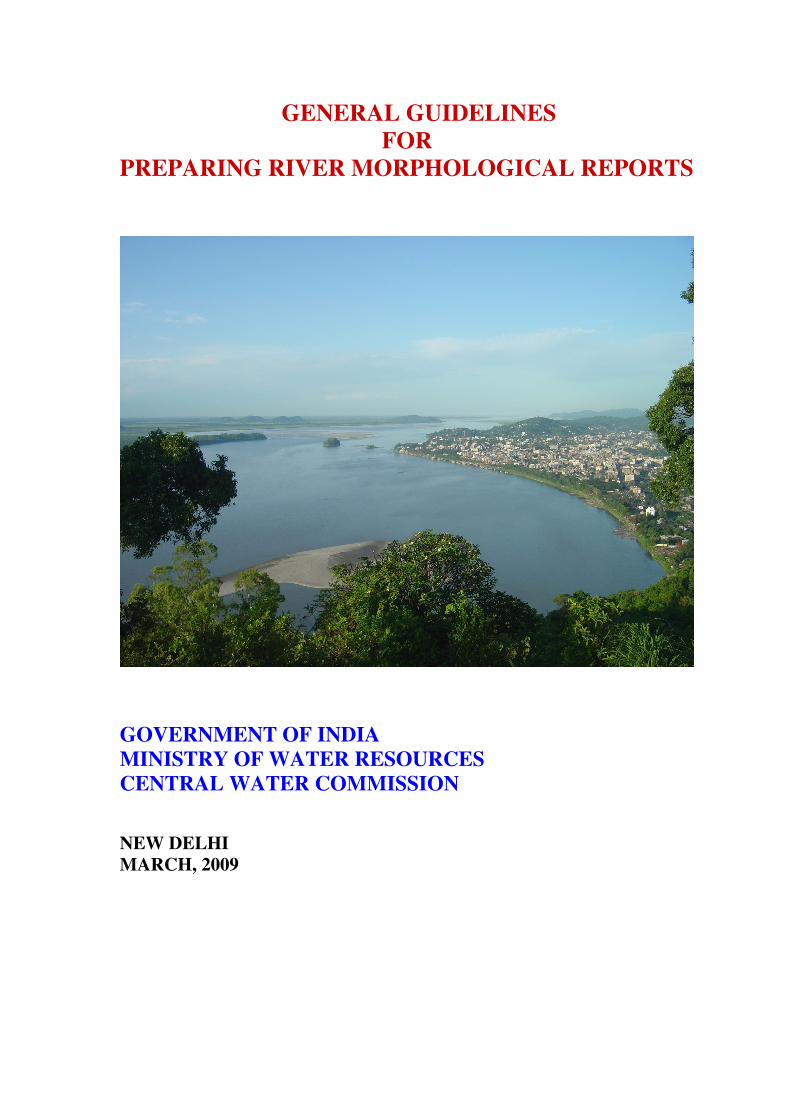
Satellite Image of River Brahmaputra - Down Stream of Guwahati (Assam)