rfq for topographic surveying services for new operations
TRANSCRIPT

Page 1 of 16
GREENVILLE UTILITIES COMMISSION Greenville, North Carolina
REQUEST FOR QUALIFICATIONS FOR
TOPOGRAPHIC SURVEYING SERVICES
FOR NEW OPERATIONS CENTER
A. SCOPE OF SERVICES
SURVEYOR will conduct a topographic survey and mapping for Tract 2 as indicated on attached
Recombination Plat for Greenville Utilities Commission. The survey shall be conducted by, or under the
supervision of a Professional Surveyor licensed to practice in North Carolina. All surveying and mapping to
be performed in accordance with NCAC Title 21, Chapter 56.1600 and the scope of work as outlined below:
1.0 GENERAL
1.1 Topographic Surveying Requirements
Show Parcel lines including street right of ways and jurisdiction, width and type of pavement.
Location and description of existing visible structures within the project area including top elevation and spot elevations at corners; including structure inverts if accessible.
Show recorded or otherwise known easements and/or rights-of-way and identify owners (holders) if known.
Show property zoning and building set-backs
Show owners name / zoning / land use of adjacent property.
Location of existing structures within the project area including building materials and note number of
stories and outside dimension of buildings.
Locate and describe fences, walls and other above ground features.
Horizontal Datum shall be NAD83/2011 and control established to the Class A standard or better.
Vertical Datum shall be NAVD 88 and established at the site to Class C (GPS) standard or better.
Provide a minimum of two temporary benchmarks on site with a description and elevation to nearest 0.01 foot and two semi-permanent control points with coordinates for future use.
One foot contour interval; error shall not exceed one-half contour interval, except as noted.
Spot elevations to be taken at 100 foot grid or less on natural ground and 50 feet on center along hard surface features such as curb, centerline roads and edge of pavement. Additional spots as needed are to be taken along topographic features, i.e. top of bank, toe of bank, centerline ditch, grade breaks, high points and low points, to accurately depict existing conditions.
Show any and all encroachments across the boundary lines of the property, detailing the dimensions
and type of encroachment, or state that there are no encroachments.
Indicate whether or not the property is located in a flood zone(s). Indicate the FEMA flood zone map(s) reference and the specific flood hazard zone in which the property is located (Zone A, B, C, etc.). If property has multiple flood zone classifications, show and identify each flood zone and mark the contour lines of each flood zone on the survey.
Provide utility information from record drawing provided by the client or if obtainable from the utility provider; in addition, an NC-811 locate will need to be requested for the site survey limits. NC-811 Ticket numbers are to be listed on the face of the survey.
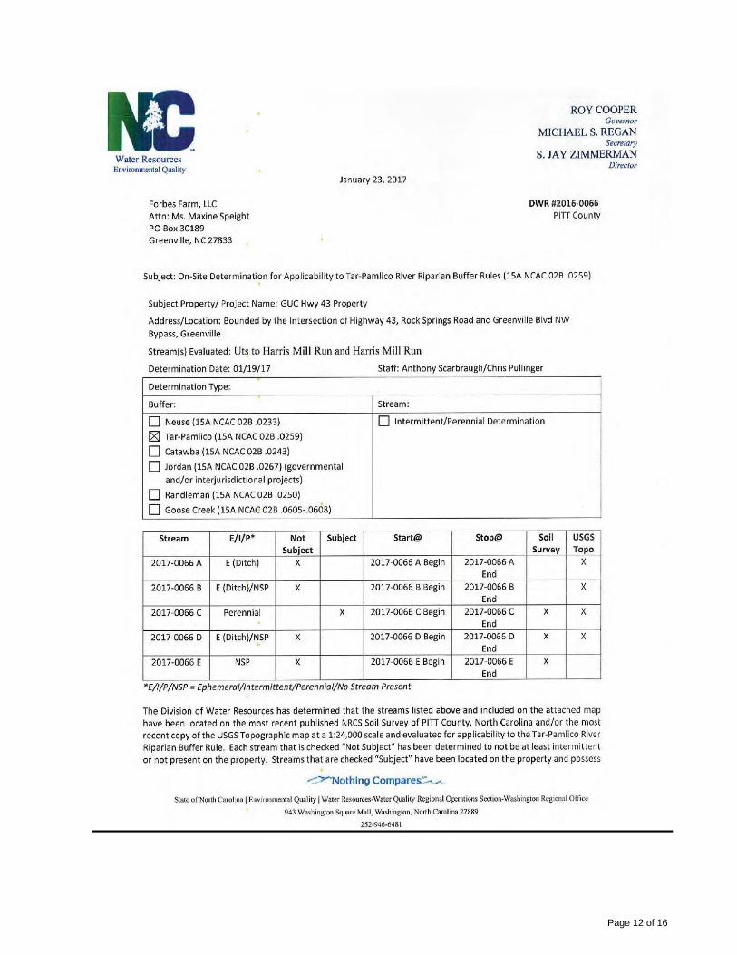
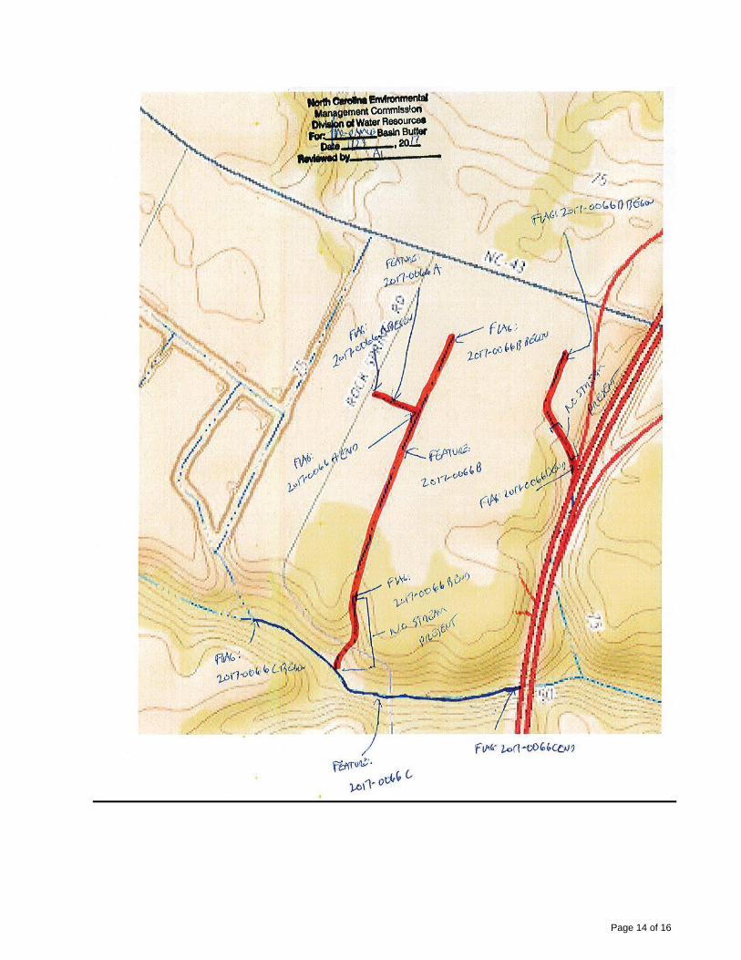
Show locations of wetlands and other environmental conditions as contained in preliminary sketch prepared by Land Management Group dated January, 2017 (copy attached).
Show Parcel lines including street right of ways and jurisdiction, width and type of pavement.
Location and description of existing visible structures within the project area including top elevation and spot elevations at corners; including structure inverts if accessible.
Show recorded or otherwise known easements and/or rights-of-way and identify owners (holders) if known.
Show property zoning and building set-backs

Page 2 of 16
Show owners name / zoning / land use of adjacent property.
Location of existing structures within the project area including building materials and note number of
stories and outside dimension of buildings.
Locate and describe fences, walls and other above ground features.
Horizontal Datum shall be NAD83/2011 and control established to the Class A standard or better.
Vertical Datum shall be NAVD 88 and established at the site to Class C (GPS) standard or better.
Provide a minimum of two temporary benchmarks on site with a description and elevation to nearest 0.01 foot and two semi-permanent control points with coordinates for future use.
One foot contour interval; error shall not exceed one-half contour interval, except as noted.
Spot elevations to be taken at 100 foot grid or less on natural ground and 50 feet on center along hard surface features such as curb, centerline roads and edge of pavement. Additional spots as needed are to be taken along topographic features, i.e. top of bank, toe of bank, centerline ditch, grade breaks, high points and low points, to accurately depict existing conditions.
Show any and all encroachments across the boundary lines of the property, detailing the dimensions
and type of encroachment, or state that there are no encroachments.
Indicate whether or not the property is located in a flood zone(s). Indicate the FEMA flood zone map(s) reference and the specific flood hazard zone in which the property is located (Zone A, B, C, etc.). If property has multiple flood zone classifications, show and identify each flood zone and mark the contour lines of each flood zone on the survey.
Provide utility information from record drawing provided by the client or if obtainable from the utility provider; in addition, an NC-811 locate will need to be requested for the site survey limits. NC-811 Ticket numbers are to be listed on the face of the survey.
Show locations of wetlands and other environmental conditions as contained in preliminary sketch prepared by Land Management Group dated January, 2017 (copy attached).
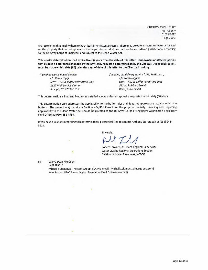
Show locations of features that are subject to the Tar-Pamlico Riparian Buffer Rules in accordance with letter from NC Department of Environmental Quality dated January 23, 2017 (copy attached).
1.2 Mapping Requirements
Furnish two (2) copies Drawing shall be signed and sealed by Professional Land Surveyor with the appropriate certifications per 21 NCAC 56.1600.
Utilize separate layers for different items (i.e. property lines, spot grades, contour lines, setbacks, easements, utilities, storm pipes, survey notes, etc.).
Drawing sheets shall be trim size 24" x 36" or 30” x 42” with 1 1/2 inch left binding edge and 1/2" borders.
Provide legend of symbols and abbreviations used on drawings.
Provide spot elevations on paved or other hard surfaces to the nearest hundredth of a foot and natural ground to the nearest tenth of a foot.
Provide elevation datum on drawings and show location of each temporary benchmark and horizontal control point.
Show vicinity map.
1.3 Electronic File Requirements
Furnish digital file compatible with AutoCAD Land Desktop or Civil3D of the completed survey. File must contain all the survey information depicted on the signed and sealed hard copy, excluding signature and seal. Seal must be replaced as required by 21 NCAC 56.
Furnish Digital Terrain Model TIN of completed work and in LandXML format.
Furnish ASCII point file used to create the survey.

Page 3 of 16
B. SOLICITATION INFORMATION
1.0 PROPOSAL PACKAGE
To be considered, please provide your Proposal package in the following format:
1.1 Firm Information
Included at a minimum, the Prime Consultant shall provide:
a. Business Structure (Corporation, Joint Venture, Partnership).
b. Financial Statement - This statement will be an audited report with comments not
older than one (1) year. If the most current report has not yet been audited, the previous audited report with comment shall affirm the most recent financial statement. The Financial Statement (included as an Appendix) is not included in the overall page count. A letter from the Firm’s banker addressing the general size of its accounts, its credit worthiness and overall financial performance will be acceptable in lieu of a financial statement.
c. History of the Firm, including number of years it has been in business, present
ownership, and key management individuals. Describe any anticipated or existing changes in overall corporate management ownership.
d. Pending litigation that may have a material impact to the Firm's financial standing
and/or the Firm's performance on this project, and major disputes, contract defaults, and liens in the last 5 years.
1.2 Firm Experience
Briefly describe the Firm's related experience in surveying, topographic surveying and mapping. The Firm must provide at least five (5) recent projects of a similar scope and complexity. These projects should also demonstrate the Firm's ability to meet time and budget requirements. The following minimum information should be included for each project:
a. Name and location of the project, b. Owner's name, c. General description of the project, d. Date awarded, e. Date completed or date of anticipated project completion, f. Owner's contact name, phone number, and e-mail address.
1.3 Project Team
The project team shall consist of members with demonstrated knowledge in surveying, topographic surveying and mapping of similar scope and complexity as contemplated.
a. Name and title, b. Proposed assignment for this project, c. Percentage of time to be assigned to this project (compared to concurrent
assignments to other projects), d. Experience (type of projects, specific project involvement, etc.), and e. Other qualifications.
Page 4 of 16
1.4 Project Approach and Schedule
Please describe your Firm's approach, including Sub-consultant(s) input, to meet or exceed the proposed services defined as the Project Scope. Please submit a work plan that includes an estimated man-hour effort for each significant segment or task of the work and the anticipated staff level to be assigned to that work segment. Please include an anticipated schedule for the completion of this Project.
1.5 Quality of Service
Testimonials: The Firm may include no more than three one page letters from clients that it has worked with on previous projects. Letters should comment on budget and/or schedule experiences and qualitative matters related to services rendered by the Firm or Team members. The Firm may also include a list of other client references with owner name and contact information.
2.0 EVALUATION CRITERIA RFQs will be evaluated using criteria as listed below in order of relative importance:
a. Professional qualifications of assigned staff. b. Firm’s experience with similar types of projects. c. Project approach and schedule. d. Demonstrated ability to meet time and budget requirements. e. Locality. f. References.
3.0 SUBMITTALS and INQUIRIES
RFQ packages should be no more than twenty (20) pages in length. Please prepare a cover letter no longer than two (2) pages, signed by an authorized representative of the firm. The table of contents will follow the cover letter (the cover letter and table of contents are not included in the overall page count). Pages shall be 8.5" x 11" with the exception of charts, photos, and exhibits which may utilize 11" x 17" folded to 8.5" x 11."
Inquiries on the project or requests for additional information must be E-mailed to: Cleve Haddock, CLGPO, Procurement Coordinator at [email protected] no later than February 20, 2017 at 5:00 p.m. local time. Greenville Utilities Commission will not be responsible for or bound by any oral instructions made by an employee(s) of GUC regarding this RFQ invitation. To be considered, four (4) copies and one (1) CD of the completed RFQ should be mailed or delivered to: Cleve Haddock, CLGPO, Procurement Coordinator, Greenville Utilities Commission, 401 S. Greene Street, Greenville, N.C. 27834 and referenced: RFQ for Topographic Surveying Services for New Operations Center.
4.0 DUE DATE and INTERVIEWS RFQ submittals must be received no later than March 1, 2017 at 2:00 p.m. local time. Late submittals will not be considered. After the screening of RFQs, shortlisted Firms may be given additional information for interviews. These interviews will relate less to the past experience and qualifications already detailed in the submittal than to identification of the Firm’s program approach and to an appraisal of the people who would be directly involved in the project.

Page 5 of 16
C. TERMS AND CONDITIONS GUC reserves the right to reject all Qualifications or accept such Qualifications, as appears in its own best interest, and to waive technicalities or irregularities of any kind in the proposal.
1.0 CONFLICT OF INTEREST
In general, conflicts of interest relate to the potential for self-gain usually, but not always, of a fiscal nature. Potential for self-gain can serve to undermine the judgment or objectivity of Proposers providing consultation services. A potential or actual conflict of interest exists when commitments and obligations to GUC are likely to be compromised by a Proposer's other interests or commitments, especially economic, particularly if those interests or commitments are not disclosed. Not all conflicting interests are necessarily impermissible. Timely and complete disclosure of potential conflicts of interest may be a satisfactory remedy and protects the consultant from suspicion and accusations of breach of professional integrity. Proposers are asked to disclose any situation or relationship that might be regarded as potential conflict of interest with, but not limited to, their expected duties and recommendations as defined in this RFQ.
2.0 PROPOSER INCURRED COSTS
All costs that may be incurred to prepare Qualifications, attend meetings, attend site inspections, provide requested follow-up information, make formal and informal presentations, and for the entire contract negotiations process if applicable, shall be the sole responsibility of each Proposer. GUC is not responsible under any circumstances for reimbursement of any costs that may be incurred by Proposers during the proposal preparation, subsequent selection or negotiation stages.
3.0 MINORITY BUSINESS PARTICIPATION PROGRAM
GUC has adopted an Affirmative Action and Minority and Women Business Enterprise Plan (M/WBE) Program. Firms submitting a proposal are attesting that they also have taken affirmative action to ensure equality of opportunity in all aspects of employment, and to utilize M/WBE suppliers of materials and/or labor.
4.0 INSURANCE REQUIREMENTS
GUC shall be named as additional insured for its interest on all policies of insurance except Worker's Compensation as regards ongoing operations, products, and completed operations and this shall be noted on the face of the Certificate of Insurance.
Certificates for all such policies shall be provided by the Firm's insurance agent or broker to GUC within (fifteen) 15 working days from the date of award. Firm will provide GUC a minimum of 30 days advance notice in the event of the insurance policies or insurance policy is canceled. Sub-consultants approved by GUC to perform work on this project are subject to all of the requirements in this section. Firm agrees to maintain and keep in force during the life of the design engagement, with a company or companies authorized to do business in North Carolina for the following insurance policies:
Automobile Liability - $1,000,000.00 per Occurrence- Combined Single Limit Coverage shall include bodily injury and property damage and cover all vehicles including owned, nonowned and hired.
Commercial General Liability - $1,000,000.00 per Occurrence
(Including products and completed operations liability)
Worker’s Compensation Coverage A - State of North Carolina Statutory Coverage B - Employers Liability

Page 6 of 16
$500,000.00/$500,000.00
Umbrella Liability - $1,000,000.00 Per Occurrence Over Primary Insurance Errors and Omissions Liability - $2,000,000.00
5.0 PROPOSAL WITHDRAWAL
A proposer must notify GUC in writing of its request to withdraw a proposal within seventy-two (72) hours after the proposal opening, not including Saturdays, Sundays, or holidays. In order to justify withdrawal, the proposer must demonstrate that a substantial error exists and that the proposal was submitted in good faith.
6.0 AFFIRMATIVE ACTION
The Provider will take affirmative action in complying with all Federal and State requirements concerning fair employment and employment of the handicapped, and concerning the treatment of all employees, without discrimination by reason of race, color, religion, sex, national origin, or physical handicap.
7.0 MEDIATION/BINDING ARBITRATION
In the event of any dispute between the Parties, the Parties agree to submit any dispute to nonbinding mediation before a mutually agreeable Mediator prior to initiating litigation. If the Parties are unable to agree upon a Mediator within thirty (30) days after demand therefore, either Party may petition a Court of competent jurisdiction for the designation of a qualified Mediator for these purposes. Each Party shall bear its own costs and expenses of participating in the mediation (including, without limitation, reasonable attorneys’ fees), and each Party shall bear one-half (1/2) of the costs and expenses of the Mediator. Unless otherwise agreed, the Parties will hold the mediation in Greenville, North Carolina. The matters discussed or revealed in the mediation session shall not be disclosed in any subsequent litigation. In the event the matter is not resolved in mediation, either Party may request arbitration. The parties shall jointly select an Arbitrator, and shall be bound by the decision of the Arbitrator with respect to any dispute between the parties with respect to this Agreement. If the parties are unable to mutually agree upon an Arbitrator, the Parties shall each select an Arbitrator, and the two Arbitrators so selected shall select a third Arbitrator, and the decision of the majority of the Arbitrators shall be conclusive and binding upon the Parties. The Parties at all times agree to equally split the costs of any Arbitrator(s) selected in an effort to resolve the dispute between the Parties. Any party desiring to resolve a dispute under the terms of this Agreement shall notify the other Party in writing, and the Parties shall seek to agree upon a mutually agreed upon Arbitrator within a period of ten (10) days from the date of such written demand. If the Parties are unable to agree within such ten (10) day period, the Parties shall each select an Arbitrator, and the two (2) Arbitrators so selected shall select a third Arbitrator within fifteen (15) days from the date of the written demand for arbitration, and a decision shall be rendered by the Arbitrator(s) so selected within five (5) days after such Arbitrator(s) is selected.
8.0 INDEMNITY PROVISION
Provider agrees to indemnify and save GUC of the City of Greenville, Pitt County, North Carolina, and the City of Greenville, North Carolina, its co-owners, joint ventures, agents, employees, and insurance carriers harmless from any and all losses, claims, actions, costs, expenses including reasonable attorney fees, judgments, subrogations, or other damages resulting from injury to any person (including injury resulting in death), or damage (including loss or destruction) to property of whatsoever nature of any person arising out of or incident to the performance of the terms of this Contract by Provider, including, but not limited to, Provider’s employees, agents, subcontractors, and others designated by Provider to perform work or services in, about, or attendant to, the work and services under the terms of this Contract. Provider shall not be held responsible for any losses, expenses, claims, subrogations, actions, costs, judgments, or other damages, directly, solely, and proximately caused by the negligence of GUC of the City of Greenville, Pitt

Page 7 of 16
County, North Carolina. Insurance covering this indemnity agreement by the Provider in favor of Greenville Utilities Commission of the City of Greenville, Pitt County, North Carolina, shall be provided by Provider.
9.0 GOVERNING LAWS
All requests, contracts, transactions, agreements, etc., are made under and shall be governed by and construed in accordance with the laws of the State of North Carolina.
10.0 ADMINISTRATIVE CODE
Bids, Qualifications, and awards are subject to applicable provisions of the North Carolina Administrative Code.
11.0 SITUS The place of all contracts, transactions, agreements, their situs and forum, shall be North Carolina, where
all matters, whether in contract or tort, relating to the validity, construction, interpretation, and enforcement
shall be determined.
12.0 E-VERIFY
E-Verify - I understand that E-Verify is the federal E-Verify program operated by the United States Department of Homeland Security and other federal agencies, or any successor or equivalent program used to verify the work authorization of newly hired employees pursuant to federal law in accordance with NCGS §64-25 et seq. I am aware of and in compliance with the requirements of E-Verify and Article 2 of Chapter 64 of the North Carolina General Statutes. To the best of my knowledge, any subcontractors employed by me as a part of this contract are in compliance with the requirements of E-Verify and Article 2 of Chapter 64 of the North Carolina General Statutes.
13.0 IRAN DIVESTMENT ACT CERTIFICATION
By acceptance of this purchase order, Vendor/Contractor certifies that, as of the date of the purchase order
or contract, it is not on the Final Divestment List as created by the State Treasurer pursuant to N.C.G.S. §
143-6A-4. In compliance with the requirements of the Iran Divestment Act and N.C.G.S. § 143C-6A-5(b),
Vendor/Contractor shall not utilize in the performance of the contract any subcontractor that is identified on
the Final Divestment List.
[Balance of page left blank intentionally]
Page 8 of 16
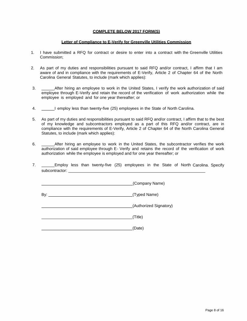
COMPLETE BELOW 2017 FORM(S)
Letter of Compliance to E-Verify for Greenville Utilities Commission
1. I have submitted a RFQ for contract or desire to enter into a contract with the Greenville Utilities Commission;
2. As part of my duties and responsibilities pursuant to said RFQ and/or contract, I affirm that I am aware of and in compliance with the requirements of E-Verify, Article 2 of Chapter 64 of the North Carolina General Statutes, to include (mark which applies):
3. After hiring an employee to work in the United States, I verify the work authorization of said employee through E-Verify and retain the record of the verification of work authorization while the employee is employed and for one year thereafter; or
4. I employ less than twenty-five (25) employees in the State of North Carolina.
5. As part of my duties and responsibilities pursuant to said RFQ and/or contract, I affirm that to the best of my knowledge and subcontractors employed as a part of this RFQ and/or contract, are in compliance with the requirements of E-Verify, Article 2 of Chapter 64 of the North Carolina General Statutes, to include (mark which applies):
6. After hiring an employee to work in the United States, the subcontractor verifies the work authorization of said employee through E- Verify and retains the record of the verification of work authorization while the employee is employed and for one year thereafter; or
7. Employ less than twenty-five (25) employees in the State of North Carolina. Specify
subcontractor:
(Company Name)
By: (Typed Name)
(Authorized Signatory)
(Title)
(Date)

Page 9 of 16
Letter of Compliance to IRAN Divestment Act Certification for
Greenville Utilities Commission
RFP Number (if applicable): ____________________________
Name of Vendor or Bidder:
IRAN DIVESTMENT ACT CERTIFICATION
REQUIRED BY N.C.G.S. 143C-6A-5(a)
As of the date listed below, the vendor or bidder listed above is not listed on the Final Divestment List created by the State Treasurer pursuant to N.C.G.S. 143-6A-4.
The undersigned hereby certifies that he or she is authorized by the vendor or bidder listed above to make the foregoing statement.
Signature Date
Printed Name Title
Notes to persons signing this form: N.C.G.S. 143C-6A·5(a) requires this certification for bids or contracts with the State of North Carolina, a North Carolina local government, or any other political subdivision of the State of North Carolina. The certification is required at the following times:
• When a bid is submitted • When a contract is entered into (if the certification was not already made when the
vendor made its bid) • When a contract is renewed or assigned
N.C.G.S. 143C-6A-5(b) requires that contractors with the State, a North Carolina local government, or any other political subdivision of the State of North Carolina must not utilize any subcontractor found on the Stale Treasurer's Final Divestment List. The State Treasurer's Final Divestment List can be found on the State Treasurer's website at the address www.nctreasurer.com/lran and will be updated every 180 days.
Page 10 of 16
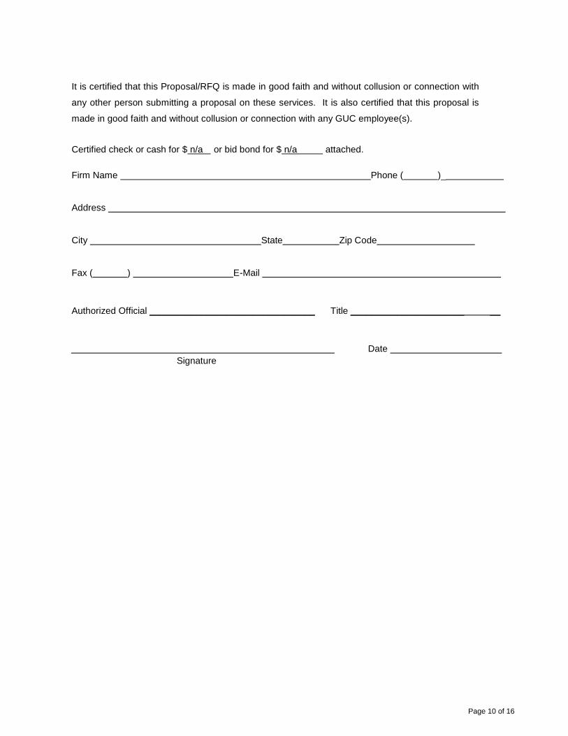
It is certified that this Proposal/RFQ is made in good faith and without collusion or connection with
any other person submitting a proposal on these services. It is also certified that this proposal is
made in good faith and without collusion or connection with any GUC employee(s).
Certified check or cash for $ n/a or bid bond for $ n/a attached.
Firm Name Phone ( )_
Address
City State Zip Code
Fax ( ) E-Mail
Authorized Official ________________________________ Title ______________________ __
Date
Signature

Page 11 of 16
Page 12 of 16
Page 13 of 16
Page 14 of 16

Page 15 of 16

Page 16 of 16