riau data analysis: 14 year changes monitored by … data analysis: 14 year changes monitored by...
TRANSCRIPT

KC12 presentations
Riau data analysis: 14 year changes monitored by JERS-1/PALSAR
Goal: Change detection of the NRCSTrial for biomass changeSemi automatic estimation system with given resolutionsPeat land subsidence estimation
Future problemsFilteringCollection of ground truth - NRCS-biomassTrial for the saturated area
M.Shimada

Start
Mosaicking for year_nMosaicking for year_nMosaicking for year_nMosaicking for year_nMosaicking for year_n
Same coordinate system
Ortho rectified slope corrected data
Classification
Covert NRCS -> Biomass
Differentiation of Biomass etc.
DinSAR - subsidence

B:Biomass estimation(NRCS)
log W( )= a0 + a1σHV0 + a2 σHV
0( )2 + b1σ HH0 + b2 σHH
0( )2
After Sassan S.[2007]
> 係数を地上データを用いて作成する必要あり。
2008/11 1994/2Biomass chage at the central kalimantan

PALSAR Sumatra mosaic July, 2007 and change over 15 years
Harapan Rainforest 200km
One season mosaiccolored with three values, HH, HV, HH/HV.
Coverage:Malaysia and Sumatra
Green: forestPurple:clear cut
PALSAR :FBD(Fine beam dual, 10m resolution)
Riau
Sumatra, Indonesia Malaysia
Batanghari river.
Djambi
South Sumatra

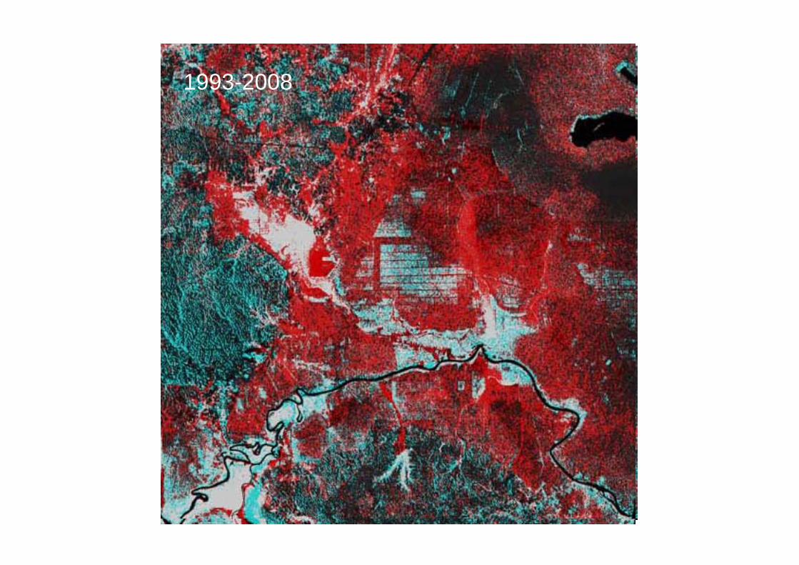
R:1993G:1998B:2008

1993-1998 1998-2008
1993-2008
Biomass changes

Color composite of biomass changes(1998,2008,2008)

Color composite of biomass changes(1993,1998,1998)

Color composite of biomass changes(1993,2008,2008)
1993-19981998-20081993-2008
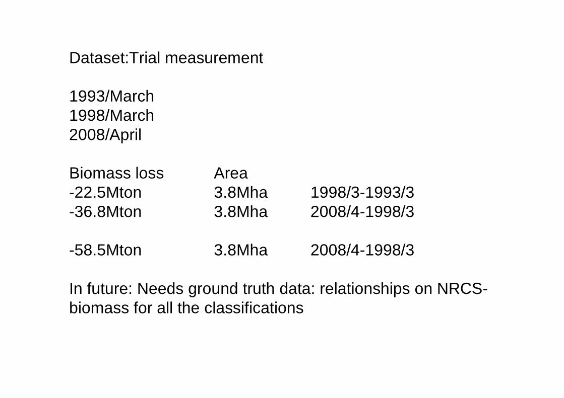
Dataset:Trial measurement
1993/March1998/March2008/April
Biomass loss Area-22.5Mton 3.8Mha 1998/3-1993/3-36.8Mton 3.8Mha 2008/4-1998/3
-58.5Mton 3.8Mha 2008/4-1998/3
In future: Needs ground truth data: relationships on NRCS-biomass for all the classifications

Approach:
Shell command for mosaicking Several datasets for the spatial expansions with specified resolution
Classify the datasets
Apply the NRCS-Biomass relationship for each classes
Differentiate the datasets

APRIL concession – cleared area with canals, acacia plantation and natural forest corridor, Riau, Indonesia
Validation at Riau State, Indonesia on PALSAR dual pol enhancement