right sizing transportation investments · belt from this tod •dart will use this commitment as...
TRANSCRIPT

RIGHT SIZING TRANSPORTATION
INVESTMENTS
AMPOSeptember 29, 2018

Right Sizing
• Definition – the right size, which you know it when you see it!
• LOCAL: The Community weighs in to provide feedback for calibrating the local opportunity to the regional investment.
• REGIONAL: Making something the right size to respond efficiently and effectively.

US 75 @ Walnut Hill Lane – 1959
Source:
texasfreeway.com

US 75 @ Walnut Hill Lane – 1989
Source: texasfreeway.com

US 75 @ Walnut Hill Lane – 2029?
Source: steer.ru

Cotton BeltFort Worth, Texas

• Fort Worth to DFW Airport
• Approved for Construction
• FTA $500 Million Full Funding Grant Agreement with local match
• DFW Airport to Plano/Richardson
• Constructed via a DART Design Build Contract
• Some Value Capture Funding

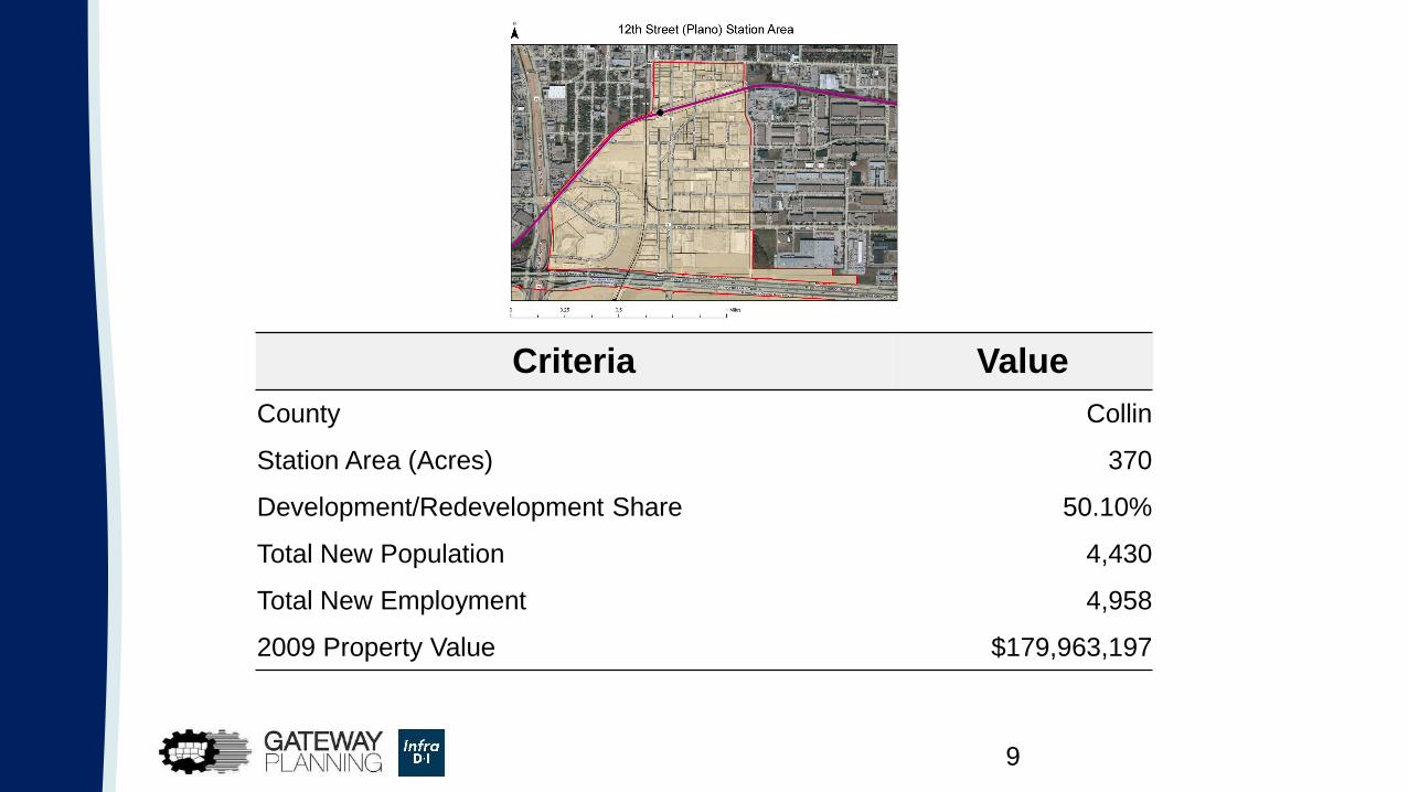
Sample Station Area
9
Criteria Value
County Collin
Station Area (Acres) 370
Development/Redevelopment Share 50.10%
Total New Population 4,430
Total New Employment 4,958
2009 Property Value $179,963,197
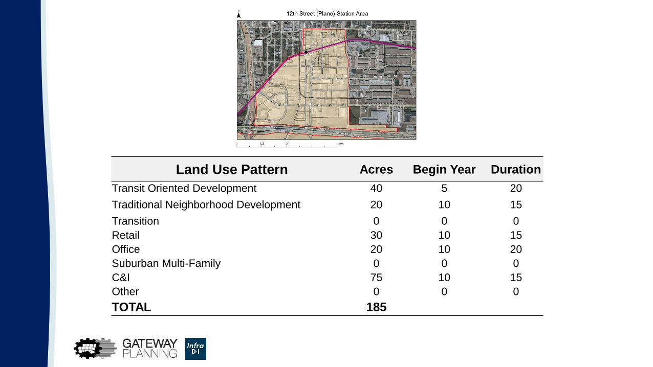
Land Use Pattern Acres Begin Year Duration
Transit Oriented Development 40 5 20
Traditional Neighborhood Development 20 10 15
Transition 0 0 0
Retail 30 10 15
Office 20 10 20
Suburban Multi-Family 0 0 0
C&I 75 10 15
Other 0 0 0
TOTAL 185

What Is Value Capture?
• Several Means• Incremental Land Value Increase
• Incremental Tax-base Growth
• Advertising Revenues
• Other economic value drivers
• Key Components• Local Jurisdiction Approval
• Developer Support

Sample Station Area

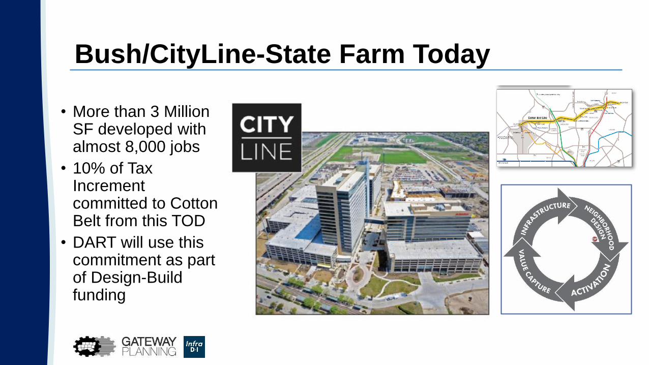
Bush/CityLine-State Farm Today
• More than 3 Million SF developed with almost 8,000 jobs
• 10% of Tax Increment committed to Cotton Belt from this TOD
• DART will use this commitment as part of Design-Build funding

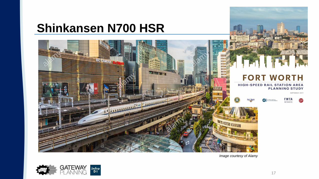
High-Speed Rail Station Area PlanningFort Worth, Arlington, and Dallas, Texas

Right Sizing High-Speed Rail
17
Image courtesy of Alamy
Shinkansen N700 HSR

18
Study Area and Draft Alignment Options
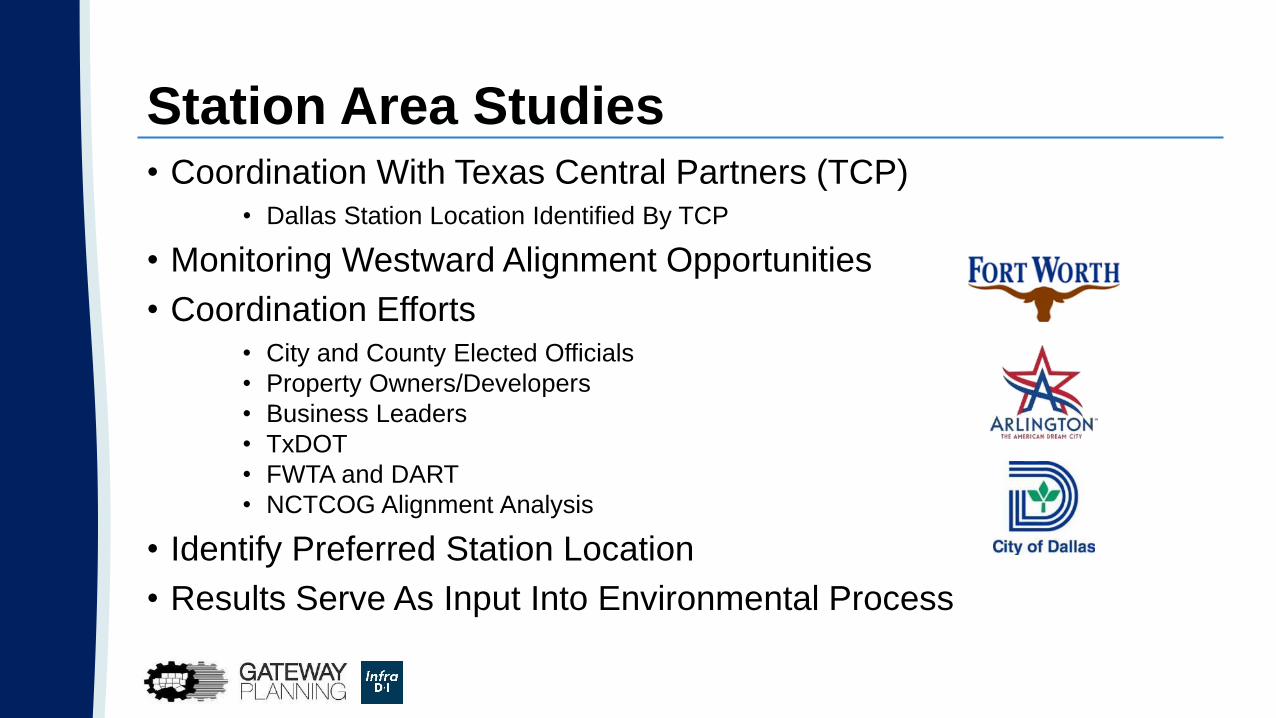
Station Area Studies• Coordination With Texas Central Partners (TCP)
• Dallas Station Location Identified By TCP
• Monitoring Westward Alignment Opportunities
• Coordination Efforts• City and County Elected Officials
• Property Owners/Developers
• Business Leaders
• TxDOT
• FWTA and DART
• NCTCOG Alignment Analysis
• Identify Preferred Station Location
• Results Serve As Input Into Environmental Process

Fort Worth Station Areas
Study Conducted for the City of Fort Worth
Study Efforts
Analyzing Possible Station Locations
Completed Stakeholder Input Meetings
City of Fort Worth and Tarrant County Elected Officials
Fort Worth Housing Solutions (Butler)
Sundance Square and Downtown Business Leaders
Trinity Metro
Coordinating with NCTCOG Alignment Analysis
20

Fort Worth Station Location Criteria
Alignment Options
Land Availability and Ownership
Existing Infrastructure Compatibility
Environmental Justice
Station Area Context
Public Plan Consistency
Partnership Potential
Economic Development Opportunities
Mobility Plan Policies and Recommendations

Fort Worth Station Location Criteria
E. ITC – 127
G. Central Rail – 121
F. East Sundance – 115
C. Southside – 96
A. Butler – 89
D. T&P – 86
B. East Lancaster – 81

Rightsizing for High-Speed Rail
• Instead of requiring thousands of parking spaces at the ITC for the future station, NCTCOG allowed Trinity Metro, the City and the consultant team Gateway Planning to assume a 500-space need due to future transit connectivity and autonomous vehicle impacts
Dallas CityMAPDallas, Texas

NCTCOG Role with CityMAP
• Provided tools
• Provided data
• Attended coordination meetings
• Need recommendations from others

Dallas CityMAP – Regional to Local
• How a TxDOT funded local initiative has regional implications
• Economic development, community development and value capture from the highway corridors through downtown
• Right size roadway design to capture the most potential for both regional commute and local development context

I-345/I-45 Remove Scenario
Remove & Replace
Scenario

I-345/I-45 Remove Scenario
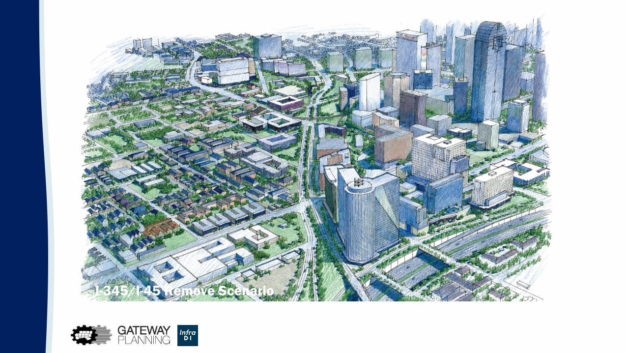
I-345/I-45 Remove Scenario

I-30 Canyon
Compressed

I-30 Canyon Compressed Scenario


I-30 Connectivity & Complete Streets Opportunities

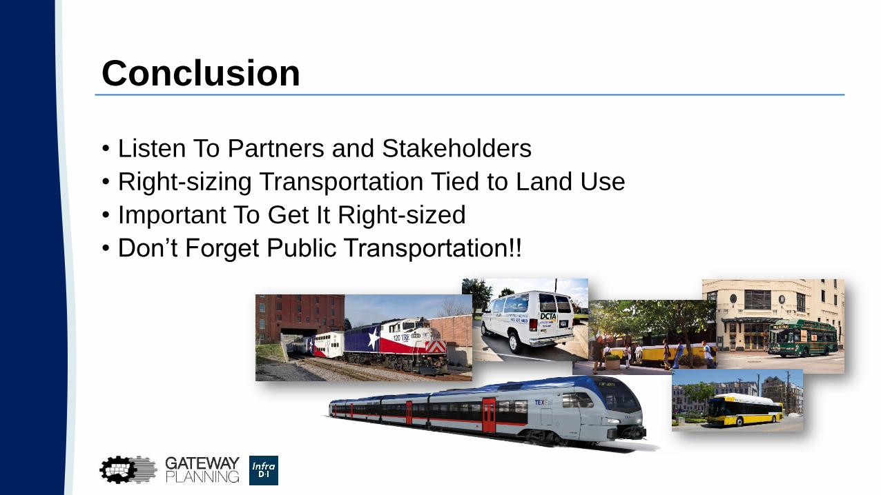
Conclusion
• Listen To Partners and Stakeholders
• Right-sizing Transportation Tied to Land Use
• Important To Get It Right-sized
• Don’t Forget Public Transportation!!
Questions?
Kevin Feldt
Program Manager
(817) 704-2529
Mo
bilit
y 2
04
5
Kelsey Berry
Principal
(214) 529-7430