rivers - dnmkr7tf85gze.cloudfront.net water in rivers flows downhill, with the ultimate goal of...
TRANSCRIPT

ARTICLE-A-DAY™
Rivers6 Articles
Check articles you have read:
Earth's Water: Rivers and Streams909 words
Rivers and the Landscape425 words
Sediment and Suspended Sediment in Rivers594 words
Lengths of the World's Major Rivers281 words
Rivers and Streamflow737 words
What Is a Watershed?918 words
Page 1 of 14 ReadWorks.org · © 2018 ReadWorks , Inc. All rights reserved.®

National Park Service
The Chattahoochee River, Atlanta,Georgia, USA. The river servesmany purposes, from drinking waterto wildlife habitat to a recreation spotfor the whole city.
Earth's Water: Rivers and StreamsT his text is fro m the U.S. Geo lo g ical Survey: Water Science Scho o l.
Rivers? Streams? Creeks? They are all names for water flowing on the
Earth's surface. . . .
Most of the water you see flowing in rivers comes from precipitation
runoff from the land surface alongside the river. Of course, not all runoff
ends up in rivers. Some of it evaporates on the journey downslope, can
be diverted and used by people for their uses, and can even be lapped up
by thirsty animals. Rivers flow through valleys in the landscape with
ridges of higher land separating the valleys. The area of land between
ridges that collects precipitation is a watershed or drainage basin. Most,
but not all, precipitation that falls in a watershed runs off directly into
rivers - part of it soaks into the ground to recharge groundwater aquifers, some of which can then
seep back into riverbeds.
What is a river?
A river forms from water moving from a higher altitude to a lower altitude, all due to gravity. When
rain falls on the land, it either seeps into the ground or becomes runoff, which flows downhill into
rivers and lakes, on its journey towards the seas. In most landscapes the land is not perfectly flat—
it slopes downhill in some direction. Flowing water finds its way downhill initially as small creeks.
As small creeks flow downhill they merge to form larger streams and rivers. Rivers eventually end
up flowing into the oceans. If water flows to a place that is surrounded by higher land on all sides, a
lake will form. If people have built a dam to hinder a river's flow, the lake that forms is a reservoir.
Rivers serve many uses
The phrase "river of life" is not just a random set of words. Rivers have
been essential not only to humans, but to all l ife on earth, ever since life
began. Plants and animals grow and congregate around rivers simply
because water is so essential to all l ife. It might seem that rivers happen
SHOW_AUTO_COPYRIGHTNO_PARTNER_LOGOEarth's Water: Rivers and Streams
Page 2 of 14 © 2018 ReadWorks®, Inc. All rights reserved.

to run through many cities in the world, but it is not that the rivers go through the city, but rather that
the city was built and grew up around the river. For humans, rivers are diverted for flood control,
irrigation, power generation, municipal uses, and even waste disposal.
Where does the water in rivers come from?
[. . .]
[T]he water in a river doesn't all come from surface runoff. Rain falling on the land also seeps into
the Earth to form groundwater. At a certain depth below the land surface, called the water table,
the ground becomes saturated with water. If a river bank happens to cut into this saturated layer, as
most rivers do, then water will seep out of the ground into the river. Groundwater seepage can
sometimes be seen when a road is built through water-bearing layers, and even on a driveway.
USGS
Look at the diagram above. The ground below the water table, the aquifer (the purple area), is
saturated, whereas the ground above (the pink area) is not. The top layer (unsaturated soil/rock
material) is usually wet, but not totally saturated. Saturated, water-bearing materials often exist in
horizontal layers beneath the land surface. Since rivers, in time, may cut vertically into the ground
as they flow (as the river cuts into the purple section in the diagram), the water-bearing layers of
rock can become exposed on the river banks. Thus, some of the water in rivers is attributed to flow
coming out of the banks. This is why even during droughts there is usually some water in streams.
Where does the water in rivers go?
Like everything else on (and in) the Earth, water obeys the rules of gravity and tries to get to the
Earth's Water: Rivers and Streams
Page 3 of 14 © 2018 ReadWorks®, Inc. All rights reserved.

NASA Earth Observatory
Satellite view of the ending point ofthe Colorado River near the Gulf ofCalifornia, Mexico. The ColoradoRiver can be seen in dark blue at thetopmost central part of this image.
center of the Earth (did you imagine that every molecule in your body is trying to do this, also? ). So,
the water in rivers flows downhill, with the ultimate goal of flowing into the oceans, which are at
sea level. River water may end up in a lake or reservoir, in a pipe aimed at Farmer Joe's corn stalks,
in a local swimming pool, or in your drinking glass, but much of it eventually ends up back in the
oceans, where it rejoins the water cycle, which is ALWAYS in progress.
One river that doesn't participate anymore in this normal cycle is the
mighty Colorado River, flowing from Colorado to the Gulf of California in
Mexico. The Colorado River certainly starts out as mighty—mighty
enough to have carved out the Grand Canyon—but nowadays it does not
even end as a trickle. Whereas it once flowed into a large marshy area at
the Gulf of California, today it l iterally disappears in the farmlands at the
base of the Sierra de Juarez Mountains in Mexico. As the Colorado River
flows through the desert [southwest], it gets used and used by millions
of thirsty residents and for crop irrigation; used until there is nothing
left. In this satellite view of the "exit point" of the Colorado River, the
river itself is the dark blue patch at the top.
Earth's Water: Rivers and Streams
Page 4 of 14 © 2018 ReadWorks®, Inc. All rights reserved.

Rivers and the LandscapeT he text and imag es are fro m the U.S. Geo lo g ical Survey: Water Science Scho o l.
Rivers and streams begin their lives as smaller creeks, often called "the
headwaters." These small tributaries . . . run downhill until they merge to
form bigger tributaries . . . which continue merging to form larger rivers .
. . . Rivers keep flowing to lower altitudes, towards the oceans. River
systems are similar to the blood vessels in your body. Tiny capillaries
that carry blood keep merging together until all of the blood empties
into large veins, which deliver the blood to your heart.
All rivers are surrounded by a certain amount of land that is higher in
altitude (upgradient) than the actual river. Precipitation that falls in this
area eventually flows downhill towards the river. At any particular point
on a river, the land upgradient of the point is the river's watershed, or
drainage basin. . . .
What separates two watersheds from each other are ridges of higher land. You might have heard of
the Continental Divide, which runs along the highest ridges of the Rocky Mountains. Precipitation
falling on the western side of the Divide will flow towards the Pacific Ocean and precipitation
falling on the eastern slopes will flow towards the Atlantic Ocean, via the Gulf of Mexico. The
United States has many watersheds of many sizes, and many, many ridges that define these
drainage basins. . . . [I]n Atlanta, Ga, the main street through the city is Peachtree Street. It is
actually built on top of a ridge that is a drainage-basin divide. Rain falling on the eastern side of
Peachtree Street will flow towards the Atlantic Ocean, while runoff on the western side heads to
the Gulf of Mexico.
Rivers and streams have a great impact on both the local landscape
and our own lives. Flowing water continually erodes the land it runs
through, and over millions of years the topography of the land can
be greatly changed (notice how deep the Grand Canyon gorge is).
River water is used by humans for irrigation; rivers deposit mineral-
rich soil in their flood plains where man can grow crops; rivers are
SHOW_AUTO_COPYRIGHTNO_PARTNER_LOGORivers and the Landscape
Page 5 of 14 © 2018 ReadWorks®, Inc. All rights reserved.

used to transport people and their manufactured products; rivers
can produce hydroelectric power; and, if you notice where towns
and cities are located, people build their communities next to rivers
. . . .
Rivers also transport soil and sediment from one place to another, which has a great impact on the
landscape. This is important to our stomachs, as silt that is deposited in flood plains of rivers makes
excellent farmland (just ask the ancient Egyptians who lived along the Nile River and depended on
the annual flooding of the river for their livelihood).
Rivers and the Landscape
Page 6 of 14 © 2018 ReadWorks®, Inc. All rights reserved.

Sediment-laden water from atributary, where development isprobably taking place, entering theclearer Chattahoochee River nearAtlanta, Georgia
Sediment and Suspended Sediment in RiversT he text and imag es are fro m the U.S. Geo lo g ical Survey: Water Science Scho o l.
Storms, of course, deliver large amounts of water to a river, but did you
know they also bring along lots of eroded soil and debris from the
surrounding landscape? Rocks as small as tiny clay particles and as
large as boulders moved by the water are called sediment. Fast-moving
water can pick up, suspend, and move larger particles more easily than
slow-moving waters. This is why rivers are more muddy-looking during
storms—they are carrying a LOT more sediment than they carry during a
low-flow period. In fact, so much sediment is carried during storms that
over one-half of all the sediment moved during a year might be
transported during a single storm period.
If you scoop up some muddy river water in a glass you are viewing the suspended sediment in the
water. If you leave your glass in a quiet spot for a while the sediment will start to settle to the
bottom of the glass. The same thing happens in rivers in spots where the water is not moving so
quickly—much of the suspended sediment falls to the stream bed to become bottom sediment (yes,
mud). The sediment may build up on the bottom or it may get picked up and suspended again by
swift-moving water to move further downstream.
So what does this have to do with people? On the positive side, sediment deposited on the banks
and flood plains of a river is often mineral-rich and makes excellent farmland. The fertile
floodplains of the Nile in Egypt and of the Mississippi River in the United States have flooding rivers
to thank for their excellent soils. On the negative side, when rivers flood, they leave behind many
tons of wet, sticky, heavy, and smelly mud—not something you would want in your basement.
Sediment in rivers can also shorten the lifespan of dams and reservoirs. When a river is dammed
and a reservoir is created, the sediments that used to flow along with the relatively fast-moving
river water are, instead, deposited in the reservoir. This happens because the river water flowing
through the reservoir moves too slowly to keep sediment suspended -- the sediment settles to the
bottom of the reservoir. Reservoirs slowly fill up with sediment and mud, eventually making them
unusable for their intended purposes.
SHOW_AUTO_COPYRIGHTNO_PARTNER_LOGOSediment and Suspended Sediment in Rivers
Page 7 of 14 © 2018 ReadWorks®, Inc. All rights reserved.

Sediment-data collection in the LittleColorado River a kilometer upstreamfrom the Colorado River, GrandCanyon, Arizona
The U.S. Geological Survey (USGS) does quite a lot of work across the
country measuring how much sediment is transported by streams. To do
this, both the amount of water flowing past a site (streamflow or flow)
and the amount of sediment in that water (sediment concentration) must
be measured. Both streamflow and sediment concentration are
continually changing.
Streamflow is measured by making a discharge measurement.
Suspended sediment, the kind of sediment that is moved in the water
itself, is measured by collecting bottles of water and sending them to a
lab to determine the concentration. Because the amount of sediment a river can transport changes
over time, hydrologists take measurements and samples as streamflow goes up and down during a
storm. Once we know how much water is flowing and the amount of sediment in the water at
different flow conditions, we can compute the tonnage of sediment that moves past the
measurement site during a day, during the storm, and even during the whole year.
Sediment and Suspended Sediment in Rivers
Page 8 of 14 © 2018 ReadWorks®, Inc. All rights reserved.

Kammerer, J.C., Largest Rivers in the United States, US Geological SurveyFact Sheet OFR 87-242 rev. 1990
Lengths of the World's Major RiversT his text is fro m the U.S. Geo lo g ical Survey: Water Science Scho o l.
Take a look at a map of the United States or of
any country in the world. Notice how towns
and cities tend to be located next to rivers?
This is no coincidence. Rivers provide water
for the essential needs of both tiny towns and
huge cities. There's a good chance that you
live near one of [your] nation's large rivers.
Ever wonder what rivers are the longest?
Look at the graphic below to see our short list
of long rivers.
(It's not so easy to define how long a river is.
If a number of tributaries merge to form a
larger river, how would you define where the
river actually begins? Here is how we are
defining river length:
River leng ths o r river-leng th data are affected no t o nly
by so me o f the natural and artificial causes no ted in the
preceding parag raph, but also by the precisio n o f
vario us techniques o f measurement, by the scale o f available maps o r aerial pho to g raphs, and by so mewhat arbitrary
decisio ns. Fo r example, the leng th may be co nsidered to be the distance fro m the mo uth to the mo st distant headwater
so urce (irrespective o f stream name) o r fro m the mo uth to the headwaters o f the stream co mmo nly identified as the
so urce stream. T he names o f so me rivers, such as the Mississippi River and the Rio Grande, are unchang ed fro m so urce to
mo uth. In co ntrast, the name o f the so urce o f the Mo bile River—T ickanetley Creek—chang es five times befo re beco ming
Mo bile River 45 miles no rth o f Mo bile Bay.
This information is from USGS Open-File Report 87-242.
SHOW_AUTO_COPYRIGHTNO_PARTNER_LOGOLengths of the World's Major Rivers
Page 9 of 14 © 2018 ReadWorks®, Inc. All rights reserved.

Rivers and StreamflowT he text and imag es are fro m the U.S. Geo lo g ical Survey: Water Science Scho o l.
If you read our discussion on the role the oceans play in the water
cycle, you know that evaporation from the oceans is the primary way
that water returns to the atmosphere from the Earth's surface. Water
returns to the Earth from precipitation falling on the land, where
gravity either takes it into the ground as infiltration or it begins
running downhill as surface runoff. But how does much of the water get
back into the oceans to keep the water cycle going? A lot of runoff
ends up in creeks, streams, and rivers, flowing downhill towards the oceans. Unless the river flows
into a closed lake, a rare occurrence, or is diverted for humans' uses, a common occurrence, they
empty into the oceans, thus fulfilling their water-cycle duties.
The U.S. Geological Survey (USGS) uses the term "streamflow" to refer to the amount of water
flowing in a river. Although USGS usually uses the term "stream" when discussing flowing water
bodies, in these pages we'll use "rivers" more often, since that is probably what you are more
familiar with.
Importance of rivers
Rivers are invaluable to not only people, but to life everywhere. Not only are rivers a great place for
people (and their dogs) to play, but people use river water for drinking-water supplies and
irrigation water, to produce electricity, to flush away wastes (hopefully, but not always, treated
wastes), to transport merchandise, and to obtain food. Rivers are major aquatic landscapes for all
manners of plants and animals. Rivers even help keep the aquifers underground full of water by
discharging water downward through their streambeds. And, we've already mentioned that the
oceans stay full of water because rivers and runoff continually refreshes them.
Watersheds and rivers
One word can explain why any river exists on Earth—gravity. You've heard that "water seeks its
own level," but really water is seeking the center of the Earth, just like everything else. In practical
SHOW_AUTO_COPYRIGHTNO_PARTNER_LOGORivers and Streamflow
Page 10 of 14 © 2018 ReadWorks®, Inc. All rights reserved.
terms, water generally seeks to flow to the oceans, which are at sea
level. So, no matter where on Earth water is, it tries to flow downhill .
With the Earth being a very unlevel place, water ends up occupying the
valleys and depressions in the landscape as rivers and lakes.
When looking at the location of rivers and the amount of streamflow in
rivers, the key concept is the river's "watershed." What is a watershed?
Easy, if you are standing on the ground right now, just look down. You're
standing, and everyone is standing, in a watershed. A watershed is the
area of land where all of the water that falls in it and drains off of it goes to the same place.
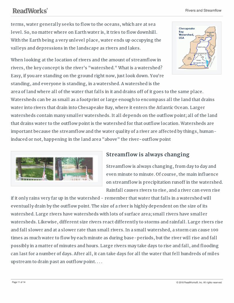
Watersheds can be as small as a footprint or large enough to encompass all the land that drains
water into rivers that drain into Chesapeake Bay, where it enters the Atlantic Ocean. Larger
watersheds contain many smaller watersheds. It all depends on the outflow point; all of the land
that drains water to the outflow point is the watershed for that outflow location. Watersheds are
important because the streamflow and the water quality of a river are affected by things, human-
induced or not, happening in the land area "above" the river-outflow point
Streamflow is always changing
Streamflow is always changing, from day to day and
even minute to minute. Of course, the main influence
on streamflow is precipitation runoff in the watershed.
Rainfall causes rivers to rise, and a river can even rise
if it only rains very far up in the watershed - remember that water that falls in a watershed will
eventually drain by the outflow point. The size of a river is highly dependent on the size of its
watershed. Large rivers have watersheds with lots of surface area; small rivers have smaller
watersheds. Likewise, different size rivers react differently to storms and rainfall . Large rivers rise
and fall slower and at a slower rate than small rivers. In a small watershed, a storm can cause 100
times as much water to flow by each minute as during base-periods, but the river will rise and fall
possibly in a matter of minutes and hours. Large rivers may take days to rise and fall, and flooding
can last for a number of days. After all, it can take days for all the water that fell hundreds of miles
upstream to drain past an outflow point. . . .
Rivers and Streamflow
Page 11 of 14 © 2018 ReadWorks®, Inc. All rights reserved.

What Is a Watershed?T he text and imag es are fro m the U.S. Geo lo g ical Survey: Water Science Scho o l.
When looking at the location of rivers and the amount of
streamflow in rivers, the key concept is the river's
"watershed." What is a watershed? Easy, if you are standing
on ground right now, just look down. You're standing, and
everyone is standing, in a watershed. A watershed is the
area of land where all of the water that falls in it and drains
off of it goes to a common outlet. Watersheds can be as
small as a footprint or large enough to encompass all the
land that drains water into rivers that drain into Chesapeake Bay, where it enters the Atlantic
Ocean. This map shows one set of watershed boundaries in the continental United States; these are
known as National 8-digit hydrologic units (watersheds).
A watershed is an area of land that drains all the streams and rainfall to a common outlet such as the
outflow of a reservoir, mouth of a bay, or any point along a stream channel. The word watershed is
sometimes used interchangeably with drainage basin or catchment. Ridges and hills that separate
two watersheds are called the drainage divide. The watershed consists of surface water--lakes,
streams, reservoirs, and wetlands--and all the underlying ground water. Larger watersheds
contain many smaller watersheds. It all depends on the outflow point; all of the land that drains
water to the outflow point is the watershed for that outflow location. Watersheds are important
because the streamflow and the water quality of a river are affected by things, human-induced or
not, happening in the land area "above" the river-outflow point.
A watershed is a precipitation collector
Most of the precipitation that falls within the drainage area of a stream's
monitoring site collects in the stream and eventually flows by the
monitoring site. Many factors, some listed below, determine how much
of the streamflow will flow by the monitoring site. Imagine that the
whole basin is covered with a big (and strong) plastic sheet. Then if it
rained one inch, all of that rain would fall on the plastic, run downslope
SHOW_AUTO_COPYRIGHTNO_PARTNER_LOGOWhat Is a Watershed?
Page 12 of 14 © 2018 ReadWorks®, Inc. All rights reserved.

into gulleys and small creeks and then drain into main stream. Ignoring evaporation and any other
losses, and using a 1-square mile example watershed, then all of the approximately 17,378,560
gallons of water that fell . . . as rainfall would eventually flow by the watershed-outflow point.
Not all precipitation that falls in a watershed flows out
To picture a watershed as a plastic-covered area of land that collects precipitation is overly
simplistic and not at all l ike a real-world watershed. A career could be built on trying to model a
watershed water budget (correlating water coming into a watershed to water leaving a watershed).
There are many factors that determine how much water flows in a stream (these factors are
universal in nature and not particular to a single stream):
Precipitation: The greatest factor controlling streamflow, by far, is the amount of precipitation
that falls in the watershed as rain or snow. However, not all precipitation that falls in a
watershed flows out, and a stream will often continue to flow where there is no direct runoff
from recent precipitation.
Infiltration: When rain falls on dry ground, some of the water soaks in, or infiltrates the soil .
Some water that infiltrates will remain in the shallow soil layer, where it will gradually move
downhill, through the soil, and eventually enters the stream by seepage into the stream bank.
Some of the water may infiltrate much deeper, recharging groundwater aquifers. Water may
travel long distances or remain in storage for long periods before returning to the surface. The
amount of water that will soak in over time depends on several characteristics of the watershed:
Soil characteristics: In Georgia, clayey and [rocky] soils of the northern areas absorb less
water at a slower rate than sandy soils, such as in Georgia's Coastal Plain. Soils absorbing
less water results in more runoff overland into streams.
Soil saturation: Like a wet sponge, soil already saturated from previous rainfall can't absorb
much more ... thus more rainfall will become surface runoff.
Land cover: Some land covers have a great impact on infiltration and rainfall runoff.
Impervious surfaces, such as parking lots, roads, and developments, act as a "fast lane" for
rainfall - right into storm drains that drain directly into streams. Flooding becomes more
prevalent as the area of impervious surfaces increase.
Slope of the land: Water falling on steeply-sloped land runs off more quickly than water
falling on flat land.
What Is a Watershed?
Page 13 of 14 © 2018 ReadWorks®, Inc. All rights reserved.

Evaporation: Water from rainfall returns to the atmosphere largely through evaporation. The
amount of evaporation depends on temperature, solar radiation, wind, atmospheric pressure,
and other factors.
Transpiration: The root systems of plants absorb water from the surrounding soil in various
amounts. Most of this water moves through the plant and escapes into the atmosphere through
the leaves. Transpiration is controlled by the same factors as evaporation, and by the
characteristics and density of the vegetation. Vegetation slows runoff and allows water to seep
into the ground.
Storage: Reservoirs store water and increase the amount of water that evaporates and
infiltrates. The storage and release of water in reservoirs can have a significant effect on the
streamflow patterns of the river below the dam.
Water use by people: Uses of a stream might range from a few homeowners and businesses
pumping small amounts of water to irrigate their lawns to large amounts of water withdrawals
for irrigation, industries, mining, and to supply populations with drinking water.
What Is a Watershed?
Page 14 of 14 © 2018 ReadWorks®, Inc. All rights reserved.