role of spatial database in biodiversity conservation planning sham davande, gis expert arid...
TRANSCRIPT
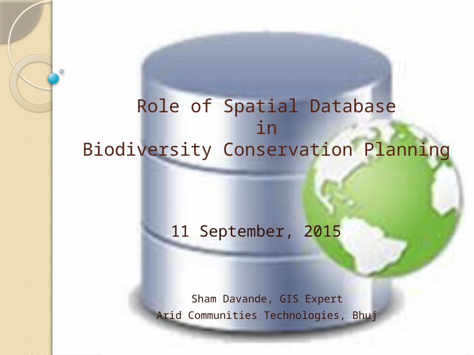
Role of Spatial Databasein
Biodiversity Conservation Planning
Sham Davande, GIS Expert
Arid Communities Technologies, Bhuj
11 September, 2015
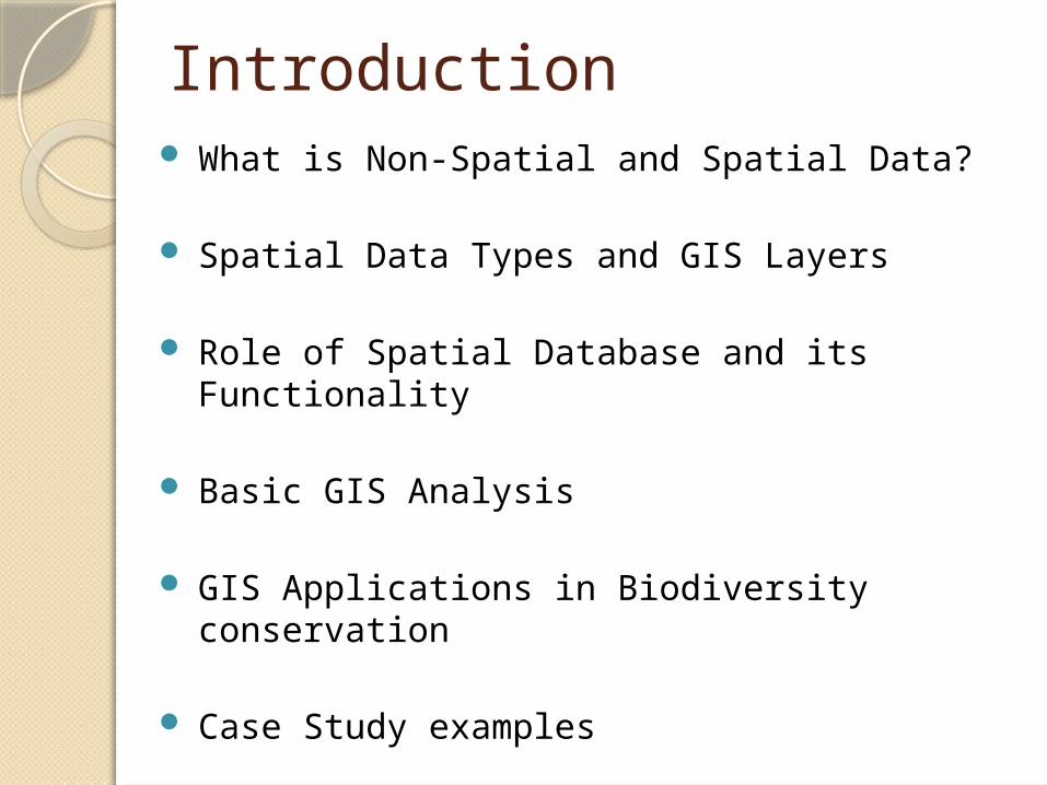
Introduction What is Non-Spatial and Spatial Data?
Spatial Data Types and GIS Layers
Role of Spatial Database and its Functionality
Basic GIS Analysis
GIS Applications in Biodiversity conservation
Case Study examples
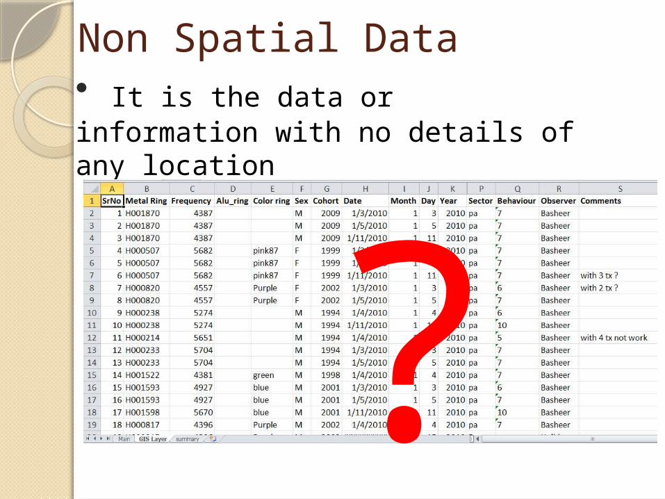
Non Spatial Data• It is the data or information with no details of any location
?
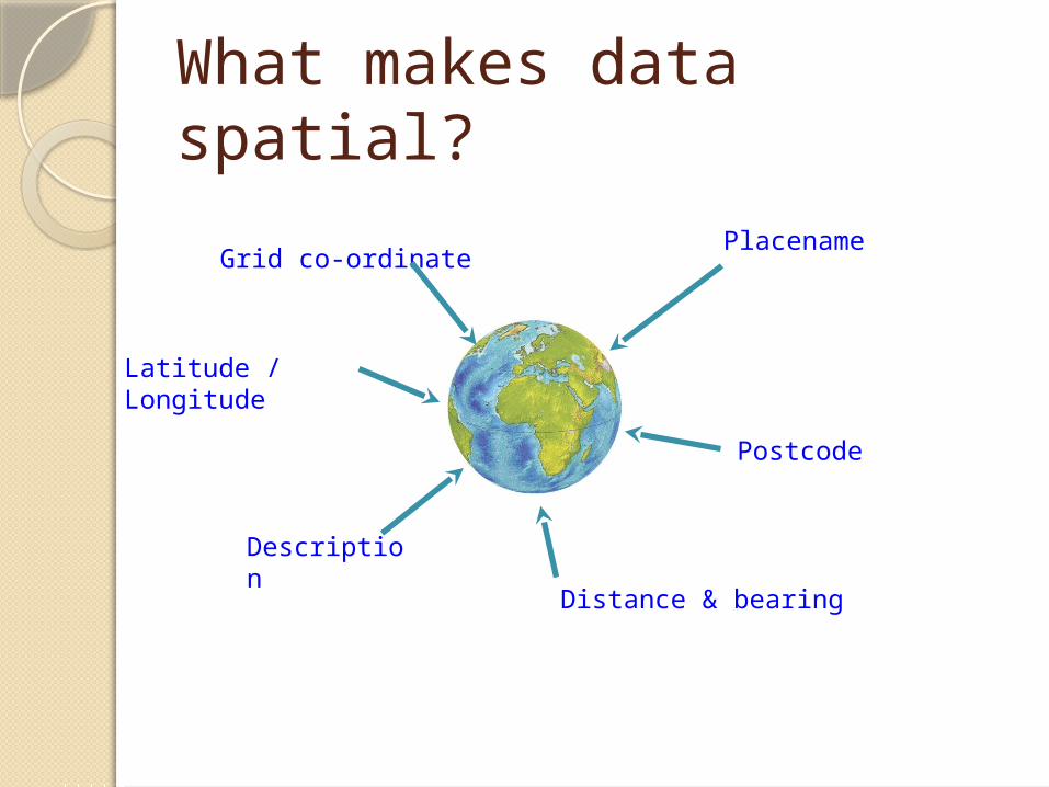
What makes data spatial?
PlacenameGrid co-ordinate
Postcode
Distance & bearing
Description
Latitude / Longitude
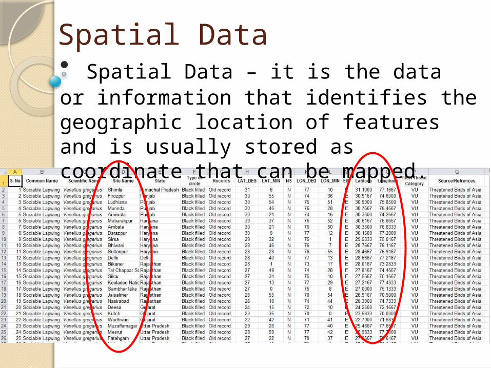
Spatial Data• Spatial Data – it is the data or information that identifies the geographic location of features and is usually stored as coordinate that can be mapped.
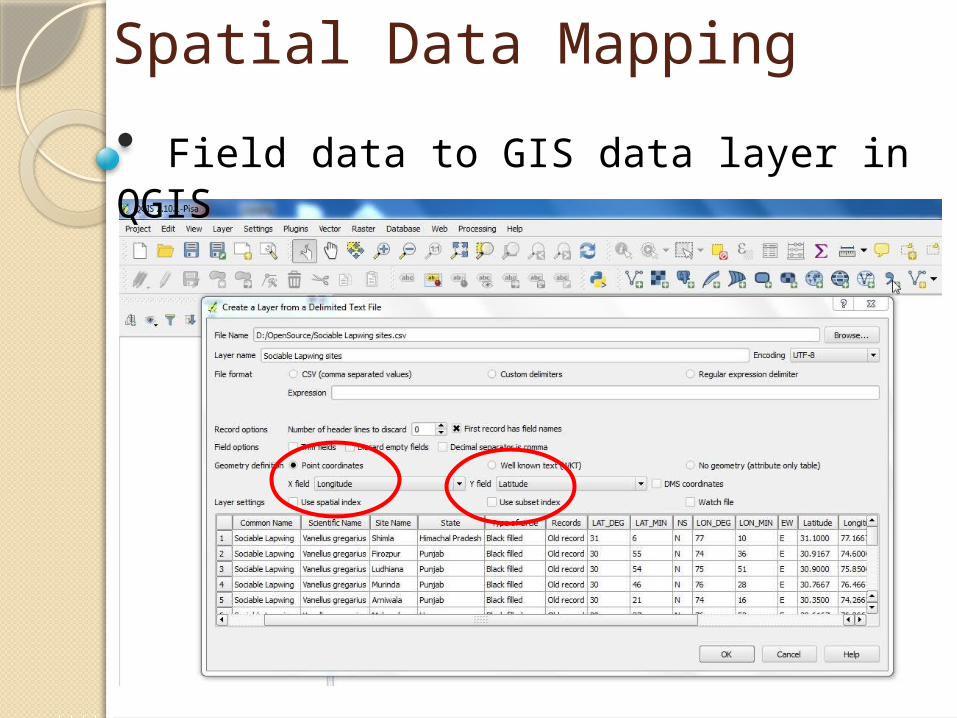
Spatial Data Mapping
• Field data to GIS data layer in QGIS
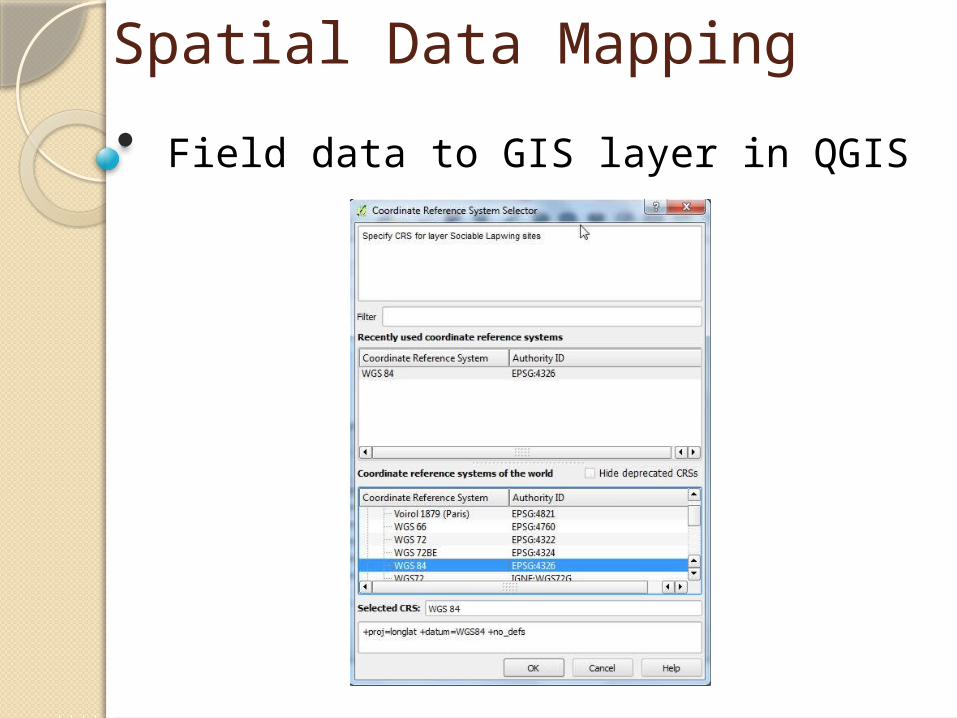
Spatial Data Mapping
• Field data to GIS layer in QGIS
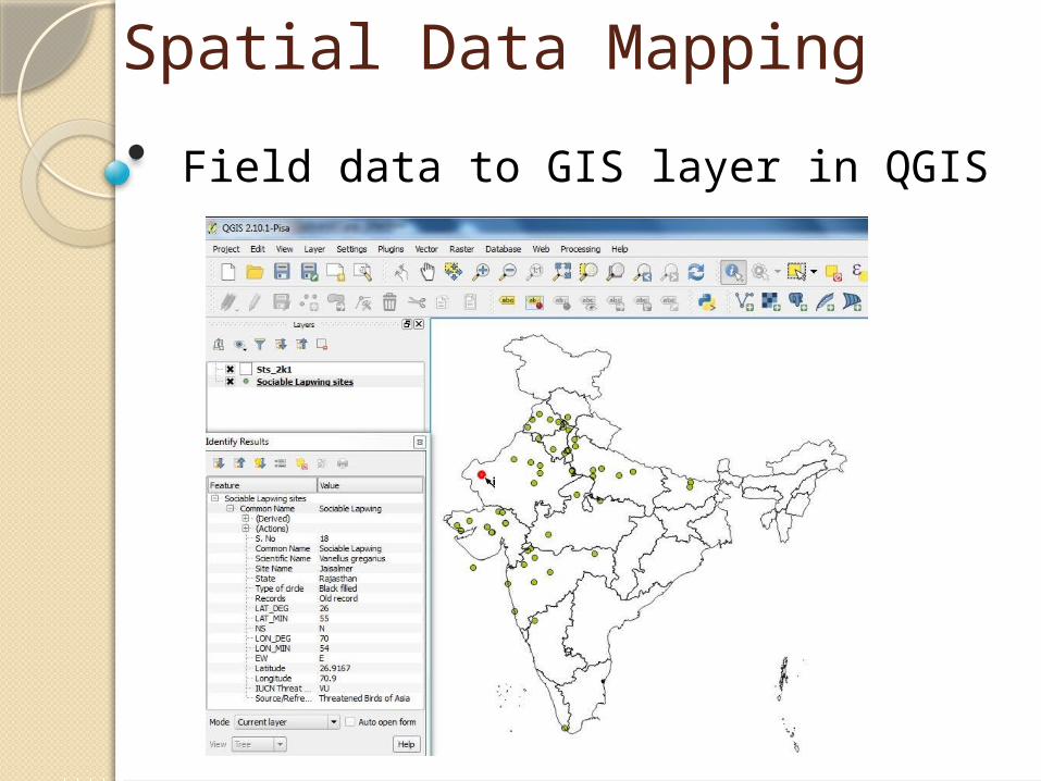
Spatial Data Mapping
• Field data to GIS layer in QGIS
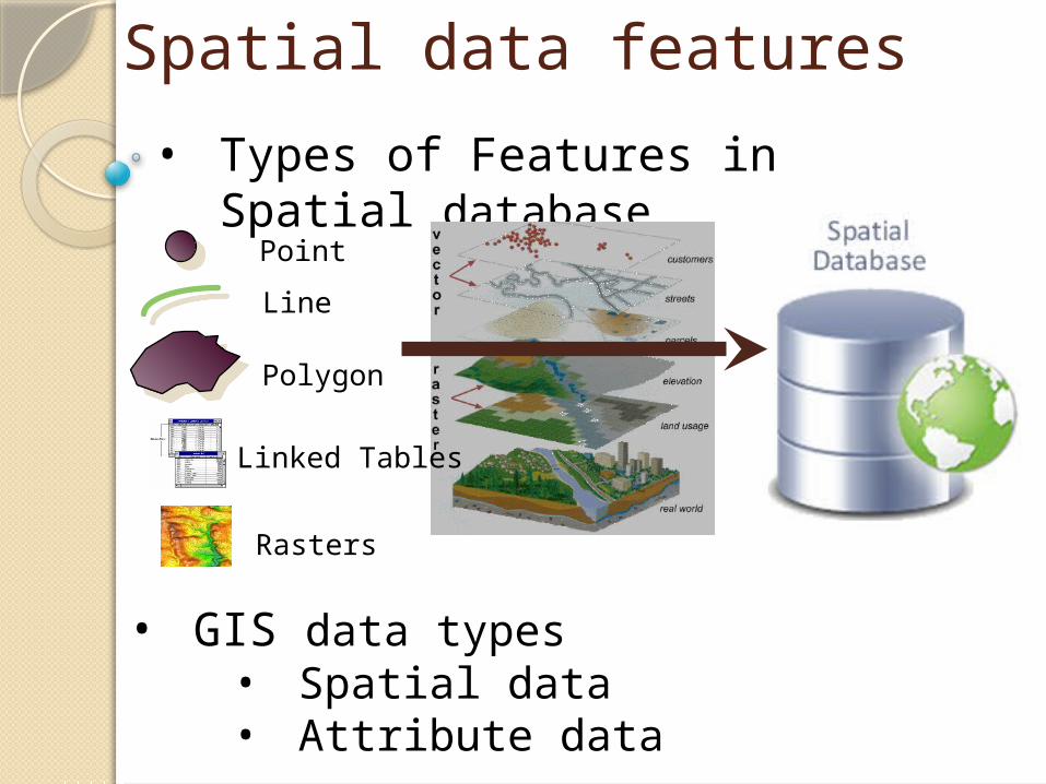
Spatial data features
• Types of Features in Spatial database
Point
Line
Polygon
• GIS data types • Spatial data• Attribute data
Linked Tables
Rasters
10
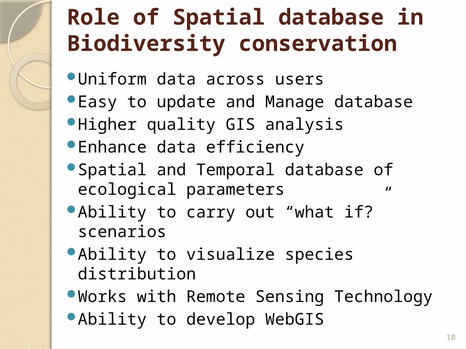
Role of Spatial database in Biodiversity conservationUniform data across usersEasy to update and Manage databaseHigher quality GIS analysisEnhance data efficiencySpatial and Temporal database of
ecological parametersAbility to carry out “what if?” scenariosAbility to visualize species distributionWorks with Remote Sensing TechnologyAbility to develop WebGIS
11
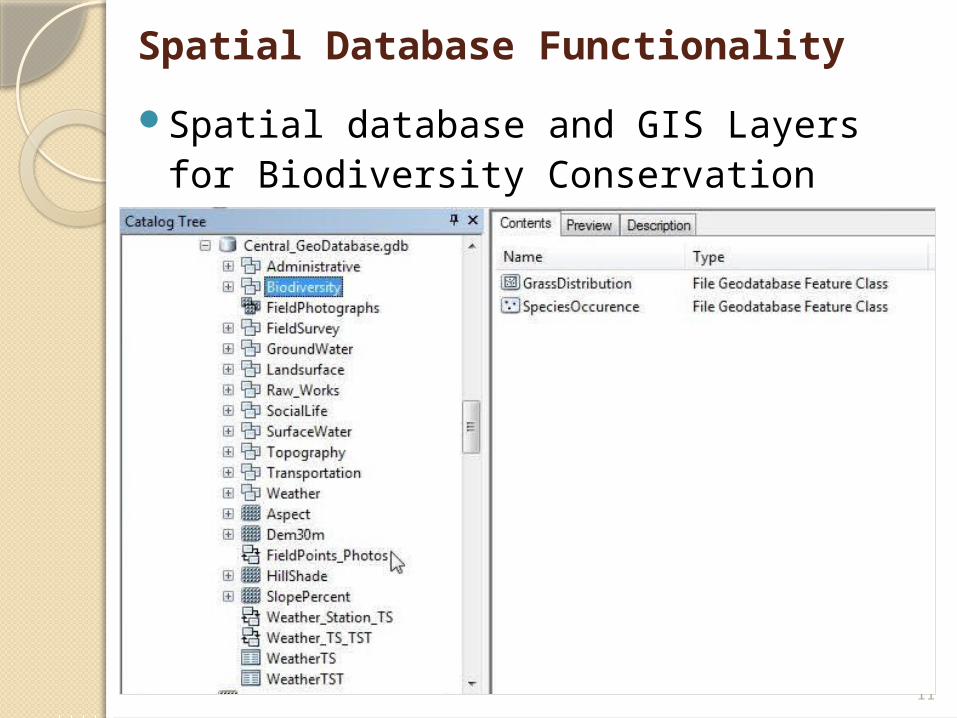
Spatial database and GIS Layers for Biodiversity Conservation
Spatial Database Functionality
12
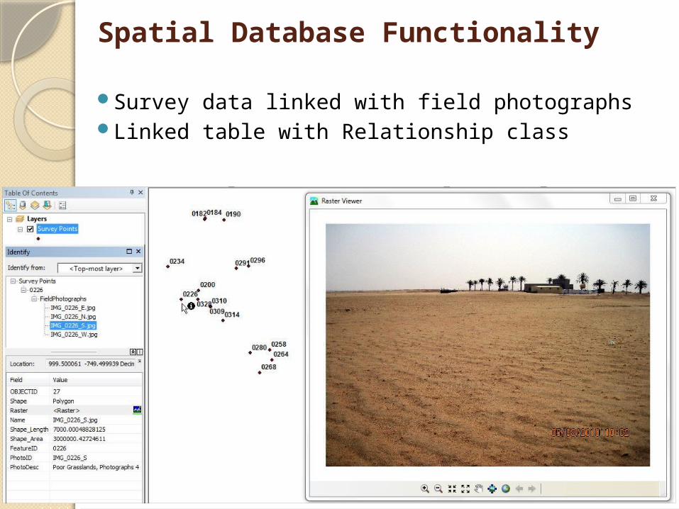
Spatial Database Functionality
Survey data linked with field photographsLinked table with Relationship class
13
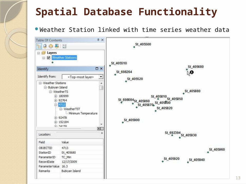
Spatial Database Functionality
Weather Station linked with time series weather data
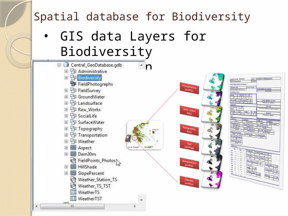
Spatial database for Biodiversity• GIS data Layers for
Biodiversity Conservation
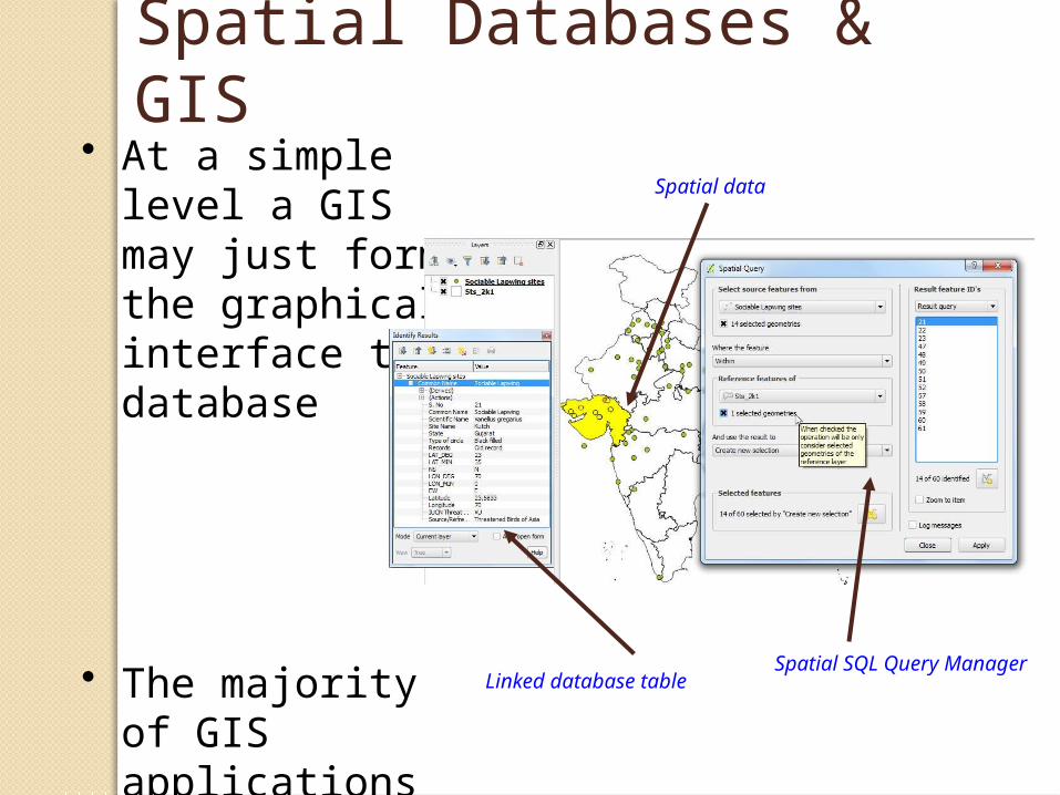
Spatial Databases & GIS• At a simple level
a GIS may just form the graphical interface to a database
• The majority of GIS applications follow this example
Linked database table
Spatial data
Spatial SQL Query Manager
GIS & AnalysisIn the context of GIS, analysis is...
“Deriving new information from existing data”
It is also the manipulation of data to solve a probleme.g. identify all areas within 500m of a lake
Increase in use of GIS analytical capabilities, BUTmany GIS projects only use the software to store
and manage geographical data
Yet analysis often relies on many simple basic GIS techniques
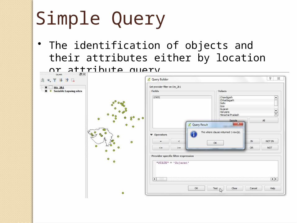
Simple Query• The identification of objects and their
attributes either by location or attribute query.
Spatial data
Spatial SQL Query Manager
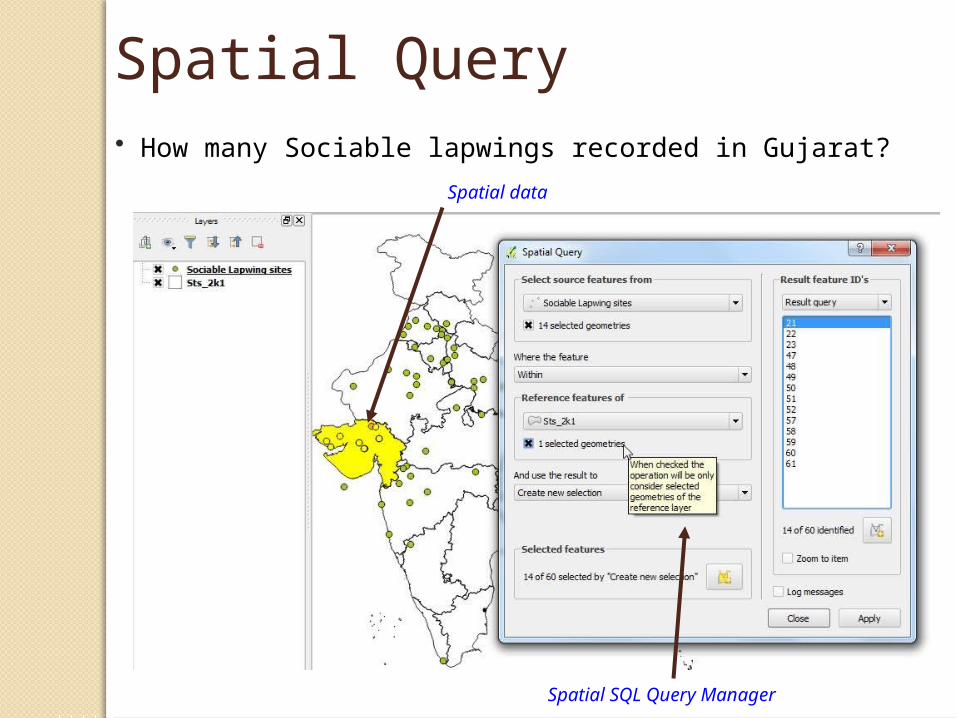
Spatial Query• How many Sociable lapwings recorded in Gujarat?
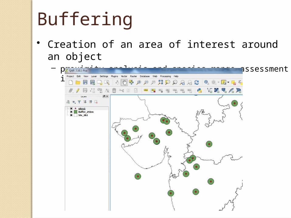
Buffering• Creation of an area of interest around an object
– proximity analysis and species range assessment in an area
20
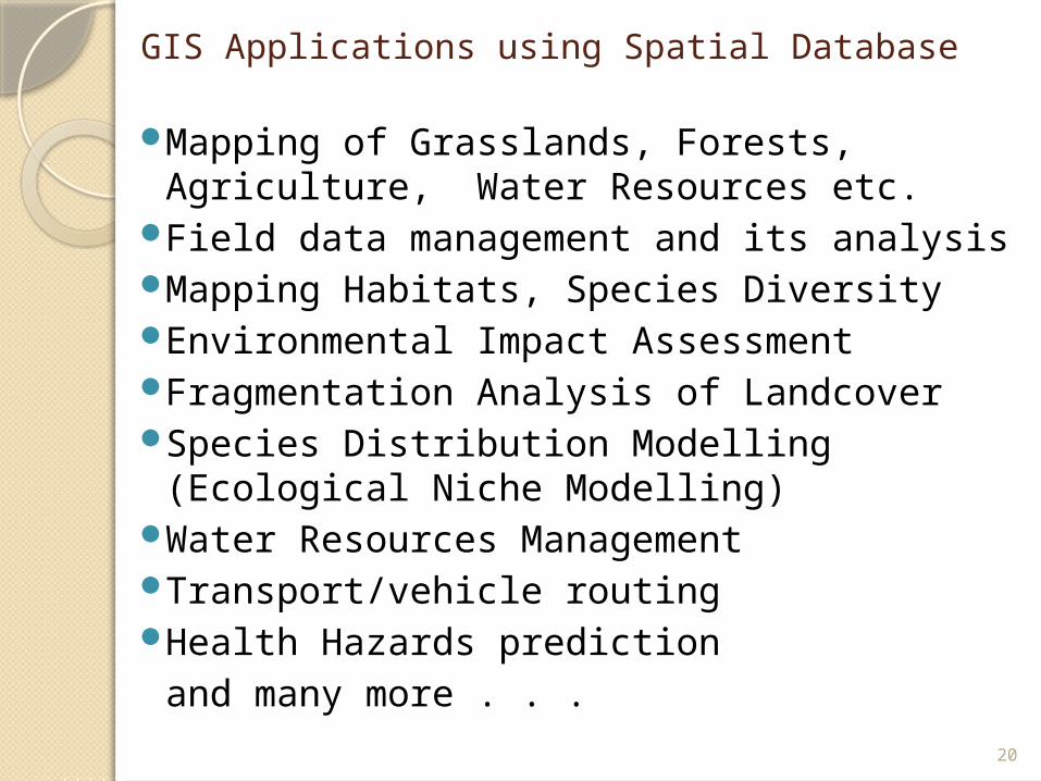
GIS Applications using Spatial Database
Mapping of Grasslands, Forests, Agriculture, Water Resources etc.
Field data management and its analysisMapping Habitats, Species DiversityEnvironmental Impact AssessmentFragmentation Analysis of LandcoverSpecies Distribution Modelling (Ecological
Niche Modelling)Water Resources ManagementTransport/vehicle routingHealth Hazards prediction
and many more . . .
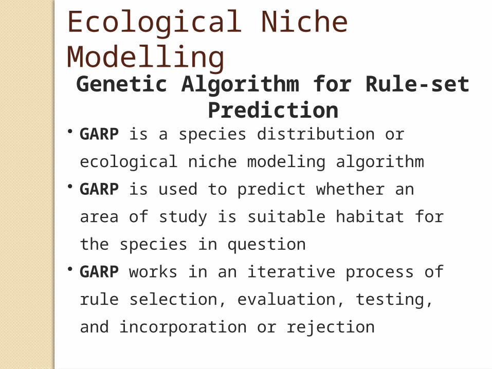
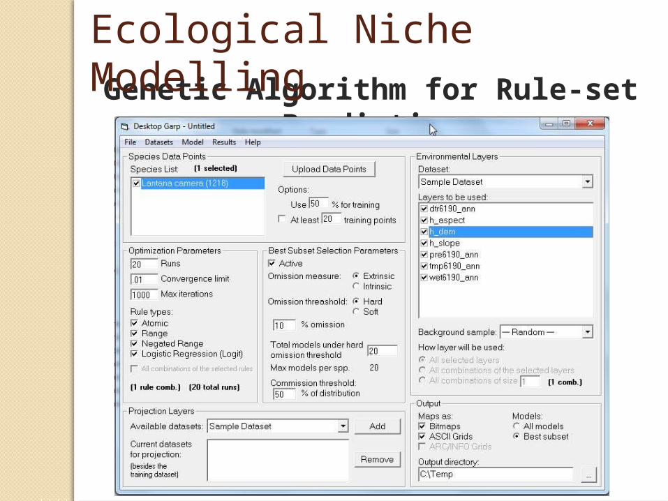
Genetic Algorithm for Rule-set Prediction
• GARP is a species distribution or ecological
niche modeling algorithm
• GARP is used to predict whether an area of
study is suitable habitat for the species in
question
• GARP works in an iterative process of rule
selection, evaluation, testing, and
incorporation or rejection
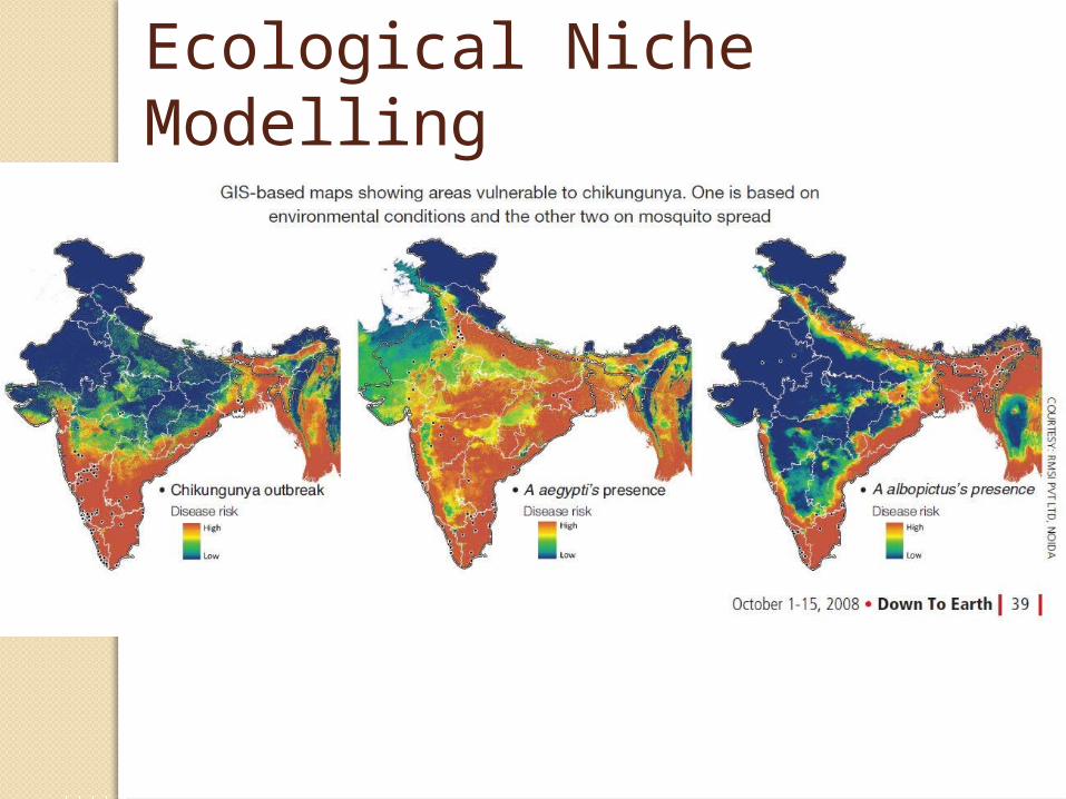
Ecological Niche Modelling
Genetic Algorithm for Rule-set Prediction
Ecological Niche Modelling
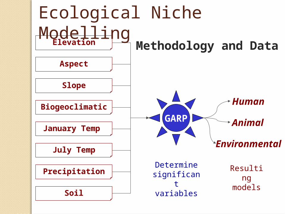
GARP Animal
Human
Environmental
Elevation
Aspect
Slope
Biogeoclimatic
January Temp
July Temp
Precipitation
Soil
Determine significant variables
Methodology and Data
Resulting
models
Ecological Niche Modelling
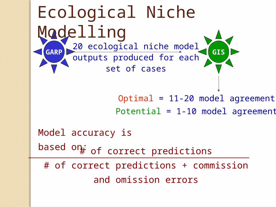
GARP20 ecological niche model
outputs produced for each set of cases
GIS
Potential = 1-10 model agreement
Optimal = 11-20 model agreement
Model accuracy is based
on: # of correct predictions
# of correct predictions + commission and
omission errors
Ecological Niche Modelling
Ecological Niche Modelling
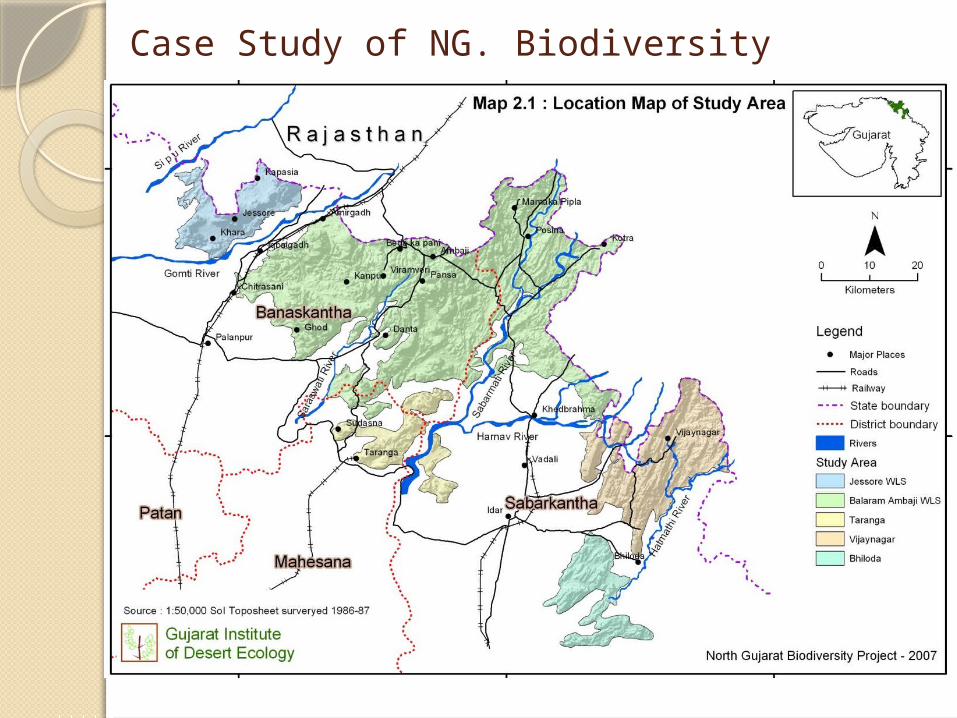
Case Study of NG. Biodiversity
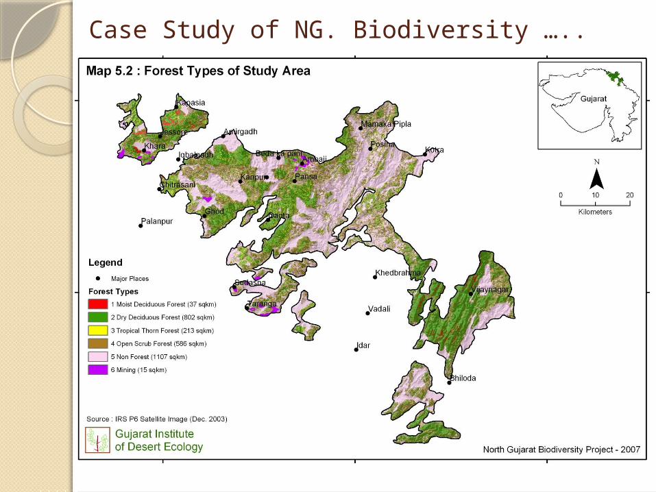
Case Study of NG. Biodiversity …..
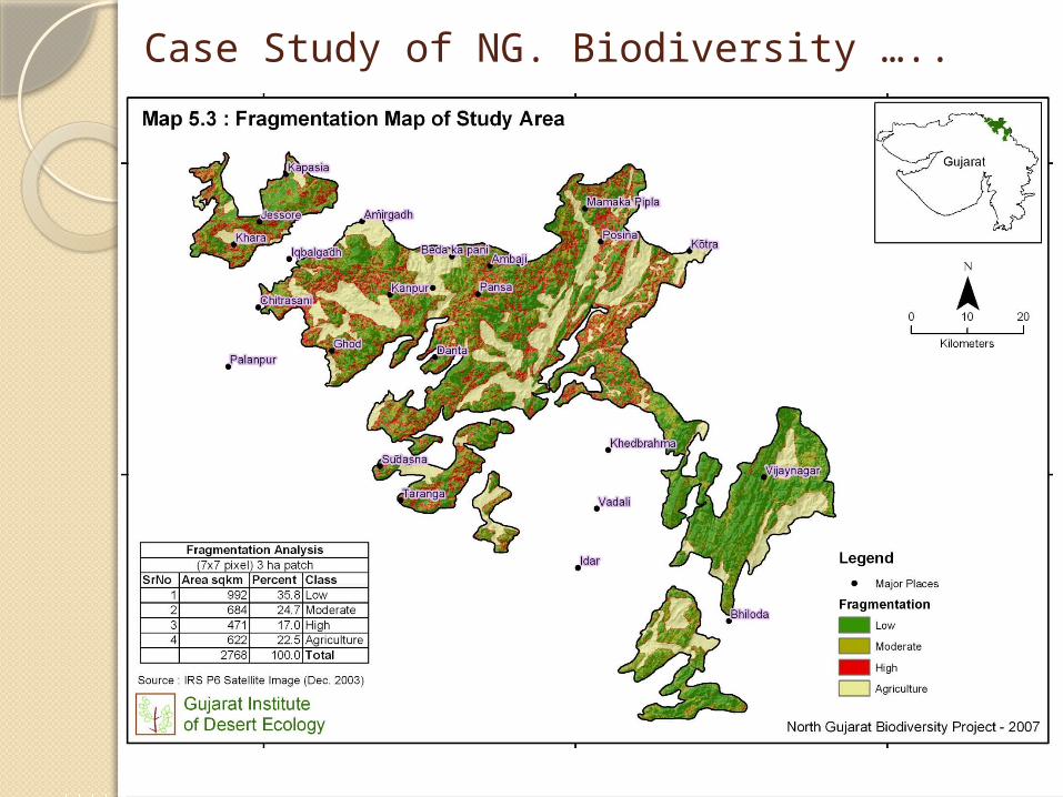
Case Study of NG. Biodiversity …..
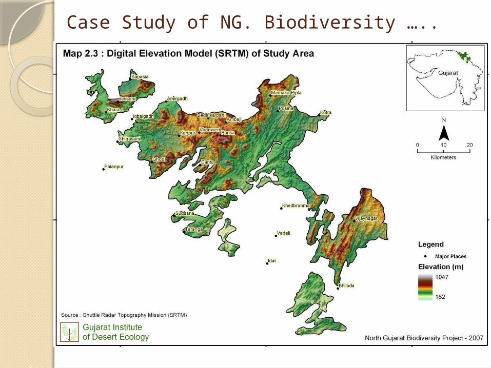
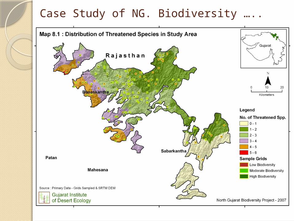
Case Study of NG. Biodiversity …..
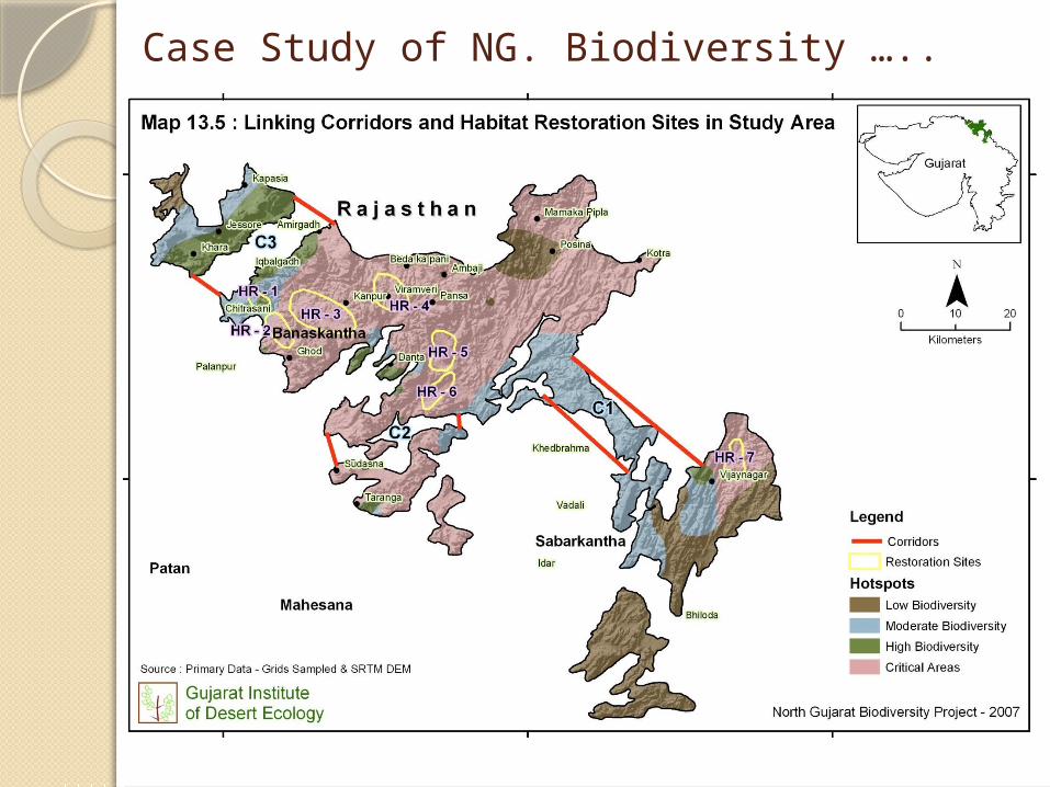
Case Study of NG. Biodiversity …..
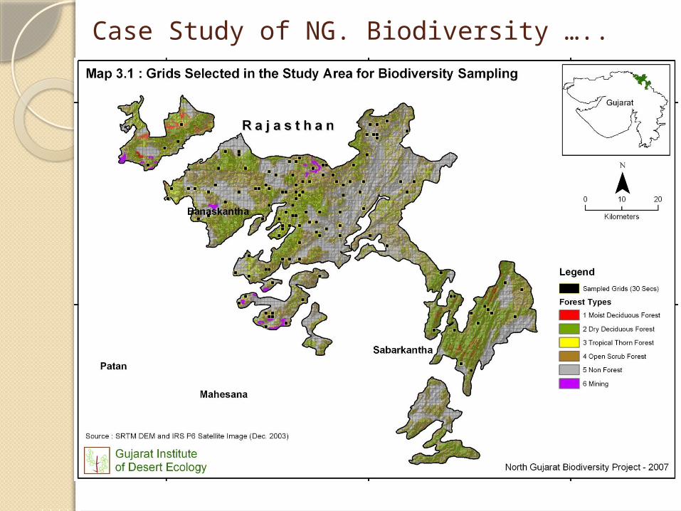
Case Study of NG. Biodiversity …..
Case Study of NG. Biodiversity …..
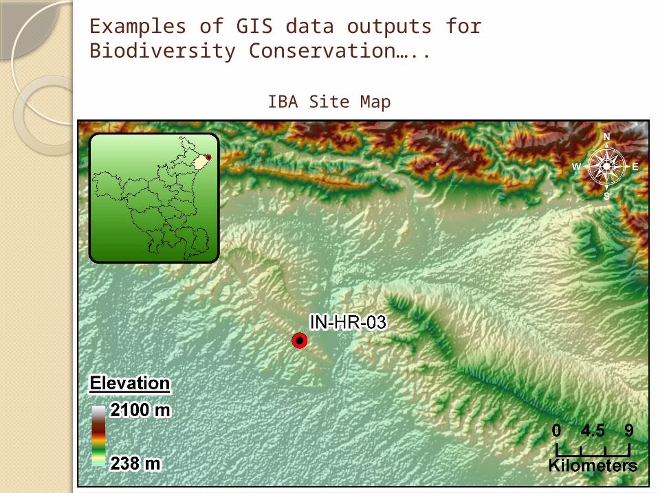
Examples of GIS data outputs for Biodiversity Conservation…..
IBA Site Map
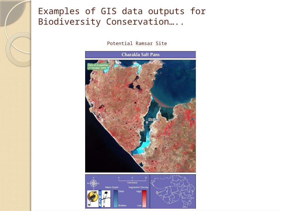
Examples of GIS data outputs for Biodiversity Conservation…..
Potential Ramsar Site
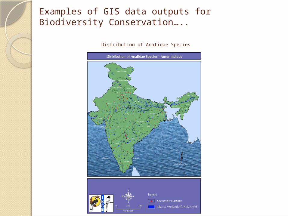
Examples of GIS data outputs for Biodiversity Conservation…..
Distribution of Anatidae Species
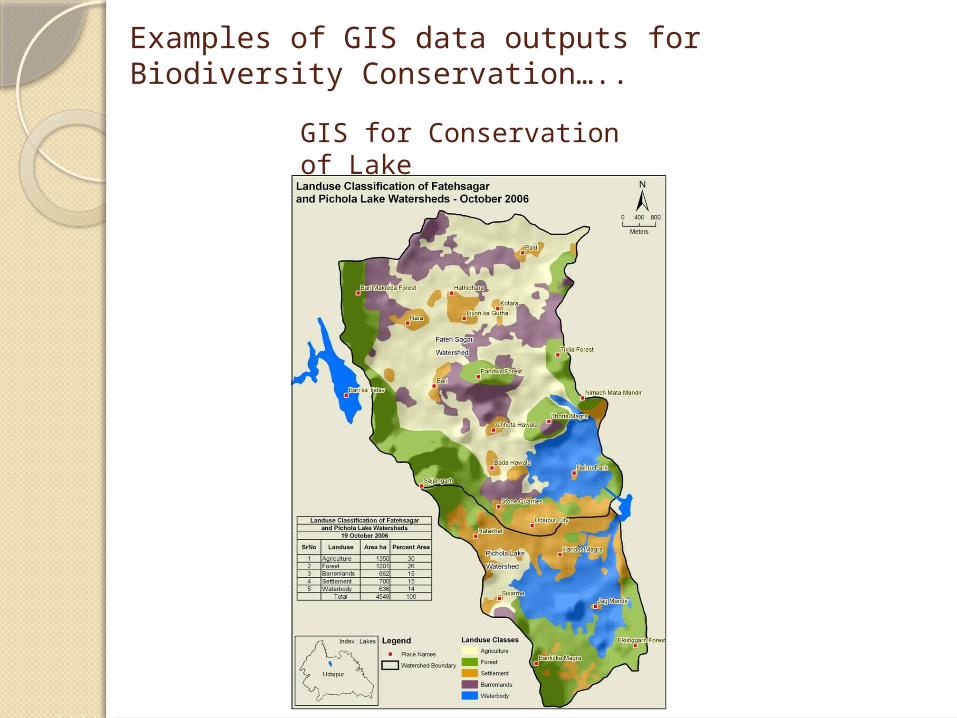
Examples of GIS data outputs for Biodiversity Conservation…..
GIS for Conservation of Lake
Examples of GIS data outputs for Biodiversity Conservation…..
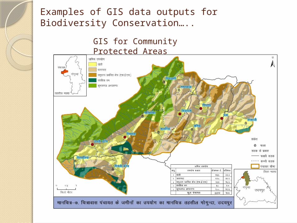
GIS for Community Protected Areas
Examples of GIS data outputs for Biodiversity Conservation…..
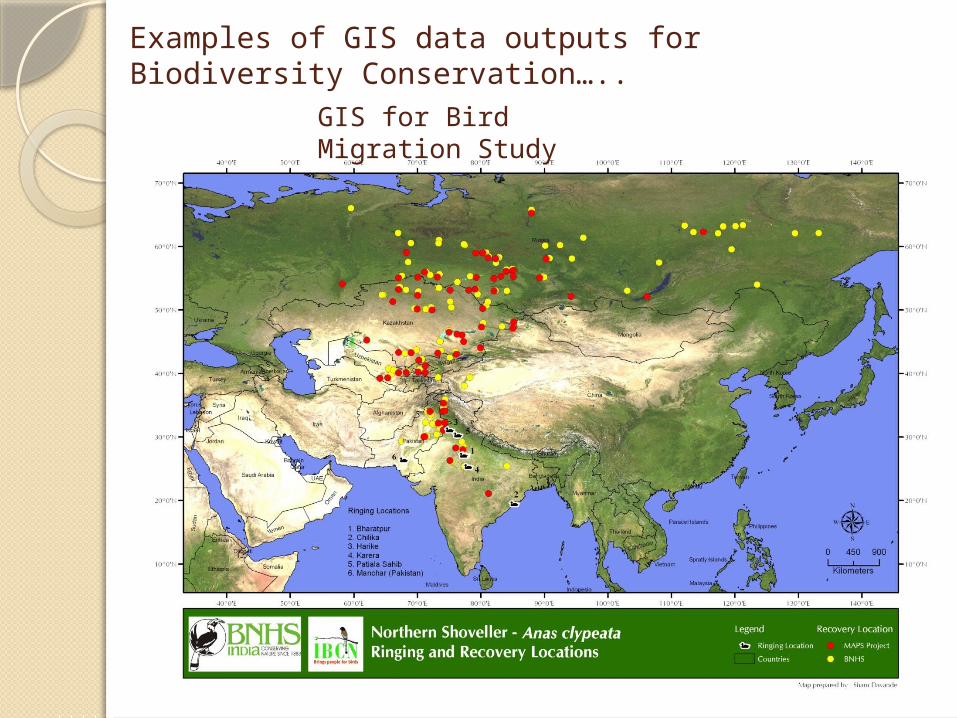
GIS for Bird Migration Study
Examples of GIS data outputs for Biodiversity Conservation…..
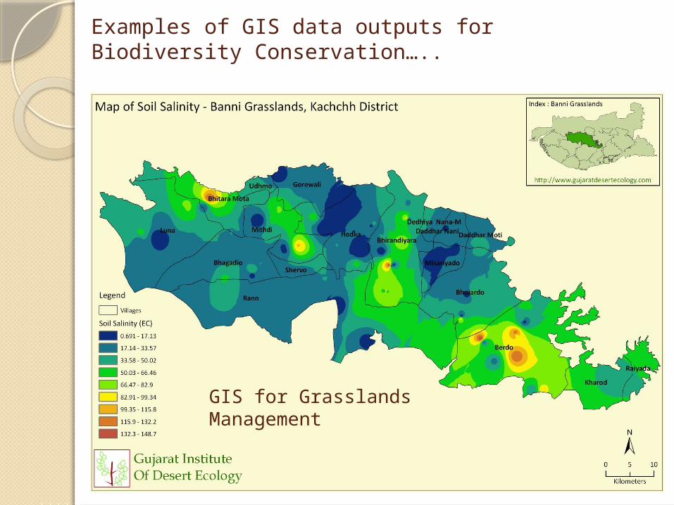
GIS for Grasslands Management
Examples of GIS data outputs for Biodiversity Conservation…..
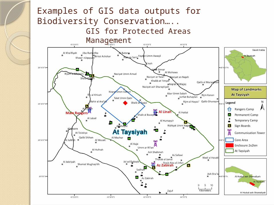
GIS for Protected Areas Management

Thank you for your attention!!!