route 9p over the saratoga lake outlet
TRANSCRIPT
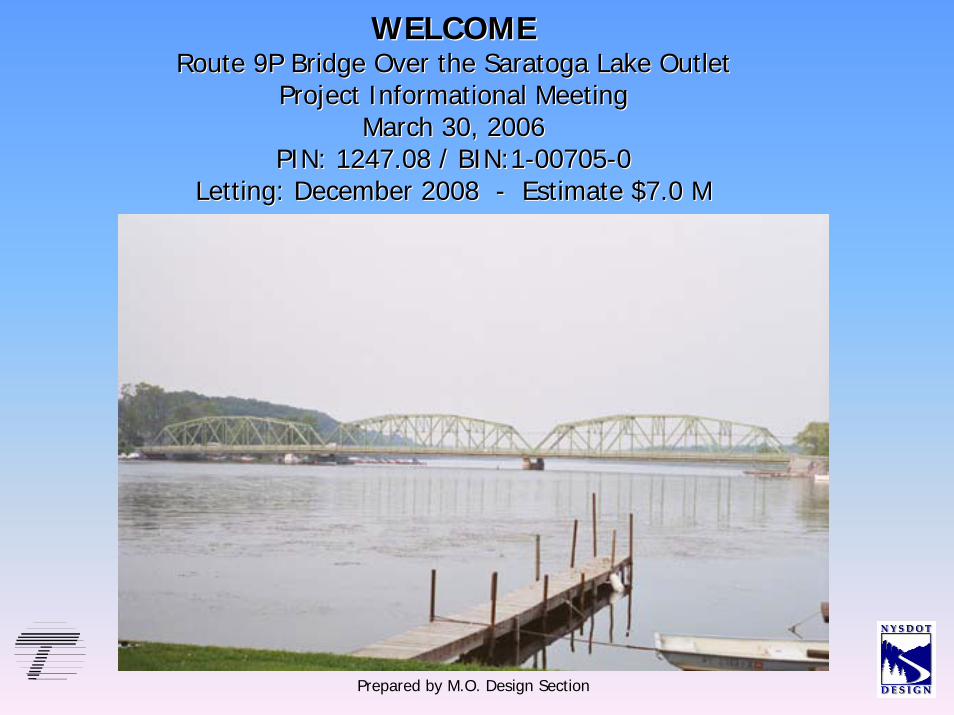
WELCOMEWELCOMERoute 9P Bridge Over the Saratoga Lake OutletRoute 9P Bridge Over the Saratoga Lake Outlet
Project Informational Meeting Project Informational Meeting March 30, 2006March 30, 2006
PIN: 1247.08 / BIN:1PIN: 1247.08 / BIN:1--0070500705--00Letting: December 2008 Letting: December 2008 -- Estimate $7.0 MEstimate $7.0 M
Prepared by M.O. Design Section
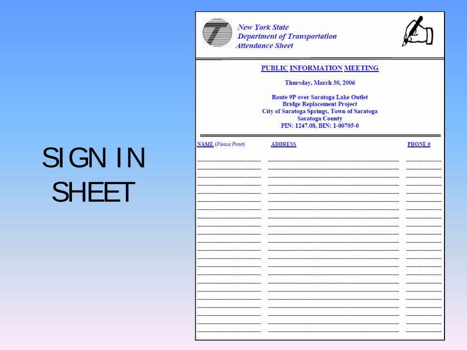
SIGN IN SHEET
Organizations on the ProjectContact List
Federal and State Environmental AgenciesOffice of Parks and RecreationState Historic OfficeSaratoga CountyCity of Saratoga Springs and Town of SaratogaEmergency Services; Fire, Police & AmbulanceRowing and Bicycling GroupsFishing and Snowmobiling ClubsSaratoga Lake Improvement DistrictSaratoga Lake AssociationSaratoga Lake MarinasSaratoga Lake RestaurantsSaratoga Lake Businesses
Purpose of Tonight’s Meeting
• Obtain Feedback from Public• Provide Information on the Methods of Maintaining
Traffic During Construction• Provide Information on the Construction Impacts• Provide Information on the Project Schedule• Provide Information on the Design Process
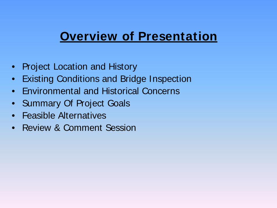
Overview of Presentation
• Project Location and History• Existing Conditions and Bridge Inspection • Environmental and Historical Concerns• Summary Of Project Goals• Feasible Alternatives• Review & Comment Session
Project Locationand
History
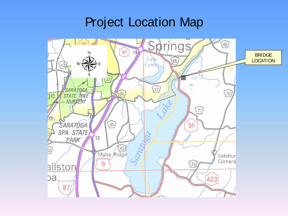
Project Location Map
BRIDGE LOCATION
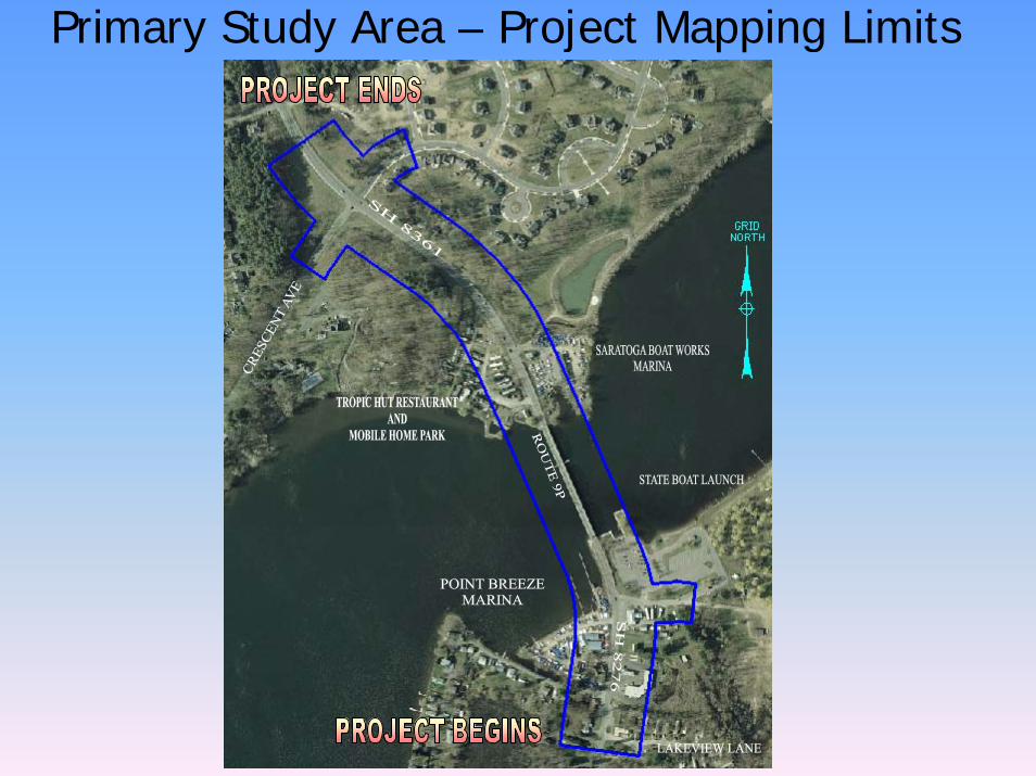
Primary Study Area – Project Mapping Limits
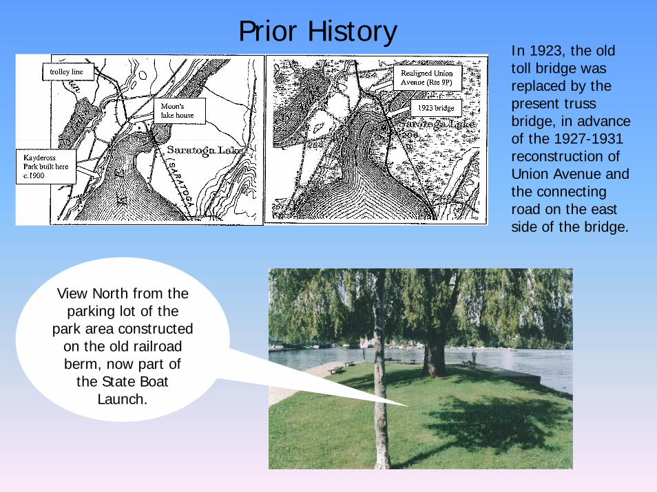
Prior HistoryIn 1923, the old toll bridge was replaced by the present truss bridge, in advance of the 1927-1931 reconstruction of Union Avenue and the connecting road on the east side of the bridge.
View North from the parking lot of the
park area constructed on the old railroad berm, now part of
the State Boat Launch.
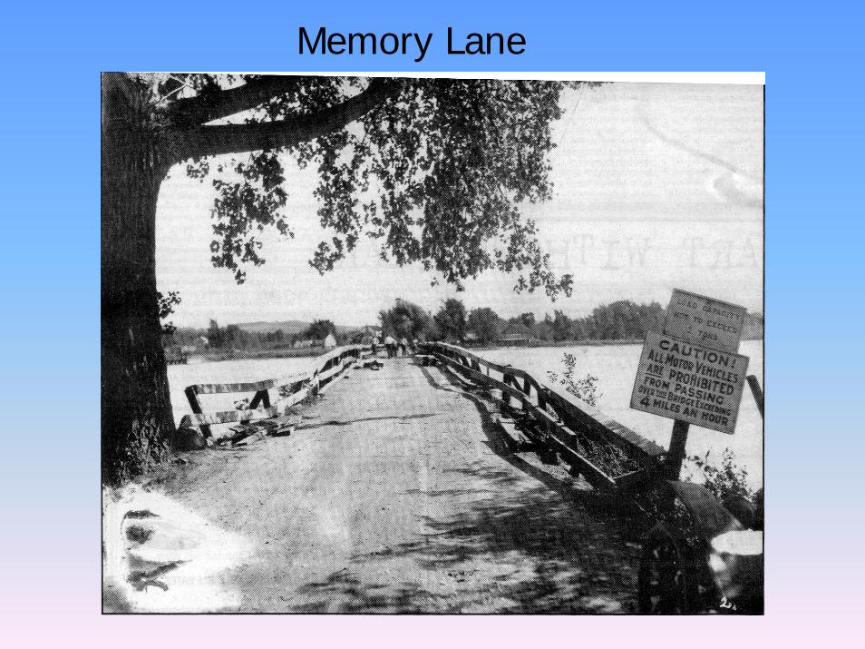
Memory Lane
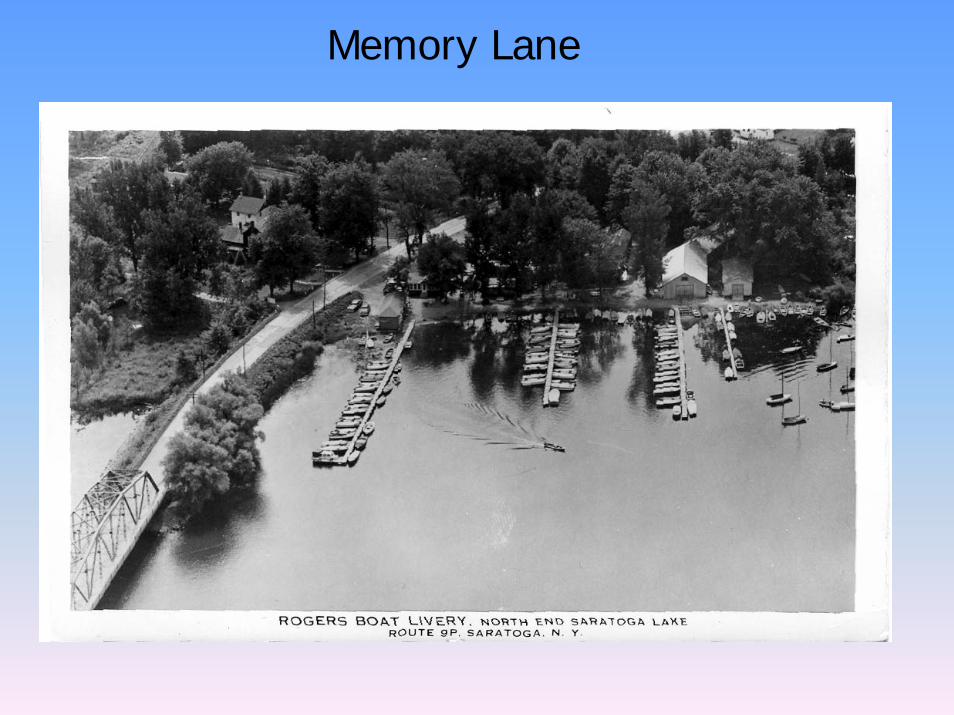
Memory Lane
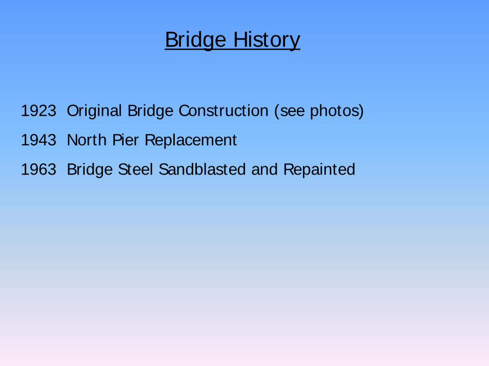
Bridge History
1923 Original Bridge Construction (see photos)
1943 North Pier Replacement
1963 Bridge Steel Sandblasted and Repainted
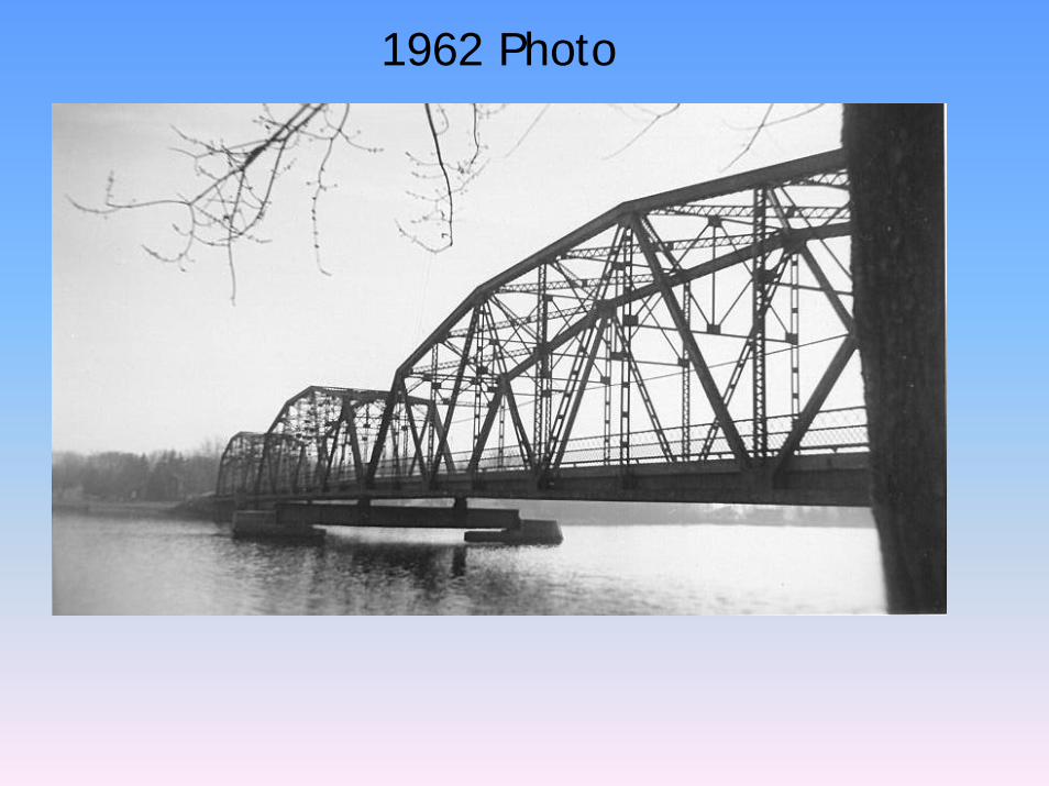
1962 Photo

1962 Photo
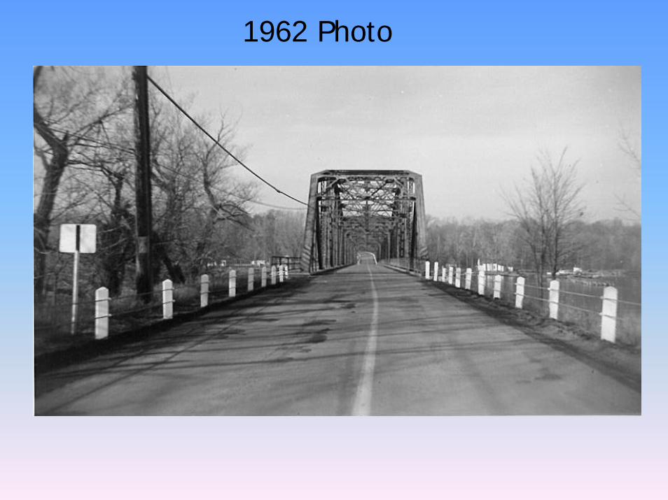
1962 Photo
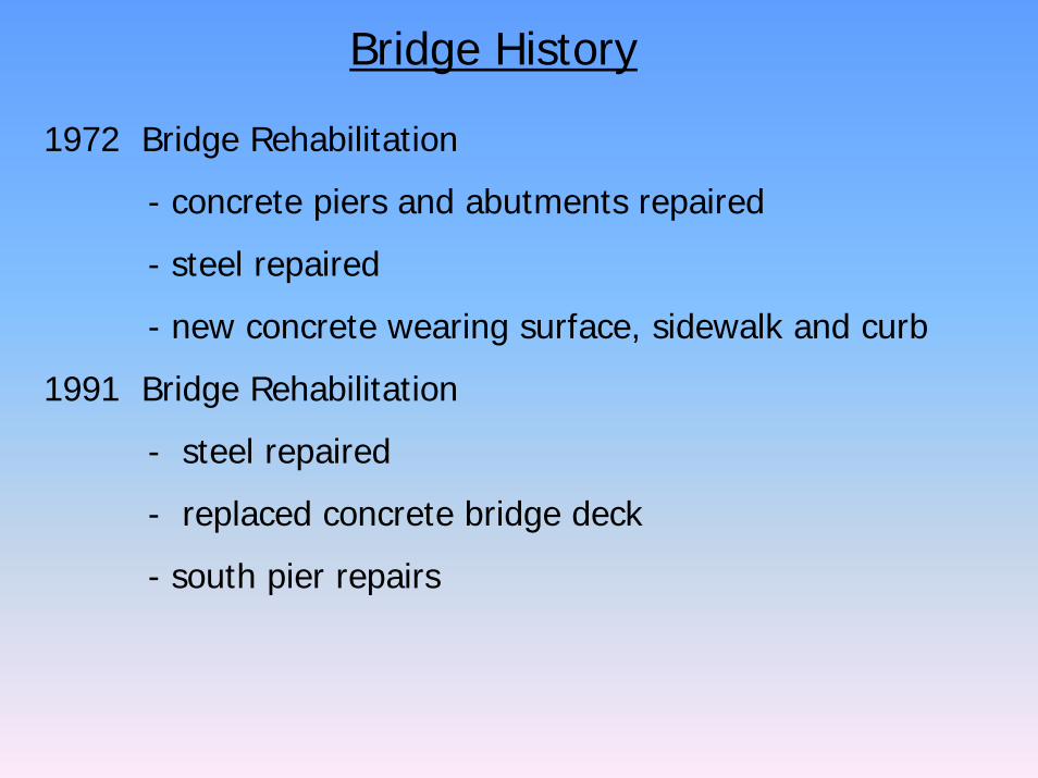
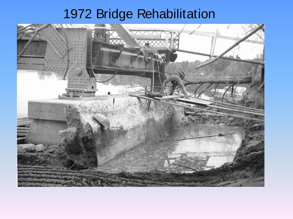
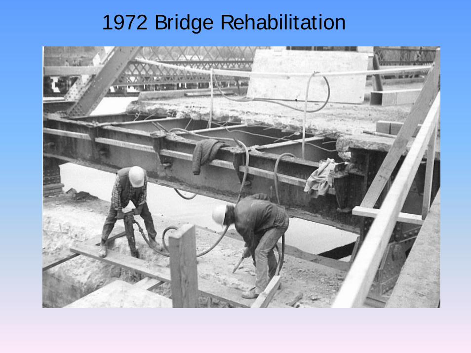
Bridge History
1972 Bridge Rehabilitation
- concrete piers and abutments repaired
- steel repaired
- new concrete wearing surface, sidewalk and curb
1991 Bridge Rehabilitation
- steel repaired
- replaced concrete bridge deck
- south pier repairs
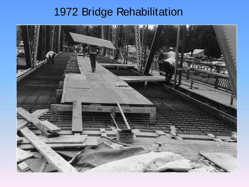
1972 Bridge Rehabilitation
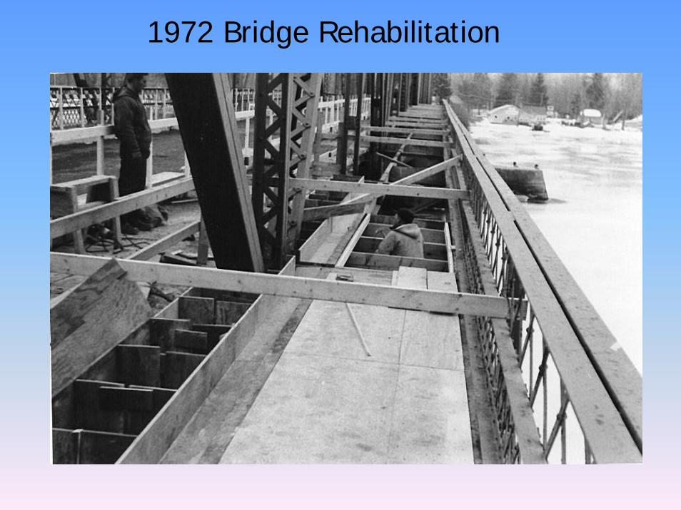
1972 Bridge Rehabilitation
1972 Bridge Rehabilitation
1972 Bridge Rehabilitation
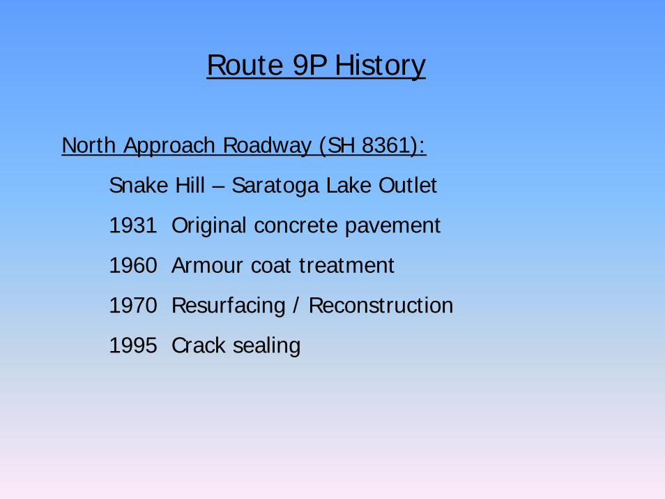
Route 9P History
North Approach Roadway (SH 8361):
Snake Hill – Saratoga Lake Outlet
1931 Original concrete pavement
1960 Armour coat treatment
1970 Resurfacing / Reconstruction
1995 Crack sealing
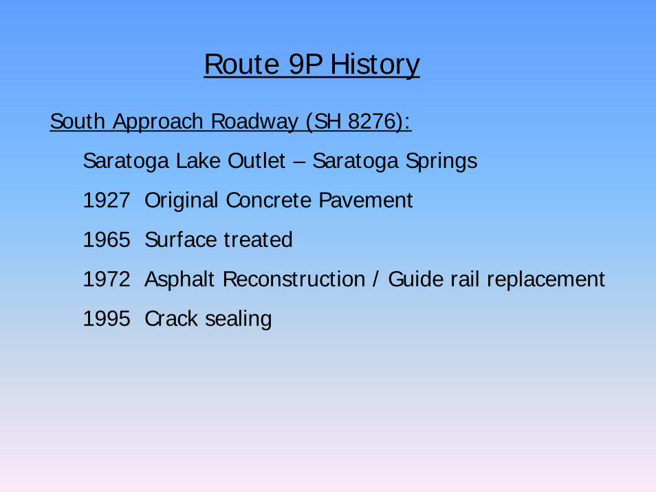
Route 9P History
South Approach Roadway (SH 8276):
Saratoga Lake Outlet – Saratoga Springs
1927 Original Concrete Pavement
1965 Surface treated
1972 Asphalt Reconstruction / Guide rail replacement
1995 Crack sealing
Existing Conditionsand
Bridge Inspection
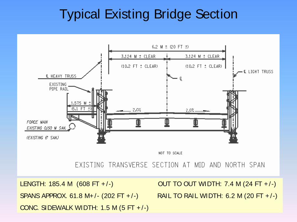
Typical Existing Bridge Section
LENGTH: 185.4 M (608 FT +/-) OUT TO OUT WIDTH: 7.4 M (24 FT +/-)
SPANS APPROX. 61.8 M+/- (202 FT +/-) RAIL TO RAIL WIDTH: 6.2 M (20 FT +/-)
CONC. SIDEWALK WIDTH: 1.5 M (5 FT +/-)
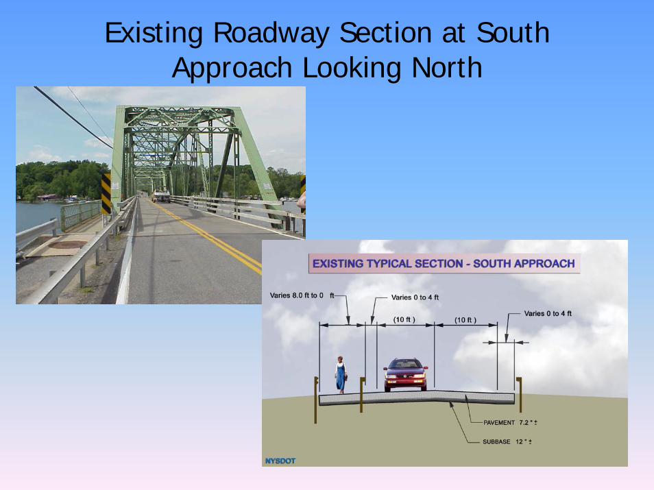
Existing Roadway Section at South Approach Looking North
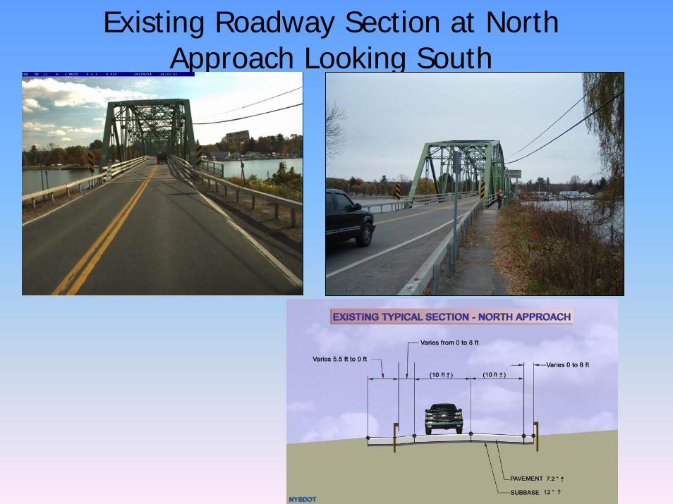
Existing Roadway Section at North Approach Looking South
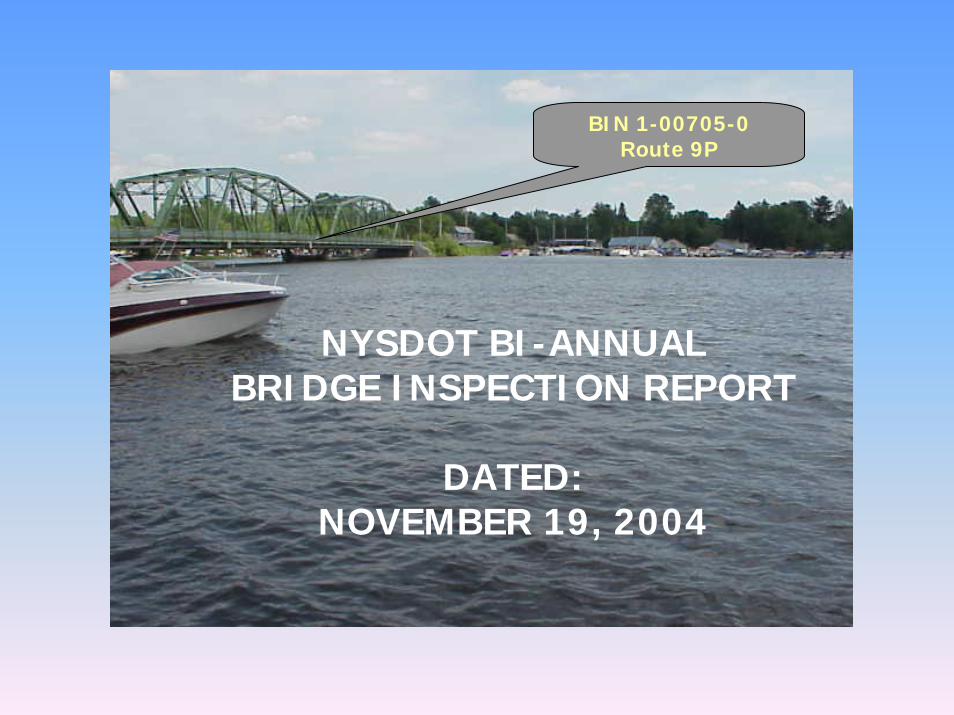
BIN 1-00705-0 Route 9P
NYSDOT BI-ANNUAL BRIDGE INSPECTION REPORT
DATED: NOVEMBER 19, 2004
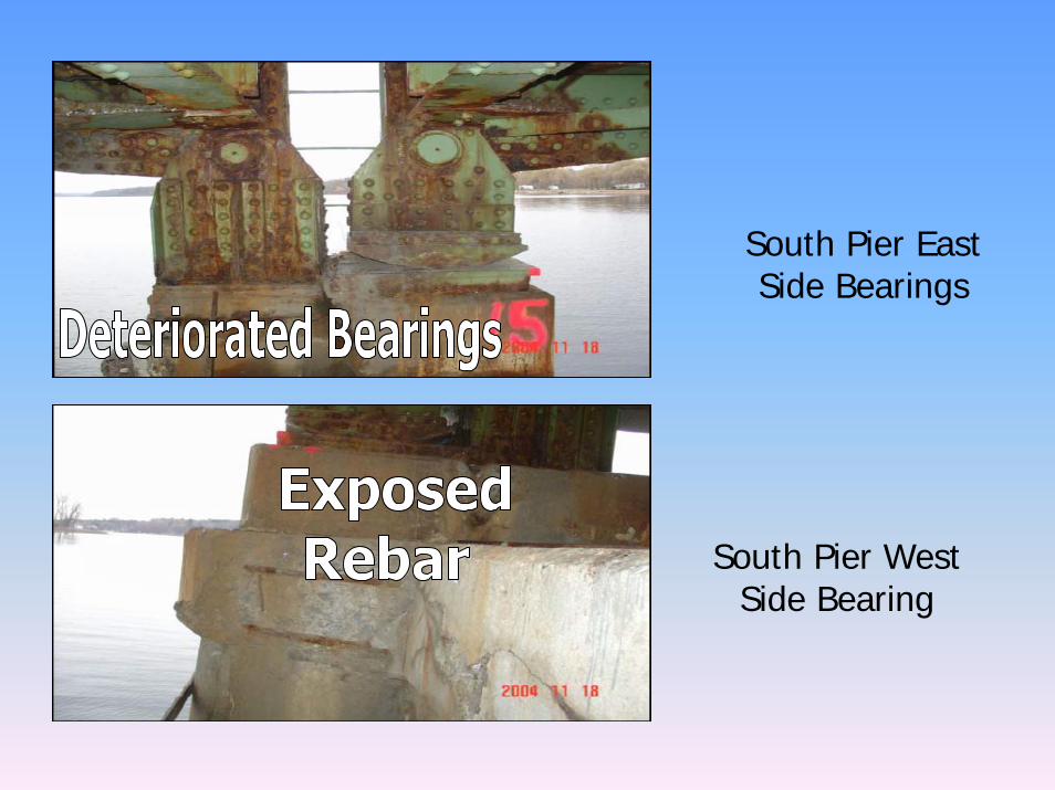
South Pier East Side Bearings
South Pier West Side Bearing

Span 1, Near Midspan33% Section Loss
Span 1, Looking West (200mm (7.87”) high,
total web losses of 45%)
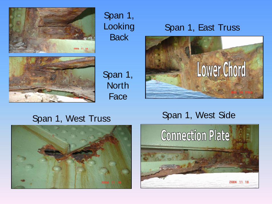
Span 1, Looking
BackSpan 1, East Truss
Span 1, North Face
Span 1, West SideSpan 1, West Truss
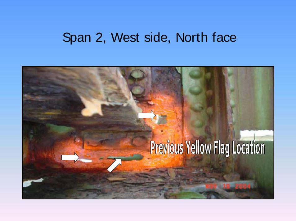
Span 2, West side, North face
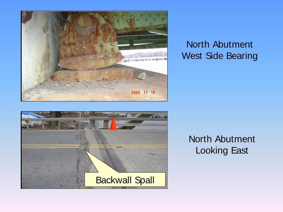
North Abutment West Side Bearing
Backwall Spall
North Abutment Looking East
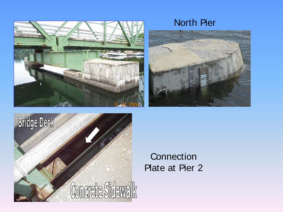
North Pier
Connection Plate at Pier 2
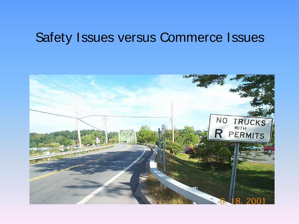
Safety Issues versus Commerce Issues
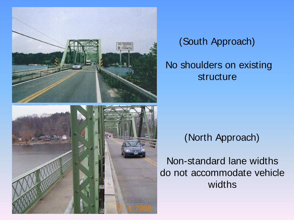
(South Approach)
No shoulders on existing structure
(North Approach)
Non-standard lane widths do not accommodate vehicle
widths
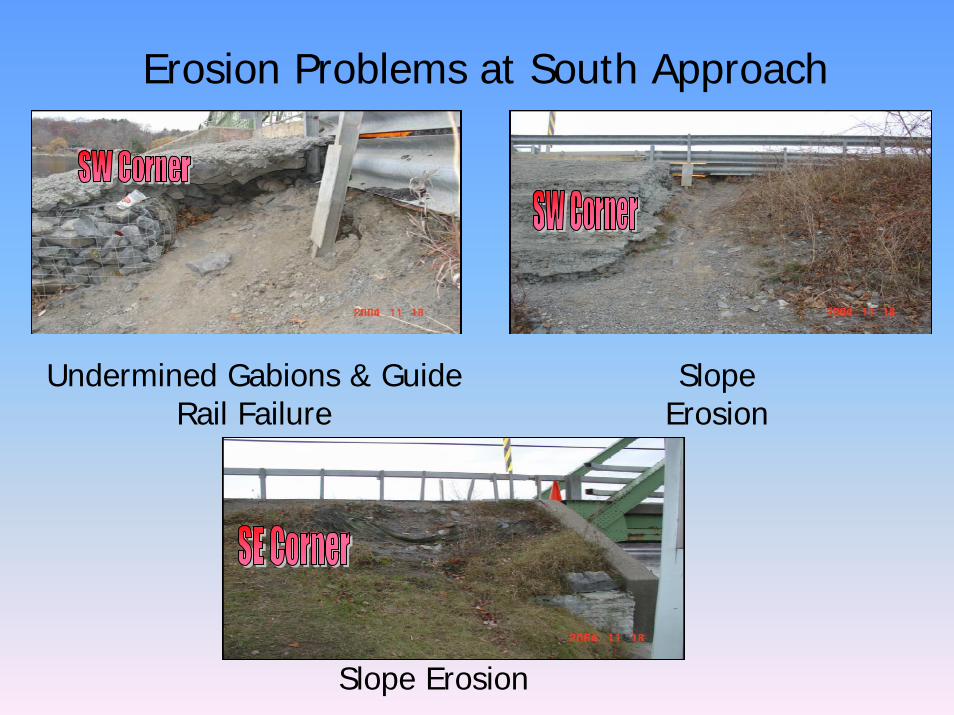
Erosion Problems at South Approach
Slope Erosion
Undermined Gabions & Guide Rail Failure
Slope Erosion
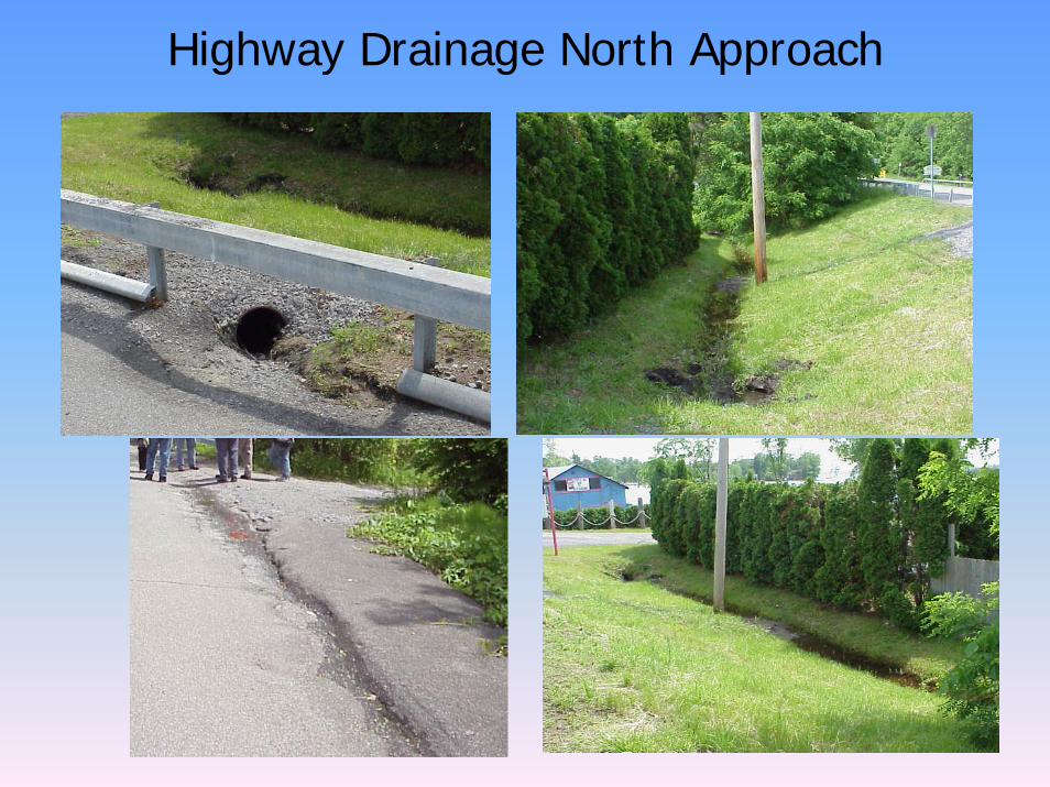
Highway Drainage North Approach
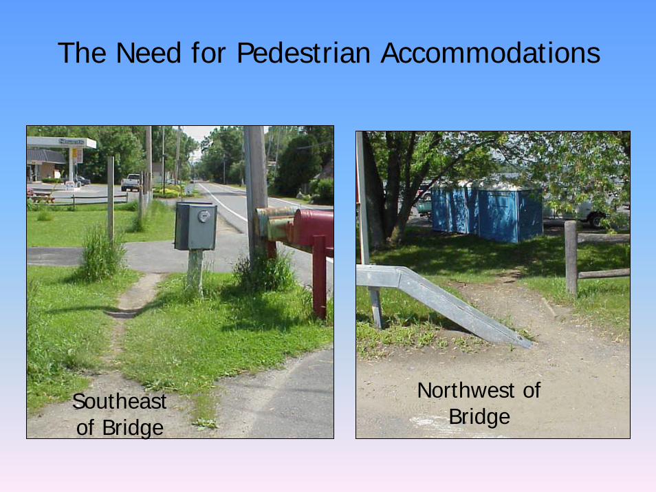
The Need for Pedestrian Accommodations
Southeast of Bridge
Northwest of Bridge
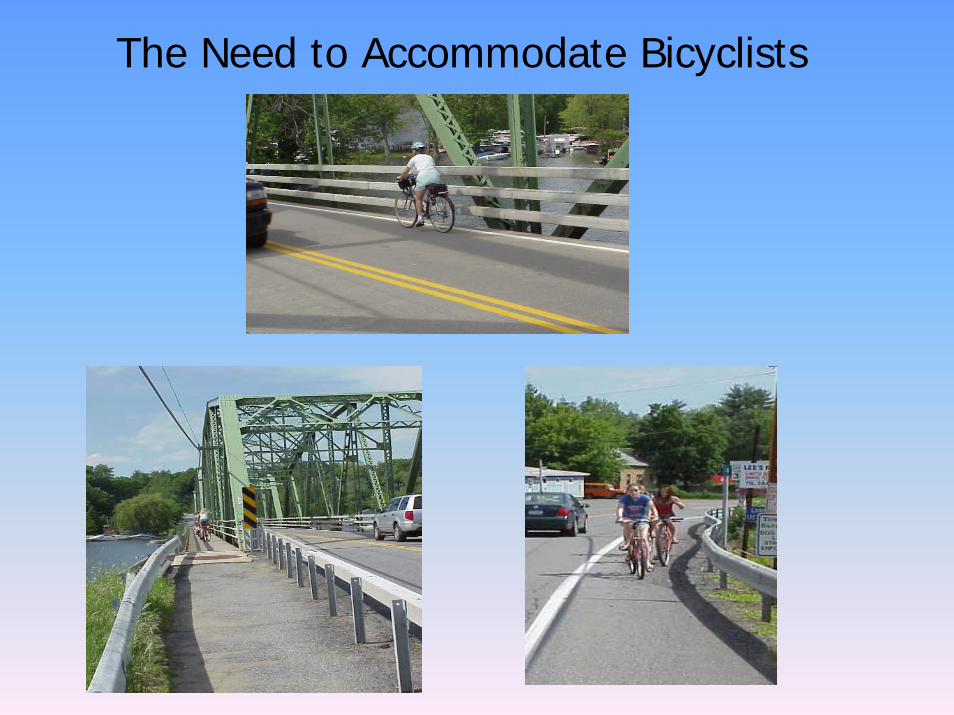
The Need to Accommodate Bicyclists
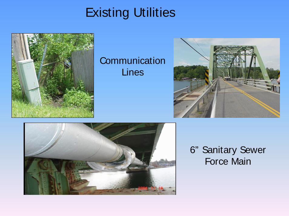
Existing Utilities
CommunicationLines
6” Sanitary Sewer Force Main

Environmentaland
Historical Concerns
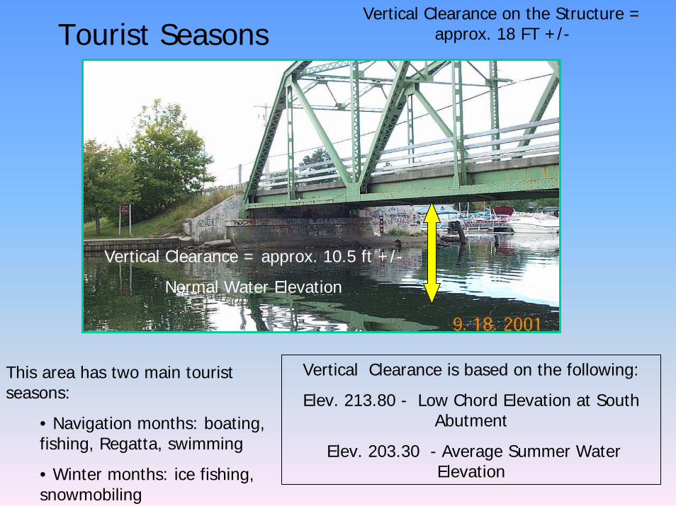
Vertical Clearance on the Structure = approx. 18 FT +/-Tourist Seasons
Vertical Clearance = approx. 10.5 ft +/-
Normal Water Elevation
Vertical Clearance is based on the following:
Elev. 213.80 - Low Chord Elevation at South Abutment
Elev. 203.30 - Average Summer Water Elevation
This area has two main tourist seasons:
• Navigation months: boating, fishing, Regatta, swimming
• Winter months: ice fishing, snowmobiling
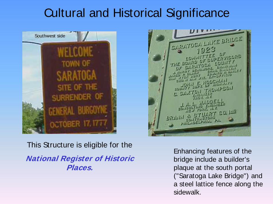
Cultural and Historical Significance
Southwest side
This Structure is eligible for the
National Register of Historic Places.
Enhancing features of the bridge include a builder's plaque at the south portal ("Saratoga Lake Bridge") and a steel lattice fence along the sidewalk.
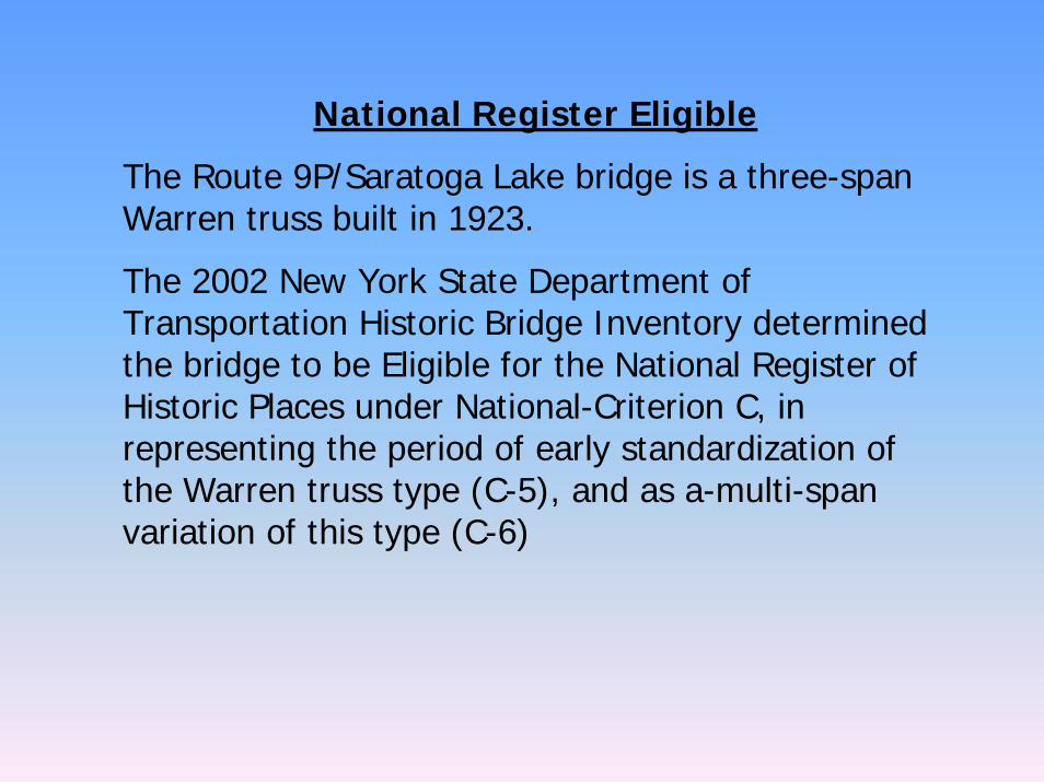
National Register Eligible
The Route 9P/Saratoga Lake bridge is a three-span Warren truss built in 1923.
The 2002 New York State Department of Transportation Historic Bridge Inventory determined the bridge to be Eligible for the National Register of Historic Places under National-Criterion C, in representing the period of early standardization of the Warren truss type (C-5), and as a-multi-span variation of this type (C-6)
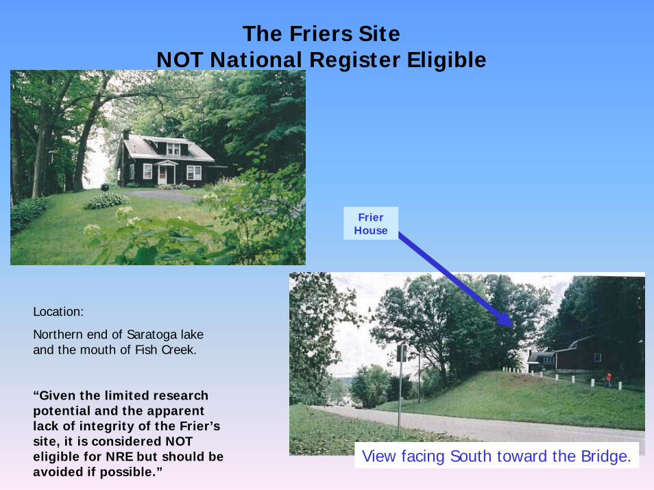
The Friers Site NOT National Register Eligible
View facing South toward the Bridge.
Location:
Northern end of Saratoga lake and the mouth of Fish Creek.
“Given the limited research potential and the apparent lack of integrity of the Frier’s site, it is considered NOT eligible for NRE but should be avoided if possible.”
Frier House
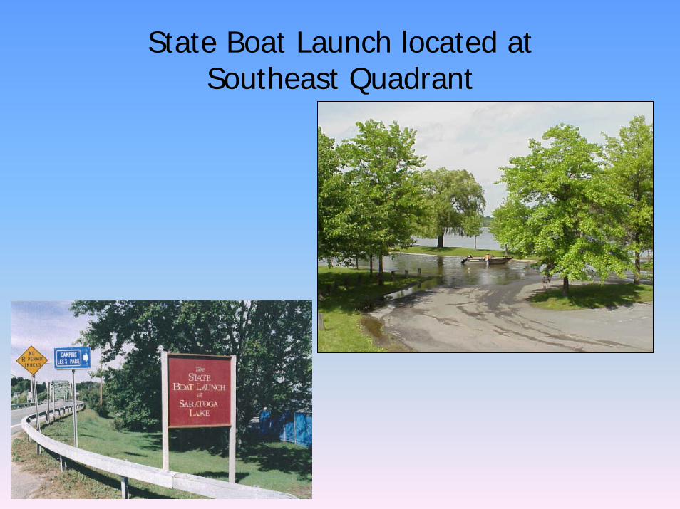
State Boat Launch located at Southeast Quadrant
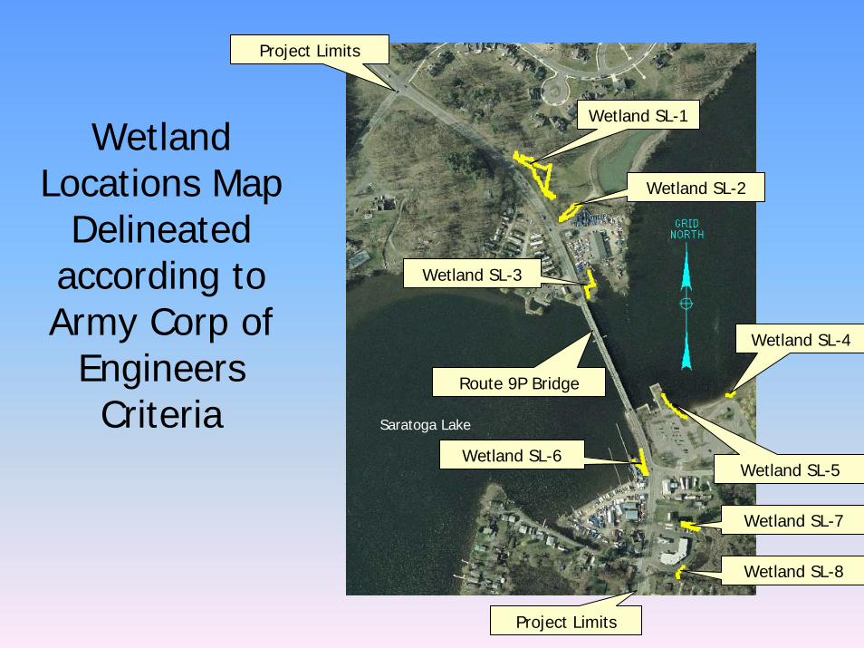
Wetland Locations Map
Delineated according to Army Corp of
EngineersCriteria
Wetland SL-1
Wetland SL-2
Wetland SL-3
Wetland SL-5Wetland SL-6
Wetland SL-4
Wetland SL-7
Wetland SL-8
Project Limits
Route 9P Bridge
Saratoga Lake
Project Limits
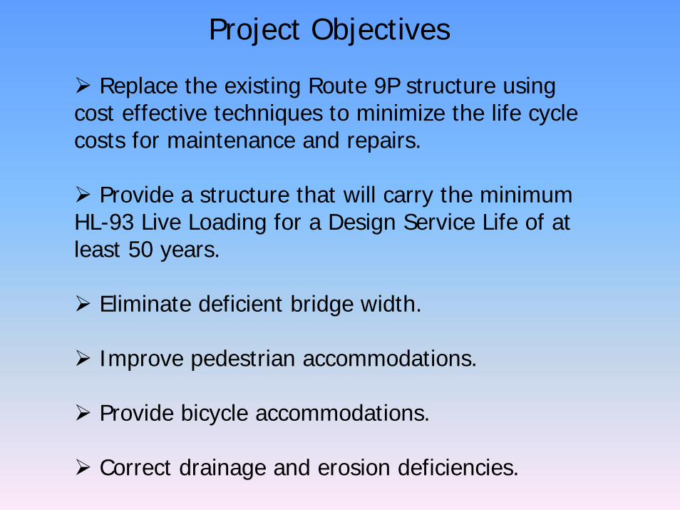
Project Objectives
Replace the existing Route 9P structure using cost effective techniques to minimize the life cycle costs for maintenance and repairs.
Provide a structure that will carry the minimum HL-93 Live Loading for a Design Service Life of at least 50 years.
Eliminate deficient bridge width.
Improve pedestrian accommodations.
Provide bicycle accommodations.
Correct drainage and erosion deficiencies.
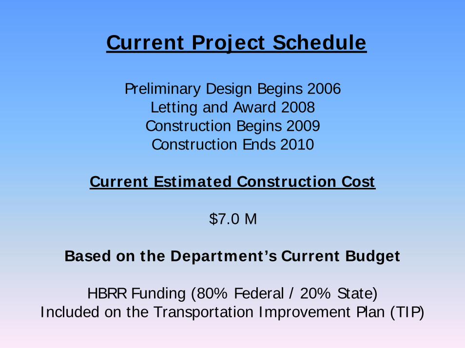
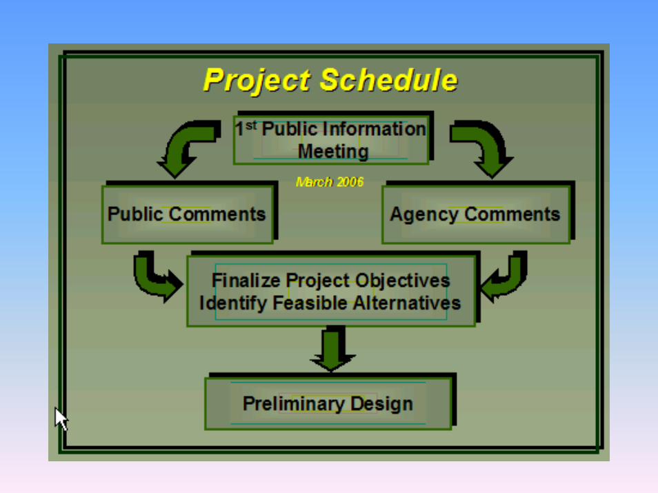
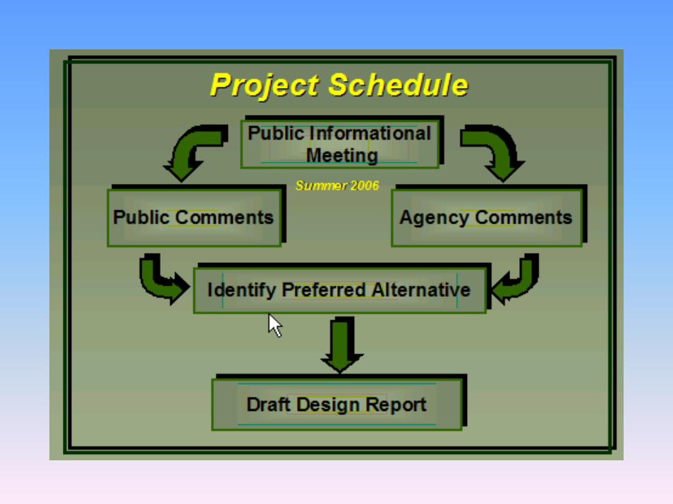
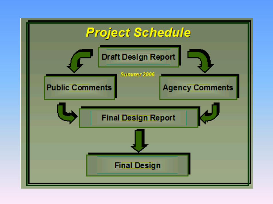
Current Project Schedule
Preliminary Design Begins 2006Letting and Award 2008
Construction Begins 2009Construction Ends 2010
Current Estimated Construction Cost
$7.0 M
Based on the Department’s Current Budget
HBRR Funding (80% Federal / 20% State)Included on the Transportation Improvement Plan (TIP)

Potential Alternatives
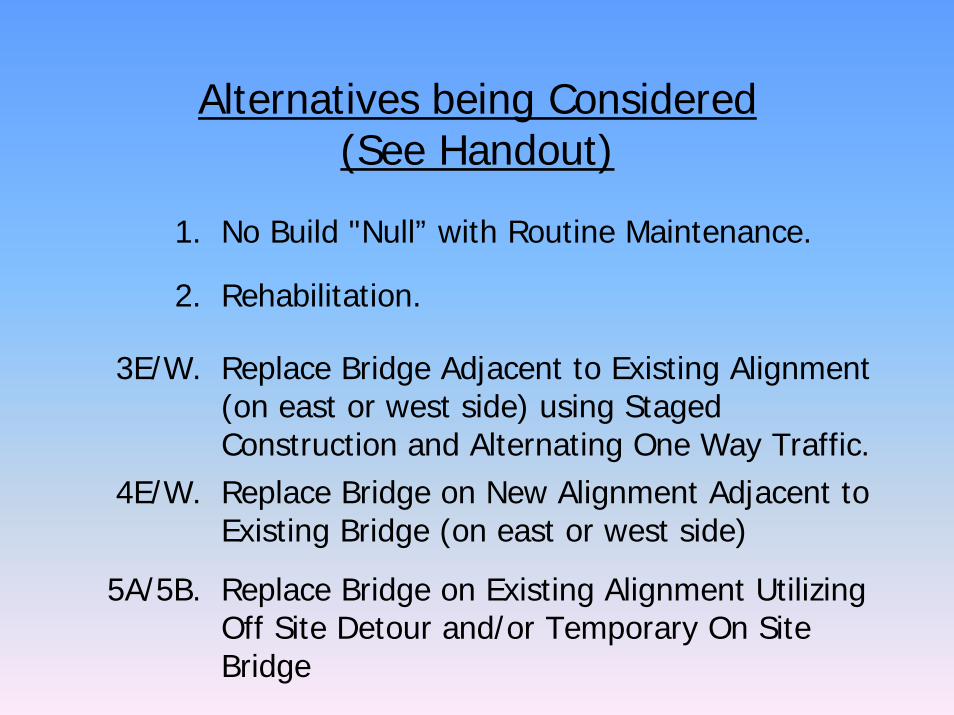
Alternatives being Considered(See Handout)
1. No Build "Null” with Routine Maintenance.
2. Rehabilitation.
3E/W. Replace Bridge Adjacent to Existing Alignment (on east or west side) using Staged Construction and Alternating One Way Traffic.
4E/W. Replace Bridge on New Alignment Adjacent to Existing Bridge (on east or west side)
5A/5B. Replace Bridge on Existing Alignment Utilizing Off Site Detour and/or Temporary On Site Bridge
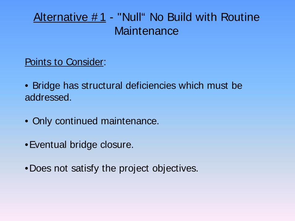
Alternative #1 - "Null“ No Build with Routine Maintenance
Points to Consider:
• Bridge has structural deficiencies which must be addressed.
• Only continued maintenance.
•Eventual bridge closure.
•Does not satisfy the project objectives.
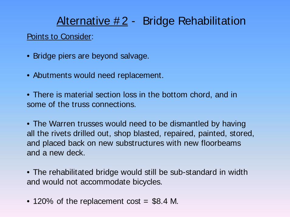
Alternative #2 - Bridge RehabilitationPoints to Consider:
• Bridge piers are beyond salvage.
• Abutments would need replacement.
• There is material section loss in the bottom chord, and in some of the truss connections.
• The Warren trusses would need to be dismantled by having all the rivets drilled out, shop blasted, repaired, painted, stored, and placed back on new substructures with new floorbeams and a new deck.
• The rehabilitated bridge would still be sub-standard in width and would not accommodate bicycles.
• 120% of the replacement cost = $8.4 M.
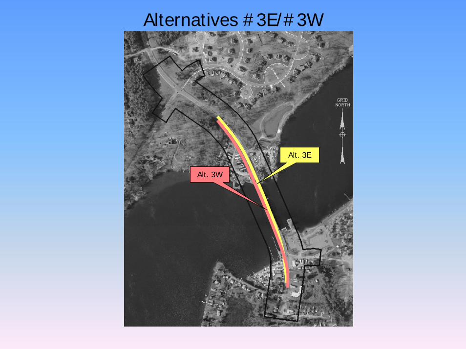
Alternatives #3E/#3W
Alt. 3E
Alt. 3W
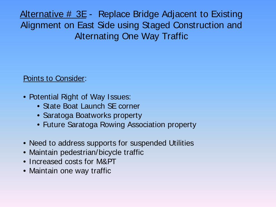
Alternative # 3E - Replace Bridge Adjacent to Existing Alignment on East Side using Staged Construction and
Alternating One Way Traffic
Points to Consider:
• Potential Right of Way Issues:• State Boat Launch SE corner• Saratoga Boatworks property• Future Saratoga Rowing Association property
• Need to address supports for suspended Utilities • Maintain pedestrian/bicycle traffic• Increased costs for M&PT• Maintain one way traffic
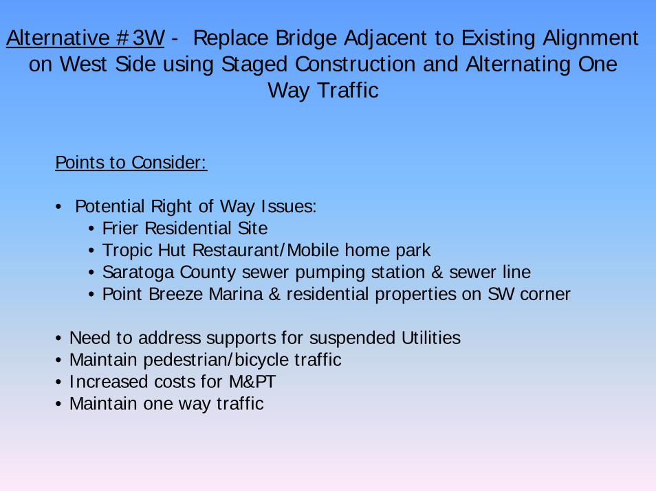
Alternative #3W - Replace Bridge Adjacent to Existing Alignment on West Side using Staged Construction and Alternating One
Way Traffic
Points to Consider:
• Potential Right of Way Issues:• Frier Residential Site • Tropic Hut Restaurant/Mobile home park• Saratoga County sewer pumping station & sewer line• Point Breeze Marina & residential properties on SW corner
• Need to address supports for suspended Utilities• Maintain pedestrian/bicycle traffic• Increased costs for M&PT• Maintain one way traffic
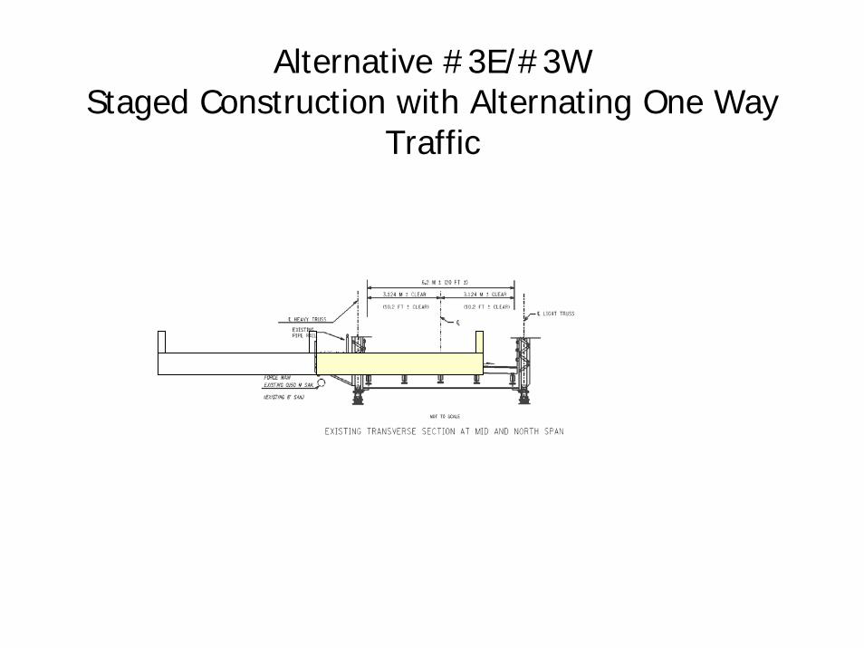
Alternative #3E/#3WStaged Construction with Alternating One Way
Traffic
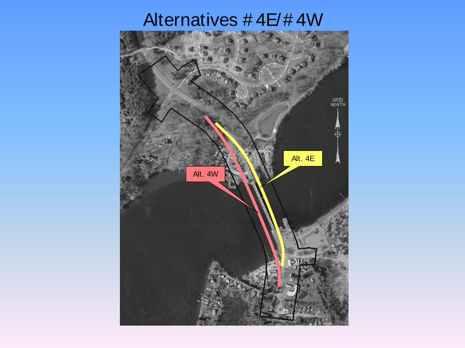
Alternatives #4E/#4W
Alt. 4E
Alt. 4W
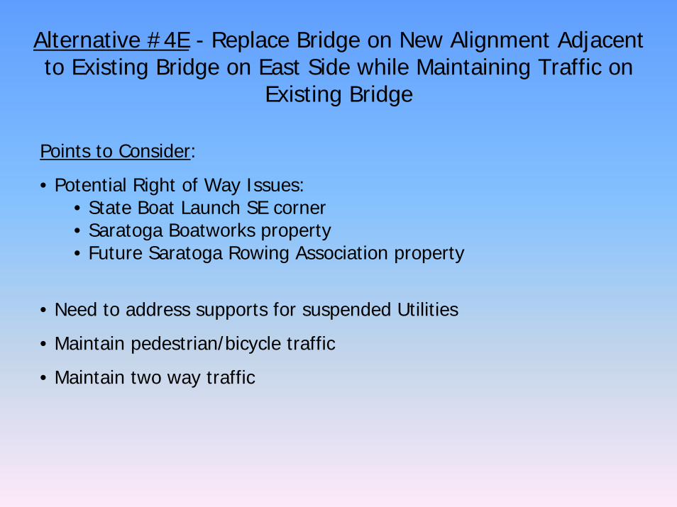
Alternative #4E - Replace Bridge on New Alignment Adjacent to Existing Bridge on East Side while Maintaining Traffic on
Existing Bridge
Points to Consider:
• Potential Right of Way Issues:• State Boat Launch SE corner• Saratoga Boatworks property• Future Saratoga Rowing Association property
• Need to address supports for suspended Utilities
• Maintain pedestrian/bicycle traffic
• Maintain two way traffic
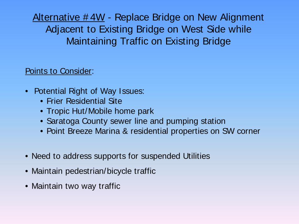
Alternative #4W - Replace Bridge on New Alignment Adjacent to Existing Bridge on West Side while
Maintaining Traffic on Existing Bridge
Points to Consider:
• Potential Right of Way Issues:• Frier Residential Site • Tropic Hut/Mobile home park• Saratoga County sewer line and pumping station• Point Breeze Marina & residential properties on SW corner
• Need to address supports for suspended Utilities
• Maintain pedestrian/bicycle traffic
• Maintain two way traffic
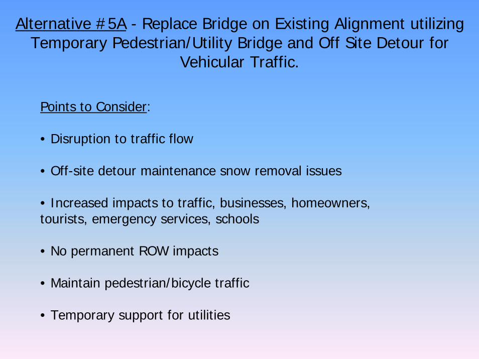
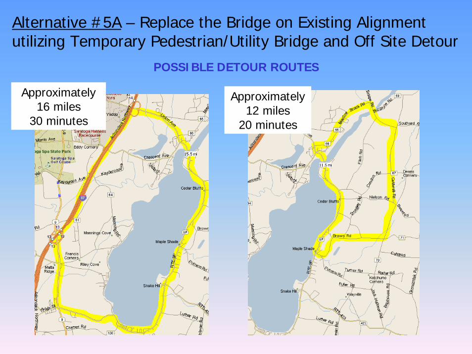
Alternative #5A - Replace Bridge on Existing Alignment utilizing Temporary Pedestrian/Utility Bridge and Off Site Detour for
Vehicular Traffic.
Points to Consider:
• Disruption to traffic flow
• Off-site detour maintenance snow removal issues
• Increased impacts to traffic, businesses, homeowners, tourists, emergency services, schools
• No permanent ROW impacts
• Maintain pedestrian/bicycle traffic
• Temporary support for utilities
Alternative #5A – Replace the Bridge on Existing Alignment utilizing Temporary Pedestrian/Utility Bridge and Off Site Detour
POSSIBLE DETOUR ROUTES
Approximately 16 miles
30 minutes
Approximately 12 miles
20 minutes
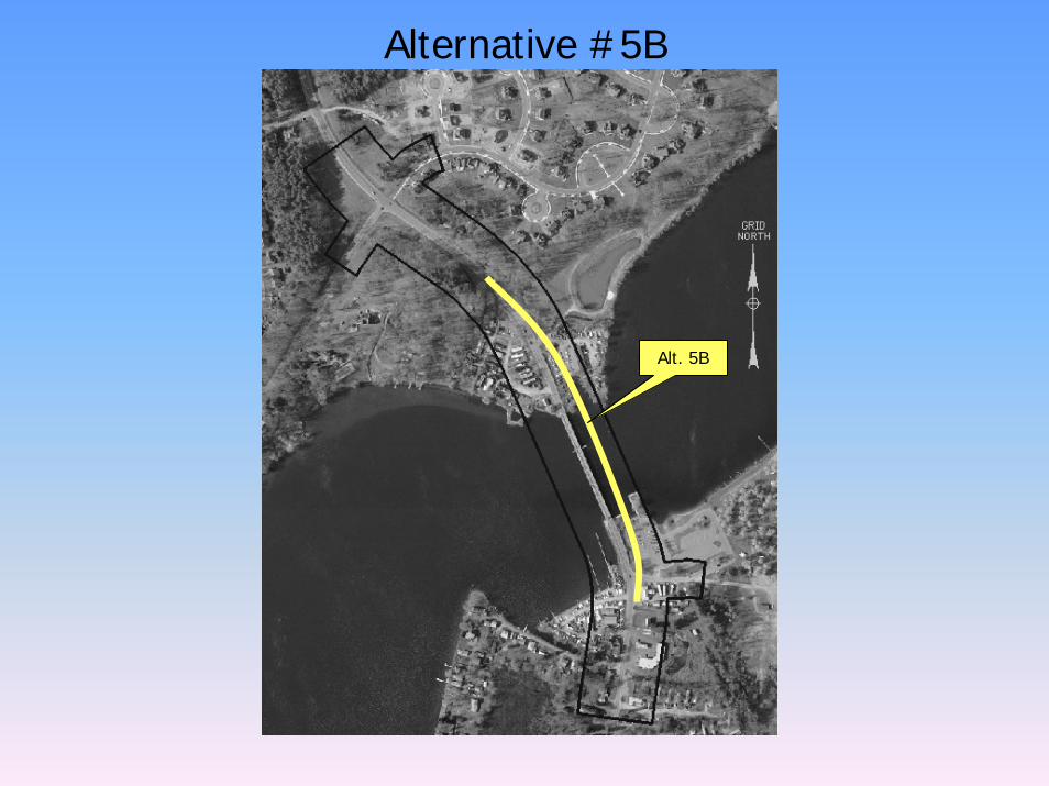
Alternative #5B
Alt. 5B
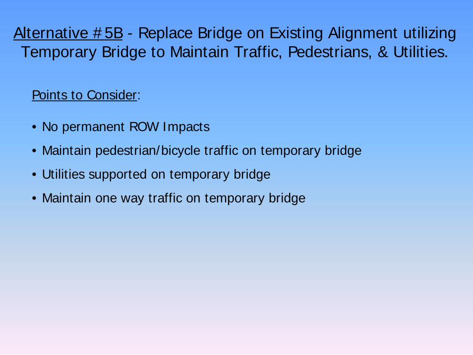
Alternative #5B - Replace Bridge on Existing Alignment utilizing Temporary Bridge to Maintain Traffic, Pedestrians, & Utilities.
Points to Consider:
• No permanent ROW Impacts
• Maintain pedestrian/bicycle traffic on temporary bridge
• Utilities supported on temporary bridge
• Maintain one way traffic on temporary bridge
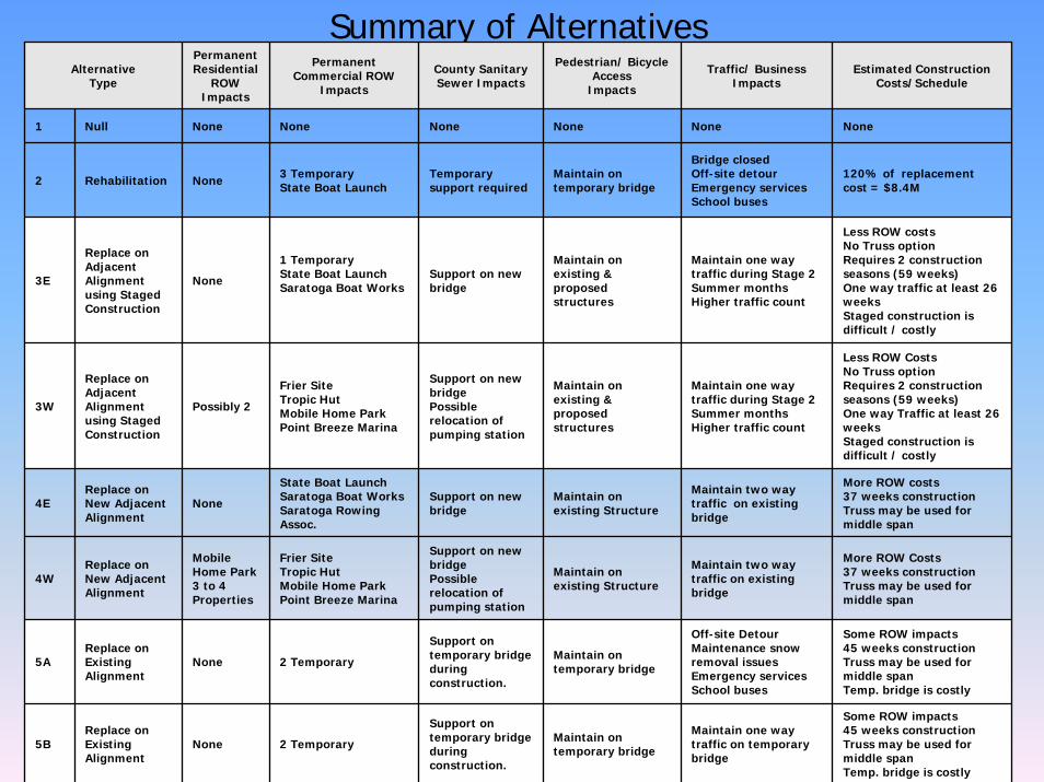
Summary of AlternativesAlternative
Type
Permanent Residential
ROW Impacts
Permanent Commercial ROW
Impacts
County Sanitary Sewer Impacts
Pedestrian/ BicycleAccess
Impacts
Traffic/ Business Impacts
Estimated Construction Costs/Schedule
1 Null None None None None None None
2 Rehabilitation None 3 TemporaryState Boat Launch
Temporary support required
Maintain on temporary bridge
Bridge closedOff-site detour Emergency servicesSchool buses
120% of replacement cost = $8.4M
3E
Replace on Adjacent Alignment using Staged Construction
None
1 Temporary State Boat LaunchSaratoga Boat Works
Support on new bridge
Maintain on existing & proposed structures
Maintain one way traffic during Stage 2Summer monthsHigher traffic count
Less ROW costsNo Truss optionRequires 2 construction seasons (59 weeks)One way traffic at least 26 weeksStaged construction is difficult / costly
3W
Replace on Adjacent Alignment using Staged Construction
Possibly 2
Frier SiteTropic HutMobile Home ParkPoint Breeze Marina
Support on new bridge Possible relocation of pumping station
Maintain on existing & proposed structures
Maintain one way traffic during Stage 2Summer monthsHigher traffic count
Less ROW CostsNo Truss optionRequires 2 construction seasons (59 weeks)One way Traffic at least 26 weeksStaged construction is difficult / costly
4E Replace on New Adjacent Alignment
None
State Boat LaunchSaratoga Boat WorksSaratoga Rowing Assoc.
Support on new bridge
Maintain on existing Structure
Maintain two way traffic on existing bridge
More ROW costs37 weeks constructionTruss may be used for middle span
4W Replace on New AdjacentAlignment
Mobile Home Park3 to 4 Properties
Frier SiteTropic HutMobile Home ParkPoint Breeze Marina
Support on new bridgePossible relocation of pumping station
Maintain on existing Structure
Maintain two way traffic on existing bridge
More ROW Costs37 weeks constructionTruss may be used for middle span
5AReplace on Existing Alignment
None 2 Temporary
Support on temporary bridge during construction.
Maintain on temporary bridge
Off-site Detour Maintenance snow removal issuesEmergency servicesSchool buses
Some ROW impacts45 weeks constructionTruss may be used for middle spanTemp. bridge is costly
5BReplace on Existing Alignment
None 2 Temporary
Support on temporary bridge during construction.
Maintain on temporary bridge
Maintain one way traffic on temporary bridge
Some ROW impacts45 weeks construction Truss may be used for middle spanTemp. bridge is costly

COMMENT FORM
POPULAR RECREATIONAL AREA
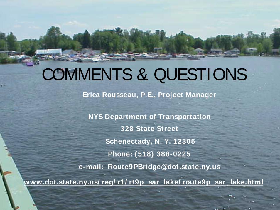
COMMENTS & QUESTIONS
www.dot.state.ny.us/reg/r1/rt9p_sar_lake/route9p_sar_lake.html
Erica Rousseau, P.E., Project Manager
NYS Department of Transportation
328 State Street
Schenectady, N. Y. 12305
Phone: (518) 388-0225
e-mail: [email protected]