royal borough of windsor & … is recommended the panel refuses planning permission for the...
TRANSCRIPT

ROYAL BOROUGH OF WINDSOR & MAIDENHEADPLANNING COMMITTEE
MAIDENHEAD DEVELOPMENT CONTROL PANEL
17 December 2018 Item: 1ApplicationNo.:
18/00600/FULL
Location: John Guest Speedfit Ltd Oldfield Road Maidenhead SL6 8BYProposal: Demolition of existing warehouse (B8) and construction of extended warehouse (B8),
with access from Oldfield Road.Applicant: John Guest LtdAgent: Mr Barry WattsParish/Ward: Maidenhead Unparished/Oldfield Ward
If you have a question about this report, please contact: Alys Hughes on 01628 796040 or [email protected]
1. SUMMARY
1.1 This application was reported to the Borough Wide Panel on the 4th of October when Membersresolved to defer making a decision in order to provide an opportunity for the applicant toaddress the key issues which resulted in the recommendation to refuse the application. Theseissues related to flooding, ground conditions and tree protection. It was requested that theapplication be reported back to Members at the December Maidenhead Area Panel meeting.Since the Borough Wide Panel meeting, an email was sent to the agent advising them of theopportunity to submit further information and a response email from the agent was received onthe 15th of November confirming that they wished the application to be determined based on theinformation already submitted to date. Therefore as no further information has beenforthcoming, the recommendation remains as one of refusal. The original report on theapplication is copied below for Members convenience.
1.2 The proposal site is situated within flood zones 2 and 3. The mitigation measures put forward bythe applicant to compensate for the increased footprint of the building is that it can becomefloodable with the roller shutter doors designed to open with a sensor, triggered when the floodwater depth is considered to be critical, thus allowing flood water to enter the building. Themitigation measures are not considered to be acceptable as it relies on intervention (i.e. theopening of doors) and the proposal is therefore considered contrary to policy F1 and paragraph163 of the NPPF (2018).
1.3 The site has been identified as having a risk of being contaminated and insufficient informationhas been submitted to demonstrate that the development is suitable for its proposed use whentaking into consideration the risk of contamination, contrary to paragraph 178 a) of the NPPF(2018).
1.4 It is considered that the design and appearance of the building, despite being more visible fromthe surrounding area due to its increased height and scale, would not have a detrimental impacton the character and appearance of the surrounding area or have a significant impact on theamenities of neighbouring sites.
1.5 There is no objection to the proposed amendments to the access or the amendments to theamount of parking or the parking layout. The proposal complies with policies P4 and T5 of theadopted Local Plan.
1.6 The trees adjoining the site on the northern boundary form a prominent element of the locallandscape and insufficient information has been submitted to adequately demonstrate theprotection of these trees, contrary to policy N6 of the adopted Local Plan.

It is recommended the Panel REFUSES planning permission for the followingsummarised reasons (the full reasons are identified in Section 10 of this report):
1. The proposal site is situated within flood zones 2 and 3 and the mitigation measuresput forward are not acceptable in terms of ensuring that the development by reasonof its increased footprint would not result in the displacement of flood water andsubsequently would not increase the risk of flooding elsewhere. The proposal istherefore considered to be contrary to local plan policy F1 and paragraph 163 of theNPPF (2018).
2. The level of information submitted to support the application has not adequatelydemonstrated that the development would comply with paragraph 178 a) of theNPPF (2018) which states that ‘decisions should ensure that a site is suitable for itsproposed use taking into account ground conditions and any risks arising from landinstability and contamination’.
3. The proposed development fails to adequately secure the protection of importanttrees which contribute positively to the local landscape. As such, the application iscontrary to paragraph 175 (c) of the National Planning Policy Framework (2018),Local Plan policy N6 , along with polices SP2, SP3 and NE2 of the Borough LocalPlan Submission Version to which a significant level of weight is afforded.
2. REASON FOR PANEL DETERMINATION
Members deferred their determination of this application at the meeting of the Borough WidePanel on 4th October to enable the applicants to submit further information to seek toovercome the recommended reasons for refusal.
3. DESCRIPTION OF THE SITE AND ITS SURROUNDINGS
3.1 The proposal site consists of a 10,688sqm section of land situated on the south east of ReformRoad and to the west of Oldfield Road and is occupied by John Guest. The site adjoins industrialunits to the west and south east, residential uses to the north and north east and the railway lineto the south.
3.2 The site is situated within the built up area of Maidenhead and is located on land designated asflood zones 2 and 3. The site has been identified as having a risk of being contaminated.
4. DESCRIPTION OF THE PROPOSAL AND ANY RELEVANT PLANNING HISTORY
4.1 Planning permission is sought for the demolition of existing warehouse (476.3sqm) andconstruction of extended warehouse (1123.6sqm) with access from Oldfield Road. Thedevelopment would remain in B8 use.
4.2 11/02739/FULL - Extension of north side of building to infill between Units 2 and 3. Permitted28.11.11
11/02224/FULL – Erection of two silos. Permitted 26.09.11
11/02217/FULL – Single storey side extension to house electricity transformer. Permitted26.09.11
11/00138/FULL – Reroof and over clad walls of an industrial unit. Permitted 03.03.11
10/02913/CPD – Certificate of lawfulness to determine whether a recladding and refurbishmentof warehouse unit is lawful. Refused. 17.01.11
10/02693/FULL – Renewal of planning permission 08/00206 for the erection of an extension forindustrial use with mezzanine first floor. Permitted 17.01.11

08/01141/CPD – Certificate of lawfulness for construction of a proposed link between 2 industrialbuildings. Permitted 11.06.08
03/40385/FULL – Erection of six louvered lantern ventilators on roof of offices and 200mmdiameter boiler flu to north elevation. Permitted 08.07.03
5. MAIN RELEVANT STRATEGIES AND POLICIES RELEVANT TO THE DECISION
5.1 National Planning Policy Framework Sections 2, 4, 6, 11, 12
Royal Borough Local Plan (1999)
5.2 The main policies are:
Within settlementarea
Highways andParking Trees Flooding
DG1, H10, H11 P4, T5 N6 F1
These policies can be found athttps://www3.rbwm.gov.uk/downloads/download/154/local_plan_documents_and_appendices
Borough Local Plan: Submission Version
Issue Local Plan Policy
Design in keeping with character and appearanceof area
SP2, SP3
Manages flood risk and waterways NR1
The NPPF sets out that decision-makers may give weight to relevant policies in emerging plansaccording to their stage of preparation. The Borough Local Plan Submission Document waspublished in June 2017. Public consultation ran from 30 June to 27 September 2017. Followingthis process the Council prepared a report summarising the issues raised in the representationsand setting out its response to them. This report, together with all the representations receivedduring the representation period, the plan and its supporting documents have now beensubmitted to the Secretary of State for examination. The Submission Version of the BoroughLocal Plan does not form part of the statutory development plan for the Borough. However, bypublishing and submitting the Borough Local Plan for independent examination the Council hasformally confirmed its intention to adopt the submission version. As the Council considers theemerging Borough Local Plan to be sound and legally compliant, officers and Councillors shouldaccord relevant policies and allocations significant weight in the determination of applicationstaking account of the extent to which there are unresolved objections to relevant policies.Therefore, the weight afforded to each policy at this stage will differ depending on the level andtype of representation to that policy. This is addressed in more details in the assessment below.
This document can be found at:https://www3.rbwm.gov.uk/info/201026/borough_local_plan/1351/submission/1
Supplementary planning documents
5.3 Supplementary planning documents adopted by the Council relevant to the proposal are:
The Interpretation of Policy F1 (Area Liable to Flooding) Supplementary Planning Guidance(SPG) 2004
More information on these documents can be found at:https://www3.rbwm.gov.uk/info/200414/local_development_framework/494/supplementary_planning
Other Local Strategies or Publications

5.4 Other Strategies or publications relevant to the proposal are:
RBWM Townscape Assessment RBWM Parking Strategy
More information on these documents can be found at:https://www3.rbwm.gov.uk/info/200414/local_development_framework/494/supplementary_planning
6. EXPLANATION OF RECOMMENDATION
6.1 The key issues for consideration are:
i impact on flood risk, ground pollution and drainage
ii impact on the character and appearance of the area
iii impact on neighbouring amenities
vi Trees and landscaping
v parking and highways
Issue i – Impact on flood risk and ground pollution
6.2 The site is situated within flood zone 2 (medium probability of flooding) and flood zone 3 (highprobability of flooding). In accordance with the NPPF and NPPG, when applying the SequentialTest, a pragmatic approach on the availability of alternatives sites should be taken. Forextensions to existing business premises, it is impractical to suggest that there are more suitablelocations for that development elsewhere. The proposal therefore passes the Sequential Test.
6.3 In ‘Table 2: Flood risk vulnerability classification’, the development is classified as ‘lessvulnerable’. In accordance with ‘Table 3: Flood risk vulnerability and flood zone ‘compatibility’’,the development is acceptable in Flood Zone 3 and the Exceptions Test is not required.
6.4 Paragraph 163 of the NPPF and footnote 50 outlines that the development should be supportedby a site-specific flood-risk assessment (FRA). This FRA should demonstrate the following:
‘a) within the site, the most vulnerable development is located in areas of lowest flood risk,unless there are overriding reasons to prefer a different location;b) the development is appropriately flood resistant and resilient;c) it incorporates sustainable drainage systems, unless there is clear evidence that this would beinappropriate;d) any residual risk can be safely managed; ande) safe access and escape routes are included where appropriate, as part of an agreedemergency plan.’
6.5 An FRA has been submitted to support the application. This has been reviewed by theEnvironment Agency. It does not demonstrate that any increase in built footprint within the 1%annual probability flood extent, with an appropriate allowance for climate change, can be directlycompensated for. This is necessary to prevent new development reducing flood plain storageand displacing flood waters, thereby increasing flood risk elsewhere. Level for level flood plaincompensation is the preferred method of mitigation as voids, stilts or under croft parking tend tobecome blocked over time by debris or domestic effects leading to a gradual loss of theproposed mitigation. In the FRA, it is outlined that the increased footprint of the building wouldbe mitigated through allowing the new structure to be flooded. The proposed roller shutter doorswould be designed to open with a sensor, triggered when the flood water depth is considered tobe critical, thus allowing flood water to enter the building. It is not considered that mitigation byopening of doors would allow for the free flow of water, which is required to be generally

unimpeded and not be reliant on intervention. This proposal does not constitute the status of a‘floodable’ building. Furthermore, as the purpose of the building is to provide more space for themanufacture of goods, this would likely involve equipment to be fixed to the floor as well as thestorage of machinery and materials, meaning that it would not be an empty space for the storageof water. The proposal relies on the sensors to work as designed and no information has beenprovided as to how long the doors would remain open, nor what fail safe there would be in theevent that the doors are not opened. For the above reasons, the FRA is not considered to beacceptable and the development does not comply with paragraph 163 of the NPPF.
6.6 Paragraph 178 a) of the NPPF states that ‘decisions should ensure that a site is suitable for itsproposed use taking account of ground conditions and any risk arising from land instability andcontamination’. The Geotechnical Investigation report submitted with the application assessesthe physical characteristics of the underlying geology with respect to foundation design. Thethree wells installed for this investigation are clustered in the north western part of the car parkand within a very small part of the development site. The report states that no physicalcontamination investigation was carried out and only one single composite sample of shallowlevel ground (depth of 0.3m to 0.7 m bgl) was taken for analysis. No groundwater samples weretaken or analysed despite groundwater having been encountered between 2.7m and 2.9 bgl.This investigation is not adequate to assess the potential risk to controlled waters caused by thisdevelopment. The proposal is therefore contrary to paragraph 178 of the NPPF.
6.7 Details in relation to the drainage of the site have been submitted to support the application andthese have been assessed by the Lead Local Flood Authority. In the latest response they haverequested the submission of more information and have recommended refusal until thisinformation is received. However, their response suggests that a sustainable drainage system isachievable on site provided that the relevant information is provided and therefore it would beunreasonable to refuse the application on this basis as the drainage strategy could beappropriately dealt with under a planning condition.
Issue ii – Impact on the character and appearance of the area
6.8 The appearance of a development is a material planning consideration and the NationalPlanning Policy Framework, (requiring well-designed places) and Local Plan Policy DG1,advises that all development should seek to achieve a high quality of design that improves thecharacter and quality of an area. The proposal, in terms of its proposed use of materials, heightand scale, is considered to harmonise with that of existing buildings on the site. Whilst projectingcloser towards Oldfield Road than the building it is to replace, as it would harmonise with theappearance of the existing buildings, it would not appear as a prominent or overbearing additionwhen viewed from the street scene.
Issue iii – Impact on neighbouring amenities
6.9 The proposed development would have a greater depth than the existing building, stretching anadditional 22m along the northern boundary of the site. The proposal would also be greater inheight than the existing with an eaves height of 6m (previously 4m with a side parapet of 4.6m)and ridge height of 7.6m (previously 4.6m). This would mean that the development would bemore visible from surrounding sites. The boundaries of the site where the proposed building is tobe located adjoins industrial uses to the west, a section of maintained landscaping to the northwith residential uses beyond, and residential uses to the east. No concerns are raised with therelationship of the development with the industrial uses to the west. In terms of the relationshipwith the neighbouring dwellings to the north, the rear gardens of these dwellings are at a depthof around 10m and are set back from the shared boundary by a section of landscaped landapproximately 8m in depth. Due to the degree of separation between the dwellings and theproposed building, it is not considered that it would have a detrimental impact on the rearamenity areas of these dwellings in terms of loss of light or obtrusive appearance. There are alsolarge trees located on this section of land which would provide a good level of screening of theproposed building. The distance between the building and the dwellings to the east is consideredsufficient to prevent the development having any significant impact on their amenity areas.

6.10 Due to the use of the site, it is anticipated that there is a certain level of noise and disturbancethat arises from this existing use. Concerns have been raised by the occupants of neighbouringproperties along Kingsquarter that the development would result in an increased level of noiseand disturbance which would be detrimental to their living conditions. However, whilst thedevelopment would result in a larger building, it is not considered that the increased level ofactivity associated with this increased floorspace would be significantly greater than the currentsituation. The extended length of the building would in fact mean that deliveries to and from thissection of the building would be situated further away from dwellings along Kingsquarter than thecurrent situation. The proposal is therefore considered to comply with paragraph 127 f) of theNPPF.
Issue iv – Parking and highways
6.11 The site currently benefits from having 3 vehicular access points with one off Reform Road andtwo off Oldfield Road. The transport statement reads:
‘The Reform Road frontage operates as the main visitor and small delivery access where parkingis provided for visitors as well as some staff. The Oldfield Road frontage has 3 access pointswhich accommodate the majority of the staff car parking together with larger deliveries’.
The proposal includes widening the most northerly access off Oldfield Road by 3m to improve themanoeuvrability for an articulated delivery vehicle to leave the site. A swept path analysis hasbeen provided which demonstrates that a large articulated lorry would still be able to enter andexit the site in forward gear and that the existing visibility splays would not be affected by theproposal.
6.12 The site currently benefits from having 2 parking areas. The proposal includes the demolition ofthe existing 443sqm warehouse to construct a new 964sqm warehouse, both in B8 use. Underthe Local Authorities current parking standards, a B8 use require that one car parking space isprovided per 90sqm with a lorry space. Therefore the new building generates a demand for 11car parking spaces however as the development would take up a section of the site whichcurrently provides for parking, the car parking spaces would be reduced within the Oldfield Roadcar park from 53 to 42 spaces. A parking survey has been submitted to support the applicationfollowing the request from the Highways Authority, which confirms that there is spare capacitywithin the Oldfield Road car park. It is considered that the proposal would not result in vehiclesparking along Reform Road or the surrounding area. The proposal complies with local plan policyP4.
6.13 The development would not result in an increase in vehicular movements which would have adetrimental effect on the local highway network and therefore complies with local plan T5.
Issue v – Trees and landscaping
6.14 The trees that adjoin the site on the northern boundary are not protected however, they areprominent features within the local landscape and serve a purpose as a soft screen between theapplication site and the neighbouring sites to the north. No arboricultural information has beensubmitted to support the application. The Council’s Tree Officer has advised that it is likely thatthe foundations for the new building would compromise the root systems of these trees and in theabsence of arboricultural information and details regarding the foundation design of the building,it is not possible to fully assess the potential impact. Given policy N6 of the local plan, it isrecommended that the application is refused.
7. CONSULTATIONS CARRIED OUT
Comments from interested parties
11 letters were received objecting to the application, summarised as:

CommentWhere in thereport this isconsidered
1. Development would reduce the value of properties surrounding thesite
Not a materialplanningconsideration
2. Increase in traffic along Oldfield Road 6.133. Overbearing appearance from neighbouring sites 6.94. Building has no right to be in residential area The site is
currently in B8 useand thedevelopmentwould be replacingan existingbuilding used inconnection to thisuse.
5. Fear of crime – building would conceal rear gardens of Kingsquartermaking it easier to break into properties.
No significantdifference to thecurrent situation
6 Increased noise and disturbance 6.107. Increased air pollution Condition
recommended byEnvironmentProtection
8. Cause safety issues to road uses HighwaysAuthority considerthere not to be asignificantincrease in trafficgeneration and thevisibility splaysproposed at theaccess areacceptable
9 Disturbance during construction period Not a materialplanningconsideration
10 Trees shown incorrectly on the plans in terms of their number andheight
Noted
Statutory consultees
Consultee CommentWhere in thereport this isconsidered
EnvironmentAgency
Object Issue i
Lead LocalFloodAuthority
Object Issue v

Other consultees
Consultee CommentWhere in thereport this isconsidered
HighwaysAuthority
No objection Issue iv
EnvironmentProtection
Conditions and informatives recommended Noted
Tree Officer Object Issue vi
8. APPENDICES TO THIS REPORT
Appendix A - Site location plan and site layout
Appendix B – Existing elevations
Appendix C – Proposed elevations
Appendix D – Proposed floorplans
9. RECOMMENDED FOR REFUSAL IF PERMISSION IS NOT GRANTED
1 The proposal site is situated within flood zones 2 and 3 and the mitigation measures put forwardare not acceptable in terms of ensuring that the development by reason of its increased footprintwould not result in the displacement of flood water and subsequently would increase the risk offlooding elsewhere. The proposal is therefore considered to be contrary to local plan policy F1and paragraph 163 of the NPPF (2018).
2 The level of information submitted to support the application has not adequately demonstratedthat the site is safe to be developed and that the proposal would comply with paragraph 178 a) ofthe NPPF (2018) which states that 'decisions should ensure that a site is suitable for its proposeduse taking into account the ground conditions and any risks arising from land instability andcontamination'.
3 The proposed development fails to adequately secure the protection of important trees whichcontribute positively to the local landscape. As such, the application is contrary to paragraph 175(c) of the National Planning Policy Framework (2018), Local Plan policy N6 , along with policesSP2, SP3 and NE2 of the Borough Local Plan Submission Version to which a significant level ofweight is afforded.

Appendix A – Proposed site plan and location plan

Appendix B – Existing plans and elevations

Appendix C – Proposed elevations

Appendix E – Proposed floor plans

ROYAL BOROUGH OF WINDSOR & MAIDENHEADPLANNING COMMITTEE
MAIDENHEAD DEVELOPMENT CONTROL PANEL
17 December 2018 Item: 2ApplicationNo.:
18/02105/FULL
Location: Land To The South of Stafferton Way And East of Vicus Way MaidenheadProposal: Erection of five storey split-deck multi-storey car park with access and associated
landscaping following removal of existing slab and hardstanding (Regulation 3application)
Applicant: The Royal Borough of Windsor And MaidenheadAgent: Mr Matthew BlythinParish/Ward: Maidenhead Unparished/Oldfield Ward
If you have a question about this report, please contact: Claire Pugh on 01628 685739 or [email protected]
1. SUMMARY
1.1 The application proposes a multi-storey car park (5 storeys).
1.2 It is not considered that the proposed multi-storey car park would conflict with Policy OA6 of theMaidenhead AAP (this forms part of the Adopted Development Plan), which seeks to deliver anew multi-storey car park within the Stafferton Way Opportunity Area. The scheme would conflictwith policies ED1 and ED2 of the emerging Borough Local Plan, which is a materialconsideration of significant weight. It is considered that there are material considerations whichweigh in favour of the application, which include the need for the car parking to supportcommuters using Maidenhead Train Station and to take into account the future Cross rail, andalso the need to support Maidenhead Town Centre and its redevelopment.
1.3 The scheme is considered to be of an acceptable scale and appearance within the context of thisarea, and is considered to have an acceptable impact upon trees of significance. The scheme isconsidered to be acceptable in terms of flood risk. It is not considered that the proposal wouldhave a severe impact on the highway network, or that it would have an unacceptable impact onhighway safety.
1.4 It is acknowledged that the scheme would have a detrimental impact on neighbouring residentialproperties, and this is considered in the planning balance.
It is recommended the Panel authorises the Head of Planning:
1.To grant planning permission subject to the conditions listed in Section 10 of thisreport.
2. REASON FOR PANEL DETERMINATION
The Council’s Constitution does not give the Head of Planning delegated powers todetermine the application in the way recommended; such decisions can only be made by thePanel. In addition, the Council owns the land.
3. DESCRIPTION OF THE SITE AND ITS SURROUNDINGS
3.1 The application site relates to land to the south of Stafferton Way and to the east of Vicus Way.The application site measures circa 0.4 hectares and was last utilised as a temporary staff carpark by the site owners (the Royal Borough of Windsor and Maidenhead).
3.2 The site is accessed from Vicus Way, a direct route off Stafferton Way, which links to theBraywick roundabout to the west. The Vicus Way and Stafferton Way junction is marked by amini-roundabout.
3.3 The site is situated outside of the Maidenhead town centre boundary, but is within theMaidenhead Town Centre Area Action Plan Area (Adopted Plan).
3.4 To the rear (south) of the site is a flatted development of five to six storeys in height. To the westof the site, on the opposite side of Vicus Way are residential properties of 2 storeys in height. Theeast of the application site is Lock and Store, a commercial premises of 4 storeys in height. Onthe opposite side of Stafferton Way are retail premises which are relatively low in height, and theStafferton Way multi-storey car park which is 5 storeys in height.
3.5 Beech trees provide screening on the southern boundary of the site (these trees are situated inthe neighbouring site).
3.6 The application site is in the region of 1-1.5 metres lower than the ground level of the groundlevel of Stafferton Way and Vicus Way
3.7 The application site is within flood zone 2 (medium risk flooding).
4. DESCRIPTION OF THE PROPOSAL AND ANY RELEVANT PLANNING HISTORY
4.1 The application proposes the construction of a multi-story car park which would be 5 storeyshigh (open deck). The main built form of the proposed building would have a height of 14-15metres and a maximum height of circa 17.4 metres to accommodate the cores for the lift accessand stairs positioned to the north and south of the proposed building. The proposed layout wouldbe in the form of a ‘split deck’ layout where the ramps connecting the levels would be positionedto the southern and northern end of the building.
4.2 The car park would provide 516 car parking spaces. Table 4.1 sets out the parking mix proposedthroughout the proposed building.
Table 4.1- Car parking mix
ParkingProvision
Level
Ground 1 2 3 4 TotalStandardBay
36 107 107 107 109 466
AccessibleBay
24 0 0 0 0 24
Electricchargingbay
21 0 0 0 0 21
Accessiblebay withelectriccharging
5 0 0 0 0 5
Total 86 107 107 107 109 516
4.3 Since the initial submission the applicant has sought to amend the level of electric vehiclecharging points to be reflective of demand, and accordingly some of the proposed informationcontained in the planning statement, Transport Assessment and Design and Access Statementdo not fully align with the above break down of mix of parking spaces.
4.4 The existing vehicular access from Vicus Way would be adapted and utilised to serve thedevelopment.

4.5 The building would be finished in a cladding system; a metal cladding would be used at groundfloor level, with a wooden cladding system applied to the upper floors of the building. The cores(to accommodate the lift and stairwell) would be in a natural concrete with a translucent paintfinish to the ground floor area for anti-graffiti measures.
4.6 The Car Park Management Plan sets out that the car park will be operational between the hoursof 5am and 8pm.
4.7 There is planning history on the site, but there is no history considered to be of relevance to thisapplication. The Local Planning Authority is currently or has recently considered a number ofother planning applications which are considered to be relevant to the context of this application,these are:
York Road redevelopment site:18/01608/FULL: Mixed use redevelopment of the site comprise of 5 buildings, varying from 4-8storeys in height to provide a total of 229 new residential dwellings, 1,930 sqm Gross ExternalArea (GEA) of commercial and/or community/cultural floor space (Use Class A1/A3/B1/D1).The Local Planning Authority resolved to grant planning permission on the 27.09.018. Thisincludes redeveloping on York Road and Grove Road surface car parks.
Ten Pin, Holmanleaze
18/01796/FULL: Demolition of existing building and resurfacing of site with change of use tosurface car park and erection of boundary hoarding for temporary 5 year period (100 car parkingspaces).Approved: 02.08.2018
Clyde House, Reform Road:
18/01558/FULL: Resurfacing of site with change of use to surface car park and erection ofboundary hoarding for temporary 5 year period following demolition of existing building (60 carparking spaces). Approved: 18.07.2018
4.8 These applications are relevant as they show other applications for major town centreredevelopment, or for temporary car parks within the Maidenhead AAP area.
5. MAIN RELEVANT STRATEGIES AND POLICIES RELEVANT TO THE DECISION
5.1 The National Planning Policy Framework (NPPF) (2018) acts as guidance for local planningauthorities and decision-takers, both in drawing up plans and making decisions about planningapplications. At the heart of the National Planning Policy Framework is a presumption in favour ofsustainable development. The NPPF is a material consideration of significant weight in thedetermination of applications.
The sections of the NPPF that are relevant to this application include:Section 2- Achieving Sustainable DevelopmentSection 6 – Building a strong competitive economySection 9- Promoting Sustainable TransportSection 12- Achieving well designed placesSection 14- Meeting the challenges of climate change, flooding and coastal changeSection 15- Conserving and enhancing the natural environment
Royal Borough Local Plan
5.2 The Borough’s current adopted Local Plan comprises of the saved policies from the Local Plan(Incorporating Alterations Adopted June 2003). The policies which are considered relevant to thissite and planning application are as follows:
N6 Trees and development

DG1 Design guidelines NAP3- Noise and Fumes NAP4 Pollution of groundwater and surface water T5 New Developments and Highway Design T7 Cycling T8 Pedestrian environment P4 Parking within Development IMP1 Associated infrastructure, facilities, amenities
These policies can be found athttps://www3.rbwm.gov.uk/downloads/download/154/local_plan_documents_and_appendices
The Maidenhead Area Action Plan (AAP) (2011) forms part of the adopted Development Planand sets out the Council’s vision for the regeneration of the Maidenhead Town Centre. Thedocument focuses on; Place Making, Economy, People and Movement. The AAP also identifiessix sites for specific development.
Policies of relevance include:
Policy MTC 1 Streets & Spaces Policy MTC 2 Greening Policy MTC 4 Quality Design Policy MTC 14 Accessibility Policy MTC 15 Transport Infrastructure Policy OA6 Stafferton Way Opportunity Area Policy IMP2 Infrastructure & Planning Obligations
Borough Local Plan: Submission Version (BLPSV)
Policies in the BLPSV which are relevant to the consideration of this planning application are: SP1 Spatial Strategy SP2 Sustainability and placemaking SP3 Character and design of new development ED1 Economic Development ED2 Employment Sites ED3 Other Sites and Loss of Employment Floorspace NR1 Managing Flood Risk and Waterways NR2 Trees, Woodlands and Hedgerows NR3 Nature Conservation EP1 Environmental Protection EP2 Air Pollution EP3 Artificial Light Pollution EP4 Noise EP5 Contaminated Land and Water IF1 Infrastructure and Developer Contributions IF2 Sustainable Transport
The NPPF sets out that decision-makers may give weight to relevant policies in emerging plansaccording to their stage of preparation. The Borough Local Plan Submission Document waspublished in June 2017. Public consultation ran from 30 June to 27 September 2017. Followingthis process the Council prepared a report summarising the issues raised in the representationsand setting out its response to them. This report, together with all the representations receivedduring the representation period, the plan and its supporting documents have now beensubmitted to the Secretary of State for examination. The Submission Version of the BoroughLocal Plan does not form part of the statutory development plan for the Borough. However, bypublishing and submitting the Borough Local Plan for independent examination the Council hasformally confirmed its intention to adopt the submission version. As the Council considers theemerging Borough Local Plan to be sound and legally compliant, officers and Councillors shouldaccord relevant policies and allocations significant weight in the determination of applications

taking account of the extent to which there are unresolved objections to relevant policies.Therefore, the weight afforded to each policy at this stage will differ depending on the level andtype of representation to that policy. This is addressed in more details in the assessment below.
Significant weight is to be accorded to Borough Local Plan Submission Version policies allrelevant policies, aside from Policy NR1 (Flood Risk). Lesser weight should be accorded toBorough Local Plan Submission Version policy NR1 due to the extent and nature of objectionsraised to it by representations on the Borough Local Plan Submission Version.
This document can be found at:https://www3.rbwm.gov.uk/info/201026/borough_local_plan/1351/submission/1
Supplementary planning documents
Other Local Strategies or Publications
Other Strategies or publications relevant to the proposal are:
RBWM Townscape Assessment – view at: RBWM Parking Strategy – view at: Thames Valley Berkshire Strategic Economic Plan
More information on the Townscape Assessment and Parking Strategy can be found at:https://www3.rbwm.gov.uk/info/200414/local_development_framework/494/supplementary_planning
6. CONSULTATIONS CARRIED OUT
Comments from interested parties
126 occupiers were notified directly of the application.
The planning officer posted a notice advertising the application at the site on the 25th July 2018and the application was advertised in the Maidenhead Advertiser on the 26th July 2018.
26 letters have been received objecting to the application, summarised as:
CommentWhere in thereport this isconsidered
1. The size of the building will impact residents (to the south) behind itmajorly. Will result in a lack of privacy.
7.37-7.46
2. Excessive noise. As it stands we can already hear the noisebetween 22:00 – 1:00am in the current car park across StaffertonWay, when teenage joy riders do “donuts” in the car park.
7.80-7.81
3. Serious loss of daylight to the residential units to the south of thesite.
7.37—7.46
4. Excessive traffic on a small road. The highway network cannotaccommodate the additional traffic arising from the proposed carpark.
7.47-7.60
5. Adverse effect on road safety. The road Vicus way has a majorblind spot and does not need the increase of traffic. Additionally itwill make it hard for residents to access their own homes.
7.47-7.60
7. Light and views from flats to the south will be adversely affected. 7.37-7.46
7. It is going to look aesthetically awful. 7..17-7.368 The air quality/ noise is going to be unacceptable, especially during
construction (groundworks).Addressed nreport.

9. Object to the fact that prime land near other retail areas is beingused for a car park for commuters, rather than investing in the areawith more retail or commercial building of us to local residents.
Noted.
10. It states this application is to ease future car park worries, it feelsmuch more like its easy money and until we see any positive changein the town (rather than shops just shutting down). It is hard to seethis plan not just being done regardless of its residents.
7.83-87
11 The entire case is a single solution to potential additional demandand displacement of existing parking capacity across the borough.More efficient would be a borough wide approach, finding acollection of solutions that promote economically beneficial andenvironmentally friendly methods of transport.
Noted.
12 The current government is committed to phasing out petrol anddiesel cars in the next 20 years and yet you are proposing a car parkwith a shockingly low 10% provision and a further 10%passive provision.
7.65-7.66
13 The planning application does not even validate the Stafferton Way/Vicus Way mini-roundabout, the junction that is most affected by thisproposal. In addition the 2032 baseline model is based on an upliftfrom 2016 and committed developments at this stage. There is noevidence that the 2032 base model has taken into account thesignificant additional dwellings under construction on Vicus Way(Loftings site). Therefore the transport assessment is fundamentallyflawed and cannot support this application.
7.47-60
14 The proposal contains no plan to enhance the road layoutsurrounding the proposed car park. The only highway modificationreferenced within this application is those planned by Redrow aspart of their planning application for the new Lofting’s site.
7.47-60
15 A proposal of a 5 storey car park to be built, when there is a largecar park directly opposite, is astonishing.
7.83-87
16 The land was originally used at ground level & is shocking how theproposal is to build a 5 storey building which will overshadow ourhomes
7.37-46
17 Better public transport should be considered rather than incentivisingtraffic & pollution.
Noted.
18 Maidenhead is an up and coming vibrant town and I personally feelthat a multi-storey car park sends the wrong message to current andfuture developers and residents.
7.83-87
19 The roundabout on the corner where you are building the car park isdangerous due to how the people drive down the road and the noisefrom the drug dealers ( which you do nothing about) in the car parkadjacent to this area is horrendous and upsetting so I would hate toencourage a similar situation
7.47-60
20 I ask you to either reconsider the height of the building completely orat least how the car park is managed by adding barriers so peoplecan’t drive in to the car park freely
See 7.32
21 Concerns over lighting from the car park, and the impact this willhave on neighbouring residential properties.
See 7.32 andcondition 8.
22 We are concerned about the security of the car park, having to hearthe alarms of the cars and this will increase the risk of trafficaccidents around the area
7.33
23 The car park will increase the number of commuters to London,therefore, not increasing employment in the town. The regenerationplans in Maidenhead town will have an impact on weekends andnight activity and other car parks are closer to the proposed TheLanding development.
7.83-87

24 The proposed ‘minor realignment works’ in the form of a zebracrossing will add more confusion to the junction with a real possibilityof physical/permanent harm to those using Vicus Way either in avehicle or on foot. I have experienced 2 near misses in a month (onfoot and in a car).
7.47-60
25 The recommended signage inside the car park ‘reminding people todrive at slow speeds and be respectful of neighbours’ is reliant uponhuman behaviour. Furthermore, being reliant upona report to assess noise impact on neighbouring properties is notreflective of lived experiences and I disagree with the findings that‘short-term noise events...will not be noticeable or intrusive.
7.80-81
26 There is already a multi storey car park a minutes’ walk away fromthe proposed building. I walk past this multi storey car park everyday and not once have I seen that the lower floor is full.
7.83-87
27 The development will result in the loss of significant trees. 7.33-7.3628 It would be extremely unhealthy to open our windows and doors with
the carpark in front of us, all the pollution from hundreds of carsstarting and stopping their engines, simply filtering into our home.
7.62-6.66
29 Many young families bought their first home here and the plannedparking will adversely affect their biggest investment
Not a planningconsideration.
30 Multi-storey carpark will make almost impossible for Redrowresidents getting in and out by car (and not only) during rush hours
7.42-60
31 Multi-storey carpark directly opposite – why not trying to improve itsmanagement
The applicationsubmitted has tobe considered.
32 The development of the car park would not benefit the regenerationof Maidenhead, instead it would serve as a park and ride forcommuters to travel into London instead of increasing jobswithin the local area.
7.83-87
33 There are already 2 car parks next to the site: a (i) multi story carpark and (ii) retail car park, both on Stafferton Way.
7.83-8.7
34 In addition to the loud noises and unsafe environment, cars oftenenter and exit the car parks at relatively high speeds making theroads around the car parks dangerous.
7.47-7.60
35 Alternatively PLEASE could the Borough CONSIDER building andunderground garage and building a park (or other safe communityenhancement facility) on top instead?
The applicationsubmitted has tobe considered.
36 What security measures will be put in place to prevent cars racingand back firing their engines (which Is very loud)?
This is notwithin thecontrol ofplanning.
37 I have concerns about traffic management in the immediate vicinity.The existing pedestrian crossing points in the area are inadequate.While there is a traffic light crossing next to Lidl supermarket, thezebra crossing just beyond the mini roundabout is dangerous.Frequently I have been trying to cross on that zebra crossing andcars either do not stop or stop at the very last second. As part of theplanned works, I would hope that this zebra crossing be upgraded toa traffic light crossing as at present it is a danger.
7.47-60
38 The scheme would decrease property values within the area. Not a planningconsideration.
39 If the Council believes there is a need for other car parks inMaidenhead, they should put these in non- residential areas. Thisuse is not compatible in a residential area.
This area is notpurely aresidential area.

40The proposed building would sit within the streetscene between thefour storey building and two storey terrace dwelling houses to thewest. The proposed building would fail to respect the existingbuilding heights, and would appear out of character and significantlyoverbearing to neighbouring properties.
7.17-7.36
41 A prevailing characteristic of the area on Stafferton Way is buildingsbeing set back from the road; this building would be out of keepingwith this.
7.17-7.36
42 Owing to the size of the building, there is no opportunity to put inmeaningful landscaping, which will be of detriment to the characterof the area.
7.36
43 An assessment on overshadowing has not been submitted. Noted, it is notconsiderednecessary
44 Given the pathway of the sun, significant overshadowing wouldoccur to Lock and Store and residential properties to the west in themorning and evenings.
7.37-7.46
45 The proposed building would be significantly overbearing toneighbouring properties.
7.37-7.46
46 Owing to the scale of the proposed building, it would make the carpark area and general approach to Lock and Store unwelcoming.
Not a relevantplanningconsideration.
47 The building would block views of Lock and Store and Lidl, and thiswould impact upon trade to Lock and Store which relies a lot onpassing trade.
This is not aplanningconsideration.
48 Lock and Store (as a neighbouring user) would not supportconstruction work overhanging their boundary; it would bedangerous.
Noted, this isnot relevant tothe planningassessment.
49 The proposed building will cross a ROW to the south of the site;Lock and Store benefit from a right of access along this and wouldnot permit this ROW being built on/impeded.
Noted, this isnot relevant tothe planningassessment.
50.
My house is directly opposite the proposed site; my front drive isused as a crossing point and a pavement by people who are too lazyto the use of existing pavements. I anticipate that with the erection ofthe car park that many more people will use my property as apavement’ I request the Council to find a solution to this.
The TransportAssessmentdoes show anew footway togo on thewestern side ofVicus Way (tobe secured bythe Redrowscheme), with anew pedestriancrossing put inon Vicus Way.
51 The Vicus Way plot is owned by the Council and yes it is available atthe moment, but that doesn’t make it a suitable spot for such a bigdevelopment.
This applicationmust beconsideredagainstdevelopmentplans policies.
52 It is the responsibility of the Planning department not to allow this carpark to be erected at this location because it will cause a real risk ofinjury to pedestrians, drivers and cyclists.
See 7.47-7.60
53 Pollution and noise will increase from new traffic and moreimportantly from stationary cars, due to gridlocks on the road, havinga negative impact on residents’ Lives and Health
See 6.3-6.6

54 Security, Behaviour and Disturbance issues relating to car park.Crime and anti-social behaviour in the area will increase and willadversely impact on residents. This is already a problem for thSafferton Way Car Park.
See 7.32
55 The Flooding report recommends that the application is refused See 7.7-7.1657 The Daylight Assessment shows incorrect and misleading
information. Specifically the photos in the assessment do not show 1Greenfield as it is today. There are 2 side windows facing VicusWay.
See 7.37-7.46
58 Light Pollution coming from the Car park, into our windows 24/7. Seerecommendedcondition 8.
59 The application contravenes both the current planning policy and thesubmitted Borough Local Plan.
See 7.2-7.6
Policy OA6 of the Maidenhead Area Action Plan allocates land northof Stafferton Way for a multi storey car park. This was a reasonablesite when the Plan was consulted on and approved, so what haschanged? The land may not be in the Council’s ownership but whatefforts have they made to negotiate for its purchase or to use, ifnecessary, Compulsory Purchase powers?
See 7.2-7.6
60 Too much money is being spent on this project. Not relevant tothe planningconsideration.
61 The development has been described as a “Temporary Car Park” inAll correspondence toresidents, even the latest letter to residents dated 12 November2018 , as well as on the on-line planning application on the Council’swebsite. This is entirely misleading, and the consultation has notbeen properly carried out. This can give a reason for a complaint tothe Local Government Ombudsman
The reference toa temporary carpark was givenas the part ofthe site address(as the sites lastuse), not thedescription ofdevelopment.For clarity thesite address hasbeen amendedto removereference to thetemporary carpark.
62 Where is the report which shows the need for the extra car parkingspaces?
This was notsubmitted withthe application.
63 There is evidence that parking usage in Maidenhead is down. This applicationhas to beconsidered onits merits.
61 Scheme does not accord with AAP, as the land south of StaffertonWay was meant to provide a striking gateway- this development willnot achieve that.
7.2-7.6

62 The Stafferton Way Opportunity Area is not appropriate for tallbuildings, as set out in the AAP.
For thepurposes of theAAP, tallbuildings arethose which arenoticeablyhigher than 20m. This schemewould not benoticeablyhigher than 20metres.
63 The proposal does not accord with Policy OA6 of the AAP, as thebuilding would result in a detrimental impact on neighbouringresidential uses, and is not considered to be high quality design.
The explanationof Policy OA6sets this out.Whilst thescheme isconsidered tocause someharm toresidentialamenity, thishas beenweighed in theplanningbalance. Seeparagraphs 7.17and 7.36 inrelation todesign.
64 Policy OA6 only allows for non-office employment to be provided onthis site.
See 7.2-7.6
65 Transport Assessment is flawed. Disagreed with the conclusionsfrom the modelling and the predicted queue lengths.
See 7.47-7.60
66 This is another example of infrastructure not being planned properly,and the Council finding a quick fix solution.
This applicationmust beconsidered onits merits.
67 Transport assessments are often not correct, as can be seen withthe school built in Oldfield.
The TA is thebest source ofinformation thatcan be used toinform arecommendation on thisapplication.
68 Please not I will be issuing proceedings for loss of right to light. Noted, this is aseparateprocess fromplanning.
69 Scheme will cause a danger to pedestrian safety. 6.47-6.60

70 Separation distances between the buildings is not acceptable. 7.37-7.46
A petition (with 152 signatures) has been submitted to the Council in relation to the application,setting out objections to the planning application. The objections are:
A third car park so close to a residential area will add to the existing issues from antisocialbehaviour originating from the existing car parks in the area. This will make the area amore dangerous place to live in.
The air pollution in the area will increase, having a negative impact on the residents’health.
The surrounding roads will become more dangerous for pedestrians and will not cope withthe additional traffic, especially as there is a recycling centre next door and hundreds ofnew residential dwellings on Vicus Way.
The noise in the area will increase and will exist 24 hours a day. This will impact on theresidents’ lives, health and ability to function properly. Young children need to sleep early,adults need to rest so that they can work the next day.
RBWM has already permitted the erection of hundreds new residential dwellings in VicusWay. A residential area does not mix well with a multi storey car park so close.
It will make the area look aesthetically ugly, noisy and over polluted
Consultees
Consultee CommentWhere in thereport this isconsidered
EcologyOfficer
No objection, subject to conditions for a ConstructionEnvironmental Management Plan to be submitted, and acondition to secure biodiversity enhancements.
7.70-7.74
EnvironmentAgency
No objection, subject to conditions regarding groundinvestigation works should be undertaken across the site.
Seerecommendedcondition.
BerkshireArchaeology
Offers no objection, subject to a condition being imposed toensure that the recommendations in the submittedarchaeological report are followed.
7.75-7.77
Council’s TreeOfficer
No objections subject to conditions. Noted, seerecommendedcondition 12.
EnvironmentalProtection
Recommends conditions.Does not consider the scheme will have an adverse impacton air quality.Recommends a condition for ground contamination.
Addressed inreport.
Highways No objection. 7.47-7.60Lead LocalFloodAuthority
No objection, subject to a condition. Seerecommendedcondition 7.
Other responses
CommentWhere in thereport this isconsidered
AccessAdvisoryForum
The AAF supports the provision of disabled parking withinthe temporary car park – 28 Blue Badge spaces out of thetotal 515 parking spaces. All Blue Badge spaces have rearand shared side access zones and are on the ground floor of
This is not arequirement ofPolicy in theAdopted Local

the car park.
However we do have a concern about disabled users of theproposed car park safely crossing Stafferton Way to accessthe town centre, retail park or station.
Of the two existing nearby pedestrian crossings, thezebra crossing enables Greenfields residents tocross Stafferton Way while the more recent Toucancrossing provides a crossing point of Stafferton Wayto users of the Green Way and shoppers using theRetail Park / Lidl.
Neither existing pedestrian crossing would enable auser of the temporary car park to cross StaffertonWay without first having to navigate either thejunction of Vicus Way & Stafferton Way or theentrances to Lidl and Retail Park car parks
Plan. Howeversee 7.59.
ThamesValley Police Thames Valley Police advise that they consider the design
and layout to be problematic in crime prevention designterms. Their Observations are summarised below. It shouldbe noted that they have not provided comments on theupdated car park management plan:
If the car park is to be a 24/7 facility, the design of thenew car park must incorporate appropriate measuresas to deter ASB and criminal activity. They query ifthere will be a security / Customer Service office / oron site patrols.
Careful consideration must be given to the parkingdeck surface treatment. Where local factors dictate, itis advised that new parking facilities should betreated with anti-graffiti coatings, textured surfacefinishes that limit the effect of vandalism in addition
Payment machines/meters should be positioned in thebusiest areas of the parking facility and be wellilluminated and overlooked by CCTV. Their locationshould be clearly visible or signed and they should beemptied regularly.
From the plans provided I cannot determine lightinglevels or position of lighting within the car park.Lighting can have a dramatic effect in reducing crime,the fear of crime and anti-social behaviour. I haveconcerns that the application does not seem toprovide any details as to how the parking areas andany other non-adopted public realm of the car park. Itis requested that the car park be lit to BS5489standard.
Advises that formal surveillance (CCTV) beincorporated into the development, the system shouldbe capable of monitoring all vehicle and pedestrianentrances; circulatory movement of traffic around theparking areas; pay points; any internal or external
7.32

secluded areas; and stairwell
Stairwells due to their lack of natural surveillance canquickly become a location where individuals cangather unobserved these areas are prone to ASB,graffiti, litter. Where possible the stairwells shouldinclude open balustrades allowing good visibility onapproach to and from landing areas. Stairwell andlanding openings to the outside face of car parkareas should be glazed for enhanced natural lightand surveillance. Where this is not possible, vandalresistant mirrors installed at stair turns can assist withnatural surveillance; however I would recommendthat CCTV, should be installed within the stairwells
7. EXPLANATION OF RECOMMENDATION
7.1 The key issues for consideration are:
i Principle of redevelopment at the site
ii Flood Risk
iii Design, including impact on trees and new landscaping
iv Impact upon neighbouring amenity (including noise and lighting)
v Impact on highways and parking considerations
vi Environmental Considerations
vii Other material considerations
Principle of this redevelopment at this site
7.2 Policy OA6 of the Maidenhead Area Action Plan (which forms part of the adopted developmentplan) sets out that the Stafferton Way Opportunity Area is allocated for employment development,and then goes on to set out the proposals that should come forward in this area. Policy OA6explains that one of the proposals in this Opportunity Area should comprise a new multi-storeycar park (which is not an employment use). Policy OA6 of the Maidenhead Area Action Plan setsout that land to the South of Stafferton Way (which includes this application site) should beutilised to deliver 4,000 sqm of non-office employment floorspace, this includes B1(b), B1(c), B2,B8 and car showroom use.
7.3 The Lock and Store (adjacent to the site), which is also situated on land south of Stafferton Wayhas 8,607m² of B8 self storage, which exceeds the 4000 square metre figure specified in PolicyOA6. As such it is not considered that this scheme would conflict with the requirements PolicyOA6. Policy OA6 of the AAP identifies that a multi-storey car park should be located on land tothe north of Stafferton Way. However, the land to the north of Stafferton Way is in privateownership, and so it would not be possible to provide a new multi-storey car park in this area.The provision of this multi-storey car park would meet the aims of Policy OA6 which seeks todeliver a multi-storey car park in this Opportunity Area.
7.4 Policy ED2 of the Borough Local Plan Submission Version (BLPSV) seeks to maintain thisapplication site (as part of a wider allocation) for employment use. This forms part of the widereconomic strategy for the BLPSV as set out in policies ED1 and ED2, which are affordedsignificant weight.

7.5 The scheme does not comply with Policies ED1 and ED2 of the emerging BLPSV. Theapplication site is on land allocated as a business area, and this scheme would remove landallocated for business purposes. However, within Policy ED2 it is stated that within businessareas, development proposals that improve and upgrade the facilities available will be supported.This multi-storey car park will increase car parking and will provide car parking for employeeswithin the area. In this instance the provision of a multi-storey car park would support the aims ofPolicy OA6 which forms part of the Adopted development plan.
7.6 It is acknowledged that the scheme would take away land allocated for employment purposes inthe emerging Borough Local Plan. The Borough Local Plan is not part of the adopteddevelopment plan, however, it is afforded significant weight in decision making. As such, materialconsiderations have been considered at 7.8.83-7.87 of this report.
Flood Risk
7.7 The application site is situated within flood zone 2 (medium risk flooding). A car park would fallinto a less vulnerable use, and according to guidance contained within the NPPF and NationalPlanning Practice Guidance (NPPG), a less vulnerable use is appropriate within this flood zone.
7.8 In accordance with the NPPF, it is a requirement for the scheme to pass the Sequential Test. Theaim of the Sequential Test is to steer development to areas at the lowest risk of flooding.Development should not be permitted if there are reasonably available sites appropriate for theproposed development in areas with a lower probability of flooding. If the Sequential Test cannotbe met, the principle of the development in Flood Zone 2 is not acceptable.
7.9 In order to pass the Sequential Test, it is necessary for the application to demonstrate that thereare no alternative reasonably available suitable sites at a lower risk of flooding (i.e. outside of theflood zone) that could accommodate this scheme. With regard to the area of search foralternative sites, given that the need for the car park is to support Maidenhead town centre andits regeneration, for workers in the town centre, and for commuters to London, the search forsites should be limited to the Maidenhead Area Action Plan Area. In addition, the need for a multi-storey car park to be accommodated within the Stafferton Way Opportunity Area is set out in theMaidenhead Area Action Plan. With regard to other potential sites within the AAP area, theexpansion of the existing Broadway car park is in the pipeline, but the expansion of this car parkon its own would not meet the car parking requirements for Maidenhead. Aside from this, withinthe Maidenhead AAP area, other reasonably available sites are either not at a lower risk offlooding than the application site and so are not sequentially preferable, or those sites that areavailable and at a lower risk of flooding are earmarked for future residential development. Suchalternative sites include:-Reform Road (is at a higher risk of flooding).-The Landing (earmarked for a mixed use development)-St Cloud Way (the site is at a lower risk of flooding, but residential development is anticipated forthe site)-York Road site (situated in flood zone 3)
7.10 It is considered that the Sequential Test is passed.
7.11 Paragraph 163 of the NPPF (2018) sets out that provided the Sequential Test can be passed, itneeds to be demonstrated as part of an application that:
a) within the site, the most vulnerable development is located in areas of lowest flood risk, unlessthere are overriding reasons to prefer a different location;b) the development is appropriately flood resistant and resilient;c) it incorporates sustainable drainage systems, unless there is clear evidence that this would beinappropriate;d) any residual risk can be safely managed; ande) safe access and escape routes are included where appropriate, as part of an agreedemergency plan.

7.12 In this case most of the site is situated in flood zone 2; the proposed use is a less vulnerable useand so the location of the proposed building within the site is considered to be acceptable.
7.13 The Flood Risk Assessment sets out that the finished floor level of the car park will be set at24.00 AOD which is above the 1 in 100 year plus climate change flood level, which is predicted tobe 23.76 AOD.
7.14 The application is submitted with a Sustainable Drainage Strategy, which adequately addressesthe management of surface water. The surface water drainage strategy comprises an onlinegeocellular attenuation tank with limited discharge rates. The proposed geocellular storagesystem dealing with the management of rainfall runoff has been designed to accommodate a1:100year + 40% climate change storm event. In addition, the possibility of surface water runoffrunning on to the site from the east during extreme rainfall events (in excess of 1% AEP + climatechange) has been recognised and any water running over the existing kerb line to the east of theproposed development will be directed to a compensatory storage area below the proposedmezzanine floor level. While the Lead Local Flood Authority is satisfied with the approach to themanagement of surface water some additional information is required (specifically relating to thecompensatory storage area) and it is recommended that full details are secured by way ofCondition 7.
7.15 With regard to residual risk, the FRA sets out that the site is not located within an area benefittingfrom flood defences and so is not at risk of flood defence failure
7.16 With regard to the access and evacuation, there would be a low hazard escape route in 1 in 100plus climate change allowance flood event.
Design, including impact on trees
7.17 Policy DG1 of the adopted Local Plan seeks to ensure that development will be of a highstandard of design and landscaping, compatible with the area and street scene.
7.18 Policies MTC1 and MTC 4 of the Maidenhead Area Action Plan emphasise the need for placemaking and creating a high quality, town centre environment. Policy OA 6: Stafferton WayOpportunity Area sets out how development proposals should seek to deliver high qualityarchitecture.
7.19 Section 12 of the NPPF which is a material consideration of significant weight to this applicationdeals with achieving well designed places and delivery of developments that will function andcontribute to the overall quality of the area in the long term. To achieve this development shouldbe visually attractive as a result of good architecture, layout and appropriate and effectivelandscaping; they should be sympathetic to local character and history, including the surroundingbuilt environment and landscape setting. The NPPF is clear to emphasise that this should notprevent or discourage change (such as increased densities).
7.20 Policies SP1 and SP2 of the BLPSV states that new developments should positively contribute tothe places in which they are located and that larger developments should provide a harmonious,integrated mix of uses, where appropriate, that foster a sense of community, vibrancy andactivity, along with contributing to the provision of social, natural, transport and utilityinfrastructure to support communities. The policy further promotes the community integration andsustainable place making. Policy SP3 sets out a number of principles to achieve a suitable highquality design. In reviewing the level of unresolved objections to these policies on the BLPSVsignificant weight is given to these overarching design principles to ensure appropriatedevelopment.
7.21 The Stafferton Way Opportunity Area is identified as part of a southern gateway into the towncentre (within the Adopted AAP), segregated from the central area by the railway line to thenorth. The character of the area is mixed and reflective of this edge of centre location.
Layout

7.22 Car parks are inevitably essentially a large ‘box’ in form with large floor plates. The proposedlayout looks to maximise the efficiency of the site, whilst having due regard for the siteconstraints (notably the residential flatted development and line of trees positioned to the southof the application site). Accordingly the proposed car park layout is positioned away from thisboundary. The vehicle access is also proposed to the western part of the site, off the existinghighway and set back from the main through road of Stafferton Way. Pedestrian Access routesare proposed to the north and west of the application site, to connect to existing pavements andfootways. Disabled access Ramps are proposed as part of this. The proposed car park wouldalso be positioned close to the eastern elevation, which forms the parking area of the adjoiningcommercial use.
7.23 In terms of the proposed internal layout the proposal would utilise a split level with a one-waysystem circulating traffic around the car park with ramps located to the north and south to connectthe split levels. Internally pedestrians would navigate the car park via a series of walkways andcrossing points leading to 2 stair cores which provide the vertical circulation and means ofescape. The main core is located to the north of the application site opposite Stafferton Way. Thesouthern stair core, adjacent to the car park access is predominantly an escape core.
Scale and mass
7.24 Buildings in the Stafferton Way Opportunity Area comprise a mix of buildings that range between2-5 storeys in height. The buildings in commercial use, owing to their footprint and design appearas fairly bulky buildings. Lower density two storey residential properties are located to the east ofthe application site, across form Vicus Way forming Greenfields and Alpine Close. To the rear ofthe application site is a 5- 6 story residential flatted development.
7.25 The Design and Access statement for this scheme sets out the massing arrangement andalternatives which were considered. A split level arrangement between the east and west of theproposed building was considered appropriate as it allows efficiencies of the proposed rampedlocations and also enables the ability to concentrate the massing and height towards the easternboundary with the adjacent commercial premises.
7.26 Whilst there are smaller scale buildings to the west of this application site, Vicus Way provides aphysical separation between the proposed building, and these nearby buildings. As discussed atsection 3.4 of this report, larger scale buildings are present within the vicinity of the site andthese contribute to the character of the area, against which this application is assessed.
7.27 It is accepted that the building will occupy a large part of the application site, and because of itsshape will have a large bulk and mass. However, as the building would be sited on a corner plot,with the roads providing physical separation from other smaller scale buildings, and because ofthe variety in the scale of buildings that exist within the local area, it is not considered that scaleand massing of the building would look at odds within the context of this area. Broadly theproposal would comply with the development plan in this regard.
7.28 It is worth noting that the application site is within an edge of centre location. The application siteforms part of a wider Opportunity area within the Maidenhead AAP which allocates the site foremployment purposes, and a large scale building would have been anticipated for this site.
Proposed architectural approach
7.29 The architectural design of the proposed building has been influenced by its use. The buildingneeds to be functional for its purpose; a car park needs to be designed to be secure. Thisrequirement has influenced the design, and material palette for the building. At ground floor level,this will be will be enclosed in a metal mesh to allow light and ventilation into this part of the carpark, while still providing a rigid, vandalism resistant barrier on the ground floor perimeter of theparking spaces. The upper floors of the building would be in cladding of ventilated façades madeup of natural wood panels and the corresponding substructure. Each panel would consist of ahigh density bakelite core, clad in a veneer of natural wood with a surface treated with syntheticresin and an exterior PVDF film (polyvinylidene fluoride). This material has been selected due to

its high resistance, as it does not require the typical maintenance of other woods for exteriors.The Design and Access Statement sets out that the colour of the vertical panels and the buildingin general is derived from the colour palette of the surrounding development in particular the tworesidential developments west and south of the site which utilise a range of dark and earthymaterials.
7.30 Given the use of the proposed building, the rationale for selecting the materials is apparent. Inaddition, there is a mix of materials and colour within the locality, including colours with an earthytone, and as such it is considered the proposed material palette is acceptable. The proposedbuilding has a functional appearance, however, a number of commercial buildings in the localityalso have a functional appearance (Lock and Store, the retail units on the northern side ofStafferton Way). As such, the architectural approach is considered to be acceptable within thisarea.
Other design considerations
7.31 The AAP (2011) and the NPPF (2018) both seek opportunities to design out crime and createsafe and accessible areas.
7.32 In addition to the proposed design of the façade of the building and use of materials that havebeen selected in order to provide a vandalism resistant barrier, the proposal incorporates othermeasures to prevent crime. The car park will be operational between the hours of 5am and 8pm.The entrance to the car park will be closed at 8pm and directional control provisions will allowcars to exit the car park should any vehicle remain in the car park after 8pm. The gate will beautomated and locked shut at 8pm each day, opening at 5am. The directional flow provisions willtake the form of flow plates (i.e. causing damage to any car that tries to enter via the exit). Inaddition, both stairwells will have open balustrades allowing good visibility on approach to andfrom landing areas and vandal resistant mirrors will be installed at stair turns to assist with naturalsurveillance. CCTV will be installed in the stair wells and also on the floor plates to cover paymachines. Thames Valley Police have been consulted on the revised Management Car ParkManagement Plan and their comments are awaited.
Landscape (including trees)
7.33 As set out above Policies MTC1, MTC 4 and OA6 of the Maidenhead AAP (2011) seek highquality design, and landscaping forms a key part of this. Local Plan policies N6 and DG1 alsoprovide general design policies on the importance of high quality landscaping in deliveringsuccessful schemes. Policy N6 of the adopted Local Plan states that plans for new developmentshould, wherever practicable, allow for the retention of existing suitable trees and include anappropriate tree planting and landscaping scheme. Where the amenity value of trees outweighsthe justification for development, planning permission should be refused.
7.34 BLPSV Policy SP3 requires development to protect trees and vegetation worthy of retention andsets out that comprehensive green and blue infrastructure schemes should be integrated intoproposals. Policy NR2 of the BLPSV seeks the protection and retention of trees, and whereneeded suitable mitigation. Where the amenity value of the trees outweighs the justification fordevelopment, planning permission may be refused.
7.35 A small group of trees and shrubs to be removed as part of the redevelopment of the site are oflimited landscape quality and there is no objection to their loss. Located on the southernboundary of the application site is a row of trees outside of the application site. An arboriculturalreport and associated tree survey has been submitted as part of the application. It is proposed toprotect these trees during the construction process by leaving existing tarmac within the rootingarea of these trees, with tree protection fencing erected by this tarmac area. The Council’s treeofficer is satisfied with this approach, and condition 12 seeks to secure that the developmentwould be undertaken in accordance with these tree protection measures.
7.36 Due to the proposed layout there are some opportunities for tree planting and/or softlandscaping. Recommended condition 9 sets out proposed landscaping conditions, however, it isunlikely that there is space for any meaningful tree planting. Visibility splays are fundamental for

this form of development and therefore any form of soft landscaping would likely be low level.This does not weigh in favour of the scheme.
Impact on Neighbouring Amenity (including noise and lighting)
7.37 There are no specific policies in the adopted Local Plan or the Maidenhead Town Centre AAPregarding impact on neighbouring amenity. Paragraph 127 (f) of the NPPF (2018) is a materialplanning consideration to be given significant weight and states developments should:
“Create places that are safe, inclusive and accessible and which promote health and well-being,with a high standard of amenity for existing and future users”.
7.38 Policy SP3 of the BLPSV states that development will be expected to have no unacceptableeffect on the amenities enjoyed by the occupants of adjoining properties in terms of privacy, light,disturbance, vibration, pollution, dust, smell and access to sunlight and daylight.
7.39 The Daylight and Sunlight Analysis prepared by AECOM Limited looks at the potential impact onadjacent buildings (in residential and non-residential use). The assessment is based on theBuilding Research Establishment (BRE) guidelines, which are used nationally as guidance andapply equally to rural and urban locations. BRE recommendations are guidelines rather thanadopted policy.
7.40 The Daylight and Sunlight Assessment sets out the detailed results. For several of theneighbouring buildings, the assessment concludes that there would be a reduction in light towindows, but the reduction in light would be to an acceptable level, in line with therecommendations of the BRE guidelines.
7.41 With regard to the impact of the proposed development on the flats to the south of the applicationsite, there would be a significant reduction in light to a number of windows on the northernelevation of a block of flats closet to the application site. This building is shown as Block A withinthe submitted daylight/sunlight assessment. Although most of the windows on the northernelevation of the building would fail to accord with the guidelines within BRE, those windowsimpacted are either serving secondary bedrooms, or are secondary windows to living rooms.Given that the windows impacted do not serve primary rooms, or the room has another source oflight, it is not considered the proposal would have a significant impact on the amenity of occupiersin this neighbouring building. In addition, there is a row of trees on the boundary which wouldhave some impact on light to some of the lower level windows.
7.42 There is another block of flats to the south of the application site (labelled block B in the Daylightand Sunlight Assessment). This building is sited further away from the application site than BlockA. Two windows at ground floor level of this building were tested, and the reduction in light wasconsidered to be acceptable in accordance with the BRE guidelines.
7.43 It is acknowledged that the views from the windows in the flats to the south of the application sitewill change, and occupants would have views of the building. However, the flats impacted haveother windows which will be free from visual intrusion. In addition, it is considered that therewould be a reasonable separation distance so that the building is not unduly overbearing. Therewould be a minimum distance of 13 metres between the proposed building and the boundary withthe block of flats to the south, and there would be a distance of around 22 metres between therear elevation of the proposed building and the north elevation to this block of flats. The Councildoes not have adopted standards on separation distances between buildings, however, thisseparation distance between the buildings is considered reasonable given the context of thisarea.
7.44 Turning to the residential properties to the west of the application site (on the opposite side ofVicus Way), the impact on light to windows is considered to be acceptable, in accordance withthe BRE guidelines. The occupier of 1 Greenfield states that the Daylight and SunlightAssessment does not take account of windows in the side elevation of this property, however,the approved plans for an extension to 1 Greenfields shows that these side windows serve non-habitable rooms, which are not afforded the same protection as habitable rooms. There will be a

change to the view from these properties, and there is likely to be shadowing cast to theseproperties and their gardens (the impact will be greater during morning hours), however, theproposed building (at 5 stories) is set some distance from the boundaries of the dwellings (inexcess of 19 metres), and it is considered that whilst there would be an impact upon outlook andshadowing to these properties, it would not be of a level that would cause significant harm toresidential amenity. The proposed building (excluding the external ramp) would be approximately20 metres from the side elevation of 1 Greenfields. It should be noted that it is the side elevationof 1 Greenfields that faces the proposed car park, and the windows within this side elevationserve non-habitable rooms. In any case, this separation is considered to be acceptable given thecontext of this area.
7.45 It should be acknowledged that this application site is located in an edge of centre location, closeto the town centre. The buildings that exist in this area are reflective of its edge of centre location.The Local Planning Authority would expect that a higher density development would be providedin this location. It is accepted that the scheme’s design avoids significant loss of residentialamenity, whilst noting that harm does result from some of loss of light and overshadowing thatcannot be mitigated. This is addressed in the planning balance section of this report.
7.46 Concerns have been raised by residents who live next to the site about their properties beingoverlooked, and experiencing an invasion of privacy. It is accepted that there would be viewsfrom the proposed building towards nearby residential properties. However, the use of theproposed building needs to be taken into account when considering this matter. The scheme isfor a car park; users of the car park would park their car and travel on to their next destination,whether it be the town centre, or to travel by train. It is not a building where users will spend aconsiderable amount of time, compared to a residential or office use, and so overlooking will belimited. In addition, the cladding used will limit views out from the building. The scheme is notconsidered to cause an unacceptable level of overlooking to neighbouring residential properties.
Highways Considerations
7.47 Policy T5 of the adopted Local Plan states that all development proposals will be expected tocomply with the Council's adopted highway design standards. Policy MTC4 on Quality designsets out that development will be expected to satisfactorily address traffic, movement, servicingand parking impacts. Policies MTC14 and MTC 15 of the AAP (2011) sets out that accessibility tothe town centre will be optimised with an emphasis on sustainable modes of transport. PolicyMTC15 sets out the transport infrastructure needed to support development, much of thesehighway improvements sit outside of this application site, although it is worth highlighting that theStafferton Way Link has now been implemented.
7.48 The NPPF (2018) states that developments should promote opportunities for sustainabletransport modes (suitable to the type of development and its location), provide safe and suitableaccess to the site for all users; and any significant impacts from the development on the transportnetwork (in terms of capacity and congestion), or on highway safety, can be cost effectivelymitigated to an acceptable degree.
7.49 Paragraph 109 of The NPPF (2018) is clear that:
‘Development should only be prevented or refused on highways grounds if there would be anunacceptable impact on highway safety, or the residual cumulative impacts on the road networkwould be severe.’
7.50 A Transport Statement (TA) (dated July 2018) was prepared by Robert West and submitted insupport of this planning application. The Transport Statement was further updated in November2018 to include the modelling of 2 junctions within the vicinity of the application site. The TA looksto model the potential impact the proposed development would have on the highway network.The Transport Assessment utilises the RBWMHM2 Strategic Transport Model, (the Loftingsscheme was included in the Strategic Model) and the ARCADY model, together with trafficsurveys undertaken by the applicant.

7.51 The proposed car park would be utilised as a long stay car park for commuters and office workersin the town centre. Based on information on current car park usage, this should allow some longstay parking at Broadway and Hines Meadow to be located here, releasing these spaces for shortstay/shoppers car parking. The TA sets out that it is likely that there would be around 730 vehiclemovements coming to and from the site on a daily basis, the majority of which will access the carpark between the morning hours of 07:00- 09:00 hours and exit around 17:00- 19:00 hours duringthe week days.
Transport Assessment Results. Outputs from ‘Baseline - Year 2032’ model (no car park)
7.52 The modelling shows that the A308 / Rushington Avenue / Stafferton Way junction is predicted tooperate within capacity during the AM and PM peaks, with ratio of flow to capacity (RFC) valueson all approaches being below the practical maximum value of 0.85.
7.53 The model also shows that the Stafferton Way / Vicus Way roundabout is predicted to operatewithin capacity, with a maximum RFC value of 0.76 and a maximum queue length of around 18m.
Transport Assessment Results- Outputs from ‘With Development – Year 2032’
7.54 The model predicts that the A308 / Rushington Avenue / Stafferton Way roundabout will operateslightly above capacity. Increased RFC values are predicted on all approaches with the highestvalue (0.90) on Braywick Road (south) during the AM peak. The queue length on this approach ispredicted to increase from around 5 cars (28 metres) to around 8 cars (47 metres). However, thisincreased queue length does not affect any other junctions and is therefore consideredacceptable.
7.55 The model shows that the proposed mini-roundabout at Stafferton Way / Vicus Way wouldoperate within capacity, with the highest RFC (0.80) on Stafferton Way (west) in the morningpeak. The predicted queue length for this arm is 4 cars (23 metres) which is lower than thedistance to the Stafferton Way car park / Stafferton Way junction (around 30 metres).
7.56 It is not considered that the residual cumulative impact on the road network from the proposeddevelopment would be severe. In addition, it is not considered that this would result in a danger tohighway safety.
7.57 The scheme does not provide for cycle storage, and this fails to accord with Policy T7 of theAdopted Local Plan and advice contained in the NPPF which advises that schemes should bedesigned to give priority to cyclists. This weighs against the application.
7.58 The site is located in an area which is well provided for with an extensive network of footwaysand quiet routes suitable for cyclists to facilitate ease of movement from the site to the TownCentre and to the Railway Station. This includes the Maidenhead Waterways to the east of theapplication site. The pedestrian access cores will be provided towards the northern and southernedges of the car park, while the vehicle access and egress points will be provided in the south-west corner of the structure. Off-site highways works propose the provision of a zebra crossingon Vicus Way (onto a footway which is yet to be constructed) and the extension of the footwayalong the northern edge of the site, along Stafferton Way to ensure suitable and safe pedestrianroutes from the site to the wider area. It is considered that the implementation of the zebracrossing and the extension of the footway to the north of the application site are necessary inorder to ensure that users of the car park have an adequate pedestrian route when leaving andaccessing the car park by foot.
7.59 The NPPF sets out that applications for development should address the needs of people withdisabilities and reduced mobility in relation to all modes of transport. In this case, disabled carparking bays are shown on the ground floor level, and ramps are proposed on the north and westelevation of the proposed building. The proposed zebra crossing on the Vicus Way will provide aroute from the proposed car park to the town centre and station that negates the need to navigateVicus Way or the Lidl entrance in an uncontrolled way and therefore secures a safe route for allusers.
7.60 Subject to a planning condition to secure the extension on the footway to the north of theapplication site, and for the zebra crossing on Vicus Way to be implemented (see recommendedcondition 14), it is considered that the scheme would have an acceptable impact upon highwaysafety.
Issue vi Environmental Considerations
Sustainable Urban Drainage
7.61 Policy OA6 relating to the Stafferton Way Opportunity Area sets out that new development shouldutilise sustainable drainage systems within the site design and layout. Paragraph 165 of NationalPlanning Policy Framework states that all ‘major’ planning applications must incorporatessustainable drainage systems unless there is clear evidence that this would be inappropriate.SuDS must be properly designed to ensure that the maintenance and operation costs areproportionate and sustainable for the lifetime of the development.
7.62 In accordance with The Floods and Water Management Act 2010 the Royal Borough in its role asLead Local Flood Authority (LLFA), is a statutory consultee for all major applications. The LLFAhas considered the proposal and the applicants Sustainable Urban Drainage informationsubmitted as part of this planning application and raise no objection.
Impact on Air Quality
7.63 Whilst the Maidenhead AAP (2011) acknowledges that most of the town centre is covered by anAir Quality Management Area there are no specific Development Plan policies relating to airquality. The NPPF (2018) states that planning decisions should sustain and contribute towardscompliance with relevant limit values or national objectives for pollutants, taking into account thepresence of Air Quality Management Areas
7.64 An Air Quality Assessment (dated 15.08.2018) has been submitted in support of this planningapplication. The assessment concludes that the overall operational air quality impacts of thedevelopment are judged to not be significant. The approach, methodology and conclusion of theair quality assessment that the effects of development traffic on local air quality are considered tobe acceptable.
7.65 Environmental Protection advises that to help offset the impact of the proposed development onlocal air quality a condition should ensure the provision of 5% of electric vehicle charging spacesas part of this proposed development with a further option for another 5% enabling a futureincrease to 10% within 3 years from when the car park becomes operational. However, given thatthis is not required to render the development acceptable with regard to air quality, it is notconsidered reasonable to secure this by planning condition. Electric charging points are proposedas part of this application, 5% active and 5%, passive to align the proposal with future trends forutilising more environmentally friendly modes of transport. A CEMP can secure details ofrecycling material taken from the site and the sourcing of materials. These matters go towardsinvesting in sustainable technologies and sustainable construction.
7.66 The Council’s Environment Protection Officer has also recommended conditions regarding dustmanagement during construction. This could be secured by planning condition (see condition 6).
Sustainability and Energy
7.67 The Council’s adopted Sustainable Design and Construction SPD (2009) provides furtherguidance on how new development is expected to incorporate sustainable principles into thedevelopment including, construction techniques, renewable energy, green infrastructure andcarbon reduction technologies. However, Sustainable development techniques have moved onsince the adoption of this document. Therefore less weight should be attributed to this documentin this regard. Nonetheless the SPD sets out measures for achieving sustainable forms ofdevelopment, including 10% energy being delivered through renewable sources and meetingBREEAM measures.

7.68 The NPPF (2018) para 153 states that in determining planning applications developments shouldcomply with any development plan policies on local requirements for decentralised energy supplyunless it can be demonstrated by the applicant, having regard to the type of developmentinvolved and its design, that this is not feasible or viable
7.69 The proposed development is for a car park where it is difficult to meet the requirements of theadopted SPD for utilising renewable energy technologies or the ability to provide measures toreduce water and energy consumption. Therefore and having due regard for the type ofdevelopment involved and its design it is concluded that it is not practical or feasible to provideother mode of renewable energy as part of this development.
Impact on Biodiversity
7.70 Policy MTC 3 of the AAP (2011) seek to conserve and enhance biodiversity. Paragraph 170 ofthe NPPF (2018) states that planning decisions should contribute to and enhance the natural andlocal environment. The emphasis is on minimising impacts on and providing net gains forbiodiversity.
7.71 Policy NR 1 of the BLPSV also seeks to ensure development does not reduce the waterwaysecological network or habitat. Emerging Policy NR 3 of the BLSV requires proposals to protectand enhance biodiversity. Policy IF 3 of the BLPSV seeks the provision of high quality green andblue infrastructure of river corridors.
7.72 An Ecological Appraisal (dated June 2018) prepared by Bioscan has been submitted in support ofthis planning application. The conclusions establish that the site is of limited ecological value.
7.73 The Council’s Ecologist has highlighted the location of the Greenway Corridor Local Wildlife Site(LWS) 95m northeast and grassland fields 130m south. To ensure that the nearby LWS isprotected during the construction phase and that nesting birds and other wildlife are not harmedas a result of the development, the Council’s ecologist has recommended a condition to secure aConstruction Environmental Management Plan (CEMP) to secure details on how the constructionprocess will be managed so as not to adversely impact on this site. However given there is noecology value on this site and the distances to nearby ecology areas the requirements of thisrecommended condition are not considered to be reasonable or necessary to make thedevelopment acceptable.
7.74 It is considered to be reasonable and necessary for conditions regarding biodiversityenhancements to be provided, this should be a prior to conditions and is set out in recommendedcondition 11.
Archaeological matters
7.75 Paragraph 189 of the NPPF (2018) states that local planning authorities should:
‘Where a site on which development is proposed includes, or has the potential to include,heritage assets with archaeological interest, local planning authorities should requiredevelopers to submit an appropriate desk-based assessment and, where necessary, afield evaluation’.
7.76 An archaeological desktop assessment has been submitted in connection with this applicationprepared by Thames Valley Archaeological Services and Project specification for anarchaeological evaluation’ and dated June 2018 and 29 June 2019. This concludes that that thesite has limited archaeological potential. Berkshire Archaeology has been consulted on thisapplication and considers that there is evidence to indicate the application area to have anarchaeological interest, the wider area has revealed evidence for prehistoric, Roman and Saxonremains.

7.77 The consultation response from Berkshire Archaeology is that the assessment is a reasonableand fair account of the known archaeological resource within and in the vicinity of the applicationboundary. The assessment also sets out proposed exploratory archaeological investigation whichBerkshire Archaeology consider is an appropriate programme of archaeological work.Recommended condition 10 would secure the implementation.
Ground conditions and land contamination
7.78 Policy NAP4 of the Adopted Local Plan seeks to ensure that development will not pose anunacceptable risk to the quality of groundwater. This is supported by paragraphs 178 and 179 ofthe NPPF (2018) which seek to insure development takes into account proper remediation forcontaminated land.
7.79 A Phase 1 Geo-environmental Desk Study Report (dated 8 June 2018) has been prepared byAECOM has been submitted in support of this application. Appropriate remediation and mitigationmeasures can be secured by condition. The Environment Agency and the CouncilsEnvironmental Protection Team have raised no objections subject to conditions. These are setout in recommended Conditions 3, 4 and 5.
Noise
7.80 The Institute of Environmental Management & Assessment provide guidance on noise impactassessment. These documents provide guidance on how to recognise when noise should beconsidered of concern and affect and impact descriptors for long- and short- term changes toenvironmental sound conditions.
7.81 A Noise Assessment was submitted with the planning application. The report concludes that theoperation of the proposed car park is unlikely to have any observable impact on the neighbouringresidences.
Other Material Considerations
7.82 The proposal would not conflict with Policy OA6 of the AAP (which forms of the adoptedDevelopment Plan), however, the scheme does conflict with policies ED1 and ED2 of theemerging Borough Local Plan, which allocates the site for employment purposes. The mostrecent evidence base for employment floorspace highlights the importance of retainingemployment land. As such, it needs to be considered whether there are material considerationswhich support allowing the loss of employment land in this instance. The material considerationsare set out below.
The Need for Car Parking in this location
7.83 This proposal is part of a wider programme of temporary and permanent car parking across thetown to provide mitigation during the regeneration programme where spaces are lost. Overall thisproposal would be one of a number of car parks near the centre to accommodate the town’sneeds and growth and support employment and economic growth. The site is located within areasonable walking distance of the town centre and railway station, and so is a good location toaccommodate long stay commuter and town centre employee parking, and would help mitigatethe loss of other car parks within the Maidenhead AAP area as well as maintain continuity of carparking availability while other car parks are redeveloped in the town. It would also release carparking closer to the centre for shopper’s to use during the day
7.84 The need for a multi-storey car park has been recognised within the Stafferton Way OpportunityArea within Maidenhead AAP, which notes that with the arrival of Crossrail, and substantialdevelopment planned for the town centre, that a new multi-storey is required to service thisadditional growth as well as meet unmet parking demand from existing employers in the town. Atparagraph 7.95 of the AAP it sets out that to ensure the station’s continued success it is importantthat the AAP promotes good access to the transport hub at the station, including the provision ofsuitable car parking facilities for commuters within this Opportunity Area. The council has secured

£3.75 million of Local Growth Fund support for a project to improve access to / interchange atMaidenhead Station; this forms part of the overall strategy for town centre regeneration.
The scheme has four elements:1. Construction of a multi-modal transport interchange on Maidenhead Station forecourt toimprove connections between journeys made on foot, bicycle, bus, train, taxi and car.2. Improved pedestrian and cycle linkages between the rail station and the town centre, withenvironmental enhancements for the station forecourt that will transform the area and create aproper gateway to the town centre.3. Construction of replacement parking for that displaced from the station forecourt within anadditional floor on Stafferton Way car park multi-storey car park.4. Traffic management improvements (converting Broadway to two-way operation).
7.85 The project is needed to cope with the predicted increase in passengers and vehicles accessingthe station as a result of modernisation of the Great Western Main Line, the opening of theElizabeth Line (Crossrail) in December 2019 and the future construction of the Western Rail Linkto Heathrow. The scheme is recognised as part of a wider phased re-development ofMaidenhead town centre as set out in the Maidenhead Town Centre Area Action Plan (AAP); thisproposal also falls to be considered as part of that wider programme for regeneration which willbring forward housing and employment uses across the plan period.
7.86 Although Policy OA6 of the AAP identifies land to the north of Stafferton Way to accommodate amulti-storey car park, this site is not within the Council’s control, and as such is not deliverable.As such, this application site is likely the only available site within the Stafferton Way Opportunityarea to accommodate this multi-storey car park. The Council has undertaken significant work toidentify opportunities to provide continuity of parking and additional capacity and has identifiedthis site as the most appropriate and deliverable option.
7.87 Feasibility works have been undertaken in relation to putting additional floors on the existingStafferton Way multi-storey car park, however, the building is unable to structurally take this load.This car park will need to be redeveloped to increase parking capacity, but this will exacerbateproblems for commuters using the railway station. It does form part of the long term plan.
The benefits of providing long stay car parkingLong stay car parking supports town centre business in the following ways: It provides parking for employees, ensuring staff retention and successful operation of
businesses and supporting employment uses in Maidenhead. It frees up town centre short stay parking more suited to shoppers and leisure visitors who
are vital to the town centre economy It cements Maidenheads status as a key commuter town, which brings significant
expenditure to the area as commuters are incentivised to live in the area, which hasindirect benefits to secondary services and other business.
Planning balance
7.88 It is considered that the building would be of an acceptable scale and appearance within thecontext of this area, and that it would have an acceptable impact upon trees to be retained.The scheme is considered to be acceptable in respect of flood risk. The scheme is notconsidered to result in a severe impact on the highway network, and is considered to have anacceptable impact on highway safety.
7.89 The scheme would impact upon neighbouring residential properties. Policy DG1 of theAdopted Local Plan is relevant. It is accepted that the design of the building has limited theimpact on residential amenity as much as it is possible, but nevertheless harm does resultthrough some loss of light and overshadowing. It is however, considered that this, in itself isnot significant enough to warrant refusal on this ground alone. As such this harm needs to beweighed against any benefits. .

7.90 The scheme would not conflict with Policy OA6 of the Maidenhead AAP (the adopteddevelopment plan). The scheme would conflict with Policies ED1 and ED2 of the emergingBorough Local Plan as it would result in the loss of employment land, which is a materialconsideration of significant weight. However, in this instance it is considered that there arematerial considerations which weigh in favour of the application that is the need to have thiscar parking to support the train station as an important transport hub, and provide commutersusing the train with car parking spaces, and to support the need for parking arising from thetown centre redevelopment. It is evident that there are limited opportunities within the AAParea to accommodate a multi-storey car park, and this site would provide a car park in theStafferton Way Opportunity Area, which is identified as a requirement in the Maidenhead AAP.The Table below sets out development plan policies and material considerations for theapplication, and those against. This table assumes SUDS and Highways have been resolved.
Development Plan Policies forthe application
Development Plan Policies against theapplication
TreesLandscapingAAP vision for Maidenhead, andthe requirement for a car park inthe Opportunity AreaAir QualityDesignOverlooking
Overshadowing and loss of light toresidential properties.Absence of cycle parking
Material Considerations forCapturing trips on the edge of townPasses the Sequential TestSupport Economic DevelopmentStrategySupport wider SEP/LEP includingMaidenhead Station forecourtscheme. (LEP funding agreed).Support Maidenhead as acommuter town which bringssecondary expenditure.Support employment uses in theOpportunity AreaSupport the planned regenerationof Maidenhead Town Centre.If the Council does not provide thiscar park, a car park will not comeforwardMaximising efficient use of sites-sequentially preferable sites arebeing brought forward to providehousing.
Material considerations againstThe site is allocated for employmentpurposes in the emerging Borough LocalPlan, which is afforded significant weight.
7.91 It is considered that there are development plan policies, and a number of material considerationswhich weigh in favour of approving the application.
8. COMMUNITY INFRASTRUCTURE LEVY (CIL)
8.1 The development is not CIL liable.
9. APPENDICES TO THIS REPORT
Appendix A - Site location plan
Appendix B – Proposed site layout
Appendix C – Elevations
Appendix D – Floor plans

Appendix E- Plans showing works to Vicus Way and mini-roundabout as secured by theresidential development by the Redrow Scheme.
10. CONDITIONS RECOMMENDED FOR INCLUSION IF PERMISSION IS GRANTED REASONS
1 The development hereby permitted shall be commenced within three years from the date of thispermission.Reason: To accord with the provisions of Section 91 of the Town and Country Planning Act 1990(as amended).
2 Prior to the construction of the building hereby approved, samples of the materials to be used onthe external surfaces of the building shall be submitted to and approved in writing by the LPA.The building shall be constructed in the approved materials.Reason: To ensure the materials used have an acceptable appearance.
3 Unless otherwise agreed by the Local Planning Authority, development other than that requiredto be carried out as part of an approved scheme of remediation must not commence untilconditions 1 to 4 have been complied with. If unexpected contamination is found afterdevelopment has begun, development must be halted on that part of the site affected by theunexpected contamination to the extent specified by the Local Planning Authority in writing untilcondition 4 has been complied with in relation to that contamination.
1. Site Characterisation An investigation and risk assessment, in addition to any assessmentprovided with the planning application, must be completed in accordance with a scheme toassess the nature and extent of any contamination on the site, whether or not it originates on thesite. The contents of the scheme are subject to the approval in writing of the Local PlanningAuthority. The investigation and risk assessment must be undertaken by competent persons anda written report of the findings must be produced. The written report is subject to the approval inwriting of the Local Planning Authority. The report of the findings must include:
a survey of the extent, scale and nature of contamination;as assessment of the potential risks to:human healthproperty (existing or proposed) including buildings, crops, livestock, adjoining land,groundwaters and surface waters,ecological systems,archaeological sites and ancient monuments:an appraisal of remedial options, and proposal of preferred option(s).
This must be conducted in accordance with DEFRA and the Environment Agency's `Modelprocedures for the Management of Land Contamination, CLR 11'.
2. Submission of Remediation Scheme. A detailed remediation scheme to bring the site to acondition suitable for intended use by removing unacceptable risks to human health, buildingsand other property and the natural and historical environment must be prepared, and is subject tothe approval in writing of the Local Planning Authority. The scheme must include all works to beundertaken, proposed remediation objectives and remediation criteria, timetable of works and sitemanagement procedures. The scheme must ensure that the site will not qualify as contaminatedland under Part 2A of the Environmental Protection Act 1990 in relation to the intended use of theland after remediation.
3. Implementation of Approved Remediation Scheme. The approved remediation scheme mustbe carried out in accordance with its terms prior to the commencement of development other thanthat required to carry out remediation, unless otherwise agreed in writing by the Local PlanningAuthority. The Local Planning Authority must be given two weeks written notification ofcommencement of the remediation scheme works.
Following completion of measures identified in the approved remediation scheme, a verificationreport (referred to in PPS23 as a validation report) that demonstrates the effectiveness of the

remediation carried out must be produced, and is subject to the approval in writing of the LocalPlanning Authority.
4. Reporting Unexpected Contamination In the event that contamination is found at anytimewhen carrying out the approved development that was not previously identified it must bereported in writing immediately to the Local Planning Authority. An investigation and riskassessment must be undertaken in accordance with the requirements of condition 1, and whereremediation is necessary a remediation scheme must be prepared in accordance with therequirements of condition 2, which is the subject of the approval in writing of the Local PlanningAuthority.
Following completion of measures identified in the approved remediation scheme a verificationreport must be prepared, which is subject to the approval in writing of the Local PlanningAuthority in accordance with condition 3.
5. Long Term Monitoring and Maintenance A monitoring and maintenance scheme to includemonitoring the long-term effectiveness of the proposed remediation over a period of (x) years,and the provision of reports on the same must be prepared, both of which are subject to theapproval in writing of the Local Planning Authority.
Following completion of the measures identified in that scheme and when the remediationobjectives have been achieved, reports that demonstrate the effectiveness of the monitoring andmaintenance carried out must be produced and submitted to the Local Planning Authority.
This must be conducted in accordance with DEFRA and the Environment Agency's ` ModelProcedures for the Management of Land Contamination, CLR 11'.Reason: To ensure that risks from land contamination to the future users of the land and theneighbouring land are minimised, together with those to controlled waters, property andecological systems, and to ensure that the development can be carried out safely withoutunacceptable risks to workers, neighbours and other offsite receptors. Relevant Policy Local PlanNAP4.This needs to be pre-commencement to ensure the site is adequately remediated.
4 No development approved by this planning permission shall take place until a remediationstrategy that includes the following components to deal with the risks associated withcontamination of the site shall each be submitted to and approved, in writing, by the localplanning authority:1. A preliminary risk assessment which has identified:all previous usespotential contaminants associated with those usesa conceptual model of the site indicating sources, pathways and receptorspotentially unacceptable risks arising from contamination at the site.
2. A site investigation scheme, based on (1) to provide information for a detailedassessment of the risk to all receptors that may be affected, including those off site.3. The results of the site investigation and the detailed risk assessment referred to in (2) and,based on these, an options appraisal and remediation strategy giving full details of theremediation measures required and how they are to be undertaken.4. A verification plan providing details of the data that will be collected in order to demonstratethat the works set out in the remediation strategy in (3) are complete and identifying anyrequirements for longer-term monitoring of pollutant linkages, maintenance and arrangements forcontingency action.Any changes to these components require the express written consent of the local planningauthority. The scheme shall be implemented as approved.Reason: To protect and prevent the pollution of controlled waters from potential pollutantsassociated with current and previous land uses in line with National Planning Policy Framework(NPPF), paragraphs 170, 180, 178.Prior to the first use of the car park hereby approved, a verification report demonstratingcompletion of works set out in the approved remediation strategy and the effectiveness of theremediation shall have been submitted to and approved, in writing, by the local planningauthority. The report shall include results of sampling and monitoring carried out in accordance

with the approved verification plan to demonstrate that the site remediation criteria have beenmet. It shall also include any plan (a "long-term monitoring and maintenance plan") for longer-term monitoring of pollutant linkages, maintenance and arrangements for contingency action, asidentified in the verification plan. The long-term monitoring and maintenance plan shall beimplemented as approved.Reason: To protect and prevent the pollution of controlled waters from potential pollutantsassociated with current and previous land uses in line with National Planning Policy Framework(NPPF), paragraphs 170, 180, 178. This condition needs to be pre-commencement to ensure thesite is remediated, so as not to cause pollution to water.
5 No infiltration of surface water drainage into the ground (i.e. soakaways) at the application site ispermitted other than with the written consent of the Local Planning Authority. The developmentshall be carried out in accordance with the approved details.Reason: : To protect and prevent the pollution of controlled waters from potential pollutantsassociated with current and previous land uses in line with National Planning Policy Framework(NPPF), paragraphs 170, 180, 178.
6 No development shall take place until a site specific Construction Environmental ManagementPlan has been submitted to and been approved in writing by the Local Planning Authority. Theplan must demonstrate the adoption and use of the best practicable means to reduce the effectsof noise, vibration, dust and site lighting. The plan should include, but not be limited to:
Procedures for maintaining good public relations including complaint management, publicconsultation and liaison
Arrangements for liaison with the Environmental Protection TeamAll works and ancillary operations which are audible at the site boundary, or at
such other place as may be agreed with the Local Planning Authority, shall be carried out onlybetween the following hours:
08 00 Hours and 18 00 Hours on Mondays to Fridays and 08 00 and 13 00 Hours onSaturdays and; at no time on Sundays and Bank Holidays.
Deliveries to and removal of plant, equipment, machinery and waste from the site mustonly take place within the permitted hours detailed above.
Mitigation measures as defined in BS 5528: Parts 1 and 2: 2009 Noise and VibrationControl on Construction and Open Sites shall be used to minimise noise disturbance fromconstruction works.
Procedures for emergency deviation of the agreed working hours.Control measures for dust and other air-borne pollutants. This must also take into
account the need to protect any local resident who may have a particular susceptibility to air-borne pollutants.
Measures for controlling the use of site lighting whether required for safe working or forsecurity purposes.Reason: In the interests of the amenities of surrounding occupiers during the construction of thedevelopment.
7 Prior to the commencement of development, details of the Sustainable Drainage Strategy shallbe submitted to and approved in writing by the Local Planning Authority. The development shallbe carried out in accordance with the approved Sustainable Drainage Strategy.Reason: To ensure that the development is provided with an adequate Sustainable DrainageStrategy. This condition needs to be pre-commencement as the proposed drainage system isbelow the building footprint and needs to be approved before the building is constructed.
8 The development shall be undertaken in accordance with the measures set out in the Car ParkManagement Plan Revision 3. Prior to the first use of the car park hereby approved, details of theof the positions of CCTV and the location and type of lighting to be used shall be submitted toand approved in writing by the Local Planning Authority. The approved security measures shallbe implemented prior to the first use of the car park and shall be retained in perpetuity.Reason: To ensure measures incorporated to help prevent crime and create a secureenvironment.
9 Prior to completion of the development here by approved details of soft landscaping works shallbe submitted to and approved in writing by the Local Planning Authority. All hard and soft
landscape works shall be carried out in accordance with the approved details following thecompletion of the development and retained thereafter in accordance with the approved details.Where proposed hard surfaces/structures/ground levels are to be altered within, or introducedinto the root protection areas of retained on/off site trees, scaled cross-section constructiondrawings and supporting method statement will be required to support the hard landscapeplan/specifications.B) Soft landscaping - These details shall include; A) a detailed soft landscaping plan to arecognised scale clearly illustrating the location of all trees/shrubs/hedges/plants to be plantedand areas of turf to be laid; B) a detailed written soft landscape specification detailing thequantity, density, size, species, position and the proposed time or programme of planting of alltrees/shrubs/hedges/plants. This specification shall include details of groundpreparation/cultivation within and adjacent to root protection areas of retained on/off site trees,and other operations associated with, tree/shrub/ hedge/plant establishment.If within a period of five years from the date of planting of any tree/shrub/hedge/plant shown onthe approved plan(s), or any tree/shrub/hedge/plant in replacement for it is removed, uprooted,destroyed, dies, or becomes seriously damaged or defective, another tree/shrub/hedge/plant ofthe same species and size as that originally planted, shall be planted in the immediate vicinity,unless the Local Planning Authority gives its written consent to any variation.Reason: To ensure a form of development that maintains, and contributes positively to, thecharacter and appearance of the area. Relevant Policies - Local Plan DG1
10 The development shall be carried out in accordance with the programme of archaeological workset out in the 'Project specification for an archaeological evaluation' prepared by Thames ValleyArchaeological Services and dated 29th June 2018. The condition may not be fully dischargeduntil the full programme of archaeological work has been implemented in accordance with theagreed programme.Reason:: The site lies in an area of archaeological potential, particularly in relation to theprehistoric, Roman and post-Roman settlement and land use of the Middle Thames Valley. Thepotential impacts can be mitigated by a programme of archaeological work in accordance withnational and local planning policy.
11 Prior to the first occupation of the car park hereby approved, details (to include specifications andlocations) of biodiversity enhancements on and around the development shall be submitted toand approved in writing by the Local Planning Authority. The approved measures shall beimplemented prior to the first use of the car park hereby approved.Reason: To incorporate biodiversity in and around developments in accordance with paragraph175 of the NPPF
12 The development shall be undertaken in accordance with the tree protection measures as setout in the Arboricultural Method Statement Version 2, read in conjunction with the TreeProtection Plan.Reason:: In order to protect the trees on the southern boundary of the site.
13 The finished floor level of the ground floor of the car park shall be set at a minimum level of24.00 AOD.Reason: To ensure the finished floor level is set above the predicted 1 in 100 year plus climatechange flood event.
14 Prior to the first use of the car park hereby approved, the provision of the footway to the north ofthe application site and the provision of the zebra crossing on Vicus Way shall be submitted toand approved in writing by the Local Planning Authority. These works shall be undertaken inaccordance with the approved details prior to the first use of the car park.Reason: To ensure the scheme has an acceptable impact on highway safety, as required by theNPPF.
15 No part of the development shall be occupied until vehicle parking spaces have been provided inaccordance with the approved drawings. The space approved shall be retained for parking inassociation with the development.

Reason: To ensure that the development is provided with adequate parking facilities in order toreduce the likelihood of roadside parking which could be detrimental to the free flow of traffic andto highway safety. Relevant Policies - Local Plan P4, DG1.
16 No development shall take place, including any works of demolition, until a ConstructionManagement Plan has been submitted to, and approved in writing by, the local planningauthority. The approved Plan shall be adhered to throughout the construction period. The Planshall include:a site plan (showing the areas set out below)confirmation that a pre-start record of site conditions on the adjoining public highway will beundertaken with RBWM Highways and a commitment to repair any damage causedprovision for the parking of vehicles of site operatives and visitorsprovisions for loading, unloading and storage of plant and materials within the sitedetails of access to the site, including means to control and manage access and egress ofvehicles to and from the site for the duration of construction including phasing arrangementsdetails of vehicle routeing from the site to the wider strategic road networkthe erection and maintenance of security hoarding including decorative displays and facilities forpublic viewing, where appropriateprovision of wheel washing facilities at the site exit and a commitment to sweep adjacent roadswhen required and at the request of the councila scheme for recycling/disposing of waste resulting from demolition and construction worksmeasures to ensure the safety of all users of the public highway especially cyclists andpedestrians in the vicinity of the site and especially at the accesscommitment to liaise with other contractors in the vicinity of the site to maximise the potential forconsolidation and to minimise traffic impacts.avoidance of peak hours for deliveries and details of a booking system to avoid vehicles waitingon the public highwayall necessary traffic orders and other permissions required to allow safe access to the site to besecured and implemented prior to commencement of constructiondetails of the construction programme and a schedule of traffic movementsReason: In the interests of highway safety and the free flow of traffic. Relevant Policies - LocalPlan T5.
17 The development hereby permitted shall be carried out in accordance with the approved planslisted below.Reason: To ensure that the development is carried out in accordance with the approvedparticulars and plans.

Appendix A- Site location plan
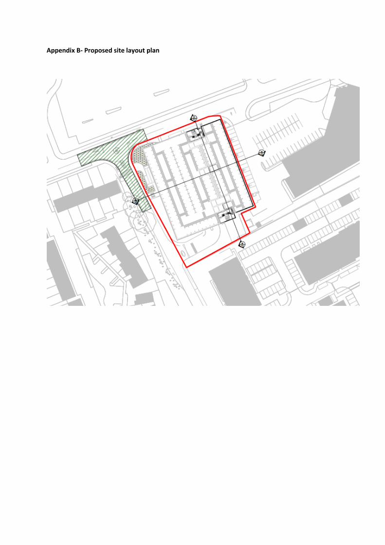
Appendix B- Proposed site layout plan

Appendix C- Proposed Elevations

Appendix D- Proposed floor plans
Ground floor plan

First floor plan
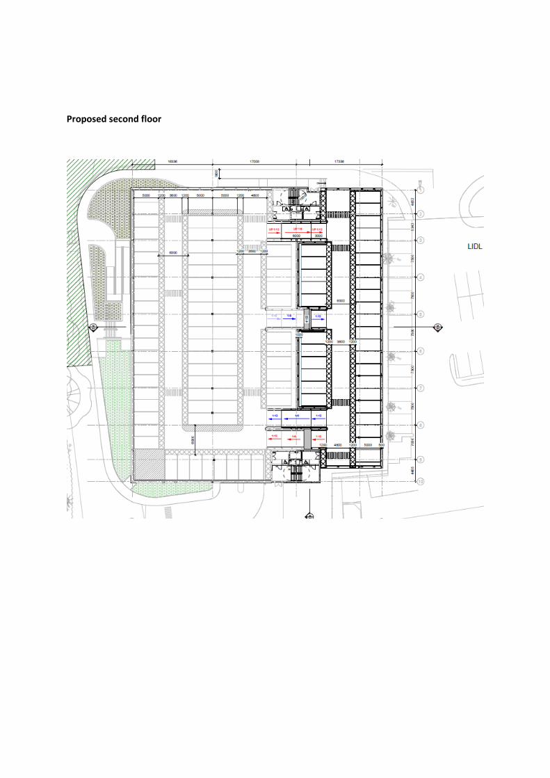
Proposed second floor

Proposed third floor

Proposed fourth floor
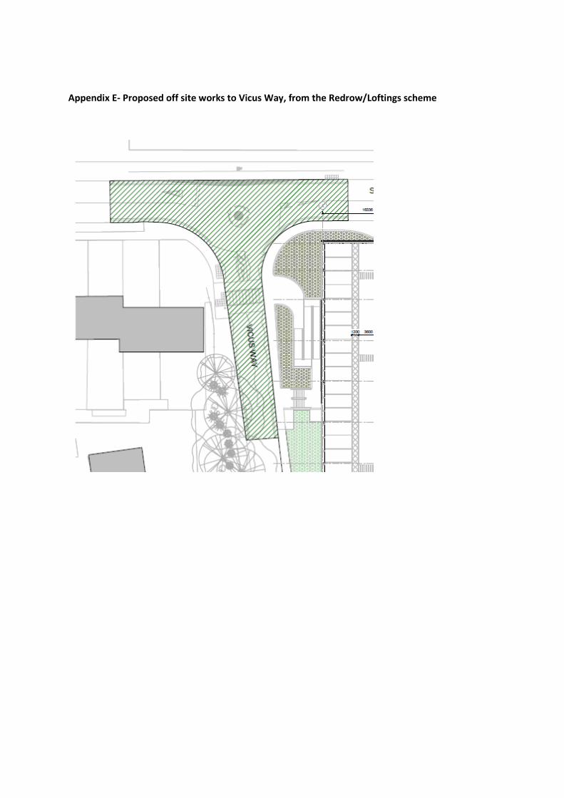
Appendix E- Proposed off site works to Vicus Way, from the Redrow/Loftings scheme


ROYAL BOROUGH OF WINDSOR & MAIDENHEADPLANNING COMMITTEE
MAIDENHEAD DEVELOPMENT CONTROL PANEL
17 December 2018 Item: 3ApplicationNo.:
18/02379/FULL
Location: The Red Lion Oakley Green Road Oakley Green Windsor SL4 4PZProposal: Proposed 1no. two bedroom dwelling and 1no. four bedroom dwelling with associated
works following conversion of public houseApplicant: P RogerAgent: Mr Richard MurrayParish/Ward: Bray Parish/Bray Ward
If you have a question about this report, please contact: Claire Pugh on 01628 685739 or [email protected]
1. SUMMARY
1.1 The application seeks conversion of a Public House into 2 dwellings. It is considered it has beendemonstrated there is no longer need for the Public House as a community facility. Theconversion is considered to have an acceptable impact on this Listed Building, and is consideredto be appropriate development in the Green Belt. The scheme is also considered to have anacceptable impact on Highway Safety. The application is therefore recommended for approval.
It is recommended the Panel grants planning permission with the conditions listed inSection 13 of this report.
2. REASON FOR PANEL DETERMINATION
At the request of Councillor Coppinger if the recommendation of the Head of Planning is toapprove, given the number of public houses shut and this Councils’ wish to retain suchcommunity assets it is essential that this decision is made in public.
3. DESCRIPTION OF THE SITE AND ITS SURROUNDINGS
3.1 The Red Lion Public House is situated on the Oakley Green Road. The application site measurescirca 0.17 hectares. The Public House is currently vacant.
3.2 The building is a Grade II Listed Building, which was added to the list in 1989. The main buildingwas constructed as a workers cottage, although it may originally have been two. It dates from thelate 18th or early 19th century, and currently presents as a two storey lobby entrance house, witha large single storey modern extension of little historic or architectural interest to the rear. Thereis also a single storey lean to addition to the west, probably dating from the early to mid19thcentury.
3.3 To the front of the building is a large tarmacked car parking area, and to the rear of the building isa large grassed area. Along the site boundaries is close board fencing, with some trees andhedging.
3.4 The application site is situated in a predominantly residential area, with residential properties tothe north, east and west of the application site.
4. KEY CONSTRAINTS
4.1 Loss of the Public House as a Community FacilityListed BuildingGreen Belt

5. DESCRIPTION OF THE PROPOSAL AND ANY RELEVANT PLANNING HISTORY
5.1 The application seeks planning permission for the change of use from a public house (A4planning use class) to two residential dwellings (C3 planning use class). The building would beconverted and sub-divided to accommodate the two dwellings. One of the dwellings would have2 bedrooms, and one of the dwellings would have 4 bedrooms.
5.2 In terms of proposed external alterations to the building, no alterations are proposed to theexternal elevations of the original part of the building. Changes are proposed to the rear singlestorey modern extension; the false pitched roof would be removed and the extension would havea flat roof.
5.3 Internal alterations are proposed to the building to facilitate the proposed conversion, whichinclude the alterations to internal walls in the original part of the building and the reintroduction ofan internal staircase to provide access to the first floor level. Within the modern additions of thebuilding, the removal of some internal walls are proposed.
5.4 To the front part of the site, it is proposed to reduce the amount of hardstanding for car parking.The hard surfacing for the proposed car parking area would be in neutral shade buff resin boundgravel and permeable block paving. Grassed areas would be introduced, with new native treesproposed to be planted. To the rear of the site, a new hedgerow is proposed on the site’sboundaries, and the rear grassed area would be subdivided by a 1.8m high trellis topped closeboarded fence in order to provide 2 garden areas for the dwellings.
5.5 The existing vehicular access serving the site would be reduced in width. Five car parking spaceswould be provided to serve the development.
6. DEVELOPMENT PLAN
Adopted Royal Borough Local Plan (2003)
6.1 The main strategic planning considerations applying to the site and the associated policies are:
Issue Adopted Local Plan PolicyDesign DG1, H10,H11Highways P4 AND T5Green Belt GB1, GB2 (part A), GB3Community Facility CF1Listed Building LB2, LB3Trees N6
These policies can be found athttps://www3.rbwm.gov.uk/downloads/download/154/local_plan_documents_and_appendices
7. MATERIAL PLANNING CONSIDERATIONS
National Planning Policy Framework Sections (NPPF) (2018)
Section 4- Decision–makingSection 8- Promoting Healthy and Safe communitiesSection 9- Promoting Sustainable TransportSection 12- Achieving well-designed placesSection 13- Protecting Green Belt landSection 16- Conserving and enhancing the historic environment
Borough Local Plan: Submission Version

Issue Local Plan PolicyDesign in keeping with character and appearanceof area
SP2, SP3
Sustainable Transport IF2Green Belt SP5Historic Environment HE1Community Facilities IF7Trees NR2
7.1 The NPPF sets out that decision-makers may give weight to relevant policies in emerging plansaccording to their stage of preparation. The Borough Local Plan Submission Document waspublished in June 2017. Public consultation ran from 30 June to 27 September 2017. Followingthis process the Council prepared a report summarising the issues raised in the representationsand setting out its response to them. This report, together with all the representations receivedduring the representation period, the plan and its supporting documents have now beensubmitted to the Secretary of State for examination. The Submission Version of the BoroughLocal Plan does not form part of the statutory development plan for the Borough. However, bypublishing and submitting the Borough Local Plan for independent examination the Council hasformally confirmed its intention to adopt the submission version. As the Council considers theemerging Borough Local Plan to be sound and legally compliant, officers and Councillors shouldaccord relevant policies and allocations significant weight in the determination of applicationstaking account of the extent to which there are unresolved objections to relevant policies.Therefore, the weight afforded to each policy at this stage will differ depending on the level andtype of representation to that policy. This is addressed in more detail in the assessment below.
Other Local Strategies or Publications
7.2 Other Strategies or publications relevant to the proposal are: RBWM Parking Strategy
More information on these documents can be found at:https://www3.rbwm.gov.uk/info/200414/local_development_framework/494/supplementary_planning
8. CONSULTATIONS CARRIED OUT
Comments from interested parties
8 occupiers were notified directly of the application.
The planning officer posted a notice advertising the application at the site on the 21st August2018 and the application was advertised in the Local Press on the 30th August 2018.
2 letters were received supporting the application, summarised as:
CommentWhere in thereport this isconsidered
1 The pub has had in the region of 7 landlords/ladies who have tried tomake the pub a success in various formats - country pub with andwithout food, Chinese restaurant, music venue, etc. all with littlesuccess. Marc (last landlord) had the best go at making the pub work asa music venue/community hub, but this brought with it a number ofchallenges for the close neighbours
Noted.
2. There is a dedicated following with groups like the Ye Olde Red LionAction Group, whom I am sure will rally and object on mass to thischange of use, but I for one as a neighbour support the change to twofamily homes, bringing stability to my very local community.
Noted.
3. If approved, the scheme would ensure the green belt is protected, alongwith the investment needed to maintain and protect this Listed Building.
Noted.
4. The scheme would return the building back to its original use. 9.16-9.205. If this application is refused, who knows what will happen or how long
residents will suffer a derelict boarded up building, likely to be falling intofurther disrepair.
Noted, but thisis not a planningconsideration.
6. Scheme is sensitive to the Listed Building, and fits with the character ofthe area
Addressed inthe report.
1 letter was received objecting to the application, summarised as:
CommentWhere in thereport this isconsidered
1. Objects to the loss of the Public House, which is a much loved facility 9.2-9.112. Loss of the public house conflicts with adopted local plan policy and
emerging Borough Local Plan policy.9.2-9.11
3. Whatever policy is applied the applicant has failed to demonstrate thatthere is no need for the community facility. The marketing/ viabilityassessment submitted simply states that there is another pub nearbybut this is totally insufficient in terms of an assessment of need.
9.2-9.11
4. The Facebook page Ye Olde Red Lion Action Group will provide furtherevidence of the amount of support for the pub in the local area.
Noted, however,this is not theprocedure tofollow tocomment on aplanningapplication.
5 Appeal decisions for the loss Public Houses in London have beensubmitted, and have been asked to be taken into consideration for thisapplication.
See 9.35
Consultees
Consultee CommentWhere in thereport this isconsidered
Bray ParishCouncil
Recommended for approval, subject to an archaeologicalsurvey taking place. A resident has advised, althoughsmaller building on the site is not Listed and does date backto the 15th century.
BerkshireArcheologyhave notrecommended acondition forthis.
HighwayAuthority
No objection subject to conditions. Noted.
EnvironmentalProtection
No objection. Noted.
Tree Officer No objections subject to conditions for tree protectiondetails and landscaping.
See
ConservationOfficer
Whilst these proposals would result in the loss of thehistoric use of the building, which has been a public housesince the 1840s, the buildings were prior to this in use ascottages. The conversion of these buildings back toresidential use would not result in the loss of the historicfloorplan of the structures, nor the loss of any historic fabricprovided the scheme is revised in line with therecommendations contained in this report.
It considered that the landscaping proposed to the frontagein particular will positively benefit and enhance the settingof the listed building and indeed that of the adjacentcottages.
See 9.16-9.20andrecommendedconditions.

Whilst the loss of the historic use will cause some smalllevel of harm to the significance of the building, overall thebenefit of its repair and long term viable use, and theimprovement to its setting are public benefits considered tooutweigh this small level of harm.
No objections subject to conditions.
9. EXPLANATION OF RECOMMENDATION
9.1 The key issues for consideration are:
i Loss of the Public House as a Community Facility
ii Green Belt
iii Impact on Listed Building
iv Parking/Highways
v Impact on character of the area
vi Residential Amenity
Loss of the Public House as a Community Facility
9.2 Policy CF1 of the Adopted Local Plan states that the Council will not permit the loss of existingcommunity facilities and buildings, unless it is satisfied that:i) there is no longer a need for them; orii) an acceptable alternative provision is to be made elsewhere.
9.3 This policy is considered to be in compliance with the NPPF, which sets out that planning policiesand decisions should plan positively for the provision and use of shared spaces, communityfacilities (such as public houses) to enhance the sustainability of communities and residentialenvironments.
9.4 Policy IF7 of the Borough Local Plan also provides guidance on the loss of community facilities,and is given significant weight.
Marketing
9.5 The application is supported by a Marketing report from Fleurets (Charted surveyors) and aMarketing & Viability Study from Savills.
9.6 The marketing report from Fleurets sets out that the property was put on the open market inAugust 2015, and was taken off the market in December 2016. In this period, the property wastaken off the market from November 2015 until January 2016, when there was a formal offer onthe premises. In addition the property was taken off the market from April 2016 and put back onthe market in May 2016. During the marketing period, reductions in the asking price were made;the pub was originally marketed at £850,000 and finally reduced to £675,000. The premises wasalso Listed as an asset of Community Value in this time.
9.7 Savills was initially instructed to act on behalf of Punch Taverns in marketing the property on 13October 2017. The property exchanged contracts on 20 April 2018. The report confirms that therewas strong interest, but no offers materialised. No offers were received by Savills from anycommercial or community users.
Asset of Community Value

9.8 The Public House is registered as an Asset of Community Value. The Council’s CommunitiesPartnerships Team advised on the process that the building has been through, and this is set outbelow.
The pub was listed in March 2016 and will remain listed as an Asset of Community Value for fiveyears until March 2021.
Phase One
-The Council (Community Partnerships) received a notice of relevant disposal 2 June 2016.
-Residents expressed an interest in bidding and a full six month moratorium was triggered whichexpired 2 December 2016.
-As no bid was received an eighteen month protected period (from the date of the relevantdisposal notice) was imposed, during which there could be no further moratoriums, and thisexpired on 2 December 2017.
Phase Two
The owners approached the local Parish Council and they were put in touch, through the Councilwith the residents involved in the earlier ‘failed’ purchase. Owners met with residents and theParish regarding the potential of splitting the pub into two.
The Parish and residents didn’t consider this proposal viable.
The owners formally notified the Council on 4th January 2018 of their intention to enter into arelevant disposal again.
Because the protected period had expired a new six week moratorium was triggered and expiredon 7th February 2018.
Residents involved in the earlier discussions were informed at this point and advised andreminded of the six week deadline to formally express interest. It is only groups with a particularstatus/structure that can trigger the longer moratorium.
No expressions of interest were received by the deadline, and as such a new eighteen monthprotected period is now in effect dating from the new notice of relevant disposal.
The ‘new’ protected period will expire on 3 June 2019. No further moratoriums can be imposedduring this period.
Conclusion
9.9 The applicant has submitted evidence to show how the premises was marketed for over oneyear. This involved various methods of marketing with two commercial/leisure property agents,with no offers materialising.
9.10 The fact that the Public House is registered as an Asset of Community Value is a materialplanning consideration in the determination of this application. Whilst the community weresuccessful in getting the Public House registered as an Asset of Community Value, a communitygroup has not made formal expressions of interest to take this asset over. In addition, thisapplication has not generated a lot of objections from the community.
9.11 Based on the above, it is considered that there is not a strong desire for this this Public House toremain as a Community Facility. The proposal is considered to comply with Policy CF1 of theAdopted Local Plan, and Policy IF7 of the Borough Local Plan Submission Version.
Green Belt

9.12 Adopted Local Plan Policies GB1, GB2, GB3 and GB8 of the Adopted Local Plan are therelevant policies to this proposal. Policy GB1 sets out the exceptions to inappropriatedevelopment in the Green Belt, policy GB2 sets out the tests on the impact on openness of theGreen Belt, Policy GB3 sets out exceptions to inappropriate residential development in theGreen Belt and Policy GB8 covers the reuse and conversion of buildings in the Green Belt. Eachof these policies is not fully consistent with the National Planning Policy Framework, and so arenot given full weight in the determination of this application.
9.13 Policy SP5 of the Borough Local Plan Submission Version, is a material consideration. Thispolicy is not fully consistent with the NPPF, and so is given moderate weight.
9.14 The National Planning Policy Framework is the most up to date National Planning Guidancepublished in 2018. It is a material consideration of significant weight, and this is what the schemehas been assessed against in respect of Green Belt Policy.
9.15 The proposal seeks to convert the existing building for use as two dwellings. It proposes noextensions to the building. This would fall under an exception to inappropriate development in theGreen Belt, as the re-use of a building provided that it is of permanent and substantialconstruction (paragraph 146 of the NPPF) and provided it preserves the openness of the GreenBelt. The proposed development would not extend the building, and would actually reduce theoverall height of the rear single storey addition to the building. In addition, to the front of theapplication site, the amount of car parking would be reduced, which would improve the opennessof the Green Belt. As a result of the development a fence would be erected to sub-divide the reargarden which would reduce openness. Taking this all into account, it is considered thedevelopment would preserve the openness of the Green Belt and it is considered that thescheme complies with paragraph 146 of the NPPF.
Impact on Listed Building
9.16 Policy LB2 of the Adopted Local Plan sets out a criteria for assessing works to a Listed Building.This policy is largely consisted with the NPPF in respect of dealing with Heritage Assets. PolicyLB3 of the Adopted Local Plan relates to the change of use of Listed Buildings, and the criteria tobe adhered to. This policy is largely consistent with the NPPF.
9.17 The scheme proposes the change of use, and internal alterations to a Listed Building. In addition,some external alterations to the modern additions to the Listed Building are proposed. Theexternal alterations proposed to the modern additions of the Listed Building, including the changeto the roof of the single storey rear extension would not adversely impact upon the ListedBuilding.
9.18 With regard to the internal alterations proposed to the Listed Building to accommodate thechange of use, it is not considered that the proposed changes to the original part of the building,would cause harm to the historic plan form of the building. In addition some original features willbe reinstated. The internal changes to the modern additions of the building would not cause harmto the Listed Building. The change of use, will result in the loss of the Public House as a historicuse, which the Council’s Conservation Officer has identified as causing a small level of harm tothe significance of this Listed Building. It is considered that the scheme will return the buildingsback to its original use as residential, and such would not harm the significance of the ListedBuilding.
9.19 In terms of the setting of the Listed Building, it is considered that the reduction in hardstanding tothe front, with additional grass to be laid and trees planted would improve the setting to this ListedBuilding.
9.20 The scheme is considered to comply with Policies LB2 and LB3 of the Adopted Local Plan. TheCouncil has had special regard to the desirability of preserving the building or its setting, or any

features of special architectural or historic interest which it possesses, as required under Section16(2) of the Planning (Listed Buildings and Conservation Areas) Act 1990.
Parking/Highways
9.21 The B3024 Oakley Green Road is classified as a district distributor road which provides a linkbetween the A330 Ascot Road and the A308 Windsor Road.
9.22 The site currently benefits from having a 14.3m wide vehicular access from Oakley Green Road.The application proposes to reduce the width of the access to 4.0m. This is considered to beacceptable. A condition is recommended to secure details of the visibility splays to be provided(see condition 12).
9.23 The 2 bedroom unit would have 2 car parking spaces and the 4 bedroom unit would have 3 carparking spaces. This complies with the Council’s Parking Strategy May 2004. Adequate turningfacilities are provided on site to enable a car and delivery vehicle to enter and exit the site in aforward gear. The proposed development has the potential to generate 12 vehicle movementsper day. This proposed development would result in a significant reduction in vehicle movementsper day compared to the lawful use as a public house.
9.24 The scheme is considered to comply with Policies P4 and T5 of the Adopted Local Plan.
Impact on the character of the area
9.25 Policies DG1 and H10 of the Adopted Local Plan provide guidance design. Policy H11 sets outthat housing schemes should not result in a cramped form of development. These policies arelargely consistent with the aims of the NPPF, and are given significant weight.
9.26 The external alterations to the building proposed are considered to be acceptable. The schemewould introduce more grassed area and new trees to the front of the site according to the outlinelandscaping scheme, which is a benefit. It is recommended that a detailed landscaping plan issecured (see condition 10). There are trees on the boundaries of the site which are notprotected, but contribute to the visual amenity of the site. A condition is recommended to securetree protection measures for these trees. (see condition 4). The location of the refuse and cyclestores is shown on the site layout plan, and a condition is recommended requiring the elevationsof the stores to be provided and approved by the LPA. The creation of 2 dwellings within thisbuilding and the creation of two rear garden areas would create an acceptable density ofdevelopment within this area. The scheme is considered to comply with Policies DG1, H10 andH11 of the Adopted Local Plan.
Residential Amenity
9.27 There are no relevant Adopted Local Plan policies to this scheme which provide guidance onresidential amenity.
9.28 Paragraph 127 of the NPPF sets out that developments should create places that are safe,inclusive and accessible and which promote health and well-being, with a high standard ofamenity for existing and future users; and where crime and disorder, and the fear of crime, do notundermine the quality of life or community cohesion and resilience.
9.29 In this case, many of the buildings surrounding the application site are in residential use, and so aproposed residential use would be compatible. In terms of the impact of the proposeddevelopment, the scheme does not introduce any new windows or extensions and so the impacton neighbouring properties is considered to be acceptable.
Ecology

9.30 The buildings was assessed as having “moderate” potential to host roosting bats, and as such, inline with the Bat Conservation Trust’s Bat Survey Guidelines, two emergence/re-entry surveyswere undertaken. An additional survey was carried out in order to determine the status of a roostfollowing the emergence of a single brown long-eared bat during the earlier surveys. No furtherbats were observed using the building.
9.31 The ecology report concludes that the proposals will result in the loss of a brown long-eared batday roost. As such, a licence for development works affecting bats will need to be obtained fromNatural England - for derogation from the provisions of the Habitat Regulations - before workswhich could impact upon the roost can commence. The report provides a mitigation plan toensure that bats are not harmed and that replacement roosting sites are provided, and if it isimplemented, the favourable conservation status of bats will be maintained. The Council’sEcologist has recommended a planning condition for a licence from Natural England to beprovided to the LPA, however, the licence from Natural England is a separate process and theapplicant will need the licence from the before works commence, it is not considered necessaryto duplicate controls through the planning process. In terms of biodiversity enhancements, thereport sets out that bat and bird boxes will be implemented. A condition will be imposed to ensurethe recommendations of the ecology report are followed. (see condition 14).
Housing Land Supply
9.32 Paragraphs 10 and 11 of the NPPF (2018) set out that there will be a presumption in favour ofSustainable Development. The latter paragraph states that:
For decision-taking this means: approving development proposals that accord with an up-to-datedevelopment plan without delay; or where there are no relevant development plan policies, or thepolicies which are most important for determining the application are out-of-date, grantingpermission unless: the application of policies in this Framework that protect areas or assets of particular
importance provides a clear reason for refusing the development proposed; or any adverse impacts of doing so would significantly and demonstrably outweigh the
benefits, when assessed against the policies in this Framework taken as a whole.
9.33 Footnote 7 of the NPPF (2018) clarifies that policies which are most important for determining theapplication are out-of-date includes include, for applications involving the provision of housing,situations where the local planning authority cannot demonstrate a five year supply of deliverablehousing sites (with the appropriate buffer).
9.34 Following the Regulation 19 consultation on the Submission Version of the Local Plan, theCouncil formally submitted in January 2018. The Borough Local Plan Submissions Version setsout a stepped housing trajectory over the plan period (2013-2033). As detailed in the supportingHousing Land Availability Assessment a five year supply of deliverable housing sites can bedemonstrated against this proposed stepped trajectory. However as the BLPSV is not yetadopted planning policy, due regard also needs to be given to the NPPF (2018) standard methodin national planning guidance to determine the minimum number of homes needed for theborough. At the time of writing, based on this methodology the Council is able to demonstrate afive year rolling housing land supply based on the current national guidance.
Other considerations
9.35 An objector has submitted appeal decisions for schemes involving the loss of Public Houses inLondon, and asks for them to be considered in the determination of this application. One of theappeals referenced was allowed, and the other dismissed; some were dismissed on the groundsof the loss of a community facility, but some were not dismissed on this ground. These appealdecisions are given limited weight as a material consideration to the consideration of thisapplication, as these schemes were not assessed against development plan policy for thisBorough, and the details and circumstances of each of these cases are not known.
10. COMMUNITY INFRASTRUCTURE LEVY (CIL)

10.1 The development is CIL liable. The floorspace of the building is 203 square metres.
11. CONCLUSION
11.1 It is considered that there is sufficient evidence, through the marketing exercise and the lack ofexpressions for the community to acquire the pub as an Asset of Community Value, to showthere is no longer a need for this premises as a community facility. The proposal is considered tocomply with Policy CF1 of the Local Plan. The conversion of the building to residential use is notconsidered to cause harm to this Listed Building, and the proposal is considered to comply withpolices LB2 and LB3 of the Local Plan. The scheme is considered to be an appropriate form ofdevelopment within the Green Belt, in compliance with the NPPF. The scheme is considered tohave an acceptable impact on Highway Safety. The application is therefore considered to be inaccordance with the national policy guidance and relevant policies in the Development Plan andas such is recommended for approval.
12. APPENDICES TO THIS REPORT
Appendix A - Site location plan
Appendix B – Proposed site layout
Appendix C – Existing and proposed elevations
Appendix D – Existing and proposed floorplans
13. CONDITIONS RECOMMENDED FOR INCLUSION IF PERMISSION IS GRANTED
1 The development hereby permitted shall be commenced within three years from the date of thispermission.Reason: To accord with the provisions of Section 91 of the Town and Country Planning Act 1990(as amended).
2 Notwithstanding the details shown on the submitted drawings, plans, including elevations andcross-sections of frames, glazing bars, casements, doors and cills of all new external doors andwindows at a scale of 1:10 or 1:5 shall be submitted to and approved in writing prior to thecommencement of development. The development shall be undertaken in accordance with theapproved details.Reason: To ensure the details are acceptable for this Listed Building. Relevant Policy -LocalPlan Policy LB2. These details need to be approved prior to commencement, to ensure the worksto the Listed Building are acceptable.
3 All new windows and doors shall be constructed in painted timber.Reason: To ensure the details are acceptable for this Listed Building. Relevant Policy -Local PlanPolicy LB2.
4 No development shall take place until an Arboricultural Method Statement and Tree ProtectionPlan specific to this scheme, has been submitted and approved in writing by the Local PlanningAuthority. The Tree Protection Plan and Arboricultural Method Statement shall be written inaccordance with, and address sections 5.5, 6.1, 6.2, 6.3 and 7 of British Standard 5837:2012Trees in relation to design, demolition and construction recommendations.Nothing shall be stored or placed in any area in accordance with this condition and theground levels within those areas shall not be altered, nor shall any excavation be made,without the prior written approval of the Local Planning AuthorityThereafter the works shall be carried out in accordance with the approved details until completionof the development.Reason: To protect trees which contribute to the visual amenities of the site and surroundingarea. Relevant Policies - Local Plan DG1, N6. These details are needed prior tocommencement of development, to ensure adequate tree protection measures are implementedbefore development takes place.
5 Prior to the installation of any new flues or vents, details of the position, size, design and

materials of the flues and vents shall be submitted to and approved in writing by the LocalPlanning Authority.Reason: To ensure the details are acceptable for this Listed Building. Relevant Policy -LocalPlan Policy LB2
6 The rooflights shall be constructed in metal. Prior to the installation of the rooflights, themanufacturer's details of the new rooflights shall be submitted to and approved in writing to theLocal Planning Authority prior to their installation.Reason: To ensure the details are acceptable for this Listed Building. Relevant Policy -LocalPlan Policy LB2
7 Any new pipework, gutters and hopper heads shall be in painted cast metal. Details of any newexternal pipework shall be submitted to and approved in writing by the Local Planning Authority.Reason: To ensure the details are acceptable for this Listed Building. Relevant Policy -LocalPlan Policy LB2
8 Prior to the new roof on the rear single storey part of the building being constructed, a cross-section of the new parapet to the rear ground floor shall be submitted to and approved in writingby the Local Planning Authority.Reason: To ensure the details are acceptable for this Listed Building. Relevant Policy -LocalPlan Policy LB2
9 Prior to the construction of the roof to the single storey rear element of the building, a sample ofroofing material for the flat roof shall be submitted to and approved in writing by the LocalPlanning Authority. The development shall be constructed in accordance with the approveddetails.Reason: To ensure the details are acceptable for this Listed Building. Relevant Policy -LocalPlan Policy LB2
10 Prior to the first occupation of the dwellings hereby approved, details of hard and softlandscaping works shall be submitted to and approved in writing by the Local Planning Authority.All hard and soft landscape works shall be carried out in accordance with the approved detailsprior to the occupation of the dwellings hereby approved, and retained thereafter in accordancewith the approved details.Soft landscaping These details shall include; A) a detailed soft landscaping plan to a recognisedscale clearly illustrating the location of all trees/shrubs/hedges/plants to be planted and areas ofturf to be laid; B) a detailed written soft landscape specification detailing the quantity, density,size, species, position and the proposed time or programme of planting of alltrees/shrubs/hedges/plants. This specification shall include details of groundpreparation/cultivation within and adjacent to root protection areas of retained on/off site trees,and other operations associated with, tree/shrub/ hedge/plant establishment.If within a period of five years from the date of planting of any tree/shrub/hedge/plant shown onthe approved plan(s), or any tree/shrub/hedge/plant in replacement for it is removed, uprooted,destroyed, dies, or becomes seriously damaged or defective, another tree/shrub/hedge/plant ofthe same species and size as that originally planted, shall be planted in the immediate vicinity,unless the Local Planning Authority gives its written consent to any variation.Reason: To ensure a form of development that maintains, and contributes positively to, thecharacter and appearance of the area. Relevant Policies Local Plan DG1.
11 No part of the development shall be occupied until vehicle parking and turning space has beenprovided, surfaced and marked out in accordance with the approved drawing. The spaceapproved shall be kept available for parking and turning in association with the development.Reason: To ensure that the development is provided with adequate parking facilities in order toreduce the likelihood of roadside parking which could be detrimental to the free flow of traffic andto highway safety, and to facilitate vehicles entering and leaving the highway in forward gear.Relevant Policies - Local Plan P4, DG1
12 Prior to the first occupation of the dwellings hereby approved, a plan showing the visibility splaysshall be submitted to and approved in writing by the Local Planning Authority. The visibility splaysapproved shall be implemented prior to the first occupation of the dwellings. All dimensions are to

be measured along the edge of the driveway and the back of footway from their point ofintersection. The areas within these splays shall be kept free of all obstructions to visibility over aheight of 0.6 metres above carriageway level.Reason: : In the interests of highway safety. Relevant Policies - Local Plan T5
13 No part of the development shall be occupied until elevations of the refuse bin storage area andrecycling facilities, have been submitted to and approved in writing by the Local PlanningAuthority. The development shall be undertaken in accordance with the approved details.Reason: To ensure that the development is provided with adequate facilities that allow it to beserviced in a manner which would not adversely affect the free flow of traffic and highway safetyand to ensure the sustainability of the development. Relevant Policies - Local Plan T5, DG1
14 The development shall be undertaken in accordance with the measures set out in the EcologyReport Dated 20th July 2018.Reason: To safeguard protected species and to enhance bifold.
15 The development hereby permitted shall be carried out in accordance with the approved planslisted below.Reason: To ensure that the development is carried out in accordance with the approvedparticulars and plans.

Appendix A- Site location plan

Appendix B- Proposed site layout

Appendix C- Existing and Proposed Elevations


Proposed

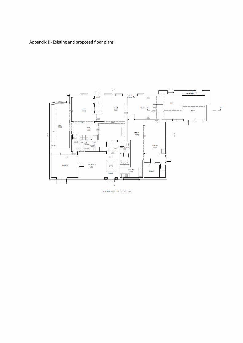
Appendix D- Existing and proposed floor plans

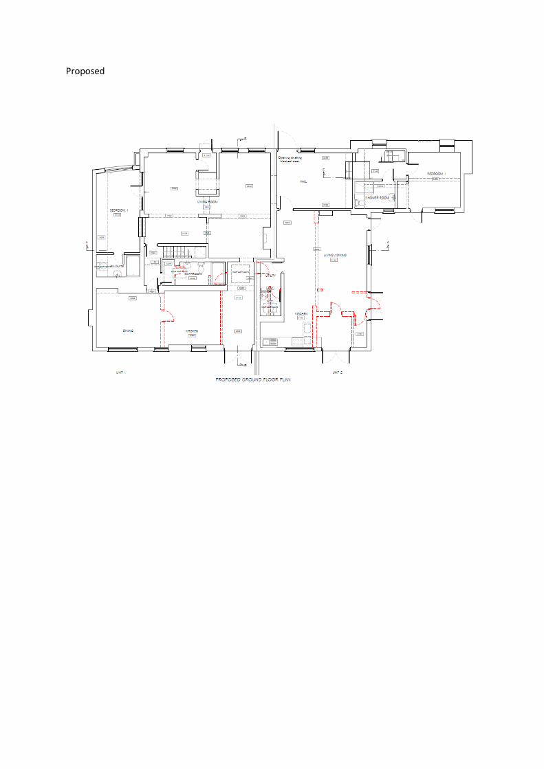
Proposed


ROYAL BOROUGH OF WINDSOR & MAIDENHEADPLANNING COMMITTEE
MAIDENHEAD DEVELOPMENT CONTROL PANEL
17 December 2018 Item: 4ApplicationNo.:
18/02510/FULL
Location: Land To The West of Mullberry Coningsby Lane Fifield MaidenheadProposal: Construction of an agricultural buildingApplicant: Mrs Kendall SmithAgent: Not ApplicableParish/Ward: Bray Parish/Bray Ward
If you have a question about this report, please contact: Alys Hughes on 01628 796040 or [email protected]
1. SUMMARY
1.1 On balance, the proposed uses are considered to be ancillary to the agricultural use of the landand therefore compliant with paragraph 145 a) of the NPPF, constituting an appropriate form ofdevelopment within the Green Belt.
1.2 The proposed development would have an acceptable impact on the character and appearanceof the area and also on the amenities of neighbouring properties.
1.3 No objections are raised in regards to matters relating to ecology, flooding and highways.
It is recommended the Panel grants planning permission with the conditions listed inSection 12 of this report.
2. REASON FOR PANEL DETERMINATION
At the request of Councillor Coppinger as it’s considered that the proposal is anoverdevelopment of the site which will destroy the essential openness of the Green Belt.
3. DESCRIPTION OF THE SITE AND ITS SURROUNDINGS
3.1 The proposal site consists of land to the north of Coningsby Lane. The land used to form part ofConingsby Farm but has now been sold off. Permission has recently been granted for the changeof use of the site from agriculture to mixed agriculture and equestrian use and also for theconstruction of agricultural livestock/storage buildings.
4. KEY CONSTRAINTS
4.1 Green Belt
5. DESCRIPTION OF THE PROPOSAL AND ANY RELEVANT PLANNING HISTORY
5.1 Planning permission is sought for the construction of an agricultural building measuring 12.6m x4.05m. It would incorporate a dual pitched roof with an eaves height of 2.4m and ridge height of3.6m. The building would provide for a fleece store, shower room, fleece product making roomand a scanning equipment storage room.
5.2 18/02886/AGDET - Notification to determine whether prior approval is required for theconstruction of a new agricultural barn. Refused.
18/02513/FULL - Construction of permanent essential workers dwelling, new access and trackwith entrance gates, hard standing and new boundary treatment. Refused. 24.10.18

18/02289/FULL – Change of use of land to mixed agriculture and equestrian. Permitted. 23.11.18
18/02070/CONDIT - Details required by condition 4 (construction management plan) and11(external lighting) of planning permission 17/03579. Approved. 06.09.18
18/02059/CONDIT – Details required by condition 4 (construction management plan) and11(external lighting) of planning permission 17/03580. Approved. 06.09.18
18/01699/CONDIT – Details required by condition 9 (archaeology works) of planning permission17/03580/FULL. Approved. 27.07.18
18/01698/CONDIT – Details required by condition 9 (Archaeology works) of planning permission17/03579/FULL. Approved. 26.07.18
17/03596/FULL – Construction of permanent essential workers dwelling, garage and multi-useagricultural building/farm shop, new access and track with entrance gates, hard standing and newboundary treatment. Refused. 06.06.18
17/03579/FULL – Erection of two agricultural livestock buildings, new access, gates and track,agricultural hardstanding and boundary treatment. Approved. 09.04.18
17/03580/FULL – Erection of agricultural storage building, new access, gates and track,agricultural hardstanding and boundary treatment. Approved. 09.04.18
17/03581/FULL – Erection of American barn stables, new access, gates and track, agriculturalhardstanding and boundary treatment. Pending consideration. Pending consideration
6. DEVELOPMENT PLAN
Adopted Royal Borough Local Plan (2003)
6.1 The main strategic planning considerations applying to the site and the associated policies are:
Issue Adopted Local Plan PolicyDesign in keeping with character and appearanceof area
DG1,
Acceptable impact on Green Belt GB1, GB2Highways P4 and T5
These policies can be found athttps://www3.rbwm.gov.uk/downloads/download/154/local_plan_documents_and_appendices
7. MATERIAL PLANNING CONSIDERATIONS
National Planning Policy Framework Sections (NPPF) (2018)
Section 4 - Decision–makingSection 9 - Promoting Sustainable TransportSection 12 - Achieving well-designed placesSection 13 - Protecting Green Belt land
Borough Local Plan: Submission Version
Issue Local Plan PolicyDesign in keeping with character and appearanceof area
SP2, SP3
Appropriate development in Green Belt andacceptable impact on Green Belt
SP5
Sustainable Transport IF2
7.1 The NPPF sets out that decision-makers may give weight to relevant policies in emerging plansaccording to their stage of preparation. The Borough Local Plan Submission Document waspublished in June 2017. Public consultation ran from 30 June to 27 September 2017. Followingthis process the Council prepared a report summarising the issues raised in the representationsand setting out its response to them. This report, together with all the representations receivedduring the representation period, the plan and its supporting documents have now beensubmitted to the Secretary of State for examination. The Submission Version of the BoroughLocal Plan does not form part of the statutory development plan for the Borough. However, bypublishing and submitting the Borough Local Plan for independent examination the Council hasformally confirmed its intention to adopt the submission version. As the Council considers theemerging Borough Local Plan to be sound and legally compliant, officers and Councillors shouldaccord relevant policies and allocations significant weight in the determination of applicationstaking account of the extent to which there are unresolved objections to relevant policies.Therefore, the weight afforded to each policy at this stage will differ depending on the level andtype of representation to that policy. This is addressed in more detail in the assessment below.
Other Local Strategies or Publications
7.2 Other Strategies or publications relevant to the proposal are:
RBWM Parking Strategy RBWM Landscape Character Assessment
More information on these documents can be found at:https://www3.rbwm.gov.uk/info/200414/local_development_framework/494/supplementary_planning
8. CONSULTATIONS CARRIED OUT
Comments from interested parties
2 letters were received supporting the application, summarised as:
CommentWhere in thereport this isconsidered
1. Comments in relation to proposed dwelling This applicationis for theconstruction ofan agriculturalbuilding and nota dwelling
2. No objection on an ecological, highways, archaeological, public rights orway of environmental basis.
Noted
14 letters were received objecting to the application, summarised as:
CommentWhere in thereport this isconsidered
1. Situated on Green Belt land and is not an appropriate developmentand does not constitute very special circumstances
9.2 – 9.6
2. Does not preserve openness 9.2 – 9.6

3. Commercial use not agricultural 9.2 – 9.64. Flooding of site 9.125. Increased traffic on Coningsby Lane 9.106. Comments in relation to proposed dwelling This application
is for theconstruction ofan agriculturalbuilding and nota dwelling
7. Would set a precedent for further buildings All applicationsassessed ontheir ownindividual merit
8. All buildings appear large enough to be converted into dwellings at alater date
This would besubject tofurther planningpermission
9. Proposed use can be accommodated in the other approved buildings 9.2 – 9.610. Appears more like a domestic structure in character and design 9.7 – 9.811. Impact on public rights of way 9.13
Consultees
Consultee CommentWhere in thereport this isconsidered
Parish Council ‘Recommend for refusal – the development appears to be aretail/manufacturing building and not agricultural for whichthere is no change of use. Planning permission for threeagricultural buildings on the site has been approved and afurther building would constitute an unacceptable impact onthe openness of the Green Belt’.
9.2 – 9.6
Ecology No objection subject to conditions. See 9.11HighwaysAuthority
No objection. Conditions and informatives recommended See 9.10
BerkshireArchaeology
No objection as no further action as regards to the buriedarchaeological heritage is required.
Noted
EnvironmentalProtection
Conditions and informatives recommended Condition moreappropriate asinformative.
9. EXPLANATION OF RECOMMENDATION
9.1 The key issues for consideration are:
i whether the proposal is an acceptable form of development within the Green Belt
ii impact on the character and appearance of the area
iii impact on neighbouring amenities
iv other considerations
Whether the proposal is an acceptable form of development within the Green Belt
9.2 The proposal site is situated within the Green Belt where its main characteristics are identified asits openness and permanence. Paragraph 145 of the NPPF states that the construction of newbuildings within the Green Belt should be regarded as inappropriate development. Inappropriatedevelopment is by definition harmful to the Green Belt and should not be approved except in veryspecial circumstances. However, paragraph 145 goes on to list certain exceptions to

inappropriate development, one of which includes under a) buildings for agriculture and forestry.Local plan policy GB1 and also policy SP5 of the emerging local plan are consistent with theNPPF.
9.3 The proposed building would be providing for a toilet/shower room, storage of fleeces, a scanningequipment storage room and a room allocated for fleece product making. The building has beendescribed by the applicant as an agricultural ancillary building to be used in association with thealpacas and other livestock breeding and rearing. If it is to comply with exception a) underparagraph 145 of the NPPF, it first needs to be established whether the proposed use of thebuilding is considered to be for the purposes of agriculture.
9.4 The Court of Appeal Judgement Millington v SoS and Shrewsbury & Atcham BC (1999) indicatedthat small scale manufacture of wine or cider was a perfectly natural ancillary activity at a farmand has shown that where farm processing is not on a large scale it could be considered ancillaryto agriculture. Due to the small scale of the area within the building allocated for themanufacturing of products, it is considered that this would be viewed as being ancillary toagriculture. The proposed storage use is primarily related to activities at the farm and is thereforealso regarded as ancillary. The toilet/shower room facilities are proposed for visitors to the farm,vets and workers. Whilst toilets are not directly linked to agriculture, it would be serving personslinked to the farm. On balance, it is considered that the proposed use of the building can beregarded as being ancillary to agriculture.
9.5 The proposed building would inevitably impact on the openness of the site and it has beenquestioned by the Council why it is detached in nature rather than in a form of an addition to oneof the other approved agricultural buildings. The justification given by the agent/applicant is thatthe building needs to be located away from the existing buildings to prevent dirt and verminreaching the fleeces. Whether this is the case or not the impact on openness cannot be takeninto consideration. This is in line with the outcome of a court of appeal judgement between R.(Lee Valley Regional Park Authority) v Epping Forest District Council and Valley Grown NurseriesLtd (2016) where it was determined that applications for agricultural buildings do not fall to beassessed in terms of their impact on openness. Therefore it would be unreasonable to sustain arefusal based on the detached nature of the building alone and its impact on openess.
9.6 Following the above assessment and on balance, the development is considered to fall underexception a) of paragraph 145 of the NPPF and therefore constitutes an appropriate form ofdevelopment within the Green Belt.
Impact on the character and appearance of the area
9.7 Paragraph 127 b) states that decisions should ensure that developments are visually attractive asa result of good architecture, layout and appropriate and effective landscaping. Paragraph 130states that permission should be refused for development of poor design that fails to take theopportunities available for improving the character and quality of an area and the way it functions.
9.8 The proposed design and scale of the building, which has resulted from the proposed use, wouldnot appear prominent or out of character on the agricultural land. The proposed use of materials,whilst they differ to those of the other approved agricultural buildings, are not considered to beharmful to the appearance and character of the area.
Impact on neighbouring amenities
9.9 Paragraph 127 f) of the NPPF seeks to ensure a high standard of amenity for existing and futureoccupiers. The proposed structure would be set back a sufficient distance from the boundaries ofthe site and from neighbouring amenity areas beyond that. It is not therefore considered that theproposal would have an adverse impact on any nearby residential amenities.

Other considerations
9.10 The proposed development would be served by an access granted permission under planningapplications 17/03579/FULL and 17/03580/FULL. Whilst this has not yet been constructed it doesbenefit from planning permission and therefore it is not required to be reassessed under thiscurrent application. The Highway Authority raises no objection in terms of additional traffic as theuse is ancillary to the main use of the site.
9.11 The Council’s ecologist has been consulted on the application to review the Habitat Surveysubmitted to support the application. The ecologist has advised that the information containedwithin the Extended Phase 1 Habitat Survey (Abricon Ltd, November 2017) is acceptable andthat a condition should be included on any permission to ensure that the development is carriedout in accordance with the details contained in the submitted information.
9.12 Concerns has been raised by the community that the site has historically flooded. The site issituated within flood zone 1. A flood risk assessment (FRA) in flood zone 1 is only required if thedevelopment is more than 1 hectare or in an area with critical drainage problems as notified bythe Environment Agency. The site is not more than 1 hectare and is not within an area of criticaldrainage and therefore no FRA is required. A main river is situated to the north of the sitehowever the development is not within 20m of this and so there is no requirement to consult theEnvironment Agency.
9.13 The proposed building would be sited approximately 230 metres away from the public right ofway. Any views of the development this distance, the small scale nature of the proposal and itsoverall design would not cause harm.
10. CONCLUSION
10.1 The proposal complies with national policy contained within the NPPF and with the relevantpolicies GB1, GB2, DG1, T5 and P4 of the Development Plan. Furthermore significant weight isto be accorded to the relevant Borough Local Plan Submission Version policies in this case andthe above application is considered to comply with. For these reasons the application isrecommended for approval.
11. APPENDICES TO THIS REPORT
Appendix A - Site location plan
Appendix B – Proposed site plan
Appendix C – Proposed floor plan
Appendix D – Proposed elevations
12. CONDITIONS RECOMMENDED FOR INCLUSION IF PERMISSION IS GRANTED
1 The development hereby permitted shall be commenced within three years from the date of thispermission.Reason: To accord with the provisions of Section 91 of the Town and Country Planning Act 1990(as amended).
2 The materials to be used on the external surfaces of the development shall be in accordance withthose specified in the application unless any different materials are first agreed in writing by theLocal Planning Authority. Development shall be carried out in accordance with the approveddetails.Reason: In the interests of the visual amenities of the area. Relevant Policies - Local Plan DG1.
3 The development shall be carried out in accordance with the details and method statementscontained within the Extended Phase One Habitat Survey of Land North of Coningsby Farm,Fifield produced by Arbicon, dated November 2017.Reason: To protect habitats and the wildlife and ecological value of the site. Relevant Policy:Local Plan N9.

4 The development hereby permitted shall be carried out in accordance with the approved planslisted below.Reason: To ensure that the development is carried out in accordance with the approvedparticulars and plans.
Informatives
1 applicant and their contractor should take all practicable steps to minimise dust disposition,which is a major cause of nuisance to residents living near to construction and demolition sites.The applicant and their contractor should ensure that all loose materials are covered up ordamped down by a suitable water device, to ensure that all cutting/breaking is appropriatelydamped down, to ensure that the haul route is paved or tarmacked before works commence, isregularly swept and damped down, and to ensure the site is appropriately screened to preventdust nuisance to neighbouring properties.
2 The applicants' contractor is advised to apply for a prior consent, which controls the hours ofworking and can stipulate noise limits on the site. This is recommended by way of Informativeand is covered by the Control of Pollution Act 1974. Such an agreement is entered intovoluntarily, but is legally binding. The applicant's attention is also drawn to the provisions underBritish Standard Code of Practice B.S. 5228: 2009 'Noise Control on Construction and OpenSites'.The applicant should be aware the permitted hours of construction working in the Authorityare as follows:Monday-Friday 08.00-18.00Saturday 08.00-13.00Noworking on Sundays or Bank Holidays.Please contact the Environmental Protection Team on01628 683830.
3 The Royal Borough receives a large number of complaints relating to construction burningactivities. The applicant should be aware that any burning that gives rise to a smoke nuisance isactionable under the Environmental Protection Act 1990. Further that any burning that gives riseto dark smoke is considered an offence under the Clean Air Act 1993. It is the EnvironmentalProtection Team policy that there should be no fires on construction or demolition sites. Allconstruction and demolition waste should be taken off site for disposal. The only exceptionsrelate to knotweed and in some cases infected timber where burning may be considered the bestpracticable environmental option. In these rare cases we would expect the contractor to informthe Environmental Protection Team before burning on 01628 683538 and follow good practice.

Appendix A – Site location plan

Appendix B – Proposed site plan

Appendix C – Floor plan
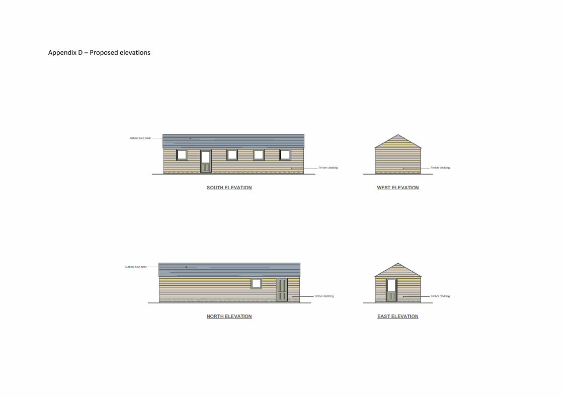
Appendix D – Proposed elevations

ROYAL BOROUGH OF WINDSOR & MAIDENHEADPLANNING COMMITTEE
MAIDENHEAD DEVELOPMENT CONTROL PANEL
17 December 2018 Item: 5ApplicationNo.:
18/02588/FULL
Location: The Crooked Billet Westborough Road Maidenhead SL6 4ASProposal: Construction of x7 four-bedroom dwellings including associated landscaping, amenity
space and parking following demolition of the existing building.Applicant: Clearview Residential LimitedAgent: Mr Ben StonebridgeParish/Ward: Maidenhead Unparished/Boyn Hill Ward
If you have a question about this report, please contact: Claire Pugh on 01628 685739 or [email protected]
1. SUMMARY
1.1 The scheme seeks permission for the demolition of the existing Public House, and theconstruction of 7 dwellings, with associated car parking. The scheme is considered to result inthe loss of a community facility, it is considered to be a cramped and overdeveloped form ofdevelopment, and there are concerns that the scheme would result in a danger to highwaysafety. As such the application is recommended for refusal.
It is recommended the Panel REFUSES planning permission for the followingsummarised reasons (the full reasons are identified in Section 13 of this report):
1. The scheme would result in the loss of a Public House, which is regarded as acommunity facility, in conflict with Policy CF1 of the Local Plan
2. The scheme represents a cramped and overdeveloped form of development, andwould cause harm to the character of the area.
3. The scheme fails to demonstrate that an adequate level of car parking has beenprovided, and that it would not result in a danger to highway safety. The schemeconflicts with Polices P4 and T5 of the Local Plan
2. REASON FOR PANEL DETERMINATION
At the request of Councillor Claire Stretton, irrespective of the recommendation of the Headof Planning, for the following reason:
‘In the public interest including concerns regarding the consultation process and time for thepublic to respond.’
3. DESCRIPTION OF THE SITE AND ITS SURROUNDINGS
3.1 The site comprises a public house (established lawful use) and its associated car parking area.The site is relatively flat and measures circa 0.15 hectares. The site currently has hoardingerected on the boundaries. A row of trees are located on the rear boundary of the site.
3.2 Adjacent to the site are residential properties. To the south east of the application site is afootpath (footpath 87) which connects Westborough Road to Rutland Place.
3.3 The site is situated on the eastern side of Westborough Road in Maidenhead. It is situated in apredominantly residential area. All Saints Junior School, and two public houses (The North Starand the Pond House) and a convenience store all lie within relative proximity of the site.

3.4 The buildings in the locality are predominantly two stories and domestic in scale. Buildings tendto have gable or hipped roofs. Some dwellings have car parking to the front on driveways, andothers have no off-road parking.
3.5 The Royal Borough’s Townscape Assessment was approved in August 2010 and defines broadareas of townscape. It is used to define the character of an area and is used in conjunction withthe relevant Local Plan Policies (particularly DG1, H11). According to the Council’s TownscapeAssessment, the site is situated within Late 20th Century Suburbs, but it is located next to thetownscape of Victorian and Edwardian Suburbs.
The Council’s Townscape Assessment identifies key features of late 20th Century Suburbs as:
Built form defined by suburban style semi-detached and detached two storey houses,set in regular plots with short front, and long back, gardens.
Consistency in plot form, density and building scale results in a harmonised streetscapecharacter.
The key features of Victorian and Edwardian Suburbs are identified as:
-Medium-high density residential suburbs built in the Victorian/Edwardian style, typicallybetween c.1837 and 1910, displaying considerable architectural and stylistic uniformity.
-Block pattern is regular, consisting of short and long 2 storey terraces with some largersemi-detached 2 or 3 storey dwellings on principal streets.
-Roofs are pitched and typically tiled in natural slate - chimneys contribute to a visuallystimulating roofscape.
-A relatively high density urban environment, with few street trees. On street parking is anotable characteristic of this high density townscape type.
4. KEY CONSTRAINTS
4.1 Loss of the Public House
5. DESCRIPTION OF THE PROPOSAL AND ANY RELEVANT PLANNING HISTORY
5.1 The application seeks planning permission for the construction of seven, 4 bedroom dwellings,following the demolition of the existing building.
5.2 The dwellings would be provided in two terraced blocks, one of three and one of four dwellings.Both of the blocks would be set back from the road by around 10 metres, and would have tandemparking to the front. A total of 14 car parking spaces would be provided.
5.3 The two blocks of terraced houses would have gable roofs. Dormer windows would be providedon the rear elevation of the dwellings, with roof terraces provided at second floor level.
5.4 The dwellings would have an eaves height of approximately 5.4 metres, and a ridge height of10.3 metres.
5.5 The Design and Access Statement sets out that the design approach to the dwellings, has beentaken from the existing building on site.
5.6 The planning history for the site shows change of use of land to a car park for the pub and anextension to the pub (both in the 1980’s). A prior notification application to demolish the CrookedBillet was withdrawn in January 2018. An application for temporary hoarding (retrospective) hasrecently been granted temporary planning permission.

6. DEVELOPMENT PLAN
Adopted Royal Borough Local Plan (2003)
6.1 The main Development Plan policies applying to the site are:
Issue Adopted Local Plan PolicyDesign and impact on character of the area DG1, H10,H11Highways/Parking P4 AND T5Community Facility CF1
7. MATERIAL PLANNING CONSIDERATIONS
National Planning Policy Framework Sections (NPPF) (2018)
Section 4- Decision–makingSection 8- Promoting Healthy and Safe CommunitiesSection 9- Promoting Sustainable TransportSection 12- Achieving well-designed places
Borough Local Plan: Submission Version
Issue Local Plan PolicyDesign in keeping with character and appearanceof area
SP2, SP3
Sustainable Transport IF2Community Facility IF7
7.1 The NPPF sets out that decision-makers may give weight to relevant policies in emerging plansaccording to their stage of preparation. The Borough Local Plan Submission Document waspublished in June 2017. Public consultation ran from 30 June to 27 September 2017. Followingthis process the Council prepared a report summarising the issues raised in the representationsand setting out its response to them. This report, together with all the representations receivedduring the representation period, the plan and its supporting documents have now beensubmitted to the Secretary of State for examination. The Submission Version of the BoroughLocal Plan does not form part of the statutory development plan for the Borough. However, bypublishing and submitting the Borough Local Plan for independent examination the Council hasformally confirmed its intention to adopt the submission version. As the Council considers theemerging Borough Local Plan to be sound and legally compliant, officers and Councillors shouldaccord relevant policies and allocations significant weight in the determination of applicationstaking account of the extent to which there are unresolved objections to relevant policies.Therefore, the weight afforded to each policy at this stage will differ depending on the level andtype of representation to that policy. All relevant policies to this application in the Borough LocalPlan to this application are given significant weight.
7.2 This document can be found at:https://www3.rbwm.gov.uk/info/201026/borough_local_plan/1351/submission/1
Other Local Strategies or Publications
7.3 Other Strategies or publications relevant to the proposal are: RBWM Townscape Assessment RBWM Parking Strategy
More information on these documents can be found at:https://www3.rbwm.gov.uk/info/200414/local_development_framework/494/supplementary_planning
8. CONSULTATIONS CARRIED OUT

Comments from interested parties
31 occupiers were notified directly of the application.
The planning officer posted a notice close to the application site advertising the application siteon 20th September.
An advert was placed in the Maidenhead Advertiser on the 20th September 2018.
11 letters were received objecting to the application, summarised as:
CommentWhere in thereport this isconsidered
1. The area is already congested with traffic. The addition of 7 dwellingswill add to the problems in the area. This will cause danger to childrencrossing the road to get to school.
9.19-9.25
2. The proposed arrangement of parking means cars will reverse onto theroad which is dangerous.
9.24
3. The car parking provision is inadequate, and this will put furtherpressure on parking on surrounding roads
9.19-9.25
4. Scheme is overdevelopment of the site. 9.11-9.185. Concerns over construction traffic. This is not
relevant to theplanningconsideration.
6 The height of the roof is a big concern. 9.11-9.187 Concerns over impact on residential amenity to number 44
Westborough Road.9.30
8 I would also like to draw attention to the claim that this was no longer apublic house and was just a restaurant. This was clearly not the case.One half remained as a pub whilst only the other halfwas a restaurant.
9.2-9.10
9 There has already been the removal and destruction of at least 2 treeson the site.
9.16
10 It is not clear about the screening of the current tree line to the rear ofthe Crooked Billet for existing neighbours with the new properties beingthree storeys high with a terrace to the master bedroom situated to therear of the properties looking straight onto Rutland Gate.
9.16
11 Rubbish- Rats, and 21 bins moving around the residents will impacteveryone on the road and Rutland gate residents.
This is notconsidered tobe significant towarrant refusalon this ground.
12 Trees behind the proposed development are giving shelter and privacyto Rutland gate residents for the past 20 years. We don’t see the needto cut the trees down and even if the new proposed development goesahead then new residents will appreciate they will get the sameshelter, green area and privacy
Trees, cannotbe retained toprotect privacy.
13 Scheme is contrary to Adopted Local Plan policy H8 The scheme isnot consideredto conflict withPolicy H8 of theAdopted LocalPlan
14 The scale and density of the development will damage the character ofthe area.
9.11-9.18
15 The balconies will cause unacceptable overlooking. 9.26-9.33

16 Scheme conflicts with Policy H12 of the Adopted Local Plan. This policyrelates toconversion ofexistingdwellings andso is notapplicable.
17 Where will refuse and recycling be provided? Concerns over this. 9.1718 Scheme conflicts with Policy H14 of the Adopted Local plan This policies
relates toextensions todwellings, andso is notapplicable.
19 Trees have already been removed, it is important for other trees to beretained. These contribute to the character of the site and are importantfor wildlife.
9.16
20 No thought given to how the scheme will impact on the footpathadjacent to the site.
Noted, however,no objection israised to theimpact on thispath.
21 Bouchra consisted of two halves – a restaurant and a bar. No-onelocally ever anticipated having to “prove” that the pub operated as apub
9.2-9.10
22 I drank there. I attended hired rooms there occasionally for meetings.There was a pool table at that time. We drank beer. From a bar
9.2-9.10
23 The argument of low barrelage indicates the building was not used as apub is illogical.
Noted.
24 Given that there is no likely supply of new employment land for at leasta decade, so existing sites of commercial activity should be activelypromoted by the Council for that purpose.
Policies relatingto the retentionof employmentland are notapplicable tothis application.
25 The marketing as a public house is inadequate. 9.2-9.10
26 The earlier “demolition” application, apparently causing Bouchra to beforced to vacate to the Ghandi, has simply reduced employmentopportunities in this area. I do not recall the site being advertised forcommercial alternative uses, and this must be explored before thecouncil even consider a “change of use” to residential purposes
9.2-9.10
27 Employment floor space is reduced by this application, contrary topolicy in the BLP.
9.35
28 The applicant did not advertise the sale locally. It now claims that a for-sale board would have been insensitive! This meant that local residentswere not afforded the proper and fair opportunity to get together andpotentially buy it, or apply to register the site as an asset of communityvalue. The North Star pub, by contrast had a huge for sale sign up sothat everyone knew.
9.2-9.10
29 Council posted the site notice on the wrong side of the road and failedto rectify the situation soon enough.
Noted. A sitenotice wasdisplayed on thehoarding onsite.

30 All of the properties on Rutland Gate should have been notified, not just1 property.
It is not requiredby legislation topost a sitenotice and notifyall neighbouringproperties,however,additionalproperties onRutland Gatewere notified ata later date.
31 The proposal was originally described as 7 detached dwellings, but hassince been amended. It is poor the application was described in anincorrect way.
The descriptionwas changed,but theapplicationforms and plansclearly show thedwellings arenot detached.
32 How will the Council deal with any illegal car parking on Rutland Place. The Council canonly deal withcars parked onadoptedhighways withparkingrestrictions. Notrelevant to thisplanningassessment.
33 The development will make the alleyway next to the site very dark, willthe Council or developer install lighting?
The developeris not providingoff site works. Itis notconsidered acondition wouldbe necessary toinstall lightingon the footpath.
34 The building should be retained and converted into a nursery or primaryschool.
This applicationhas to beconsidered onits merits.
35 Adverse impact on all neighbouring properties. 9.26-9.33
Consultees
Consultee CommentWhere in thereport this isconsidered
Ecologist No objection, subject to conditions. 9.34HighwayAuthority
Requires further information to demonstrate the level ofparking proposed would be acceptable. Holding objection.
9.19-9.25
Environmental Protection
No objection subject to conditions. Noted.
Council’stree officer
The application and Arboricultural Appraisal Report ismissing key information to fully assess the impact of theproposal. The information currently available would suggestthat it would not be feasible to protect the trees that areshown to be retained as part of the proposed development. I
9.16

would recommend that additional information be provided toclarify the proposal
Rights ofWay Officer
No objection. Noted.
Others
Group CommentWhere in thereport this isconsidered
MaidenheadCivic Society
No objection to the principle of residential development, butthe scheme is overdevelopment of the site. Comment thatsemi-detached dwellings would be more appropriate for thisarea.
9.11-9.18
9. EXPLANATION OF RECOMMENDATION
9.1 The key issues for consideration are:
i Loss of a Public House as Community Facility
ii Design and impact on the character of the area, including impact on trees
iii Transport
iv Impact on residential amenity
v Other material considerations
vi Conclusion
Loss of the Public House as a Community Facility
9.2 Policy CF1 of the Adopted Local Plan states that the Council will not permit the loss of existingcommunity facilities and buildings, unless it is satisfied that:- there is no longer a need for them; or-an acceptable alternative provision is to be made elsewhere.
9.3 This policy is considered to be in compliance with the NPPF, which sets out that planning policiesand decisions should plan positively for the provision and use of shared spaces, communityfacilities (such as public houses) to enhance the sustainability of communities and residentialenvironments.
9.4 Policy IF7 of the Borough Local Plan provides guidance on the loss of community facilities, and isgiven significant weight.
9.5 A Planning Viability Report, prepared by Fluerets has been submitted with this planningapplication. This report states that although the lawful use of the building is as a Public House,that in fact the building has operated as a restaurant for a considerable amount of time, since atleast 2009, and for this reason should not be classed as a Public House, and in turn should notbe regarded as community facility. However, no evidence has been submitted which wouldsuggest that on the balance of probabilities the whole building was used as a restaurant (A3 useclass) for a period of at least 10 years (this is when an unauthorised change of use wouldbecome lawful). In addition, objections from residents would suggest the part of the building stillfunctioned as a Public House, and there was a bar area within the building that had a pool tableand darts board, and that the bar could be hired out for meetings. This would suggest that useof the public house had not been lost, and it continue to serve the community in some form. Assuch, the building is regarded as a Public House, and the proposal is assessed against PolicyCF1 of the Adopted Local Plan.

9.6 The submitted Planning Viability report, however, does go on to consider the building as a PublicHouse. Within the report, there are statements made about the general downturn in the use ofPublic Houses, the condition of the premises being poor, and the availability of other PublicHouses within the local area. These matters do not evidence the need that this Public House isno longer needed as a community facility. In terms of the National trends associated with the useof Public Houses, this is relevant to any Public House and is not specific to this site. With regardto the condition of the premises, if the owner has let the building fall into a poor condition and hasnot invested in it, this is not a reason to allow the loss of a public house. In addition, if theproperty was in such a poor condition, it would be expected that the asking price of the premiseswould have reflected this. With regard to other Public Houses being within the local area, thisdoes not suggest that there is no longer a need for this premises as a Public House.
9.7 Turning to the marketing that was done for this premises, the Planning Viability report sets outthat the freehold interest in the property was placed on the market by Fleurets on 12th October2017. The guide price was £625,000 + VAT. The property was listed on the Fleurets website aswell as circulated to parties registered with Fleurets and with matching property requirements.
9.8 An open house viewing was arranged for Thursday 19th October 2017, however, it is stated thatthe tenant refused access to the parties in attendance and the viewing had to take place on anexternal only basis. 20 parties attended the viewing. Of those that viewed the property, it is statedthat all bar one party were parties considering alternative use for redevelopment. Due to stronglevels of interest in the property, a “Best and Final Bids” deadline was issued forThursday 26th October 2017. 29 offers were received and ranged significantly. All offers receivedwere from parties seeking alternative use for redevelopment. There were no offersfor future public house use. The Planning Viability report sets out that the premises remainedlisted on Fleurets website until August 2018. The period of marketing was less than a 12 monthperiod. This marketing evidence is not sufficiently robust to justify the loss of this Public House.
9.9 Based on the information submitted with this application, it has not been demonstrated that thispremises was solely used as a restaurant (A3 use) and that the building did not have a functionas a Public House which served the community. In addition, the marketing of the premises as aPublic House was not undertaken for an extensive enough period to demonstrate it is no longerneeded. Policy IF7 of the Borough Local Plan Submission Version would indicate that a period of12 months would be the appropriate period to market the premises for.
9.10 The application conflicts with Policy CF1 of the Adopted Local Plan, and Policy IF7 of theBorough Local Plan Submission Version.
Design and impact on the character of the area, including impact on trees
9.11 As set out in section 3 of this report, the buildings in the local area tend to be two storeys anddomestic in scale. There is variety in the style of buildings in the area, and so there is noobjection in principle to the applicant’s design approach of taking reference from the existingbuilding on site.
9.12 In terms of the layout of the scheme, the principle of having car parking to the front of theproposed buildings is considered to be acceptable, as there are examples of this arrangementalong Westborough Road, however, in this case owing to the amount of car parking spaces in atandem arrangement proposed, this would result in car parking dominating the frontage of thesite. This is not a characteristic of this area. The extensive amount of car parking proposedwould dominate the site and would cause harm to the character of this area.
9.13 In relation to the scale of the proposed buildings, two buildings would extend across a largeproportion of the site. To the northern boundary, there would be a distance of 4 metres betweenthe proposed 2 storey flank elevation of the dwelling and the boundary with number 21. Therewould be a gap of circa 1.5 metres between the proposed buildings, and a gap of about 1.5metres between the flank elevation of the proposed building and the southern boundary of thesite. The distance between the proposed buildings, and the southern boundary of the site do notprovide much spatial relief.

9.14 The proposed dwellings would have a height of 10.3 metres; this height is needed in order toaccommodate rooms within the roof. However the height proposed would be noticeably tallerthan the other two storey dwellings surrounding the application site, which tend to be 7.5-8metres in height. It is the combination of the scale and massing of the proposed dwellings,together with the layout proposed that means that this development would appear cramped, andas such would cause harm to the character of the area.
9.15 The use of the gable roof is considered to be acceptable within the context of this area, however,the roof in relation to the walls of the dwellings is out of proportion, and the roof would appear asa dominating feature of the buildings. This is not typical of buildings in this area. In respect of theridge height, this would be noticeably taller than other buildings in the area, and the height of thedwellings would look at odds when compared with the height of other buildings in the area.
9.16 Turning to trees and landscaping, there are no trees on site which are subject to a TreePreservation Order, and there is no objection to the loss of trees in principle, provided a suitablelandscaping scheme could be put in place. However, it is doubtful whether the trees to the rear ofthe site would realistically be retained, with sheds and a footpath proposed in the root protectionareas of these trees. However, even though the trees shown to be retained may not be realistic, itis considered that suitable new tree planting and landscaping could mitigate for such loss.
9.17 The site layout plan does not show an area where bins for refuse and recycling would beprovided on site within a 25 metre carry distance (Manual for Streets) to the road. There is noroom to the front of the site to provide such a refuse/recycling collection area, and so there areconcerns that this scheme provides inadequate provision for refuse and recycling. Without suchfacilities, bins are likely to be stored on the Highway, which will look unsightly, and could cause adanger to pedestrian safety.
9.18 The scheme is considered to be a cramped and overdeveloped form of development that is not inkeeping with the character of the area. The scale of the buildings proposed is out of keeping withthe scale of buildings in the local area. The proposal is considered to conflict with Adopted LocalPlan Polices DG1, H10 and H11.
Transport
9.19 Policy P4 of the Adopted Local Plan sets out that the scheme should provide parking, inaccordance with the Council’s Parking Strategy. The Council’s Parking Strategy was published in2004. This Strategy sets out maximum parking standards for areas considered to be poor andgood accessibility. This site would be identified as an area of poor accessibility, owing to itsdistance from the train station. In accordance with this strategy, 7, 4 bedroom dwellings would berequired to provide 21 car parking spaces. The scheme provides 14 car parking spaces, whichwould result in a shortfall of 7 car parking spaces.
9.20 The NPPF 2018 sets out that maximum parking standards for residential and non-residentialdevelopment should only be set where there is a clear and compelling justification that they arenecessary for managing the local road network. Policy P4 is not entirely consistent with the NPPFand is given moderate weight. However, the parking standards set within the Parking Strategy isthe Council’s most up to date guidance on what level of car parking should be provided fordevelopment schemes, and so it is for the applicant to demonstrate if a lower amount of parkingwould be acceptable.
9.21 In this case there are known parking pressures for on-street parking within this area. It istherefore critical for the applicant to demonstrate that the proposed parking levels are acceptableand would not create additional parking pressures for on-street parking, which in turn could resultin a danger to highway safety.
9.22 The applicant has not provided on-street parking surveys, or any other information todemonstrate that the level of car parking proposed is acceptable. Although in the Transport

Statement, it sets out that census data shows car ownership levels are at 1.46, this figure will bean average for all dwellings, ranging from studios flats up to 4 or more bedroom dwellings. Thisdoes not give evidence that 2 parking spaces would be suitable for dwellings with 4 bedrooms.Without evidence to the contrary, there is a concern that the scheme could place further pressureon off-street car parking, which could cause a danger to highway safety. The scheme isconsidered to conflict with Policy P4 of the Adopted Local Plan and the requirements of theNPPF, where it states that development should only be prevented or refused on highwaysgrounds if there would be an unacceptable impact on highway safety, or the residual cumulativeimpacts on the road network would be severe.
9.23 Policy T5 of the Adopted Local Plan states that all developments are required to comply with theCouncil’s Adopted Highway Standards. This policy is considered to be in accordance with theNPPF and so is given significant weight.
9.24 There is no objection to the principle of tandem parking on this site, as Westborough Road is nota classified road, and so there would be no objection if cars were to reverse onto the road.According to the Council’s Highway Design Guide and Parking Strategy 2004, tandem spacesproposed should have a minimum depth of 10.8 metres. Not all of the parking spaces proposedmeet this standard. The concern is that if this standard is not met, cars are likely to overhang thehighway causing a danger to highway safety.
9.25 The scheme fails to comply with paragraph 109 of the NPPF, and Policies P4 and T5 of theAdopted Local Plan.
Impact on residential amenity
9.26 There are no relevant Adopted Local Plan policies which provide guidance on residentialamenity. The NPPF, sets out that development should provide a high standard of amenity forexisting and future users.
9.27 With regard to the property to the north-west (number 21) the proposed development would notbreach the 45 or 60 light angle to any habitable room windows in the rear elevation of thisproperty. Owing to the siting, and set-off from this boundary at two storey level, it is notconsidered the building would be unduly overbearing to this property or its garden.
9.28 With regard to impact on privacy, no windows are proposed in the side elevation facing number21. The proposed roof terrace at second floor level would be 6 metres off the boundary withnumber 21. This distance is close, particularly for a roof terrace at second floor level, and it isconsidered this would result in unacceptable overlooking to number 21. A privacy screen of asufficient height and level obscurity would need to be erected along this part of the terrace inorder to avoid unacceptable overlooking.
9.29 With regard to the dwelling to the south-east of the site (beyond the footpath), number 37, thereis a first floor side window in the side elevation, but this window is obscurely glazed and does notappear to be a primary window serving a habitable room. There are no concerns over the impactfrom the development on this window. Owing to the siting of the proposed dwelling, it is notconsidered that this would be unduly overbearing to the rear garden area of number 37. Nowindows are proposed in the side elevation of the building facing this property. A roof terrace atsecond floor level would be around 6 metres from the boundary to the rear garden of theirproperty, and so a privacy screen would also need to be erected on the terrace facing thisproperty should permission be forthcoming.
9.30 Turning to the properties on the opposite side of Westborough Road, there is considered to beample distance to avoid any unacceptable overbearing impact, loss of light or overlooking.
9.31 Turning to the properties to the east (Rutland Gate and Rutland Place), the most impactedproperty would be 44 Rutland Place. There would be a distance of around 20 metres between therear elevation of the proposed dwellings and the boundary to this property across a road, and this

is considered to be an adequate distance so that there would be no unacceptable levels ofoverlooking, or overbearing impact on this property.
9.32 With regard to the standard of amenity of future occupiers of the proposed dwellings, the schemeis considered to provide an adequate standard of amenity.
9.33 The roof terraces at second floor level are not ideal, however, provided a privacy screen waserected, it is considered this would prevent unacceptable levels of overlooking to numbers 21 and37 Westborough Road.
Ecology
9.34 In line with the Bat Conservation Trust’s Bat Survey Guidelines, a single dusk emergence surveywas undertaken. No bats were observed emerging from the building, and the surveyors recordedlimited bat activity overall. To ensure that bats are safeguarded in the unlikely event that they arepresent, it would be appropriate to implement precautionary mitigation. The roof should bedismantled carefully and should any bats or recent evidence of bats be found, all works shouldcease immediately and Natural England would need to be contacted.
Other Material Considerations
9.35 Some of the objections refer to this scheme as resulting in a loss of employment land, however, aPublic House is not regarded as an employment use for the purposes of Adopted and emergingLocal Plan policies.
Housing Land Supply
9.36 Paragraphs 10 and 11 of the NPPF (2018) set out that there will be a presumption in favour ofSustainable Development. The latter paragraph states that:
For decision-taking this means: approving development proposals that accord with an up-to-datedevelopment plan without delay; or where there are no relevant development plan policies, or thepolicies which are most important for determining the application are out-of-date, grantingpermission unless: the application of policies in this Framework that protect areas or assets of particular
importance provides a clear reason for refusing the development proposed; or any adverse impacts of doing so would significantly and demonstrably outweigh the
benefits, when assessed against the policies in this Framework taken as a whole.
Footnote 7 of the NPPF (2018) clarifies that policies which are most important for determining theapplication are out-of-date includes, for applications involving the provision of housing, situationswhere the local planning authority cannot demonstrate a five year supply of deliverable housingsites (with the appropriate buffer).
Following the Regulation 19 consultation on the Submission Version of the Local Plan, theCouncil formally submitted in January 2018. The Borough Local Plan Submission Version setsout a stepped housing trajectory over the plan period (2013-2033). As detailed in the supportingHousing Land Availability Assessment a five year supply of deliverable housing sites can bedemonstrated against this proposed stepped trajectory. However as the BLPSV is not yetadopted planning policy, due regard also needs to be given regarding the NPPF (2018) standardmethod in national planning guidance to determine the minimum number of homes needed forthe borough. At the time of writing, based on this methodology the Council is able to demonstratea five year rolling housing land supply based on the current national guidance.
10. COMMUNITY INFRASTRUCTURE LEVY (CIL)

10.1 The development is CIL liable. The proposed floorspace of the dwellings is 934.57. In terms ofexisting floorspace, this is not known, as existing floorplans have not been submitted with theapplication.
11. CONCLUSION
11.1 The scheme is considered to result in the loss of a community facility, in conflict with Policy CF1of the Adopted Local Plan. The scheme is considered to be a cramped overdevelopment of thesite that would cause harm to the character of the area, in conflict with Policies DG1, H10 andH11 of the Adopted Local Plan. The application fails to demonstrate that adequate parking wouldbe provided, and that it would have an acceptable impact on highway safety, in conflict withPolicies P4 and T5 of the Adopted Local Plan, and the requirements of the NPPF. In terms of thebenefits of the scheme, it would provide housing within the Borough. The scheme does notcomply with a number of policies in the adopted Development Plan, and there are no materialconsiderations which indicate that the application should be approved.
12. APPENDICES TO THIS REPORT
Appendix A - Site location plan
Appendix B – Proposed Site Layout
Appendix C – Proposed Elevations
Appendix D – Proposed floor plans
13. REASONS RECOMMENDED FOR REFUSAL
1 It has not been demonstrated that there is no longer a need for the Public House which isregarded as a community facility. The application therefore conflicts with Policy CF1 of theAdopted Local Plan and Policy IF7 of the Borough Local Plan Submission Version.
2 The scheme, by virtue of the scale of the buildings and extent of car parking, represents acramped, overdevelopment of the site. Furthermore, the height of the buildings would appearincongruous within the street scene. The scheme would therefore cause harm to the characterand visual amenities of the area, and conflicts with Policies DG1, H10 and H11 of the AdoptedLocal Plan, with Policy SP3 of the Borough Local Plan Submission Version, and with paragraph127 of the National Planning Policy Framework.
3 The application does not provide sufficient car parking in accordance with the Council's ParkingStandards and the application fails to demonstrate that the level of parking proposed would beadequate. Without this evidence there are concerns that scheme would result in additionalpressure for on-street parking which is likely to result in a danger to highway safety. In addition,the parking spaces in the tandem arrangement fail to meet the Council's Highways Design Guide,which is also likely to cause a danger to highway safety. The scheme also fails to demonstratethat a refuse and recycling area can be provided within 25 metres carry distance of the highway,which is against the guidance in Manual for Streets. This is also likely to cause a danger toHighway Safety. The scheme therefore conflicts with Policies P4 and T5 of the Adopted LocalPlan and paragraph 109 of the NPPF.

Appendix A- Site location plan

Appendix B- Proposed site layout

Appendix C- Proposed Elevations
Proposed front elevation – block 1

Proposed front elevation- Block 2

Proposed rear elevation

Appendix D- Proposed floor plans
Block 1


Block 2
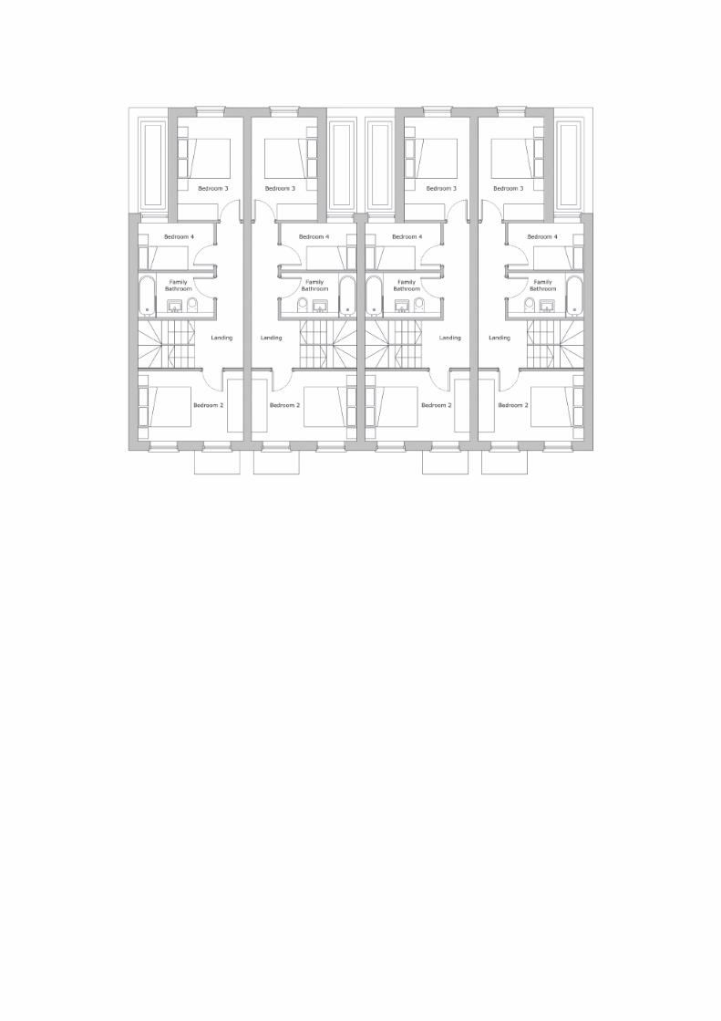
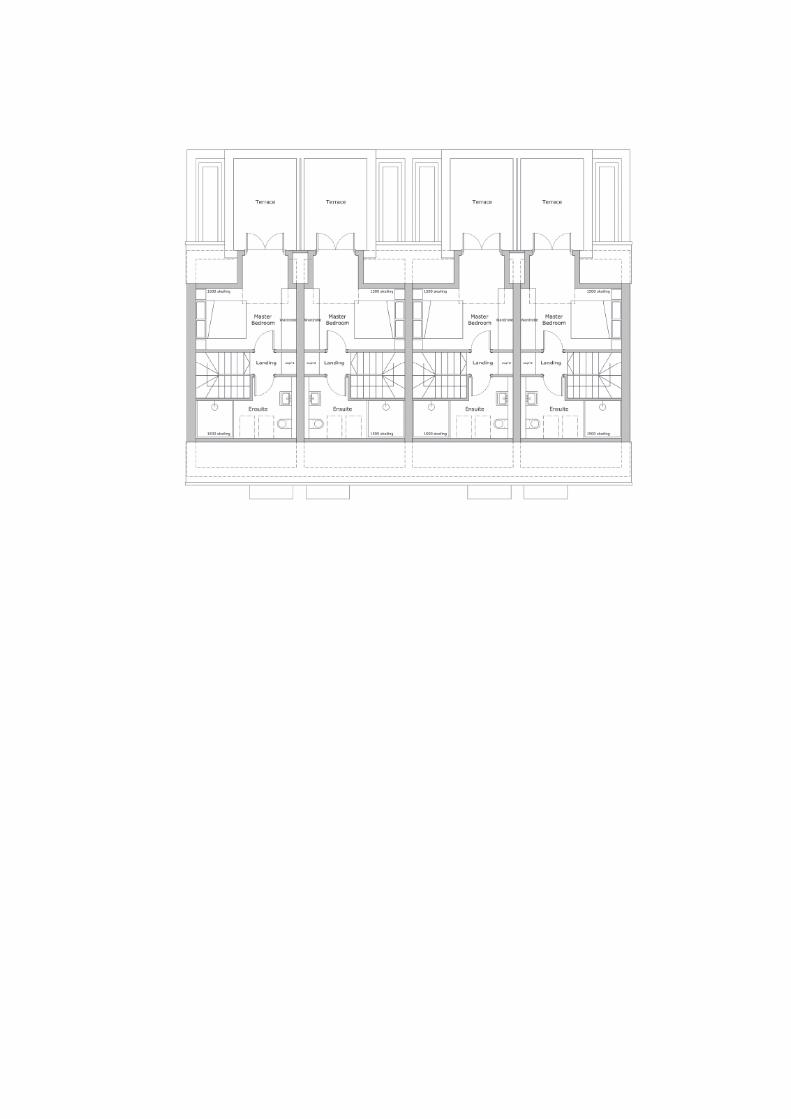

ROYAL BOROUGH OF WINDSOR & MAIDENHEADPLANNING COMMITTEE
MAIDENHEAD DEVELOPMENT CONTROL PANEL
17 December 2018 Item: 6ApplicationNo.:
18/02770/OUT
Location: Field Adjacent To North West Corner of Grove Business Park Waltham RoadMaidenhead
Proposal: Erection of a single storey agricultural barnApplicant: Mr & Mrs SmithAgent: Tom McArdleParish/Ward: White Waltham Parish/Hurley And Walthams Ward
If you have a question about this report, please contact: Sheila Bowen on 01628 796061 or [email protected]
1. SUMMARY
1.1 This is an outline application for a large agricultural barn on land belonging to the ShottesbrookeEstate adjacent to the Grove Business Park in Waltham Road. The applicant has givenevidence that a barn of this size is reasonably needed for the purposes of agriculture, and therecommendation is that outline planning permission is granted. Amended plans have beenreceived taking the building outside of the Root Protection Areas of the protected trees in GroveBusiness Park. Details of landscaping need to be submitted as reserved matters at a laterstage.
It is recommended the Panel authorises the Head of Planning:
1.To grant planning permission on the receipt of no objections being raised by theLead Local Flood Authority regarding the proposed sustainable drainage schemeand with the conditions listed in Section 12 of this report.
2. To refuse planning permission should the Lead Local Flood Authority confirm thatthe proposed drainage scheme would not comply with Paragraph 163 of the NPPFand would increase the risk of flooding in the area.
2. REASON FOR PANEL DETERMINATION
The Council’s Constitution does not give the Head of Planning delegated powers todetermine the application in the way recommended as this is a major application; suchdecisions can only be made by the Panel.
3. DESCRIPTION OF THE SITE AND ITS SURROUNDINGS
3.1 The site is an area of open landscape located immediately to the north of the Grove BusinessPark and a short way south of the White Waltham Airfield in White Waltham. The site isseparated from the business park by a 2m high metal fence, and there are a number of treesnear the boundary within the business park which are the subject of Tree Preservation Orders.The site lies in the Green Belt.
4. KEY CONSTRAINTS
4.1 Policy GB1 of the Local Plan and Paragraph 145 of the National Planning Policy Framework 2018states that the construction of buildings for agriculture and forestry is appropriate development inthe Green Belt.

5. DESCRIPTION OF THE PROPOSAL AND ANY RELEVANT PLANNING HISTORY
5.1 The site area marked by a red line on the location plan would measure 75m by 40m, and thebuilding would measure 72m by 30m, with an eaves height of 5m and a ridge height of 6.5m. Itwould be 2160sqm in area. It would be rectangular in plan, with a south facing rear wall of1200mm high pre-cast concrete panels with steel box profile plasticoated cladding above, sidewalls of steel cladding with roller shutter doors, a north facing front elevation of 6m wide steelroller shutter doors, and a dual pitched roof of corrugated fibre cement roof panels. It would belocated 10m north of the boundary fence of the business park. Approval is sought in this outlineapplication for access, appearance, layout and scale, with landscaping as a reserved matter.
5.2 No relevant planning history.
6. DEVELOPMENT PLAN
Adopted Royal Borough Local Plan (2003)
6.1 The main strategic planning considerations applying to the site and the associated policies are:
Issue Adopted Local Plan PolicyDesign in keeping with character and appearanceof area
DG1
Appropriate development in the Green Belt GB1, GB2Trees N6
These policies can be found athttps://www3.rbwm.gov.uk/downloads/download/154/local_plan_documents_and_appendices
7. MATERIAL PLANNING CONSIDERATIONS
National Planning Policy Framework Sections (NPPF) (2018)
Section 4- Decision–makingSection 12- Achieving well-designed placesSection 13- Protecting Green Belt land
Borough Local Plan: Submission Version
Issue Local Plan PolicyDesign in keeping with character and appearanceof area
SP2, SP3
Green Belt SP5
7.1 The NPPF sets out that decision-makers may give weight to relevant policies in emerging plansaccording to their stage of preparation. The Borough Local Plan Submission Document waspublished in June 2017. Public consultation ran from 30 June to 27 September 2017. Followingthis process the Council prepared a report summarising the issues raised in the representationsand setting out its response to them. This report, together with all the representations receivedduring the representation period, the plan and its supporting documents have now beensubmitted to the Secretary of State for examination. The Submission Version of the BoroughLocal Plan does not form part of the statutory development plan for the Borough. However, bypublishing and submitting the Borough Local Plan for independent examination the Council hasformally confirmed its intention to adopt the submission version. As the Council considers theemerging Borough Local Plan to be sound and legally compliant, officers and Councillors shouldaccord relevant policies and allocations significant weight in the determination of applicationstaking account of the extent to which there are unresolved objections to relevant policies.

Therefore, the weight afforded to each policy at this stage will differ depending on the level andtype of representation to that policy. This is addressed in more detail in the assessment below.
7.2 This document can be found at:https://www3.rbwm.gov.uk/info/201026/borough_local_plan/1351/submission/1
Other Local Strategies or Publications
7.3 Other Strategies or publications relevant to the proposal are: RBWM Landscape Character Assessment
More information on this document can be found at:https://www3.rbwm.gov.uk/info/200414/local_development_framework/494/supplementary_planning
8. CONSULTATIONS CARRIED OUT
Comments from interested parties
24 businesses within the Grove Business Park were notified directly of the application.
The planning officer posted a notice advertising the application at the site on 11.10. 2018 and theapplication was advertised in the Maidenhead Advertiser on 11.10.2018.
No comments were received from neighbours.
Consultees
Consultee CommentWhere in thereport this isconsidered
WhiteWalthamParish Council
No objection Noted
EnvironmentalProtection
No objection, suggested informatives The relevantinformatives willbe added.
Local FloodAuthority
Requested a drainage statement 9.11
Highways No objection 9.10Tree Officers No objection to amended plans 9.9
9. EXPLANATION OF RECOMMENDATION
9.1 The key issues for consideration are:
i whether the proposal is appropriate development in the Green Belt;
ii impact on the openness of the Green Belt;
iii whether the proposed design would have an acceptable impact on the character of thearea;
iv impact on trees that are important to the character of the area; and
v highways impact.
Whether appropriate development in the Green Belt.

9.2 Policy GB1 of the Local Plan states that the construction of new buildings for agriculture orforestry is appropriate development within the Green Belt, and BLPSV Policy SP5 and the NPPFParagraph 145 re-iterate this definition.
9.3 The proposed barn would be a building for agriculture. The applicants have stated in support ofthis the following. “The estate as a whole extends to 823.59 ha, of which the arable operationsextend over 522.43 ha and 129.35 ha of pastureland. The arable operations are split circa 3/8thswinter wheat, 3/8ths spring barley and 2/8ths oil seed rape. The farm currently uses the ratherageing grain store (located to the east of the proposed barn) which provides a useable floor areaof 700 sqm, thereby allowing for the storage of circa 1500 tonnes of harvested grain andtherefore accommodates circa 82% of the winter wheat crop and thereby the remainder of thewinter wheat harvest, all of the spring barley harvest, all of the oil seed rape harvest and all of thestraw crops are having to be sold directly from the field. The consequences of selling more than60% of the farm’s yield directly from the field is that the farm cannot achieve the best prices, andthe proposed barn will allow the farm to maximise income which in turn is reinvested in the farm.”Figures have been provided which show that the floor area proposed is what is required to storethe crops. This is summarised as total spring barley, oil seed rape, straw and the balance of thewinter wheat floor area storage requirement: 2169.32 sqm. Floor area of proposed barn 2160sqm.
9.4 Given the above, it is considered that the proposed barn is an agricultural building which isreasonably required for the purposes of agriculture. It will ensure that the viability of the farm ismaintained for years to come. Consequently it is considered that the proposal is appropriatedevelopment in the Green Belt, and complies with Policies GB1 of the Local Plan, Policy SP5 ofthe BLPSV, and Paragraph 145 of the NPPF.
Impact on Openness of the Green Belt
9.5 Policy GB2 of the Local Plan states that permission will not be granted for new developmentwhich will have a greater impact on openness than the existing development on the site, or whereit will harm the character of the countryside.
9.6 The barn would be sited close to the buildings in Grove Business Park, and would appear as alarge agricultural building which would not be harmful to the character of the countryside. Giventhat this is appropriate development in the Green Belt as set out in the previous section, theimpact on openness cannot be taken into consideration. This is in line with the outcome of a courtof appeal judgement between R. (Lee Valley Regional Park Authority) v Epping Forest DistrictCouncil and Valley Grown Nurseries Ltd (2016) where it was determined that applications foragricultural buildings do not fall to be assessed in terms of their impact on openness.
Design
9.7 Policy DG1 of the Local Plan states among other design guidelines that harm should not becaused to the character of the area through the loss of important features that contribute to thatcharacter.
9.8 The proposed design would be typical of modern farm barns, and is not considered to be harmfulto the open rural character of the area, given its location close to the buildings in Grove BusinessPark. Views of the barn from within the business park would be softened by the large trees nearthe northern boundary of the business park. The design of the proposal is considered to beacceptable. The appearance, layout and scale of the proposal is considered to be acceptable.
Trees
9.9 Policy N6 of the Local Plan requires the protection of important trees on or near developmentsites. In this case, there are no trees within the application site, but there are trees within theGrove Business Park adjacent to the site which are the subject of Tree Preservation Orders. Theplans as originally submitted would have had the building 2.5m away from the boundary, butrevised plans have been received showing the building 10m away from the boundary and outsideof the Root Protection Areas of the protected trees. It is considered that they are far enough

away not to be affected by the proposed development. The impact on trees is thereforeacceptable, and the proposal complies with Policy N6 of the Local Plan.
Highways
9.10 The proposed new barn would be accessed from an existing junction onto Waltham Road and isunlikely to result in any additional traffic impact. The Highway Authority raises no objection to theproposal.
Other matters
9.11 A sustainable drainage scheme is required to demonstrate that this proposal would not increasethe risk of flooding in the area as this is a major application. This has now been supplied togetherwith a soakaway plan, and has been forwarded to the Local Flood Authority. The comments ofthe Lead Local Flood Authority are awaited and the recommendation reflects this.
10. CONCLUSION
10.1 The proposal is considered to be appropriate development in the Green Belt which will bebeneficial to agriculture, and would not be harmful to the character of the area, or to the health ofnearby protected trees. The proposal is therefore considered to comply with the DevelopmentPlan and material planning considerations which are the relevant policies of the Borough LocalPlan Submission Version to which significant weight should be given and the NPPF 2018.
11. APPENDICES TO THIS REPORT
Appendix A - Site location plan and site layout
Appendix B – Shottesbrooke Estate Plan
Appendix C – Floor Plan
Appendix D - Elevations
12. CONDITIONS RECOMMENDED FOR INCLUSION IF PERMISSION IS GRANTED
1 Details of the landscaping (hereinafter called the 'reserved matters') shall be submitted to andapproved in writing by the Local Planning Authority before any part of the development iscommenced.Reason: To accord with the provisions of the Town and Country Planning (General DevelopmentProcedure) Order 1995.
2 An application for the approval of the reserved matters shall be made to the Local PlanningAuthority within three years of the date of this permissionReason: To accord with the requirements of Section 92 of the Town and Country Planning Act1990 (as amended).
3 The Development shall commence within two years from the date of approval of the last of thereserved matters.Reason: In accordance with the requirements of Section 92 of the Town and Country PlanningAct 1990 (as amended).
4 The materials to be used on the external surfaces of the development shall be in accordance withthose specified in the application unless any different materials are first agreed in writing by theLocal Planning Authority. Development shall be carried out in accordance with the approveddetails.Reason: In the interests of the visual amenities of the area. Relevant Policies - Local Plan DG1.
5 The erection of fencing for the protection of any retained tree and any other protection specifiedshall be undertaken in accordance with the approved plans and particulars before anyequipment, machinery or materials are brought on to the site, and thereafter maintained until thecompletion of all construction work and all equipment, machinery and surplus materials have

been permanently removed from the site. Nothing shall be stored or placed in any area fenced inaccordance with this condition and the ground levels within those areas shall not be altered, norshall any excavation be made, without the written approval of the Local Planning Authority.Reason: To protect trees which contribute to the visual amenities of the site and surroundingarea. Relevant Policies - Local Plan DG1, N6.
6 The development hereby permitted shall be carried out in accordance with the approved planslisted below.Reason: To ensure that the development is carried out in accordance with the approvedparticulars and plans.
Informatives
1 No construction work or demolition work shall be carried out or plant operated other thanbetween the following hours: 0800 hours and 1800 hours on Monday to Friday, 0800 hours and1300 hours on Saturday and at no time on Sundays, Bank or Public Holidays
2 There should be no collections from or deliveries to the site during the demolition andconstruction stages outside the hours of 0800 hours and 1800 hours on Monday to Friday, 0800hours to 1300 hours on Saturday and at no time on Sundays, Bank or Public Holidays.
3 The applicant and their contractor should take all practicable steps to minimise dust deposition,which is a major cause of nuisance to residents living near to construction and demolition sites.The applicant and their contractor should ensure that all loose materials are covered up ordamped down by a suitable water device, to ensure that all cutting/breaking is appropriatelydamped down, to ensure that the haul route is paved or tarmac before works commence, isregularly swept and damped down, and to ensure the site is appropriately screened to preventdust nuisance to neighbouring properties. The applicant is advised to follow guidance withrespect to dust control:London working group on Air Pollution Planning and the Environment(APPLE): London Code of Practice, Part 1: The Control of Dust from Construction; and theBuilding Research Establishment: Control of dust from construction and demolition activities.
4 The Royal Borough receives a large number of complaints relating to construction burningactivities. The applicant should be aware that any burning that gives rise to a smoke nuisance isactionable under the Environmental Protection Act 1990. Further that any burning that gives riseto dark smoke is considered an offence under the Clean Air Act 1993. It is the EnvironmentalProtection Team policy that there should be no fires on construction or demolition sites. Allconstruction and demolition waste should be taken off site for disposal. The only exceptionsrelate to knotweed and in some cases infected timber where burning may be considered the bestpracticable environmental option. In these rare cases we would expect the contractor to informthe Environmental Protection Team before burning on 01628 68 3830 and follow good practice.

Appendix A
Appendix B

Appendix C
Appendix D