rpt on drilling stripping & preparation of a … · combined with annealing effect of later...
TRANSCRIPT

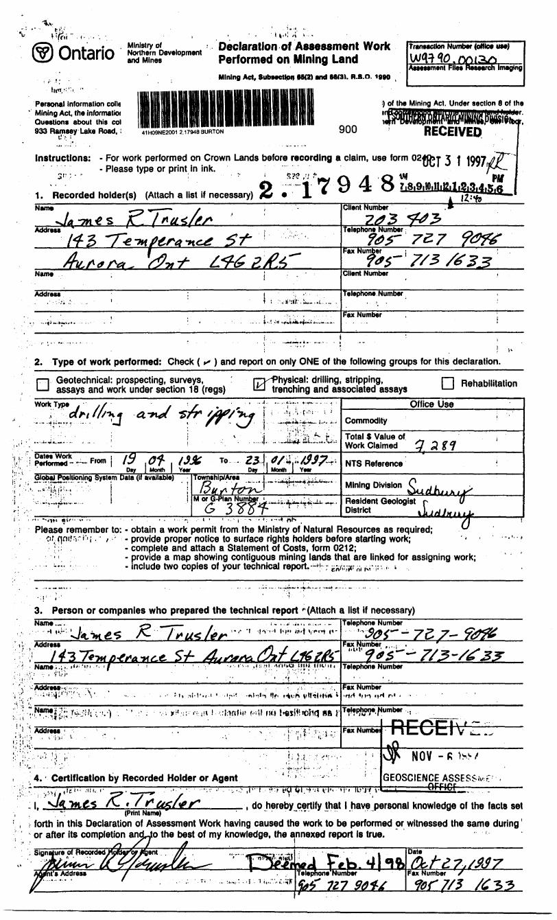
2. 17948SOUTHERN ONTARIO MINING DIVISION
RECEIVED
OCT 3 1 1997
i VI*
41H09NE2001 2.17948 BURTON 010
REPORT ON DRILLING,STRIPPING ANDPREPARATION OF A SITE PLAN ON A
PROSPECTIVE DIMENSION STONE SOURCE ON THEBLACK LAKE PROPERTY
THE PARRY SOUND DISTRICT OF ONTARIO
by
JAMES R. TRUSLER
ECETVENOV -fi IS?/
(GEOSCIENCE ASSESS.V '—————-OFRCF
LONG.: 80 009'22"W - 80 010'41"W LAT.: 45037'19"N-45 038'40"N NTS: 41H/9 DATE: January 30,1997

REPORT ON DRILLING.STRIPPING ANDPREPARATION OF A SITE PLAN ON A
PROSPECTIVE DIMENSION STONE SOURCE ON THEBLACK LAKE PROPERTY
THE PARRY SOUND DISTRICT OF ONTARIO
SUMMARYThe Parry Sound area of Ontario is underlain by complex gneisses and
migmatites of Middle to Late Proterozoic age which are part of the Ontario segment of the Central Gneiss Belt of the Grenville Structural Province. A working model of thrust plates (called domains and sub-domains) which are separated by ductile thrust faults and moved in a northwesterly direction upon each other has been postulated by Davidson et al (1982). Easton (1992) has improved this model in his synopsis using a hierarchy of terranes and domains wherein the terranes include domains of similar age which are autochthonous with respect to each other. Age dating has indicated that four of these large scale terranes or plates are stacked on each other with the base being near Sudbury at the Grenville Front and the top being near Kingston.
Despite the recent wealth of scholarly publications a comprehensive geological map has not yet been made available for the area. However, the limited information available has enabled the clear identification of potentially favourable conditions for both flagstone and dimension stone. Several flagstone occurrences cluster along Davidson's thrusts and several potential dimension stone prospects have been identified within the interior of particular domains.
Although one may ordinarily not expect to find dimension stone within tectonite terranes, it is evident that the autochthonous nature of some of the domains combined with annealing effect of later superimposed amphibolite facies metamorphism preserved large competent blocks of migmatites and gneisses.
As a result of mapping dimension stone potential, and sawing and polishing specimens from many prospects. Seven sites in the Britt domain, and one in each of the Rosseau and Moon River domains have been staked and mapped by the writer resulting in the definition of a large number of potential quarry sites. The ten claim unit Black Lake property is one of these.
The property is underlain by the Bolger pluton which is a circum 1450 Ma megacrystic granite intrusion. A highly strained megacrystic unit trends northeasterly across the northwestern portion of the property bounded on the southeast by derived complex migmatites. The migmatite in the south half of lot 26 concession II has been drill tested and test quarried with positive results by a previous claim holder.
A 25.5 foot vertical drill hole was put down on a site west of the one previously tested by Pacific Granitestone in a similar multicoloured migmatite. Stripping of an area
Page i
approximately 50 metres square was followed up with mapping of the joints and preparation of a detailed site plan in the period August through October, 1996.
The exposed area revealed a very attractive multicoloured migmatite with deep red, black and white shades laminated layered and complexly intermixed. The site is contained in a recumbent fold requiring more drill evaluation for a check on consistency. The drill hole exposed similar attractive material to the exposed surface outcrop. Un fortunately the core was fractured every 12 centimetres on average. Adjustments to achieve less core breakage were made before this drilling as a swivel was obtained to allow free movement of the core barrel. It is believed that vibration and the poor mounted setup of the rig may still be causing problems. All of the fractures were fresh suggesting that the drill tools are still preventing undisturbed recovery of core.
The site will require drilling in more detail and a larger core diameter should be obtained to eliminate the core breakage problem.
Page ii

41H09NE2001 2.17948 BURTON 0 1 OP
TABLE OF CONTENTS
SUMMARY ..................................................... Page i
INTRODUCTION ................................................ Page 1
LOCATION AND ACCESS ........................................ Page 1
PROPERTY ................................................... Page 3
DATES WORKED METHODS USED ON CURRENT PROJECT ........... Page 4
RESULTS OF DRILLING AND STRIPPING ........................... Page 4
CONCLUSIONS ................................................ Page 8
RECOMMENDATIONS ........................................... Page 8
REFERENCES ................................................. Page 9
AUTHOR'S CERTIFICATE ....................................... Page 15
LIST OF FIGURES
Figure 1: Location Map .......................................... Page 2Figure 2: Property Map .......................................... Page 3Figure 3: Drill Hole ft Stripping Plan With Vertical Joints .............. Page 6
LIST OF TABLES TABLE 1: BLACK LAKE PROPERTY ............................... Page 3DRILL HOLE: BL96-1 ............................................ Page 7
Page iii
INTRODUCTION
In 1991, the writer commenced a project to evaluate the flagstone and dimension stone resources of the Parry Sound area. At the same time efforts by former Ministry of Northern Development and Mines geologists, principally Chris Marmont and Dave Villard, were being made to outline the substantial potential for these stone resources and make the public aware of the opportunity. In 1992, the regional investigation of flagstone resources by the writer proved discouraging. It was decided late in the field season to focus solely on the dimension stone potential.
By the end of 1992, many prospective dimension stone sites had been identified by either government publications or by the writer's prospecting. Nine of these dimension stone properties have now been staked by the writer, and an initial evaluation of each property involving geological mapping of the outcrops at a scale of 1:5,000 has been completed. The work provides an initial evaluation of potential quarry sites on each property. The project has been supported by the Ontario Prospector's Assistance Program in 1992, 1993, 1995 and 1996.
In October, 1992, a two claim unit portion of the Black Lake property was staked for its dimension stone potential. Geological mapping was carried out in 1993. In the meantime an adjacent property being tested by Pacific Granitestone Ltd. lapsed and the writer staked eight claim units in October, 1994. The acquired claims contain one quarry site from which Pacific Granitestone removed seven large blocks for processing. This report is the result of drilling one 25.5 foot hole and stripping and preparation of a plan of the stripping and joint patterns on a dimension stone prospect in lot 26 Concession 2, Burton Twp.
The format of the report is formulated in compliance with assessment submission requirements.
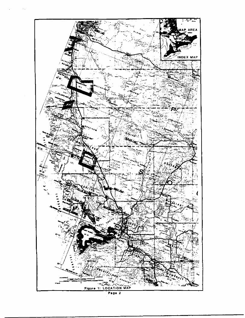
LOCATION AND ACCESSThe property is located in Burton Township, Parry Sound District, Southern
Ontario Mining District, and Sudbury District Regional Geologist's area approximately 165 miles (264 km) north of Toronto (Figure 1). The property is bounded by longitudes 80 0 10'41"W on the west and 80 0 10'41"W on the east and latitudes 45 0 37'19"N on the south and 45 0 38'40"N on the north. The corresponding UTM co-ordinates in metres are 564,031 on the west, 565,800 on the east, 5,052,150 on the south and 5,054,342 on the north. The property is within National Topographic System area 41H/9 and is recorded on claim map G3884.
The Black Lake property is in Burton Township, and can be accessed by a hydro access road which leads one some seven kilometres west of the town of Ardbeg. Ardbeg is at the western terminus of Highway 520 which can be reached by exiting Highway 124 at Waubamik, 11 kilometres northeast of Parry Sound and following a secondary road for twenty five kilometres to the north.
Page l
"̂
WU. :*B^'A. U,. -^.j^ritg^vi
Figure 1: LOCATION MAP
Page 2
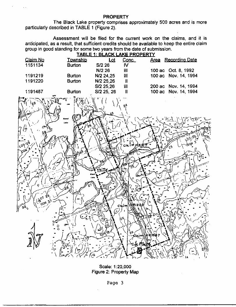
PROPERTYThe Black Lake property comprises approximately 500 acres and is more
particularly described in TABLE 1 (Figure 2).
Assessment will be filed for the current work on the claims, and it is anticipated, as a result, that sufficient credits should be available to keep the entire claim group in good standing for some two years from the date of submission.
TABLE 1 : BLACK LAKE PROPERTYClaim No 1151134
11912191191220
1191487
Township Burton
Burton Burton
Burton
Lot Cone.S/2 26 IVN/2 26 III
N/2 24,25 IIIN/2 25,26 IIS/2 25,26 IIIS/2 25, 26 II
Area Recording Date
100 ac Oct. 8, 1992 100 ac Nov. 14, 1994
200 ac Nov. 14, 1994 100 ac Nov. 14, 1994
;'..^t
Scale: 1:20,000 Figure 2: Property Map
Page 3

DATES WORKED METHODS USED ON CURRENT PROJECTPreparation work on the project commenced on April 19, 1996, the field work
commenced on June 23,1996 and the map drafting and report writing was completed on January 30, 1997. Actual work days for assessment purposes break down as follows:
Black Lake Property: Claims SO1191219,1191220 and 1191487Preparation: Apr. 19,1996 (1 day)Field: Apr. 20, June 23, 1996 (Vklay orienting drilling and stripping; Yiday spottinghole)Drilling: Aug. 24,25,26 ( 9 man days Marc Robert, Paul Jamieson, Dave Jamieson)Stripping: Aug. 25, 26, 29, 31, Oct. 8, 21, 22,1996 (BV2 man days). Work performedby Dave Jamieson, Marc Roberts and Jim Trusler the latter doing 3 man days ofstripping. The work was done with a Wajax pump, adze, chain saw and shovels. Acontinous strip within a SOmetre square area was cleared to bedrock to enablemapping of the bedrock.Mapping: Oct, 21, 22, 27, 28, 1996 ( 3man days) Jim TruslerDrafting: Jan 29, 1997 (1 day)Report Preparation: Jan 30, 1997 (1day)
The magnetic declination used in the field work is 10 0-15'W.
Preparation for field work was done using a previously scanned air photo image which had been registered to the Ontario Base Map digital data in 1995. This image was changed from a .tif file to a jpg file in Graphic Workshops and an image was produced at a scale of 1:500 scale using L View Pro software. This enabled absolute positioning in the field and saves a great amount of time in establishing control.
RESULTS OF DRILLING AND STRIPPING
A potential dimension stone site is located to the west of the hydro line road in the south half of lot 26, Concession 2, Burton Twp. The area is 300 metres X 400 metres and rises 10 metres above the surrounding area. This is the area that was selected for drilling and stripping in 1996. The site hosts similar material to that material previously removed from the Pacific Granitestone quarry and is imediately west of that quarry.
The site plan covers an area 100 metres X 50 metres and a vertical rise of 7 metres, and its location is indexed on Figure 2. The site exposes some lit par lit red, black and white , multicoloured migmatite which is exposed over a large portion of a hill which is 300 metres X 300 metres and rises 10 to 15 metres above the surrounding drainage. Sub- horizontal joint spacings exceed 2 metres and vertical joint spacings are from 2 to 10 metres. The major joint strikes between 160 0 and 180 0 parallel to the axis of the hill. Three minor discontinuous cross joints were seen at azimuths ranging from 20 0to 80 0 . The gneissic foliation is uniform at 160 0 dipping 20 0 E. A subhorizontal joint is apparently parallel to the gneissic foliation. It is apparent that the joint separation on the sub-horizontal set is possibly up to 4 metres. The hill is contained in a recumbent fold and the overall symmetry
Page 4

has not been completely mapped out.
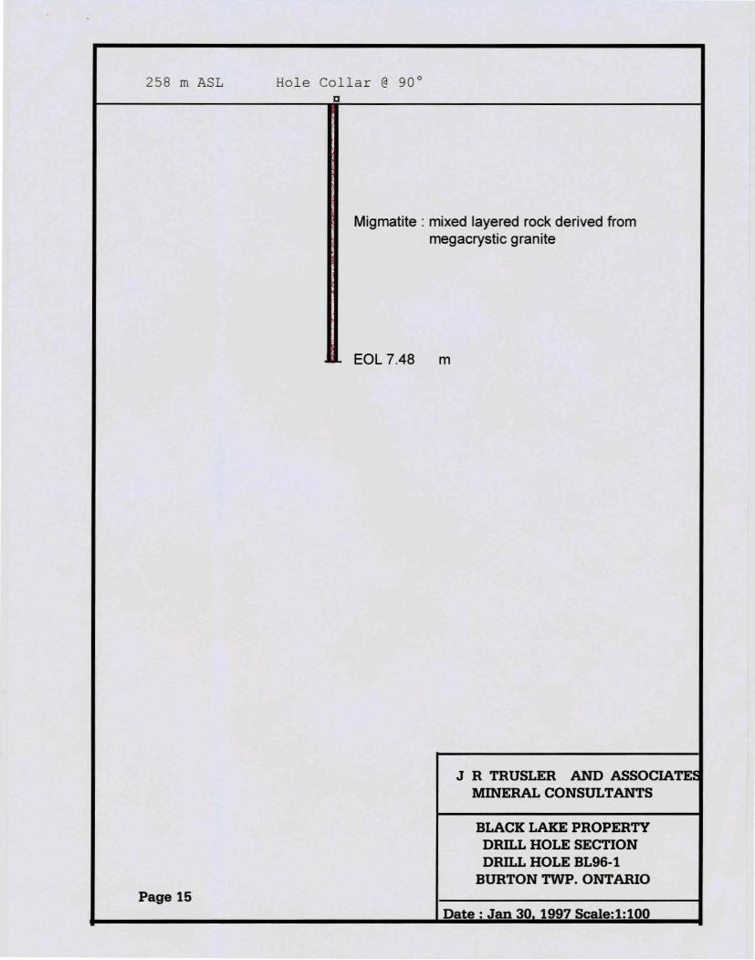
Drill hole BL96-1 was drilled vertically for 25.5 ft. To test this material. The rock is very attractive as described in outcrop. Unfortunately the core was broken on average every 13 cm. All of the fracture surfaces are fresh breaks and it was concluded that the drill was not properly anchored in order to prevent excessive vibration and torque on the core. This test will need to be done again with better suited drilling tools in order to ascertain the horizontal joint seperation.
Page 5

LEGEND^—' "Topographic! canCout- — A*-**.
Trail
Lot line
Wooded area
Moss cover
Swamp
Horizontal joint Vertical joint Gneissic foliation
Figure: 3 ;
BLACK LAKE PROPERTY
DRILL HOLE PLAN
AND LOCATION MAP
JR TRUSLER SITE RLAN
Note: UTM OF STRIPPING.MAPPINGCoordinates for the 'southwest corner-of VERTICAL JOINTSthe map sheet: ^^ ^̂^
5052185N Burton Twp., Ont.5651 97E Date:Dec.28,199^ JRT
O
Page 6

J R TRUSLER Page: l ——————————————— HOLE NO.: BL96-1
Co-ords 112N 1211 E DIAMOND DRILL RECORD Property: Black Lake_______________ Claim No.: 1191487
Township: BURTON Azimuth 0.0 *** Dip Tests *** Lot/Cone: 26 II
Date Started: Aug. 24, 1996 Dip -90.0 Depth Az. Dip Date Completed:Aug 26, 1996
________________ Logged By: J R Trusler Elevation: 15& ^ AS*. Date Logged: Sept.23, 1996
0.0 0.0 -90 Measure: MetricLength: 7.48 NTS: 41H/9 Contractor: D.R. Jamieson Geological Consultants Ltd. Core Size: AX Purpose: TO TEST DIMENSION STONE POTENTIAL Core Stored At: AURORA Note: GRID REFERENCED TO SW CORNER OF PROPERTY
SW CORNER OF PROPERTY AT UTM 56403 IE AND 5052150N
From To ———————————————— Description (m) (m)
0.0 7.48 MIGMATITEMixed layered rock with variegated, multicoloured, gneissic texture with at least three distinct phases with complexly blended colours: bright hematitic red speckled within light grey medium grained component; a salt and pepper coarse grained pegmatitic constituent with white, pink and black speckles and a black and white laminated constituent; rock is generally thickly laminated and thinly layered. Hornblende is the major mafic mineral at 2007o concentration overall, approximately Wo magnetite, apatite and/or epidote approximately Wo in neosome sections, minor leucoxene, "^P/o almandine garnet within aggregates of mafic minerals, minor chlorite in the centre of some amphiboles, 1507o quartz and 60 to 7007ofeldspar (comprising both plagioclase and microcline). Most feldspars are equant, but many larger ones are euhedral but slightly strained. The leucosome phase comprises approximately 6507o of the core section and the paleosome phase comprises approximately 3 5Vo. The gneissic foliation varies from 45 0 to 90 0 to the core axis; over five folds were evident in the core section but are within an evident recumbent fold where the hole is collared.
7.71 End of holeFracturing in hole due to uncontrolled torque was noted in centimetres from the top of the hole as follows: l, 16,27,32,35, 38,45,49 ,73,78, 88,93,102,106,117, 125,174,190,212,224, 235,254,274, 308, 324, 327, 330, 336,344, 370, 377, 384,418,428,436,449,459,477, 507, 518,521,527,541,555,566,576,589,599,615,627,641,644,649,655 (vuggy), 669,676,694, 697, 722, 740, 748.
Page 7

CONCLUSIONS
The Britt domain comprises a complexly deformed and metamorphosed series of rocks. Although some of the rocks are metasedimentary in origin the preponderance of the rocks were originally plutonic, but have been changed by dynamic and thermal metamorphism. The final stages of this metamorphism appear to have annealed the rock into a compact and durable material having some relict textures and many overlapping and lively features.
Nine dimension stone prospects were staked in the Parry Sound area, and all have been mapped geologically. Many of the rocks underlying these properties are migmatitic derivatives of granitic intrusions and present a great variety of textures. In some cases it is evident that the paleosome constituent was megacrystic and subsequent neosome phases have distinct compositions and fabrics. The sites were chosen for their attractiveness and the apparent availability of accessible large blocks.
Two sites on the currently mapped portion of the Black Lake property warrant further attention. Both sites are underlain by a variegated migmatitic derivative of megacrystic granite, covering areas 300 metres X 400 metres and 400 metres X 600 metres respectively. These two areas contain a significant dimension stone resource and the one area is partially developed with a quarry and drill tested. Site planning, detailed mapping, and a drill hole were completed in 1996 in order to test the site in lot 26, Cone. 2 Burton Twp. The exposed area revealed a very attractive multicoloured migmatite with deep red, black and white shades laminated layered and complexly intermixed. The site is contained in a recumbent fold requiring more drill evaluation for a check on consistency. The drill hole exposed similar attractive material to the exposed surface outcrop. Un fortunately the core was fractured every 13 centimetres on average. Adjustments to achieve less core breakage were made before this drilling as a swivel was obtained to allow free movement of the core barrel. It is believed that vibration and the poor mounted setup of the rig may still be causing problems. All of the fractures were fresh suggesting that the drill tools are still preventing undisturbed recovery of core.
The site will require drilling in more detail and a larger core diameter should be obtained to eliminate the core breakage problem.
RECOMMENDATIONS
It is recommended that the site underlain by migmatite on lot 26, Concession 2, Burton Twp. be drilled again in order to retrieve un broken core. A larger diameter core should be obtained and more stable, variable rate drill should used.
Page 8

REFERENCES
Bell, R. 1876. Report on geological researches north of Lake Huron and east of Lake Superior; in Geological Survey of Canada Report on Progress 1876-77.
Bennett, P. J. 1975. The deformation of the northern half of the Brandy Lake Complex, Port Carling, Ontario. M.Se. thesis, Department of Geology, University of Toronto, Toronto, Ont.
Bright, E.G. 1987. Precambrian geology of the Whitestone Lake area, District of Parry Sound; Ontario Geological Survey, Map P.3095, Geological Series-Preliminary Map, scale 1:15,840, geology 1986.
Culshaw, N.G., Davidson, A., and Nadeau, L. 1983. Structural subdivisions of the Grenville Province in the Parry Sound-Algonquin region, Ontario; in Current research , pt. B, Geological Survey of Canada, Paper 83-1B,p.243-252.
Culshaw, N.G., Corrigan, D., Drage, J., and Wallace, P. 1988. Georgian Bay geological synthesis: Key Harbour to Dillon, Grenville Province of Ontario; in Current research, Part C, Geological Survey of Canada, Paper 88-1 C, p. 129-133.
Davidson, A. 1984a. Identification of ductile shear zones in the southwestern Grenville Province of the Canadian Shield. In Precambrian tectonics illustrated. Edited by A. Kroner and R. Greiling. E. Schweizrbart'sche Verlagsbuchhandlung (Nagele u. Obermiller), Stuttgart, Germany, pp. 263-279.
_______ 1984b. Tectonic boundaries within the Grenville Province of the CanadianShield. Journal of Geodynamics, 1: 433-444.
________ 1986. New interpretations in the southwestern Grenville Province, edited by J.M. Moore, A. Davidson and A. Baer, Geological Association of Canada, Special Paper 31, p.61-74
Davidson, A. and Morgan, W.C. 1981. Preliminary notes on thegeology east of Georgian Bay, Grenville Structural Province, Ontario; in Current research, pt. A, Geological Survey of Canada, Paper 81-1A,p.291-298.
Davidson, A., Culshaw, N. and Nadeau, L. 1982. A tectono-metamorphic framework for part of the Grenville Province, Parry Sound region, Ontario; in Current research, pt.A, Geological Survey of Canada, Paper 82-1 A, p.175-190.
Fahrig, W.F. and West, T. 1986. Diabase dyke swarms of the Canadian shield; Geological Survey of Canada, Map 1627A, scale 1:4,873,900.
Page 9
Fouts, C.R. and Marmont C. 1989. Gneisses of the Parry Sound-Muskoka Area; Flagstone resources, Ontario Geological Survey, Open File Report 5725
Garland, M. 1987. Graphite in the Central gneiss belt of the Grenville Province of Ontario; Ontario Geological Survey, Open File Report 5649.
Hanmer, S. 1984. Strain-insensitive foliations in polymineralic rocks; Canadian Journal of Earth Sciences, v.21, p. 1410-1414.
______ 1988. Ductile thrusting at the mid-crustal level, southwestern GrenvilleProvince; Canadian Journal of Earth Sciences, v.25, p. 1049-1059.
Harrison, J.C. 1977. Geology and structure of the Go Home Bay area, District of Muskoka, Ontario. B.Sc. thesis, Department of Geology, University of Toronto, Toronto, Ont.
Hewitt, D.F. 1967. Geology and mineral deposits of the Parry Sound -Huntsville area; Ontario Geological Survey, Geological Report 52, 65p.
Innes, D. G. 1992. Assessment Work Report, Ardbeg Property, Burton Township, Ontario, 1886 Holdings Ltd. Ont Min of Nor Dev and Mines Asssessment files.
Lacy, W.C. 1960. Geology of the Dunchurch area, Ontario; Geological Society of America Bulletin, Volume 71, p. 1713-1718
Lashbrook, Raymond L. 1990a. Geological Report on The Woods Road Property, Carting Township, Ontario. 1886 Holdings Ltd. Ont Min of Nor Dev and Mines Asssessment files.
1990b. Geological Report on Burton Township, Ontario. 1886 Holdings Ltd. Ont Min of Nor Dev and Mines Asssessment files.
Lindia, F.M., Thomas, M.D. and Davidson, A. 1983. Geological significance of the Bouger gravity anomalies in the region of the Parry Sound domain, Grenville Province, Ontario; in Current research , ptB, Geological Survey of Canada, Paper 83-1 B, p.261-266.
Lumbers, S.B. 1975. Geology of the Burwash area; Ontario Division of Mines, Geological Report 116,160 p., with Map 2271 scale 1:126,720.
Macfie, R.1.1988. Preliminary investigation of the Parry Sound -Seguin domain boundary; in Summary of field work and other activities 1988, by the Ontario Geological survey, Ontario Geological Survey, Miscellaneous Paper 141, p.315-318.
Page 10

Macfie, R.I: and Dixon, J. M. 1990. Tectonic relations among Parry Sound domain and Seguin and Rosseau sub-domains Grant 370; in Geoscience Research Grant Program Summary of Research 1989-1990, Ontario Geological Survey, Miscellaneous Paper 150, 1990, p.200-212.
Marmont, C., Zuberec, P.M., and Conrod, W.D. 1988. Industrial minerals, rare-earth elements, and building stone in the Districts of Muskoka, Parry Sound, and Nipissing and the County of Haliburton; in Summary of Field Work and Other Activities 1988, by the Ontario Geological Survey, Ontario Geological Survey, Miscellaneous Paper 141, p.319-325.
Marmont, C. 1992. Industrial minerals and building stone in the Districts of Nipissing, Parry Sound and Sudbury;in Summary of Field Work and Other Activities 1992, Ontario Geological Survey Miscellaneous Paper 160, p.261-265.
1992. Building Stone Opportunities in Central Ontario -1991 Supplement. Ontario Geological Survey, Open File Report 5825, 20p.
1993. Exploration Guidelines and Opportunities for Dimensional Stone in Central Ontario. Ontario Geological Survey, Open File Report 5853, 83p.
McRoberts, G., Macfie, R.I. and Hammar, D. J. 1988. Geology of the Manitouwabing Lake area, District of Parry Sound; in Summary of Field Work and Other Activities 1988, by the Ontario Geological Survey, Ontario Geological Survey, Miscellaneous Paper 141,p.309-314.
McRoberts, G., and Tremblay, M.L, 1988. Precambrian geology of the Ferrie River area, District of Parry Sound; Ontario Geological Survey, Map P. 3123, Geological Series- Preliminary Map, scale 1:15,840
Murray, A. 1848. On an examination of the shores, islands and rivers of Lake Huron including parts of the east coast of Hudson Bay and the Spanish River; in Geological Survey of Canada Report of Progress 1848-49.
Nadeau, L. 1984. Deformation of leucogabbro at Parry Sound, Ontario. M.Se. thesis, Carlton University, Ottawa, Ont.
Parks, W.A. 1900. Work in the Muskoka district, Ontario; in Geological Survey of Canada, Summary report for 1900, part A pp. 121-126 (pub 1901).
Satterly, J. 1942. Mineral Occurrences in Parry Sound District, Ontario Department of Mines, v.51,Part 2,41 p. with Map 1942-2.
Satterly, J. 1955. Geology of Lount Township; Ontario Department of Mines Annual Report, v.64, Part 6, 43p., with Map 1955-4, scale 1:31,680.
Page 11
Schwerdtner, W. M., and Bauer, G. 1975. Tectonic significance of mylonite zones. Neues Jahrbuch fur Mineralogie, Monatshefte, No. 11: 500-509.
Schwerdtner, W.M., and Mawer, C.K. 1982. Geology of the Gravenhurst region , Grenville Structural Province, Ontario. In Current research, part B. Geological Survey of Canada, Paper 82-1 B, pp. 195 - 207.
Schwerdtner, W.M., and Waddington, D.H. 1978. Structure and Lithology of Muskoka - southern Georgian Bay region, Central Ontario. In Toronto 78 Field Trips Guidebook. Edited by A. L. Currie and W.O. Mackasey. Geological Association of Canada, pp. 204-212.
Schwerdtner, W.M., Waddington, D.H., and Stollery, G. 1974. Percrystallinepseudomorphs as natural gauges of incremental paleostrain. Neues Jahrbuch fur Mineralogie, Monatshefte, No. 3/4: 174-182.
Schwerdtner, W.M., Bennett, P.J., and Janes, T.W. 1977. Application of L-S fabric scheme to structural mapping and paleostrain analysis. Canadian Journal of Earth Sciences, 14: 1021-1032.
Schwerdtner, W.M., Mawer, C.K., and Hubbs, A. F. 1981. Geology of the Gravenhurst region, Grenville Structural Province,Ontario: Preliminary mapping results. In Current research, part B, Geological Survey of Canada, Paper 81-1B, pp. 167-169.
Schwerdtner, W.M. 1987. Interplay between folding and ductile shearing in the Proterozoic crust of the Muskoka-Parry Sound region, central Ontario; Canadian Journal of Earth Sciences, v.24, p. 1507-1525.
Tremblay, M.L. 1988. Remote sensing study of curvilinear, structural features in the Parry Sound domain, Grenville Province; in Summary of field work and other activities 1988, Ontario Geological Survey Miscellaneous Paper 141 pp.326-329.
Trusler, J.R. and Villard, D.J. 1980. Geology of the Parry Sound-Sans Souci map area; scale 1:31,680, unpublished manuscript and map done for the Ontario Ministry of Natural Resources.
Trusler, J.R. 1992.Prospecting Programme for Flagstone and Decorative Stone in the Parry Sound District of Ontario. OPAP File No.: OP92-174
1993a. Geological Reconnaissance for Flagstone and Dimension Stone in the Parry Sound District of Ontario; Regional survey submitted to Assessment Files, Ontario Geological Survey.
Page 12

Trusler, J. R. 1993b. A Geological Survey of the Dimension Stone Resouces on the Killbear Point Property, Parry Sound District of Ontario; survey submitted to Assessment Files, Ontario Geological Survey.
1993c. A Geological Survey of the Dimension Stone Resouces on the Black Lake Property, Parry Sound District of Ontario; survey submitted to Assessment Files, Ontario Geological Survey.
1993d. A Geological Survey of the Dimension Stone Resouces on the Burnt Lake Property, Parry Sound District of Ontario; survey submitted to Assessment Files, Ontario Geological Survey.
1993e. A Geological Survey of the Dimension Stone Resouces on the Dillon Road Property, Parry Sound District of Ontario; survey submitted to Assessment Files, Ontario Geological Survey.
19931 A Geological Survey of the Dimension Stone Resouces on the Shebeshekong Lake Property, Parry Sound District of Ontario; survey submitted to Assessment Files, Ontario Geological Survey.
1993g. A Geological Survey of the Dimension Stone Resouces on the Grundy Lake Property, Parry Sound District of Ontario; survey submitted to Assessment Files, Ontario Geological Survey.
1993h. A Geological Survey of the Dimension Stone Resouces on the Jacknife Harbour Property, Parry Sound District of Ontario; survey submitted to Assessment Files, Ontario Geological Survey.
1993L A Geological Survey of the Dimension Stone Resouces on the Turtle Lake Property, Parry Sound District of Ontario; survey submitted to Assessment Files, Ontario Geological Survey.
1993J. A Geological Survey of the Dimension Stone Resouces on the Woods Road Property, Parry Sound District of Ontario; survey submitted to Assessment Files, Ontario Geological Survey.
van Berkel, J.T., and Schwerdtner, W.M., W.M. 1986. Structural geology of the Moon River area. Ontario Geological Survey, P2954(with marginal notes).
van Breeman, O., Davidson, A., Loveridge, W.D. and Sullivan, R.W. 1986. U-Pb zircon geochronology of the Grenville tectonites, granulites and igneous precursors, Parry Sound, Ontario; in The Grenville Province, edited by J.M. Moore, A. Davidson and A. Baer, Geological Association of Canada, Special Paper 31, p. 191-208.
Page 13

Waddington, D.H. 1973. Foliation and mineral lineation in the Moon River synform, Grenville Structural Province, Ontario. M.Se. thesis, University of Toronto, Toronto, Ont.
Walker, T. L. 1905. The Muskoka district, Ontario; in Geological Survey of Canada, Summary report for 1905, p. 84-86, (published 1906)_______ 1913. The precambrian of Parry Island and vicinity; in Geological Survey of Canada Guide Book No. 5., p. 98-100.
Wynne-Edwards, H. R. 1972. The Grenville Province; in Variations in tectonic style in Canada, edited by R.A. Price and R.J.W. Douglas, Geological Association of Canada, Special Paper 11, p263-344.
Page 14
258 m ASL Hole Collar @ 90
Migmatite : mixed layered rock derived from megacrystic granite
M. EOL7.48 m
Page 15
J R TRUSLER AND ASSOCIATES MINERAL CONSULTANTS
BLACK LAKE PROPERTY DRILL HOLE SECTION DRILL HOLE BL96-1
BURTON TWP. ONTARIO
Date : Jan 30. 1997 Scale: 1:100

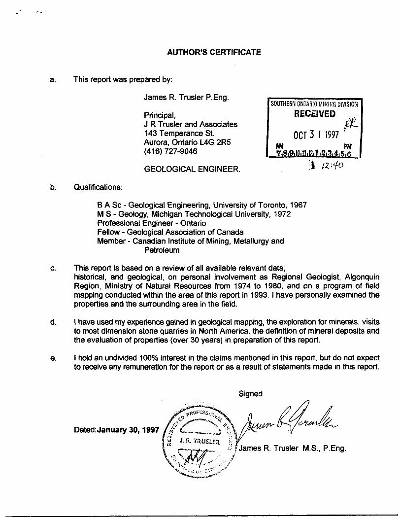
AUTHOR'S CERTIFICATE
a. This report was prepared by:
James R. Trusler P.Eng.
Principal,J R Trusler and Associates 143 Temperance St. Aurora, Ontario L4G 2R5 (416) 727-9046
SOUTHERN ONTARIO MINING DIVISIONRECEIVED
OCT 3 1 1997AM PH
GEOLOGICAL ENGINEER.
Qualifications:
B A Se - Geological Engineering, University of Toronto, 1967 MS- Geology, Michigan Technological University, 1972 Professional Engineer - Ontario Fellow - Geological Association of Canada Member - Canadian Institute of Mining, Metallurgy and
Petroleum
This report is based on a review of all available relevant data;historical, and geological, on personal involvement as Regional Geologist, Algonquin Region, Ministry of Natural Resources from 1974 to 1980, and on a program of field mapping conducted within the area of this report in 1993. l have personally examined the properties and the surrounding area in the field.
l have used my experience gained in geological mapping, the exploration for minerals, visits to most dimension stone quarries in North America, the definition of mineral deposits and the evaluation of properties (over 30 years) in preparation of this report.
l hold an undivided 1000Xo interest in the claims mentioned in this report, but do not expect to receive any remuneration for the report or as a result of statements made in this report.
Dated:January 30,1997
Signed
; f James R. Trusler M.S., P.Eng.
ofNorthern Development and Mines
i |X /i i... -Declaration of Assessment Work Performed on Mining LandMining Act, Subsection eW2) and ewai. n.a.o 1990
Transaction Number (office use)
Assessment F Imaging
Personal Information colle Mining Act. the Informatioi Questions about this col933 Ramsey Lake Road,:
t! ; i41H09NE2001 2.17948 BURTON 900
) of the Mining Act. Under section B of the
RECEIVED
Instructions: - For work performed on Crown Lands before recording a claim, use form 02ffhr \ \ - Please type or print in ink. .
1. Recorded holder(s) (Attach a list if necessary)
, ^ , ,.-— f"7-fl 4* -^
±Name Client Number
Address
14- 2;5 f- ! Telephone Number 7Z7
Fax Num
Name Client Number
Address \ ' 'i ''" - -1 i ^j'W.lw-.u.,...
Telephone Number
Fax Number
2. Type of work performed: Check ( ^ ) and report on only ONE of the following groups for this declaration.
Q Geotechnical: prospecting, surveys, assays and work under section 18 (regs)
rrv^Physical: drilling, stripping, Li-J trenching and associated aassays | | Rehabilitation
Work Type Office UseCommodity
Total S Value of Work Claimed fi
Dates Work Performed - From j 19 01* | f~.
________Day l Month | YxrTO.
Month YMTNTS Reference
Global Positioning System Data (if available) Township/Area ^ lowns IJ tt
Min,nfl DivisionM or G-Plan
G Resident Geologist District
^Fv-Please remember to: - obtain a work permit from the Ministry of Natural Resources as required;
"' i ; - provide proper notice to surface rights holders before starting work;- complete and attach a Statement of Costs, form 0212;- provide a map showing contiguous mining lands that are linked for assigning work;- include two copies of your technical report.--": r ^w™ i^i-'- l
3. Person or companies who prepared the technical report -(Attach a list if necessary)Name... Telephone Number
Address Fax Number ,,.^- Namt. ;- j:: M! ACMiO I IIH- . ... .. Telephone Number
Fax Number
rio Telephone, Number ..
RECEIVAddress '( , ^ ••;-^' v
4. Certification by Recorded Holder or Agent
NOV -R t*-/
GEOSCIENCE ASSESS OFFICr————
i,-Z?
A. * , do hereby certify that l have personal knowledge of the facts set(Print Name)
forth in this Declaration of Assessment Work having caused the work to be performed or witnessed the same during' or after its completion ang^Jo the best of my knowledge, the annexed report is true.

5. Work to be recorded and distributed.,the mining land where work, was performed, .must accompany this form. ; " v "?
Work can only be assigned to claims that are contiguous (adjoining) to at the time work was performed. A map showing the contiguous link !
'..' rii'-^i *vf) '
.Mining Claim Number. Or if work was done on other eligible mining land, show In this , ; column the location number indicated on the claim map.
eg"
eg
eg
1
2
3
4' s' ".
6~
7 -
8
9
10
11
W
13
i u^
i 15;
1 ' TB7B27
5 1234567 '
1234568
^)ifttiZ7^^UBI'Ll^^0 H9IZU)
\ ' ' - - - .- - 1 '*."•'•': \ . : , ,
....
, ,
"-1
:i, : . .
•t;-. ..
Number of Claim Units. For other mining land, list hectares. ,.
16 ha '
12 '
2
Zz^
; ( " ' '
' - : - ,-
* ' , '\ ' ' '
:
. - .-;u:". . .. Column Totals. . - '- -ii i
Value of work* ̂ performed on this claim or othe^!^
..mining land.,,.,^,..
S26, 825 '"
-.-•IT ."-i-. O SM*
S 8, 892
f-?t,F?'\
,: . '.—i.i ^* : - , -. "V , - v-f.v"
. . . . j: ......
. . ..-a.
r^ . •^- ••••'f-.-
.1...' r. .- .... ,.s...-.:
. -*
! ;.r.-; r: f Vl^ntf ,
. ^.".-. ,* ,iw^.
-^ ;!;^J
^7^^f -
'lvalue of work f applied to this•^?^*:-.i. "' . - 'tyMqsW't-V"'
^^N/A :t '
1 ' W- S24.000 1
i : S 4,000
h" ftp ! l" : /600
3Z00-..^...
V f V K* "*- -- , i . - -?* . , , . - .•r*^ '••'•""
.1C. . v .tr
— -~ : -- •-•-
tj^... /l cp-' -ni
, i tt . -
* ., , '
J ;
^|-; - lafr.,M) p.l: . *' f,- - -- - * - -;' ' f
v*'t.:.;' ;: -"'' ;"v ' ' '' -
^.iti,,:. ,. /. j. :'
i*^,.,,\:--.~# ————— T*Z600*-\
Value of work assigned to other mining claims.
; 1
124,000
0
0
' *f#00
. -
l.!': 1
'•* - : - *,
Bank. Value of work to be distributed at a future date.
S2.825
0 '
S4.892
/6X?
fS6T?' ....Y •••-*- 1, do hereby certify that the above work credits are eligible under
/l '* -"f'nrM *'4t - -'•••' 'i"T' ' - -' - - -- -' :'-'•-•'t (Print FuH Name) 'subsection 7(1) of the Assessment Work Regulation 6/96 fort assignment to contiguous claims or for application to: ' * ;'.' ' • ••' nv! ; the claim where the work was done. ••-- i , * -1^ . i ivt^-i 1*0*1 i
-f--Signature of Date
6. instructions for cutting back credits that are not approved.to*f *f" bH'f
Some of the credits claimed in this declaration may be cut back. Please check (y) In the boxes below to show how you wish to prioritize the deletion of credits: '"^tfjvr (̂ 1 . Credits are to be cut back from the Bank first,: followed by option 2 or 3 or 4 as indicated.
,:":i,,:'i v n rt oroHite are to be.cut back starting with the.claims,listed.last, working backwards; orIW-I f
2-•* : il 3. Credits are to be cut back equally over all claims listed in -this declaration; or
r'.'"-'i'F ffiibt"} "" "" ' -••— '- ' - - ••••' v.-U'.-:a^ - i .i L , -H !?\^ l— l 4- Credits are to be cut back as prioritized on the attached appendix or as follows (describe):
! '*' ' ' ' ' 'r- ' •' •- ' ' "
]; Note: If you have not indicated how your credits are to be deleted, credits will be^cut back from the Bank first,^/^\rC;Julto^.byoptloiinumber2^
For Office Use OnlyReceived Stamp iTl
Dale Approved .*: :1 e-'
Date Notification Sent
Total Value of Credit ApproveT"
Approved for Recording by Mining Recorder (Signature)-

fntaric ~- MfeMry.oiJiiU; M INING DiVlSlt)^—
Personal Information c section 8 of the Mlninj the mining land holder
Nortl and
OCT 3 t 1997lecled on this form Is obtained under
formation Is a public Mlord
Mines. 6th Floor, 933 Ramsey Lake
Statement of Costs "' f or'Assessment Credit
Traniicllon Number (oillce use)
ie authority of subsection 6(1) of the Assessment Work Flegulnllon 6/96. Under This Information will be used to review the assessment work tind correspond with •e directed to the Chief Mining Recorder, Ministry of Northern Development and
; ''' 'I.M.-.r f' .' K. l "
;, Work TypeUnits of Work*****VJ. '
Depending on the type of work, list the number of hours/days worked, metres of drilling, kilo metres of grid line, number of samples, etc. :
Cost Per Unit of work
Total Cost
. 12" ** SG 0,0*c/
fl/77-**
Associated Costs (e.g. supplies, mobilization and demobilization).I'l
^-— f *)ig f li Wn W*fr*
Food and Lodging Costs r ' M
Total Value ol Assessment Work
Calculations of Filing Discounts:' ' ' ' l . H
1. Work filed within two years of performance is claimed at 100(Vb of the above Total Value of Assessment Work.2. If work is filed after two years and up to five years after performance, It can only be claimed at 5007o of the Total
1 'Value of Assessment Work. If this situation applies to your claims, use the calculation below:'i . . ' - J - - *1 ' i .
;, -TOTAL VALUE OF ASSESSMENT WORK x 0.50 - Total S value of worked claimed.
Work' older than 5 years is not eligible for credit. ' -' ' W .' :!n:'* f: ;* ? '' i^ : Mi , -A recorded holder may be required to verify expenditures claimed In this statement of costs within 45 days of a '' -
request for verification and/or correction/clarification* If verification'and/or correction/clarification Is not made, the ri ' Minister may reject all or part of the assessment work submitted.**W* eh Unrftwiuv). i: - . - . -. . i
1....- 41.w.
: Certification verifying costs:
*IK r , do hereby certify, that the amounts shown are as accurate as mayi.fr^r-f *y.i (piew* print full name); -t , * *, • ..•|.,--*'-i-i *' irvi ^1-^11^. f 'V*-'- / ". -u-,: ..-'
! reasonably be determined and the costs were incurred while .conducting assessment work on the lands Indicated on
l am authorizedthe accompanying Declaration of Work form as
to make this certifica
NQV -
i (rvcordtd holder, ftQtnt, orftAto ootnpui^ potlUcxi vi^ijtlgnlng cuthoflty) t

Ministry ofNorthern Developmentand Mines
Minister* du Developpement du Nord et des Mines
March 13,1998
JAMES RICHARD TRUSLER 143 TEMPERANCE ST. AURORA, Ontario L4G-2R5
OntarioGeoscience Assessment Office 933 Ramsey Lake Road 6th Floor Sudbury, Ontario P3E 6B5
Telephone: (888)415-9846 Fax: (705) 670-5881
Dear Sir or Madam:
Subject: Transaction Number(s):
Submission Number: 2 .17948
StatusW9790.00130 Approval After Notice
We have reviewed your Assessment Work submission with the above noted Transaction Number(s). The attached summary page(s) indicate the results of the review. WE RECOMMEND YOU READ THIS SUMMARY FOR THE DETAILS PERTAINING TO YOUR ASSESSMENT WORK.
If the status for a transaction is a 45 Day Notice, the summary will outline the reasons for the notice, and any steps you can take to remedy deficiencies. The 90-day deemed approval provision, subsection 6(7) of the Assessment Work Regulation, will no longer be in effect for assessment work which has received a 45 Day Notice.
Please note any revisions must be submitted in DUPLICATE to the Geoscience Assessment Office, by the response date on the summary.
If you have any questions regarding this correspondence, please contact Lucille Jerome by e-mail at [email protected] or by telephone at (705) 670-5858.
Yours sincerely,
ORIGINAL SIGNED BYBlair KiteSupervisor, Geoscience Assessment OfficeMining Lands Section
Correspondence ID: 12013
Copy for: Assessment Library
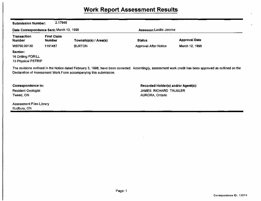
Work Report Assessment Results
Submission Number: 2.17948
Date Correspondence Sent: March 13, 1998 AssessonLucille Jerome
First Claim Number1191487
Township(s) l Area(s) BURTON
StatusApproval After Notice
Approval DateMarch 12, 1998
Transaction NumberW9790.00130
Section:16 Drilling PDRILL 10 Physical PSTRIP
The revisions outlined in the Notice dated February 3,1998, have been corrected. Accordingly, assessment work credit has been approved as outlined on the Declaration of Assessment Work Form accompanying this submission.
Correspondence to:Resident Geologist Tweed, ON
Assessment Files Library Sudbury, ON
Recorded Holder(s) and/or Agent(s):JAMES RICHARD TRUSLER AURORA, Ontario
Page: 1Correspondence ID: 12013