sac river bridge haer no. m0-110 (bridge no. h-123a)...
TRANSCRIPT
SAC RIVER BRIDGE (Bridge No. H-123A) Spanning Sac River at U.S. Route 160 Ash Grove vicinity Greene County Missouri
PHOTOGRAPHS
WRITTEN HISTORICAL AND DESCRIPTIVE DATA
HISTORIC AMERICAN ENGINEERING RECORD MIDWEST REGIONAL OFFICE
National Park Service U.S. Department of the Interior
1709 Jackson Street Omaha, NE 68102
HAER No. M0-110
Location:
U.S.G.S. Quadrangle:
Construction Dates:
Designer:
Builder:
Present Owner:
Present Use:
Significance:
Historian:
HISTORIC AMERICAN ENGINEERING RECORD
SAC RNER BRIDGE
Spanning the Sac River at U.S. Route 160 Ash Grove vicinity Greene County, Missouri
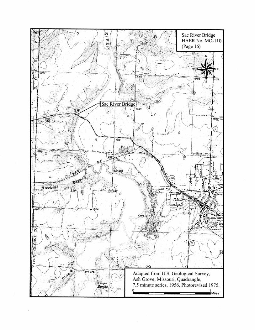
Ash Grove, Missouri, 7.5 Minute Series, 1956 Photorevised 1978
1926-27
HAER No. M0-110
Bureau of Bridges, Missouri State Highway Department
A. P. Poirot Construction Company, Belleville, Illinois
Missouri Department of Transportation
Vehicular bridge
The Sac River Bridge (Bridge No. H-123A) is a three-span, reinforced concrete, two-ribbed, open spandrel arch bridge, and is significant as a well-preserved, early example of this structural type.
David C. Austin, May 2005
I. DESCRIPTION OF THE SAC RIVER BRIDGE
Sac River Bridge HAER No. M0-110 (Page 2)
The Sac River Bridge (Bridge No. H-123A) spanning the Sac River at U.S. Route 160 consists of three 100-foot, reinforced concrete, two-ribbed, open spandrel arch spans carried on reinforced concrete piers and end abutments (see Photographs M0-110-1 through M0-110-3). The overall bridge length is 310' as measured between the front walls of the two end abutments. The roadway width is 20' as measured between the curbs. 1
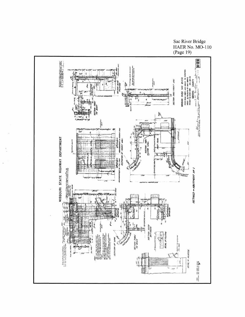
The two end abutments are similar in design, both having enclosed arch buttresses, curved wing walls, and fluted pilasters (see Photographs M0-110-4 through M0-110-8). The design of Abutment No. 1 on the west bank, redrawn in June 1926 after construction had started (see pages 19 and 21), features two main footings 16' long x 6'-6" wide x 2' thick, carried into solid rock to an elevation of 899'-6". The footings anchor the two arch buttresses that extend outward from the rear of the footings to the arch springing line at the 906' elevation. The arch buttresses measure 5' wide, and have a vertical thickness of 3' at the arch springing line. The buttresses are enclosed by walls l '-3" thick. The total height of the face of the abutment from the base of the footings to the roadway grade measures 23'-10-5/8". It has a face width of 24'-6". The abutment walls are braced by a rear interior tie beam 1 '-6" x 2', which itself is supported by two I-foot-square columns. Fluted pilasters at the exterior comers are 5' wide, and are topped with corbelling that continues across the face of the abutment. Curved wingwalls extending from the rear of the abutment are built to a radius of 8'-10-3/4", providing a 30-foot shoulder-to-shoulder roadway width at the bridge endposts. The total length of Abutment No. 1 from the endposts to the abutment face is 26'.
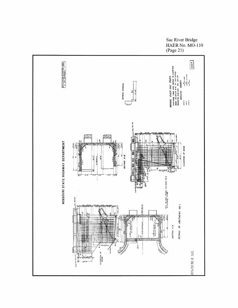
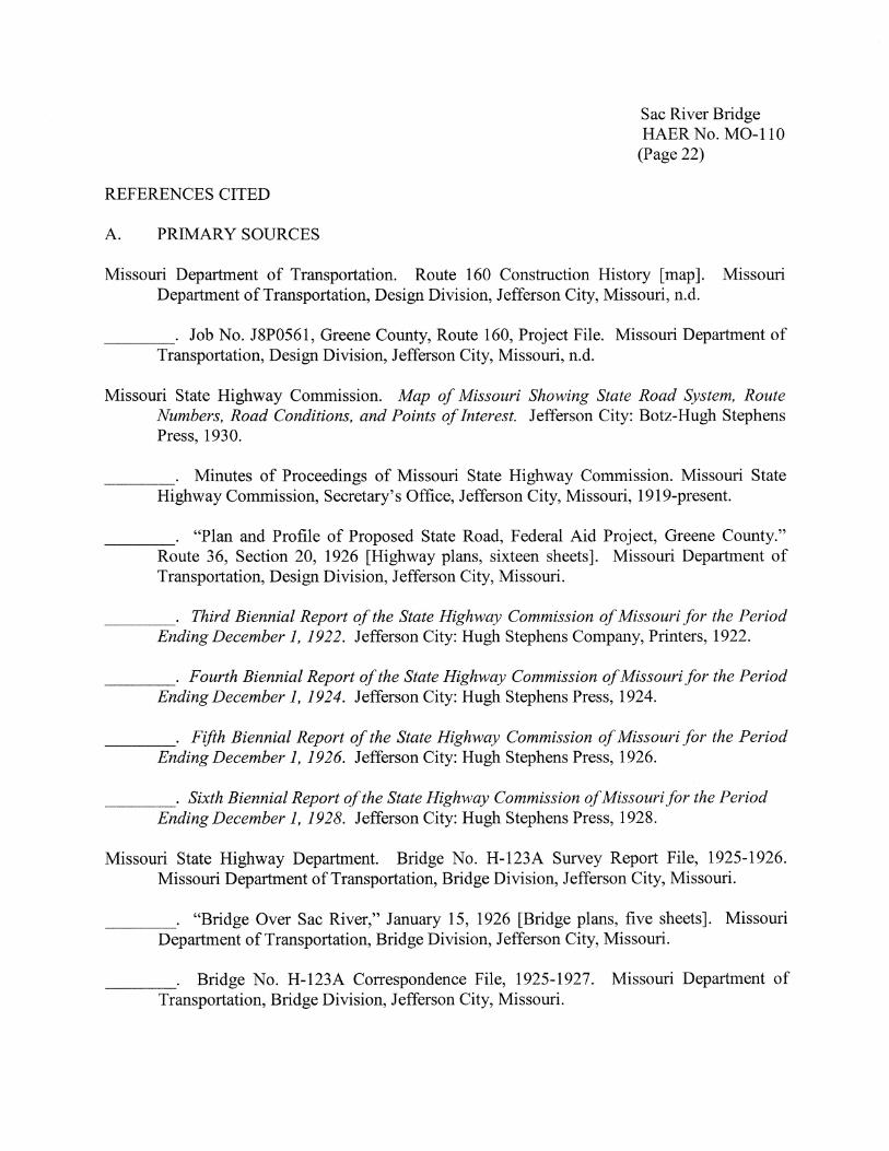
Abutment No. 4 on the east bank (see page 20) has design features similar to Abutment No. 1. The two main footings for the arch buttresses of Abutment No. 4 rest at an elevation of 897'-6" and measure 18' long x 6'-6" wide x 2' thick, with extensions serving to support the curved wingwalls. The footings themselves are anchored into solid rock with 3/4" - and 7 /8" -diameter dowel rods driven at least l' deep and grouted. The arch buttresses are keyed into the footings and secured with 1/2"-diameter reinforcing rods. As with Abutment No. 1, the arch springing line occurs at an elevation of 906' where the buttresses emerge from the abutment face and end with construction joints. The abutment face and wingwalls, again 1 '-3" thick, are braced by two interior tie beams 1 '-6" x 2', supported by four I-foot-square posts. Construction joints in the wing walls occur just below the tie beams. There are 3" drain holes in the abutment face and wing walls. The details of the fluted comer pilasters and the upper corbelling are the same as on Abutment No. 1. The total height of Abutment No. 4 is 25' -10-5/8" at the front face. Its total length is 28'-9" from the face to the rear endposts.
1 Missouri State Highway Department, "Bridge Over Sac River," [bridge plans, five sheets], January 15, 1926, Bridge Division, Missouri Department of Transportation, Jefferson City, Missouri.
Sac River Bridge HAER No. M0-110 (Page 3)
Pier Nos. 2 and 3 (see page 20, and Photographs M0-110-9 and M0-110-10) are open piers of identical dimensions set on two rectangular footings measuring 30' x 12' x 3', which rest at an elevation of 896'-6". Oval column bases keyed into the footings are 5' high with basal dimensions of 27'-8" long x 9' -2" wide. A batter of 4" per 1' gives the column bases upper dimensions of 24'-6" x 6', finished with a 4" bevel. Cutwater cones are at the ends of the column bases. A construction joint occurs where the two columns at each pier, together with the arch rib butts, are keyed into the column bases and tied in with 1/2" - and 7 /8" -diameter reinforcing rods. The next concrete pouring completed the pier columns to a point level with the tops of the arch rib butts (See Photograph M0-110-11). The pier columns, centered 12' apart, measure 6'-6" x 5' x 18'-7", and are built up to an elevation of 923'-1". Flared, corbelled crowns extend out an additional 3 '-2" to support the outer edges of the bridge deck. The pier columns are fluted similarly to the abutment pilasters (see Photographs M0-110-12 and M0-110-13).
The elliptical arch ribs, or rings, (see pages 17-18, and Photographs M0-110-14 through M0-110-19) are 5' wide with 3" beveled edges. The ribs are centered 12' apart. They have a vertical thickness at the springing line of 3 ', and taper gradually to a thickness of 1 '-6" at the arch crown. The rise measures 14' from the springing line at the 906' elevation to the arch crown. The ribs are reinforced at both the top and bottom with seven 7 /8" -diameter reinforcing rods spaced 9" apart. Three vertical bar spacers, 1-3/4" x 1/4" (length varies), are spaced every 2'-6", as are 1/2"-diameter reinforcing bars placed transversely across the width of the ribs. Pouring of the two ribs on each span occurred sequentially in four segmental blocks. The first blocks poured were from the rib butts at the piers and abutments outward approximately 15'. The second block was a section of the arch crown about 25' long. Two segments about 17' -6" long on either side of the crown followed next. Finally, four key blocks 3 '-6" long closed the arch. Pouring of the final keys occurred at least twenty-four hours after the adjacent blocks had been poured. The centering remained in place for at least twenty-one days after the arch ribs had been poured, and for at least fourteen days after pouring of the adjacent span. The arch ribs are connected at the third and sixth bent of each span with transverse tie beams 7'-0" x l '-3" x 1 '-6". Platforms for the spandrel bents also were formed during the construction of the ribs.
Twenty-four spandrel bents (see page 18) are numbered consecutively from west to east. Each arch span carries eight bents consisting of two columns 3 '-6" x 1 '-3"; the heights of the columns range from under 1" at Bents 4 and 21, to over 7'-4" at Bents 9 and 16. Cap beams measure 22' long x 1'-3" wide x 1'-4" high. The bents are spaced symmetrically along the arch ribs at 10' intervals. The spandrel bents directly support the reinforced concrete bridge deck, which is 1 O" thick at the centerline and 20' wide between the curbs (see Photographs M0-110-20 and M0-110-21 ). Deck expansion joints layered with tar paper and 3/4" bituminous felt occur at the piers and abutments, and at the third and sixth spandrel bents of each span. The curbs are 1 '-6" wide and 10" high at the deck edge. Drainage outlets 6' long x 5" high are centered between each bent. The curbs support reinforced concrete balustrades 2 '-6" high composed of bottom railings 10" wide x 8" high, precast balusters measuring 4" x 4" x 1 '-8", and top beveled railings
Sac River Bridge HAER No. M0-110 (Page 4)
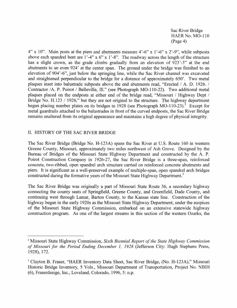
4" x 10". Main posts at the piers and abutments measure 4' -6" x 1 '-6" x 2' -9", while subposts above each spandrel bent are 1 '-4" x 6" x 1 '-8". The roadway across the length of the structure has a slight crown, as the grade climbs gradually from an elevation of 923'-3" at the end abutments to an even 924' at the center span. The ground under the bridge was finished to an elevation of 904'-6", just below the springing line, while the Sac River channel was excavated and straightened perpendicular to the bridge for a distance of approximately 650'. Two metal plaques inset into balustrade subposts above the end abutments read, "Erected/ A. D. 1926. / Contractor / A. P. Poirot / Belleville, Ill." (see Photograph M0-110-22). Two additional metal plaques placed on the endposts at either end of the bridge read, "Missouri / Highway Dept / Bridge No. H.123 / 1926," but they are not original to the structure. The highway department began placing number plates on its bridges in 1928 (see Photograph M0-110-23).2 Except for metal guardrails attached to the balustrades in front of the curved endposts, the Sac River Bridge remains unaltered from its original appearance and maintains a high degree of physical integrity.
II. HISTORY OF THE SAC RIVER BRIDGE
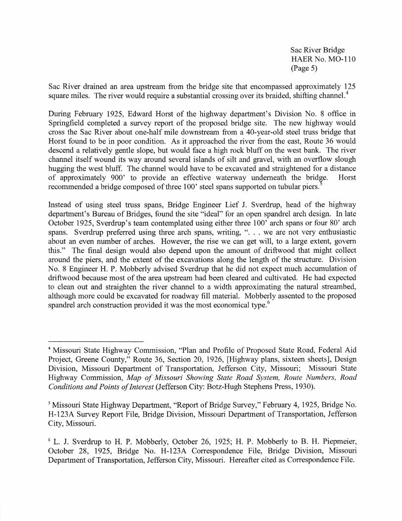
The Sac River Bridge (Bridge No. H-123A) spans the Sac River at U.S. Route 160 in western Greene County, Missouri, approximately two miles northwest of Ash Grove. Designed by the Bureau of Bridges of the Missouri State Highway Department and constructed by the A. P. Poirot Construction Company in 1926-27, the Sac River Bridge is a three-span, reinforced concrete, two-ribbed, open spandrel arch structure carried on reinforced concrete abutments and piers. It is significant as a well-preserved example of multiple-span, open spandrel arch bridges constructed during the formative years of the Missouri State Highway Department.3
The Sac River Bridge was originally a part of Missouri State Route 36, a secondary highway connecting the county seats of Springfield, Greene County, and Greenfield, Dade County, and continuing west through Lamar, Barton County, to the Kansas state line. Construction of the highway began in the early 1920s as the Missouri State Highway Department, under the auspices of the Missouri State Highway Commission, embarked on an extensive statewide highway construction program. As one of the largest streams in this section of the western Ozarks, the
2 Missouri State Highway Commission, Sixth Biennial Report of the State Highway Commission of Missouri for the Period Ending December 1, 1928 (Jefferson City: Hugh Stephens Press, 1928), 172.
3 Clayton B. Fraser, "HAER Inventory Data Sheet, Sac River Bridge, (No. H-123A)," Missouri Historic Bridge Inventory, 5 Vols., Missouri Department of Transportation, Project No. NBIH (6), Fraserdesign, Inc., Loveland, Colorado, 1996, 5: n.p.
Sac River Bridge HAER No. M0-110 (Page 5)
Sac River drained an area upstream from the bridge site that encompassed approximately 125 square miles. The river would require a substantial crossing over its braided, shifting channel.4
During February 1925, Edward Horst of the highway department's Division No. 8 office in Springfield completed a survey report of the proposed bridge site. The new highway would cross the Sac River about one-half mile downstream from a 40-year-old steel truss bridge that Horst found to be in poor condition. As it approached the river from the east, Route 36 would descend a relatively gentle slope, but would face a high rock bluff on the west bank. The river channel itself wound its way around several islands of silt and gravel, with an overflow slough hugging the west bluff. The channel would have to be excavated and straightened for a distance of approximately 900' to provide an effective waterway underneath the bridge. Horst recommended a bridge composed of three 100' steel spans supported on tubular piers. 5
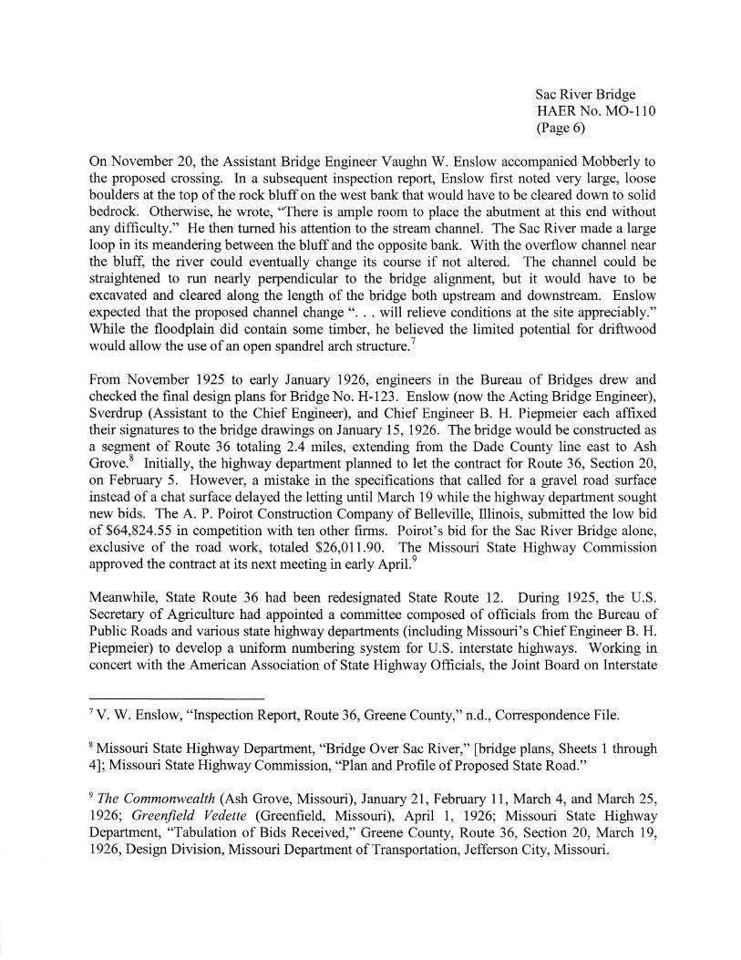
Instead of using steel truss spans, Bridge Engineer Lief J. Sverdrup, head of the highway department's Bureau of Bridges, found the site "ideal" for an open spandrel arch design. In late October 1925, Sverdrup's team contemplated using either three 100' arch spans or four 80' arch spans. Sverdrup preferred using three arch spans, writing, " ... we are not very enthusiastic about an even number of arches. However, the rise we can get will, to a large extent, govern this." The final design would also depend upon the amount of driftwood that might collect around the piers, and the extent of the excavations along the length of the structure. Division No. 8 Engineer H.P. Mobberly advised Sverdrup that he did not expect much accumulation of driftwood because most of the area upstream had been cleared and cultivated. He had expected to clean out and straighten the river channel to a width approximating the natural streambed, although more could be excavated for roadway fill material. Mobberly assented to the proposed spandrel arch construction provided it was the most economical type. 6
4 Missouri State Highway Commission, "Plan and Profile of Proposed State Road, Federal Aid Project, Greene County," Route 36, Section 20, 1926, [Highway plans, sixteen sheets], Design Division, Missouri Department of Transportation, Jefferson City, Missouri; Missouri State Highway Commission, Map of Missouri Showing State Road System, Route Numbers, Road Conditions and Points of Interest (Jefferson City: Botz-Hugh Stephens Press, 1930).
5 Missouri State Highway Department, "Report of Bridge Survey," February 4, 1925, Bridge No. H-123A Survey Report File, Bridge Division, Missouri Department of Transportation, Jefferson City, Missouri.
6 L. J. Sverdrup to H. P. Mobberly, October 26, 1925; H. P. Mobberly to B. H. Piepmeier, October 28, 1925, Bridge No. H-123A Correspondence File, Bridge Division, Missouri Department of Transportation, Jefferson City, Missouri. Hereafter cited as Correspondence File.
Sac River Bridge HAER No. M0-110 (Page 6)
On November 20, the Assistant Bridge Engineer Vaughn W. Enslow accompanied Mobberly to the proposed crossing. In a subsequent inspection report, Enslow first noted very large, loose boulders at the top of the rock bluff on the west bank that would have to be cleared down to solid bedrock. Otherwise, he wrote, "There is ample room to place the abutment at this end without any difficulty." He then turned his attention to the stream channel. The Sac River made a large loop in its meandering between the bluff and the opposite bank. With the overflow channel near the bluff, the river could eventually change its course if not altered. The channel could be straightened to run nearly perpendicular to the bridge alignment, but it would have to be excavated and cleared along the length of the bridge both upstream and downstream. Enslow expected that the proposed channel change" ... will relieve conditions at the site appreciably." While the floodplain did contain some timber, he believed the limited potential for driftwood would allow the use of an open spandrel arch structure. 7
From November 1925 to early January 1926, engineers in the Bureau of Bridges drew and checked the final design plans for Bridge No. H-123. Enslow (now the Acting Bridge Engineer), Sverdrup (Assistant to the Chief Engineer), and Chief Engineer B. H. Piepmeier each affixed their signatures to the bridge drawings on January 15, 1926. The bridge would be constructed as a segment of Route 36 totaling 2.4 miles, extending from the Dade County line east to Ash Grove.8 Initially, the highway department planned to let the contract for Route 36, Section 20, on February 5. However, a mistake in the specifications that called for a gravel road surface instead of a chat surface delayed the letting until March 19 while the highway department sought new bids. The A. P. Poirot Construction Company of Belleville, Illinois, submitted the low bid of $64,824.55 in competition with ten other firms. Poirot's bid for the Sac River Bridge alone, exclusive of the road work, totaled $26,011.90. The Missouri State Highway Commission approved the contract at its next meeting in early April.9
Meanwhile, State Route 36 had been redesignated State Route 12. During 1925, the U.S. Secretary of Agriculture had appointed a committee composed of officials from the Bureau of Public Roads and various state highway departments (including Missouri's Chief Engineer B. H. Piepmeier) to develop a uniform numbering system for U.S. interstate highways. Working in concert with the American Association of State Highway Officials, the Joint Board on Interstate
7 V. W. Enslow, "Inspection Report, Route 36, Greene County," n.d., Correspondence File.
8 Missouri State Highway Department, "Bridge Over Sac River," [bridge plans, Sheets 1 through 4]; Missouri State Highway Commission, "Plan and Profile of Proposed State Road."
9 The Commonwealth (Ash Grove, Missouri), January 21, February 11, March 4, and March 25, 1926; Greenfield Vedette (Greenfield, Missouri), April 1, 1926; Missouri State Highway Department, "Tabulation of Bids Received," Greene County, Route 36, Section 20, March 19, 1926, Design Division, Missouri Department of Transportation, Jefferson City, Missouri.

Sac River Bridge HAER No. M0-110 (Page 7)
Highways largely completed its work by late 1925. Consequently, in early 1926 an interstate highway in northern Missouri became a part of U.S. Route 36, while former State Route 36 in southwest Missouri became State Route 12. 10 Nevertheless, highway department correspondence continued to refer to the Sac River Bridge project as Route 3 6, Section 20. 11
The A. P. Poirot Construction Company, represented by a Mr. Chister, began their work in early May 1926, shipping several carloads of machinery by rail into Ash Grove. 12 One major problem occurred at the outset when unexpected conditions forced a redesign of Abutment No. 1 on the west bank. On June 17, Division Engineer Mobberly informed Sverdrup, "The outline of the rock is so much different from the soundings shown on the bridge survey that I am sending you this sketch for a re-design of this abutment and would like to have the new design forwarded as soon as possible as the contractors are at work."13 The rough sketches depicted a rock overhang at the rear of the abutment site that would have to be removed. While the bridge engineers hurriedly drew a new design of the abutment, Sverdrup inquired by telegram on June 23 whether they could shift the bridge location slightly, but evidently the work on the other piers had already progressed too far. In order for the arch buttresses to be cast against solid rock, it became necessary to lengthen the footings, the buttresses, and the depth of the wingwalls. The new design, sent to Mobberly on July 3, considerably lengthened the arch buttresses at Abutment No. 1 from 8'-6" as planned to as much as 15'-3" at the northern buttress. (Alteration of the design was subsequently reflected by the bridge designation H-123A). 14 Later correspondence revealed that the additional rock excavation amounted to more than ninety-seven cubic yards, and no doubt caused some delay in the completion of the bridge. As Mobberly noted, "The [rock excavation] work could have been done considerably cheaper if the contractor had been properly equipped .... " 15
10 A. E. Johnson, ed., AASHO: The First Fifty Years, 1914-1964 (Washington, D.C.: American Association of State Highway Officials, 1965), 139-143; Greenfield Vedette, February 11, 1926.
11 Correspondence File, passim.
12 The Commonwealth, April 29 and May 13, 1926.
13 H. P. Mobberly to B. H. Piepmeier, June 17, 1926, Correspondence File.
14 "Sketch showing solid rock lines at Abutment No. 1 site," June 15, 1926, Bridge No. H-123A Survey Report File; H. P. Mobberly to B. H. Piepmeier, June 17, 1926; L. J. Sverdrup to H. P. Mobberly, June 23, 1926; B. H. Piepmeier to H.P. Mobberly, July 3, 1926, Correspondence File; Missouri State Highway Department, "Bridge Over Sac River," Sheets 3 and 5.
15 H.P. Mobberly to T. H. Cutler, May 27, 1927; T. H. Cutler to H.P. Mobberly, June 7, 1927, Correspondence File.
Sac River Bridge HAER No. M0-110 (Page 8)
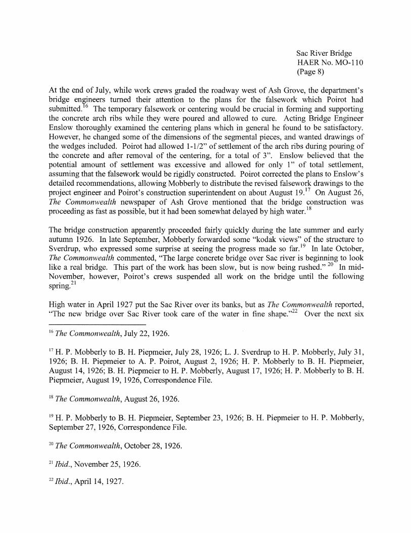
At the end of July, while work crews graded the roadway west of Ash Grove, the department's bridge en?!neers turned their attention to the plans for the falsework which Poirot had submitted. 6 The temporary falsework or centering would be crucial in forming and supporting the concrete arch ribs while they were poured and allowed to cure. Acting Bridge Engineer Enslow thoroughly examined the centering plans which in general he found to be satisfactory. However, he changed some of the dimensions of the segmental pieces, and wanted drawings of the wedges included. Poirot had allowed 1-1/2" of settlement of the arch ribs during pouring of the concrete and after removal of the centering, for a total of 3". Enslow believed that the potential amount of settlement was excessive and allowed for only 1" of total settlement, assuming that the falsework would be rigidly constructed. Poirot corrected the plans to Enslow's detailed recommendations, allowing Mobberly to distribute the revised falsework drawings to the project engineer and Poirot's construction superintendent on about August 19.17 On August 26, The Commonwealth newspaper of Ash Grove mentioned that the bridge construction was proceeding as fast as possible, but it had been somewhat delayed by high water. 18
The bridge construction apparently proceeded fairly quickly during the late summer and early autumn 1926. In late September, Mobberly forwarded some "kodak views" of the structure to Sverdrup, who expressed some surprise at seeing the progress made so far. 19 In late October, The Commonwealth commented, "The large concrete bridge over Sac river is beginning to look like a real bridge. This part of the work has been slow, but is now being rushed." 20 In midNovember, however, Poirot's crews suspended all work on the bridge until the following spring.21
High water in April 1927 put the Sac River over its banks, but as The Commonwealth reported, "The new bridge over Sac River took care of the water in fine shape."22 Over the next six
16 The Commonwealth, July 22, 1926.
17 H.P. Mobberly to B. H. Piepmeier, July 28, 1926; L. J. Sverdrup to H.P. Mobberly, July 31, 1926; B. H. Piepmeier to A. P. Poirot, August 2, 1926; H. P. Mobberly to B. H. Piepmeier, August 14, 1926; B. H. Piepmeier to H. P. Mobberly, August 17, 1926; H. P. Mobberly to B. H. Piepmeier, August 19, 1926, Correspondence File.
18 The Commonwealth, August 26, 1926.
19 H.P. Mobberly to B. H. Piepmeier, September 23, 1926; B. H. Piepmeier to H.P. Mobberly, September 27, 1926, Correspondence File.
20 The Commonwealth, October 28, 1926.
21 Ibid., November 25, 1926.
22 Ibid., April 14, 1927.

Sac River Bridge HAER No. M0-110 (Page 9)
months, as inferred from occasional, brief reports in The Commonwealth, the A. P. Poirot Construction Company focused on the remaining roadwork. On May 12 the newspaper reported that the graveling from the Dade County line to a canning factory outside of town was almost complete. Another section from Ash Grove to a lime company's lake would be finished soon. Poirot's crews were then building up the roadway fill at the bridge's east approach, using borrow material obtained from the river channel excavations. In its June 23 issue, the newspaper again stated the graveling was finished from the Dade County line to the Sac River Bridge, and from the lime company plant east to the canning factory. On September 8, Poirot estimated he would finish the job in two or three weeks. Finally, on October 20, The Commonwealth announced that the section of Route 12 from Dade County to Ash Grove had opened on Tuesday, October 18, 1927.23
In 1930, State Route 12 became a part of U.S. Route 160, which continued west from southwest Missouri into southern Kansas. In 1934, a five-mile section of Route 160 in western Greene County received a bituminous mat surface over its gravel roadbed. In 1952, a redesignation of other state routes extended U.S. Route 160 easterly from Springfield to Poplar Bluff, Missouri.24
The Sac River Bridge (Bridge No. H-123A) carried traffic on Route 160 for approximately seventy-five years before the Missouri Department of Transportation developed plans to replace the structure. The bridge remained in good condition but its relatively narrow width of 20' compared to modem standards rendered it functionally obsolete. Proposed plans initially called for a new bridge sited about 150' upstream from the old bridge, and the realignment of the roadway accordingly. On January 13, 2005, the project development core team based in the District 8 office in Springfield re-examined the purpose and need of the proposed bridge replacement project. Led by Transportation Project Manager Jim Hartman, the core team members decided that despite its narrow width, Bridge No. H-123A did not warrant replacement and would remain in use indefinitely. Team members found the bridge to be structurally sound, with a very low accident rate, and also recognized its historical significance. The core team decided that realigning a curve west of the bridge and two curves east of the bridge would significantly address most safety concerns. The roadway realignments would allow the narrow bridge to handle traffic more safely. The core team also concluded that a desired widening of the bridge deck, which would necessitate the removal of the concrete curbs and balustrades, may not be technically feasible on a bridge of this type. The possibility of widening the deck may be re-
23 Ibid., May 12, June 23, September 8, and October 20, 1927.
24 "Change of Route Numbers," July 8, 1930; "Extension of Route 160," September 9, 1952, in Minutes of Proceedings of Missouri State Highway Commission, 1919-present, Secretary's Office, Missouri State Highway Commission, Jefferson City, Missouri; Missouri Department of Transportation, Route 160 Construction History [map], Design Division, Missouri Department of Transportation, Jefferson City, Missouri.
Sac River Bridge HAER No. M0-110
(Page 10)
examined at a future date should it become necessary for safety reasons. Therefore, the Sac River Bridge will remain in place with no major alterations, and will continue to carry Route 160 traffic for the foreseeable future. 25
III. A. P. POIROT CONSTRUCTION COMPANY
Aloys P. Poirot, contractor for the Sac River Bridge, formed the A. P. Poirot Construction Company in 1919. Born in Belleville, St. Clair County, Illinois, in 1883, Poirot was the son of Severin and Susie (Gundlach) Poirot. Aloys Poirot graduated from the University of Illinois in 1906 with an engineering degree.26 His first known work as an independent contractor came in June 1917 when he received a $6,118 contract from the Illinois State Highway Commission to construct several bridges in Perry County. Several months later in September 1917 he received another contract to construct a bridge in Shiloh Valley Township in St. Clair County. A year later in August 1918, Poirot was awarded a $3,293 contract to construct a bridge on Old St. Louis Road, in the East St. Louis area. These achievements led to the organization of the A. P. Poirot Construction Company in 1919. In 1921, the company erected a reinforced concrete bridge on North Second Street in Belleville for $3,225. In 1922, at the age of 39, Aloys Poirot married Anne L. Voigt. 27
Except for the Sac River Bridge in southwest Missouri, the known work conducted by the A. P. Poirot Construction Company remained concentrated in southwest Illinois. Throughout the 1920s, the company continued to contract with the cities of Belleville and O'Fallon for various street and alley paving projects.28 In 1923, the company erected a bridge over Richland Creek on North Illinois Street in Belleville for approximately $13,000.29
25 Jim Hartman, "Core Team Meeting Minutes," January 13, 2005, in Job No. J8P0561, Greene County, Route 160, Project File, Design Division, Missouri Department of Transportation, Jefferson City, Missouri.
26 Belleville Daily Advocate (Belleville, Illinois), November 9, 1939.
27 Ibid., June 28, September 24, 1917, August 6, 1918, August 13, 1921, and November 9, 1939.
28 Ibid., November 4, 1922; January 8, January 24, February 12, November 1, 1923; July 2, July 16, September 2, 1924; June 23, August 10, August 22, 1925; June 23, August 4, October 1, October 29, 1927; April 28, May 28, June 11, July 20, September 12, 1928; and June 3, October 10, November 6, 1929.
29 Ibid., July 28, 1923 and January 12, 1924.
Sac River Bridge HAER No. M0-110
(Page 11)
Other civil engineering work involved local water system projects. In 1924, Poirot was awarded a contract to construct a water filtration plant in New Athens, Illinois. In 1931, the A. P. Poirot Construction Company provided a water tank and concrete reservoir for the Millstadt, Illinois, water company, and in 1932 constructed Millstadt's water distribution system. In 1935, Poirot's company built a water filtration plant in Sparta, Illinois, for a bid of $21,650. In 1936, Poirot was contracted to construct a waterworks facility in Okawville, Illinois. 30
In addition to his interests in his construction company, Aloys Poirot owned a rice plantation in Arkansas and was a director of the St. Clair National Bank of Belleville. Poirot died of cancer in November 1939 at the age of 56 and was interred in Green Mount Cemetery in Belleville.31 The Sac River Bridge is the only bridge in Missouri known to have been built by the A. P. Poirot Construction Company. 32
IV. RIBBED, OPEN SP ANDREL ARCH BRIDGES IN MISSOURI
When designed in late 1925, the Sac River Bridge represented one of the first bridges of its type to be built by the Missouri State Highway Department. Created in 1913, the highway department established its Bureau of Bridges in 1917. The new bureau's first priority was to produce standardized designs of bridges and culverts for county road projects. By the end of 1920, the bridge bureau had developed two dozen standard designs for concrete superstructures, but all for spans of less than 50'. Longer spans required individual designs specific to their locations. The bureau's bridge engineers began to routinely combine various substructure and superstructure components, altering general designs to fit a particular crossing. During 1922, when the highway department assumed a broader authority to construct and maintain a state highway system, the Bureau of Bridges produced specialized designs for 293 new bridges, while also revising the standard bridge plans and specifications to conform to those of the Bureau of Public Roads. In 1923, the number of special bridge designs grew to 405. Within the two-year period ending in December 1926, the bridge bureau supplied 450 new bridge designs for the state highway system. It had by then adopted a prudent policy of selecting the most cost-effective structural type for each crossing: "All bridge surveys are carefully studied to determine the best and most economical structure for each crossing. Alternate layouts are made to determine the
30 Ibid., October 9, 1924, August 22, 1931, March 9, 1932, and August 24, 1935.
31lbid., November 9, 1939; St. Louis Post-Dispatch, November 10, 1939; St. Louis GlobeDemocrat, November 10, 1939.
32 Fraser, Missouri Historic Bridge Inventory, 1: 83-139, passim.
Sac River Bridge HAER No. M0-110
(Page 12)
most economical combination of span length and types. Proper consideration is also given at this time to adequacy of opening, both for waterway and for passage of drift. "33
As a particular structural type, reinforced concrete, multiple-ribbed (as opposed to continuousribbed), open spandrel arch bridges first appeared in the early 1900s. In 1906, George S. Webster and Henry H. Quimby of the Department of Public Works in Philadelphia, Pennsylvania, completed their design of the Walnut Lane Bridge over Wissahickon Creek in Fairmount Park. Completed in 1908, the two-ribbed arch bridge featured a main span of 233' with a rise of over 70'. Eight spandrel arches above the ribs supported the bridge deck. While structurally similar to a European stone arch bridge, the Walnut Lane Bridge was the longest concrete arch bridge constructed up to that time. However, it made minimal use of reinforcing steel, instead using stone rubble embedded in the concrete, and was essentially an unreinforced or massed concrete structure. Nevertheless, it helped to establish the use of concrete as an economical and pliable material for bridge construction. 34
By 1910, only four open spandrel concrete bridges in the United States had span lengths greater than 175'. Long spans typically relied on a continuous rib that extended the width of the structure, while shorter spans generally employed filled spandrel arch designs. Inspired by the well-publicized Walnut Lane Bridge, additional multiple-ribbed, open spandrel arch designs began to appear around 1910. They required less construction material than continuous-ribbed bridges. Within Missouri, the first three documented examples of multiple-ribbed arch bridges appeared in 1917 in both Kansas City, Jackson County, and in Excelsior Springs, Clay County. These included the Twenty-seventh Street Viaduct in Kansas City, built with a central arch span 120' long with flanking deck girders, the Troost Avenue Bridge, with one arch span of74', and in Excelsior Springs, the Garland Street Bridge with one arch span of 68'. The Marietta Street Bridge, built in Excelsior Springs in about 1920, featured one arch span of 72'. The Sebree
33 State Highway Board of Missouri, Report of the State Highway Board of Missouri for the Period Ending December 1, 1918 (Jefferson City: Hugh Stephens Company, Printers, 1918), 100-101; State Highway Board of Missouri, Report of the State Highway Board of Missouri for the Period Ending December 1, 1920 (Jefferson City: Hugh Stephens Company, Printers, 1920), 8, 129; Missouri State Highway Commission, Third Biennial Report of the State Highway Commission of Missouri for the Period Ending December 1, 1922 (Jefferson City: Hugh Stephens Company, Printers, 1922), 128; Quote from Missouri State Highway Commission, Fifth Biennial Report of the State Highway Commission of Missouri for the Period Ending December 1, 1926 (Jefferson City: Hugh Stephens Press, 1926), 140.
34 Helen P. Ross, "Walnut Lane Bridge, Pennsylvania Historic Bridges Recording Project-II, Spanning Wissahickon Creek at Walnut Lane (State Route 4013), Philadelphia, Philadelphia County, Pennsylvania, HAER No. PA-504," Historic American Engineering Record, National Park Service, Washington, D.C., 1998, revised by Justin M. Spivey, 2001, 1-8.

Sac River Bridge HAER No. M0-110
(Page 13)
Bridge in Kansas City, designed by Harrington, Howard and Ash in 1921, combined three 80-foot open spandrel arch spans and five arched deck girder spans. Thus by that time, engineers had successfully combined reinforced concrete technology with multiple-ribbed, open spandrel arch designs. 35
The Missouri State Highway Department began designing multiple-ribbed, open spandrel arch bridges in 1925. In April, the department's Bureau of Bridges completed the design for the Bull Creek Bridge (Bridge No. H-39) in Taney County. It featured three, two-ribbed arch spans each 80' long with a rise from the springing line to the intrados of 16'. Carried on reinforced concrete abutments and piers, it had a roadway width of 20' with a climbing grade of 2.24 percent. While it was under construction, the department provided the contractor with falsework design plans for a continuous-ribbed, filled spandrel arch bridge because that was the best illustration they could provide at the time. Ultimately, the contractor and the department's bridge engineers collaborated in designing suitable falsework plans for the highway department's first multipleribbed structure.36 At about the same time in early 1925, the bridge bureau designed the Sinking Creek Bridge (Bridge No. H-79) in Shannon County. It also featured three, two-ribbed arch spans of 80' with concrete deck girder approach spans, but with a narrower roadway 18' wide.37
The Sac River Bridge (Bridge No. H-123) incorporated design elements similar to these first two bridges. Namely, they shared elliptical arch ribs of equal lengths which tapered toward the crown, spandrel bents spaced symmetrically along the lengths of the ribs, fluting on the pier columns and abutment pilasters, and reinforced concrete balustrades interrupted by posts and subposts. Most later examples also incorporated these same design elements. Some of these features originated from the highway department's earlier filled spandrel arch bridge designs. 38
35 Fraser, "Concrete Open Spandrel Arches," Missouri Historic Bridge Inventory, 1: 139-140.
36 David C. Austin, "Bull Creek Bridge, Bridge No. H-39, Taney County, Route 160, Project No. J8P0612," Cultural Resources Section, Design Division, Missouri Department of Transportation, Jefferson City, Missouri, 2001, 1-7.
37 Fraser, "HAER Inventory Data Sheet, Sinking Creek Bridge, (No. H-79)," Missouri Historic Bridge Inventory, Vol. 5: n.p.
38 Fraser, "Concrete Open Spandrel Arches," Missouri Historic Bridge Inventory, 1: 139-140; David Quick, "Early Twentieth Century Concrete Bridge Engineering and Aesthetics in the United States and the Y-Bridge at Galena, Missouri," Material Culture 22 (2) (Summer 1990), 32. For an example of a filled spandrel arch bridge designed by the Missouri State Highway Department, see David C. Austin, "Meramec River Bridge Spanning the Meramec River at Missouri State Route 19, Steelville vicinity, Crawford County, Missouri, HAER No. M0-109," Historic American Engineering Record, National Park Service, Washington, D.C., 1999.

Sac River Bridge HAER No. M0-110
(Page 14)
The Missouri State Highway Department's Bureau of Bridges continued to regularly employ ribbed, open spandrel arch bridges to about 1933, with a few late examples appearing in 1943 and 1946. These bridges incorporated up to five arch spans, with each span usually ranging from 80' to 150' in length. The Branson Bridge (Bridge No. J-705R) spanning Lake Taneycomo in Taney County is perhaps the most distinguished of Missouri's remaining concrete arch structures. Designed in 1931, the bridge consists of five, two-ribbed open spandrel arch spans each 195' long, flanked by concrete deck girder approach spans. A redesign in this case replaced the fluting in the pier columns with recessed ranels, an embellishment repeated in the reconfigured spandrel bents and balustrade posts.3 The 195-foot span length of the Branson Bridge was surpassed a few years earlier, however, with the Osage River Bridge at Osceola, St. Clair County. Completed in December 1928, it had a single, two-ribbed, open spandrel arch span 225' long, coupled with eight concrete girder spans.40
Most of Missouri's open spandrel arch bridges shared the same general design found in the Sac River Bridge. One critic analyzed a similar open spandrel arch bridge, the Galena "Y" Bridge in Stone County, also completed in 1927. He categorized the design as "Classical Modeme, a subcategory of Art Deco." Stylistically, he found that these bridges reflected traditional, as opposed to Modernist, design: "Even though these bridges represent modem economic developments and are constructed of [modem] materials and by modem techniques, these bridges are not stylistically modem and they represent conservative structural concepts." The decorative elements are also viewed as conservative expressions that enhance the balanced symmetry. "[F]lutes, balusters and so forth ... further elaborate the already repetitive, rhythmic character of the arches and columns, and give the bridge a more human and comfortable scale while at the same time enhancing an overall sense of monumental order. This order evokes a sense of the ancient and continuing tradition of classical design." The traditional design is nevertheless viewed as suitable. Overall, it invokes ". . . a language of form appropriate to a government sponsored project and one which would have been reassuring for the conservative inhabitants of an area [southwest Missouri] undergoing great social and economic change."41
39 Fraser, "Concrete Open Spandrel Arches," Missouri Historic Bridge Inventory, 1: 139-140; "HAER Inventory Data Sheet, Branson Bridge, (No. J-705R)," Missouri Historic Bridge Inventory, Vol. 5: n.p.
40 Missouri State Highway Commission, Sixth Biennial Report, 171; Robert L. Hayden, "Osage River Bridge Spanning the Osage River, Osceola, St. Clair County, Missouri, HAER No. M0-17," Historic American Engineering Record, National Park Service, Washington, D.C., 1978.
41 Quick, "Early Twentieth Century Concrete Bridge Engineering," 32-33.
Sac River Bridge HAER No. M0-110
(Page 15)
Most of Missouri's concrete arch bridges were built within the Ozark region in the south half of the state.42 An apparent reason for this regional concentration is the abundant supplies of sand and gravel found in Ozark stream.beds. The Missouri State Highway Department realized the potential usefulness of these natural materials at an early date, as stated in a 1924 report: "It is generally recognized that southern Missouri has an abundant supply of good road materials. All through the Ozark territory, the streams are filled with a good grade of road gravel and in many cases a quality of gravel suitable for concrete work."43 With an emphasis on economy, the highway department often used these on-site materials as concrete aggregates. In the case of Shannon County's Eminence Bridge, for example, records documented that both the fine and course aggregates used in that concrete arch structure had been taken directly from the Jacks Fork River at the bridge site.44 It is unknown if this occurred with the Sac River Bridge in Greene County. However, a ready source of both cement and aggregate would have been available through the Ash Grove Lime and Portland Cement Company located between Ash Grove and the Sac River. In March 1926, spurred by the approaching construction work on Route 36, the cement company announced its plans to install a rock crusher at its plant site to produce gravel and stone aggregate. The company may well have supplied the concrete and aggregate materials used in the Sac River Bridge.45
The Sac River Bridge is significant as one of the earliest examples of a reinforced concrete, tworibbed, open spandrel arch bridge designed by the Bureau of Bridges of the Missouri State Highway Department. Designed in late 1925 and completed in 1927, the Sac River Bridge is typical of its type. Consisting of three 100-foot elliptical arch spans, it characteristically imparts a balanced, symmetrical appearance in elevation. The decorative fluting and corbelling also appear in elevation, obscured from general view. Spanning the upper Sac River in an unremarkable rural setting, the Sac River Bridge was designed as part of an inter-county seat, secondary state highway. Although it imparts a sense of an aesthetic, the bridge's design and construction reflect a broader purpose of providing an economical and effective modem river crossing for an emerging state highway system.
42 Fraser, "Concrete Open Spandrel Arches," 139.
43 Missouri State Highway Commission, Fourth Biennial Report of the State Highway Commission of Missouri for the Period Ending December 1, 1924 (Jefferson City: Hugh Stephens Press, 1924), 64.
44 David C. Austin, "Eminence Bridge (Jacks Fork Bridge), Bridge No. K-209, Shannon County, Route 19," Cultural Resources Section, Design Division, Missouri Department of Transportation, Jefferson City, Missouri, 2002, 1-3.
45 The Commonwealth, March 18, 1926.
Sac River Bridge HAER No. M0-110 (Page 16)
E
' )
) ,~
\r-" I, :\'' r:. < l .
i,r~~; .. ··· -------~--------\·· ... > ......... _____ .i.. .... Adapted from U.S. Geological Survey, Ash Grove, Missouri, Quadrangle, 7.5 minute series, 1956, Photorevised 1975. 0 1 111••-===::J•••ic:===-••lllli Miles

Sac River Bridge HAER No. M0-110 (Page 17)

I-z w :!it 1-n: < a. •w a >" < ~-
:x: w i: I.I.I 1-
l < 1-U'l
ti ii. ' ::)
~ I 0 II) k ,; II) ! ~ i i ;;
i l ,. ~ 1 l \It
~ : ' t
'it
Sac River Bridge HAER No. M0-110 (Page 18)
i " ·, •, t )
i I ~
"' l ,, ~
~
i ~ ,,
~.$
ti
'· I I ti l t{ ~ .. ~ l ' h } kl
4;
Sac River Bridge HAER No. M0-110 (Page 19)
I
I ~
()! l'l" ~ "t it
~ ~ I ~ ;q
I ~! I
i I,! t
IH ..

Sac River Bridge HAER No. M0-110 (Page 20)
... z w :& .... a:: < Iii Q >-< jl:·. :I:! S! :c w ... < ... i:11
ii: ! 5 ~ i
ti
ft t "
Sac River Bridge HAER No. M0-110 (Page 21)
i l \\: .. i !
.. ~
J ! f 1! h ~-t Ji i ..
I ".'. t,i· * lit :3 i ij
@i~
'"' ""' t: ~= ~e ,~ j
REFERENCES CITED
A. PRIMARY SOURCES
Sac River Bridge HAER No. M0-110
(Page 22)
Missouri Department of Transportation. Route 160 Construction History [map]. Missouri Department of Transportation, Design Division, Jefferson City, Missouri, n.d.
____ . Job No. J8P0561, Greene County, Route 160, Project File. Missouri Department of Transportation, Design Division, Jefferson City, Missouri, n.d.
Missouri State Highway Commission. Map of Missouri Showing State Road System, Route Numbers, Road Conditions, and Points of Interest. Jefferson City: Botz-Hugh Stephens Press, 1930.
____ . Minutes of Proceedings of Missouri State Highway Commission. Missouri State Highway Commission, Secretary's Office, Jefferson City, Missouri, 1919-present.
____ . "Plan and Profile of Proposed State Road, Federal Aid Project, Greene County." Route 36, Section 20, 1926 [Highway plans, sixteen sheets]. Missouri Department of Transportation, Design Division, Jefferson City, Missouri.
____ . Third Biennial Report of the State Highway Commission of Missouri for the Period Ending December 1, 1922. Jefferson City: Hugh Stephens Company, Printers, 1922.
____ . Fourth Biennial Report of the State Highway Commission of Missouri for the Period Ending December 1, 1924. Jefferson City: Hugh Stephens Press, 1924.
____ . Fifth Biennial Report of the State Highway Commission of Missouri for the Period Ending December 1, 1926. Jefferson City: Hugh Stephens Press, 1926.
____ . Sixth Biennial Report of the State Highway Commission of Missouri for the Period Ending December 1, 1928. Jefferson City: Hugh Stephens Press, 1928.
Missouri State Highway Department. Bridge No. H-123A Survey Report File, 1925-1926. Missouri Department of Transportation, Bridge Division, Jefferson City, Missouri.
____ . "Bridge Over Sac River," January 15, 1926 [Bridge plans, five sheets]. Missouri Department of Transportation, Bridge Division, Jefferson City, Missouri.
___ . Bridge No. H-123A Correspondence File, 1925-1927. Missouri Department of Transportation, Bridge Division, Jefferson City, Missouri.
Sac River Bridge HAER No. M0-110
(Page 23)
____ . "Tabulation of Bids Received." Greene County, Route 36, Section 20, March 19, 1926. Missouri Department of Transportation, Design Division, Jefferson City, Missouri.
State Highway Board of Missouri. Report of the State Highway Board of Missouri for the Period Ending December 1, 1918. Jefferson City: Hugh Stephens Company, Printers, 1918.
____ . Report of the State Highway Board of Missouri for the Period Ending December 1, 1920. Jefferson City: Hugh Stephens Company, Printers, 1920.
U.S. Geological Survey. Ash Grove, Missouri, Quadrangle Map. 7.5 Minute Series. U.S. Geological Survey, U.S. Department of the Interior, Washington, D.C., 1956, photorevised 197 5.
B. NEWSPAPERS
Belleville Daily Advocate (Belleville, Illinois).
The Commonwealth (Ash Grove, Missouri).
Greenfield Vedette (Greenfield, Missouri).
St. Louis Globe-Democrat (St. Louis, Missouri).
St. Louis Post-Dispatch (St. Louis, Missouri).
C. SECONDARY SOURCES
Austin, David C. "Bull Creek Bridge, Bridge No. H-39, Taney County, Route 160, Project No. J8P0612." Missouri Department of Transportation, Design Division, Cultural Resources Section, Jefferson City, Missouri, 2001.
____ . "Meramec River Bridge, Spanning the Meramec River at Missouri State Route 19, Steelville vicinity, Crawford County, Missouri, HAER No. M0-109." Historic American Engineering Record, National Park Service, Washington, D.C., 1999.
___ . "Eminence Bridge (Jacks Fork Bridge), Bridge No. K-209, Shannon County, Route 19." Missouri Department of Transportation, Design Division, Cultural Resources Section, Jefferson City, Missouri, 2002.
Sac River Bridge HAER No. M0-110
(Page 24)
Fraser, Clayton B., comp. Missouri Historic Bridge Inventory. 5 Vols. Missouri Department of Transportation, Project No. NBIH (6). Fraserdesign, Inc., Loveland, Colarado, 1996.
Hayden, Robert L. "Osage River Bridge Spanning the Osage River, Osceola, St. Clair County, Missouri, HAER No. M0-17." Historic American Engineering Record, National Park Service, Washington, D.C., 1978.
Johnson, A. E., ed. AASHO: The First Fifty Years, 1914-1964. Washington, D.C.: American Association of State Highway Officials, 1965.
Quick, David. "Early Twentieth Century Concrete Bridge Engineering and Aesthetics in the United States and the Y-Bridge at Galena, Missouri." Material Culture 22 (2) (Summer 1990): 27-35.
Ross, Helen. "Walnut Lane Bridge, Pennsylvania Historic Bridges Recording Project-II, Spanning Wissahickon Creek at Walnut Lane (State Route 4013), Philadelphia, Philadelphia County, Pennsylvania, HAER No. P A-504." Historic American Engineering Record, National Park Service, Washington, D.C.,1998, revised by Justin M. Spivey, 2001.