santa fe county open space and trails … final_s.pdf · santa fe county open space and trails...
TRANSCRIPT

SANTA FE COUNTY OPEN SPACE AND TRAILS PROGRAM
LOS POTREROS OPEN SPACE MANAGEMENT PLAN
Ecotone
F I N A L D R A F TSEPTEMBER 13, 2016

ACKNOWLEDGMENTS
Santa Fe County / Los Potreros Open Space Management Plan
The planning team acknowledges the support and insights offered by the 2015-2016 Santa Fe County Board of Commissioners.
Henry Roybal – District 1
Miguel Chavez– District 2
Robert Anaya – District 3
Kathleen Holian – District 4
Liz Stefanics – District 5
Furthermore, the planning team wishes to acknowledge the support and insights offered by the County Open Lands, Trails, and Parks Advisory Committee (COLTPAC).
The extensive knowledge, effort and guidance from the County Open Space and Trails (OS&T) planning, project development, and maintenance staff was invaluable in developing this plan.
Maria Lohmann, OS&T Senior Planner,
Paul Olafson, Planning Project Manager
Erin Ortigoza, Senior Community Planner
Colleen Baker, OS&T Project Manager
Shane Martinez, OS&T Maintenance Technician Lead
Approximately twenty different people participated in the stakeholder input process for the Plan. Stakeholder input was particularly important in the planning process to confirm the network of stakeholders, identify critical land conservation issues, understand complicated land and water (acequia) management practices in the area, formulate a vision for the property, identify preferred land uses and management activities, verify Management Plan priorities, and obtain feedback on draft management plan language.
The planning team obtained stakeholder input in a variety of ways:
• Meetings, telephone interviews, e-mail communications, and field walks with approximately ten key-informants in the community
• Three community meetings at the Benny J. Chavez Community Center in Chimayo; between 8 and 14 people participated in each of the meetings
• A public review and input process of the public review draft version of the Management Plan; comments were summarized in a table and responses were formulated behind each one of the comments; six people submitted written comments on the Draft Management Plan.
The Los Potreros Open Space Management Plan was developed by a planning team led by Ecotone. The Ecotone planning team included:
Ecotone / team lead, ecologist
Jan-Willem Jansens
The Community Store / facilitator
Carl Moore, Jessie Lawrence
River Source / ecological planner
Richard Schrader, Carlos Herrera
Surrounding Studio / land planner
Faith Okuma , Sandra Donner,
Earth Analytics, Inc./ GIS planners
Wetherbee Dorshow, Tonya Fallis,
Kim Kearns

Santa Fe County / Los Potreros Open Space Management Plan
TABLE OF CONTENTS
1.0 INTRODUCTION
1.1. Plan Purpose and Need 1
1.2. Property Description 2
1.3. Management Plan Development Process 6
2.0 LOS POTREROS OPEN SPACE MANAGEMENT PLAN
2.1. A Vision + Goals for Los Potreros Open Space 9
2.2. Monitoring, and Information Management 11
2.3. Conceptual Master Plan 15
2.5. Terrain Management 25
2.6. Plan Implementation and Financing Mechanisms 28
LOS POTREROS OPEN SPACE APPENDICES
APPENDIX A: Overview of Management Activities Table for Los Potreros Open Space
APPENDIX B: A Field Characterization for the Los Potreros Open Space Property Santa Fe County, New Mexico - An Existing Conditions and Inventory Report
APPENDIX C: Assessment of Grazing Management Conditions and Alternative Grazing
APPENDIX D: Maintenance Plan for Los Potreros Open Space
APPENDIX E: Maintenance, Stewardship, and Restoration Projects for Year-1

Santa Fe County / Los Potreros Open Space Management Plan
Santa Fe County / Los Potreros Open Space Management Plan
EXECUTIVE SUMMARY
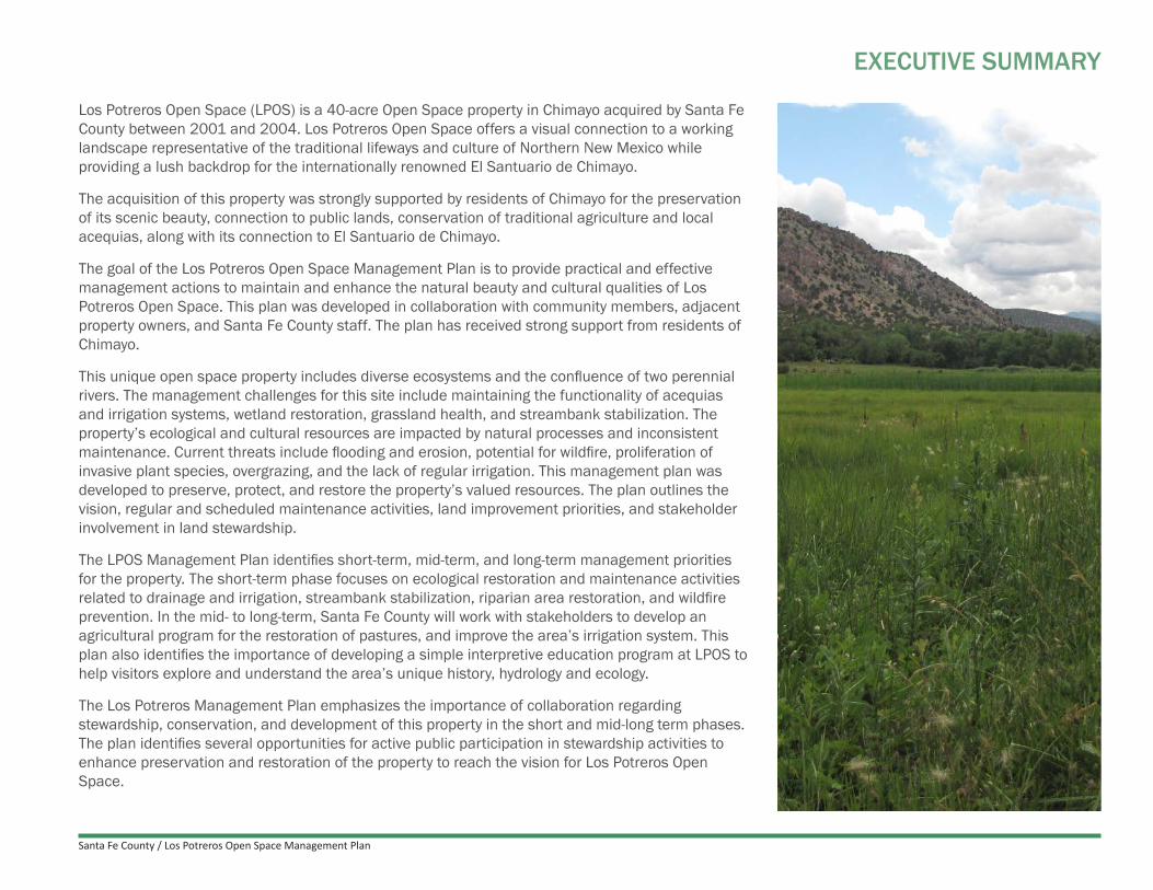
Los Potreros Open Space (LPOS) is a 40-acre Open Space property in Chimayo acquired by Santa Fe County between 2001 and 2004. Los Potreros Open Space offers a visual connection to a working landscape representative of the traditional lifeways and culture of Northern New Mexico while providing a lush backdrop for the internationally renowned El Santuario de Chimayo.
The acquisition of this property was strongly supported by residents of Chimayo for the preservation of its scenic beauty, connection to public lands, conservation of traditional agriculture and local acequias, along with its connection to El Santuario de Chimayo.
The goal of the Los Potreros Open Space Management Plan is to provide practical and effective management actions to maintain and enhance the natural beauty and cultural qualities of Los Potreros Open Space. This plan was developed in collaboration with community members, adjacent property owners, and Santa Fe County staff. The plan has received strong support from residents of Chimayo.
This unique open space property includes diverse ecosystems and the confluence of two perennial rivers. The management challenges for this site include maintaining the functionality of acequias and irrigation systems, wetland restoration, grassland health, and streambank stabilization. The property’s ecological and cultural resources are impacted by natural processes and inconsistent maintenance. Current threats include flooding and erosion, potential for wildfire, proliferation of invasive plant species, overgrazing, and the lack of regular irrigation. This management plan was developed to preserve, protect, and restore the property’s valued resources. The plan outlines the vision, regular and scheduled maintenance activities, land improvement priorities, and stakeholder involvement in land stewardship.
The LPOS Management Plan identifies short-term, mid-term, and long-term management priorities for the property. The short-term phase focuses on ecological restoration and maintenance activities related to drainage and irrigation, streambank stabilization, riparian area restoration, and wildfire prevention. In the mid- to long-term, Santa Fe County will work with stakeholders to develop an agricultural program for the restoration of pastures, and improve the area’s irrigation system. This plan also identifies the importance of developing a simple interpretive education program at LPOS to help visitors explore and understand the area’s unique history, hydrology and ecology.
The Los Potreros Management Plan emphasizes the importance of collaboration regarding stewardship, conservation, and development of this property in the short and mid-long term phases. The plan identifies several opportunities for active public participation in stewardship activities to enhance preservation and restoration of the property to reach the vision for Los Potreros Open Space.

Santa Fe County / Los Potreros Open Space Management Plan
Figure 1. View of Los Potreros Open Space - from south looking to north Source: Google Earth
CHIMAYO
EL SANTUARIO DE CHIMAYO
RIO SANTA CRUZ
BUREAU OF LAND MANAGEMENT
SR 96 / J
UAN MED
INA ROAD
RIO QUEMADO
N

Santa Fe County / Los Potreros Open Space Management Plan 1
1.0 INTRODUCTION
This Management Plan for the Los Potreros Open Space was developed with community members, neighbors, property owners and other stakeholders from the Chimayo area.
The planning team worked with them to formulate a vision for the Los Potreros Open Space and to verify the final plan components and priorities.
1.1. Plan Purpose and Need
The Los Potreros Open Space Management Plan was developed between June 2015 and May 2016. A Field Characterization report, a detailed Maintenance Plan, and a Planners’ Guide for County staff accompany the LPOS Management Plan. The Planners’ Guide describes technical planning methods, approaches to County capacity building, best management practices (BMPs), and guidance recommendations for plan implementation.
The LPOS Management Plan outlines a planning direction and specific action priorities, for short-term, mid-term, and long-term phases. The Plan was written for Santa Fe County staff, County policy makers, community stakeholders, and site stewards with the purpose to:
• Describe the vision, goals, and objectives for management of the property;• Help staff and the public understand terrain conditions and suitability of the land for different uses of the property;• Clarify priorities for site restoration and maintenance;• Identify projects for future investment and financing mechanisms to fund them;• Streamline management protocols within Santa Fe County.
The Plan was developed in response to a recommendation from the County Open Lands, Trails, and Parks Advisory Committee (COLTPAC) and with clear and strong support for enhanced management of open space properties from the Board of County Commissioners (BCC). The Plan arose from a growing need for:
• A strategic management plan that includes community outreach, a conceptual master plan, funding analysis, and maintenance plan to direct County staff in managing LPOS;
• A strong vision with clear objectives and strategies for resource conservation, agricultural preservation, passive recreation, and public access;• An overview of existing conditions and a site-specific inventory report;• A detailed maintenance plan with recommendations for labor and equipment needed;• A concept plan that identifies, prioritizes and estimates timing and costs for key projects;• An analysis of potential funding mechanisms to implement the plan.
LPOS Management Plan Need The need to develop a Management Plan for LPOS has been a high priority because of a variety of ecological and functional site conditions that require systematic attention and consistent maintenance and resource management. Additionally, the 2015 Chimayo Community Plan included several recommendations for improvements at LPOS regarding wildfire prevention, water quality improvement, and flood and erosion control.

Santa Fe County / Los Potreros Open Space Management Plan2
0 4 8 16Mi
CHIMAYO
Santuario de Chimayo
LOS POTREROS OPEN SPACE LOS POTREROS
OPEN SPACE
SANTA FE
SR 5
20
Figure 2. Location Map - Los Potreros Open Space
1.2. Property Description
The Los Potreros Open Space is a 40-acre County Open Space property, at the confluence of the Rio Quemado and Rio Santa Cruz, in Chimayo, in the northern part of Santa Fe County (Figure 2). The LPOS offers a unique scenic backdrop to El Santuario de Chimayo and is strongly connected to the famous church.
More than half of the LPOS property consists of historic grassland, or “Potrero” (foal pasture).The eastern portions consists of wooded foothills through which two acequias run with dry juniper savannah at the higher edges. To the east of the parcels is BLM land. Access to the LPOS is via a locked and gated auto entrance from Juan Medina Road at the west most parcel, and a few informal foot bridges and stream crossings along the Rio Santa Cruz and Rio Quemado.
The LPOS property has a unique wetland and riparian ecosystem associated with the confluence of the Rio Quemado and Rio Santa Cruz. Much of the pastures are wetlands. The rugged hills, wetlands, grasslands, riparian areas, and trees lining the rivers and pastures provide valuable wildlife habitat and unique scenic beauty. The LPOS retains a historic, pastoral character, and local residents strongly advocate for the preservation of these characteristics.
LPOS is comprised of three, non-contiguous parcels in the valley between the confluence of the Rio Santa Cruz and the Rio Quemado. LPOS is bordered by numerous private parcels and the Santuario de Chimayo on the west side of the valley. Santa Fe County, the private landowners of these parcels, and the leadership of the Santuario de Chimayo acknowledge the integrity of the LPOS and the private parcels together in the entire valley landscape. Implementation of this Plan will require coordination and collaboration with neighbors, specifically regarding access and shared landscape resources. Table 1 and Figure 3 identify the key parcels for collaboratively managing the LPOS.
The LPOS Management Plan is informed by a landscape assessment (“A Field Characterization for the Los Potreros Open Space Property Santa Fe County, New Mexico - An Existing Conditions and Inventory Report”) (APPENDIX B) and a detailed analysis of the grazing lease and grazing opportunities at LPOS (APPENDIX C), which were completed in early 2016 as part of the management planning process. These reports document the riparian and wetland conditions at LPOS and the wildlife habitat conditions of the wetlands and surrounding riparian areas of the Rio Santa Cruz, Rio Quemado, and the acequias that flow on the east side of the property.

Santa Fe County / Los Potreros Open Space Management Plan 3
Current conditions indicate need for resource protection and restoration. Threats to the property’s resources include:
• Risks of woody debris jams, flooding, and bank erosion• Wildfire risk in the riparian zone and on the densely vegetated toe of slopes in the riparian
vegetation associated with the acequias• Proliferation of invasive plant species (elm, tree of heaven, Russian olive, Kochia spp., and
knapweed)• Grassland and wetland plant diversity and forage quality losses due to an ineffective grazing
lease system, cattle trespass, and saturated or extremely dry soil conditions• Acequia ditches and infrastructure requiring ongoing repairs and maintenance, and a piped
irrigation system
In 2015-2016, grassland and wetland conditions for grazing were poor due to saturated soils and a predominance of rushes and sedges which represent a low-quality forage. Only yearlings and goats may benefit from these forage conditions. Residents stated that even baling of hay would generate a low value forage product. As a result, the LPOS Management Plan recommends a review and overhaul of the grazing program at LPOS, along with resting the land, restoring ecological and forage conditions, and infrastructure improvements.
The Field Characterization report also documents the conditions of infrastructure, such as access points, fences, gates, stream crossings, and trails. In 2016, the only official access point to LPOS is the gate on the far west side of the property off of Juan Medina Road.
At this location there is only informal, off-site roadside parking for about three vehicles. From the gate a two track trail runs along the Rio Quemado providing vehicle access to the pasture (parcel 6) across two fords in the stream. A narrow foot trail continues on the west side of the river until halfway into parcel 7. Trails developed around 2005 by the Chimayo Conservation Corps have not been maintained and are mostly overgrown.
Santa Fe County purchased the LPOS parcels from several local, private landowners between December 2001 (parcel 7) and 2004 (parcels 1 and 6 and a conservation easement on parcel 4. It took until 2011 to get the water rights transferred from the Santa Cruz Ditch.
Photo 1. Woody debrs in Martinez Arriba Ditch
Photo 2. Wetland conditions in West Potrero.
Photo 3. Overgrown conditions at Las Cuevas Ditch

Santa Fe County / Los Potreros Open Space Management Plan4
Figure 3. Figure 2. Key Parcels / SFCOS Parcels and Adjacent Parcels
3
1
7
6
5
2
4
Parcel Number Parcel Name Location Description
Parcel 1Orlando’s or South Potrero parcel
Parcel along Rio Santa Cruz and CR92 (0.31 acres of grassland)
Parcel 2 Bal family parcel AParcel along Rio Santa Cruz, accessible from driveway off of CR92, with gates into parcels 1+3
Parcel 3 Bal family parcel AParcel along Rio Santa Cruz with gates into parcels 2+4
Parcel 4
Conservation Easement pasture, owned by Vigil family
Parcel along Rio Santa Cruz across from El Santuario parking area (2.48 acres of grassland), accessible with gates from parcels 3+5, and a ford across Rio Santa Cruz
Parcel 5Josefina’s or Martinez family parcel
Parcel along Rio Santa Cruz across from El Santuario, with gates to parcels 4+6
Parcel 6Modesto’s or West Potrero pastures
Parcel at confluence of Rio Santa Cruz and Rio Quemado, just east of El Santuario (8.87 acres of grassland and wetland), with gates to parcels 5+7, and a ford and main gate to Juan Medina Road for ingress/egress (approx. 1 acre).
Parcel 7Orlando’s or East Potrero pastures
Parcel upstream along Rio Quemado (6.98 acres of grassland and wetland), with gates to parcel 6 and to the riparian area along Rio Quemado
Table 1. Key Parcels Ownership Descriptions (Green marked properties are part of Los Potreros Open Space )
N

Santa Fe County / Los Potreros Open Space Management Plan 5
Photo 4. View from Northeast corner of parcel 7 looking towards potrero.

Santa Fe County / Los Potreros Open Space Management Plan6
1.3. Management Plan Development ProcessThe planning process was informed by the initial goals for the acquisition of the property and a set of planning principles. The planning principles were formulated based on public input and management conditions within Santa Fe County.
INITIAL GOALS FOR ACQUISITION • Preserve the undeveloped state, viewshed and backdrop of El Santuario de Chimayo• Develop a gateway to BLM properties via the trails along the Rio Quemado• Conserve traditional agricultural practices and the historic acequias
PLANNING PRINCIPLES • Adhere to goals and purpose of Santa Fe County Open Space and Trails Program• Ensure public access and safety (based on the reasons for acquiring the property)• Keep maintenance needs to a minimum (commensurate to County capacity and community-
based stewardship support)• Minimize needed investments related to master planning• Minimize the disturbance of cultural and ecological resources• Identify and enhance opportunities for agricultural use of Open Space properties• Involve youth and create educational opportunities
The planning process included three phases:
Scoping and Reconnaissance Phase• Interviews with key stakeholders, community members, and County staff to develop an initial
understanding for engaging the community in the management plan process.• Review of relevant Santa Fe County plans and policies.• Site visits to identify specific research needed for this management plan.• The first public input meeting to develop an initial community vision for the site.
Research Phase• Follow-up interviews with key stake-holders and community members to refine the approach
for the second public input meeting.• Research on topics identified in the Scoping and Reconnaissance phase.• Additional site visits to confirm terrain management units and collect data for a land suitability
assessment and the development of management recommendations.• Mapping of findings of the Scoping/Reconnaissance and Research phases.

Santa Fe County / Los Potreros Open Space Management Plan 7
Planning Phase• The second public input meeting to present research and land suitability findings and
formulate ideas for management of the property.• Writing the first draft of the management plan.• Interviews and reviews with County staff to confirm plan coordination and implementation
opportunities.• The third public meeting to confirm the draft vision statement and goals and review the major
components of the draft management plan.• Final draft management plan for review and the approval process.
Information Management Santa Fe County will gradually streamline and enhance the procedures that help staff acquire, store, and share knowledge that is essential for effective resource management of LPOS. Recommendations about County capacity building, knowledge development, information management, plan updates and community involvement methods are described in the Planners’ Guide.
Plan UpdatingThis plan is a living document which will be updated and amended when necessary. The scope of the plan is approximately 15-20 years. Plan information is specific for the short-term (years 1-5), descriptive for the mid-term (years 6-10), and preliminary for the long-term (year 11 and beyond).
Changing community needs, terrain conditions, and County management capacity will inevitably lead to the need for plan adjustments. Priorities and timelines may shift, and objectives for planned projects, maintenance activities, and community relations may change or expand. Following completion and assessment of actions beyond the mid-term span of this plan (10-15 years), this plan may need a thorough updating.

Santa Fe County / Los Potreros Open Space Management Plan8
Santa Fe County / Los Potreros Open Space Management Plan 9
2.0 LOS POTREROS OPEN SPACE MANAGEMENT PLAN
This section describes the Los Potreros Open Space vision, the management goal and specific site management objectives.
Included are recommendations for monitoring and information management, a conceptual master plan with key projects, community stewardship, terrain management and funding options.
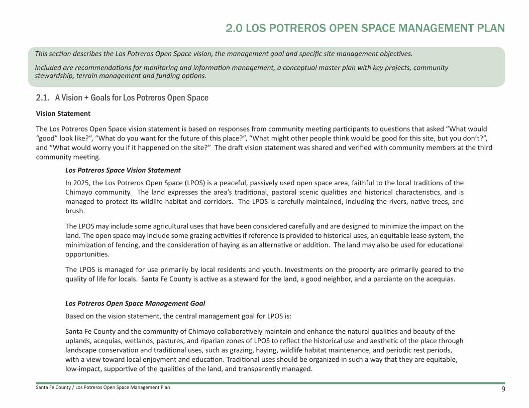
2.1. A Vision + Goals for Los Potreros Open Space
Vision Statement
The Los Potreros Open Space vision statement is based on responses from community meeting participants to questions that asked “What would “good” look like?”, “What do you want for the future of this place?”, “What might other people think would be good for this site, but you don’t?”, and “What would worry you if it happened on the site?” The draft vision statement was shared and verified with community members at the third community meeting.
Los Potreros Space Vision Statement
In 2025, the Los Potreros Open Space (LPOS) is a peaceful, passively used open space area, faithful to the local traditions of the Chimayo community. The land expresses the area’s traditional, pastoral scenic qualities and historical characteristics, and is managed to protect its wildlife habitat and corridors. The LPOS is carefully maintained, including the rivers, native trees, and brush.
The LPOS may include some agricultural uses that have been considered carefully and are designed to minimize the impact on the land. The open space may include some grazing activities if reference is provided to historical uses, an equitable lease system, the minimization of fencing, and the consideration of haying as an alternative or addition. The land may also be used for educational opportunities.
The LPOS is managed for use primarily by local residents and youth. Investments on the property are primarily geared to the quality of life for locals. Santa Fe County is active as a steward for the land, a good neighbor, and a parciante on the acequias.
Los Potreros Open Space Management Goal
Based on the vision statement, the central management goal for LPOS is:
Santa Fe County and the community of Chimayo collaboratively maintain and enhance the natural qualities and beauty of the uplands, acequias, wetlands, pastures, and riparian zones of LPOS to reflect the historical use and aesthetic of the place through landscape conservation and traditional uses, such as grazing, haying, wildlife habitat maintenance, and periodic rest periods, with a view toward local enjoyment and education. Traditional uses should be organized in such a way that they are equitable, low-impact, supportive of the qualities of the land, and transparently managed.
Santa Fe County / Los Potreros Open Space Management Plan10
Management Goals + Objectives
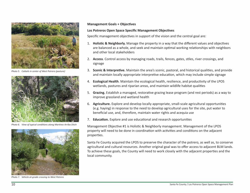
Los Potreros Open Space Specific Management ObjectivesSpecific management objectives in support of the vision and the central goal are:
1. Holistic & Neighborly. Manage the property in a way that the different values and objectives are balanced as a whole, and seek and maintain optimal working relationships with neighbors and other local stakeholders
2. Access. Control access by managing roads, trails, fences, gates, stiles, river crossings, and signage
3. Scenic & Interpretive. Maintain the area’s scenic, pastoral, and historical qualities, and provide and maintain locally appropriate interpretive education, which may include simple signage
4. Ecological Health. Maintain the ecological health, resilience, and productivity of the LPOS wetlands, pastures and riparian areas, and maintain wildlife habitat qualities
5. Grazing. Establish a managed, restorative grazing lease program (and rest periods) as a way to improve grassland and wetland health
6. Agriculture. Explore and develop locally appropriate, small-scale agricultural opportunities (e.g. haying) in response to the need to develop agricultural uses for the site, put water to beneficial use, and, therefore, maintain water rights and acequia use
7. Education. Explore and use educational and research opportunities
Management Objective #1 is Holistic & Neighborly management. Management of the LPOS property will need to be done in coordination with activities and conditions on the adjacent properties.
Santa Fe County acquired the LPOS to preserve the character of the potrero, as well as, to conserve agricultural and cultural resources. Another original goal was to offer access to adjacent BLM lands. To achieve these goals, the County will need to work closely with the adjacent properties and the local community.
Photo 5. Cattails in center of West Potrero (pasture)
Photo 6. View of typical conditions along Martinez Arriba Ditch
Photo 7. Vehicle at-grade crossing to West Potrero

Santa Fe County / Los Potreros Open Space Management Plan 11
Santa Fe County acknowledges the many connections that LPOS has with the surrounding properties, the Rio Quemado and Rio Santa Cruz, and beyond. The long-term success of the Plan will require coordination and collaboration with adjacent property owners, community stakeholders, acequia associations, and El Santuario de Chimayo
2.2. Monitoring, and Information Management
Monitoring
To ascertain that progress is made toward achieving management goals, County staff together with local community partners will periodically monitor certain indicators of progress (Table 2).
A basic set of monitoring activities for LPOS includes first tier of 5 measurements for which a base-line of data was established during the management planning process. These proposed first tier monitoring activities are numbered and their locations are indicated by number on a TMU map (Figure 3). A second tier consists of 8 additional monitoring activities that Santa Fe County staff may conduct in the future if staff time and budget allow. Locations for these second tier activities will need to be established later.
Based on the monitoring overview described below, and as part of plan implementation, Santa Fe County staff will develop a detailed monitoring plan. A detailed monitoring plan enables staff and stakeholders to track progress made toward specific goals and objectives. Ideally, the monitoring plan will be updated annually with community members and stakeholders.
A detailed monitoring plan specifies how the indicators will be measured or documented, when and where this will be done, who will do it, and what equipment or supplies are needed. Additionally, a detailed monitoring plan will establish or estimate numerical thresholds and conditions that serve to indicate whether corrective action will be needed.
Base-line methods and findings are described in “A Field Characterization for the Los Potreros Open Space Property Santa Fe County, New Mexico - An Existing Conditions and Inventory Report” (2016). Methods for additional monitoring activities are in a list of BMPs in the Planners’ Guide.
Photo 8. Existing stile, overgrown vegetation along Rio Santa Cruz
Photo 9. Traditional style pasture fence
Photo 10. overgrown conditions at southmost parcel.

Santa Fe County / Los Potreros Open Space Management Plan12
Sant
uario
Ln
Co Rd 92
Co Rd 92
Medina
Ln
Santo
Nino Dr
Co Rd 94C
SantuarioDr
Co Rd 92
Juan
Med
ina
Rd
Sta
teR
te52
0
Santa
Fe Co Rd 92
Juan Medina Rd
Juan
Med
ina
Rd
State Rte 520
Stat
eRt
e52
0
6180
6440
6420
64006380
6360
634063106290
6270
64506430641063906370
63506330
63606320
6300
6280
62606250
6240
6230
6490
6480
6470
6460
64606450
6230
6220
6210
6200
6180
6170
6160
6150
6220
6290
62706250
6220
6210
6200
6190
6290
6280
6260
6240
6460
6190
6280
6320
6310
6300
6290
6210
6170
6160
6150
620061906180
6170
6190
6180
6100
6290
6100
6110
6170
6180 6170
618061
70
6180
6170
6130
6140
6190
6120
6260
6250
6240
6170
6170
6120
6130
6140
6170
6160
6150
6170
6170
6180
6140
6250
6240
6160
6150
6300
Source: Esri, DigitalGlobe, GeoEye, i-cubed, USDA, USGS, AEX, Getmapping, Aerogrid, IGN, IGP, swisstopo, and the GIS User Community
LOS POTREROS Perennial Streams
Ephemeral Streams
Roads
Wetlands 0 500250Feet
.Access Road
SANTUARIO DE CHIMAYO
Figure 4. Monitoring Points for Los Potreros Open Space
2
1
2
2
1
2
3
1
1
3
3
33
3
2
11
11
1
3
5
3
3
4
4
MONITORING LOCATIONS MAP
Monitoring ExampleTo improve forage quality and quantity from year to year, a simple threshold could be to set baseline levels based on the Los Potreros Field Characterization Report established in 2015. If monitoring shows that if conditions are not the same as the previous year’s conditions, corrective action would be taken. In such a case, causes for the impairment need to be established and addressed. This might mean for example that a pasture must be rested, that the grazing regime must be changed, or that a fence must be fixed.
4
4
4
4

Santa Fe County / Los Potreros Open Space Management Plan 13
No. Conditions Monitored Mgmt Objectives Indicators and Monitoring Method Monitoring Frequency and Season
1 Forage quantity and quality & cover of grasslands
Ecological Health / Grazing
Dry weight of clipped biomass in random sample plots (one plot selected along a transect with 10 plots); measurement of vegetation cover in selected transects; literature review of forage quality of species found in transects
Annually in September or October
2 Fuel load of riparian zone Ecological Health “Brown’s Line” transects for fuel load estimates Every 3 years (spring/fall)
3Dead and down wood and debris in streams, on stream-banks and on slopes
Ecological Health
Visual observation during walk through and photo documentation; tally number of dead branches, tree trunks, and large rock obstacles in channel and nearby adjacent river banks.
Every 3 years in spring or fall
4Stream channel stability around grade control and diversion structures and diversion efficiency
Ecological Health / Grazing/ Agriculture
Visual observation during walk through and photo point documentation Annually (spring or fall)
5 Conservation Easement baseline conditions
Holistic & Neighborly / Ecological Health
Visual observation during walk through and photo point documentation Annually (spring or fall)
6 Neighbor and stakeholder steward-ship and relations Holistic & Neighborly Public participation and initiative; public feedback and expressions
of support Annually
7 Scenic quality Holistic & Neighborly / Scenic & Interpretive
Visual observation during walk through and photo point documentation Annually (spring or fall)
8 Liability risks to neighboring properties
Holistic & Neighborly / Ecological Health
Visual observation during walk through and photo point documentation Quarterly
9 Infrastructure conditions; fence effectiveness Scenic & Interpretive Visual observation during walk- through and photo point and GPS/
Avenza PDF Map documentation of any infrastructure damage(Bi-)Annually (spring and/or fall)
10 Stream channel morphology, efficiency and bank stability Ecological Health Visual observation during walk through and photo point
documentation Annually (spring or fall)
11 Slope stability Ecological Health Visual observation during walk through and photo point documentation Annually (spring or fall)
12Vegetation health, presence of non-native plants and other invasives
Ecological HealthPlant list comparison with knowledge of native and invasive plants; visual observation during walk through and photo point and GPS/Avenza PDF Map documentation of locations
Annually (late summer or fall)
13 Hydrological terrain conditions: irrigation and drainage effectiveness
Ecological Health / Grazing
Visual observation during walk through and photo documentation Annually (spring or fall)
Note: The table indicates the minimum suggested monitoring frequency. In some circumstances frequencies may need to be increased if/when staff time and funds allow, or if monitoring activities can be conducted by community volunteers. Table 2. Monitoring Matrix

Santa Fe County / Los Potreros Open Space Management Plan14
Santa Fe County / Los Potreros Open Space Management Plan 15
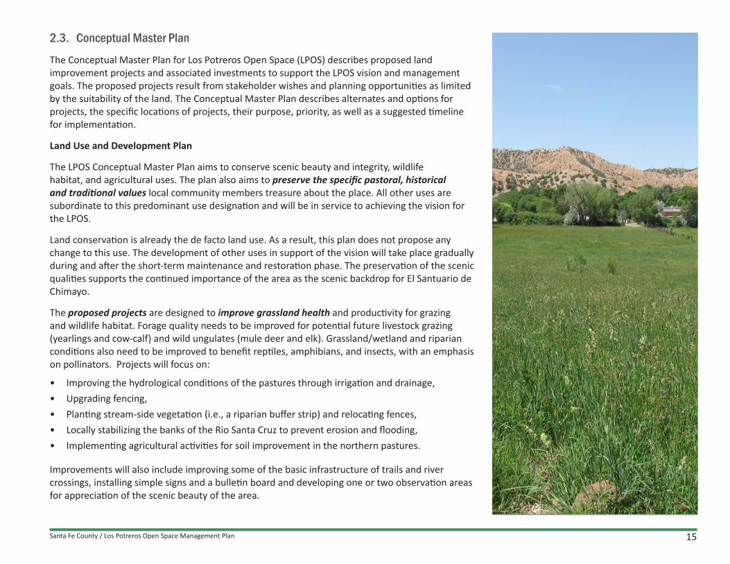
2.3. Conceptual Master Plan
The Conceptual Master Plan for Los Potreros Open Space (LPOS) describes proposed land improvement projects and associated investments to support the LPOS vision and management goals. The proposed projects result from stakeholder wishes and planning opportunities as limited by the suitability of the land. The Conceptual Master Plan describes alternates and options for projects, the specific locations of projects, their purpose, priority, as well as a suggested timeline for implementation.
Land Use and Development Plan
The LPOS Conceptual Master Plan aims to conserve scenic beauty and integrity, wildlife habitat, and agricultural uses. The plan also aims to preserve the specific pastoral, historical and traditional values local community members treasure about the place. All other uses are subordinate to this predominant use designation and will be in service to achieving the vision for the LPOS.
Land conservation is already the de facto land use. As a result, this plan does not propose any change to this use. The development of other uses in support of the vision will take place gradually during and after the short-term maintenance and restoration phase. The preservation of the scenic qualities supports the continued importance of the area as the scenic backdrop for El Santuario de Chimayo.
The proposed projects are designed to improve grassland health and productivity for grazing and wildlife habitat. Forage quality needs to be improved for potential future livestock grazing (yearlings and cow-calf) and wild ungulates (mule deer and elk). Grassland/wetland and riparian conditions also need to be improved to benefit reptiles, amphibians, and insects, with an emphasis on pollinators. Projects will focus on:
• Improving the hydrological conditions of the pastures through irrigation and drainage, • Upgrading fencing,• Planting stream-side vegetation (i.e., a riparian buffer strip) and relocating fences,• Locally stabilizing the banks of the Rio Santa Cruz to prevent erosion and flooding,• Implementing agricultural activities for soil improvement in the northern pastures.
Improvements will also include improving some of the basic infrastructure of trails and river crossings, installing simple signs and a bulletin board and developing one or two observation areas for appreciation of the scenic beauty of the area.

Santa Fe County / Los Potreros Open Space Management Plan16
Alternatives for proposed Conceptual Master Plan projects will be developed during the full Master Planning process of each individual project. Alternatives typically vary between (1) No Action, (2) Preferred Solution, and (3) Alternative Solution(s).
No Action Alternative
No Action Alternative has been the default alternative from the time of purchase of the LPOS property. This alternative will likely be ended during the Short Term phase of the Management Plan. No Action will likely lead to increased threats of resource degradation and needs for more costly maintenance and restoration work. This alternative would preclude investments in desired ecological terrain improvements, safety measures, and signage.
Preferred and Alternative Solutions
During the Conceptual Master Plan process for LPOS no need arose to consider fundamentally different alternative solutions for the protection and improvement of conditions of LPOS. Instead, the proposed activities constitute a gradual organic development of activities spread over time.
However, at the level of specific projects (improvement), detailed technical alternatives may apply. These alternatives should be considered when these projects are being planned and designed. The advantages and disadvantages of each alternative and the determination of a preferred alternative is not timely in this Management Plan and is deferred to the Detailed Master Plans.
Santa Fe County / Los Potreros Open Space Management Plan 17
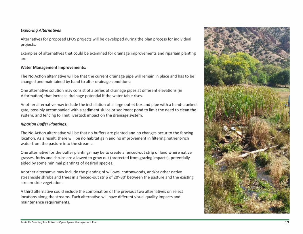
Exploring Alternatives
Alternatives for proposed LPOS projects will be developed during the plan process for individual projects.
Examples of alternatives that could be examined for drainage improvements and ripariain planting are:
Water Management Improvements:
The No Action alternative will be that the current drainage pipe will remain in place and has to be changed and maintained by hand to alter drainage conditions.
One alternative solution may consist of a series of drainage pipes at different elevations (in V-formation) that increase drainage potential if the water table rises.
Another alternative may include the installation of a large outlet box and pipe with a hand-cranked gate, possibly accompanied with a sediment sluice or sediment pond to limit the need to clean the system, and fencing to limit livestock impact on the drainage system.
Riparian Buffer Plantings:
The No Action alternative will be that no buffers are planted and no changes occur to the fencing location. As a result, there will be no habitat gain and no improvement in filtering nutrient-rich water from the pasture into the streams.
One alternative for the buffer plantings may be to create a fenced-out strip of land where native grasses, forbs and shrubs are allowed to grow out (protected from grazing impacts), potentially aided by some minimal plantings of desired species.
Another alternative may include the planting of willows, cottonwoods, and/or other native streamside shrubs and trees in a fenced-out strip of 20’-30’ between the pasture and the existing stream-side vegetation.
A third alternative could include the combination of the previous two alternatives on select locations along the streams. Each alternative will have different visual quality impacts and maintenance requirements.

Santa Fe County / Los Potreros Open Space Management Plan18
Key Projects for Planning, Research, and Development Planning and preparation is required for all Conceptual Master Plan improvements. Implementation of improvements will be coordinated with maintenance and repair activities. The following key projects for planning, research, and development are required to prepare maintenance and proposed improvements.
1. Develop protocols for communication and verification about maintenance and land restoration work, mapping, monitoring, and team coordination.
2. Develop and implement a monitoring plan for baseline data for all scheduled activities and associated terrain conditions.
3. Develop a basic signage plan for boundary marking and/or acknowledgment of the LPOS and the conservation easement, along with a bulletin board that will serve to post flyers and announcements. The signage should address public safety rules, leave-no-trace principles, and Santa Fe County contact information. Signage design that is simple and unobtrusive will best meet the vision for the LPOS.
4. Develop a simple grassland and grazing management plan, including pasture management, irrigation and drainage planning, and a short-term plan for haying and baling (with community involvement).
5. Work with the Santa Fe County Legal Department to complete change of water rights ownership, develop a plan to utilize the water rights already allocated through the Martinez Arriba Ditch, the Las Cuevas Ditch, and the Manuel Vigil Ditch, and improve irrigation infrastructure and acequia management systems.
6. Pay dues and making arrangements for laborers and their payment for acequia improvement work.
7. Develop a detailed plan and design for drainage improvements for the West Potrero pasture (parcel 6), with a detailed scope of work for RFP implementation.
8. Redesign the grazing lease process, and creat a lease program for managed, restorative grazing, and a managed grazing lease for grassland maintenance.
9. Prepare an RFP for bank stabilization, drainage improvement, and associated arroyo maintenance.
10. Prepare an RFP to plant riparian buffer strip vegetation along Rio Quemado and Rio Santa Cruz on the West Potrero parcel 6.
11. Initiate a cultural/archaeological survey for the entire property.

Santa Fe County / Los Potreros Open Space Management Plan 19
Mid-term and long-term include:12. Design a simple trail and observation area on the west side of the West Potrero parcel 6
13. Plan and organize a community-driven restoration project for the dry pastures (parcel 7). This project should include assessment of the irrigation system, and of opportunities in the community to actively participate; this restoration project may include the planting of cover crops, mulching with mowed crops, and managed, restorative grazing. Sowing and cultivating a forage crop subsequent to restoration efforts would provide soil cover soil restoration capacity, and forage for wildlife and livestock.
14. Research and plan for a simple interpretive education program for the LPOS
15. Replace and remove old, weak, dead and fallen trees.

Santa Fe County / Los Potreros Open Space Management Plan20
EcotoneLOS POTREROS OPEN SPACE
MAINTENANCE / IMPROVEMENTS / PLANNINGC H I M A Y O N M
MID-LONG TERMSHORT TERM
MA
INTE
NA
NC
E IM
PRO
VEM
ENTS
PL
AN
NIN
G
MAINTENANCE / IMPROVEMENT / PLANNING
GRAZING PLANNING• Update grazing lease contract• Develop grazing management plan
Rest the land (2 to 4 years) Bale hay (2 to 4 years)
• Conduct restorative grazing experiment Design program Conduct test for two years Evaluate
DRAINAGE - RIPARIAN PLANNING• Study and design meadow drainage• Plan and design riparian bank stabilization
Rio Santa Cruz Rio Quemado
• Plan and design riparian plant buffers
COMMUNITY STEWARDSHIP• Organize community stewardship group• Community maintenance events Ditch cleaning
Agricultural projects
GRAZING PLANNING• Implement Restorative Grazing Leases• Review Restorative Grazing Lease - every 3-5 years
AGRICULTURAL PLANNING• Evaluate further soil improvements for north pasture• Study and propose options for expanded agriculture• Study and plan scenic view point and simple access
COMMUNITY STEWARDSHIP• Strenghten community stewardship group• Continue community events• Develop educational and research opportunities
QUARTERLY-ANNUAL • Clean ditches• Maintain and repair fences • Place sign and bulletin board
GRASSLAND IMPROVEMENT* Fence repair and improvement* Drainage improvements* Irrigation improvements
CONTINUE IMPROVEMENT OPPORTUNITIES • Rehabilitate North Pasture
Irrigate Sow cover crop Graze lightly
• Grazing and field access
3 TO 5 YEAR REPEAT • Clear out dead wood and weak
trees on slopes• Rio Santa Cruz channel clean-up• Rio Quemedo channel clean-up• Maintain roads and fords
QUARTERLY-ANNUAL / CONTINUE• Clean ditches• Maintain and repair fences
3 TO 5 YEAR REPEAT - CONTINUE• Clear out dead wood and weak trees on slopes• Rio Santa Cruz channel clean-up• Rio Quemedo channel clean-up• Maintain roads and fords
ECOLOGICAL IMPROVEMENTS• Bank stabilization of Rio Santa Cruz• Planting of riparian buffers in
western pasture along Rio Quemado and Rio Santa Cruz
SHORT TERMPrioritization and phasing for LPOS is based on the terrain conditions of early 2016. The baseline site conditions include needed maintenance on acequias, drainage systems, fences, and wooded areas. The proposed Conceptual Master Plan activities follow the prioritization criteria outlined in the Planner’s Guide.
• Short-term:
o All activities focus on land restoration and maintenance to address conditions caused by deferred maintenance.
o Grazing uses will be paused to rest and improve the land with a focus on ecological restoration and management of the pastures; grazing may resume after several years when grassland health is restored, infrastructure is improved, and the County’s lease system is updated.
• Mid-term:
o Improvement of the dry, northern pastures.
o Infrastructure upgrades.
o Possible development of a scenic observation area.
Figure 5. Maintenance/Improvement/Planning Diagram

Santa Fe County / Los Potreros Open Space Management Plan 21
EcotoneLOS POTREROS OPEN SPACE
MAINTENANCE / IMPROVEMENTS / PLANNINGC H I M A Y O N M
MID-LONG TERMSHORT TERM
MA
INTE
NA
NC
E IM
PRO
VEM
ENTS
PL
AN
NIN
G
MAINTENANCE / IMPROVEMENT / PLANNING
GRAZING PLANNING• Update grazing lease contract• Develop grazing management plan
Rest the land (2 to 4 years) Bale hay (2 to 4 years)
• Conduct restorative grazing experiment Design program Conduct test for two years Evaluate
DRAINAGE - RIPARIAN PLANNING• Study and design meadow drainage• Plan and design riparian bank stabilization
Rio Santa Cruz Rio Quemado
• Plan and design riparian plant buffers
COMMUNITY STEWARDSHIP• Organize community stewardship group• Community maintenance events Ditch cleaning
Agricultural projects
GRAZING PLANNING• Implement Restorative Grazing Leases• Review Restorative Grazing Lease - every 3-5 years
AGRICULTURAL PLANNING• Evaluate further soil improvements for north pasture• Study and propose options for expanded agriculture• Study and plan scenic view point and simple access
COMMUNITY STEWARDSHIP• Strenghten community stewardship group• Continue community events• Develop educational and research opportunities
QUARTERLY-ANNUAL • Clean ditches• Maintain and repair fences • Place sign and bulletin board
GRASSLAND IMPROVEMENT* Fence repair and improvement* Drainage improvements* Irrigation improvements
CONTINUE IMPROVEMENT OPPORTUNITIES • Rehabilitate North Pasture
Irrigate Sow cover crop Graze lightly
• Grazing and field access
3 TO 5 YEAR REPEAT • Clear out dead wood and weak
trees on slopes• Rio Santa Cruz channel clean-up• Rio Quemedo channel clean-up• Maintain roads and fords
QUARTERLY-ANNUAL / CONTINUE• Clean ditches• Maintain and repair fences
3 TO 5 YEAR REPEAT - CONTINUE• Clear out dead wood and weak trees on slopes• Rio Santa Cruz channel clean-up• Rio Quemedo channel clean-up• Maintain roads and fords
ECOLOGICAL IMPROVEMENTS• Bank stabilization of Rio Santa Cruz• Planting of riparian buffers in
western pasture along Rio Quemado and Rio Santa Cruz
MID TERM - LONG TERM• Long-term:
o Conceptual Master Plan components, such as the possible ongoing ecological and agricultural development of the irrigated, northern fields.
o Installation of some educational interpretive education signage.
o Upgrades of ditches, fences, fords, and trails.
Community involvement is essential to management implementation. Public involvement may include feedback on proposed project details during future planning and design sessions and active engagement in the planning and implementation of the projects. Several maintenance activities will be suitable for community or volunteer participation, which will facilitate community stewardship for open space care and maintenance.
A comprehensive overview of planning activities along with maintenance activities, Conceptual Master Plan projects, and community stewardship activities is included in APPENDIX A. The activities are listed by functional group (planning, maintenance, community services, and projects/improvements) relative to Santa Fe County’s organization of departments.

Santa Fe County / Los Potreros Open Space Management Plan22
2.4. Community Relations
Santa Fe County intends to develop and maintain productive, neighborly and collaborative relations with the Chimayo community regarding the implementation of the LPOS Management Plan.
Information ExchangeIn the short term, Santa Fe County plans to expand and develop several methods for information exchange with community members and stakeholders.
Signage
Santa Fe County will install simple signage to identify the Open Space property. Santa Fe County will also install a sign indicating the conservation easement on parcel #4, as stipulated in the Easement Deed Agreement. Signage will also inform the public about safety, leave-no-trace principles, general care and stewardship behavior, and contact information for Santa Fe County. Boundary markers will be installed for maintenance and access control. A bulletin board will be placed at the gate on Juan Medina Road for public notices, such as specific events, meetings, and terrain management activities.
Website
Santa Fe County will maintain website pages dedicated to the County Open Space & Trails program. The website may be expanded with a specific webpage describing the LPOS landscape and history, management plan information and activities, and planned events at the LPOS.
Community Contact
Santa Fe County will work with the community to identify a communication structure with community members who are available to field comments and questions and contact County staff for follow-up actions. Communication may address signage, grassland management and improved grazing practices, haying and baling activities, collaboration on acequia cleanup, weed management, and wood removal and distribution, among other initiatives, especially in the initial phase of plan implementation.
Santa Fe County intends to include a diverse group of community stakeholders in volunteer stewardship work. These stakeholder groups include:
• Immediate neighbors and parciantes on the acequias (the Martinez Arriba Ditch, Las Cuevas Ditch, and Manuel Vigil Ditch)
• Representatives on behalf of El Santuario de Chimayo
• Other acequia groups, namely those associated with the Potrero Ditch, Santa Cruz Irrigation District ditch, and the Los Ranchos, Jaramillo, and Epitacio acequias
• Chimayo Historic Preservation Association
• Local youth, and possibly organized through the Chimayo Conservation Corps
• Local farmers
• Local livestock owners
• Area schools and their students, the Chimayo Elementary School, Camino de Paz (agricultural) School, and Northern New Mexico College in Española
• Regional conservation groups, hiking and outdoor organizations, and other entities that could become interested in LPOS
Santa Fe County / Los Potreros Open Space Management Plan 23
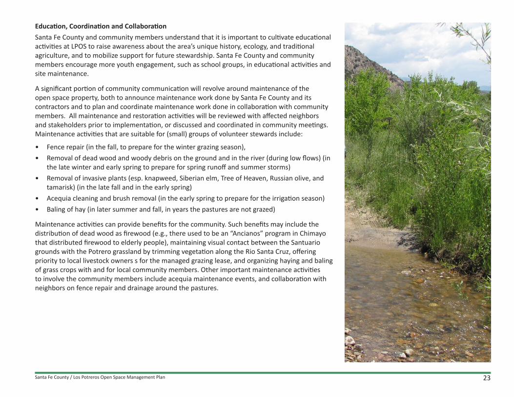
Education, Coordination and CollaborationSanta Fe County and community members understand that it is important to cultivate educational activities at LPOS to raise awareness about the area’s unique history, ecology, and traditional agriculture, and to mobilize support for future stewardship. Santa Fe County and community members encourage more youth engagement, such as school groups, in educational activities and site maintenance.
A significant portion of community communication will revolve around maintenance of the open space property, both to announce maintenance work done by Santa Fe County and its contractors and to plan and coordinate maintenance work done in collaboration with community members. All maintenance and restoration activities will be reviewed with affected neighbors and stakeholders prior to implementation, or discussed and coordinated in community meetings. Maintenance activities that are suitable for (small) groups of volunteer stewards include:
• Fence repair (in the fall, to prepare for the winter grazing season),• Removal of dead wood and woody debris on the ground and in the river (during low flows) (in
the late winter and early spring to prepare for spring runoff and summer storms) • Removal of invasive plants (esp. knapweed, Siberian elm, Tree of Heaven, Russian olive, and
tamarisk) (in the late fall and in the early spring) • Acequia cleaning and brush removal (in the early spring to prepare for the irrigation season) • Baling of hay (in later summer and fall, in years the pastures are not grazed)
Maintenance activities can provide benefits for the community. Such benefits may include the distribution of dead wood as firewood (e.g., there used to be an “Ancianos” program in Chimayo that distributed firewood to elderly people), maintaining visual contact between the Santuario grounds with the Potrero grassland by trimming vegetation along the Rio Santa Cruz, offering priority to local livestock owners s for the managed grazing lease, and organizing haying and baling of grass crops with and for local community members. Other important maintenance activities to involve the community members include acequia maintenance events, and collaboration with neighbors on fence repair and drainage around the pastures.

Santa Fe County / Los Potreros Open Space Management Plan24
Collaboration on maintenance activities will be effective by organizing community partners around specific, tangible projects to foster communication and trust, and generate additional objectives, priorities, and creative new ideas for problem solving. The following topics are of interest in the community and may serve as pilot projects for implementation of this plan:
• Grassland and wetland management and traditional grazing• Other agricultural uses, including haying and baling• Scenic and spiritual appreciation• Wildlife habitat conservation• Public and youth education
A more detailed list of community involvement is included in section 2.6 about short-term Plan implementation activities.

Santa Fe County / Los Potreros Open Space Management Plan 25
2.5. Terrain Management
For purposes of maintenance and land use suitability, the LPOS Management Plan identifies several Terrain Management Units (TMUs) (Figure 6). Each TMU encompasses an area with similar landscape features and maintenance requirements, and similar land suitability characteristics (i.e., a unique set of options for land use). The identification of TMUs organizes the spatial management aspects of this plan. TMUs continue across the landscape. Santa Fe County will manage each TMU according to its particular needs and terrain characteristics. The TMU map (Figure 6) has been developed for County terrain management purposes only and does not reflect any water rights or hydrographic survey conditions.
Terrain management activities are described in detail in a separate Maintenance Plan for LPOS. The following sections summarize terrain management in the context of the LPOS Management Plan. The proposed terrain management activities also reference specific Best Management Practices (BMPs), which are described in the Planners’ Guide.
Maintenance and Restoration Plan Summary Terrain management includes land restoration, maintenance, and community stewardship. Terrain management activities are specific for each Terrain Management Unit (TMU).
Each TMU requires a discrete set of management activities to maintain their ecological functions in support of the central management goal for the LPOS. An overview of terrain management activities is included in Table 3. A comprehensive Maintenance Plan for LPOS is included in APPENDIX D. Detailed lists of terrain management activities in Year-1 are included in APPENDIX E
The County will face challenges to achieve all the maintenance needs at LPOS that will arise in the future. Strategies that can be useful to optimize maintenance efforts, include:
• Collaboration with adjacent properties, agencies and community stewards to leverage working together to address maintenance needs,
• Invest smaller consistent amounts of time and labor on a well-planned maintenance activities,• Conduct maintenance activities at the optimum time based on monitoring information or a
regular schedule.

Santa Fe County / Los Potreros Open Space Management Plan26
Sant
uario
Ln
Co Rd 92
Co Rd 92
Medina
Ln
Santo
Nino Dr
Co Rd 94C
SantuarioDr
Co Rd 92
Juan
Med
ina
Rd
Sta
teR
te52
0
Santa
Fe Co Rd 92
Juan Medina Rd
Juan
Med
ina
Rd
State Rte 520
Stat
eRt
e52
0
6180
6440
6420
64006380
6360
634063106290
6270
64506430641063906370
63506330
63606320
6300
6280
62606250
6240
6230
6490
6480
6470
6460
64606450
6230
6220
6210
6200
6180
6170
6160
6150
6220
6290
62706250
6220
6210
6200
6190
6290
6280
6260
6240
6460
6190
6280
6320
6310
6300
6290
6210
6170
6160
6150
620061906180
6170
6190
6180
6100
6290
6100
6110
6170
6180 6170
618061
70
6180
6170
6130
6140
6190
6120
6260
6250
6240
6170
6170
6120
6130
6140
6170
6160
6150
6170
6170
6180
6140
6250
6240
6160
6150
6300
Source: Esri, DigitalGlobe, GeoEye, i-cubed, USDA, USGS, AEX, Getmapping, Aerogrid, IGN, IGP, swisstopo, and the GIS User Community
LOS POTREROS Perennial Streams
Ephemeral Streams
Roads
Wetlands 0 500250Feet
.Access Road
SANTUARIO DE CHIMAYO
N
LEGENDLP-RIP RIPARIAN UNITstream channels, banks, riparian vegetation bu�er strips
LP-ACE ACEQUIA UNITditches, banks, maintenance paths
LP-WET WETLAND UNITpermanently water saturated / valley bottomlands
LP-GRA-D GRASSLAND-DRY UNITdry grass, forb, and shrub / valley bottomlands
LP-GRA-W GRASSLAND-WET UNIT
LP-GRA-P GRASSLAND-PASTURE UNIT
low, seasonally wet / valley bottomlands
relatively dry, high-quality pasture / valley bottomlands
LP-TOE TOE OF SLOPE UNITecological transition zone on lower slopes (below Santa Cruz ditch)
LP-WOO WOODLAND UNIThigher, rugged uplands with piñon-juniper vegetation
PROPERTY BOUNDARY
FLOWLINES
TRAIL
PUBLIC GATE
PARKING
TERRAIN MANAGEMENT UNITS
Figure 6. Los Potreros Open Space - Terrain Management Units Map

Santa Fe County / Los Potreros Open Space Management Plan 27
Where What Why WhenTMUs Anticipated Regular Maintenance Activities Objective Maintenance Frequency*
All TMUs Dialogue about maintenance with neighbors and stakeholders and integrate feedback in planning Holistic & Neighborly Annually
All TMUs Inspect and expand property boundary markers, especially at corner points, with labeled Carsonite fiberglass posts, if necessary reinforced with T-posts Access One time (year-1) and
when needed
All TMUs Inspect and repair:Access / Scenic & Interpretive / Ecological Health
a. Annually
a. Fences, gates and stiles b. Annuallyb. Stream crossings c. Annuallyc. Roads and trails (esp. drainage fixes along CR 92) d. Annuallyd. Signage
LP-RIP a. Remove fallen trees, dead wood, woody debris Ecological Health a. Annuallyb. Remove vegetation encroaching on the stream channel in specific locations b. Once in 2-3 years
LP-ACE a. Acequia cleaning, tree thinning, bank repair (la limpia y la jara) Ecological Health a. Annually (spring)b. Infrastructure repairs b. Annually (spring)c. Gopher and mole control c. Annually
LP-WET a. Remove periodically of dead wood and invasive plants Ecological Health a. Every 2-3 yearsb. Clean drainage structures b. Annually
LP-GRA-D a. Inspect irrigation system Ecological Health / Agriculture
a. Annually once water rights are secured
b. Cover crop and weed management b. AnnuallyLP-GRA-W a. Irrigation and drainage management Ecological Health / Grazing a. Monthly
b. Grazing management b. Monthly-Quarterly
LP-GRA-P a. Irrigation and drainage management Ecological Health / Agriculture / Grazing a. Monthly
b. Grazing management b. Monthly-QuarterlyLP-TOE a. Remove dead wood Ecological Health a. Annually
b. Remove invasive plant species b. Annuallyc. Soil conservation c. Annually
Table 3. Terrain Management Units - Maintenance Activities
* Note: The table indicates the minimum suggested frequency. In some circumstances frequencies may need to be increased if/when staff time and funds allow, or if maintenance activities can conducted by community volunteers.

Santa Fe County / Los Potreros Open Space Management Plan28
2.6. Plan Implementation and Financing Mechanisms
Plan implementation will start by identifying priorities and timelines among staff for activities regarding maintenance, planning and project preparation, community outreach, and community stewardship involvement. Prioritization will be based on balancing the tasks at hand, and the staff and funds available to accomplish the tasks.
First Year Implementation
Implementation of this plan will start upon approval of the plan by the County .
Recommended Year-1 implementation activities include:
1. Periodic community meetings to explain the planned implementation activities with an emphasis on:
a. Terrain inspections, baseline data collection, priority maintenance activities, and planning activities for key projects for repairs and improvements,
b. Identifying community interest and capacity to assist with the planned activities,
c. Developing outlines for collaborative projects between Santa Fe County and neighbors and other local stakeholders,
d. Coordinating specific community involvement for the selected projects,
e. Annual review of prior year activities and next year implementation planning.
2. Implementation of selected terrain inspection, base-line data collection (for future monitoring), and maintenance activities by County maintenance staff, assisted by neighbors and local volunteers; inspections, data gathering and priority maintenance will include:
a. Delineation and marking of boundaries,
b. Inspecting and repairing all interior and exterior fence conditions,
c. Weed removal, especially invasive tree species,
d. Removal of dead wood, fallen trees, and debris in the streams,
e. Removal of dead wood, fallen trees, and dead brush on stream banks and on the LP-TOE TMU, including wood or wood chip distribution in the community or wood disposal elsewhere,
f. Acequia cleanout and small repairs.

Santa Fe County / Los Potreros Open Space Management Plan 29
3. Planning, collaboration, and community organizing to implement priority projects; possible projects may include:
a. Development and placement of signs and a bulletin board,
b. Drainage improvements at the wetland drainage point of the West Potrero pasture,
c. Fence repair work that would require consideration of the historical and cultural visual quality of the area and/or the improvement of gates, and/or fence improvements along the streams,
d. Drainage improvements at the intersection of CR92, an arroyo, a driveway and Rio Santa Cruz, at a river bend on parcel 1,
e. Structural improvements to the channel of Rio Santa Cruz, especially in the river bend on parcel 1,
f. Haying and baling of grass and forbs.
4. Research and planning for the preparation of larger initiatives to be implemented at a later date, including:
a. Development of protocols for communication, staff development, and coordination,
b. Development of a signage plan that includes site specific signs, public outreach and communication strategies,
c. Grassland management planning and the updating of a grazing lease,
d. Completion of water rights ownership change and reconciliation of irrigation planning (19.18 acres of irrigation rights and potentially irrigable acres of land) with grassland management and grazing management planning (11.6 leased acres and 8.61 grazed acres),
e. Development of a drainage plan and design,
f. Development of a plan and design for streambank improvements on the Rio Santa Cruz,
g. Development of a plan and design for expanded riparian vegetation buffer strips,
h. Evaluation of the Year-1 and adapt planning for subsequent years.

Santa Fe County / Los Potreros Open Space Management Plan30
Financing Mechanisms, Funding Sources, and Partners
Santa Fe County owns and manages more than 6,600 acres of open space properties and parks, but it has insufficient funding and staff resources to meet the acquisition and management goals for the properties. Santa Fe County will be able to implement this plan if it successfully continues to develop new funding mechanisms, identify new funding sources, and cultivate collaborative relationships with neighbors, local stakeholders, and other interest groups.
To implement this plan, Santa Fe County will include neighbors, stakeholders and other partners to help with planning, maintaining, and data collecting for the purposes of monitoring, planning, and developing projects. This collaborative approach will help build neighborly relationships and increase buy-in from and stewardship by the people with the greatest interest in the property and it will reduce the need for outside funding for property management.
Santa Fe County will pursue funding sources and explore creative funding mechanisms to ensure the financial viability of managing the LPOS according to the recommendations of this management plan (Table 4).

Santa Fe County / Los Potreros Open Space Management Plan 31
POTENTIAL FUNDING SOURCES PURPOSE ACQUISITION TIME FRAMEGeneral Fund (Santa Fe County) Staff costs Annual budgeting processGrants Staff and consultants for various tasks, such as: Dependent on funding source timelines
FencingSigns, bulletin boardGrazing plan updateMonitoring programRiver bank stabilizationRiparian buffer plantingAcequia association and water rights use and managementAg program developmentInterpretive education research and implementationWildfire prevention; riparian area thinning Ongoing (Short-Long term)
CIP funds For the same as above Annual budgeting processFFS (Fee for Service) Grazing contract On a contract basis
POTENTIAL FUNDING MECHANISMS & COLLABORATIONS
PURPOSE DEVELOPMENT TIME FRAME
Hiring a grant writer for OS funding Pursue more grant funding Short-termCultivating community stewards Delegating work to local community stakeholders Short-mid termOrganizing social/cultural (fund raising) events with non-profit partners
Generating discretionary income and public outreach Mid-long term
Establishing a “Friends of LPOS” group Generating discretionary income and public outreach Mid-long termCollaboration with non-profit entities for co-management activities
Sharing the burden with organized stakeholders Mid-long term
Voter-approved Revenue Initiatives Providing a dedicated annual revenue stream for OS, Parks and Trails
Long-term
Establishing an NGO for overarching support to OS property management
Sharing the burden with organized stakeholders Long-term
Table 4. Potential Funding Sources and Mechanisms

Santa Fe County / Los Potreros Open Space Management Plan32
Santa Fe County / Los Potreros Open Space Management Plan 33
APPENDIX
LOS POTREROS OPEN SPACE APPENDICES (separate document)
APPENDIX A: Overview of Management Activities Table for Los Potreros Open Space
APPENDIX B: A Field Characterization for the Los Potreros Open Space Property Santa Fe County, New Mexico - An Existing Conditions and Inventory Report
APPENDIX C: Assessment of Grazing Management Conditions and Alternative Grazing
APPENDIX D: Maintenance Plan for Los Potreros Open Space
APPENDIX E: Maintenance, Stewardship, and Restoration Projects for Year-1