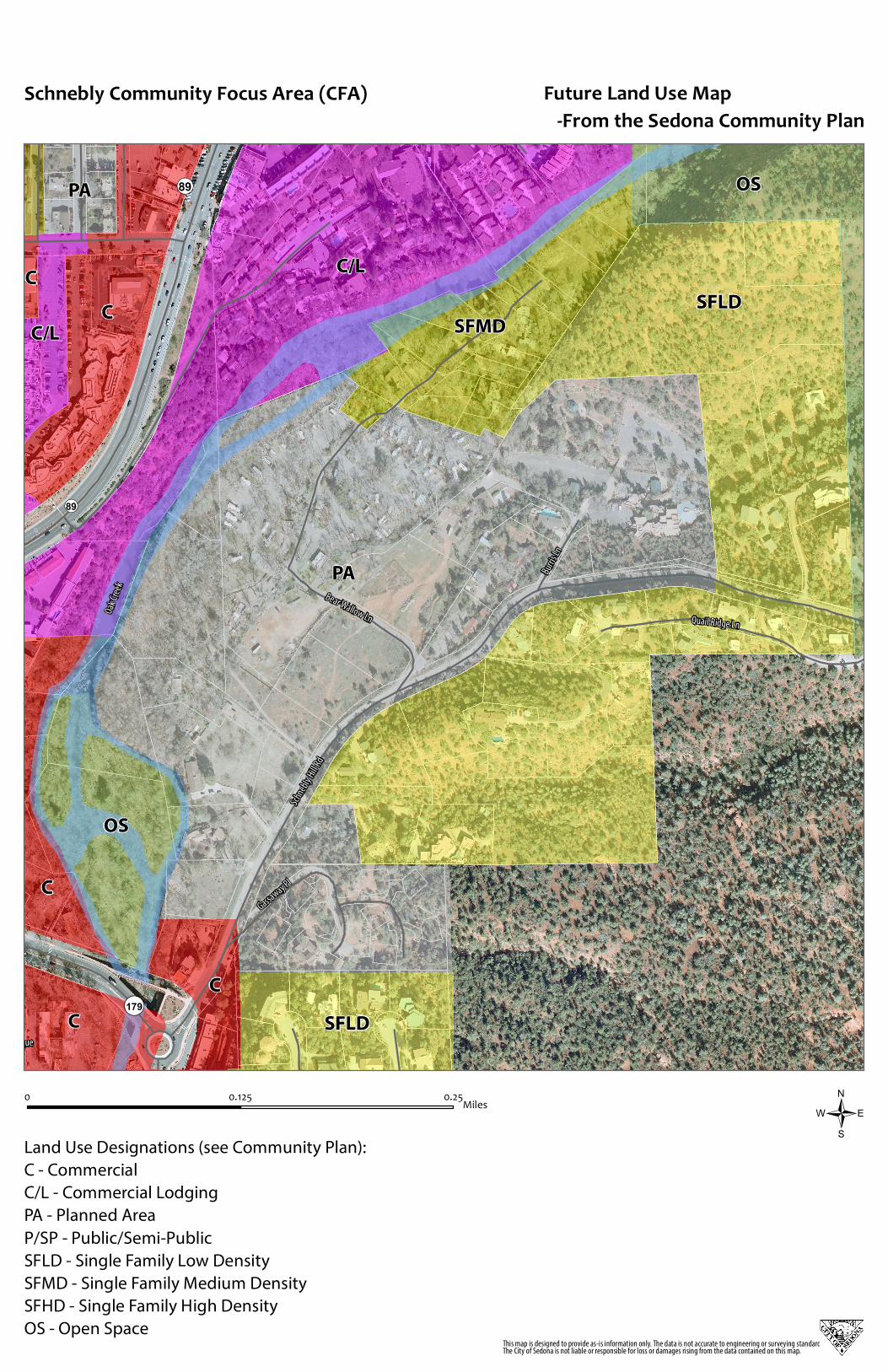
schnebly cfa future land use map
TRANSCRIPT
Schn
ebly
Hill R
d
Oak C
reek
¬«179
¬«89
Tlaquepaque
Bear Wallow Ln
Burri
s Ln
Quail Ridge Ln
Gassaway Pl
¬«89
PA
SFLD
C/L
C
OS
OS
C
C
C
SFMD
SFLD
PA
C/L
C
/0 0.250.125 Miles
Future Land Use Map -From the Sedona Community Plan
This map is designed to provide as-is information only. The data is not accurate to engineering or surveying standards.The City of Sedona is not liable or responsible for loss or damages rising from the data contained on this map.
Land Use Designations (see Community Plan):
C - Commercial
C/L - Commercial Lodging
PA - Planned Area
P/SP - Public/Semi-Public
SFLD - Single Family Low Density
SFMD - Single Family Medium Density
SFHD - Single Family High Density
OS - Open Space
Schnebly Community Focus Area (CFA)